
The Chingus Sarai
The Chingus Sarai or Fort is an old Mughal era Sarai on the Mughal Road which connected Punjab with Kashmir over the Pir Panjals. The word “Chingus’ is derived from the Persian word for “Intestines”. It got this rather unflattering name after the intestines / entrails of one of the Great Mughals, Emperor Jahangir were buried here.

The Entrance to the Sarai
The Entrails of an Emperor : Chingus Sarai
(Advisory : Please use your discretion while reading this Post. Some parts of it might sound distasteful to sensitive people.)
On the Old Mughal Road or the Mughal Road as its called now lies a Sarai called the Chingus Sarai. This was among a series of Sarais built by the Mughals to serve as stop over points on their Journeys to Kashmir via the Pir Ki Gali. Some of these Sarais still exist though in a dilapidated condition on the Road. These include the most well known of these Sarais as well, the Aliabad Sarai which was right below the Pir Ki Gali. The Road and the Sarais on it were built by the Kurdish Governor of Kashmir and Lahore, Ali Mardan Khan

Inside the Chingus Sarai / Fort
Situated at an around 2000 ft the Sarai is around 130 kms from Jammu and around 35 kms from Rajouri. It is situated near the Village of Chingus along the banks of the Sukhtao River. It offers a spectacular view of the snowy Ranges of the Pir Panjals. This was the fifth Sarai on the way from Gujrat (now in Punjab, Pakistan) across the Pir Panjals into the Kashmir Valley and ending at Srinagar. The name of the Village earlier used to be called Khanpur and was established by the Jaral Hill Rajas. So why was the name changed ?
As most of you known that the Mughals were great patrons of Kashmir and none of the Mughals was as enamoured with Kashmir as Emperor Jahangir, also called Saleem, the somewhat rebellious son of Akbar the Great. Yes the same Saleem of Saleem Anarkali fame. As per historians Emperor Jahangir visited Kashmir a total of 13 times. In contrast Akbar visited Kashmir twice and Shahjahan and Aurangzeb once each. The Mughal Gardens in Kashmir are a legacy of the Mughal love affair with Kashmir. Emperor Jahangir himself is credited with the creation of the Shalimar Bagh while the others were laid down by his son, Emperor Shahjahan, who could never really enjoy Kashmir as much as he would have liked to. Jahangir’s grandson, the unfortunate Dara Shikoh was also a great Patron of Kashmir and the Chashmashahi Garden is said to have been a gift for Dara from his father Emperor shah Jahan.

The staying Quarters at the Chingus Sarai
Coming back to Chingus. The word Chingus is derived from the Persian word “Chingan” which means intestines or entrails. So why such a seemingly gory name for a halting Sarai on the way to what the Mughals called the Paradise on Earth. Well it so happened that in 1627 while on his way back from Kashmir, Emperor Jahangir fell ill at a place called Behram Gali (Behramgala) in the Poonch area. He was advised rest and the Royal Caravan decided to halt for a few days at Behram Gali before moving on. It would give the Emperor time to recover from ill health. And so they bade time and soon the Emperor health began to recover. And soon he got back to that Royal favourite past time of Shikar ie Hunting.
One day while on a Shikar it is said that it so happened that one of the Royal attendants was trying to drive a group of Deer into within the hunting Range of the Emperor. Apparently while doing so he slipped and fell down from a certain height on the top of the Hillock. This happened right in front of the Emperor and while he watched a big rock dislodged by his fall fell on top of the attendant and the poor fellow died a painful death in front of the Emperor Jahangir. And tragically the Royal attendants Mother was also present on the scene and after watching her son’s life end so painfully she started wailing and crying as any Mother would do in such a scenario. This chain of events had a great adverse effect on the Emperor.
The Emperor fell ill again and this time the Empress Nurjahan decided to rush him to Lahore. But alas his time had and this time there was no recovery. The Great Moghul Emperor Mirza Nur-ud-din Beig Mohammad Khan Salim aka Nur-ud-din Muhammad Jahangir Badshah Ghazi aka Jahangir died at the age of 58 at the next halting station in Rajouri.

A fairly recent addition, a Mosque inside the Sarai.
The Empress decided to keep his death a secret in order to avoid a war of succession (which was quite vicious amongst the Mughals) before the time that she got to Lahore and took control of the situation. If the news of the death leaked out while she was far away from the Imperial Courts she and the claimants she backed would be at a distinct advantage. And as it is there was a lot of conflict between her and Prince Khurram (who would later become the Emperor Shahjahan) and they were engaged in a bitter power struggle. And she knew once Prince Khurram came to knew of the death of his father all bets would be off. They decided to prop up the body of the Emperor on top of the Royal Elephant so as to give the impression that he was alive.
But there was a slight issue. Now that they were almost in the heat of the Plains the Body would start to smell and it was impossible to hide the smell that emanates from a dead body. A close confidant, a Royal Doctor I assume, suggested that they take out the Intestines and the Entrails of the Emperor so that they can delay the process of the Body decaying and giving off the smell. And hence the Intestines of the Mughal Emperor were removed and buried in what would henceforth be called the Chingus Sarai. The Sarai which holds under its soil the entrails of the Emperor. And while doing so they also made a Grave where they buried the intestines.

The Garve of the Mughal Emperor, Jahangir
To cut a long story short they made it back to Lahore and as envisaged a bitter conflict ensued but eventually it was Prince Khurram who emerged on top and was crowned the Emperor and Nur Jahan ended up in prison. However subsequent to that the late Emperor was buried at Shahdara near Lahore. This gave Emperor Jahangir the unique distinction of having two graves, one at Shahdara and one in the foothills of the Pir Panjals at the Chingus Sarai.
The Chingus Sarai has got some attention from the authorities but not really the kind of attention that one of the Great Emperors of Hindustan deserved. And that's the story of the Chingus Sarai.
For those who venture into Kashmir using the Mughal do go have a look. History and its knowledge can even make the most mundane looking old structure suddenly come alive and the same holds true for the Chingus Sarai. There is a Marble Tomb at the place where the entrails were buried.
Pics Credit :Parshati Dutta
A Place Called Chushul
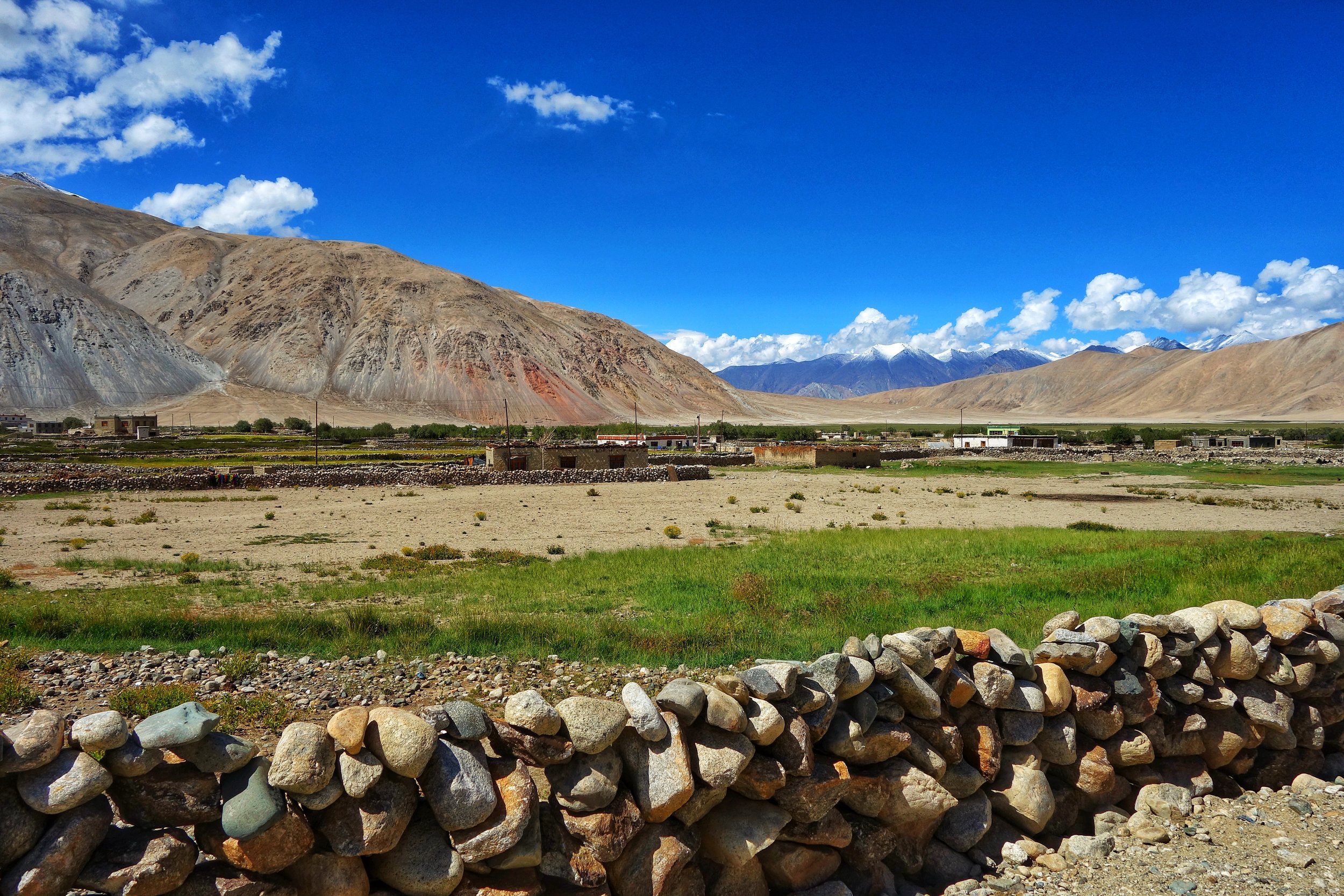
On the desolate Changthang region of the Tibetan Plateau lies the Village of Chushul. It lies close to the Border with China. And it was here that a Treaty was signed and Ladakh became a part of the Sikh Empire.
A Place Called Chushul
Chushul is a Village close to the Indian LAC with China in the Eastern Ladakh region close to Pangong Lake as well as Rezang La. At an altitude of around 4360 m it used to be the main Village of the Changthang block in the Ladakh region earlier. And it is one of the five designated locations along the LAC where the Border personnel from both countries meet to have formal meetings in order to maintain peace at the LAC.

On the way to Chushul and driving along the Pangong Tso.
We passed this place on our way from Pangong Lake to Tso Moriri which I must rate as one of the finest drive one can do in the Trans Himalayas cutting across the Changthang. Once we got to Chushul we realised that one of our Vehicles was short on fuel. And since Chushul was one of the main Villages on the way and uncertain of whether we will get fuel anywhere ahead we decided to look for Petrol in Chushul. We had already crossed Chushul when we decided to turn back and when we came back into the Village we passed by the Police Post . And there was an old Policeman sitting outside. We asked him where we could get Fuel. He told us and then suddenly he asked us for our Inner Line Permits.

The Village of Chushul and the Monastery in Yellow
All of us in 4 Vehicles were Residents of the state of Jammu and Kashmir and as such we dont require Inner Line Permits. J and K residents just need to show IDs to prove their credentials and they are good to go. And plus we had a letter from JK Tourism which pretty much gave us an open Pass as far as the ITBP/ Army guys were OK with it. The Policeman just saw the Letter and checked the IDs of the guys in the first Car and told us to go. Since I am no longer a permanent resident of JK being based in Gurugram I was carrying my old Passport photocopy which had been issued in Srinagar. But I had still got an ILP made for myself just in case. But it didnt come to that and the Policeman was satisfied that we were all JK residents and let us go.
And then we got the fuel had Lunch and we were on our way again. We again passed the Police Post and this time there was another younger Policeman there who signalled us to stop. We stopped and told him that we had already shown our papers. He looked at all of us. And then suddenly I realised that he was staring at me. The Policeman then said “ Iska permit Kidhar hai” pointing at me. He again said “Yeh foreigner ka Permit kahaan hai ?”. Out of all the Kashmiri guys he somehow assumed me to be a Foreigner. I was slightly amused and started smiling. I blurted “Sirji main Foreigner nahin hoon. Srinagar se aaya hoon” He started laughing and bade us n our way.

Before entering Chushul, traditional pile of Horns to ward off evil.
Now to more important stuff. Historically this was the place where the Treaty of Chushul was signed in 1842 which officially demarcated the border between Ladakh and Tibet as a consequence of which Ladakh became a part of the Sikh Kingdom of the Punjab. After the death of General Zorawar Singh in Tibet his Army had been routed. The Tibeto-Chinese Army then marched towards Leh and almost captured it. Except for a small Dogra detachment that was entrenched in the Fort. The Dogra Detachment held on till the time fresh troops arrived under Diwan Hari Chand and Wazir Ratnu. The Dogras drove out the Tibeto-Chinese and started chasing them and the Tibeto-Chinese forces dug in at Drangtse.
In a brilliant tactical move the Dogras flooded the Tibetan fortifications by diverting a local River and they were again forced to flee Eastwards. The Dogras were again on their heels as avenging the death of their beloved General Zorawar Singh was their most motivational factor. The opposing Forces finally met on the open fields at Chushul in August 1842 and in the engagement the Tibeto-Chinese force was defeated and their General was decapitated in a form of brutal medieval revenge. With their General avenged they could now go back as both sides had by now now lost the appetite for further engagements.

The fields of Chushul
Both sides then decided to have a treaty by the way of which their territories would be demarcated and recognised by each other. And the Tibetans and the Chinese gave up any claim whatsoever that they had over Ladakh. So on 16/ 17th September 1842 was signed the Treaty of Chushul at Chushul and it said
"As on this auspicious day, the 3nd of Assuj, samvat 1899 (16th/17th September 1842) we, the officers of the Lhasa (Governrnent), Kalon of Sokan and Bakshi Shajpuh, commander of the forces, and two officers on behalf of the most resplendent Sri Khalsa ji Sahib, the asylum of the world, King Sher Singh ji, and Sri Maharaja Sahib Raja-i-Rajagan Raja Sahib Bahadur Raja Gulab Singh, i.e.. the Muktar-ud-Daula Diwan Hari Chand and the asylum of vizirs, Vizir Ratnun. in a meeting called together for the promotion of peace and unity, and by professions and vows of friendship, unity and sincerity of heart and by taking oaths like those of Kunjak Sahib, have arranged and agreed that relations of peace, friendship and unity between Sri Khalsaji and Sri Maharaja Sahib Bahadur Raja Gulab Singh ji, and the Emperor of China and the Lama Guru of Lhasa will hence forward remain firmly established forever; and we declare in the presence of the Kunjak Sahib that on no account whatsoever will there be any deviation, difference of departure (from this agreement). We shall neither at present nor in the future have anything to do or interfere at all with the boundaries of Ladakh and its surroundings as fixed from ancient times and will allow the annual export of wool, shawls and tea by way of Ladakh according to the old established customs.
Should any of the Opponents of Sri Sarkar Khalsa ji and Sri Raja Sahib Bahadur at any time enter our territories, we shall not pay any heed to his words or allow him to remain in our country. We shall offer no hindrance to traders of Ladakh who visit our territories. We shall not even to the extent of a hair's breadth act in contravention of the terms that we have agreed to above regarding firm friendship, unity, the fixed boundaries of Ladakh and the keeping open of the route for wool, shawls and tea. We call Kunjak Sahib, Kairi, Lassi, Zhon Mahan, and Khushal Chon as witnesses to this treaty."
And to this day the territories as designated in this Treaty as held as the Official border as recognised by the Indian Government though the Chinese from time to time play some hanky panky as has become their norm in this Sector. But of course that doesnt take away from the significance of the Treaty or from the importance of Chushul itself.

Traditional Cow Dung for using as Fuel
A visit to Chushul would always be worth it if you love the Mountains and love some History as well.
Pic from August 2018. Chushul, Eastern Ladakh.
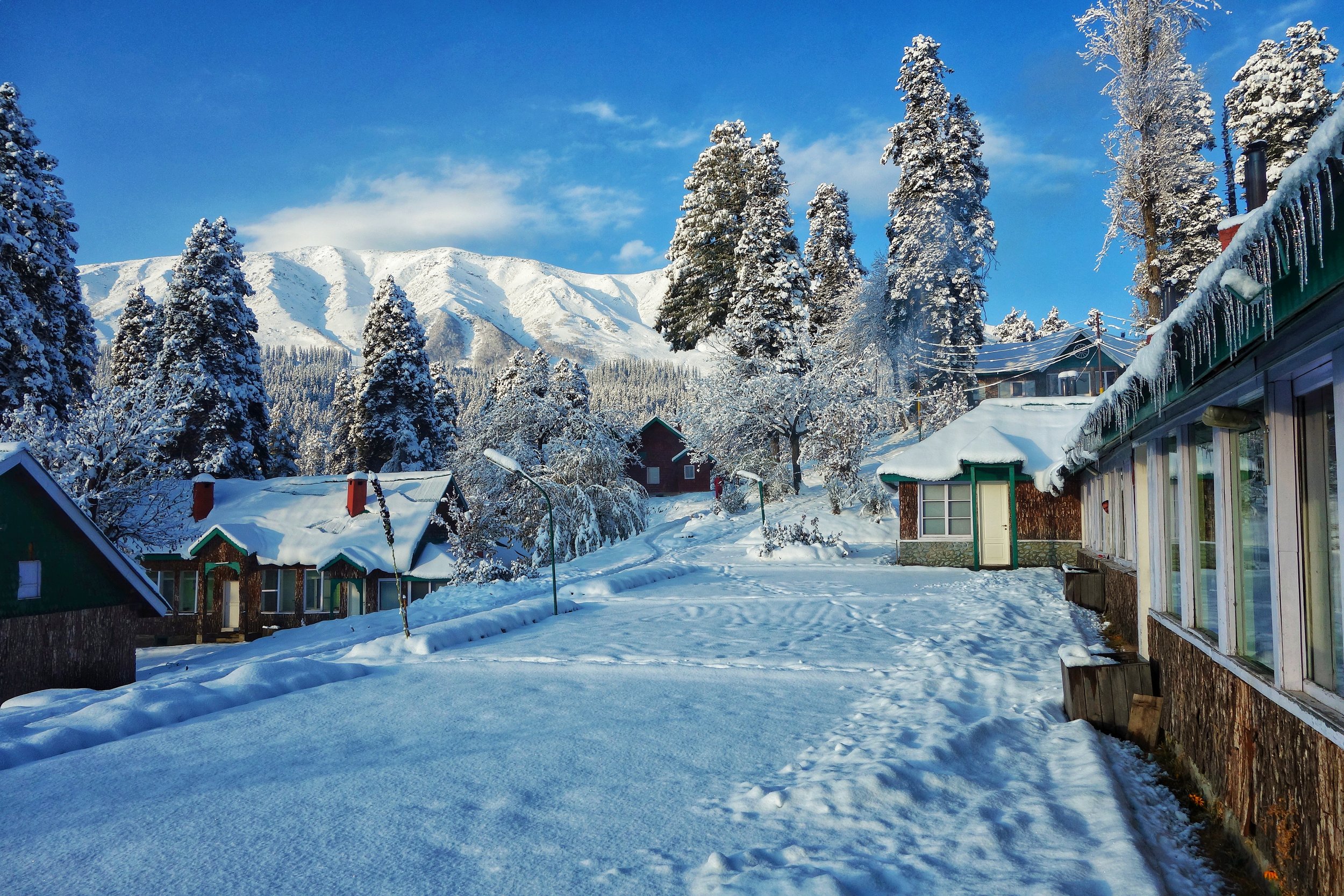
Guide to Catch a Snowfall !
Our Guide on How to Catch a Snowfall !
Guide to Catch a Snowfall!
One of the most frequently asked Questions here has to be this one :
Q. I am travelling to XYZ in ABC month. Will I be able to see snow ?
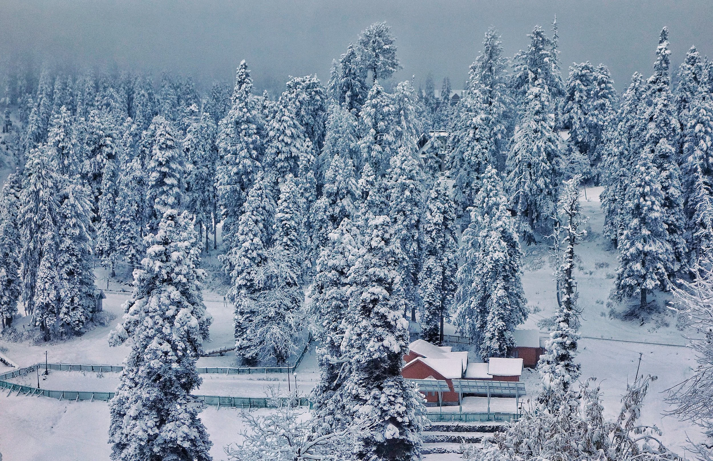
A. First thing you need to do is differentiate between "Snow" and "Snow Fall". Snow is usually available in some form or the other near the Hill Stations through-out the year. But Snow Fall happens during the winters. I assume when most people say "Snow" they refer to the witnessing the falling of Snow and not the dirty muddy pieces of icy snow that they pass off as snow at places like Rohtang in the Summers just to take the tourists for a ride. So you need to get the facts right and plan accordingly.
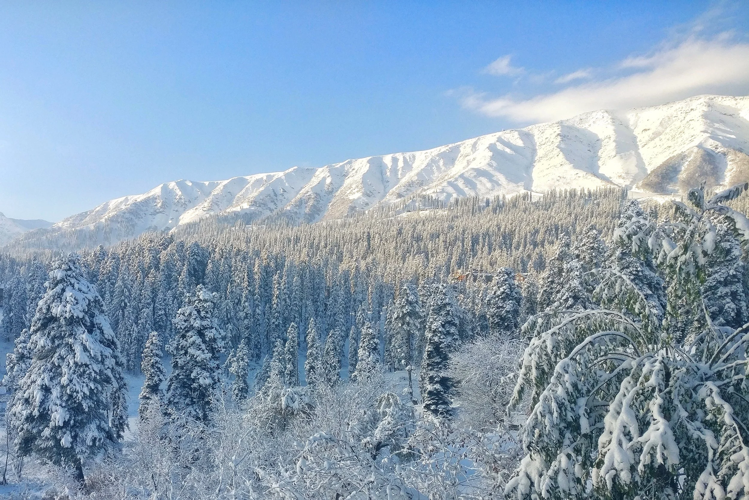
The best way to plan for seeing a Snow Fall to do is check with the forecasts on various Internet websites and compare the forecasts. If a majority forecast snowfall then there is a good chance of snow. Also check the minimum and maximum temperatures for that period. If the day time temperature is around 4 degrees C or lower and its cloudy, the precipitation would likely be in the form of Snow. It might initially start as rain and then turn into sleet and finally into snow. And if it starts raining in the night it would be good chance that you would wake up to a white morning with a shroud of silence around that only a snowfall could bring.
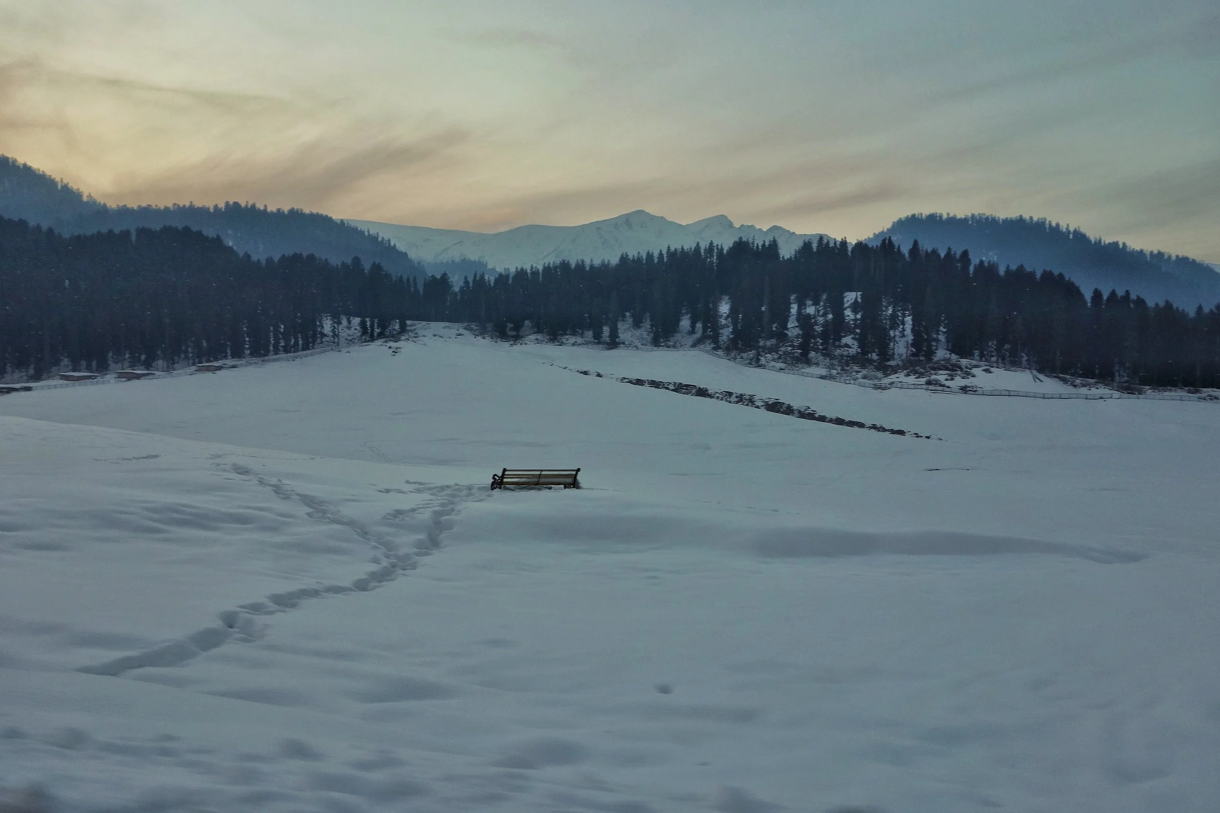
In the Himalayan context it usually snows at the better known Hill Stations mostly in December, January and February. There could be snowfalls out of this period as well but 80% of the snowfalls take place in this season at Hill Stations with an altitude of upto around 2000 meters. There of course can be freak Snowfalls which might extended into April. At altitudes beyond this level it could snow (as in a snow fall) from October to April. And above 3000 meters it could snow all round the year once the conditions are ripe.
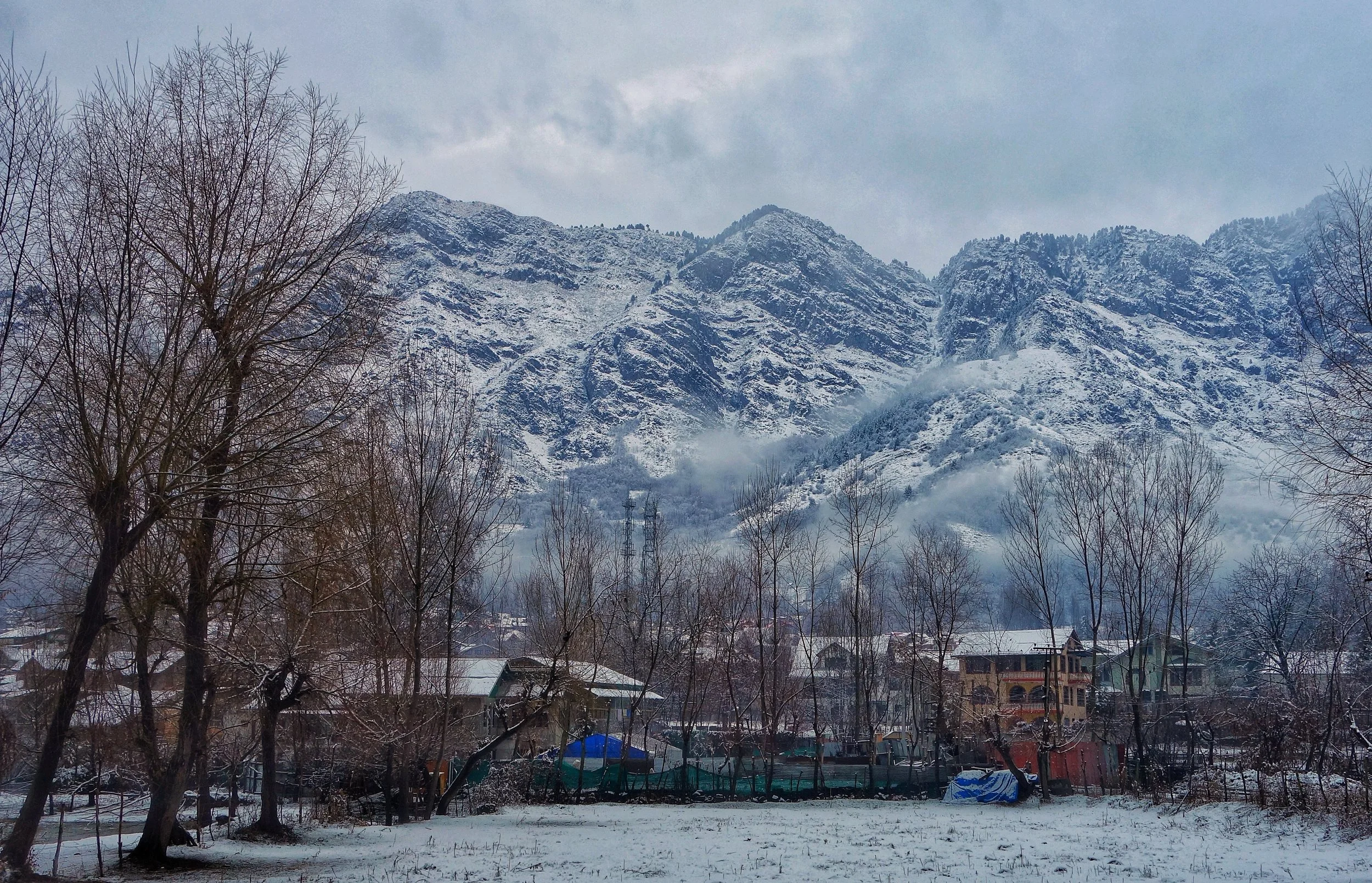
I give you an example of the Snowfalls in Kashmir in 2017 which might give you an idea as I was personally present on these occasions of Snowfalls and hence remember them quite well.
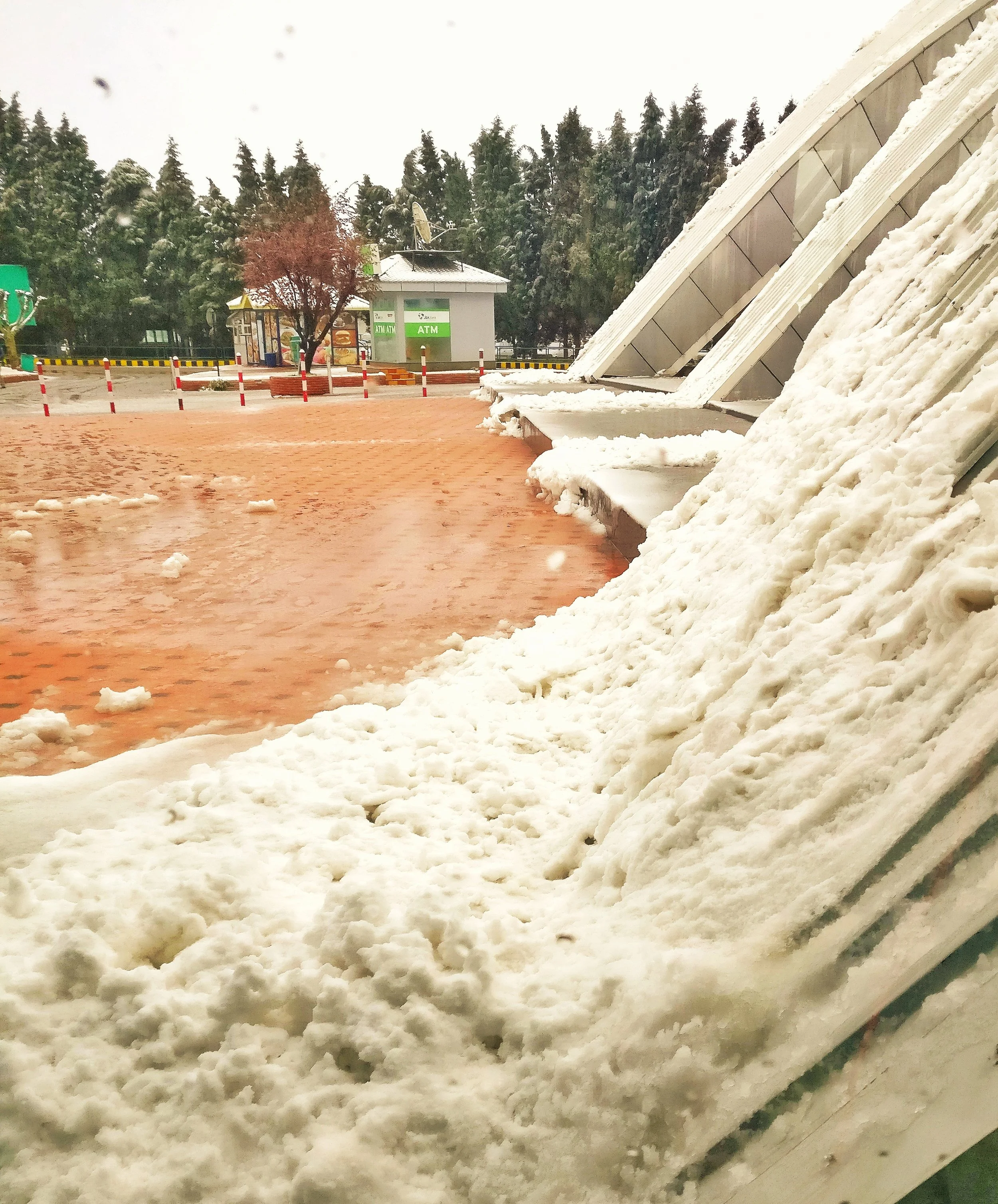
The first Snowfall that I witnessed in Kashmir was on, believe it or not April 6th when we had freak Snowfall in Srinagar itself though it was quite brief but still unusual.
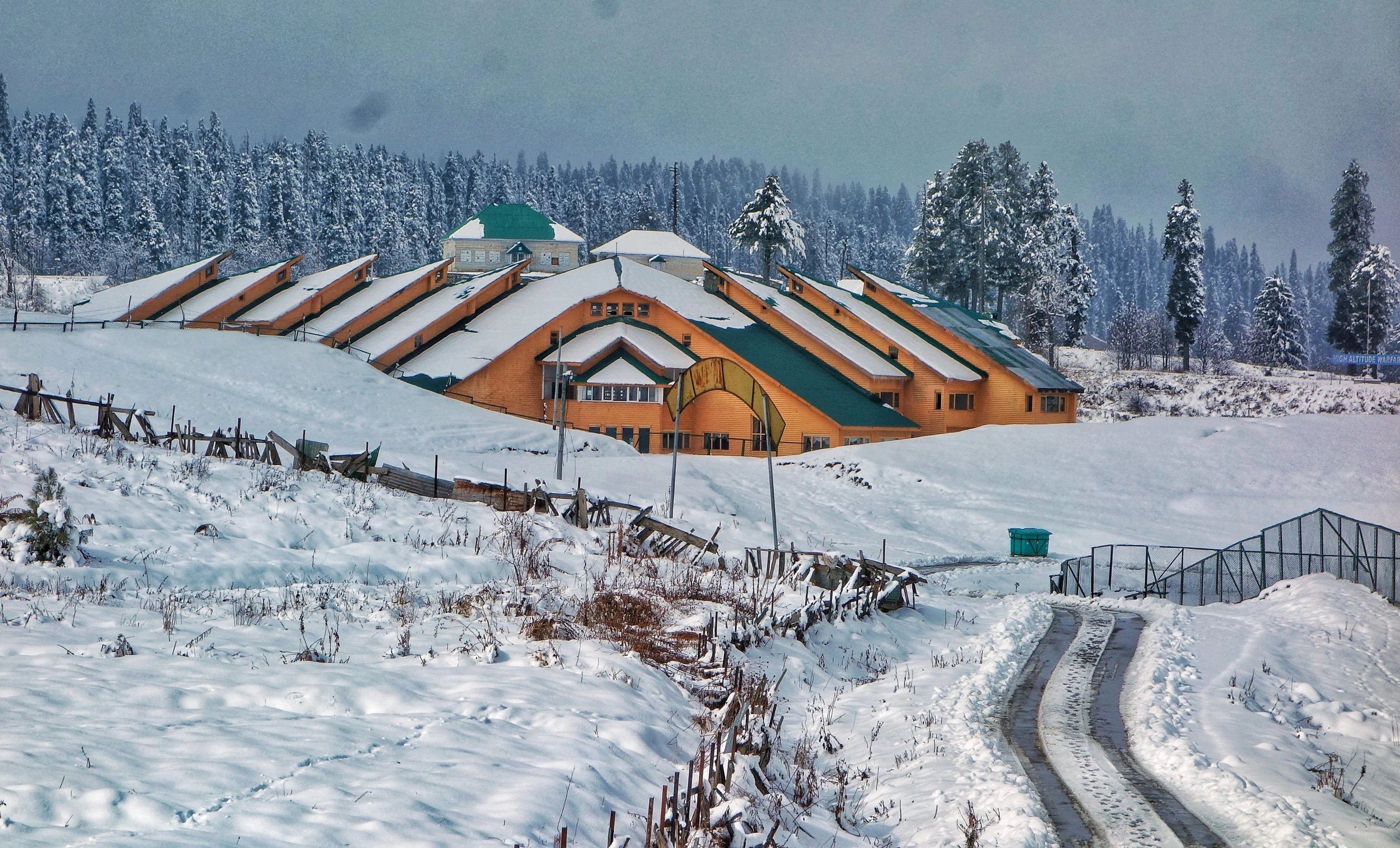
The first heavy Snowfall of the Winter season I witnessed in Gulmarg where it snowed in the first Week of November. The first Snowfall of that season in Srinagar occured on December 12th. And then there was a Snowfall in the second Week on February, 2018.
In between it was Snowing regularly in the higher reaches like Gulmarg. That's no surprise, Gulmarg being in the Pir Panjals gets the heaviest snow as no where in the Himalayas does it snow as much as in the Pir Panjals.
You need to keep an eye out for the Western Disturbance which comes from the Mediterranean side and causes Snowfall especially in the Valley and the Western Himalayas.
Just adding a pic of a snowfall in February 2018. As seen in Badamwari.
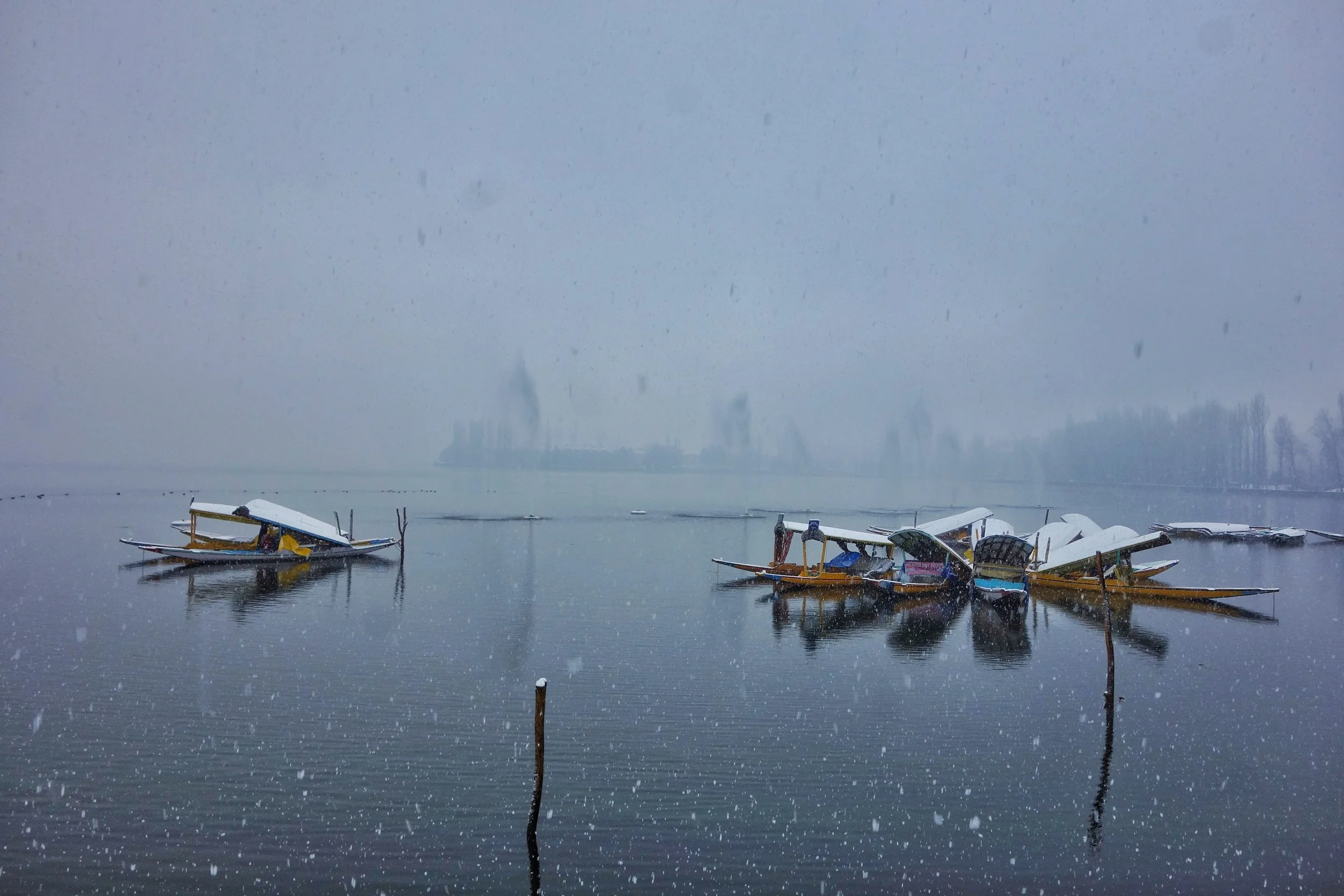
PS : We at, Travel The Himalayas are organising "Snowfall" special Tours, which are tailored specifically keeping in mind the Weather patterns historically and combining them with real time Data from the Indian Meteorological department and other Weather forecasting Websites. Its your best chance of catching a Snowfall. Do get in touch if interested.
The Newt of Chuharnag
The high Altitude Lake of Chuharnag is a home to various stories and legends. The most endearing one of the Newt of Chuharnag that people used to “kidnap” and hold till the Gods paid them back in the form of Rain.
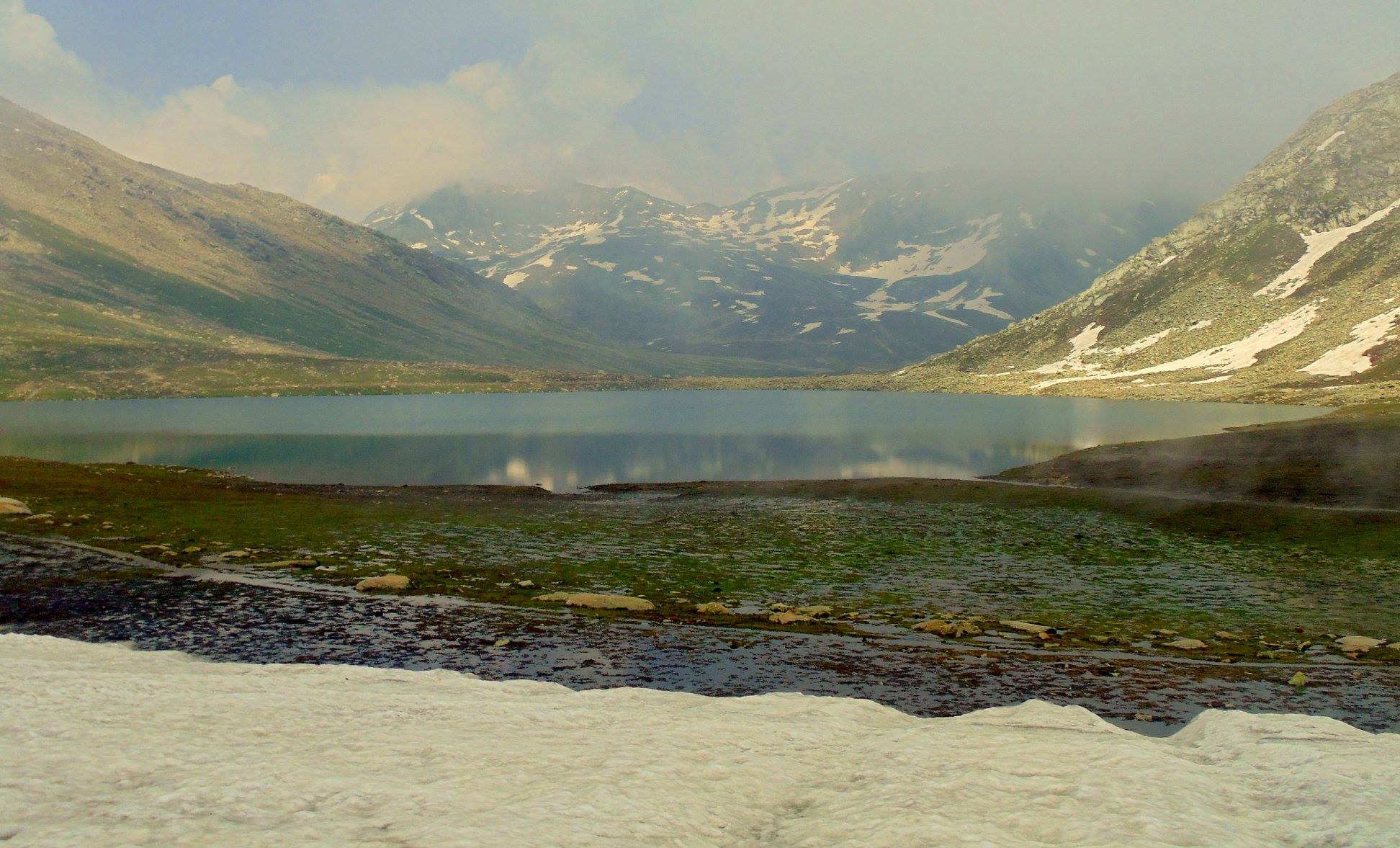
The Newt of Chuharnag
Margan Pass at 3810 m is a Pass which connects the Kashmir Valley with the fascinating Wardwan Valley in the Kishtwar District. However the main Pass which connects Kishtwar proper to Kashmir is the Sinthan Pass and that is the Route which is usually taken.The Newt of Chuharnag
The Margan Pass which has in recent years become Motorable (though the climb is tough one) is as fascinating as ever and has many stories connected to it as from Wadwan one can cross over to Suru Valley or even Zanskar or the Lidder Valley or even Amarnath. I had trekked across the Margan Pass into Warwan in 1989 as a part of school Trek and we had camped just under the Pass and it was just amazing.
As it so happens near the Pass and a short hike away lie a couple of Alpine Lakes which I have not had the opportunity of visiting but they are on my List. One of these is called Chuharnag Lake or the Tsuharnag Lake. Point to be noted is that the Wadwan has for centuries being a region which straddles almost all the three Divisions of the state Kashmir, Jammu and Ladakh has been a haven for all kinds of renegades throughout history. I had recounted the story of Chamal Singh and Co, a disgraced General who became a very successful Dacoit and spread terror all across the Pir Panjals.
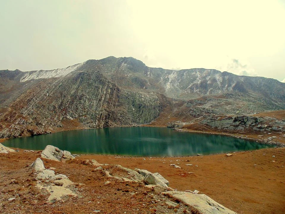
But this particular Lake has certain mystical stories attached to it which are fascinating to say the least. The Lake gives great views of the Valleys around and is surrounded on three sides by grassy sloped Mountains which abound with flowers in the Summers. Those who have been to the Lake swear by the beauty of the Lake and a Lake such as this one was sure to have Legends attached to it as the norm with the Ancients.
Apparently the Chuharnag Lake was the guardian angel of the Kutahar Pargana in Kashmir though ironically not a drop of water from this Lake comes into Kashmir and flows into the Warwan River which is a tributary of the Chenab. The Kutahar Pargana consisted of a number of Villages like Tserpura, Shangas, Naogam and Achabal. I have spent nearly a year in Achabal as a toddler so I kinda like the place and the whole area as such.
Another story about the Chuharnag is the one about its family. Apparently Chuharnag’s mother sent her Eldest son to look for a place where they could live comfortably. The son returned and told her that he found a place but it only had room for him but not her. The Mother cursed him and he was turned into a spring coming out of white Rocks in a crag in the Mountainside. Its still there. Next she asked Chuharnag for the same thing. He came back and told his Mother though he had found a place but it only had Room for her but none for him. The Mother was impressed with him and granted him a preeminent place in the surroundings. The Mother also became a spring which used to be called Maji (Mother).
But the most interesting Legend of the Lake consisted of a Newt (a kind of Lizard for the ones not aware). These Himalayan Newts are found on the banks of some Alpine Lakes in the Himalayas. It is said, that since the Kutahar Paragna was mostly dependent on rain water for their crops (as Chuharnag used to send the water to the Chenab), the Hindus and Muslims of the Pargana used to send a Brahmin priests every year to come and pray at Chuharnag for the rains and make a sacrifice to the Rain Gods.
After having done this the Brahmin used to look for the Newts and eventually catch one. Once caught they put the Newt in a bowl filled with the Lakes water. Next they invoke the Lord of the Chuharnag and inform him that please grant us good Rains and in order to ensure you do the same we will carry the Newt down with us a “guest”. So basically the Newt was taken hostage in return for good rains.
But of course the Lords are also smart. Though it worked most of the times sometimes a smarty pants Lord would just cause Rainfall in the Mountains and not the Villages themselves. Well it didnt say anywhere in the agreement where they were supposed to cause the Rainfall.
The Brahmins were no less. In the beginning the Hostage is kept at a Brahmins place. And when they realise that the Lords have played the ‘Rain in the Mountains and not in the Villages” trick they turn the Newt over to the “scavengers” at that time at the lowest rung in the hierarchy of the Caste System. Of course this was a chastisement that even the Lords couldnt do with. And they had no options but to make the rains in the Villages.
Of course once the Rains came the Newt was ceremoniously released into the spring waters around the Village in a special ceremony. The Lords fulfill what is asked from them and as a result the hostage is honourably released. But during this period if any harm would befall the Newt then the wrath of the Lords would befall the family who were taking care of the Hostage. And incase the hostage died then a member of the family would also die as devised by the Lords.
Of course this is no longer the case. But once you hear such stories then the fascination for visiting such a place just goes to another level. Try and hike upto the Lake next time and try looking for a Newt but make sure not to take it back home as a Hostage ! :)
Story Source : The Legendary Sir Ram Chander Kak.
Pic from Summers. Chuharnag Lake, Margan pass, Jammu and Kashmir. Photo credit Aarif Mountaineer
The Murree Brewery
The Murree Brewery was established in 1860 the fulfill the ever increasing demand of Beer for the British Troops in the British Indian Army. It did roaring business till it was reduced to ruins after being burnt down during the riots in the wake of the partition of the British India.

The Ruins of the Murree Brewery in Murree.
The Murree Brewery
Murree Brewery was established in 1860 in response to the ever increasing demand for beer by the personnel of the British Raj, and is currently the oldest continuing enterprise in Pakistan.
Consequent to the British annexation of the Punjab in 1849 from Sikh rule, and more so after 1857 when the British Crown formally extended its sovereignty over India, a structured administration commenced in the Punjab.

The Ruins of the Murree Brewery in Murree.
To meet the beer requirements of British personnel (mainly army), the Murree Brewery was established in 1860 and incorporated a year later at Ghora Galli, located in the Pir Punjal range of the Western Himalayas at an elevation of 6000' above sea level, near the resort town of Murree.
Between 1885 & 1890 the Company established Breweries in Rawalpindi & Quetta & acquired an interest in the Oticumand (South India) & Norailiya (Ceylon) breweries. A distillery was also established in the above period in Rawalpindi next to the Brewery.

The Ruins of the Murree Brewery in Murree.
The Murree Brewery at Ghora Galli was therefore among the first modern beer breweries established in Asia. Murree Beer proved to be very popular among the British troopers who were largely barracked in the 'Galis' of these hills. The virtues of beer brewed from barley malt & hops as a light alcoholic beverage were not lost on the local population who rapidly became avid consumers.
By the turn of the 20 century, the name "Murree" was famous for its beer in keg and bottle in the bars, beer halls and army messes of British India. Murree Beer was first awarded a medal for product excellence at the Philadelphia Exhibition in 1876, followed by numerous awards over the past 140 years.
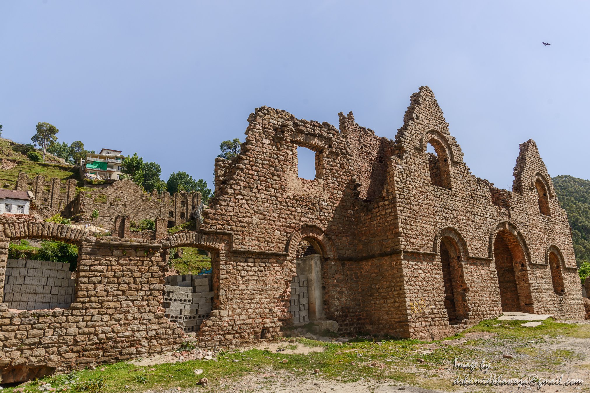
The Ruins of the Murree Brewery in Murree.
In 1935, a massive earthquake totally demolished the Quetta brewery as well as substantial part of Quetta town, killing thousands of persons, including a number of our employees. At Ghora Galli (Murree), the scarcity of water became an emerging problem. By the 1920s, brewing was mostly transferred to the Rawalpindi brewery but malting continued at Ghora Galli till the 1940s, when this property was sold. This historic brewery built in Gothic style architecture was burnt during the partition riots of 1947/48. The Ruins of the building still exist in Murree and are a testimony to the grandeur of the Brewery Building as it once stood.

Park Lodge a handsome residential property was purchased by the company from Mrs.H. Whymper in 1888. It was the principal residence and head office of the company till 1959, when it was taken over by the Government of Pakistan to house the office of the President of Pakistan. It remains an office of the Head of State of Pakistan from 1960 till the present day.
Two English families were closely connected with the founding of the original brewery. Edward Dyer was the first General Manager of the company. He was also the founder of Dyer Meaken breweries, Simla Hills. His son Gen.Dwyer attained notoriety for his role in the Jalainwala Bagh incident. Edward Whymper, a member of this family was the first person to climb Matterhorn mountain in 1865. The Rawalpindi brewery is blessed with deep aquifers of good water. A railway siding was extended to the premises in the 19th century, which is now derelict.

The Ruins of the Murree Brewery in Murree.
Buddhist Art from Kashmir at the Metropolitan Museum, New York
Kashmir was at one time one of the great centers of Buddhist learning and it was from Kashmir that Buddhism spread Northwards into Ladakh and Central Asia and subsequently to Tibet and China. The Metropolitan Museum in New York has a fine collection of Kashmiri Buddhist artworks.

Reliquary(?) with Scenes from the Life of Buddha

Reliquary(?) with Scenes from the Life of Buddha
Date: ca. 10th century / Culture: India (Jammu & Kashmir, ancient kingdom of Kashmir) or Pakistan : Medium: Bone with traces of color and gold paint / Dimensions: H. 5 3/8 in. (13.6 cm); W. 4 3/8 in. (11.1 cm); D. 2 9/16 in. (6.5 cm) / Classification: Sculpture
This container likely served as a Buddhist reliquary. There are three scenes: the first shows the miraculous birth of Siddhartha, the historical Buddha. He emerges from the right side of his mother, Queen Maya, who is supported by her sister, Mahaprajapati. The second scene depicts the temptation of Siddhartha as he meditates at Bodhgaya immediately before attaining enlightenment. The third scene is a rare representation of the crowned and jeweled Buddha setting into motion the wheel of law, a reference to his first sermon at the Deer Park at Sarnath.

Vajrasattava
Date: 8th century / Culture:India (Jammu and Kashmir, ancient kingdom of Kashmir) / Medium: Brass with silver inlay / Dimensions:H. 6 5/8 in. (16.9 cm); W. 3 7/8 in. (9.8 cm); D. 2 3/4 in. (7 cm) / Classification: Sculpture
The Esoteric Buddhist deity Vajrasattva holds a stylized thunderbolt and a bell and sits in royal ease on a stylized mountain, with his pendant foot supported by a lotus bloom. Two snake deities, a naga and nagini, emerge from the mountain’s waters and raise their hands in veneration of Vajrasattva’s transcendent wisdom.

Panel of a Portable Buddhist Shrine with Dancer and Musician Celebrants
Date:8th century / Culture:India (Jammu and Kashmir, ancient kingdom of Kashmir) / Medium:Ivory with traces of color / Dimensions:H. 1 7/16 in. (3.6 cm); W. 1 7/8 in. (4.8 cm) / Classification:Ivories

Crowned Buddha
Date:9th century / Culture:India, Ancient kingdom of Kashmir / Medium:Brass / Dimensions: H. 20 3/8 in. x W. 9 in. (51.8cm x 22.9 cm); D. (from hands) 3 in. (7.6 cm) / Classification: Sculpture
The Buddha is usually depicted in a monk’s simple garments; however, when he wears rich jewelry and a crown, he evokes the special form of Buddha as a cakravartin, or universal monarch. In Kashmir this form also recalls the splendor of the Buddha in heaven, where he reveals himself to the bodhisattvas. Both the high tripartite diadem and tasseled cape reflect Central Asian influence on Kashmiri Buddhist art of this period.

Crowned and Jeweled Buddha
Date:ca. 9th century / Culture:India (Jammu and Kashmir, ancient kingdom of Kashmir) / Medium:Copper with silver inlay / Dimensions:H. 7 1/16 in. (17.9 cm); W. 3 7/8 in. (9.8 cm) /Classification:Metalwork
Buddha sits in a yogic posture, wearing a high tripartite crown and fully articulated robes. His lowered hand grants boons to the male donor kneeling before him presenting an offering, likely a garland. The crown with flying ribbons demonstrates the powerful influence of Sasanian royal imagery on later Kashmiri art.

Panel of a Buddhist Ritual Crown with Ratnasambhava, the Transcendent Buddha of the South
Date:10th–11th century / Culture:India (Jammu and Kashmir) or western Tibet / Medium: Wood with traces of polychrome / Dimensions:H. 6 7/8 in. (17.5 cm); W. 3 7/8 in. (9.8 cm) / Classification:Sculpture
Ratnasambhava is one of the five Transcendent Buddhas of Esoteric Buddhism. Horses are his traditional mounts.

Bodhisattva in Contemplative Pose
Date:5th–6th century / Culture:India (Jammu & Kashmir, ancient kingdom of Kashmir) or Pakistan / Medium:Stone / Dimensions:H. 3 5/8 in. (9.2 cm) / Classification: Sculpture

Buddha Bust
Date:8th century / Culture:India (Jammu & Kashmir, ancient kingdom of Kashmir) / Medium:Stone / Dimensions:Gr. H. 2 5/16 x Gr. W. 1 3/4 in. (5.9 x 4.5 cm) / Classification:Sculpture

Seated Shakyamuni
Date:9th century / Culture:India (Jammu & Kashmir, ancient kingdom of Kashmir) / Medium:Bronze / Dimensions:H. 6 5/8 × W. 3 in. (16.8 × 7.6 cm) / Classification:Sculpture

Seated Headless Buddha
Date:8th century or earlier / Culture:India (Jammu & Kashmir, ancient kingdom of Kashmir) / Medium:Terracotta / Dimensions:H. 2 1/4 in. (5.7 cm) /Classification:Sculpture

Buddha
Date:7th–8th century / Culture:India (Kashmir region) / Medium:Brass inlaid with copper and silver / Dimensions:H. 3 7/8 x W. 2 1/2 x D. 1 3/8 in. (9.8 x 6.4 x 3.5 cm) / Classification:Sculpture

Bodhisattva Maitreya, the Buddha of the Future
Date:7th century / Culture:India (Jammu and Kashmir) or Pakistan (Swat Valley) / Medium:Bronze inlaid with silver / Dimensions:H. 7 1/8 in. (18.1 cm) / Classification:Sculpture
The messianic savior Maitreya is identified by the flask he holds in his lower hand. He is seated in a yogic posture on a double-lotus cushion and extends spiritual protection to believers with his raised hand, here displayed with the palm facing inwards, not outwards as is conventional. This icon has a superbly preserved metal surface, complete with silver inlay on the eyes and forehead mark (urna). The raised ornamentation reflects an awareness of Gupta design. The figure and base were cast separately, and the lotus base is inscribed on the reverse with a donor dedication.

Preaching Buddha
Date: 8th century / Culture:India (Jammu & Kashmir, ancient kingdom of Kashmir) or Pakistan / Medium:Bronze with silver inlay / Dimensions:H. 8 3/8 in. (21.3 cm) / Classification:Sculpture
This Buddha, with his legs folded in a full yogic posture and his hands gesturing preaching, invokes the first sermon at Sarnath. The complex treatment of the monastic robes, most notably their pleated ends, is evidence of an unidentified monastic workshop, probably located in Kashmir or the Swat Valley. The treatment of the hair curls is unconventional, as is the extreme stylization of the eyes and eyebrow. Silver inlay marks the eyes and auspicious forehead mark (urna).
The Tiger Leaping Rock
The Tiger Leaping Rock in the middle of the Tiger Leaping Gorge, which is one of the deepest River Gorges in the world in Yunnan, forces the Jinsha or the Upper Yangtze through a narrow channel just a few meters wide. The result of a River which is almost a km wide being forced through a Channel just a few meters wide is indeed spectacular.
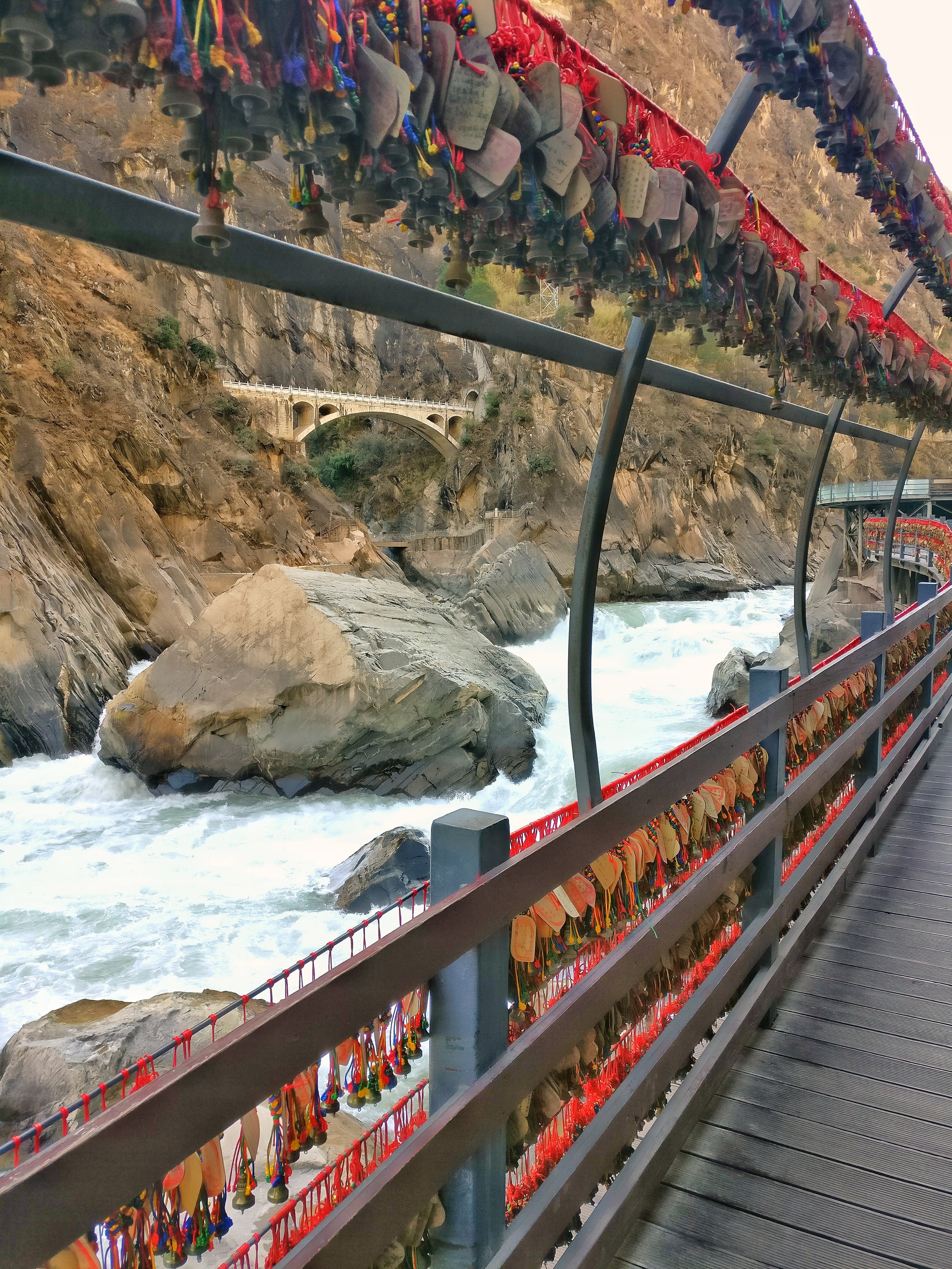
The Tiger Leaping Rock in the Middle of the Gorge, Tiger Leaping Gorge, Yunnan
The Tiger Leaping Rock
I first heard of the Tiger Leaping Gorge while watching Palin's Himalayas. The Tiger Leaping Gorge was the Easternmost place that Palin visited in the epic Journey.
This is the legendary Tiger Leaping Rock right in the middle of the Tiger Leaping Gorge. This rock forces the Jinsha or the Upper Yangtze through a 10 meter wide corridor. It was dry season when I took this pic but in the rainy season it's a sight to behold and it seems the whole earth trembles due to the force of the water as it squeezes through this narrow corridor.
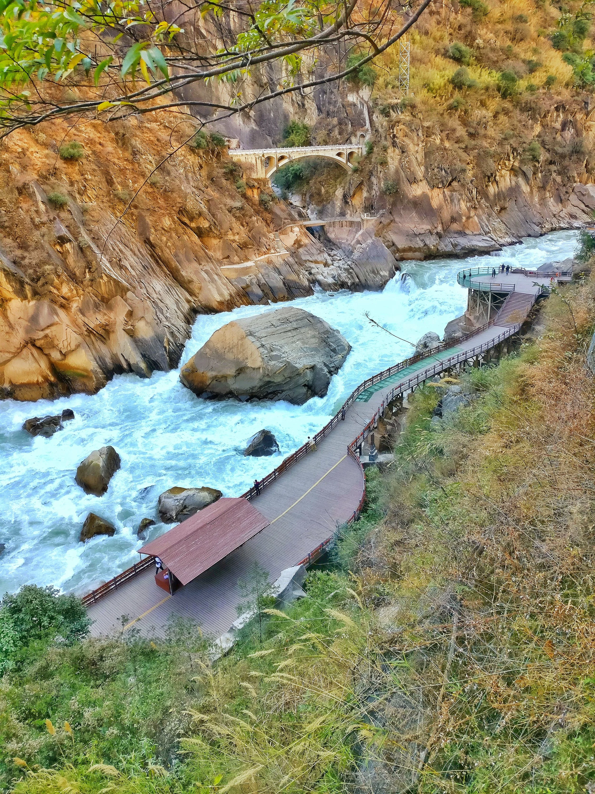
A view from above of the Tiger Leaping Rock with the viewing Platform, Tiger Leaping Gorge, Yunnan
In the rainy season the whole 13 meter rock rumbles under the pressure of all the water furiously trying to make it's way down. It's really a spectacle when a River more than half a mile wide if forced through a channel just a few meters wide thanks to the rock.
As per the story told by Palin the Gorge got it's name from the story of Tiger which jumped across the Yangtze while being chased by a hunter. The Tiger jumped into this rock and then across the the River to the other side. Hence the name Tiger Leaping Gorge.

The point at which the Jinsha or the Upper Yangtze enters the Tiger Leaping Gorge under the shadow of the Haba Snow Mountain, Tiger Leaping Gorge, Yunnan
And on the other side are Peaks which have a vertical elevation of almost 4000 m from the level at which the water flows. To put it into perspective this Canyon is more than twice the height of the Grand Canyon in the US. The level of the River flow is at an altitude of around 1800 m and its surrounded by Peaks touching almost 6000 m. These are the Hengduan Mountains which form the Eastern edge of the Tibetan Plateau.
Those little bells with the red tags are good luck charms that the local Naxi people use to tie to honor the spirits of their ancestors.
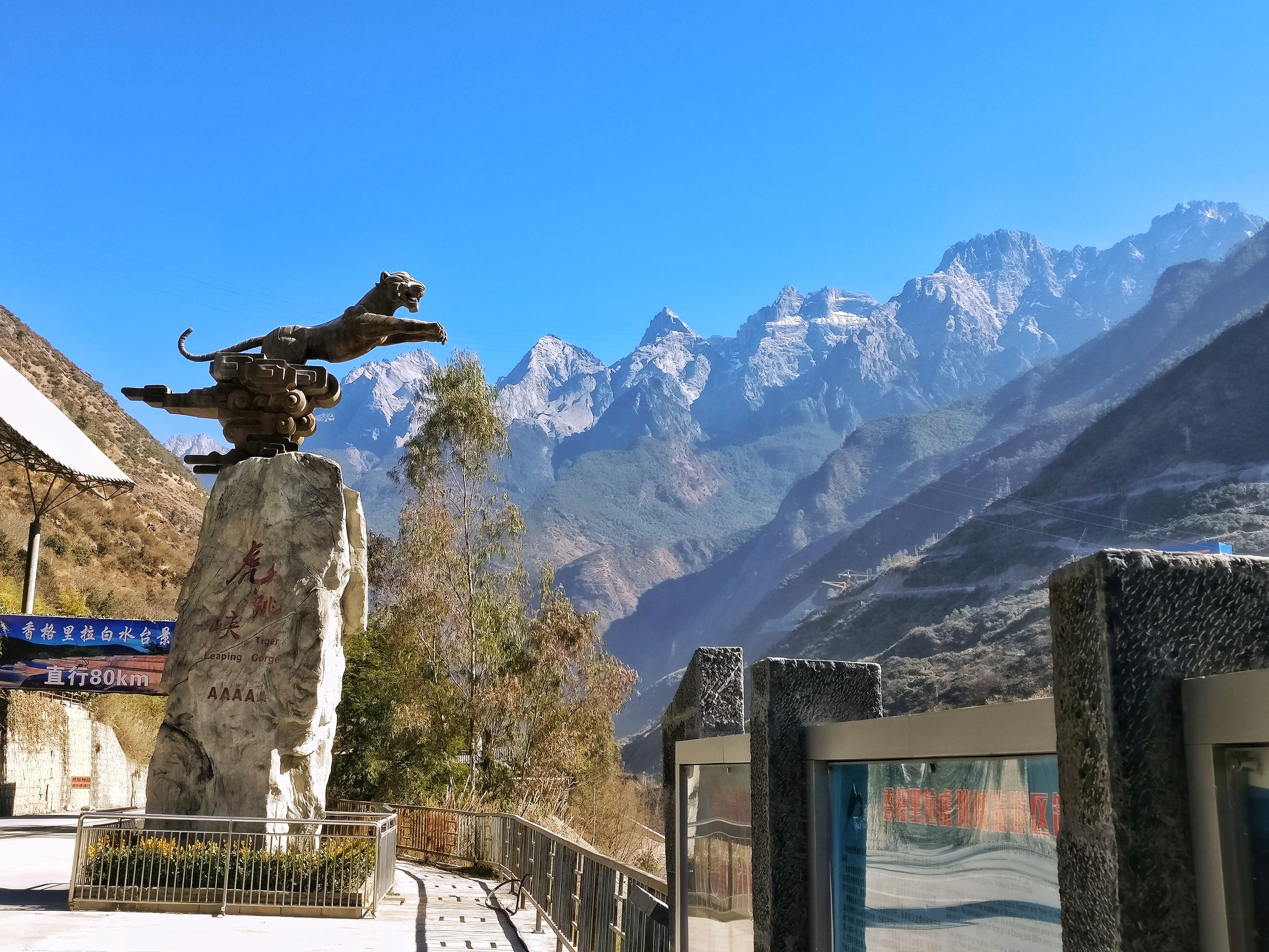
The statue of the Leaping Tiger, Tiger Leaping Gorge, Yunnan
This place, if you understand the significance and the geography that went into it makes the hair stand on the back of your neck. Its where Tibet meets South Asia and China. No wonder it's a UNESCO designated World Heritage Site under the Three Parallel Rivers of Yunnan Protected Area. The three of the mightiest rivers of Asia, the Yangtze, the Salween and the Mekong cutting across the jagged Peaks of the Hengduan Mountains around this area.
This place was opened to foreigners only in the 1990's and now attracts Mountain lovers from all over the World who want to witness the epic scenery that the place offers.

Spectacular.
Pic from January 2017. The Tiger Leaping Gorge, Deqen Tibetan Autonomous Prefecture, Western Yunnan, China
The Changthang
The Changthang is a part of the Tibetan Plateau which is located in the Western and North Western part of Tibet and it also includes Eastern Ladakh. Its a forbidding Plateau and is home to a number of Lakes like the Pangong Tso and the Tso Moriri. However it holds a large array of wildlife in its high altitude Wetlands. Its home to the Changpa People who are nomadic herders known to keep the best herd of Pashmina Goats.

The Changthang.
A place of immense beauty amidst desolation of the Tibetan Plateau. A place devoid of most human in habitation except for the Pashmina Goat rearing Changpas. With an average altitude of above 4000m it stretched from Tibet into Ladakh.

The Changthang is home surprisingly to a large number of wildlife species including the Snow Leopard, the Tibetan Wild Ass, the Chiru etc. The legendary Indus flows through the Changthang and it includes a number of wetlands and marshes which attract migratory birds such as the Black Necked Crane and the Bar Headed Geese.

The Changthang always fascinated the Western Explorers few of whom ever stepped into its splendid isolation. The unpredictable weather, the Artic conditions in the Winters and the paucity if human in habitation didnt help either.

I happened the drive from Pangong Lake to the Tso Moriri, two Lakes which lie within the Changthang. And to keep it simple it was one of the most beautiful places I have ever been to. The legendary Changthang. The home of the Changpa who produce the finest Pashmina bearing Goats. Pashm which for centuries bought neighbouring Kingdoms to War with each other.

Pic from this week. Some where on the Changthang between Pangong Tso and Tso Moriri.
The Patola Shahis of Gilgit
The Patola Shahis were a Dynasty that ruled the region of Gilgit and were instrumental in the promotion and spread of Buddhism in Central Asia and Tibet.

The Patola Shahis of Gilgit
The enchanting region of Gilgit was at one time ruled by the powerful Patola Shahi Dynasty between the 6th and the 8th Century. It was a great.l Asia through North Indian Plains and Kashmir. It was at this time that great statues of the Buddha were carved out on rock faces all over the Region. One of the most important historical find relating to Buddhism was also found in Gilgit, named after it as the Gilgit Manuscript which today lies partly in the National Archives in New Delhi as well as partly at the SPS Museum in Srinagar. Such was the importance of this manuscript that Pandit Jawaharlal Nehru had in 1947 despatched a special Plane to Kashmir to get the Gilgit Manuscript to Delhi for safety.
The Patola Shahis find mention in the later parts of the Gilgit Manuscripts as well as on certain Bronzes of that period found in the Region. They are also known from the Hatun inscription in the Ishkoman Valley and from an inscription at Hodor. The Gilgit Manuscript mentions a certain Patola Deva Shahi Vajradityanandi.
Gilgit is the name given to the western frontier districts of the erstwhile state of Jammu and Kashmir which are now under the occupation of Pakistan alongwith the more central Baltistan. It corresponds to the region called Dardistan. Its subdivisions are Astor, Bunji, Chilas, Gilgit, Hunza, Nagar, Punial, Yasin and Chitral. Adjacent to it is the territory of Baltistan consisting of the subdivisions of Kharmang, Kaplu, Shigar ·Skardu and Rondu'. More strictly Gilgit signifies the lower valleys of the Gi]git river joining the Indus at its acute bend north of Nanga Parbat. This whole area is extremely mountainous exceeding 20,000 feet on the north and west, but the lower valley is about 5"000 feet and grows maize, millet, temperate cereals and even some cotton and rice.
The people of Gilgit were Dardic as opposed to the Baltis of Baltistan who were of the Tibetan stock with Dardic admixture. Their language is Shina as opposed to the Tibetan derived Balti of the Baltis. Interestingly in the region of Gurez and Drass there still exist Shina speaking communities which had originally come down from Gilgit. It is pertinent to note that Gurez was an important pit stop on the road that linked Kashmir with Gilgit across the Burzil Pass.
Along river valleys and mountain passes run routes connecting this region with the outside world. One route passing through the Tragbal and Burzil passes joins Gilgit to Srinagar 223 miles south of it 3. Another route connects Gilgit with the Abbottabad frontier of the Punjab along the Bahusar Pass. In the north, narrow sterile mountain valleys, measuring some 100 to 15"0 miles in width, separate the province from the Chinese frontier beyond the Muztagh and Karakoram ranges.
The region of Gilgit and Baltistan is known as Daradadesa in old texts like the Rajatarangini. Its people, the Daradas, are said to have played an important part in the history of Kashmir. According to the Tibetan historian Taranatha, the route between it and Kashmir was opened by Buddhist pilgrims and missionaries who reached Kashmir with and following Madhyantika the emissary of Moggaliputta Tissa at the time of Asoka. The ancient name of Gilgit under its Hindu Rajas was Sargin, which was later known as Gilit.
The Patola Shahis unlike the Kabul Shahis were great proponents of Buddhism and it was under their patronage that Buddhism flourished in the region was spread towards Central Asia and Tibet. Even to this day the number of Buddhist sites discovered in Gilgit alongwith the various rock carvings the Himalayan regions which are no longer Buddhist are a testimony to this fact. Stretching across from the Hindu Kush from the Bamiyan region where the giant Buddhas were made all the way into the Trans Himalayas and the Karakorams were numerous Monasteries dedicated to Buddhism. It was from these Monasteries that the present form of Tibetan Buddhism evolved and is still prevalent from Ladakh to Tibet and all the way to Yunnan.
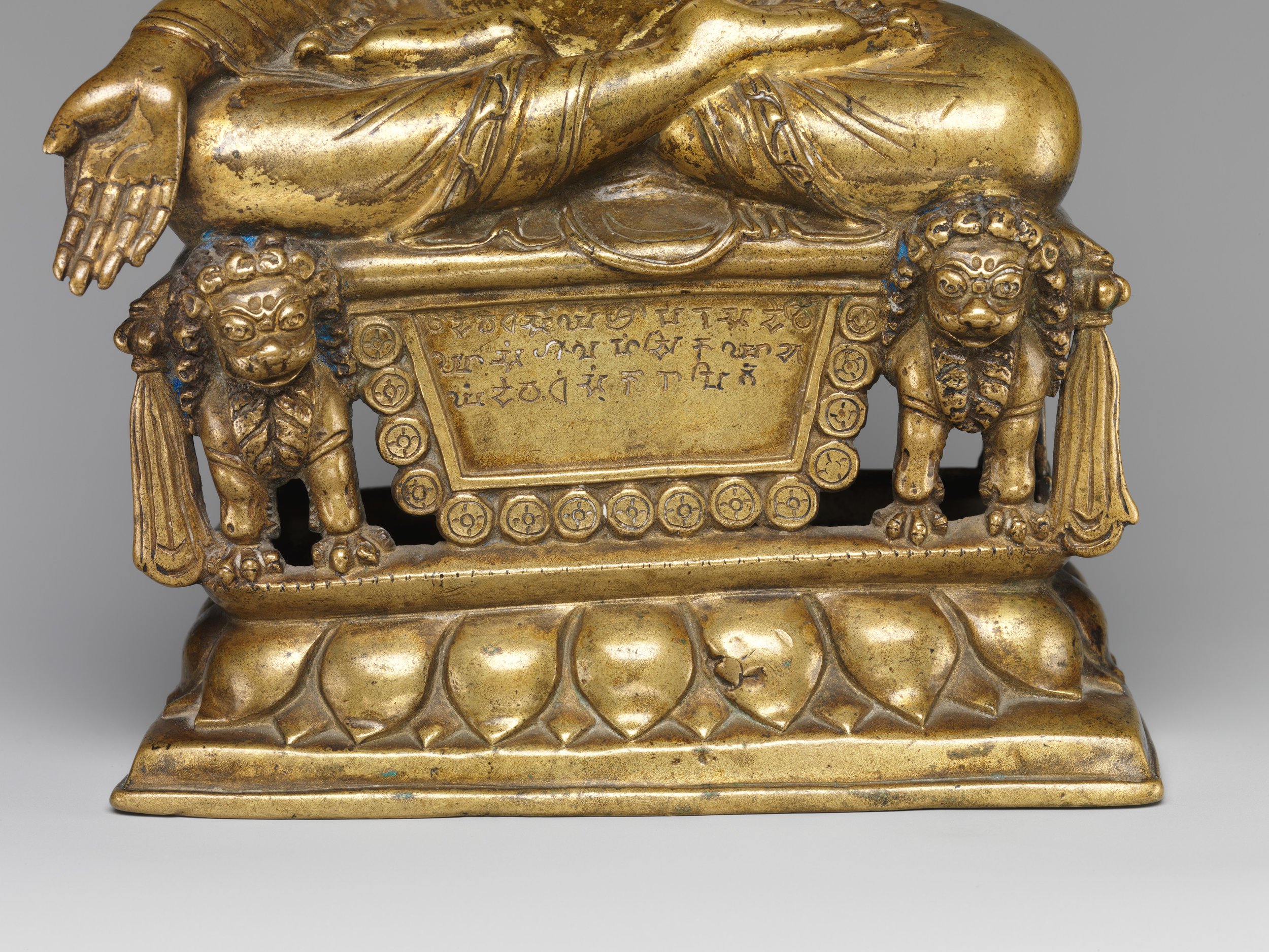
But little is actually known about the Patola Shahis except that they left as a legacy great pieces of art such as this Buddha inscribed with an ancient form of Sanskrit. Its presently in the Met Art Museum in New York and the Museum website describes it as such
Enthroned Buddha Granting Boons : Date to ca. 600. Gilt brass with silver and copper inlay. It also mentions this (sic) : This Buddha is one of the three earliest datable sculptures associated with the kingdom of Gilgit in northern Pakistan. All were commissioned by Queen Mangalahamsika, known from Gilgit manuscripts to have been the senior queen to King Vajraditayanandi (reigned ca. 600). The Sanskrit donor inscription engraved on the front cartouche states: “Om. This is a pious gift. This pious gift was ordered to be made by the Shri Paramadevi [Highest Queen] Mangalahamsika” (trans. O. von Hinueber).
Pics from the Met Art Museum, New York
Shyok : The River of Death
The name of the Shyok River in the local language means the “River of Death”. True to its name its still as wild and furious as it used to be. This is the story of the Shyok and its notorious reputation.
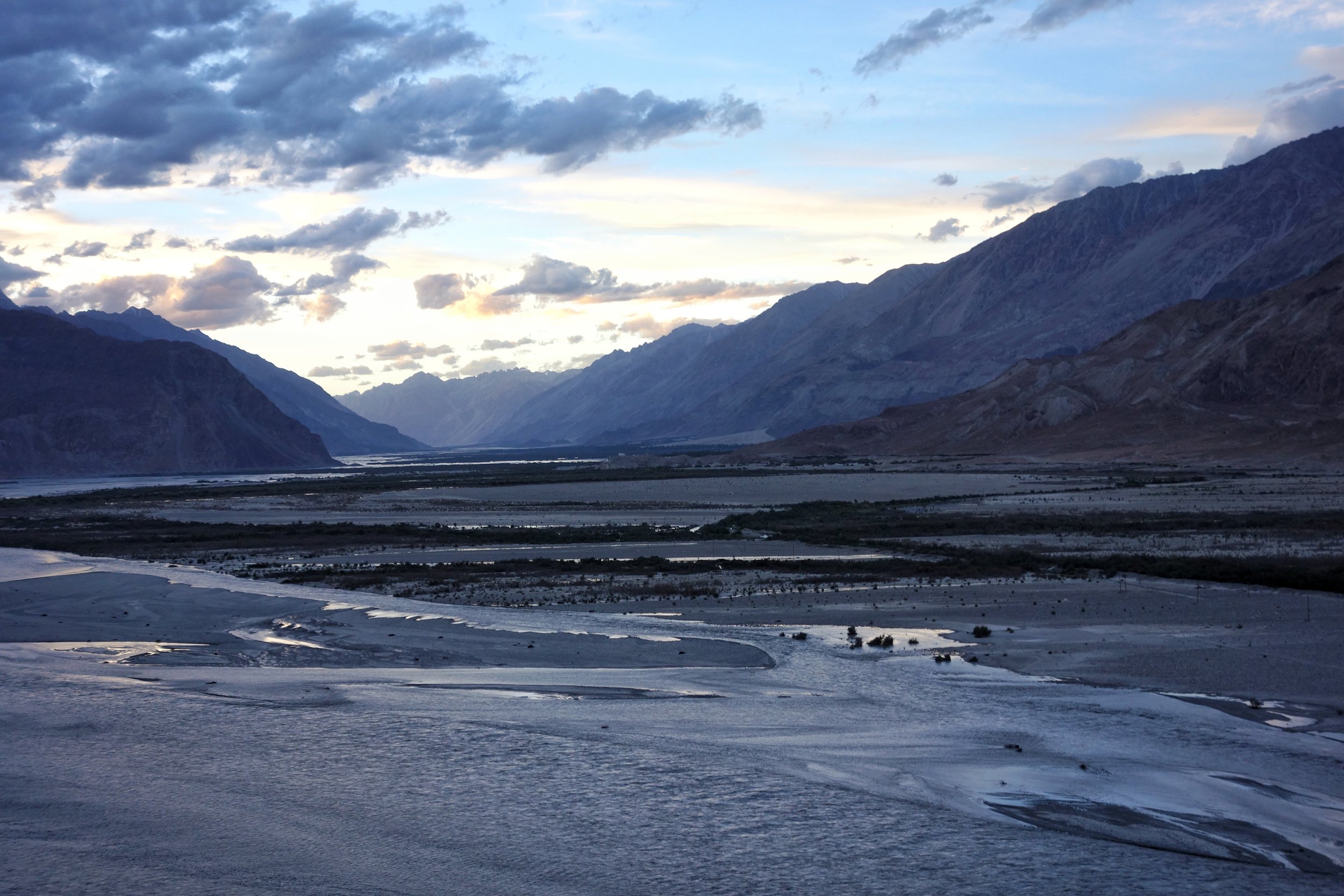
The vast flood plain where the Shyok meets the Nubra
Shyok : The River of Death
The Shyok. A wild River which rises in the Rimo Glacier which is one of the branches of the Siachen Glacier in the Karakorams and and its one of the biggest Glacial systems in the Trans Himalayas. The Glacier is more famous for the dubious distinction of being the highest battlefield in the World.
That the name of this River rising from this Glacier means “The River of Death” in the Ladakhi/ Yarkandi language is rather a matter of coincidence and does not stem from the same reference. It comes from the fact that during the journey North from Leh towards Yarkand in Central Asia the River had to be crossed multiple times. In fact for the Winter route the Shyok had to be crossed a total of 22 times. But the upside was that it was comparatively the easiest to cross in the Winters. Many Men and pack animals were swept away by this River and hence it ended up with the notorious name and a deadly reputation. Thankfully nowadays there are many Bridges over the River which enables one to cross over safely.
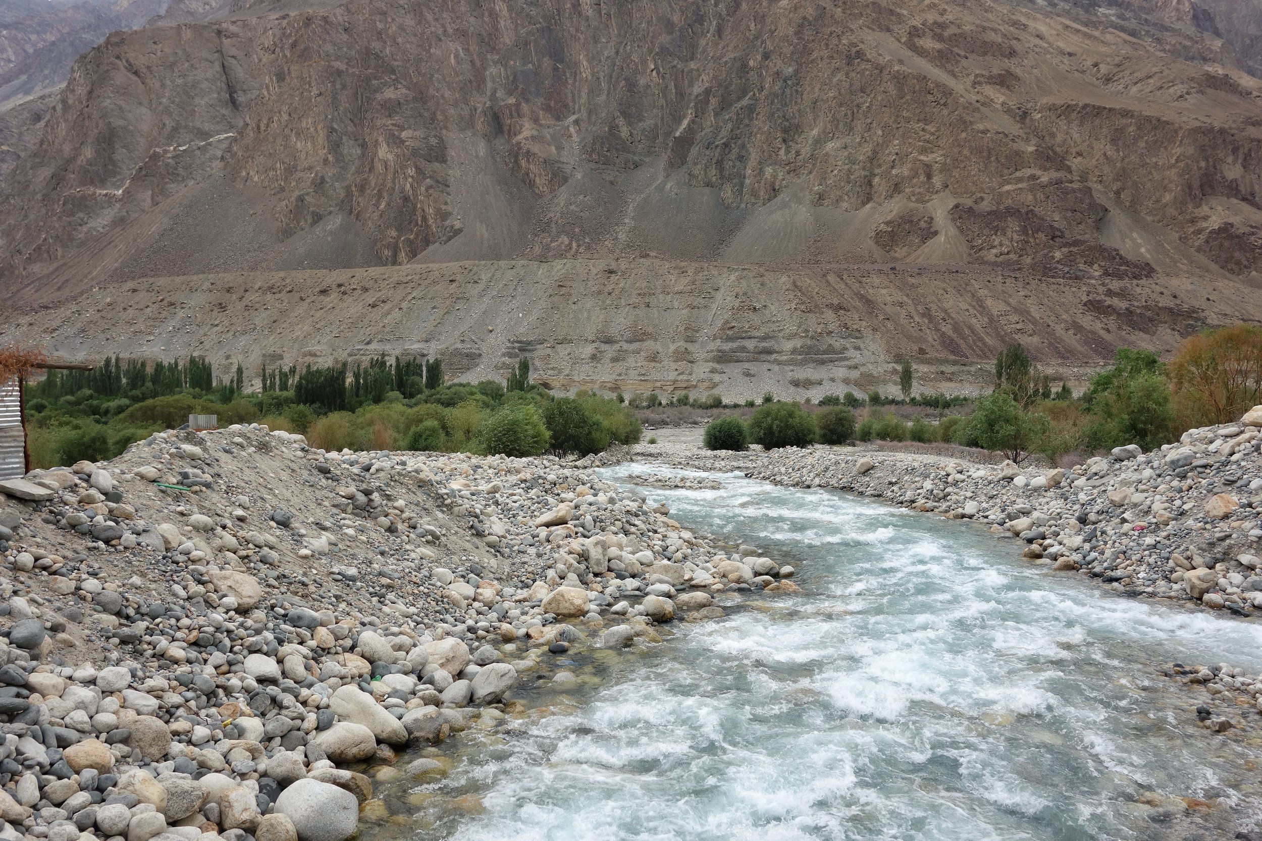
An unamed Tributary coming down to meet the Shyok
From its point of origin the Shyok the River flows in a Southerly direction and is joined by the Galwan and the Chang Chenmo Rivers. In this area the Shyok forms a boundary between Ladakh and Tibet. And then the River takes a u turn and starts flowing North from somewhere before the Village of Shyok. This has been attributed to the fact that the Shyok flows through one of the main Tectonic fault lines that separates the Himalayas from the Karakorams. The Shyok is still considered the landmark that demarcates between the two mightiest Ranges in the World. So when you descend from the Khardung La the Mountains you see beyond the River are the Karakorams.
Strangely the whole area through which the Shyok flows beyond Khalsar is referred to as the Nubra Valley where as the Nubra is a just a tributary which joins the Shyok in vast flood plain just before the Village of Diskit. Like the Shyok also rises in the wilds of the Karakorams / Trans Himalayas and heads South like all good Rivers do but the same phenomenon which causes the Shyok to take a U turn compels the Nubra to also join along the Shyok.

The point at which the Shyok enters Pakistan controlled territory across the LOC in what used to be Baltistan.
And the Shyok continues its journey North as it enters what was historically the region of Baltistan somewhere before the Village of Turtuk which is well known Tourist destination now. And beyond Turtuk it passes Tyakashi and finally the last Village on this side of the LOC Thang and then flows into Pakistan controlled territory.
Once there it is further joined by the Shigar River which carries the glacial waters from the Baltoro and the Biafo Glaciers. It passes by the town of Khapalu and finally merges with the Indus at Keris, a town to the East of Skardu. A total journey of around 550 kms through some of the most hotly contested border areas between India, China and Pakistan. From the Siachen to the being the dividing line between India and China to again heading up the LOC at the head of the Nubra Valley. Its almost the like the nomenclature “The River of Death” has a new context. A much deadlier one.
One can now travel almost 190 kms along the length of the River from the Village of Shyok all the way upto Thang at the LOC. Like I did last week and the River of Death was in all its fury especially where the Valley became narrower. And we had a narrow escape when a landslide hit just a few minutes as we were driving along the River. If it would have hit us we would have been swept away into the wild Shyok and the River would have again lived upto its reputation.
Posting a Video which was shot the next day when the Road open after crews came in from the Thoise Airport to remove the landslide debris. The next day also when we reached Men and Machine were hard at work to remove the last of the debris. The Video was shot as we waited for the all clear to cross affected part.
Next time you are there do pay your respects to the Shyok, the River of Death
When Two Great Gamers Met in High Asia
When two of the great Great Gamers from each side, Younghusband from the British Empire and Grombchevsky from Tsarist Russia met on the high Mountain wilderness on the other side of the Himalayas.
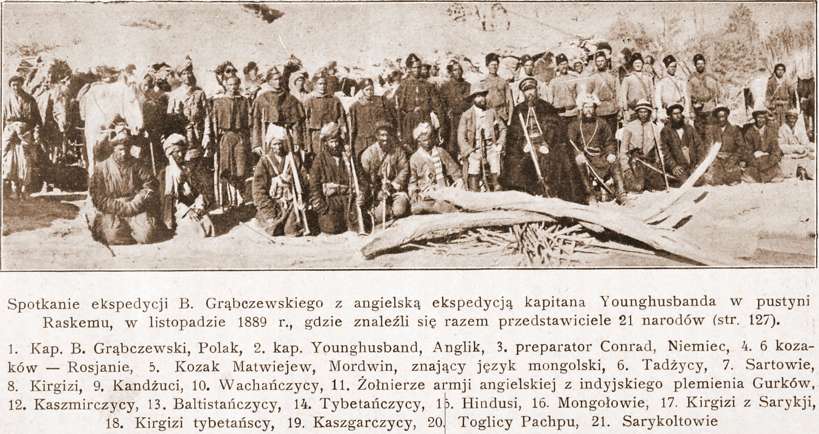
When Younghusband met Grombchevsky
When the Two Great Gamers Met in High Asia
The Great Game was game of intrigue and one upmanship played between the two Greatest Empires of that time, the British Empire and the Tsarist Russian Empire that was played in the most of the Nineteenth Century. At stake for the British was the Jewel in the Crown, the Indian sub-continent while for the Tsarist Russia it was their Empire in Central Asia. Both these Empires met somewhere in high Asia in the midst of the Mountains of the Great Himalayan System.
The British had constant nightmares of Cossacks riding over the great Mountains and making a dent in their Indian holdings. The fact that Tsarist Russia overran most of Central Asia during this time and that a body of Cossacks now sat on top of the Wakhan not very far from the Kashmir territories did not make things comfortable for them either. The Great Game was played in a region stretching from Persia to Afghanistan over to India and Tibet and the whole of Central Asia.

Sir Francis Younghusband
There have been many Western Explorers who went on different assignments in these Mountains but one of the key reasons was always to find out more about the Politics and the Geography of the regions which were not under the Control of the Empire. The frontiers of the Punjab Empire of Maharaja Ranjit Singh were a key target as they bordered the wilds of Afghanistan as it slowly gave way to Central Asia. Also of great interest to them were the Routes that were traditionally taken from Kashmir via Ladakh into Central Asia. The Cossacks had a reputation and the British wanted to have the information on all the possible Routes that the Cossacks would take in case they decided to lay their claim on the Jewel in the Crown.

Younghusband's Route from Peking to Kashmir over the Mustagh Pass
One of the great players of the Great Game from the English side was the well know Gentleman, Sir Lt. Col. Francis Edward Younghusband. He was born at Murree and joined the Military in the footsteps of his father and elder brother. His first achievement was to make a Journey through Manchuria and China mainland and onto the Takla Makan into the Tarim Basin and from there onto the fabled Central Asian Khanate cities of Kashgar and Yarkand and from there over the Pamirs and the Karakorams over the Mustagh Pass into Kashmir and finally into British territory. He led several other expeditions into the Mountains and he led the British invasion of Tibet in 1903. He has been widely accepted as a great Explorer and Soldier. More on him and his Expeditions in a later Post.
On the Tsarist Russian side also there was no dearth of Men who were no less. One of the most accomplished players from their side was Bronislav Grombchevsky, an Officer in the Russian Imperial Army of ethnic Polish descent. He led many expeditions into Kashgaria as the region of the Tarim Basin in the late 1800s. This Region was of great interest to the three Empires which met in the vicinity, the third one being the Chinese Empire. The region of Kashkagia was a Khanate ruled by the insolent Ulugh Beg, who tried to balance the influences of all these three Great powers in his own tyrannical way. Among his missions were an expedition along the Gilgit River with his Cossacks which led to alarm bells ringing in the British Empire and were one of the reasons for the Hunza Chitral missions of the British Army to subjugate the errant local Rulers and which eventually ended in Gilgit being taken on lease from Maharaja of Jammu and Kashmir and the creation of Gilgit Agency.
One of the most interesting Event that took place between these two contemporary Giants of the Great Game took place in 1889. Captain Younghusband, as he was at that time was despatched with a small detachment of Gurkha soldiers to explore unknown regions of Northern Ladakh where the trade between Ladakh and Yarkand had been disrupted by Hunzai raiders. While on this mission Capt.Younghusband’s detachment was camping somewhere along the wilds of the Yarkand River. As it so happened Grombchevsky and his detachment of Cossacks were Camping somewhere in the vicinity as well. Two great European officers of competing Empires (the largest in the World at that time and the most powerful as well) were camped close to each other in High Asia, an unknown Mountainous wilderness where India met Central Asia. Of course they had to meet as these Officers were also Gentlemen.

Bronislav Grombchevsky
Bronislav Grombchevsky sent an invitation to Capt. Younghusband to come over to his Camp for dinner. Capt. Younghusband accepted the offer. So the Capt with his Gurkha escort went over to meet his Russian counterpart. It is said they sat late into the night having a Gentlemanly discussion on the current situation and the Great Game intrigues. Apparently over copious amounts of Vodka served by the Russians Capt.Younghusband candidly asked Grombchevsky about any Russian plan to invade India through these mountains. Not really sure what Grombchevsky had to say on this but he made a point by telling his Cossacks to put on a display of their legendary Horsemanship in front of the British Captain who is said to have been suitably impressed. After the Cossacks were through with their performance Captain Younghusband told his Gurkhas to put on a Rifle drill for his Russian hosts. The Drill along with the Gurkhas brandishing their Khukris to the cry of “Jai Maha Kali, Ayo Gorkhali” are said to have impressed Grombchevsky even more as it was quite unlike anything he and the Cossacks had ever seen before. The Captain made his point and he made it well.
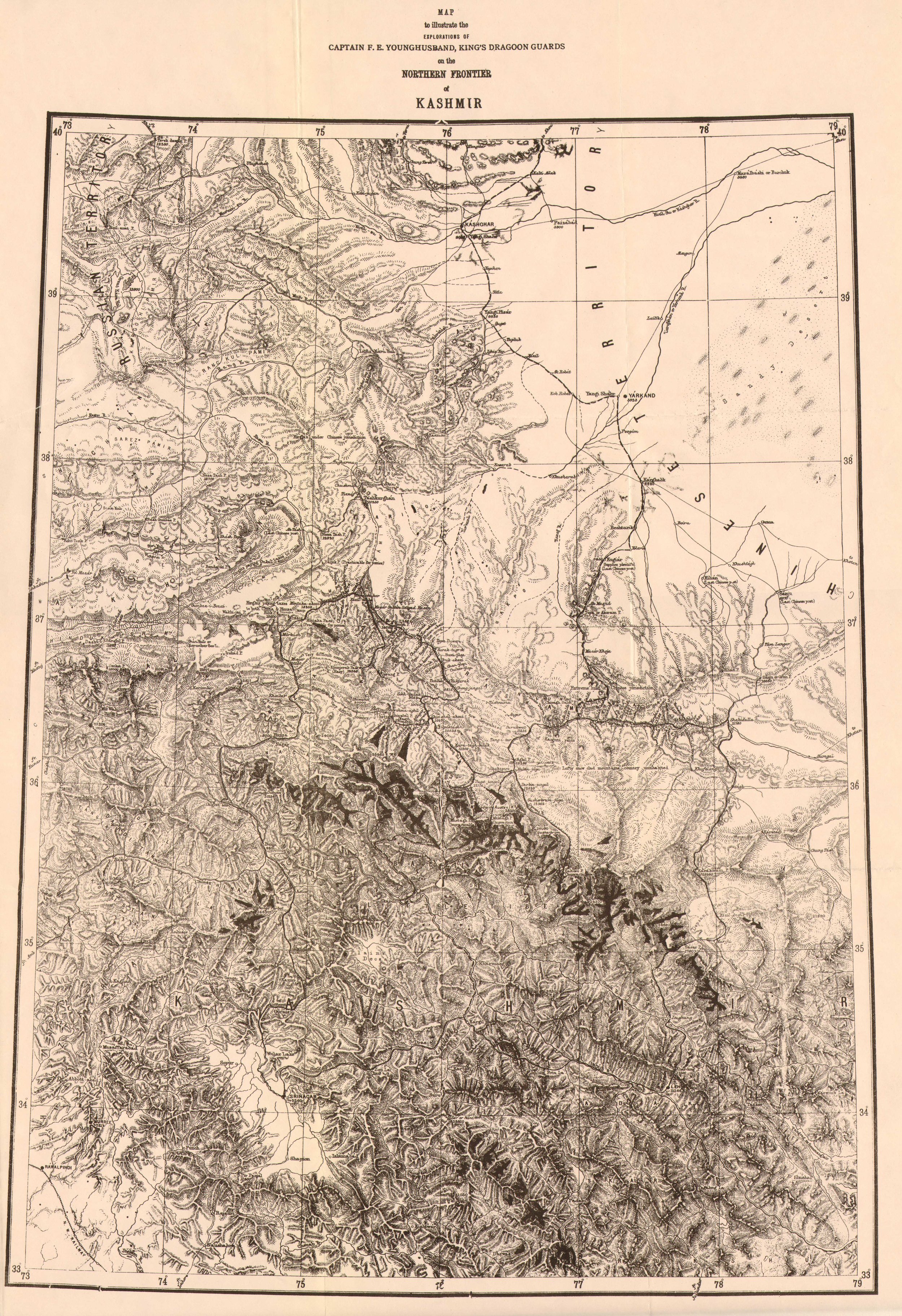
The Northern Frontier of Kashmir by Francis Younghusband 1880
The night over both parties parted, Capt Younghusband carried on with his explorations in the Karakorams while Grombchevsky continued on his way towards Tibet.
The Russian invasion of India through High Asia over the Mountains never happened and the Great Game became a fascinating chapter in History.
Of that famous meeting between the two European Officers in High Asia with their Cossacks and Gurkhas still exists and I m posting that here. Interestingly the pic is from Russian sources and besides the Officers and Soldiers from each side it mentions the ethnicity of the people who were a part of the respective retinues are mentioned. We find Tajiks, Sartowie (?), Kirghiz, Kunduzi, Wakhani, Kashmiri, Baltistani, Tibetan, Hindu (Indian ?), Mongol, Saraiki, Kirghiz Tibetan, Kashgari, Togily Pachpu (?) and Saraikoli mentioned.
In the pic we see Capt Younghusband in the center left wearing a hat with his Gurkhas behind and other members of his party on his left. On the right is Grombchevsky with his Cossacks behind him and other staff on the right sitting on the Ground.
Pic from November 1889. Somewhere in the Raksam Valley on the Yarkand River.
The Best of Kashmir in Pics
A Collection of great pics from Kashmir showcasing why exactly this most exalted of all Himalayan Valleys is referred to as “The Paradise” on Earth.

The Hazratbal Shrine besides the Dal Lake
A Collection of some of the best pics showcasing the beauty of Kashmir. Truly "Paradise on Earth"

The Pir Panjals as seen from Rajbagh in Srinagar

The Jamia Masjid in Down Town Srinagar

Sun comes out after a day of Snowfall in Gulmarg. The Apharwat Mountain glistens
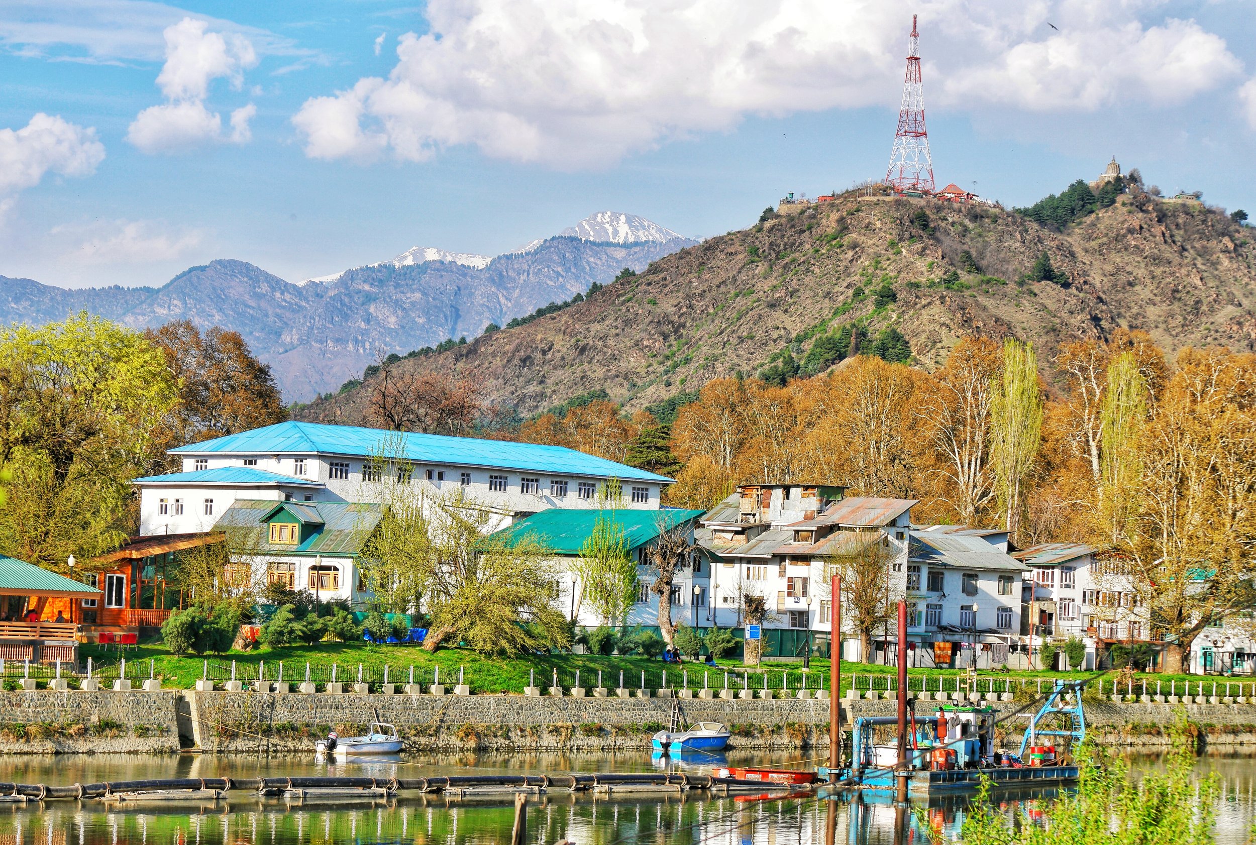
The Jehlum as it flows down Srinagar. The Shankaracharya Hill with the Temple in the background.
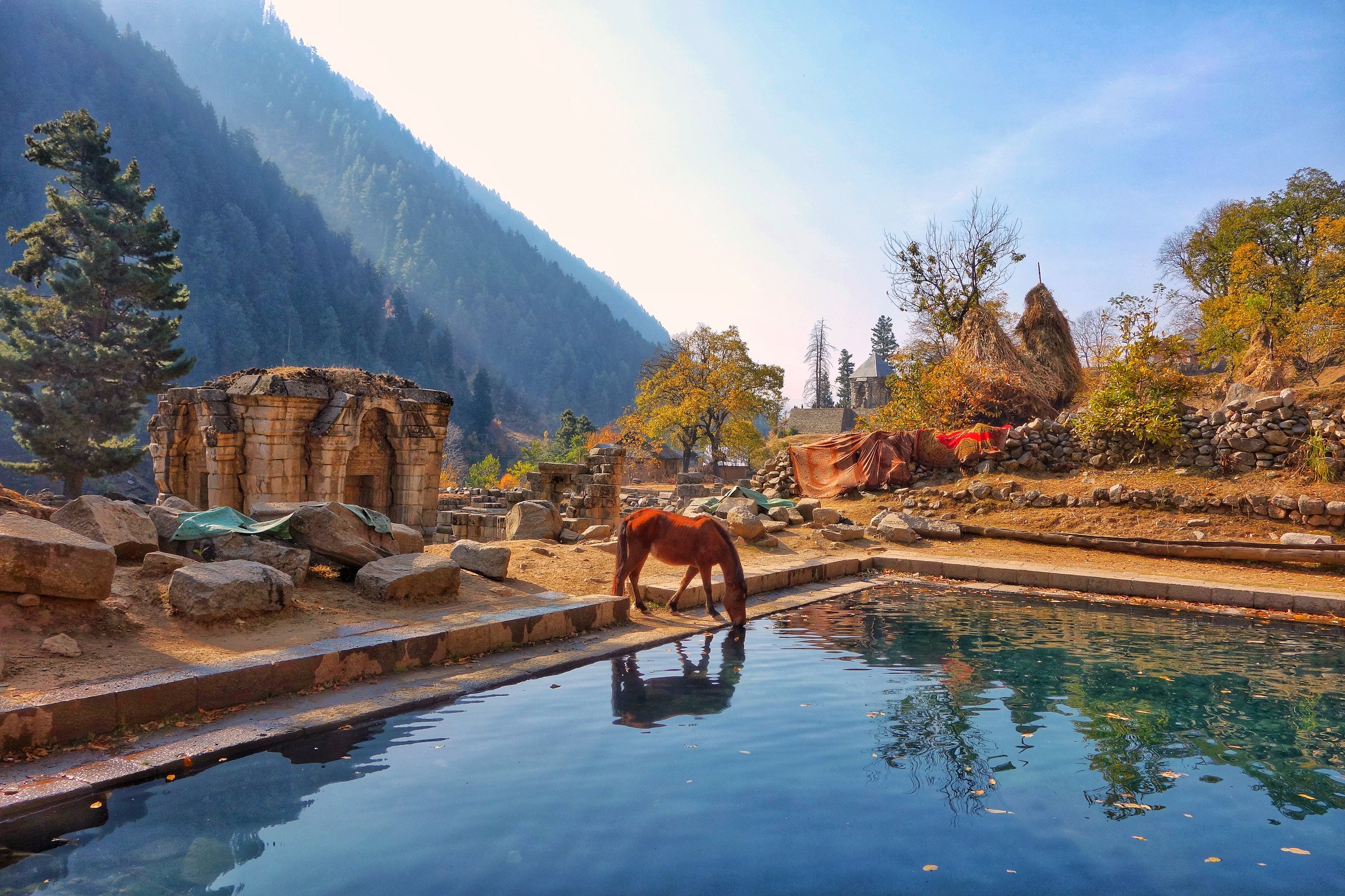
A Horse drinks at the Pond at the ruins of the Temples at Naranag

Somewhere in the Jungles above Bandipora

Near the Dachigam National Park

Shikaras on the Dal Lake during a Snowfall

The Dal Lake
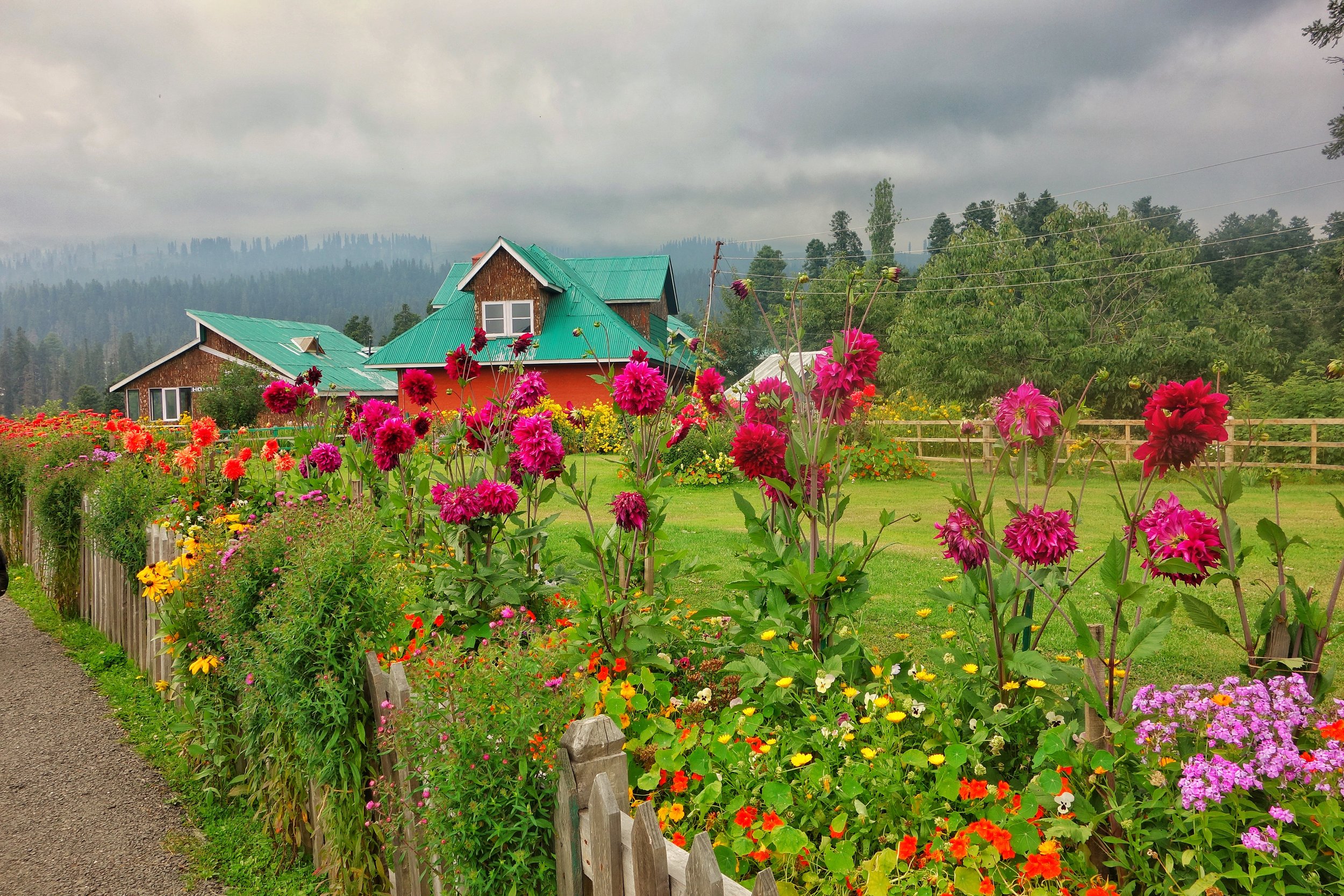
In full bloom in Gulmarg

The Rani Temple in Gulmarg with Mt.Haramukh in the background

The Lidder River near Pahalgam
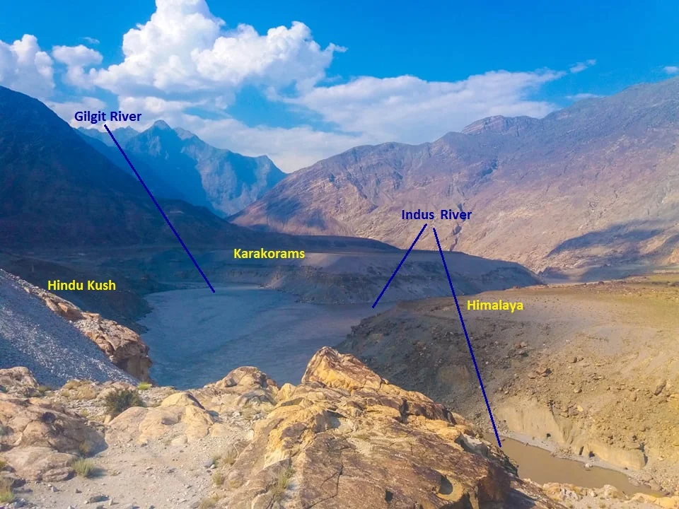
The Junction of the Three Mightiest Mountain Ranges
Jaglot near Gilgit is the point where the Three Mightiest Mountain Ranges of the world the Himalayas, the Karakorams and the Hindu Kush meet at the confluence of the Gilgit River with the Indus River

The Point where the Himalayas, the Karakorams and the Hindu Kush meet. At the confluemce of the Gilgit and the Indus Rivers.
The Place where the Himalayas, the Karakorams and the Hindu Kush Meet
Have you heard of Jaglot ?
It's a small little nondescript Village around 40 kms from Gilgit town which would have remained as such if not for a Geographical feature that the place holds. This point is located where the mighty Indus meets the Gilgit River in Gilgit Baltistan as the region is now called. This place is considered the meeting of the three mightiest Mountain Ranges in the World, the Himalaya which is home to 9 of the 10 highest Peaks in the World including the highest one Mt. Everest, the jagged Karakorams which is home to the K2 and the third one coming from the North West, the Hindu Kush which is come to the Tirich Mir which at 7708m is the highest Peak outside of the Himalayas-Karakoram Mountain System.
One of the oft asked questions is that is the Karakoram a sub Range of the Himalayas ? The answer is both no and yes and it depends on how you want to answer. They are in pure scientific terms different Ranges but a part of the same Mountain Complex that are referred to as the Great Himalayas.
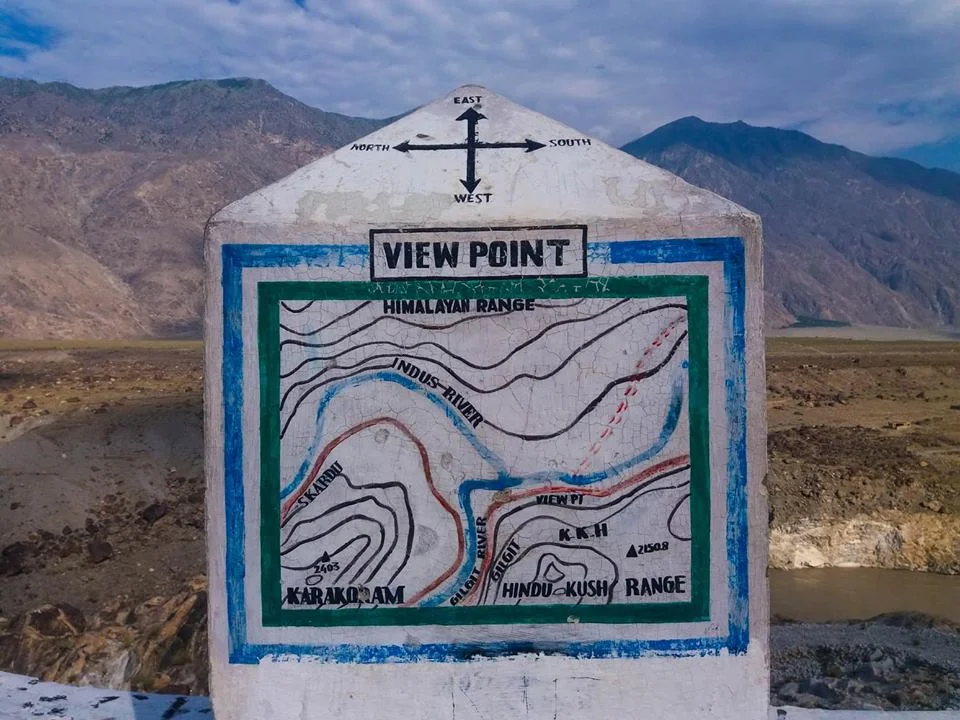
The point of convergence of the three Highest Ranges in the World !
Technically both are different Ranges as they were formed at different stages of one cataclysmic Event namely the collision/ subduction of the Indian Plate under the Eurasian Plate. Both follow their own separate Thrust lines and to really understand it you really need to get into Plate tectonics and understand stuff as I present to you below. This is taken from A Tectonic framework of the Himalaya, Karakoram and Tibet, and Problems of their Evolution by B F Windley :
“The Himalaya, the Karakoram and Tibet were assembled by the successive accretion to Asia of continental and arc terranes during the Mesozoic and early Tertiary. The Jinsha and Banggong Sutures in Tibet join continental terranes separated from Gondwana. Ophiolites were obducted onto the shelf of southern Tibet in the Jurassic before the formation of the Banggong Suture. The Kohistan--Ladakh Terrane contains an island arc that was accreted in the late Cretaceous on the Shyok Suture and consequently evolved into an Andean-type batholith. Further east this Trans-Himalayan batholith developed on the southern active margin of Tibet without the prior development of an island arc. Ophiolites were obducted onto the shelf of India in the late Cretaceous to Lower Palaeocene before the closing of Tethys and the formation of the Indus--Yarlung Zangbo Suture at about 50 Ma. Post-collisional northward indentation of India at ca. 5 cm a-1 since the Eocene has redeformed this accreted terrane collage; palaeomagnetic evidence suggests this indentation has given rise to some 2000 km of intracontinental shortening. Expressions of this shortening are the uplift of mid-crustal gneisses in the Karakoram on a late-Tertiary breakback thrust, folding of Palaeogene redbeds in Tibet, south-directed thrust imbrication of the foreland and shelf of the Indian Plate, north-directed back-thrusts along the Indus Suture Zone, post-Miocene spreading and uplift of thickened Tibet, giving rise to N--S extensional faults, and strike-slip faults, which allowed eastward escape of Tibetan fault blocks.”

The Public Viewing Point.
Now coming back to more simpler stuff as in Geographical terms the Karakorams are separated from the Himalayas by the Indus in its Upper Course. However in Ladakh the division is taken as the Shyok instead of the Indus. So when you are in Nubra Valley the Mountains on the other side of Shyok River as the Karakorams and this side as the Himalayas. However some people stick to the classical Indus division and by that norm the Ladakh Range would be part of the Karakorams and not the Himalayas. By the same definition Leh would be in the Karakorams and not the Himalayas.
However this ambiguity disappears once the Shyok River merges with the Indus at a place called Keris near the town of Skardu. The Nubra river also joins the Shyok in Nubra Valley and the River widens significantly. The fact that both these Rivers do a complete turnaround of 180 degrees from their original sources indicates the presence of fault lines.
The Hindu Kush on the other hand is separated from the Karakorams by the Gilgit River. The Gilgit rises somewhere between the mountain vastness of the Hindu Kush and the Karakorams. And it passes through Gilgit Town and eventually the joins the Indus at Jaglot. This is where eventually these three mighty Ranges meet. Of all the places that I would want to visit one day this would definitely be on the top.
If the ancients would have been able understand the significance of this location (which we do now due to years of research aided by modern scientific equipment) they would have built some great structures over here I would imagine. However there are still local legends about this place ie where the Indus meets the Gilgit (the legend has no relation to the meeting of the Three Great Ranges). As per the legend Fairies and other such creatures come to have a bath here at midnight or something on that lines.
So do note the name down. I'm sure you would like to go there.
The Case of Aksai Chin
Aksai Chin a high altitude desert which lies between the Karakorams and the Kun Lun is a disputed territory between India and China in the Trans Himalayas. Here is the story.

The Case of Aksai Chin
Most people interested in the Mountains of India are usually familiar with the name Aksai Chin. It's supposed to be a part of India but is under illegal occupation by China. Most of us are aware how a large part of the Jammu and Kashmir was taken by our neighbour and which are today named as Gilgit Pakistan and “Azad Kashmir”. And the Indian Government calls it Pakistan Occupied Kashmir (Technically the correct term that should have been used was Pakistan Occupied Jammu and Kashmir). But for some strange reason the Government never uses the term China Occupied Kashmir/ Jammu and Kashmir for Aksai Chin or the Shaksgam Valley which was illegally cede to China by Pakistan as a part of a border settlement.

The Aksai Chin Soda Plains
So what is Aksai Chian ? Well its a Mountain desert wilderness beyond the Karakoram Mountains with an area of around 15000 sq km and its lowest point is around 4300 m. As the altitude would suggest its a largely uninhabited area and the population traditionally consisted of nomadic herders.
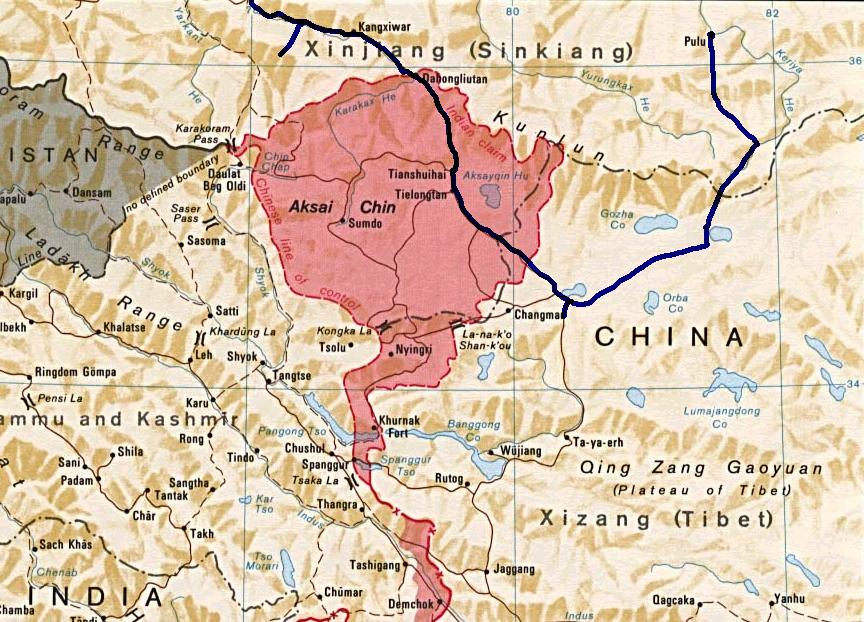
The Disputed Region of Aksai Chin
Actually unlike on the Western side the borders of the state of Jammu and Kashmir were never really defined in these parts as no one really ventured into this territory. And this region lay somewhere between the Eastern Turkestan (now called Xinjiang) and Tibet both of which came under actual Chinese control in the late 1940s and by that time the state of Jammu and Kashmir was already a point of conflict. And because of the conflicts on the Western front India never paid any attention to this region and China’s own issues in settling the restive newly taken provinces of Xinjiang and Tibet kept both countries busy in their own affairs.
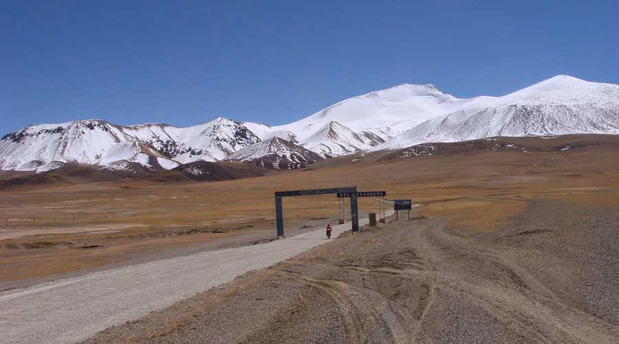
https://aboutoutdoors.wordpress.com/2016/07/14/the-ladakh-photos/aksai-chin/
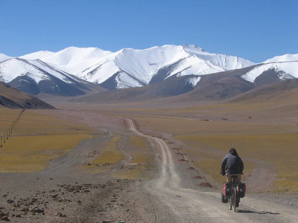
So once the Chinese had settled the matters in Xinjiang as well as Tibet they decided to build a highway which connected these two Regions. This was to connect both the Regions but the only issue was that this Highway was supposed to run through Aksai Chin and the Chinese built this Highway with the Indian Government totally unaware though there are reasons to believe that the Indian Government was in the know but didn't decide to act till it was too late. The Chinese state that the Road has been built through territory which is a part of Chinese territory. The Highway itself is a marvel of engineering mostly between the altitudes of 4000 to 5000 m.
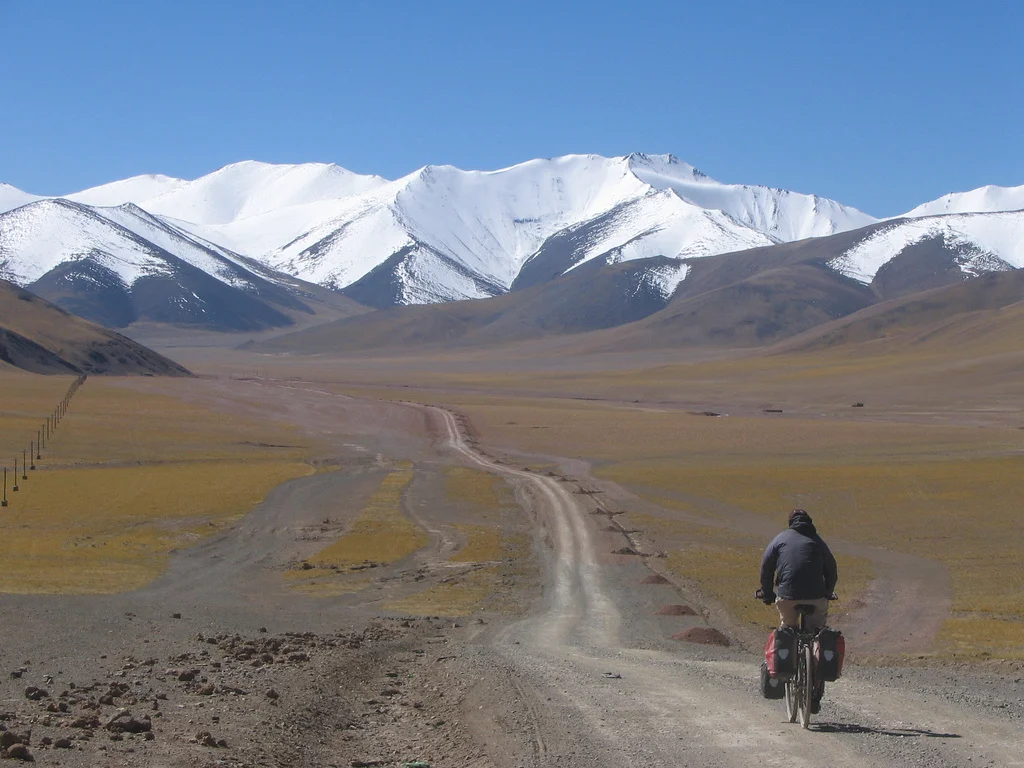
https://www.flickr.com/photos/45689575@N00/315010853
This conflict in the Indian and Chinese stands stems from a historical baggage of different demarcations of the Border at different times in History. The original Indian claim was based on the Johnson line of 1865. Then there was the Macartney-MacDonald Line of 1899 accepted by Chinese till 1959. And then there was the Foreign Office Line of 1875. All these lines as you can see in the Map are different. And then there is the absurd Chinese claim line of post 1962 which more than doubles the territory that it had claimed earlier.
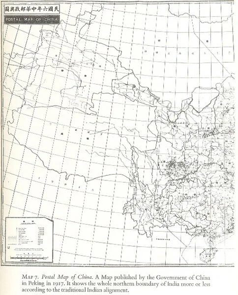
Postal Map of China published in 1917 which shows Aksai Chin as a part of India.
The Johnson Line of 1865 gave the whole of the Aksai Chin to India all the way to the Kun Lun Mountains. The Macartney-MacDonald line on the other hand gave most of Aksai Chin to the Chinese with the main Karakoram acting as the border between the two Countries.The Chinese had earlier shown the Johnson Line in their Maps as well. The Macartney - McDonald Line was drawn keeping in mind the Great Game which was on at that time between the British and the Russians. So the British decided to give away Aksai Chin to the Chinese. However the proposed Macartney- MacDonald Line was never confirmed by the Chinese but however they took it to be the border. On the other hand the British kept changing the Border between the Johnson Line and the Macartney Line as per their convenience. They could do this easily as this area was/is mostly uninhabited
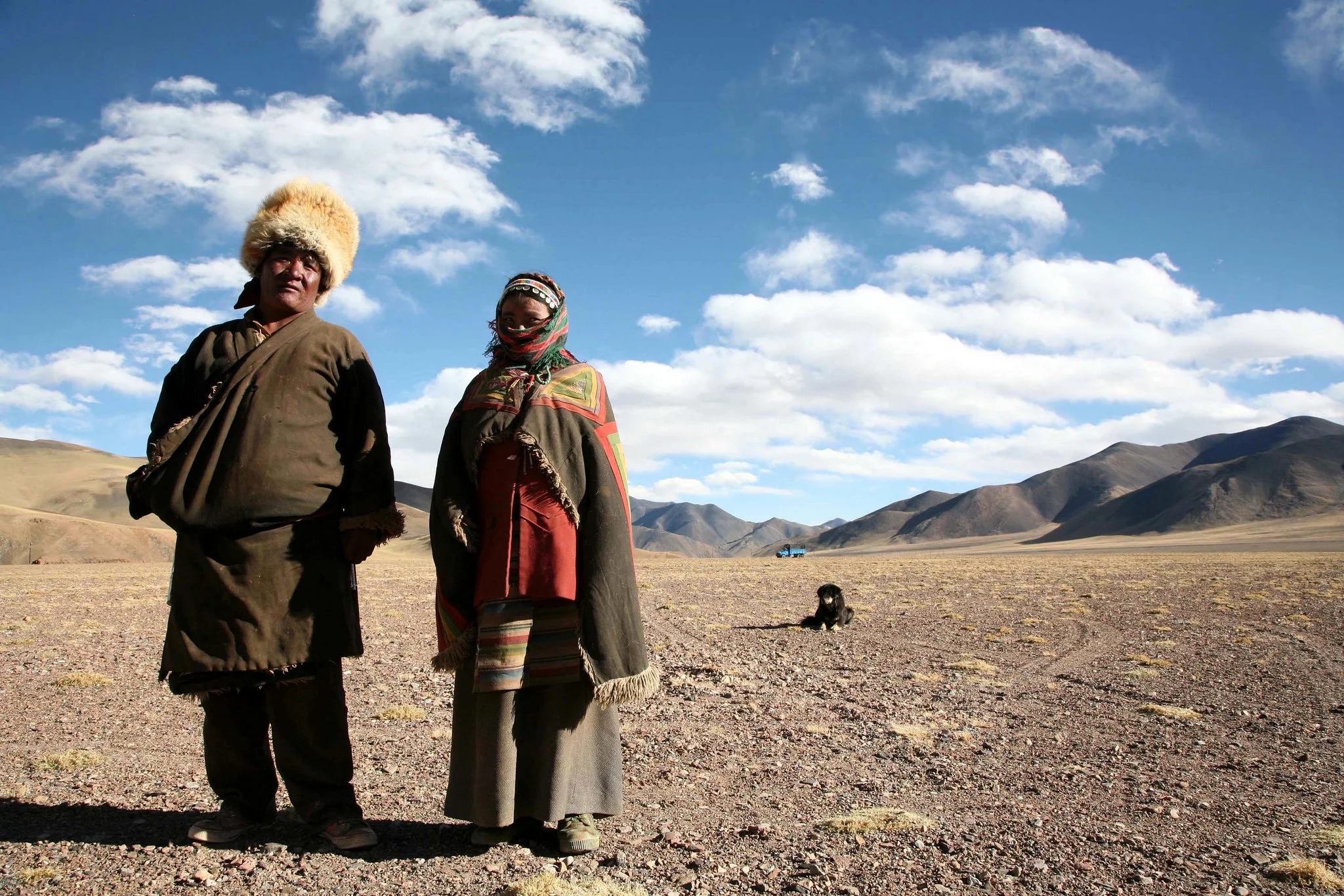
A Nomad Couple in Aksai Chin (https://www.flickr.com/photos/eriagn/)
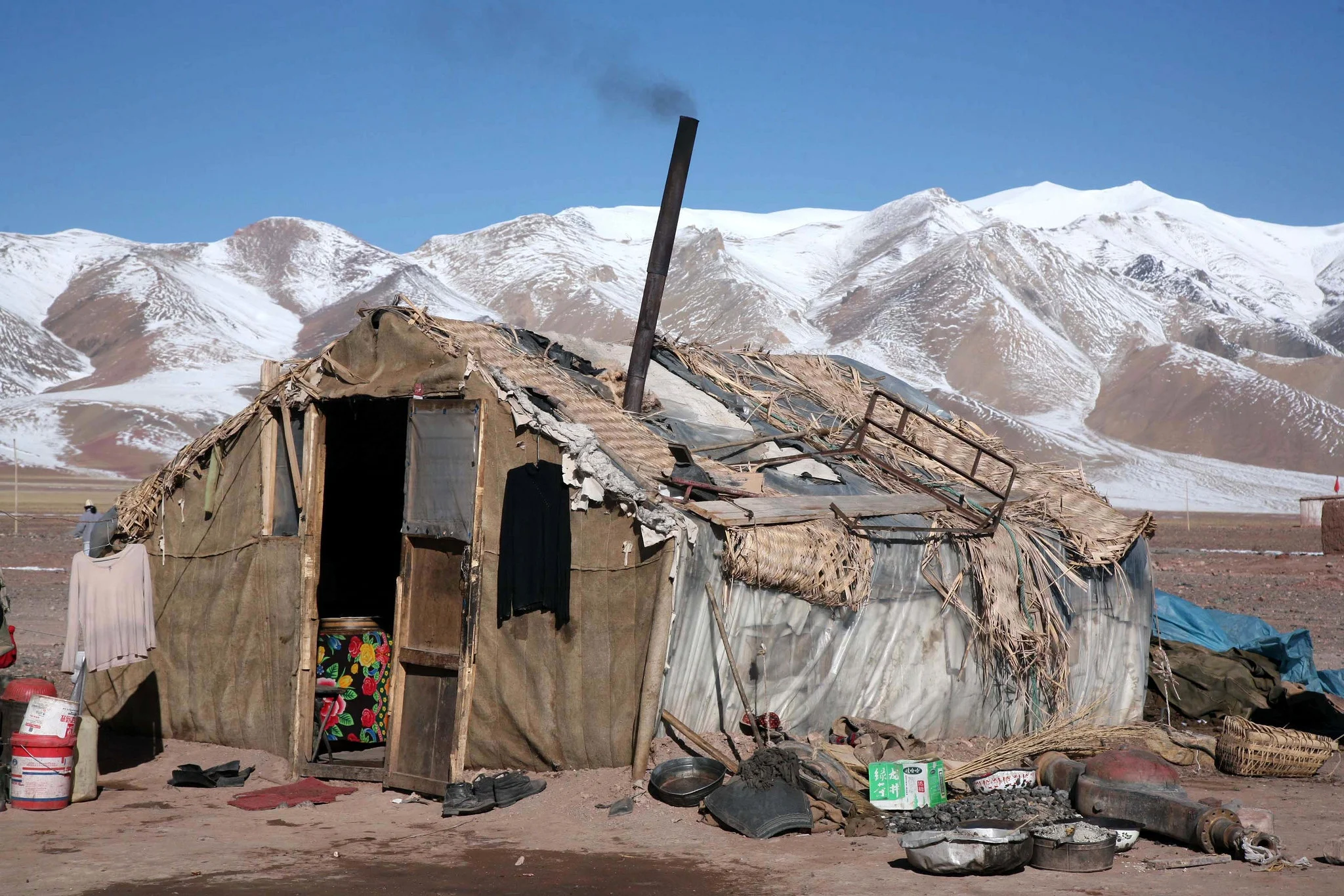
A Dwelling at Aksai Chin ((https://www.flickr.com/photos/eriagn/)
China and Pakistan also settled their border as per the Macartney-McDonald Line and the Shaksgam Valley was turned over to the Chinese as per this line. So there are no longer any border issues between the two countries now.
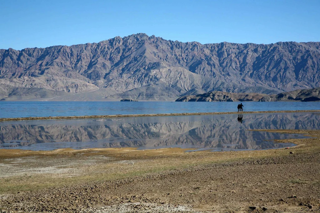
A Lake on the Soda Plains ((https://www.flickr.com/photos/eriagn/)
In conclusion we can say that this dispute carries historical baggage which comes down from much before Independence unlike the Pakistani occupation which was a result of actions at the time of the Partition. Both India and China have held many rounds of Border Talks and there is also talk of India recognising Aksai Chin as a part of China and China accepting Arunachal Pradesh as a part of India. Of course both countries would want a face saving solution where both look as the winner. Difficult surely but not impossible.
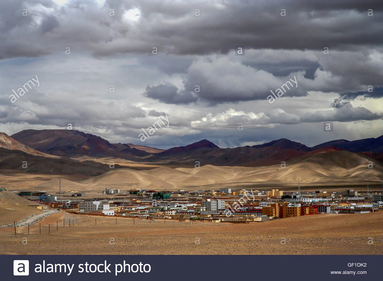
A Chinese "City' called Ali in Aksai Chin.
And here is a Video of the Xinijiang to Tibet Road as it snakes through the Pamirs and the Kun Luns.
The Blog Archive for Kiki on Travel the Himalayas
The Index / Archive for Articles / Notes posted by Kiki on Travel the Himalayas.
Our Blog Archive for Kiki on Travel the Himalayas
-
July 2026
- Jul 8, 2026 The Three Kashmirs Jul 8, 2026
-
August 2025
- Aug 16, 2025 Chisoti : The Anatomy of a Disaster Aug 16, 2025
-
June 2025
- Jun 18, 2025 A Journey to Galwan Valley Jun 18, 2025
-
January 2025
- Jan 29, 2025 Galwan Valley opened for Tourists Jan 29, 2025
-
December 2024
- Dec 29, 2024 Ten Offbeat Locations in Kashmir Dec 29, 2024
-
July 2024
- Jul 26, 2024 The Nanga Parbat from the Kashmir Valley Jul 26, 2024
-
May 2024
- May 25, 2024 A Culinary Holiday in Kashmir by Marryam Reshii May 25, 2024
-
December 2023
- Dec 17, 2023 Keran : Where a River Runs Through Dec 17, 2023
-
October 2023
- Oct 19, 2023 Ten Offbeat Things to Do in Ladakh Oct 19, 2023
-
September 2023
- Sep 4, 2023 The Elusive Kaobal Gali Sep 4, 2023
-
August 2023
- Aug 13, 2023 Kiki’s Ten Things to Do in Ladakh Aug 13, 2023
-
June 2023
- Jun 27, 2023 Understanding the LoC in Kashmir Jun 27, 2023
-
December 2022
- Dec 9, 2022 Srinagar to Kashgar by Road : The First Motorised Crossing of the Greatest Mountain Ranges Dec 9, 2022
-
November 2022
- Nov 28, 2022 Lolab and Bangus Nov 28, 2022
- Nov 13, 2022 Gurez and Tulail : Then and Now Nov 13, 2022
-
August 2022
- Aug 14, 2022 Starchey's Ladakh 1851 Aug 14, 2022
-
July 2022
- Jul 25, 2022 Rainfall in the Himalayas Jul 25, 2022
- Jul 24, 2022 Kiki's Guide to Kashmir Jul 24, 2022
- Jul 23, 2022 Warwan Marwah Dacchan : The Last Inner Himalayan Wilderness Jul 23, 2022
- Jul 2, 2022 The Border River : Kishanganga aka Neelam Jul 2, 2022
-
January 2022
- Jan 31, 2022 Karakorams in Ladakh Jan 31, 2022
-
December 2021
- Dec 15, 2021 Amarnath Yatra 1898 Diwan Alim Chand Dec 15, 2021
- Dec 14, 2021 The Road to Uri Dec 14, 2021
-
September 2021
- Sep 25, 2021 Chorbat Valley : Where Ladakh Gives Way to Baltistan Sep 25, 2021
- Sep 4, 2021 Pestonjee Ka Ghoda and Parsis in Kashmir Sep 4, 2021
-
April 2021
- Apr 28, 2021 The Pir Panjal Pass Apr 28, 2021
-
June 2020
- Jun 10, 2020 One of the Most Dangerous Mountain Roads in the World Jun 10, 2020
- Jun 6, 2020 Wazir Lakhpat Rai Padari of Padar, Kishtwar Jun 6, 2020
- Jun 1, 2020 The Bridges of Srinagar by Francis Firth Jun 1, 2020
-
May 2020
- May 16, 2020 Gold Prospecting in the Riyasat e Jammu and Kashmir 1890 May 16, 2020
- May 9, 2020 The Indus Ganges Divide May 9, 2020
- May 9, 2020 Kashmir : Do’s and Donts from 1902 May 9, 2020
- May 8, 2020 The Great Game on the Roof of the World May 8, 2020
- May 6, 2020 Of Mountains and Rivers May 6, 2020
- May 6, 2020 The Last Anglo Abor War 1911 May 6, 2020
-
April 2020
- Apr 29, 2020 The Nandana Fortress of the Salt Range Apr 29, 2020
-
January 2020
- Jan 29, 2020 The Making of the Brahmaputra Jan 29, 2020
- Jan 29, 2020 Video of Duke of Abruzzi’s Karakoram Expedition of 1909 Jan 29, 2020
- Jan 9, 2020 Pangi to Zanskar Jan 9, 2020
-
December 2019
- Dec 26, 2019 The Stilwell Road Dec 26, 2019
- Dec 14, 2019 Nampong - Hell’s Gate on the Stillwell Road Dec 14, 2019
- Dec 8, 2019 The Forgotten Jairampur Cemetery Dec 8, 2019
-
October 2019
- Oct 15, 2019 The Nun Barashigri Glacial Region Oct 15, 2019
- Oct 15, 2019 Historical Map of the Dogra Kingdom of Jammu and Kashmir Oct 15, 2019
-
September 2019
- Sep 20, 2019 Pahadi Wilson : The English Raja of Harsil Sep 20, 2019
- Sep 16, 2019 The Gilgit Game Sep 16, 2019
- Sep 11, 2019 The Indigenous People of Jammu and Kashmir Sep 11, 2019
-
August 2019
- Aug 30, 2019 The Dudu Timber Saga Aug 30, 2019
- Aug 14, 2019 The Dhankar Buddha of Spiti Aug 14, 2019
-
July 2019
- Jul 25, 2019 The Chamba Lahaul and the British Lahaul Story Jul 25, 2019
- Jul 16, 2019 And then there is Bhaderwah ! Jul 16, 2019
- Jul 16, 2019 The Story of the Poonch Kingdom Jul 16, 2019
- Jul 16, 2019 Pogal Paristan : The Land of Fairies Jul 16, 2019
- Jul 16, 2019 Pandit Nain Singh Obituary by a British Officer Jul 16, 2019
- Jul 3, 2019 The Lingual Diversity of the state of Jammu and Kashmir Jul 3, 2019
- Jul 1, 2019 The Original Mountain Men and Women of the Western Himalayas Jul 1, 2019
-
June 2019
- Jun 26, 2019 The Dichotomy of the Moon River Jun 26, 2019
- Jun 25, 2019 The Pass of Shiva Jun 25, 2019
- Jun 15, 2019 The Sheep of Sinthan Jun 15, 2019
-
May 2019
- May 14, 2019 Gurez to Drass May 14, 2019
- May 14, 2019 The Minaret of Jam May 14, 2019
-
April 2019
- Apr 29, 2019 Of the Himalayan Mountains and Rivers Apr 29, 2019
- Apr 24, 2019 The Illustrated Mountain Geography of Ladakh Apr 24, 2019
- Apr 17, 2019 The Exploration of the Siachen or Rose Glacier Apr 17, 2019
- Apr 16, 2019 The Brahui of the Bolan Pass, Baluchistan Apr 16, 2019
- Apr 8, 2019 The Enchanting Padri Gali Apr 8, 2019
- Apr 7, 2019 The Inter-State Himalayan Boundary Dispute at 14000 ft Apr 7, 2019
- Apr 5, 2019 The Burmese Tamils of Moreh Apr 5, 2019
- Apr 5, 2019 The Chakma Raja who gave away a Kingdom ! Apr 5, 2019
-
March 2019
- Mar 27, 2019 The Shaksgam Valley Mar 27, 2019
- Mar 25, 2019 Ethical Trekking Mar 25, 2019
- Mar 24, 2019 The Hindu Raj Mountains Mar 24, 2019
- Mar 6, 2019 Kintup and the Everest of Rivers Mar 6, 2019
- Mar 1, 2019 The Legendary Gurkha Bulbudder Mar 1, 2019
-
February 2019
- Feb 12, 2019 Romancing the Mall Feb 12, 2019
-
January 2019
- Jan 21, 2019 High Altitude Gear from the Hall of Fame in Leh Jan 21, 2019
- Jan 18, 2019 The Muztagh Jan 18, 2019
- Jan 14, 2019 The Kashmir Mammoths : A Tragic Comedy Almost Jan 14, 2019
- Jan 11, 2019 Himalayan Geology / Tectonics Jan 11, 2019
- Jan 9, 2019 The Map Shawl of Kashmir Jan 9, 2019
- Jan 7, 2019 New Routes Opened in Ladakh Jan 7, 2019
- Jan 5, 2019 The Elusive Kashmir Sapphires Jan 5, 2019
- Jan 4, 2019 Mahasu Temple Hanol Jan 4, 2019
- Jan 3, 2019 The Last Queen of Kashmir Jan 3, 2019
-
December 2018
- Dec 25, 2018 The Remanent of an Army Dec 25, 2018
- Dec 21, 2018 The Temples of the Indus : Kafirkot Dec 21, 2018
- Dec 20, 2018 Chitral Expedition Dec 20, 2018
- Dec 18, 2018 Heating Systems in the Himalayas : Caution Advised Dec 18, 2018
- Dec 4, 2018 Dalhousie's Colonel Dec 4, 2018
-
November 2018
- Nov 29, 2018 British Museum Kashmir Collection Part II Nov 29, 2018
- Nov 27, 2018 The Forgotten Kashmiri Nov 27, 2018
- Nov 21, 2018 Antiquities from Ladakh at the British Museum Nov 21, 2018
- Nov 20, 2018 Kashmir Musings I Nov 20, 2018
- Nov 11, 2018 The Keeper of Buddha's Bones Nov 11, 2018
- Nov 2, 2018 The Consulate at Chini Bagh Nov 2, 2018
-
October 2018
- Oct 29, 2018 The Uighur Hajis Oct 29, 2018
- Oct 25, 2018 Around the Hari Parbat Hill Oct 25, 2018
- Oct 21, 2018 Central Asian Arts at the Shanghai Museum Oct 21, 2018
- Oct 15, 2018 Saddles of the Horse Empires Oct 15, 2018
- Oct 13, 2018 A Visual Journey Through Dachigam National Park Oct 13, 2018
- Oct 9, 2018 Tibetan Arts and Antiquities at the Shanghai Museum Oct 9, 2018
- Oct 3, 2018 British Museum Kashmir Collection Part I Oct 3, 2018
-
September 2018
- Sep 30, 2018 The "Outsider" Kashmiris Sep 30, 2018
- Sep 27, 2018 Thang : India's most Northernly Village Sep 27, 2018
- Sep 27, 2018 The Chingus Sarai Sep 27, 2018
- Sep 25, 2018 A Place Called Chushul Sep 25, 2018
- Sep 24, 2018 Guide to Catch a Snowfall ! Sep 24, 2018
- Sep 24, 2018 The Newt of Chuharnag Sep 24, 2018
- Sep 17, 2018 The Murree Brewery Sep 17, 2018
- Sep 8, 2018 Buddhist Art from Kashmir at the Metropolitan Museum, New York Sep 8, 2018
- Sep 8, 2018 The Tiger Leaping Rock Sep 8, 2018
- Sep 7, 2018 The Changthang Sep 7, 2018
-
August 2018
- Aug 27, 2018 The Patola Shahis of Gilgit Aug 27, 2018
- Aug 22, 2018 Shyok : The River of Death Aug 22, 2018
- Aug 21, 2018 When Two Great Gamers Met in High Asia Aug 21, 2018
- Aug 5, 2018 The Best of Kashmir in Pics Aug 5, 2018
- Aug 4, 2018 The Junction of the Three Mightiest Mountain Ranges Aug 4, 2018
- Aug 1, 2018 The Case of Aksai Chin Aug 1, 2018
- Aug 1, 2018 The Blog Archive for Kiki on Travel the Himalayas Aug 1, 2018
-
July 2018
- Jul 30, 2018 Vittorio Sella's Himalayan and Karakoram Classics Jul 30, 2018
- Jul 28, 2018 Humans of the Himalayas : The Wakhi People Jul 28, 2018
- Jul 23, 2018 The Tibetan Mastiffs Business Jul 23, 2018
- Jul 22, 2018 Munshi Aziz Bhat Museum of Central Asian Antiquities Jul 22, 2018
- Jul 21, 2018 The Gilgit Manuscripts Jul 21, 2018
- Jul 19, 2018 Kashmir Stone and Bronze Sculptures from Antiquity (SPS Museum) Jul 19, 2018
- Jul 18, 2018 The Karakorams in India Jul 18, 2018
- Jul 14, 2018 The Tengpora Durga : From Kashmir to Manhattan to Germany ! Jul 14, 2018
- Jul 14, 2018 The Potatso National Park in Yunnan Jul 14, 2018
- Jul 10, 2018 The Great First Bend of the Yangtze River Jul 10, 2018
- Jul 8, 2018 The Ganden Sumtseling Tibetan Monastery in Yunnan Jul 8, 2018
- Jul 6, 2018 Herodotus's Legendary Fox Sized Gold Digging Ants Jul 6, 2018
- Jul 5, 2018 Kashmir Collection at Metropolitan Museum of Art, New York Jul 5, 2018
- Jul 4, 2018 The Kashmiri Spy in Tibet Jul 4, 2018
- Jul 1, 2018 Amarnath Yatra pics from 1920 by Ralph Stewart Jul 1, 2018
-
June 2018
- Jun 30, 2018 Driving in the Himalayan Mountains Jun 30, 2018
- Jun 27, 2018 The Karakoram Anomaly Jun 27, 2018
- Jun 10, 2018 La Dvags : Ladakh The Land of Passes Jun 10, 2018
- Jun 4, 2018 The Curious Case of the Baltis of Dehradun Jun 4, 2018
-
May 2018
- May 26, 2018 The Gurudwara and the Hindu Dharamshala at Leh May 26, 2018
- May 25, 2018 Kishtwar : At the Himalayan Crossroads May 25, 2018
- May 18, 2018 The Battle of Basgo May 18, 2018
- May 13, 2018 The Brave Shen - Pa May 13, 2018
- May 13, 2018 On Flight of Fancy to Leh May 13, 2018
- May 11, 2018 Drass : Hembabs / Hembaps May 11, 2018
- May 3, 2018 Bulbulik Music School, Gojal Valley, Gilgit May 3, 2018
-
April 2018
- Apr 20, 2018 The Hari Parbat Fort, Srinagar, Kashmir Apr 20, 2018
- Apr 13, 2018 Humans of Himalayas : The Khampa Apr 13, 2018
- Apr 12, 2018 The Horsemen of the Pir Panjals Apr 12, 2018
- Apr 11, 2018 The Monster of the Snows : Rolba 1500 Apr 11, 2018
- Apr 8, 2018 Humans of Himalayas : The Kalash Apr 8, 2018
- Apr 8, 2018 Zanskar : The Valley of Copper Apr 8, 2018
- Apr 1, 2018 The Dagwan Nallah, Dachigam National Park Apr 1, 2018
- Apr 1, 2018 Roerich Himalaya Apr 1, 2018
- Apr 1, 2018 Thakur of Gondla Apr 1, 2018
- Apr 1, 2018 Dusshera in Quetta Apr 1, 2018
- Apr 1, 2018 AMS : Effects of Altitude Apr 1, 2018
- Apr 1, 2018 Apple Grafters Apr 1, 2018
- Apr 1, 2018 When East met West Apr 1, 2018
- Apr 1, 2018 Annapurna and Dhaulagiri Apr 1, 2018
- Apr 1, 2018 Srinagar Old Town : Walkhrough Apr 1, 2018
- Apr 1, 2018 Altai Himalayas Apr 1, 2018
- Apr 1, 2018 Himalayan Tales : The Whiteys Apr 1, 2018
- Apr 1, 2018 The Uri Memorial to Nand Singh VC MVC : Forgotten Hero Apr 1, 2018
- Apr 1, 2018 Buzkashi Apr 1, 2018
- Apr 1, 2018 Markhor / Ibex Hunting Apr 1, 2018
- Apr 1, 2018 The Map Shawl II Apr 1, 2018
- Apr 1, 2018 Burzahom : Ancient Kashmir and its Dogs Apr 1, 2018
- Apr 1, 2018 The Indus Irony Apr 1, 2018
- Apr 1, 2018 Kashmir and Tibet : The Forgotten Past Apr 1, 2018
- Apr 1, 2018 First Lord Shiva on an Indic Coin Apr 1, 2018
- Apr 1, 2018 9th Century Vaishnava Avatar Apr 1, 2018
- Apr 1, 2018 The Legendary Map Shawl of Kashmir Apr 1, 2018
- Apr 1, 2018 Pahadi Languages of the Punjab Himalayas Apr 1, 2018
- Apr 1, 2018 Lijiang Instant Noodles Hotel Apr 1, 2018
- Apr 1, 2018 Passes into Kashmir Apr 1, 2018
- Apr 1, 2018 The Kashmir Ladakh Yarkand TransHimalayan Silk Route Apr 1, 2018
- Apr 1, 2018 The Nanga Parbat Apr 1, 2018
- Apr 1, 2018 The Great Himalayan Mountain Complex Apr 1, 2018
- Apr 1, 2018 The Inglorious Bastards of the Pir Panjals Apr 1, 2018
- Apr 1, 2018 The Jawalaji Temple in Europe Apr 1, 2018
- Apr 1, 2018 Harwan Buddhist Monastery Ruins Apr 1, 2018
- Apr 1, 2018 The Thanedaar of Balsan Apr 1, 2018
- Apr 1, 2018 Mission Yarkand Apr 1, 2018
- Apr 1, 2018 The Chamba Story Apr 1, 2018
- Apr 1, 2018 Martand Sun Temple : Then and Now Apr 1, 2018
- Apr 1, 2018 The Khukris of Kotkhai Palace Apr 1, 2018
- Apr 1, 2018 Travelling to Tibet Apr 1, 2018
- Apr 1, 2018 Ladakh / Baltistan / Gilgit Story Apr 1, 2018
- Apr 1, 2018 The Worst Trade Route in the World Apr 1, 2018
- Apr 1, 2018 Dummy's Guide to Kashmir Apr 1, 2018
- Apr 1, 2018 Ghosts and Pahadi Dogs Apr 1, 2018
- Apr 1, 2018 The Great Temple Complex at Naranag Apr 1, 2018
- Apr 1, 2018 Himachal Day : A Brief History of the Modern Times Apr 1, 2018
- Apr 1, 2018 The Treasures of the Shri Pratap Singh Museum Apr 1, 2018
- Apr 1, 2018 Kashmir : Between The Mughals and the Dogras Apr 1, 2018
- Apr 1, 2018 Parihaspora – The Ancient Capital of Kashmir Apr 1, 2018
Vittorio Sella's Himalayan and Karakoram Classics
Vittorio Sella was an Italian photographer and mountaineer, who took photographs of mountains which are regarded as some of the finest ever made. He did extensive Photography in the Himalayas and the Karakorams.

Vittorio Sella's Himalayan and Karakoram Classics
Vittorio Sella (28 August 1859 – 12 August 1943) was an Italian photographer and mountaineer, who took photographs of mountains which are regarded as some of the finest ever made.
Sella was born in Biella in the foothills of the Alps and acquired his interest in Alpinism from his uncle, Quintino Sella. He made a number of significant climbs in the Alps, including the first winter ascents of the Matterhorn and Monte Rosa,[3] and the first winter traverse of Mont Blanc.[4] He took part in several expeditions further afield, including three to the Caucasus (where a peak now bears his name),[5] to Mount Saint Elias in Alaska, to the Rwenzori in Africa, and the 1909 expedition to K2 and the Karakoram. The latter three expeditions were in the company of Luigi Amedeo, Duke of the Abruzzi. Sella continued to climb into his old age, and made his last attempt on the Matterhorn at seventy six. The attempt failed when one of his guides was injured in an accident.[4]
The Duke of Abruzzi on the Chogolisa
The high quality of Sella's photography was in part due to his use of 30×40 cm photographic plates, in spite of the difficulty of carrying bulky and fragile equipment into remote places. He had to invent equipment, including modified pack saddles and rucksacks, to allow these particularly large glass plates to be transported safely.[6] His photographs were widely published and exhibited, and highly praised; Ansel Adams, who saw thirty-one that Sella had presented to the US Sierra Club, said they inspired "a definitely religious awe".[7] Many of the photographs he took were of mountains which had not been previously recorded and so have historical as well as artistic significance; for example by recording the retreat of glaciers in the Rwenzori mountains in Central Africa.[8]

The Baltoro Glacier from Urdokas
Sella died in Biella in 1943. His collection of photographs is now managed by the Sella Foundation (Fondazione Sella) in Biella.[8] Some pictures of Sella are exhibited in the Museo Nazionale della Montagna "Duca degli Abruzzi" in Turin.

The Gasherbrum

The K2

The K2

The Kanchenjunga

The Kanchenjunga
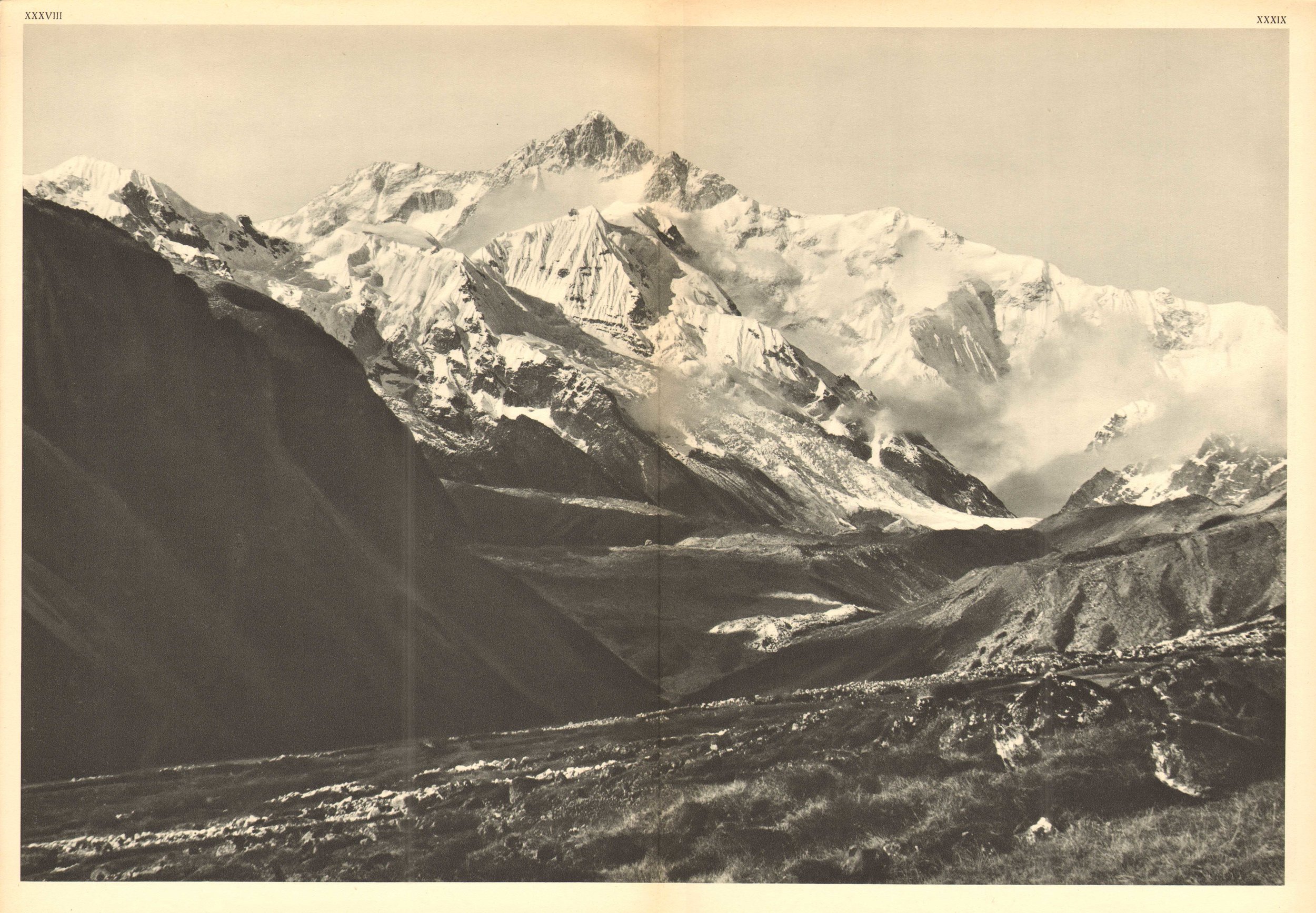
The Kanchenjunga
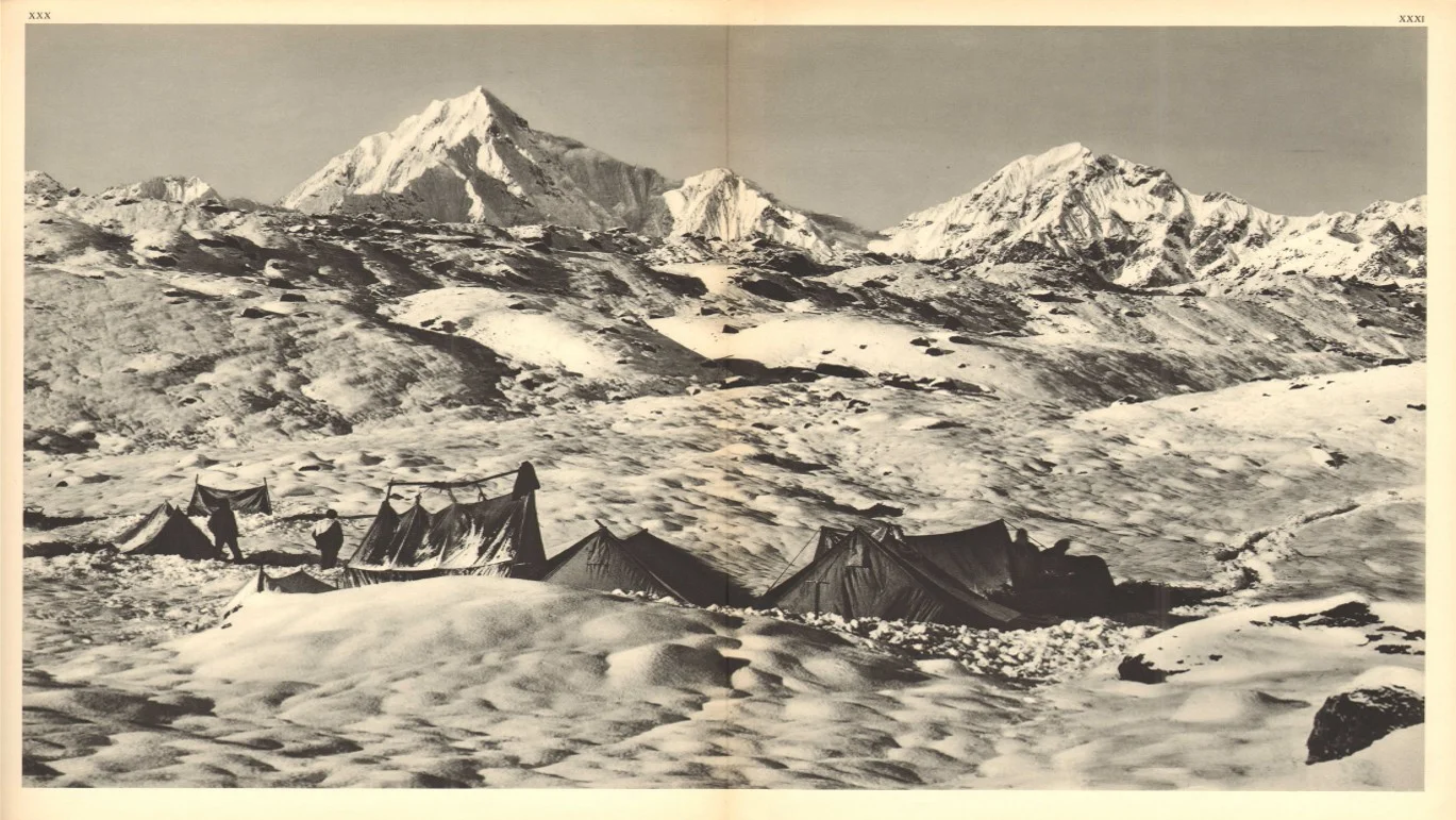
The Kanchenjunga
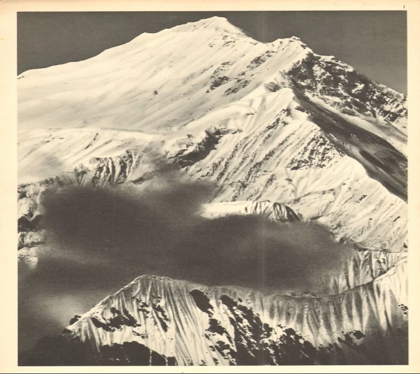
The Everest

The Muztagh Tower

The Muztagh Tower

The Nanga Parbat

The Nanga Parbat

The Wedge Peak

Humans of the Himalayas : The Wakhi People
Living literally on the Roof of the World or the Bam-I-Duniya are the Wakhi people, who predominantly live in the Wakhan Corridor, the narrow strip of Afghan territory that traditionally separated the British Empire from Tsarist Russia in days of the old. Also called the Khik at present they live in the Wakhan of today's Badakhshan region located in northeastern Afghanistan and southeastern Tajikistan.
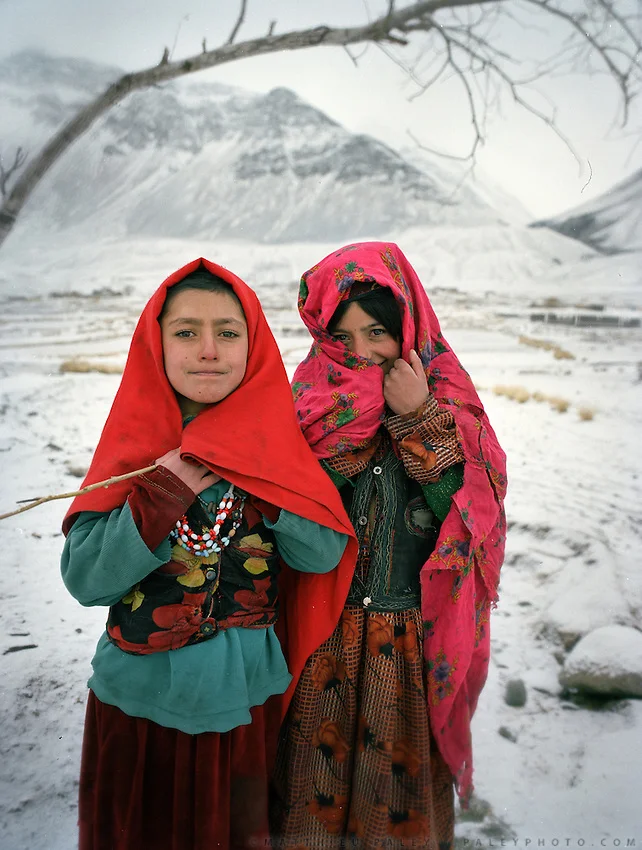
Wakhi Girls
Humans of the Himalayas : The Wakhis
Living literally on the Roof of the World or the Bam-I-Duniya are the Wakhi people, who predominantly live in the Wakhan Corridor, the narrow strip of Afghan territory that traditionally separated the British Empire from Tsarist Russia in days of the old. Also called the Khik at present they live in the Wakhan of today's Badakhshan region located in northeastern Afghanistan and southeastern Tajikistan.

Traditional Wakhi Women
The Wakhan sits at the junction of three major mountain ranges, the Hindu Kush, the Himalaya/ Karakoram, and the Pamirs – what is called the Pamir Knot. The valley is carved by the Wakhan River, fed by glacial meltwater from the surrounding mountains. From the town of Ishkashim, at 2,700 meters above sea level, the valley climbs steadily eastward, eventually reaching high altitude pasture land, above 4,000 meters, along the border with China. Due to its dramatic isolation the Wakhan corridor has been spared of the war in Afghanistan and has been mostly spared of the depredations of the war. But region still exists in a time warp due to the same isolation.

A Wakhi Family
The Wakhi are a Persian people as such of Tajik ancestry. The Wakhi speak the Wakhi language, which is a Indo-European language of the Iranian branch of the language family, distantly related to Persian Tajiks, and are Ismailis, a progressive branch of Shia Islam that eschews many conventional Muslim practices. They do not fast during Ramadan, for example, which is uncommon elsewhere in Afghanistan. The Wakhi practice combined mountain agriculture, growing wheat, barley, potatoes, beans, and peas in the valley, and herding their yak, sheep, and goat to high-altitude pastures above 4,000 meters during the summer. Their homes are made of stone and mud-plastered walls that are scattered around the valley floor around irrigated mountain oases. Those Wakhi that bring their animals to the high pastures live in nomadic yak-fur tents during the summer.
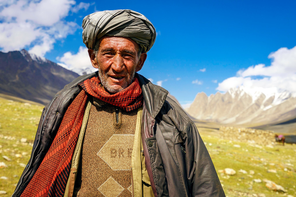
A Wakhi Chief
The Wakhi language belongs to the southern group of the Pamir languages, in the Iranian group of the Indo-European family of languages, where the different Ishkashmi and Wakhi languages are included. The Wakhi language, rich in archaisms, differs considerably from the Pamir languages, and generally from the southeastern group of Iranian languages, having certain common characteristics with the Indian languages. Although divided by borders, the Wakhi language is still very much the same, and dialectal differences are not great.
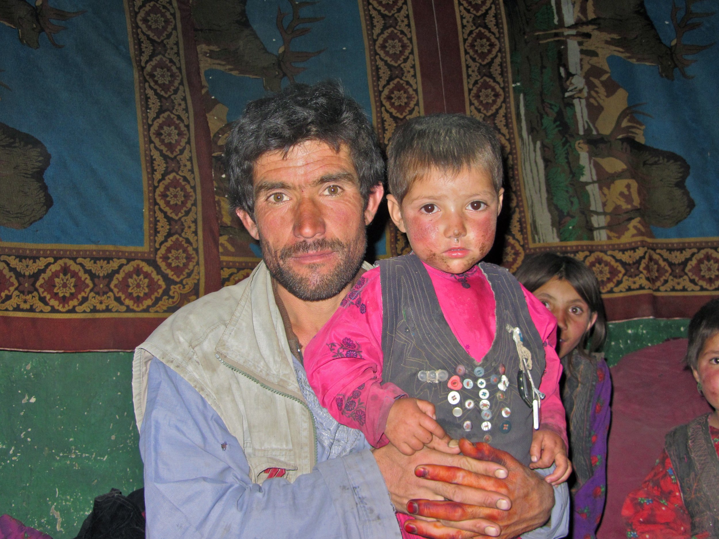
A Wakhi Father and son
The language of mutual communication, and the written language, for the Ismaelites of the small nations of Pamir has been the Tajik language. The Wakhi oral tradition is also bilingual (Wakhi and Tajik). On the Upper Wakhandarya, there are noticeable Turkic influences in place-names. Wakhi-Kirgiz contacts are maintained even today. Many Wakhs also speak the Shugni language. The Wakhi folksong bul’bulik is principally a women’s song, it is sung on the summer pastures. Before the establishment of the Soviet regime, the Wakhs were almost totally illiterate. Nowadays, schooling is obligatory for everyone. The language for schooling is, without exception, Tadzhik, which places Wakhi in a passive role and accelerates the disintegration of the language. In domestic situation, however, Wakhi is still preferred, whatever the subject, although most Wakhs speak Tadzhik quite fluently.

A Group of Wakhi Men
Besides the Wakhan Corridor there are smaller pockets of Wakhis who inhabit the higher reaches of the Hunza Valley in Gilgit Baltistan, Chiral in Khyber Pakhtunkhwa, in Tajikistan across the Pamirs, southern Xinijiang in China, some in Russia and even a few odd Wakhi villages in Turkey. As per the present estimate the total number of Wakhi people would be around 70,000 to 100,000.
In China along with the Sarikoli people the Wakhi are termed as the “Tajik” minority. In Afghanistan, they are officially called "Pamiris". In Tajikistan, the Wakhi are recognized by the state as "Tajiks", but they still self-identify as "Pamiris". In Pakistan, they refer to themselves as "Pamiris" or "Gujali".

Wakhi Old Women
When the Persians and Tartars subjugated the areas north of the Hindukush in the 12th century the southern valleys of the Hindukush gained a distinct identity under different names as Bolor, Dardistan, Tibet Gujal, Kashkar etc who were divided by the chains of mountains however the Ghalcha and Dard people living on the northern and southern side of the Hindukush have been close to each other despite the natural hurdle of the mountain chains.
Trade caravans and pilgrims from eastern Turkistan used to cross over the Kurambar Boroghil and Darwaza passes into Chitral and this caravan route served as a permanent link between these regions. Many people from Chitral crossed into Wakhan for permanent settlement. The Wakhi herdsmen usually came with their flocks to the Boroghil for summer camps. Wakhi horsemen used to visit for Polo and Buzkashi as far south as Razdan field in Torikho valley.The Wakhi art, craft and architecture occupy a distinct place in the neighboring area. There are certain festivities which mark particular occasions and vary from valley to valley. The Wakhi are fond of music Daf open drum and flute and Rabab are popularly played. Male members are responsible for farming, weaving woolen clothes. While women look after the house and cattle.

A Map of Wakhan and Pamir country
Compiled from various sources on the Net
All pics from the Net for educational purposes. In case you own the copyright for any of these and you want it removed please message me and i will remove it immediately.
Prior permission has been taken from the Admins (Other) for this series. If you think that you have a story that needs multiple pics and people pics please get in touch with the Admins.
The Tibetan Mastiffs Business
The Story of one of the largest Dog Breeds in the World, the Tibetan Mastiffs who have protected people and live stock for centuries on the Tibetan Plateau.
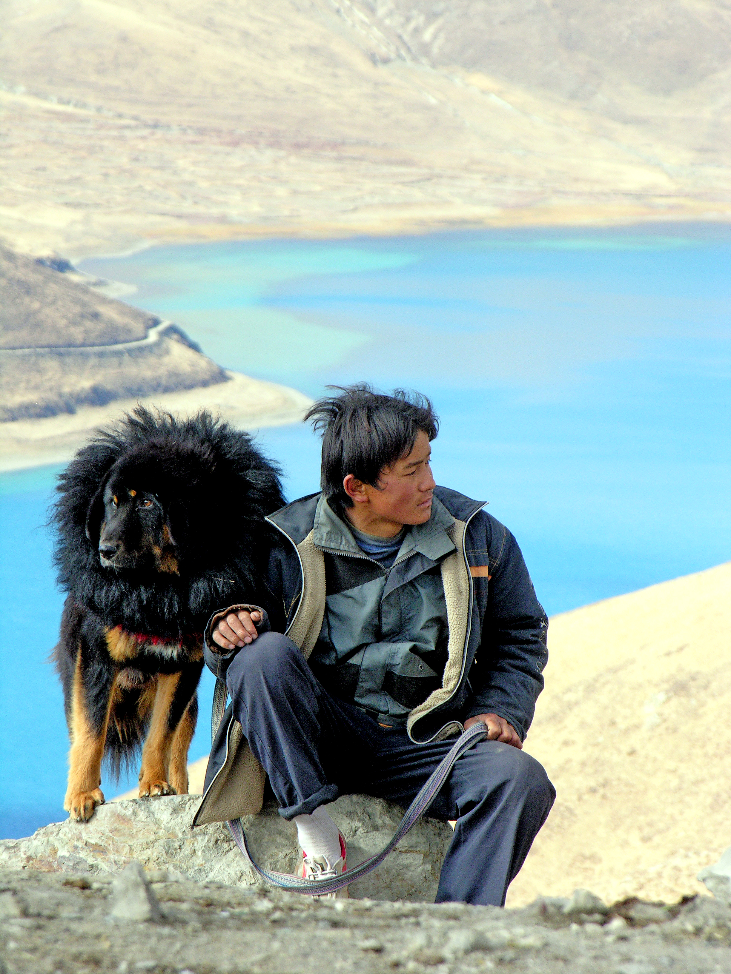
A Tibetan Mastiff in Tibet (Pic from Wikipedia)
The Tibetan Mastiff Business
Ever heard of the Tibetan Mastiffs ? I am sure most of you must have heard of these monsters of Dogs that lived on the Tibetan Plateau and grew into large proportions to the point that instead of resembling Dogs they looked like Bears. They are known for their ferocity and loyalty as well. And of course their shaggy coat which protects them from the extreme cold on the Tibetan Plateau makes them look much bigger than they actually are. And last but not the least their Gruff Bark which literally sends shivers down one's spine. I have kept a Himalayan Sheep Dog or what we called a Bakarwal at my home in Kashmir but its Gruff was nowhere close to what a Tibetan Mastiff Gruff sounds like. They are almost like Bass Speakers. Bigger the speaker, deeper is the Gruff and its more bone chilling.

A Pair of Tibetan Mastiffs goign into a frenzy as they see me trying to take their pics.
I have never really encountered a pure Tibetan Mastiff in India though have occasionally come across what I call the Himalayan Mastiff during wanderings in the Mountains. But I know people who have pure ones in India but I have never had a chance to visit them. And I am sure many people have purer varieties in the Regions bordering Tibet.
Anyways I had my first real encounter with these Monsters of the Canine World when last winters, in January 2017, I decided to visit a part of the Tibetan Plateau which lay on the eastern edge along the Hengduan Mountains. Of course I was told its no use going there at the height of Winters and that too solo but I had the time and opportunity so I decided to take a detour while on a Business trip.

Another pic of a Tibetan Mastiff with the hair standing on the back of its neck.
It was in Shangri La or Zhongdian that I first encountered these guys. Zhongdian or the fancy name, Shangri La, that the Chinese Government has given it is home to the beautiful Ganden Sumtseling Monastery and is the seat of the local Government in the Deqin Tibetan Autonomous Prefecture. The Tibetan name for the town is Gyalthang. The Town is situated at around 3200 m above sea level on the Eastern edge of the Tibetan Plateau.
I had booked a Tibetan Lodge near the Monastery and as the Weather was nice I decided to take a walk around the Lamucyang Tso, a small Lake facing the Monastery. The Lodge was a typical Guest House built like a Traditional Tibetan home in a typical traditional Tibetan Village. While on the walk I came across the first Monster and it was lying lazily in the Grass asleep. I went past it keep a safe distance and then I encountered another but this was on Guard duty outside his House and luckily he was chained up. The moment he realised my presence he went crazy off the hook. And it was big. I am lucky the Chain held on but it did give me a scare.

The guy I saw lazing by the Lake. Chilled out !
The next morning I woke up early around 5 AM as I wanted to take pics of the Sunrise and the Monastery as I felt the Monastery would look good when the first rays of the Sun fall on its gilded Roof. It was still dark when I got out of my Lodge and the temperature was 15 Degrees below zero. And there was this small Hill that I wanted to climb as it would give me a good view of the Monastery as well as the Sun as it rose over the Mountains. And i started walking but I did not take into account that I had to pass the House with the crazy Tibetan Mastiff again. I realized it just when I was in front of the House and I heard his growl. There have been few times that I have been so scared in my life. He went wild again and I just prayed to whichever God was up at that time to ensure that his Chain holds. It did and I thankfully got some shots.
The next day I decided to take a walk through the Village as I wanted to hike up a Mountain Peak which looked quite inviting. And then I came across all kinds of Tibetan Mastiffs as it seemed every house in the Village had at least one. And every time a stranger crossed they went into a frenzy. But I rather enjoyed the Tibetan Mastiff Symphony (Cacophony actually) that I created every time I walked the Village, which for some strange reason had very few people and mostly Yaks, Pigs, Chickens and Tibetan mastiffs. The most endearing sight for me was one of two huge Tibetan Mastiffs sleeping alongside with a couple of the Pot Bellied Black Pigs. It was surreal but I didn't have the courage to walk into someone’s House and take pics of the Mastiffs and Pigs enjoying their siesta.
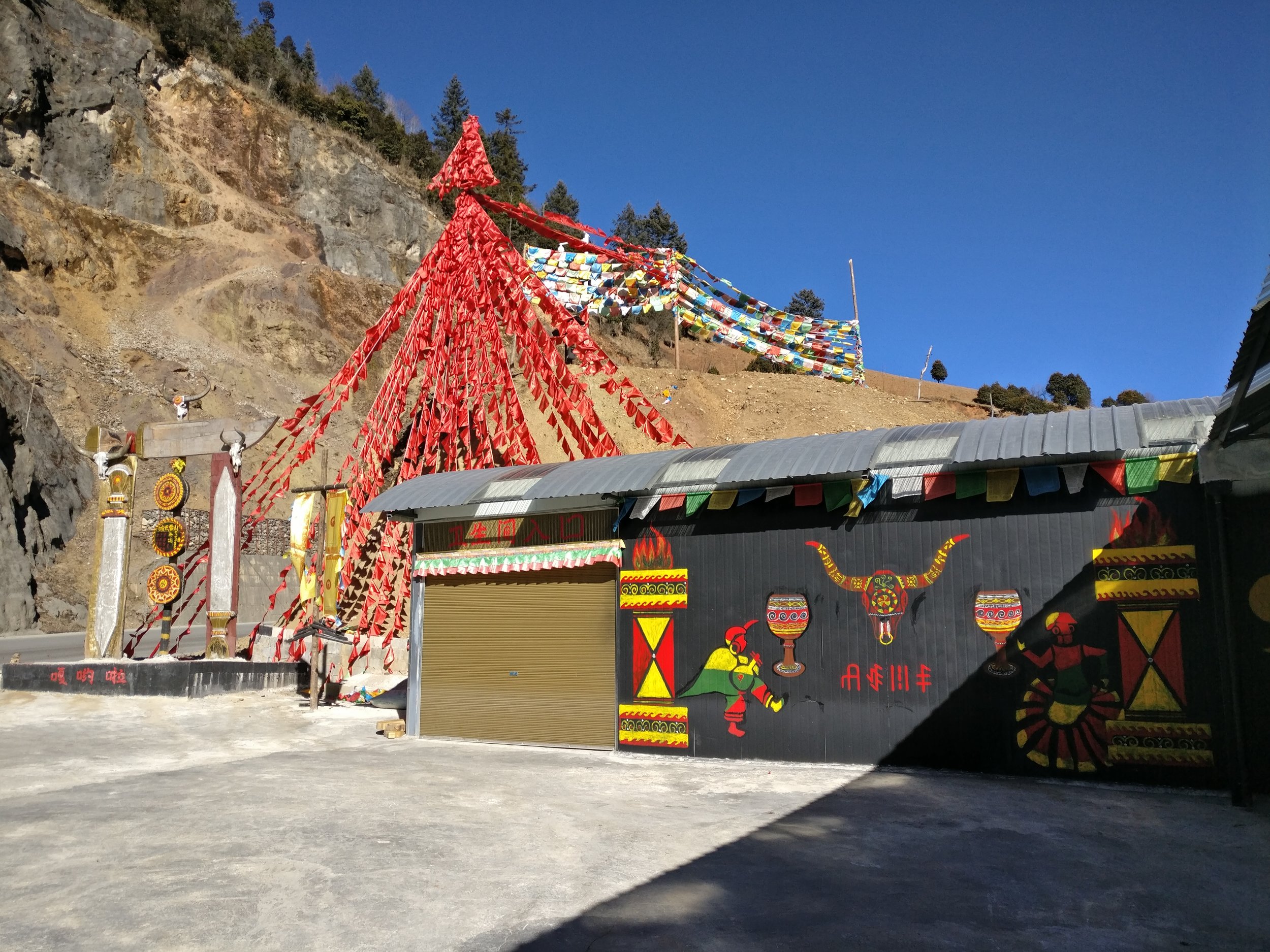
A Shop selling Tibetan Mastiffs.
Anyways coming down to more serious business, as the Chinese have grown wealthier, so has their craze for keeping Tibetan Mastiffs more as status symbols though I admit I have seen some crazy love for Dogs in China which I simply can't imagine anywhere else. So much in fashion are these Tibetan Mastiffs that there are reports of a puppy being sold for 2 Million USD, that's a whopping 14 Crores in Indian Rupees. Of course with this Breed being in so much demand what has happened is that the breeding and sale of these Mastiffs is happening on a big scale. And of course what this means many unscrupulous people getting into this business and trying to maximize profits they keep these animals in despicable conditions. And of course the business couldn't sustain forever and the business fell in 2013 with the supply overwhelming in demand putting many out of business.

One of the "Showrooms" selling Tibetan Mastiffs
And i saw it up close and personal. From Gyalthang I took a taxi down to Lijiang as i wanted to visit the Tiger leaping Gorge. Now most Chinese Tourists come by High Speed Train to Lijiang and then do the 4 hour trip to Shangri La or Xianggelila as they call it by Luxury buses. And this Road in its upper stretch had at least 10 Showrooms (yes Showrooms) selling just Tibetan Mastiffs. I stopped at a couple but they were mostly shut as it was off season but I could see that they still had a few Mastiffs held on the backside in cages. And the way these majestic creatures were kept was just pathetic. Filthy cages which didn't seem to have been cleaned since ages and very smelly. And the Dogs had all shaggy coats which seemed all matted. I clicked some pics but never had the heart to post them online as they are just simply disgusting. But I was amazed at the scale of this Business and wondered how long will the craze last and what would happen to the Mastiffs when they fell out of favor with their fashionable owners. Let's admit it. Keeping a Dog so large is no easy task as it has to be given enough food, space, grooming and care for it to thrive. And plus you need to make sure that the Dog is provide facilities to survive the environment in hotter areas

Wooden Cages inside which the Tibetan Mastiffs are kept.
So as result what has happened is that many Tibetan Mastiffs are now abandoned by either the Owners or the unscrupulous Breeders who due to massive competition can no longer make profit so they just abandon the Dogs to roam the streets. An that is a sad sight for such Dogs which once were almost Royalty. Even sadder is the fact that many are sold to Dog slaughter houses which process them for Dog meat which is still liked as food in parts of China. And also there are reports of abandoned Tibetan Mastiffs teaming up with Wild Wolves to attack livestock !
A Tibetan Mastiff inside the wooden cage looking at me.
Here is a heartbreaking Video of more than a 1000 Tibetan Mastiffs at a shelter set up by the Surmang Namgyal Monastery. But i guess these are the lucky ones who will no longer have to beg on streets for scraps of food or end up as Meat themselves on a Chinese Table.

Not much we can do but as a penance maybe we should start taking care of the street Dogs wherever we live and never buy Dogs from Breeders. Dont shop. Please adopt.
Munshi Aziz Bhat Museum of Central Asian Antiquities
The Munshi Aziz Bhatt Museum of Central Antiquities which holds a priceless treasure of Items and Objects which were once traded on the legendary Kashmir to Yarkand Silk Route via Ladakh.

A decorated Mongol Horse Saddle
Munshi Aziz Bhat Museum of Central Asian Antiquities
The name Kargil is famous now. Mainly because it is associated with a War that was given its name as it was fought in this area almost 20 years back and it was the country’s first televised War. But few would imagine that once upon a time it was a major trading Route on the Silk Route which connected Northern and Peninsular India with Central Asia and China.
Kargil is at a strategic location and is as such almost equidistant from Skardu, Leh , Padam in Zanskar and Srinagar. Infact its name itself is derived from its location. Kargil literally means a place to stop from all directions. Its etymology has evolved from the word Garkill. Where “Gar” means from all places and “Khil” to stop. And true to its name, all historical accounts of British and European travellers reveal Kargil to be just that. Situated along the river Suru (a tributary of the Indus, which flows into Gilgit Baltistan) it boasted of a fort built by the Ladakhi King in the 19th century. The old caravan bazaar ran along the river and a few mud houses by the slopes nestled in a green oasis of the Suru valley.

The old crumbling Kargil Sarai
Traders from all over the region and beyond converged upon Kargil. There were Punjabis, Kashmiris, Baltis, Yarkandis, Ladakhi, Tibetans, Afghans, Arghuns, Pathans, Kirghiz and all other ethnicities from the neighbouring Regions. The Dogra Rulers as well as the British promoted this Trade after the Dogras came into power and consolidated their Rule in the Region. They also improved and facilitated the creation of the Treaty Road which was a Trade Route all the way from Srinagar to Yarkand.
At the time that the trade was flourishing there was a certain Gentleman by the name of Munshi Aziz Bhat of Kargil who was the official petition writer for the Maharaja of Jammu and Kashmir for the Baltistan Wazarat. A Petition writer in those days was a powerful man, as if you had an issue that you wanted to bring to the higher authorities and the highest being the Maharaja, who had to approach the Petition writer to do it on your behalf. So the strength of your case basically lay on how the Petition writer presented it. As such Munshi Aziz Bhat was a very well respected man in Kargil.

The Kargil Sarai facing the Suru River.
Munshi Aziz Bhat was a trader also being on the Central Asian trade Route and owned a number of shops in Kargil and his trading company was called Munshi Aziz Bhat and Sons. He set up a Serai, the Kargil Serai in 1920 to offer boarding lodging and storage places to the Traders. Soon the Serai became a stopover place for all kinds of traders from all kinds of places in Kargil. The Kargil Serai also served as a kind of an unofficial Post Office which received a lot of mail especially from the Hoshiarpuri Punjabi traders. The Serai had in its front a couple of shops as well which the Traders could use to display their wares. The Serai was a busy one in the late 1800s as well as the early 1900s and it saw many traders come and go.
Janet Rizvi in her epic Trans-Himalayan Caravans, Merchant Princes and Peasant Traders in Ladakh (p 260) mentions “ …it would seem that for the transporters belonging to the villages downriver from Drass, Kargil (rather than Srinagar) was the centre to which they went in the first instance in search of work. The hub of this activity was Munshi Aziz Bhat’s sarai, which was a depot for goods going in all four directions...there was in particular plenty of coming and going between Kargil and Skardu…”

An old style Building in the Kargil Bazar
And then came the turmoil of 1947 when initially Kargil was occupied by invaders from the other side. And ofcourse with the Chinese occupation of Xinjiang and its move on Tibet the Trade Route was finally shut down by the Chinese in 1949. A once buzzing trade route and all its dependencies were suddenly shut. The Kargi Serai lost its guests as even the Hoshiarpuri merchants went away. The Serai fell into disrepair and meanwhile Munshi saab also passed away.
The Seari was however bequeathed as family property to Aziz Saab’ descendents and so the three storied Serai remained for decades. A lonely relic in the Kargil bazaar of a time long gone. It remained under lock and key for a good 50 years but its condition kept on deteriorating. No one it seems was aware of what lay inside the Serai since decades.
An establishment still run by descendants of the Punjabi traders from Hoshiarpur who were at the frontline of the Central Asian trade.
In was a chance discovery in the beginning of this century that some workers were sent to the place to clear some mess as parts of the structure had collapsed. The workers unearthed some very interesting items and reported these to the owners. The Owners then decided to come and check for themselves and they unearthed in what can only be called a priceless treasure in form of various items related to the Central Asian trade and items from all over Central Asia, the Indian sub-continent, Tibet and even Europe. As luck would have it a visiting historian persuaded the family to preserve this price less collection instead of it ending up in some antique shops. And so was set up the Aziz Bhat Museum of Central Asian and Kargil Trade Artifacts to display the Collection of items unearthed.
The range of artifacts unearthed from the Munshi Aziz Bhat Sarai has given invaluable insights into not only the forgotten trade history but also into the corss-cultural, cosmopolitan past of Kargil. These artifacts aren’t mere antiques but they are a testimony to the fact that Kargil was a melting pot of cultures, languages, lifestyles and ideas. They are now on display in a part of the Munshi family’s house that has now been converted into the Musuem.

Saddles from Central Asia.
The diverse collection of artifacts include not only the goods that were traded along the route but also the items used by the traders and people involved in the trade. Some of the choicest artifacts include hookah pipes from Yarkand, rugs from Kashgar, fabrics — dyed and raw silk from Khotan in China, natural dyes, costumes, jewellery, coins, shoes, utensils and ammunition. Apart from these, the museum incorporates mercantile items from the late 19th and early 18th centuries like leather skins, coarse cotton cloth, carpets from Central Asia, British horse seats and saddles, buttons from Italy and items from the factory of the Nizam of Hyderabad. Over the years, the museum has also acquired various local artifacts that are relevant to Kargil, some of the key artifacts have been the first hand written Quran by the Buddhist Ruler King Namgyal of Kartse sometime in the 14th/15h century and a number of legal manuscripts that are written both in Tibetan and Urdu for the benefit of the King as well as his people. This was at the time when Islam was spreading across Ladakh and most of the rulers were Buddhists.
This Museum is a must go recommended place to go to in Kargil in case you are interested in the history of the Central Asian Trade along with the Central Asian Museum.

In the pic above
1. Toiletries / Soap, Lux soap, Tooth Brush, / Shaving Brush, Pear soap, and Shaving Soap. / Place: - England, Germany, Italy, USA./ Period : 1903, 1905,1926, 1939. All these finished & believed to be luxury, were imported From England, Germany & USA. After reaching the Mumbai Coast, these luxury items travels all the way from Mumbai To Central Asia, Via Yarkand, Khotan, & Kashgar. The merchants with caravans of these goods either batter or sold these items to nobles.
2. Local Name :- Jola / Place : Cuba / Period : 18th Cent 100 LBS, Sugar sack from Cuba imported to Central Asia.
3. Modern medicines / Place : Britain ,USA / Period:- 18th Century / Introduced by the different Moravian Missionaries these medicines were unknown to Central Asia & Tibet.
4. Raw silk thread, Plain Silk & Imperial silk / Local Name : Shahi. / Place : Khotan/ Preiod : 17th Century Known as Shahi, or the Imperial cloth, introduced to the world from Khotan.
5. Thanka (Paintings) / Local Name : Thanka / Place : Rangdum. / Period : 16th Century
A rare Thanka Painting, gifted to Munshi Aziz Bhat, by the villager of Rangdum. Showing the wheel of life.
6. A Rug from Bukhara / Local Name : Namdah (Fingma). / Place : Bhokara. / Period : 1822.
A Central Asian Rug from Bhokara, Name of Mohan Lal (from Kashmir) who happens to be the Assistance of Sir. Alexender Burnes, a British officer of the company is written in the Center.
The Gilgit Manuscripts
The Gilgit Manuscripts discovered in the early 1900s in Gilgit are one of the oldest Buddhist Manuscripts discovered in India. Believed to be one of the most revered Buddhist scriptures, it represents the discourse delivered by Buddha towards the end of his life.

A leaf from the Gilgit Manuscript
The Gilgit Manuscripts : A Treasure Forgotten
A couple of cattle grazers in 1931, in a village Naurpur near Gilgit once came upon a wooden box in a circular chamber in side a Buddhist stupa which contained a large number old Manuscripts pertaining to Buddhism. Little did they know that they had stumbled upon one of the most important finds of the century. The Gilgit Manuscripts are the oldest surviving religious Manuscripts from the sub-continent and of the oldest ones in Buddhism.
The cattle grazers took the collection to the Wazir of Gilgit who in turn turned it over to the Maharaja of Jammu and Kashmir and the news of the discovery of this Great Treasure spread world wide. Opinions vary about the date of this manuscript. One branch of scholars says it was written in the second century AD., while another puts the date at somewhere between the sixth and seventh centuries.
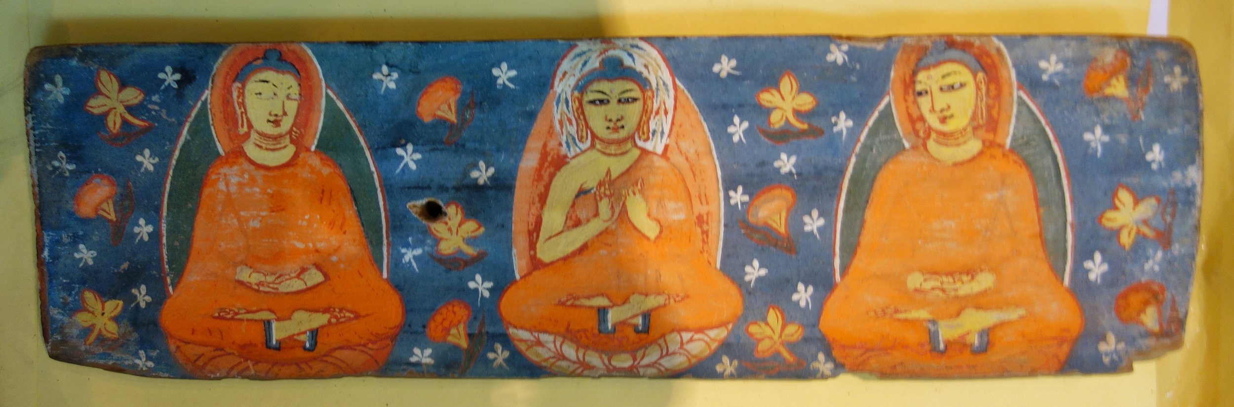
The Hand Painted Covers in which the Manuscripts were kept
Gilgit was at that time at the cross roads where South Asia, Central Asia and Eastern Asia met and it was an important stop on the Silk Road. Many monks from India carried the message of the Buddha from here to Tibet, China, Korea and even as far as Japan. It was along the Silk Road that Buddhism spread eastwards towards the rest of Asia. Gilgit hence played an important part in the spread of Buddhism and hence this find.
The almost seventeen centuries old Gilgit Manuscript has been giving historians a hard time, as no one has yet been able to fully decipher it. The lamination of the manuscript by the National Archives of India sometime ago has once again put the limelight back on this all-important literature concerning India, Tibet, China, Japan and other neighbouring countries.

Another leaf from the Gilgit Manuscipt
In fact in 1897 - 34 years before it was discovered - the Buddhist Text Society of Calcutta had published references to the Gilgit Manuscript saying that if it were ever to be found it would unravel the ancient history of several communities as it is considered to be the oldest Buddhist manuscript.
A corpus of many Buddhist texts such as the Four Sutras from the Buddhist canon, including the famous Lotus Sutra, the Manuscripts survived because they were written on the bark of the Bhoj (Birch) Tree which does not decay and obviously helped by the sub zero temperatures in Gilgit. They were written in the Buddhist form of Sanskrit in the Sarada or the Sharda Script. The Gilgit Manuscripts deciphered thus far cover a wide range of subjects such as religion, religious rituals, philosophy, iconometry, monastic discipline, folk tales, medicine and culinary art.
The most famous of the Gilgit manuscripts, the Gilgit Lotus Sutra is preserved in the National Archives of India in Delhi. Known as the Saddharma Pundarika Sutra – or the teachings of the white lotus and sun – the sutra is the basis of the Tiantai and Nichiren schools of Buddhism. In 2012 a facsimile edition of it was published by by the National Archives jointly with the Institute of Oriental Philosophy and Soka Gakkai, a Japan-based non-governmental organization.

Another cover for the Gilgit Manuscript
"In August 1938, seven years after the discovery of the texts, the archaeologist Madhusudan Kaul Shastri led a systematic excavation of the Naupur site and discovered another larger chamber at the base of the structure. The chamber contained another set of the Gilgit Manuscripts along with votive objects and probably Buddhist cult bronzes.
"According to renowned scholar Karl Jettmar, inscriptions on these bronzes “reveal that they were produced and dedicated due to the generosity and the religious zeal of a Patola Shahi”. The Patola Shahis, also known as Palola Shahis, were the rulers of Gilgit and Baltistan from the late sixth to the early eighth centuries AD.
"Shortly after, Kaul Shastri and his team outlined the specifications of the second group of manuscripts and other finds from the site including the hand painted covers of two manuscripts.
"In the third phase, the well-known Italian scholar Giuseppe Tucci secured another small group of the manuscripts in 1956. Obtaining them from a street vendor in Rawalpindi, he presented them to the Karachi museum.
"Roughly 60 manuscripts and 17 Avadnas emerging from Naupur are of unmatched significance in Buddhist studies. These are the oldest surviving collection of religious texts in the subcontinent. Based on the paleographical evidence, scholars agree that local Buddhist devotees compiled these texts between the fifth and sixth century AD. With the exception of only a few scripts, all the manuscripts were written on birch bark in Buddhist hybrid Sanskrit language in the Gupta Brahmi and post-Gupta Brahmi script.

More leaves from the Gilgit Manuscript
"The manuscripts contain sutras from the Buddhist canon, the Samghata Sutra, Samadhiraja Sutra, Saddharma Pundarika Sutra, and Bhaisajyaguru Sutra.The Samadhiraja Sutra is one of the important Mahayana canonical texts, which are collectively called Navadharma. The Saddharma Pundarika Sutra, popularly known as Lotus Sutra, figures prominently in the Gilgit Manuscripts and scholars agree it was the most venerated sutra of the Buddhists from the Gilgit area"
Though the grammatical and literature aspects of the text are gradually becoming more of historical interest in the contemporary world, what is of interest is the social relevance of some of the sutras mentioned in the manuscript. Experts feel that when the full text is deciphered a common thread will be found in the language and people of countries like India China, Japan, Thailand, Tibet and Korea which would have the potential of altering the very geo-political map of the region.
At present the main collection is with the National Archives in New Delhi and some parts with the British Museum in London and at the Karachi Museum. Apparently Nehru had the many body of the Manuscripts bought by a special Plane from Srinagar in 1948 after the Tribal Invasion. However a small part of the manu scripts still lie at the Shri Partap Museum in Srinagar though not on display.
The importance of the Gilgit Manuscripts can be guaged from this Report in the BBC :
http://www.bbc.com/news/world-asia-india-17935041
As luck would have it I managed to have a look and some parts of this Great Treasure at the Sri Partap Singh Museum yesterday and was even allowed to take pics. :)

Some more leaves
To come face to face with such a great treasure is truly a humbling experience and I could not help but tremble with excitement as the significance of what I was going to see. This is the Holy Grail of Buddhist Learning.
NOTE : Compiled from nformation on the Gilgit Manuscripts from various references on the Net.
PS : The Museum plans to put this on Display as it is shifting to a new Building and some Galleries are already open for Public viewing. The Museum has a great collection and is a must see when you visit Srinagar. I will try and share more treasures from the Museum here.
Kiki’s Blog
Stories from the Himalayas








Five years ago the Galwan Valley was in the News for the wrong reasons after a deadly clash between the Indian and Chinese Armies in the Valley located in Ladakh lead to many deaths on the contentious Border between the two countries in wake of continued Chinese intrusions into Indian territory.
This area along the Shyok River, of which the Galwan Nallah or the Galwan River which forms the Galwan Valley has been off limits to Civilians since long but now the Indian Government has decided to open up the area for Civilians and we were amongst the First Civilians to venture into this beautifully desolate part of the Eastern Karakorams in Ladakh. Earlier Civilians could only venture upto the Village of Shyok from where the Shyok River takes a U turn and flows in a Northerly direction.