

Ten Offbeat Things to Do in Ladakh
Most People while visiting Ladakh just visit the same old Places, popular Tourist places and ones popularized by Bollywood and Influencers on Social Media. As a result a few Places bear the brunt of the Tourist footfalls which has serious Environmental and Social Impact.
I have always subscribed to the Philosophy that instead of sending 100 people to 5 places send 20 people to 25 places. Ecologically viable Tourism starts by spreading the load of the Tourists. And here is a list of Ten Things that I would recommend to do in Ladakh. And please remember that Ladakh is a large Region and most of it is rather unknown for most people. Ive added a Note on the Mountain Geography of Ladakh for easier understanding. You can also read my Ladakh Travel Guide for General Information.
So I have compiled a list of Ten Things that I would do in Ladakh, keeping in view all my Visits and Readings on Ladakh. They are in no particular order and each One is a Unique experience in its own.

Most People while visiting Ladakh just visit the same old Places, popular Tourist places and ones popularized by Bollywood and Influencers on Social Media. As a result a few Places bear the brunt of the Tourist footfalls which has serious Environmental and Social Impact.
I have always subscribed to the Philosophy that instead of sending 100 people to 5 places send 20 people to 25 places. Ecologically viable Tourism starts by spreading the load of the Tourists. And here is a list of Ten Things that I would recommend to do in Ladakh. And please remember that Ladakh is a large Region and most of it is rather unknown for most people. Ive added a Note on the Mountain Geography of Ladakh for easier understanding. You can also read my Ladakh Travel Guide for General Information.
So I have compiled a list of Ten Things that I would do in Ladakh, keeping in view all my Visits and Readings on Ladakh. They are in no particular order and each One is a Unique experience in its own.
1. Explore the Basgo Monastery and Fort :
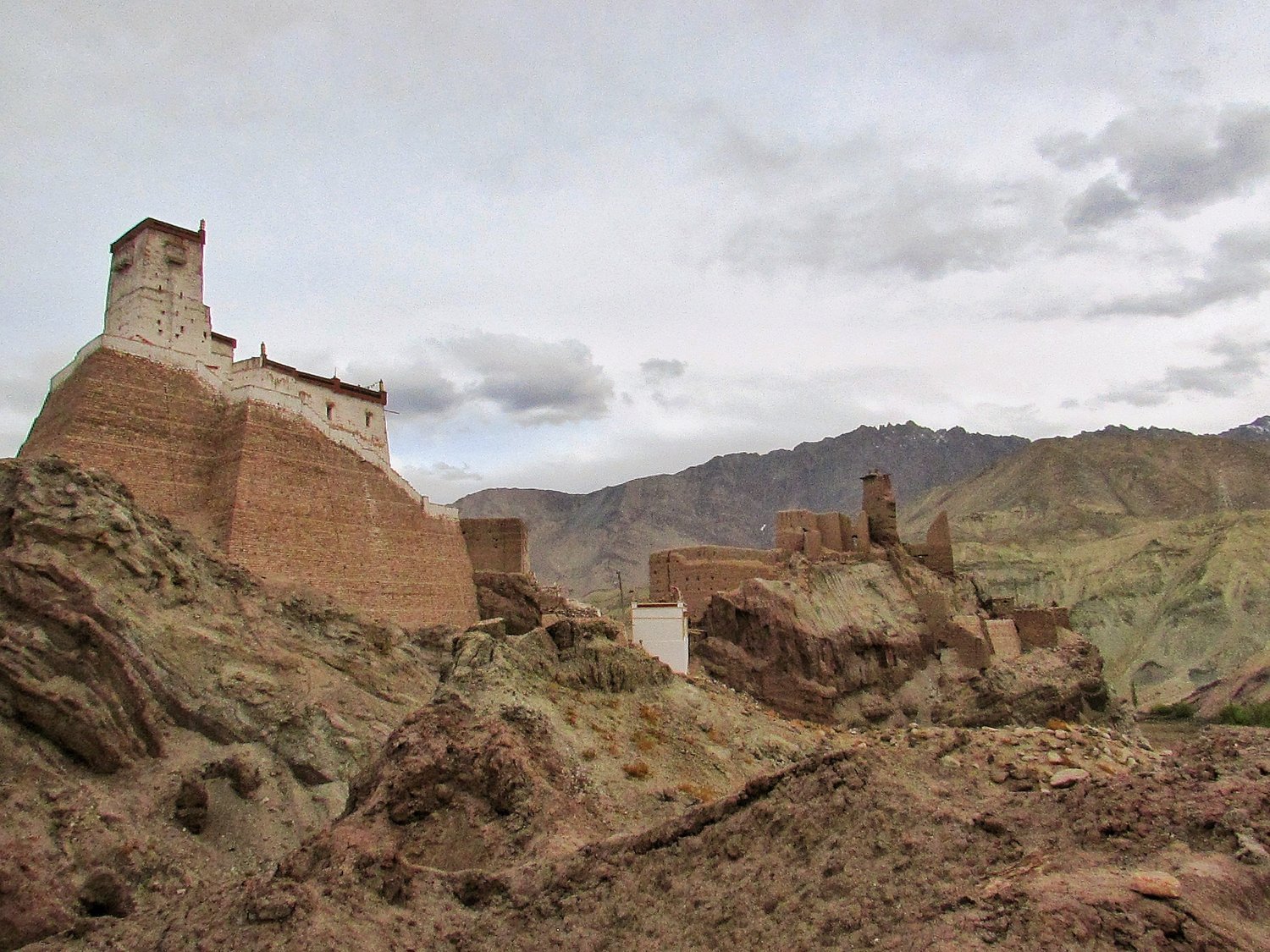
Basgo located some distance away from Leh was once the Capital of Ladakh and still the site of an impressive Monastery and a Fort. It was on the Plains outside that the Battle of Basgo was fought.
It was the Tibetans and their Mongol allies vs the Ladakhis and their Mughal allies. During the build up to the Battle the Mughal force crossed the Indus over two wooden bridges at Khalaste and marched towards Basgo. The two armies met at a plain called Jargyal between Basgo and Nimmu. This is referred to as the Battle of Basgo fought in 1679.
And the battle hardened Mughals along with their Ladakhi and Kullu allies proved too strong for the Tibeto-Mongols and their Bushahri allies. The Tibeto-Mongols were pushed back and routed all the way to Spituk where after a brief lull the fighting erupted again until they were driven beyond the Pangong Lake to a place called Tashigang.
They built themselves a Fort and shut themselves in and the Mughal Army now turned back, confident that the Tibeto-Mongols were gone for good. But of course Mongols being Mongols, they were wrong, but more of that later.
Read More about the Battle of Basgo
2. Gaze at the Stars at the Astrohub : A Great New Stargazing Experience in near Leh
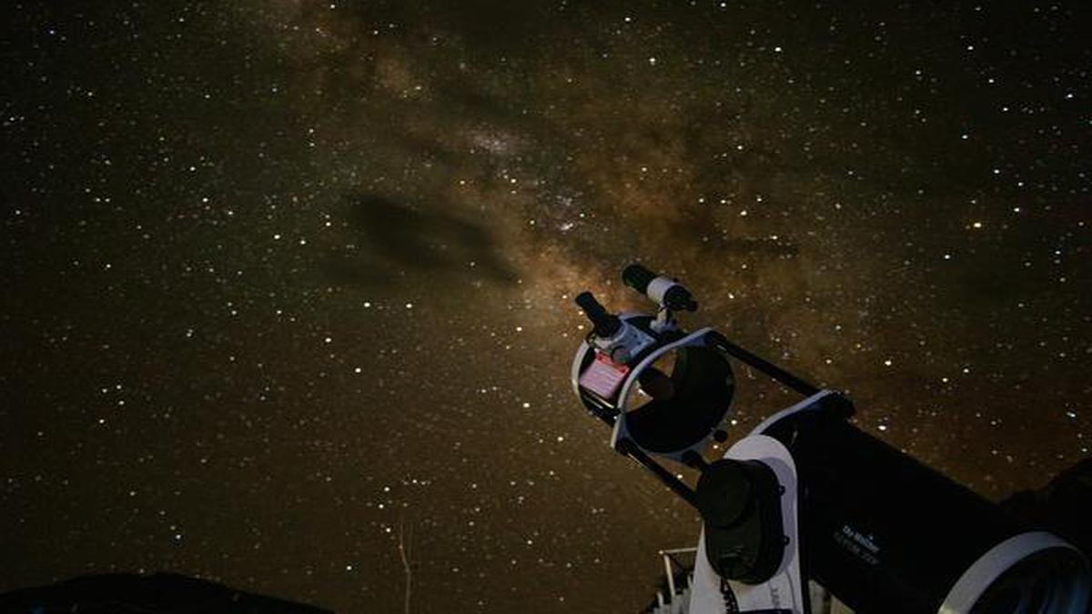
Introducing the Cosmohub in Phyang around 30 kms from Leh. An Initiative totally handled by the Local Village Ladies.
The Cosmohub has a Telescope which enables you to gaze even further into Space in the already very clear Ladakh skies.
Cosmohub- A New Stargazing experience near Leh. This women-led Astro-tourism initiative offers stargazing through a Telescope along with local folklore about skies narrated by trained local women.
You also get to Experience local Cuisine and Handicrafts prepared by a local self help group of women in addition to a guided tour of the nearby Monastery.
3. Visit the abandoned Village of Old Hundarman :
Ladakh offers many gems set in the Trans Himalayan landscape.
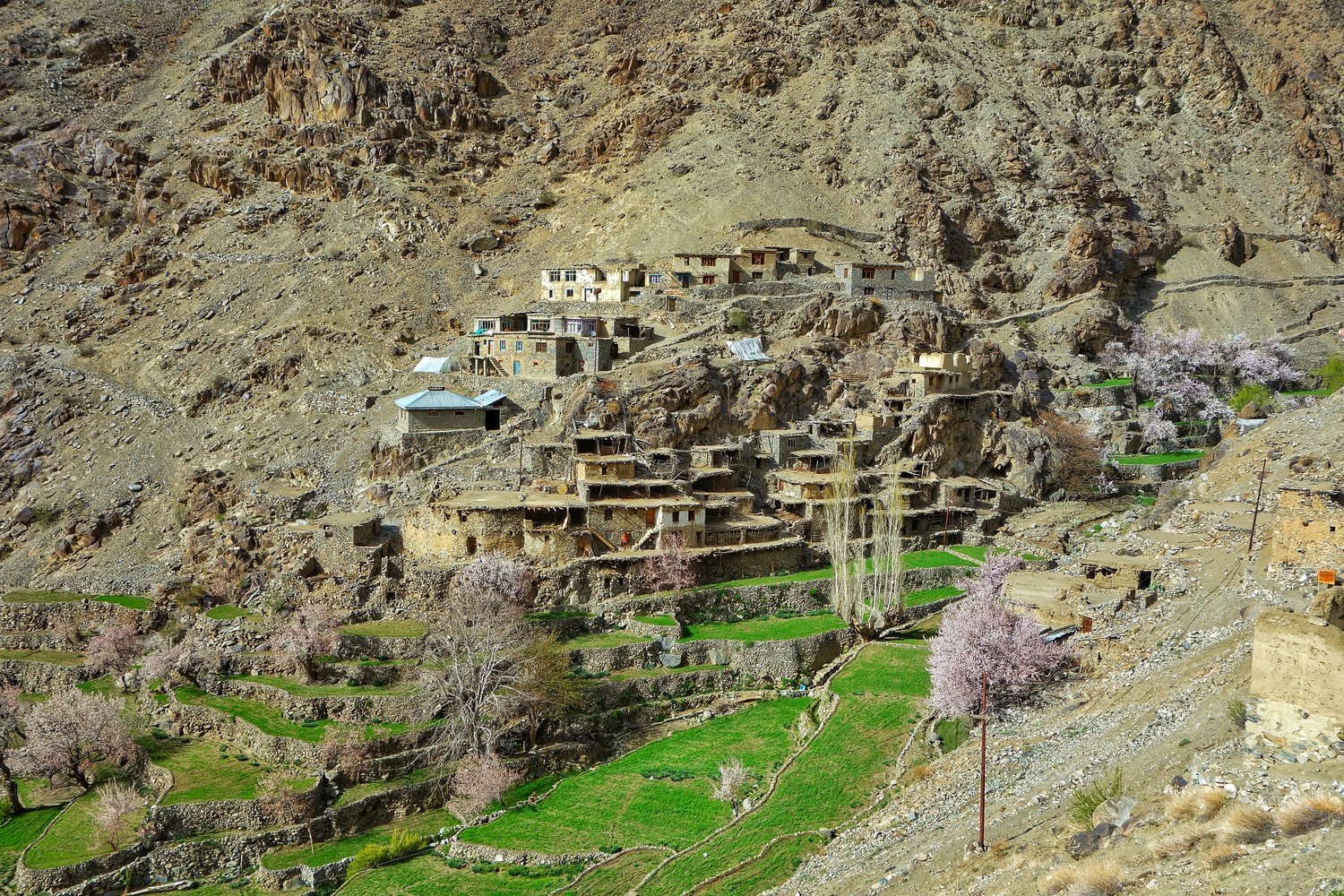
One such place while travelling to Ladakh is the Village called Hundarman near Kargil. Set in a sharp mountain gully 11km from Kargil, the tumbledown ghost village of Hundarman is a remarkable sight.
Rocky crags tower above, a steeply raked arc of stone-walled terraces sits below and virtually all of the low-ceilinged homes are stacked on top of one another, forming a fascinating core that has been (somewhat) preserved as a unique time capsule. And there is a neat little Museum in one of the abandoned Homes with antiquities found in these abandoned Houses.
This Village was till 1971 under Pakistani control but came under Indian Control after the 1971 War. And the fact that there are Warning Signs about Land Mines on both sides of the Road leading to Hundarman is a testament to the turmoil this Region has seen.
Yes you will hear the same Story about another place on this List.
4. Watch the Karakorams from the Khardung La :

Yes Khardung La is famous as one of the Highest Passes in the World but what most people dont know is that one gets a great view of the mighty Karakoram Range while looking North standing atop the Khardung La.
And now for some fun facts on the Karakorams in India. The Karakorams is a Mountain Range and like all Great Mountain Ranges it has a number of sub Ranges. And it has been classified into Nine Sub Ranges and out of these 3 lie fully on the Indian side and a 4th lies partly on the Indian side.
The Sasser Muztagh is the southernmost sub Range of the main Range and lies between the bend of the Shyok when it changes direction and heads in a Northern direction. The Shyok rises in the Rimo Muztagh which lies above the Sasser Muztagh.
The same trend is shown by the Nubra which also joins the Shyok and its at this point the Baltoro Sub Range starts which is partly on the Indian side. So the Sasser and the Baltoro Ranges are divided by the Nubra which rises in the Siachen Glacier. The Sasser La runs roughly between the Sasser Muztagh and the Rimo Muztagh. And in the extreme North along the Siachen Glacier runs the Siachen Muztagh.
Read More about the Karakorams in Ladakh
5. Visit the Donkey Sanctuary in Leh :

You must have seen a lot of Donkeys roaming around in the Streets of Leh. They are used as beasts of Burden in these rugged Mountains and many of them are unfortunately abandoned one they are older or are injured.
Sonam Dorje runs a Donkey Sanctuary on the outskirts of Leh where these unwanted Donkeys are taken care of. Its a Happy Place for these unwanted Donkeys where they can just do their Donkey things and get Food to eat and even basic Medical facilities.
The Donkey Sanctuary runs solely on Donations so its a good idea to visit the places, spend some time with the Donkey Bros and give whatever you can for the Welfare of these Donkeys.
Read More about the Donkey Sanctuary in Ladakh
6. Visit the Munshi Aziz Bhat Museum / Central Asian Museum :
Munshi Aziz Bhat was a trader also on the Central Asian trade Route and owned a number of shops in Kargil and his trading company was called Munshi Aziz Bhat and Sons. He set up a Serai, the Kargil Serai in 1920 to offer boarding lodging and storage places to the Traders. Soon the Serai became a stopover place for all kinds of traders from all kinds of places in Kargil. The Kargil Serai also served as a kind of an unofficial Post Office which received a lot of mail especially from the Hoshiarpuri Punjabi traders. The Serai had in its front a couple of shops as well which the Traders could use to display their wares. The Serai was a busy one in the late 1800s as well as the early 1900s and it saw many traders come and go.
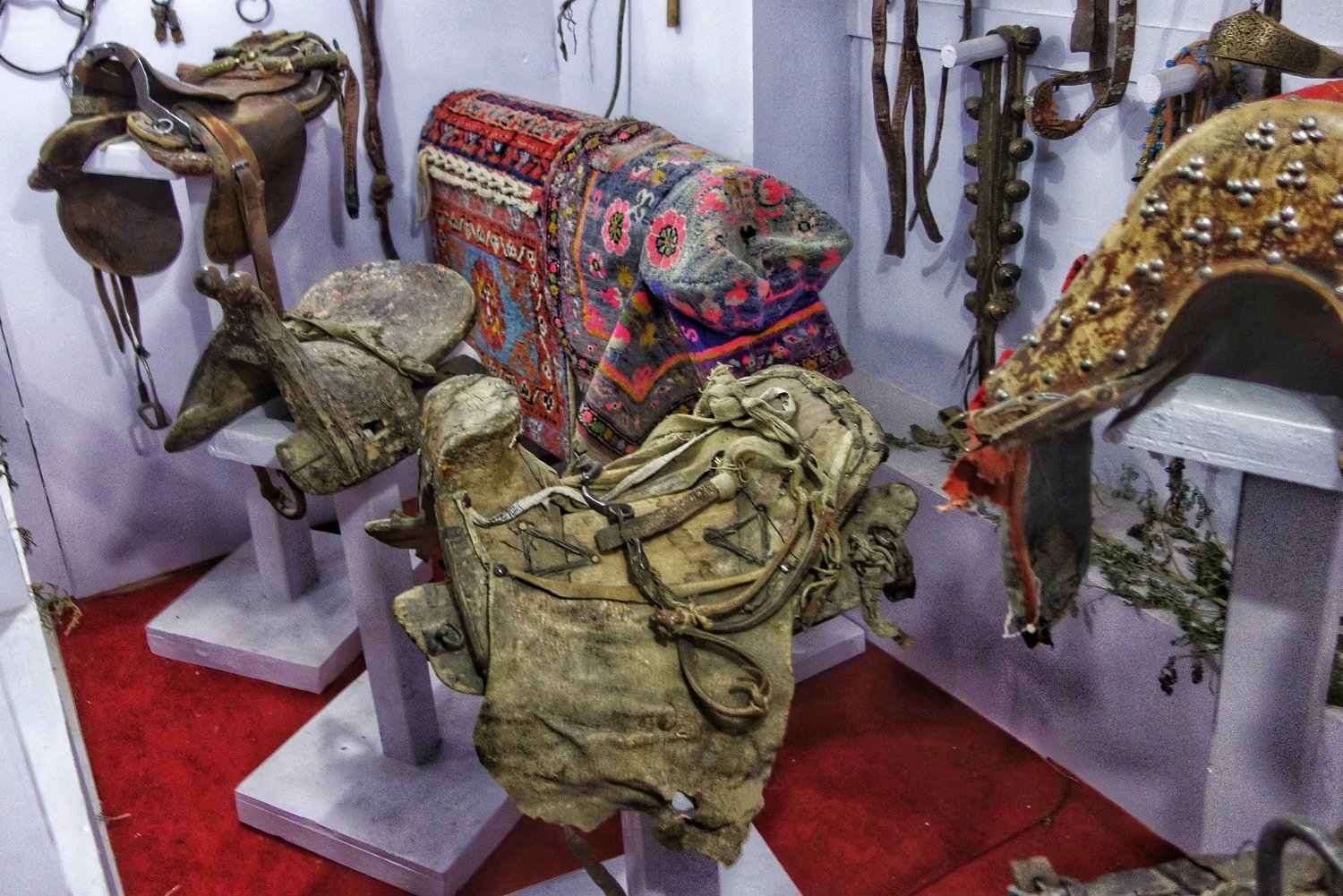
It was a chance discovery in the beginning of this century that some workers were sent to the place to clear some mess as parts of the structure had collapsed. The workers unearthed some very interesting items and reported these to the owners. The Owners then decided to come and check for themselves and they unearthed what can only be called a priceless treasure in the form of various items related to the Central Asian trade and items from all over Central Asia, the Indian subcontinent, Tibet and even Europe. As luck would have it a visiting historian persuaded the family to preserve this price-less collection instead of it ending up in some antique shops. And so was set up the Aziz Bhat Museum of Central Asian and Kargil Trade Artefacts to display the Collection.
The range of artefacts unearthed from the Munshi Aziz Bhat Sarai has given invaluable insights into not only the forgotten trade history but also into the cross-cultural, cosmopolitan past of Kargil. These artefacts aren’t mere antiques but they are a testimony to the fact that Kargil was a melting pot of cultures, languages, lifestyles and ideas. They are now on display in a part of the Munshi family’s house that has now been converted into the Museum.
Read More about the Munshi Aziz Bhat Museum
7. Panikhar and watch the Twin Peaks Nun and Kun :

Have you ever wondered what it feels to stand at the foot of the Greatest Mountain Range on the Planet, the Great Himalayan Range itself and stare at a 7000 Meter plus feet Mountain ?
The sheer grandeur of the Great Himalayan Range on one side and the Zanskar Range on the other side can be experienced in the Suru Valley. You can watch in awe the Twin Peaks of Nun and Kun which are a part of the Great Himalayan Range and tower above the Suru Valley and from places like Panikhar and Parkachik you get a superb view of these Giants.
Read More about the Suru Valley
8. Visit the Alchi Monastery :

Out of all the beautiful Monasteries in Ladakh the Alchi Monastery is probably the most fascinating one because of its Paintings and Murals said to have been done by Artists who came from Kashmir and they have a certain Kashmiri touch to them.
As per a leading researcher on Himalayan and Tibetan Art : “The world-famous Buddhist monastery of Alchi in Ladakh, India, is the best-preserved temple complex in the Himalayas. Proposed for inclusion in the UNESCO World Cultural Heritage list in 1998, the monastery's artworks reveal influences from India and Tibet across Central Asia and Iran, even as far back as Ancient Greece. Housing thousands of rare paintings and sculptures from the area dating back to the eleventh century, it provides fascinating insight into the spiritual and secular life of mediaeval Kashmir and Western Tibet.
9. Pay a Visit to Baltistan :

The neighbouring Region of Ladakh to the West is Baltistan Region. The people share almost the same Ethnicity as the people of Ladakh but over the centuries their Culture has changed and Religion is mostly Islam. The language of the Baltis is still quite similar to Ladakhi and is actually the closest language to the Old Tibetan language.
At the time of Partition almost the whole of Baltistan was occupied by Pakistan with its main City of Skardu. However over the Years in subsequent Conflicts the Indians managed to get back a little part of Baltistan and nowadays one of these Villages, Turtuk has become quite a Tourist destination.
Visit Turtuk to get a taste of Balti Culture and besides Turtuk there are a number of other Villages where you can see Balti People and Experience Balti Culture. You can now even visit the Northernmost Village of Thang which is located right on the Line of Control.
Read More about Ladakh and Baltistan
10. Drive from Pangong Tso to Tso Moriri over the Changthang :
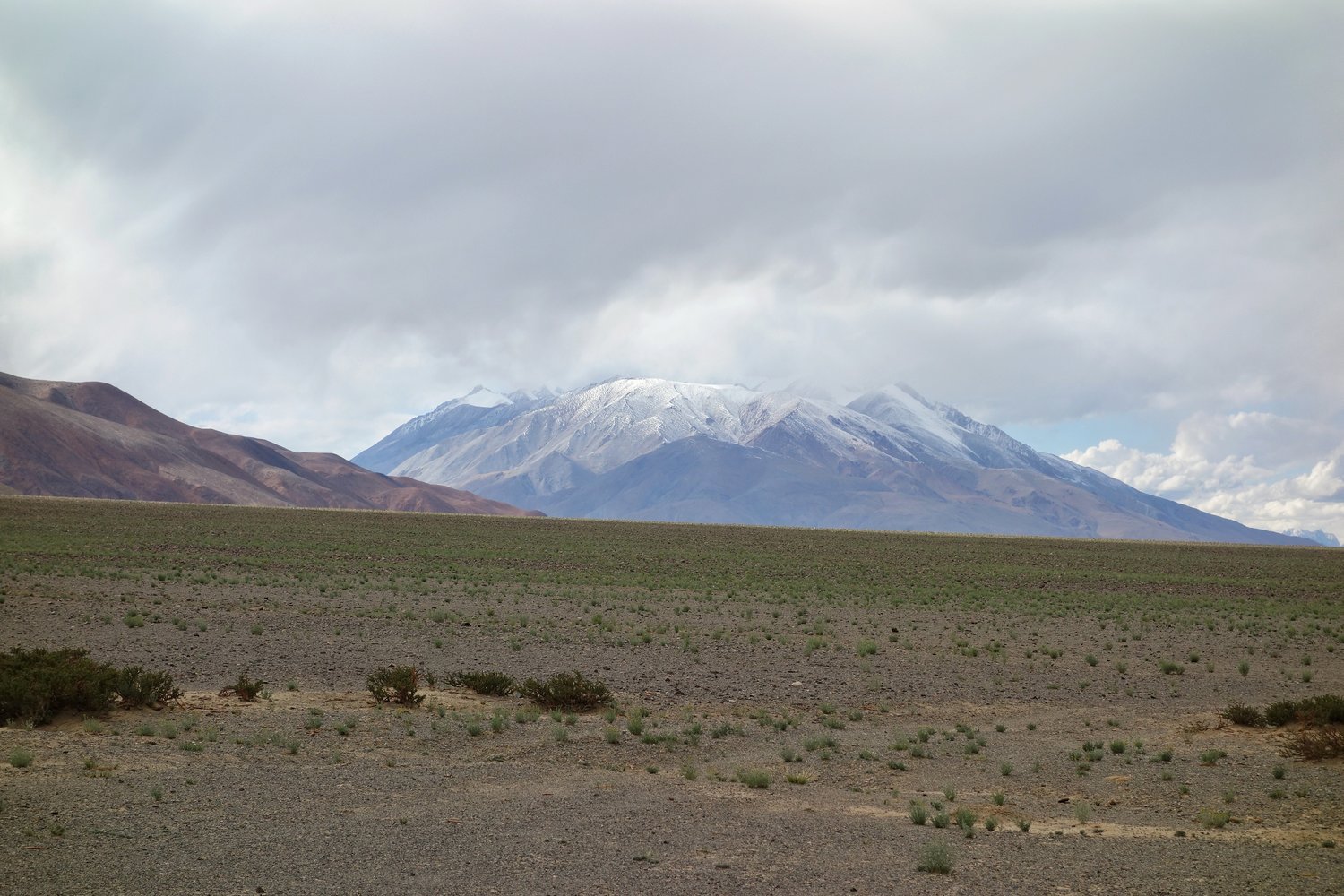
Of all the drives one can do in Ladakh the most fascinating for me is the one of going over the Changthang while driving from the Pangong Lake to the Tso Moriri Lake. The Changthang is a vast High Altitude Plateau that stretches over thousands of kms and includes parts of Tibet as well as Ladakh and goes all the way to Xinjiang.
It is an extremely inhospitable place but at the same time its beauty is quite unparalleled. Its dotted with certain Wetlands and on this stretch the Indus River enters Ladakh from the Tibetan side. The Changthang is largely uninhabited except for the hardy Changpa Nomads who raise their flocks of the famous Pashmina Goats on this Plateau.
Read More about the Changthang
Addendum : A Note on Understanding the Geography of Ladakh
The Mountain Geography of Ladakh
Kiki’s Ten Things to Do in Ladakh
Most People while visiting Ladakh just visit the same old Places, popular Tourist places and ones popularized by Bollywood and Influencers on Social Media. As a result a few Places bear the brunt of the Tourist footfalls which has serious Environmental and Social Impact.
I have always subscribed to the Philosophy that instead of sending 100 people to 5 places send 20 people to 25 places. Ecologically viable Tourism starts by spreading the load of the Tourists. And here is a list of Ten Things that I would recommend to do in Ladakh. And please remember that Ladakh is a large Region and most of it is rather unknown for most people. Ive added a Note on the Mountain Geography of Ladakh for easier understanding. You can also read my Ladakh Travel Guide for General Information.
So I have compiled a list of Ten Things that I would do in Ladakh, keeping in view all my Visits and Readings on Ladakh. They are in no particular order and each One is a Unique experience in its own.
Most People while visiting Ladakh just visit the same old Places, popular Tourist places and ones popularized by Bollywood and Influencers on Social Media. As a result a few Places bear the brunt of the Tourist footfalls which has serious Environmental and Social Impact.
I have always subscribed to the Philosophy that instead of sending 100 people to 5 places send 20 people to 25 places. Ecologically viable Tourism starts by spreading the load of the Tourists. And here is a list of Ten Things that I would recommend to do in Ladakh. And please remember that Ladakh is a large Region and most of it is rather unknown for most people. Ive added a Note on the Mountain Geography of Ladakh for easier understanding. You can also read my Ladakh Travel Guide for General Information.
So I have compiled a list of Ten Things that I would do in Ladakh, keeping in view all my Visits and Readings on Ladakh. They are in no particular order and each One is a Unique experience in its own.
1. Explore the Basgo Monastery and Fort :
Basgo located some distance away from Leh was once the Capital of Ladakh and still the site of an impressive Monastery and a Fort. It was on the Plains outside that the Battle of Basgo was fought.
It was the Tibetans and their Mongol allies vs the Ladakhis and their Mughal allies. During the build up to the Battle the Mughal force crossed the Indus over two wooden bridges at Khalaste and marched towards Basgo. The two armies met at a plain called Jargyal between Basgo and Nimmu. This is referred to as the Battle of Basgo fought in 1679.
And the battle hardened Mughals along with their Ladakhi and Kullu allies proved too strong for the Tibeto-Mongols and their Bushahri allies. The Tibeto-Mongols were pushed back and routed all the way to Spituk where after a brief lull the fighting erupted again until they were driven beyond the Pangong Lake to a place called Tashigang.
They built themselves a Fort and shut themselves in and the Mughal Army now turned back, confident that the Tibeto-Mongols were gone for good. But of course Mongols being Mongols, they were wrong, but more of that later.
Read More about the Battle of Basgo
2. Gaze at the Stars at the Astrohub : A Great New Stargazing Experience in near Leh
Introducing the Cosmohub in Phyang around 30 kms from Leh. An Initiative totally handled by the Local Village Ladies.
The Cosmohub has a Telescope which enables you to gaze even further into Space in the already very clear Ladakh skies.
Cosmohub- A New Stargazing experience near Leh. This women-led Astro-tourism initiative offers stargazing through a Telescope along with local folklore about skies narrated by trained local women.
You also get to Experience local Cuisine and Handicrafts prepared by a local self help group of women in addition to a guided tour of the nearby Monastery.
3. Visit the abandoned Village of Old Hundarman :
Ladakh offers many gems set in the Trans Himalayan landscape.
One such place while travelling to Ladakh is the Village called Hundarman near Kargil. Set in a sharp mountain gully 11km from Kargil, the tumbledown ghost village of Hundarman is a remarkable sight.
Rocky crags tower above, a steeply raked arc of stone-walled terraces sits below and virtually all of the low-ceilinged homes are stacked on top of one another, forming a fascinating core that has been (somewhat) preserved as a unique time capsule. And there is a neat little Museum in one of the abandoned Homes with antiquities found in these abandoned Houses.
This Village was till 1971 under Pakistani control but came under Indian Control after the 1971 War. And the fact that there are Warning Signs about Land Mines on both sides of the Road leading to Hundarman is a testament to the turmoil this Region has seen.
Yes you will hear the same Story about another place on this List.
4. Watch the Karakorams from the Khardung La :
Yes Khardung La is famous as one of the Highest Passes in the World but what most people dont know is that one gets a great view of the mighty Karakoram Range while looking North standing atop the Khardung La.
And now for some fun facts on the Karakorams in India. The Karakorams is a Mountain Range and like all Great Mountain Ranges it has a number of sub Ranges. And it has been classified into Nine Sub Ranges and out of these 3 lie fully on the Indian side and a 4th lies partly on the Indian side.
The Sasser Muztagh is the southernmost sub Range of the main Range and lies between the bend of the Shyok when it changes direction and heads in a Northern direction. The Shyok rises in the Rimo Muztagh which lies above the Sasser Muztagh.
The same trend is shown by the Nubra which also joins the Shyok and its at this point the Baltoro Sub Range starts which is partly on the Indian side. So the Sasser and the Baltoro Ranges are divided by the Nubra which rises in the Siachen Glacier. The Sasser La runs roughly between the Sasser Muztagh and the Rimo Muztagh. And in the extreme North along the Siachen Glacier runs the Siachen Muztagh.
Read More about the Karakorams in Ladakh
5. Visit the Donkey Sanctuary in Leh :
You must have seen a lot of Donkeys roaming around in the Streets of Leh. They are used as beasts of Burden in these rugged Mountains and many of them are unfortunately abandoned one they are older or are injured.
Sonam Dorje runs a Donkey Sanctuary on the outskirts of Leh where these unwanted Donkeys are taken care of. Its a Happy Place for these unwanted Donkeys where they can just do their Donkey things and get Food to eat and even basic Medical facilities.
The Donkey Sanctuary runs solely on Donations so its a good idea to visit the places, spend some time with the Donkey Bros and give whatever you can for the Welfare of these Donkeys.
Read More about the Donkey Sanctuary in Ladakh
6. Visit the Munshi Aziz Bhat Museum / Central Asian Museum :
Munshi Aziz Bhat was a trader also on the Central Asian trade Route and owned a number of shops in Kargil and his trading company was called Munshi Aziz Bhat and Sons. He set up a Serai, the Kargil Serai in 1920 to offer boarding lodging and storage places to the Traders. Soon the Serai became a stopover place for all kinds of traders from all kinds of places in Kargil. The Kargil Serai also served as a kind of an unofficial Post Office which received a lot of mail especially from the Hoshiarpuri Punjabi traders. The Serai had in its front a couple of shops as well which the Traders could use to display their wares. The Serai was a busy one in the late 1800s as well as the early 1900s and it saw many traders come and go.
It was a chance discovery in the beginning of this century that some workers were sent to the place to clear some mess as parts of the structure had collapsed. The workers unearthed some very interesting items and reported these to the owners. The Owners then decided to come and check for themselves and they unearthed what can only be called a priceless treasure in the form of various items related to the Central Asian trade and items from all over Central Asia, the Indian subcontinent, Tibet and even Europe. As luck would have it a visiting historian persuaded the family to preserve this price-less collection instead of it ending up in some antique shops. And so was set up the Aziz Bhat Museum of Central Asian and Kargil Trade Artefacts to display the Collection.
The range of artefacts unearthed from the Munshi Aziz Bhat Sarai has given invaluable insights into not only the forgotten trade history but also into the cross-cultural, cosmopolitan past of Kargil. These artefacts aren’t mere antiques but they are a testimony to the fact that Kargil was a melting pot of cultures, languages, lifestyles and ideas. They are now on display in a part of the Munshi family’s house that has now been converted into the Museum.
Read More about the Munshi Aziz Bhat Museum
7. Panikhar and watch the Twin Peaks Nun and Kun :
Have you ever wondered what it feels to stand at the foot of the Greatest Mountain Range on the Planet, the Great Himalayan Range itself and stare at a 7000 Meter plus feet Mountain ?
The sheer grandeur of the Great Himalayan Range on one side and the Zanskar Range on the other side can be experienced in the Suru Valley. You can watch in awe the Twin Peaks of Nun and Kun which are a part of the Great Himalayan Range and tower above the Suru Valley and from places like Panikhar and Parkachik you get a superb view of these Giants.
Read More about the Suru Valley
8. Visit the Alchi Monastery :
Out of all the beautiful Monasteries in Ladakh the Alchi Monastery is probably the most fascinating one because of its Paintings and Murals said to have been done by Artists who came from Kashmir and they have a certain Kashmiri touch to them.
As per a leading researcher on Himalayan and Tibetan Art : “The world-famous Buddhist monastery of Alchi in Ladakh, India, is the best-preserved temple complex in the Himalayas. Proposed for inclusion in the UNESCO World Cultural Heritage list in 1998, the monastery's artworks reveal influences from India and Tibet across Central Asia and Iran, even as far back as Ancient Greece. Housing thousands of rare paintings and sculptures from the area dating back to the eleventh century, it provides fascinating insight into the spiritual and secular life of mediaeval Kashmir and Western Tibet.
9. Pay a Visit to Baltistan :
The neighbouring Region of Ladakh to the West is Baltistan Region. The people share almost the same Ethnicity as the people of Ladakh but over the centuries their Culture has changed and Religion is mostly Islam. The language of the Baltis is still quite similar to Ladakhi and is actually the closest language to the Old Tibetan language.
At the time of Partition almost the whole of Baltistan was occupied by Pakistan with its main City of Skardu. However over the Years in subsequent Conflicts the Indians managed to get back a little part of Baltistan and nowadays one of these Villages, Turtuk has become quite a Tourist destination.
Visit Turtuk to get a taste of Balti Culture and besides Turtuk there are a number of other Villages where you can see Balti People and Experience Balti Culture. You can now even visit the Northernmost Village of Thang which is located right on the Line of Control.
Read More about Ladakh and Baltistan
10. Drive from Pangong Tso to Tso Moriri over the Changthang :
Of all the drives one can do in Ladakh the most fascinating for me is the one of going over the Changthang while driving from the Pangong Lake to the Tso Moriri Lake. The Changthang is a vast High Altitude Plateau that stretches over thousands of kms and includes parts of Tibet as well as Ladakh and goes all the way to Xinjiang.
It is an extremely inhospitable place but at the same time its beauty is quite unparalleled. Its dotted with certain Wetlands and on this stretch the Indus River enters Ladakh from the Tibetan side. The Changthang is largely uninhabited except for the hardy Changpa Nomads who raise their flocks of the famous Pashmina Goats on this Plateau.
Read More about the Changthang
Addendum : A Note on Understanding the Geography of Ladakh
The Mountain Geography of Ladakh

Srinagar to Kashgar by Road : The First Motorised Crossing of the Greatest Mountain Ranges
Once the Expedition commenced there arose new Challenges. Though the Afghanistan Civil War had ended, the situation in North Afghanistan and Routes into the Pamirs were far from being safe for the Expedition. So another detour was decided. It was decided that the Expedition would now crossover into India from Afghanistan and then they would take the Mountain track that connected Srinagar in Kashmir with Yarkand / Tashkurgan in Chinese Turkestan or what is now Xinjiang

The Complete Beirut to Beijing Route
Citroen is an iconic French Automobile brand which has been making Motor Cars for well over 125 years. In the 1920s and the 30s they embarked upon a number of Journeys through the wildest impenetrable parts of the World to prove the reliability of the ruggedness of the Citroen. The idea of putting these Expeditions together came from Andre Citreon who was the founder of the Company.

They first made Two Expeditions into the wilds of Africa as the French had a bunch of Colonies in Africa and they completed the Expeditions with a reasonable amount of success. The First of these being the crossing of the Sahara Desert by Motorcar in 1924. And then they made a Journey across the length of Africa from Bechar in Algeria in North Africa all the way down to Cape Town in South Africa becoming the first people to do so. Both these were accomplished using Half Track Citroen Vehicles and these were led by the Explorers Georges-Marie Haardt and Louis Audouin Dubreuil.

Being received by a British detachment at Landi Kotal near the Khyber Pass in June, 1931
And then in 1930 they came up with their most ambitious Expedition. One that involved retracing the steps of Marco Polo by crossing Central Asia and going all the way to China. This Route was the famous Silk Route as it was called and for centuries traders from all over the adjoining Regions used this Road for not only Trade but the exchange of ideas as well. As with their other Expeditions this was also supposed to be a first, the First Motorised Expedition to retrace the fabled Silk Route.

The Expedition had its own set of unique challenges. And these were not only Geographical and Logistical. It was Political as well. It involved getting the requisite Permissions from the Communists in Russia as well as the powers to be in China which was in the throes of a Civil War between the Kuomintang and the Communists. And so the Expedition applied for permission was applied to the Russians for passage through Western or Russian Turkestan as that part of Central Asia was called.

But with just a few Months before the Expedition was to commence the Russians withdrew the permission and they now had to chalk out an Alternative Route. Which they did and now after crossing Persia instead of going into Western Turkestan they decided to take the Route through Afghanistan and up North crossing the Hindu Kush and the Pamirs and reaching Tashkurgan.

Once the Expedition commenced there arose new Challenges. Though the Afghanistan Civil War had ended, the situation in North Afghanistan and Routes into the Pamirs were far from being safe for the Expedition. So another detour was decided. It was decided that the Expedition would now crossover into India from Afghanistan and then they would take the Mountain track that connected Srinagar in Kashmir with Yarkand / Tashkurgan in Chinese Turkestan or what is now Xinjiang

So now a new Geographical challenge arose. That of crossing the Himalaya as well as the Karakorams besides all the other Regions. These were two of the Highest Mountain Ranges on the Planet but still they reckoned that they would be able to achieve the same. They decided to run the gauntlet.

So from Iran they entered Afghanistan via Herat and crossed the Country at great Speed and entered British India at where else but the Khyber Pass and now they were in relative safety and they proceeded towards Srinagar via Rawalpindi through the Jhelum Cart Road. In Srinagar they were personal Guests of the Maharaja and it was through the Maharaja’s territory they would travel all the way North across the Great Himalayan Range and the Karakoram Range.

The Pandethran Temple in Srinagar, Kashmir
They took the Silk Road from Srinagar which connected Srinagar with Gilgit as well as Skardu. So they drove from Srinagar towards the Wular Lake, crossed over the Rajdhan or Rajdhanigan or Tragbal Pass (around 11600+ feet) as it was called and entered the Gurez Valley which bordered the Kashmir Valley on the North. This was the first Motorised crossing of the Razdan Pass as well. From Gurez onwards the tough part started as they now had to cross the Snow Laden Burzil Pass on the Great Himalayan Range. And the Photographs attached show the condition of the Pass.

Infact to get to the Pass itself they had to disassemble the Vehicles and they were carried on foot by the Porters and then re-assembled when it was possible to drive these tough Half Tracks. They were tough but nothing compared to the Mountains. And rather than the Machines it was the hardy Mountain men who carried these Automobiles over the Mountains. They also set a World Record for the highest altitude that a Vehicle drove on at over 13500 on the Burzil Pass.
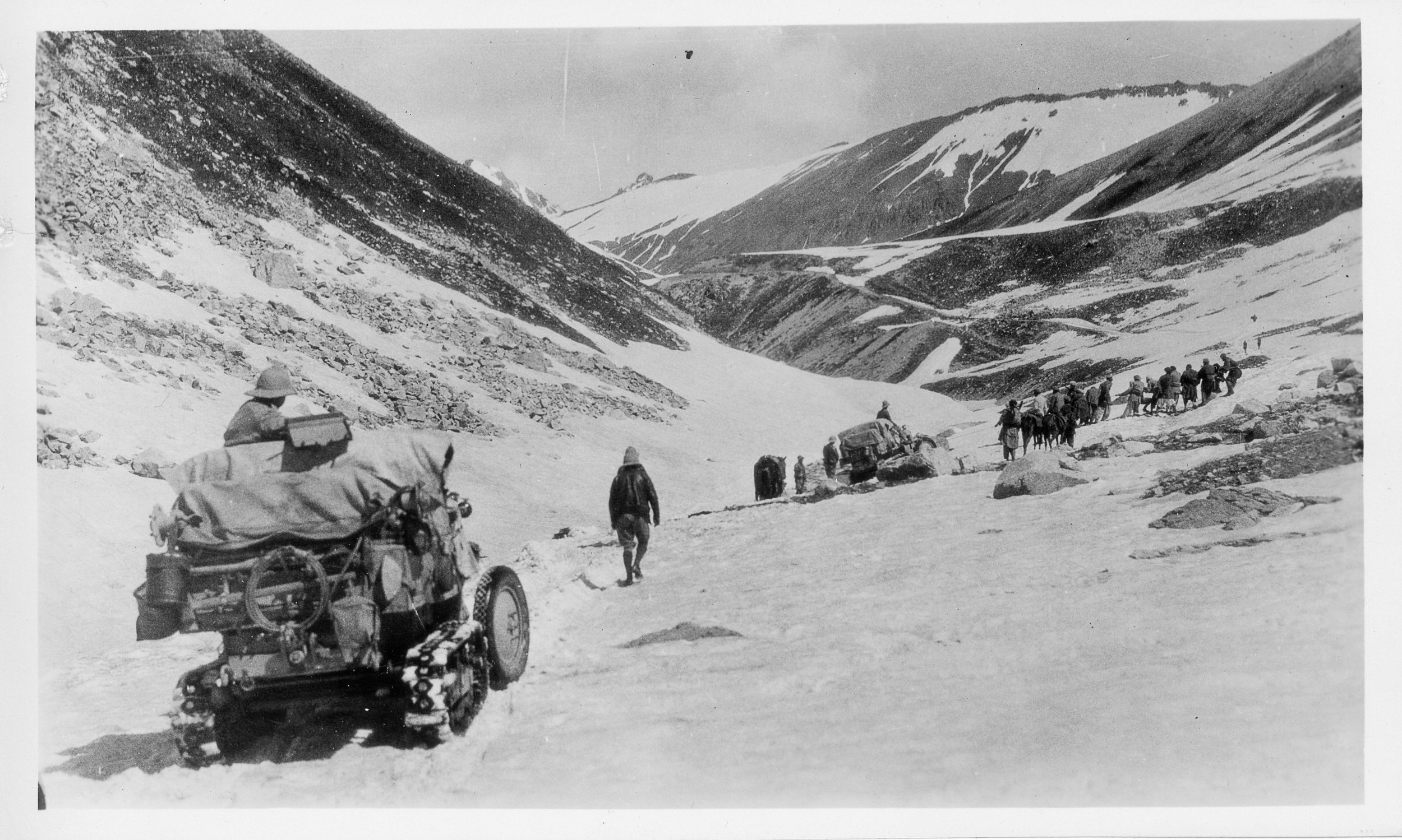
On the way down as well they had to face almost impossible situations and again they had no option but to disassemble the Vehicles and have them carried by the Porters. And they managed to make their way to Astore and then to Gilgit. From Gilgit they made their way to Gojal and to get over the Karakorams they chose the Kilik Pass which was parallel to the Mantaka Pass which was more frequently used but the Kilik Pass was relatively free of Snow and they carried the Vehicles over the Kilik Pass and descended into the Pamirs and were now across the Border of British India and firmly in Chinese Turkestan where they planned to meet up with the other Group which had started from Peking towards Central Asia. Of course the Group which came from Peking faced a lot of Political obstacles rather than the Geographical obstacles faced by what was called the Pamir Group. But that then is another Story.

All said and done it was the Citroen Haardt Expedition which showed that it was possible for Automobiles (with a lot of Human help) to cross this almost unassailable Mountain barrier.

Nowadays however due to the Political situation the Old Silk Route from Srinagar to Gilgit lies abandoned though you can cross the Razdan Pass and get into Gurez. And on the other side of the LoC a Motorable Road now gets you over the Karakorams via the Khunjerab Pass. The Kilik Pass being long forgotten.

Photo Credit : All Photos from the Internet / Citroen Haardt Expedition / Nationa Geographic/ Getty Images.
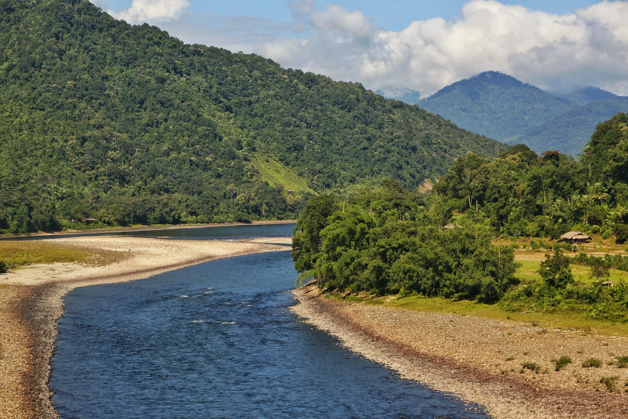
Of Mountains and Rivers
One of the most interesting thing about the Himalayas is how the Rivers interact with the Range and how the River Basins work. Since none of us is taught this in school in the Geography class the way one can study this fascinating aspect is to study Maps. Not the Maps of the new but the old Maps made by the Geological Surveys and the Royal Geographic Society Maps. The kind of detailing in these Maps is amazing when we keep in mind the fact that it was all done by boots on the Ground. No Aerial or Satellite Cartography.

Of the Himalayan Mountains and the Rivers
One of the most interesting thing about the Himalayas is how the Rivers interact with the Range and how the River Basins work. Since none of us is taught this in school in the Geography class the way one can study this fascinating aspect is to study Maps. Not the Maps of the new but the old Maps made by the Geological Surveys and the Royal Geographic Society Maps. The kind of detailing in these Maps is amazing when we keep in mind the fact that it was all done by boots on the Ground. No Aerial or Satellite Cartography.
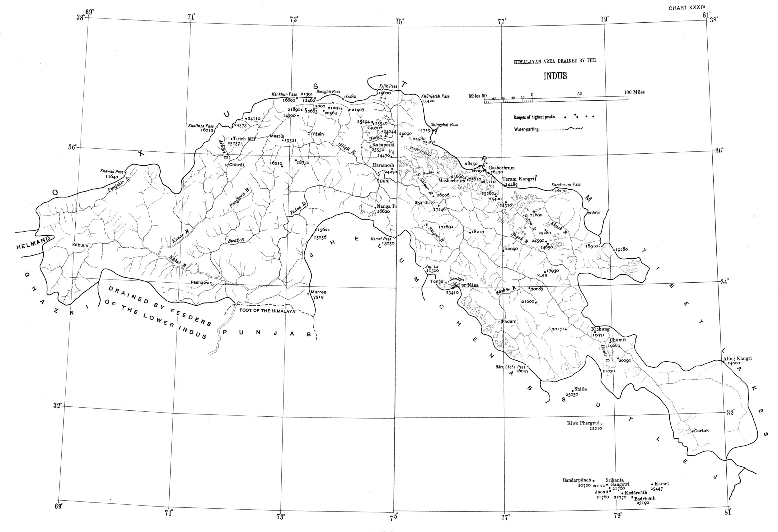
And I finally found a Map which shows the River Basins / the Mountains / the Ridgelines / the Water Partings in a very simple and lucid fashion. Of course there are some explanations required for the un-initiated in the fine art of reading Maps. Not only does it show the Water Basins in the Himalayan context but it also shows the neighbouring River basins and how the Mountains affect the Course of the Rivers. You also need to understand that its this conflict between the Rivers and Mountains which has created the Valleys which has enabled Human communities to inhabit the Mountains.
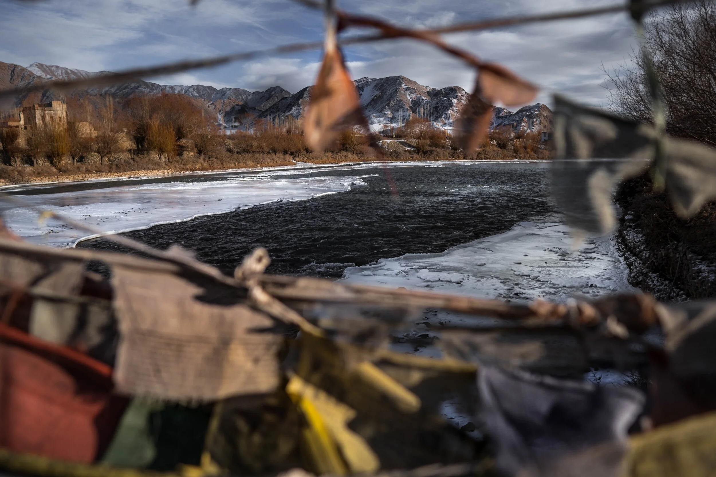
In the Himalayan context the Three main Rivers which drain the Himalayas are the Indus in the West, the Ganges in the Middle and the Brahmaputra in the East. It is common knowledge that the Indus and the Brahmaputra which rise from almost the same vicinity of each other near the Mansarovar Lake in the Tibetan Plateau hem in the Great Himalayan Range from the opposite sides. The Indus forms the boundary on the West as it passes by the Nanga Parbat and the Brahmaputra forms the boundary on the East and it rounds off the Namcha Barwa in the East. The Indus and the Brahmaputra both never breach the Main Himalayan Ridgeline and run alongside but behind the Main Himalayan Ridgeline on the Tibetan Plateau. Both flow along what Geologists call the Indus Tsangpo Suture or divide in simpler terms. I would also like to mention one major River which actually cuts through the main Himalayan Ridge line and forms the Eastern boundary of the Western Himalayas. This would be the Satluj which coincidentally also originates around the same area as the Indus and the Brahmaputra (which is called Tsangpo in Tibet) and follows an independent course cutting through the Himalayas though it finally ends up in the Indus once it reaches the Great Plains of the Punjab.
Beyond the Basins of the Himalayan Rivers we have in the neighbourhood the Tibetan Basin though a part of the Tibetan Plateau is drained by these Himalayan Rivers themselves. Further North the main Ridge line of the Karakorams forms the Water Parting between the Himalayan Rivers (the Indus system) and the Tarim Basin. The Tarim Basin is itself separated from the Tibetan Basin by the Kunlun Mountains. To the West of the Tarim Basin separated by the Pamirs in the South and the Tian Shan in the North is the Central Asian basin of the Oxus and Jaxartes of the old. The names Oxus and Jaxartes were enough in the old times to induce Explorers to go into a frenzy so inaccessible these areas were. However nowadays the Oxus and Jaxartes are better known by their present names, the Amur Darya and the Syr Darya. On the southern Edge the Oxus and Jaxartes Basin is separated from the Himalayan River Basin by the Hindu Kush. Further down the sub Ranges of the Hindu Kush like the Sulaiman Mountains divides the Himalayan River Basin from the Helmand River Basin. This rounds off the Water Partings of the Indus in the Western Himalayas.
If you follow the Indus River in the Map you would see that after the point of origin the Main Waterparting of the Rivers runs behind the Main Himalayan Range rather than along the Main Ridge as classically should be the case. However at the point roughly at where it enters Ladakh from the Tibetan Plateau the River aligns itself with the Main Himalayan Range and continues the same course all the way to the Nanga Parbat where the Great Himalayan Range ends. The Water Parting however moves North towards the Karakorams and even across the Karakorams as seen in zone H. Close to the K2 however the Water Parting again moves along the main Himalayan Ridge line. But then after following the Main Ridge line of the Karakoram to West it again goes beyond the Karakorams as seen in zone C. It continues this trend until its behind the main Ridgeline of the Hindu Kush till at a point beyond the Tirich Mir it again aligns with the Main Ridge line to deviate again to form Zone B all the way to the Helmand Basin.
In pretty much the same way the Water Parting of the Tarim Basin also jumps beyond the Kun Lun, the Pamirs and the Tian Shans at places but it doesn't jump the main Ridge Line of the Karakorams as the reigning Peak of the K2 brings in a semblance of order and the Water Partings follow the K2 in the classical mode (I know this is complicated but once you co-relate with the Map and do some readings it will become more fascinating). Interestingly in the Hindu Kush its the highest Peak of the Hindu Kush the Tirich Mir which forces the Water Parting to run along the main Ridge line just like its supposed to be classically. However a point to be noted is that the Indus never concedes any of its “Mountains” the Western Himalayas or the Karakorams or the Hindu Kush to any River though itself it pushes its Basinal boundaries to well into the Kun Luns, the Pamirs and the Tian Shans though not quite making it to the main Ridge line.
And of course as we all the Mountains are rising and the Rivers are just cutting the Gorges and the Valleys and this state of flux will continue over a period of time till the end of time. And because of this constant change the Water Partings are not as fixed or permanent as we would like to believe. They are also constantly changing and evolving in a Geological time frame. This also shows how the Rivers and the Basind connect these highest Mountains in the World in a closer relationship than we actually believe. The River and the Basins provide the linkages which connect the Himalayas with the Karakorams, the Hindu Kush, the Kun Lun, the Pamirs and the Tian Shans. I collectively like to use the term “Himalayas” when talking about all these Ranges and the Great Himalayan Range when I am referring to the Main Himalaya Range. The highest Range on the Planet.
May we one day get to behold the magnificent sights that these Mountains hold and their mighty Peaks. And may we one day get to drink water from all these Rivers. The transition zones between these Himalayas is probably even today one of the least explored in the World and they continue to hold their Mysteries, occasionally revealing them to us mere Mortals.
Of the Himalayan Mountains and Rivers
The Rivers and the Himalayas and the even the Mountain Ranges beyond it are always interacting in very interesting ways. In this article we see how the River Basins of the Indus, Ganges and Satluj and the Mountains interact and in some cases the River Basins extend beyond the Ranges themselves.

Of the Mountains and the Rivers
One of the most interesting thing about the Himalayas is how the Rivers interact with the Range and how the River Basins work. Since none of us is taught this in school in the Geography class the way one can study this fascinating aspect is to study Maps. Not the Maps of the new but the old Maps made by the Geological Surveys and the Royal Geographic Society Maps. The kind of detailing in these Maps is amazing when we keep in mind the fact that it was all done by boots on the Ground. No Aerial or Satellite Cartography.
And I finally found a Map which shows the River Basins / the Mountains / the Ridgelines / the Water Partings in a very simple and lucid fashion. Of course there are some explanations required for the un-initiated in the fine art of reading Maps. Not only does it show the Water Basins in the Himalayan context but it also shows the neighbouring River basins and how the Mountains affect the Course of the Rivers. You also need to understand that its this conflict between the Rivers and Mountains which has created the Valleys which has enabled Human communities to inhabit the Mountains.
In the Himalayan context the Three main Rivers which drain the Himalayas are the Indus in the West, the Ganges in the Middle and the Brahmaputra in the East. It is common knowledge that the Indus and the Brahmaputra which rise from almost the same vicinity of each other near the Mansarovar Lake in the Tibetan Plateau hem in the Great Himalayan Range from the opposite sides. The Indus forms the boundary on the West as it passes by the Nanga Parbat and the Brahmaputra forms the boundary on the East and it rounds off the Namcha Barwa in the East. The Indus and the Brahmaputra both never breach the Main Himalayan Ridgeline and run alongside but behind the Main Himalayan Ridgeline on the Tibetan Plateau. Both flow along what Geologists call the Indus Tsangpo Suture or divide in simpler terms. I would also like to mention one major River which actually cuts through the main Himalayan Ridge line and forms the Eastern boundary of the Western Himalayas. This would be the Satluj which coincidentally also originates around the same area as the Indus and the Brahmaputra (which is called Tsangpo in Tibet) and follows an independent course cutting through the Himalayas though it finally ends up in the Indus once it reaches the Great Plains of the Punjab.
Beyond the Basins of the Himalayan Rivers we have in the neighbourhood the Tibetan Basin though a part of the Tibetan Plateau is drained by these Himalayan Rivers themselves. Further North the main Ridge line of the Karakorams forms the Water Parting between the Himalayan Rivers (the Indus system) and the Tarim Basin. The Tarim Basin is itself separated from the Tibetan Basin by the Kunlun Mountains. To the West of the Tarim Basin separated by the Pamirs in the South and the Tian Shan in the North is the Central Asian basin of the Oxus and Jaxartes of the old. The names Oxus and Jaxartes were enough in the old times to induce Explorers to go into a frenzy so inaccessible these areas were. However nowadays the Oxus and Jaxartes are better known by their present names, the Amur Darya and the Syr Darya. On the southern Edge the Oxus and Jaxartes Basin is separated from the Himalayan River Basin by the Hindu Kush. Further down the sub Ranges of the Hindu Kush like the Sulaiman Mountains divides the Himalayan River Basin from the Helmand River Basin. This rounds off the Water Partings of the Indus in the Western Himalayas.
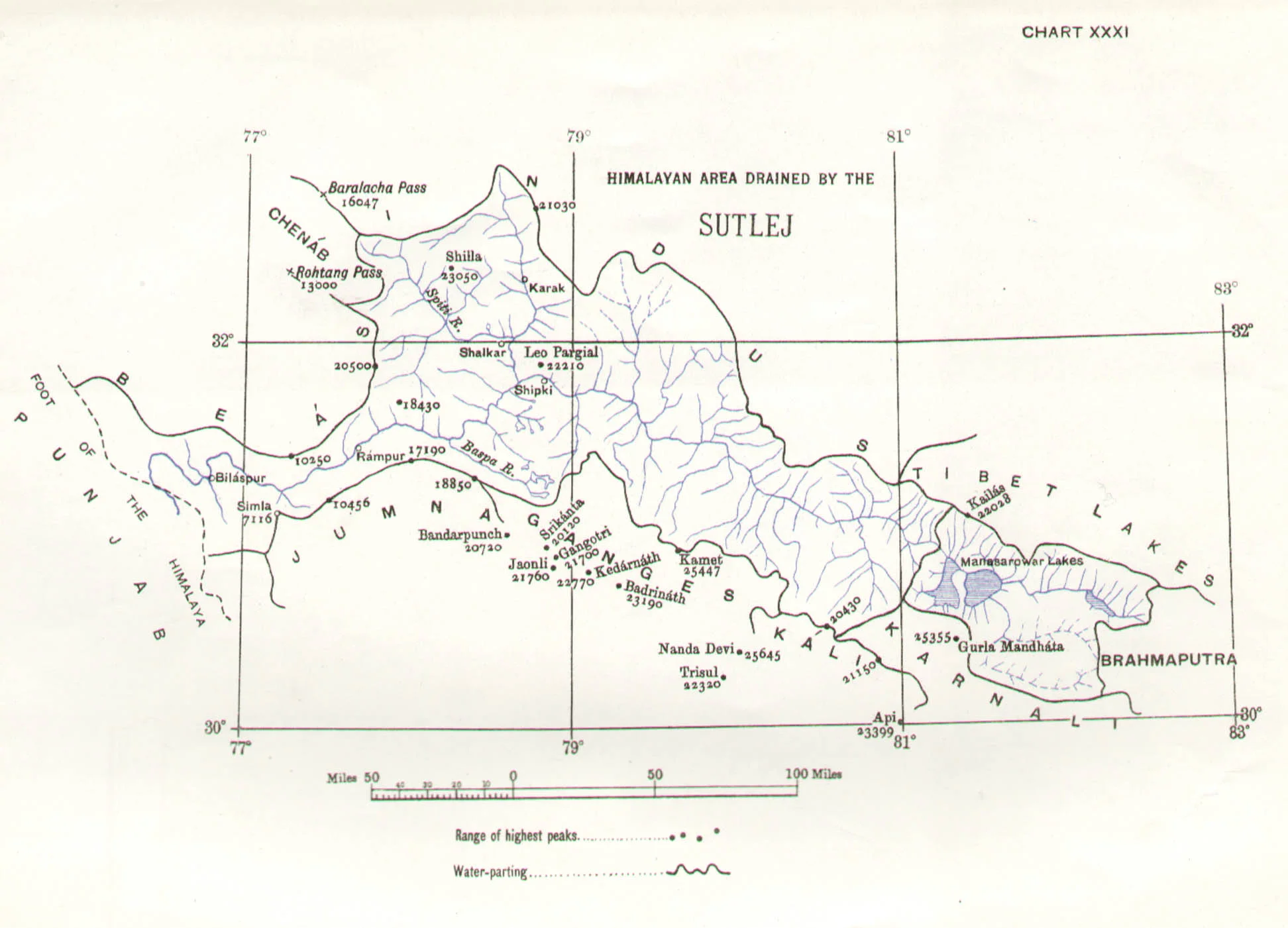
If you follow the Indus River in the Map you would see that after the point of origin the Main Waterparting of the Rivers runs behind the Main Himalayan Range rather than along the Main Ridge as classically should be the case. However at the point roughly at where it enters Ladakh from the Tibetan Plateau the River aligns itself with the Main Himalayan Range and continues the same course all the way to the Nanga Parbat where the Great Himalayan Range ends. The Water Parting however moves North towards the Karakorams and even across the Karakorams as seen in zone H. Close to the K2 however the Water Parting again moves along the main Himalayan Ridge line. But then after following the Main Ridge line of the Karakoram to West it again goes beyond the Karakorams as seen in zone C. It continues this trend until its behind the main Ridgeline of the Hindu Kush till at a point beyond the Tirich Mir it again aligns with the Main Ridge line to deviate again to form Zone B all the way to the Helmand Basin.
In pretty much the same way the Water Parting of the Tarim Basin also jumps beyond the Kun Lun, the Pamirs and the Tian Shans at places but it doesn't jump the main Ridge Line of the Karakorams as the reigning Peak of the K2 brings in a semblance of order and the Water Partings follow the K2 in the classical mode (I know this is complicated but once you co-relate with the Map and do some readings it will become more fascinating). Interestingly in the Hindu Kush its the highest Peak of the Hindu Kush the Tirich Mir which forces the Water Parting to run along the main Ridge line just like its supposed to be classically. However a point to be noted is that the Indus never concedes any of its “Mountains” the Western Himalayas or the Karakorams or the Hindu Kush to any River though itself it pushes its Basinal boundaries to well into the Kun Luns, the Pamirs and the Tian Shans though not quite making it to the main Ridge line.
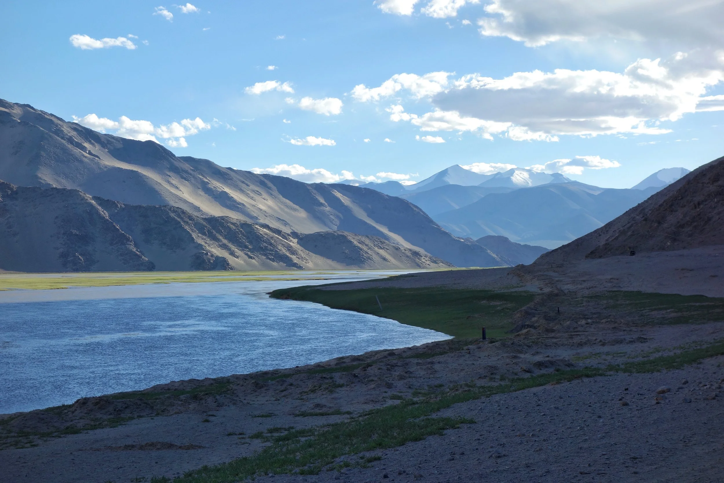
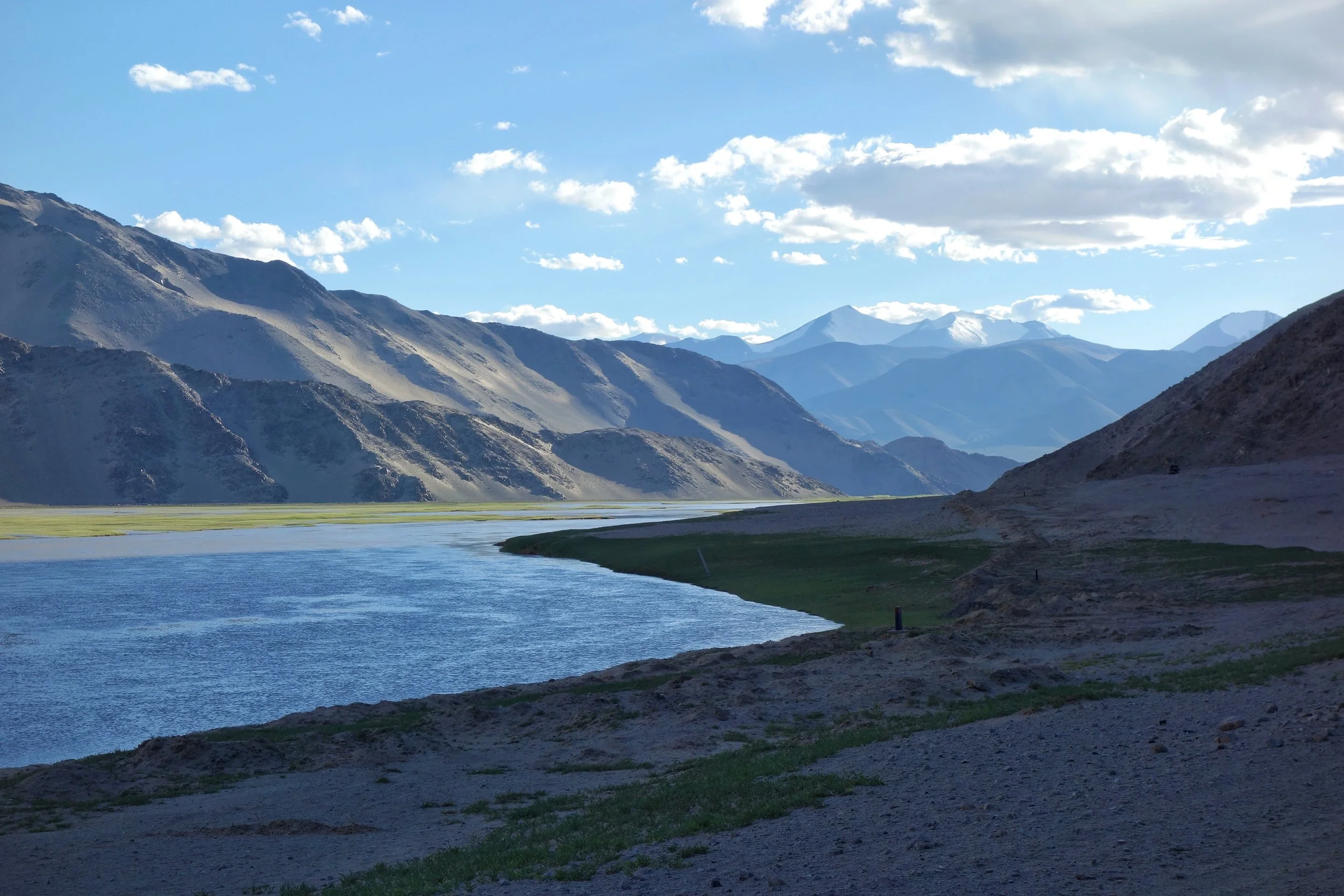
The Indus after it enters Ladakh from Tibet on the Chnagthang
And of course as we all the Mountains are rising and the Rivers are just cutting the Gorges and the Valleys and this state of flux will continue over a period of time till the end of time. And because of this constant change the Water Partings are not as fixed or permanent as we would like to believe. They are also constantly changing and evolving in a Geological time frame. This also shows how the Rivers and the Basind connect these highest Mountains in the World in a closer relationship than we actually believe. The River and the Basins provide the linkages which connect the Himalayas with the Karakorams, the Hindu Kush, the Kun Lun, the Pamirs and the Tian Shans. I collectively like to use the term “Himalayas” when talking about all these Ranges and the Great Himalayan Range when I am referring to the Main Himalaya Range. The highest Range on the Planet.
May we one day get to behold the magnificent sights that these Mountains hold and their mighty Peaks. And may we one day get to drink water from all these Rivers. The transition zones between these Himalayas is probably even today one of the most least explored in the World and they continue to hold their Mysteries, occasionally revealing them to us mere Mortals.
The Exploration of the Siachen or Rose Glacier
The Story of the Exploration of the Siachen Glacier. This Glacier, now said to be the highest Battlefield in the World, was first Explored and Mapped by a team led by a Lady Fanny Bullock. This is her Story as well as Guide to explaining the Siachen Glacier with its main features and Glaciers around it.

The Siachen Map
The Exploration of the Siachen or Rose Glacier
The Siachen Glacier. It must be the most talked about Glacier in the Himalayan Karakoram region. A Glacier that has got famous for reasons that are just Political and I would steer clear of that. But there was a time before Partition when it was just another wonder in the Wilderness of the Himalayan Karakoram Mountains. One of the largest Glaciers outside the Polar Regions and for the early Explorers it was hard to believe that such massive Glaciers could exist anywhere outside the Polar Regions.

Ms.Fanny Bullock (Pic Courtesy Wikipedia)
The credit for the initial Exploration and Mapping goes to a Lady Fanny Bullock and her husband William Hunter Workman. They were actually a rich couple who liked to Tour the World and once they happened to come to India for a Cycling Tour. It was then that they got introduced to the Himalayas and it proved to be a life-long affair. The couple made 8 trips thereafter climbing and exploring the Himalayan and the Karakoram Mountains. They made many notable explorations during these Trips and during one of these Trips Ms.Fanny Bullock also managed to climb the Pinnacle Peak during their explorations of the Nun Kun Massif. The Pinnacle Peak is a side Peak to these Twin Peaks and at 6930 m it was a world record for a Lady at that time. It should be mentioned that being rich, they could afford Italian Porters and Guides though they also took local support.

Ms.Fanny Bullock atop Pinnacle with a Poster calling for Woman to be allowed to Vote (Pic Courtesy Wikipedia)
However they seemed to have an issue with the local Porters and many of their Travelogues were full of complaints against the local Porters and their behavior. I assume that it was a Cultural thing more than anything else. Born is a rich aristocratic American family which then moved to Europe she was far removed from the hardships of the people in the Mountains and it seems that the Lady got on very well with the Mountains but never did get along with the people who inhabited the same Mountains. Many people also accused the couple of exaggerating their actual accomplishments and always longing to be in the limelight. And their Maps were far from accurate. But all said and done they explored some of the least and even never ventured into areas especially in the Karakorams and this included many forays onto the many large Glaciers that the Range held.
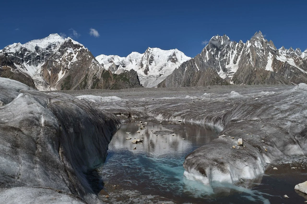
The Biafo Glacier (Pic Courtesy Wikipedia)
These Glaciers included the first attempt at the Biafo Glacier in 1899, an attempt they had to give up due to the Weather and the Crevasses so they moved onto exploring the Skara La Glacier instead. In 1902 they returned for the exploration of the Chogo Lungma Glacier. In 1907 they came to Kashmir and carried out the first exploration of the Nun Kun Massif. It was during this Exploration that at the age of 47, Fanny Bullock summited the Pinnacle Peak at 6930 m. Interestingly two years later a Lady competitor of hers claimed to have climbed a Peak in the Andes that stood at 7000m. But our Lady didn't believe her and actually paid an amount of USD 13000 to a Group of French Mountaineers to actually climb that Mountain in Andes and get the actual height. It turned out to be 6768 m. Fanny Bullock kept this Record to herself for a couple of decades.
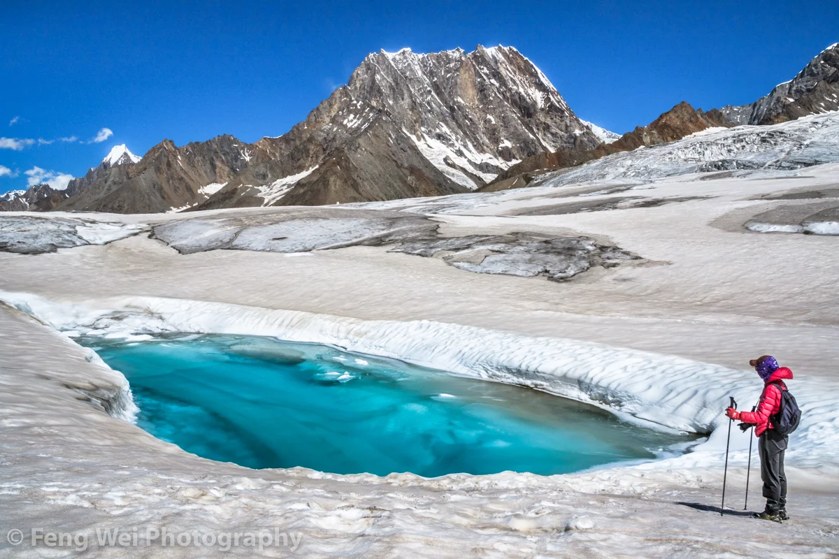
The Hispar Glacier (Courtesy Feng Wei Photography)
In 1908 the Lady with husband in tow arrived once again to explore the Hispar Glacier and even traversed across it and went to the Biafo Glacier setting another Record for ladies. They explored a number of side Glaciers and Peaks. In 1911 - 12 they finally decided to go and explore the biggest Glacier of them all. The Rose Glacier or the Siachen Glacier as we know it now. And they explored the Glacier and its sides for the two month period they spent there. It was a commendable piece of Exploration and as per all accounts this Exploration was led by Fanny Bullock herself. This was considered to be there greatest accomplishment and it also happened to be the last time in the Himalayan Karakoram Region due to the outbreak of the First World War.

A Wild Rose locally called a Sia (Pic Courtesy Wikipedia)
In her Book written after this Expedition, Two Summers in the Ice-Wilds of Eastern Karakoram , Fanny Workman writes : “The object of placing my full name in connection with the [Siachen Glacier] expedition ... is not because I wish in any way to thrust myself forward, but solely that in the accomplishments of women, now and in the future, it should be known to them and stated in print that a woman was the initiator and special leader of this expedition. When, later, woman occupies her acknowledged position as an individual worker in all fields, as well as those of exploration, no such emphasis of her work will be needed; but that day has not fully arrived, and at present it behooves women, for the benefit of their sex, to put what they do, at least, on record.”
And sharing the Map that was made by, as it came to be known as, the Fanny Bullock Workman Expedition of 1912 of the Siachen or Rose Glacier ( I am sure most of you are aware of the fact that the wod “Sia” in the local language stands for Wild Rose”). A very interesting Map indeed though not exactly accurate but still a great feat of Exploration, Mountaineering and Cartography.

The Indira Col and Turkestan La (Courtesy Josh Jagran)
Of course this is a Map which I love as to me its a work of art which has been worked hard at. And I have marked some important Passes which were used to access this Glacier (not that many people accessed this Glacier but these Passes were the ones used). The first one is of course the famous Indira Col at 18911 ft (The Workman Map wrongly describes it as 20880 ft) which is marked as Indira Col or Pass in the Map. No it isnt named after Indira Gandhi. It was named probably by the makers of this Map themselves as they gave names to all the features they saw as un-named in the Maps of their time that they were carrying (These Maps are described on the Map itself). They gave some features English names and some they gave Hindi names. Like the Indira Col (Named after Lord Indira) and Mt.Lakhsmi (self-explanatory) and they called a Group of Peaks as the “Apasaras”. Also itr signifies that the Indira Col was never used by the locals and hence never given a name. Its just too tough for anyone but a trained person.

The Kondus Glacier (Pic Courtesy the Amercan Alpine Journal)
Then there is the Bilafond La (No.2) at also known as the Saltoro Pass at 17881 ft on the Saltoro Ridge (The Workman Map puts the height at 18370 ft) . The name apparently comes from the Balti word for “Butterfly” or the Pass of the Butterflies. This was apparently one of the Passes that were used on the Silk Route which connected Ladakh and Baltistan with Central Asia. And then there is the Turkestan La (No. 3) said to be 19209 ft as per the Workman Map. This was probably another Pass into Turkestan as the area beyond the Karakorams referred to as. Not very significant anymore.

Dogs somewhere on the Siachen Glacier (Courtesy Wikipedia)
And then there is the Sia La (No.4) (The word Sia again derived from the local word for the Wild Roses that grew in the area). It stand at 18337 ft (The Workman Map puts the height as 18705 ft) on the main Saltoro Ridge. Further down is the Gyong La Pass which is not marked in the Map.
And then the Map also shows numerous side Glaciers and big Glaciers in the neighbourhood of the main Siachen Glacier. Like from below or the West the Kondus / Kaberi Glacier, the Bilaphond and Lolophond Glaciers, the Sher-Pi-Gang Glacier and the Peak 36 Glacier. Above or on the East (left side) of the Siachen are the Urdok Glacier and the Tarim Shehr Glacier.

Jammu and Kashmir dispute Map by the UN.
Of course we are all well aware of the situation on the Glacier and I would like to point out that all the Passes mentioned above are well in control of the Indian Army and they control the access to the Glacier. So in actual Geographic terms India controls the Siachen Glacier. And all the area running North of the point NJ 9842. But thats about all I can say about that.
High Altitude Gear from the Hall of Fame in Leh
The Hall of Fame Museum near Leh in Ladakh has a section dedicated to the Equipment used by High Altitude Mountaineers generally and the Indian Army specifically while guarding the high frontiers in the Himalayas and the Karakorams. We have a look at some of the great Gear on display.

High Altitude Gear from the Hall of Fame in Leh
The Hall of Fame Museum near Leh in Ladakh has a section dedicated to the Equipment used by High Altitude Mountaineers generally and the Indian Army specifically while guarding the high frontiers in the Himalayas and the Karakorams. We have a look at some of the great Gear on display. The same Equipment is sued by the Indian Army deployed at the frozen heights of the Siachen Glacier in Northern Ladakh.

A high end Dome tent for two people.

Palletised loads. These are air dropped to various locations at places where access is difficult.

A Sled and a De-compression Bag

A low temperature high Altitude all Weather suit. along with different climbing aids displayed on the Wall.

Different Mountaineering Gear I

Different Mountaineering Gear II

A Snowmobile

A Dome Tent

A Siachen Soldier’s full Gear

Knots. different types of Knots
The Muztagh
People who read Books about old explorations in the Western Himalayas and Karakoram and the Hindu Kush come across a term quite often “Muztagh”. The first time I read this name, and though I was unaware of the meaning I knew it was a strong word. For a long time Muztagh was the name given to the almost impenetrable wall of Mountains which separate Kashmir from Central Asia. An of course with everything in Central Asia the word has Turkic origins.
The Muztagh
People who read Books about old explorations in the Western Himalayas and Karakoram and the Hindu Kush come across a term quite often “Muztagh”. The first time I read this name, and though I was unaware of the meaning I knew it was a strong word. For a long time Muztagh was the name given to the almost impenetrable wall of Mountains which separate Kashmir from Central Asia. An of course with everything in Central Asia the word has Turkic origins.
Muztagh is made up of two words : Muz/ Buz which means Ice and Tagh/Dagh which means Mountain. So it means Ice Mountain which is similar to the word Himalayas which gets its from Sanskrit words Him meaning Snow and Alaya which means home. To the Ancients in India any Mountain which was permanently Snow covered was a Himalaya and in the same way the word Muztagh was the term used by the Turkic people to describe any Mountain that was permanently covered with Snow. Simple implication is that Snow covered Mountains always had a certain degree of reverential awe attached to them and it is no wonder that in may beliefs the Mountains were supposed to be the place the Gods resided.
The Karakoram was for the longest time referred to as Muztagh. The Karakorams because of their perpendicularity are the most impenetrable Mountain Ranges in the World and the people never went into them and there is simply no inhabitation. That's why it took Westerners to actually figure out that K2 was the second highest Mountain in the World. To the locals (as in the people living closest to the K2) it was simply a Muztagh out of many Muztaghs. And to them any Mountain in any direction was simply a Muztagh. They didn't really care if it was the Karakorams, the Himalayas, the Hindu Kush or the Pamirs. And this is unlike say in Nepal where the Everest was known as the Sagarmatha or “The Goddess of the Sky’ and the Tibetans called it the Chomolungma or the Holy Mother.
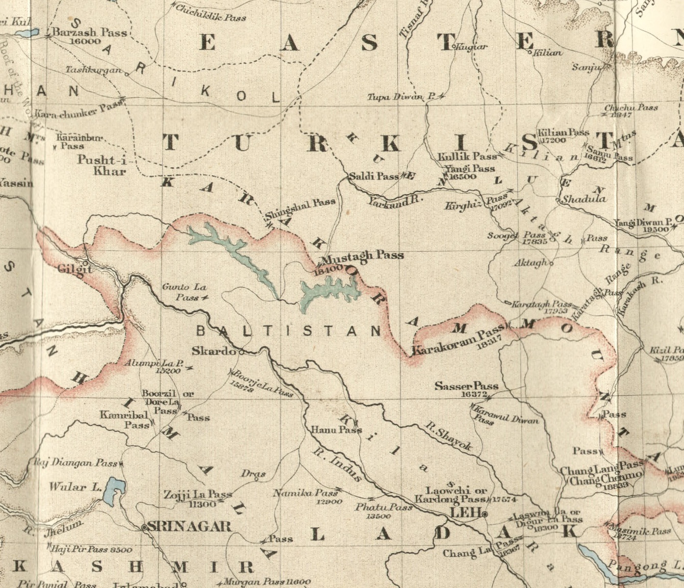
And as of today the term Muztagh is still in use for some Mighty Peaks in the Karakorams, in the Pamirs and even on the Northern edge of the Tibetan Plateau near Mongolia. And it was also the name of a very famous Pass which connected Baltistan with Central Asia made famous by Francis Younghusband who came down from Central Asia into Baltistan via the Mustagh Pass. Infact Younghusband identified two Passes as the Muztagh pass. One was the Old Muztagh Pass and the other was the New Muztagh Pass. Both Passes were well over 5000 m and were on the watershed between the Tarim Basin to the North and the Indus Basin to the South. The Muztagh Pass was the shortest Route between Skardu and Yarkand and by extension the shortest Route between Kashmir / Punjab bypassing Ladakh and into Central Asia and was a part of the Silk Route in those days. The Pass had gradually been abandoned as it became treacherous to cross due to Glacial movements.

By Jialiang Gao www.peace-on-earth.org - Own work, CC BY-SA 3.0, https://commons.wikimedia.org/w/index.php?curid=2626699
And now coming to the Mighty mountains that carry the Muztagh name. The mightiest is of them all and one of my favourite Mountains is the Muztagh Ata. Not only is it a “Muztagh” but its an “Ata”. Ata is the Turkic word for Father/ Ancestor. So Muztagh Ata means the Ice Mountain Father. At 7509 m it is one of the highest Peaks in Central Asia and though regarded as a part of the Kun Lun Range by some it is considered a part of the “Eastern Pamirs” by most. Whatever Range its classified in it is a majestic Mountain and said to be one of the few 7000+ m Peaks which is considered easier to climb than most other Peaks of that classification. And as per one scholar the Rig Veda also mentions a Mountain called Mujavant from where the best Soma came from and he is certain that the Mountain in question is none other than the Muztagh Ata. Interesting to say the least.

The Muztagh Tower : By Kogo (talk · contribs) - Own work by the original uploader, GFDL, https://commons.wikimedia.org/w/index.php?curid=35803
Now we come to another interesting Mountain called the Muztagh Tower which is in the Baltoro Range of the Karakorams. This Tower shaped Mountain was first immortalized on film by none other than Vittoria Sella who took a picture of this impressive Peak. At 7276 m it just great justice to its status as a Muztagh. Infact the pic of the Muztagh Tower was used in some Book where it was titled simply as the “Last Citadel” and it is almost one. The “Last Citadel” was climbed in 1956 when Sella’s pic set off a race between two separate teams of Mountaineers.
And the most isolated Muztagh. The “Great” Muztagh or the Ulugh Muztagh. The word Ulugh in Turkic stands for “Great”. This is an extremely remote Group of Mountains at the North of the Tibetan Plateau and its lies on the Northern front of the Kun Lun Mountains. For a long time the elevation of this Mountain was said to be 7700m plus but in 1985 using modern equipment the height was measured to be 6973 m but didnt do anything to take from the Ulugh part. It still is unclimbed and it is said that many Expeditions have even failed to reach the base of the Mountain due to its remoteness and due to the fact that driving to the Mountain involves going through terrain of between 4000 m to 5000 m. And it is a beautiful Mountain. Doing great justice to the Muztagh part as well.

The Ulugh Muztagh
And lastly even today the Karakorams are sometimes referred to as the Karakoram Muztagh or even Muztagh. Infact Eric Shipton mentions that once upon a time there were certain Scholars who wanted the Karakorams to be re-named as the Muztagh. But that didnt really happen but even today the sub Ranges of the Karakoram carry the Muztagh title. Some of these Muztagh sub Ranges of the Karakorams is as under
Baltoro Muztagh
Batura Muztagh
Hispar Muztagh
Panmah Muztagh
Rimo Muztagh
Sasser Muztagh
Siachen Muztagh
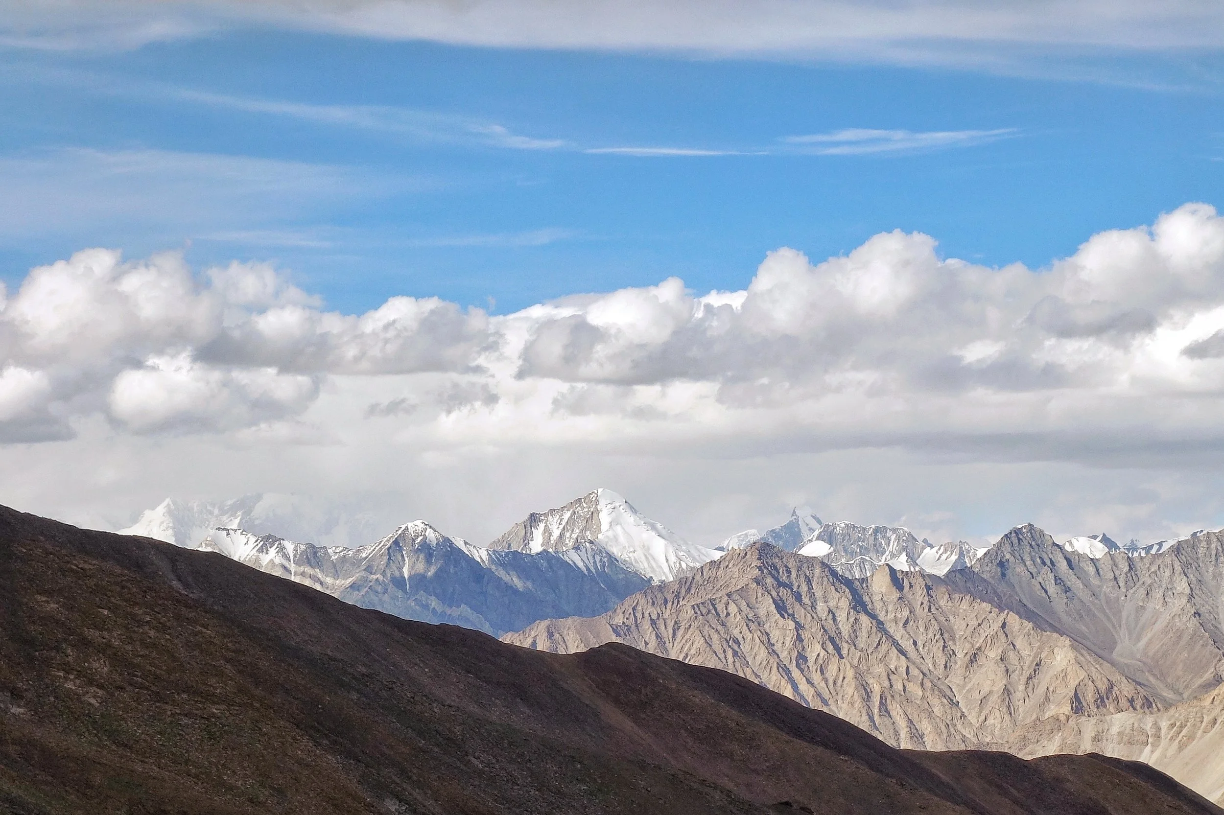
And leaving you with a pic of the Sasser Muztagh (also known as Saser Kangri as Kangri is the Tibetan word for a Mountain) as seen from the Khardung La. At 7672 m it does great justice to its title as a Muztagh. And once you are done with with your selfies at the superlative sign boards at the top take a look North. And when you spot the Saser Muztagh just bow down. A little. You just saw a Muztagh.
Pic from August 2018. The Saser Muztagh/ Kangri, Khardung La, Ladakh
The Junction of the Three Mightiest Mountain Ranges
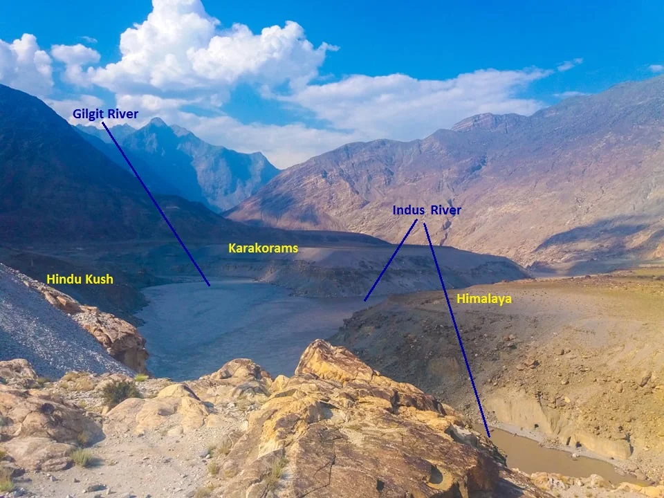
Jaglot near Gilgit is the point where the Three Mightiest Mountain Ranges of the world the Himalayas, the Karakorams and the Hindu Kush meet at the confluence of the Gilgit River with the Indus River

The Point where the Himalayas, the Karakorams and the Hindu Kush meet. At the confluemce of the Gilgit and the Indus Rivers.
The Place where the Himalayas, the Karakorams and the Hindu Kush Meet
Have you heard of Jaglot ?
It's a small little nondescript Village around 40 kms from Gilgit town which would have remained as such if not for a Geographical feature that the place holds. This point is located where the mighty Indus meets the Gilgit River in Gilgit Baltistan as the region is now called. This place is considered the meeting of the three mightiest Mountain Ranges in the World, the Himalaya which is home to 9 of the 10 highest Peaks in the World including the highest one Mt. Everest, the jagged Karakorams which is home to the K2 and the third one coming from the North West, the Hindu Kush which is come to the Tirich Mir which at 7708m is the highest Peak outside of the Himalayas-Karakoram Mountain System.
One of the oft asked questions is that is the Karakoram a sub Range of the Himalayas ? The answer is both no and yes and it depends on how you want to answer. They are in pure scientific terms different Ranges but a part of the same Mountain Complex that are referred to as the Great Himalayas.
The point of convergence of the three Highest Ranges in the World !
Technically both are different Ranges as they were formed at different stages of one cataclysmic Event namely the collision/ subduction of the Indian Plate under the Eurasian Plate. Both follow their own separate Thrust lines and to really understand it you really need to get into Plate tectonics and understand stuff as I present to you below. This is taken from A Tectonic framework of the Himalaya, Karakoram and Tibet, and Problems of their Evolution by B F Windley :
“The Himalaya, the Karakoram and Tibet were assembled by the successive accretion to Asia of continental and arc terranes during the Mesozoic and early Tertiary. The Jinsha and Banggong Sutures in Tibet join continental terranes separated from Gondwana. Ophiolites were obducted onto the shelf of southern Tibet in the Jurassic before the formation of the Banggong Suture. The Kohistan--Ladakh Terrane contains an island arc that was accreted in the late Cretaceous on the Shyok Suture and consequently evolved into an Andean-type batholith. Further east this Trans-Himalayan batholith developed on the southern active margin of Tibet without the prior development of an island arc. Ophiolites were obducted onto the shelf of India in the late Cretaceous to Lower Palaeocene before the closing of Tethys and the formation of the Indus--Yarlung Zangbo Suture at about 50 Ma. Post-collisional northward indentation of India at ca. 5 cm a-1 since the Eocene has redeformed this accreted terrane collage; palaeomagnetic evidence suggests this indentation has given rise to some 2000 km of intracontinental shortening. Expressions of this shortening are the uplift of mid-crustal gneisses in the Karakoram on a late-Tertiary breakback thrust, folding of Palaeogene redbeds in Tibet, south-directed thrust imbrication of the foreland and shelf of the Indian Plate, north-directed back-thrusts along the Indus Suture Zone, post-Miocene spreading and uplift of thickened Tibet, giving rise to N--S extensional faults, and strike-slip faults, which allowed eastward escape of Tibetan fault blocks.”

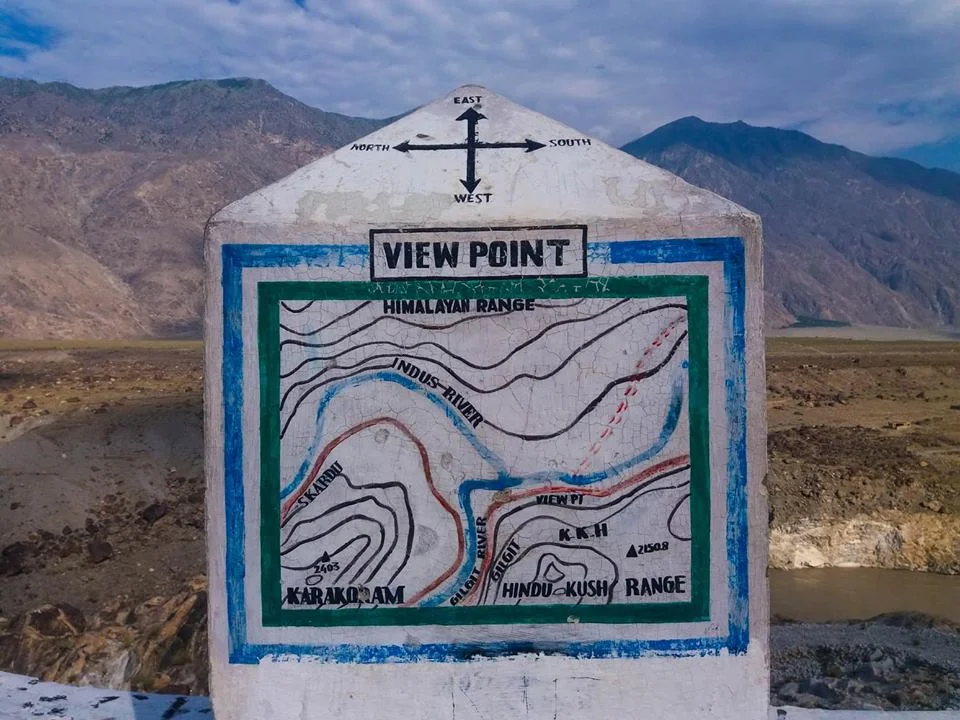
The Public Viewing Point.
Now coming back to more simpler stuff as in Geographical terms the Karakorams are separated from the Himalayas by the Indus in its Upper Course. However in Ladakh the division is taken as the Shyok instead of the Indus. So when you are in Nubra Valley the Mountains on the other side of Shyok River as the Karakorams and this side as the Himalayas. However some people stick to the classical Indus division and by that norm the Ladakh Range would be part of the Karakorams and not the Himalayas. By the same definition Leh would be in the Karakorams and not the Himalayas.
However this ambiguity disappears once the Shyok River merges with the Indus at a place called Keris near the town of Skardu. The Nubra river also joins the Shyok in Nubra Valley and the River widens significantly. The fact that both these Rivers do a complete turnaround of 180 degrees from their original sources indicates the presence of fault lines.
The Hindu Kush on the other hand is separated from the Karakorams by the Gilgit River. The Gilgit rises somewhere between the mountain vastness of the Hindu Kush and the Karakorams. And it passes through Gilgit Town and eventually the joins the Indus at Jaglot. This is where eventually these three mighty Ranges meet. Of all the places that I would want to visit one day this would definitely be on the top.
If the ancients would have been able understand the significance of this location (which we do now due to years of research aided by modern scientific equipment) they would have built some great structures over here I would imagine. However there are still local legends about this place ie where the Indus meets the Gilgit (the legend has no relation to the meeting of the Three Great Ranges). As per the legend Fairies and other such creatures come to have a bath here at midnight or something on that lines.
So do note the name down. I'm sure you would like to go there.
Vittorio Sella's Himalayan and Karakoram Classics
Vittorio Sella was an Italian photographer and mountaineer, who took photographs of mountains which are regarded as some of the finest ever made. He did extensive Photography in the Himalayas and the Karakorams.

Vittorio Sella's Himalayan and Karakoram Classics
Vittorio Sella (28 August 1859 – 12 August 1943) was an Italian photographer and mountaineer, who took photographs of mountains which are regarded as some of the finest ever made.
Sella was born in Biella in the foothills of the Alps and acquired his interest in Alpinism from his uncle, Quintino Sella. He made a number of significant climbs in the Alps, including the first winter ascents of the Matterhorn and Monte Rosa,[3] and the first winter traverse of Mont Blanc.[4] He took part in several expeditions further afield, including three to the Caucasus (where a peak now bears his name),[5] to Mount Saint Elias in Alaska, to the Rwenzori in Africa, and the 1909 expedition to K2 and the Karakoram. The latter three expeditions were in the company of Luigi Amedeo, Duke of the Abruzzi. Sella continued to climb into his old age, and made his last attempt on the Matterhorn at seventy six. The attempt failed when one of his guides was injured in an accident.[4]
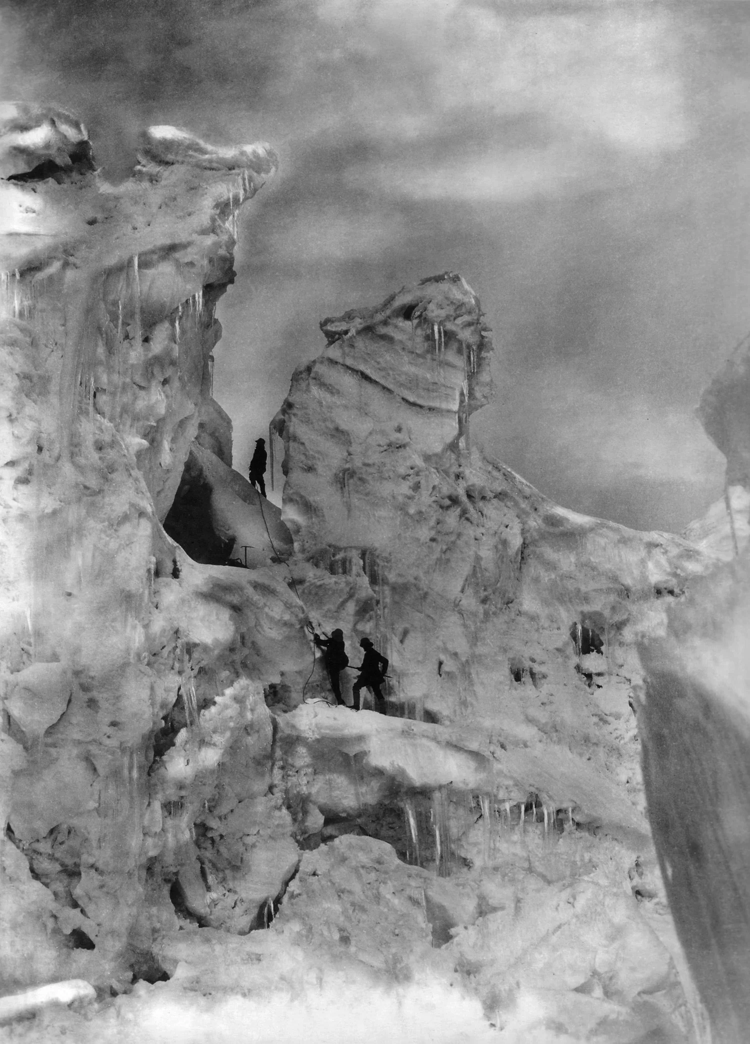
The Duke of Abruzzi on the Chogolisa
The high quality of Sella's photography was in part due to his use of 30×40 cm photographic plates, in spite of the difficulty of carrying bulky and fragile equipment into remote places. He had to invent equipment, including modified pack saddles and rucksacks, to allow these particularly large glass plates to be transported safely.[6] His photographs were widely published and exhibited, and highly praised; Ansel Adams, who saw thirty-one that Sella had presented to the US Sierra Club, said they inspired "a definitely religious awe".[7] Many of the photographs he took were of mountains which had not been previously recorded and so have historical as well as artistic significance; for example by recording the retreat of glaciers in the Rwenzori mountains in Central Africa.[8]

The Baltoro Glacier from Urdokas
Sella died in Biella in 1943. His collection of photographs is now managed by the Sella Foundation (Fondazione Sella) in Biella.[8] Some pictures of Sella are exhibited in the Museo Nazionale della Montagna "Duca degli Abruzzi" in Turin.

The Gasherbrum

The K2

The K2

The Kanchenjunga

The Kanchenjunga
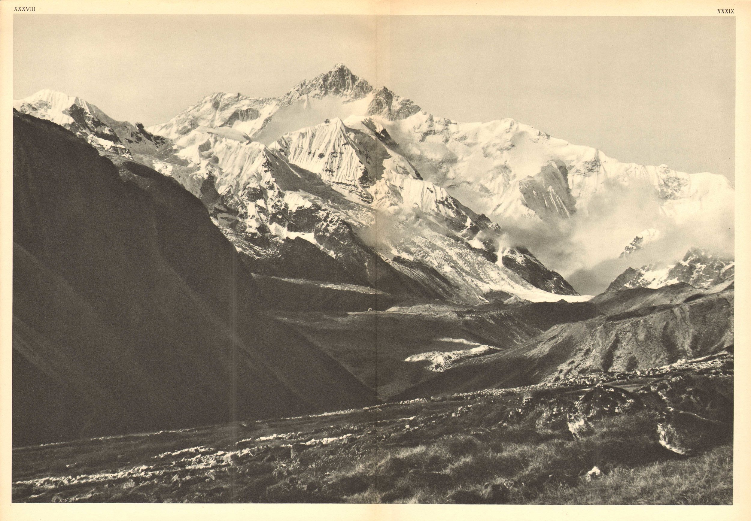
The Kanchenjunga
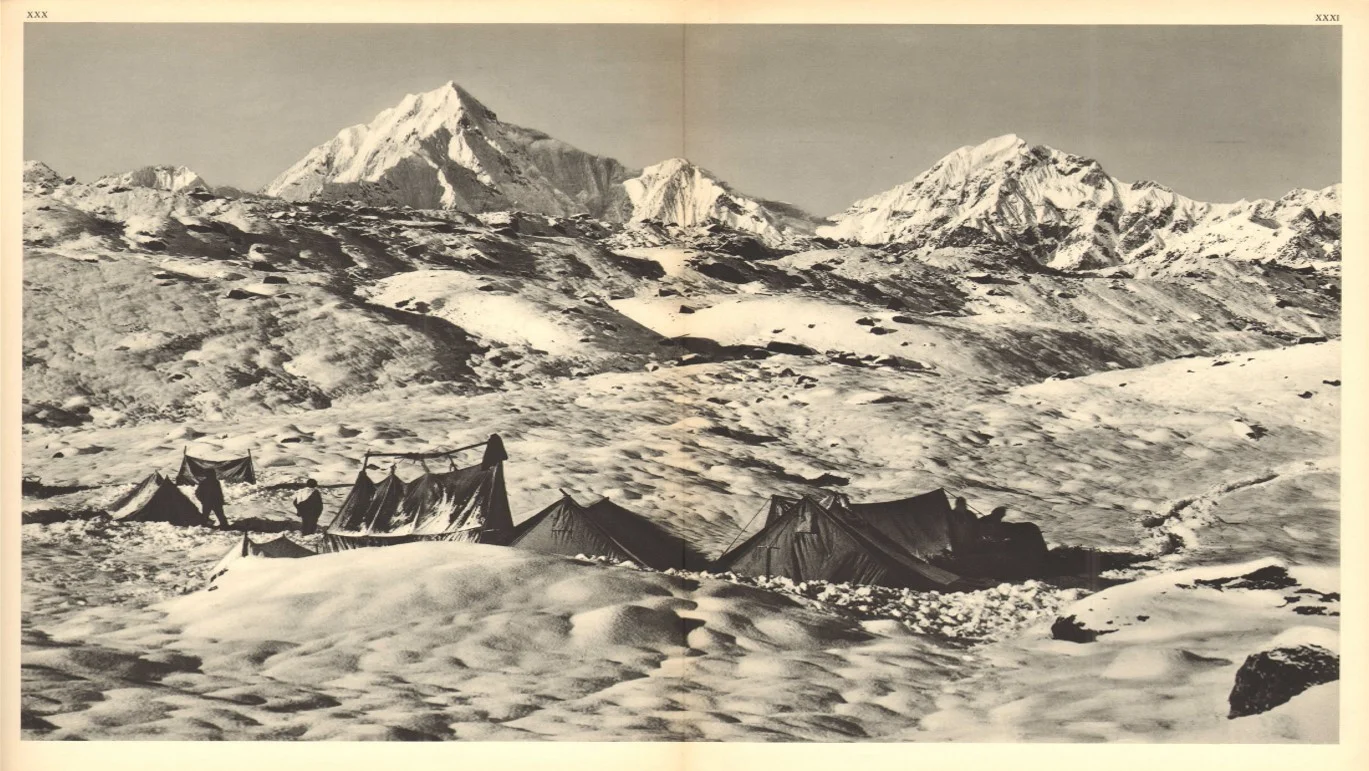
The Kanchenjunga
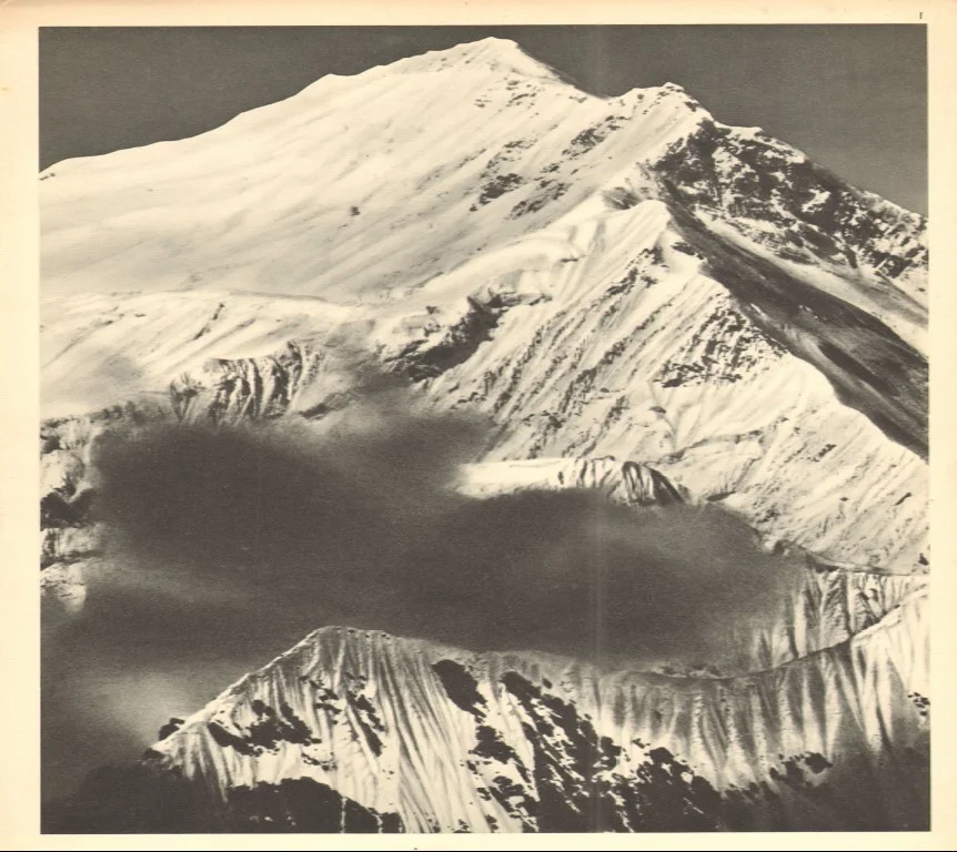
The Everest

The Muztagh Tower

The Muztagh Tower

The Nanga Parbat

The Nanga Parbat

The Wedge Peak
The Karakorams in India
The Karakorams are the most vertical of all the Mountain Ranges in the World. A large part of the Karakoram falls within India but most people are unaware of it. We explain.

The Karakorams as seen from a flight coming into land at Leh.
The Karakorams in India
The Karakoram, with its named derived from the Turkic word "Kara' meaning Black and "Koram" meaning Gravel. These impenetrable Mountains were seen as citadels and Towers of black gravel by the Central Asians and hence the name. They were also referred to as the Muztagh which meant Ice Mountain by the Western Explorers as well. The term Muztagh is now used to denote the sub Ranges of the Karakorams. As per some historians they were referred to as the “Krishnagiris” in the Puranas.
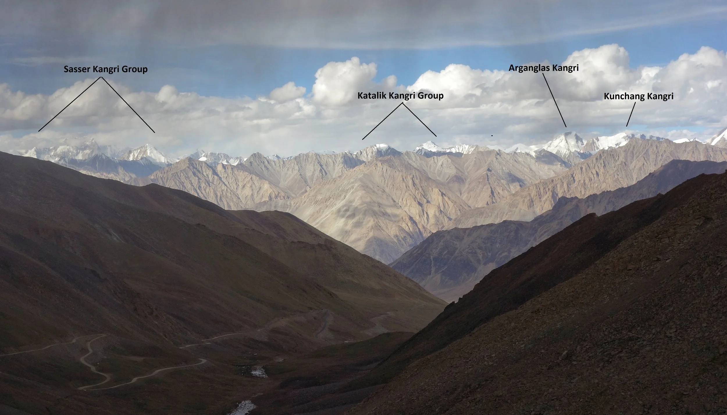
The Sasser Kangri Group and other Peaks of the Karakorams as seen from the Khardung La (Pass)
The Karakorams extend right from the Aksai Chin in the East to the Wakhan Corridor in the West and has other great Mountain Ranges like the Himalayas, the Hindu Kush, the Pamirs and the Kun Lun as its neighbors. It runs app. 550 kms from East to West starting at the Saser Muztagh in the East to the Batura Muztagh in the Hunza District.
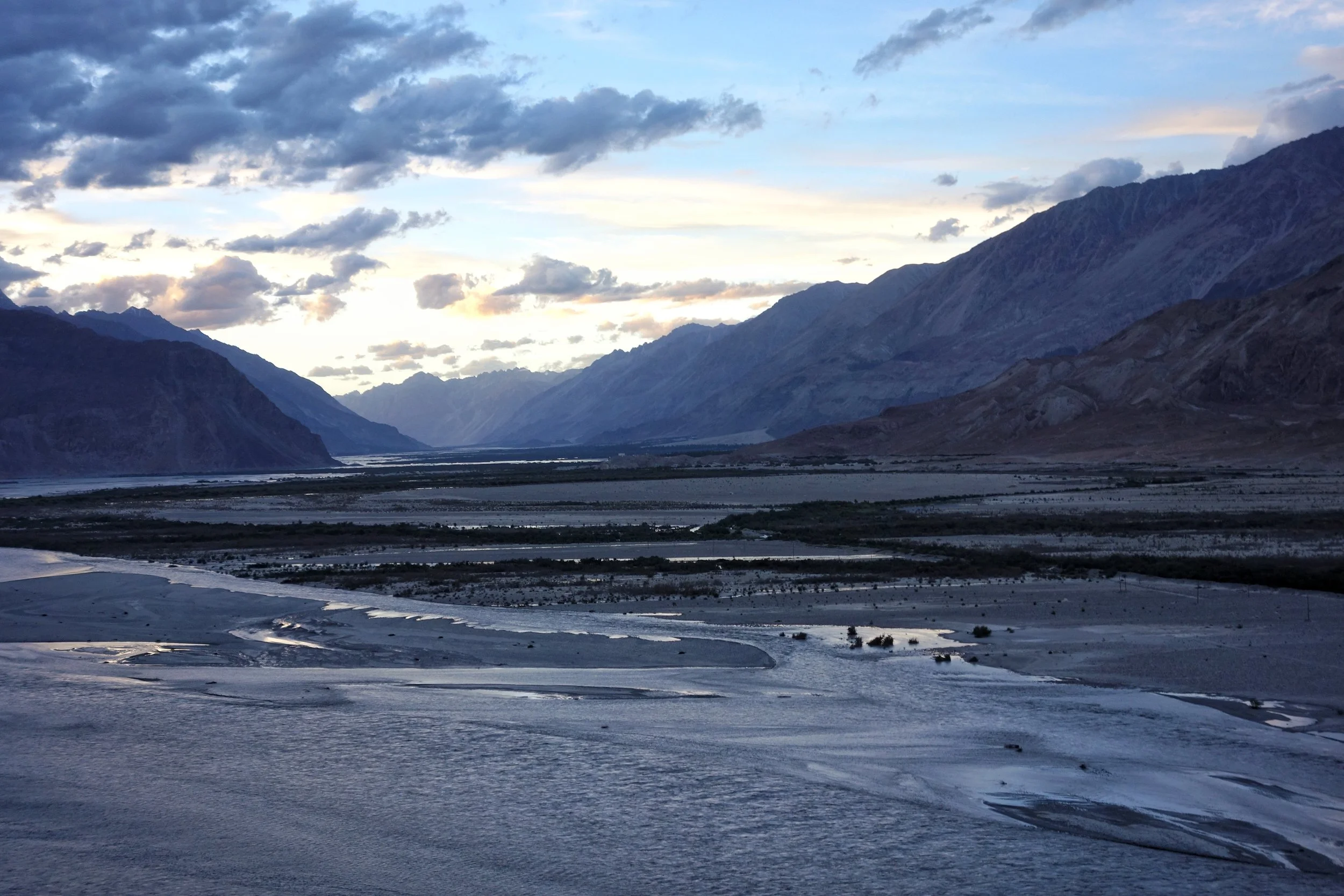
The Confluence of the Shyok and the Nubra. The Karakorams on the other side of the confluence.
Its Southern boundary is defined by the Gilgit, Indus and the Shyok Rivers which separate it from the Himalayan Range in the South. Infact in the Nubra Valley the Shyok River plays the boundary between the Himalayan Range and the Karakorams. In the North its the Karakash and the Yarkand Rivers which separate it from the Pamirs and the Kun Luns. The Karakorams actually lie right in the Center of the Great Himalayan Mountain Complex bounded by Ranges which are unparalleled in their sheer verticality. All these Ranges have Peaks exceeding 7000m which are not found in any other region on the Planet.
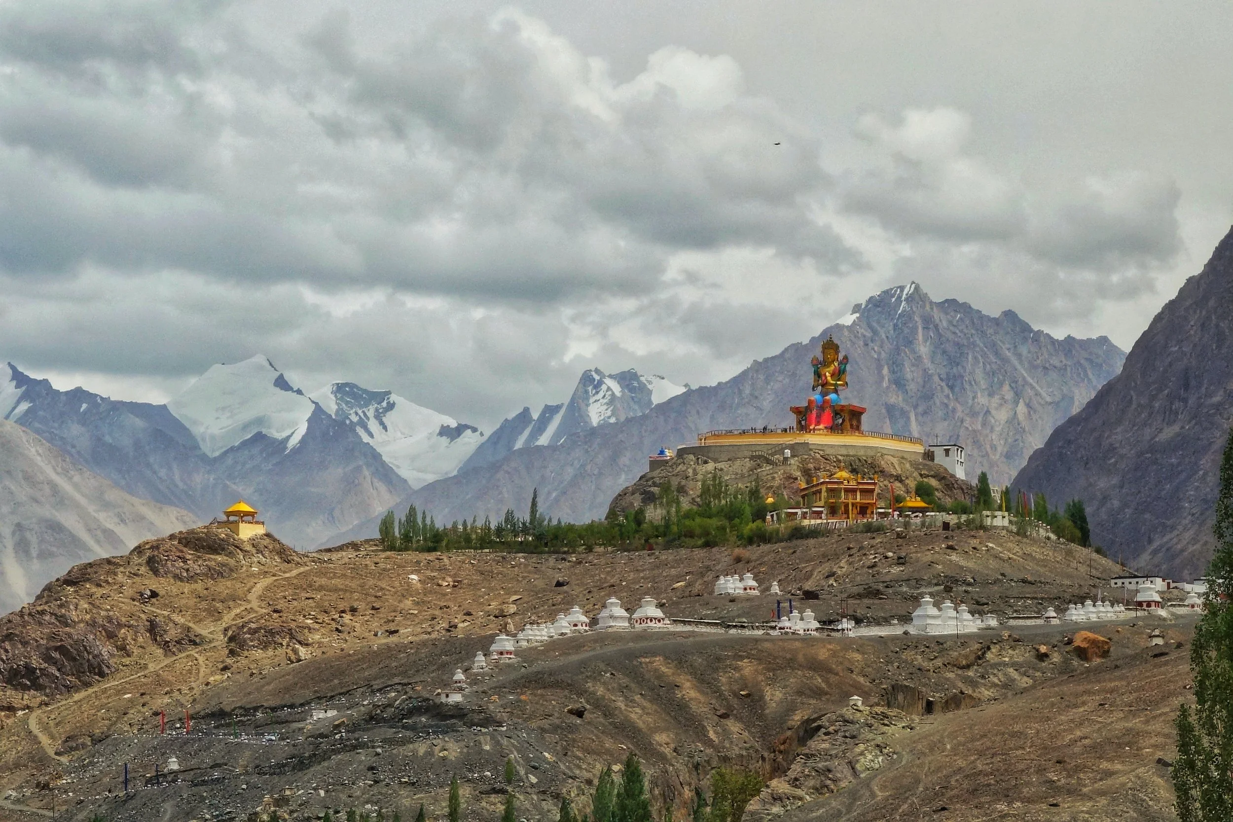
The Karakorams in the background of the Buddha Statue at Diskit in Nubra Valley
Broadly this most vertical of all the Mountain Ranges is subdivided into the following sub Ranges though experts differ on this aspect. The nine sub Ranges are as under
Sasser Muztagh
Rimo Muztagh
Siachen Muztagh
Baltoro Muztagh
Mashebrum Muztagh
Panmah Muztagh
Hispar Muztagh
Spantik Sosbun Muztagh
Rakaposhi Haramosh Muztagh
Batura Muztagh

Unnamed Karakoram Peaks along the Nubra Valley
Contrary to the popular perceptions a sizeable part of the Karakorams lies in territory well under Indian control though being in a sensitive border region most of it is off limits to Civilians and even climbing Expeditions to this area as the one carried out by the Himalayan Club and led by our Vice President, the acclaimed Mountaineer Divyesh Muni need various special permissions to visit these areas. Of the sub Ranges the Sasser Muztagh, the Rimo Muztagh and the Siachen Muztagh lie well within Indian held territory. Even a substantial part of the Baltoro Muztagh is within this territory. In Fact of the 10 highest Peaks in Indian territory (excluding the ones in Occupied territory) lie in the Karakorams. And three of these lie in the Sasser Massif and belong to the Sasser Kangri family. Infact these are clearly visible from the top of the Khardung if you look towards the North.
The Karakoram Anomaly
In this time and age of Global warming and changes in the overall global weather patterns one of the most established fact is the shrinking of the Polar Ice Caps and the reduction of Glaciers in the Glacial non Polar Regions of the World. However there are certain Glaciers in the Karakorams which are growing and this has been termed as the Karakoram Anamoly by the experts.

The Karakoram Anomaly
In this time and age of Global warming and changes in the overall global weather patterns one of the most established fact is the shrinking of the Polar Ice Caps and the reduction of Glaciers in the Glacial non Polar Regions of the World.
We have seen the the alarming consequences closer to home with the shrinking of Glaciers in the Himalayan Regions especially in the Central Himalayas. But there is one Region which defies this Global trend and the Glaciers have actually remained the same or have actually increased. This Region is the extreme Western Part of the Himalayas and mainly in the Karakorams.
This my friends is called the Karakoram Anomaly and it has baffled leading scientists for some time now. How the Karakorams buck the trend of Glacial reduction is still to be answered in all its nuances. However some reasons have been attributed to be the cause of this Anomaly.
Firstly unlike the main Himalayan Range which gets a bulk of its precipitation (in the form of Rain in the lower reaches and in the form of Snow in the higher reaches) in the Summer season thanks to the Monsoon the Karakoram remains largely dry during the season. The Himalayas block the Monsoon and at the same time block the heat from the Indian Plains to get to the Karakorams. The Karakorams on the other hand get most of their precipitation in the Winters and most of it in the form of Snow with the clouds coming in from Central Asia and the Western disturbance.
Also a few degrees change in temperature would not really affect the snowfall in the Karakoram Range in the Winters however the same change would have drastic effects for the Himalayan Glaciers in the Summers. As the Snow would be less and Rain would be more. And people who have lived in snowy Regions would understand how Rain cuts through Snow and Ice.
Another theory purported is that the Glaciers of the Karakorams have a large amount of debris built up over the ages. A thick layer of debri which turns the top Ice of the Glacier into a dark colour attracts more heat and accelerates Glacial melt. However if the debris are thicker they actually act as insulators and preserve the Ice underneath.
Yet another Theory being put out there is the fact that the lowest areas of the Karakorams are now cultivated at a larger scale then at any time in the past. This insinuates the use of a larger amount of water for cultivation and this leads to more moisture in the atmosphere and hence more precipitation in the area creating a different microclimate in the area.
Personally I see the first theory making the most sense though the other two also make sense. And I assume it's a mixture of all the above stated factors.
Hopefully one day Scientists will find out the exact reason for the Karakoram Anomaly.
Till then we can probably take some solace in the fact that the Glaciers in at least one Region are not shrinking.
A pic of the Drang Drung Glacier of the Great Himalayan Range. Pic from April 2018. On a flight from Delhi to Leh
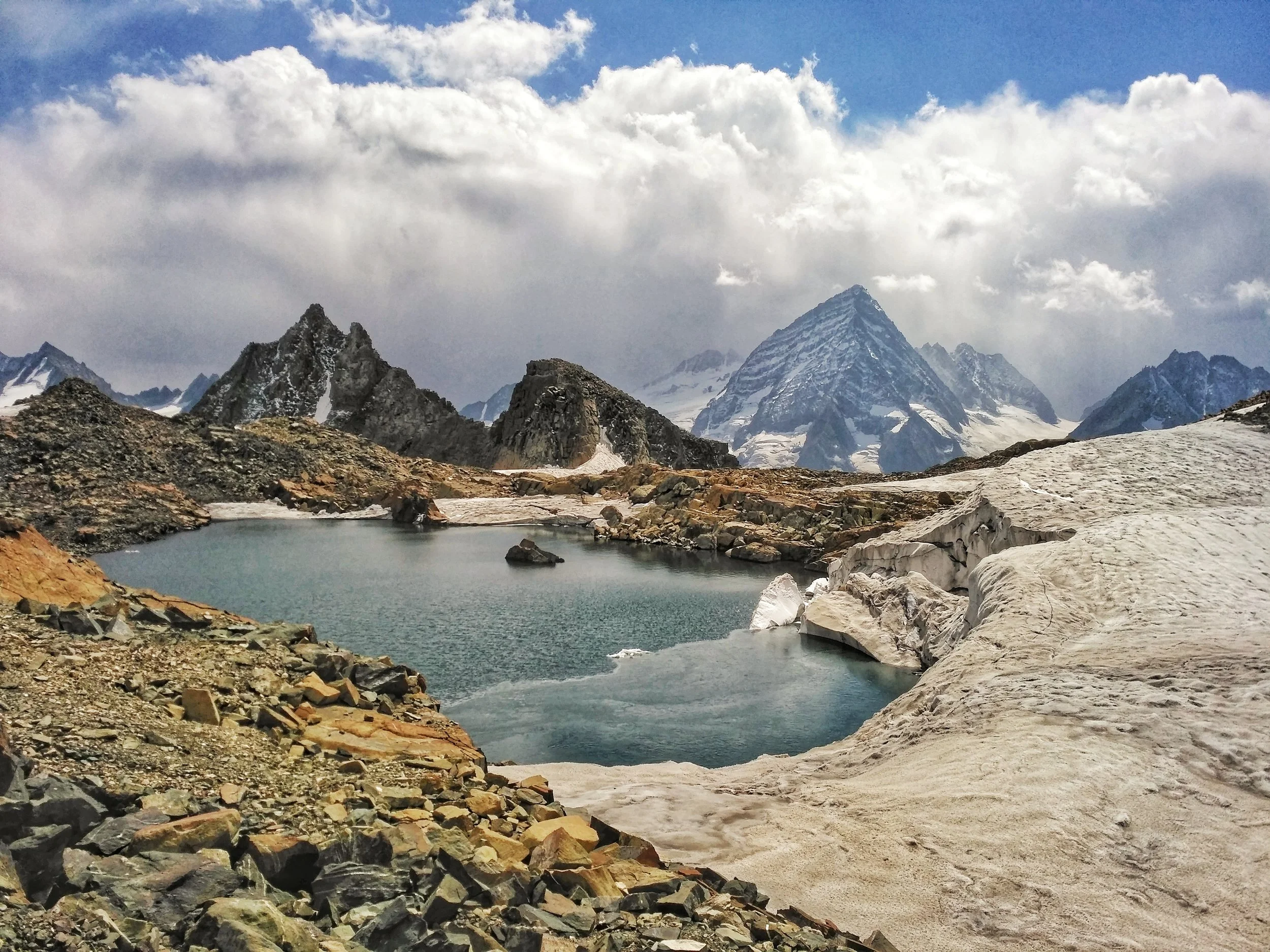
The Great Himalayan Mountain Complex
The Great Mountain Complex of the Himalayas is a vast expanse which includes the highest Peaks on the Planet and stretches all the way from Central Asia to South East Asia. We explain about some of the main Mountain Ranges of this Great Complex.

Dummy’s Guide to the Himalaya
THE GREAT MOUNTAIN COMPLEX OF THE HIMALAYA : The Western/ North Western Flank.
The Himalaya are a part of an extremely complex mountain system which includes the highest peaks on the planet. Created by great Tectonic plate movements millions of years ago, when the Indian plate collided with the Eurasian plate, the Himalaya are still rising. Most of the Ranges I mention below are regarded as separate ranges and are as such but in the broadest sense we have taken all the Mountain Systems between the Indian subcontinent and Central Asia and refer to them as the Himalaya, the name stemming from the Sanskrit words “Him” snow and “Alay” home.

The epicenter of this system lies somewhere in between the wild mountains north of Kashmir and the nodal orogenic uplift known as the Pamir Knot in Tajikistan. From the Pamir Knot rise the great ranges of Central Asia and they meet the Great Himalaya at the epicenter. The Great mountain wilderness north of Kashmir right upto the Pamirs are till today one of the least explored region on the planet. The last great Explorers of this region were mostly Europeans in the pre – Independence era. The physical factors aside, sadly, there are political reasons today which keep a large part of this great mountain wilderness off limits to explorers.
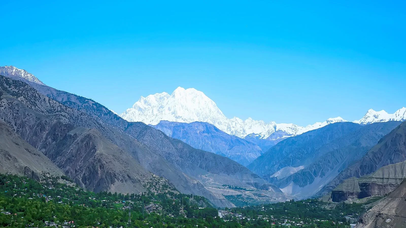
The Tirich Mir (Pic from 99wallpapers.com)
Starting from the West, from the arid hills of Afghanistan comes the Hindu Kush. Its brown treeless slopes rise up and get higher and steeper as the approach the meeting point of the giants. The Hindu Kush still has a hint of Middle Eastern deserts even below the Glaciers of the 7708 m high Tirich Mir. The term Hindu Kush derives from Persian stands for “Hindu Killer” probably in reference to the unknown number of Indian slaves who perished in the cold and snows of these mountains while sold into slavery in the Central Asia.
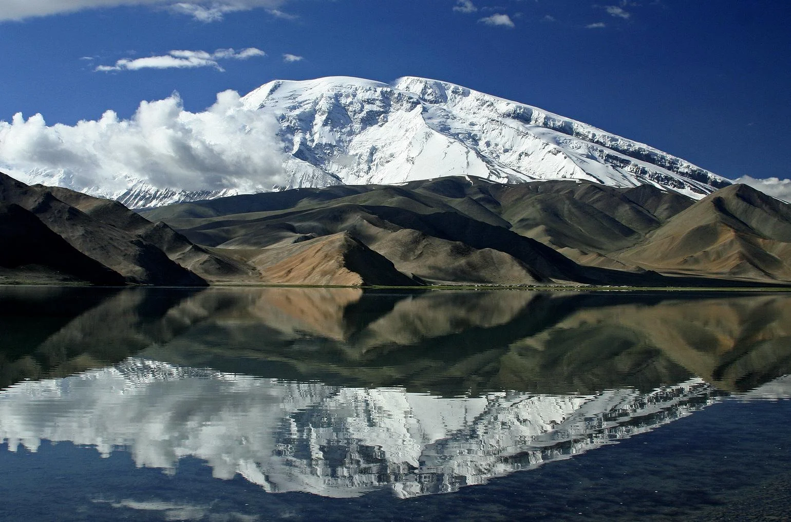
The Mustagh Ata (https://www.summitpost.org/muztagh-ata/151886
To the North of the Hindu Kush lie the rounded domes of the Pamirs. This is still a mysterious and almost polar region of several mountain ranges linked together, and to other ranges, by a north-south range which includes the peak of Muztagh Ata whose name means “The Father of Snowy Mountains” standing at 7509 m. The Arabs used to refer to the Pamirs as the “Bam i Duniya” or the Roof of the World. The name Pamirs comes from the Persian reference to these mountains.

The Kunlun Shan (https://www.summitpost.org/kunlun-shan/171011
Moving eastwards of the Pamirs we have the Kun Lun. It rises over the Tarim Basin in the Takla Makan desert and rise up as it moves towards the epi center. The highest peak of the Kun Lun is the Luishi Shan standing at 7167m. Overlooking the great Silk Route of Cathay they have always been historically regarded as the southern frontier of the Chinese empire. The Kun Lun were named after a semi-mythical reference in classical Chinese texts to the source of the Yellow River.

Where all these ranges meet lies the Karakoram. Mightiest of all these ranges, they radiate from an amphitheater of peaks called Concordia which holds three of the worlds highest peaks in the world. The Karakoram is a perpendicular wilderness where only mountaineers can venture. Glaciers thirty miles long and a quarter mile deep lie in the valleys. These Glaciers here are the largest that can be found outside of the Polar regions. The highest peak of the Karakoram if of course the K2 standing at 8611 m. The name Karakoram comes from the Turkic term “Black Gravel”, Kara being the Turkic term for “Black” very similar to the Hindi “Kala”.
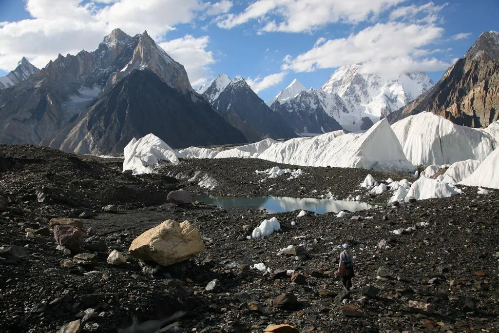
Concordia in the Karakorams (https://www.summitpost.org/concordia-the-amphitheatre-of-ten-of-the-world-s-thirty-greatest-mountains/534309
South of the Karakoram is the Ladakh Range which is considered a sub-range of the Karakoram itself as per Encyclopedia Brittanica though some consider it a part of the Great Himalaya. South of this Range is the Zanskar Range, which is a sub-range of the Great Himalaya, which seperates the Ladakh region from Kashmir and Jammu regions.

Joining from south west in the Mother Range the Great Himalaya, culminating in its giant sweep from across Nepal at the formidable Nanga Parbat standing at an imposing 8126 m. What makes this mountain so formidable is that it rises vertically from around the base of the Indus to its imposing height. This is same sweep of the most formidable mountains on the planet which includes the highest peak on the planet Mt. Everest. The Great Himalaya range stretches from the Nanga Parbat in the North West to the Namche Barwa in the East.The range varies in width from 400 kilometres (250 mi) in the west to 150 kilometres (93 mi) in the east.
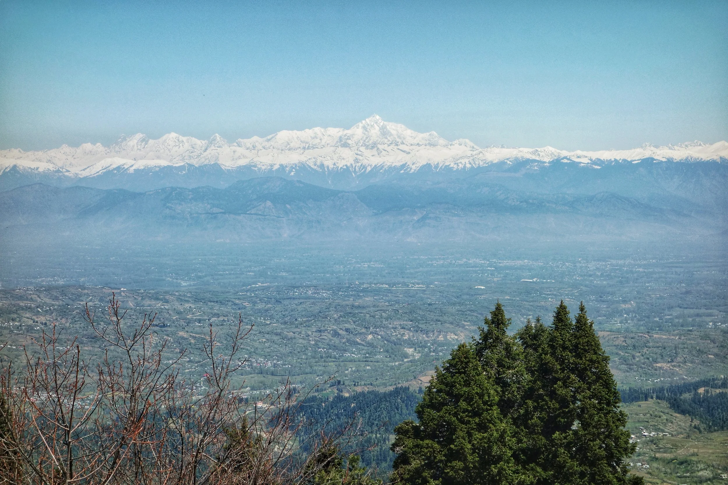
Nanga Parbat
Moving southwards we have the Pir Panjals which though considered a part of the Greater Himalaya, are as noble as a range can be and in another part of the world would have been a seperate Range itself. Though not high as per Himalayan standards it is the first snowcovered peaks tha you encounter moving up from Northern India. Compared to the barren mountains that lie north of it the Pir Panjals are all green and bountiful. The Pir Panjal gets more snow than anywhere in the Western Himalaya. The Pir Panjal gets its name from the Pir Panjal Pass, which was named according to one theory after “Five” “Panj” and “Saints” “Pir” or five pious brothers who lived around there. Another theory alludes the name to the Kashmiri word for a Pass “Pansal” and “Saint” “Pir”, a saint whose grave was supposed to be on this Pass.
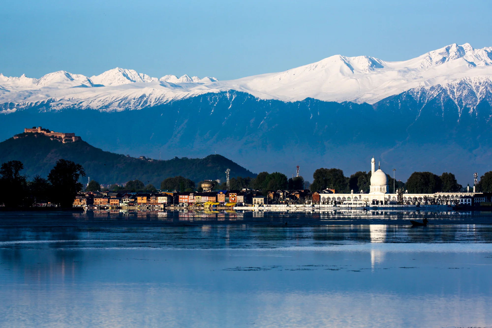
The Pir Panjals over the Kashmir Valley
South of the Pir Panjal we have the Dhauladhar Range though some consider the Dhauladhar to be a part of the Pir Panjal itself. The Dhaula Dhar is also reffered to as the Lesser Himalaya.
Finally the these Ranges give way to the gentle Sivalik Hills which finally merge into the Great Indian plains.
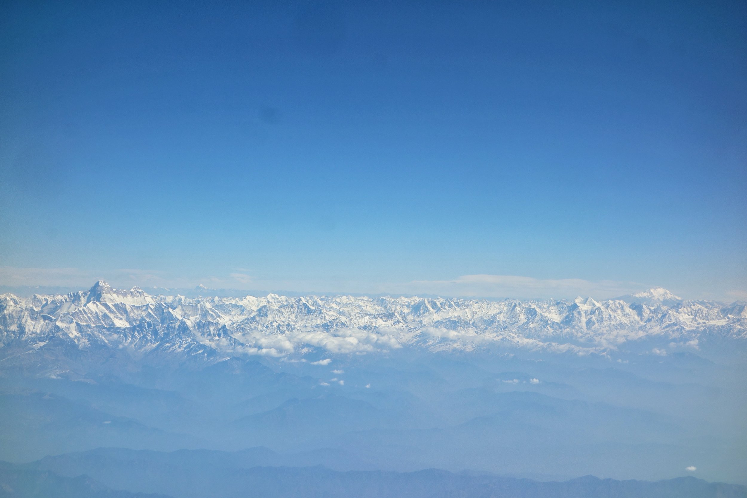
The Holy Mountains of the Himalayas : The Nanda Devi and the Kaliash Parbat
Major Inputs and extracts from the John Keay Classic : Where Mountains and Men Meet
PHOTO (Map) : A classical map of the Western Himalaya without national boundaries. Sourced from John Keays : Where Mountains and Men Meet :
NOTE : As mentioned before all scholars do not agree on the classification of these Ranges/ sub-Ranges. However a majority of them would agree on what I state above. The above article has been compiled from various sources.
Kiki’s Blog
Stories from the Himalayas







Five years ago the Galwan Valley was in the News for the wrong reasons after a deadly clash between the Indian and Chinese Armies in the Valley located in Ladakh lead to many deaths on the contentious Border between the two countries in wake of continued Chinese intrusions into Indian territory.
This area along the Shyok River, of which the Galwan Nallah or the Galwan River which forms the Galwan Valley has been off limits to Civilians since long but now the Indian Government has decided to open up the area for Civilians and we were amongst the First Civilians to venture into this beautifully desolate part of the Eastern Karakorams in Ladakh. Earlier Civilians could only venture upto the Village of Shyok from where the Shyok River takes a U turn and flows in a Northerly direction.