

Keran : Where a River Runs Through
A Photo Gallery of Keran along the Line of Control in Jammu and Kashmir
A Photo Gallery of the Village of Keran which is divided by the Kishanganga which acts as the Line of Control in this part of Jammu and Kashmir
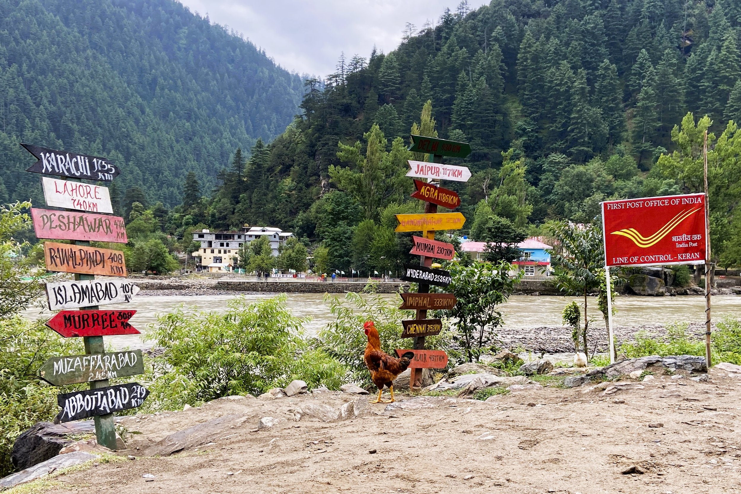
Signages in Keran on the banks of the Kishanganga which is called Neelum by our Neighbours.

The beautiful Kishanganga aka Neelum River at Keran
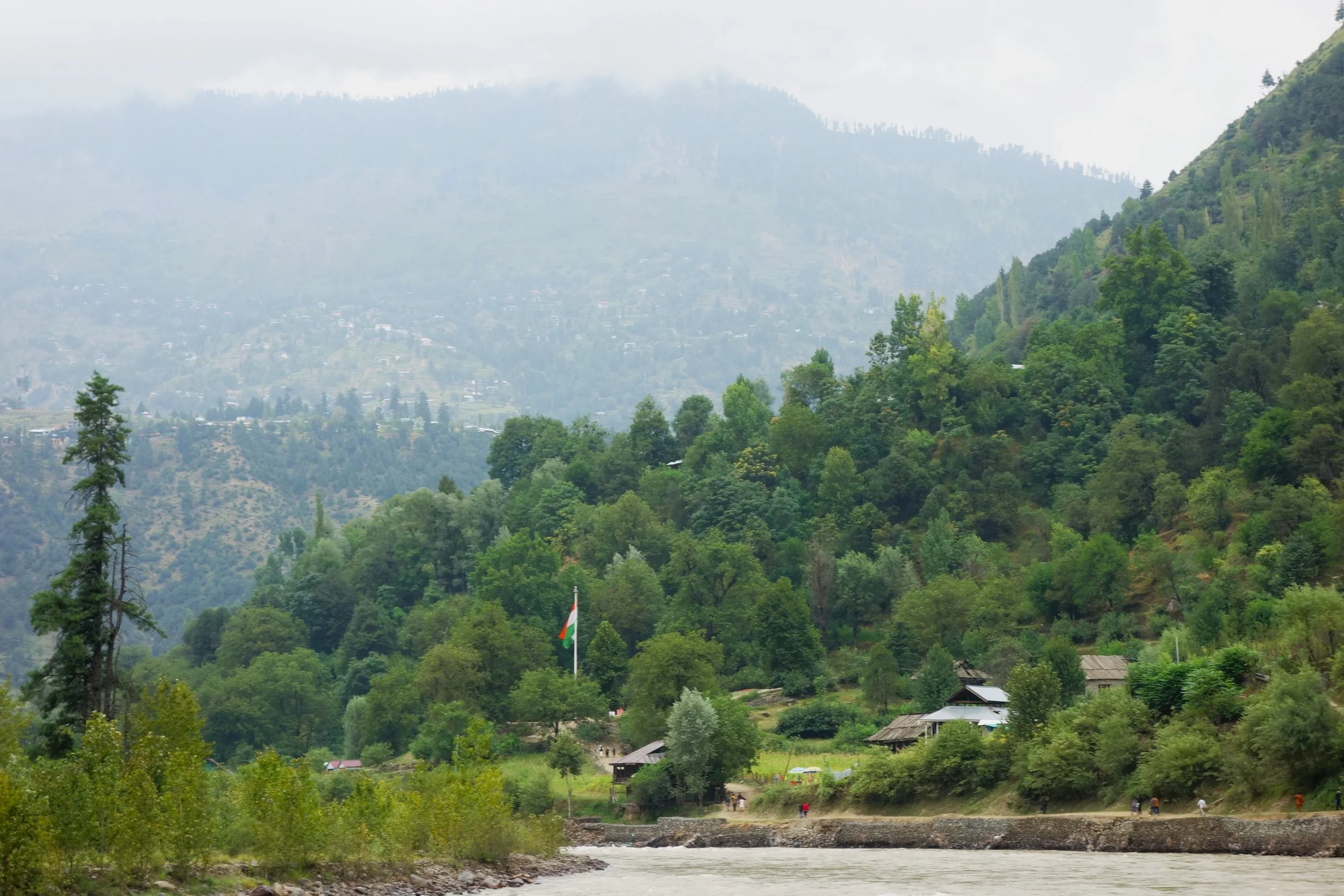
The Indian Flag flies high on the Indian side in Keran
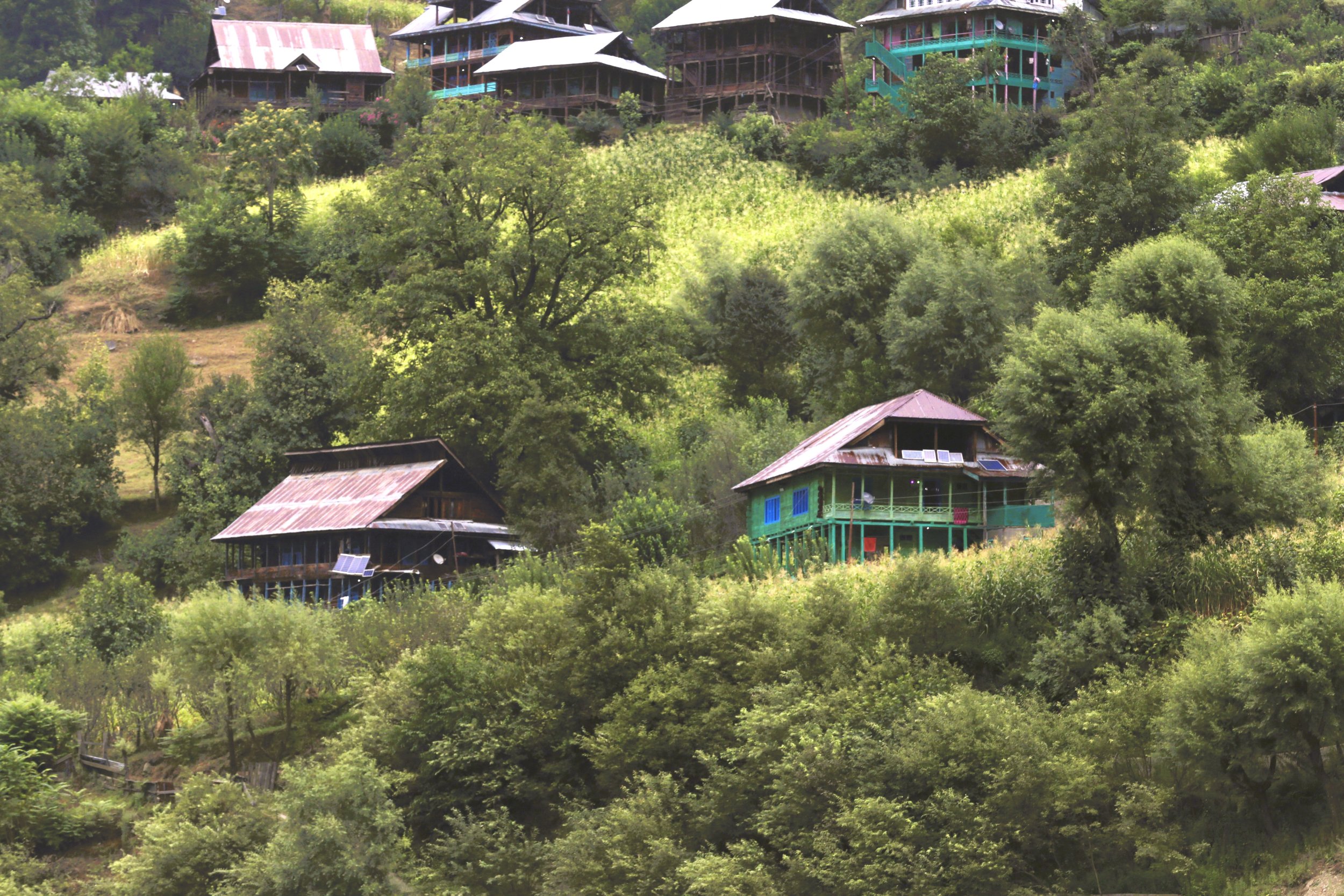
Village Houses in Keran
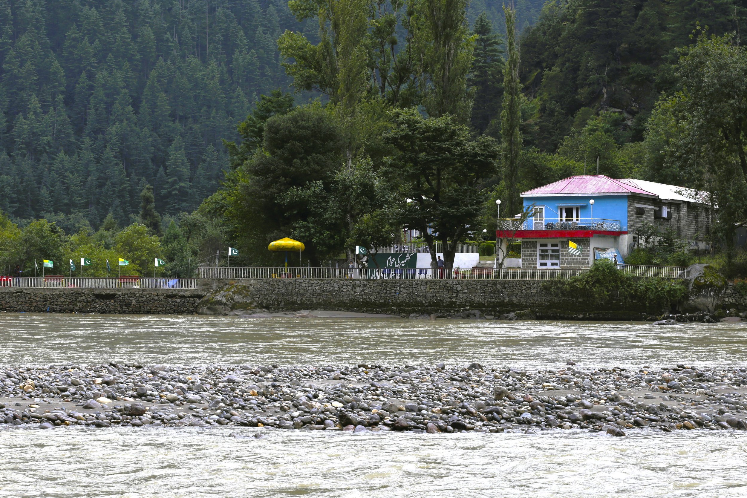


We Love Neelum signs on the other side of the Kishanganga in the so called Neelum Valley in Keran
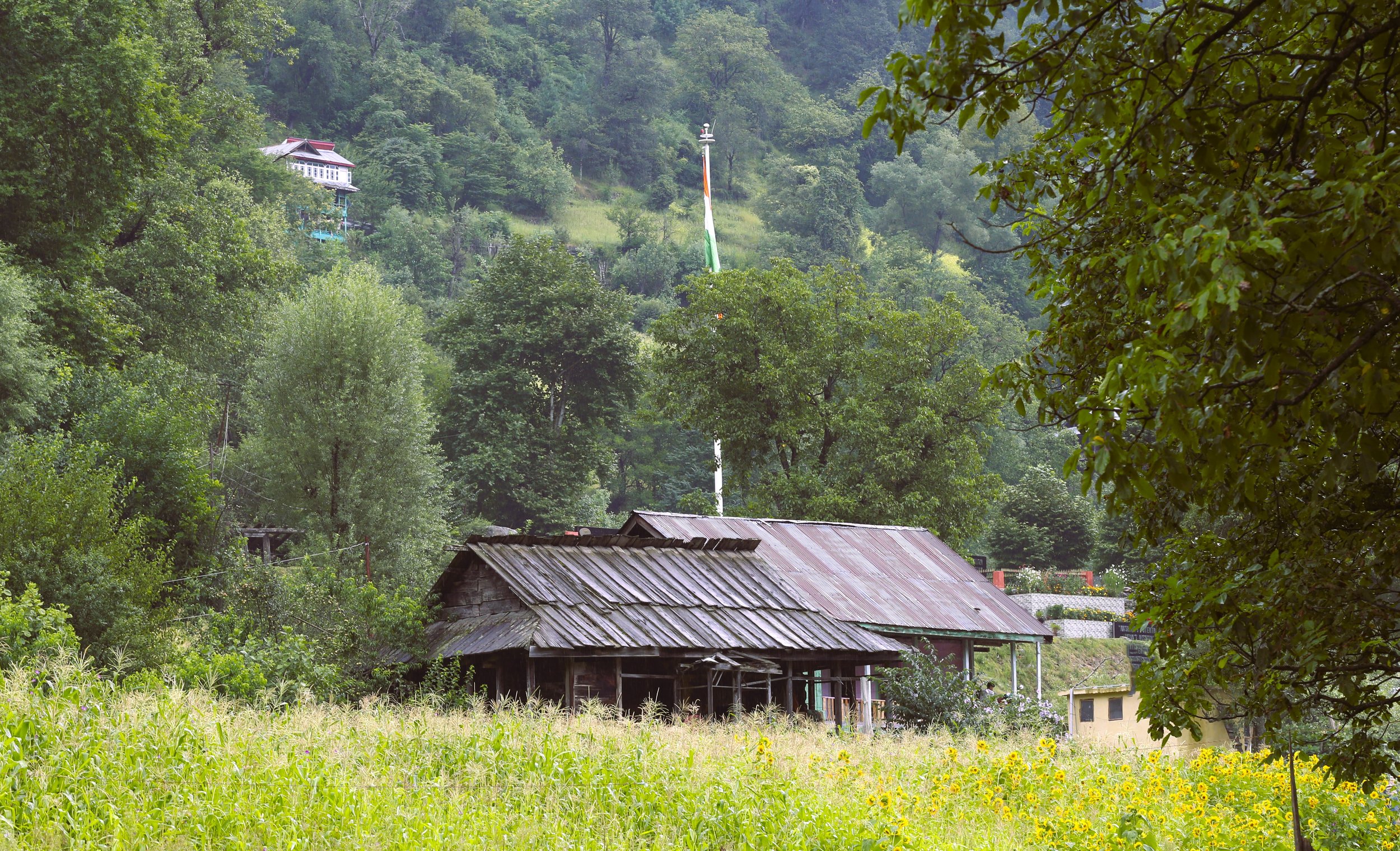
An abandoned House in the Keran Village
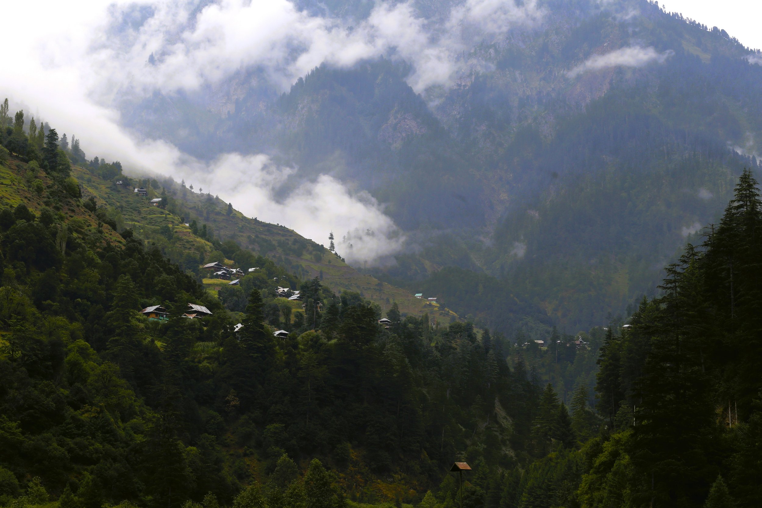
Another view of a Village in Keran

Another view of the Kishanganga aka the Neelum River in Keran

The Elusive Kaobal Gali
The Kaobal Gali stands at an Elevation of 4167 metres (app 13600 ft) on the main Great Himalayan Range has traditionally connected the Tulail and Gurez Valleys with the Mushkoh Valley in the Drass Region. Interestingly people on both sides of the Pass are Shina and speak Shina language just like their fellow Dardic Shina people in Gilgit. This is a peculiarity as usually when you cross a Pass on the Great Himalayan Range the Culture Language and People change.
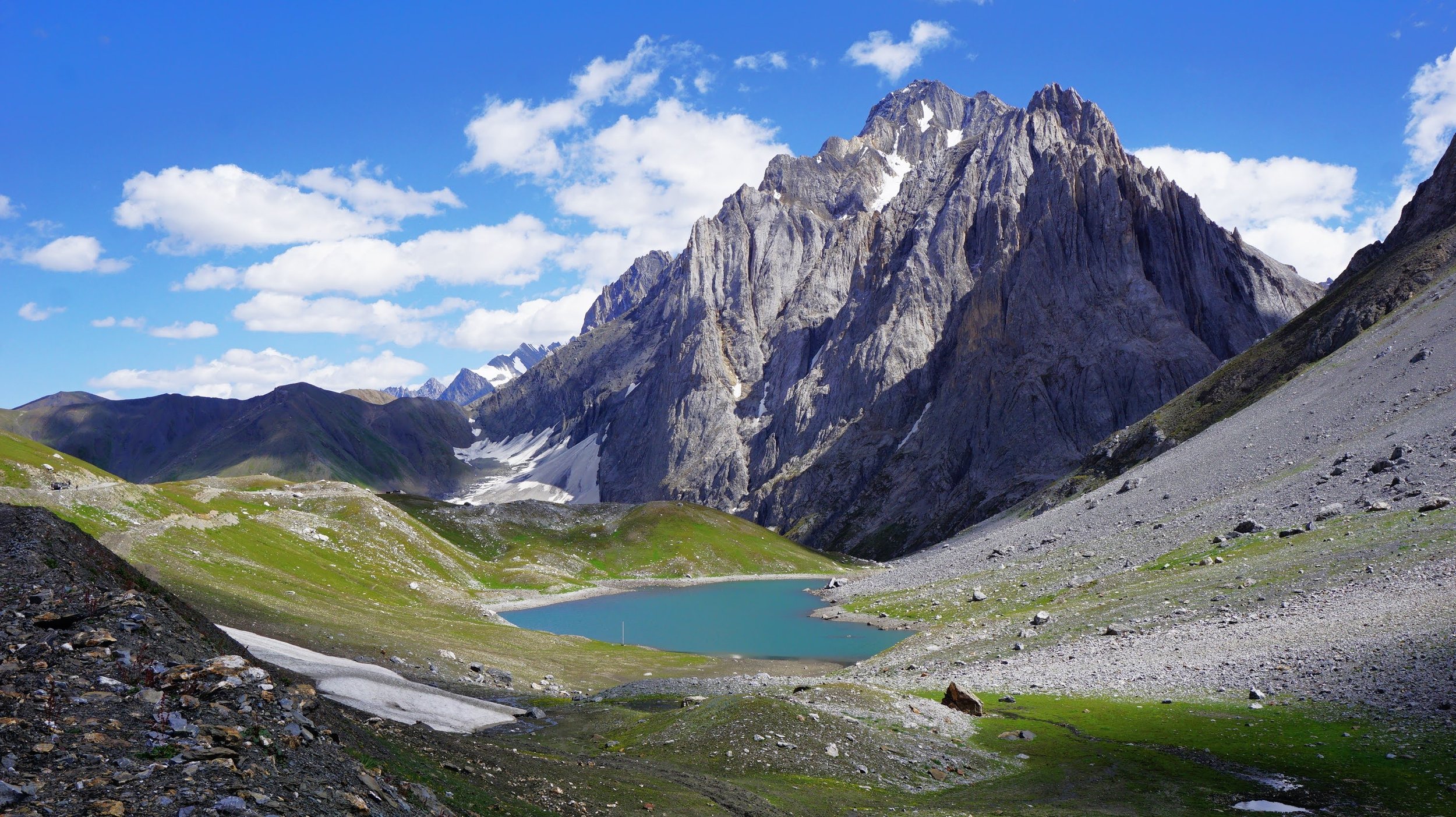
The Kaobal Gali with the Kaobal Sar or Draupadi Kund at its foot
The Great Himalayan Range is a formidable barrier with its monumental Mountains but Humans for centuries have endured to cross this Range to go beyond this Range into Ladakh and Tibet and beyond into Central Asia.
In the Western Himalayas there were a series of Passes which were used the cross this Great Mountain barrier with the main ones starting from the East were the Parang La which connected Ladakh with Spiti, the Baralacha La which connected Lahaul with Ladakh, the Sinku La which connected Lahaul with Zanskar in Ladakh, and then a series of difficult Passes which connected Padar in Kishtwar with Zanskar in Ladakh like the Umas La, Poat La and Hagshu La.
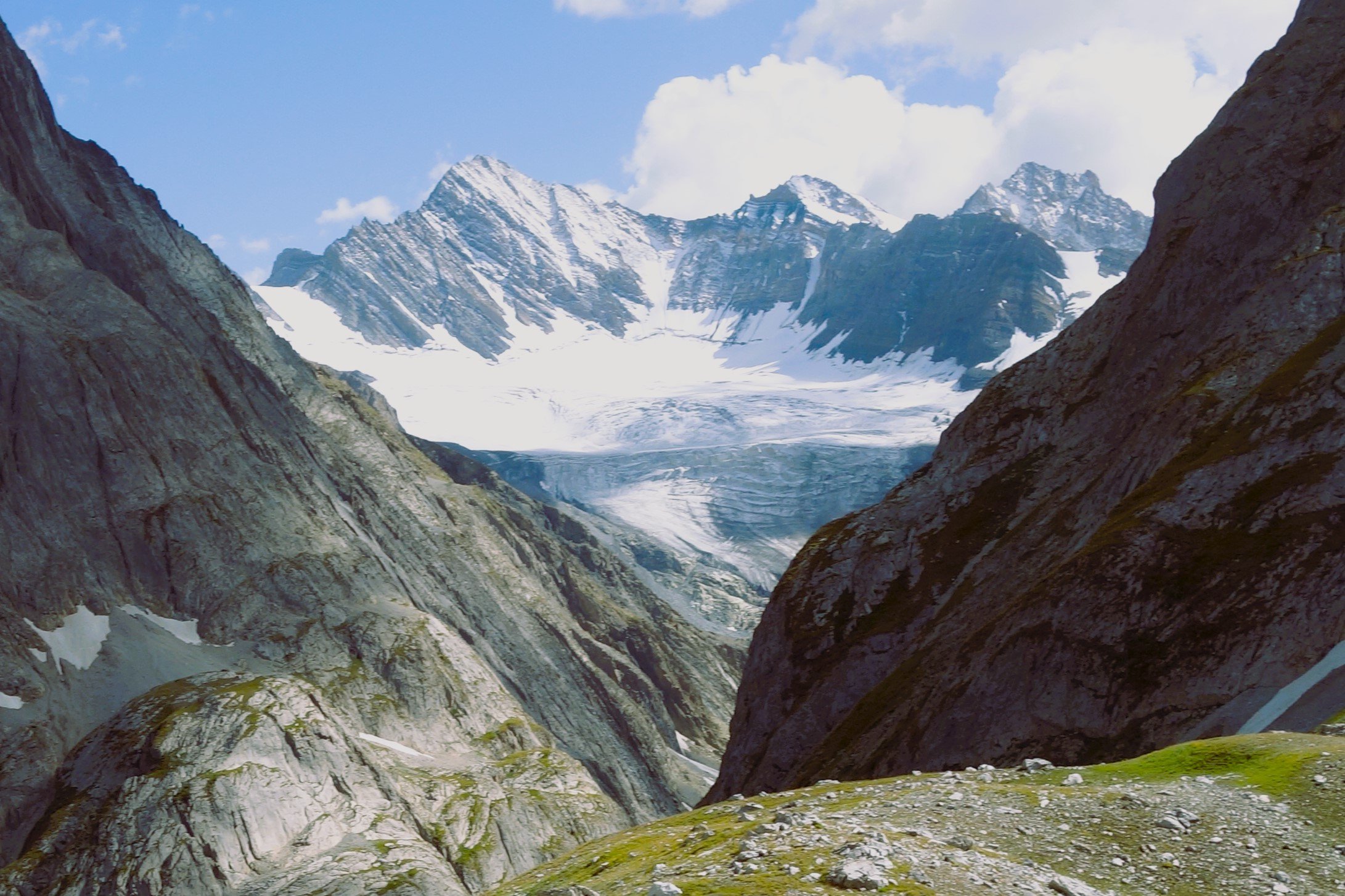
The Kaobal Glacier
Moving further West we again had a series of Passes which connected Warwan in like the Bhotkol Pass / Lonvilad Gali. And then we had the one of the lowest but one of the most notorious Passes over the Great Himalayan Range, the Zoji La. And then the last one is mostly unknown Kaobal Gali which connected the Tulail Valley in Gurez with the Mushkoh Valley in Drass in Ladakh.
The Pass stands at an Elevation of 4167 metres (app 13600 ft) on the main Great Himalayan Range has traditionally connected the Tulail and Gurez Valleys with the Mushkoh Valley in the Drass Region. Interestingly people on both sides of the Pass are Shina and speak Shina language just like their fellow Dardic Shina people in Gilgit. This is a peculiarity as usually when you cross a Pass on the Great Himalayan Range the Culture Language and People change.

Closer View of the Kaobal Sar also known as the Draupadi Kund
Another factor which makes this Pass different in todays context is that it lies at a very sensitive position along the Line of Control and on one side is the Mushkoh Valley which had seen a lot of Military action during the Kargil War. As a result of this Pass is strictly off limits to all Civilians and till date very few Civilians have been allowed to visit this Pass and recently we were among the lucky few who have got access to the Pass.
The Pass itself is set in a spectacular location. The Kaobal Peak and the Kaobal Glacier loom over the Pass and there is a beautiful Alpine Lake at the foot of the Pass called the Kaobal Sar but also more commonly referred to as the Draupadi Kund. The setting of the Lake is so beautiful that you cant help but give it a celestial connection. On one side are the Greens of Tulail and on the other side are the Trans Himalayan browns of Mushkoh in Drass. The Contrast is quite stunning.

The Tulail Gurez side of the Pass
The Pass also marks the Border between the Union Territory of Jammu and Kashmir and Ladakh. At the time we were there we had gone from the Tulail side and had initially planned to descend the other side of the Pass into Drass but that was not to be as there was a Landslide on the other side and the Road was shut for all kinds of traffic. Also the Road onwards from Chakwali Village which is the last Village on the Jammu and Kashmir side is extremely Rough and can only be attempted in clear Weather with proper 4x4 Vehicle.
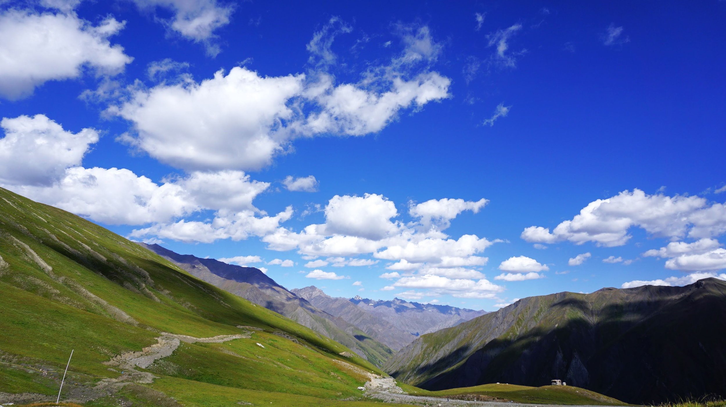
The Drass side of the Pass
There was a recent Report that the Government is planning to open the Road from Gurez to Drass via Kaobal Gali to Tourists at some point in future. So hopefully one day a controlled number of Tourists will get access to this absolute Gem of the Himalayas.

Srinagar to Kashgar by Road : The First Motorised Crossing of the Greatest Mountain Ranges
Once the Expedition commenced there arose new Challenges. Though the Afghanistan Civil War had ended, the situation in North Afghanistan and Routes into the Pamirs were far from being safe for the Expedition. So another detour was decided. It was decided that the Expedition would now crossover into India from Afghanistan and then they would take the Mountain track that connected Srinagar in Kashmir with Yarkand / Tashkurgan in Chinese Turkestan or what is now Xinjiang

The Complete Beirut to Beijing Route
Citroen is an iconic French Automobile brand which has been making Motor Cars for well over 125 years. In the 1920s and the 30s they embarked upon a number of Journeys through the wildest impenetrable parts of the World to prove the reliability of the ruggedness of the Citroen. The idea of putting these Expeditions together came from Andre Citreon who was the founder of the Company.

They first made Two Expeditions into the wilds of Africa as the French had a bunch of Colonies in Africa and they completed the Expeditions with a reasonable amount of success. The First of these being the crossing of the Sahara Desert by Motorcar in 1924. And then they made a Journey across the length of Africa from Bechar in Algeria in North Africa all the way down to Cape Town in South Africa becoming the first people to do so. Both these were accomplished using Half Track Citroen Vehicles and these were led by the Explorers Georges-Marie Haardt and Louis Audouin Dubreuil.

Being received by a British detachment at Landi Kotal near the Khyber Pass in June, 1931
And then in 1930 they came up with their most ambitious Expedition. One that involved retracing the steps of Marco Polo by crossing Central Asia and going all the way to China. This Route was the famous Silk Route as it was called and for centuries traders from all over the adjoining Regions used this Road for not only Trade but the exchange of ideas as well. As with their other Expeditions this was also supposed to be a first, the First Motorised Expedition to retrace the fabled Silk Route.

The Expedition had its own set of unique challenges. And these were not only Geographical and Logistical. It was Political as well. It involved getting the requisite Permissions from the Communists in Russia as well as the powers to be in China which was in the throes of a Civil War between the Kuomintang and the Communists. And so the Expedition applied for permission was applied to the Russians for passage through Western or Russian Turkestan as that part of Central Asia was called.

But with just a few Months before the Expedition was to commence the Russians withdrew the permission and they now had to chalk out an Alternative Route. Which they did and now after crossing Persia instead of going into Western Turkestan they decided to take the Route through Afghanistan and up North crossing the Hindu Kush and the Pamirs and reaching Tashkurgan.

Once the Expedition commenced there arose new Challenges. Though the Afghanistan Civil War had ended, the situation in North Afghanistan and Routes into the Pamirs were far from being safe for the Expedition. So another detour was decided. It was decided that the Expedition would now crossover into India from Afghanistan and then they would take the Mountain track that connected Srinagar in Kashmir with Yarkand / Tashkurgan in Chinese Turkestan or what is now Xinjiang

So now a new Geographical challenge arose. That of crossing the Himalaya as well as the Karakorams besides all the other Regions. These were two of the Highest Mountain Ranges on the Planet but still they reckoned that they would be able to achieve the same. They decided to run the gauntlet.

So from Iran they entered Afghanistan via Herat and crossed the Country at great Speed and entered British India at where else but the Khyber Pass and now they were in relative safety and they proceeded towards Srinagar via Rawalpindi through the Jhelum Cart Road. In Srinagar they were personal Guests of the Maharaja and it was through the Maharaja’s territory they would travel all the way North across the Great Himalayan Range and the Karakoram Range.

The Pandethran Temple in Srinagar, Kashmir
They took the Silk Road from Srinagar which connected Srinagar with Gilgit as well as Skardu. So they drove from Srinagar towards the Wular Lake, crossed over the Rajdhan or Rajdhanigan or Tragbal Pass (around 11600+ feet) as it was called and entered the Gurez Valley which bordered the Kashmir Valley on the North. This was the first Motorised crossing of the Razdan Pass as well. From Gurez onwards the tough part started as they now had to cross the Snow Laden Burzil Pass on the Great Himalayan Range. And the Photographs attached show the condition of the Pass.

Infact to get to the Pass itself they had to disassemble the Vehicles and they were carried on foot by the Porters and then re-assembled when it was possible to drive these tough Half Tracks. They were tough but nothing compared to the Mountains. And rather than the Machines it was the hardy Mountain men who carried these Automobiles over the Mountains. They also set a World Record for the highest altitude that a Vehicle drove on at over 13500 on the Burzil Pass.
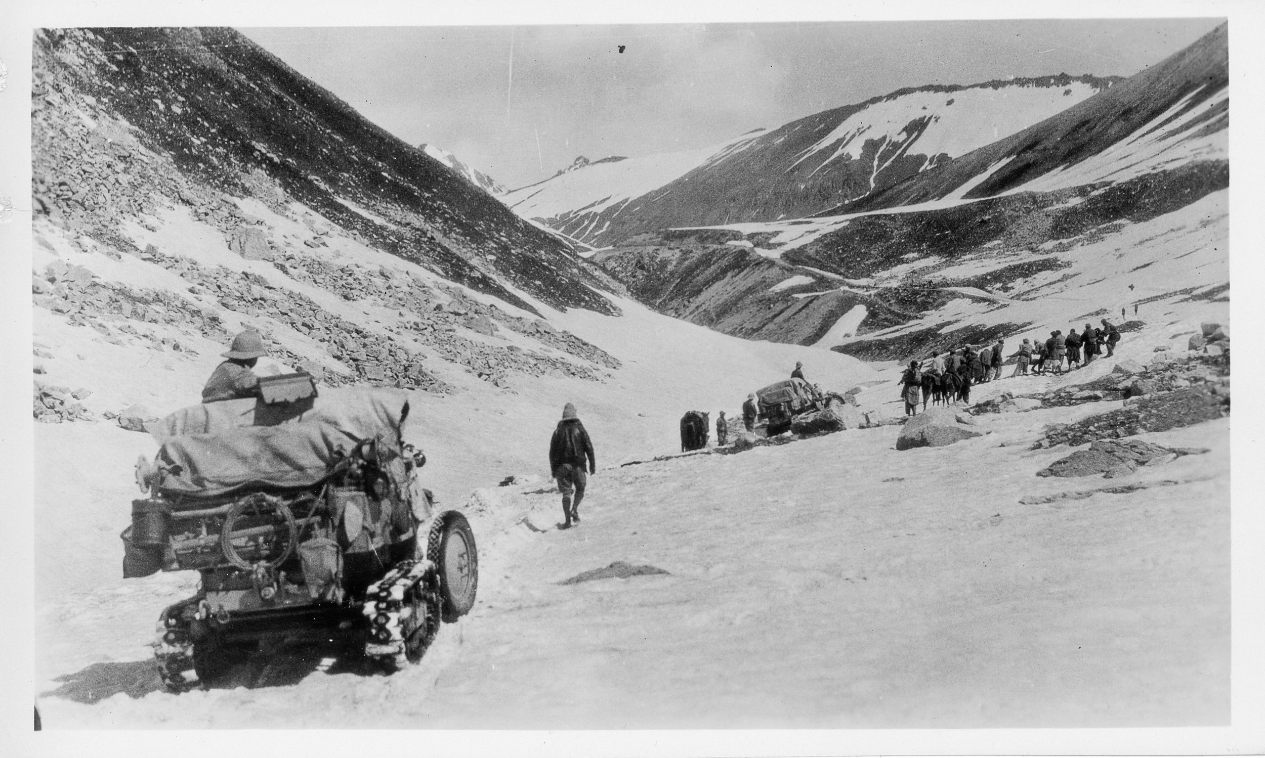
On the way down as well they had to face almost impossible situations and again they had no option but to disassemble the Vehicles and have them carried by the Porters. And they managed to make their way to Astore and then to Gilgit. From Gilgit they made their way to Gojal and to get over the Karakorams they chose the Kilik Pass which was parallel to the Mantaka Pass which was more frequently used but the Kilik Pass was relatively free of Snow and they carried the Vehicles over the Kilik Pass and descended into the Pamirs and were now across the Border of British India and firmly in Chinese Turkestan where they planned to meet up with the other Group which had started from Peking towards Central Asia. Of course the Group which came from Peking faced a lot of Political obstacles rather than the Geographical obstacles faced by what was called the Pamir Group. But that then is another Story.

All said and done it was the Citroen Haardt Expedition which showed that it was possible for Automobiles (with a lot of Human help) to cross this almost unassailable Mountain barrier.

Nowadays however due to the Political situation the Old Silk Route from Srinagar to Gilgit lies abandoned though you can cross the Razdan Pass and get into Gurez. And on the other side of the LoC a Motorable Road now gets you over the Karakorams via the Khunjerab Pass. The Kilik Pass being long forgotten.

Photo Credit : All Photos from the Internet / Citroen Haardt Expedition / Nationa Geographic/ Getty Images.

The Road to Uri
For the ones unaware of Uri it lies along the Jhelum Gorge as it swirls out of the Kashmir Valley and enters PoK and Uri is the last major Town before the LoC which lies around a dozen kms ahead of Uri. Ahead of Uri lies the Village of Salamabad which was the point for the Cross Border trade and Trucks from the other side of the LoC used to visit in better times. And then of course there is the Kaman Seu which is the LoC between the 2 Countries.

The Kazinag Mountains as seen from the Road to Uri
The Road to Uri and Beyond
Many of you must have heard of this place called Uri and many must have seen the famous Movie which had the same name (Though it was Shot in Serbia, that wasnt Uri) but how many have you been to Uri. Except for people from the Armed Forces and their known ones I hardly know anyone who has gone or made an effort to go to Uri.

On the Road. Uri 37 kms away
Uri lies at one end of the Kashmir Valley as the Mountains close in and the Jehlum now flows thorugh a Gorge instead of the wide expanse of the Kashmir Valley. The Valley keeps getting narrower as one moves towards Uri from Baramullah.

One of the idyllic Villages on the Jehlum
For the ones unaware of Uri it lies along the Jhelum Gorge as it swirls out of the Kashmir Valley and enters PoK and Uri is the last major Town before the LoC which lies around a dozen kms ahead of Uri. Ahead of Uri lies the Village of Salamabad which was the point for the Cross Border trade and Trucks from the other side of the LoC used to visit in better times. And then of course there is the Kaman Seu which is the LoC between the 2 Countries.

Approaching Uri which lies on the Mountain we are facing
Uri itself is beautifully set, surrounded by Mountains and overlooking the Jhelum as it moves across Kashmir. And its in Uri that things begin to change and Pahadi culture starts to show its influence. Uri is like a gateway to and out of Kashmir. And any Indian citizen can visit Uri Town without any Permits. You are allowed all the way to the Uri Bazaar and incase you want to go beyond Uri you need Permits.

Uri and Around
Moving beyond the drive to Uri from Srinagar (its around 100 kms) is also a scenic one and Ive tried to catch some of the views though it was a dreary December so the Mountains were as Brown as ever though there was some Snow on the Mountains.
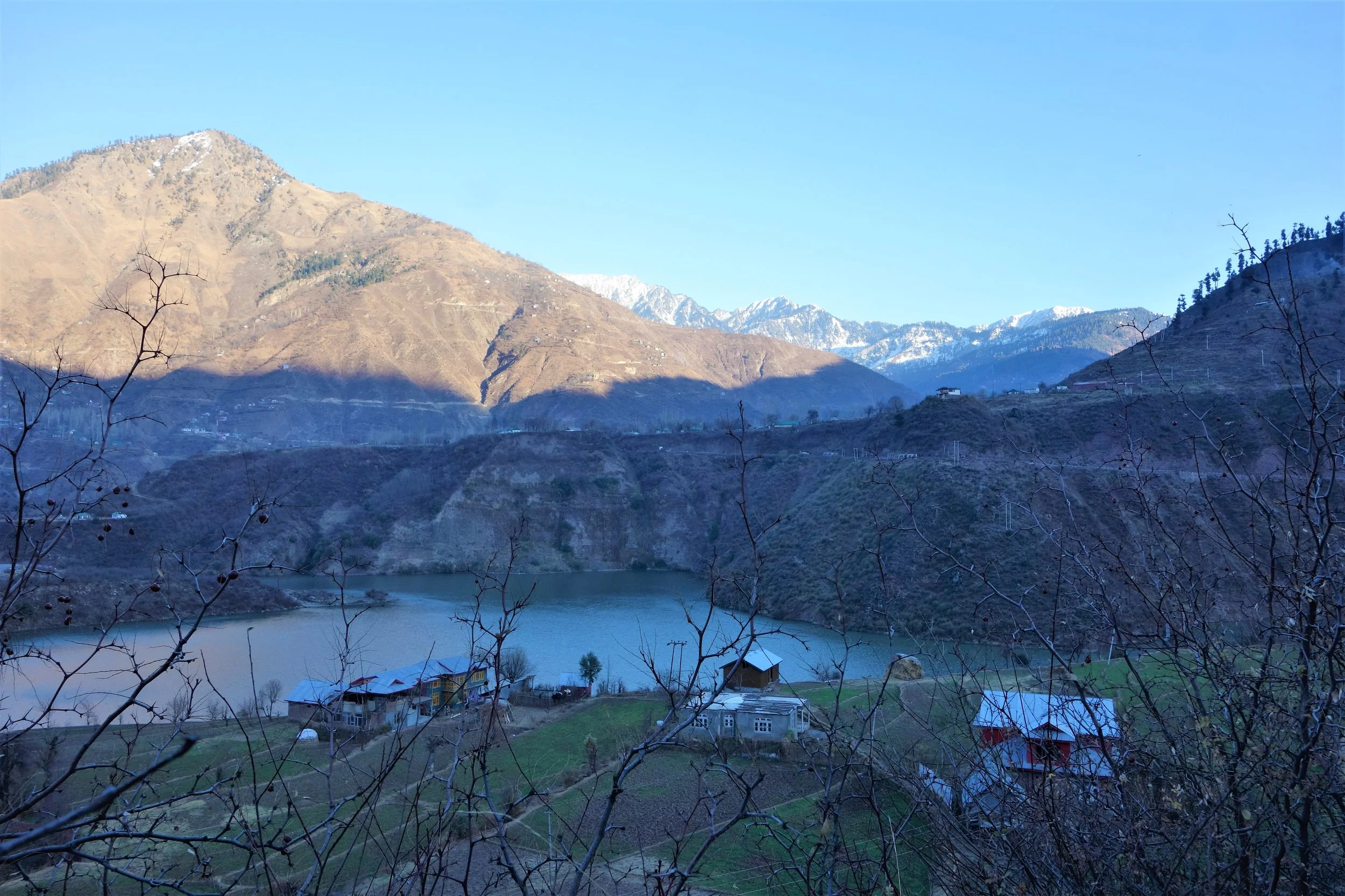
Moving beyond Uri and looking back just as we are reaching Salamabad
Sharing some pics of around Uri and I can assure you its much prettier in the Spring and the Summers. We at Travel The Himalayas arrange visits to such Offbeat destinations moving beyond the usual Touristy destinations.

The Road towards the LoC beyond Salamabad
Dulanja is one of the last Villages on the LoC on the Indian side and just beyond the Ridges is the Pakistani side across the LoC.

One of the last Villages on the Indian side of the LoC, Dulanja
Next time on your visit to Kashmir do try and fit in Uri as an Offbeat destination.

A beautiful Sunset in the area
Pics from 2017, December.

Gold Prospecting in the Riyasat e Jammu and Kashmir 1890
The Gazetteer of Kashmir and Ladakh of 1890 is a treasure trove of information regarding various aspects in the state. This is the small little Chapter in the Gazetteer which talks of Gold prospecting in the Riyasat. And of course it talks of some Gold mining in Baltistan.

A Man Sand Washing for Gold somewhere in Baltistan
The Gazetteer of Kashmir and Ladakh of 1890 is a treasure trove of information regarding various aspects in the state. This is the small little Chapter in the Gazetteer which talks of Gold prospecting in the Riyasat. And of course it talks of some Gold mining in Baltistan. But it mentions that Gold was still pretty tough to find and hardly an economically viable activity for the labour it involved. I wonder where did Herodotus get the reference for the Gold Digging Ants of Byltae ?
Gold.-Hugel is probably correct in his statement that neither gold nor silver has been found ; but he adds, "neither do the streams hear down gold dust, as in the neighboring countries."
This latter statement is disproved, as far as concerns the Shingo river, by Captain Montgomerie, R.E., who, in his account of the progress of the Kashmir survey, gives the following particulars regarding gold-washing in that stream "The drainage, escaping from the plains of Deosai, through a not easily distinguished gorge near the Katasiri station, falls into the Dras River above Kirkikhu. This tributary of the Dras River is called the Shigar and sometimes the Shingo river; it brings down gold with its waters, and gold-washing is carried on just below the junction. The Indus itself and several of its tributaries are known to produce gold.

The point at which the Shingo River meets the Drass River
The gold-washing in said not to be valuable, but it does sometimes give as much as one or two small rupees a day to a man, though a most barbarous method is employed in washing the earth. Thin earth is taken from the detritus which, I think, now generally lies above the highest flood line. After two or three washings, a black, heavyish sort of sand is left,, with the pieces of gold scattered here and there. As far as my own experience goes, I should say it was not a very profitable business, for after half an hour's washing I only got five very tiny nuggets hardly worth an anna, and I had, at the time, the benefit of the assistance of an Australian gentleman. This gentleman thought that something might be done by investing in a cradle aod apparatus. He said that a substance like the black send mentioned above had proved valuable in Australia."
Gold-washing is also carried on on the banks of the Jhelum, in the neighborhood of Tangrot, north of Jhelum, but to a very trifling extent. In the trans-Himalayan province gold is found in the bede of the Zanskar,Indus, and Basha rivers.

The Confluence of the Indus and the Zanskar
The people of Skardu are in the habit of coming every spring to the junction of the Zanskar river with the Indus, to search for Gold brought down by the melting of the winter Snow. Vigne says that on the banks of the Basha stream more gold is produced than in any other- part of Baltistan, and this was the only place which the former Raja reserved for himself. Any other person might wash the sand for gold elsewhere, but the value of the quantity collected at the end of the time expended is so nearly balanced that Vigne never saw any gold diggers but on one occasion (at Kiris). Here four or five men were employed, and must have washed and sifted a great many bushels of earth, but the quantity of gold dust obtained was not more than would cover a shilling.

Ladies learning Gold prospecting on the Shimsal River in Hunza
Apparently there still is a Tribe called Sonewal in the Shina language that pan the Rivers for Gold in Gilgit Baltistan and they sell their Gold to the jewellers in Gilgit apparently. But Gold prospecting still gives hope and some employment to people in these harsh Mountains.

The Indus Ganges Divide
The Indus and the Ganges are the two great Rivers which originate in the Himalayas/ Trans-Himalayas and all the Rivers of the Western and Central Himalayas drain into either of these two Rivers. The Indo - Gangetic Plain as the combined basin of these two Rivers is called sustains well over a Billion people and is one of the most thickly populated Regions on the Planet. The story of the Indus and the Ganga is the story of India in historical, social and religious contexts.
The Indus Ganges Divide
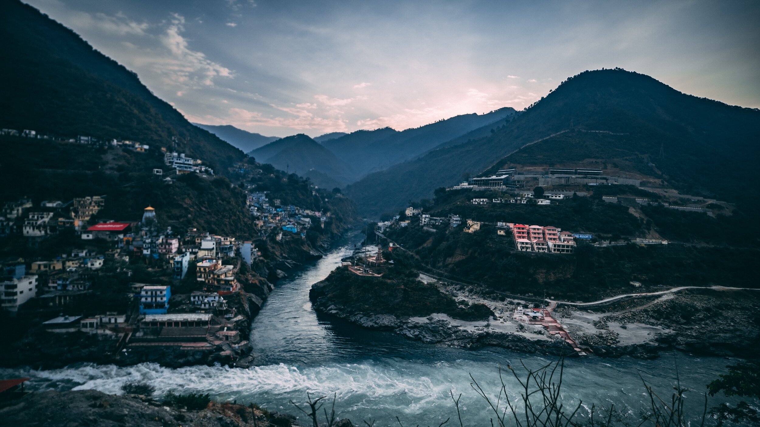
The Indus and the Ganges are the two great Rivers which originate in the Himalayas/ Trans-Himalayas and all the Rivers of the Western and Central Himalayas drain into either of these two Rivers. The Indo - Gangetic Plain as the combined basin of these two Rivers is called sustains well over a Billion people and is one of the most thickly populated Regions on the Planet. The story of the Indus and the Ganga is the story of India in historical, social and religious contexts.
Most of the Indus basin was turned over to Pakistan as a result of the partition though still a substantial part of Punjab, one of the most fertile of lands thanks to the Rivers coming down from the Himalayas still lies with us. The legendary land of the five Rivers traditionally stretched from Delhi to Peshawar though things have changed now. At the time of the Punjabi resurrection in early 1800’s under the indomitable Sher-E-Punjab, Maharaja Ranjit Singh it was the River Sutlej which served as the border between the powerful Sikh Kingdom of Punjab which stretched all the way to Tibet in the North and Balochistan in the South and the British Indian holdings.
The Sutlej also happens to be the longest of the five Rivers that give the Punjab its name and its also the Easternmost tributary of the mighty Indus. And its some where in Eastern Himachal that the actual ridgelines exist which separate the Indus Basin from the ganges Basin. Its actually a series of Ridges which run from Shimla itself towards Narkand and towards Rampur which lies on the Satluj River.
On the other side of the Ridge lie the tributaries and Nallahs which join either the Giri River or the Pabbar River. I assume that the Pabbar which drains into the Tons and then into the Yamuna and finally into the Ganges would be the Westernmost tributary (indirect albeit) of the Ganges. And interestingly some of these Nallahs are just a few hundred meters apart but the waters of one would end up in the Arabian Sea while the waters of the other would end up in the Bay of Bengal.
As per what you can see on the Google Maps Nallahs or Streams of the area join either the Satluj or the Giri River or the Pabbar. The Giri River is yet another tributary of the Yamuna which rises at a place called the Giri Ganga in the Mountains above Kharapathar near Kotkhai. Some of the Nallahs in the area are as follows
The Brandii Khad eventually joins the Satluj : https://goo.gl/maps/rsCFNgMFhCo
Ashwani Khad eventually joins the Giri River: https://goo.gl/maps/N4g4iY2iGGm
Nauty Khad (Eventually joins the Satluj) : https://goo.gl/maps/8JVFsbrETa42
Teer Nallah / Thaila Khad / Bhaira Khad are other Nallahs which run either side of the divide.
Can someone familiar with the Hydrography of the area let me know where actually are the points of origins of two seperate Streams which go to either sides are closest to each other ? Or is there a point somewhere where the same source of water gets divided to go either way. I would really like to visit such a place if it exists. This little piece of exploration might sound strange to people but different people have different obsessions. Mine is mainly the Himalayas and the Rivers which rise from it.
Thanks for taking time out to read this.
Presenting a pic of the Pabbar River cutting through the Pabbar Valley coming down from its point of origin at the Chandranahan Lake.
Of Mountains and Rivers
One of the most interesting thing about the Himalayas is how the Rivers interact with the Range and how the River Basins work. Since none of us is taught this in school in the Geography class the way one can study this fascinating aspect is to study Maps. Not the Maps of the new but the old Maps made by the Geological Surveys and the Royal Geographic Society Maps. The kind of detailing in these Maps is amazing when we keep in mind the fact that it was all done by boots on the Ground. No Aerial or Satellite Cartography.

Of the Himalayan Mountains and the Rivers
One of the most interesting thing about the Himalayas is how the Rivers interact with the Range and how the River Basins work. Since none of us is taught this in school in the Geography class the way one can study this fascinating aspect is to study Maps. Not the Maps of the new but the old Maps made by the Geological Surveys and the Royal Geographic Society Maps. The kind of detailing in these Maps is amazing when we keep in mind the fact that it was all done by boots on the Ground. No Aerial or Satellite Cartography.
And I finally found a Map which shows the River Basins / the Mountains / the Ridgelines / the Water Partings in a very simple and lucid fashion. Of course there are some explanations required for the un-initiated in the fine art of reading Maps. Not only does it show the Water Basins in the Himalayan context but it also shows the neighbouring River basins and how the Mountains affect the Course of the Rivers. You also need to understand that its this conflict between the Rivers and Mountains which has created the Valleys which has enabled Human communities to inhabit the Mountains.
In the Himalayan context the Three main Rivers which drain the Himalayas are the Indus in the West, the Ganges in the Middle and the Brahmaputra in the East. It is common knowledge that the Indus and the Brahmaputra which rise from almost the same vicinity of each other near the Mansarovar Lake in the Tibetan Plateau hem in the Great Himalayan Range from the opposite sides. The Indus forms the boundary on the West as it passes by the Nanga Parbat and the Brahmaputra forms the boundary on the East and it rounds off the Namcha Barwa in the East. The Indus and the Brahmaputra both never breach the Main Himalayan Ridgeline and run alongside but behind the Main Himalayan Ridgeline on the Tibetan Plateau. Both flow along what Geologists call the Indus Tsangpo Suture or divide in simpler terms. I would also like to mention one major River which actually cuts through the main Himalayan Ridge line and forms the Eastern boundary of the Western Himalayas. This would be the Satluj which coincidentally also originates around the same area as the Indus and the Brahmaputra (which is called Tsangpo in Tibet) and follows an independent course cutting through the Himalayas though it finally ends up in the Indus once it reaches the Great Plains of the Punjab.
Beyond the Basins of the Himalayan Rivers we have in the neighbourhood the Tibetan Basin though a part of the Tibetan Plateau is drained by these Himalayan Rivers themselves. Further North the main Ridge line of the Karakorams forms the Water Parting between the Himalayan Rivers (the Indus system) and the Tarim Basin. The Tarim Basin is itself separated from the Tibetan Basin by the Kunlun Mountains. To the West of the Tarim Basin separated by the Pamirs in the South and the Tian Shan in the North is the Central Asian basin of the Oxus and Jaxartes of the old. The names Oxus and Jaxartes were enough in the old times to induce Explorers to go into a frenzy so inaccessible these areas were. However nowadays the Oxus and Jaxartes are better known by their present names, the Amur Darya and the Syr Darya. On the southern Edge the Oxus and Jaxartes Basin is separated from the Himalayan River Basin by the Hindu Kush. Further down the sub Ranges of the Hindu Kush like the Sulaiman Mountains divides the Himalayan River Basin from the Helmand River Basin. This rounds off the Water Partings of the Indus in the Western Himalayas.
If you follow the Indus River in the Map you would see that after the point of origin the Main Waterparting of the Rivers runs behind the Main Himalayan Range rather than along the Main Ridge as classically should be the case. However at the point roughly at where it enters Ladakh from the Tibetan Plateau the River aligns itself with the Main Himalayan Range and continues the same course all the way to the Nanga Parbat where the Great Himalayan Range ends. The Water Parting however moves North towards the Karakorams and even across the Karakorams as seen in zone H. Close to the K2 however the Water Parting again moves along the main Himalayan Ridge line. But then after following the Main Ridge line of the Karakoram to West it again goes beyond the Karakorams as seen in zone C. It continues this trend until its behind the main Ridgeline of the Hindu Kush till at a point beyond the Tirich Mir it again aligns with the Main Ridge line to deviate again to form Zone B all the way to the Helmand Basin.
In pretty much the same way the Water Parting of the Tarim Basin also jumps beyond the Kun Lun, the Pamirs and the Tian Shans at places but it doesn't jump the main Ridge Line of the Karakorams as the reigning Peak of the K2 brings in a semblance of order and the Water Partings follow the K2 in the classical mode (I know this is complicated but once you co-relate with the Map and do some readings it will become more fascinating). Interestingly in the Hindu Kush its the highest Peak of the Hindu Kush the Tirich Mir which forces the Water Parting to run along the main Ridge line just like its supposed to be classically. However a point to be noted is that the Indus never concedes any of its “Mountains” the Western Himalayas or the Karakorams or the Hindu Kush to any River though itself it pushes its Basinal boundaries to well into the Kun Luns, the Pamirs and the Tian Shans though not quite making it to the main Ridge line.
And of course as we all the Mountains are rising and the Rivers are just cutting the Gorges and the Valleys and this state of flux will continue over a period of time till the end of time. And because of this constant change the Water Partings are not as fixed or permanent as we would like to believe. They are also constantly changing and evolving in a Geological time frame. This also shows how the Rivers and the Basind connect these highest Mountains in the World in a closer relationship than we actually believe. The River and the Basins provide the linkages which connect the Himalayas with the Karakorams, the Hindu Kush, the Kun Lun, the Pamirs and the Tian Shans. I collectively like to use the term “Himalayas” when talking about all these Ranges and the Great Himalayan Range when I am referring to the Main Himalaya Range. The highest Range on the Planet.
May we one day get to behold the magnificent sights that these Mountains hold and their mighty Peaks. And may we one day get to drink water from all these Rivers. The transition zones between these Himalayas is probably even today one of the least explored in the World and they continue to hold their Mysteries, occasionally revealing them to us mere Mortals.
The Making of the Brahmaputra
The Brahmaputra is one of the great Rivers of the World and its named after the Hindu God Brahma. The Son of Brahma actually. The River originates close to the Mansrover Lake and makes it’s journey across the Tibetan Plateau and then it turns around the Himalayas and finally arrives on the plains of Assam. Its course from the Tibetan Plateau to the plains of Assam was for years an endearing mystery.

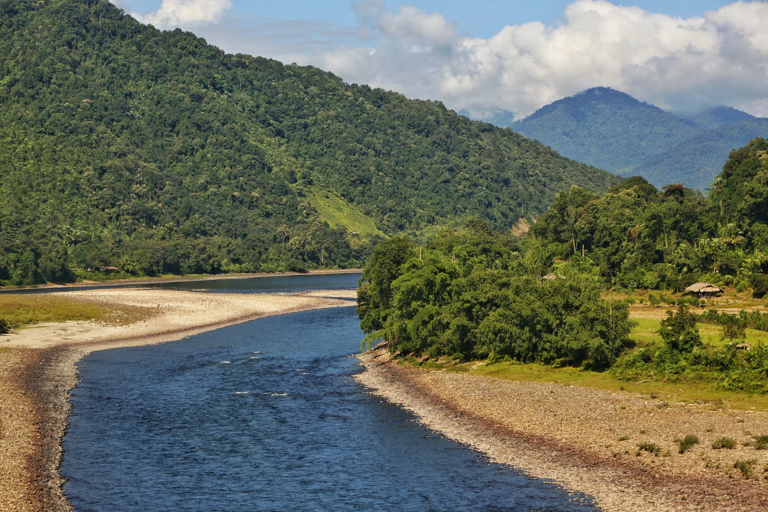
The Siang at Ranighat where it becomes the Brahmaputra
The Making of the Brahmaputra
So this year I finally saw for myself the only “Male” River of the Indian sub-continent the mighty Brahmaputra named after the God Brahma and it name means the Son of Brahma. In November though it presented its most benign form to me but it still was an awesome sight. For people used to Rivers in Northern India the Brahmaputra is almost a revelation because of its sheer size. Irs almost like an Ocean and you cant see the other end. I can only start to imagine how it looks after the Snow melt in the Summers and more so when the Monsoon hits and the River floods large areas of the surrounding country.
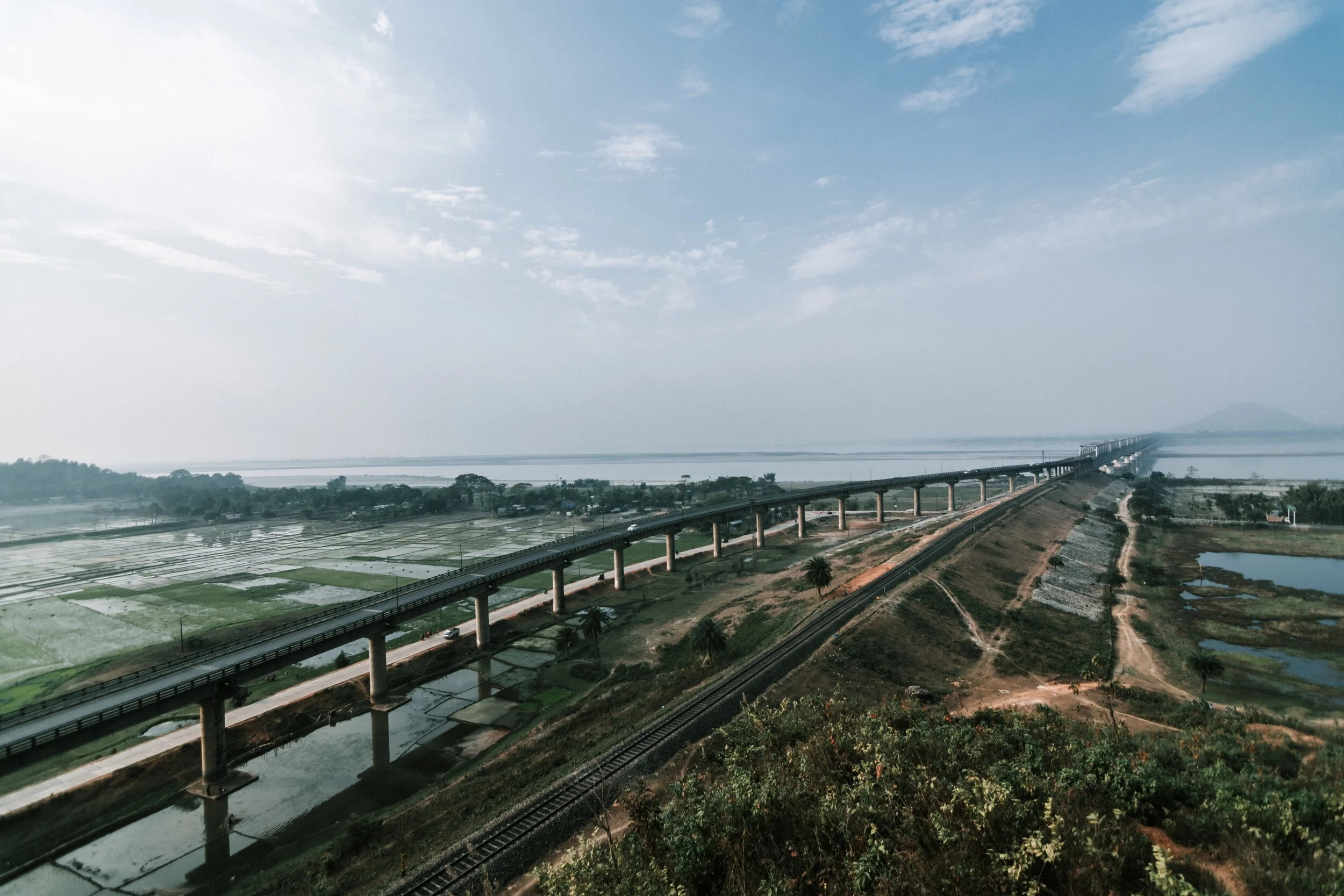
So we started off from Dibrugarh and made our way to the year old Bogibeel Bridge, which is a double decker Bridge for both Road and Rail and which has been in the making for over 200 months now. The work has been slow on the Bridge as it could only be done between the months of November to March when the rains are away and the water level was low. And it was from this Bridge that I had my first sighting of the mighty Brahmaputra and it looked awesome. In the far background I could see the silhouettes of the Himalayan foothills. And we couldn't help but stop our Cars in the middle of the Bridge and have a look at the magnificent Brahmaputra and its vast Flood plains. The River looked as serene as any body of water could and it was easy to forget that its the same River which wrecks destruction on a massive scale every year.

The Siang
Now understanding the origin of the Brahmaputra was always a complex task for the explorers of these parts which were few and far between. Unlike the Western Himalayas which had a whole lot of Explorers and Spies prying around, this was literally impossible in the Eastern Himalayas due to the dense Jungles which were a result of a lower Latitude (read this as warmer) and three times the amount of Rainfall that falls in the Western Himalayas. And then the thing was that there were three contenders who met at almost at the same location in the Assam plains near Sadiya where the Siang (also called the Dihang), the Dihang or Sikang which came from a more Northwesterly direction and then there was the mighty Lohit which came from an Easterly direction. All these carried enough water to be the Tsangpo. Finally the mystery was solved around 1885 and the Siang or the Dihang was finally established as the Tsang Po from the Tibetan Plateau.

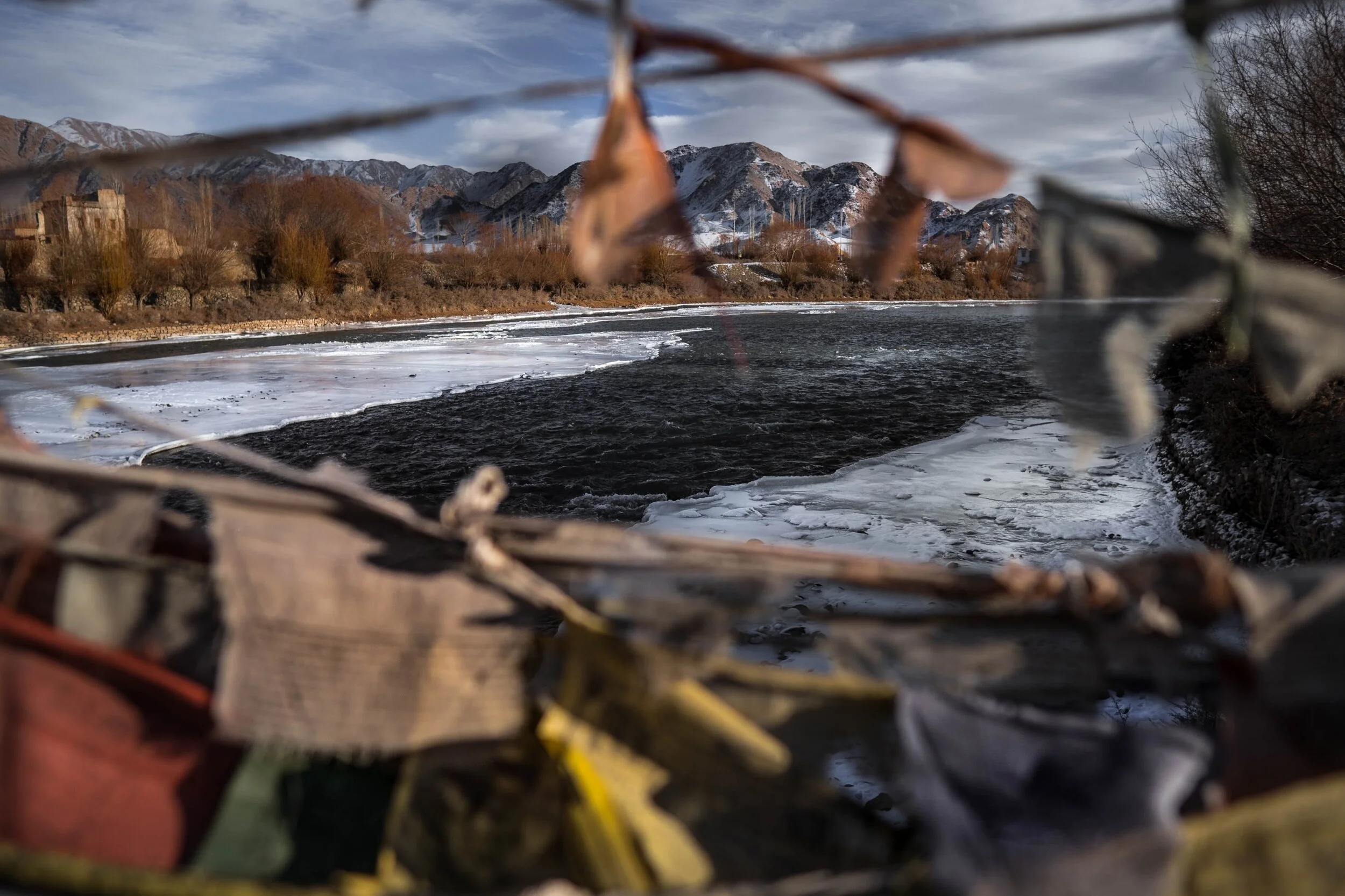
The Tsang Po on the Tibetan Plateau
Starting from the beginning or the Yarlung Tsangpo as its known in Tibet originates from the vicinity of the Mansrover in Western Tibet and flows in an Easterly direction. It has thousands of small tributaries in Tibet with the first main one being the Raga Tsangpo. And then its the Nang Chu, Shang Chu and Rang Chu. Further ahead its joined by the Lhasa River or the Kyi Chu as its also called. And then a couple of other Rivers till the point its reaches the Eastern anchor of the Great Himalayan Range, the Namcha Barwa, at 7782 m, does justice to the Himalayan Range. At this point Yarlun pivots and runs through one of the deepest River Gorges in the World, the Yarlung Tsangpo Gorge and emerges as the Dihang or the Siang in Arunachal Pradesh.
Out of the other two, which along with the Siang form what is called the Brahmaputra once it reaches Assam, the Dibang River rises in the Mishmi Hills which are located where the Himalayan Ranges meets the Indo Burma Hill Ranges. The source of the River is near the Keya Pass somewhere close to the border with China. The third River, the mighty Lohit rises in the Tibetan Plateau and is known there as the Zayu. Its origin lies in the Kangri Garpo Range and it enters Arunachal Pradesh from Tibet and finally emerges into the plains at what is known as the Parshuram Kund. Many people in Assam used to consider the Lohit as the main Brahmaputra and many still do.

The Siyom River meets the Siang
And of course as it moves on through the Plains of Assam its joined by a number of Himalayan Rivers such as the Subansiri, Kameng, Bhareli, Dhansiri, Manas, Champamati, Saralbhanga, and Sankosh rivers. As well as Rivers rising in the Hills on the like the Burhi Dihing, the Disang, the Dikhu, and the Kopili. And then it enters Bangladesh and out of our realm.
Having experienced it now I know why its the only “Male” River in India. I wish to witness its angry avatar. I will return someday.
And below is a picture of the place where the Dihang or the Siang becomes the mighty Brahmaputra and the Eastern Himalayas give in to Plains of Assam and vice versa. In Geographical context this is a place where all your dreams come true. You understand how infinite Nature is and how insignificant we humans are. Yes we did build a Bridge there though.
Pic from November 2019. Above Pasighat, Arunachal Pradesh
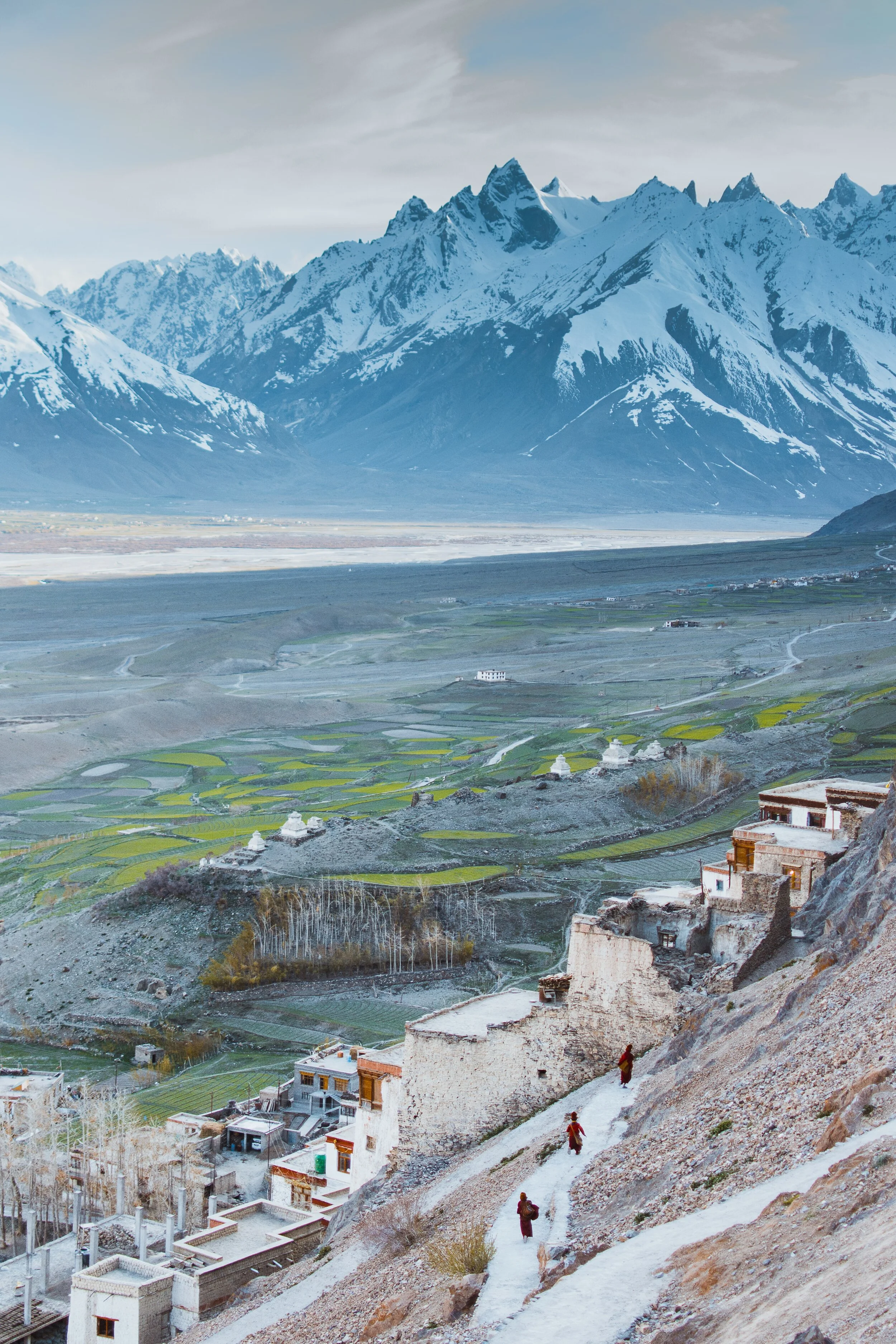
Pangi to Zanskar
The Ancient Routes which connected Pangi Valley in Chamba with Zanskar in Ladakh : Excerpts from Guide to Dalhousie Chamba and the Inner Mountains Between Shimla and Kashmir (1923)

The Village of Palamo on the Route connecting Lahaul with Zanskar via the Shinku La
Pangi to Zanskar
Excerpts from Guide to Dalhousie Chamba and the Inner Mountains Between Shimla and Kashmir (1923)
One of the most interesting readings of the recent times for me is this little Book. It was written by J Hucthison LRCP & SE, Chamba. It was printed at the Civil and Military Gazette Press in 1923 in Lahore and it was on sale for Rs.2.
Since at those times Motorable Roads / Motors were rare they hardly existed in the Himalayas. So a lot of stuff was written about different Routes which connected one Valley to another. And in today’s context we are sometimes surprised as the Routes were described between two areas which we don't really realise are close enough to be connected directly.
One such series is the section on the Routes which connected Pangi Valley to Zanskar. Yes you heard it right. These two were actually connected and still are though I doubt anyone uses these Routes anymore. We also need to remember that Pangi Valley in its higher reaches has Villages called Bhatoris which are Villages inhabited by “Bhots” as people of Tibetan/ Ladakhi origin were referred to. Just like in the neighbouring Paddar Valley of Kishtwar these “Bhots” are believed to have originally come over from Zanskar. Also worth remembering is the fact that Zanskar was at a point of time under Chamba Rule.

The Pangi Valley near the Killar Town
As per the Book, its says that in the earlier times a certain part of Trade to Central Asia was conducted from this Route while it was conducted from the Paddar and Umasi La Route as well. The Goods came to Pangi from Pathankot and Nurpur over the Sach and the Cheni Passes to Pangi. So what exactly does it say about the connecting Routes between Pangi and Zanskar. It mentions Six Routes which can be taken from Pangi to Zanskar and all these involve crossing the Great Himalaya itself. These are taken as stated in the Book.
1. From Darwas a branch ascends the Sural Nala and crosses the Sarsank Pass (16,200 feet), into the Danlong Nallah.
2. A similar branch from Kilar runs up the Hunan Nala and crosses the Shinkil Pass (16,300 feet).
3. From Sach a branch ascends the Saichu Nala to Saichu (10 miles), and Tuan (8 miles) and crosses the Mun La (16,500 feet), and unites with the two roads from Darwas and Kilar; the combined road then crosses the Poat La (17,500 feet) to Burdan Gompa in Zanskar. The roads from .Kilar and Tuan are seldom used. That from Darwas takes five days to Burda8n Gompa,. The stages are : Kansar, 8 miles ; Atyud, 1.0 miles ; Gokhun (over Sarsank Pass) 16 miles ; Sangati (Danlong N46), 6 miles ; Punchi (over Poat La) 12 miles ; Burdan Gompa, 6 miles. Large glaciers on both passes.

On the Road from Pangi to Lahaul along the Chandrabhaga
4. In the Saichu Nala an upper road runs from Kutal near Sach to Shun and rejoins the other road at Hillu, but it is rough and in places dangerous. From Saichu a Branch runs up the Chasag Nala to Bhotaur (10 miles) and crosses the Gurdhar Pass (16,791 feet), to Miyar (20 miles) in the Miyar Nala. This pass is so called owing to its being passable for ponies, which are brought from Lahul by this route to Pangi and over the Sach Pass to Chamba. Two men are needed to render help at difficult parts of the road.
5. At Udaipur a branch runs up the Miyar Nila and is narrow and difficult for four miles. From Chimrat (12 miles) the valley is open and the road good, up to the head of the Valley where it crosses the Kang La, 17,500 feet, in the Western Himalaya to Burdan Gompa. The journey from Kanjer, the last village, occupies five days. The stages are : Gompa, 8 miles ; Kesaryuncha, 7 miles ; Dutombn, 8 miles : Chural-pachan, (over Kang La), 12 miles : Bardan Gompa, 6 miles.

The Karsha Monastery in Zanskar. Pic by Klara Avsenik
6. Beyond Kanjer a branch ascends a side nala to croes the Tharang La, 17,133 feet, to the head of the Kado Tokpo stream in British Lahul. The journey from Kanjer to Darcha takes four days ; large glacier, but road fairly good ; no village till near Darcha.
Its amazing that most of these Passes and Routes are not in use and only the most hardened Trekkers venture into these most Inner parts of the Himalayas. This is where the opportunity lies for “Explorers” in the actual sense of the word to venture into see the beauty of the Inner Himalayas. As in the “wild” country which lies between “Shimla and Kashmir” as this hand Book called them.
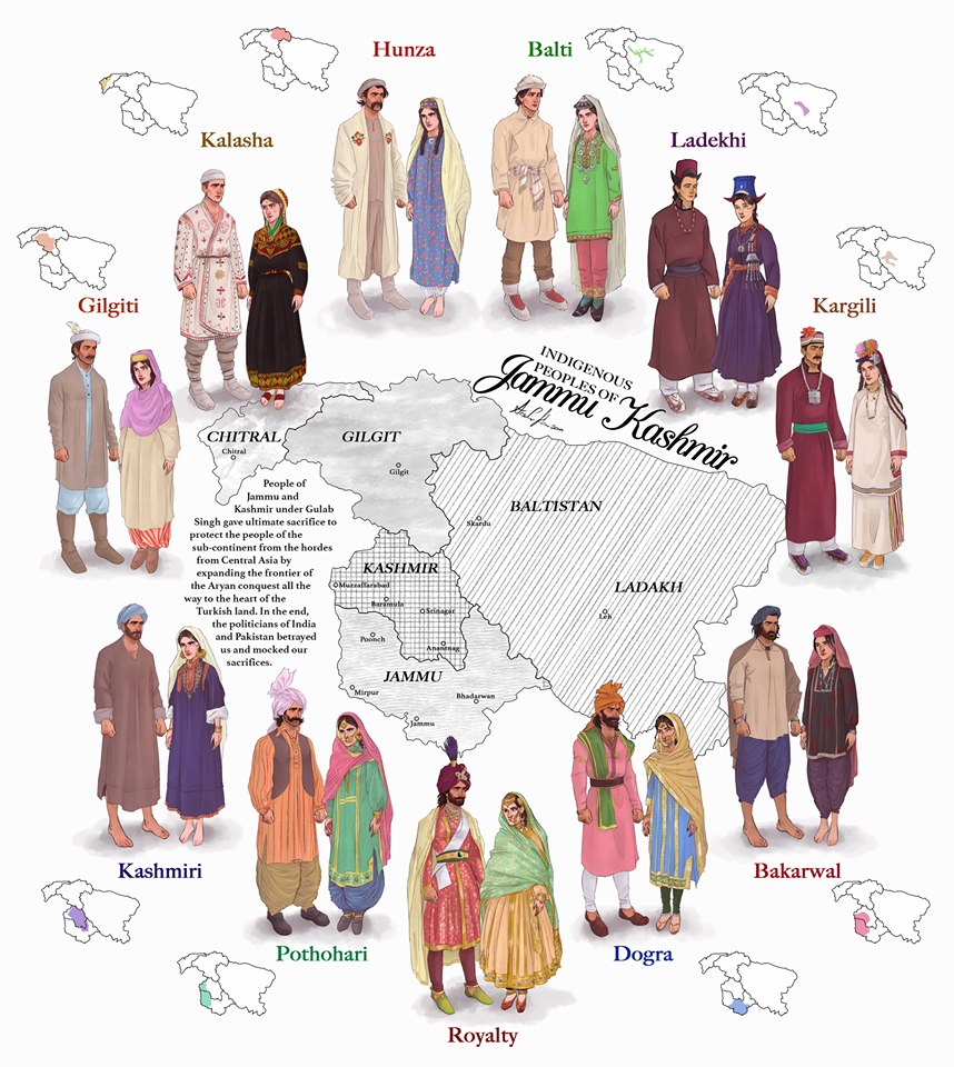
The Indigenous People of Jammu and Kashmir
The erstwhile State of Jammu and Kashmir was one of the most diverse State in the country in Ethnic, Religious and Lingual dimensions. The main "People" of Jammu and Kashmir and its different regions are briefly described in this Article.

The Indigenous People of Erstwhile State of Jammu and Kashmir.
This is a graphical representation of the people of Jammu and Kashmir made by Arsalan Khan and Rajja Sourav Singh Sarmal. A brief description of each by me to help in better understanding (Clockwise from top) :

Hunza (Burusho) Ladies. Pic credit Wikipedia
The Hunza : The Hunza or the Burusho people inhabit the Hunza Valley and neighboring Valleys in the extreme North of the state. They speak the Burushaski language which as a language has not been identified with any language Group. The Hunzai now mostly follow different schools of Islam.
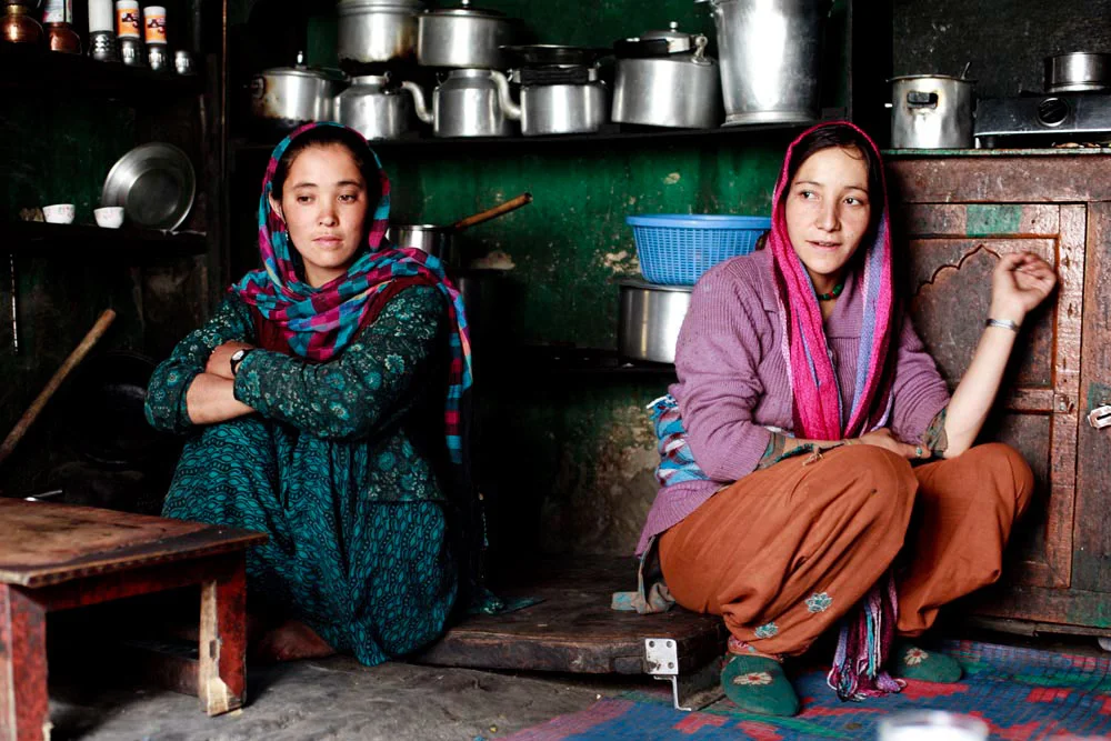
Balti Ladies. Pic Courtesy : https://www.behance.net/gallery/12289037/The-Balti-People-of-India
The Baltis : The Baltis are the inhabitants of the Baltistan and are of Tibetan origin with Dardic admix. Their language is Balti, which is a part of the Tibetan language Group. Infact it has the greatest similarity to old Tibetan. The Baltis follow Islam.

A :Ladakhi Lady in traditional Dress. Pic Courtesy Jimmy Nelson
The Ladakhis : The Ladakhis are the inhabitants of the Ladakh region and are of Tibetan descent. The Ladakhi language is from the Tibetan family. Ladakhis are Buddhists as well as Muslim.

Ladies in Kargil. Pic Courtesy Roots Ladakh
The Kargilis : The Kargilis or the Purigpas as they are called inhabit the Western part of Ladakh at the crossroads with Baltistan and Kashmir. Their language Purigi is a dialect of Balti and as such they are also a part of the Tibetan family. Purigis are mostly Muslim.

Bakarwal Men
The Bakarwals : The Bakarwals and their close cousins the Gujjars are traditionally nomadic pastoral people who inhabited the foothills of the Himalayas and moved to the Mountains in the Summers with their livestock. They (Gujjars/ Bakarwals) form the majority in the Poonch Rajouri region and spread among the Jammu Division and in Kashmir as well. They follow Islam.

Maharaja Ranbir Singh, the Dogra Ruler of Jammu and Kashmir state during who’s Rule the Dogra Kingdom reached it largest extent and also included Chitral
The Dogras : The traditional dwellers of the Jammu region or the “Duggar” as the region was known. They live in the foothills of Jammu and are spread into Himachal Pradesh as well. The Dogras speak the Dogri language which is from the Western Pahari Group of languages. The Dogras are mostly Hindu though a significant number converted to Islam and were referred to as Chibalis.
The Potohari : The Potohari/ Pahari are the most Punjabic people of Jammu and Kashmir and live across the Potohar Plateau which stretches well beyond Rawalpindi. They are in sizeable numbers in Poonch. Their language Pahari-Pothwari belongs to the Lhanda Family of Punjabi. They are majorly Muslim but there is a strong Hindu minority as well.
The Kashmiri : The people of the Kashmir area found mostly in the Kashmir Valley. They are the biggest Indegenous Group of people in the state. They speak Kashmiri language which belongs to the Dardic family of languages. Kashmiris are mostly Muslim though a small minority of Kashmiri Hindus also exists.

Dard - Shina People in Kargil
The Gilgiti : The Gilgiti or the Dards are the inhabitants of the vast Gilgit Valley in the North West of the state. They speak the Shina language. They (Dards) are also found in other areas of the state like Gurez and Drass where they have said to have migrated from Gilgit. They follow Islam though a few follow Buddhism as well in Ladakh.
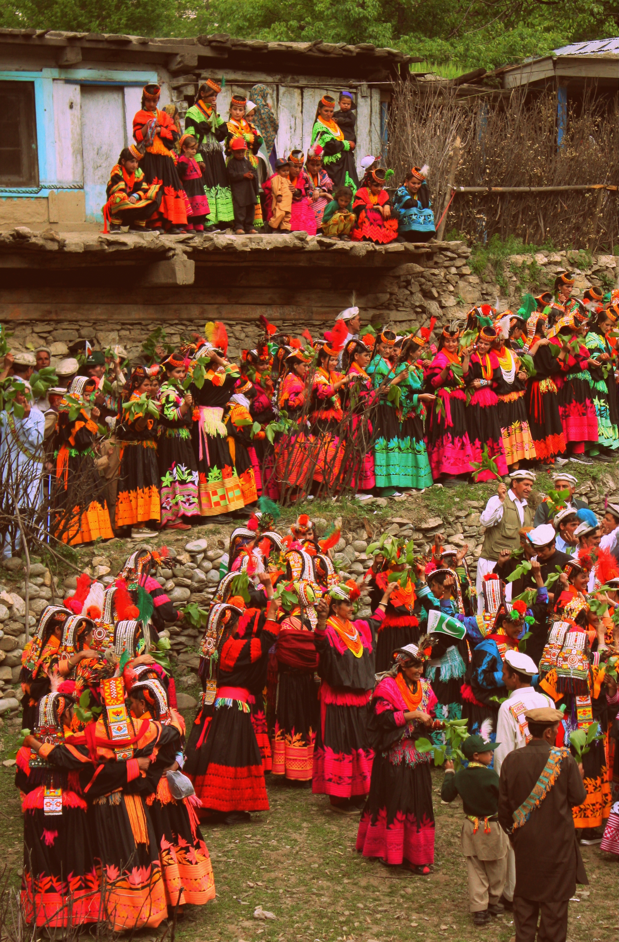
Kalash People during the Chillam Joshi Festiva. Pic Courtesy Wikipedia
The Kalash : The Kalash inhabit three Valleys in the Chitral Region now in KPK though at one time the Chitral Kingdom paid tribute to the Kingdom of Jammu and Kashmir. The Kalsha speak the Kalasha language which is a part of the Dardic family of languages. They have a distinct culture which has been under threat. Most Kalasha have converted to islam though a small number (3000 app) still follow traditional Animist beliefs.
Hi Res of Graphic can be downloaded from the link in the first comment.

Pogal Paristan : The Land of Fairies
There is a place called Pogal and Paristan/ sometimes written as Peristan as well. Pogal and Peristan are both Rivers and they together give their name to this area. As per some Paristan name is derived from the word “Pari” for fairy and hence it meant the Land of Fairies and it is really that beautiful from what I have read and seen. Sargali, Sunseri, GaganTop, Nandigarh, Hans Raj Peak, Sharvadhar and the beautiful Gugli Meadows are said to be some of the places worth visiting here. And the language spoken here is a seperate one called the Pogali which is considered close to Kishtwari and Kashmiri. But the fact that they have developed a dialect of their own speaks about the separate character of this Region.

Pogal Paristan : The Land of Fairies
Ever heard of it. I am sure not. This is a small Region located in Ramban district and above Banihal in an area which is as unknown as well I dont even have an equivalent. Very few people I know have even heard of this beautiful Region. Of course lying on the borderlands between Jammu and Kashmir divisions hasn't done any favours to this place. I have never been to this place but would probably go next time around. I was planning to go to Spiti as I have never been there but Pogal Parsitan sure sounds better. So when people ask me “Oh you've never been Spiti ? Ill just nod my head and say Oh you've never been to Pogal Paristan ? I would rather go to a place few people go then go to a place where everyone is going.
But the topic today is the place called Pogal and Paristan/ sometimes written as Peristan as well. Pogal and Peristan are both Rivers and they together give their name to this area. As per some Paristan name is derived from the word “Pari” for fairy and hence it meant the Land of Fairies and it is really that beautiful from what I have read and seen. Sargali, Sunseri, GaganTop, Nandigarh, Hans Raj Peak, Sharvadhar and the beautiful Gugli Meadows are said to be some of the places worth visiting here. And the language spoken here is a seperate one called the Pogali which is considered close to Kishtwari and Kashmiri. But the fact that they have developed a dialect of their own speaks about the separate character of this Region.
And going back to the Gazetteer and what it said about these places :
Pogal : The name of a Valley lying towards the South-East end of the Banihal district; its drained by the Sundari or the Pogal stream , which takes its rise on the Southern slopes of the Nandmarg mountain, and flows in a south-westerly direction to a junction with the Peristan stream a tributary of the Bichlari River.
Peristan : The name of a narrow valley lying at the south-east end of the Banihal district. Its general direction is east and west ; the range of mountains on the south side is of considerable elevation, and the slopes are covered with forest; on the north the hills are not so high, and are bare and stony, This valley contains no large villages, but there are numerous hamlets and a considerable amount of cultivation.
.The Peritsan stream, which drains it, takes its rise on the slope of the lofty mountain at the north-east end of the valley, and flowing in a westerly direction, unites with the Sunderi or Pogal stream, above its junction with the Bichlari. The banks are for the most part precipitous, especially on the north side.
It is bridged just west of the Village of Chiuli, and is fordable a little distance above it, and also, it is believed, in other places. The path from Kishtwir to Kashmir, by the Nandmarg pass, crosses the Peristan Valley. It ia used early in the season before the Brari Bal route becomes practicable.
It further mentions the following Peristan which is the name of a Village in the same Valley. A small Village in the Valley of the same name forming part of the Banihal district ; it is situated on the top of a spur above the west side of the Village of Halan.
The inhabitants number two families of Hindu zamindars and a Muslim Blacksmith.
Peristan lies on the Road from Kishtwar to Kashmir by the Nandmarg Pass.
I tried to find a pic of the Region and though I found a few Videos I couldnt find any pic to do justice to the beauty of the Region. So i just post the best pic I could find which is from July 2018. Its from a high Meadow and has Gujjar Dhoks.
Pic from July 2018 (assumed). Pogal Paristan, Ramban District, Jammu Division, Jammu and Kashmir. Photographer unknown.
The Lingual Diversity of the state of Jammu and Kashmir
The state of Jammu and Kashmir is made up of a number of geographically separate Regions divided by Ranges of the Himalaya. Its home to a diverse variety of Ethnicity, Cultures, Religions and of course Languages and Dialects. This article looks at the language diversity in the state of Jammu and Kashmir.

The Lingual Diversity of the state of Jammu and Kashmir
The State of Jammu and Kashmir is not only Geographically and Ethnically diverse with the two Highest Ranges in the World, the Himalayas and the Karakorams and also hosting Peaks of over 8000m from both these Ranges. Ethically it has a diverse mixture of people and distinct Regions dominated by different Religions such as Islam, Buddhism and Hinduism. But one of the little understood and little know fact in the Lingual diversity that exists in this state which we study as it existed in 1947 before the Partition.
The state was basically made of of 5 different Regions which were all Mountainous and it was the Mountains and the Rivers which divided the Populations. The main Regions as we can name in today’s context were (in Alphabetical order) were Baltistan, Gilgit, Jammu, Kashmir and Ladakh. And of course we have a major language language associated with the Region. Balti with Baltistan, Shina with Gilgit, Dogri with Jammu, Kashmiri with Kashmir and Ladakhi with Ladakh. But these classifications only sum up the language of the perceived majority in that Region but doesn't really give a true picture of the lingual diversity and how the languages sometime merge to create hybrid languages.
Starting from the Jammu Region which has a diverse language influences. Starting from the bottom at Poonch and Rajouri where the spoken language is Poonchi or Pahari or Potohari. This language belongs to the Lahnda/ Punjabi family of the Indo Aryan languages. Moving Eastward we have the Dogri language, which was considered as a Punjabic language and still has a lot of commonality with Punjabi. But now Dogri is considered an independent language and one of the main languages of the Western Himalayan Pahari language Group.
And then we have the Gurjuri spoken by the Gujjars. Gurjuri is closely allied to the Marwari dialect of Rajasthani and also has a fair mix of Punjabi in it. In fact the Gujars living in Punjab speak Punjabi and the languages are intermixed. Gurjuri is also spoken in the Kashmir Valley where also there are communities of Gujjars. However a number of Kashmiri words have overtime have become common usage by the Kashmiri Gujjars influenced by their Kashmiri neighbours.
Moving upwards into other parts of the Jammu Division we see increasing influence of Kashmiri language which is a part of the Dardic Language family of the Indo Aryan language Group. Bhadarwahi, Bhalesi and Curahi from an intermediate forms of speech bridging the gap between the Punjabi or Dogri and the Kashmiri System. Padari is an extremely interesting dialect, spoken in Padar region of Kistwar on the banks of the Chinab. It has a striking similarity to Pangwali, spoken in the Pangi Valley in Chamba.
Siraji is the language spoken in country north of Chinab between Ramban and Bhart on the way to Kishtwar. It is central to Doda and is also called Doda Siraji at times. Due to its location, to the North it gives was to Kashmiri, on West to Rambani, on the North East to Kishtwari, and on the South and South West to Bhadarwahi and Chamba dialect. Its generally frameworked like Punjabi but has many points in agreement with Kashmiri.
Rambani as the name suggests is the language spoken around Ramban and like the Poguli which it closely resembles it is connected with Kashmiri though further away than it than Poguli. Rambani has a very largely Punjabi pronunciation whereas Poguli pronunciation is more like Kashmiri.
Poguli is a language spoken in a small area to the East of Ramsu. It resembles Kashmiri though it is unintelligible to speakers of the Kashmiri language. However it seems that all speakers of Poguli have some basic understanding of Kashmiri. Nearly all peculiarities of Kashmiri are found in Poguli which however contains a number of points in common with dialects which look to Punjabi as a fountainhead. Kishtwari is spoken around the Kishtwar area of the Kishtwar region. It is considered a sub-dialect of Kashmir which it resembles very much. Kashmiri is well understood in Kishtwar.
And of course then we come to the Valley itself where the main spoken language is Kashmiri. The second most spoken language in Kashmir is Gurjuri probably followed by Punjabi / Pahari spoken in the Border areas adjoining the LOC in the West. However there are still speakers of Shina in the Gurez Valley, a couple of Villages in Tral and the Sarbal Village in Sonamarg. There is also a small community of Shina people who live in Srinagar city and they also speak Shina. Shina BTW is the main language of people in Gilgit.

Shina itself is a part of the Dardic family, same as the Kashmiri language. Its the most spoken language of the Gilgit region and it has a number of dialects such as Gilgiti (the prestige dialect), Astori, Chilasi Kohistani, Drasi, Gurezi, Jalkoti, Kolai, and Palasi. Related languages spoken by ethnic Shina are Brokskat (the Shina of Baltistan and Dras), Domaa, Kohistani Shina, Palula, Savi, and Ushojo. Shina is also spoken in the Drass area, Dah and Hanu and other “Aryan” Villages of Ladakh. Shina is also spoken in areas adjoining Gilgit like Kohistan in Khyber Pakhtunkhwa.
And then we come to Baltistan, where the main language is Balti. Balti is a part of the Tibetan family and belongs to the Ladakhi Balti Group. Infact many words that were used in old Tibetan are still found to be in use in modern Balti whereas they are not used in modern Tibetan anymore. Balti is widely spoken in Baltistan and a dialect, the Puriki is spoken in the Kargil area and the Suru Valley. Proper Balti is spoken in the Turtuk area of Ladakh as well. The language is also used by Balti communities settled elsewhere including the small Group of Balti people settled around Dehradun in Uttarakhand.
And finally Ladakhi which like Balti belongs to the Tibetan language family and is related to Balti as well. Besides proper Ladakhi it has a dialect called the Zanskari which is spoken in the Zanskar region. Interestingly both Ladakhi and Balti belong to the Ladakhi Balti family of Tibetan language. These are also called Western Archaic Tibetan languages as they have a lot in common with Old Tibetan unlike the more modern Western Tibetan language of the Lahaul Spitian language. Ladakhi has other sub-dialects if you may like Lehskat after Leh, where it is spoken; Shamskat, spoken in the northwest of Leh; Stotskat, spoken in the Indus valley and which is tonal unlike the others; Nubra, spoken in the north of Leh. In my personal experience I think all these Tibetan languages are mutually intelligible to some extent as I see people speaking Puriki and Ladakhi being able to have a conversation.
This should give you an idea of the languages spoken in the state of Jammu and Kashmir and we know that in the Mountains in the older times populations evolved in isolation and hence the vast array of languages and dialects and sub dialects. Infact in some cases the language changes from Valley to Valley so the actual number of dialects are well impossible to even comprehend but this gives you an idea of the diversity.
Source : Language of Northern Himalayas by Bailey 1908 and other Internet sources including Wikipedia.
And adding a language Map of Jammu and Kashmir by Drew from the late 1800's.
The Original Mountain Men and Women of the Western Himalayas
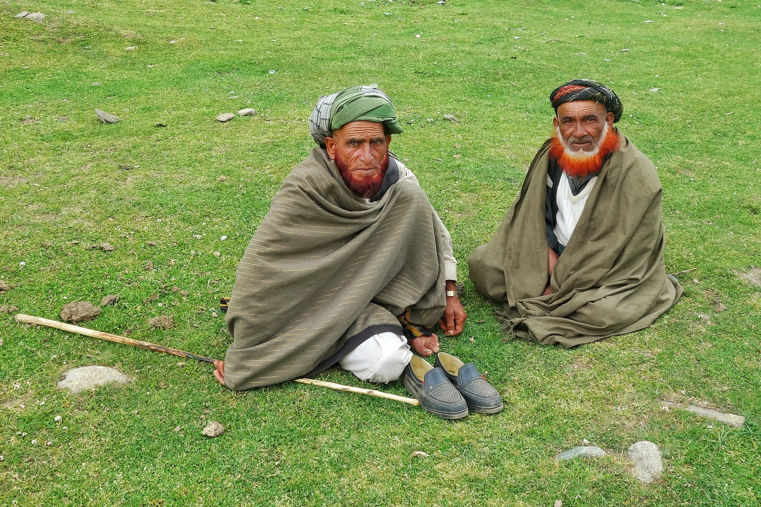
Ive had a childhood fascination for the Gujjars and especially the Bakarwals while growing up in Kashmir. Well they are almost the same thing except that nowadays the ones who live in fixed locations are called Gujjars while the ones which move up and down with their herds are referred to as the Bakarwals. Also as the name suggests it comes from the word Bakri, so a Bakarwal is also a keeper of the Sheep. Especially in the State of Jammu and Kashmir. There isnt a single Region in this vast State which is not familiar with the congenial Bakarwals who flocked to the highlands with their Goat/ Sheep / Buffaloes / Horses/ Mules which they term as “Maal” as in “Goods”. That is the commodity that they deal in and a Bakarwal is judged by the size of his Herd. And then there were my favourite part of a Bakarwal entourage, the Shepherd Dogs also called by the same name Bakarwal or Bakarwali.
The Original Mountain Men and Women of the Western Himalayas
Ive had a childhood fascination for the Gujjars and especially the Bakarwals while growing up in Kashmir. Well they are almost the same thing except that nowadays the ones who live in fixed locations are called Gujjars while the ones which move up and down with their herds are referred to as the Bakarwals. Also as the name suggests it comes from the word Bakri, so a Bakarwal is also a keeper of the Sheep. These Bakarwals are the original Mountain men of our parts. . Especially in the State of Jammu and Kashmir. There isnt a single Region in this vast State which is not familiar with the congenial Bakarwals who flocked to the highlands with their Goat/ Sheep / Buffaloes / Horses/ Mules which they term as “Maal” as in “Goods”. That is the commodity that they deal in and a Bakarwal is judged by the size of his Herd. And then there were my favourite part of a Bakarwal entourage, the Shepherd Dogs also called by the same name Bakarwal or Bakarwali.
Most of these Bakarwals are now based in the Winter time mainly in the Poonch Rajouri areas of J&K where they form a majority of the Population. However they are distributed all over the Jammu Division as well as neighbouring Regions of HP like Chamba and places like Nalagarh in Punjab and moving further East even as far as Dehradun in Uttarakhand. Infact in parts of Jammu and Himachal Pradesh they share the pastures with the other Mountain Men, the Gaddis. The main difference being that the Gujjars / Bakarwals of J&k are Muslim while the Gaddis are Hindu.
From the Jammu side they usually move towards the higher Regions in the state in all the 3 Divisions of the state. They cross the Pir Panjals to get into the Kashmir Valley and head onto the higher Alpine meadows dotted around the Valley. In the Jammu division they move towards the Kishtwar side and spread over the different Valleys like the Padar Valley from where some even go towards Zanskar. There are others who go towards Marwah and Wadwan and some even cross over to the Suru Valley in Ladakh. Some go to the higher reaches in Kathua District like Sarthal where I happened to meet both Bakarwal and Gaddi shepherds.
While on the Machail Road on the way back we gave a lift to a Bakarwal who had just left his herd at somewhere beyond Machail, areas which are inhabited by Buddhists who came to the Region from adjoining Zanskar. And we gave him a ride till Gulabgarh and on the way he asked us how hot it is in Jammu and we said that down in the foothills the temperatures were over 40 C. Ah he said then Ill go to Srinagar. I asked him why ? Well its cooler there he said and told me he had another Dera somewhere near Shopian in the higher reaches on the way to the Pir Ki Gali.
Kashmir Valley itself has quite a strong Gujjar population and they largely inhabit the areas in the higher reaches above Ganderbal all the way to Zoji La. They are also spread in the more sensitive Border Villages along the LOC. They actually live on both sides of the Border and the area that we belong to, ancestrally was also a Gujjar majority area. So we have a kind of language affinity with them as well and we can almost understand each other when they speak Gojri and I speak our Punjabi. Thats another reason why I get along with them famously. Infact in the time of Grandfather all the main guys handling the tougher side of business like the Forest Leasee and other Construction work was handled by the hardy and reliable Gujjars. And I remember my favourite one was a guy called Sitara, who drove one of our Trucks. Typical handsome Gujjar with a flowing orange (henna dyed) beard. And of course we use love going for a drive in the Truck.
Anyways with modern times creeping into their lifestyles as well many of the younger generation are now looking for alternative, more settled ways of life. Taking the heards over the high Passes into secret Valleys and Dhars best known to their forefathers and all the associated Risks are just not worth it for the newer generation. And of course every Bakarwal father wants to give education to their children and of course this is good. And education leads to aspirations and being a Shepherd doesnt rate high on any work list. I am afraid the Bakarwals we see now are the last of the Generation and the time is not far when coming across a Bakarwal entourage would be a rare thing. Its getting rarer but you can still manage if you know where to go.
And here is an entourage that we met on the way from Kishtwar to Gulabgarh. The younger and fitter men had already gone ahead with the “Maal” and this was the follow up party of the older men, women, kids and their well dressed Horses and Mules. They were a riot of Colour. And of course the younger Bakarwalis (I mean the Dog breed) as the strong amongst them were on duty with the Maal. And it was quite a sight.
Background Music is a Bakarwali song that I got from Youtube and not sure of the origin. The beautiful Song talks about a Lady (Young) talking about its only companion a Crow that used to sit on a Mountain Top. And the lady yearns for her loved ones and keeps sending many letters to her Baba, Chacha, Mama and Lala. Well thats what I understood .Enjoy the Video and the song.
PS: We took permission from the main Elder before shooting the Video and the ever genial Bakarwal gave it when I broke into my Mother tongue.
Video from June 2019. On way from Kishtwar to Gulabgarh. Jammu Division. J&K
The Dichotomy of the Moon River
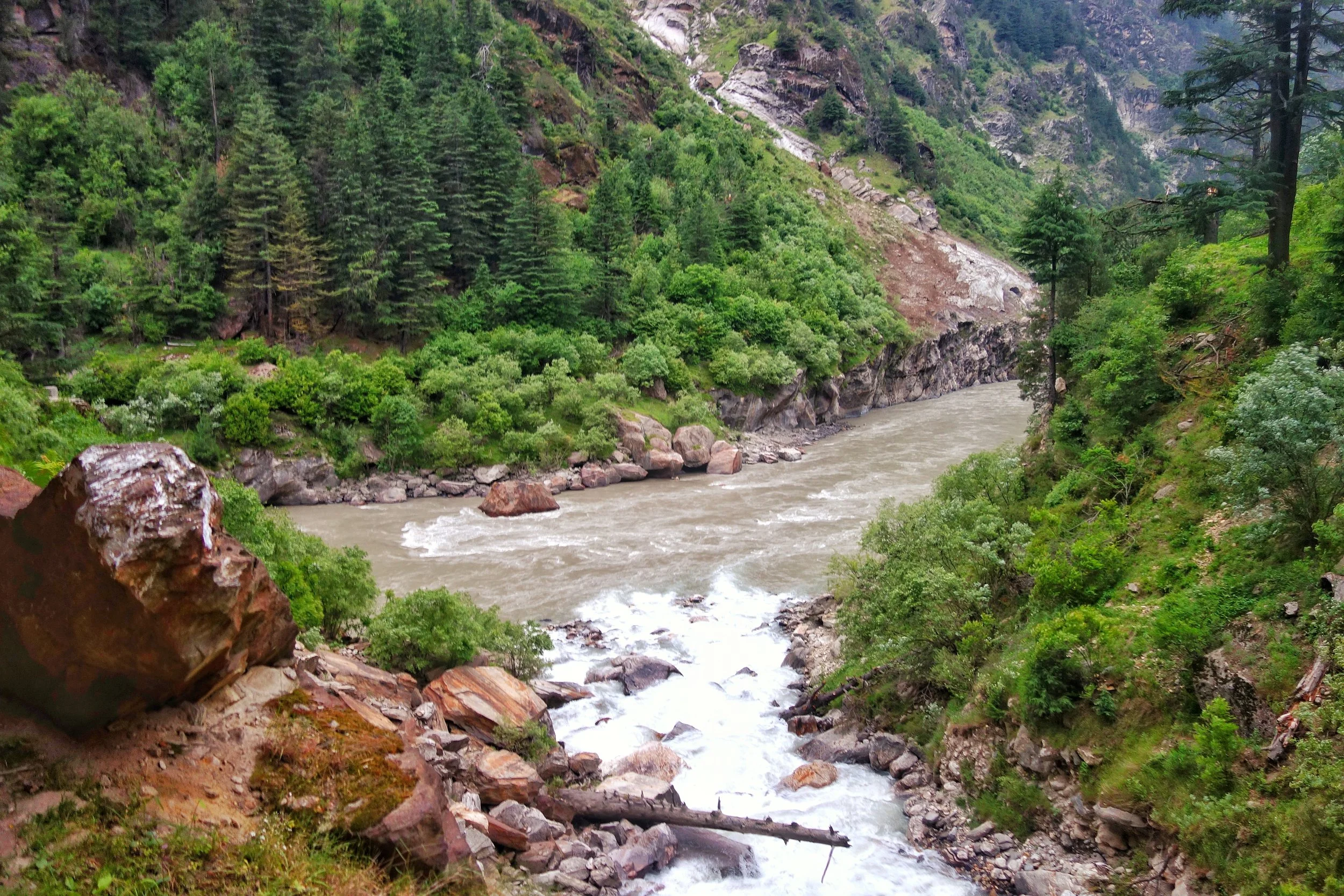
The Moon River or the Chandrabhaga or the Chenab is a River that flows through some of the most rugged parts of the Himalayas starting its journey in the Lahaul Valley and making its way through Pangi Valley and into Padar Valley and Kishtwar in Jammu and Kashmir. It is a River of many legends and we try and Map its jurney from the Chandrabhaga to the Chenab.
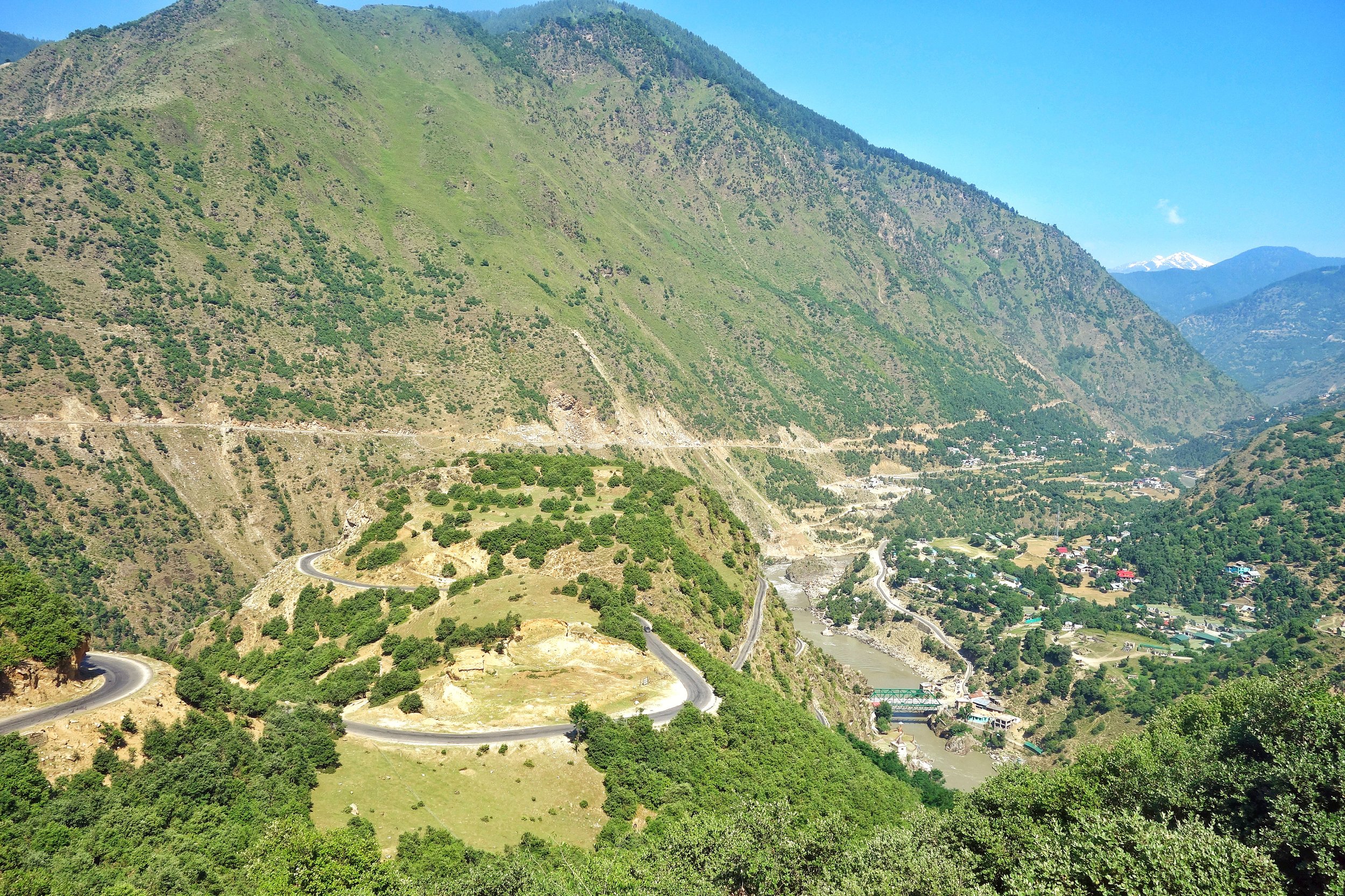
Bandarkoot near Kishtwar where the Marsudar meets the Chenab / Chandrabhaga
The Dichotomy of the Moon River
The Moon River as I like to call it or the Chandrabhaga or the Chenab, as its commonly known as, is truly a Himalayan River in all senses. This River and its tributaries run through some of the wildest and the ruggedest country in the Himalayas.Lahaul, Pangi and Kishtwar Valleys and their sub-Valleys are homes to this River. All these three Valleys have some of the craggiest Peaks in the Himalayas and the beauty is just mind blowing. Its the River of folktales and in the Punjab many love stories were written about Lovers being seperated by the Chenab. Who can forget the immortal lines from the classical Punjabi romance Sohni Mahiwal :
Sohni Chenab de kinare, Te Pukarey, Tere naam ve, aaja aaja aaja
Of course it ended in tragedy when both Sohni and Mahiwal were taken by the Chenab and the romance turned into a Tragedy for people to talk about.
Most are well aware that the Chandra and Bhaga River which rise around the Baralacha La Pass and then flow down into Lahaul and they finally merge. But the Chandrabhaga or the Chenab is the only major Himalayan River who’s name changes for apparently no reason. And also it has two starting points as well and there is debate whether the Chandra is a tributary of the Bhaga or the other way round. Its mostly an academic debate as they both rise close to each other and as by scientific definition the main River is the one which rises the farthest from the point it hits the Sea or another River that it merges into. And the Moon River finally becomes a part of the mighty Indus, after combining with the Sutlej as the Panjnad, as it makes its way to the Ocean.
Video of Driving along the Chandrabhaga Gorge between Killar in Pangi Valley, Chamba to Udaipur in the Lahaul Valley.
So why the 2 names ? The Moon River was referred to as the Askini in the Rig Veda. It meant the River with dark waters which holds true till today. The Waters of the River are rather murky as I couldnt help but notice as I travelled along the River from Kishtwar all the way till Tandi. The Gorge of the Moon River is amazingly spectacular. Its sparsely populated because of the verticality and its only now with the building of Roads can we humans even venture into this forbidden land of the Moon River. It was refferd to as the Chandrabhaga in the Mahabharata as well and the Greeks also called it Sandraphogus / Sandabaga / Cantabaga. Infact Alexander the Great established an Alexandria on the Indus at the point where the Panjnad (combination of the Chandarbhaga/ Chenab and Sutlej) met the Indus. The name Chenab is also a further development of the name with Persian cognates. Chen meaning Moon and Ab meaning water. The Moon River.
So where exactly does the River change its name ? On the maps, the regular ones officially once the River crosses into J&K from Himachal Pradesh which is at the point where the Sansari Nallah meets the River. The Sansari Nallah is considered the Border between the two states though some Maps of JK claim areas beyond the Sansari Nallah like Dharwas before Killar to be a part of J&K. The Sansari Nallah is a typical wild Himalayan River of the Region and this The photo below is taken exactly at the point where this Nallah meets the Moon River.
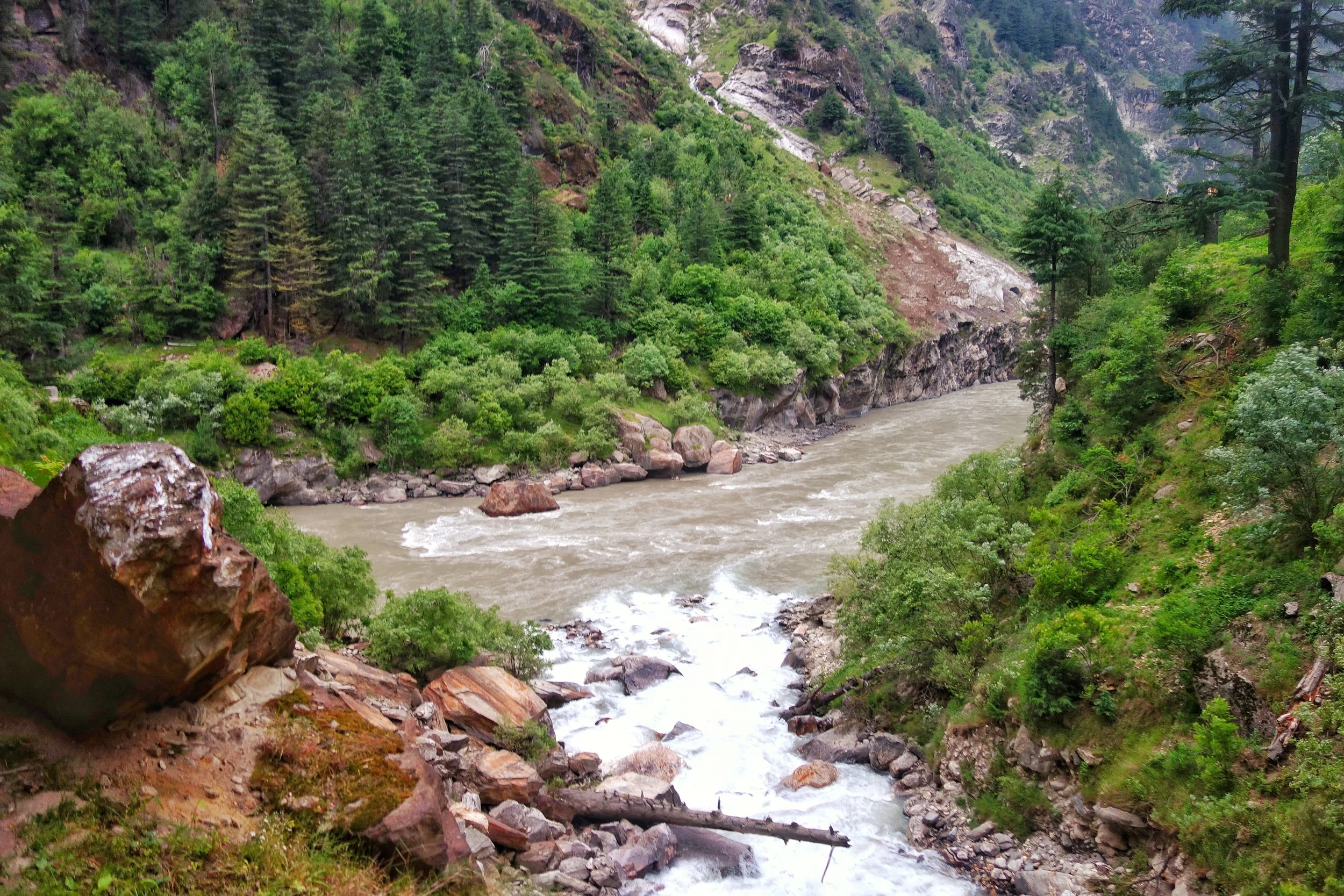
The Sansari Nallah as it meets the Chandrabhaga at the border between Himachal Pradesh and Jammu and Kashmir. This is where the Chandrabhaga becomes the Chenab.
The Sansari Nallah as it meets the Chandrabhaga at the border between Himachal Pradesh and Jammu and Kashmir. This is where the Chandrabhaga becomes the Chenab as per one account.
But there is more to it. Many purists consider the River to be still the Chandrabhaga as it enters the state of J&K. One of the main proponent of this theory is a Slovakian gentleman by the name of Altos Mlonk. He is an absolute Guru. He is the absolute master of Kishtwar and knows stuff beyond our imagination. As per Altos the point where the Chandrabhaga becomes the Chenab is at Bandarkoot near Kishtwar town where the turbulent Marsudar meets the Chandarbhaga. Infact the Marsudar carries more water than the main River itself when it merges into it.
The Marsudar rises at around 5175 mts and its begins life as the Gumbar and the Batkot Nallah which merge and form the Warwan River. This River has carved out the Warwan Valley which in my opinion is one of the most beautiful Valleys of the Himalayas. And the Warwan flows down and is joined by many other Rivulets in the Marwah and Dachan areas. The Marsudar flows throw some of the most unknown areas of the Himalayas which most wouldnt even know of. I trekked the Warwan in in 1989 and still remember the quaint River unlike the wild Marsudar that it becomes.
So I take it as such. And believe that the Chandrabhaga becomes the Chenab when the Marsudar joins it at Kishtwar. The place where these wild Rivers meet is like a pilgrimage spot for someone like me. Its just magical when you think about the places these Waters come from. The Moon River enchants forever.
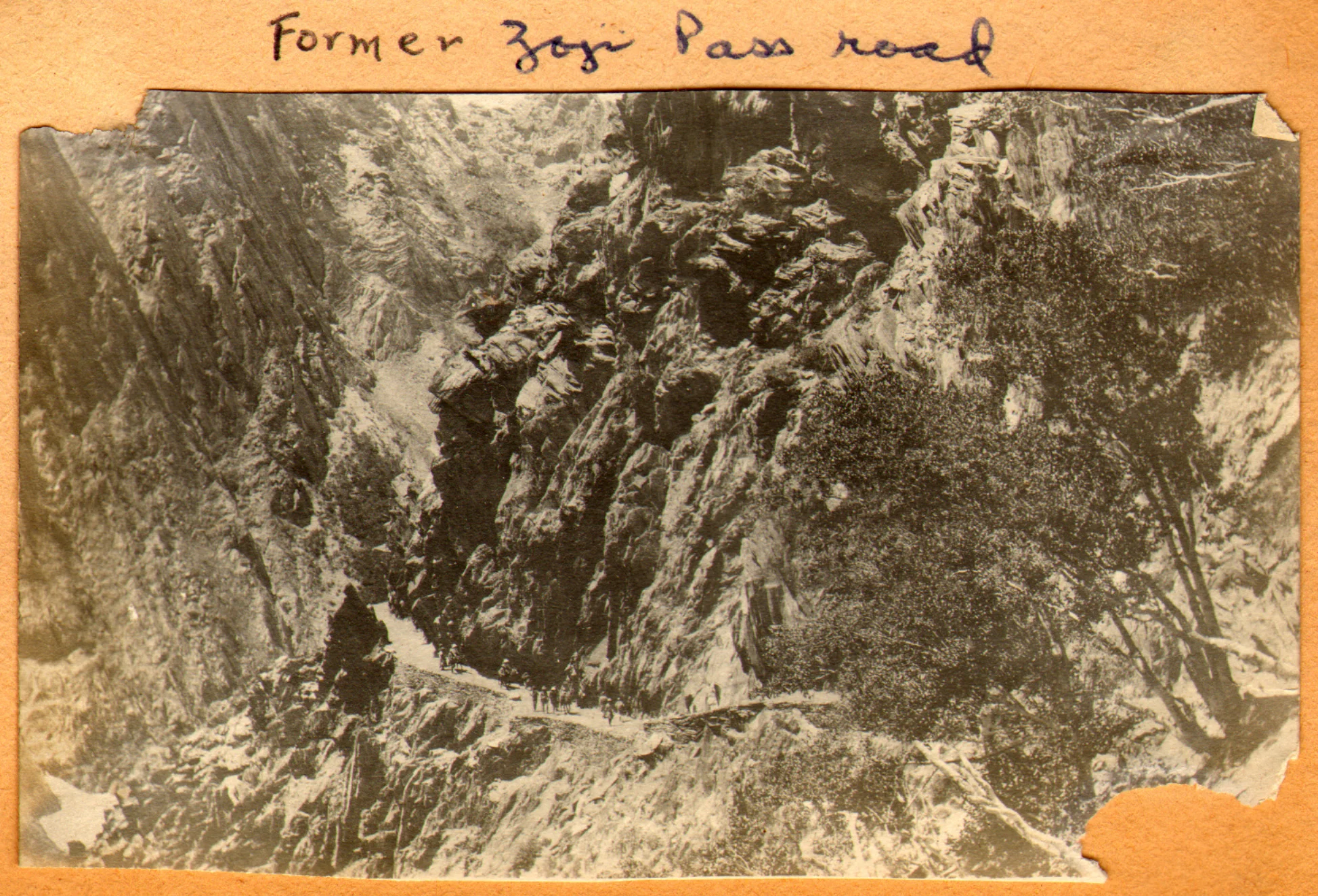
The Pass of Shiva
The Pass of Shiva as it was originally called is one of the main Passes used since historical times and it connected Kashmir with Ladakh. A fascinating insight into the Pass of Shiva or the Sheoji Pass. Today this name has transformed into what we call the Zoji La.

The Pass of Shiva
Sometimes while going through historical documents you stumble upon information thats nothing short of fascinating. As I spend some time everyday browsing through historical Documents / Journals related to the Himalayas in general and the Western Himalayas I came upon a piece of information that I was also unaware of.
The mighty Zoji La which connects Kashmir with Ladakh above the Sind Valley was actually named after Lord Shiva. The name of the Pass used to be Shivji Pass or Sheoji Pass which was corrupted with the Passage of time and eventually Sheoji turned into Zoji. Now the thing that is fascinating about this is that this is the first time I am hearing of a Mountain Pass named after the most powerful God of the Hindu trinity.

The Zoji La track as it was in 1913. Photography by Ralph Stewart.
This is what the 1890 Gazzetteer of Kashmir and Ladakh mentions about the Zoji Pass : Called Zoji La by the Ladakhis and Zoji Bal by the Kashmiris. The proper name is a corruption of Shivji or Sheoji, one of the three great Hindu deities. It leads over the Western Himalayas from the head of the Dras Valley to the Sind Valley in Kashmir. And is crossed on the Route from Srinagar to Leh between Baltal and Matayan.
It further mentions : The Pass has many names ; in the old Maps it is called Kantal, signifying the lofty hill, and under this name Jesuit missionary Desideri refers to it. Vigne calls it Palen-i-Kotal or Bal-tal (above-below) otherwise Shurji La, the hill of Shiva; the terminals “La” and “Bal” in the language of the Tibetans and Kashmiris, respectively, signify “Hill Pass”.
And interestingly it throws up some more interesting stuff from that day and age and mentions two approaches to the Pass from Kashmir : It is closed by Snow during nearly half the year, and is entirely impassable, except to Post couriers during two months. Two Routes lead up to it from the Kashmir side
1- Follows up the bed of the Sind River and passes over the blocks of Ice and Snowdrift which block the narrow Gorge through which it flows. This is the Winter Road and is only practicable for footmen.
2-Winds up the steep slope of the Hill rising above the Gorge of the Sind River to the North. It is a fair Road but is only used from July to December.
The top of the Pass is 2118 feet above Baltal. The descent on the Ladakh side is easy leading down to the Dras River and along its banks to Matayan crossing several tributary streams.
The Pass itself is the only section of the Road that closes to Dak services for more than a day or two at a time, in worst of Seasons. The Dak runners are sometimes unable to cross for two or three weeks the length of the impracticable section at such times is about 7 miles or so from Baltal to Gremen.
It should be noted that the British gave great importance to the Pass as they saw it as the first step on the way of setting up an all weather Trade Route between India and Turkestan and apparently the Pass of Shiva was the first of the mighty Passes that the Himalayas would throw at the Travelers. Maybe it because of the same reason that the Pass was held in reverence, I assume once upon a time and named after Shiva.

The Road climbing up from the Sind Valley as in the present day
In today’s day and time with all the Modern technology Engineers still struggle with the Pass though crossing it is no longer the ordeal it used to be once upon a time. But the approach is located in a fragile Mountain and shooting stones are still a clear and present danger. And landslides and avalanches still haunt the Pass. A lot of work keeps getting done but the Pass of Shiva doesn't stay quiet for long. Well, its Shiva’s Pass. What else would you expect !
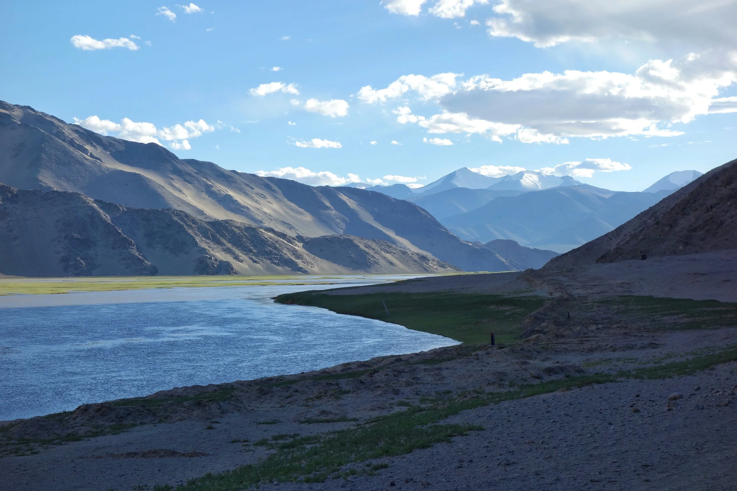
Of the Himalayan Mountains and Rivers
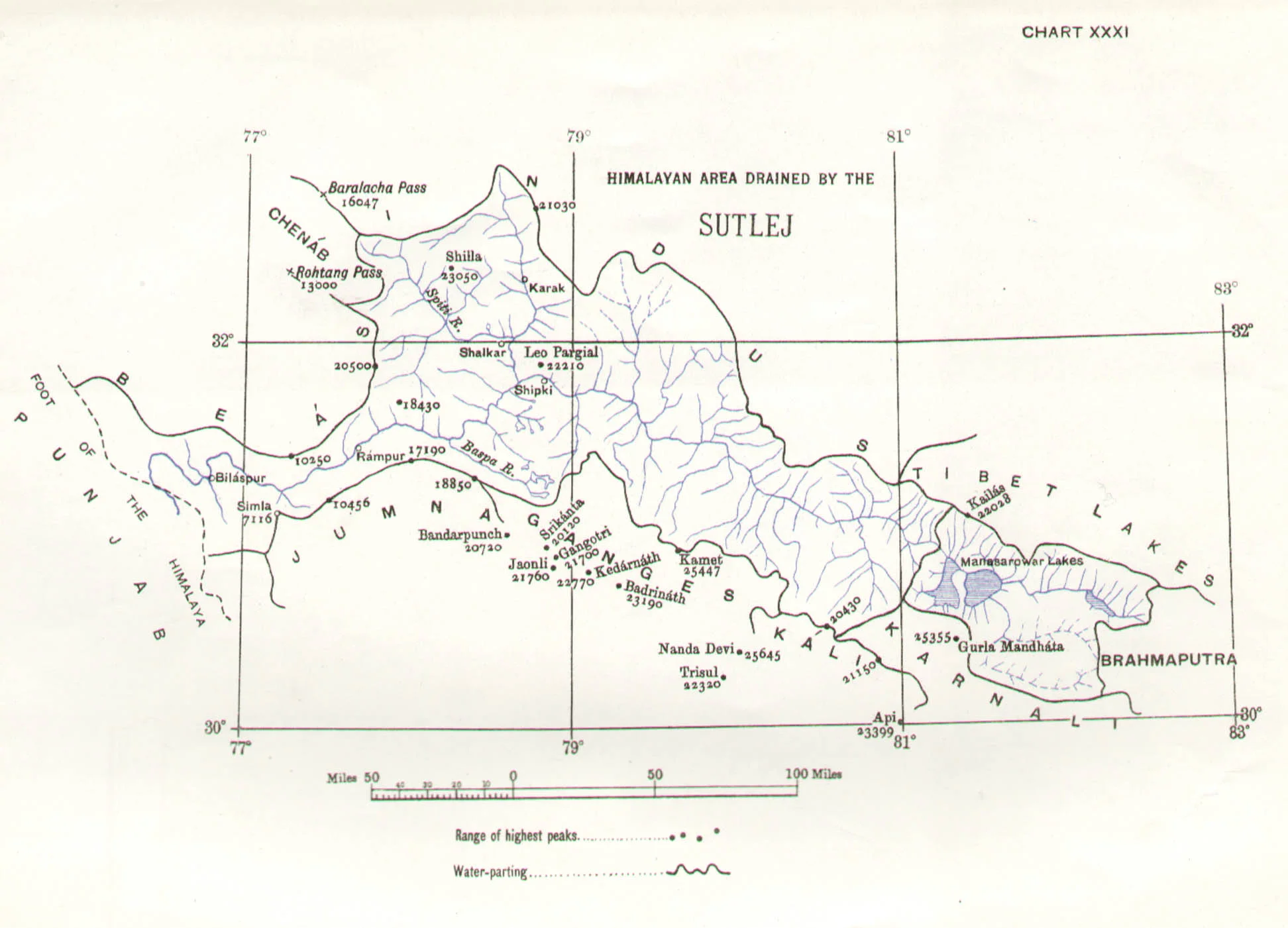
The Rivers and the Himalayas and the even the Mountain Ranges beyond it are always interacting in very interesting ways. In this article we see how the River Basins of the Indus, Ganges and Satluj and the Mountains interact and in some cases the River Basins extend beyond the Ranges themselves.

Of the Mountains and the Rivers
One of the most interesting thing about the Himalayas is how the Rivers interact with the Range and how the River Basins work. Since none of us is taught this in school in the Geography class the way one can study this fascinating aspect is to study Maps. Not the Maps of the new but the old Maps made by the Geological Surveys and the Royal Geographic Society Maps. The kind of detailing in these Maps is amazing when we keep in mind the fact that it was all done by boots on the Ground. No Aerial or Satellite Cartography.
And I finally found a Map which shows the River Basins / the Mountains / the Ridgelines / the Water Partings in a very simple and lucid fashion. Of course there are some explanations required for the un-initiated in the fine art of reading Maps. Not only does it show the Water Basins in the Himalayan context but it also shows the neighbouring River basins and how the Mountains affect the Course of the Rivers. You also need to understand that its this conflict between the Rivers and Mountains which has created the Valleys which has enabled Human communities to inhabit the Mountains.
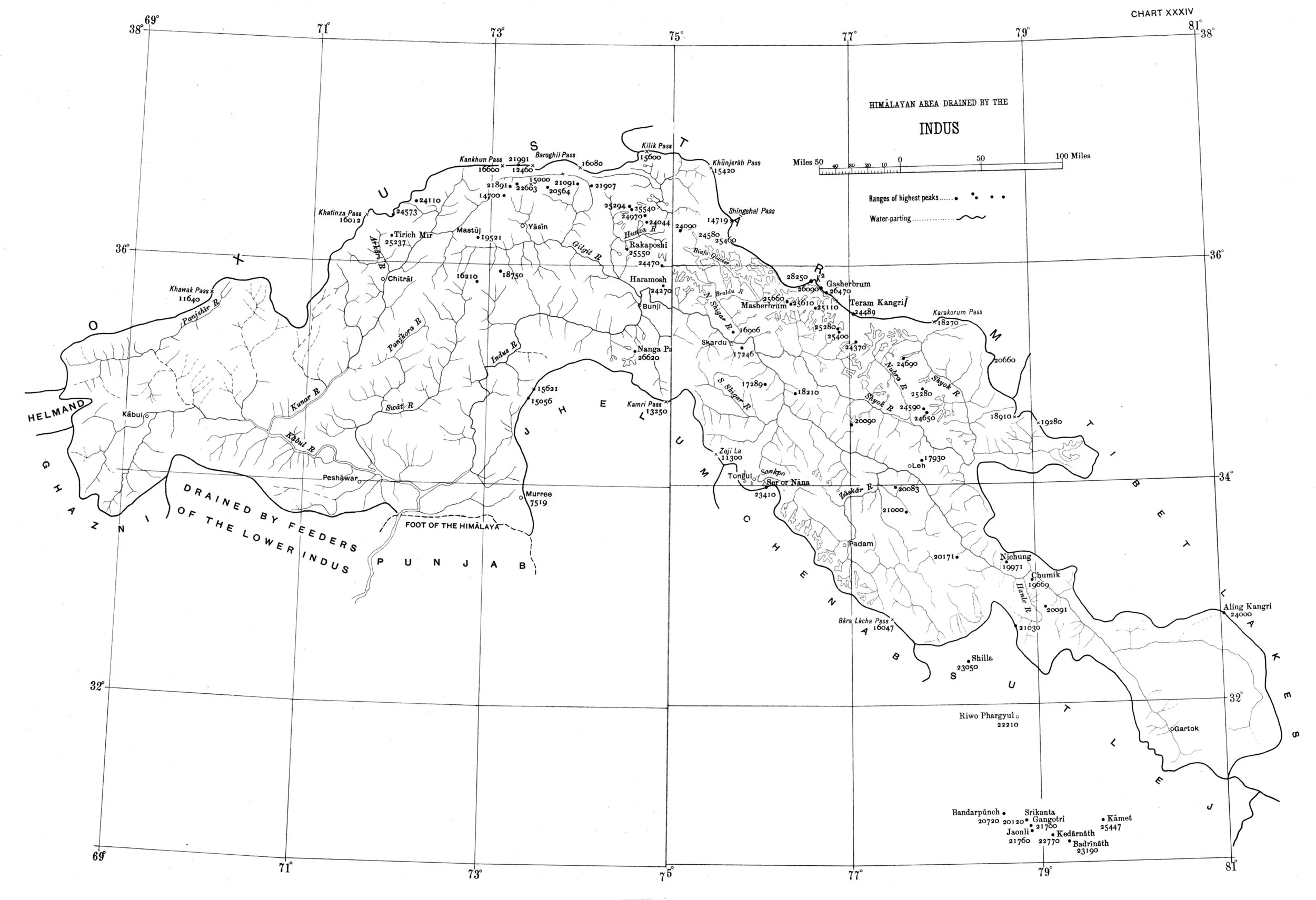
In the Himalayan context the Three main Rivers which drain the Himalayas are the Indus in the West, the Ganges in the Middle and the Brahmaputra in the East. It is common knowledge that the Indus and the Brahmaputra which rise from almost the same vicinity of each other near the Mansarovar Lake in the Tibetan Plateau hem in the Great Himalayan Range from the opposite sides. The Indus forms the boundary on the West as it passes by the Nanga Parbat and the Brahmaputra forms the boundary on the East and it rounds off the Namcha Barwa in the East. The Indus and the Brahmaputra both never breach the Main Himalayan Ridgeline and run alongside but behind the Main Himalayan Ridgeline on the Tibetan Plateau. Both flow along what Geologists call the Indus Tsangpo Suture or divide in simpler terms. I would also like to mention one major River which actually cuts through the main Himalayan Ridge line and forms the Eastern boundary of the Western Himalayas. This would be the Satluj which coincidentally also originates around the same area as the Indus and the Brahmaputra (which is called Tsangpo in Tibet) and follows an independent course cutting through the Himalayas though it finally ends up in the Indus once it reaches the Great Plains of the Punjab.
Beyond the Basins of the Himalayan Rivers we have in the neighbourhood the Tibetan Basin though a part of the Tibetan Plateau is drained by these Himalayan Rivers themselves. Further North the main Ridge line of the Karakorams forms the Water Parting between the Himalayan Rivers (the Indus system) and the Tarim Basin. The Tarim Basin is itself separated from the Tibetan Basin by the Kunlun Mountains. To the West of the Tarim Basin separated by the Pamirs in the South and the Tian Shan in the North is the Central Asian basin of the Oxus and Jaxartes of the old. The names Oxus and Jaxartes were enough in the old times to induce Explorers to go into a frenzy so inaccessible these areas were. However nowadays the Oxus and Jaxartes are better known by their present names, the Amur Darya and the Syr Darya. On the southern Edge the Oxus and Jaxartes Basin is separated from the Himalayan River Basin by the Hindu Kush. Further down the sub Ranges of the Hindu Kush like the Sulaiman Mountains divides the Himalayan River Basin from the Helmand River Basin. This rounds off the Water Partings of the Indus in the Western Himalayas.
If you follow the Indus River in the Map you would see that after the point of origin the Main Waterparting of the Rivers runs behind the Main Himalayan Range rather than along the Main Ridge as classically should be the case. However at the point roughly at where it enters Ladakh from the Tibetan Plateau the River aligns itself with the Main Himalayan Range and continues the same course all the way to the Nanga Parbat where the Great Himalayan Range ends. The Water Parting however moves North towards the Karakorams and even across the Karakorams as seen in zone H. Close to the K2 however the Water Parting again moves along the main Himalayan Ridge line. But then after following the Main Ridge line of the Karakoram to West it again goes beyond the Karakorams as seen in zone C. It continues this trend until its behind the main Ridgeline of the Hindu Kush till at a point beyond the Tirich Mir it again aligns with the Main Ridge line to deviate again to form Zone B all the way to the Helmand Basin.
In pretty much the same way the Water Parting of the Tarim Basin also jumps beyond the Kun Lun, the Pamirs and the Tian Shans at places but it doesn't jump the main Ridge Line of the Karakorams as the reigning Peak of the K2 brings in a semblance of order and the Water Partings follow the K2 in the classical mode (I know this is complicated but once you co-relate with the Map and do some readings it will become more fascinating). Interestingly in the Hindu Kush its the highest Peak of the Hindu Kush the Tirich Mir which forces the Water Parting to run along the main Ridge line just like its supposed to be classically. However a point to be noted is that the Indus never concedes any of its “Mountains” the Western Himalayas or the Karakorams or the Hindu Kush to any River though itself it pushes its Basinal boundaries to well into the Kun Luns, the Pamirs and the Tian Shans though not quite making it to the main Ridge line.
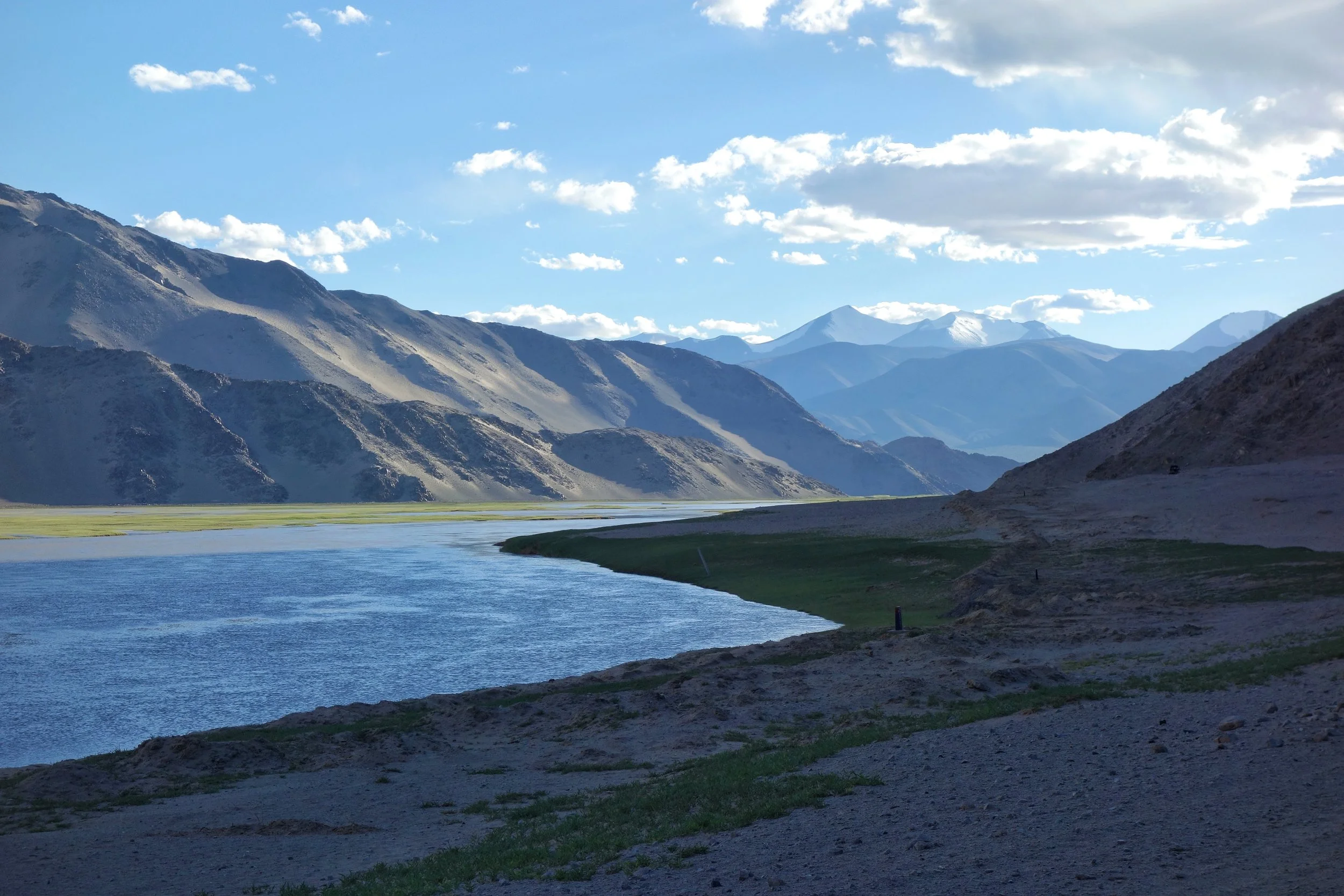
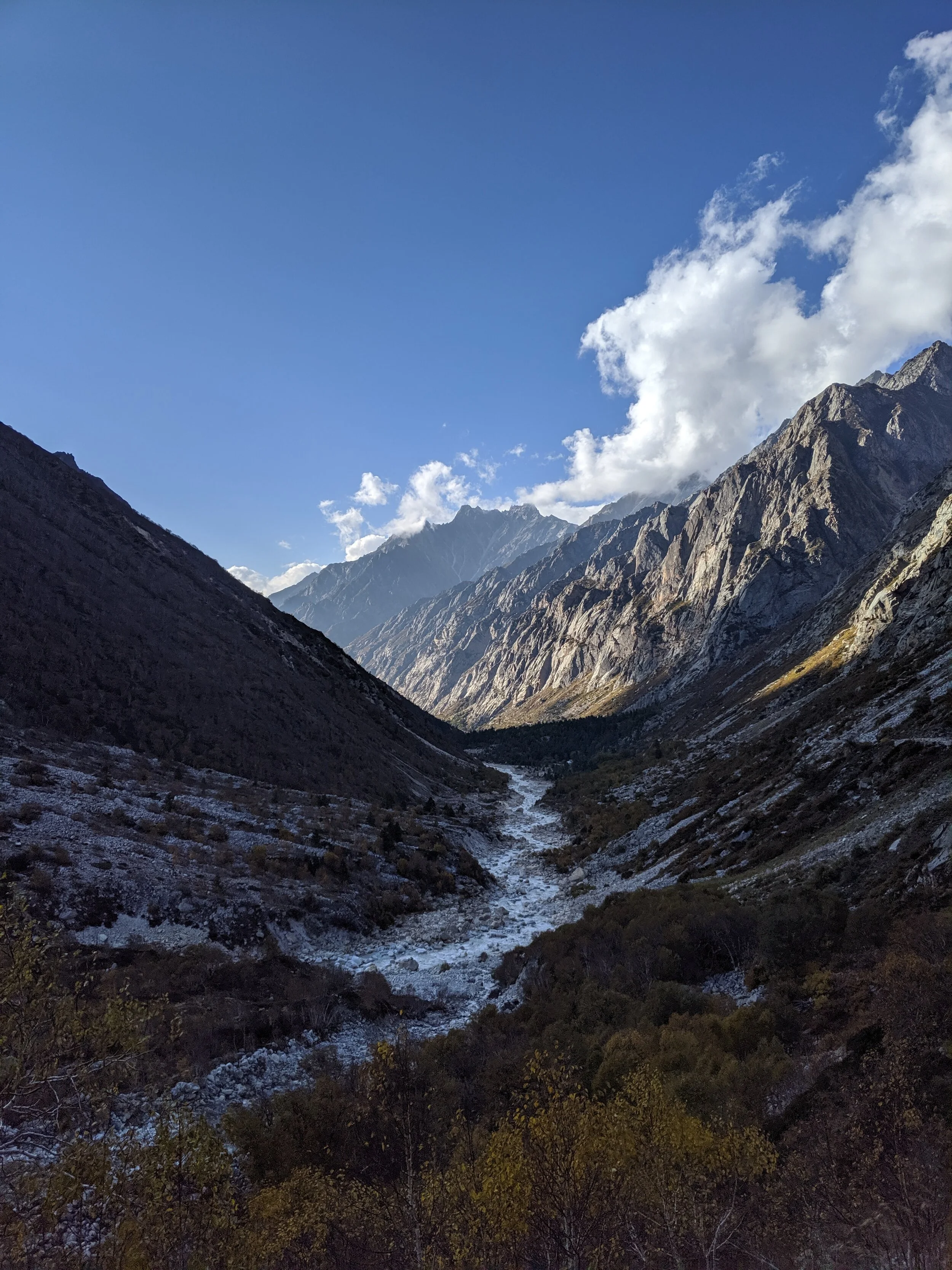
The Indus after it enters Ladakh from Tibet on the Chnagthang
And of course as we all the Mountains are rising and the Rivers are just cutting the Gorges and the Valleys and this state of flux will continue over a period of time till the end of time. And because of this constant change the Water Partings are not as fixed or permanent as we would like to believe. They are also constantly changing and evolving in a Geological time frame. This also shows how the Rivers and the Basind connect these highest Mountains in the World in a closer relationship than we actually believe. The River and the Basins provide the linkages which connect the Himalayas with the Karakorams, the Hindu Kush, the Kun Lun, the Pamirs and the Tian Shans. I collectively like to use the term “Himalayas” when talking about all these Ranges and the Great Himalayan Range when I am referring to the Main Himalaya Range. The highest Range on the Planet.
May we one day get to behold the magnificent sights that these Mountains hold and their mighty Peaks. And may we one day get to drink water from all these Rivers. The transition zones between these Himalayas is probably even today one of the most least explored in the World and they continue to hold their Mysteries, occasionally revealing them to us mere Mortals.
The Illustrated Mountain Geography of Ladakh
The Mountain Geography of Ladakh makes for interesting reading situated as it is between the Great Himalayan Range and the Karakoram Range. Also running within Ladakh are the Ladakh Range and the Zanskar Range but most people do not have a clear idea as to which Pass co-relates to which Pass.

The mighty Nun Peak of the Great Himalayan Range at 7135 m its the highest Himalayan Peak in Jammu ans Kashmir (not including the areas under occupation). On the side is the Saddle Peak.
The Illustrated Mountain Geography of Ladakh
Ladakh, the name comes from “ La Dvags” which means the Land of the High Passes. Most of us are well aware of the fact that it's a Trans Himalayan Desert. But there are other finer parts of the Geography which make it more interesting.
If you are driving to Leh whether from the Srinagar side or from the Manali side you have to cross the first major Range which falls in the way. These are the Pir Panjals. From the Srinagar side you cross it before coming into the Kashmir Valley through the Banihal Tunnel which was built under what used to be the Banihal Pass. You can also come from the Mughal Road and on that Road you cross the Pir Panjals at the Pir Ki Gali Pass. In case you are coming from the Manali side you cross the Pir Panjals at the famous Rohtang Pass. But the Rohtang Pass will soon meet the fate of the Banihal Pass as the Rohtang Tunnel is expected to be operational by the end of the Year. But it might survive as a Tourist attraction for people who want to see and experience Snow. Though the Passes on the Pir Panjals are not as high as some of the higher Passes further afield yet they are notorious as they get the maximum amount of precipitation in the Western Himalayas in the form of both Snow and Rain.

The transition between the Great Himalayan Range and the Zanskar Range as seen from a flight.
After crossing the Pir Panjal Range it's time to now cross the big Daddy. The Great Himalayan Range itself. From the Kashmir side you do it from the Zoji La and from the Lahaul side you do it via the Baralacha La. Both of these Passes are quite notorious and give a hard time to many though in recent years they have been tamed to some extent. There is talk of a Tunnel itself under the Zoji La but I guess that is many years away for now. After crossing the Great Himalayan Range from the Manali side after passing over a couple of passes you need to cross the Zanskar Range and this is does at the Tanglang La. While coming from the Kashmir side you cross the the Zanskar Range at Namika La and Fotu La.
And then if you want to go further North you have to go across the Ladakh Range which is crossed over at the famous Khardung La and now you come face to face with the most perpendicular of all the Mountain Ranges in the World. The Karakorams. Standing atop the Khardung La you can see the difference. The nicely rounded Peaks of the Zanskar and Ladakh Range in deep contrast to the craggy Towers of the Karakorams. Of course you can cross the Karakorams also (in a perfect world) over the Karakoram Pass but that's quite out of the question as of now.

A Truck astride the Great Himalayan Range as it approaches Zoji La.
Traditionally the Indus has been considered the dividing line between the Karakorams and the Himalayas. The Ladakh Range is considered by some to be a part of the Karakorams. Even the Encyclopaedia Britannica says its a part of the Karakorams but a majority of researchers consider it a part of the Himalayas as the Ladakh Range (and its sub Range the Changthang Range) along with the Kailash Range and the Nyeng-Chin-Thanla Range run almost parallel to the Great Himalayan Range all the to its Eastern extremity and hence its considered a part of the Himalayas rather than the Karakorams.
Most people who visit the fact are usually oblivious to the fact that Ladakh is located within the Karakoram Range and the Great Himalayan Range. One marks the Northern Boundary the other makes up the Southern Boundary. And most actually miss seeing the Great Himalayan Range up close from the other side. We all usually see the Great Himalayan Range from this side ie the side which faces the Indian subcontinent but seldom do we see it from the other side and Ladakh gives the perfect opportunity to do the same. Infact this is the only Place where you could have Breakfast under the shadows of the Great Himalayan Range and have dinner in the shadow of the Karakoram Range (or one of its Muztaghs as its sub-Ranges are also called). But in order to view the spectacular Great Himalayan Range you have to come down to Kargil and head into the Suru Valley. Its here in the Suru Valley sandwiched between the Zanskar Range and the Great Himalayan Range is where you get spectacular view of the Great Himalayan Range with its craggy Peaks quite different from the ones of the Zanskar or the Ladakh Range. Ah to look at the Nun Kun Peaks from Panikhar is one of the most spectacular views in the Himalayan Region but most just miss it.

The Karakorams as seen from Khardung La.
And of course you get great views of the Karakorams from the Khardung La but the views from Nubra Valley and beyond are not so spectacular but there are areas in Ladakh from where you can get great views of the Karakorams but these areas are off limits due to reasons which do not need to be elucidated here. But hopefully they will be opened someday and the beauty of the Karakorams in all their vertical glory is revealed to all of us.
The pics below show some of the things mentioned above. The magnificent Nun Kun Peaks as seen from the Suru Valley, a pic from a Flight showing the transition from the Great Himalayan Range to the Zanskar Range, a Truck astride the Great Himalayan Range near Zoji La, a pic of the mighty Karakorams as seen from Khardung La and lastly a Map for guidance on the Himalayan Range.
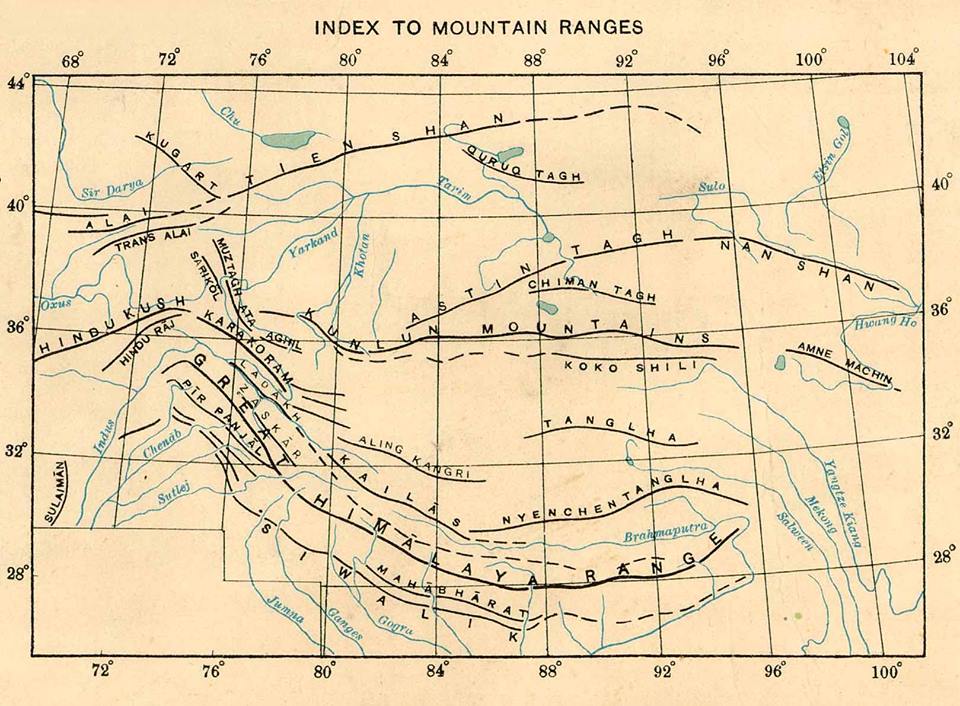
The Exploration of the Siachen or Rose Glacier
The Story of the Exploration of the Siachen Glacier. This Glacier, now said to be the highest Battlefield in the World, was first Explored and Mapped by a team led by a Lady Fanny Bullock. This is her Story as well as Guide to explaining the Siachen Glacier with its main features and Glaciers around it.

The Siachen Map
The Exploration of the Siachen or Rose Glacier
The Siachen Glacier. It must be the most talked about Glacier in the Himalayan Karakoram region. A Glacier that has got famous for reasons that are just Political and I would steer clear of that. But there was a time before Partition when it was just another wonder in the Wilderness of the Himalayan Karakoram Mountains. One of the largest Glaciers outside the Polar Regions and for the early Explorers it was hard to believe that such massive Glaciers could exist anywhere outside the Polar Regions.

Ms.Fanny Bullock (Pic Courtesy Wikipedia)
The credit for the initial Exploration and Mapping goes to a Lady Fanny Bullock and her husband William Hunter Workman. They were actually a rich couple who liked to Tour the World and once they happened to come to India for a Cycling Tour. It was then that they got introduced to the Himalayas and it proved to be a life-long affair. The couple made 8 trips thereafter climbing and exploring the Himalayan and the Karakoram Mountains. They made many notable explorations during these Trips and during one of these Trips Ms.Fanny Bullock also managed to climb the Pinnacle Peak during their explorations of the Nun Kun Massif. The Pinnacle Peak is a side Peak to these Twin Peaks and at 6930 m it was a world record for a Lady at that time. It should be mentioned that being rich, they could afford Italian Porters and Guides though they also took local support.

Ms.Fanny Bullock atop Pinnacle with a Poster calling for Woman to be allowed to Vote (Pic Courtesy Wikipedia)
However they seemed to have an issue with the local Porters and many of their Travelogues were full of complaints against the local Porters and their behavior. I assume that it was a Cultural thing more than anything else. Born is a rich aristocratic American family which then moved to Europe she was far removed from the hardships of the people in the Mountains and it seems that the Lady got on very well with the Mountains but never did get along with the people who inhabited the same Mountains. Many people also accused the couple of exaggerating their actual accomplishments and always longing to be in the limelight. And their Maps were far from accurate. But all said and done they explored some of the least and even never ventured into areas especially in the Karakorams and this included many forays onto the many large Glaciers that the Range held.
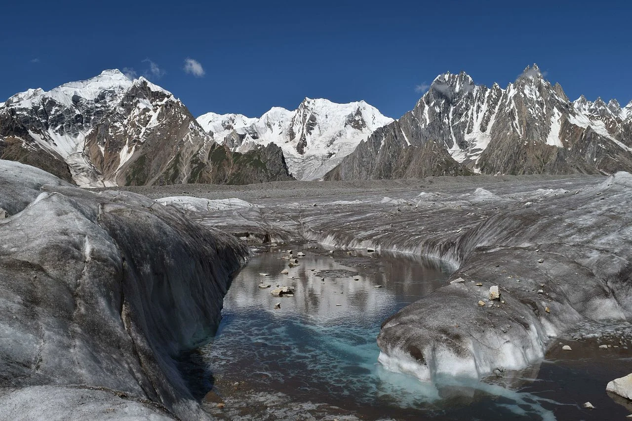
The Biafo Glacier (Pic Courtesy Wikipedia)
These Glaciers included the first attempt at the Biafo Glacier in 1899, an attempt they had to give up due to the Weather and the Crevasses so they moved onto exploring the Skara La Glacier instead. In 1902 they returned for the exploration of the Chogo Lungma Glacier. In 1907 they came to Kashmir and carried out the first exploration of the Nun Kun Massif. It was during this Exploration that at the age of 47, Fanny Bullock summited the Pinnacle Peak at 6930 m. Interestingly two years later a Lady competitor of hers claimed to have climbed a Peak in the Andes that stood at 7000m. But our Lady didn't believe her and actually paid an amount of USD 13000 to a Group of French Mountaineers to actually climb that Mountain in Andes and get the actual height. It turned out to be 6768 m. Fanny Bullock kept this Record to herself for a couple of decades.
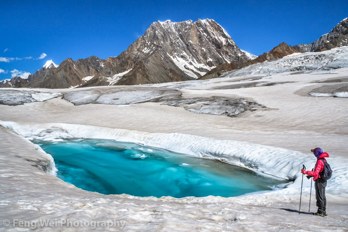
The Hispar Glacier (Courtesy Feng Wei Photography)
In 1908 the Lady with husband in tow arrived once again to explore the Hispar Glacier and even traversed across it and went to the Biafo Glacier setting another Record for ladies. They explored a number of side Glaciers and Peaks. In 1911 - 12 they finally decided to go and explore the biggest Glacier of them all. The Rose Glacier or the Siachen Glacier as we know it now. And they explored the Glacier and its sides for the two month period they spent there. It was a commendable piece of Exploration and as per all accounts this Exploration was led by Fanny Bullock herself. This was considered to be there greatest accomplishment and it also happened to be the last time in the Himalayan Karakoram Region due to the outbreak of the First World War.

A Wild Rose locally called a Sia (Pic Courtesy Wikipedia)
In her Book written after this Expedition, Two Summers in the Ice-Wilds of Eastern Karakoram , Fanny Workman writes : “The object of placing my full name in connection with the [Siachen Glacier] expedition ... is not because I wish in any way to thrust myself forward, but solely that in the accomplishments of women, now and in the future, it should be known to them and stated in print that a woman was the initiator and special leader of this expedition. When, later, woman occupies her acknowledged position as an individual worker in all fields, as well as those of exploration, no such emphasis of her work will be needed; but that day has not fully arrived, and at present it behooves women, for the benefit of their sex, to put what they do, at least, on record.”
And sharing the Map that was made by, as it came to be known as, the Fanny Bullock Workman Expedition of 1912 of the Siachen or Rose Glacier ( I am sure most of you are aware of the fact that the wod “Sia” in the local language stands for Wild Rose”). A very interesting Map indeed though not exactly accurate but still a great feat of Exploration, Mountaineering and Cartography.

The Indira Col and Turkestan La (Courtesy Josh Jagran)
Of course this is a Map which I love as to me its a work of art which has been worked hard at. And I have marked some important Passes which were used to access this Glacier (not that many people accessed this Glacier but these Passes were the ones used). The first one is of course the famous Indira Col at 18911 ft (The Workman Map wrongly describes it as 20880 ft) which is marked as Indira Col or Pass in the Map. No it isnt named after Indira Gandhi. It was named probably by the makers of this Map themselves as they gave names to all the features they saw as un-named in the Maps of their time that they were carrying (These Maps are described on the Map itself). They gave some features English names and some they gave Hindi names. Like the Indira Col (Named after Lord Indira) and Mt.Lakhsmi (self-explanatory) and they called a Group of Peaks as the “Apasaras”. Also itr signifies that the Indira Col was never used by the locals and hence never given a name. Its just too tough for anyone but a trained person.

The Kondus Glacier (Pic Courtesy the Amercan Alpine Journal)
Then there is the Bilafond La (No.2) at also known as the Saltoro Pass at 17881 ft on the Saltoro Ridge (The Workman Map puts the height at 18370 ft) . The name apparently comes from the Balti word for “Butterfly” or the Pass of the Butterflies. This was apparently one of the Passes that were used on the Silk Route which connected Ladakh and Baltistan with Central Asia. And then there is the Turkestan La (No. 3) said to be 19209 ft as per the Workman Map. This was probably another Pass into Turkestan as the area beyond the Karakorams referred to as. Not very significant anymore.

Dogs somewhere on the Siachen Glacier (Courtesy Wikipedia)
And then there is the Sia La (No.4) (The word Sia again derived from the local word for the Wild Roses that grew in the area). It stand at 18337 ft (The Workman Map puts the height as 18705 ft) on the main Saltoro Ridge. Further down is the Gyong La Pass which is not marked in the Map.
And then the Map also shows numerous side Glaciers and big Glaciers in the neighbourhood of the main Siachen Glacier. Like from below or the West the Kondus / Kaberi Glacier, the Bilaphond and Lolophond Glaciers, the Sher-Pi-Gang Glacier and the Peak 36 Glacier. Above or on the East (left side) of the Siachen are the Urdok Glacier and the Tarim Shehr Glacier.

Jammu and Kashmir dispute Map by the UN.
Of course we are all well aware of the situation on the Glacier and I would like to point out that all the Passes mentioned above are well in control of the Indian Army and they control the access to the Glacier. So in actual Geographic terms India controls the Siachen Glacier. And all the area running North of the point NJ 9842. But thats about all I can say about that.
The Enchanting Padri Gali
The enchanting Padri Pass or Padri Galli or Padri Top which connects Chamba in Himachal Pradesh with Bhaderwah in the Jammu Division of Jammu and Kashmir at around 10,400 feet amsl. It is located around 110 kms from Chamba Town and around 40 kms from Bhaderwah and is the highest point of the Chamba Bhaderwah Highway. This is one of the important Passes which connects J and K with Himachal. In older times Bhaderwah was a part of the powerful Chamba Kingdom which held Kishtwar as well and even Zanskar.

The Enchanting Padri
The enchanting Padri Pass or Padri Galli or Padri Top which connects Chamba in Himachal Pradesh with Bhaderwah in the Jammu Division of Jammu and Kashmir at around 10,400 feet amsl. It is located around 110 kms from Chamba Town and around 40 kms from Bhaderwah and is the highest point of the Chamba Bhaderwah Highway.
This is one of the important Passes which connects J and K with Himachal. In older times Bhaderwah was a part of the powerful Chamba Kingdom which held Kishtwar as well and even Zanskar. For many years Bhaderwah was the bone of contention between the Jammu Kingdom and the Chamba Kingdom until in the mid 1800’s it was taken over by Raja Gulab Singh of Jammu as terms of settlement of the Territorial boundary with the Chamba Kingdom after he acquired Kashmir as per the Treaty of Amritsar.

Bhaderwah today is a part of the Doda district and lies in the lap of the Pir Panjals. The Town of Bhaderwah itself was an important one and the Bhaderwah Fort stands watch over Town. Bhaderwah has a mixed population of Hindus and Muslims and the languages spoken include Bhaderwahi and Kashmiri.
There are many beautiful places in Bhaderwah which have for long been away from the Tourist lime light. Some of them are described below (Taken from JK Tourism Catalog) :
Kailash Kund : The Kailash Mountain overlooking the Bhaderwah Valley is supposed to be the abode of Shri Vasuki Nag. At 13067 ft the Kailash Kund is the source of the River Neeru which drains the Bhaderwah Valley. The Yatra follows Mani Mahesh Yatra and starts with the Chari Mubarak from the Village of Gatha in Bhaderwah and then goes to Vasuki Nag Temple in the heart of the Town. At Ramkund one halts for the night and there on to Kailash Kund. The annual Kailash Yatra takes place in the month of August.
Seoj Meadows : The Meadow of Seoj is flanked by a gushing River on its West which emanates from the Hills surrounding the Kailash Kund. The Landscape across the River is a replica of Pahalgam whereas on the Eastern side there are long stretches of Grasslands. On the Western side the Meadows take a descent along the crystalline water of the Seoj Rivulet and roll towards Ramnagar area of Udhampur District.
Chinta Valley : Situated at a height of 6500 ft Chinta Valley is a beautiful Valley with thick Coniferous Forests on all sides and the Chinta Nallah flowing through it. A grassy Meadow called Bagan on one side of the Village is favoured by picnickers.
Jai Valley : Ten kilometers from the Chinta Valley is the picturesque longitudinal Jai Valley at a height of around 7000 ft. Located around 32 kms from Bhaderwah it is an extremely beautiful Region spread over 6 kms. The Valley is surrounded by thick Deodar forests on steep slopes with a sprawling Meadow in the middle.
Khellani : Khellani, overlooking the Kellar Valley is a Deodar clad Plateau 15 kms from Bhaderwah. Drained by the Bankut Nallah it is an ideal leisure spot. From late Summer to Autumn the Valley provides a bounty of fruits like Apricots, Peaches, Plums and Apples. While at Khellani one can walk through Khellani Pass amidst various Villages connected at Maulote and take the Road back to Khellani.
Pic from March end, 2018
The Inter-State Himalayan Boundary Dispute at 14000 ft
An Inter-State Boundary dispute at 14000 ft beyond the mighty Baralacha La between the Himalayan states of Jammu and Kashmir and Himachal Pradesh. The dispute involves the marking of the actual Border between Lahaul on the Himachal side and Ladakh on the Jammu and Kashmir side.

The Inter-State Himalayan Boundary Dispute at 14000 ft
In 2018 a rather quite interesting story cropped up in the news regarding a dispute on the Interstate Borders in the High Himalayas between Himachal Pradesh and Jammu and Kashmir. As per the Himachal Authorities the JK Police had set up a picket more than 18 kms than the designated Border between the two States. And this led to an altercation. Of course the matter was brought to the notice of the Central Government. There were other charges as well against the Jammu and Kashmir Government including that it had given land in Himachal across the Shinku La and around Sarchu.
The story started in 2014 when the JK Police set up a new border check Post supposedly in Himachal territory. The Himachal Government despatched CID Officials to ascertain the facts and they came back with the report that there was indeed an intrusion. The DC of Lahaul and Spiti wrote to the authorities in Padam and Leh as the JK part comes within the Kargil District and the Tehsil is Zanskar. But nothing much happened.
In the following years again the JK Police set up its check Post in what was said to be Himachali territory. Again the issue was raised and this time the Central Government intervened. A team of Experts was sent from the Geological Survey of India to demarcate the Border and they concluded after doing a scientific Satellite study that the JK Police was Post was 14 kms inside Himachal. The DCs of Leh, Kargil and Lahaul and Spiti were also present but the DC of Leh refused to go with the findings of the team and said that he will have to consult “higher authorities”. And the matter remains unresolved to this day. Lets see where the JK Police puts up its Post on this disputed inter state boundary which sits at over 14000 ft.
So how was the present day Boundary agreed upon and demarcated earlier. Well it was after Maharaja Gulab Singh had taken over as Rule of the whole of Jammu, Kashmir, Ladakh and Baltistan that a boundary demarcation was needed between the British territory of Lahaul and the Maharaja’s territory of Ladakh. The boundary was flexible in earlier times as the general area was the place where the boundaries of the Kulu and Chamba Kingdoms also met. And also of Lahul, Spiti and Ladakh. And there was constant struggle between Ladakh, Kulu, Chamba and Bushahr over Lahul and Spiti. So a settlement of the Border was needed.
And it was none other than Captain Alexander Cunningham who was assigned this job. People who have read on Himalayan explorations are well familiar with the Cunninghams. All the 4 Cunningham brothers wrote extensively on the History of India and were Military Officers as well. And Alexander was perfect for adventures in the Mountains. Infact it is Alexander Cunninghams account of the Battle of Toyo, where General Zorawar Singh fell in Battle with the Tibetan Chinese Army thats considered the most authentic.
And this is how the Boundary was finally marked. Leaving you with the actual Note on this by Alexander Cunningham published in 1848. Answers many questions and also gives an idea of how boundaries were demarcated in the Himalayas dependent on the Peaks, the Passes and of course the Rivers and the Nallahs and in some case a solitary big Rock. And leaving you with the final boundary Map as well.
Memorandum by Capt. A. CUNNINGHAM, detailing the boundary between the territories of Maharaja Gulab Singh and British India, as determined by the Commissioners, P. A. VANS AGNEW, Esq. and Capt. A. CUNNINGHAM of, Engineers.
1.In laying down a permanent boundary through a mountainous county it appeared to the Commissioners desirable to select such a plan as would completely preclude any possibility of future dispute. This the Commissioners believe that they have found in their adoption as a boundary of such mountain ranges as form water-shed lines between the drainages of different rivers, as detailed below.
2. In 1839, when Capt. A.Cunningham surveyed the Lahul district the boundary between the states of Kulu and Chamba was formed by the Nalda and Chukam Nullahs, two tributaries of the Chandrabhaga, the one on its left and the other on its right bank. From the head of the Chukam Nullah the Commissioners determined that all the county to the eastward which is drained by the Bhaga, the Chandrabhaga and their tributaries belonged to the British district of Lahul ; and that the boundary between Lahul and the Zanskar district was the snowy range (called Paralassa by Dr. Gerard) dividing the drainage of the Bhaga and Chandrabhaga from that of the Zanskar river, as marked in the Map.
3. Beyond the Bar Lacha Pass to the eastward, the Commissioners found that there was an old well known boundary stone, called the Phalangdanda, which marked the limit between Lahul and Ladak. This stone is noticed by Moorcroft . It stands in the midst of an open plain on the right bank of the Yunnam River. As there sno known or recognized boundary mark on the other side of the stream, the Commissioners selected a remarkable cream-coloured peak, called Turam, as the northern limit of the British territory on the left bank of the river. As this peak is situated at the end of one of the spun of the great snowy chain, already determined as the northern limit of the Lahul district, it forms a natural continuation of the boundary line from the westward. The bearing of the Turam peak from the Phalangdanda is 9" to the northward of west.
4. As it appeared that the country to the eastward of the Pha-langdanda belonged to Piti, the Commissioners determined that the boundary between Piti and Ladak on the westward should be the Yunam River. A straight line was accordingly drawn from the Pha-lang-danda to the junction of the first Nullah on the right bank of the Yunam, from which point the Yunam River forms the boundary as far as the junction of the Cherpa or Cherep river.
5. Almost due north-east from this junction there is a remarkable square rock on the top of the hill, which From its resemblance to a fort has received the name of Lanka. This curions and well know peak wan selected as another fixed point in the boundary, to which a straight line should be drawn from the junction of the Cherpa river. Beyond this to the eastward, the Commissioners, adhering to the principle which they had first laid down, determined that - the whole of the Cherpa valley and its tributaries belonged to the British Government; and that the snowy range on its right bank which feeds d l the northern affluents of the Cherpa river should be the boundary between Ladak and the British district of Piti. This same range extends towards the east past the southern end of the Chu-Mureri Lake, where it forms the well known boundary between Ladak and the Chinese territory. The Commissioners therefore determined that the boundary between Ladak and Piti should continue from the head of the Cherpa along this same range to the Chinese boundary; thus including within Piti all the streams which water that district, and giving to Ladak all the streams which water its southern district of Rutchu.
Kiki’s Blog
Stories from the Himalayas





Five years ago the Galwan Valley was in the News for the wrong reasons after a deadly clash between the Indian and Chinese Armies in the Valley located in Ladakh lead to many deaths on the contentious Border between the two countries in wake of continued Chinese intrusions into Indian territory.
This area along the Shyok River, of which the Galwan Nallah or the Galwan River which forms the Galwan Valley has been off limits to Civilians since long but now the Indian Government has decided to open up the area for Civilians and we were amongst the First Civilians to venture into this beautifully desolate part of the Eastern Karakorams in Ladakh. Earlier Civilians could only venture upto the Village of Shyok from where the Shyok River takes a U turn and flows in a Northerly direction.