

Srinagar to Kashgar by Road : The First Motorised Crossing of the Greatest Mountain Ranges
Once the Expedition commenced there arose new Challenges. Though the Afghanistan Civil War had ended, the situation in North Afghanistan and Routes into the Pamirs were far from being safe for the Expedition. So another detour was decided. It was decided that the Expedition would now crossover into India from Afghanistan and then they would take the Mountain track that connected Srinagar in Kashmir with Yarkand / Tashkurgan in Chinese Turkestan or what is now Xinjiang

The Complete Beirut to Beijing Route
Citroen is an iconic French Automobile brand which has been making Motor Cars for well over 125 years. In the 1920s and the 30s they embarked upon a number of Journeys through the wildest impenetrable parts of the World to prove the reliability of the ruggedness of the Citroen. The idea of putting these Expeditions together came from Andre Citreon who was the founder of the Company.

They first made Two Expeditions into the wilds of Africa as the French had a bunch of Colonies in Africa and they completed the Expeditions with a reasonable amount of success. The First of these being the crossing of the Sahara Desert by Motorcar in 1924. And then they made a Journey across the length of Africa from Bechar in Algeria in North Africa all the way down to Cape Town in South Africa becoming the first people to do so. Both these were accomplished using Half Track Citroen Vehicles and these were led by the Explorers Georges-Marie Haardt and Louis Audouin Dubreuil.

Being received by a British detachment at Landi Kotal near the Khyber Pass in June, 1931
And then in 1930 they came up with their most ambitious Expedition. One that involved retracing the steps of Marco Polo by crossing Central Asia and going all the way to China. This Route was the famous Silk Route as it was called and for centuries traders from all over the adjoining Regions used this Road for not only Trade but the exchange of ideas as well. As with their other Expeditions this was also supposed to be a first, the First Motorised Expedition to retrace the fabled Silk Route.

The Expedition had its own set of unique challenges. And these were not only Geographical and Logistical. It was Political as well. It involved getting the requisite Permissions from the Communists in Russia as well as the powers to be in China which was in the throes of a Civil War between the Kuomintang and the Communists. And so the Expedition applied for permission was applied to the Russians for passage through Western or Russian Turkestan as that part of Central Asia was called.

But with just a few Months before the Expedition was to commence the Russians withdrew the permission and they now had to chalk out an Alternative Route. Which they did and now after crossing Persia instead of going into Western Turkestan they decided to take the Route through Afghanistan and up North crossing the Hindu Kush and the Pamirs and reaching Tashkurgan.

Once the Expedition commenced there arose new Challenges. Though the Afghanistan Civil War had ended, the situation in North Afghanistan and Routes into the Pamirs were far from being safe for the Expedition. So another detour was decided. It was decided that the Expedition would now crossover into India from Afghanistan and then they would take the Mountain track that connected Srinagar in Kashmir with Yarkand / Tashkurgan in Chinese Turkestan or what is now Xinjiang

So now a new Geographical challenge arose. That of crossing the Himalaya as well as the Karakorams besides all the other Regions. These were two of the Highest Mountain Ranges on the Planet but still they reckoned that they would be able to achieve the same. They decided to run the gauntlet.

So from Iran they entered Afghanistan via Herat and crossed the Country at great Speed and entered British India at where else but the Khyber Pass and now they were in relative safety and they proceeded towards Srinagar via Rawalpindi through the Jhelum Cart Road. In Srinagar they were personal Guests of the Maharaja and it was through the Maharaja’s territory they would travel all the way North across the Great Himalayan Range and the Karakoram Range.

The Pandethran Temple in Srinagar, Kashmir
They took the Silk Road from Srinagar which connected Srinagar with Gilgit as well as Skardu. So they drove from Srinagar towards the Wular Lake, crossed over the Rajdhan or Rajdhanigan or Tragbal Pass (around 11600+ feet) as it was called and entered the Gurez Valley which bordered the Kashmir Valley on the North. This was the first Motorised crossing of the Razdan Pass as well. From Gurez onwards the tough part started as they now had to cross the Snow Laden Burzil Pass on the Great Himalayan Range. And the Photographs attached show the condition of the Pass.

Infact to get to the Pass itself they had to disassemble the Vehicles and they were carried on foot by the Porters and then re-assembled when it was possible to drive these tough Half Tracks. They were tough but nothing compared to the Mountains. And rather than the Machines it was the hardy Mountain men who carried these Automobiles over the Mountains. They also set a World Record for the highest altitude that a Vehicle drove on at over 13500 on the Burzil Pass.
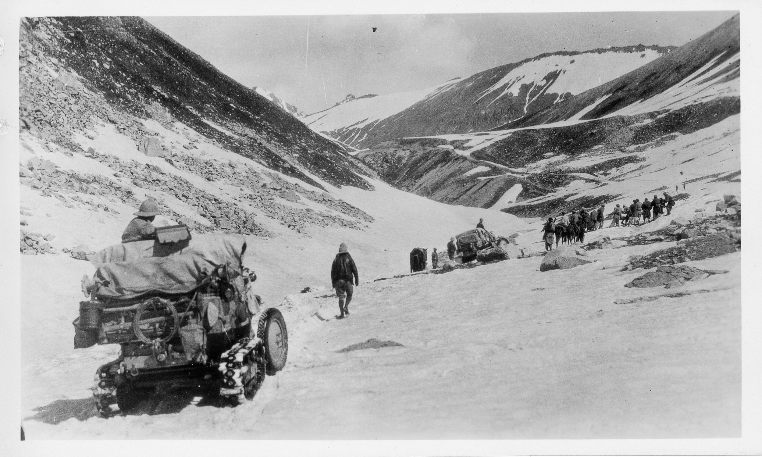
On the way down as well they had to face almost impossible situations and again they had no option but to disassemble the Vehicles and have them carried by the Porters. And they managed to make their way to Astore and then to Gilgit. From Gilgit they made their way to Gojal and to get over the Karakorams they chose the Kilik Pass which was parallel to the Mantaka Pass which was more frequently used but the Kilik Pass was relatively free of Snow and they carried the Vehicles over the Kilik Pass and descended into the Pamirs and were now across the Border of British India and firmly in Chinese Turkestan where they planned to meet up with the other Group which had started from Peking towards Central Asia. Of course the Group which came from Peking faced a lot of Political obstacles rather than the Geographical obstacles faced by what was called the Pamir Group. But that then is another Story.

All said and done it was the Citroen Haardt Expedition which showed that it was possible for Automobiles (with a lot of Human help) to cross this almost unassailable Mountain barrier.

Nowadays however due to the Political situation the Old Silk Route from Srinagar to Gilgit lies abandoned though you can cross the Razdan Pass and get into Gurez. And on the other side of the LoC a Motorable Road now gets you over the Karakorams via the Khunjerab Pass. The Kilik Pass being long forgotten.

Photo Credit : All Photos from the Internet / Citroen Haardt Expedition / Nationa Geographic/ Getty Images.
The Consulate at Chini Bagh
The story of Chinni Bagh, which at once upon a time was the Consulate of the British Empire in Kashgar to facilitate the Trade between India and Central Asia and also keeping a watch on the Russians during the Great Game.
The Consulate at Chini Bagh
Many stories have been told about the Great Yarakand to Leh Trade Route which went across some of the highest Mountains in the World and over some of the most inhospitable terrains. The Trade went up considerably after the Maharaja of Jammu and Kashmir and the British started to encourage the Trade in a big way and the so called Treaty Road was established. Those were the days of the Great Game and Trade was a perfect way for the British to compete with Russia over influence in Central Asia.
For facilitating the same the British had set up a Consulate in Kashgar which was on the Yarkand Leh trail and the first big city (If you could call it that) once you got over the Mountain wilderness in Central Asia. The Consulate for some reasons was called the Chini Bagh.Of course the Russians also had a Consulate in the same City. And the Russian and the British Consulates and the officials were constantly engaged in a games of one upmanship in order to gain favour with the Turkestanis as well as the Chinese who were nominally in control of the Region.
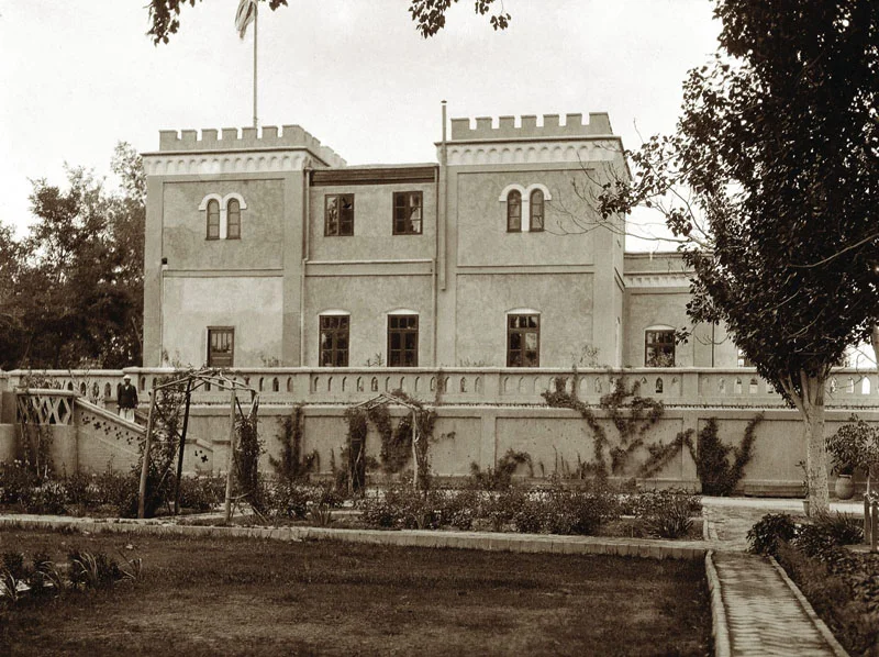
The Chinni Bagh Consulate
A some of you must be aware that most of the Trading from the Indian side was done by the industrious Punjabi traders from Hoshiarpur, many of whom were based in Leh and Kargil for doing this Trade. Initially they used to only stay there during the Summers when the Trade was maximum and used to go down to the plains of the Punjab in the Winters. But with time many of them settled there permanently.
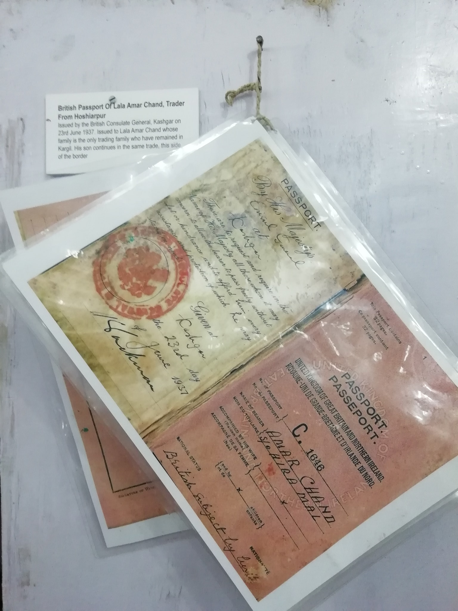
Presenting a British Passport issued to a Hoshiarpuri trader from Kargil, Shri Amar Chandji who was one of the big traders involved in this trade. And this Passport was issued at the British Consulate at Chini Bagh on June 1937 and he was referred to as a British Citizen by birth as I assume all Indians would be at the time the subcontinent was colonised by the Britishers. Amazingly enough it was Amar Chandji’s family which still lives and trades in Kargil. They are the only remaining Hoshiarpuri family living in Kargil as most of the Traders left when the Trade ended abruptly in the early 1950’s. There is still a sign in the main Market saying Amar Chand Diwan Chand Traders and they have a prominent shop in the Kargil Bazaar where Amar Chandji’s son still looks at business. I had the pleasure of having Tea with him at his shop and I was accompanied by a friend, whose family was also originally from Hoshiarpur, but settled since long in the Kulu Valley and presently cultivating Apples in the Raison area. And of course within a couple of minutes the Hoshirapuri’s from Kulu and Kargil established that they were related also through some complicated family history. The World is indeed a small place.
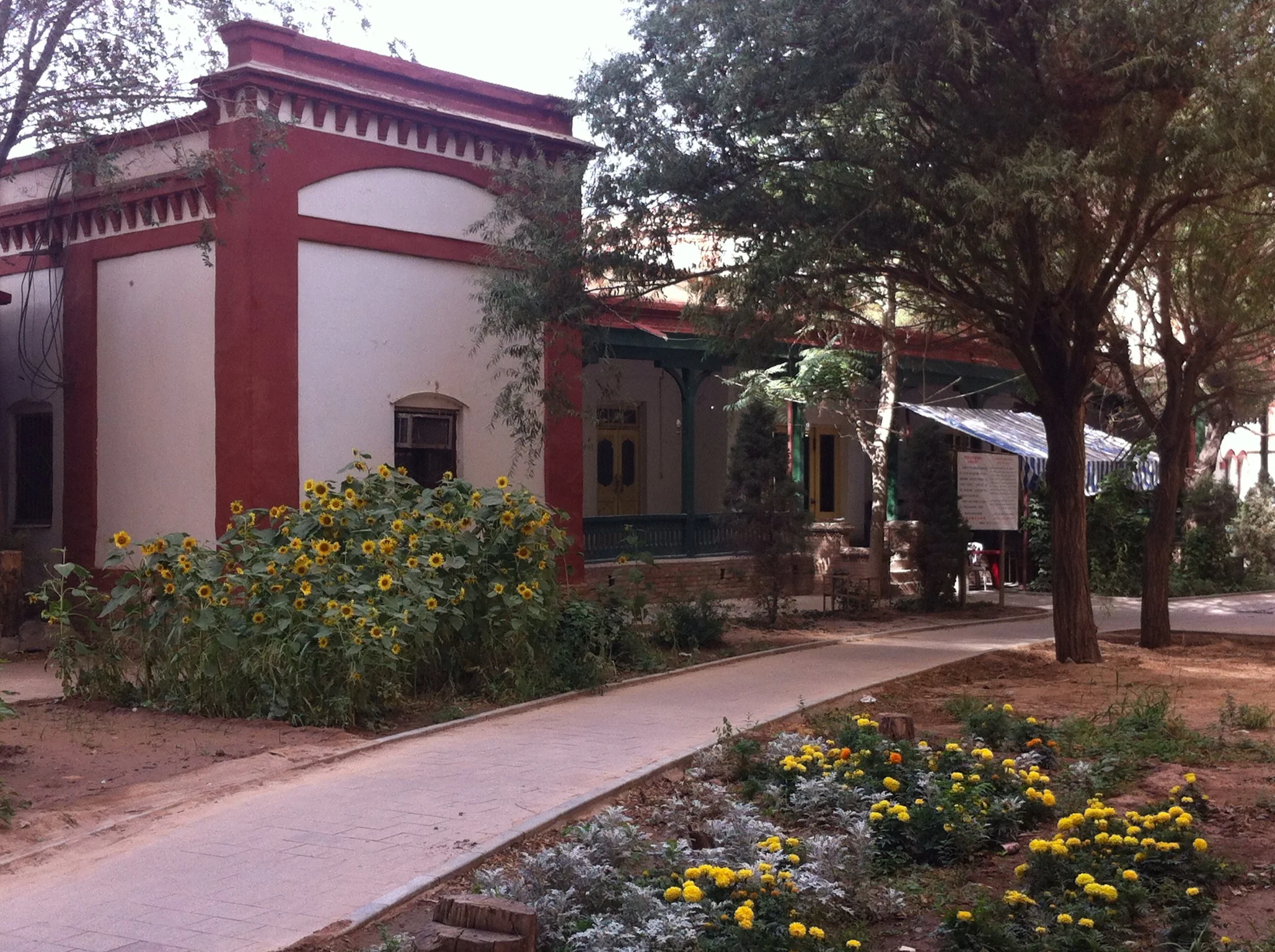
Chini Bagh as it exists today. Pic credit flashme.wordpress.com
Moving on back to the Consulate. It continued as the British Consulate till 1947 when the British decided to grant Independence to India. With the British gone the Consulate was renamed as the India Pakistan Consulate. Yes India Pakistan Consulate and it was like a joint Consulate. And things went on for a couple of years till as per now declassified CIA report things started happening and the Communist Revolution started making its presence felt. As a result the Consulate Generals of Pakistan and India were shut in 1949. It needs to be noted that Trade even at this time was on at full swing and not affected by this development. And it seems that the Indian Consulate officials continued to work well into 1950 when one fine day they decided to leave. The Consulate Incharge at that time was Capt.Sathe (he later became the Indian Ambassador to China) and all of the Indians had to leave via the most dangerous Route ie over the Karakoram Pass into Ladakh. Even the American Deputy Consulate Head took the same Route to Ladakh and the onto Srinagar and thence to Delhi from where they flew back to the US.
So why did the Consulates close or were ordered to close. Well its a complicated different story and maybe it will be told here some day. To put it simply the Communists were not very trusting of foreigners especially in a frontier Region inhabited by Uighurs who were themselves not very fond of the Chinese.
The Great Game had long ended and the Cold War had started and one of its sad legacy was the closing of my beloved “Worst Trade Route in the World”.
As for the Passport it lies in the Munshi Aziz Bhatt Museum in Kargil, a little distance from where the son of Sh. Amar Chand runs his business establishment.
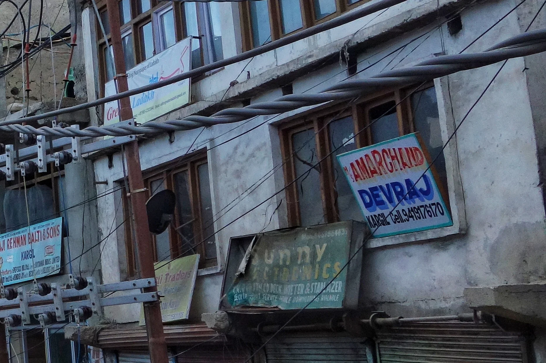
And business is still being carried out in the name of Sh.Amar Chand in the Kargil Bazaar.
Pic from May 2018. Kargil, Ladakh
The Uighur Hajis
These were also adventurers but there adventure was in the name of God. The Uighur Hajis who traveled the Leh Yarkand Route only to proceed further into mainland India and then across the Arabian Sea to do the Haj Pilgrimage.

The Uighur Hajis
Much has been written about the Trade Route which connected Ladakh with Central Asia across the high passes of the Himalayas, Karakorams and the Pamirs.I have also written on this and mentioned the Route as probably the Worst Trade Route in the World. Crossing the Highest Passes on the Planet over the Highest Mountains could never have been easy. The Men who undertook this Journey were majorly Traders and their hired Men. Well almost all except one Group of people.
This Group of people where Uighur Muslims (mostly older people) on their way down to Kashmir and the Indian Plains and ultimately to Arabia in older to undertake the Hajj pilgrimage. If you think of it that would be one of the most perilous Journey that anyone could ever undertake. For the Traders redemption lay once they reached Ladakh but for these Gentlemen the Journey had only started once they reached Leh.
From there they went onto Srinagar in Kashmir and then took the cart Road to Rawalpindi and then onto Lahore I assume and then they probably took a train Journey down to Mumbai. Once in Mumbai they got onto a Ship headed for Arabia which probably dropped them off at the Port of Aden I would assume. And then through the Arabian Desert all the way to the Holy Cities of Mecca and Medina to perform the Haj, one of the pillars of Islam.
And once having done that repeating the perilous Journey on their way back home. Keeping in mind that most of these pilgrims were Men of advanced ages I cannot help but wonder what was the mortality rate of these Pilgrims. And another thing I wonder about is how long did the whole Journey take once they left from Yarkand and returned back to Yarkand. And of course you have to keep in mind that some of them must have come to Yarkand from further afield.
These Men were also Adventurers. The motives were Religious but that doesn't take away from the remarkable Journey that these men undertook. Hats off to them.
The Pic is of a Group of Uighur Hajis in Leh in 1912.
The Gurudwara and the Hindu Dharamshala at Leh
The Gurudwara and the Hindu Dharamshala at Leh. A link back to the time when Punjabi traders connected the Trans Himalayas with the Indian Plains. Mostly from Hoshairpur they were major players in the trade with Central Asia via Ladakh. And some are still there

The Gurudwara and the Hindu Dharamshala at Leh
I had previously done a Post on the almost impossible Trade Route which connected Leh to Yarkand.
This time I had gone to Ladakh on a specific reason to go looking for clues that still survived of the great Trading Route.Of course there were other agendas on my plate as well but I wanted to find out more about this Trade and the People and commodities involved in the Trade. Of course there is mention of the Great Trade Route in the Books but since most people have lost interest in this all the remnants lie kinda forgotten.
The Trade ended in around 1949 when China closed the trading Route to what they now called Xinjiang. And it was almost 70 years now since the show ended. No one had a clue and no one seemed interested. And most asked what I was doing roaming around seemingly aimlessly where as I could be at Penguin Lake getting photographed sitting on a Scooter. Or go and meet Alexander’s family members. Or try to get permission to go to Umingting Ta, where if I could get a selfie with my tough guy look I could own Social Media for 3 days I imagine. Jokes apart I was trying my best to find something at least connected to the legendary Trade.
As luck would have it I happened to meet Sajid bhai who runs a well known Hotel in Leh and at his Hotel lobby he has a great collection of antiques and memorabilia. Sajid bhai told me that his family was involved in the Central Asian Trade and the place where his Hotel exists today was the site of a great Sarai where the Merchants from Yarkand would come down and stay. His family enjoyed Royal Patronage and this land was right next to the Leh Palace. But the most interesting fact was when Sajid bhai told me that his Mother was from Kashgar, another fabled city in Eastern Turkestan making the troika of the great cities at the edge of Tarim Basin viz Yarkand, Khotan and Kashgar. Some connect was being made. He directed me to the Central Asian Museum newly set up in Leh.
Next I visited the Central Asian Museum in Leh. A great building and very well set up though I must mention that I was a tad bit disappointed by the Collection they had. I was even more disappointed by the fact that Photography wasn't allowed inside the Museum as they had some interesting stuff. But still it had an impressive amount of information and Photos on display and one interesting information was the Volume of Trade for a certain period measured by the number of Laden Mules/ Horses : Donkeys : Camels came into Leh and were registered with the authorities. The numbers of Caravan Animals in 1871 are as given under (I copied the information on a Paper) :
From Kullu : Laden Horses/ Mules : 388 ; Donkeys : 35
From Rampur : Laden Horses/ Mules : 15 ; Donkeys : 35
From Turkestan : Laden Horses/ Mules : 956 ; Donkeys : 13 ; Camels : 18
From Kashmir : Laden Horses/ Mules : 464
From Changthang / Tibet : Laden Horses/ Mules : 460
Imports to Ladakh from North India included dyes, cotton cloth, spices, pears, rice, sugar, tobacco as well as personal items such as Needles, Soap and Combs. From China and Turkestan came Silk, carpets, cloth, gold, silver, turquoise, corals, brocades and velvet. At that time the distance between Leh and Yarkand was 548 miles and the Journey took around a month. On the other hand the time from Leh to Lhasa was around 3 months.
As mentioned in another Post the trade from the plains of Punjab used to start from Hoshiarpur and it was mostly Hoshiarpuri trader who were involved in this Trade and a number of them used to come to Leh from the Plains and some would even go to Yarkand. As time went by many of them settled partially in Leh and down in the Plains many Hoshiarpuri traders moved to Kullu.
And then I decided to take a walk in the Leh Market which is now a cobblestone street off-limits to cars. The first clue lies in the fact that a number of Shops/ Trading Marts in Leh are operated by Punjabis. Lajpat Rai Trilok Chand and Het Ram Vinay Kumar were the shops that caught my eye. Typical Punjabi trader names. Of course there are many newer Punjabi traders but most of them go away in the harsh winter but return as the Sun warms the high Desert. On enquiry at Lajpat Rai Trilok Chand, who have a big store in the main Bazaar a gentleman confirmed their link to Hoshiarpur and that they were originally from there.
And then I came across this old building which stood out amongst the new buildings in the Bazaar. And then i noticed a Saffron Flag on top and on getting closer I noticed the “Khanda” on the Flag. So it was an old Gurudwara in the Main Bazaar. And looking at the building I suddenly noticed another old board which said “Hindu Dharamshala” and it had a date in Hindi which I assume said 1933 but Im not quite sure. It turns out that the second Floor was a Gurudwara, the first Floor was a Hindu Dharamshala and the Ground Floor was shops. Im sure this served as the resting place for the Punjabi traders coming from Hoshiarpur as that was the main point of Trade in the Punjab with the Hills and the Mountains beyond. And the Shops were used by them to probably display their merchandise.
And below is the pic of the said Building which probably no-one even gives a second look to. I wish I could rummage through the stuff they have probably stacked away somewhere in the Dharamshala.
That would make a great Story for another day I guess.

The Kashmir Ladakh Yarkand TransHimalayan Silk Route
Notes from the Kashmir Ladakh Yarkand Trade Route / Silk Route

The Kashmir Ladakh Yarkand TransHimalayan Silk Route
The quite famous Double Humped or Bactrian Camels of the Nubra Valley which came into this region from Central Asia on the various trade routes that connected the two regions.
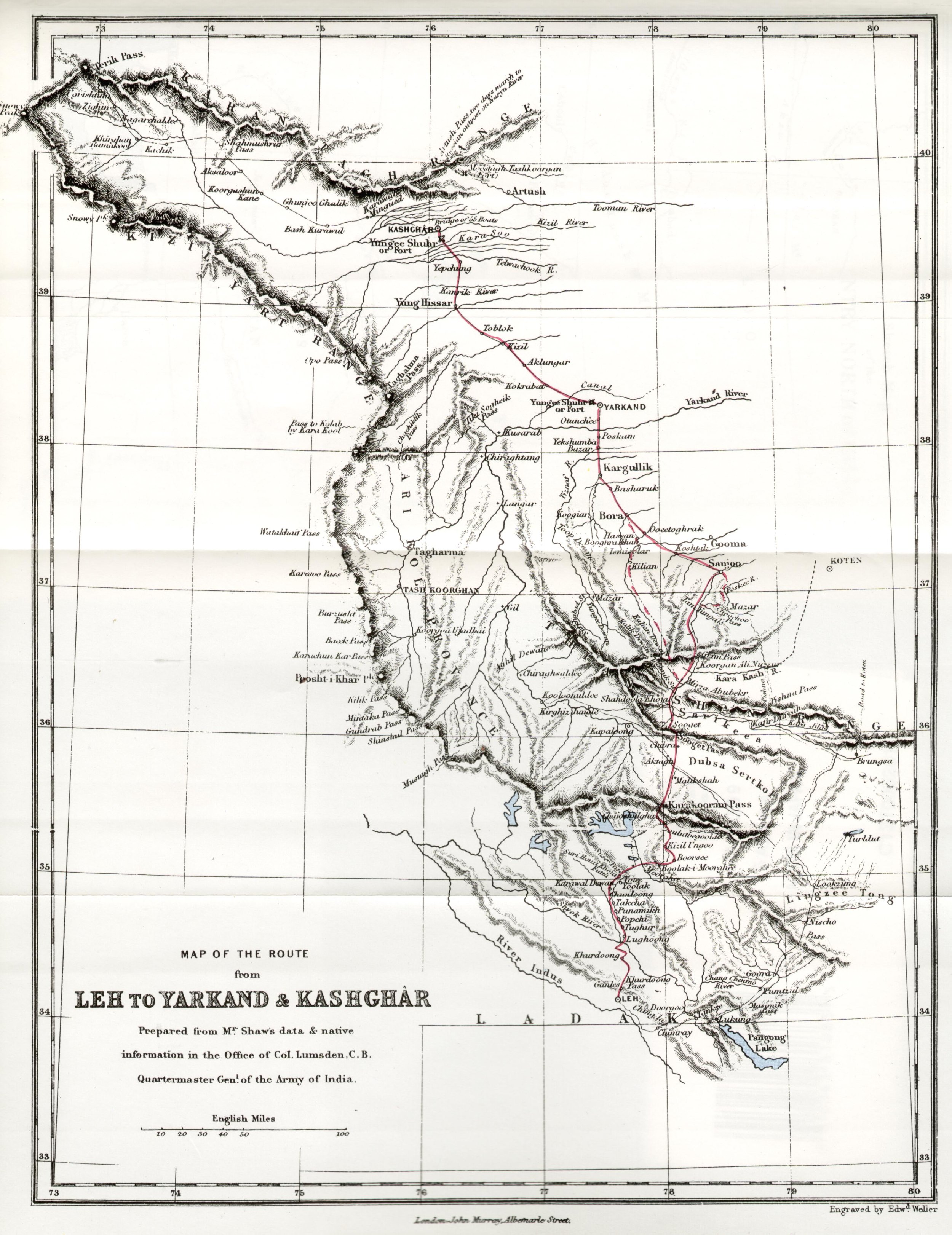
A large quantum of the trade was carried on through the classical trade route from Ladakh to Yarkand in the Tarim Basin in Turkestan of the old ( Xinjiang Province of China at present ). The traders from Ladakh took to Yarkand (which served as the gateway to Central Asia) items like Shawls, Indigo, Tea, Corals, Corals, Muslin etc. On the other from Yarkand into Ladakh (and further into Kashmir and North India) came in Silk, Precious Metals, Costumes, Jewellery and oddly Russian currency towards the end of the Nineteenth century.
The distance between Leh to Yarkand is just 475 kms as the crow flies but in those days this was a long and arduous trek which involved the crossing of atleast 5 major passes and crossing the Depsang Plains.
The great passes that had to be crossed in this great trasnverse starting from the Leh side included the now “world famous” Khardung La. From the head of the Nubra Valley started the descent into the second Pass, Sasser La,at 5411 m. From this pass the route descended into the Depsang Plains.
From the Depsang Plains, which are as desolate as any place on the planet with an average elevation of 5300 m the route headed over the Karakoram Pass which stood at 5540 m. The Karakoram Pass was/is totally bereft of any kind of vegetation and lot of the livestock just gave up. It is said that the path up the Pass is still strewn with hundreds of bones and skeletons of pack animals that just gave up and died. After crossing the the Karakoram Pass the route went towards the relatively easy Suget La.

After crossing the easiest pass on the route, Suget La, ~ 5500, which was in the Kun Lun mountains the route descended into the staging post of Shahidullah which offered some rough pastures for the load animals to refuel. It is interesting to know the British considered Shahidullah as the frontier of the state of Jammu and Kashmir and not the Karakoram Pass as some others assumed it to be.
After Shahidullah came the last pass before descending into the plains of Central Asia, the Sanju La at 5364 m. From this Pass the mountains gave way and the trade route made its way into the fabled city of Yarkand.
But this trade came to a gradual halt due to the complicated political situation in this area. Hopefully one day some people may fulfill their ultimate dream of following in the foot steps of the great caravans which connected North India with Central Asia.
PS : This pic was taken by me in July, 2004
Some inputs from John Keays : When Men and Mountains Meet
The Worst Trade Route in the World
The Story of the Trade Route or the Silk Route which connected Kashmir with Yarkand in Central Asia via Ladakh. The Route passed through some of the most inhospitable Mountain terrain and over the highest Passes in the World. No wonder some one called it “The Worst Trade Route in the World”

The Worst Trade Route in the World
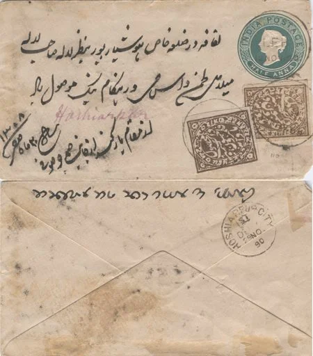
Came across this inocous looking Envelope cover during one random search on the Net while trying to know more about Mail runners in the Himalayas, you know the guys who used to take letters / Posts during the 19th century.
Looked at it closely it and the writings on it in Persian, English and Dogri in Takri script got me more interested. And then I read on it. It was letter sent from Yarkand in the Tarim Basin in Xinjiang (Sinkiang) or East Turkestan as it was known at that time to someone in Hoshiarpur in Punjab. There was a constant trade from Hoshiarpur to Yarkand via Mandi, through Kullu Valley onto Leh and onwards to Yarkand. It was in my opinion the hardest trade route in the world. (Thanks to kashmirstamps website for this invaluable photo and details)
A large quantum of the trade was carried on through the classical trade route from Ladakh to Yarkand in the Tarim Basin in Turkestan of the old ( Xinjiang Province of China at present ). The traders from Ladakh took to Yarkand (which served as the gateway to Central Asia) items like Shawls, Indigo, Tea, Corals, Muslin etc. On the other from Yarkand into Ladakh (and further into Kashmir and North India) came in Silk, Precious Metals, Costumes, Jewellery and oddly Russian currency towards the end of the Nineteenth century.
Now the letter this Envelope contained was posted on October 05, 1890 and it was delivered at Hoshairpur on November 29, 1890 after a total of 55 days. It entered the Bristish India Postal system once it reached Leh, which it did on November 12, 1890 and the Dogri stamps/writings were affixed on November 17, 1890 somewhere on the way which is speculated as Mandi but I seriously doubt anyone could get from Leh to Mandi in 5 days. So that place remains a mystery. Also it seems to be at a point under Dogra suzerainity which Mandi never was. My best guess is that it was somewhere in the Ladakh but where exactly is a mystery.

The Sasser La
To understand the dynamics of the whole journey from the Hoshiarpur to Yarkand you need to consider that it involved crossing the Dhauladhar Range, the Great Himalaya itself, the Karakorams and finally the Kun Luns itself. It involved crossing over 10 Passes, some of which are the highest in the World. It also included crossing the extremely inhospitable Depsang Plains. If ever there was a difficult “trade route” this was it. Infact one English gentleman called it the “Worst Trade Route in the World”

The Tullung putti la: The cliff you see in the background has been surmounted by a path cut through with 42 bends
Most of us are familiar with the Route from Hoshiarpur to Leh. Form the plains upto Mandi into the Kullu Valley and then upto the first great Pass, the Rohtang La. At around 13000 ft Rohtang may be dwarfed by some of the other passes which come later but with the amount of snow it received it came with a reputation. No wonder it derived its named from “A pile of Corpses”. After crossing into the vertically dramatic Lahaul Valley the route went upto the the Baralacha La, lying on the water shed of the Great Himalayas. After the getting into the Trans Himalayan Ladakh region the route crossed the Lachulang La and the Tangang La after crossing the Plateau known as the More Plains. And then we got to Leh.

Team trekking from Murgo towards Karakoram Pass
Leh was the midway point in some ways and as such was full of businessmen from both ends of the Route and places in between as well as traders from Kashmir who came up through the Zoji La Pass. Leh was a busy trade town at that time with a mix of Yarkandi, Kashmiri, Punjabi, Tibetan, Europeans as well as the very interesting Arguns (these were people born out of mixed marriages between Yarkandi and Kashmiri traders and local Ladakhi women) people besides the local Ladakhis.

The Karakoram Pass
The great passes that had to be crossed in this great trasnverse starting from the Leh side included the now “world famous” Khardung La. From the head of the Nubra Valley started the descent into the second Pass, Sasser La,at 5411 m. From this pass the route descended into the Depsang Plains. From the Depsang Plains, which are as desolate as any place on the planet with an average elevation of 5300 m the route headed over the Karakoram Pass which stood at 5540 m. The Karakoram Pass was/is totally bereft of any kind of vegetation and lot of the livestock just gave up. It is said that the path up the Pass is still strewn with hundreds of bones and skeletons of pack animals that just gave up and died. After crossing the the Karakoram Pass the route went towards the relatively easy Suget La.
After crossing the easiest pass on the route, Suget La, ~ 5500, which was in the Kun Lun mountains the route descended into the staging post of Shahidullah which offered some rough pastures for the load animals to refuel. It is interesting to know the British considered Shahidullah as the frontier of the state of Jammu and Kashmir and not the Karakoram Pass as some others assumed it to be.

The famous Karakoram Mules crossing the Shyok river at Saser Brangza on their way to Chongtash, Murgo... KK Pass.
After Shahidullah came the last pass before descending into the plains of Central Asia, the Sanju La at 5364 m. From this Pass the mountains gave way and the trade route made its way into the fabled city of Yarkand.
Of course this letter came in the opposite direction and I tried to get a transalation done from a friend (Thanks to Seema Bhatt for helping out here). In Persian the letter says “Lifafa dar Zila Khas Hoshyarpur ba nazre Lala Sahib Mela Das Hangame naik mosool howa. Az muqam e Yarqand az janabe Samad Joo Soofi. 20th of safar 1308 Safar.” The meaning with all the Persian respects and adab, means that the letter is addressed to one Lala Mela Das of Hoshiarpur and it is sent by Janaab Samad Joo Soofi. The sender in all probability was a Kashmiri trader based in Yarkand, guessing from his surname but as with a lot of Punjabis earlier the surname of Lala Mela Das remains a mystery. I checked up with a friend, who’s ancestors also used to trade with Yarkand, also from Hoshiarpur if he knew of this gentleman but till now ive drawn a blank.

One of the Trekkers in one of the "polu" shelters on the Karakoram Trail
Anyways this just goes to show what all is revealed when one digs into a simple old enevlope. The people/ the route it took/ the language/languages used/ the scripts/ the dates/ the reason etc etc. Truly something worth getting into the depth of.
For me the quest will continue as I plan to visit Yarkand some times in August I guess as I have always been fascinated by the Trans Himalayan Central Asian towns which were at the end of the Silk Road from our side and have a glimpse of the Worst Trade Route in the world. Yarkand, Kashgar, Khotan, Tashkurgan and of course the Karakoram Highway are all on my list
Additional inputs from : When Men and Mountain Meet : The Explorers of the Western Himalayas 1820 – 75. This has to be one of my favorite books on the Himalaya.
Photo from the kashmiristamps website
Kiki’s Blog
Stories from the Himalayas








Five years ago the Galwan Valley was in the News for the wrong reasons after a deadly clash between the Indian and Chinese Armies in the Valley located in Ladakh lead to many deaths on the contentious Border between the two countries in wake of continued Chinese intrusions into Indian territory.
This area along the Shyok River, of which the Galwan Nallah or the Galwan River which forms the Galwan Valley has been off limits to Civilians since long but now the Indian Government has decided to open up the area for Civilians and we were amongst the First Civilians to venture into this beautifully desolate part of the Eastern Karakorams in Ladakh. Earlier Civilians could only venture upto the Village of Shyok from where the Shyok River takes a U turn and flows in a Northerly direction.