
The Uighur Hajis
These were also adventurers but there adventure was in the name of God. The Uighur Hajis who traveled the Leh Yarkand Route only to proceed further into mainland India and then across the Arabian Sea to do the Haj Pilgrimage.

The Uighur Hajis
Much has been written about the Trade Route which connected Ladakh with Central Asia across the high passes of the Himalayas, Karakorams and the Pamirs.I have also written on this and mentioned the Route as probably the Worst Trade Route in the World. Crossing the Highest Passes on the Planet over the Highest Mountains could never have been easy. The Men who undertook this Journey were majorly Traders and their hired Men. Well almost all except one Group of people.
This Group of people where Uighur Muslims (mostly older people) on their way down to Kashmir and the Indian Plains and ultimately to Arabia in older to undertake the Hajj pilgrimage. If you think of it that would be one of the most perilous Journey that anyone could ever undertake. For the Traders redemption lay once they reached Ladakh but for these Gentlemen the Journey had only started once they reached Leh.
From there they went onto Srinagar in Kashmir and then took the cart Road to Rawalpindi and then onto Lahore I assume and then they probably took a train Journey down to Mumbai. Once in Mumbai they got onto a Ship headed for Arabia which probably dropped them off at the Port of Aden I would assume. And then through the Arabian Desert all the way to the Holy Cities of Mecca and Medina to perform the Haj, one of the pillars of Islam.
And once having done that repeating the perilous Journey on their way back home. Keeping in mind that most of these pilgrims were Men of advanced ages I cannot help but wonder what was the mortality rate of these Pilgrims. And another thing I wonder about is how long did the whole Journey take once they left from Yarkand and returned back to Yarkand. And of course you have to keep in mind that some of them must have come to Yarkand from further afield.
These Men were also Adventurers. The motives were Religious but that doesn't take away from the remarkable Journey that these men undertook. Hats off to them.
The Pic is of a Group of Uighur Hajis in Leh in 1912.
Central Asian Arts at the Shanghai Museum
The Central Asian Collection at the Shanghai Museum. At the Minorities section of the Museum on display from the Tibetan, Uighur, Kirghiz, Kazakh and other Central Asian people are various Antiques and Arts reflecting the rich culture of these people.

Mongol Brass Chess Pieces
Central Asian Arts at the Shanghai Museum
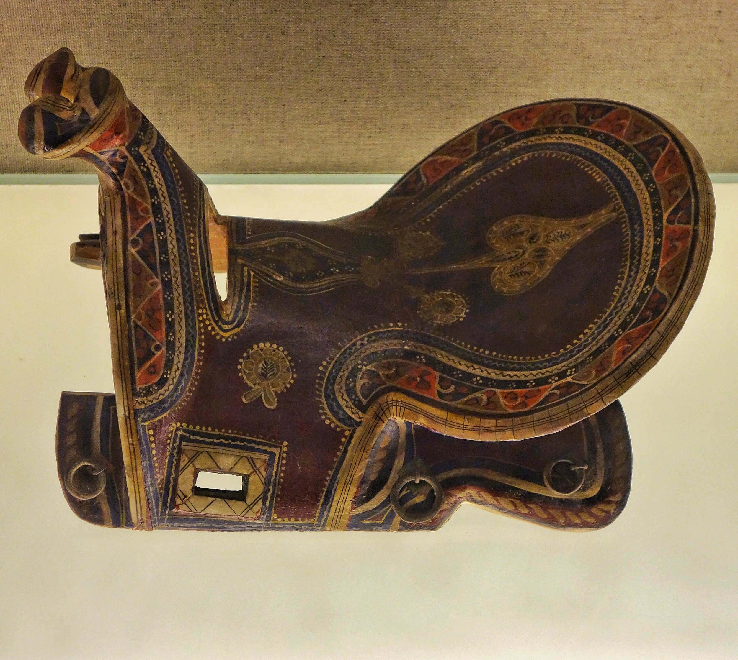
Ughyur Saddle with Painted Motif

Tajik Flute Made of Eagle Bone

Ughyur Foldable Book Rest with four folds

Ughyur Copper Bottle with Carved Motif and Arabic Lettering

Ughyur Copper Bottle w Carved Motif

Ughyur Brass Pencil Box
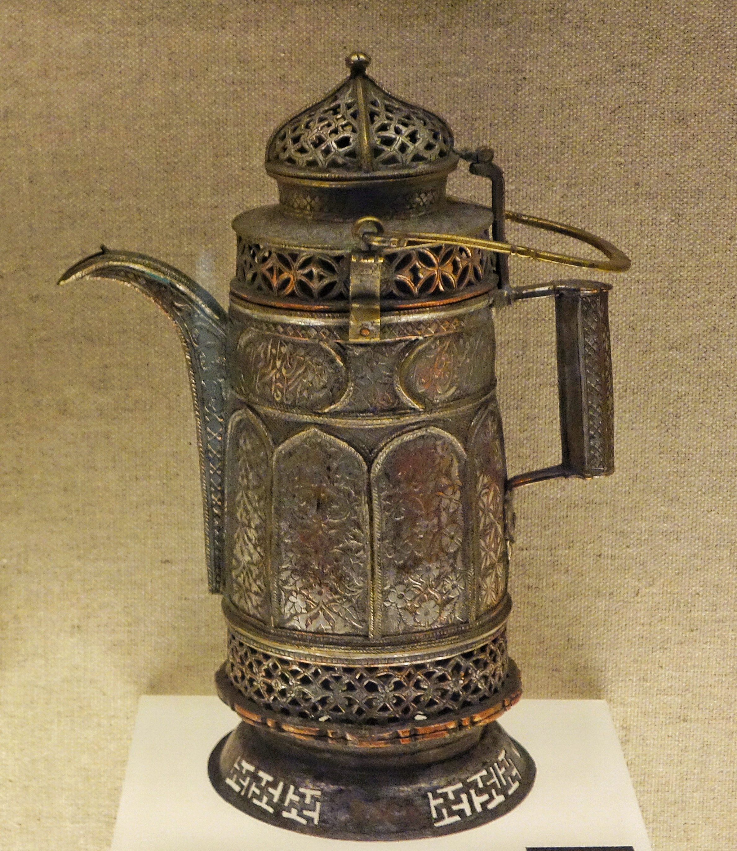
Ughyur Copper Pitcher with an openwork design and a Looped Handle
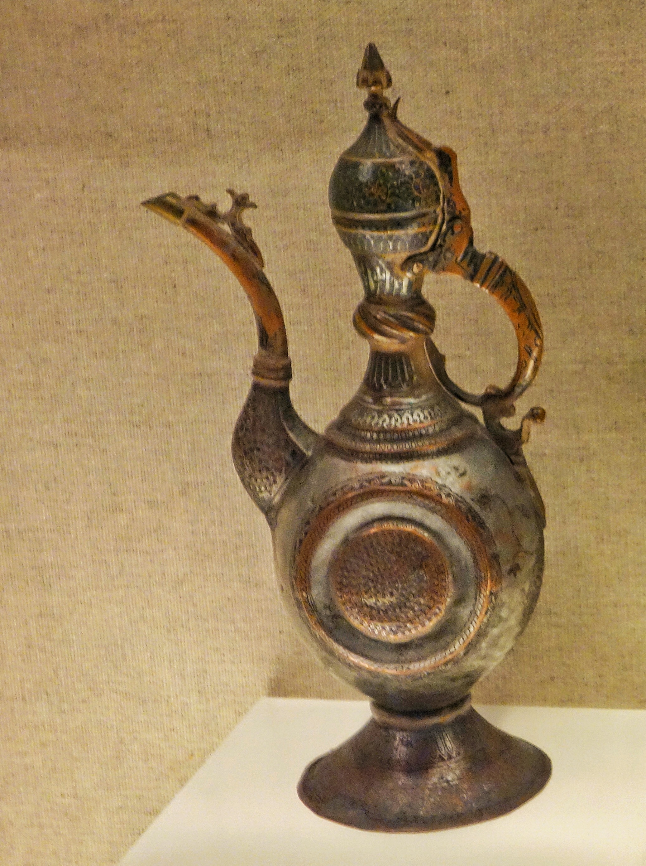


Mongol Headdress with coral beads

Kirkhiz Necklace

Ughyur Braided Ornament Adorned with Beads and Silver Khotan

Kazak Gilt Silver Ornament

Tajik Silver Eagle Shaped Head Covering Ornament with Inlaid Stones

Ughyur Necklace

Tajik Silver Filigree Earrings

Mongol Brass Copper Snuff Boxes with Inlay

Tajik Silver Pendants Strung with Beads
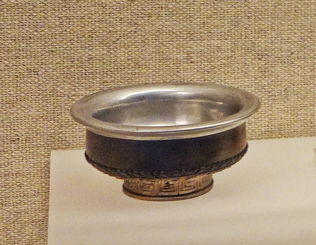
Mongol Wooden Bowl covered with Silver

Ughyur Velvet Dopa with Gold work Embroidery

Ughyur Dopa, four angled Caps wit Beads and Embroidery

Kirkhiz Waistcoat and Pants

Ughyur Dopa Embroidered Cap

Ughyur Velvet Waist Coat and Jacket with Embroidery and Beads

Ughyur Embroidered Satin Dress

Ughyur Men's Dress

Uzbek Woman’s Dress with Embroidery
When East met West
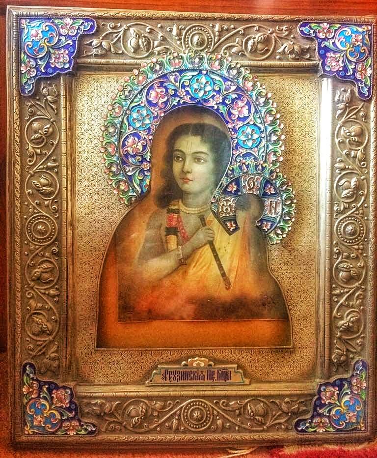
When East met West. A Lord Krishna picture in a Christian frame made in Russia. An import from Yarkand !
When East met West
A friend was kind enough to share this pic with me of a Metal Frame with Lord Krishna inside. This frame and pic was bought by someone in his family from Yarkand across the Great Himalayan divide. His family at that time was involved in Trading with Yarkand initially based at Hoshiarpur but eventually moving to Kullu.
This is a Russian frame used for the Holy Mother and the child but someone in Yarkand was smart enough to replace that with Lord Krishna and sell it to the Hindu traders / Indian traders. But looks kinda odd but I guess it was a good item to sell at that time. The metal work on the frame is quite exquisite though. And it has a Russian or a Georgian inscription as well.
Yarkand served as Center where goods from all over Asia and Europe could be traded. It was an important point in the Silk Route and also had "Route" to India. I have written at length about this Route in another Post earlier.
One of the great trading centers of Central Asia is now lost as a dusty outpost in Xinjiang. Having lost its glory for good.
Pic from July 2017. Raison, Himachal Pradesh
The Kashmir Ladakh Yarkand TransHimalayan Silk Route
Notes from the Kashmir Ladakh Yarkand Trade Route / Silk Route

The Kashmir Ladakh Yarkand TransHimalayan Silk Route
The quite famous Double Humped or Bactrian Camels of the Nubra Valley which came into this region from Central Asia on the various trade routes that connected the two regions.
A large quantum of the trade was carried on through the classical trade route from Ladakh to Yarkand in the Tarim Basin in Turkestan of the old ( Xinjiang Province of China at present ). The traders from Ladakh took to Yarkand (which served as the gateway to Central Asia) items like Shawls, Indigo, Tea, Corals, Corals, Muslin etc. On the other from Yarkand into Ladakh (and further into Kashmir and North India) came in Silk, Precious Metals, Costumes, Jewellery and oddly Russian currency towards the end of the Nineteenth century.
The distance between Leh to Yarkand is just 475 kms as the crow flies but in those days this was a long and arduous trek which involved the crossing of atleast 5 major passes and crossing the Depsang Plains.
The great passes that had to be crossed in this great trasnverse starting from the Leh side included the now “world famous” Khardung La. From the head of the Nubra Valley started the descent into the second Pass, Sasser La,at 5411 m. From this pass the route descended into the Depsang Plains.
From the Depsang Plains, which are as desolate as any place on the planet with an average elevation of 5300 m the route headed over the Karakoram Pass which stood at 5540 m. The Karakoram Pass was/is totally bereft of any kind of vegetation and lot of the livestock just gave up. It is said that the path up the Pass is still strewn with hundreds of bones and skeletons of pack animals that just gave up and died. After crossing the the Karakoram Pass the route went towards the relatively easy Suget La.

After crossing the easiest pass on the route, Suget La, ~ 5500, which was in the Kun Lun mountains the route descended into the staging post of Shahidullah which offered some rough pastures for the load animals to refuel. It is interesting to know the British considered Shahidullah as the frontier of the state of Jammu and Kashmir and not the Karakoram Pass as some others assumed it to be.
After Shahidullah came the last pass before descending into the plains of Central Asia, the Sanju La at 5364 m. From this Pass the mountains gave way and the trade route made its way into the fabled city of Yarkand.
But this trade came to a gradual halt due to the complicated political situation in this area. Hopefully one day some people may fulfill their ultimate dream of following in the foot steps of the great caravans which connected North India with Central Asia.
PS : This pic was taken by me in July, 2004
Some inputs from John Keays : When Men and Mountains Meet
Mission Yarkand
Mission Yarkand was a British Mission to to Ladakh to smoothen the trade between Ladakh and Yarkand. It was from Leh that British goods were sent into Central Asia. So it was in their great interest to facilitate the Trade. And students of Colonialism well know that where the Traders go the Soldiers soon follow !

Mission Yarkand
Continuing on the quest to understanding the Routes taken by traders when the crossed the Great Himalayan Divide which separates the Indian sub-continent from Central Asia / Tibet / Eurasia during the times of the old. For a better understanding of the complexity of this divide read this post which I had made some time back :
The Silk Route connected Cathay (the romanticised name for China) with the civilizations of the Indians, Persians, Arabs, the Europeans and everything in between. But we will focus on the Trade routes over the Himalayas and its adjoining ranges that formed thebasis of this trade.

The main cities in Central Asia which served as the great transit points on the Silk Road were the great cities of Bukhara and Samarkand in West Turkestan (It used to be called Turkestan in those times) and the cities of Kashgar, Yarkand and Hotan on the Eastern side of Turkestan. From both Bukhara and Samarkand there were well established routes over the low passes of the Hindu Kush that led into Afghanistan and from there hence to India over the Khyber Pass. But the political divides and differences between the different Khanates and the political turmoil in Afghanistan and on the whole unsettled situation casued some of the Trade to shift further East.
In the present Indian territorial context both Kargil and Leh were important trading towns on the Journey upnorth over what was probably the “Worst Trade Route in the World”. Kargil was equidistant from Srinagar and Leh and also served as a gateway to Gilgit Baltistan and the town of Skardu and further North West. There was a trade route from there as well which followed what is now the Karakoram Highway over the Khunjerab Pass into Turkestan and the town of Tashkurgan.

Coming to Leh, it served as the great bazaar as traders of all hues and colors could be found there. Leh was the point of convergence of various trade routes coming from different directions and as such was the epicenter of all the trading that went on, on this route. Unlike the touristy place it has become now it was a great center of trade where traders from Kashmir, Punjab, Yarkand, Central Asia, Tibet, Persia converged and goods, services and ideas were exchanged.
As rightly pointed out by Kaushik Shil Sir in reply to my previous post the bulk of the trade from the plains of India came up through the Srinagar Zoji La Leh trade route. However there were other caravan routes also which bought in goods. From Skardu side there was a route through Khaplu and over the Chorbat La into the Nubra Valley and onto Leh over the Khardung La. Also there was another route along the Indus Valley. From Kishtwar there was a route over the Umasi La into Zanskar and then onto Leh from there on.
From Kullu it was over the Rohtang La into Lahaul and then over the Baralacha La onto Leh. The fact that this Route went over the Baralacha La I have confirmed with many references including the documented travel of the Himalayan exploration pioneer, Moorcroft who went over the same route from Kullu and became probably the first Englishman to visit Leh. However the Route they took once they descended the Bara Lacha La and then onto Leh is something I am still working on though Im pretty sure that they followed somewhere close to where the present day road runs.
This Route was encouraged by the British as it somehow allowed them more leverage in the trading rather than paying the heavy duties which were imposed on the traditional Srinagar Zoji La by the Sikhs and later on the Dogras. Infact the British also tried the trading directly with Yarkand over the Chang La Pass, thus avoiding Leh which was under Sikh/ Dogra control. But the Route took them over the Depsang and the Changchenmo which was just devoid of any greenery or pastures and there was hardly any inhabitation for most of the Route.
From Spiti one route took you over the Parang La into Rupshu in Ladakh and then onto Leh.Further afield from Nurpur and Bushahr there was apparently a route throung the Long Lacha Pass and Thung Lung La (both these Passes have gone into obscurity from what I know). If anyone knows about them please update me. In my view all trade from these areas has now stopped so these Passes lay forgotten and are unused as such. Also maybe access to these areas are noe restricted because of present day boundary disputes.
To the east of Ladakh there was the town of Gartok from which a Route led to Lhasa as well. Ladakh for all practical purposes is a part of Tibet so there was a constant flow of traders and pilgrims on this Route. I also imagine that some Chinese goods also came into Leh by the way of this route from Tibet central.
And of course to the north of Leh stood the route to Yarkand which has been discussed in detail in a previous post. Interestingly besides that Route there were two other Routes to get to Yarkand. One Route only available in the winters was crossing the Digar La into Nubra (an alternative to the world famous Khardung La) and then walking the narrow gorges of the frozen Shyok River to the Karakoram Pass and then moving on along the Classical Leh Yarkand route. Sort of like a Chadar trade route only that now its virtually impossible. Another route as described before was through the Changchenmo and Linzithang plains over the Chang La to meet the existing classical route at Shahidulla.
Coming to a stop for now it is indeed a misfortune that in today’s day and age most of these areas are again off limits and will remain so for a long time it seems. Till then we can just read the accounts of the travels and try and get a feeling of what it felt like.
When I again get over my laziness I will write a long one on The Treaty Road between Srinagar and Yarkand.
References : Again John Keays When Mountains and Men Meet : Explorers of the Western Himalayas. And a bigger reference for this is Himalayan Frontiers of India by K Warikoo. This was one of the basic source of the information used.
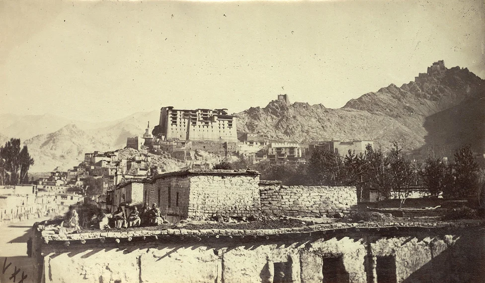
PS : “The accompanying photograph was taken by the Yarkand Mission. The official purpose of the Yarkand mission was to conclude a commercial treaty with the Amir of Yarkand and Kashghar. The mission had a deeper purpose, it was also to gather sufficient intelligence about this largely unknown area so as to be a step ahead of the Russians in what came to be called the Great Game, the struggle between Great Britain and Russia for mastery over Central Asia. The Mission would obtain geographical and historical information on the area, as well as survey its natural resources, while pressing diplomatic relations on the principalities that they traversed via Kashmir through Tibet into Chinese Turkestan. The mission was under the command of Sir T. D. Forsyth of the Bengal Civil Service, who wrote an accompanying report, Forsyth, T.D., ‘Report of a Mission to Yarkund in 1873’ (Calcutta 1875). Situated at the crossroads of Asia in the high Himalayas, Leh is the capital of the cold desert region of Ladakh, in the eastern part of the state of Jammu and Kashmir.”
Source: British Library
Pic from Summers 1873. Leh. Photographer: Edward Francis Chapman
The Worst Trade Route in the World
The Story of the Trade Route or the Silk Route which connected Kashmir with Yarkand in Central Asia via Ladakh. The Route passed through some of the most inhospitable Mountain terrain and over the highest Passes in the World. No wonder some one called it “The Worst Trade Route in the World”

The Worst Trade Route in the World
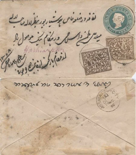
Came across this inocous looking Envelope cover during one random search on the Net while trying to know more about Mail runners in the Himalayas, you know the guys who used to take letters / Posts during the 19th century.
Looked at it closely it and the writings on it in Persian, English and Dogri in Takri script got me more interested. And then I read on it. It was letter sent from Yarkand in the Tarim Basin in Xinjiang (Sinkiang) or East Turkestan as it was known at that time to someone in Hoshiarpur in Punjab. There was a constant trade from Hoshiarpur to Yarkand via Mandi, through Kullu Valley onto Leh and onwards to Yarkand. It was in my opinion the hardest trade route in the world. (Thanks to kashmirstamps website for this invaluable photo and details)
A large quantum of the trade was carried on through the classical trade route from Ladakh to Yarkand in the Tarim Basin in Turkestan of the old ( Xinjiang Province of China at present ). The traders from Ladakh took to Yarkand (which served as the gateway to Central Asia) items like Shawls, Indigo, Tea, Corals, Muslin etc. On the other from Yarkand into Ladakh (and further into Kashmir and North India) came in Silk, Precious Metals, Costumes, Jewellery and oddly Russian currency towards the end of the Nineteenth century.
Now the letter this Envelope contained was posted on October 05, 1890 and it was delivered at Hoshairpur on November 29, 1890 after a total of 55 days. It entered the Bristish India Postal system once it reached Leh, which it did on November 12, 1890 and the Dogri stamps/writings were affixed on November 17, 1890 somewhere on the way which is speculated as Mandi but I seriously doubt anyone could get from Leh to Mandi in 5 days. So that place remains a mystery. Also it seems to be at a point under Dogra suzerainity which Mandi never was. My best guess is that it was somewhere in the Ladakh but where exactly is a mystery.

The Sasser La
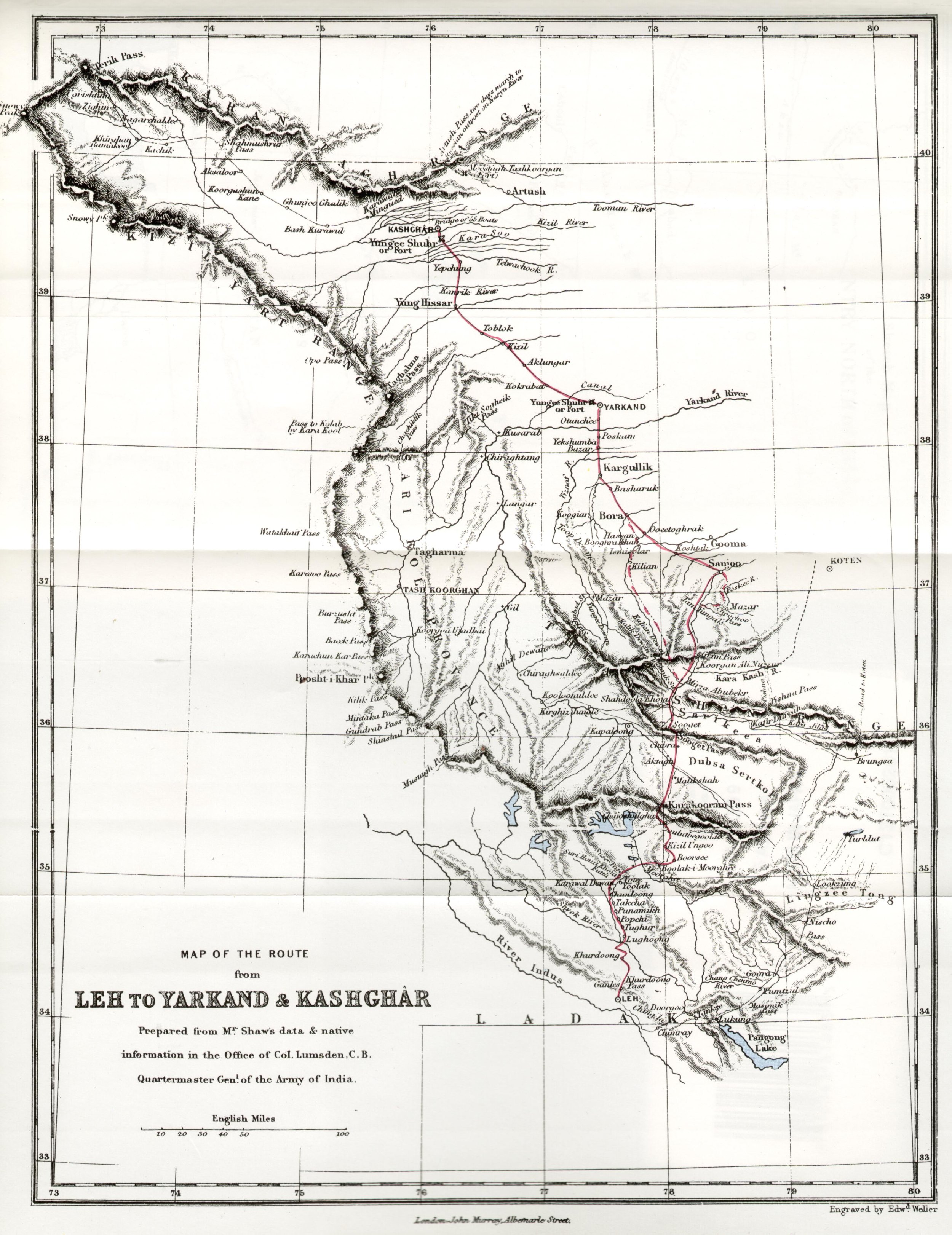
To understand the dynamics of the whole journey from the Hoshiarpur to Yarkand you need to consider that it involved crossing the Dhauladhar Range, the Great Himalaya itself, the Karakorams and finally the Kun Luns itself. It involved crossing over 10 Passes, some of which are the highest in the World. It also included crossing the extremely inhospitable Depsang Plains. If ever there was a difficult “trade route” this was it. Infact one English gentleman called it the “Worst Trade Route in the World”

The Tullung putti la: The cliff you see in the background has been surmounted by a path cut through with 42 bends
Most of us are familiar with the Route from Hoshiarpur to Leh. Form the plains upto Mandi into the Kullu Valley and then upto the first great Pass, the Rohtang La. At around 13000 ft Rohtang may be dwarfed by some of the other passes which come later but with the amount of snow it received it came with a reputation. No wonder it derived its named from “A pile of Corpses”. After crossing into the vertically dramatic Lahaul Valley the route went upto the the Baralacha La, lying on the water shed of the Great Himalayas. After the getting into the Trans Himalayan Ladakh region the route crossed the Lachulang La and the Tangang La after crossing the Plateau known as the More Plains. And then we got to Leh.

Team trekking from Murgo towards Karakoram Pass
Leh was the midway point in some ways and as such was full of businessmen from both ends of the Route and places in between as well as traders from Kashmir who came up through the Zoji La Pass. Leh was a busy trade town at that time with a mix of Yarkandi, Kashmiri, Punjabi, Tibetan, Europeans as well as the very interesting Arguns (these were people born out of mixed marriages between Yarkandi and Kashmiri traders and local Ladakhi women) people besides the local Ladakhis.

The Karakoram Pass
The great passes that had to be crossed in this great trasnverse starting from the Leh side included the now “world famous” Khardung La. From the head of the Nubra Valley started the descent into the second Pass, Sasser La,at 5411 m. From this pass the route descended into the Depsang Plains. From the Depsang Plains, which are as desolate as any place on the planet with an average elevation of 5300 m the route headed over the Karakoram Pass which stood at 5540 m. The Karakoram Pass was/is totally bereft of any kind of vegetation and lot of the livestock just gave up. It is said that the path up the Pass is still strewn with hundreds of bones and skeletons of pack animals that just gave up and died. After crossing the the Karakoram Pass the route went towards the relatively easy Suget La.
After crossing the easiest pass on the route, Suget La, ~ 5500, which was in the Kun Lun mountains the route descended into the staging post of Shahidullah which offered some rough pastures for the load animals to refuel. It is interesting to know the British considered Shahidullah as the frontier of the state of Jammu and Kashmir and not the Karakoram Pass as some others assumed it to be.

The famous Karakoram Mules crossing the Shyok river at Saser Brangza on their way to Chongtash, Murgo... KK Pass.
After Shahidullah came the last pass before descending into the plains of Central Asia, the Sanju La at 5364 m. From this Pass the mountains gave way and the trade route made its way into the fabled city of Yarkand.
Of course this letter came in the opposite direction and I tried to get a transalation done from a friend (Thanks to Seema Bhatt for helping out here). In Persian the letter says “Lifafa dar Zila Khas Hoshyarpur ba nazre Lala Sahib Mela Das Hangame naik mosool howa. Az muqam e Yarqand az janabe Samad Joo Soofi. 20th of safar 1308 Safar.” The meaning with all the Persian respects and adab, means that the letter is addressed to one Lala Mela Das of Hoshiarpur and it is sent by Janaab Samad Joo Soofi. The sender in all probability was a Kashmiri trader based in Yarkand, guessing from his surname but as with a lot of Punjabis earlier the surname of Lala Mela Das remains a mystery. I checked up with a friend, who’s ancestors also used to trade with Yarkand, also from Hoshiarpur if he knew of this gentleman but till now ive drawn a blank.

One of the Trekkers in one of the "polu" shelters on the Karakoram Trail
Anyways this just goes to show what all is revealed when one digs into a simple old enevlope. The people/ the route it took/ the language/languages used/ the scripts/ the dates/ the reason etc etc. Truly something worth getting into the depth of.
For me the quest will continue as I plan to visit Yarkand some times in August I guess as I have always been fascinated by the Trans Himalayan Central Asian towns which were at the end of the Silk Road from our side and have a glimpse of the Worst Trade Route in the world. Yarkand, Kashgar, Khotan, Tashkurgan and of course the Karakoram Highway are all on my list
Additional inputs from : When Men and Mountain Meet : The Explorers of the Western Himalayas 1820 – 75. This has to be one of my favorite books on the Himalaya.
Photo from the kashmiristamps website
Kiki’s Blog
Stories from the Himalayas








Five years ago the Galwan Valley was in the News for the wrong reasons after a deadly clash between the Indian and Chinese Armies in the Valley located in Ladakh lead to many deaths on the contentious Border between the two countries in wake of continued Chinese intrusions into Indian territory.
This area along the Shyok River, of which the Galwan Nallah or the Galwan River which forms the Galwan Valley has been off limits to Civilians since long but now the Indian Government has decided to open up the area for Civilians and we were amongst the First Civilians to venture into this beautifully desolate part of the Eastern Karakorams in Ladakh. Earlier Civilians could only venture upto the Village of Shyok from where the Shyok River takes a U turn and flows in a Northerly direction.