
The Three Kashmirs

Many people or most people especially in the sub-continent have a view and a version on Kashmir. And many or most outsiders are actually not really aware of the Kashmir they talk about. There is this whole “Paradise on Earth” narrative which talks about the physical beauty of this Land and its People. And then of course there is the Political narrative on this as i call it “Cursed Land” with hundreds of Thousands killed and displaced. But as usual my concern is mostly Geographical. As in how well do People understand the Geography of Kashmir.
Over the years ive realised there are Three Kashmirs in popular perception and all of them are called the same. Kashmir. And people often get confused about the same. Well there is a Geographical Kashmir, there are Administrative Kashmir (s) and Political Kashmir. And since everyone and their Doggy is an expert on Kashmir Ill once again for the simple matter keep stuff easy to understand stick to the time of Partition of the Subcontinent and the “Partition” of the erstwhile Riyasat E Jammu and Kashmir. And for the same I will use a Map issued by National Geographic from 1942 which shows the areas Ruled directly by the British as well as the Princely States which were indirectly run by the British through the Maharajas / Rajas / Thakurs / Zamindars etc.
And the Map also shows the essential administrative units of the states.
Jammu Province: Districts of Jammu, Jasrota (Kathua), Udhampur, Reasi and Mirpur.
Kashmir Province: Districts of Kashmir South (Anantnag), Kashmir North (Baramulla) and Muzaffarabad.
Frontier Districts: Wazarats of Ladakh and Gilgit.
Internal Jagirs: Poonch, Bhaderwah and Chenani.
In the 1941 census, further details of the frontier districts were given:
Ladakh Wazarat: Tehsils of Leh, Skardu and Kargil.
Gilgit Wazarat: Tehsils of Gilgit and Astore
Frontier Ilaqas: (under the Gilgit Agency) Punial, Ishkoman, Yasin, Kuh-Ghizer, Hunza, Nagar, Chilas.
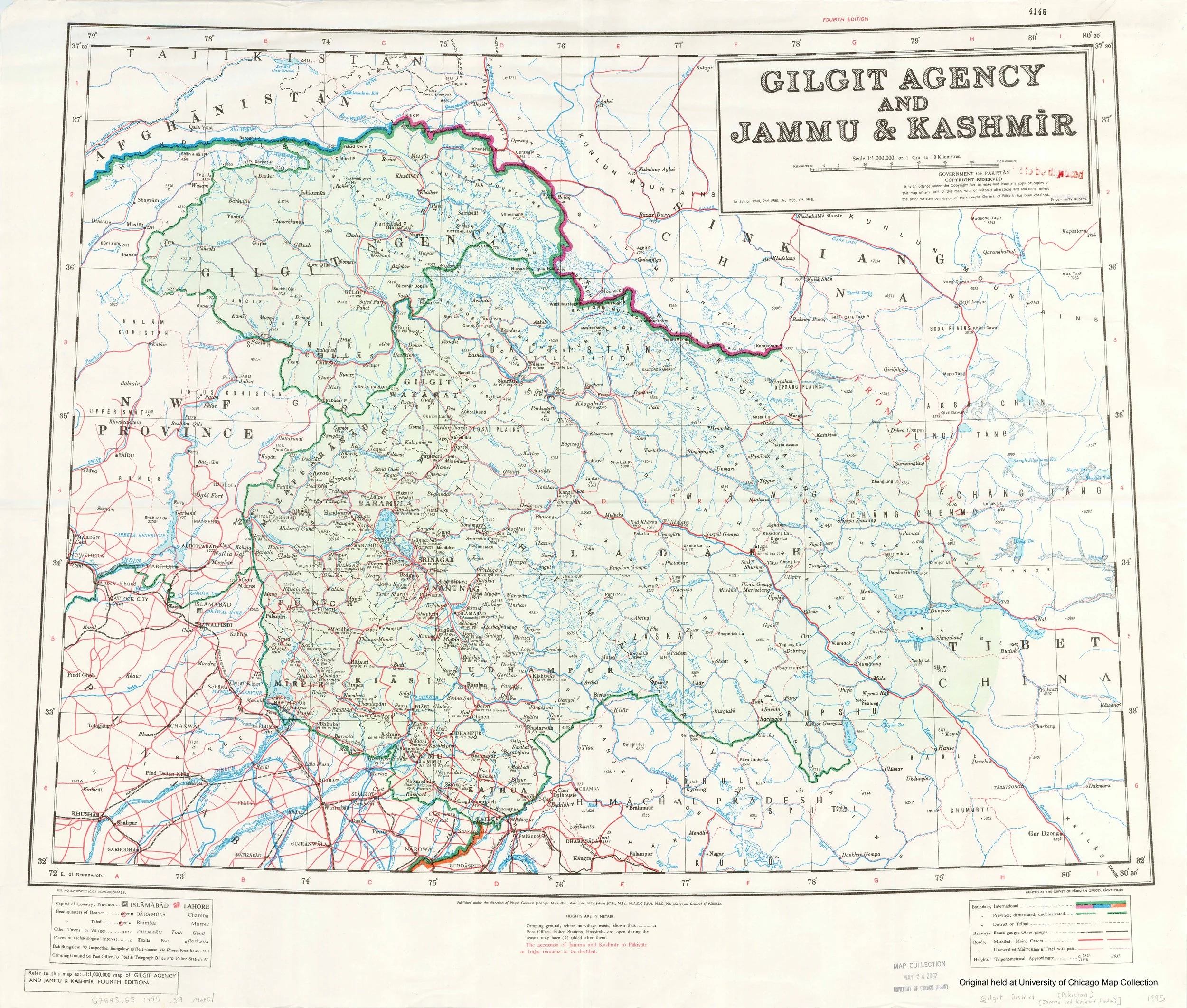
The above is from Wikipedia but it gives a good idea of how the State was politically divided into administrative Units when it was a Princely State. This Princely state was often referred to in its entirety as “Kashmir” and even till today many people think of it as the same. From Gilgit to Mirpur and from Muzaffarabad to the farthest end of Ladakh bordering Tibet everything was Kashmir. And once upon a time I imagine all the Residents fancied being called Kashmiris. For some reason there was something exotic which was attached with the name Kashmir. I experienced this in my Childhood and even now when you tell people that you are from Kashmir. No wonder all the Mirpuris from across the LoC refer to themselves as Kashmiris. This was like the First Kashmir. The all Encompassing Riyasat e Jammu and Kashmir. Basically a construct of the Sikh Empire and shaped by the Dogras.
And then there is the second Kashmir, which was called the Kashmir Province back then and the Kashmir Division after Independence. Prior to Indpendence there was Kashmir North ie Baramulla and Kashmir South ie Anantnag and added to it was Muzzafarabad District along the Jehlum as it flowed down towards the Punjab. But at the time of Independence most of Muzzafarabad fell on the other side of the LOC so what was left was a Uri area plus the rest of Baramula and of course the Anantnag District. At the time of Patition our Village was a located in the Uri Tehsil of Baramulla District. We were very much a part of this Second Kashmir historically.
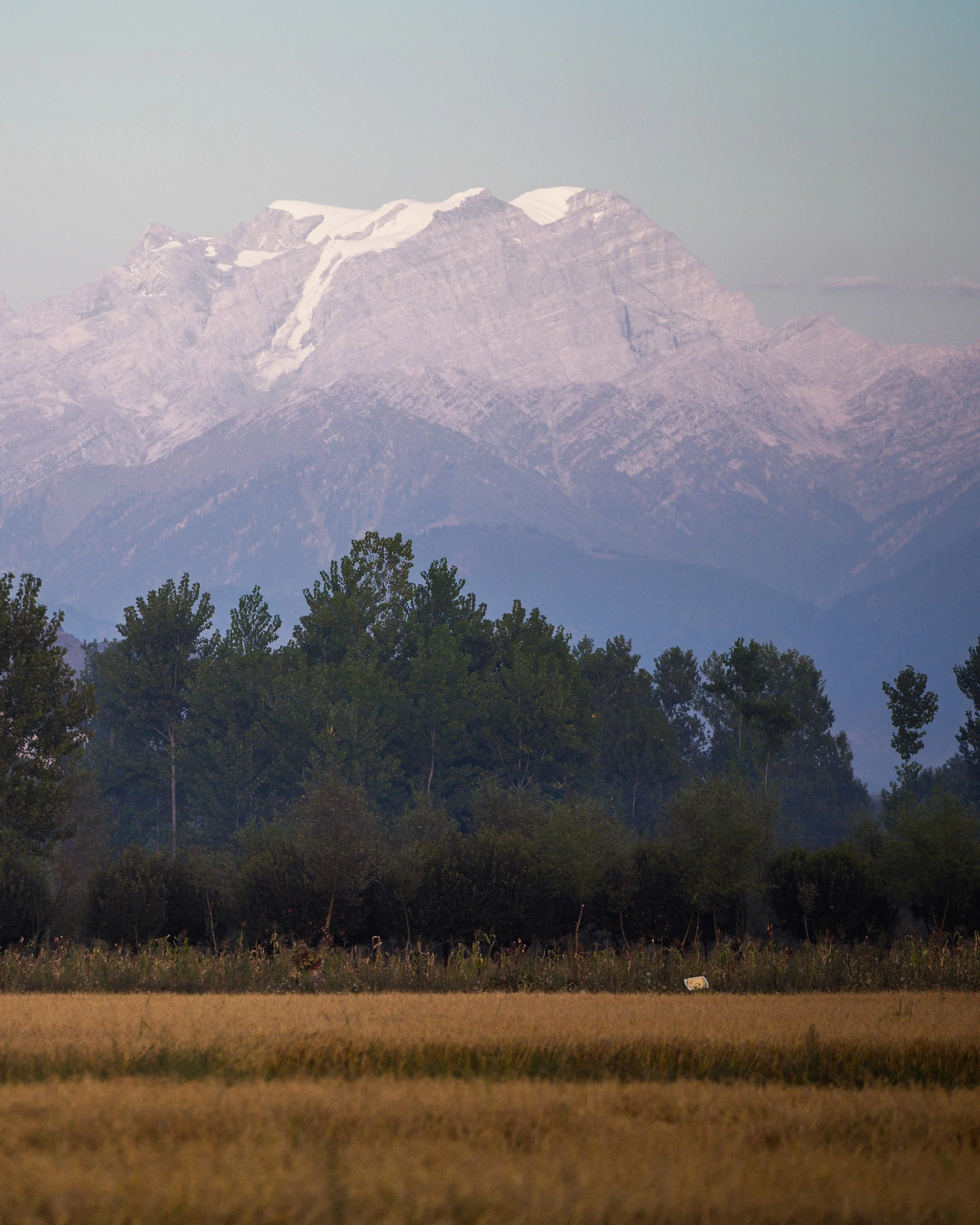
And then finally there is the Third Kashmir. The actual Geographic and Lingual Kashmir which is basically the Valley of the Jehlum and flanked on one side by the Pir Panjals and on the other side by the Great Himalayan Range. This is the famed Vale of Kashmir that for centuries was a source of fascination for outsiders. Classically on an East West alingment the Valley stretches all the way from say Verinag to Baramulla whereon the Valley disappears and is replaced by the Jehlum Gorge. This Third Kashmir is the one I grew up in as a “Kashmiri” who nonetheless couldnt speak Kashmiri but we were a Punjabi speaking Linguistic Minority. There are other “Kashmiris” here who’s Mother Tongue isnt Kashmiri like Punjabi Muslims and Gujars and even Ladakhis and Purigis but many of them speak Kashmiri fluently.
That being said i kinda find it amusing that many Pakistanis talk of thier “Kashmir” which in their imagination is what I would call the Kishanganga Valley and my Pakistani friends call the Neelum Valley. Technically that Valley isnt really a part of Kashmir. Neither Geographically nor Linguistically. However some Geographers do regard the Kishanganga as the North Western and Western edge of Kashmir though it is a different Valley. Do remember unlike other sub Valleys of Kashmir like the Lidder Valley and the Sindh Valley getting to the Kishanganga Valley includes crossing High Passes with historically the main one being Rajdhanigan Pass which once stood on the “Silk Route” which connected Kashmir with Gilgit and Skardu in Baltistan.
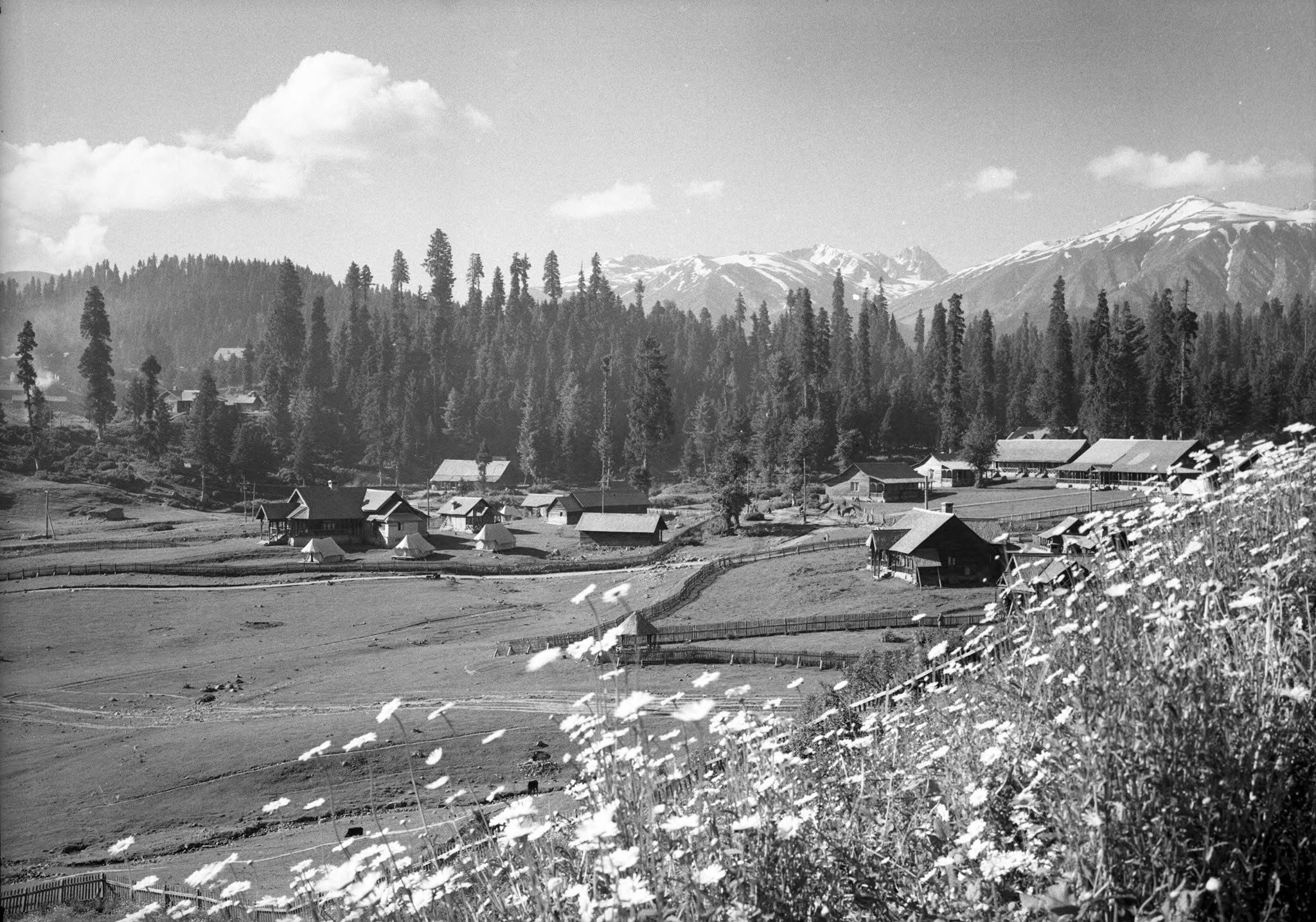
That being said the fascination that people have with Kashmir and assumed Kashmirs is indeed an enduring one even when the term is used for different Geographies in the same Region. And as a parting shot i always wondered which part of Kashmir fascinated people the most. And to work on this puzzle i first eliminated areas in Kashmir which are similar to other Geographies in Western Himalayas. Like there would be many Alpine Meadows like Gulmarg all over the Western Himalayas and there would be valleys like the Sindh and the Lidder. After many years the realisation dawned on me that it was most probably my Hometown Srinagar which fascinated visitors the most. With the Jehlum, the Lakes, the Zabarwan Mountains, the Karewas, the Gardens, the Orchards and the Forests it was and still is unique. Something which has no equal on the Planet as I would say.

Srinagar to Kashgar by Road : The First Motorised Crossing of the Greatest Mountain Ranges
Once the Expedition commenced there arose new Challenges. Though the Afghanistan Civil War had ended, the situation in North Afghanistan and Routes into the Pamirs were far from being safe for the Expedition. So another detour was decided. It was decided that the Expedition would now crossover into India from Afghanistan and then they would take the Mountain track that connected Srinagar in Kashmir with Yarkand / Tashkurgan in Chinese Turkestan or what is now Xinjiang

The Complete Beirut to Beijing Route
Citroen is an iconic French Automobile brand which has been making Motor Cars for well over 125 years. In the 1920s and the 30s they embarked upon a number of Journeys through the wildest impenetrable parts of the World to prove the reliability of the ruggedness of the Citroen. The idea of putting these Expeditions together came from Andre Citreon who was the founder of the Company.

They first made Two Expeditions into the wilds of Africa as the French had a bunch of Colonies in Africa and they completed the Expeditions with a reasonable amount of success. The First of these being the crossing of the Sahara Desert by Motorcar in 1924. And then they made a Journey across the length of Africa from Bechar in Algeria in North Africa all the way down to Cape Town in South Africa becoming the first people to do so. Both these were accomplished using Half Track Citroen Vehicles and these were led by the Explorers Georges-Marie Haardt and Louis Audouin Dubreuil.

Being received by a British detachment at Landi Kotal near the Khyber Pass in June, 1931
And then in 1930 they came up with their most ambitious Expedition. One that involved retracing the steps of Marco Polo by crossing Central Asia and going all the way to China. This Route was the famous Silk Route as it was called and for centuries traders from all over the adjoining Regions used this Road for not only Trade but the exchange of ideas as well. As with their other Expeditions this was also supposed to be a first, the First Motorised Expedition to retrace the fabled Silk Route.

The Expedition had its own set of unique challenges. And these were not only Geographical and Logistical. It was Political as well. It involved getting the requisite Permissions from the Communists in Russia as well as the powers to be in China which was in the throes of a Civil War between the Kuomintang and the Communists. And so the Expedition applied for permission was applied to the Russians for passage through Western or Russian Turkestan as that part of Central Asia was called.

But with just a few Months before the Expedition was to commence the Russians withdrew the permission and they now had to chalk out an Alternative Route. Which they did and now after crossing Persia instead of going into Western Turkestan they decided to take the Route through Afghanistan and up North crossing the Hindu Kush and the Pamirs and reaching Tashkurgan.

Once the Expedition commenced there arose new Challenges. Though the Afghanistan Civil War had ended, the situation in North Afghanistan and Routes into the Pamirs were far from being safe for the Expedition. So another detour was decided. It was decided that the Expedition would now crossover into India from Afghanistan and then they would take the Mountain track that connected Srinagar in Kashmir with Yarkand / Tashkurgan in Chinese Turkestan or what is now Xinjiang

So now a new Geographical challenge arose. That of crossing the Himalaya as well as the Karakorams besides all the other Regions. These were two of the Highest Mountain Ranges on the Planet but still they reckoned that they would be able to achieve the same. They decided to run the gauntlet.

So from Iran they entered Afghanistan via Herat and crossed the Country at great Speed and entered British India at where else but the Khyber Pass and now they were in relative safety and they proceeded towards Srinagar via Rawalpindi through the Jhelum Cart Road. In Srinagar they were personal Guests of the Maharaja and it was through the Maharaja’s territory they would travel all the way North across the Great Himalayan Range and the Karakoram Range.

The Pandethran Temple in Srinagar, Kashmir
They took the Silk Road from Srinagar which connected Srinagar with Gilgit as well as Skardu. So they drove from Srinagar towards the Wular Lake, crossed over the Rajdhan or Rajdhanigan or Tragbal Pass (around 11600+ feet) as it was called and entered the Gurez Valley which bordered the Kashmir Valley on the North. This was the first Motorised crossing of the Razdan Pass as well. From Gurez onwards the tough part started as they now had to cross the Snow Laden Burzil Pass on the Great Himalayan Range. And the Photographs attached show the condition of the Pass.

Infact to get to the Pass itself they had to disassemble the Vehicles and they were carried on foot by the Porters and then re-assembled when it was possible to drive these tough Half Tracks. They were tough but nothing compared to the Mountains. And rather than the Machines it was the hardy Mountain men who carried these Automobiles over the Mountains. They also set a World Record for the highest altitude that a Vehicle drove on at over 13500 on the Burzil Pass.
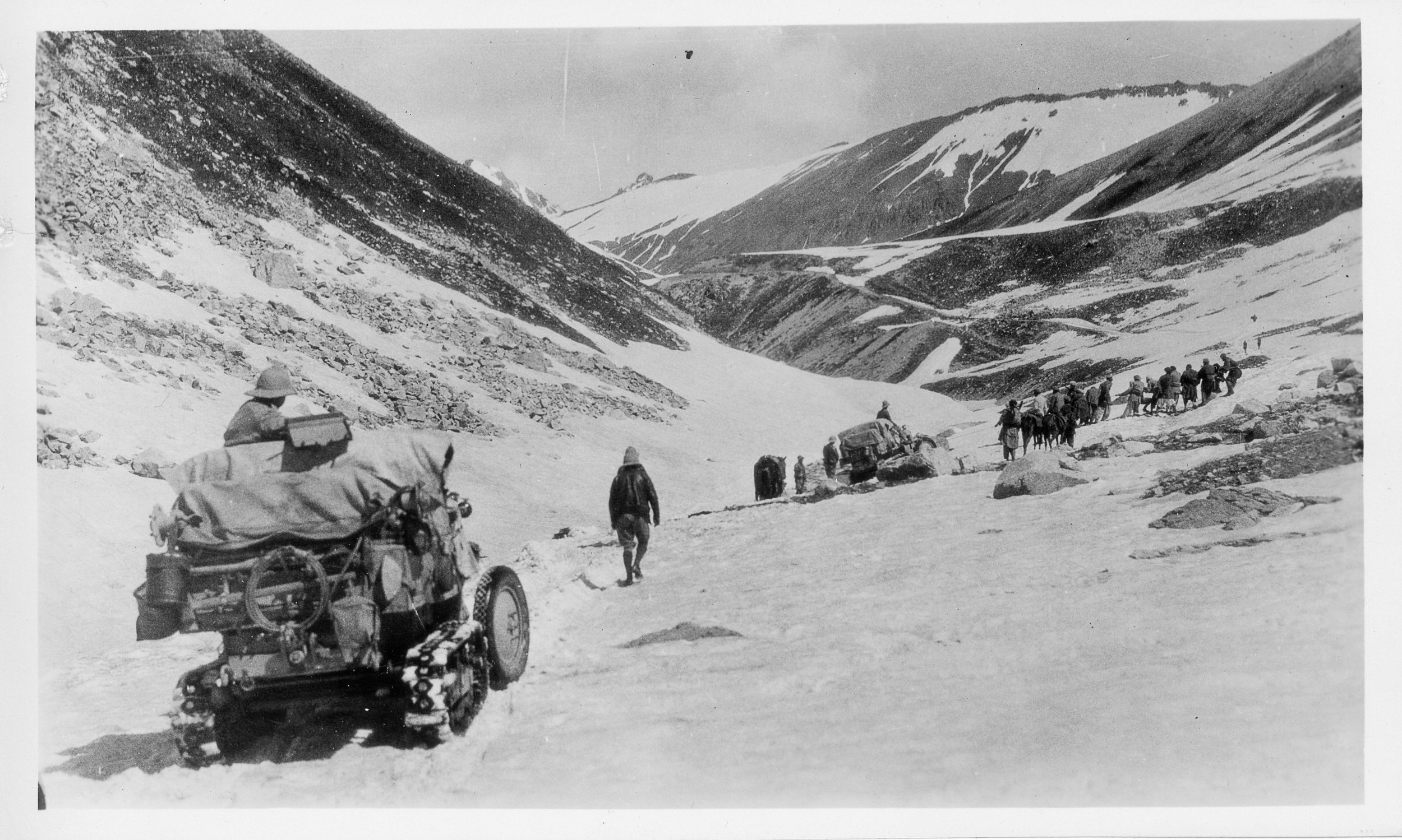
On the way down as well they had to face almost impossible situations and again they had no option but to disassemble the Vehicles and have them carried by the Porters. And they managed to make their way to Astore and then to Gilgit. From Gilgit they made their way to Gojal and to get over the Karakorams they chose the Kilik Pass which was parallel to the Mantaka Pass which was more frequently used but the Kilik Pass was relatively free of Snow and they carried the Vehicles over the Kilik Pass and descended into the Pamirs and were now across the Border of British India and firmly in Chinese Turkestan where they planned to meet up with the other Group which had started from Peking towards Central Asia. Of course the Group which came from Peking faced a lot of Political obstacles rather than the Geographical obstacles faced by what was called the Pamir Group. But that then is another Story.

All said and done it was the Citroen Haardt Expedition which showed that it was possible for Automobiles (with a lot of Human help) to cross this almost unassailable Mountain barrier.

Nowadays however due to the Political situation the Old Silk Route from Srinagar to Gilgit lies abandoned though you can cross the Razdan Pass and get into Gurez. And on the other side of the LoC a Motorable Road now gets you over the Karakorams via the Khunjerab Pass. The Kilik Pass being long forgotten.

Photo Credit : All Photos from the Internet / Citroen Haardt Expedition / Nationa Geographic/ Getty Images.

Kiki's Guide to Kashmir
A Rough Guide for People planning to visit the Kashmir Valley. And notes on the History, Culture and most importantly the Geography of the Region. And taking you beyond the normal Tourist Hotspots into more Offbeat and even unheard of places in Kashmir.
A truly fascinating place which gives people the visions of beauty and is referred to as the “Paradise on Earth”. The name is enough to conjure up images of snow covered mountain peaks, valleys with a shroud of flowers, enchanting Mountain streams and beautiful lakes. Well the geography and the de facto political boundaries of the state are a bit more complicated. Here I try to explain the complexities of what used to be the Riyasat-e-Jammu and Kashmir in 1947. I will use that as the reference point and as a geographical unit will refer to it as RJ&K.

Moving beyond the territorial claims that individual countries have on RJK and avoiding the political baggage that comes with the veracity of each claim I will just mention the geography and the political status as it exists as on date. Based upon the actual territory that is being held by the various countries which have a claim on RJK. That being said, I would like to emphasise that the purpose of this article is to educate travellers and mountain lovers about where they can go and where they cannot, which is governed basically by their nationality and the relationships which exist between individual countries.
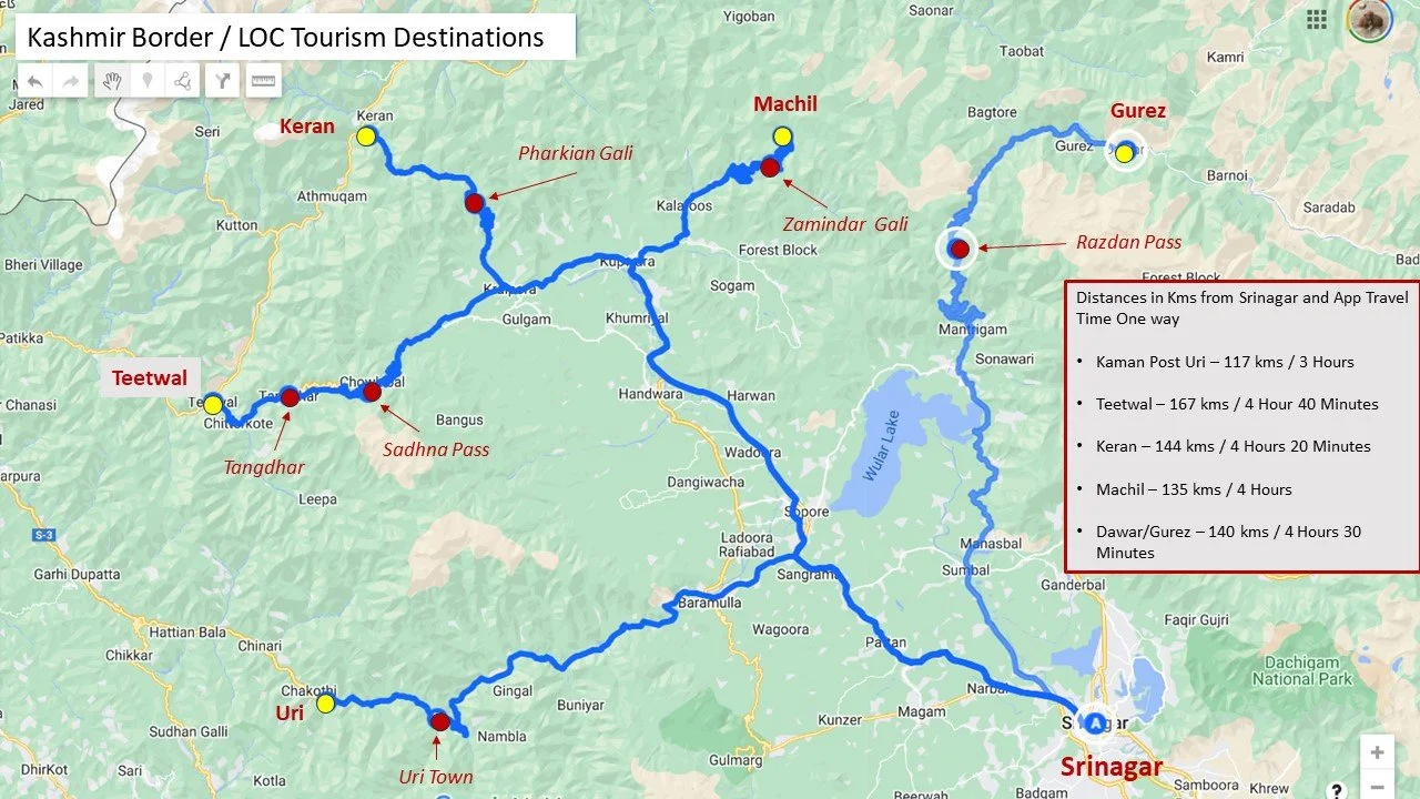
Offbeat / LOC Locations in Kashmir
RJK consisted basically of the regions Jammu, Kashmir, Ladakh, Baltistan, Gilgit and the uninhabited Aksai Chin. I would first comment on the areas of RJ&K that are under de facto Indian control which I will call J&K. J&K broadly consists of the regions of Jammu, Kashmir and it used to include Ladakh. Until they were divided into two separate Union Territories, one J&K and one Ladakh. However there are little parts of the former Baltistan that exist in J&K like the Kargil district and even Gilgit like Gurez. Jammu consists of the Jammu district as well areas along the border like Poonch, Rajouri, Udhampur and Doda. The beautiful Valleys of Bhadarwah and Kishtwar are also a part of the Jammu region. Jammu has its share of mountains especially the rugged region of Kishtwar but they are largely unknown and away from the glare of the outside world. I will cover the Jammu region in detail in a later post but for now we move on to Kashmir.
From Jammu we move onto the fabled “Vale of Cashmere” as it was called. Technically the Valley starts once you cross the Banihal Pass/ Banihal Tunnel (Pir Panjals) on the highway or when you cross the Pir Ki Gali Pass (Pir Panjals) on the Mughal Road when coming from the South. The original road to the Valley via Muzuffarabad is no longer in use due to political reasons. Also you can alternately cross the Sinthan or the Margan Pass to go to Kishtwar or Warvan. Up North the Zoji La marks the exit from the Valley while to the North West the Razdhan Pass would also entail technically leaving Kashmir Valley but those areas of Gurez are still considered a part of the Kashmir region.
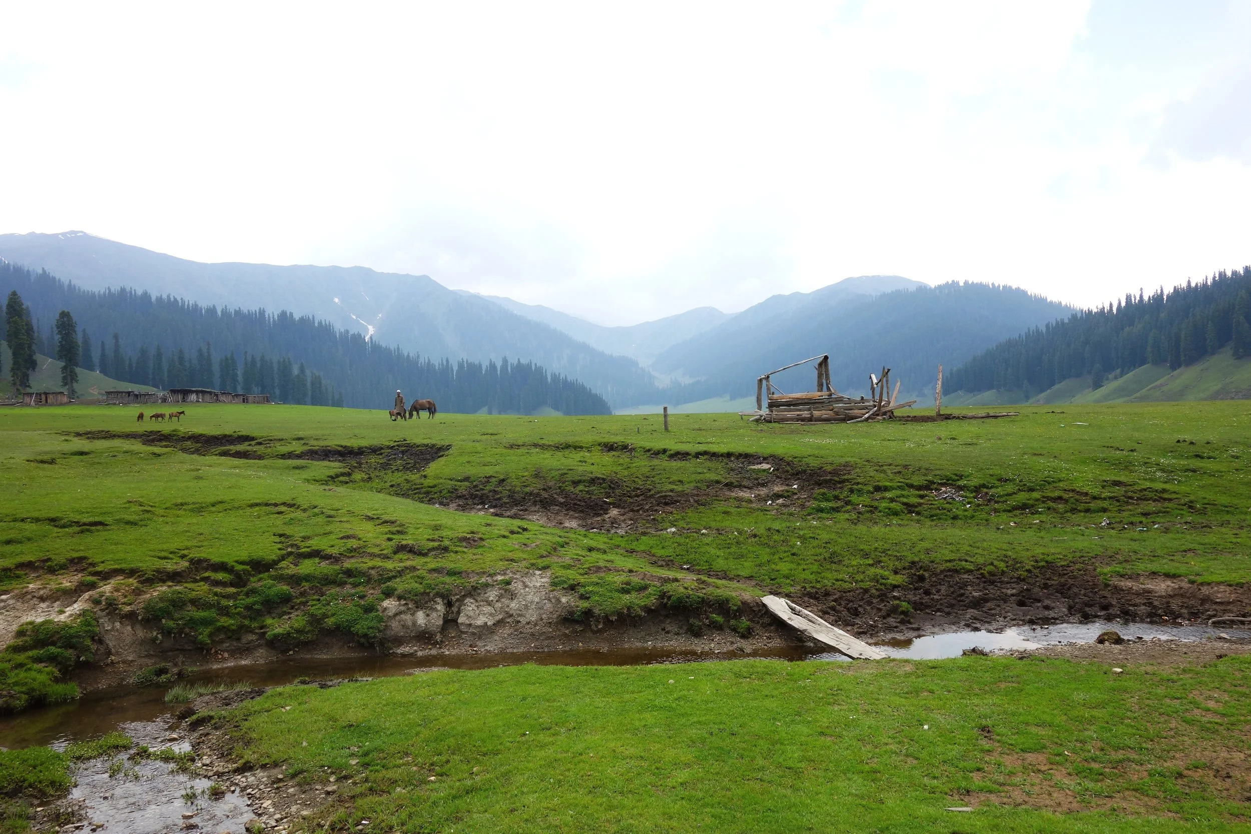
In the geological past the Valley was once a lake called the Satsar Lake which drained eventually due to various factors. However there is still a large diversity of of Lakes from the largest Wular Lake to the most famous Dal Lake to thousands of high altitude lakes nestled within the mountains which are an attractive trekking destination. The Kashmir Valley is bound on the South and South West by the Pir Panjals. And on the North and North East by the Great Himalaya and the Zanskar Range. It is by far the largest Valley in the complex Greater Himalaya Mountain system and certainly the most celebrated one.
Kashmir Valley is actually the Jehlum Valley and the Jehlum is the main drainage system for the Valley. The traditional source of the the Jehlum is considered to be the springs at Verinag. However many attribute the source to the Konsarnag Lake and even the Sheshnag Lake. The Lidder and Sindh are two main well known tributaries of the Jehlum. The Lidder has two main sources the Kolahoi Glacier for the West Lidder and the Sheshnag Lake for the East Lidder. The Sindh River rises from the Machoi Glacier near the Amarnath Caves.

A Faith Map of Jammu and Kashmir by Drew in 1875
Srinagar is the capital city of J&K and lies on the banks of the Jehlum River and it also includes the famous Dal Lake and the Nigeen Lake. The city is well know for the various Gardens laid out by the Mughals as well as the new fangled Tulip Garden which is a hit with the tourists. The Srinagar city has its own range of mountains called the Zabarwan Mountains which is a sub range of the Zanskar Range. The home of the endangered Hangul, the Dachigam National Park also lies on the edge of the City.
There are various other places of tourist interest in the Valley including Gulmarg, Pahalgam, Sonamarg, Yusmarg, Kokernag, Verinag, Achabal, Daksum, Parang and lately places like Doodpathri etc. My personal favorite has always been Gulmarg probably because I have sent a lot time here while growing up. However recently it is is over crowded and over priced. Gulmarg is a great Winter destination due to the humongous amount of Snows it gets.

The Wadwan Marwah River
The lesser know place which has fascinated me the most has been the Warwan Valley which could only be reached by trekking in the good old days. I happened to spend 5 nights in this enchanting Lost World. Being born in Kashmir and having familial connections in Himachal I have seen a lot of mountains but Warwan was special. Nowadays there is a road which goes over the Margan Pass and takes you to Inshin, the main village in Warwan. As of now I am not aware of how further this road goes. Technically though Warwan is a part of Kishtwar and hence a part of the Jammu Region.
A special note on Warwan Valley : The people of this region are by some accounts the closest that come to the ancient Kashmiris. Their language is the purest form of Kashmiri. The Warwan River runs through this enchanting Valley. This Valley runs parallel to the Lidder Valley and is around 3 to 4 km wide and 30 km long at an average elevation of 8000 to 9000 ft. At a place called Sukhnis the Valley transforms into a Gorge and on reaching Rangmarg you have two options.Taking a left leads you to the Gulol Pass crossing which you can descend into Sheshnag. Going straight takes you to the Botkol Pass going over which you come down to Panikher in the Suru Valley (Zanskar). This is the same route taken by the indomitable General Zorawar Singh when he launched his expeditions into Ladakh. Interestingly there was a Government proposal to make a road from Pahalgam to Panikhar which would technically be 45 kms but would provide unparalleled beauty as for almost half that route would under be the shadow of the fabled Nun Kun Massif. A point of special note is that Warwan as such is not in proximity of the Line of Control as compared with Gurez or Lolab.
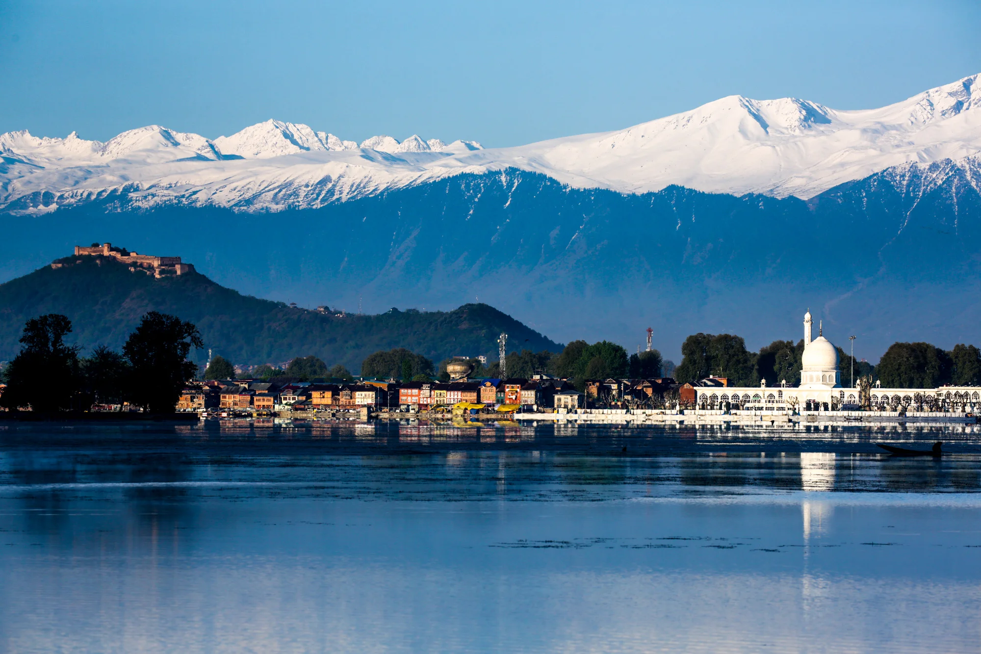
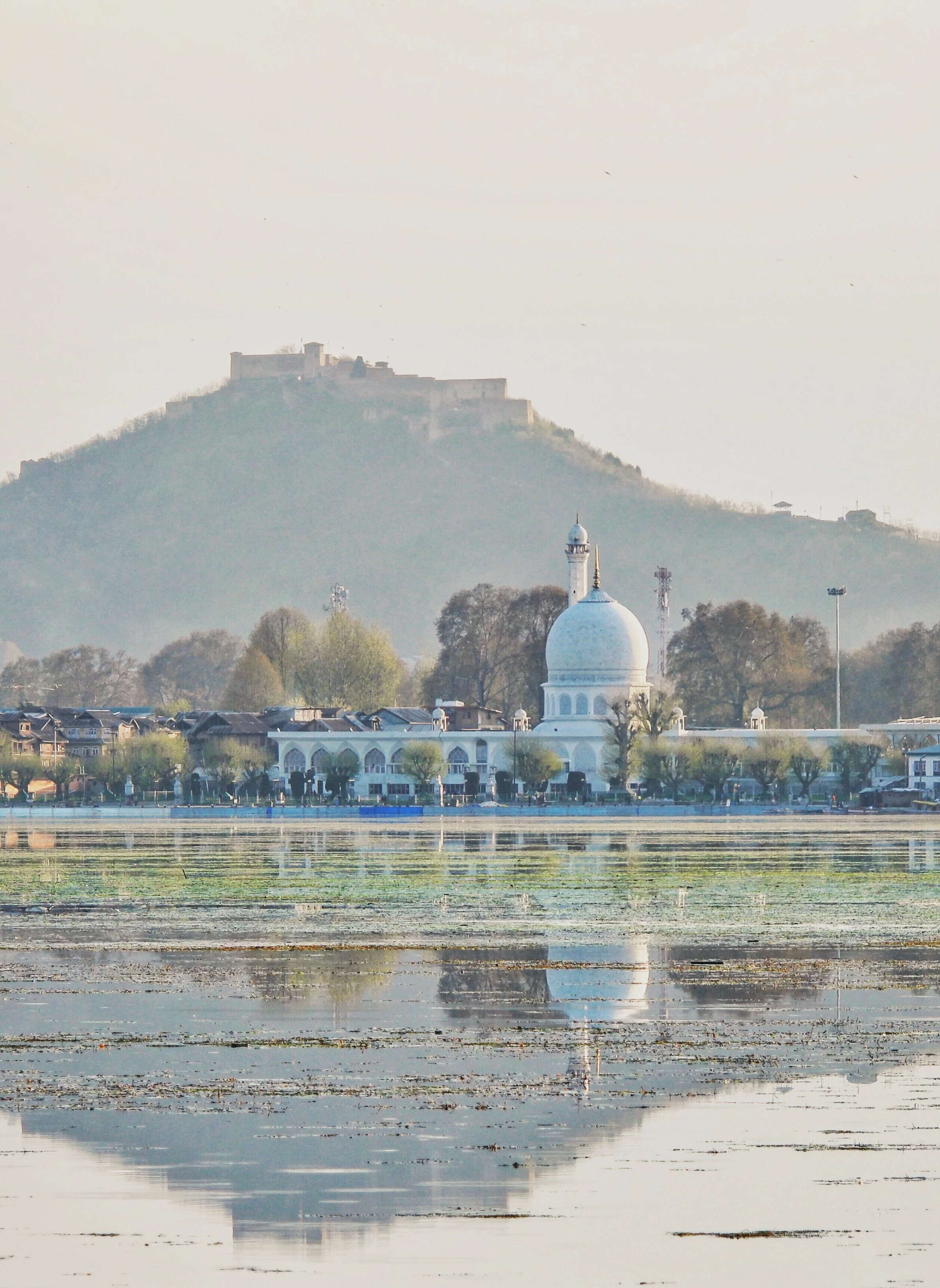
The Hazratbal Shrine by the Dal Lake and the Pir Panjals in the back ground
On the same axis lies the Sinthan Pass which connects Kashmir with Kishtwar proper. This scenic Pass is now becoming a destination as more and more Tourists go there to experience Snow which lasts well into June usually on the Sinthan Pass. One can also cross the Pass and go into Kishtwar and there are many interesting places there as well. Totally Offbeat.
Another region which sees a lot of tourist interest in the Gurez area. Gurez is actually a part of the Gilgit region but is counted in the Kashmir Valley. The people in Gurez speak Shina and were always more aligned with fellow Shina speakers in Gilgit rather than with Kashmir. The road to Gurez leads one over the Razdhan Pass and then you enter the enchanting land called Gurez. There is a road which goes from Gurez towards Kargil but as of now it is a military road but earlier that used to be one of the main Roads into Gurez. The fact that it is a part of Baltistan is borne out by the fact that the locals speak the Shina language, which is quite prevalent in Baltistan instead of Kashmiri.
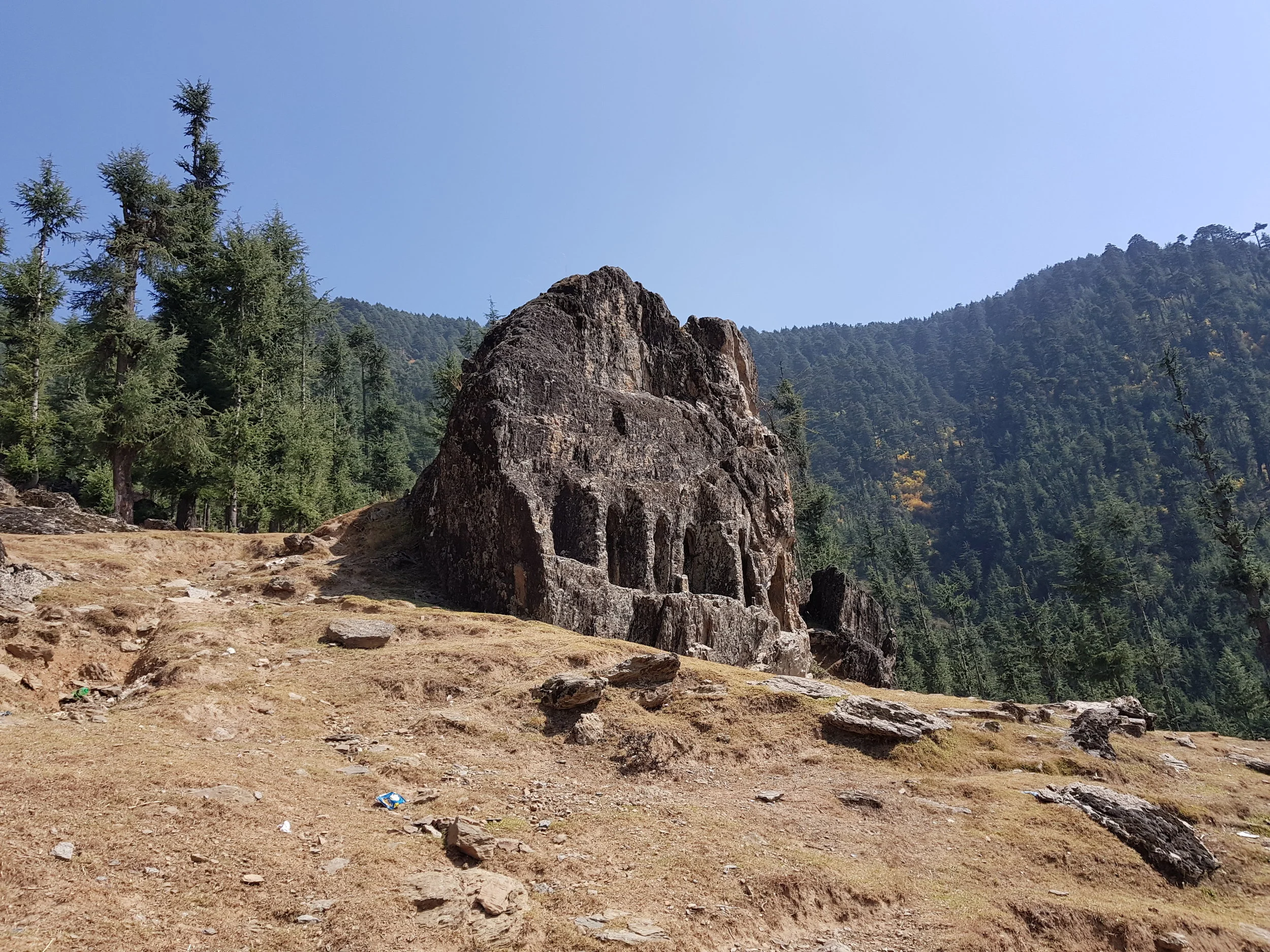
The Kalaroos Cave in Loalb Valley
And then there is the Lolab Valley and the Bangus Valley (both the Bod Bangus and the Lokut Bangus) in North Kashmir district of Kupwara. These are again very scenic areas but the movement of civilians especially tourists was severely restricted due to the proximity to the Line of Control. However now the restrictions have eased up and many Tourists now visit Bangus. Bangus is the largest Alpine meadow in Kashmir and covers a large area. The other famous Meadows in Kashmir like Gulmarg, Doodhpathri, Yusmarg and Tosa Maidan lie in the Pir Panjals and South and Western Kashmir but Bangus abuts the Great Himalayan Range itself. A Motorable Road has already been built to Bangus itself and Vehicles with 4x4 and Good Ground Clearance can already get t Bangus and even normal Passenger Cars would be able to get there once the Road is black topped.
And now for the first time the Government is trying to promote Tourism to the areas which lie right on the LOC along the Kishenganga. This includes places such as Machil, Keran, Tangdhar and Titwal. Ours is the first Travel Company which has started limited Tours to these places for Adventurous clients.
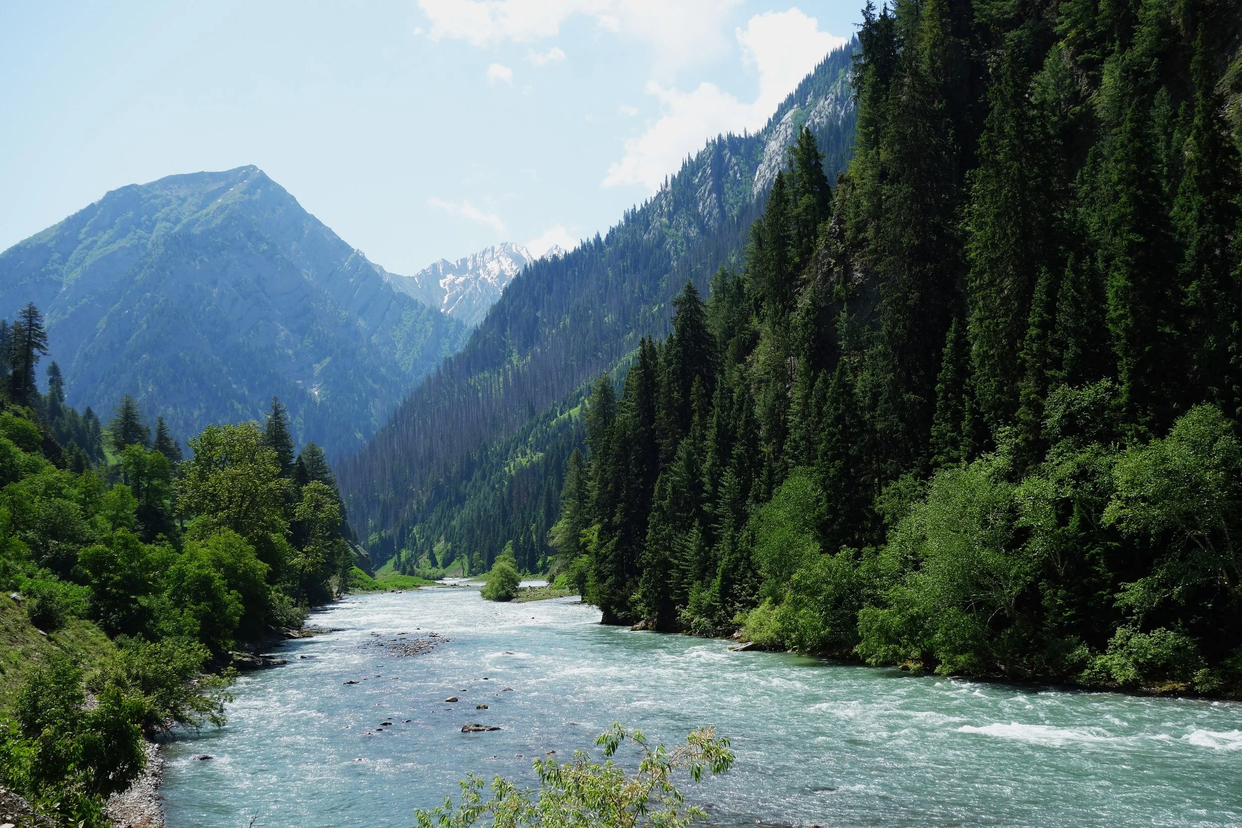
The Kishanganga River flowing through the Gurez Valley.
Weather
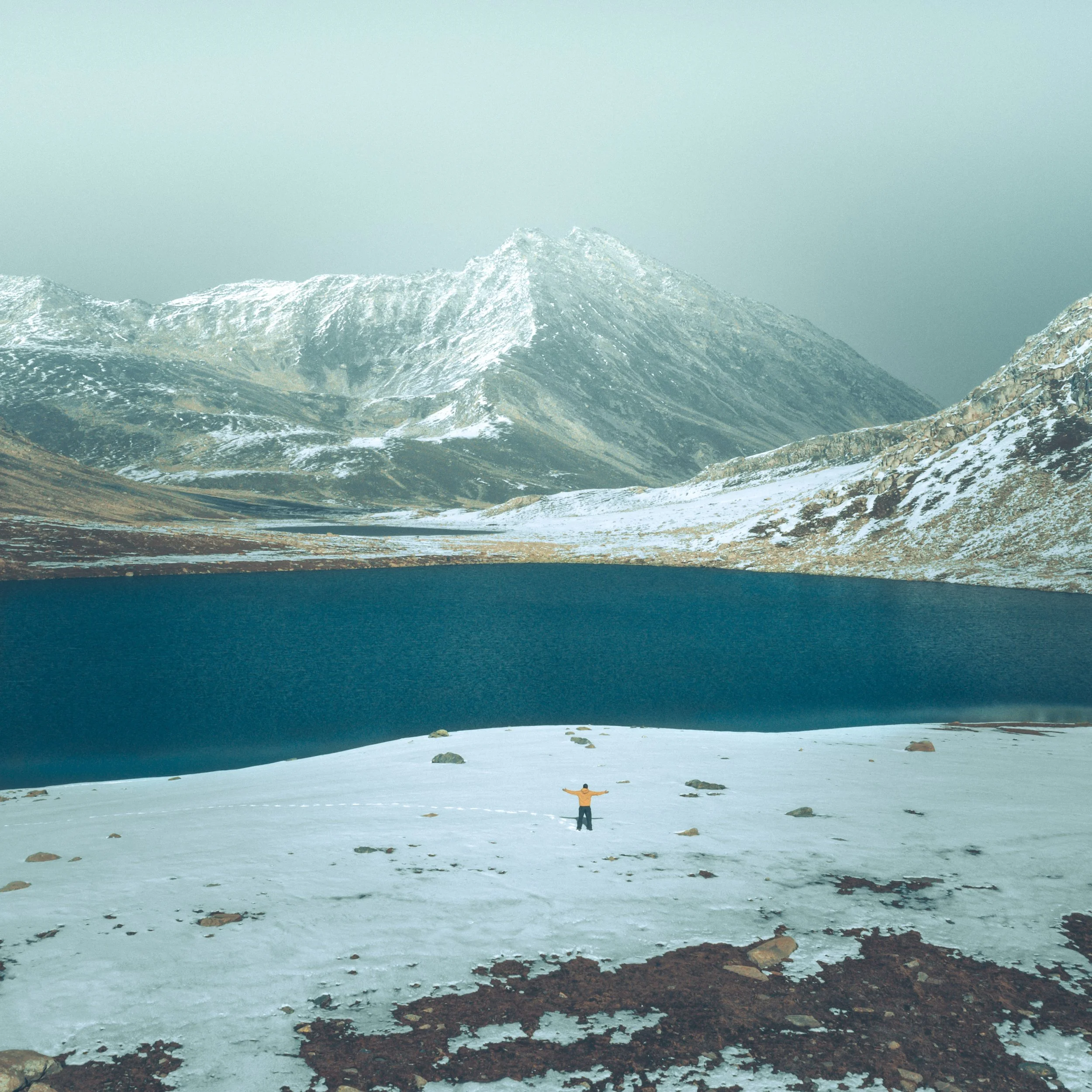
Kashmir has a Continental Weather with a proper 4 Seasons. In the Winters it can get quite Cold and all areas of the Valley get Snow in the Winters. Places like Gulmarg get a huge amount of Snow and that's why it's everyone’s favourite Winter Destination. Spring is probably the best Season in Kashmir with pleasant Days and Chilly Evenings. The Summer starts around mid June and July and in recent years it has started to get really Hot in Summers. Autumn again the Days become pleasant and the Nights Chilly.
Transport
The biggest advantage in Kashmir is the International Airport in Srinagar and its connected directly / indirectly with all Major cities. The Flight from Delhi to Srinagar is just One and Half Hours. Of course there is the Highway as well its on the verge of being connected by Rail in a couple of years.
Places to Stay
Kashmir offers a large Range of Accommodations especially in the areas more popular with the Tourists. From Budget Hostels to Five Star plus accommodations. Plus there are Homestays which offer a unique Cultural Experience as well. You can also take a look at Our Kashmir Boutique Stays in Srinagar and Pahalgam. And soon we will be in Gulmarg as well.
Tours
Here are some of the Signature Tours we run in Kashmir for people interested an authentic Kashmir Experience. People coming for the first / second Time can opt for our Kashmir Boutique Experience. People who have been to Kashmir before but now want to Experience the Offbeat side of Kashmir can go for our Kashmir Offbeat : Gurez, Lolab and Bangus Tour. And for People who want edge of the Seat Adventures we can recommend our Kashmir Edge Border Tour.
We can Customize as well and Organize Trips to all these Places. Connect with us on Whats App Messenger on 98712 92288 for a Great Kashmir Experience.

The Pir Panjal Pass
And one of the most famous Pass over the Range was called the Pir Panjal Pass and as per some versions of History the entire Range got its name from the name of the said Pass. The word Panjal probably came from the word Panchal. This Pass connects the Kashmir Valley with the Poonch Region of Jammu and thereon to the Northern Plains of India. This was the Pass used by the Mughals on what is now called the Mughal Road on their forays into Kashmir. Nowadays mostly the Pass is called the Pir ki Gali which is a reference to a Pir or Holy Man buried somewhere near the Pass.

The Pir Panjal Range a sub Range of the Himalayan Range stretches from the Kishenganga in the West to the Beas River in the East. It is mostly an under rated Mountain Range as it barely touches 20,000 ft and is dwarfed by its adjacent Himalayan Ranges. The Pir Panjal cradles one side of the Kashmir Valley and separates it from the North Indian Plains and it forms one side of the Kulu Valley as well. Two of the largest and most fabled Valleys of the Western Himalayas are bound by the Pir Panjals.
But as John Keay mentions in the epic When Men and Mountains Meet : Explorers of the Western Himalayas the Pir Panjal is as Noble a Mountain Range as any in the World. Its spires are the first White wall of Mountains that explorers faced on their way into the Northern Mountain vastness. The Pir Panjal gets more Snow than any other Range of the Himalayas, thanks to the Western disturbances, and holds one of the finest Ski Resorts in the World, Gulmarg.
And one of the most famous Pass over the Range was called the Pir Panjal Pass and as per some versions of History the entire Range got its name from the name of the said Pass. The word Panjal probably came from the word Panchal. This Pass connects the Kashmir Valley with the Poonch Region of Jammu and thereon to the Northern Plains of India. This was the Pass used by the Mughals on what is now called the Mughal Road on their forays into Kashmir. Nowadays mostly the Pass is called the Pir ki Gali which is a reference to a Pir or Holy Man buried somewhere near the Pass.
The Pir Panjal Pass has seen its share of History and as the Guardian Wall of Kashmir its history is firmly entwined with that of the Valley. It was via this Pass that many invaders came to the exalted Vale though later travel along the Jehlum Gorge was more popular as it was a much safer option than the moody Pir Panjal Pass and its freak lightning Storms and crazy Weather. There were other Passes to the right and left of the Pass as well but when a Motorable Road was constructed it chose to go through the main Pass.
And then there is this great Drone Shot by my friend Tufail Shah. Moving beyond just the aesthetics of this shot the Mountain Geography it encompasses is like a Poem in Geography. It captures the grace of the Pir Panjal Pass and other neighbouring Passes of and accompanying Meadows of the Pir Panjals. And this is what you see while approaching from the Kashmir side.
The River you see in the pic is the Rambi Ara and it itself is formed by the meeting of the Rupri Nar and the Yanga Nar which arise from the Galciers and Glacial Lakes surrounding this Pass. The Rambi Ara is a major Tributary of the Veshaw which is the largest left Bank tributary of the Jehlum. True to its point of origin the Rambi Ara is known for its turbulent nature and flash floods. In the pic you can see different streams joining up the Rambi Ara adding to its flow.
And then you can see the signs of modernity. The Road snaking its way upto the Pass and its known as the Mughal Road. The Road remains open for a good 8 to 9 months of the Year and provides an alternative to the Main Srinagar Jammu Highway. Then there are the Power transmission lines going over the Pass connecting the Kashmir Valley with the Northern Grid.
And of course last but not the least are the footprints of History left on the Pass. Almost bang in the middle of the pic you can see the remains of the Alia Bad Sarai, a Sarai built by the Mughals which offered shelter from the angry weather Gods of the Panjals. The Alia Bad Sarai stood right on the approach to the Pass but the motorable Road has been built above it. The Sarai was probably constructed under instructions from Ali Mardan Khan, a Persian General who served under Emperor Jahangir and under who’s supervision the Road was built. Ironically Jahangir died while on this Road and his Intestines are buried at the Chingus Sarai on the other side of the Pir Panjals.
It is said that he fell ill while going down this Road on his way to Lahore from Kashmir. Maybe he fell ill on the Pass itself due to inclement Weather. Maybe he paid a price for trying to tame the Gods of the Panjals. Maybe a lesson to us Mortals that the Mountains can never be tamed. The Mountains will prevail. Everytime.
Anyways enjoy the Poetry of the Pic which encompasses all the elements of the enigmatic Pir Panjals.
Pic by Tufail Shah. From Late Summer 2020

The Bridges of Srinagar by Francis Firth
Srinagar City as most must be aware is settled on both Banks of the Jehlum and as such there were a number of Bridges which were put across the Jehlum originally starting with the First Bridge or Amira Kadal which was my favourite as it was closes to Home and we had a Shop there where I used to walk to often as a kid. Of course then the Zero Bridge was built which was without doubt everyone's favorite because of Little Hut. The Sardarji's shop which sold the best Softy in Kashmir.

This is view of Zaina Kadal taken from upstream side.
Francis Firth took a series of pics in Kashmir in 1875 and he did a few on the Bridges or Kadals as they are called in Kashmir.
Srinagar City as most must be aware is settled on both Banks of the Jehlum and as such there were a number of Bridges which were put across the Jehlum originally starting with the First Bridge or Amira Kadal which was my favourite as it was closes to Home and we had a Shop there where I used to walk to often as a kid. Of course then the Zero Bridge was built which was without doubt everyone's favorite because of Little Hut. The Sardarji's shop which sold the best Softy in Kashmir.

Photograph showing Aali Kadal AKA 5th Bridge on the veth( Jehlum) This bridge was originally built between 1414--1420 AD by Sultan Ali Shah brother of Budshah. This was the first Bridge built across Jehlum in Srinagar.In the floods of 1903 this bridge got washed away. Then Maharaja Partap Singh got it reconstructed at the same spot in 1904--05. (Credit Showkat Rasheid Wani)
And the construction technique of these Bridges is described in the Gazetteer of 1890 as under
The Kadal Bridge
These bridges are all made of deodar wood, upon the same plan. and are constructed in the following manner :
A triangular space, with its apex streamwards is formed in the bed of the river by strong stakes which are well driven down and covered with planks on the outside to a height of about 8’. This space is filled with heavy stones and forms the foundation of the pier. Each Pier consists of alternate layers of Deodar trunks. The Trunks are placed about a foot apart each succeeding layer is broader than the previous one and laid at right angles to it. The Trunks are fastened together at their ends by strong wooden pegs. The Piers are united by long and very stout Deodar trunks which stretch across from one to another and which are laid about two feet apart. The platform consists of rough Planks or Slender Poles which are closely laid across the trunks which connect the Piers and fastened at each end by wooden pegs. In some cases over the platform there is a coating of grass and Earth and the railing on each side but often there is neither.

This famous 92 yard Bridge was originally constructed by Sultan Zain- ul- Abidin Budshah in 1427 AD. It was a typical wooden bridge of cantilever design. In those days it was utilized as a Market as well. The bridge was dismantled completely as it was damaged beyond repairs in 1893 floods. The Bridge was reconstructed by Maharaja Partap Singh in 1897 & again a new bridge was constructed by Maharaja Hari Singh in 1926 which was repaired in 1953--54. The photograph has been taken looking upstream , Shah Hamadan Khanqah/Mosque can be seen on the left of the photograph. (Credit Showkat Rasheid Wani)
This kind of Bridge is very strong and durable, despite its rickety construction.
The Timber being Cedar is very durable and accidents rarely occur owing to the elasticity of the Construction and the outlet afforded to sudden floods through the many Passages in the substance of the Piers. Dr.Bellow witnesses the behaviour of these Bridges in the inundation of 1869, and though they were nearly swamped by the Flood none of them gave away.
The existing Kadal Bridges in the Valley in 1890 were as follows
Khanabal ; Bij behara ; Pampur
Amira ; Hubba ; Fateh ; Zaina ; Haili ; Naya ; Suffa
Sumbal ; Sopur ; Baramulla

The Bijbehara Bridge on the Jehlum
Kashmir : Do’s and Donts from 1902
In 1902, the Foreign Department of the British Government in India issued a Guide for foreign visitors to the territories of the Maharajah of Jammu and Kashmir and especially to the Kashmir Valley. It was called Kashmir Visitor Rules : Rules and Regulations for Observance by Visitors and Residents in the Territories of H H The Maharaja of Jammu and Kashmir
Kashmir : Do’s and Donts from 1902
In 1902, the Foreign Department of the British Government in India issued a Guide for foreign visitors to the territories of the Maharajah of Jammu and Kashmir and especially to the Kashmir Valley. It was called Kashmir Visitor Rules : Rules and Regulations for Observance by Visitors and Residents in the Territories of H H The Maharaja of Jammu and Kashmir “ Listing some of the Rules and Regulations that were stipulated in the same. It is interesting to note that some of these are still in force in some way or the other. Please note that I have copied them verbatim as given in the Handbook of which I have a soft copy. (For some of the Rules I give an explanation in the brackets for more clarity)
Section 1 Travel Rules
Information as to the usual routes for entering and leaving Kashmir may be obtained from the Assistant Resident. The route via Jammu and Banihal is private, and may not be used except with the special permission of His Highness the Maharaja obtained through the Resident. (The present Highway Route was an exclusive preserve of the Maharaja as the normal Route which went from Rawalpindi would entail the Maharaja having to go through British territory to get to Kashmir )
Persons subject to these rules are not allowed to travel from Kashmir to Simla (or vice versa) across the hills, or the plains (or vice versa) vid Kishtwar, Bhadarwah and Chamba, except with special permission of His Highness the Maharaja obtained through the Resident. (So no Trekking into Kashmir :)) (Even to this day there are Roads and Passes which connect Kashmir with these places but except locals few people ever use them)
Section 2 General Rules Applicable to Jammu and Kashmir
Cows and bullocks are, under no circumstances, to be killed in Jammu and Kashmir, and visitors are requested to see that their dogs do not worry these animals.
Visitors are required to settle all accounts before leaving Kashmir ; and should see that their servants do likewise, otherwise their servants may be detained at the last moment by order of the Court on the plea of a Creditor.
Section 3 : Rules applicable for Srinagar
Servants of visitors found resorting to places other than the fixed latrines are liable to
Punishment.Grass-cutters are prohibited from cutting grass in, or in the neighbourhood of, the station occupied by Europeans.
Riding and cycling on the buud are strictly prohibited. The Police have had orders to see that this rule is rigorously enforced.
Section 4 : Camping Sites
Visitors to Srinagar are !lot ptt-mitted to encamp in the Dilawar Khan Bagh situated
within the city, nor in the Nishat, Shalimar, or Chashmah Shahi gardens in the Dal Lake. The fixed camping places are the Wunslli, Hari Singh, Ram Munshi, and Chenar Baghs at Srinagar and the Nasim Bagh on the Dal Lake. Visitors are also informed that the plot of ground at Sumbal, known as the " Nandi ICeshwar Bhairalva," should not be used for camping purposes.The Chenar Bagh is specially reserved for bachelors. No parties of which ladies are
members are permitted to encamp within it.
Section 5 : House Boat Rules (Since Europeans couldn't buy / lease Land in Kashmir most of them lived in House Boats)
No boats of any kind, including dungas, house boats, &c., shall have water-closets
leading into the river. The water-closets of all existing house boats shall be closed, and in future no house boats shall be built with such open closets.No sweeper or servant shall throw into the river any kind of offensive matter or
sewage ; sweepers of house boats must carry away all refuse and solid and liquid excreta. When in Srinagar, such offensive matter shall be deposited in places assigned by the Municipal Committee, aid while outside Srinagar, shall be deposited in some dry land away from the banks of river.
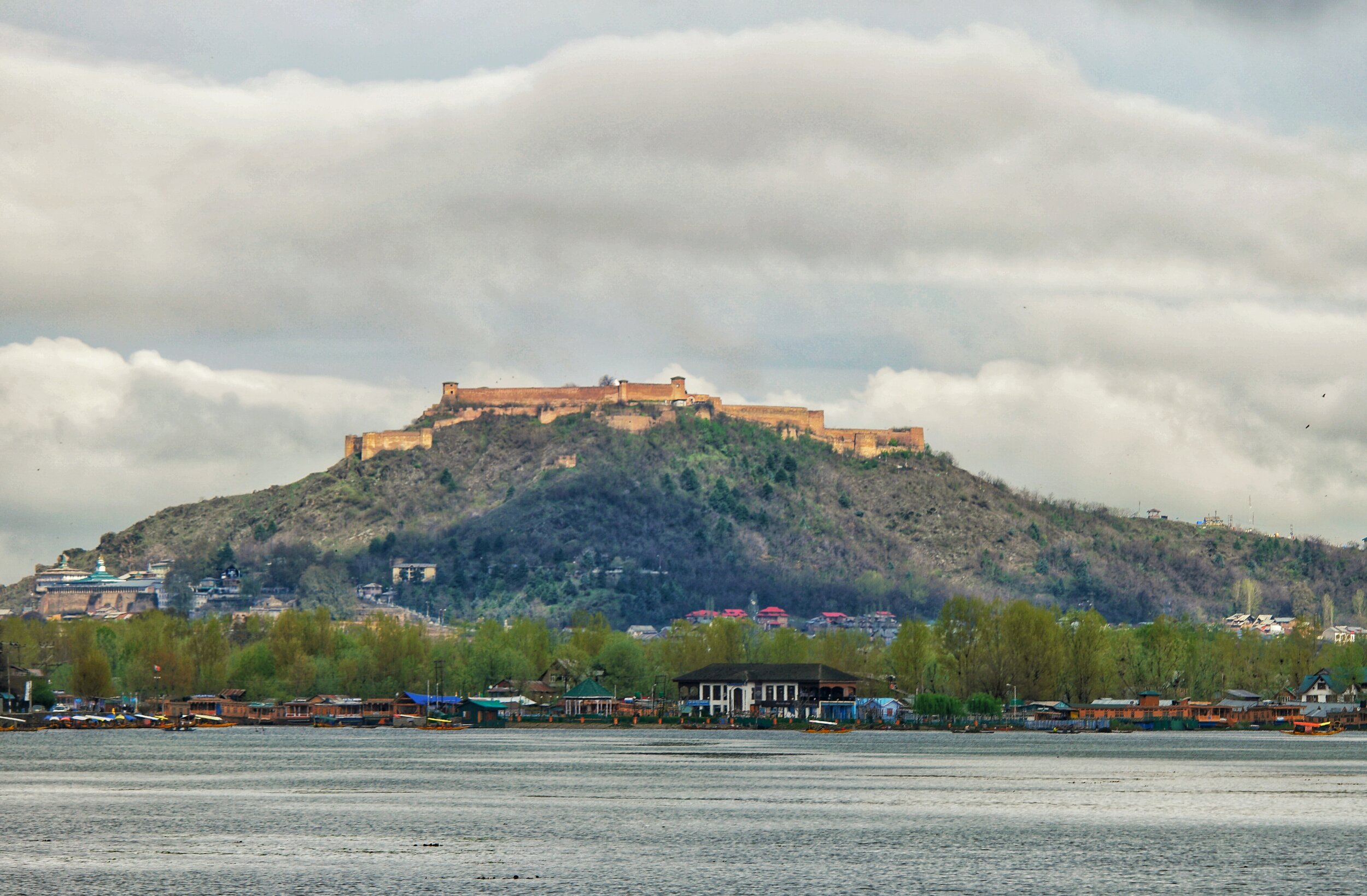
The Hari Parbat Fort over the Dal Lake. Pic from April 2017. Srinagar, Kashmir.
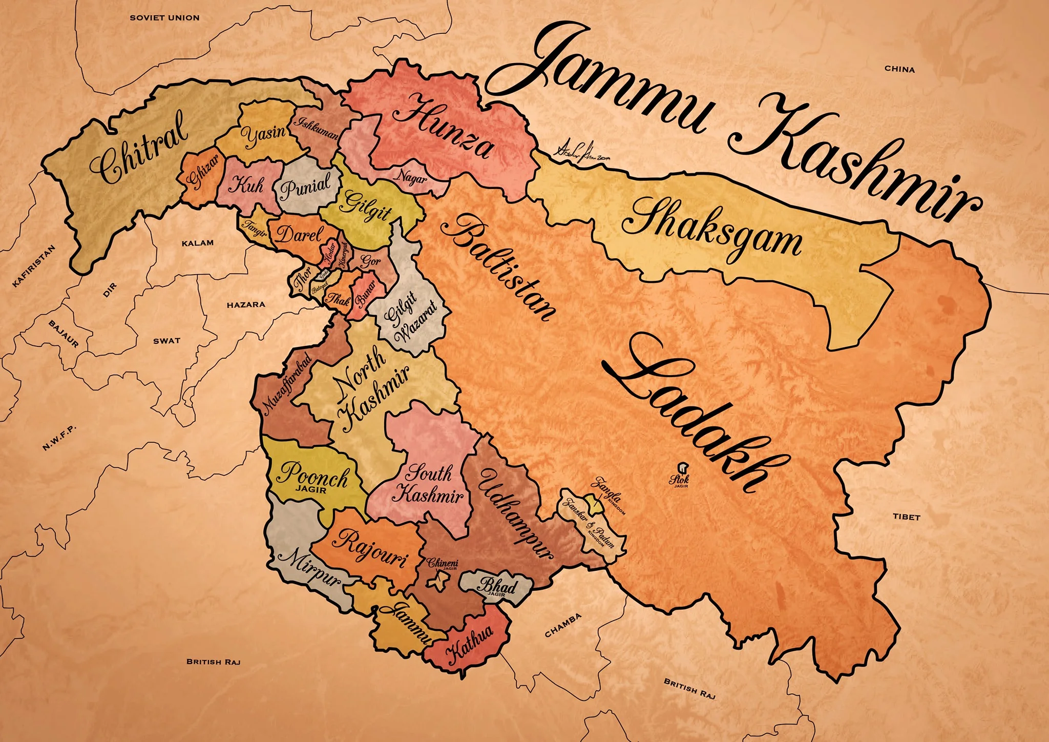
Historical Map of the Dogra Kingdom of Jammu and Kashmir
The State of Jammu and Kashmir as it was at its largest extent under the rule of the Dogras. This Map helps people understand the complicated Geography and Diversity of the erstwhile State of Jammu and Kashmir.

Historical Map of the Dogra Kingdom of Jammu and Kashmir
Another interesting Map of the previously E Jammu Kashmir by my talented friend Arsalan Khan who also belongs to the Riyasat. We had previously had an Article on the various Indigenous People of Jammu and Kashmir. Its not perfect, has its anomalies but it still an indicator of the diversity of the State from a Political angle. This Map shows the Dogra Kingdom at its most expansive. And i would like to point out that all these different areas were won over by the Dogras / Dogras under the Sikhs in War except Kashmir which was granted as a part of the Treaty between the British and Raja Gulab Singh on the payment of War Indemnity of 75 lakhs. It should be pertinent to mention that the Dogras also played a part in the Sikh conquest of Kashmir earlier from the Afghans. Also it suited the British in 1846, when the Sikh Kingdom still existed, to have a parallel power which they could use as counter against them and in this case it was Raja Gulab Singh and his hardy Hill Men. Here is an account of the transition of the Rulers in Kashmir From the Mughals to the Dogras giving a background of how Kashmir passed from the Mughals to the Afghans to the Sikhs and onto the Dogras.
Just an explanation on the parts :
Chitral : This is the most controversial inclusion as it always stirs up a Debate. Was Chitral at any point of time a part of the Dogra Kingdom ? Different historians had different versions on this but one thing was clear that the Chitral Kingdom did pay tribute to the Dogras. This has been verified by me personally with Members of the Chitral Royal Family. Of course later due to the Great Game Chitral was made a part of the Malakand Agency. Here is an account of the Chitral Expedition an important event in the History of Chitral
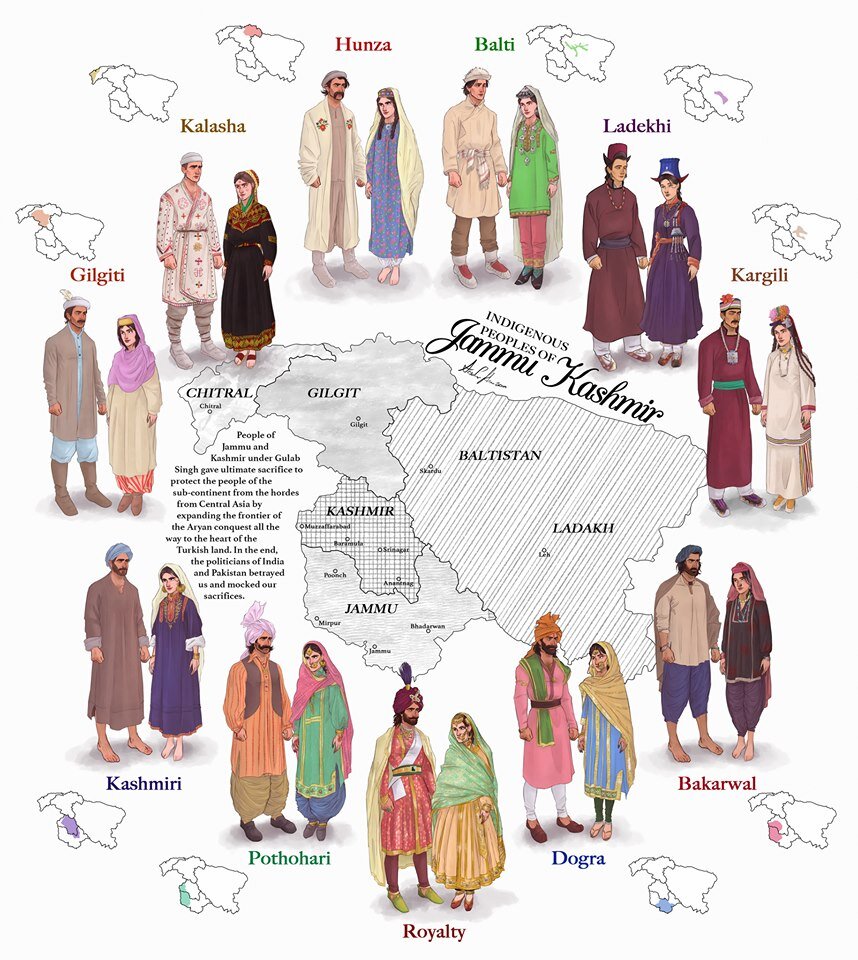
The Indigenous people of Jammu and Kashmir
Hunza / Gilgt and around : Besides Gilgit and Hunza there were other Hill States which used to be constantly at loggerheads with each other but used to occasionally unite against foreign aggression. These were Iskoman, Nagar, Yasin, Ghizer, Punial and Darel among the more notable ones. Gilgit was an important location and one of the most forward bases of the British in the Great Game which I have described in this article titled The Gilgit Game. In addition to these there were various other smaller “Shinaki Republics” which as the name suggests were Groups of Shina speaking people in communities in the area generally named as Chilas. The Imperial Gazzette of 1908 described them as such :
“A group of small republics in the valley of the Indus, lying west of Kashmir and south of Gilgit. The territory extends from the junction of the Astor river with the Indus to Seo on the right bank and Jalkot on the left bank of the latter river. Within this area the people are grouped in communities inhabiting one or more nullahs, each community forming a separate republic. Starting from the junction at Ramghat these are, in order : on the right bank, Gor, Kinergah, and Hodar ; and on the left bank, Bunar, Thak, Butogah, Giche, and Thor. They constitute the area known as the Chilas subdivision of the Gilgit Agency, while Chilas proper includes Kinergah, Butogah, and Giche. Lower down the river are Darel, Tangir, Khilli, and Seo on the right bank, and Harban, Sazln, and Jalkot on the left bank.
After the conquest of Chilas by Kashmir in 1851, the Maharaja imposed a tribute in gold-dust, and arranged for the administration of the country as part of the Gilgit district. A British Agency was re-established at Gilgit in 1889, which included, among other terri- tory, the Chilas subdivision described above except Thor. In 1892 a British mission to Gor was attacked by the Chilasis, which led to the occupation of their country and the appointment of a Political officer at Chilas. The right of the Kashmir Darbar to construct roads and station a limited number of troops in the territory was secured, but the autonomy of the Chilasis was guaranteed. Under the revised arrangements made in 1897 the republics pay small fixed sums to the Maharaja, and in 1899 Thor was incorporated in Chilas. Darel has rendered a tribute of gold-dust to Kashmir since 1866, when the Maharaja's troops raided the country. The tribute is now paid through the Punial governor. Tangir pays a small tribute to the governor of Yasin. The remaining communities have no political relations with either Kashmir or British India, except Jalkot, which from its position dominates Thor and the head of the Kagan valley in the North- West Frontier Province.”
Then on the other side we have Baltistan and Ladakh about who most people know a bit of the History and how these were conquered by General Zorawar Singh between 1834 and 1840. This is a brief account of the conquest of Ladakh and Baltistan by the Dogras. In Ladakh also once the Royal family was removed from Leh, the Ladakhi King was granted the Village of Stok and some surrounding area as a Jagir. Thats where the Stok Palace was built. Much the same way the Raja of Zanskar was granted the Jagirdari of Zangla. Or something to that effect. This is a general note on Zanskar to help in the understanding of this one of the most remote regions of the Himalayas. And ignore the Shaksgam part as its shown beyond its size. This article gives you an insight into the Shaksgam Valley. Another important part of the State which is missed out in this map is the region between the Karakorams and the Kun Lun Mountains called the Aksai Chin.
And then of course we have the Kashmir Valley itself. It was divided into North and South Kashmir for administrative purposes. To the West of Kashmir was Muzaffarabad which was the Pahari area along the Jhelum Valley starting from Uri. This is the part I belong to close to the town of Hatiann Bala. Muzzafarabad is also the Capital of the entity referred to as “Azad Jammu Kashmir”.
Then of course we have Poonch which was a Jagir granted to the family of Raja Suchet Singh, a brother of Raja Gulab Singh. It had a history of its own and struggled for a while to be independent of their Jamwal Cousins which only resulted in the Jagirdari being terminated for a bit. Here is an account of what transpired in the Kingdom of Poonch. There was also the very small Jagirdari of Chenani, which is a small Town on the Highway and I remember that there used to be a Palace of sorts over there. More than that I remember because the erstwhile Raja of Chenani was a friend of my Grandfather’s and i have seen him at my Grand Fathers’ place when I was very young.
And then there was Rajouri which is the stronghold of the Gujjars and most of them are based here during the Winters. Next to Rajouri was Mirpur which was really a part of Punjab and the people were called as Mirpuris. Due to the building of the Mangal Dam many Mirpuris went to the UK and thats the reason you have a strong Mirpuri community in the UK.
And then we had the Duggar heartland of Jammu and Kathua which bordered Chamba with which it shares a lot of Cultural similarities. The district of Udhampur at that time included the whole of Udhampur and Ramban as well as Doda and Kishtwar. The Jagirdari of Badh or Bhaderwah was granted to the Ruler of Bhaderwah who was installed by Gulab Singh after getting the Chambyalis to give up all their claims over Bhaderwah. It used to be an integral part of the Chamba Kingdom. This is an account of Bhaderwah. It connects with Chamba over the Padri Gali.
Of course this will get many people excited and there would be counter views but the views mentioned above are my own based on what I have read and experienced. Kindly feel free to disagree. But as a request just dont start a discussion 1947 onwards as it wont get us anywhere.
This Map is available in hi-res as well. Do let me know if you want.
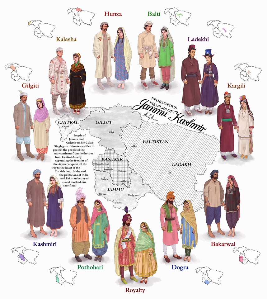
The Indigenous People of Jammu and Kashmir
The erstwhile State of Jammu and Kashmir was one of the most diverse State in the country in Ethnic, Religious and Lingual dimensions. The main "People" of Jammu and Kashmir and its different regions are briefly described in this Article.

The Indigenous People of Erstwhile State of Jammu and Kashmir.
This is a graphical representation of the people of Jammu and Kashmir made by Arsalan Khan and Rajja Sourav Singh Sarmal. A brief description of each by me to help in better understanding (Clockwise from top) :

Hunza (Burusho) Ladies. Pic credit Wikipedia
The Hunza : The Hunza or the Burusho people inhabit the Hunza Valley and neighboring Valleys in the extreme North of the state. They speak the Burushaski language which as a language has not been identified with any language Group. The Hunzai now mostly follow different schools of Islam.
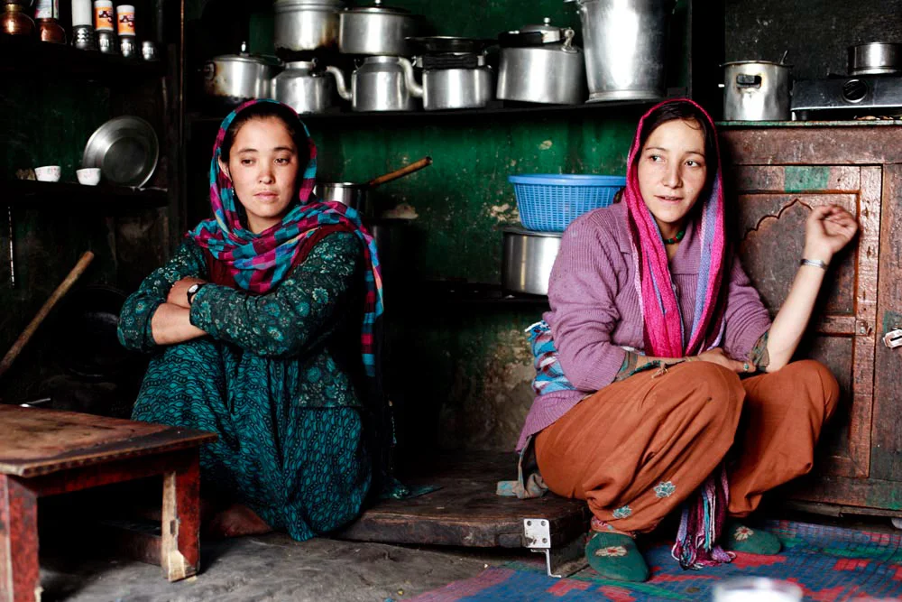
Balti Ladies. Pic Courtesy : https://www.behance.net/gallery/12289037/The-Balti-People-of-India
The Baltis : The Baltis are the inhabitants of the Baltistan and are of Tibetan origin with Dardic admix. Their language is Balti, which is a part of the Tibetan language Group. Infact it has the greatest similarity to old Tibetan. The Baltis follow Islam.

A :Ladakhi Lady in traditional Dress. Pic Courtesy Jimmy Nelson
The Ladakhis : The Ladakhis are the inhabitants of the Ladakh region and are of Tibetan descent. The Ladakhi language is from the Tibetan family. Ladakhis are Buddhists as well as Muslim.

Ladies in Kargil. Pic Courtesy Roots Ladakh
The Kargilis : The Kargilis or the Purigpas as they are called inhabit the Western part of Ladakh at the crossroads with Baltistan and Kashmir. Their language Purigi is a dialect of Balti and as such they are also a part of the Tibetan family. Purigis are mostly Muslim.

Bakarwal Men
The Bakarwals : The Bakarwals and their close cousins the Gujjars are traditionally nomadic pastoral people who inhabited the foothills of the Himalayas and moved to the Mountains in the Summers with their livestock. They (Gujjars/ Bakarwals) form the majority in the Poonch Rajouri region and spread among the Jammu Division and in Kashmir as well. They follow Islam.

Maharaja Ranbir Singh, the Dogra Ruler of Jammu and Kashmir state during who’s Rule the Dogra Kingdom reached it largest extent and also included Chitral
The Dogras : The traditional dwellers of the Jammu region or the “Duggar” as the region was known. They live in the foothills of Jammu and are spread into Himachal Pradesh as well. The Dogras speak the Dogri language which is from the Western Pahari Group of languages. The Dogras are mostly Hindu though a significant number converted to Islam and were referred to as Chibalis.
The Potohari : The Potohari/ Pahari are the most Punjabic people of Jammu and Kashmir and live across the Potohar Plateau which stretches well beyond Rawalpindi. They are in sizeable numbers in Poonch. Their language Pahari-Pothwari belongs to the Lhanda Family of Punjabi. They are majorly Muslim but there is a strong Hindu minority as well.
The Kashmiri : The people of the Kashmir area found mostly in the Kashmir Valley. They are the biggest Indegenous Group of people in the state. They speak Kashmiri language which belongs to the Dardic family of languages. Kashmiris are mostly Muslim though a small minority of Kashmiri Hindus also exists.

Dard - Shina People in Kargil
The Gilgiti : The Gilgiti or the Dards are the inhabitants of the vast Gilgit Valley in the North West of the state. They speak the Shina language. They (Dards) are also found in other areas of the state like Gurez and Drass where they have said to have migrated from Gilgit. They follow Islam though a few follow Buddhism as well in Ladakh.
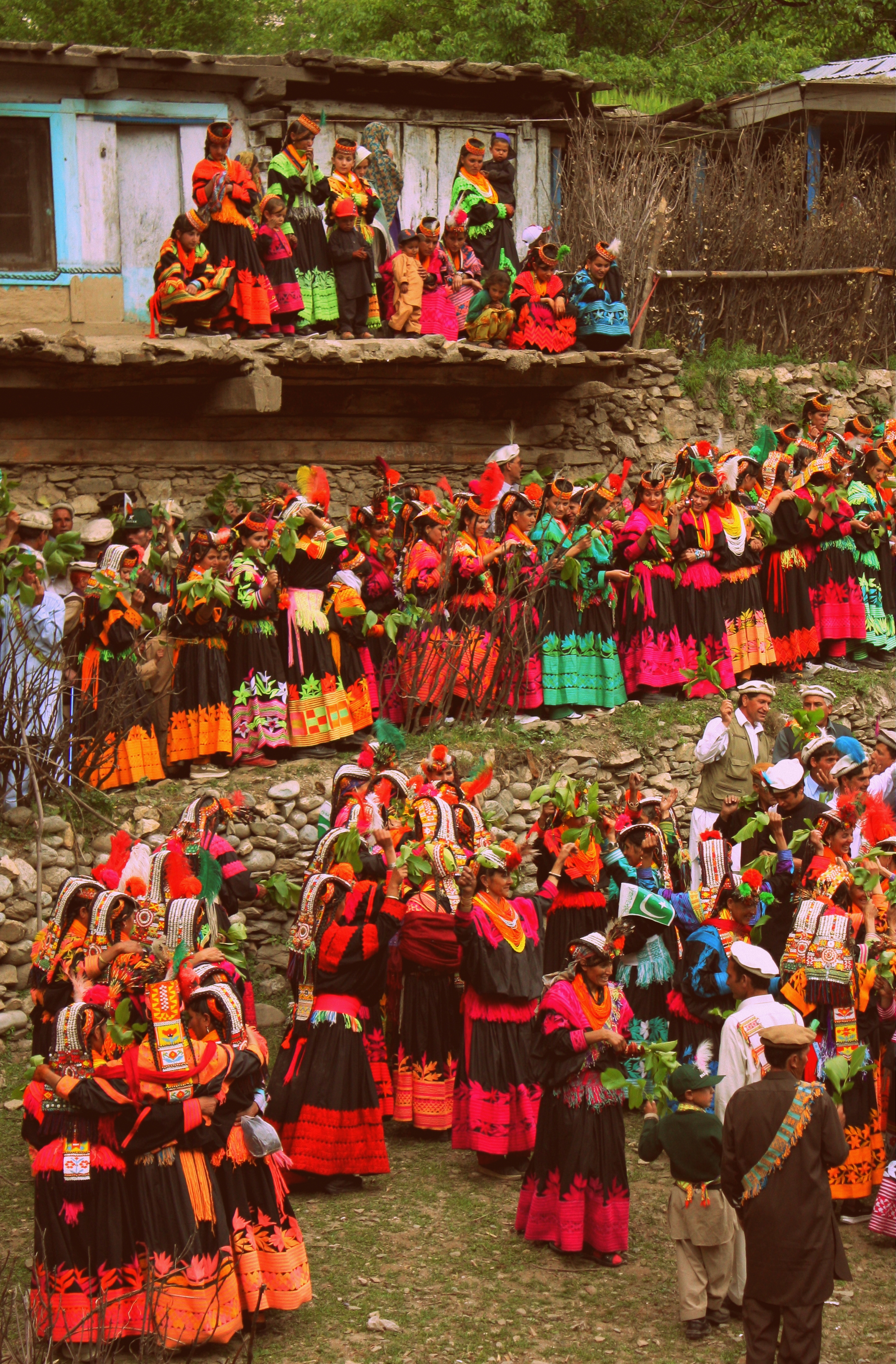
Kalash People during the Chillam Joshi Festiva. Pic Courtesy Wikipedia
The Kalash : The Kalash inhabit three Valleys in the Chitral Region now in KPK though at one time the Chitral Kingdom paid tribute to the Kingdom of Jammu and Kashmir. The Kalsha speak the Kalasha language which is a part of the Dardic family of languages. They have a distinct culture which has been under threat. Most Kalasha have converted to islam though a small number (3000 app) still follow traditional Animist beliefs.
Hi Res of Graphic can be downloaded from the link in the first comment.
The Lingual Diversity of the state of Jammu and Kashmir
The state of Jammu and Kashmir is made up of a number of geographically separate Regions divided by Ranges of the Himalaya. Its home to a diverse variety of Ethnicity, Cultures, Religions and of course Languages and Dialects. This article looks at the language diversity in the state of Jammu and Kashmir.

The Lingual Diversity of the state of Jammu and Kashmir
The State of Jammu and Kashmir is not only Geographically and Ethnically diverse with the two Highest Ranges in the World, the Himalayas and the Karakorams and also hosting Peaks of over 8000m from both these Ranges. Ethically it has a diverse mixture of people and distinct Regions dominated by different Religions such as Islam, Buddhism and Hinduism. But one of the little understood and little know fact in the Lingual diversity that exists in this state which we study as it existed in 1947 before the Partition.
The state was basically made of of 5 different Regions which were all Mountainous and it was the Mountains and the Rivers which divided the Populations. The main Regions as we can name in today’s context were (in Alphabetical order) were Baltistan, Gilgit, Jammu, Kashmir and Ladakh. And of course we have a major language language associated with the Region. Balti with Baltistan, Shina with Gilgit, Dogri with Jammu, Kashmiri with Kashmir and Ladakhi with Ladakh. But these classifications only sum up the language of the perceived majority in that Region but doesn't really give a true picture of the lingual diversity and how the languages sometime merge to create hybrid languages.
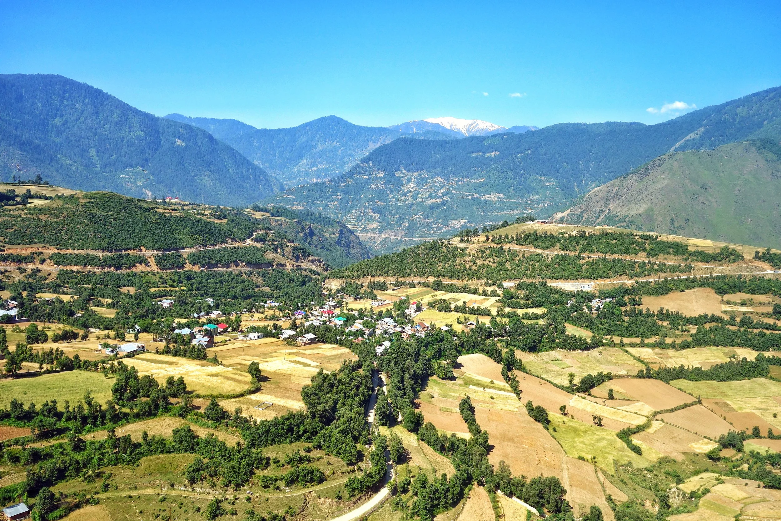
Starting from the Jammu Region which has a diverse language influences. Starting from the bottom at Poonch and Rajouri where the spoken language is Poonchi or Pahari or Potohari. This language belongs to the Lahnda/ Punjabi family of the Indo Aryan languages. Moving Eastward we have the Dogri language, which was considered as a Punjabic language and still has a lot of commonality with Punjabi. But now Dogri is considered an independent language and one of the main languages of the Western Himalayan Pahari language Group.
And then we have the Gurjuri spoken by the Gujjars. Gurjuri is closely allied to the Marwari dialect of Rajasthani and also has a fair mix of Punjabi in it. In fact the Gujars living in Punjab speak Punjabi and the languages are intermixed. Gurjuri is also spoken in the Kashmir Valley where also there are communities of Gujjars. However a number of Kashmiri words have overtime have become common usage by the Kashmiri Gujjars influenced by their Kashmiri neighbours.
Moving upwards into other parts of the Jammu Division we see increasing influence of Kashmiri language which is a part of the Dardic Language family of the Indo Aryan language Group. Bhadarwahi, Bhalesi and Curahi from an intermediate forms of speech bridging the gap between the Punjabi or Dogri and the Kashmiri System. Padari is an extremely interesting dialect, spoken in Padar region of Kistwar on the banks of the Chinab. It has a striking similarity to Pangwali, spoken in the Pangi Valley in Chamba.
Siraji is the language spoken in country north of Chinab between Ramban and Bhart on the way to Kishtwar. It is central to Doda and is also called Doda Siraji at times. Due to its location, to the North it gives was to Kashmiri, on West to Rambani, on the North East to Kishtwari, and on the South and South West to Bhadarwahi and Chamba dialect. Its generally frameworked like Punjabi but has many points in agreement with Kashmiri.
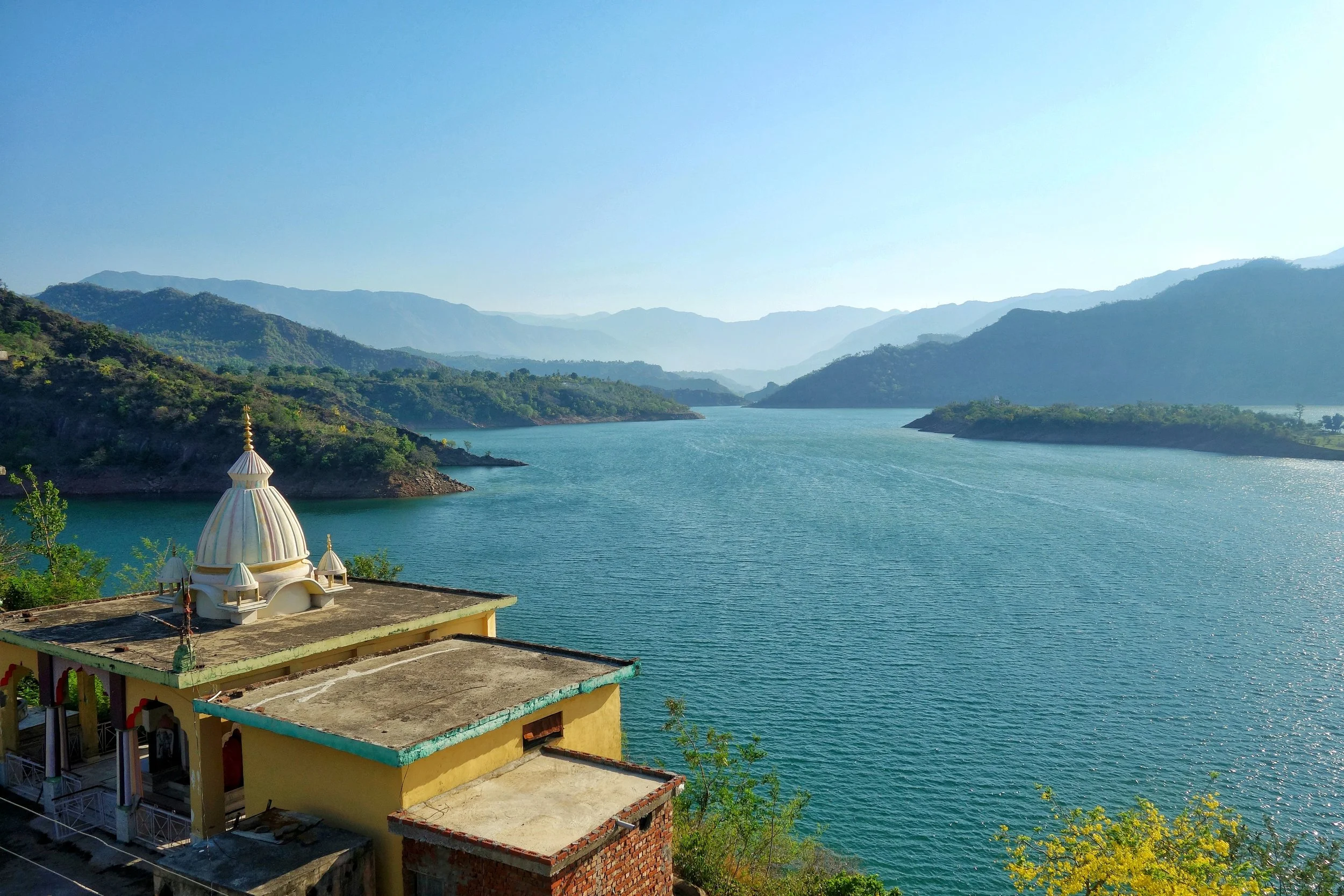
Rambani as the name suggests is the language spoken around Ramban and like the Poguli which it closely resembles it is connected with Kashmiri though further away than it than Poguli. Rambani has a very largely Punjabi pronunciation whereas Poguli pronunciation is more like Kashmiri.
Poguli is a language spoken in a small area to the East of Ramsu. It resembles Kashmiri though it is unintelligible to speakers of the Kashmiri language. However it seems that all speakers of Poguli have some basic understanding of Kashmiri. Nearly all peculiarities of Kashmiri are found in Poguli which however contains a number of points in common with dialects which look to Punjabi as a fountainhead. Kishtwari is spoken around the Kishtwar area of the Kishtwar region. It is considered a sub-dialect of Kashmir which it resembles very much. Kashmiri is well understood in Kishtwar.
And of course then we come to the Valley itself where the main spoken language is Kashmiri. The second most spoken language in Kashmir is Gurjuri probably followed by Punjabi / Pahari spoken in the Border areas adjoining the LOC in the West. However there are still speakers of Shina in the Gurez Valley, a couple of Villages in Tral and the Sarbal Village in Sonamarg. There is also a small community of Shina people who live in Srinagar city and they also speak Shina. Shina BTW is the main language of people in Gilgit.

Shina itself is a part of the Dardic family, same as the Kashmiri language. Its the most spoken language of the Gilgit region and it has a number of dialects such as Gilgiti (the prestige dialect), Astori, Chilasi Kohistani, Drasi, Gurezi, Jalkoti, Kolai, and Palasi. Related languages spoken by ethnic Shina are Brokskat (the Shina of Baltistan and Dras), Domaa, Kohistani Shina, Palula, Savi, and Ushojo. Shina is also spoken in the Drass area, Dah and Hanu and other “Aryan” Villages of Ladakh. Shina is also spoken in areas adjoining Gilgit like Kohistan in Khyber Pakhtunkhwa.
And then we come to Baltistan, where the main language is Balti. Balti is a part of the Tibetan family and belongs to the Ladakhi Balti Group. Infact many words that were used in old Tibetan are still found to be in use in modern Balti whereas they are not used in modern Tibetan anymore. Balti is widely spoken in Baltistan and a dialect, the Puriki is spoken in the Kargil area and the Suru Valley. Proper Balti is spoken in the Turtuk area of Ladakh as well. The language is also used by Balti communities settled elsewhere including the small Group of Balti people settled around Dehradun in Uttarakhand.
And finally Ladakhi which like Balti belongs to the Tibetan language family and is related to Balti as well. Besides proper Ladakhi it has a dialect called the Zanskari which is spoken in the Zanskar region. Interestingly both Ladakhi and Balti belong to the Ladakhi Balti family of Tibetan language. These are also called Western Archaic Tibetan languages as they have a lot in common with Old Tibetan unlike the more modern Western Tibetan language of the Lahaul Spitian language. Ladakhi has other sub-dialects if you may like Lehskat after Leh, where it is spoken; Shamskat, spoken in the northwest of Leh; Stotskat, spoken in the Indus valley and which is tonal unlike the others; Nubra, spoken in the north of Leh. In my personal experience I think all these Tibetan languages are mutually intelligible to some extent as I see people speaking Puriki and Ladakhi being able to have a conversation.
This should give you an idea of the languages spoken in the state of Jammu and Kashmir and we know that in the Mountains in the older times populations evolved in isolation and hence the vast array of languages and dialects and sub dialects. Infact in some cases the language changes from Valley to Valley so the actual number of dialects are well impossible to even comprehend but this gives you an idea of the diversity.
Source : Language of Northern Himalayas by Bailey 1908 and other Internet sources including Wikipedia.
And adding a language Map of Jammu and Kashmir by Drew from the late 1800's.
The Pass of Shiva
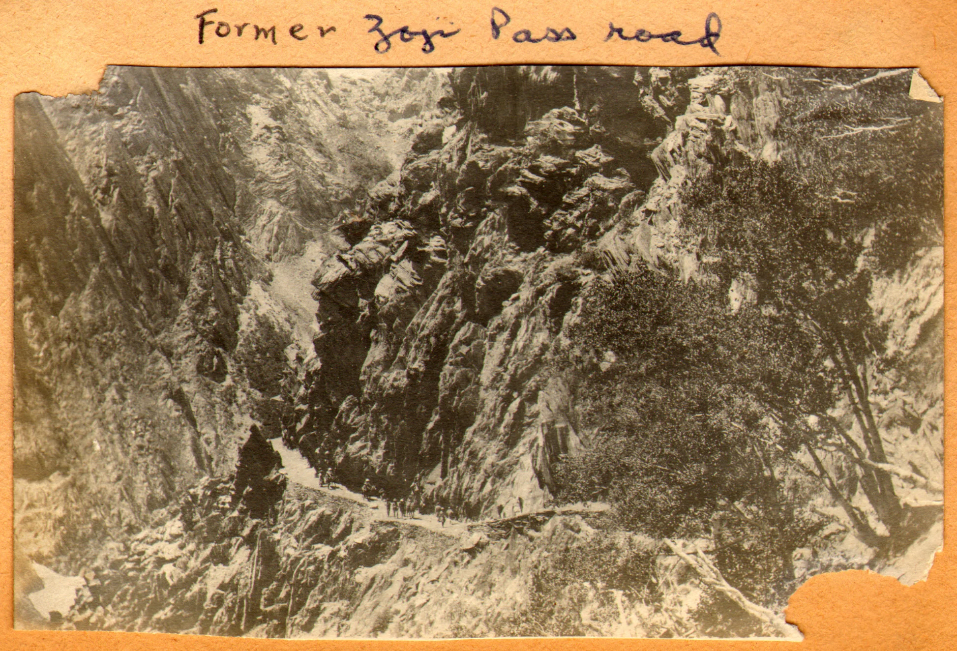
The Pass of Shiva as it was originally called is one of the main Passes used since historical times and it connected Kashmir with Ladakh. A fascinating insight into the Pass of Shiva or the Sheoji Pass. Today this name has transformed into what we call the Zoji La.

The Pass of Shiva
Sometimes while going through historical documents you stumble upon information thats nothing short of fascinating. As I spend some time everyday browsing through historical Documents / Journals related to the Himalayas in general and the Western Himalayas I came upon a piece of information that I was also unaware of.
The mighty Zoji La which connects Kashmir with Ladakh above the Sind Valley was actually named after Lord Shiva. The name of the Pass used to be Shivji Pass or Sheoji Pass which was corrupted with the Passage of time and eventually Sheoji turned into Zoji. Now the thing that is fascinating about this is that this is the first time I am hearing of a Mountain Pass named after the most powerful God of the Hindu trinity.

The Zoji La track as it was in 1913. Photography by Ralph Stewart.
This is what the 1890 Gazzetteer of Kashmir and Ladakh mentions about the Zoji Pass : Called Zoji La by the Ladakhis and Zoji Bal by the Kashmiris. The proper name is a corruption of Shivji or Sheoji, one of the three great Hindu deities. It leads over the Western Himalayas from the head of the Dras Valley to the Sind Valley in Kashmir. And is crossed on the Route from Srinagar to Leh between Baltal and Matayan.
It further mentions : The Pass has many names ; in the old Maps it is called Kantal, signifying the lofty hill, and under this name Jesuit missionary Desideri refers to it. Vigne calls it Palen-i-Kotal or Bal-tal (above-below) otherwise Shurji La, the hill of Shiva; the terminals “La” and “Bal” in the language of the Tibetans and Kashmiris, respectively, signify “Hill Pass”.
And interestingly it throws up some more interesting stuff from that day and age and mentions two approaches to the Pass from Kashmir : It is closed by Snow during nearly half the year, and is entirely impassable, except to Post couriers during two months. Two Routes lead up to it from the Kashmir side
1- Follows up the bed of the Sind River and passes over the blocks of Ice and Snowdrift which block the narrow Gorge through which it flows. This is the Winter Road and is only practicable for footmen.
2-Winds up the steep slope of the Hill rising above the Gorge of the Sind River to the North. It is a fair Road but is only used from July to December.
The top of the Pass is 2118 feet above Baltal. The descent on the Ladakh side is easy leading down to the Dras River and along its banks to Matayan crossing several tributary streams.
The Pass itself is the only section of the Road that closes to Dak services for more than a day or two at a time, in worst of Seasons. The Dak runners are sometimes unable to cross for two or three weeks the length of the impracticable section at such times is about 7 miles or so from Baltal to Gremen.
It should be noted that the British gave great importance to the Pass as they saw it as the first step on the way of setting up an all weather Trade Route between India and Turkestan and apparently the Pass of Shiva was the first of the mighty Passes that the Himalayas would throw at the Travelers. Maybe it because of the same reason that the Pass was held in reverence, I assume once upon a time and named after Shiva.

The Road climbing up from the Sind Valley as in the present day
In today’s day and time with all the Modern technology Engineers still struggle with the Pass though crossing it is no longer the ordeal it used to be once upon a time. But the approach is located in a fragile Mountain and shooting stones are still a clear and present danger. And landslides and avalanches still haunt the Pass. A lot of work keeps getting done but the Pass of Shiva doesn't stay quiet for long. Well, its Shiva’s Pass. What else would you expect !
The Sheep of Sinthan
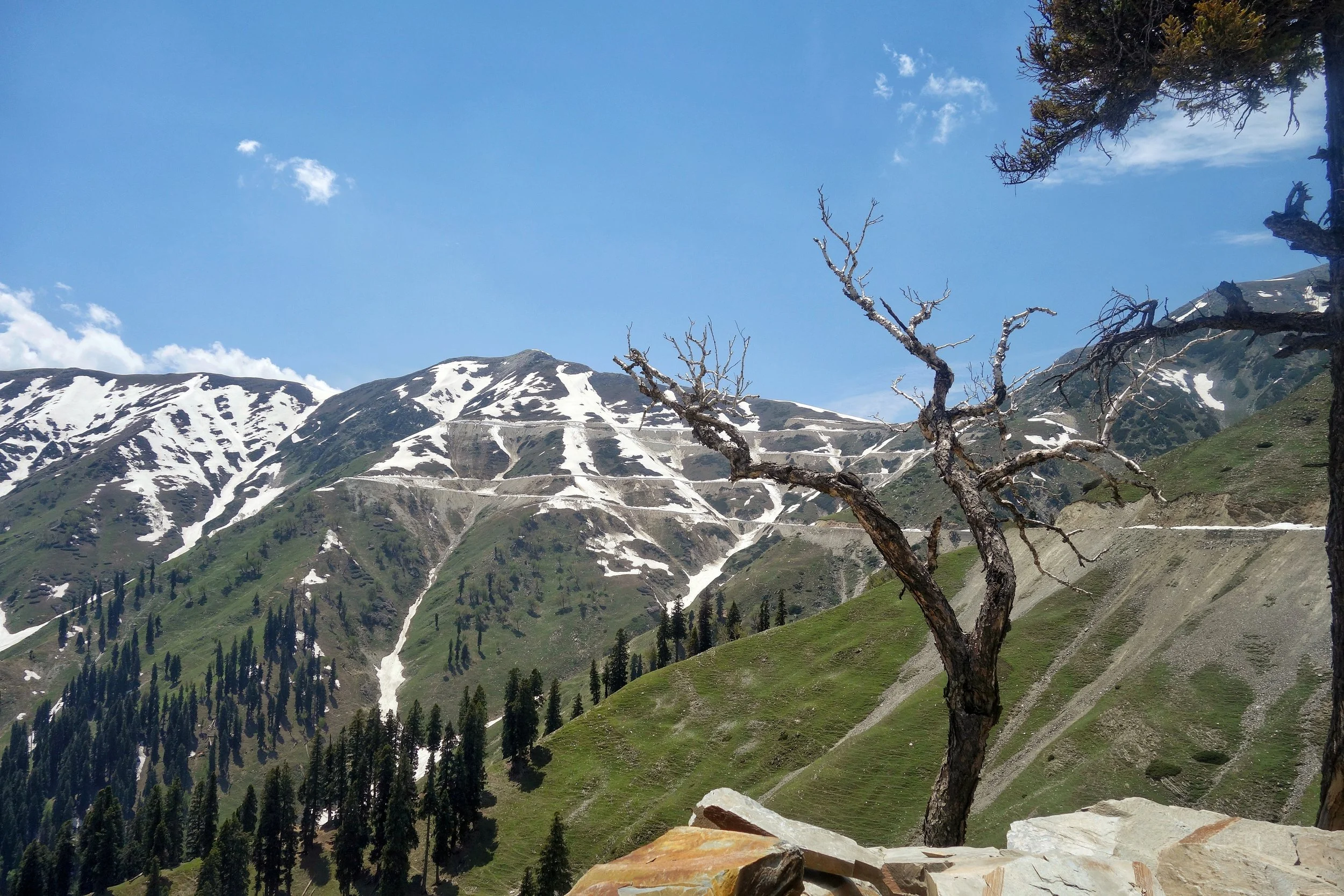
The gentle Sheep of the Sinthan Pass which connects Kashmir with Kishtwar. An absolutely beautiful Pass with mind blowing scenery on either side.
The Sheep of Sinthan
On our recent long foray into the Mountains me and Tahlan Sir decided to go to the Sinthan Pass as it had opened just a day earlier. In the evening we were warned by some people that there was some Militant activity around the Pass and we should avoid.
Of course we had our own sources and being from Kashmir these thing hardly perturb me. Anyways we got our all clear and started our Journey towards Sinthan. Because of the incident which took place one day before the security personnel were on alert and the check points to the Pass were manned by the Army. The Army men were rather amused when they saw a HR registered Fortuner with two not so young men wanting to go to Sinthan Pass. We were asked why we were going there ? I told them well I am missing home and if I feel like I might go to Srinagar from there and if I m not in the mood I will come back. They obviously laughed. :)
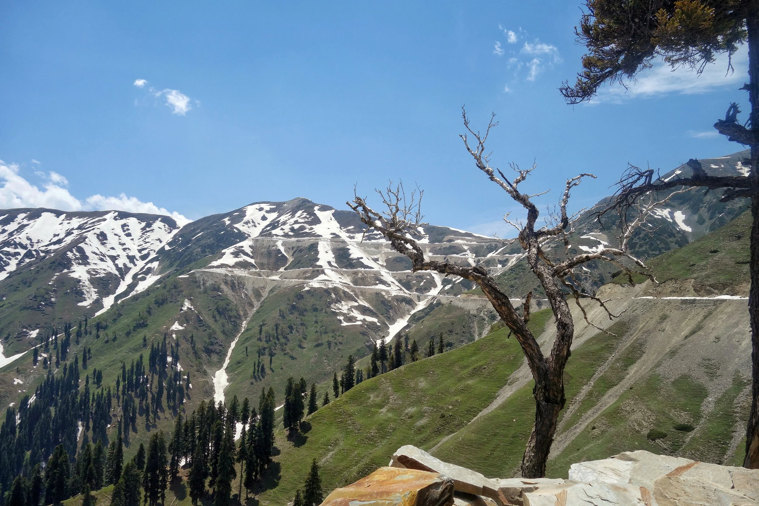
And soon we were on our way through this beautiful pristine area which still lives in an era gone by. The Gujjars were also on the move with their livestock, Horses, Families and Dogs. The population in the area is a mixed bag, there are Hindu Kishtawaris who live in the higher Villages, Muslim Kishtawaris (some of Kashmiri) descent in the Villages along the Road and Gujjars on the move and also living in some of the Villages. This mixing gives this area a unique cultural identity and adds to the charm of the place. Mosques and Temples around each other. It almost gave a notion of Paradise but of course this area has had its share of troubles.
Anyways the drive upto the top was just amazing with a lot of Snow walls right till the top of the Pass and some more on the other side. Anyways once on top I told Ramesh Sir that lets go down to Kashmir and have a cup of tea at the first place we find in Kashmir. And it was while going down that we met these guys. And surely they looked dangerous, but they didnt bother us and to me they looked like Tourists going upto their favourite holiday destination. Have a look ;)
And of course we had Tea at a shack set up by a Gujjar boy and served Girdas with Butter and Tea. And then we met a Gentleman there. Well thats a story for another day.
Video from the Kashmir Side of the Sinthan Pass. June 2019.
The Kashmir Mammoths : A Tragic Comedy Almost
Kashmir was once home to the Woolly Mammoths at the time of the last Ice Age. To date there have been remains of two Mammoths that have been found in the same area in Kashmir at the Interval of 70 years. And tragically both were taken out of Kashmir. One set of the Mammoth remains were subsequently returned while a struggle is on to get the other set.

The Kashmir Mammoths : A Tragic Comedy Almost.
The Woolly Mammoth, the giant of the North which roamed the expanses of Central and Northern Asia among-st other places. And it was also the ancestor of both the Asian and the African Elephants but became extinct after the ending of the Ice Age from what we know.
Many remains of the prehistoric Mammoths have been found all over the world, most notably in Siberia where the remains buried in the permafrost have emerged as fresh as probably the day the mammoth died. And all thanks to the frozen Ground and the low temperatures. In-fact the remains are so fresh that DNA samples have been taken and some scientists are trying to clone and resurrect the Mammoth. I am sure many of you must have seen the “Raising The Mammoth” series on Discovery or was it on National Geographic. Not very sure.
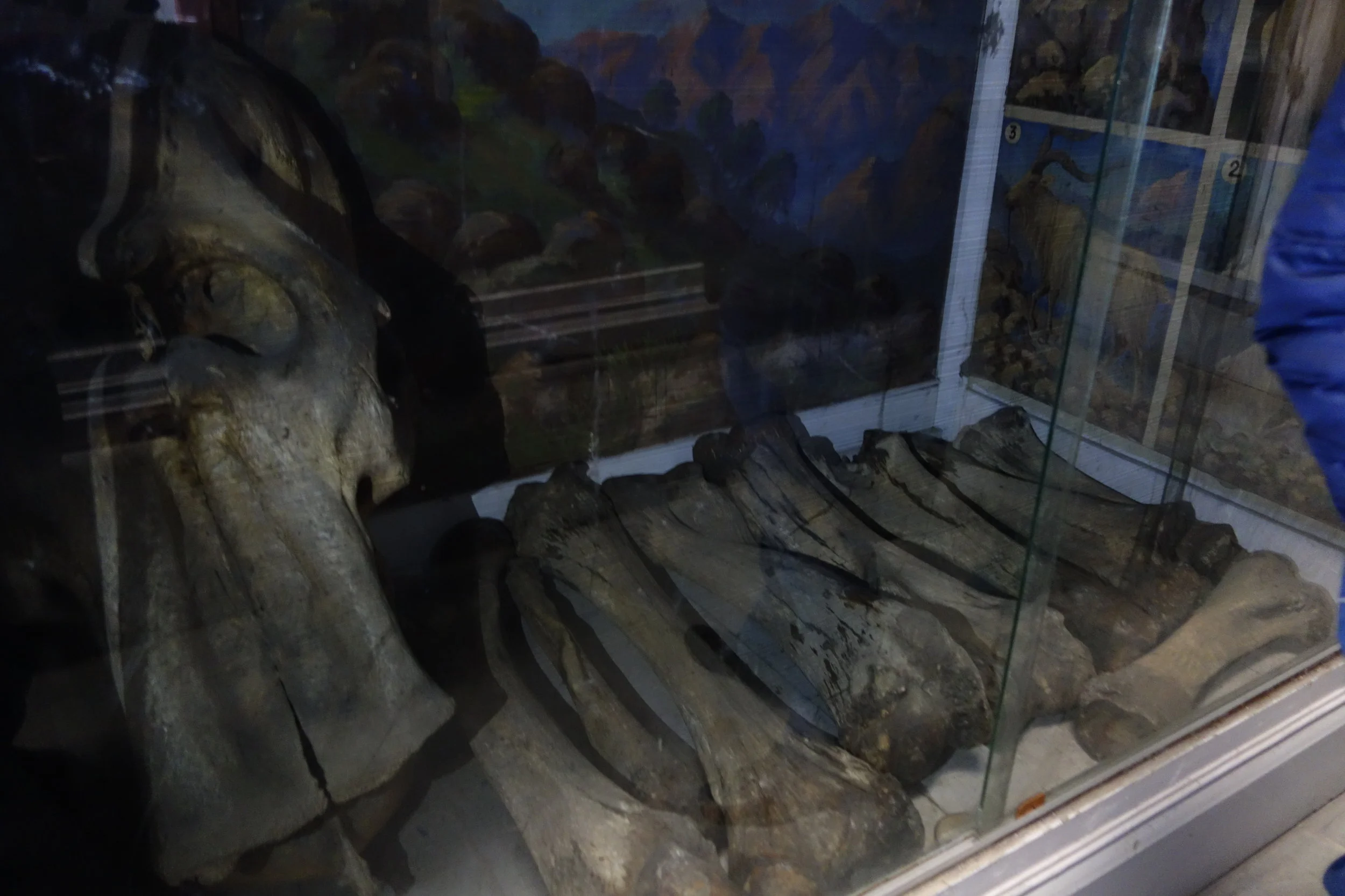
And now the story of not one, but remains of two Woolly Mammoths found in the Himalayas from where else but Kashmir. The thing is that Kashmir is so beautiful that even a couple of Mammoths decided to move in and make it their home. Now this was unprecedented and apparently the second Mammoth found was said to be the biggest Mammoth remains ever found. The Skull was 5 feet by 4 feet. A broken Tusk almost 3 feet along was also found. Experts later calculated the size of the Tusks to be a staggering 12 feet. Yes 12 feet. That's like One and half Stories. This was really some find. But in Kashmir even such finds can get embroiled in comical situations.
The first Mammoth was found in 1931 by an American called Dr. De Terra who was a researcher with the Carnegie foundation in the United States. He was working for the Yale University and visited Kashmir twice while on the trail of the remains of prehistoric man in Kashmir. He found some remains of prehistoric times but his most exciting find was the remains of a Mammoth at the same general location where the second Mammoth remains would be found 70 years hence. But the good scientist on his return took all the Mammoth remains with him to the good old United States of America. The Mammoth remains were then put on display at the Yale University in New Haven. And it was then that this news reached the Maharaja of Jammu and Kashmir. Of course he was infuriated at his people to let go of such a significant prehistoric find. So letters were sent by the Maharaja to the Yale University asking for the return of the Mammoth remains as they were taken without any Official consent. Under pressure the University and more importantly Dr. De Terra relented and the Mammoth remains were sent back to Kashmir. The Doctor maintained he had got the necessary permissions to take the remains but had relented to return them as he wanted to go to Kashmir again.
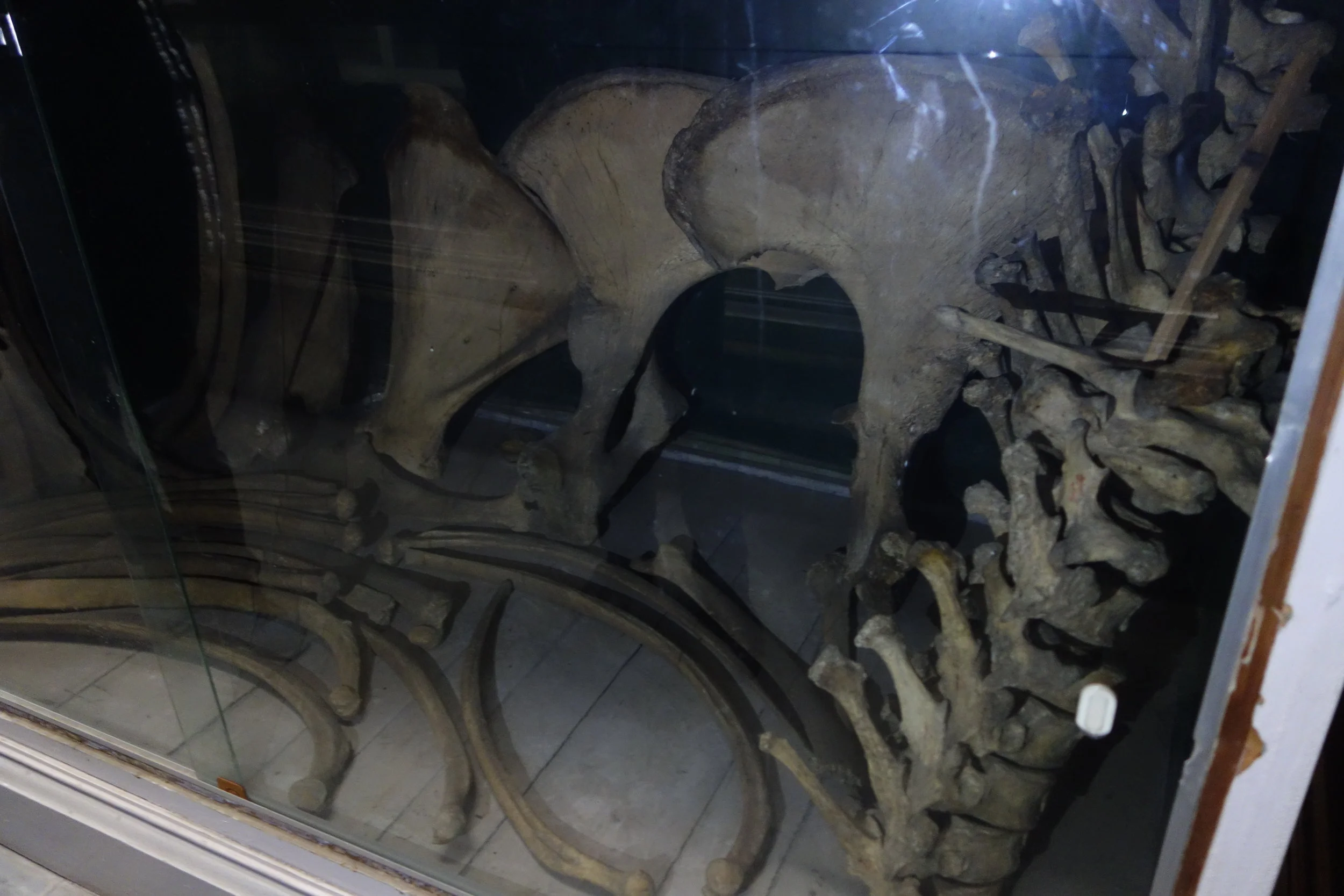
So the first Mammoth returned to its beautiful Motherland, Mouj Kashir (Mother Kashmir). And now it was put on display at the new Palace of the Maharaja of Jammu and Kashmir. And the Tusks of the Mammoth worked well as Coat Hangers. To be honest who can think of a more impressive Coat Hanger than prehistoric Mammoth Tusks. But soon enough better sense prevailed and in around 1935 the Mammoth remains were shifted to the Sri Pratap Singh Museum in Srinagar. And its there where it rests to this day and were damaged a little in the Floods. As a result they are not on display for Public and is in the Archives.
Coming to the second, bigger, Mammoth which was discovered in 2001 by a Group of students on a field trip around the Karewa in Pampore. The find was a great one and got top publicity in the National Newspapers as well. There was great euphoria among the Scholars and the Students for obvious reasons. And samples were sent to to forensic labs for carbon dating and other stuff. All was nice and dandy. But good things rarely last especially in Kashmir. One fine day in 2007 a Scholar went to the site and discovered to his horror that the Mammoth remains had disappeared from the Site. Not even a trace was left behind. It was obviously a professional job.
Well the Mammoth was soon found in the corridors of the Geology Department of Jammu University. The comedy transpired in this way, one of the Scholars co-opted for studying the remains on behalf of Kashmir University had actually come from Jammu. And on his return to Jammu he decided to take all the remains with him to Jammu University. Come on not again. It was like Deja Vu. Were the Mammoth God's not happy with Kashmir ?
And soon of course a war of words ensued between both Universities. With accusations flying in both directions. And while all this was going on Jammu University announced that it no longer had the Mammoth remains. What do mean you don't have the Mammoth remains, they were asked. Well we have given the mammoth remains to the Wadia Museum of Natural History in the Jammu University itself. So technically they were in the Jammu University but were installed in the Museum and hence Museum property. Kashmir University people were of course furious as Kashmiri Mammoth belongs to Kashmir. And RTIs were filled and Cases were filed. I think. Or I would assume that being the only resort to get the Mammoth back.
Now the funniest part of the whole Mammoth story. In response to the RTI’s, Jammu University came back with a reply which made many Experts fall off their Chairs. What Mammoth ? They said. They were just remains of an Elephant, what’s all this talk of Mammoths ? Claiming that the Mammoth remains were actually that of an Elephant would of ofcourse lessen the severity of the consequences that it would entail. Even the head of Geology and the boss at the Wadia Museum of Natural History “clarified” that there is no “Mammoth” on display at the Museum. This was in 2018. “Mammoth Lies” say the Scholars from Kashmir University.
Anyways.
At least we got one back from the United States of America.
I am an eyewitness. I even took pics on a Visit to the Museum when the officials at the Museum were kind enough to let me see and photograph the Mammoth remains. For the record I am Posting a couple of pics for the record. We already lost one. We don't want to loose another one.
“And that's all i have a say about that” as a line goes in one of my favorite Movies.
Pics from October 2017. Sri Partap Singh Museum, Srinagar, Kashmir
The Map Shawl of Kashmir
One of the most exquisite creation of man on Fabric, arguably the finest. The Legendary Map Shawl of Kashmir commissioned by Maharaja Ranbir Singh of Jammu and Kashmir for Queen Victoria of the British Empire and it took 30 years to create this masterpiece. We present for the first time, the Map deciphered as shown on the Shawl which is now on display at the Victoria and Albert Museum.

The Legendary Map Shawl of Kashmir
This has to be one of the most the amazing piece of Art on Fabric ever created. The master piece of Kashmiri kani work on a Pashmina Shawl.
The amazing and exquisite Map Shawl of Srinagar. This Shawl took 30 years in the making. There are 3 or 4 such specimens in the world. And these were made in the late 1800’s.
One was reportedly presented to Queen Victoria by Maharaja Ranbir Singh and is presently at the Victoria and Albert Museum in London. One more is with a Museum in Australia. One is with a private collector and this piece is at the Shri Pratap Singh Museum in Srinagar though it’s not on display as it needs some refurbishing after the Floods.
These are the photos of the specimen at the Victoria and Albert Museum and all the pics are from their. This was presented to them by Mrs.Estelle Fuller in 1970 and this specimen as per the Museum was made in 1870.
Have spilt up the Shawl in Grids for better and in depth views of intricate Work done on these Shawls. The attention to details are just mind blowing.
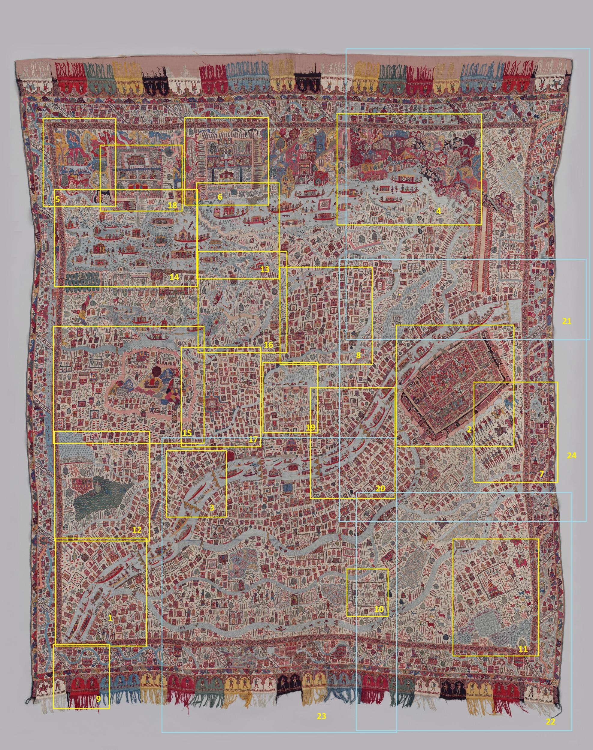

1. Safa Kadal Bridge on the Right Top corner.

2. The Shergarhi Palace,built by the Afghans, which was the residence of the Rulers of Jammu and Kashmir until 1920.

3. The Bulbul Shah Mosque between Ali Kadal and Naw Kadal

4. Shankaracharya Temple on the extreme top right.

5. The Harwan Area.
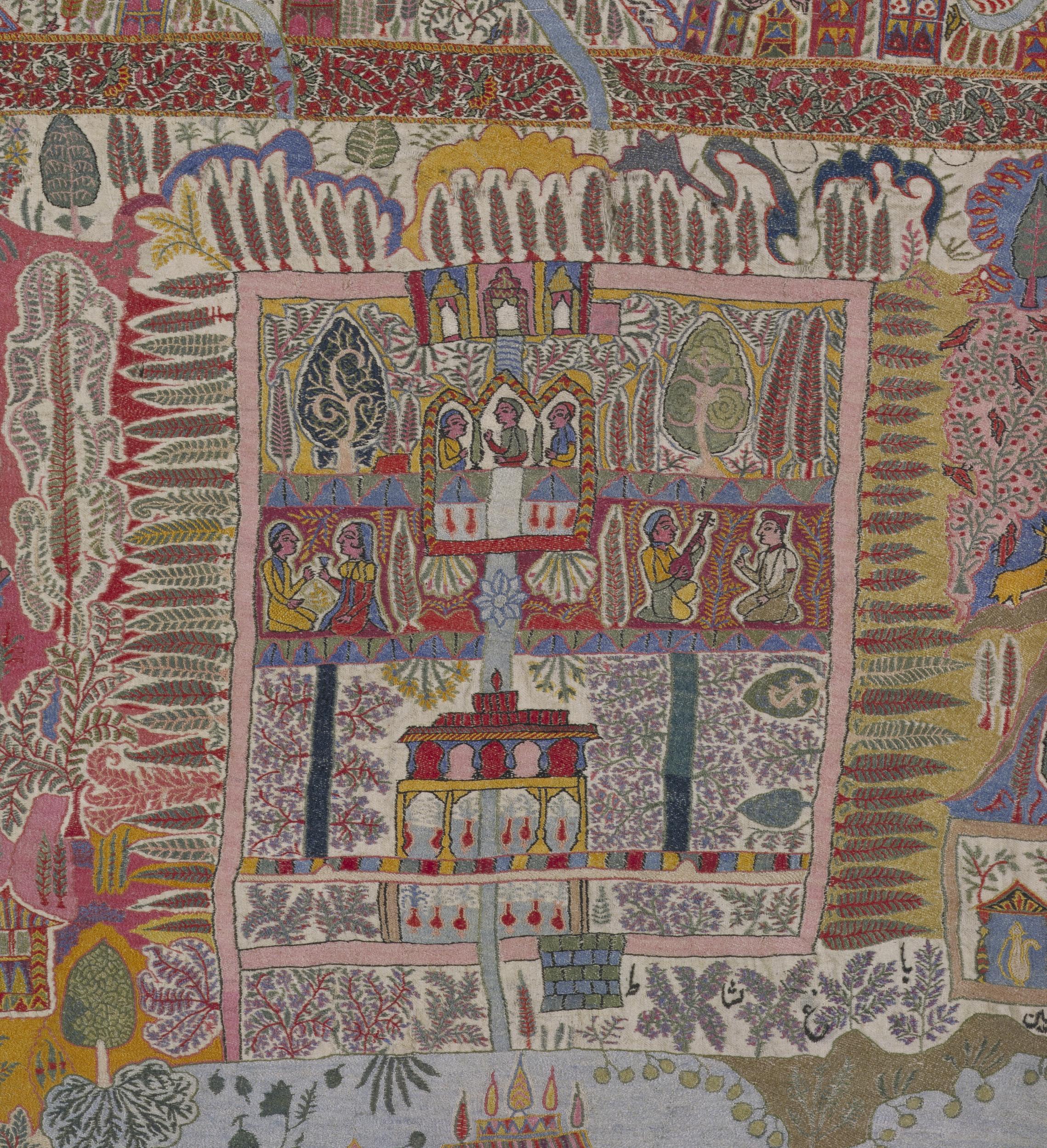
6. The Nishat Garden

7. The Parade Ground next to the Shergarhi Palace

8. The Main City Neighbourhoods

9.

10.

11.
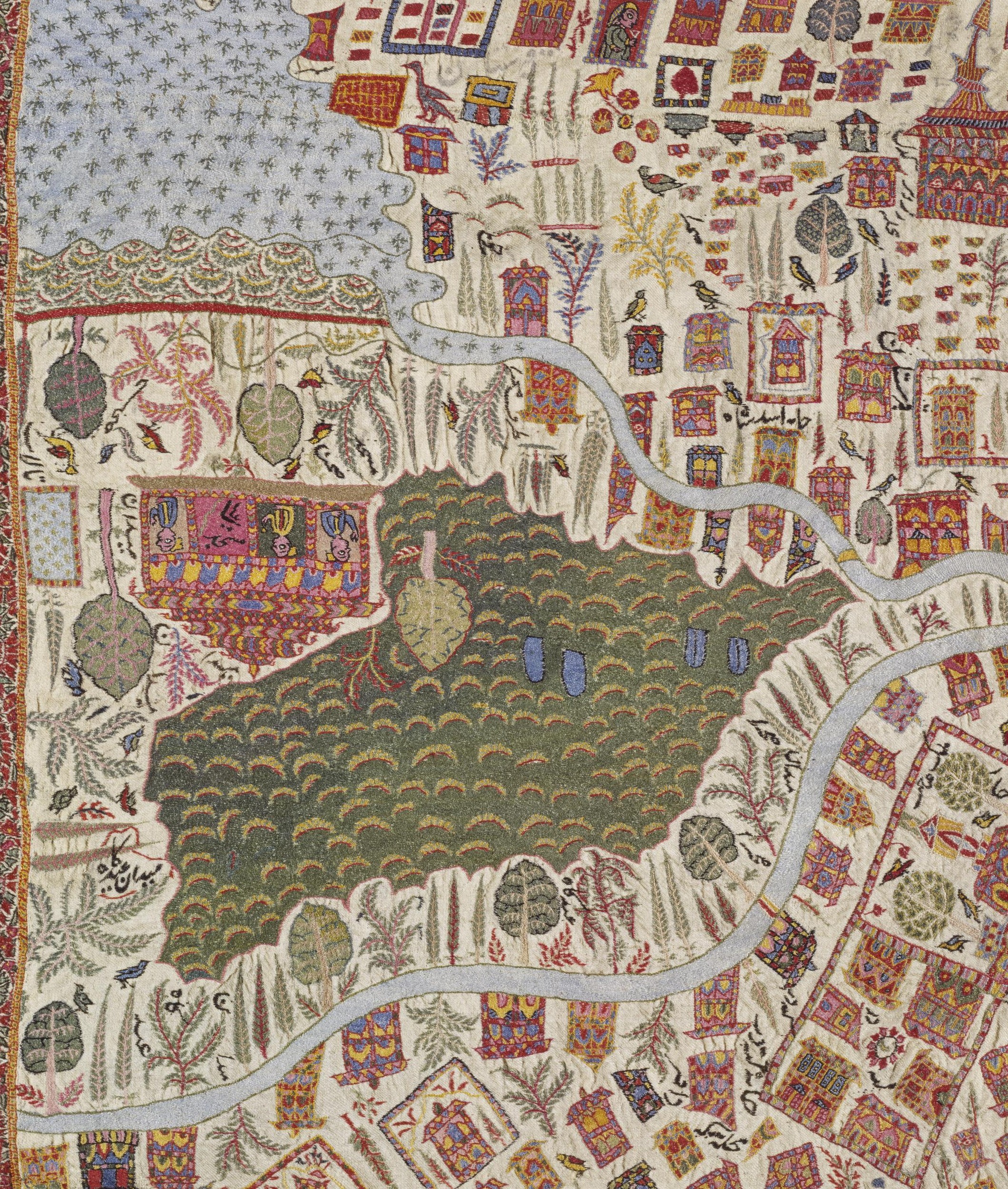
12.

13. The Dal Lake in front of the Nishat Bagh

14. Shikaras on the Dal Lake in front of the Shalimar Bagh. The figure riding in the Boat with a halo around his head is supposedly Maharajah Ranbir Singh.
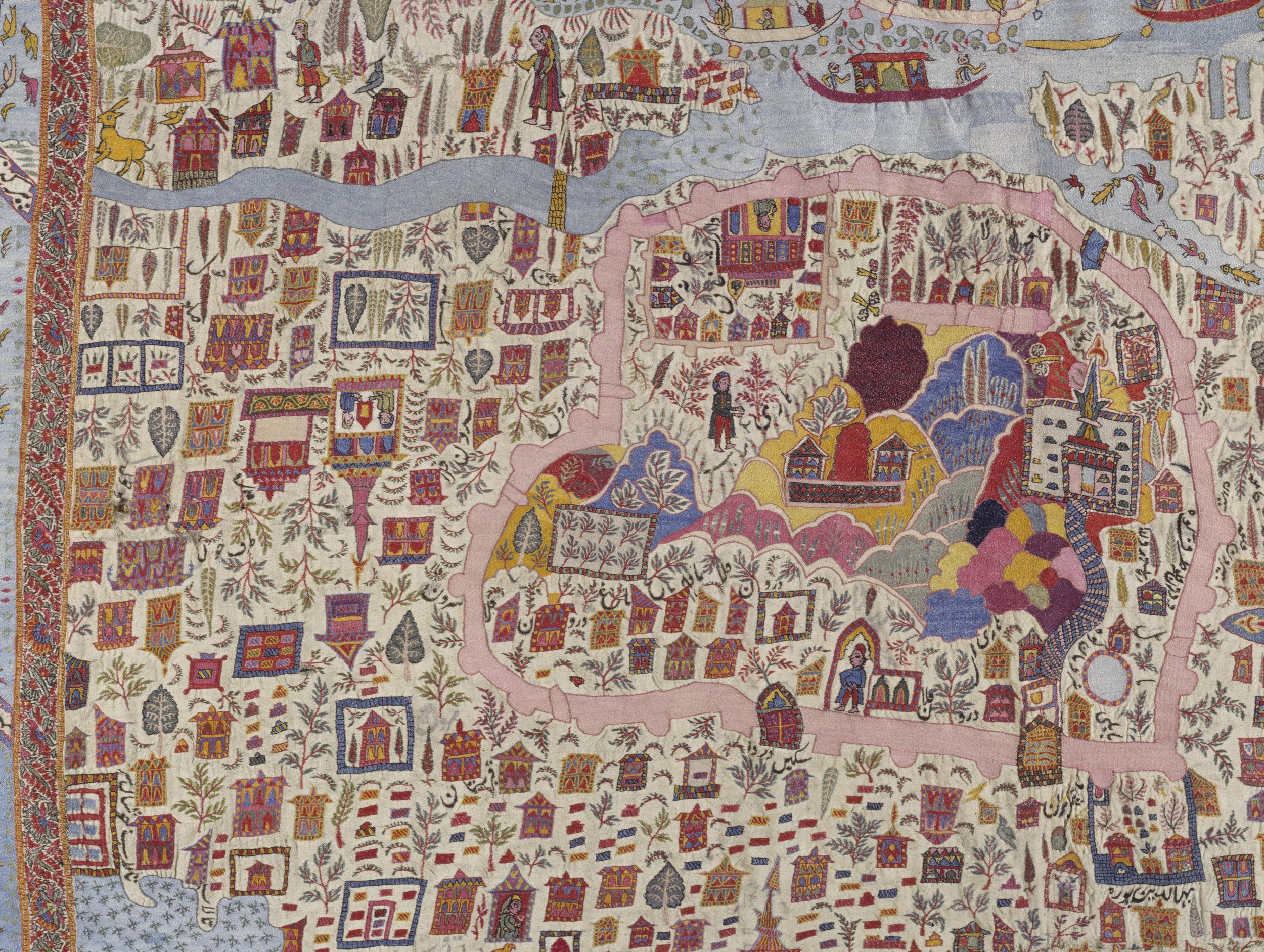
15. The Hari Parbat Fort area.

16. The backwaters of the Nigeen Lake and the Dal Lake

17. The Jama Masjid.

18. The Shalimar Garden

19. Bagh e Dilawar Khan

20.

21. The Shanakaracharya Temple at the top right

22.

23. The Shah Hamadan Mosque, the Patthar Masjid and the Budshah Tomb.

24. The Shergarhi Palace and the Parade Grounds.
The Elusive Kashmir Sapphires
The Story of the Kashmir Sapphire, the finest Sapphire that exists. Very few true Kashmir Sapphires exist today and are mostly held in Museums and Private Collections. We delve into the fascinating history of when and where did these Kashmir Sapphires came from and why they are so rare.

The Elusive Kashmir Sapphires
It was a cold November day of 2015 in Geneva when Ronny Totah got the phone call. It was about a Sapphire coming up for auction. And not any ordinary Sapphire, it was the finest Sapphire known to exist, the elusive Kashmir Sapphire. The bidding for this Sapphire would open at just 12 million Dollars and this was an invitation to Ronny Totah to attend a viewing of the Sapphire in New York before the bidding. The description and details sounded hauntingly familiar.

The Kashmir Sapphire Bracelet that was stolen from the Four Seasons in Milan in 1996
If someone knew the value of a Kashmir Sapphire and as someone who could afford it, Ronny Totah, the partner in the Jewellery House, Horovitz and Totah was the man. But the phone call got Ronny thinking about an incident that took place 20 years ago from that date. Horovitz and Torah had an exclusive Kashmir Sapphire set in a Cartier bracelet which was supposed to be put up in an auction exclusively of Cartier pieces. And a few days before the Auction some of the pieces were put up on display at the exclusive Four Seasons Hotel in Milan. It was the November of 1996. On the fateful day there were 50 people in the Exhibition Hall and the unthinkable happened. The Cartier bracelet with the Kashmir Sapphire disappeared. Seemingly into thin air it seemed. At that time.

A Pic of the Sapphire Mine by LaTouche
So where did these exclusive Kashmir Sapphires come from ? Like with all famous precious stones there are several versions to this story. A popular version goes like this. A Group of Lahouli traders turned at a Jewelers shop in Shimla and what caught the Jewelers eye were the brilliant Blue Sapphires they had to offer. And of course the Lahouli traders were averse to stating the exact origin of the Stones for obvious reasons. On being further pressed for information they conceded that they got the stones from the Mountains on the border with Zanskar. And apparently they didn't know the exact location as they in turn had got the Stones from a Shikari who had lost his flint. And he wanted to light his smoke. So he looked around for a quartz or a hard stone and found a blue stone which served his purpose rather well. He decided to carry it and later on gave it to one of the Lahouli traders. Even Shikari saab wasn't too sure where he found the Stones.

A Pic of the Apparatus used for Mining by LaTouche
But the news of the Blue Sapphires spread in Shimla and soon a few more stones turned and sooner rather than later the news wafted across and reached the the ears of the Maharajah in who’s realm these Stones originated. And he got his men working. Soon it was heard that the Stones had their origin in Padar, a Valley along the Chenab which bordered Himachal on one side and Zanskar on the other side. But initially it was mistaken as Padam instead of Padar so guys turned up in Padam in Zanskar looking for the whereabouts of the source of these priceless stones. But finally Padar was identified as the source and a body of Maharaja’s soldiers were dispatched to secure the Mine for the Maharaja of Jammu and Kashmir or the “Maharaja of Kashmir” as was more commonly known and hence the Sapphires got a name. The Kashmir Sapphires.

An unknown Trekker sitting in front of one of the Mine Shafts in the 80’s.
It was in 1882 when the Mine was secured and samples sent to the Indian Museum, where the experts were also astonished at the quality of these Sapphires. They were by far the best Sapphires that were ever seen. This was Music to the ears of the Maharaja and soon large scale mining of the Kashmir Sapphire started and it was soon on the wishlist of all the Maharajas and the Mem Saabs in the summer capital of British India, Simla. But exactly 5 years down the line after reaping great benefits the Mines seem to run out of Sapphires and the operation became unprofitable.

Gulabgarh, the main Village in Padar and the last Roadhead.
The Maharaja was alarmed and he invited experts from the Geological Survey of India to visit the Mines and give their expert advice. Tom D Latouche, the Deputy Superintendent of the Geological Survey of India led the team. And they managed to reach the Mines but not without some difficulty as the are to this day doesn't have Roads or Electricity and a 5 day walk apparently from the nearest Road head. He noted that the deposits in the Main Mine were almost exhausted and there was Mining activity a 100 meters below the main on the Valley floor. However the Sapphires from this location were inferior in quality to the Sapphires at the main Mine. However they did a study over a couple of months and made a detailed Report to the Maharaja. But it did nothing revive the Mining operations as the profitability was down as it seems the place had run out of Sapphires. Simple.

Typical topography of the area where the Sapphire Mines are located
Mining operations were shut down completely in 1889 till 1905 though Poachers would sometimes hit upon the Mines. In 1906 the Mines were leased out to a private Company who mined for 2 years without much success. And so the story carried on with a new Company / Individual taking the lease every few years and then walking out as it was just too costly because of the inhospitable terrain and overall remoteness. After Independence JK Minerals took the Mines and again a number of classified Surveys and Mappings were done of the area. But nothing much came out of it. Every few years the Government of Jammu and Kashmir comes out with a new Scheme to lease out the Mines but nothing really happens knowing the dysfunctionality of my State.
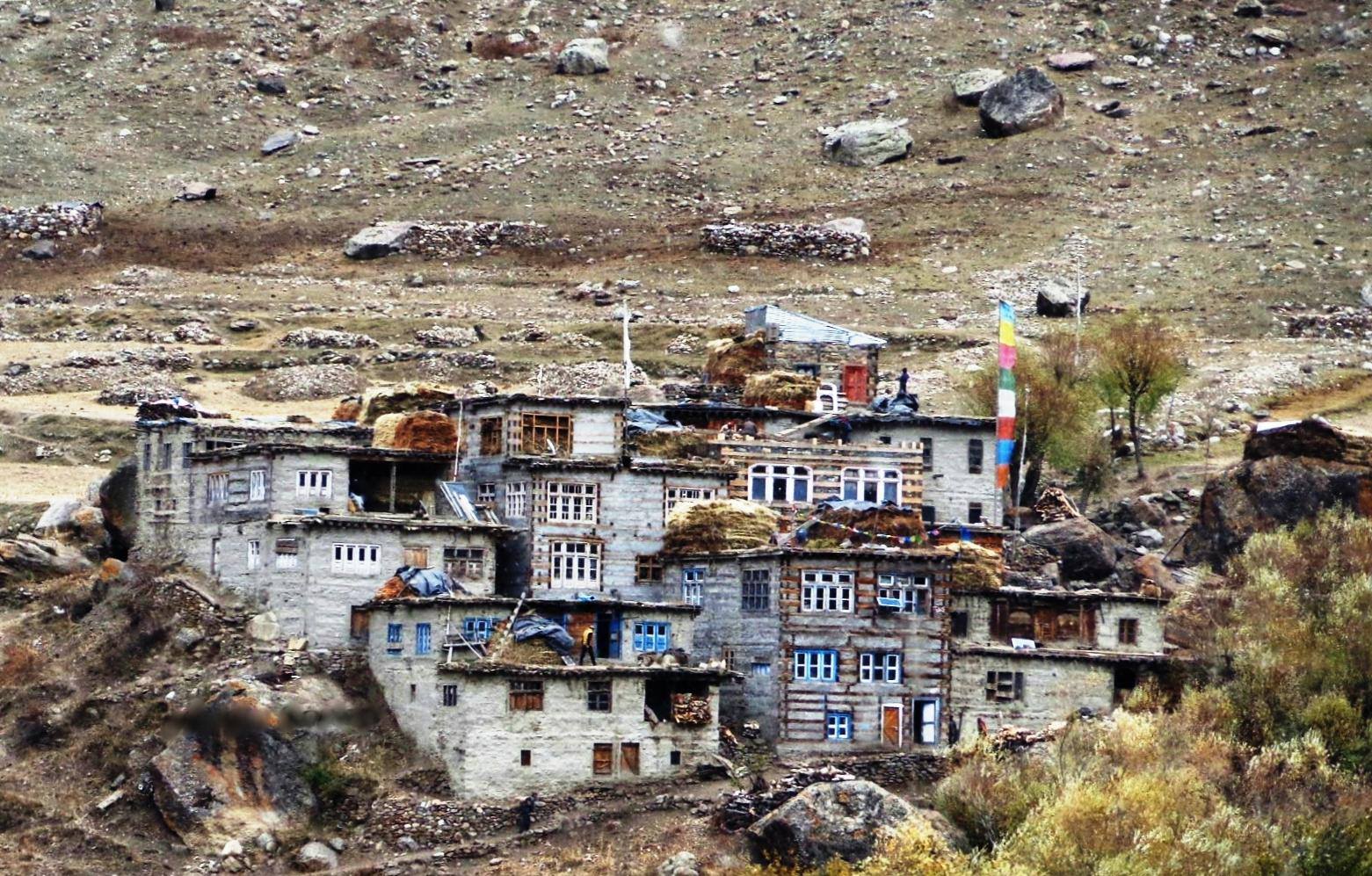
Sumcham, the last Village on the trail that leads to the Hagshu La and into Zanskar
In the meanwhile the Mines are Guarded by the Police and are strictly off limits for everyone. Well almost everyone if you know what I mean. No one is simply allowed in the area and though you will find the location on the Internet I have purposely left out the exact location and details of the Mines. People who need to know already know it. Anyways its off limits so nothing much can be done even if you know the place. I will let it rest at that.
Hence the value of Kashmir Sapphires has only gone up and few are seen outside of Museums and Private collections. They are simply not found anymore.

Kashmir Sapphires in ready as well as raw form.
Ah and coming back to Ronny. After going through more details Ronny was convinced this is the same Kashmir Sapphire which was stolen in Milan. Though reduced in Caratage (thieves normally do that and alter the shape of the Stone for obvious reasons) the characteristics mentioned in the certificate were exactly like his Stone. The Stone was withdrawn from the Auction but Ronny didnt stop there. Though he got insurance amount of around 1.8 Million dollars in 1996 after the Theft but he needed the culprits to be caught. As we speak now Ronny is fighting out in the Courts with present owners to get viewing of the Kashmir Sapphire and have it verified by independent experts. More on that when something happens.
Coming back to the Kashmir Sapphires and this is what a Gemologist says about them “The Sapphires of Kashmir form an exclusive class of their own. In the Jewel trade it is customary to attach the appellation 'Kashmir' to any fine Sapphire regardless of its geographical origin. This is an indication of the outstanding qualities of Kashmir Sapphires. The colour of these Sapphires resembles the beautiful hue of the peacock's neck. Even a small concentration of that fine colour illuminates the entire structure of the Gem.”
The Elusive Kashmir Sapphires
The Last Queen of Kashmir
The story of Queen Kota or Kota Rani as she was also known. The trials and tribulations that she witnessed during a very volatile period in History. And of course the tragic end of the Last Queen of Kashmir.

The Last Queen of Kashmir
And back to Kashmir to tell you the story of an interesting time in the history of Kashmir. A story of the last Queen of Kashmir. A story of the first Muslim King of Kashmir who came from Ladakh. A story of Shah Mir. And a story of a Tragedy.
It was the 14th Century and the Lohara Dynasty was in power in the Kashmir Valley and as was usual with the Loharas there was intense infighting amongst the Loharas and with the local Chieftains known as the Damaras. And the Loharas had already repulsed a number of attacks by the Ghanivids but however Kashmir being a protected natural Fortress was a big advantage and the Invaders concentrated more on the easier conquests in the plains of North India.
Besides there were invasions from the Central Asian side by the Mongols and Turks who use to come in and occasionally raid the country. The later Loharas were weak incompetent Rulers and it was just a matter if time before they would fall. It was imminent and at the same time they relied more on outsiders in the matters of importance given the distrust between them. There were two notable outsiders there at that time who’s name would go down in history.
One was the Buddhist Ladakhi Prince Rinchen, who after failing in an attempt to take over the Kingdom of Ladakh had crossed over the Mountains into Kashmir and found employment with the King. The King Suhadeva who was in power made the Ladakhi Prince, who’s full name was Lhachan Gualbu Rinchana, a Minister in his administration. But he wasnt the only prominent outsider who King Suhadeva made apart of his administration.
The other one was Shams-ud-Din Shah Mir, a Muslim who had come to Kashmir from the region Swat which once was a part of the Gandharan Kingdom just like Kashmir and a great center of Buddhist learning. His exact origin is not known but most probably a Swati of Tajik origin (a Gebbari) and his exact reason of leaving his homeland unknown. Whatever the reason was it didn't matter and he was also appointed as a Minister by King Suhadeva.
And then like in every story the Villains turned up. This was a Mongol and Turkic Army under the Command of Dulacha which decided to march into and plunder Kashmir. The Pagan Mongol Commander was about give a lesson in Central Asian Warfare to the Kashmiris. And it hit them like only the Mongols could hit in those times. The King Suhadeva tried to bribe the Mongols into going back but this only increased the burden on the population and he became even more unpopular. He had no option but to flee and he did that and ran away to Kishtwar. The only person in the Kingdom who showed some semblance of resistance was Suhadeva’s General Ramchandra. And in doing so he also became the King. And in the meanwhile the general populace went into hiding and this included the wily Prince Rinchen with his band also went into hiding in what was known as Lars.
And finally the Mongols decided to leave and the country was utterly devastated. Ramachandra had managed to survived the onslaught but soon they had a problem of outlaws coming in from neighbouring regions coming in like Vultures to pick off whatever was left after the Mongol invasion. Ramachandra decided to put Rinchen in charge of whatever was left of the Army to drive out these brigands. This he did but in the process he managed to get a hold over the Army and knew they were at his beck and call. So what does the Prince, who always wanted to be the King do ? He marches back and kills Ramachandra and takes the throne of Kashmir. And he also did one more thing. He married Kota, the beautiful daughter of Ramachandra.
Now to get popular support of the local population who were largely Hindu he decided to convert to Hinduism so as to get maximum support but the powerful Brahmins straight away rejected this for reasons best known to them. And then, Shah Mir who was now a Minister suggested that he could convert to Islam as by this time there was a strong minority of Muslims in Kashmir. The exact story of why Prince Rinchen converted to Islam has many versions so just leave it to that. And soon Kashmir had a its first Muslim King, the first Sultan, Sultan Sadruddin Shah or Hazrat Sadruddin Shah or Hazrat Rinchan Shah as he is also called.
He soon had a son with the Kota Rani, Haidar Khan who was under the tutelage of Shah Mir who was his most trusted Minster. But the state was still under constant threat from Rebels and Brigands and it was on a campaign that Prince Rinchan, as he was originally known was assassinated which again plunged the Kingdom into crisis. And this was the opportunity that Udyanadeva, brother of the last Lohara King Suhadeva came into the picture and usurped the Throne. And not only did he usurp the throne but he also married Rinchan’s Kota Rani. King Udyanadeva was destined the last Hindu King of Kashmir of Medieval times.
But Udyanadeva provide to be a inept Ruler and the real power was held And as his ill-luck would have it another Mongol Turkic Army turned up at the gates and this time it was headed by Allacha, again a Mongol Pagan bent upon giving a dose of Mongol warcraft to the Hindu, Muslims and Buddhists alike. Just like his brother Suhadeva, Udyanadeva fled but to Tibet. And just like her father, Ramachandra, the Kota Queen decided to stand her ground. And she gave strong resistance to the Mongols and took the fight to them and managed to defeat Achalla and the Mongols but at great costs. But she had won and the Mongols left.
And Kashmir had probably its first reigning Queen, Kota Rani and unfortunately she would also be the last.
Shah Mir had played second fiddle for the longest time. It was already 1339 He had served under the different Kings and now with the Queen and her power weakened he decided to make his play. Shah Mir played well and managed to take the reigns of power from the Queen. But that wasnt all, he wanted to marry the Kota Rani as well.
What happened next is well known but how exactly it transpired is not known. And I am one for dramatic endings. It is said that the Queen agreed to marry Shah Mir, who established himself as the first Sultan of what would come to be known as the Shah Miri Dynasty. And the day they got married and Shah Mir came to her, Queen Kota cut her stomach with a dagger and offered her intestines to Shah Mir as a wedding gift. And thus ended Queen Kota.
The Last Queen of Kashmir.
PS: This is my version of Events. And it is an attempt at explaining simply a very complicated time in the History of Kashmir. A time which mostly doesnt figure in public discourse anymore.
To know more about the Queen do read The Last Queen of Kashmir by Rakesh Kaul. Harper Collins. Available on Amazon.
Chitral Expedition
The Story of the the Chitral Expedition, a conflict in the shadows of the Hindu Kush and the Karakorams between the local Rulers and his tribesmen against the British and the soldiers of the Jammu and Kashmir state. A story of a seige and how it was finally broken.
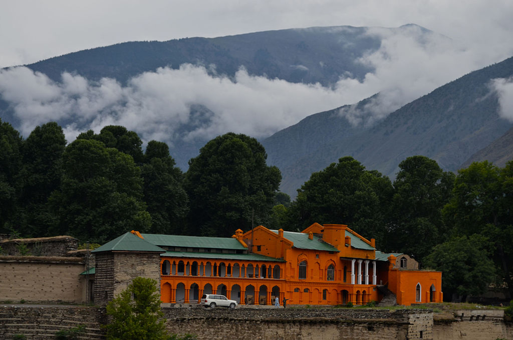
Chitral Expedition
Chitral is a town located at al elevation of around 1800 m in the Hindu Kush Mountains and its the district HQ of Chitral district in the Khyber Pakhtunkhwa of Pakistan near the border with Afghanistan.
Because of its strategic location it was witness to many events in the Great Game as it played out between the British Empire and the Tsarist Russia. With the formation of the state of Jammu and Kashmir in 1846 and the subsequent conquest of Gilgit / Hunza the Chitral region also came under the influence of the Maharaja of Jammu and Kashmir in 1876 with the blessings of the British. However once they leased out Gilgit from the Maharaja to keep on eye on the Russians and thus the Gilgit Agency was formed. Chitral was taken out of the Maharaja’s realm of influence and made a part of what came to be called the NWFP.

However there was an incident in Chitral which tested the resolve of the British to hold on to Chitral. Chitral had a semi-independent Ruler called the Mehtar who was subservient to the British. In 1892 the Ruler of Chitral, Aman ul Mulk expired and he had ruled since 1857. His death was followed by a brutal war of succession between his sons. And the British watched this and so did their Garrison of 400 men who were housed inside the Chitral Fort by the Chitral River. The old Ruler was succeeded by a son but his brother (the departed Mehtar’s) also appeared on the scene from exile in Kabul. And so did another son who was under British protection. And if that wasn't enough an Afghan tribal leader with his men also turned up. Without getting into details let me say it was a mess and the British Garrison which had 5 British Officers commanding the 14th Sikh and Kashmiri Infantrymen from the Maharaja’s Army were under siege.
Meanwhile the British decided to send some relief columns to the aid of the defenders of the Fort. The troops were gathered in Gilgit and they consisted of 400 Sikh Pioneers mostly Road Builders, some 50 Kashmiri Sappers and a troop of irregular Hunzais numbering around 800 men. All tough Mountain men. They needed to be tough as it was March and between Chitral and Gilgit lay the formidable Shandur Pass crossing which in Winter was never really thought of as a possibility. This is the same Shandur Pass where nowadays the Shandur Polo Match is held between the Chitralis and the Gilgitis. At 3700 m it lay where the Karakorams met the Hindu Kush. Col James Kelly didn't really have an option and this was the option he had.

And they set off on March 23rd. By March 30 they had crossed 10,000 ft and well into the snowline and the snow was deep. But they had the element of surprise and the Chitralis on the other side of the Pass had no inkling that a whole body of troop could cross the Pass in late Winter. It's said that after crossing the Snowline the porters saw what was in store for them as the snow around Shandur was waist deep. And they decided to drop their loads and go back. But the Soldiers didn't really agree with them and you can't really win an argument with Men who carry guns. They got back to their duty and Sledges were used to transport the heavy Guns over the Pass. Once they were over the Pass did the Chitralis realise that they had uninvited Guests coming over to the aid of the besieged Garrison in the Chitral Fort.
In the meanwhile a huge British Force of 15000 was assembled in Peshawar and set off. Joining them unofficially was our old friend, Lt Col Francis Edward Younghusband. This force set off a week after Kelly’s force under General Law. The serious British reaction to this incident was due to the fear of the Russians taking advantage and Ivan and Cossacks coming to the party. They also faced the formidable Malakand Pass and the eventually the Lowari Pass. The Malakand Pass defended by Umar Khan’s 12,000 Afghan fighters which they overcame as the Afghans dispersed. And they crossed the Lowari on the same day that Kelly’s force entered Chitral and the Fort. And it is said that Younghusband ran in front of the detachment and was the first from this force to enter Chitral. And apparently they had finished the last bottle of Brandy the night before. Hangover makes you do crazy things.

Anyways at the end of the day the British got the Fort and the control of Chitral. Many of the Troops got the Chitral Relief Medal. And i should mention that my fellow team Member Rijul Gill’s grandfather was also awarded a Chitral Relief Medal which he still has in his possession.
As for Chitral once they re-established control in 1895 the British installed Shuja-ul -Mulk, a 12 year old son of the late Mehtar as the Mehtar and he ruled for a period 41 years till 1936 and peace returned for good to Chitral.
And I should mention that Chitral is beautiful country. And its the home of the Kalash. It used to be called Peristan as it was said that fairies lived there. If I was a Fairy I would Chitral as home. Its just beautiful.
Pic of the Chitral Fort by the Chitral River. Phot credit Syed Imran Scach.
British Museum Kashmir Collection Part II
The Britsih Musuem has a fine Collection of Kashmir Art on display. Some glimpses of the Kashmir Art held in the archives of the British Museum. This is Part II.

Kashmir Collection at the British Museum Part II
Second Part of of the Kashmir Art and Antiquities on display at the British Museum. All pics and descriptions are from the British Museum website.

A figure of the Buddha seated in padmāsana, his hands folded on his lap in dhyānamudrā; cast in bronze with copper and silver inlay. 8th C
Despite its modest size this bronze has a monumental aspect with a fullness of face and body due to the influence of Gupta modelling absorbed by the art of Kashmir. While it resembles seated Buddhas in central and even eastern India on account of this common influence, its distinctively regional features appear in the shape of the head, the hairline and the upward tilt of the eyes. The copper inlay of the lips and silver in the eyes, like the flap of the robe hanging from the left shoulder, are Indian medieval characteristics; inlay became progressively commoner. The damage on the image may be due to casting faults.
Figure (Buddha). Standing on lotus. Made of bronze. 10th C - 11th C
Figure (Viṣṇu.fragment). With boar heads on shoulders,earring and necklace,worn. Made of marble (white). 9thC-10thC
Figure (Viṣṇu as Varaha). Made of stone (schist). 9th C
A bronze standing figure of Tara, missing proper right arm. 11th C - 13th C
A bronze standing figure of Tara, missing proper right arm. 11th C - 13th C
Part of a carved wooden Buddhist shrine (portable) with three niches: the central contains a figure of an ivory seated Bodhisattva flanked by many attendants. The left and right niches are are empty but probably contained standing figures of female attendants. 8th C
The empty niches on either side of the main figure held a pair of carved ivory female attendants now in the Cleveland Museum of Art.Zwalf 1985
This wooden panel, with one surviving seated Bodhisattva, probably belonged to a shrine imitating a Kashmiri temple which, even with a proportionately high superstructure, would have been readily portable. The Bodhisattva's crown, where a 'parent' Buddha might have been, is damaged and there is no other evidence to identify him. The flanking niches must also have contained acolytes. This form of Buddhist devotional object was a characteristic product of the Kashmir region.
Seated figure of the Buddha, with right hand in varadamudrā and left raised by the shoulder holding his garment end; cast in a copper alloy with silver inlay. Thin copper base plate; inscribed on the rear. 9th C - 11 th C

Standing figure of Vajrasattva, cast in a copper alloy, with a pointed halo, broken and repaired with straps and rivets. 15th C. Found in Tibet
Figure. Steatite stone figure of Gaja-Lakṣmī, seated on a lion. 7th C

Figure (Kārttikeya). Figure on a peacock holding a parrot. Made of carved and gilded agalmatolite. 8th C. Found in Khotan/ Yoktan

Part of an oval lid showing a women with a cup being held to her lips; carved in a grey steatite; broken. Hepthatilite 6th C
Originally labelled as possibly 8th-9th century, Ghose suggests an early 6th century date for this as part of a group of similar items in different collections
Kashmir Musings I
Random musings from Journeys in my Homeland of Kashmir. In this one we talk about the exquisite Wooden Ceiling Patterns created by the Kashmiri art of Khatamband. We also talk about the regal Residency Building in Kashmir which was once housed the British resident in the State of Jammu and Kashmir and which now serves as a Government Arts Emporium.

The first is the traditional Khatamband wooden ceiling which is made of small geometric pieces of Walnut or Deodar wood as seen in the pic below. This originated in Persia and made it down to Kashmir. These are traditionally made without any nails or glue and are just fitted together using joints in wood. These intricate pieces of art serve as a heat insulator as well. However it is a time taking task and expensive as such. Also with wood getting expensive this art form is slowly disappearing from Kashmiri homes. We are still lucky to have this ceiling in some parts of the house which was done more than 40 years ago and it even survived the floods.
The second which most of you must be familiar with is the Bukhari, which as the name suggests came from Bukhara in Central Asia. Traditionally we had three kinds of Bukharis: Wood burning, such was the original type, then the Coal burning and finally the Saw Dust burning. The Coal one was the hottest but it came with the danger of asphyxiation. The Wood one was the second hottest but it need a constant supply of wood but never the less was the most popular one. In our house we had the Saw Dust one as it was most convenient though heat generation was less compared to the other two. However Saw Dust as a waste product was easily available in those times. Nowadays these are being replaced by Gas, Kerosene and Electrical heaters. And slowly the Bukhari would only be found at places like this. The Bukharis in the pic below are the extra large variety types and wood burning.

The Residency, which lends its name to Srinagar's stylish (once upon a time) Residency Road, after the light snowfall day before yesterday.
This served as the Residence of the Resident of the British Indian Government to the Court of the Maharaja of Jammu and Kashmir.
Set amidst vast lawns and surrounded by numerous Chinars hundreds of years old it sits right opposite to what used to be the Polo Ground. The building now serves as a Handicrafts Emporium showcasing arts and crafts from the Valley.
Unlike other Hill Stations which were a part of the British dominion, Kashmir wasn't and the Maharaja explicitly forbade any foreigner from owning any land in the Valley (it still holds true in another manifestation which is now a Political issue). So all the British used to stay in Houseboats as they were allowed to stay on these and even own them.
The Residency building is a beautiful heritage building with two magnificent gates on either side. One gate led towards the Lal Chowk area while the other opened towards the exclusive, white only, Srinagar Club.
Around the Hari Parbat Hill
The Fort of Hari Parbat or the Koh-E-Miraan dominates the skyline of old Srinagar. The Fort was built by the Afghan Durranis who ruled the region at one point of time and has stood witness to the vagaries of time in Kashmir. Many places of historical / religious lay dotted around the Hill.

The Hari Parbat Fort as seen from the Badamwari below
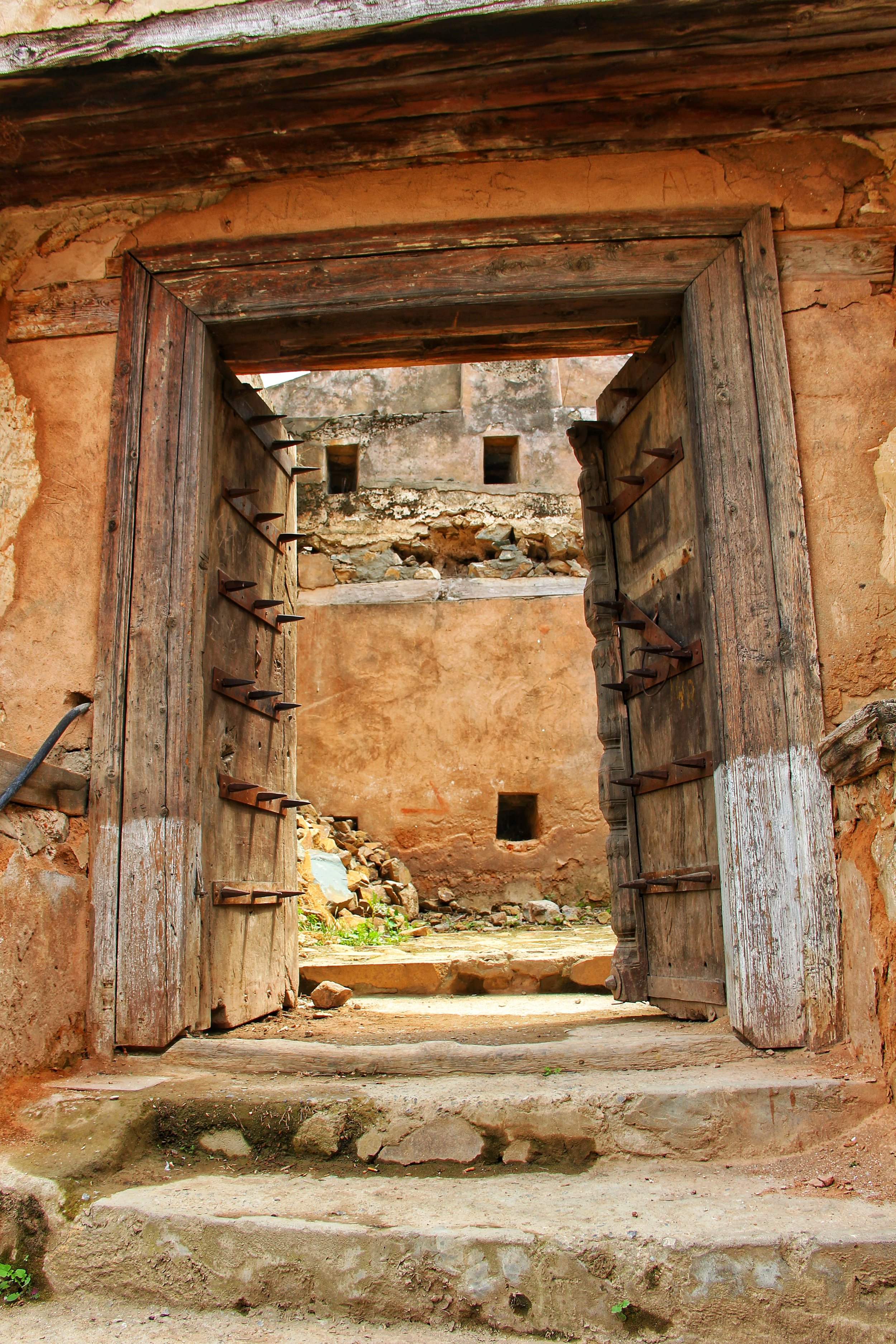
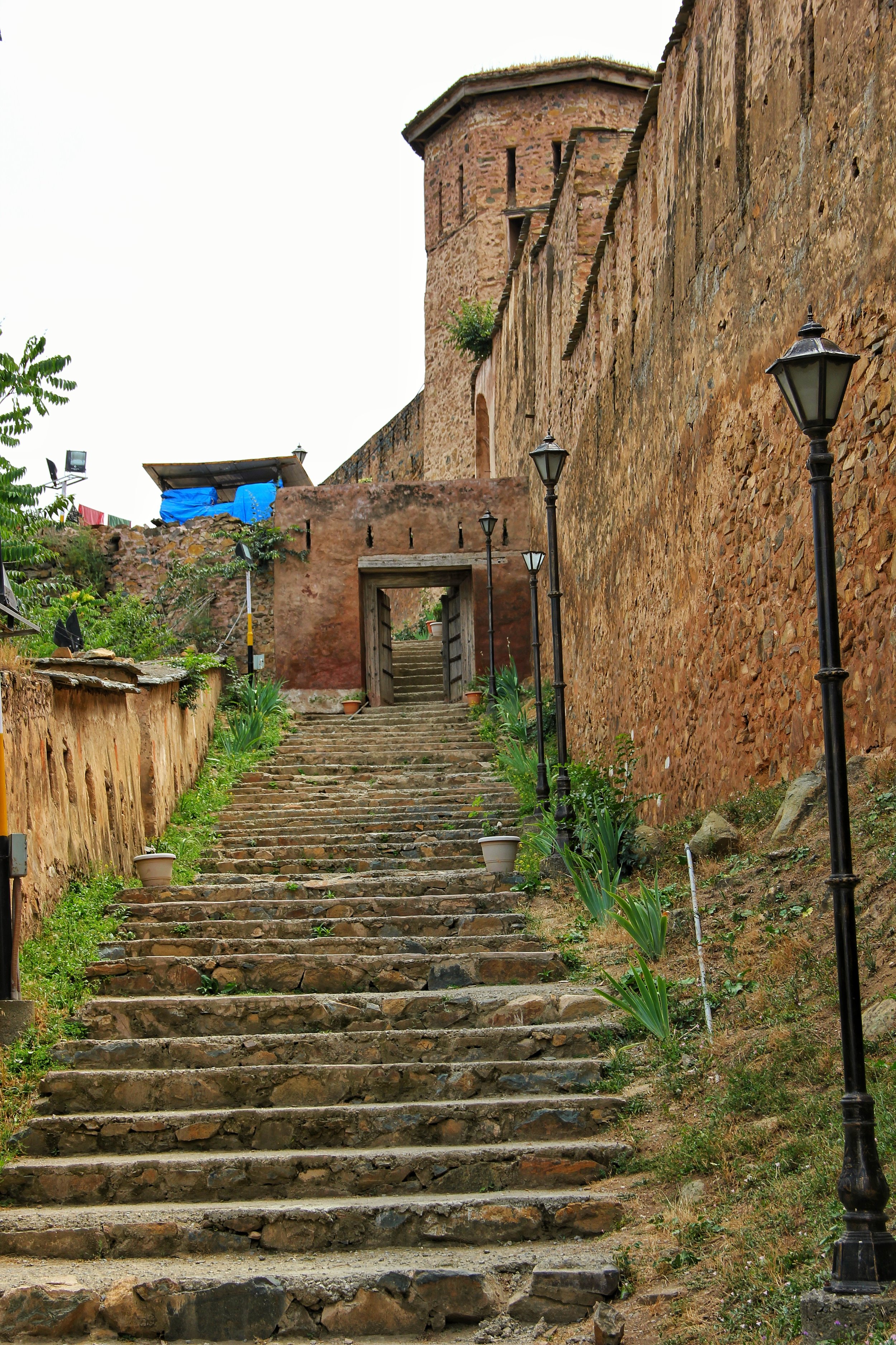
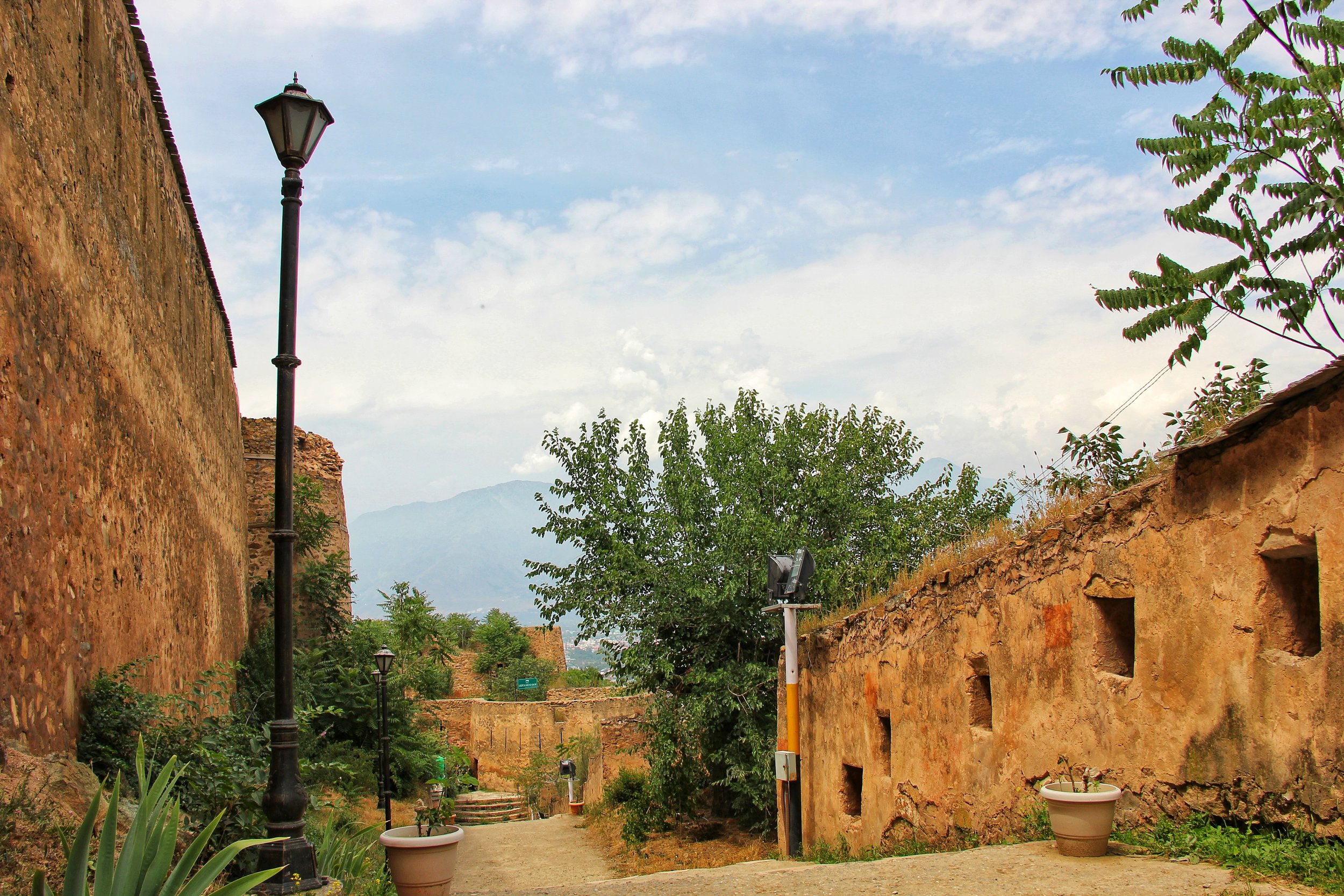
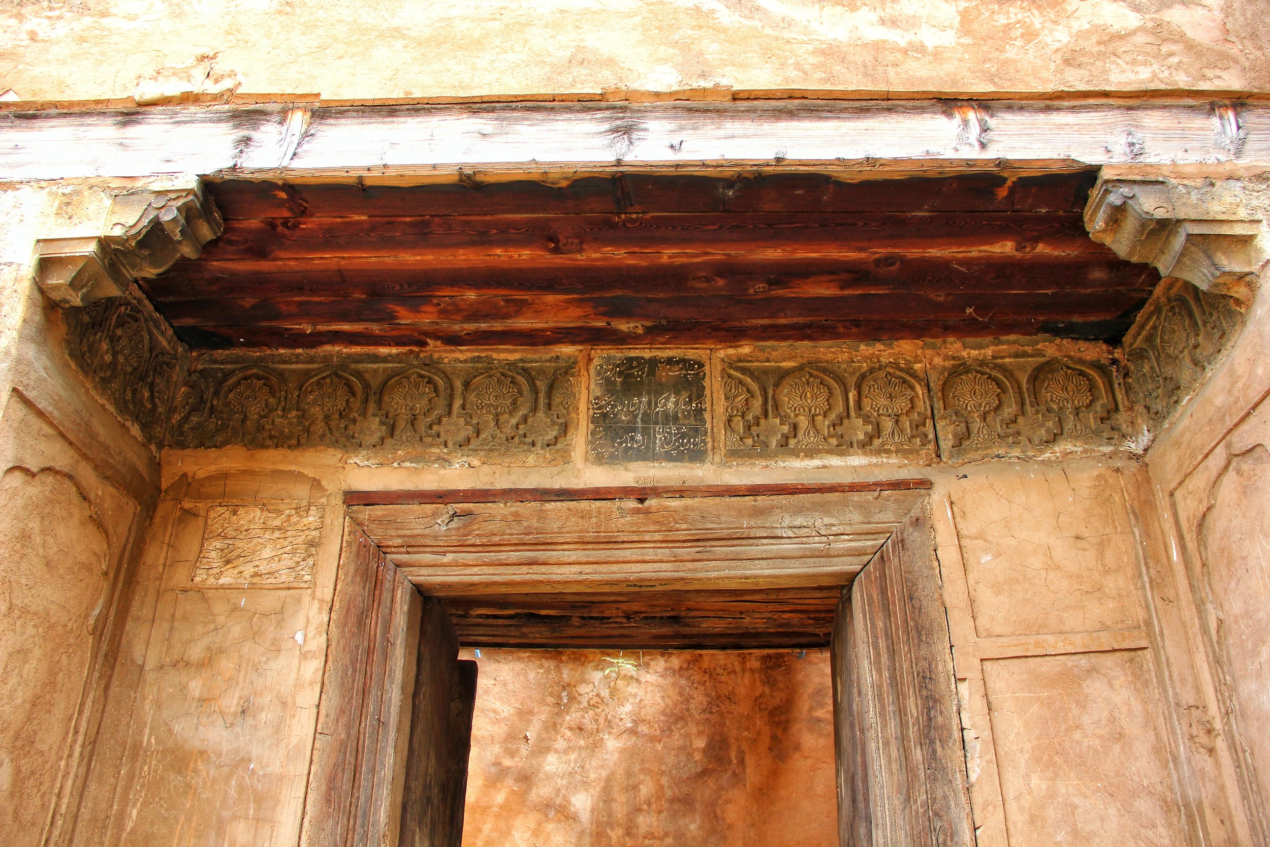
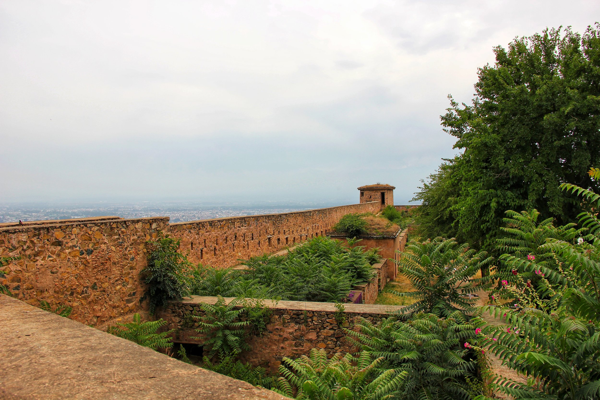
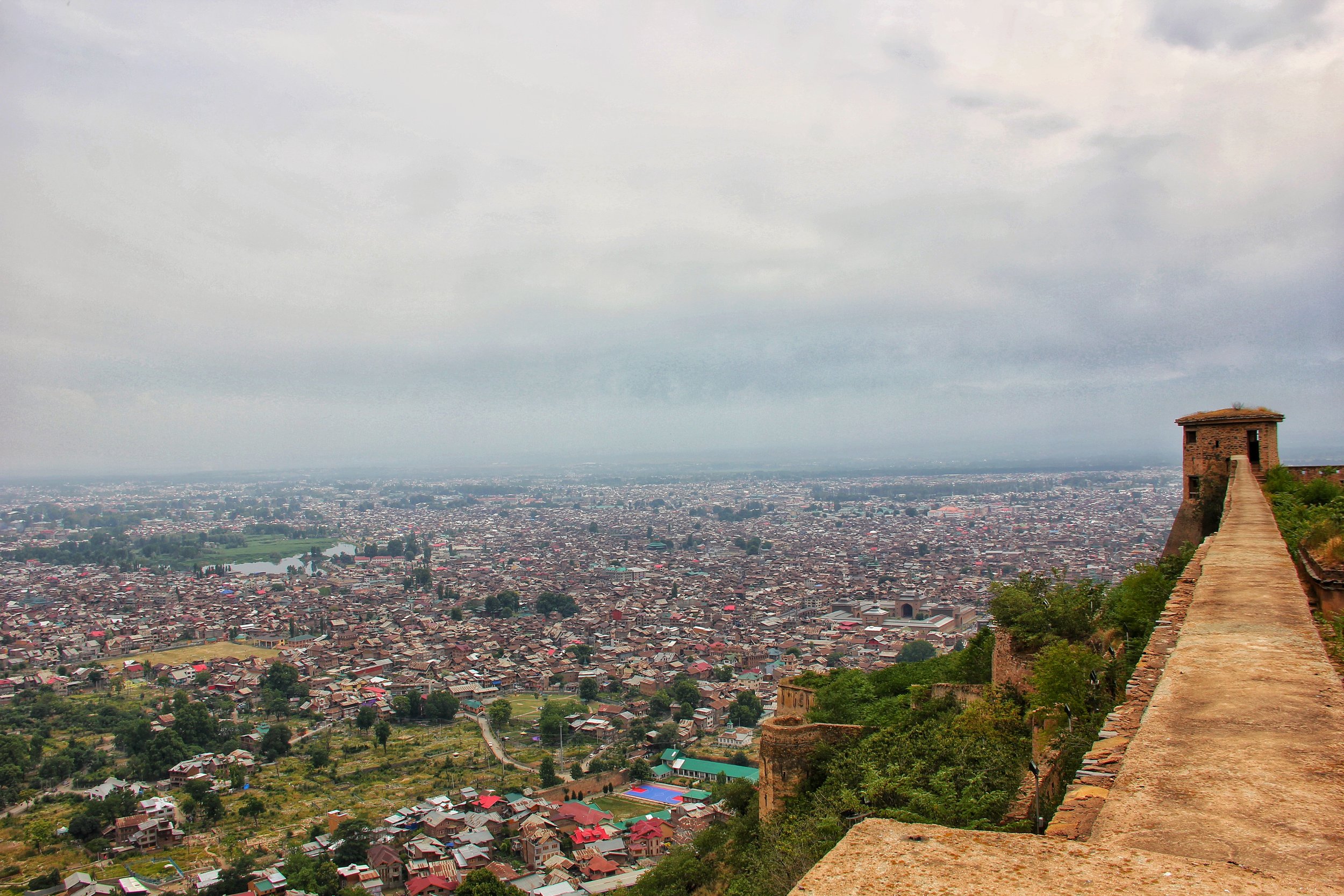
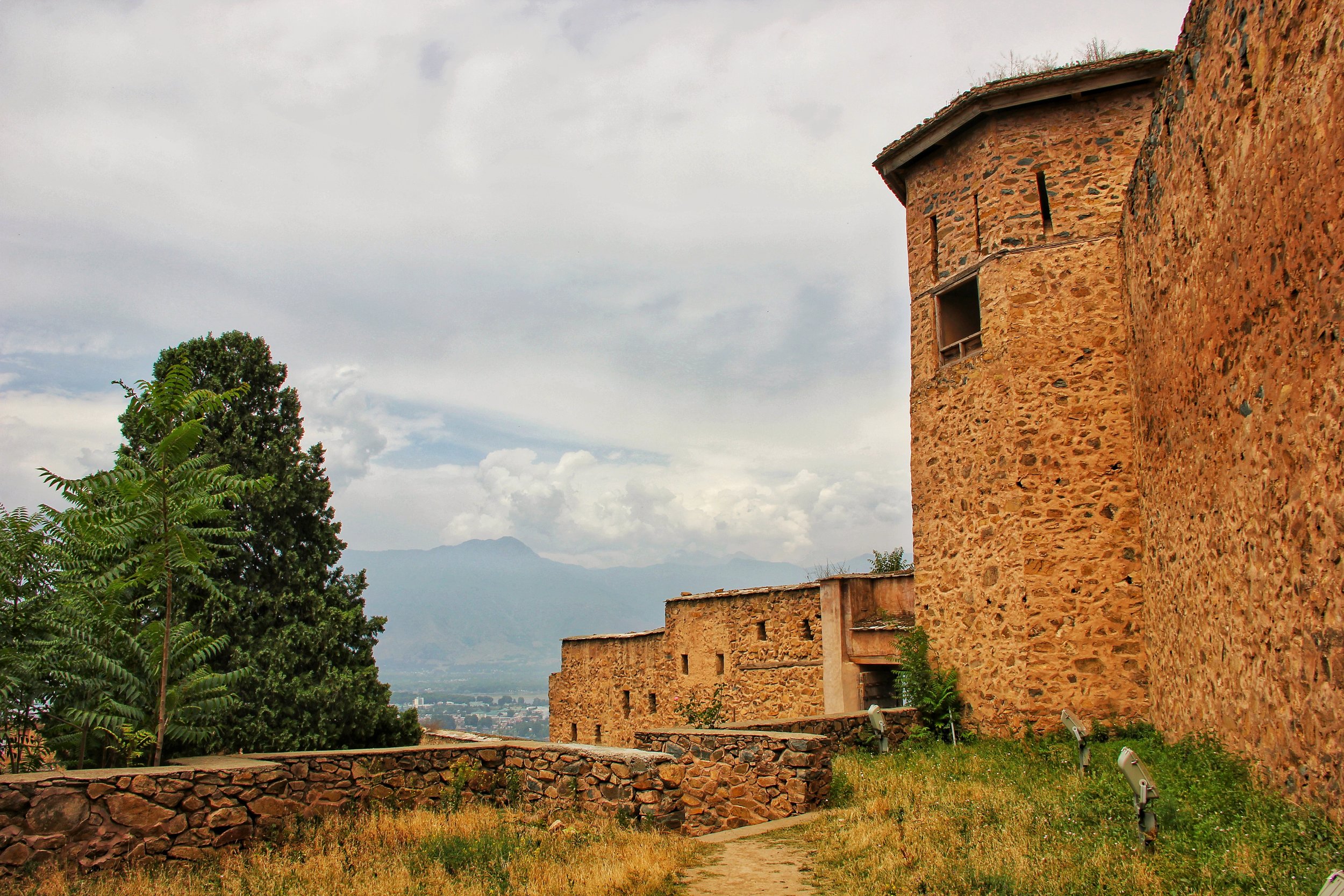
The imposing Hari Parbat Fort. The present Fort was built by the Durrani Afghans in 1808 though originally the fortifications around the hill were built during the reign of Akbar who wanted to make a new capital here. I did some explorations around the Fort two weeks back and found some interesting things around. The original Fortification wall built by the Mughals still exist in parts around the lower parts of the Hill.
The most fascinating fact was that there was a tunnel from the Fort which led one to the shores of the Pokhribal Lake, an extension of the Nigeen Lake, right from the top of the Fort. The Tunnel entrance is still there at the Pokhribal Lake. Also a ventilation hole around 10 ft is still preserved in the Badamwari Garden. The Tunnel is now blocked so the secret passage way cannot be explored further. The Hill also holds the Shrine of Makhdoom Sahib such encompasses various historical structures of the Mughal Era, as well as the Sharika Devi Temple and the Chatti Padshahi Gurudwara.
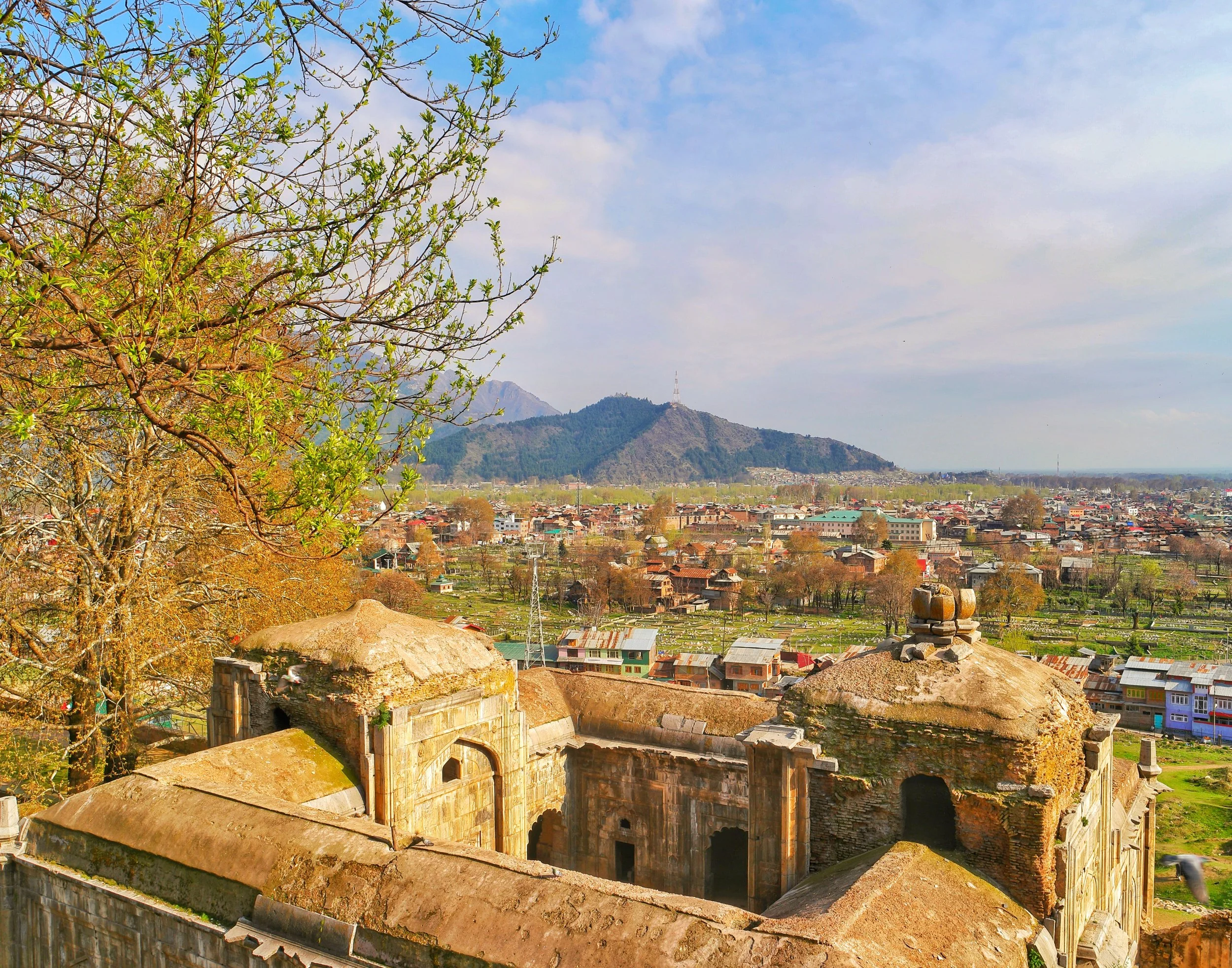
The Akhun Mullah Mosque on the Hari Parbat
An alternate view of Srinagar old Town. As seen from above the Mosque of Akhun Mullah Shah near Makhdoom Sahib a little way up from the Kathi Darawaza. This little Mosque was erected by Dara Shikoh in attractive grey limestone to honor his tutor Akhun Mullah Shah. The Mosque was built in 1649 AD and it has a stone lotus over it's pulpit, the only one of its kind in Kashmir. Another little architectural gem of Kashmir. In the background is visible the Shankaracharya Hill with the Shankaracharya Temple, another gem that was made in the 7th century AD.

Massive Chinars overlooking the Srinagar city in the compound of the Akhun Mulla Mosque

The Chatti Padshahi Gurudwara as seen from the Hari Parbat
The Chatti Padshahi Gurudwara, one of the most revered Gurudwaras in the state of Jammu and Kashmir, in Srinagar as seen from the Akhun Mullah Shah Mosque. This Gurudwara is situated in the Rainawari locality near the Kathi Darawaza on the foot of the Hari Parbat. It is associated with the Sixth Guru who is supposed to have roamed around in the Valley spreading the message of Guru Nanak Dev ji.

Pokhribal Lake a part of the Nigeen Lake and the Lepers Colony behind it

The Boat Club at Pokhribal Lake at Srinagar
This pic was taken from the top of the now in ruins outerwall of the Hari Parbat Fort. The water body that you see here is called Pokhribal and it's an extension of the Nigeen Lake. Underneath the massive Chinars is a Shamshan Ghat run by the Ahle Singham, a local Sikh Group. The shed is where they cremate the bodies.
The White building is the Boat Club though there surely wasn't much boating happening and the place looked derelict. Just a few guys using the pier for trying to catch a fish on their improvised fishing rods. The White structure across the Lake is a water treatment plant or something on those lines.
Behind the plant there are old buildings and a big old Hospital. This is Kashmir's Leper Colony. This isolated spot was where all the Lepers in the state were kept. Due to ignorance Lepers were shunned and were forced to live in isolation over here. In time they married amongst themselves and had families. Now three generations of the Lepers families live here. The Lepers are still provided daily / monthly rations. Generally people tend to stay away from this place.
Next time will surely visit the Leper Colony. It's a place time and people forgot. And of course the pic has the Zabarwan, the Lakes, the Chinars and all other things usually associated with Kashmir.

A Family home and its field by the banks of the Pokhribal Lake. On the right you can see the Tunnel which linked the Lake to the Fort on the top of the Hill

An massive old Chinar by the Pokhribal Lake with an ancient structure. Next to the Chinar is a crematorium used by the Sikh families living in this area.

A view of the Nigeen Lake in the foreground and the Dal Lake in the background with the Zabarwan Mountains in the background.

The Jamia Masjid in downtown Srinagar as seen from the Hari Parbat
The Jamia Masjid in the Nowhatta area of Srinagar surrounded by the old part of Srinagar. This beautiful Mosque is one of the largest Mosques in Kashmir and has a capacity of well over 30,000. It was built in 1394 AD by a Sultan of the Shah Miri Dynasty. It is a beautiful piece of Architecture indeed though few outsiders visit this place. This was clicked from the Mosque of Akhun Mullah Shah above the Kathi Darwaza both of which are ASI designated monuments and again are beautiful examples of Islamic Architecture.

The Pir Panjals in the background of Srinagar city as seen from the Akhun Mullah Mosque
The "Outsider" Kashmiris
The Story of outsiders who came and finally settled in Kashmir. And today are a part of Kashmir like any other Kashmiri.
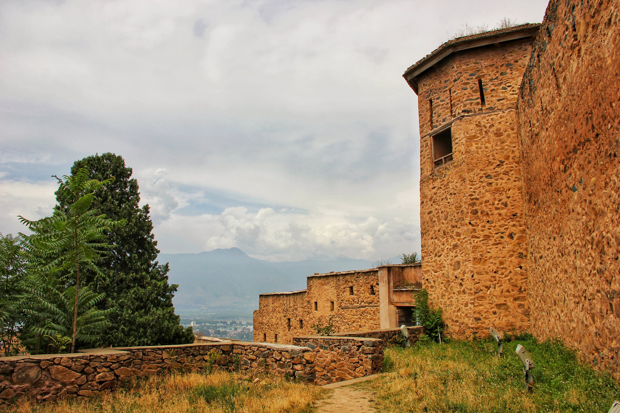
The Outsider Kashmiris
Kashmir has for centuries has fascinated people from all around attracted by the sublime climate, the scenic settings and the genial people. Its not for nothing that its the most fabled (and the largest I might add) of the Valleys that nestle in the Himalayas. And for the same reason it had an attraction and many Conquerors, Adventurers and Refugees sought respite in this Valley. Of course most of you would be familiar with more than famous couplet by Amir Khusrau “Gar firdaus bar-rue zamin ast, hami asto, hamin asto, hamin ast.”
Of course my bias towards Kashmir is apparent to anyone who follows my Posts. Thats natural as I come from Kashmir and still spend substantial time in the Valley in spite of what I call the “Troubles” like they did in Northern Ireland. Its a complicated place with a complicated History and complicated problems. And that's all I say about that. The “Troubles” I mean.
Today I would like to talk about an aspect that not many know about. Its about people who came from outside and made the Valley their home. They didn't always arrive voluntarily and they didn't always arrive in the best of conditions. But in the end they added another flavor to the Bouquet called Kashmir. For the sake of privacy I will not mention the the names or the family names but just give you an idea on their background and how they ended up in Kashmir. And now all these people are very much a part of Kashmir. I will for the sake of convenience mention three instances of people from outside Kashmir who are now a part of the Kashmiri fabric.
The first one is about the Architect from Dubrovnik in present day Croatia but in those days a part of the Austro-Hungarian Empire. The Architect was commissioned by a Maharajah in present day Gujurat to design and build his Palace. The Architect came down on the Maharajah's commission and built the Palace and at the same time fell in love with the country. Except for the hot weather. To compensate for that he moved North and established a Hotel in Lahore and Murree and eventually ended up in Kashmir. He established Hotels in Srinagar and Gulmarg as well. And boy were these places famous. The great Explorer and Soldier Sir Francis Younghusband (for those not in the know he captured Lhasa in a fight with the Tibetans) had this to say about the Hotel and Srinagar 'Srinagar is indeed a gay place for the summer months', he wrote, 'with games going on every day, dances nearly every week, dinners, garden parties and picnics.' And that's Sir Francis Younghusband speaking.
Most of you connected to Kashmir would have well made out which Hotel and which family I am talking about. And of course now they are a fully Kashmiri family in all respects. But still it makes for a fascinating story. I wish someday someone from their family would write a Book on the story of their family. The Hotel in Srinagar if you can believe it had a Chandelier presented to it by none other than Nikita Khrushchev himself. Yes Nikita Khrushchev of the “We will bury you’ infamy.
Moving on there is another family which has its roots in Afghanistan. The Afghans ruled Kashmir for a long period of time and as such there are many families that trace their origin to Afghanistan. But this particular family had an interesting story. They belonged to the ruling Barakzai clan but in a war of succession they fell on the wrong side of a family feud. Most of their relatives on their side met a brutal fate and were tied to the mouth of cannons and you know the rest of the story. However a few of them managed to escape and made their way into Kashmir. Owing to their Royal status and being Barakzais the Dogra Maharajah recognized their importance and inducted them into their service. One of the Afghan Gentlemen was appointed the Inspector General of Police of Kashmir and the family was then settled in Kashmir. The family did well and today the Great Grandson of the original migrants from Afghanistan is a friend of mine. Incidentally they also have a great Hotel in Srinagar amongst other businesses.
The two instances I gave you are of people who came voluntarily one out of choice and one out of distress and made Kashmir their home. Then there is the story of two Princes and their entourage who were taken as “Guests” (read Hostages) to Kashmir from their homelands in Gilgit and Hunza to ensure good conduct of the Rulers of Nagar and Hunza as they had rebelled against the Central authorities in Kashmir. Once they were subjugated again some guests were taken from the Royal families to Kashmir to ensure conduct compliance by the Rulers in line with what the Kashmir authorities wanted. Of course the Two Princes and their retinue could never return and settled in Mohalla in Rainawari in Kashmir which is today called the Botraj Mohalla and the descendants of the Princes still continue to live in the Mohalla. They tend to marry amongst each other and keep alive their Religious and Lingual traditions. And they still continue to be respected as descendants of a Royal family from Hunza by their Kashmiri neighbors and held in high esteem.
These are just three examples of foreigners who came in and kind of assimilated with the local population. Well almost. But most of their stories are now forgotten. Only remembered by a few who care to remember. Maybe one day all such stories would be compiled. Maybe.
Now to look for a pic to go with the story.
Nothing better than the Hari Parbat Fort. The only existing Fort in the Valley.
Pic from July 2018. Hari Parbat Fort, Srinagar, Kashmir. Pic Courtesy Ankit Gupta
Kiki’s Blog
Stories from the Himalayas







Five years ago the Galwan Valley was in the News for the wrong reasons after a deadly clash between the Indian and Chinese Armies in the Valley located in Ladakh lead to many deaths on the contentious Border between the two countries in wake of continued Chinese intrusions into Indian territory.
This area along the Shyok River, of which the Galwan Nallah or the Galwan River which forms the Galwan Valley has been off limits to Civilians since long but now the Indian Government has decided to open up the area for Civilians and we were amongst the First Civilians to venture into this beautifully desolate part of the Eastern Karakorams in Ladakh. Earlier Civilians could only venture upto the Village of Shyok from where the Shyok River takes a U turn and flows in a Northerly direction.