
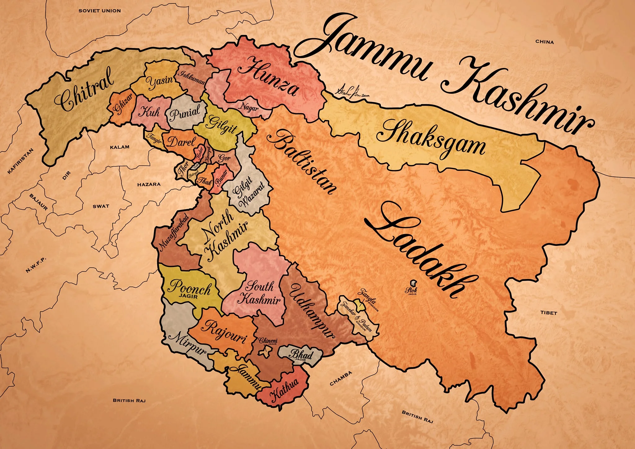
Historical Map of the Dogra Kingdom of Jammu and Kashmir
The State of Jammu and Kashmir as it was at its largest extent under the rule of the Dogras. This Map helps people understand the complicated Geography and Diversity of the erstwhile State of Jammu and Kashmir.

Historical Map of the Dogra Kingdom of Jammu and Kashmir
Another interesting Map of the previously E Jammu Kashmir by my talented friend Arsalan Khan who also belongs to the Riyasat. We had previously had an Article on the various Indigenous People of Jammu and Kashmir. Its not perfect, has its anomalies but it still an indicator of the diversity of the State from a Political angle. This Map shows the Dogra Kingdom at its most expansive. And i would like to point out that all these different areas were won over by the Dogras / Dogras under the Sikhs in War except Kashmir which was granted as a part of the Treaty between the British and Raja Gulab Singh on the payment of War Indemnity of 75 lakhs. It should be pertinent to mention that the Dogras also played a part in the Sikh conquest of Kashmir earlier from the Afghans. Also it suited the British in 1846, when the Sikh Kingdom still existed, to have a parallel power which they could use as counter against them and in this case it was Raja Gulab Singh and his hardy Hill Men. Here is an account of the transition of the Rulers in Kashmir From the Mughals to the Dogras giving a background of how Kashmir passed from the Mughals to the Afghans to the Sikhs and onto the Dogras.
Just an explanation on the parts :
Chitral : This is the most controversial inclusion as it always stirs up a Debate. Was Chitral at any point of time a part of the Dogra Kingdom ? Different historians had different versions on this but one thing was clear that the Chitral Kingdom did pay tribute to the Dogras. This has been verified by me personally with Members of the Chitral Royal Family. Of course later due to the Great Game Chitral was made a part of the Malakand Agency. Here is an account of the Chitral Expedition an important event in the History of Chitral
The Indigenous people of Jammu and Kashmir
Hunza / Gilgt and around : Besides Gilgit and Hunza there were other Hill States which used to be constantly at loggerheads with each other but used to occasionally unite against foreign aggression. These were Iskoman, Nagar, Yasin, Ghizer, Punial and Darel among the more notable ones. Gilgit was an important location and one of the most forward bases of the British in the Great Game which I have described in this article titled The Gilgit Game. In addition to these there were various other smaller “Shinaki Republics” which as the name suggests were Groups of Shina speaking people in communities in the area generally named as Chilas. The Imperial Gazzette of 1908 described them as such :
“A group of small republics in the valley of the Indus, lying west of Kashmir and south of Gilgit. The territory extends from the junction of the Astor river with the Indus to Seo on the right bank and Jalkot on the left bank of the latter river. Within this area the people are grouped in communities inhabiting one or more nullahs, each community forming a separate republic. Starting from the junction at Ramghat these are, in order : on the right bank, Gor, Kinergah, and Hodar ; and on the left bank, Bunar, Thak, Butogah, Giche, and Thor. They constitute the area known as the Chilas subdivision of the Gilgit Agency, while Chilas proper includes Kinergah, Butogah, and Giche. Lower down the river are Darel, Tangir, Khilli, and Seo on the right bank, and Harban, Sazln, and Jalkot on the left bank.
After the conquest of Chilas by Kashmir in 1851, the Maharaja imposed a tribute in gold-dust, and arranged for the administration of the country as part of the Gilgit district. A British Agency was re-established at Gilgit in 1889, which included, among other terri- tory, the Chilas subdivision described above except Thor. In 1892 a British mission to Gor was attacked by the Chilasis, which led to the occupation of their country and the appointment of a Political officer at Chilas. The right of the Kashmir Darbar to construct roads and station a limited number of troops in the territory was secured, but the autonomy of the Chilasis was guaranteed. Under the revised arrangements made in 1897 the republics pay small fixed sums to the Maharaja, and in 1899 Thor was incorporated in Chilas. Darel has rendered a tribute of gold-dust to Kashmir since 1866, when the Maharaja's troops raided the country. The tribute is now paid through the Punial governor. Tangir pays a small tribute to the governor of Yasin. The remaining communities have no political relations with either Kashmir or British India, except Jalkot, which from its position dominates Thor and the head of the Kagan valley in the North- West Frontier Province.”
Then on the other side we have Baltistan and Ladakh about who most people know a bit of the History and how these were conquered by General Zorawar Singh between 1834 and 1840. This is a brief account of the conquest of Ladakh and Baltistan by the Dogras. In Ladakh also once the Royal family was removed from Leh, the Ladakhi King was granted the Village of Stok and some surrounding area as a Jagir. Thats where the Stok Palace was built. Much the same way the Raja of Zanskar was granted the Jagirdari of Zangla. Or something to that effect. This is a general note on Zanskar to help in the understanding of this one of the most remote regions of the Himalayas. And ignore the Shaksgam part as its shown beyond its size. This article gives you an insight into the Shaksgam Valley. Another important part of the State which is missed out in this map is the region between the Karakorams and the Kun Lun Mountains called the Aksai Chin.
And then of course we have the Kashmir Valley itself. It was divided into North and South Kashmir for administrative purposes. To the West of Kashmir was Muzaffarabad which was the Pahari area along the Jhelum Valley starting from Uri. This is the part I belong to close to the town of Hatiann Bala. Muzzafarabad is also the Capital of the entity referred to as “Azad Jammu Kashmir”.
Then of course we have Poonch which was a Jagir granted to the family of Raja Suchet Singh, a brother of Raja Gulab Singh. It had a history of its own and struggled for a while to be independent of their Jamwal Cousins which only resulted in the Jagirdari being terminated for a bit. Here is an account of what transpired in the Kingdom of Poonch. There was also the very small Jagirdari of Chenani, which is a small Town on the Highway and I remember that there used to be a Palace of sorts over there. More than that I remember because the erstwhile Raja of Chenani was a friend of my Grandfather’s and i have seen him at my Grand Fathers’ place when I was very young.
And then there was Rajouri which is the stronghold of the Gujjars and most of them are based here during the Winters. Next to Rajouri was Mirpur which was really a part of Punjab and the people were called as Mirpuris. Due to the building of the Mangal Dam many Mirpuris went to the UK and thats the reason you have a strong Mirpuri community in the UK.
And then we had the Duggar heartland of Jammu and Kathua which bordered Chamba with which it shares a lot of Cultural similarities. The district of Udhampur at that time included the whole of Udhampur and Ramban as well as Doda and Kishtwar. The Jagirdari of Badh or Bhaderwah was granted to the Ruler of Bhaderwah who was installed by Gulab Singh after getting the Chambyalis to give up all their claims over Bhaderwah. It used to be an integral part of the Chamba Kingdom. This is an account of Bhaderwah. It connects with Chamba over the Padri Gali.
Of course this will get many people excited and there would be counter views but the views mentioned above are my own based on what I have read and experienced. Kindly feel free to disagree. But as a request just dont start a discussion 1947 onwards as it wont get us anywhere.
This Map is available in hi-res as well. Do let me know if you want.
The Gilgit Game
Gilgit, strategically located is a vast valley around the point where the Gilgit and Hunza River meet beyond the Great Himalayan Range .. It was bound from the North on one side by the Karakoram Range and on the Western side by the Hindu Kush. Its location particularly later in history was one of immense importance once the Great Game started between Tsarist Russia and Imperial Britain.

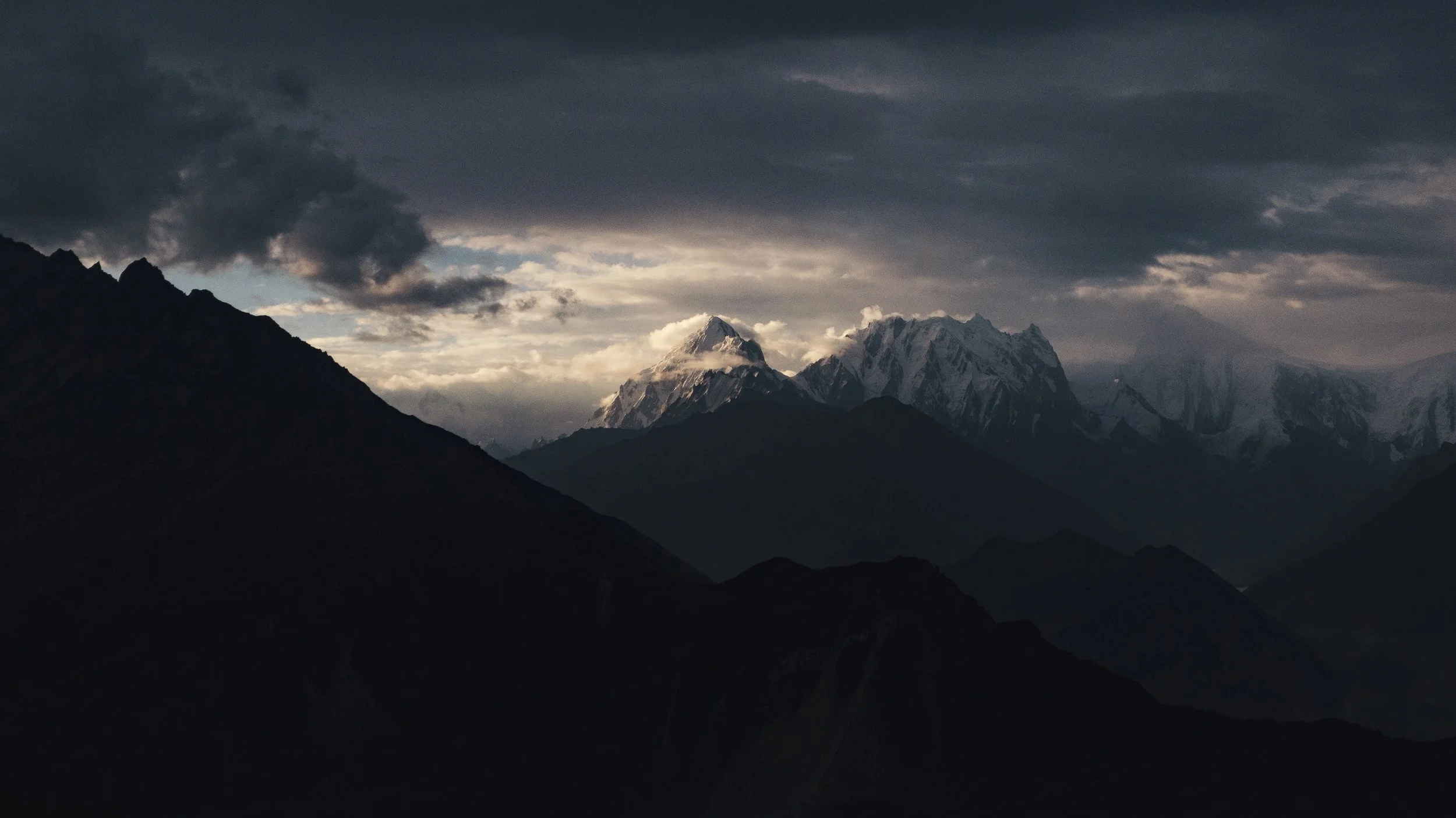
Rakaposhi Peak as seen from the Gilgit Valley. Pic Courtesy Wikipedia
The Gilgit Game
Gilgit used to be a part of the Riyasat E Jammu Kashmir till it was occupied by Pakistan in 1947 and formed what was called the Northern Areas. A few years back it was made a “Province” along with Baltistan and re-named as Gilgit Batistan.
Gilgit lies in a Region which consisted Dardic populations and this was also called Dardistan. As per the Gazetteer of Jammu and Kashmir the district of Dardistan consisted of the following sub-divisions : Astore, Bunji, Chilas, Gilgit, Hunza, Nagar, Punial, Yasin and Chitral. On the whole the areas was called the Gilgit Wazarat and Gilgit was the main town.
Anyone familiar with the Geography of the Region would know the strategic location of Gilgit, which forms a vast valley around the point where the Gilgit and Hunza River meet beyond the Great Himalayan Range at an altitude of just 1500 m. It was bound from the North on one side by the Karakoram Range and on the Western side by the Hindu Kush. Its location particularly later in history was one of immense importance once the Great Game started between Tsarist Russia and Imperial Britain. Before the Great Game also its location with access to Central Asia, Afghanistan, Tibet and Kashmir and thereon to India made it an important center of Trade.

Somewhere in Hunza
The history of Gilgit is mostly obscure but at some point of time Buddhism held sway here and it was Ruled by the Patola Shahis. Gilgit was a great center of Buddhist learning and many pieces of Budhist religious iconry and Manuscripts like the Gilgit Manuscript have been found here. It was from Gilgit that many Buddhist Monks went further into Central Asia to spread the message of Buddha. However at some point of time Buddhism declined like in other places in North India and the Tra Dynasty came into power after a brief period of Tibetan and Chinese Rule in the region.
The names of the Ra Dynasty (The King was called Ra), who were Hindus (but some claim Hindu) is largely unknown except for the last one who was called Shri Badut. This Shri badut was apparently and cruel man and said to be a Cannibal as well. He was apparently killed by a Persian prince who married his Daughter and became the first Muslim ruler of Gilgit. The death of Shri Badut is still celebrated in Gilgit. The name of the Ruler hence was changed from Ra to Trakhan and its the Trakhan Dynasty which continued to Rule Gilgit for many centuries to come. And it continued to rule well into the starting of the 19th century.
As per the Kashmir Gazetteer of 1890 : “The history of Gilgit that is, its reliable history-does not go back further than the commencement of the present century, when it was conquered by the Yasinis under Suliman Shah, Khushwaktia. Azad Khan, of Payal or Punial, displaced the Yasinis, and Tahir Shah of the Nagar family overturned the Payali Raj. Tahir left Gilgit to his son Sikandar Khan, who was ousted by Gauhar Aman of Yasin about 1841. There upon Karim Khan, brother of Sikandar Khan, sought aid from the Governor of Kashmir,who, with the sanction of the Lahore darbar, sent a force of 1,000 men under Nathu Shah to assist him. In the meanwhile Sikandar Khan had been murdered; so Nathu Shah, feeling doubtful of success, sent for reinforcements. When these arrived, he assaulted the Fort and took it by storm. Gauhar Aman, ou hearing of this, fled precipitately to Mastuj. "
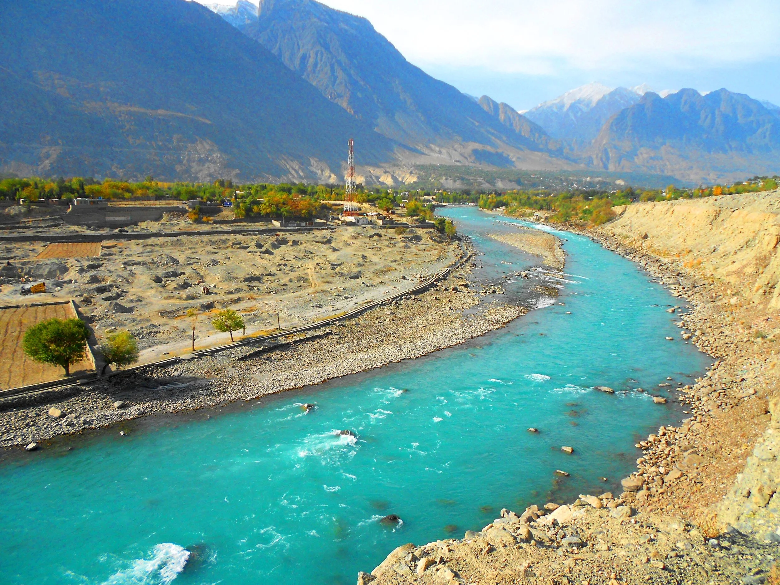
Gilgit River
From then on Gilgit became a part of the Sikh Kingdom and subsequently the Dogras. However it was not as easy as I am making it sound. There were multiple rebellions and it was during one such incident that Nathu Shah who was the Governor of Gilgit was killed. In 1856 again the Sikhs took Gilgit only to be relieved of it in the successive by Gauhar Khan. It was only after the 1857 and the First Mutiny that Maharaja Ranbir Singh sent a force to recover the country in 1860. In 1863 they rose again and another expedition was sent to Yasin. In 1866 Hunza was attacked by the Dogras along with their Nagar allies, but a trick was played on the Dogras and they were routed. A general alliance was formed against the Dogras by the Chitralis, Yasinis, Tangiris, Darelis and Hunzai and Punial was taken from them. However the Dogra garrison of 2500 at Gilgit held out and then reinforcements arrived and the Dogras re-claimed Gilgit and the surrounding country. Punitive missions were done and the status of Gilgit as an inevitable part of the Riyasat was finalised.
And by this time the Great Game had heated up and the Russians were right across the Hindu Kush and were almost at the Wakhan. This let the alarm bells ringing in the Empire Where the Sun Never Set. The British wanted to have greater influence on Gilgit and convinced the head strong Maharaja Ranbir Singh to let them station an Officer On Special duty to Gilgit in 1877. Gilgit was now the main listening Post in the Great Game and not far from there were the feared Cossacks of the Russian Army. After the death of the Maharaja the British appointed a Political Agent to Gilgit and effectively took over the administration of Gilgit. Gilgit Agency as it was called effectively became British and only in name was under the Maharaja’s rule. All the other neighbouring states were also slowly absorbed into the Gilgit Agency. Chitral was however made a part of Malakand Agency in NWFP. In 1935 the British leased out Gilgit from the Maharaja settling any doubts over Gilgit’s status.And so it stayed till Independence when the British on their return reverted Gilgit over to the Maharaja.

Gojal, Hunza - Nagar
It was now that the “Gilgit Rebellion” took place. The British left and the JK State took charge and Brig Ghansara Singh was appointed the Governor. The Gilgit Scouts, a regiment created by the British comprising of locals were incited by none other than their British officers to rebel and on 1st November after the Maharaja signed the Instrument of Accession they broke out in revolt. Both Brig. Ghansara Singh and his second in command Col.Majid were arrested by the Gilgit Scouts. And then the inevitable happened and the Non-Muslim population was put to the sword. The madness of the sub-continent spread to Gilgit as well. And of course the majority of the Population also wanted to be a part of the new nation on the West. The matter was thus settled for the time being. The same Gilgit Scouts moved further and sieged Skardu and captured kargil and even went as far as Zanskar.
The question remained as to why the British officers openly supported and even planned the whole operation. It was a Military Coup and no civilians took part. And even more strangely the British were eager that Gilgit be a part of Pakistan. The reason for the same was actually quite simple. The British as well as the Americans still wanted Gilgit as a base. The approach to Gilgit from Srinagar was mainly through the Burzil Pass which connected Guraiz with Gilgit. And then there was the Rajdhan Pass. Both these Passes were blocked for snow in the Winters and the Burzil would stay shut for atleast 6 months in a year. On the other hand the approach to Gilgit from NWFP was much easier and through an all Weather Road. Secondly the “Allies” were aware that they would be in a better position to influence Pakistan rather than India due to obvious reasons. And hence the whole operation planned and implemented. It was one of the smaller Games of the Great Game and is called by some as the Gilgit Game. There are many detailed writings on this so get a copy if you want more details.
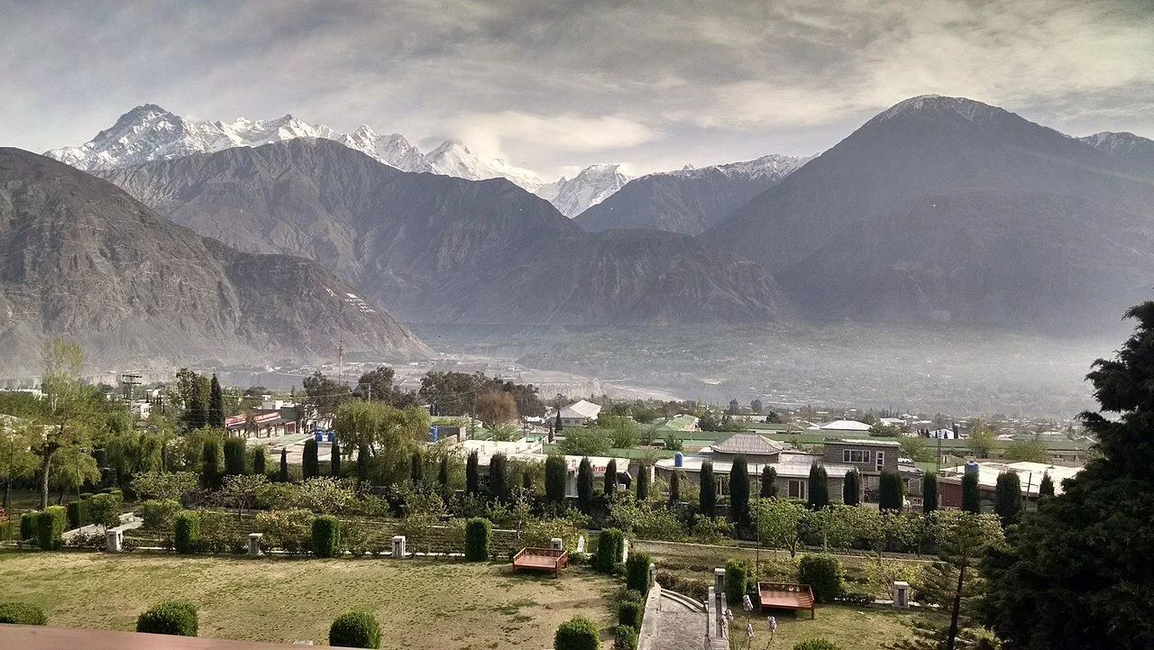
A view of the Gilgit Town and Valley. Image Courtesy Wikipedia
A pic of the Gilgit Town and the vast Valley surrounding it which made it perfect for an Airbase among other things. The Soviet union was just minutes away by flight. Pic courtesy Fehd Raza. Summer months.
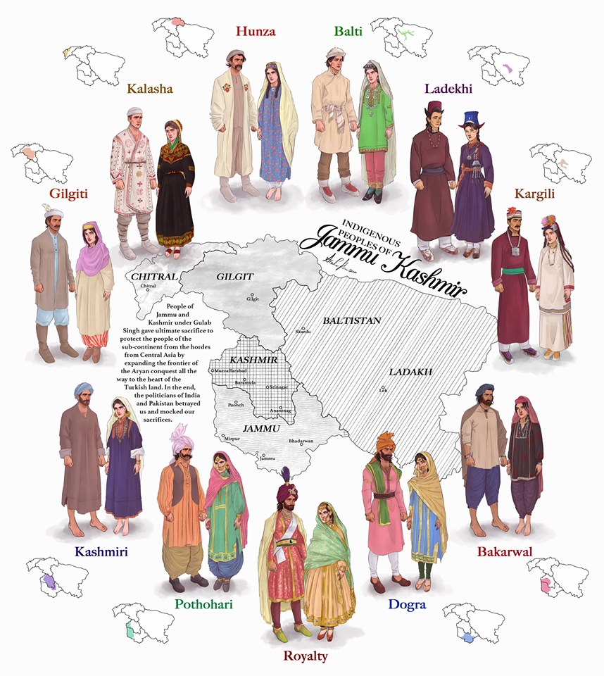
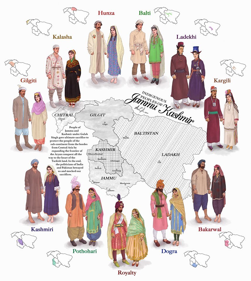
The Indigenous People of Jammu and Kashmir
The erstwhile State of Jammu and Kashmir was one of the most diverse State in the country in Ethnic, Religious and Lingual dimensions. The main "People" of Jammu and Kashmir and its different regions are briefly described in this Article.

The Indigenous People of Erstwhile State of Jammu and Kashmir.
This is a graphical representation of the people of Jammu and Kashmir made by Arsalan Khan and Rajja Sourav Singh Sarmal. A brief description of each by me to help in better understanding (Clockwise from top) :

Hunza (Burusho) Ladies. Pic credit Wikipedia
The Hunza : The Hunza or the Burusho people inhabit the Hunza Valley and neighboring Valleys in the extreme North of the state. They speak the Burushaski language which as a language has not been identified with any language Group. The Hunzai now mostly follow different schools of Islam.
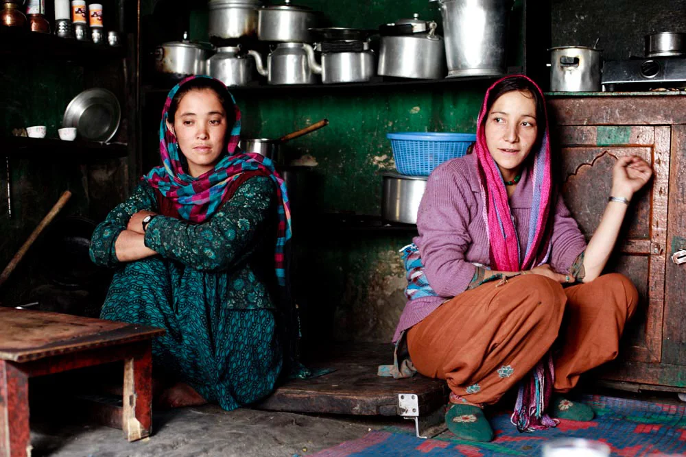
Balti Ladies. Pic Courtesy : https://www.behance.net/gallery/12289037/The-Balti-People-of-India
The Baltis : The Baltis are the inhabitants of the Baltistan and are of Tibetan origin with Dardic admix. Their language is Balti, which is a part of the Tibetan language Group. Infact it has the greatest similarity to old Tibetan. The Baltis follow Islam.

A :Ladakhi Lady in traditional Dress. Pic Courtesy Jimmy Nelson
The Ladakhis : The Ladakhis are the inhabitants of the Ladakh region and are of Tibetan descent. The Ladakhi language is from the Tibetan family. Ladakhis are Buddhists as well as Muslim.

Ladies in Kargil. Pic Courtesy Roots Ladakh
The Kargilis : The Kargilis or the Purigpas as they are called inhabit the Western part of Ladakh at the crossroads with Baltistan and Kashmir. Their language Purigi is a dialect of Balti and as such they are also a part of the Tibetan family. Purigis are mostly Muslim.

Bakarwal Men
The Bakarwals : The Bakarwals and their close cousins the Gujjars are traditionally nomadic pastoral people who inhabited the foothills of the Himalayas and moved to the Mountains in the Summers with their livestock. They (Gujjars/ Bakarwals) form the majority in the Poonch Rajouri region and spread among the Jammu Division and in Kashmir as well. They follow Islam.

Maharaja Ranbir Singh, the Dogra Ruler of Jammu and Kashmir state during who’s Rule the Dogra Kingdom reached it largest extent and also included Chitral
The Dogras : The traditional dwellers of the Jammu region or the “Duggar” as the region was known. They live in the foothills of Jammu and are spread into Himachal Pradesh as well. The Dogras speak the Dogri language which is from the Western Pahari Group of languages. The Dogras are mostly Hindu though a significant number converted to Islam and were referred to as Chibalis.
The Potohari : The Potohari/ Pahari are the most Punjabic people of Jammu and Kashmir and live across the Potohar Plateau which stretches well beyond Rawalpindi. They are in sizeable numbers in Poonch. Their language Pahari-Pothwari belongs to the Lhanda Family of Punjabi. They are majorly Muslim but there is a strong Hindu minority as well.
The Kashmiri : The people of the Kashmir area found mostly in the Kashmir Valley. They are the biggest Indegenous Group of people in the state. They speak Kashmiri language which belongs to the Dardic family of languages. Kashmiris are mostly Muslim though a small minority of Kashmiri Hindus also exists.

Dard - Shina People in Kargil
The Gilgiti : The Gilgiti or the Dards are the inhabitants of the vast Gilgit Valley in the North West of the state. They speak the Shina language. They (Dards) are also found in other areas of the state like Gurez and Drass where they have said to have migrated from Gilgit. They follow Islam though a few follow Buddhism as well in Ladakh.
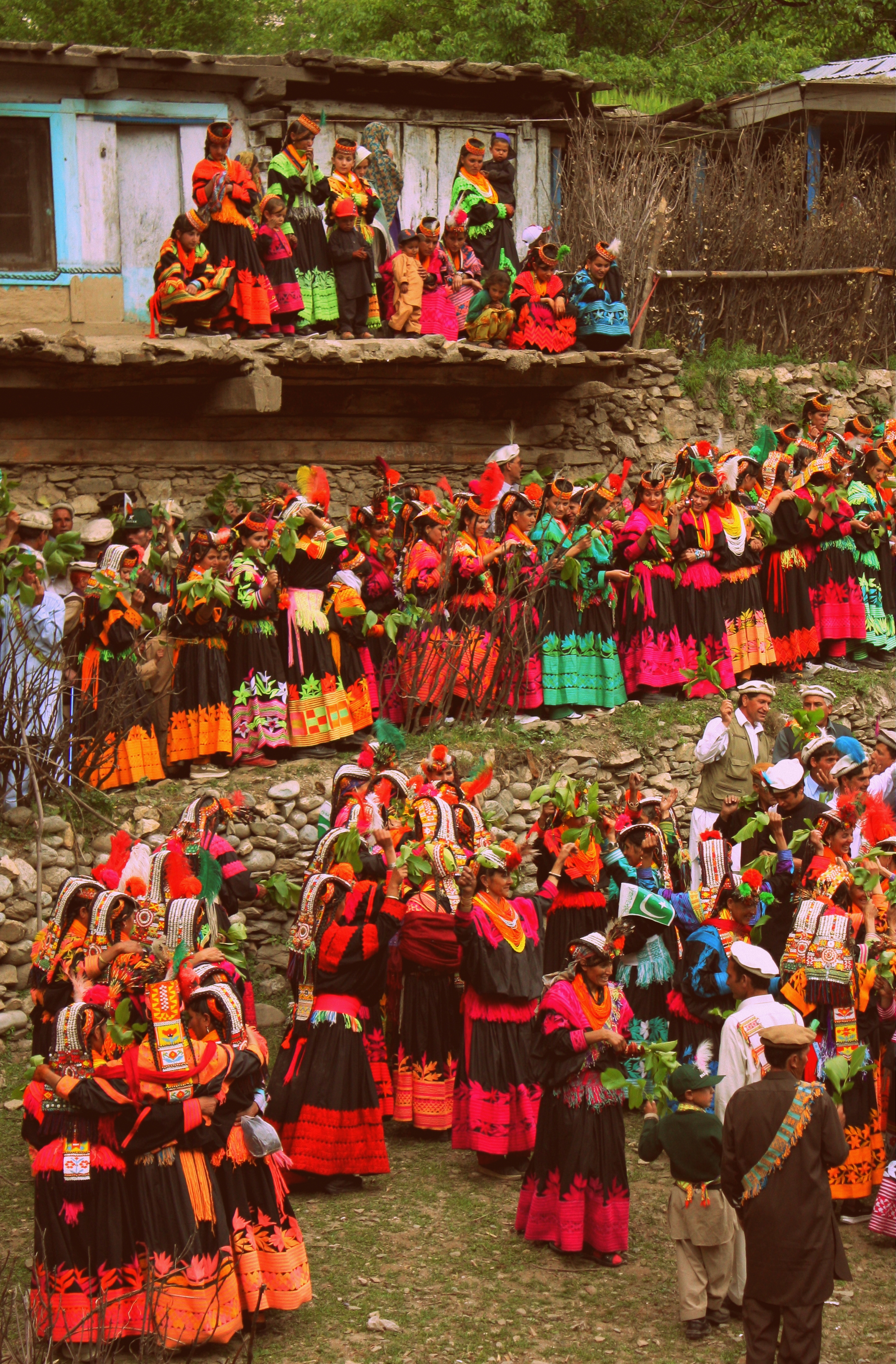
Kalash People during the Chillam Joshi Festiva. Pic Courtesy Wikipedia
The Kalash : The Kalash inhabit three Valleys in the Chitral Region now in KPK though at one time the Chitral Kingdom paid tribute to the Kingdom of Jammu and Kashmir. The Kalsha speak the Kalasha language which is a part of the Dardic family of languages. They have a distinct culture which has been under threat. Most Kalasha have converted to islam though a small number (3000 app) still follow traditional Animist beliefs.
Hi Res of Graphic can be downloaded from the link in the first comment.
The Dudu Timber Saga
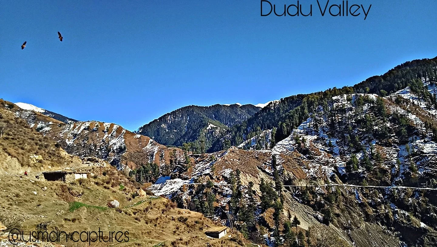
A tale from a time gone by when Forests were seen as great Resources of Timber and vast tract of these Himalayan Forests were given out on contract for Timber extraction. My Family was also involved in this Timber trade and were known as others in this business at Forest Leasees. This particular story is from the remote and unknown Dudu Latti Valley in Udhampur District in the Jammu Division of the Union Territory of J&K.
The Dudu Timber Saga
In today’s day and age the cutting of Forests is an abhorretion frowned upon by one and all. It was not always the same as once upon a time Timber was a great resource with multiple uses. Especially Himalayan Timber.
My family was involved in Timber business or “Jangalaat” as it was called back in the good old days when Timber and Forests were a resource to be exploited for Commercial gain. Cutting forests and selling them in the Market was an established big business in the Himalayan states especially in Jammu and Kashmir where Timber was one of the main resources of State Revenue.
Amongst the other hats he wore, my Grandfather was a Forest Leasee. A Forest Leasee was a person who took on contract a certain part of Mountain from the Government a part of Mountain. Under the terms of the Contract the Forest Leasee bid a certain amount for an area in Government floated Tenders. And once you got the Contract the whole Mountain was your and so were all the Trees. So once you landed up a Contract you sent your Men to the Jungle to cut down as many Trees as possible in the Contractual period.
It was a profitable Business I must say but not always as you would read as we go on. From the forests of Thandipora North of Kupwara, around Boniyar in Uri and even Pogal Paristan and Dudu Valley in Jammu. I grew up listening stories from my Father about those Forest Leasee days about how he would go to one of these remote Forestry Camps and spend the night there in Tents amidst the Bears and the Leopards. Of all the stories of those days my favourite one is about an incident which occured in a far away place in Jammu and Kashmir called the Dudu Valley in the Jammu Division somewhere in the wilderness between Udhampur and Kishtwar. Dudu Valley is now a part of the Latti Tehsil in Udhampur District.
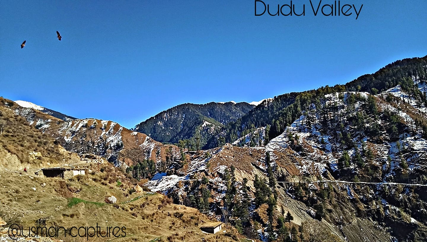
Dudu Valley is today a secluded unknown beautiful part of Jammu so you can well imagine what it would have been back in those days over a 50 years back. But what Dudu had in those days were thick Forests which it still retains in parts till today as Iam made to believe. My Grandfather landed a Forest Contract in the Dudu Valley which was quite an isolated part of the state at that time. Also it was quite far from our base in Srinagar in Kashmir, in the back and beyond of Jammu Division. But my Grandfather thought he got a good deal and went ahead and took up the Contract along with a Partner who was based in Jammu and Pathankot.
Dudu Valley is drained by the Tawi River as it emerges out of its source near the Kailash Kund Lake from the Kailash Kund Glacier in the heights of the Pir Panjals. As it happened none of the younger men in the family were ready to go to this place in the back and beyond of nowhere. So it was upto my Grandfather to make the Journey all the way from Srinagar to Dudu Valley partly by Vehicle, partly by Horse and partly by foot. My Grandfather was a tough and sturdy Pahadi guy who was always up for the challenge. And he took it up.
So religiously he used to come to the place every other week to check on how stuff was going on at the isolated Camp.And of course things used to be fine when he was there but due to other business matters he could but spend just a few days in the wilderness of Dudu and had to return to Srinagar after a few days.
Now in those times half the challenge lay in getting the Contract for a lucrative Jungle and the other challenge was getting the cut Timber down to the Depots in Srinagar and Jammu from where it was sold in the Market. The way the Timber was transported in those days was kinda elementary. You just lobbed the cut Timber into the Mountain River and it would do the hard work and transport the Timber down River to more plainer areas where they were corralled and fished out of the River and sent to the Depot. This might sound very funny but this practice is still in use in parts of the World and even I have seen it being used in Kashmir long after we got out of the Forest Leasee business.
So one fine day when the Dudu harvest was done the logs were as usual tossed into the River. It was a good harvest and a large amount of high quality Dudu Forest Timber was now afloat the Tawi on its way downstream. And there were always teams of our guys downstream at the collection point to collect the Timber and get it out. But as it turned out that someone messed up and my Grandfather who was supposed to be on top of the operation was busy elsewhere, with full confidence in his Partner who was incharge of team for collection. The Timber arrived at the collection point but it seems no-one was there to corral it and the look out posted there had passed out after a bout of drinking. As a result all Timber just floated down. All the high quality Dudu Timber just floated downriver still and soon crossed over to Pakistan. It was a great loss.
Of course Daddy, as I used to call my Grandfather, let loose his wrath on all the incompetent people responsible for this debacle and decided that he would give up the Forest Business. And from the vast experience he had amassed working in areas in JK which even today most people have not heard of he decided to move to Government Contracts for construction in these areas. Besides the experience he had also at his behest a large Group of the hardiest men of these Mountains, the Gujjars in his employment as we shared Lingual similarity with them and our language dialects were quite similar. This of course helped him getting many Government and Military Contracts. The crowning glory of his career being bagging the prestigious Contract to build the High Altitude Warfare School at Gulmarg.
Sometimes I wonder what it would have been to have lived in those times. That Era. When Exploring Mountains could be made into a profitable business. Anyways.
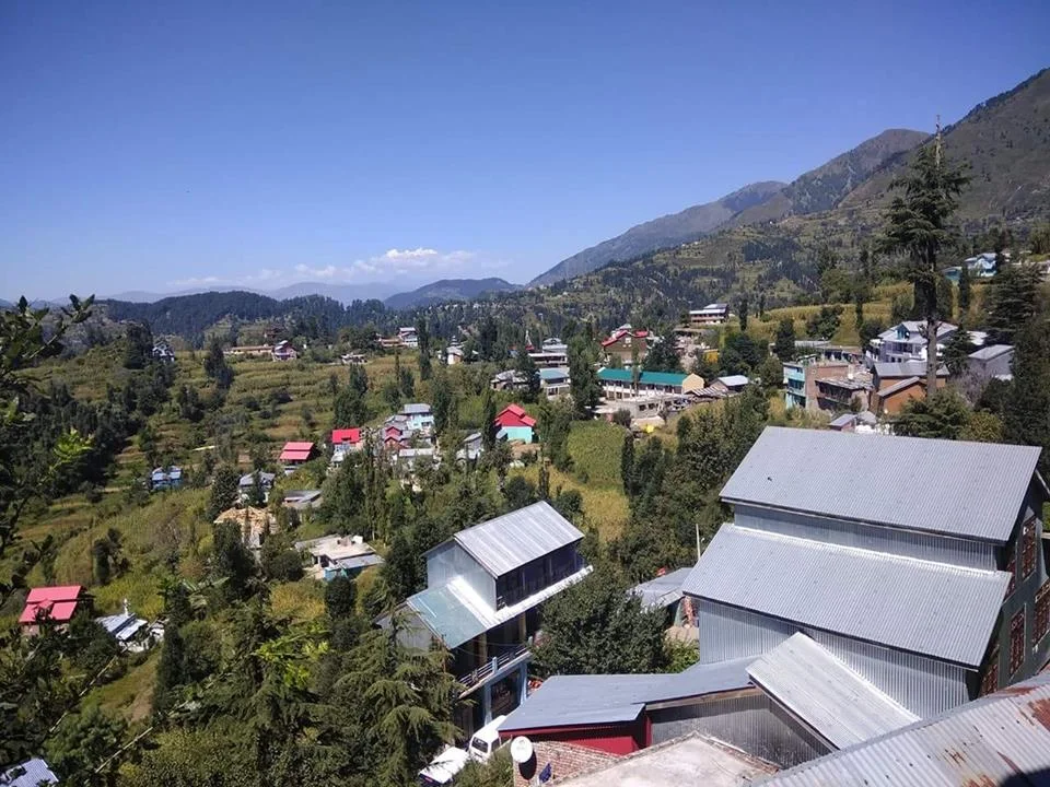
Try visiting the Dudu Valley. Its still as pristine, almost, as it was during my Grandfather’s time. :)
A pic of the Dudu Valley. Summer’s, this year. Pic credit the FB Page of Latti Dudu https://www.facebook.com/LATTItehsil/
The Enchanting Padri Gali
The enchanting Padri Pass or Padri Galli or Padri Top which connects Chamba in Himachal Pradesh with Bhaderwah in the Jammu Division of Jammu and Kashmir at around 10,400 feet amsl. It is located around 110 kms from Chamba Town and around 40 kms from Bhaderwah and is the highest point of the Chamba Bhaderwah Highway. This is one of the important Passes which connects J and K with Himachal. In older times Bhaderwah was a part of the powerful Chamba Kingdom which held Kishtwar as well and even Zanskar.

The Enchanting Padri
The enchanting Padri Pass or Padri Galli or Padri Top which connects Chamba in Himachal Pradesh with Bhaderwah in the Jammu Division of Jammu and Kashmir at around 10,400 feet amsl. It is located around 110 kms from Chamba Town and around 40 kms from Bhaderwah and is the highest point of the Chamba Bhaderwah Highway.
This is one of the important Passes which connects J and K with Himachal. In older times Bhaderwah was a part of the powerful Chamba Kingdom which held Kishtwar as well and even Zanskar. For many years Bhaderwah was the bone of contention between the Jammu Kingdom and the Chamba Kingdom until in the mid 1800’s it was taken over by Raja Gulab Singh of Jammu as terms of settlement of the Territorial boundary with the Chamba Kingdom after he acquired Kashmir as per the Treaty of Amritsar.

Bhaderwah today is a part of the Doda district and lies in the lap of the Pir Panjals. The Town of Bhaderwah itself was an important one and the Bhaderwah Fort stands watch over Town. Bhaderwah has a mixed population of Hindus and Muslims and the languages spoken include Bhaderwahi and Kashmiri.
There are many beautiful places in Bhaderwah which have for long been away from the Tourist lime light. Some of them are described below (Taken from JK Tourism Catalog) :
Kailash Kund : The Kailash Mountain overlooking the Bhaderwah Valley is supposed to be the abode of Shri Vasuki Nag. At 13067 ft the Kailash Kund is the source of the River Neeru which drains the Bhaderwah Valley. The Yatra follows Mani Mahesh Yatra and starts with the Chari Mubarak from the Village of Gatha in Bhaderwah and then goes to Vasuki Nag Temple in the heart of the Town. At Ramkund one halts for the night and there on to Kailash Kund. The annual Kailash Yatra takes place in the month of August.
Seoj Meadows : The Meadow of Seoj is flanked by a gushing River on its West which emanates from the Hills surrounding the Kailash Kund. The Landscape across the River is a replica of Pahalgam whereas on the Eastern side there are long stretches of Grasslands. On the Western side the Meadows take a descent along the crystalline water of the Seoj Rivulet and roll towards Ramnagar area of Udhampur District.
Chinta Valley : Situated at a height of 6500 ft Chinta Valley is a beautiful Valley with thick Coniferous Forests on all sides and the Chinta Nallah flowing through it. A grassy Meadow called Bagan on one side of the Village is favoured by picnickers.
Jai Valley : Ten kilometers from the Chinta Valley is the picturesque longitudinal Jai Valley at a height of around 7000 ft. Located around 32 kms from Bhaderwah it is an extremely beautiful Region spread over 6 kms. The Valley is surrounded by thick Deodar forests on steep slopes with a sprawling Meadow in the middle.
Khellani : Khellani, overlooking the Kellar Valley is a Deodar clad Plateau 15 kms from Bhaderwah. Drained by the Bankut Nallah it is an ideal leisure spot. From late Summer to Autumn the Valley provides a bounty of fruits like Apricots, Peaches, Plums and Apples. While at Khellani one can walk through Khellani Pass amidst various Villages connected at Maulote and take the Road back to Khellani.
Pic from March end, 2018
Kiki’s Blog
Stories from the Himalayas








Five years ago the Galwan Valley was in the News for the wrong reasons after a deadly clash between the Indian and Chinese Armies in the Valley located in Ladakh lead to many deaths on the contentious Border between the two countries in wake of continued Chinese intrusions into Indian territory.
This area along the Shyok River, of which the Galwan Nallah or the Galwan River which forms the Galwan Valley has been off limits to Civilians since long but now the Indian Government has decided to open up the area for Civilians and we were amongst the First Civilians to venture into this beautifully desolate part of the Eastern Karakorams in Ladakh. Earlier Civilians could only venture upto the Village of Shyok from where the Shyok River takes a U turn and flows in a Northerly direction.