

The Pir Panjal Pass
And one of the most famous Pass over the Range was called the Pir Panjal Pass and as per some versions of History the entire Range got its name from the name of the said Pass. The word Panjal probably came from the word Panchal. This Pass connects the Kashmir Valley with the Poonch Region of Jammu and thereon to the Northern Plains of India. This was the Pass used by the Mughals on what is now called the Mughal Road on their forays into Kashmir. Nowadays mostly the Pass is called the Pir ki Gali which is a reference to a Pir or Holy Man buried somewhere near the Pass.

The Pir Panjal Range a sub Range of the Himalayan Range stretches from the Kishenganga in the West to the Beas River in the East. It is mostly an under rated Mountain Range as it barely touches 20,000 ft and is dwarfed by its adjacent Himalayan Ranges. The Pir Panjal cradles one side of the Kashmir Valley and separates it from the North Indian Plains and it forms one side of the Kulu Valley as well. Two of the largest and most fabled Valleys of the Western Himalayas are bound by the Pir Panjals.
But as John Keay mentions in the epic When Men and Mountains Meet : Explorers of the Western Himalayas the Pir Panjal is as Noble a Mountain Range as any in the World. Its spires are the first White wall of Mountains that explorers faced on their way into the Northern Mountain vastness. The Pir Panjal gets more Snow than any other Range of the Himalayas, thanks to the Western disturbances, and holds one of the finest Ski Resorts in the World, Gulmarg.
And one of the most famous Pass over the Range was called the Pir Panjal Pass and as per some versions of History the entire Range got its name from the name of the said Pass. The word Panjal probably came from the word Panchal. This Pass connects the Kashmir Valley with the Poonch Region of Jammu and thereon to the Northern Plains of India. This was the Pass used by the Mughals on what is now called the Mughal Road on their forays into Kashmir. Nowadays mostly the Pass is called the Pir ki Gali which is a reference to a Pir or Holy Man buried somewhere near the Pass.
The Pir Panjal Pass has seen its share of History and as the Guardian Wall of Kashmir its history is firmly entwined with that of the Valley. It was via this Pass that many invaders came to the exalted Vale though later travel along the Jehlum Gorge was more popular as it was a much safer option than the moody Pir Panjal Pass and its freak lightning Storms and crazy Weather. There were other Passes to the right and left of the Pass as well but when a Motorable Road was constructed it chose to go through the main Pass.
And then there is this great Drone Shot by my friend Tufail Shah. Moving beyond just the aesthetics of this shot the Mountain Geography it encompasses is like a Poem in Geography. It captures the grace of the Pir Panjal Pass and other neighbouring Passes of and accompanying Meadows of the Pir Panjals. And this is what you see while approaching from the Kashmir side.
The River you see in the pic is the Rambi Ara and it itself is formed by the meeting of the Rupri Nar and the Yanga Nar which arise from the Galciers and Glacial Lakes surrounding this Pass. The Rambi Ara is a major Tributary of the Veshaw which is the largest left Bank tributary of the Jehlum. True to its point of origin the Rambi Ara is known for its turbulent nature and flash floods. In the pic you can see different streams joining up the Rambi Ara adding to its flow.
And then you can see the signs of modernity. The Road snaking its way upto the Pass and its known as the Mughal Road. The Road remains open for a good 8 to 9 months of the Year and provides an alternative to the Main Srinagar Jammu Highway. Then there are the Power transmission lines going over the Pass connecting the Kashmir Valley with the Northern Grid.
And of course last but not the least are the footprints of History left on the Pass. Almost bang in the middle of the pic you can see the remains of the Alia Bad Sarai, a Sarai built by the Mughals which offered shelter from the angry weather Gods of the Panjals. The Alia Bad Sarai stood right on the approach to the Pass but the motorable Road has been built above it. The Sarai was probably constructed under instructions from Ali Mardan Khan, a Persian General who served under Emperor Jahangir and under who’s supervision the Road was built. Ironically Jahangir died while on this Road and his Intestines are buried at the Chingus Sarai on the other side of the Pir Panjals.
It is said that he fell ill while going down this Road on his way to Lahore from Kashmir. Maybe he fell ill on the Pass itself due to inclement Weather. Maybe he paid a price for trying to tame the Gods of the Panjals. Maybe a lesson to us Mortals that the Mountains can never be tamed. The Mountains will prevail. Everytime.
Anyways enjoy the Poetry of the Pic which encompasses all the elements of the enigmatic Pir Panjals.
Pic by Tufail Shah. From Late Summer 2020

Pogal Paristan : The Land of Fairies
There is a place called Pogal and Paristan/ sometimes written as Peristan as well. Pogal and Peristan are both Rivers and they together give their name to this area. As per some Paristan name is derived from the word “Pari” for fairy and hence it meant the Land of Fairies and it is really that beautiful from what I have read and seen. Sargali, Sunseri, GaganTop, Nandigarh, Hans Raj Peak, Sharvadhar and the beautiful Gugli Meadows are said to be some of the places worth visiting here. And the language spoken here is a seperate one called the Pogali which is considered close to Kishtwari and Kashmiri. But the fact that they have developed a dialect of their own speaks about the separate character of this Region.

Pogal Paristan : The Land of Fairies
Ever heard of it. I am sure not. This is a small Region located in Ramban district and above Banihal in an area which is as unknown as well I dont even have an equivalent. Very few people I know have even heard of this beautiful Region. Of course lying on the borderlands between Jammu and Kashmir divisions hasn't done any favours to this place. I have never been to this place but would probably go next time around. I was planning to go to Spiti as I have never been there but Pogal Parsitan sure sounds better. So when people ask me “Oh you've never been Spiti ? Ill just nod my head and say Oh you've never been to Pogal Paristan ? I would rather go to a place few people go then go to a place where everyone is going.
But the topic today is the place called Pogal and Paristan/ sometimes written as Peristan as well. Pogal and Peristan are both Rivers and they together give their name to this area. As per some Paristan name is derived from the word “Pari” for fairy and hence it meant the Land of Fairies and it is really that beautiful from what I have read and seen. Sargali, Sunseri, GaganTop, Nandigarh, Hans Raj Peak, Sharvadhar and the beautiful Gugli Meadows are said to be some of the places worth visiting here. And the language spoken here is a seperate one called the Pogali which is considered close to Kishtwari and Kashmiri. But the fact that they have developed a dialect of their own speaks about the separate character of this Region.
And going back to the Gazetteer and what it said about these places :
Pogal : The name of a Valley lying towards the South-East end of the Banihal district; its drained by the Sundari or the Pogal stream , which takes its rise on the Southern slopes of the Nandmarg mountain, and flows in a south-westerly direction to a junction with the Peristan stream a tributary of the Bichlari River.
Peristan : The name of a narrow valley lying at the south-east end of the Banihal district. Its general direction is east and west ; the range of mountains on the south side is of considerable elevation, and the slopes are covered with forest; on the north the hills are not so high, and are bare and stony, This valley contains no large villages, but there are numerous hamlets and a considerable amount of cultivation.
.The Peritsan stream, which drains it, takes its rise on the slope of the lofty mountain at the north-east end of the valley, and flowing in a westerly direction, unites with the Sunderi or Pogal stream, above its junction with the Bichlari. The banks are for the most part precipitous, especially on the north side.
It is bridged just west of the Village of Chiuli, and is fordable a little distance above it, and also, it is believed, in other places. The path from Kishtwir to Kashmir, by the Nandmarg pass, crosses the Peristan Valley. It ia used early in the season before the Brari Bal route becomes practicable.
It further mentions the following Peristan which is the name of a Village in the same Valley. A small Village in the Valley of the same name forming part of the Banihal district ; it is situated on the top of a spur above the west side of the Village of Halan.
The inhabitants number two families of Hindu zamindars and a Muslim Blacksmith.
Peristan lies on the Road from Kishtwar to Kashmir by the Nandmarg Pass.
I tried to find a pic of the Region and though I found a few Videos I couldnt find any pic to do justice to the beauty of the Region. So i just post the best pic I could find which is from July 2018. Its from a high Meadow and has Gujjar Dhoks.
Pic from July 2018 (assumed). Pogal Paristan, Ramban District, Jammu Division, Jammu and Kashmir. Photographer unknown.
The Enchanting Padri Gali
The enchanting Padri Pass or Padri Galli or Padri Top which connects Chamba in Himachal Pradesh with Bhaderwah in the Jammu Division of Jammu and Kashmir at around 10,400 feet amsl. It is located around 110 kms from Chamba Town and around 40 kms from Bhaderwah and is the highest point of the Chamba Bhaderwah Highway. This is one of the important Passes which connects J and K with Himachal. In older times Bhaderwah was a part of the powerful Chamba Kingdom which held Kishtwar as well and even Zanskar.

The Enchanting Padri
The enchanting Padri Pass or Padri Galli or Padri Top which connects Chamba in Himachal Pradesh with Bhaderwah in the Jammu Division of Jammu and Kashmir at around 10,400 feet amsl. It is located around 110 kms from Chamba Town and around 40 kms from Bhaderwah and is the highest point of the Chamba Bhaderwah Highway.
This is one of the important Passes which connects J and K with Himachal. In older times Bhaderwah was a part of the powerful Chamba Kingdom which held Kishtwar as well and even Zanskar. For many years Bhaderwah was the bone of contention between the Jammu Kingdom and the Chamba Kingdom until in the mid 1800’s it was taken over by Raja Gulab Singh of Jammu as terms of settlement of the Territorial boundary with the Chamba Kingdom after he acquired Kashmir as per the Treaty of Amritsar.

Bhaderwah today is a part of the Doda district and lies in the lap of the Pir Panjals. The Town of Bhaderwah itself was an important one and the Bhaderwah Fort stands watch over Town. Bhaderwah has a mixed population of Hindus and Muslims and the languages spoken include Bhaderwahi and Kashmiri.
There are many beautiful places in Bhaderwah which have for long been away from the Tourist lime light. Some of them are described below (Taken from JK Tourism Catalog) :
Kailash Kund : The Kailash Mountain overlooking the Bhaderwah Valley is supposed to be the abode of Shri Vasuki Nag. At 13067 ft the Kailash Kund is the source of the River Neeru which drains the Bhaderwah Valley. The Yatra follows Mani Mahesh Yatra and starts with the Chari Mubarak from the Village of Gatha in Bhaderwah and then goes to Vasuki Nag Temple in the heart of the Town. At Ramkund one halts for the night and there on to Kailash Kund. The annual Kailash Yatra takes place in the month of August.
Seoj Meadows : The Meadow of Seoj is flanked by a gushing River on its West which emanates from the Hills surrounding the Kailash Kund. The Landscape across the River is a replica of Pahalgam whereas on the Eastern side there are long stretches of Grasslands. On the Western side the Meadows take a descent along the crystalline water of the Seoj Rivulet and roll towards Ramnagar area of Udhampur District.
Chinta Valley : Situated at a height of 6500 ft Chinta Valley is a beautiful Valley with thick Coniferous Forests on all sides and the Chinta Nallah flowing through it. A grassy Meadow called Bagan on one side of the Village is favoured by picnickers.
Jai Valley : Ten kilometers from the Chinta Valley is the picturesque longitudinal Jai Valley at a height of around 7000 ft. Located around 32 kms from Bhaderwah it is an extremely beautiful Region spread over 6 kms. The Valley is surrounded by thick Deodar forests on steep slopes with a sprawling Meadow in the middle.
Khellani : Khellani, overlooking the Kellar Valley is a Deodar clad Plateau 15 kms from Bhaderwah. Drained by the Bankut Nallah it is an ideal leisure spot. From late Summer to Autumn the Valley provides a bounty of fruits like Apricots, Peaches, Plums and Apples. While at Khellani one can walk through Khellani Pass amidst various Villages connected at Maulote and take the Road back to Khellani.
Pic from March end, 2018
The Murree Brewery
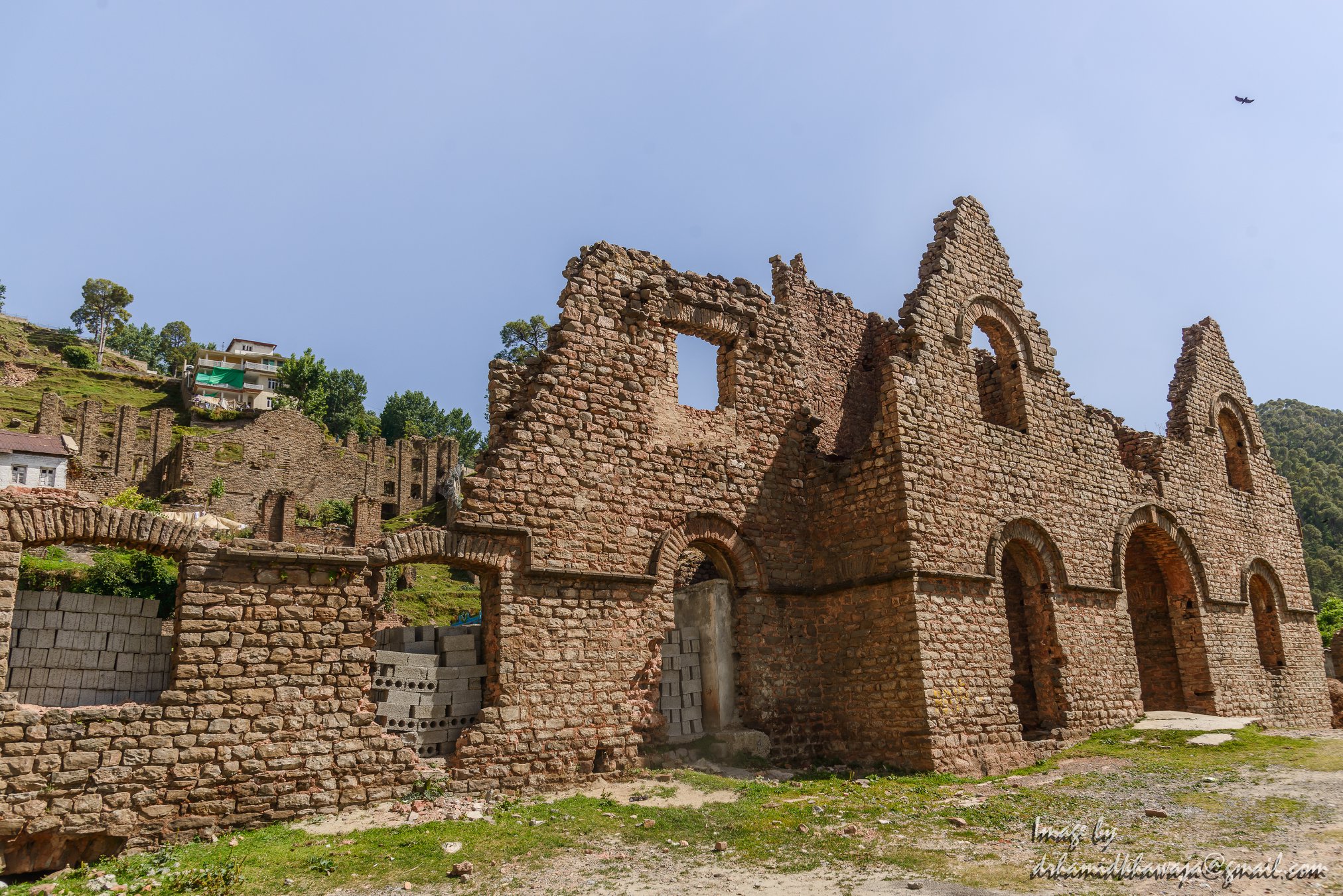
The Murree Brewery was established in 1860 the fulfill the ever increasing demand of Beer for the British Troops in the British Indian Army. It did roaring business till it was reduced to ruins after being burnt down during the riots in the wake of the partition of the British India.

The Ruins of the Murree Brewery in Murree.
The Murree Brewery
Murree Brewery was established in 1860 in response to the ever increasing demand for beer by the personnel of the British Raj, and is currently the oldest continuing enterprise in Pakistan.
Consequent to the British annexation of the Punjab in 1849 from Sikh rule, and more so after 1857 when the British Crown formally extended its sovereignty over India, a structured administration commenced in the Punjab.

The Ruins of the Murree Brewery in Murree.
To meet the beer requirements of British personnel (mainly army), the Murree Brewery was established in 1860 and incorporated a year later at Ghora Galli, located in the Pir Punjal range of the Western Himalayas at an elevation of 6000' above sea level, near the resort town of Murree.
Between 1885 & 1890 the Company established Breweries in Rawalpindi & Quetta & acquired an interest in the Oticumand (South India) & Norailiya (Ceylon) breweries. A distillery was also established in the above period in Rawalpindi next to the Brewery.

The Ruins of the Murree Brewery in Murree.
The Murree Brewery at Ghora Galli was therefore among the first modern beer breweries established in Asia. Murree Beer proved to be very popular among the British troopers who were largely barracked in the 'Galis' of these hills. The virtues of beer brewed from barley malt & hops as a light alcoholic beverage were not lost on the local population who rapidly became avid consumers.
By the turn of the 20 century, the name "Murree" was famous for its beer in keg and bottle in the bars, beer halls and army messes of British India. Murree Beer was first awarded a medal for product excellence at the Philadelphia Exhibition in 1876, followed by numerous awards over the past 140 years.
The Ruins of the Murree Brewery in Murree.
In 1935, a massive earthquake totally demolished the Quetta brewery as well as substantial part of Quetta town, killing thousands of persons, including a number of our employees. At Ghora Galli (Murree), the scarcity of water became an emerging problem. By the 1920s, brewing was mostly transferred to the Rawalpindi brewery but malting continued at Ghora Galli till the 1940s, when this property was sold. This historic brewery built in Gothic style architecture was burnt during the partition riots of 1947/48. The Ruins of the building still exist in Murree and are a testimony to the grandeur of the Brewery Building as it once stood.

Park Lodge a handsome residential property was purchased by the company from Mrs.H. Whymper in 1888. It was the principal residence and head office of the company till 1959, when it was taken over by the Government of Pakistan to house the office of the President of Pakistan. It remains an office of the Head of State of Pakistan from 1960 till the present day.
Two English families were closely connected with the founding of the original brewery. Edward Dyer was the first General Manager of the company. He was also the founder of Dyer Meaken breweries, Simla Hills. His son Gen.Dwyer attained notoriety for his role in the Jalainwala Bagh incident. Edward Whymper, a member of this family was the first person to climb Matterhorn mountain in 1865. The Rawalpindi brewery is blessed with deep aquifers of good water. A railway siding was extended to the premises in the 19th century, which is now derelict.

The Ruins of the Murree Brewery in Murree.
The Hari Parbat Fort, Srinagar, Kashmir
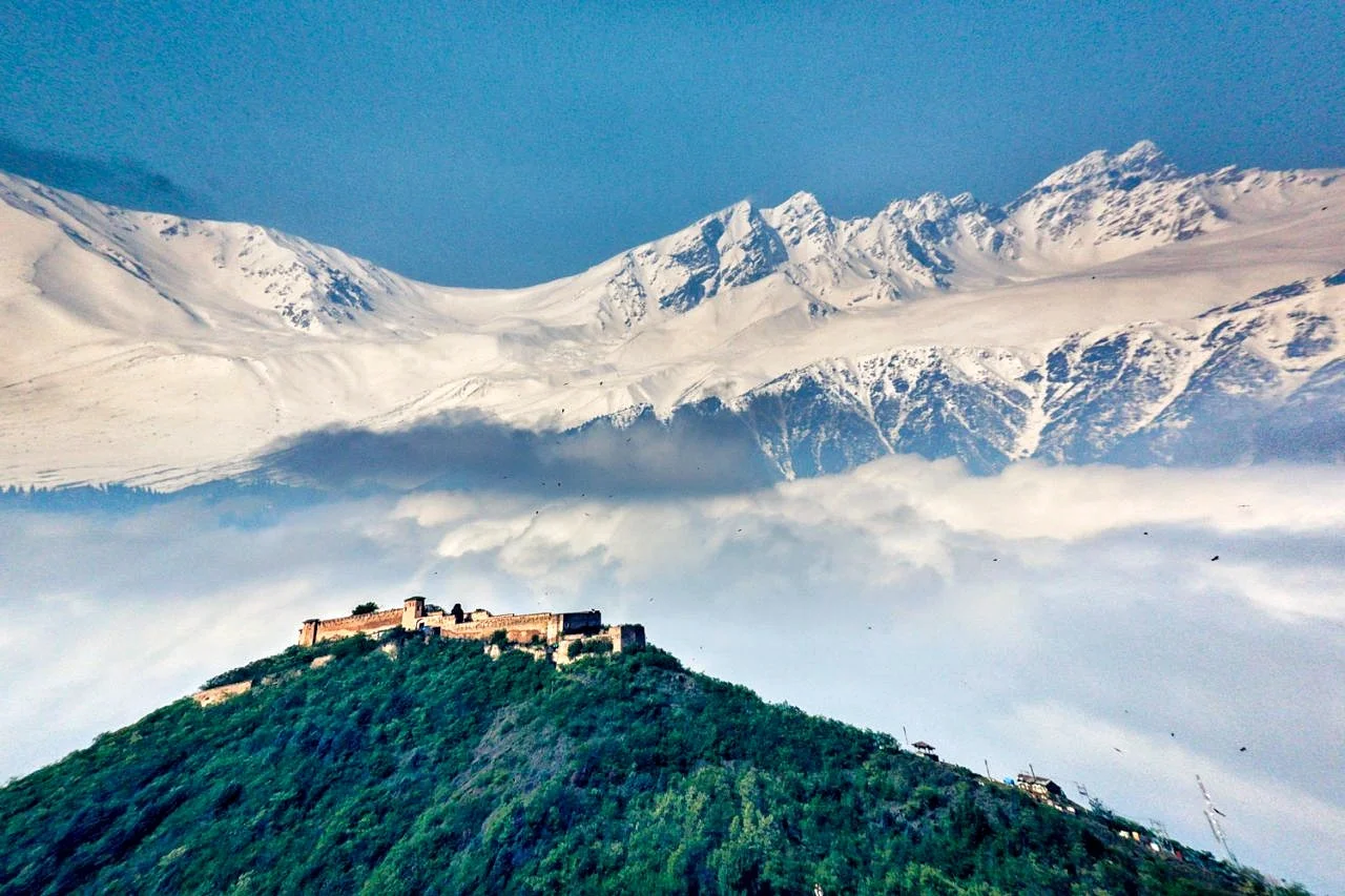
The Hari Parbat is the only surviving Fort in the Kashmir region of the state of Jammu and Kashmir. It stands over a hill also known as the Koh-I-Maraan and originally was the site of a Fort built by Emperor Akbar. He had also built a large fortification Wall at the base of the Hill parts of which survive till today.
The Hari Parbat Fort
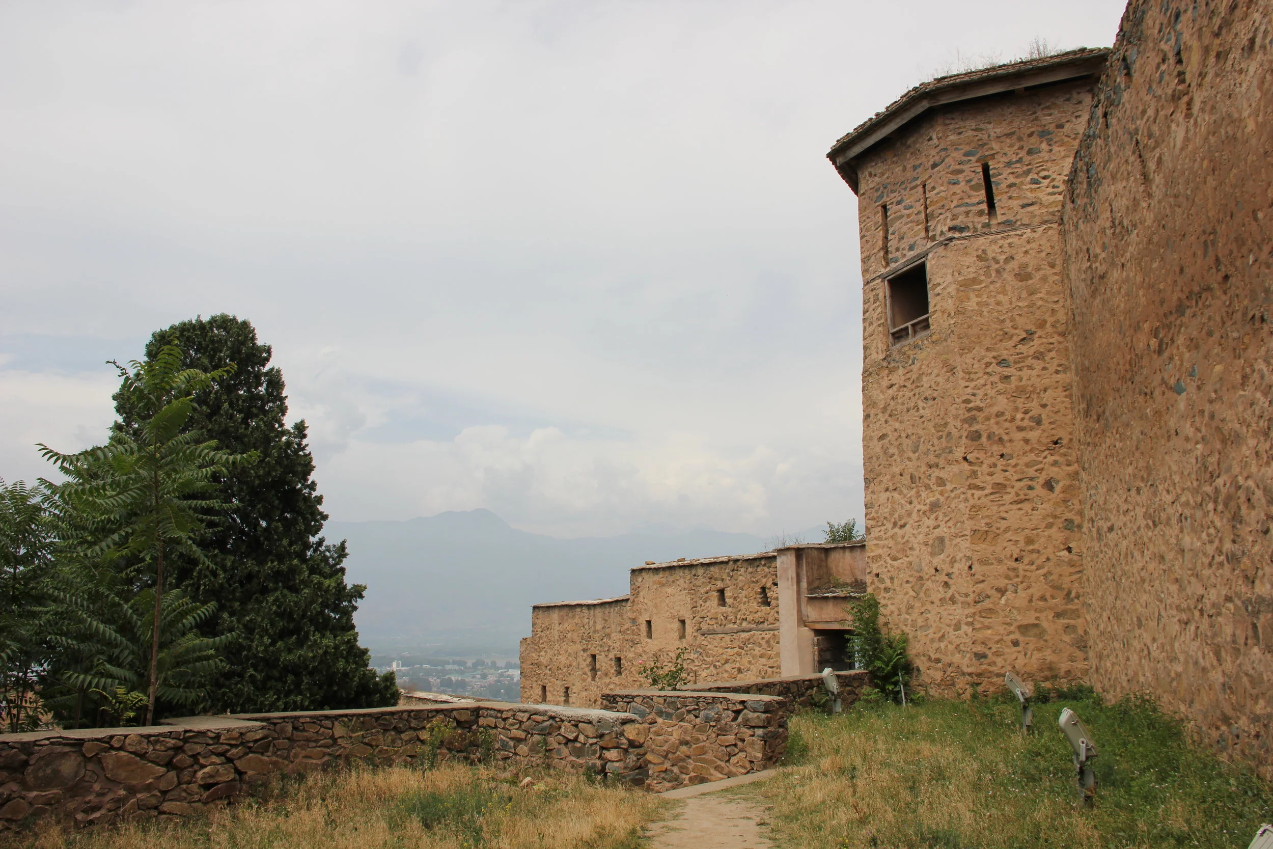
Standing next to the massive Fort walls
The Hari Parbat is the only surviving Fort in the Kashmir region of the state of Jammu and Kashmir. It stands over a hill also known as the Koh-I-Maraan and originally was the site of a Fort built by Emperor Akbar. He had also built a large fortification Wall at the base of the Hill parts of which survive till today.
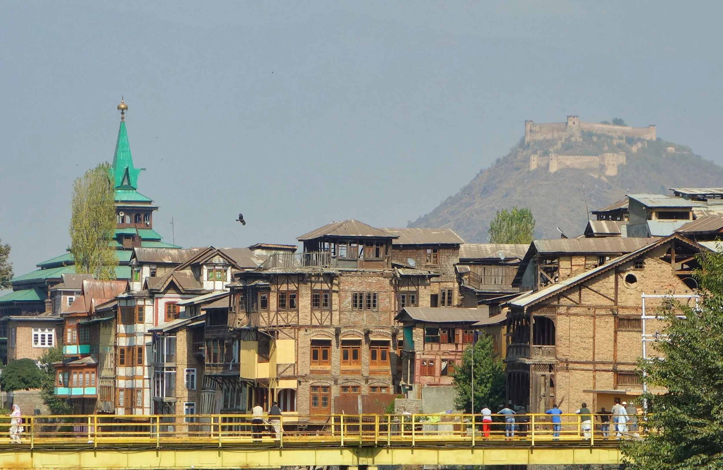
The Hari Parbat Fort as it looms above the Old City of Srinagar
The present structure was built by the Afghans when Kashmir was a part of the Afghan Durrani Empire under Shah Shuja Durrani. Ironically Shah Shuja Durrani was himself held prisoner in the Fort by the Governor of Kashmir, Atta Muhammed Khan. Atta Muhammed Khan had declared himself pretty much independent after his father was murdered in Kabul by supporters of a certain claimant to the Throne. As it so happened in 1808, the Afghan King Shah Shuja was ousted by the same individual, Muhammed Shah and his minister Fateh Khan. Atta Muhammed Khan invited Shah Shuja to come to Kashmir from where he could still go on ruling as the King of Afghanistan. Shah Shuja took the offer and landed up in Srinagar only to find himself Atta Muhammed Khan's prisoner at the Hari Parbat Fort.
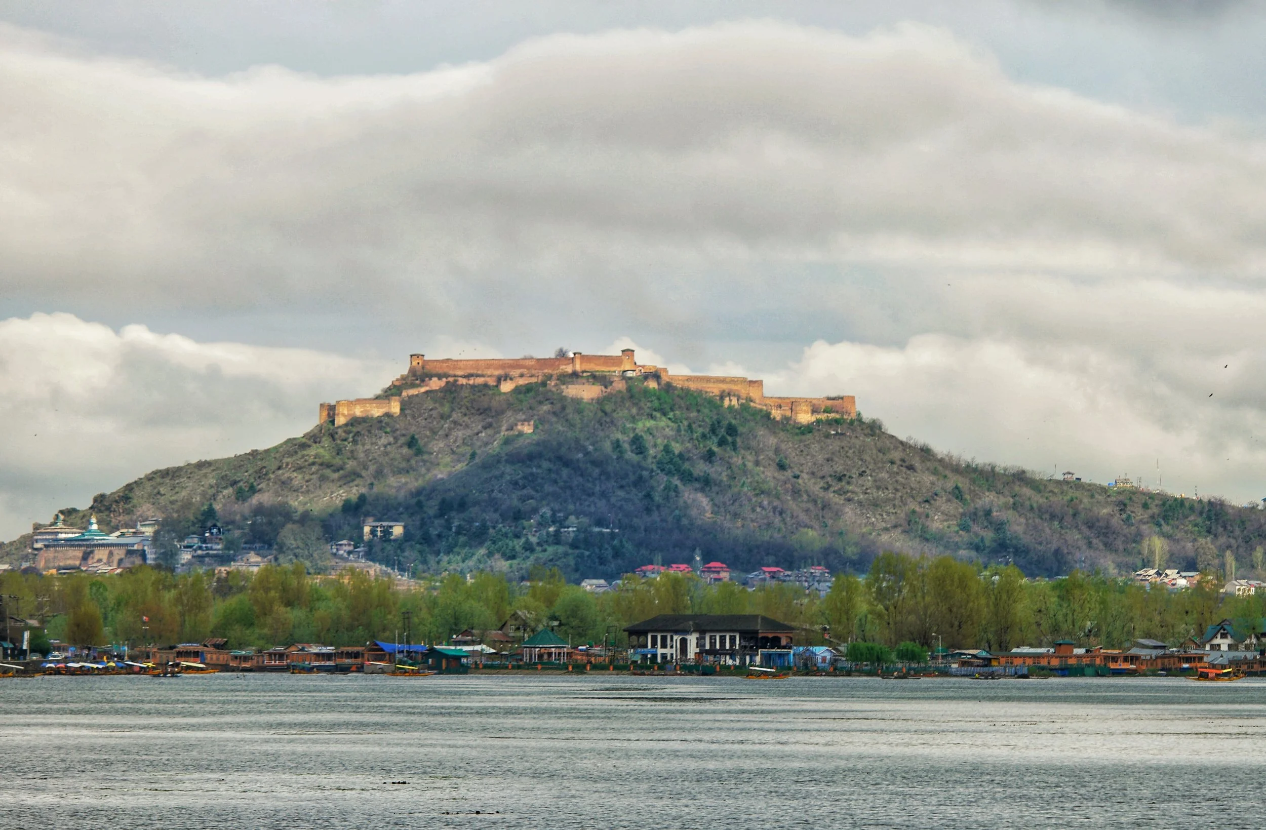
The Fort from the Dal Lake side.
However a force of Durrani Afghans in alliance with the Sikhs of Maharaja Ranjit Singh landed in Kashmir soon after and the Sikhs got Shah Shuja Durrani free from his prison inside the Hari Parbat Fort. As per Sikh history sources the ultimate prize promised to Maharaja Ranjit Singh for getting Shah Shuja Durrani freed from the Hari Parbat Fort was the Koh-I-Noor Diamond. Having done his part of the deal and having delivered Shah Shuja Durrani safely to his wife in Lahore the Maharaja of Punjab soon got the possession of the fabled diamond. Maharaja Ranjit Singh who being a Cavalry man had great love for Horses and had the Kohinoor mounted as a head piece on his favorite Horse which he used to ride.

Inside the Fort
The Sikh flag of Maharaja Ranjit Singh finally flew over the Hari Parbat Fort when the Sikhs under the able leadership of General Hari Singh Nalwa finally defeated the Afghans in 1820. After a brief period of Sikh rule Kashmir and the Fort changed hands and landed in the hands of the Dogras led by Raja Gulab Singh after the Sikh loss in the First Anglo Sikh War of 1846. The Dogra Rule lasted for just a fraction over 100 years and in 1947 it became a part of India and since then the Fort has been occupied by the Security Forces.

The Fort from Pari Mahal
The Fort still stands as proud as ever on ite vantage point overlooking the Srinagar city. The Fort Hillside holds some important places of worship for varied religious inclinations. There is the Shrine of Makhdoom Sahib, a saint held in great reverence by the Kashmiri Muslims. There is the Sharika Devi Mandir who is worshipped as an incarnation of Shakti. On the day celebrated as Sharika's birthday, devotees make a sacrificial offering of taher-charvan to the goddess (taher - rice boiled with turmeric powder and mixed with oil and salt; charvan – cooked goat liver). Then there is the Chatti Padshahi Gurudwara where the Sixth Guru, Guru Hargobind had supposedly preached and stayed for a few days during a visit to Kashmir. This Gurudwara is considered the holiest Sikh shrine in Kashmir.

The Hazratbal Shrine with the Hari Parbat Fort in the Background.
For me the Hari Parbat stands as a sentinel which silently watches over the myriads of events which have happened in this thence troubled land. And it keeps watching. With the mighty Pir Panjals in the background.
It looks beautiful when its lit up in the evening but this capture by Ramesh Tahlan Sir captures the essence of this mighty Fort, the only Fort in the Valley of Kashmir which still stands strong having withstood the vagaries of time.
The Inglorious Bastards of the Pir Panjals
The Inglorious Bastards of the Pir Panjals

The Inglorious Bastards of the Pir Panjals
It was early morning when the phone rang. It was a cold winter’s morning and it was snowing outside. As I struggled out of bed to pick up the phone the last thing I imagined was that I would get vital information about the most wanted canine outlaw of the Western Himalayas. Jagawar aka Jaggu aka Jaggu Satrangi aka Jags Caninleone.
On the other side was an informer who told me about Jaggu and his dog friday, Carlos the Jackal, being seen in the snows of Gulmarg. As the Sub Inspector in charge of the Canine Crimes Group this was the chance I was looking for. If I could get hold of Jaggu I could finally become an Inspector and maybe Basanti would then agree to marry me.
I put on my clothes, a t shirt, a half sleeves sweater, sweatshirt, a jacket and another jacket. Gulmarg snow season is cold and it’s there where all these Gangsters hideout. But I was a man in a mission and Jaggu was firmly in my cross hairs.
Last seen near one of the Ski lifts, Jaggu was armed and dangerous. And more so Carlos the Jackal, always ready to fight till the end for Jaggu. I needed to proceed with caution. But someone needed to do the job and I was the man for the job. And I could already hear Basanti saying yes to my marriage proposal.
And then came the time of reckoning. Out in the distance near the Ski lift I spotted Jaggu and Carlos. Planning their next heist, their next kill, their next hit. But they seemed to be frolicking in the snow like little kids. Who could have imagined that these were the Inglorious Bastards of the Pir Panjals having taken over the canine underworld after eliminating the heads of seven criminal canine families.
And then I decided to take the bull by the horn and called out to Jaggu and Carlos. We had met before but at that time Jaggu was an innocent six months old Puppy far removed from the murky crime world. He responded. I think he still remembered the butter chicken leg that I gave him.
The dangerous duo trotted towards me. I knew there was danger but I had to take the risk. And then they were upon me. And I asked him his name. He didn’t respond. I asked again in English knowing how conscious these Gangstas was. No reply again. I asked in Kashmiri. And then in Punjabi and assured him no harm will come upon him.
But Jaggu the crime lord, the name a mother would take to scare a crying child to stop crying, would say nothing. Like a Costa Nostra of the Pir Panjals. There was something Sicilian in the air. He just looked at me with his big beautiful eyes. And Carlos was all the time giving me the look, ready to pounce.
It was then that I realized that I should let these Inglorious Bastards be. Let them roam the snows of the Pir Panjals. There time wasn’t up yet and maybe the Almighty had deemed these devils to roam and spread terror in the Western Himalayas.
My marriage to Basanti would probably have to wait.
The Inglorious Bastards of the Pir Panjals won this round. But only this time.
Kiki’s Blog
Stories from the Himalayas








Five years ago the Galwan Valley was in the News for the wrong reasons after a deadly clash between the Indian and Chinese Armies in the Valley located in Ladakh lead to many deaths on the contentious Border between the two countries in wake of continued Chinese intrusions into Indian territory.
This area along the Shyok River, of which the Galwan Nallah or the Galwan River which forms the Galwan Valley has been off limits to Civilians since long but now the Indian Government has decided to open up the area for Civilians and we were amongst the First Civilians to venture into this beautifully desolate part of the Eastern Karakorams in Ladakh. Earlier Civilians could only venture upto the Village of Shyok from where the Shyok River takes a U turn and flows in a Northerly direction.