

Warwan Marwah Dacchan : The Last Inner Himalayan Wilderness
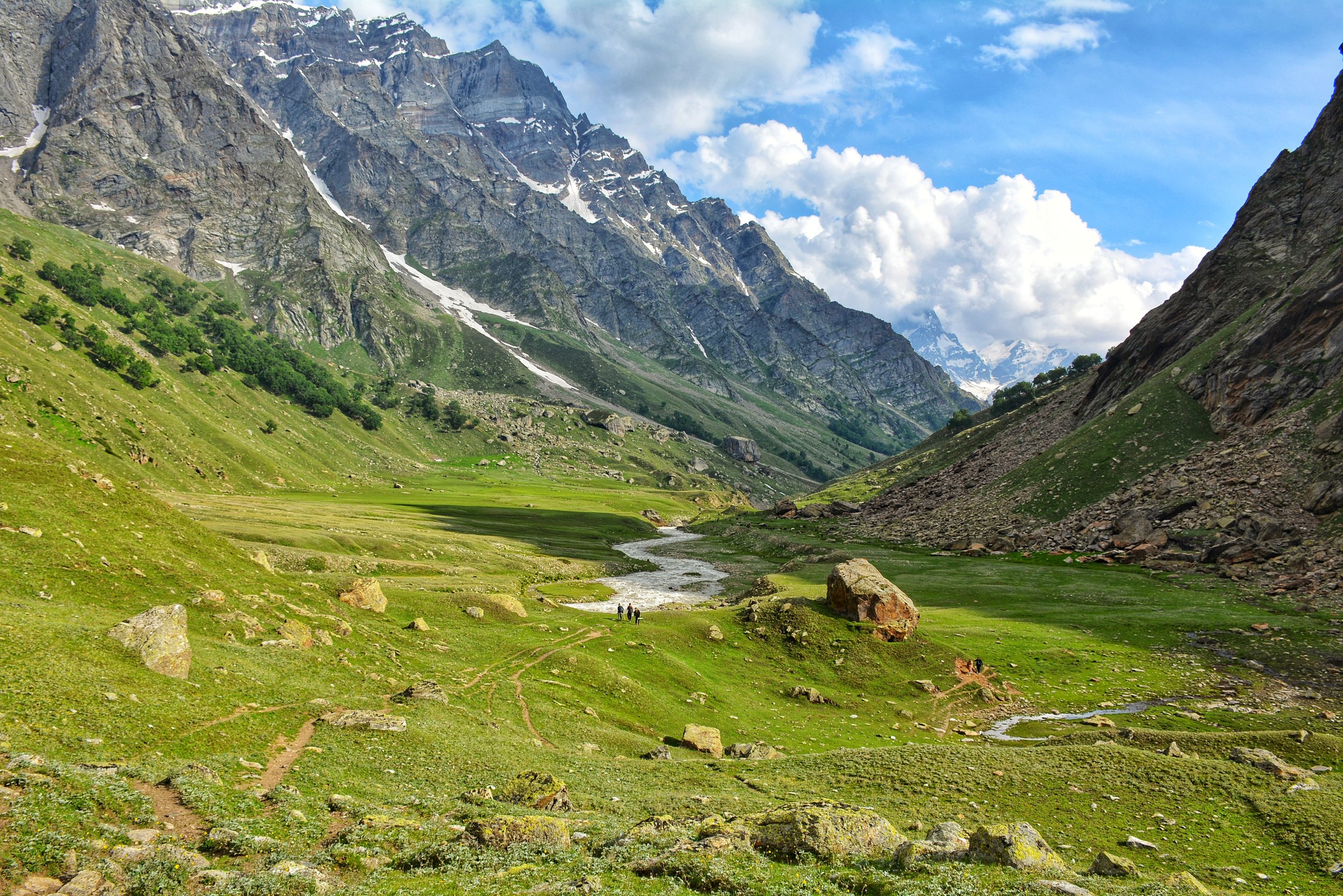
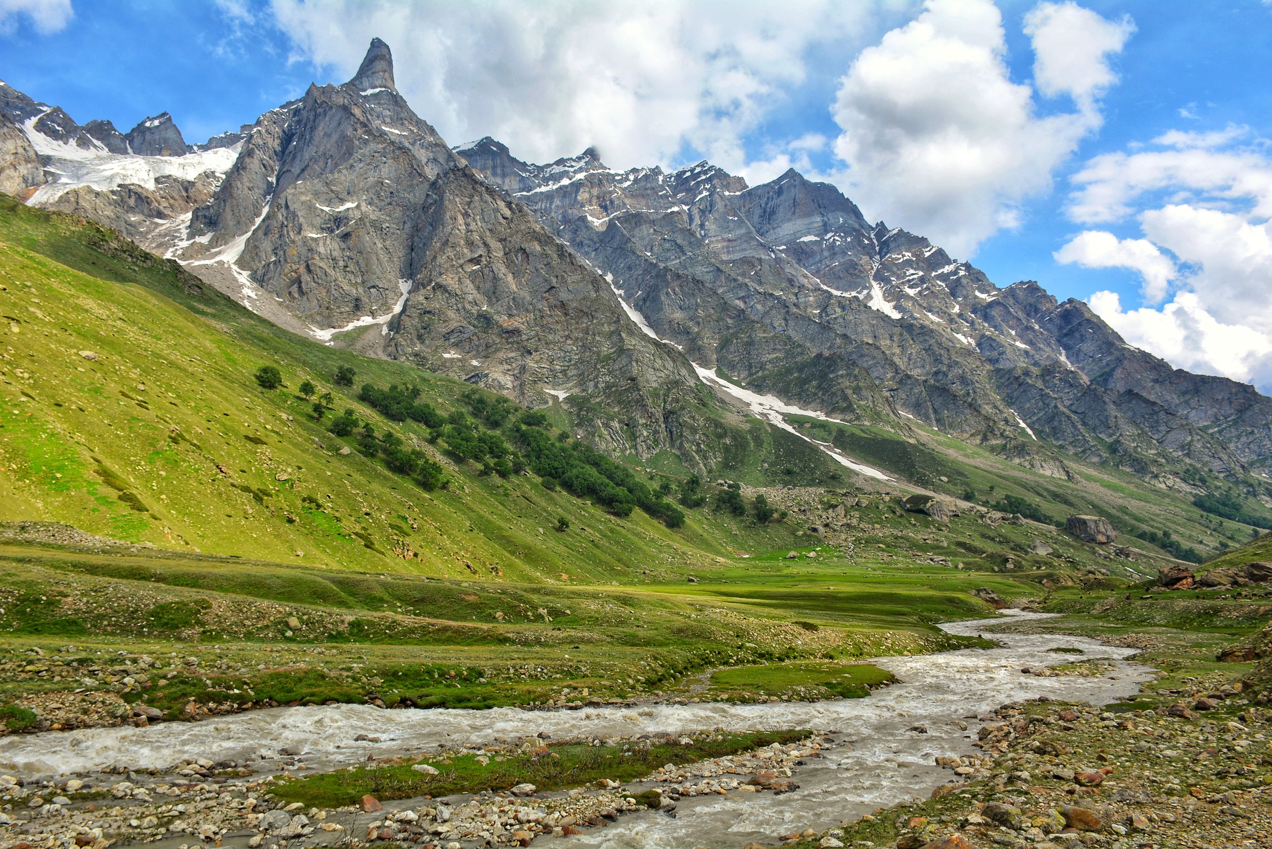
Kishtwar itself is remote and always under the shadow of Kashmir but this part of Kishtwar which lies next to Kashmir on one side and the Suru Valley of Ladakh on the other side is probably one of the last great wildernesses in the Inner Himalayas. This is the Warwan- Marwah - Dachchan belt lies along the Maru Wadwan River or as its also known Warwan / Marwah (Marev) / Marsu Dhar River along different parts of its course, which is a major tributary of the Chenab.

In the Inner Himalayas lies a beautiful Region so remote that most people haven't even heard of it forget about going there. Kishtwar itself is remote and always under the shadow of Kashmir but this part of Kishtwar which lies next to Kashmir on one side and the Suru Valley of Ladakh on the other side is probably one of the last great wildernesses in the Inner Himalayas. This is the Warwan- Marwah - Dachchan belt lies along the Maru Wadwan River or as its also known Warwan / Marwah (Marev) / Marsu Dhar River along different parts of its course, which is a major tributary of the Chenab. These three sub parts of this Region all lie along the same River and offer a rare insight into how people lived maybe many years ago. Sandwiched between the Pir Panjals and the Great Himalayan Range this is a Region few outsiders have set foot.
My romance with this area began in 1989 when I was a student in Class 9 in the Burn Hall School, Srinagar. We were supposed to Trek from Daksum in Kashmir to Kishtwar via the Sinthan Pass. But at the last moment the original Trek was changed. Now we were to go from Daksum to Pahalgam via the Warwan Valley. None of us had even heard of Warwan Valley before but of course we had little choice in such matters. So off we went and on the second day we climbed up the Margan Pass and started to descend into Warwan Valley towards Inshan.
It was like walking into a lost World. The Houses were still made all of wood and the people still held that innocence. Of course the whole Village was excited as we were around 30 people. Technically though Warwan is in Kishtwar the people here speak the purest and the oldest form of Kashmiri. We happened to Trek for a few days in the Valley headed North and after reaching the head of the Valley we turned right and went over the Gulol Pass and descended onto the Sheshnag Lake to join the Amarnath trail. And of course we didnt take any pics at that time. But the memories were still there. And even today pics of these areas are very hard to come by.

The Gazetteer of Kashmir puts it as such :
MARU WARDWAN (They considered the Wardwan and Marwah as one long Valley which is also kinda like the case)
The name of a long and narrow valley lying to the South-East of Kashmir, from which it is separated by a lofty range of mountains; its direction is nearly north and south, its length being about 40 miles, and its average breadth not more than a quarter of s mile; that part lying between Maru and Wardwan being merely a narrow defile, whose sides are very steep and covered with a jungle, chiefly of fir trees. It is bounded by high and rugged mountains , which almost entirely exclude the sun from its lower portions.

The river which intersects it is a considerable stream which swells to a mighty torrent during the melting of the Snow. It rises at the northern extremity of the valley, on the borders of Suru, and flows south until it joins the Chandrabhaga just above Kishtwar, receiving in its course several tributaries from the numerous minor valleys which open on each side of it.
The upper portion of the valley is called Wardwan, and the lower Maru, The Village of Inshin, in the middle of the valley, is distant about 84 miles north of Kishtwar; and thence to Suru, by the Bhot Kol Pass, is about 76 miles, or five marches. There are various paths communicating between the Maru Wardwan Valley and Kashmir ; the principal are those lying over the Margan and Hoksar passes ; by the former Islamabid is distant 67 miles from Inshin, and by the latter 51 miles from Maru or Petgam.
'The Maru Wardwan valley contains several thinly-populated villages; the houses, which are double-storied, are roughly built of timber, and have pent roofs. It forms a portion of the Udhampur district.

Very little difference is observable in the dress and appearance of the inhabitants of this valley and of those of Kashmir, but they seem to share some of the prejudices of the Tibetans, as Vigne relates that he was told that after a death among the inhabitants of the Maru Wardwan valley, none of the deceased's relatives will touch milk until the arrival of a particular day. All the natives of the valley are, mith scarcely an exception, Muhammadans.
The climate ie very rigorous, and rain or snow falls throughout the greater part of the year; the stony fields produce but one harvest in the twelve months, and that is limited to a scanty crop of Trumba and Grihmah, and for five months of the year the inhabitants are absolute prisoners to their houses, the snow lying 10 and 15 feet deep, entirely blocking up the lower stories of the habitations. Pollard trees, Which elsewhere furnish abundant supplies of fodder for the cattle during the winter months, are very scarce, and such trees, as do grow, are small and stunted. Despite these disadvantages a considerable number of ponies are bred in the Valley, and taken to Suru, where they find ready sale or barter.

A good pony, between three and five years old, fetches, it is said, about Rs.20 (British currency). The vendor prefer to be paid in cash, but has frequently to be contented with tea ; in this case be receives a damu (a weight equal to three seers) of tea, which is valued at Rs.17 ; on this he is required to pay an import duty of Rs.2 at the custom post at Sukhnis, at the north end of the valley. If fortunate, he disposes of his tea to an itinerant merchant in the Valley, otherwise he must continue his journey to Islamabad or Srinagar before he can sell it for the Rs20 it is supposed to be worth in Kashmir ; in either case, when the labour and risk are considered, it is apparent that the transaction brings little or no profit.
The geological formation of the Maru Wardwan valley is gneiss, mica alate, and a silicious grit. The Maru Wardwan Valley is mentioned by Abul Ful in the Ayin-Akhbari ss the Murwar Dhun.

DACCHAN
The name applied to the mountains on both sides of the defile to the South of the Maru Wardwan Valley, through which the river flows on its course towards Kishtwar. The path which lies up this valley is extremely difficult, and not practicable for ponies. (Pigne.)
Now there are a few interesting Tales and Stories of this Region outlined by a few visitors who came to this place including the most eminent Archaeologist of Kashmir, Ram Chandra Kak who went onto become the Prime Minister of the Riyasat under Maharaja Hari Singh. RC Kak had visited the Valleys in the 1920s and were published in the publication called the Antiquities of Marev Wadwan.

The Valleys of Wadwan and Marwah are completely Muslim barring a few in Marwah and in Dachan they are mostly Hindu. But historically it was the inhabitants of Marwah who were more warlike who dominated all the 3 Valleys. The hereditary Zamindars carried the surname Malik but were originally Rainas pointing out that they came from outside. As per their local tradition their ancestors came from Bengal but the actual history is obscured in the fog of time. The most amazing part was that R C Kak was shown actual firmaans issued in the name of the Maliks by the Governors of Kashmir from the time of Jahangir and all the way to the time of Shah Shuja. These Marwah Maliks even provided Marrivs (as the local residents are called) to General Zorawar Singh for his campaigns in Ladakh and apparently they gave a good account of themselves. It said even from his last Campaign a few Marivs were among the few who survived.
Moving towards the South we come to the Region called Dachchan which is mostly Hindu and quite a mysterious one at that. RC Kak noted that the condition of the Men in Dachchan was unusually wretched which was because apparently almost every Woman there was proficient in the Black Arts and Witchcraft. The Men it seemed were constantly under their spell. He also noted that Marriage was quite a casual affair where a Man who found himself in an affair with a Married woman could simply pay her husband off and get her as his Wife. RC Kak noted that the whole Society was deeply ensconced in Sorcery and deviousness of all kinds. And then there were another set of people who would actually help you combat the evil spells and curses cast upon you. Curiously the Sorcery did not work on the Maharaja’s officials as it was said that during the rule of Maharaja Gulab Singh the Witches promised that they wouldn't cast their magic on his Officials. And I guess the Witches stuck to their promise.

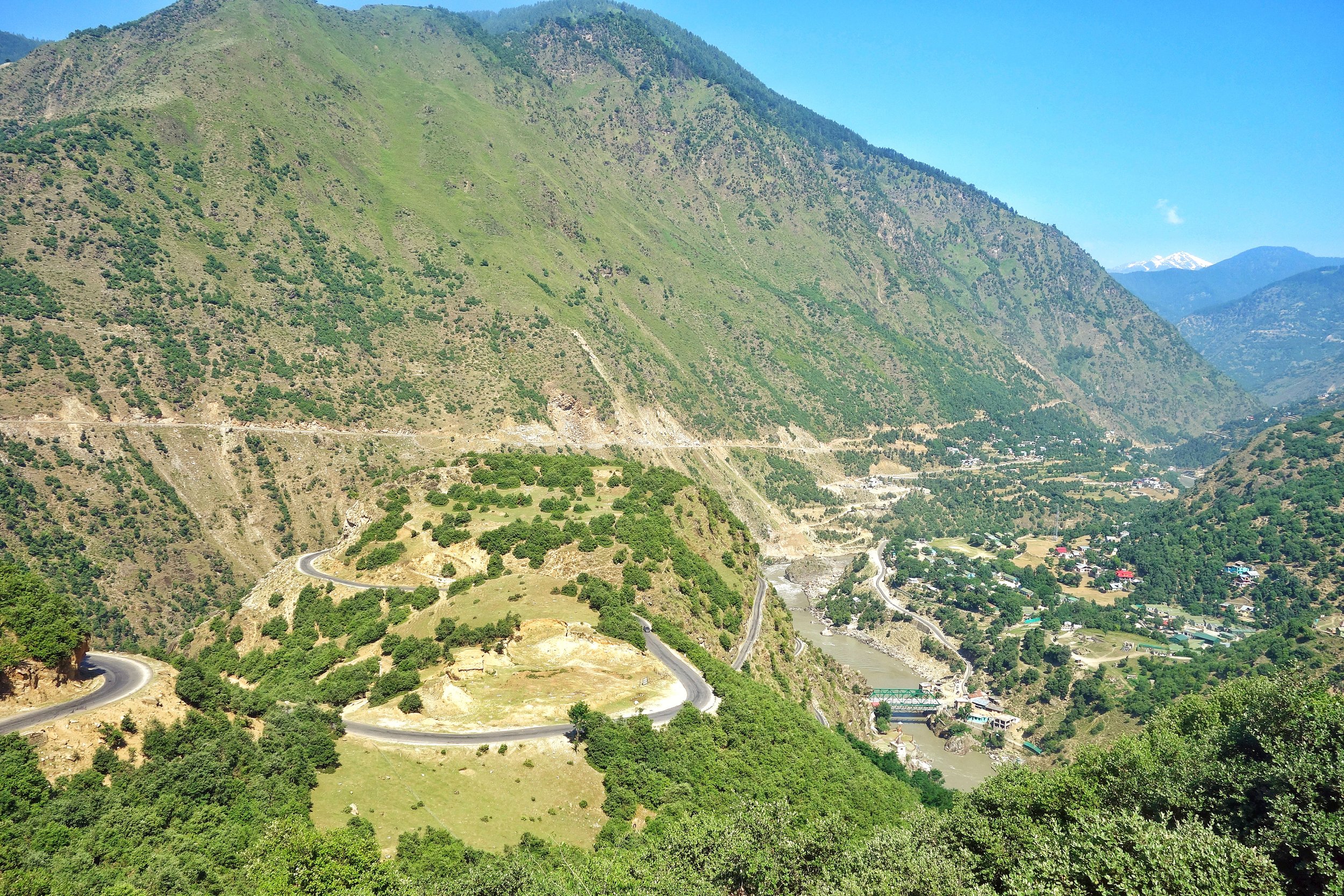
Of course times have changed now but still due to the absence of proper Roads the area remains pretty cut-off. And as a result Backward but as the photographs would testify as far and Natural beauty is concerned this Area is second to none and hopefully now that the State has become a Union Territory some Tourism would be promoted in this Region and in Kishtwar as a whole. Nowhere else in the Himalayas due you get such a mix of Culture, Language and Religion as you do in Kishtwar.
The Original Mountain Men and Women of the Western Himalayas
Ive had a childhood fascination for the Gujjars and especially the Bakarwals while growing up in Kashmir. Well they are almost the same thing except that nowadays the ones who live in fixed locations are called Gujjars while the ones which move up and down with their herds are referred to as the Bakarwals. Also as the name suggests it comes from the word Bakri, so a Bakarwal is also a keeper of the Sheep. Especially in the State of Jammu and Kashmir. There isnt a single Region in this vast State which is not familiar with the congenial Bakarwals who flocked to the highlands with their Goat/ Sheep / Buffaloes / Horses/ Mules which they term as “Maal” as in “Goods”. That is the commodity that they deal in and a Bakarwal is judged by the size of his Herd. And then there were my favourite part of a Bakarwal entourage, the Shepherd Dogs also called by the same name Bakarwal or Bakarwali.
The Original Mountain Men and Women of the Western Himalayas
Ive had a childhood fascination for the Gujjars and especially the Bakarwals while growing up in Kashmir. Well they are almost the same thing except that nowadays the ones who live in fixed locations are called Gujjars while the ones which move up and down with their herds are referred to as the Bakarwals. Also as the name suggests it comes from the word Bakri, so a Bakarwal is also a keeper of the Sheep. These Bakarwals are the original Mountain men of our parts. . Especially in the State of Jammu and Kashmir. There isnt a single Region in this vast State which is not familiar with the congenial Bakarwals who flocked to the highlands with their Goat/ Sheep / Buffaloes / Horses/ Mules which they term as “Maal” as in “Goods”. That is the commodity that they deal in and a Bakarwal is judged by the size of his Herd. And then there were my favourite part of a Bakarwal entourage, the Shepherd Dogs also called by the same name Bakarwal or Bakarwali.
Most of these Bakarwals are now based in the Winter time mainly in the Poonch Rajouri areas of J&K where they form a majority of the Population. However they are distributed all over the Jammu Division as well as neighbouring Regions of HP like Chamba and places like Nalagarh in Punjab and moving further East even as far as Dehradun in Uttarakhand. Infact in parts of Jammu and Himachal Pradesh they share the pastures with the other Mountain Men, the Gaddis. The main difference being that the Gujjars / Bakarwals of J&k are Muslim while the Gaddis are Hindu.
From the Jammu side they usually move towards the higher Regions in the state in all the 3 Divisions of the state. They cross the Pir Panjals to get into the Kashmir Valley and head onto the higher Alpine meadows dotted around the Valley. In the Jammu division they move towards the Kishtwar side and spread over the different Valleys like the Padar Valley from where some even go towards Zanskar. There are others who go towards Marwah and Wadwan and some even cross over to the Suru Valley in Ladakh. Some go to the higher reaches in Kathua District like Sarthal where I happened to meet both Bakarwal and Gaddi shepherds.
While on the Machail Road on the way back we gave a lift to a Bakarwal who had just left his herd at somewhere beyond Machail, areas which are inhabited by Buddhists who came to the Region from adjoining Zanskar. And we gave him a ride till Gulabgarh and on the way he asked us how hot it is in Jammu and we said that down in the foothills the temperatures were over 40 C. Ah he said then Ill go to Srinagar. I asked him why ? Well its cooler there he said and told me he had another Dera somewhere near Shopian in the higher reaches on the way to the Pir Ki Gali.
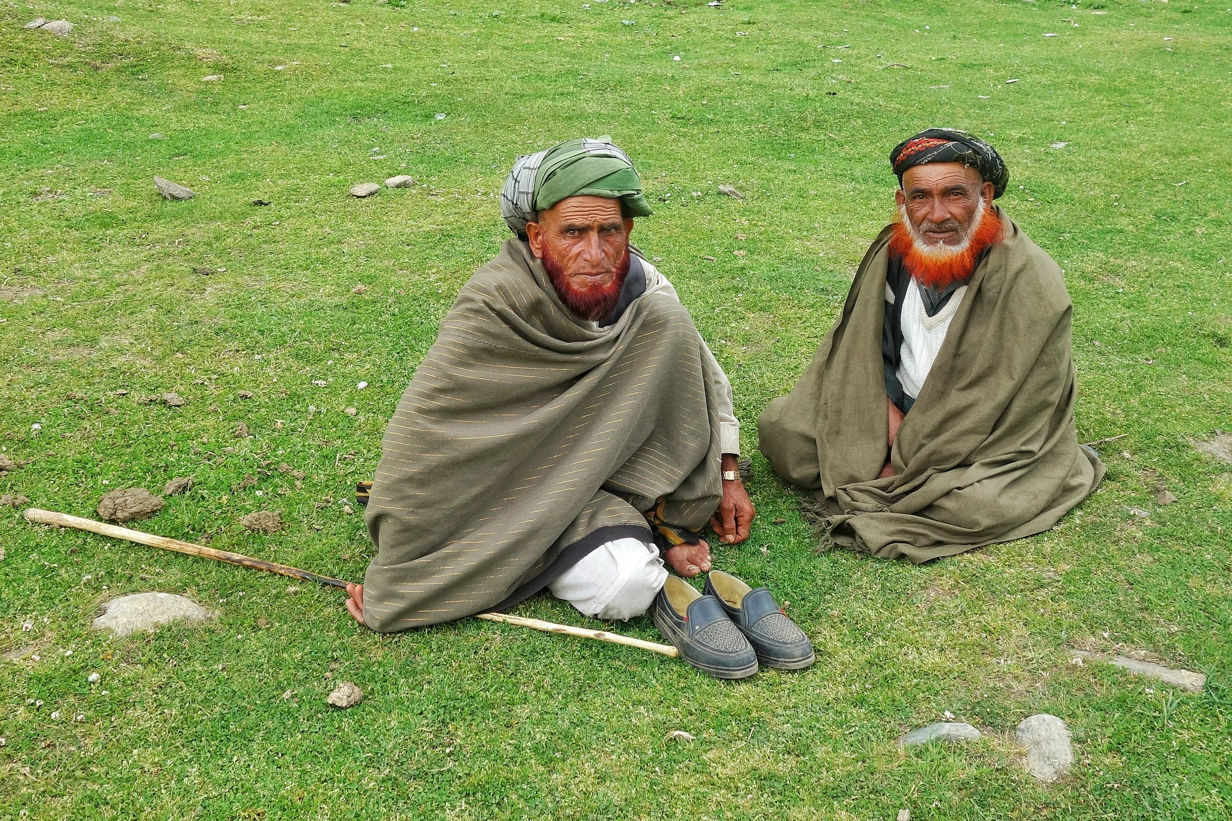
Kashmir Valley itself has quite a strong Gujjar population and they largely inhabit the areas in the higher reaches above Ganderbal all the way to Zoji La. They are also spread in the more sensitive Border Villages along the LOC. They actually live on both sides of the Border and the area that we belong to, ancestrally was also a Gujjar majority area. So we have a kind of language affinity with them as well and we can almost understand each other when they speak Gojri and I speak our Punjabi. Thats another reason why I get along with them famously. Infact in the time of Grandfather all the main guys handling the tougher side of business like the Forest Leasee and other Construction work was handled by the hardy and reliable Gujjars. And I remember my favourite one was a guy called Sitara, who drove one of our Trucks. Typical handsome Gujjar with a flowing orange (henna dyed) beard. And of course we use love going for a drive in the Truck.
Anyways with modern times creeping into their lifestyles as well many of the younger generation are now looking for alternative, more settled ways of life. Taking the heards over the high Passes into secret Valleys and Dhars best known to their forefathers and all the associated Risks are just not worth it for the newer generation. And of course every Bakarwal father wants to give education to their children and of course this is good. And education leads to aspirations and being a Shepherd doesnt rate high on any work list. I am afraid the Bakarwals we see now are the last of the Generation and the time is not far when coming across a Bakarwal entourage would be a rare thing. Its getting rarer but you can still manage if you know where to go.
And here is an entourage that we met on the way from Kishtwar to Gulabgarh. The younger and fitter men had already gone ahead with the “Maal” and this was the follow up party of the older men, women, kids and their well dressed Horses and Mules. They were a riot of Colour. And of course the younger Bakarwalis (I mean the Dog breed) as the strong amongst them were on duty with the Maal. And it was quite a sight.
Background Music is a Bakarwali song that I got from Youtube and not sure of the origin. The beautiful Song talks about a Lady (Young) talking about its only companion a Crow that used to sit on a Mountain Top. And the lady yearns for her loved ones and keeps sending many letters to her Baba, Chacha, Mama and Lala. Well thats what I understood .Enjoy the Video and the song.
PS: We took permission from the main Elder before shooting the Video and the ever genial Bakarwal gave it when I broke into my Mother tongue.
Video from June 2019. On way from Kishtwar to Gulabgarh. Jammu Division. J&K
The Dichotomy of the Moon River
The Moon River or the Chandrabhaga or the Chenab is a River that flows through some of the most rugged parts of the Himalayas starting its journey in the Lahaul Valley and making its way through Pangi Valley and into Padar Valley and Kishtwar in Jammu and Kashmir. It is a River of many legends and we try and Map its jurney from the Chandrabhaga to the Chenab.
Bandarkoot near Kishtwar where the Marsudar meets the Chenab / Chandrabhaga
The Dichotomy of the Moon River
The Moon River as I like to call it or the Chandrabhaga or the Chenab, as its commonly known as, is truly a Himalayan River in all senses. This River and its tributaries run through some of the wildest and the ruggedest country in the Himalayas.Lahaul, Pangi and Kishtwar Valleys and their sub-Valleys are homes to this River. All these three Valleys have some of the craggiest Peaks in the Himalayas and the beauty is just mind blowing. Its the River of folktales and in the Punjab many love stories were written about Lovers being seperated by the Chenab. Who can forget the immortal lines from the classical Punjabi romance Sohni Mahiwal :
Sohni Chenab de kinare, Te Pukarey, Tere naam ve, aaja aaja aaja
Of course it ended in tragedy when both Sohni and Mahiwal were taken by the Chenab and the romance turned into a Tragedy for people to talk about.
Most are well aware that the Chandra and Bhaga River which rise around the Baralacha La Pass and then flow down into Lahaul and they finally merge. But the Chandrabhaga or the Chenab is the only major Himalayan River who’s name changes for apparently no reason. And also it has two starting points as well and there is debate whether the Chandra is a tributary of the Bhaga or the other way round. Its mostly an academic debate as they both rise close to each other and as by scientific definition the main River is the one which rises the farthest from the point it hits the Sea or another River that it merges into. And the Moon River finally becomes a part of the mighty Indus, after combining with the Sutlej as the Panjnad, as it makes its way to the Ocean.
Video of Driving along the Chandrabhaga Gorge between Killar in Pangi Valley, Chamba to Udaipur in the Lahaul Valley.
So why the 2 names ? The Moon River was referred to as the Askini in the Rig Veda. It meant the River with dark waters which holds true till today. The Waters of the River are rather murky as I couldnt help but notice as I travelled along the River from Kishtwar all the way till Tandi. The Gorge of the Moon River is amazingly spectacular. Its sparsely populated because of the verticality and its only now with the building of Roads can we humans even venture into this forbidden land of the Moon River. It was refferd to as the Chandrabhaga in the Mahabharata as well and the Greeks also called it Sandraphogus / Sandabaga / Cantabaga. Infact Alexander the Great established an Alexandria on the Indus at the point where the Panjnad (combination of the Chandarbhaga/ Chenab and Sutlej) met the Indus. The name Chenab is also a further development of the name with Persian cognates. Chen meaning Moon and Ab meaning water. The Moon River.
So where exactly does the River change its name ? On the maps, the regular ones officially once the River crosses into J&K from Himachal Pradesh which is at the point where the Sansari Nallah meets the River. The Sansari Nallah is considered the Border between the two states though some Maps of JK claim areas beyond the Sansari Nallah like Dharwas before Killar to be a part of J&K. The Sansari Nallah is a typical wild Himalayan River of the Region and this The photo below is taken exactly at the point where this Nallah meets the Moon River.
The Sansari Nallah as it meets the Chandrabhaga at the border between Himachal Pradesh and Jammu and Kashmir. This is where the Chandrabhaga becomes the Chenab.
The Sansari Nallah as it meets the Chandrabhaga at the border between Himachal Pradesh and Jammu and Kashmir. This is where the Chandrabhaga becomes the Chenab as per one account.
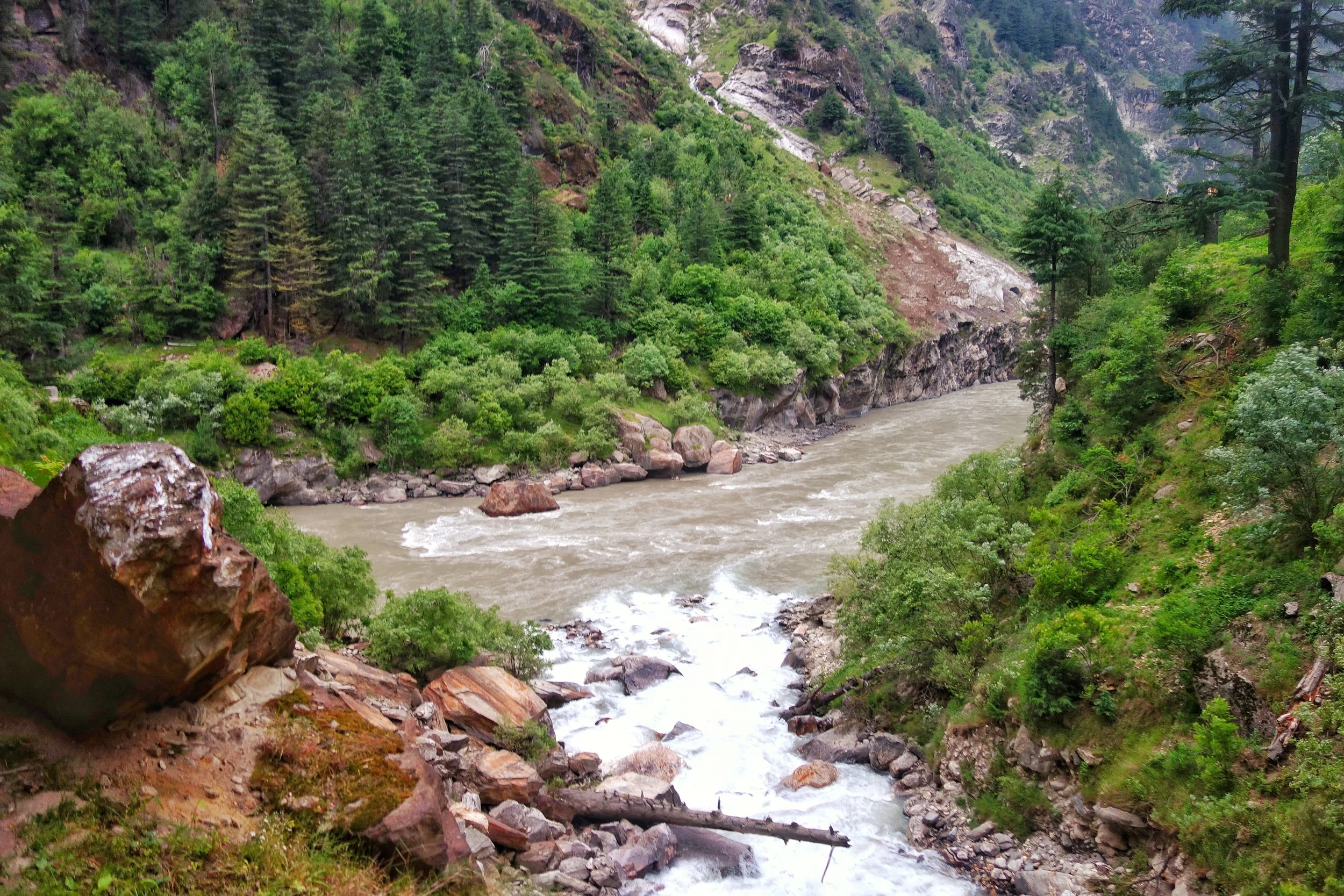
But there is more to it. Many purists consider the River to be still the Chandrabhaga as it enters the state of J&K. One of the main proponent of this theory is a Slovakian gentleman by the name of Altos Mlonk. He is an absolute Guru. He is the absolute master of Kishtwar and knows stuff beyond our imagination. As per Altos the point where the Chandrabhaga becomes the Chenab is at Bandarkoot near Kishtwar town where the turbulent Marsudar meets the Chandarbhaga. Infact the Marsudar carries more water than the main River itself when it merges into it.
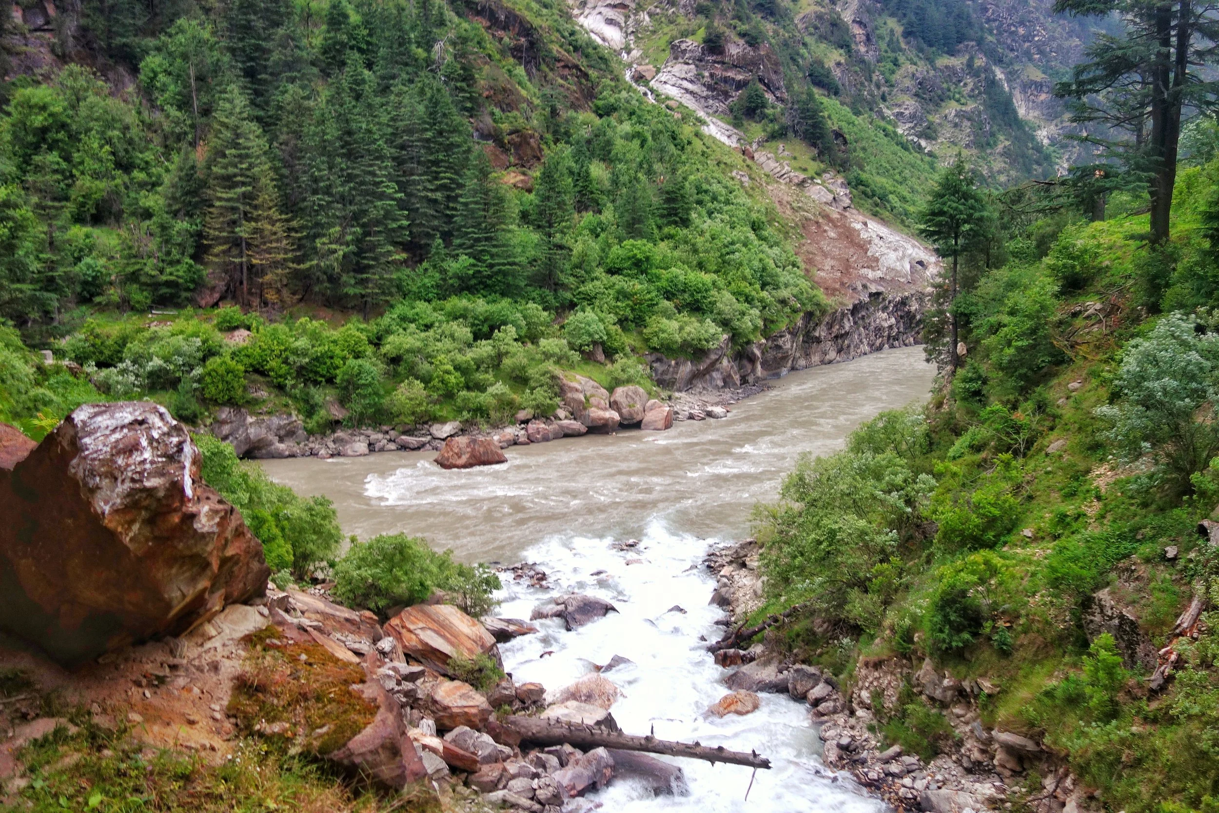
The Marsudar rises at around 5175 mts and its begins life as the Gumbar and the Batkot Nallah which merge and form the Warwan River. This River has carved out the Warwan Valley which in my opinion is one of the most beautiful Valleys of the Himalayas. And the Warwan flows down and is joined by many other Rivulets in the Marwah and Dachan areas. The Marsudar flows throw some of the most unknown areas of the Himalayas which most wouldnt even know of. I trekked the Warwan in in 1989 and still remember the quaint River unlike the wild Marsudar that it becomes.
So I take it as such. And believe that the Chandrabhaga becomes the Chenab when the Marsudar joins it at Kishtwar. The place where these wild Rivers meet is like a pilgrimage spot for someone like me. Its just magical when you think about the places these Waters come from. The Moon River enchants forever.
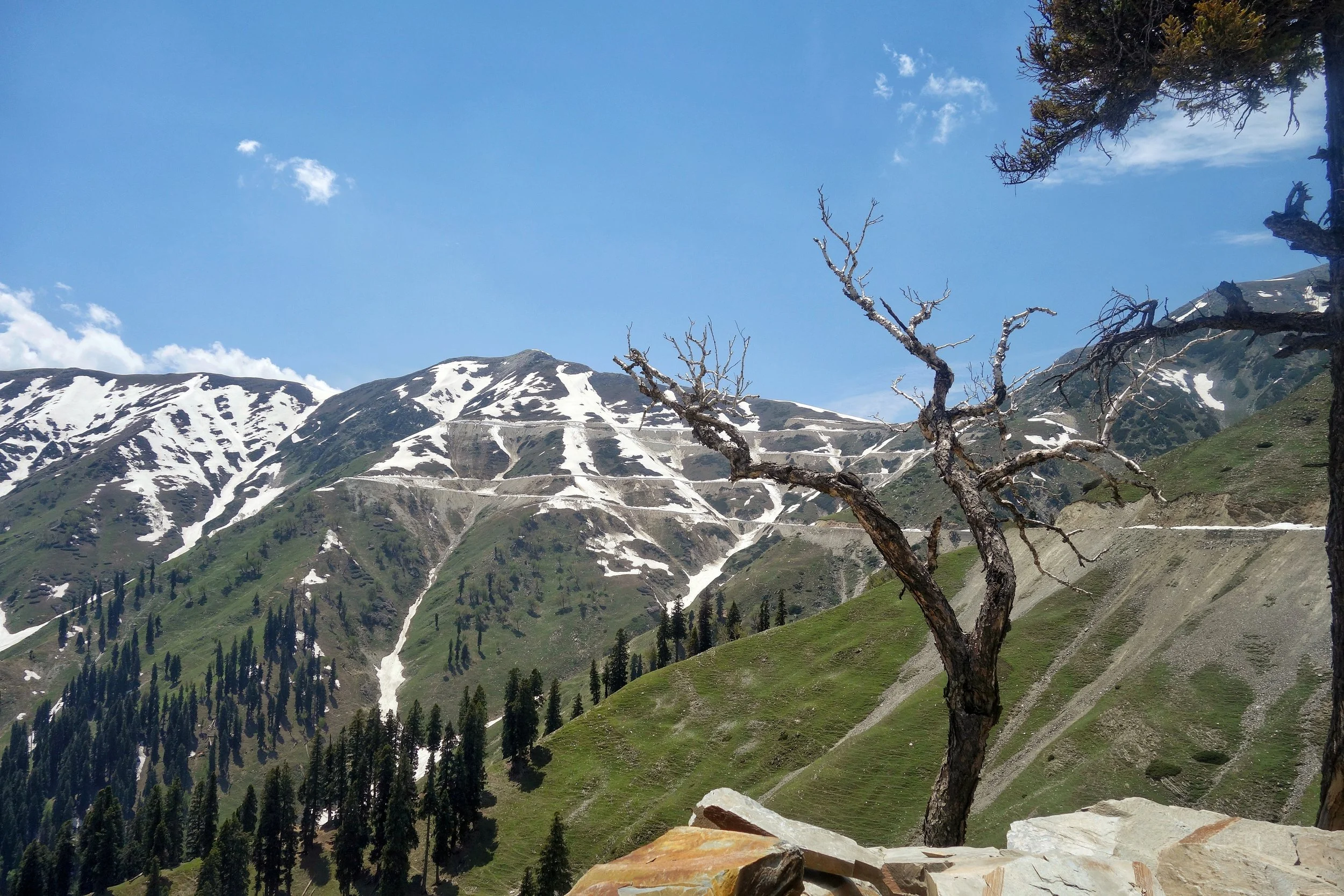
The Sheep of Sinthan
The gentle Sheep of the Sinthan Pass which connects Kashmir with Kishtwar. An absolutely beautiful Pass with mind blowing scenery on either side.
The Sheep of Sinthan
On our recent long foray into the Mountains me and Tahlan Sir decided to go to the Sinthan Pass as it had opened just a day earlier. In the evening we were warned by some people that there was some Militant activity around the Pass and we should avoid.
Of course we had our own sources and being from Kashmir these thing hardly perturb me. Anyways we got our all clear and started our Journey towards Sinthan. Because of the incident which took place one day before the security personnel were on alert and the check points to the Pass were manned by the Army. The Army men were rather amused when they saw a HR registered Fortuner with two not so young men wanting to go to Sinthan Pass. We were asked why we were going there ? I told them well I am missing home and if I feel like I might go to Srinagar from there and if I m not in the mood I will come back. They obviously laughed. :)
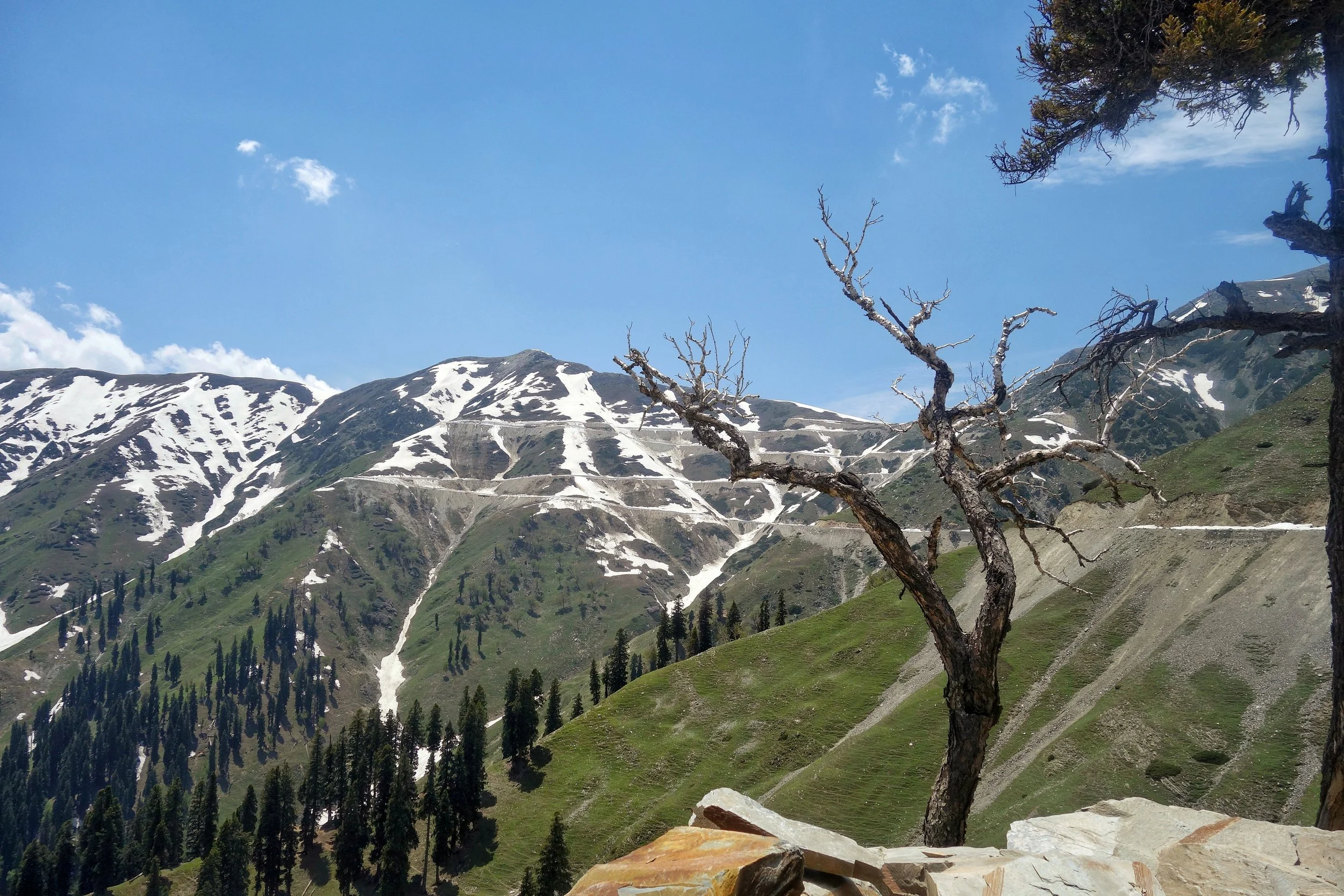
And soon we were on our way through this beautiful pristine area which still lives in an era gone by. The Gujjars were also on the move with their livestock, Horses, Families and Dogs. The population in the area is a mixed bag, there are Hindu Kishtawaris who live in the higher Villages, Muslim Kishtawaris (some of Kashmiri) descent in the Villages along the Road and Gujjars on the move and also living in some of the Villages. This mixing gives this area a unique cultural identity and adds to the charm of the place. Mosques and Temples around each other. It almost gave a notion of Paradise but of course this area has had its share of troubles.
Anyways the drive upto the top was just amazing with a lot of Snow walls right till the top of the Pass and some more on the other side. Anyways once on top I told Ramesh Sir that lets go down to Kashmir and have a cup of tea at the first place we find in Kashmir. And it was while going down that we met these guys. And surely they looked dangerous, but they didnt bother us and to me they looked like Tourists going upto their favourite holiday destination. Have a look ;)
And of course we had Tea at a shack set up by a Gujjar boy and served Girdas with Butter and Tea. And then we met a Gentleman there. Well thats a story for another day.
Video from the Kashmir Side of the Sinthan Pass. June 2019.
The Enchanting Padri Gali
The enchanting Padri Pass or Padri Galli or Padri Top which connects Chamba in Himachal Pradesh with Bhaderwah in the Jammu Division of Jammu and Kashmir at around 10,400 feet amsl. It is located around 110 kms from Chamba Town and around 40 kms from Bhaderwah and is the highest point of the Chamba Bhaderwah Highway. This is one of the important Passes which connects J and K with Himachal. In older times Bhaderwah was a part of the powerful Chamba Kingdom which held Kishtwar as well and even Zanskar.

The Enchanting Padri
The enchanting Padri Pass or Padri Galli or Padri Top which connects Chamba in Himachal Pradesh with Bhaderwah in the Jammu Division of Jammu and Kashmir at around 10,400 feet amsl. It is located around 110 kms from Chamba Town and around 40 kms from Bhaderwah and is the highest point of the Chamba Bhaderwah Highway.
This is one of the important Passes which connects J and K with Himachal. In older times Bhaderwah was a part of the powerful Chamba Kingdom which held Kishtwar as well and even Zanskar. For many years Bhaderwah was the bone of contention between the Jammu Kingdom and the Chamba Kingdom until in the mid 1800’s it was taken over by Raja Gulab Singh of Jammu as terms of settlement of the Territorial boundary with the Chamba Kingdom after he acquired Kashmir as per the Treaty of Amritsar.

Bhaderwah today is a part of the Doda district and lies in the lap of the Pir Panjals. The Town of Bhaderwah itself was an important one and the Bhaderwah Fort stands watch over Town. Bhaderwah has a mixed population of Hindus and Muslims and the languages spoken include Bhaderwahi and Kashmiri.
There are many beautiful places in Bhaderwah which have for long been away from the Tourist lime light. Some of them are described below (Taken from JK Tourism Catalog) :
Kailash Kund : The Kailash Mountain overlooking the Bhaderwah Valley is supposed to be the abode of Shri Vasuki Nag. At 13067 ft the Kailash Kund is the source of the River Neeru which drains the Bhaderwah Valley. The Yatra follows Mani Mahesh Yatra and starts with the Chari Mubarak from the Village of Gatha in Bhaderwah and then goes to Vasuki Nag Temple in the heart of the Town. At Ramkund one halts for the night and there on to Kailash Kund. The annual Kailash Yatra takes place in the month of August.
Seoj Meadows : The Meadow of Seoj is flanked by a gushing River on its West which emanates from the Hills surrounding the Kailash Kund. The Landscape across the River is a replica of Pahalgam whereas on the Eastern side there are long stretches of Grasslands. On the Western side the Meadows take a descent along the crystalline water of the Seoj Rivulet and roll towards Ramnagar area of Udhampur District.
Chinta Valley : Situated at a height of 6500 ft Chinta Valley is a beautiful Valley with thick Coniferous Forests on all sides and the Chinta Nallah flowing through it. A grassy Meadow called Bagan on one side of the Village is favoured by picnickers.
Jai Valley : Ten kilometers from the Chinta Valley is the picturesque longitudinal Jai Valley at a height of around 7000 ft. Located around 32 kms from Bhaderwah it is an extremely beautiful Region spread over 6 kms. The Valley is surrounded by thick Deodar forests on steep slopes with a sprawling Meadow in the middle.
Khellani : Khellani, overlooking the Kellar Valley is a Deodar clad Plateau 15 kms from Bhaderwah. Drained by the Bankut Nallah it is an ideal leisure spot. From late Summer to Autumn the Valley provides a bounty of fruits like Apricots, Peaches, Plums and Apples. While at Khellani one can walk through Khellani Pass amidst various Villages connected at Maulote and take the Road back to Khellani.
Pic from March end, 2018
The Elusive Kashmir Sapphires
The Story of the Kashmir Sapphire, the finest Sapphire that exists. Very few true Kashmir Sapphires exist today and are mostly held in Museums and Private Collections. We delve into the fascinating history of when and where did these Kashmir Sapphires came from and why they are so rare.

The Elusive Kashmir Sapphires
It was a cold November day of 2015 in Geneva when Ronny Totah got the phone call. It was about a Sapphire coming up for auction. And not any ordinary Sapphire, it was the finest Sapphire known to exist, the elusive Kashmir Sapphire. The bidding for this Sapphire would open at just 12 million Dollars and this was an invitation to Ronny Totah to attend a viewing of the Sapphire in New York before the bidding. The description and details sounded hauntingly familiar.

The Kashmir Sapphire Bracelet that was stolen from the Four Seasons in Milan in 1996
If someone knew the value of a Kashmir Sapphire and as someone who could afford it, Ronny Totah, the partner in the Jewellery House, Horovitz and Totah was the man. But the phone call got Ronny thinking about an incident that took place 20 years ago from that date. Horovitz and Torah had an exclusive Kashmir Sapphire set in a Cartier bracelet which was supposed to be put up in an auction exclusively of Cartier pieces. And a few days before the Auction some of the pieces were put up on display at the exclusive Four Seasons Hotel in Milan. It was the November of 1996. On the fateful day there were 50 people in the Exhibition Hall and the unthinkable happened. The Cartier bracelet with the Kashmir Sapphire disappeared. Seemingly into thin air it seemed. At that time.

A Pic of the Sapphire Mine by LaTouche
So where did these exclusive Kashmir Sapphires come from ? Like with all famous precious stones there are several versions to this story. A popular version goes like this. A Group of Lahouli traders turned at a Jewelers shop in Shimla and what caught the Jewelers eye were the brilliant Blue Sapphires they had to offer. And of course the Lahouli traders were averse to stating the exact origin of the Stones for obvious reasons. On being further pressed for information they conceded that they got the stones from the Mountains on the border with Zanskar. And apparently they didn't know the exact location as they in turn had got the Stones from a Shikari who had lost his flint. And he wanted to light his smoke. So he looked around for a quartz or a hard stone and found a blue stone which served his purpose rather well. He decided to carry it and later on gave it to one of the Lahouli traders. Even Shikari saab wasn't too sure where he found the Stones.

A Pic of the Apparatus used for Mining by LaTouche
But the news of the Blue Sapphires spread in Shimla and soon a few more stones turned and sooner rather than later the news wafted across and reached the the ears of the Maharajah in who’s realm these Stones originated. And he got his men working. Soon it was heard that the Stones had their origin in Padar, a Valley along the Chenab which bordered Himachal on one side and Zanskar on the other side. But initially it was mistaken as Padam instead of Padar so guys turned up in Padam in Zanskar looking for the whereabouts of the source of these priceless stones. But finally Padar was identified as the source and a body of Maharaja’s soldiers were dispatched to secure the Mine for the Maharaja of Jammu and Kashmir or the “Maharaja of Kashmir” as was more commonly known and hence the Sapphires got a name. The Kashmir Sapphires.

An unknown Trekker sitting in front of one of the Mine Shafts in the 80’s.
It was in 1882 when the Mine was secured and samples sent to the Indian Museum, where the experts were also astonished at the quality of these Sapphires. They were by far the best Sapphires that were ever seen. This was Music to the ears of the Maharaja and soon large scale mining of the Kashmir Sapphire started and it was soon on the wishlist of all the Maharajas and the Mem Saabs in the summer capital of British India, Simla. But exactly 5 years down the line after reaping great benefits the Mines seem to run out of Sapphires and the operation became unprofitable.

Gulabgarh, the main Village in Padar and the last Roadhead.
The Maharaja was alarmed and he invited experts from the Geological Survey of India to visit the Mines and give their expert advice. Tom D Latouche, the Deputy Superintendent of the Geological Survey of India led the team. And they managed to reach the Mines but not without some difficulty as the are to this day doesn't have Roads or Electricity and a 5 day walk apparently from the nearest Road head. He noted that the deposits in the Main Mine were almost exhausted and there was Mining activity a 100 meters below the main on the Valley floor. However the Sapphires from this location were inferior in quality to the Sapphires at the main Mine. However they did a study over a couple of months and made a detailed Report to the Maharaja. But it did nothing revive the Mining operations as the profitability was down as it seems the place had run out of Sapphires. Simple.

Typical topography of the area where the Sapphire Mines are located
Mining operations were shut down completely in 1889 till 1905 though Poachers would sometimes hit upon the Mines. In 1906 the Mines were leased out to a private Company who mined for 2 years without much success. And so the story carried on with a new Company / Individual taking the lease every few years and then walking out as it was just too costly because of the inhospitable terrain and overall remoteness. After Independence JK Minerals took the Mines and again a number of classified Surveys and Mappings were done of the area. But nothing much came out of it. Every few years the Government of Jammu and Kashmir comes out with a new Scheme to lease out the Mines but nothing really happens knowing the dysfunctionality of my State.
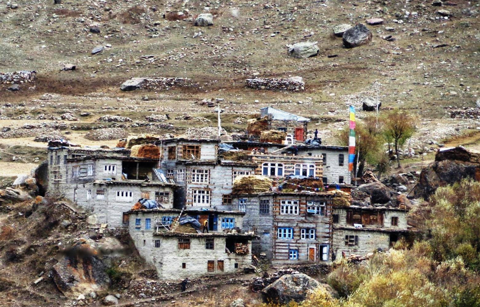
Sumcham, the last Village on the trail that leads to the Hagshu La and into Zanskar
In the meanwhile the Mines are Guarded by the Police and are strictly off limits for everyone. Well almost everyone if you know what I mean. No one is simply allowed in the area and though you will find the location on the Internet I have purposely left out the exact location and details of the Mines. People who need to know already know it. Anyways its off limits so nothing much can be done even if you know the place. I will let it rest at that.
Hence the value of Kashmir Sapphires has only gone up and few are seen outside of Museums and Private collections. They are simply not found anymore.

Kashmir Sapphires in ready as well as raw form.
Ah and coming back to Ronny. After going through more details Ronny was convinced this is the same Kashmir Sapphire which was stolen in Milan. Though reduced in Caratage (thieves normally do that and alter the shape of the Stone for obvious reasons) the characteristics mentioned in the certificate were exactly like his Stone. The Stone was withdrawn from the Auction but Ronny didnt stop there. Though he got insurance amount of around 1.8 Million dollars in 1996 after the Theft but he needed the culprits to be caught. As we speak now Ronny is fighting out in the Courts with present owners to get viewing of the Kashmir Sapphire and have it verified by independent experts. More on that when something happens.
Coming back to the Kashmir Sapphires and this is what a Gemologist says about them “The Sapphires of Kashmir form an exclusive class of their own. In the Jewel trade it is customary to attach the appellation 'Kashmir' to any fine Sapphire regardless of its geographical origin. This is an indication of the outstanding qualities of Kashmir Sapphires. The colour of these Sapphires resembles the beautiful hue of the peacock's neck. Even a small concentration of that fine colour illuminates the entire structure of the Gem.”
The Elusive Kashmir Sapphires
Kishtwar : At the Himalayan Crossroads
Kishtwar is a region in the Jammu division of the state of Jammu and Kashmir. Due to its unique location just under the shadow of the Great Himalayas and at the place where the religions and cultures of the Himalayas meet. They give Kishtwar a unique flavor which remains largely unexplored.
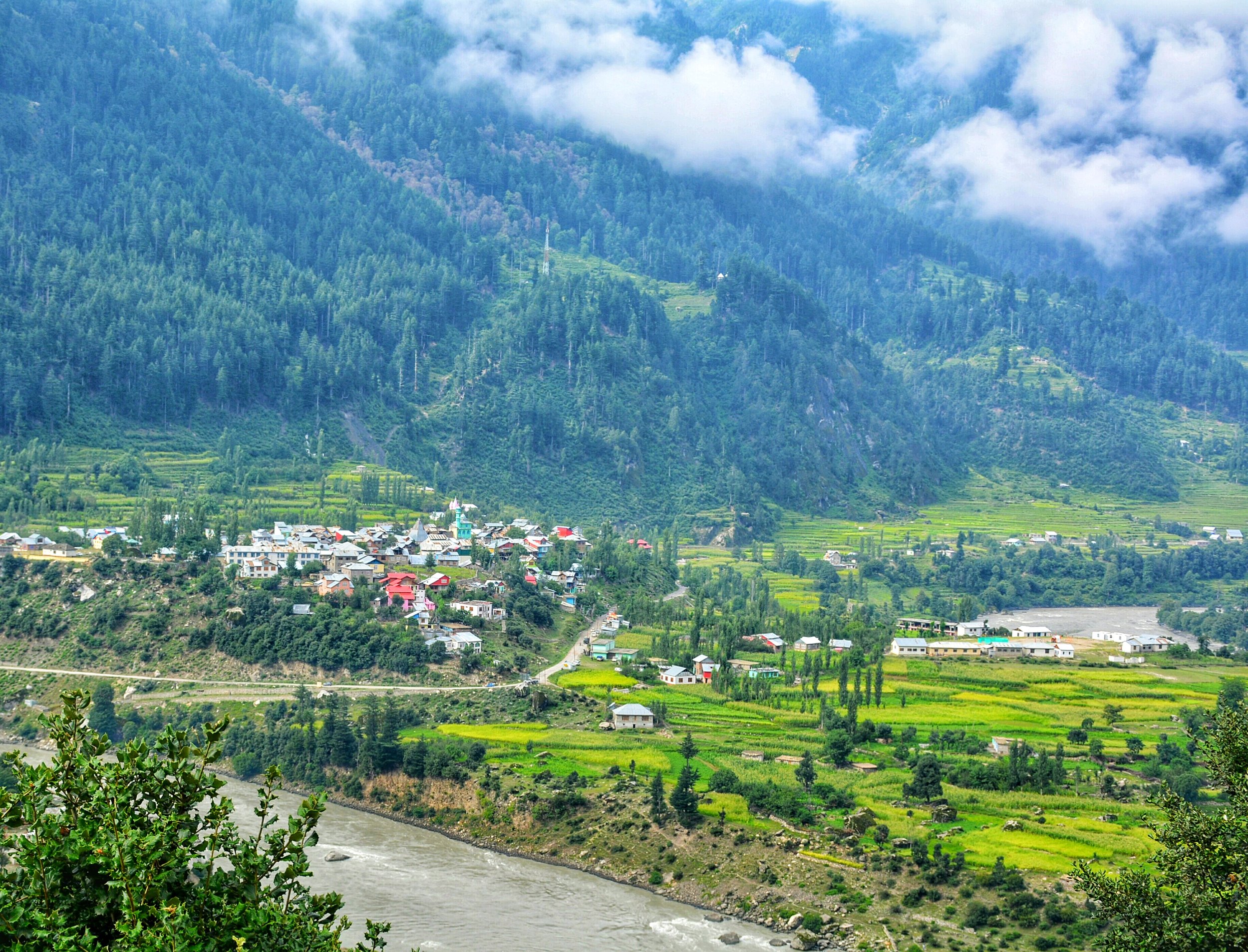
Kishtwar : At The Himalayan Crossroads
Kishtwar today is just a district in the Jammu Division of the state of Jammu and Kashmir. It borders the Kashmir Valley on one side, Doda on the other, Zanskar in the North, Chamba in the South. It has been noticed by some hard core mainly foreign Monatineers in the past and even recently for the great climbing opportunities it offers in the Kishtwar Himalayas.
Ok coming to what I wanted to write about. The Great Himalayan Range and its related Ranges stretch from the Pamir Knot down to the Hengduan Mountains in North Western Kunming. Besides all the ethnic and cultural variety there are also a variety of Religions practiced in these Mountains. Since Religion is a hot topic of debate and discussion and even derision on the Himalayan Club I decided to write on a subject related to it. To me the Religion of a place carries as much value as the ethnicity or the culture or the language does.
In the Himalayas there is the basic presence of three of our great religions. In the Western and Northern part of the Western Himalayas it is Islam which dominates. However beyond the Himalayas in the North its Buddhism. Towards the Eastern and Southern Part of the Western Himalayas it is Hinduism. And of course Buddhism in the Trans Himalayan reaches. The Central Himalayas are a stronghold of Hinduism stretching all the way across to Sikkim. But again as a feature seen earlier its Buddhism which dominates the higher Himalayas and the Trans Himalayas. Beyond Sikkim its predominantly Buddhism which is the majority religion.
Its in Kishtwar that the three belief systems merge and hence it gives unique place in the Himalayas. The majority population follows Islam, a large minority follows Hinduism and a very small minority of Buddhists also exist in Kishtwar. Its in the upper reaches of Padar (which used to be called Paldar by the Ladakhis / Tibetans) that there are exist Buddhist villages which follow the same Tibetan Buddhist traditions that are followed across the Great Himalayan divide in Zanskar. Infact in some of these Villages in Kishtwar there still exists an animal which is associated more with Ladakh or Tibet ie the Yak. In the Padar Region in the upper reaches along the Machail River there are the twin hamlets of Halo and Hango on the left side of the Machail River and the Villages of Lossaini, Dangali, Scham and Jashari which are all Buddhist Villages.
Towards the south bordering Doda and Chamba are a majority of Hindus contiguous with the populations to the South. The main Kishtwar town and to the North of it are majority Muslim population many of whom have actually come in from adjoining areas in Kashmir. In Fact the Kashmiri spoken by the people in the Warwan Valley, which is a part of Kishtwar, is supposed to be the purest form of Kashmiri as it was spoken in the olden days. The Warwan Valley runs parallel to the Suru Valley in Ladakh separated by the Great Himalayan Range itself.
Kishtwar is first referred to in the Rajatarangini by the ancient name Kashthavata, during the reign of Raja Kalsa of Kashmir (1063–1089), when "Uttamaraja", the ruler of Kashthavata visited the court of the Kashmir King in company with several other hill chiefs to pay their respects to the Raja.
It was more or less an independent Hill Kingdom ruled by Rajput Hill Rajas as was the norm in the region. The Royal family had supposedly descended from the Royal family of Suket.
However subsequently a part of it also became a part of the Western Tibetan Kingdom and the one of the Kings divided his Kingdom between his sons and they got Zanskar, Purig and Kishtwar as separate Kingdoms. However in the absence of any written historical records of history of the Region the timelines are just approximate guesses and due to the Geography of the region it is well possible that a part of Kishtwar was under the Rajput Hindu Rajas and the more higher and remote areas like Padar was under the rule of Ladakhi/ Tibetan Rajas.
In the 17th Century the Rajas of Kishtwar converted to Islam so did a large part of the population. But in an odd adaption the Rajas, though Muslims by religion, had Hindu Rajput names and this continued till the 1820 when it was captured by Raja Gulab Singh, a vassal of Maharaja Ranjit Singh. The name of the last ruling was Raja Muhammed Teg Singh s/o Raja Inayatullah Singh. The campaign for the capture of the Kingdoms of Kishtwar, Reasi and Arnos was carried on by none other than General Zorawar Singh who subsequently became the Governor of these erstwhile Kingdoms and it was from here that he planned his invasions of Ladakh, Baltistan and Tibet. And one of his main Officers, Col Mehta Basti Ram, of the well known Mehta clan of Kishtwar, who campaigned fearlessly with General Zorawar Singh in all his Campaigns. After the death of General Zorawar Singh and the subsequent signing of the Treaty of Chusul, it was Col Mehta Basti Ram who became the first Governor of Ladakh.
As of today this most beautiful part (arguably) of Himalayas lies mostly unknown to outsiders except a few adventure seekers. Lying in the shadow of Kashmir and Ladakh but a part of Jammu that can give both these places more than a run for their money just with its amazing Geographical and Cultural diversity.
Kiki’s Blog
Stories from the Himalayas








Five years ago the Galwan Valley was in the News for the wrong reasons after a deadly clash between the Indian and Chinese Armies in the Valley located in Ladakh lead to many deaths on the contentious Border between the two countries in wake of continued Chinese intrusions into Indian territory.
This area along the Shyok River, of which the Galwan Nallah or the Galwan River which forms the Galwan Valley has been off limits to Civilians since long but now the Indian Government has decided to open up the area for Civilians and we were amongst the First Civilians to venture into this beautifully desolate part of the Eastern Karakorams in Ladakh. Earlier Civilians could only venture upto the Village of Shyok from where the Shyok River takes a U turn and flows in a Northerly direction.