

Kiki's Guide to Kashmir
A Rough Guide for People planning to visit the Kashmir Valley. And notes on the History, Culture and most importantly the Geography of the Region. And taking you beyond the normal Tourist Hotspots into more Offbeat and even unheard of places in Kashmir.
A truly fascinating place which gives people the visions of beauty and is referred to as the “Paradise on Earth”. The name is enough to conjure up images of snow covered mountain peaks, valleys with a shroud of flowers, enchanting Mountain streams and beautiful lakes. Well the geography and the de facto political boundaries of the state are a bit more complicated. Here I try to explain the complexities of what used to be the Riyasat-e-Jammu and Kashmir in 1947. I will use that as the reference point and as a geographical unit will refer to it as RJ&K.

Moving beyond the territorial claims that individual countries have on RJK and avoiding the political baggage that comes with the veracity of each claim I will just mention the geography and the political status as it exists as on date. Based upon the actual territory that is being held by the various countries which have a claim on RJK. That being said, I would like to emphasise that the purpose of this article is to educate travellers and mountain lovers about where they can go and where they cannot, which is governed basically by their nationality and the relationships which exist between individual countries.
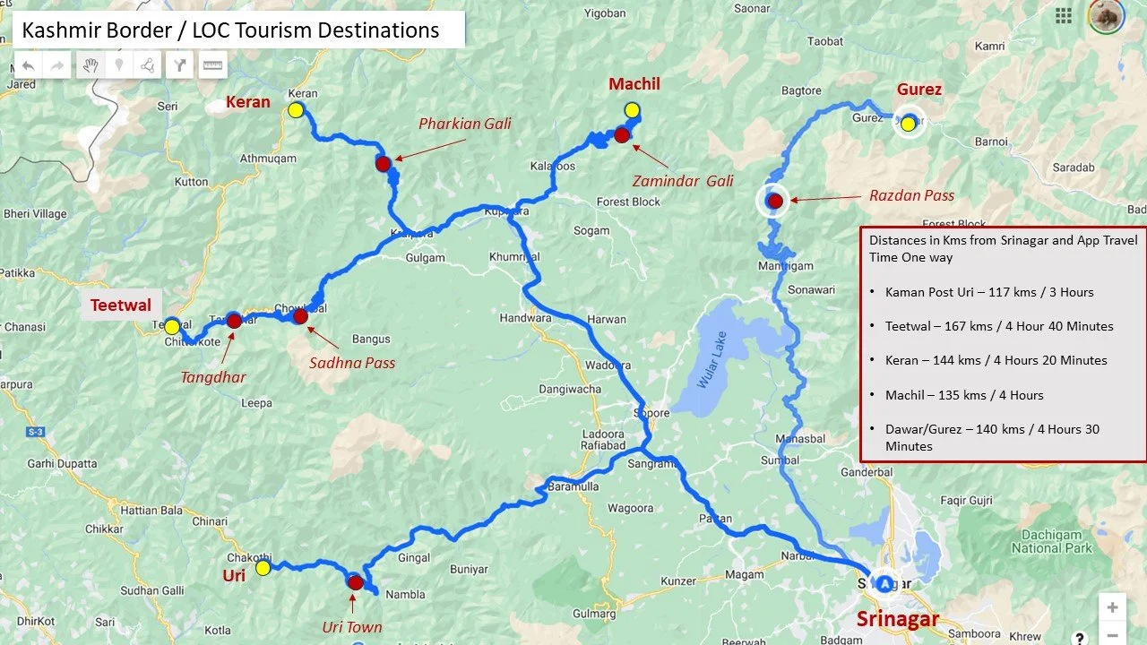
Offbeat / LOC Locations in Kashmir
RJK consisted basically of the regions Jammu, Kashmir, Ladakh, Baltistan, Gilgit and the uninhabited Aksai Chin. I would first comment on the areas of RJ&K that are under de facto Indian control which I will call J&K. J&K broadly consists of the regions of Jammu, Kashmir and it used to include Ladakh. Until they were divided into two separate Union Territories, one J&K and one Ladakh. However there are little parts of the former Baltistan that exist in J&K like the Kargil district and even Gilgit like Gurez. Jammu consists of the Jammu district as well areas along the border like Poonch, Rajouri, Udhampur and Doda. The beautiful Valleys of Bhadarwah and Kishtwar are also a part of the Jammu region. Jammu has its share of mountains especially the rugged region of Kishtwar but they are largely unknown and away from the glare of the outside world. I will cover the Jammu region in detail in a later post but for now we move on to Kashmir.
From Jammu we move onto the fabled “Vale of Cashmere” as it was called. Technically the Valley starts once you cross the Banihal Pass/ Banihal Tunnel (Pir Panjals) on the highway or when you cross the Pir Ki Gali Pass (Pir Panjals) on the Mughal Road when coming from the South. The original road to the Valley via Muzuffarabad is no longer in use due to political reasons. Also you can alternately cross the Sinthan or the Margan Pass to go to Kishtwar or Warvan. Up North the Zoji La marks the exit from the Valley while to the North West the Razdhan Pass would also entail technically leaving Kashmir Valley but those areas of Gurez are still considered a part of the Kashmir region.
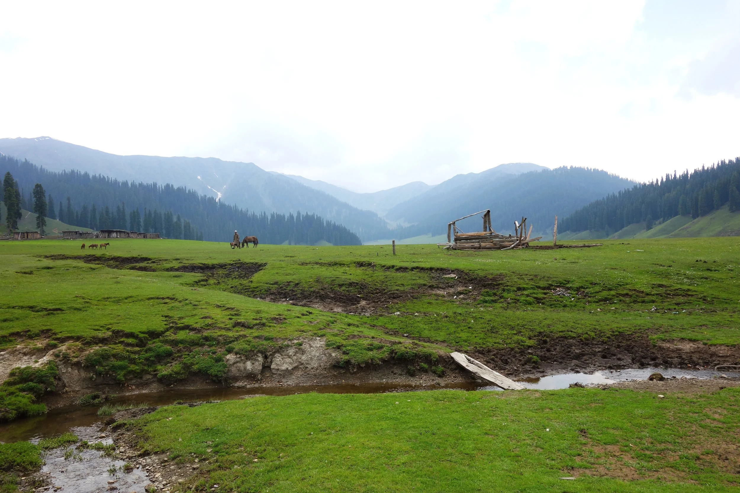
In the geological past the Valley was once a lake called the Satsar Lake which drained eventually due to various factors. However there is still a large diversity of of Lakes from the largest Wular Lake to the most famous Dal Lake to thousands of high altitude lakes nestled within the mountains which are an attractive trekking destination. The Kashmir Valley is bound on the South and South West by the Pir Panjals. And on the North and North East by the Great Himalaya and the Zanskar Range. It is by far the largest Valley in the complex Greater Himalaya Mountain system and certainly the most celebrated one.
Kashmir Valley is actually the Jehlum Valley and the Jehlum is the main drainage system for the Valley. The traditional source of the the Jehlum is considered to be the springs at Verinag. However many attribute the source to the Konsarnag Lake and even the Sheshnag Lake. The Lidder and Sindh are two main well known tributaries of the Jehlum. The Lidder has two main sources the Kolahoi Glacier for the West Lidder and the Sheshnag Lake for the East Lidder. The Sindh River rises from the Machoi Glacier near the Amarnath Caves.

A Faith Map of Jammu and Kashmir by Drew in 1875
Srinagar is the capital city of J&K and lies on the banks of the Jehlum River and it also includes the famous Dal Lake and the Nigeen Lake. The city is well know for the various Gardens laid out by the Mughals as well as the new fangled Tulip Garden which is a hit with the tourists. The Srinagar city has its own range of mountains called the Zabarwan Mountains which is a sub range of the Zanskar Range. The home of the endangered Hangul, the Dachigam National Park also lies on the edge of the City.
There are various other places of tourist interest in the Valley including Gulmarg, Pahalgam, Sonamarg, Yusmarg, Kokernag, Verinag, Achabal, Daksum, Parang and lately places like Doodpathri etc. My personal favorite has always been Gulmarg probably because I have sent a lot time here while growing up. However recently it is is over crowded and over priced. Gulmarg is a great Winter destination due to the humongous amount of Snows it gets.

The Wadwan Marwah River
The lesser know place which has fascinated me the most has been the Warwan Valley which could only be reached by trekking in the good old days. I happened to spend 5 nights in this enchanting Lost World. Being born in Kashmir and having familial connections in Himachal I have seen a lot of mountains but Warwan was special. Nowadays there is a road which goes over the Margan Pass and takes you to Inshin, the main village in Warwan. As of now I am not aware of how further this road goes. Technically though Warwan is a part of Kishtwar and hence a part of the Jammu Region.
A special note on Warwan Valley : The people of this region are by some accounts the closest that come to the ancient Kashmiris. Their language is the purest form of Kashmiri. The Warwan River runs through this enchanting Valley. This Valley runs parallel to the Lidder Valley and is around 3 to 4 km wide and 30 km long at an average elevation of 8000 to 9000 ft. At a place called Sukhnis the Valley transforms into a Gorge and on reaching Rangmarg you have two options.Taking a left leads you to the Gulol Pass crossing which you can descend into Sheshnag. Going straight takes you to the Botkol Pass going over which you come down to Panikher in the Suru Valley (Zanskar). This is the same route taken by the indomitable General Zorawar Singh when he launched his expeditions into Ladakh. Interestingly there was a Government proposal to make a road from Pahalgam to Panikhar which would technically be 45 kms but would provide unparalleled beauty as for almost half that route would under be the shadow of the fabled Nun Kun Massif. A point of special note is that Warwan as such is not in proximity of the Line of Control as compared with Gurez or Lolab.
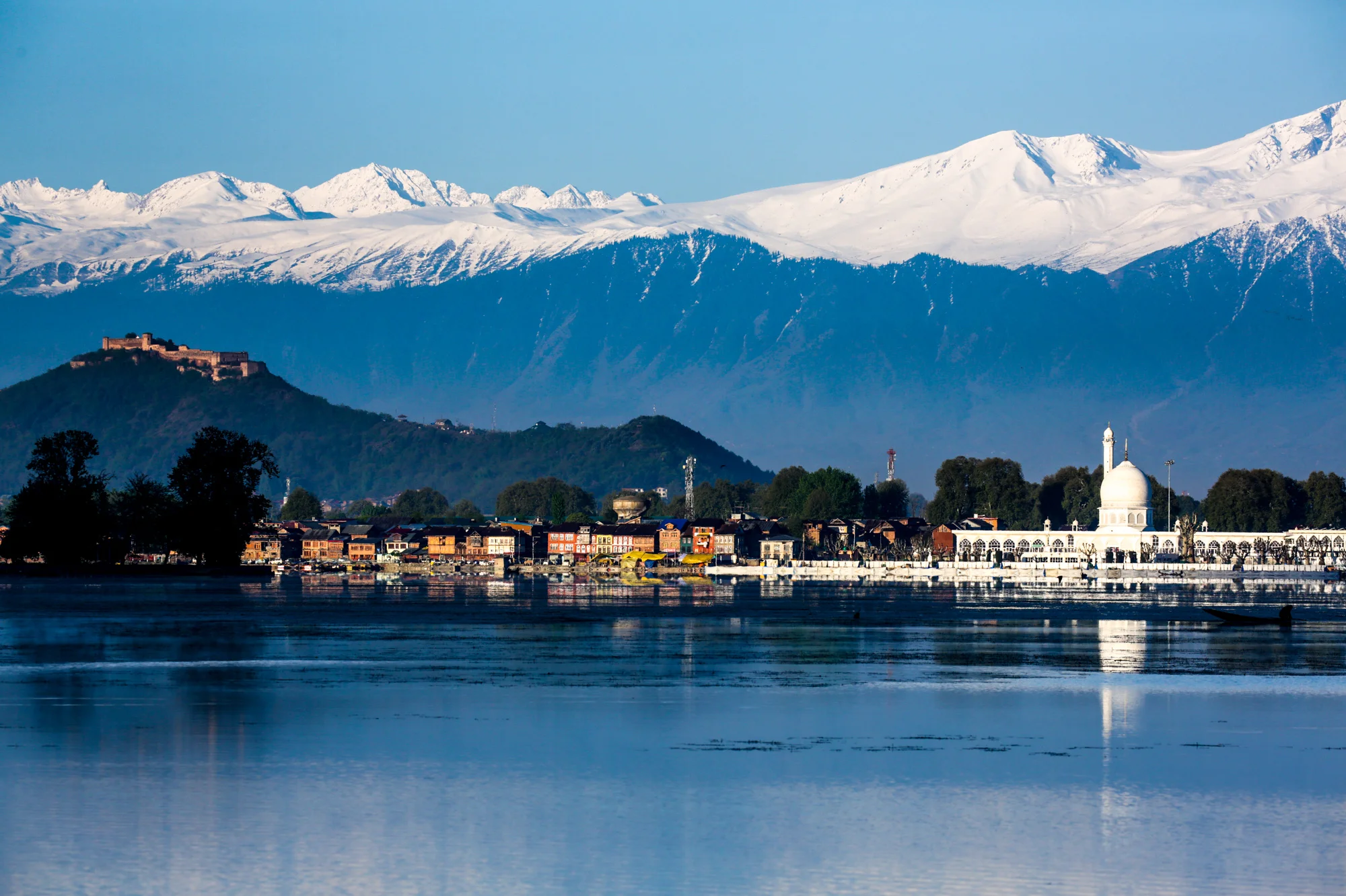
The Hazratbal Shrine by the Dal Lake and the Pir Panjals in the back ground
On the same axis lies the Sinthan Pass which connects Kashmir with Kishtwar proper. This scenic Pass is now becoming a destination as more and more Tourists go there to experience Snow which lasts well into June usually on the Sinthan Pass. One can also cross the Pass and go into Kishtwar and there are many interesting places there as well. Totally Offbeat.
Another region which sees a lot of tourist interest in the Gurez area. Gurez is actually a part of the Gilgit region but is counted in the Kashmir Valley. The people in Gurez speak Shina and were always more aligned with fellow Shina speakers in Gilgit rather than with Kashmir. The road to Gurez leads one over the Razdhan Pass and then you enter the enchanting land called Gurez. There is a road which goes from Gurez towards Kargil but as of now it is a military road but earlier that used to be one of the main Roads into Gurez. The fact that it is a part of Baltistan is borne out by the fact that the locals speak the Shina language, which is quite prevalent in Baltistan instead of Kashmiri.
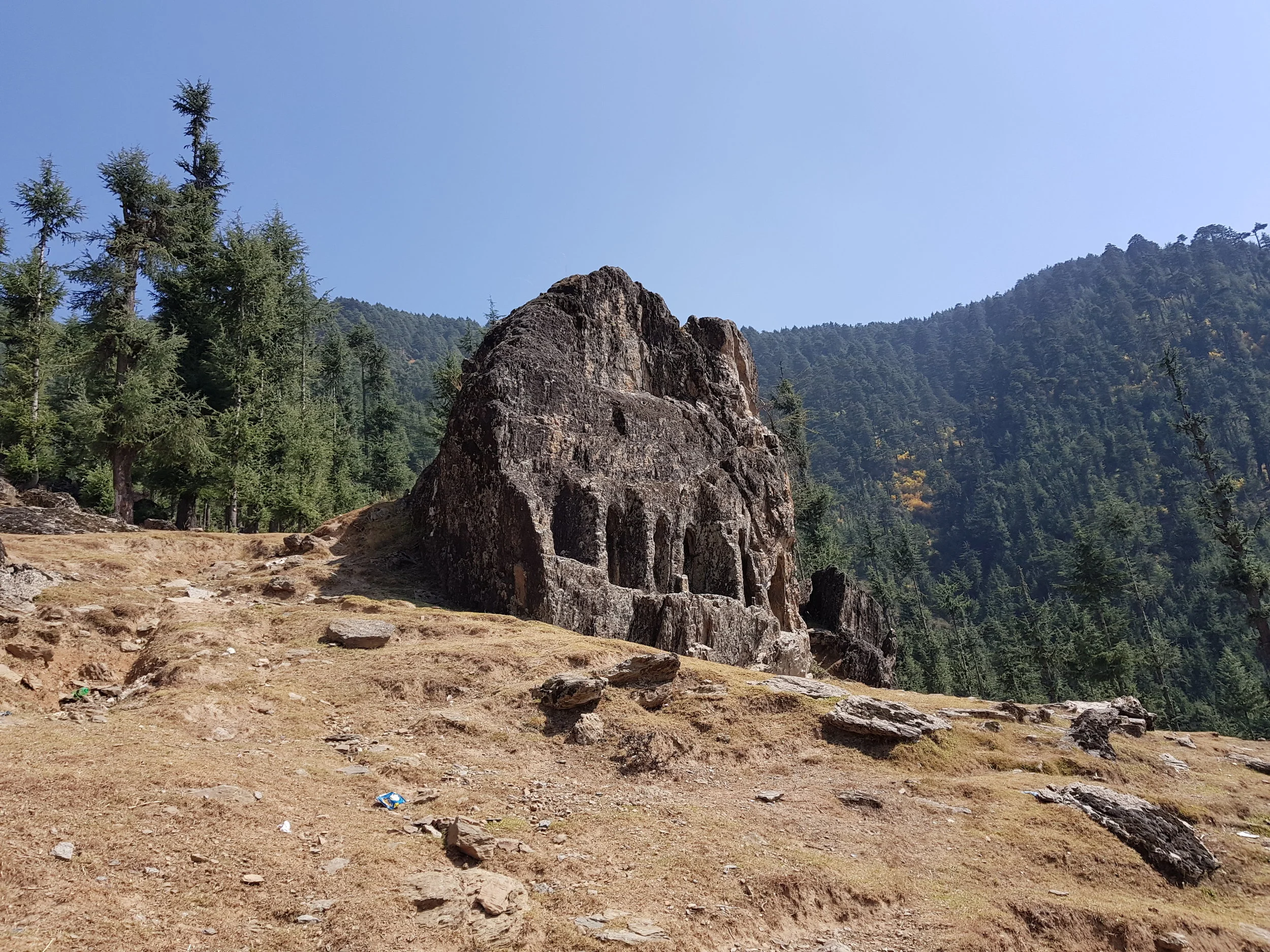
The Kalaroos Cave in Loalb Valley
And then there is the Lolab Valley and the Bangus Valley (both the Bod Bangus and the Lokut Bangus) in North Kashmir district of Kupwara. These are again very scenic areas but the movement of civilians especially tourists was severely restricted due to the proximity to the Line of Control. However now the restrictions have eased up and many Tourists now visit Bangus. Bangus is the largest Alpine meadow in Kashmir and covers a large area. The other famous Meadows in Kashmir like Gulmarg, Doodhpathri, Yusmarg and Tosa Maidan lie in the Pir Panjals and South and Western Kashmir but Bangus abuts the Great Himalayan Range itself. A Motorable Road has already been built to Bangus itself and Vehicles with 4x4 and Good Ground Clearance can already get t Bangus and even normal Passenger Cars would be able to get there once the Road is black topped.
And now for the first time the Government is trying to promote Tourism to the areas which lie right on the LOC along the Kishenganga. This includes places such as Machil, Keran, Tangdhar and Titwal. Ours is the first Travel Company which has started limited Tours to these places for Adventurous clients.
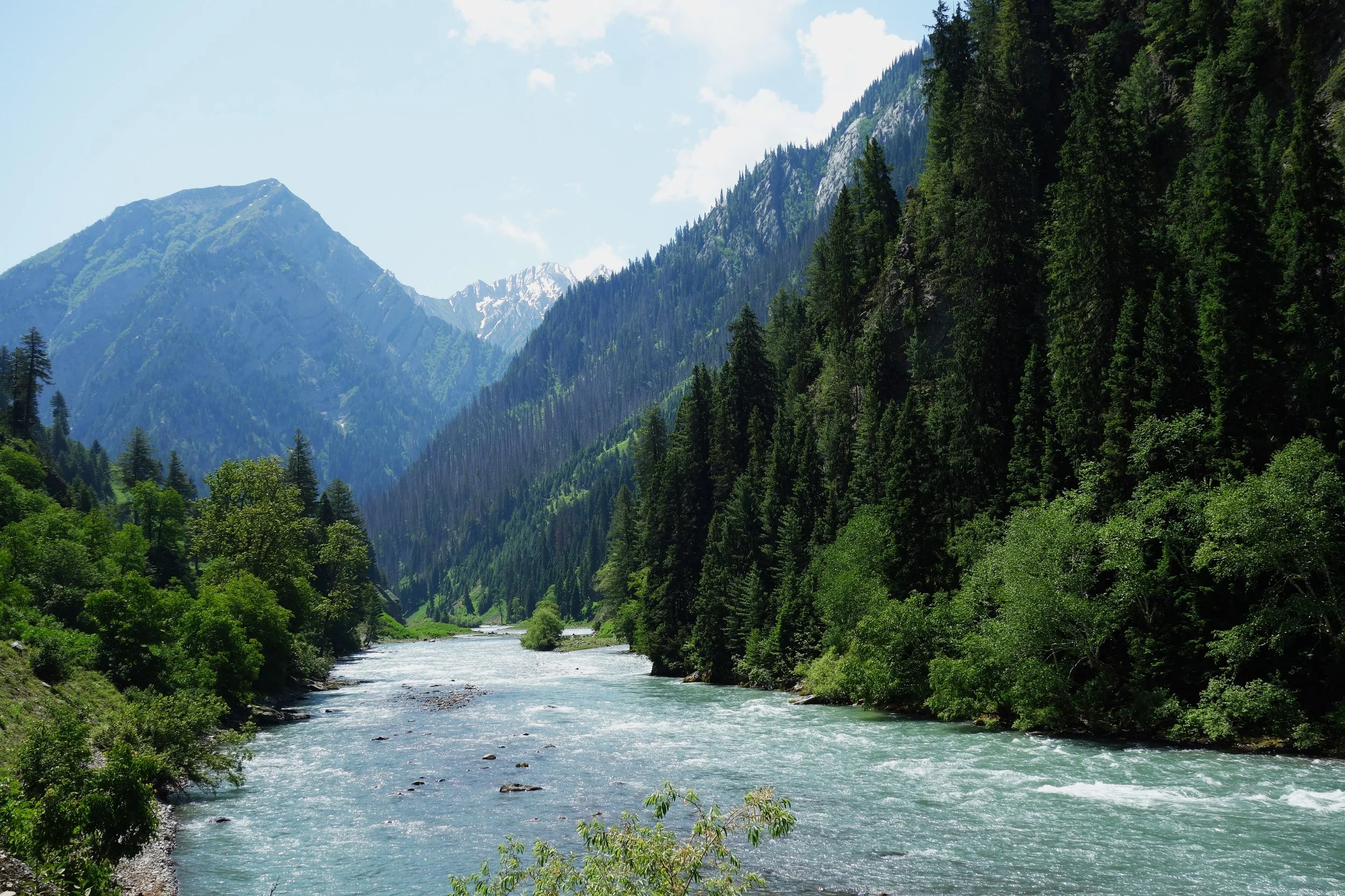
The Kishanganga River flowing through the Gurez Valley.
Weather
Kashmir has a Continental Weather with a proper 4 Seasons. In the Winters it can get quite Cold and all areas of the Valley get Snow in the Winters. Places like Gulmarg get a huge amount of Snow and that's why it's everyone’s favourite Winter Destination. Spring is probably the best Season in Kashmir with pleasant Days and Chilly Evenings. The Summer starts around mid June and July and in recent years it has started to get really Hot in Summers. Autumn again the Days become pleasant and the Nights Chilly.
Transport
The biggest advantage in Kashmir is the International Airport in Srinagar and its connected directly / indirectly with all Major cities. The Flight from Delhi to Srinagar is just One and Half Hours. Of course there is the Highway as well its on the verge of being connected by Rail in a couple of years.
Places to Stay
Kashmir offers a large Range of Accommodations especially in the areas more popular with the Tourists. From Budget Hostels to Five Star plus accommodations. Plus there are Homestays which offer a unique Cultural Experience as well. You can also take a look at Our Kashmir Boutique Stays in Srinagar and Pahalgam. And soon we will be in Gulmarg as well.
Tours
Here are some of the Signature Tours we run in Kashmir for people interested an authentic Kashmir Experience. People coming for the first / second Time can opt for our Kashmir Boutique Experience. People who have been to Kashmir before but now want to Experience the Offbeat side of Kashmir can go for our Kashmir Offbeat : Gurez, Lolab and Bangus Tour. And for People who want edge of the Seat Adventures we can recommend our Kashmir Edge Border Tour.
We can Customize as well and Organize Trips to all these Places. Connect with us on Whats App Messenger on 98712 92288 for a Great Kashmir Experience.

Warwan Marwah Dacchan : The Last Inner Himalayan Wilderness
Kishtwar itself is remote and always under the shadow of Kashmir but this part of Kishtwar which lies next to Kashmir on one side and the Suru Valley of Ladakh on the other side is probably one of the last great wildernesses in the Inner Himalayas. This is the Warwan- Marwah - Dachchan belt lies along the Maru Wadwan River or as its also known Warwan / Marwah (Marev) / Marsu Dhar River along different parts of its course, which is a major tributary of the Chenab.

In the Inner Himalayas lies a beautiful Region so remote that most people haven't even heard of it forget about going there. Kishtwar itself is remote and always under the shadow of Kashmir but this part of Kishtwar which lies next to Kashmir on one side and the Suru Valley of Ladakh on the other side is probably one of the last great wildernesses in the Inner Himalayas. This is the Warwan- Marwah - Dachchan belt lies along the Maru Wadwan River or as its also known Warwan / Marwah (Marev) / Marsu Dhar River along different parts of its course, which is a major tributary of the Chenab. These three sub parts of this Region all lie along the same River and offer a rare insight into how people lived maybe many years ago. Sandwiched between the Pir Panjals and the Great Himalayan Range this is a Region few outsiders have set foot.
My romance with this area began in 1989 when I was a student in Class 9 in the Burn Hall School, Srinagar. We were supposed to Trek from Daksum in Kashmir to Kishtwar via the Sinthan Pass. But at the last moment the original Trek was changed. Now we were to go from Daksum to Pahalgam via the Warwan Valley. None of us had even heard of Warwan Valley before but of course we had little choice in such matters. So off we went and on the second day we climbed up the Margan Pass and started to descend into Warwan Valley towards Inshan.
It was like walking into a lost World. The Houses were still made all of wood and the people still held that innocence. Of course the whole Village was excited as we were around 30 people. Technically though Warwan is in Kishtwar the people here speak the purest and the oldest form of Kashmiri. We happened to Trek for a few days in the Valley headed North and after reaching the head of the Valley we turned right and went over the Gulol Pass and descended onto the Sheshnag Lake to join the Amarnath trail. And of course we didnt take any pics at that time. But the memories were still there. And even today pics of these areas are very hard to come by.

The Gazetteer of Kashmir puts it as such :
MARU WARDWAN (They considered the Wardwan and Marwah as one long Valley which is also kinda like the case)
The name of a long and narrow valley lying to the South-East of Kashmir, from which it is separated by a lofty range of mountains; its direction is nearly north and south, its length being about 40 miles, and its average breadth not more than a quarter of s mile; that part lying between Maru and Wardwan being merely a narrow defile, whose sides are very steep and covered with a jungle, chiefly of fir trees. It is bounded by high and rugged mountains , which almost entirely exclude the sun from its lower portions.

The river which intersects it is a considerable stream which swells to a mighty torrent during the melting of the Snow. It rises at the northern extremity of the valley, on the borders of Suru, and flows south until it joins the Chandrabhaga just above Kishtwar, receiving in its course several tributaries from the numerous minor valleys which open on each side of it.
The upper portion of the valley is called Wardwan, and the lower Maru, The Village of Inshin, in the middle of the valley, is distant about 84 miles north of Kishtwar; and thence to Suru, by the Bhot Kol Pass, is about 76 miles, or five marches. There are various paths communicating between the Maru Wardwan Valley and Kashmir ; the principal are those lying over the Margan and Hoksar passes ; by the former Islamabid is distant 67 miles from Inshin, and by the latter 51 miles from Maru or Petgam.
'The Maru Wardwan valley contains several thinly-populated villages; the houses, which are double-storied, are roughly built of timber, and have pent roofs. It forms a portion of the Udhampur district.

Very little difference is observable in the dress and appearance of the inhabitants of this valley and of those of Kashmir, but they seem to share some of the prejudices of the Tibetans, as Vigne relates that he was told that after a death among the inhabitants of the Maru Wardwan valley, none of the deceased's relatives will touch milk until the arrival of a particular day. All the natives of the valley are, mith scarcely an exception, Muhammadans.
The climate ie very rigorous, and rain or snow falls throughout the greater part of the year; the stony fields produce but one harvest in the twelve months, and that is limited to a scanty crop of Trumba and Grihmah, and for five months of the year the inhabitants are absolute prisoners to their houses, the snow lying 10 and 15 feet deep, entirely blocking up the lower stories of the habitations. Pollard trees, Which elsewhere furnish abundant supplies of fodder for the cattle during the winter months, are very scarce, and such trees, as do grow, are small and stunted. Despite these disadvantages a considerable number of ponies are bred in the Valley, and taken to Suru, where they find ready sale or barter.

A good pony, between three and five years old, fetches, it is said, about Rs.20 (British currency). The vendor prefer to be paid in cash, but has frequently to be contented with tea ; in this case be receives a damu (a weight equal to three seers) of tea, which is valued at Rs.17 ; on this he is required to pay an import duty of Rs.2 at the custom post at Sukhnis, at the north end of the valley. If fortunate, he disposes of his tea to an itinerant merchant in the Valley, otherwise he must continue his journey to Islamabad or Srinagar before he can sell it for the Rs20 it is supposed to be worth in Kashmir ; in either case, when the labour and risk are considered, it is apparent that the transaction brings little or no profit.
The geological formation of the Maru Wardwan valley is gneiss, mica alate, and a silicious grit. The Maru Wardwan Valley is mentioned by Abul Ful in the Ayin-Akhbari ss the Murwar Dhun.

DACCHAN
The name applied to the mountains on both sides of the defile to the South of the Maru Wardwan Valley, through which the river flows on its course towards Kishtwar. The path which lies up this valley is extremely difficult, and not practicable for ponies. (Pigne.)
Now there are a few interesting Tales and Stories of this Region outlined by a few visitors who came to this place including the most eminent Archaeologist of Kashmir, Ram Chandra Kak who went onto become the Prime Minister of the Riyasat under Maharaja Hari Singh. RC Kak had visited the Valleys in the 1920s and were published in the publication called the Antiquities of Marev Wadwan.

The Valleys of Wadwan and Marwah are completely Muslim barring a few in Marwah and in Dachan they are mostly Hindu. But historically it was the inhabitants of Marwah who were more warlike who dominated all the 3 Valleys. The hereditary Zamindars carried the surname Malik but were originally Rainas pointing out that they came from outside. As per their local tradition their ancestors came from Bengal but the actual history is obscured in the fog of time. The most amazing part was that R C Kak was shown actual firmaans issued in the name of the Maliks by the Governors of Kashmir from the time of Jahangir and all the way to the time of Shah Shuja. These Marwah Maliks even provided Marrivs (as the local residents are called) to General Zorawar Singh for his campaigns in Ladakh and apparently they gave a good account of themselves. It said even from his last Campaign a few Marivs were among the few who survived.
Moving towards the South we come to the Region called Dachchan which is mostly Hindu and quite a mysterious one at that. RC Kak noted that the condition of the Men in Dachchan was unusually wretched which was because apparently almost every Woman there was proficient in the Black Arts and Witchcraft. The Men it seemed were constantly under their spell. He also noted that Marriage was quite a casual affair where a Man who found himself in an affair with a Married woman could simply pay her husband off and get her as his Wife. RC Kak noted that the whole Society was deeply ensconced in Sorcery and deviousness of all kinds. And then there were another set of people who would actually help you combat the evil spells and curses cast upon you. Curiously the Sorcery did not work on the Maharaja’s officials as it was said that during the rule of Maharaja Gulab Singh the Witches promised that they wouldn't cast their magic on his Officials. And I guess the Witches stuck to their promise.

Of course times have changed now but still due to the absence of proper Roads the area remains pretty cut-off. And as a result Backward but as the photographs would testify as far and Natural beauty is concerned this Area is second to none and hopefully now that the State has become a Union Territory some Tourism would be promoted in this Region and in Kishtwar as a whole. Nowhere else in the Himalayas due you get such a mix of Culture, Language and Religion as you do in Kishtwar.
The Newt of Chuharnag
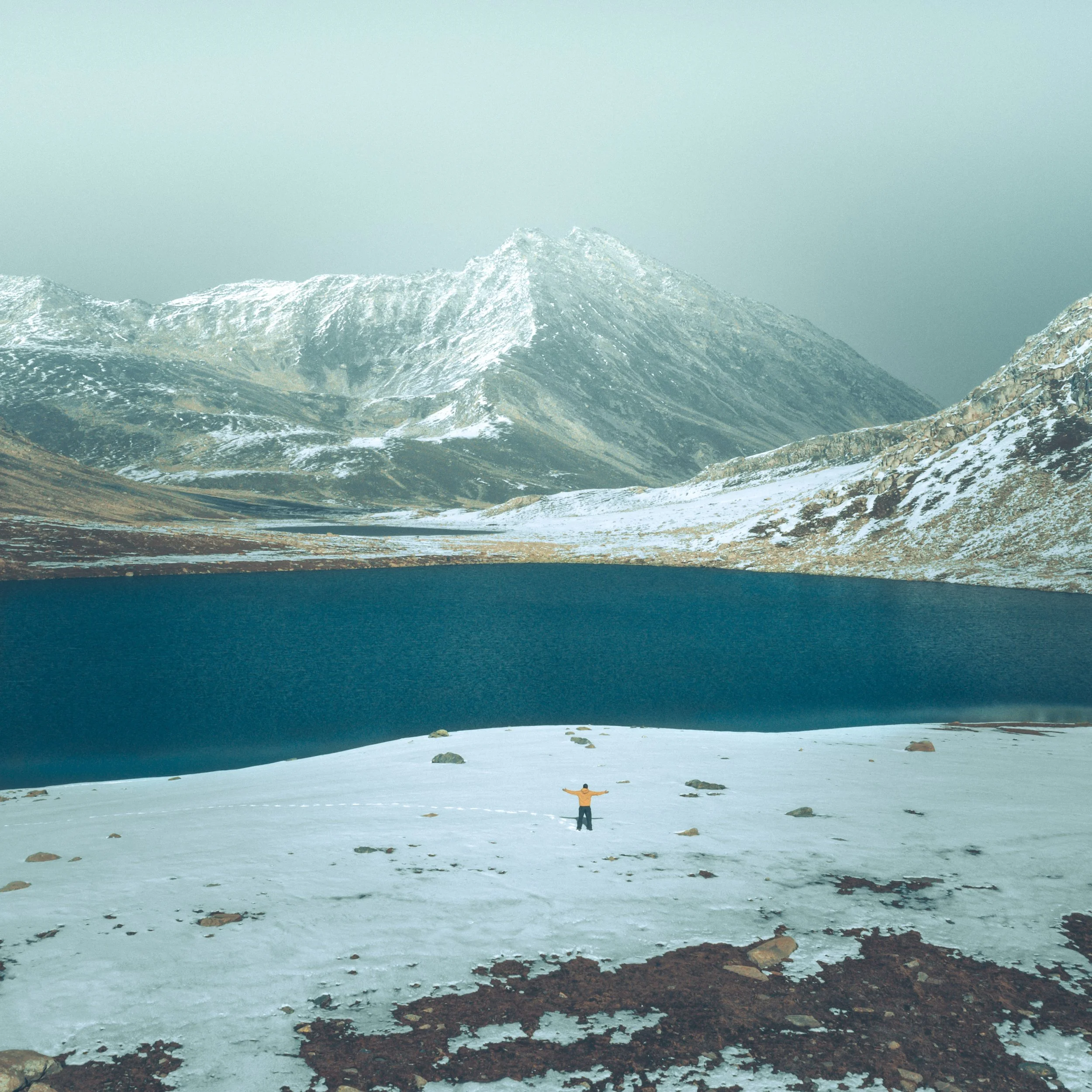
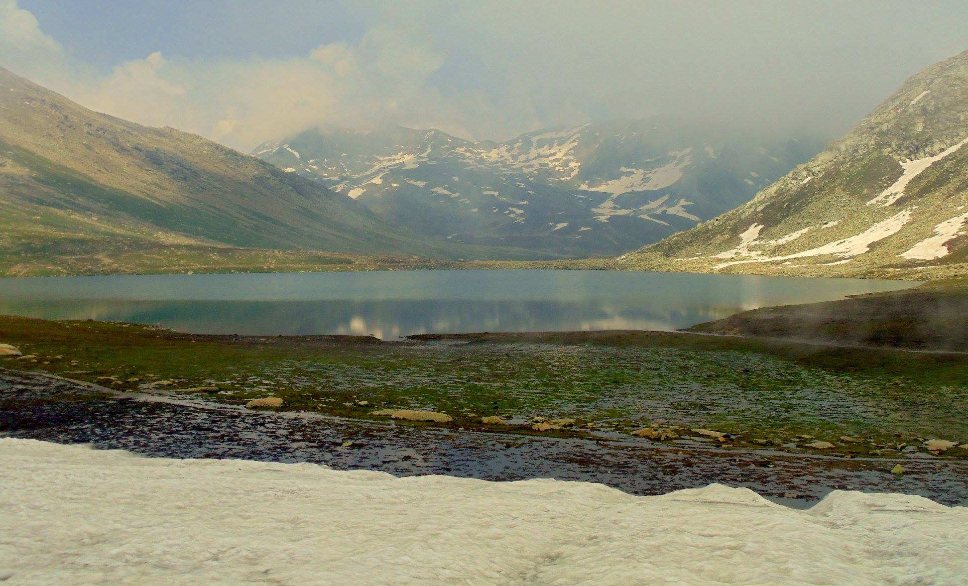
The high Altitude Lake of Chuharnag is a home to various stories and legends. The most endearing one of the Newt of Chuharnag that people used to “kidnap” and hold till the Gods paid them back in the form of Rain.
The Newt of Chuharnag
Margan Pass at 3810 m is a Pass which connects the Kashmir Valley with the fascinating Wardwan Valley in the Kishtwar District. However the main Pass which connects Kishtwar proper to Kashmir is the Sinthan Pass and that is the Route which is usually taken.The Newt of Chuharnag
The Margan Pass which has in recent years become Motorable (though the climb is tough one) is as fascinating as ever and has many stories connected to it as from Wadwan one can cross over to Suru Valley or even Zanskar or the Lidder Valley or even Amarnath. I had trekked across the Margan Pass into Warwan in 1989 as a part of school Trek and we had camped just under the Pass and it was just amazing.
As it so happens near the Pass and a short hike away lie a couple of Alpine Lakes which I have not had the opportunity of visiting but they are on my List. One of these is called Chuharnag Lake or the Tsuharnag Lake. Point to be noted is that the Wadwan has for centuries being a region which straddles almost all the three Divisions of the state Kashmir, Jammu and Ladakh has been a haven for all kinds of renegades throughout history. I had recounted the story of Chamal Singh and Co, a disgraced General who became a very successful Dacoit and spread terror all across the Pir Panjals.
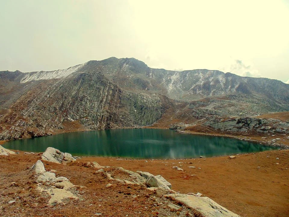
But this particular Lake has certain mystical stories attached to it which are fascinating to say the least. The Lake gives great views of the Valleys around and is surrounded on three sides by grassy sloped Mountains which abound with flowers in the Summers. Those who have been to the Lake swear by the beauty of the Lake and a Lake such as this one was sure to have Legends attached to it as the norm with the Ancients.
Apparently the Chuharnag Lake was the guardian angel of the Kutahar Pargana in Kashmir though ironically not a drop of water from this Lake comes into Kashmir and flows into the Warwan River which is a tributary of the Chenab. The Kutahar Pargana consisted of a number of Villages like Tserpura, Shangas, Naogam and Achabal. I have spent nearly a year in Achabal as a toddler so I kinda like the place and the whole area as such.
Another story about the Chuharnag is the one about its family. Apparently Chuharnag’s mother sent her Eldest son to look for a place where they could live comfortably. The son returned and told her that he found a place but it only had room for him but not her. The Mother cursed him and he was turned into a spring coming out of white Rocks in a crag in the Mountainside. Its still there. Next she asked Chuharnag for the same thing. He came back and told his Mother though he had found a place but it only had Room for her but none for him. The Mother was impressed with him and granted him a preeminent place in the surroundings. The Mother also became a spring which used to be called Maji (Mother).
But the most interesting Legend of the Lake consisted of a Newt (a kind of Lizard for the ones not aware). These Himalayan Newts are found on the banks of some Alpine Lakes in the Himalayas. It is said, that since the Kutahar Paragna was mostly dependent on rain water for their crops (as Chuharnag used to send the water to the Chenab), the Hindus and Muslims of the Pargana used to send a Brahmin priests every year to come and pray at Chuharnag for the rains and make a sacrifice to the Rain Gods.
After having done this the Brahmin used to look for the Newts and eventually catch one. Once caught they put the Newt in a bowl filled with the Lakes water. Next they invoke the Lord of the Chuharnag and inform him that please grant us good Rains and in order to ensure you do the same we will carry the Newt down with us a “guest”. So basically the Newt was taken hostage in return for good rains.
But of course the Lords are also smart. Though it worked most of the times sometimes a smarty pants Lord would just cause Rainfall in the Mountains and not the Villages themselves. Well it didnt say anywhere in the agreement where they were supposed to cause the Rainfall.
The Brahmins were no less. In the beginning the Hostage is kept at a Brahmins place. And when they realise that the Lords have played the ‘Rain in the Mountains and not in the Villages” trick they turn the Newt over to the “scavengers” at that time at the lowest rung in the hierarchy of the Caste System. Of course this was a chastisement that even the Lords couldnt do with. And they had no options but to make the rains in the Villages.
Of course once the Rains came the Newt was ceremoniously released into the spring waters around the Village in a special ceremony. The Lords fulfill what is asked from them and as a result the hostage is honourably released. But during this period if any harm would befall the Newt then the wrath of the Lords would befall the family who were taking care of the Hostage. And incase the hostage died then a member of the family would also die as devised by the Lords.
Of course this is no longer the case. But once you hear such stories then the fascination for visiting such a place just goes to another level. Try and hike upto the Lake next time and try looking for a Newt but make sure not to take it back home as a Hostage ! :)
Story Source : The Legendary Sir Ram Chander Kak.
Pic from Summers. Chuharnag Lake, Margan pass, Jammu and Kashmir. Photo credit Aarif Mountaineer
Kiki’s Blog
Stories from the Himalayas








Five years ago the Galwan Valley was in the News for the wrong reasons after a deadly clash between the Indian and Chinese Armies in the Valley located in Ladakh lead to many deaths on the contentious Border between the two countries in wake of continued Chinese intrusions into Indian territory.
This area along the Shyok River, of which the Galwan Nallah or the Galwan River which forms the Galwan Valley has been off limits to Civilians since long but now the Indian Government has decided to open up the area for Civilians and we were amongst the First Civilians to venture into this beautifully desolate part of the Eastern Karakorams in Ladakh. Earlier Civilians could only venture upto the Village of Shyok from where the Shyok River takes a U turn and flows in a Northerly direction.