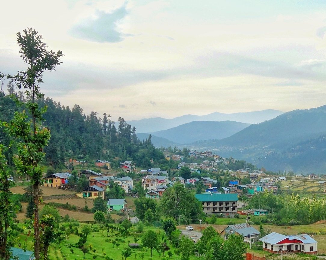
Bhaderwah
The beautiful Valley of Bhaderwah is located in the Pir Panjal Mountains in the Doda District of the Jammu Division of the Union Territory of Jammu and Kashmir located at an average elevation of above 5000 feet along the Neeru River which is a tributary of the Chenab. The scenic Valley offers an interesting mix of Culture and Traditions as well having been influenced by Chamba, Jammu and Kashmir. And it has always been compared to Kashmir as both are at a similar altitude for one.
Interestingly the Gazetteer of Kashmir and Ladakh of 1890 talks of this beautiful area as well. It specifically mentions that the fruits grown in Bhaderwah can rival the best grown in the Kashmir Valley. Tobacco grown in Bhaderwah at that time was said to be of a very superior quality. And Bhaderwah Homey was also said to be very good. In today’s age we know that the Bhaderwahi Rajmah is supposed to be one of the best Rajmah carrying on the old Bhaderwah tradition of being one of the finest agricultural areas in the State. The Houses are quite similar though the Bhaderwah Valley is much narrower than the expansive Kashmir Valley. The population also has a large Kashmiri component and the population consists of a Muslim majority with a large Hindu minority.
And besides the Bhaderwah Town which of course has the Bhaderwah Fort.
Places To See
Some of the other notable places one can visit in and around Bhaderwah is as follows :
Kailash Kund : The Kailash Mountain overlooking the Bhaderwah Valley is supposed to be the abode of Shri Vasuki Nag. At 13067 ft the Kailash Kund is the source of the River Neeru which drains the Bhaderwah Valley. The Yatra follows Mani Mahesh Yatra and starts with the Chari Mubarak from the Village of Gatha in Bhaderwah and then goes to Vasuki Nag Temple in the heart of the Town. At Ramkund one halts for the night and there on to Kailash Kund. The annual Kailash Yatra takes place in the month of August.
Seoj Meadows : The Meadow of Seoj is flanked by a gushing River on its West which emanates from the Hills surrounding the Kailash Kund. The Landscape across the River is a replica of Pahalgam whereas on the Eastern side there are long stretches of Grasslands. On the Western side the Meadows take a descent along the crystalline water of the Seoj Rivulet and roll towards Ramnagar area of Udhampur District.
Chinta Valley : Situated at a height of 6500 ft Chinta Valley is a beautiful Valley with thick Coniferous Forests on all sides and the Chinta Nallah flowing through it. A grassy Meadow called Bagan on one side of the Village is favoured by picnickers.
Jai Valley : Ten kilometers from the Chinta Valley is the picturesque longitudinal Jai Valley at a height of around 7000 ft. Located around 32 kms from Bhaderwah it is an extremely beautiful Region spread over 6 kms. The Valley is surrounded by thick Deodar forests on steep slopes with a sprawling Meadow in the middle.
Khellani : Khellani, overlooking the Kellar Valley is a Deodar clad Plateau 15 kms from Bhaderwah. Drained by the Bankut Nallah it is an ideal leisure spot. From late Summer to Autumn the Valley provides a bounty of fruits like Apricots, Peaches, Plums and Apples. While at Khellani one can walk through Khellani Pass amidst various Villages connected at Maulote and take the Road back to Khellani.
Padri : Padri is a Gali or a Pass, of undulating landscape, located 40 kms from Bhaderwah on the Chamba Road at a height of 10,500 ft. It experiences heavy Snowfall upto 5 meters which remains in place uptil June. It is one of the most popular picnic spots in Bhaderwah, Sartingal, Khanni Top, Bhal Padri, Nathi-Basti, Hanga, Noorie, Devchatar and Kellar are the other prominent places nearby with scenic splendour of the Mountainous country-side.
How to Reach Bhaderwah
By Road - Bhaderwah is connected with the rest of the country with Batote Doda Road adjacent to NH 244. All weather roads are constructed in the entire Distt. Daily Bus/Tempo services and shared Taxis are plying from Jammu & Other cities to Bhaderwah.
Bhaderwah – Chamba road (90 Kms). It is a road that takes you past many panoramic beautiful vistas of unspool countryside. Bhaderwah - Bani – Basholi road (166 kms) takes off on the 8th kms on Bhaderwah- Chamba road.
By Flight:-The nearest airport is situated in Jammu (185 kms)
By Rail:-The nearest Railhead is situated in Udhampur (150 kms) & Jammu (185 kms)


