

Srinagar to Kashgar by Road : The First Motorised Crossing of the Greatest Mountain Ranges
Once the Expedition commenced there arose new Challenges. Though the Afghanistan Civil War had ended, the situation in North Afghanistan and Routes into the Pamirs were far from being safe for the Expedition. So another detour was decided. It was decided that the Expedition would now crossover into India from Afghanistan and then they would take the Mountain track that connected Srinagar in Kashmir with Yarkand / Tashkurgan in Chinese Turkestan or what is now Xinjiang

The Complete Beirut to Beijing Route
Citroen is an iconic French Automobile brand which has been making Motor Cars for well over 125 years. In the 1920s and the 30s they embarked upon a number of Journeys through the wildest impenetrable parts of the World to prove the reliability of the ruggedness of the Citroen. The idea of putting these Expeditions together came from Andre Citreon who was the founder of the Company.

They first made Two Expeditions into the wilds of Africa as the French had a bunch of Colonies in Africa and they completed the Expeditions with a reasonable amount of success. The First of these being the crossing of the Sahara Desert by Motorcar in 1924. And then they made a Journey across the length of Africa from Bechar in Algeria in North Africa all the way down to Cape Town in South Africa becoming the first people to do so. Both these were accomplished using Half Track Citroen Vehicles and these were led by the Explorers Georges-Marie Haardt and Louis Audouin Dubreuil.

Being received by a British detachment at Landi Kotal near the Khyber Pass in June, 1931
And then in 1930 they came up with their most ambitious Expedition. One that involved retracing the steps of Marco Polo by crossing Central Asia and going all the way to China. This Route was the famous Silk Route as it was called and for centuries traders from all over the adjoining Regions used this Road for not only Trade but the exchange of ideas as well. As with their other Expeditions this was also supposed to be a first, the First Motorised Expedition to retrace the fabled Silk Route.

The Expedition had its own set of unique challenges. And these were not only Geographical and Logistical. It was Political as well. It involved getting the requisite Permissions from the Communists in Russia as well as the powers to be in China which was in the throes of a Civil War between the Kuomintang and the Communists. And so the Expedition applied for permission was applied to the Russians for passage through Western or Russian Turkestan as that part of Central Asia was called.

But with just a few Months before the Expedition was to commence the Russians withdrew the permission and they now had to chalk out an Alternative Route. Which they did and now after crossing Persia instead of going into Western Turkestan they decided to take the Route through Afghanistan and up North crossing the Hindu Kush and the Pamirs and reaching Tashkurgan.

Once the Expedition commenced there arose new Challenges. Though the Afghanistan Civil War had ended, the situation in North Afghanistan and Routes into the Pamirs were far from being safe for the Expedition. So another detour was decided. It was decided that the Expedition would now crossover into India from Afghanistan and then they would take the Mountain track that connected Srinagar in Kashmir with Yarkand / Tashkurgan in Chinese Turkestan or what is now Xinjiang

So now a new Geographical challenge arose. That of crossing the Himalaya as well as the Karakorams besides all the other Regions. These were two of the Highest Mountain Ranges on the Planet but still they reckoned that they would be able to achieve the same. They decided to run the gauntlet.

So from Iran they entered Afghanistan via Herat and crossed the Country at great Speed and entered British India at where else but the Khyber Pass and now they were in relative safety and they proceeded towards Srinagar via Rawalpindi through the Jhelum Cart Road. In Srinagar they were personal Guests of the Maharaja and it was through the Maharaja’s territory they would travel all the way North across the Great Himalayan Range and the Karakoram Range.

The Pandethran Temple in Srinagar, Kashmir
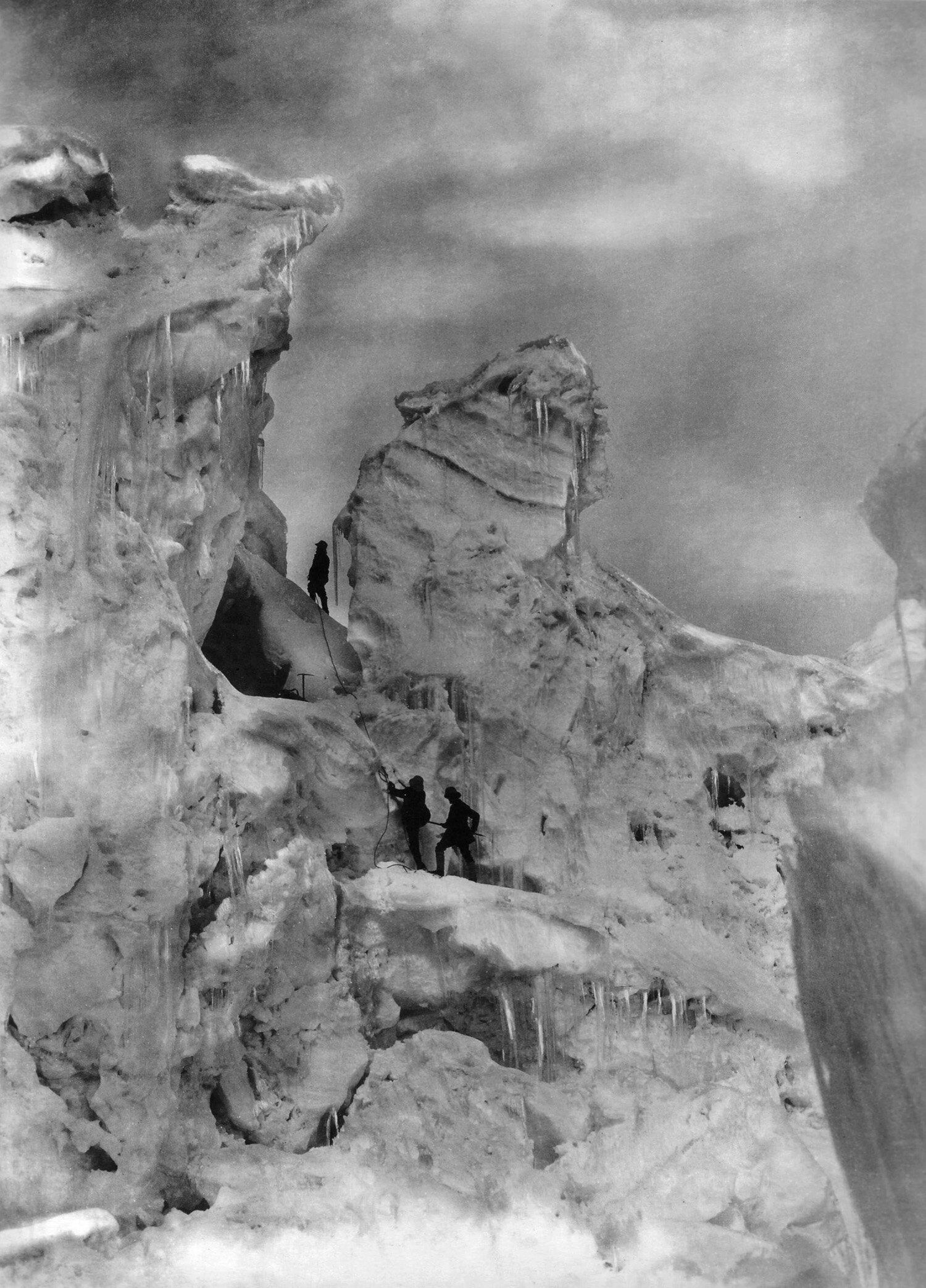
They took the Silk Road from Srinagar which connected Srinagar with Gilgit as well as Skardu. So they drove from Srinagar towards the Wular Lake, crossed over the Rajdhan or Rajdhanigan or Tragbal Pass (around 11600+ feet) as it was called and entered the Gurez Valley which bordered the Kashmir Valley on the North. This was the first Motorised crossing of the Razdan Pass as well. From Gurez onwards the tough part started as they now had to cross the Snow Laden Burzil Pass on the Great Himalayan Range. And the Photographs attached show the condition of the Pass.

Infact to get to the Pass itself they had to disassemble the Vehicles and they were carried on foot by the Porters and then re-assembled when it was possible to drive these tough Half Tracks. They were tough but nothing compared to the Mountains. And rather than the Machines it was the hardy Mountain men who carried these Automobiles over the Mountains. They also set a World Record for the highest altitude that a Vehicle drove on at over 13500 on the Burzil Pass.
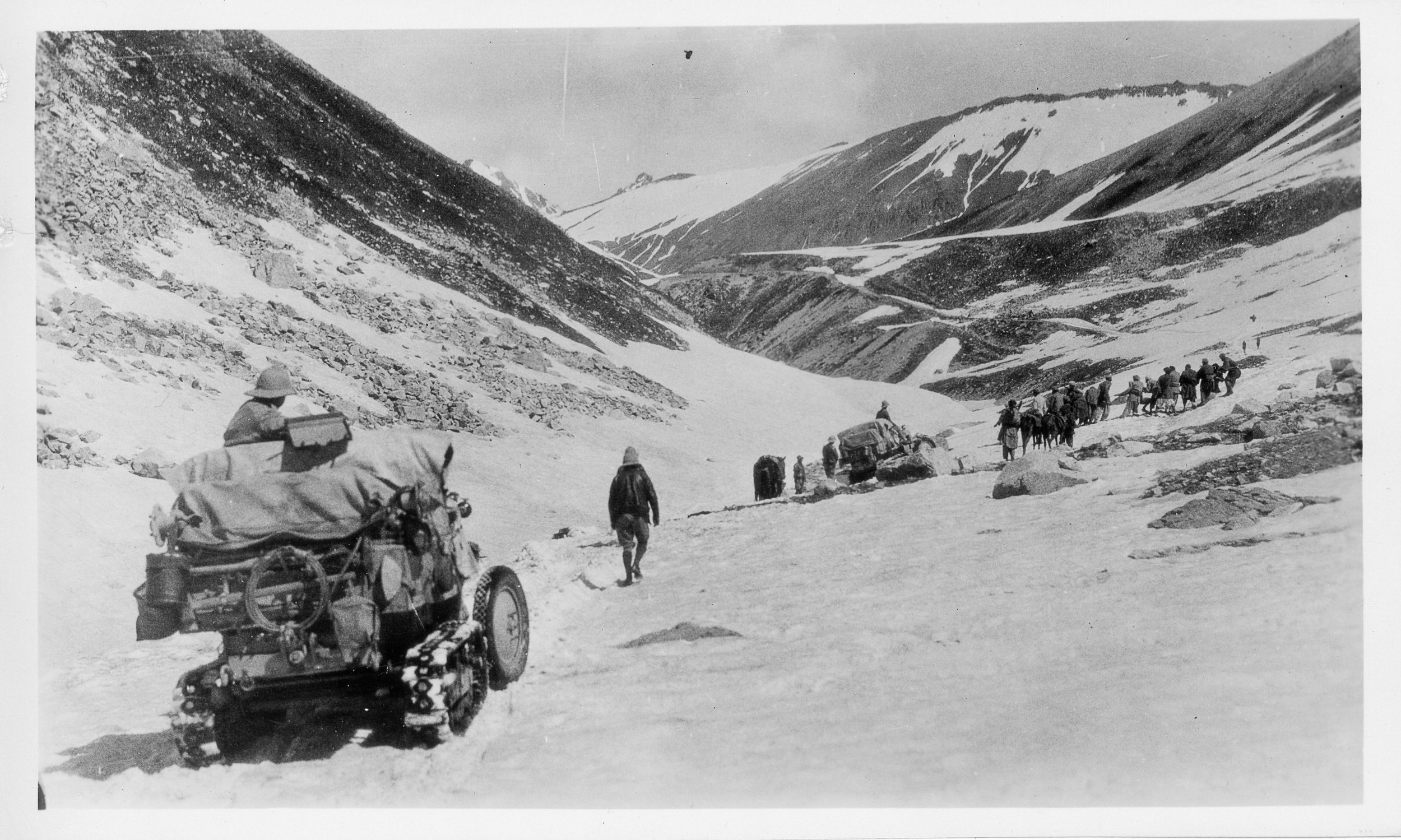
On the way down as well they had to face almost impossible situations and again they had no option but to disassemble the Vehicles and have them carried by the Porters. And they managed to make their way to Astore and then to Gilgit. From Gilgit they made their way to Gojal and to get over the Karakorams they chose the Kilik Pass which was parallel to the Mantaka Pass which was more frequently used but the Kilik Pass was relatively free of Snow and they carried the Vehicles over the Kilik Pass and descended into the Pamirs and were now across the Border of British India and firmly in Chinese Turkestan where they planned to meet up with the other Group which had started from Peking towards Central Asia. Of course the Group which came from Peking faced a lot of Political obstacles rather than the Geographical obstacles faced by what was called the Pamir Group. But that then is another Story.

All said and done it was the Citroen Haardt Expedition which showed that it was possible for Automobiles (with a lot of Human help) to cross this almost unassailable Mountain barrier.

Nowadays however due to the Political situation the Old Silk Route from Srinagar to Gilgit lies abandoned though you can cross the Razdan Pass and get into Gurez. And on the other side of the LoC a Motorable Road now gets you over the Karakorams via the Khunjerab Pass. The Kilik Pass being long forgotten.

Photo Credit : All Photos from the Internet / Citroen Haardt Expedition / Nationa Geographic/ Getty Images.

Amarnath Yatra 1898 Diwan Alim Chand
Diwan Alim Chand was a Pioneering Photographer attached to the Court of the Dogra Maharajas of Jammu and Kashmir. Diwan Alim Chand also had the privilege of having taken the first Photographs of the Amarnath Yatra back in 1898 when Maharaja Partap Singh, the Maharaja at that time had gone on a Pilgrimage to the Holy Cave.
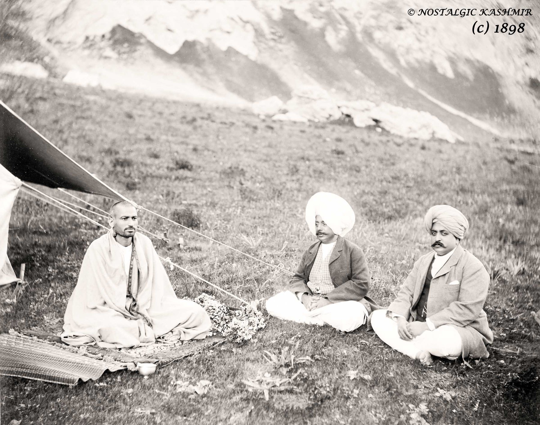
Maharaja Partap Singh (middle) flanked by Raja Amar Singh (right) and the Mahant of the Yatra at Chandanwari Camp.
Diwan Alim Chand was a Pioneering Photographer attached to the Court of the Dogra Maharajas of Jammu and Kashmir. Diwan Alim Chand also had the privilege of having taken the first Photographs of the Amarnath Yatra back in 1898 when Maharaja Partap Singh, the Maharaja at that time had gone on a Pilgrimage to the Holy Cave.
The Photographs offer a unique glimpse into History of how the Yatra was conducted almost 120 years back. It also offers a window of how the Geography of the area looked at that point of time and how it compares to more contemporary times.
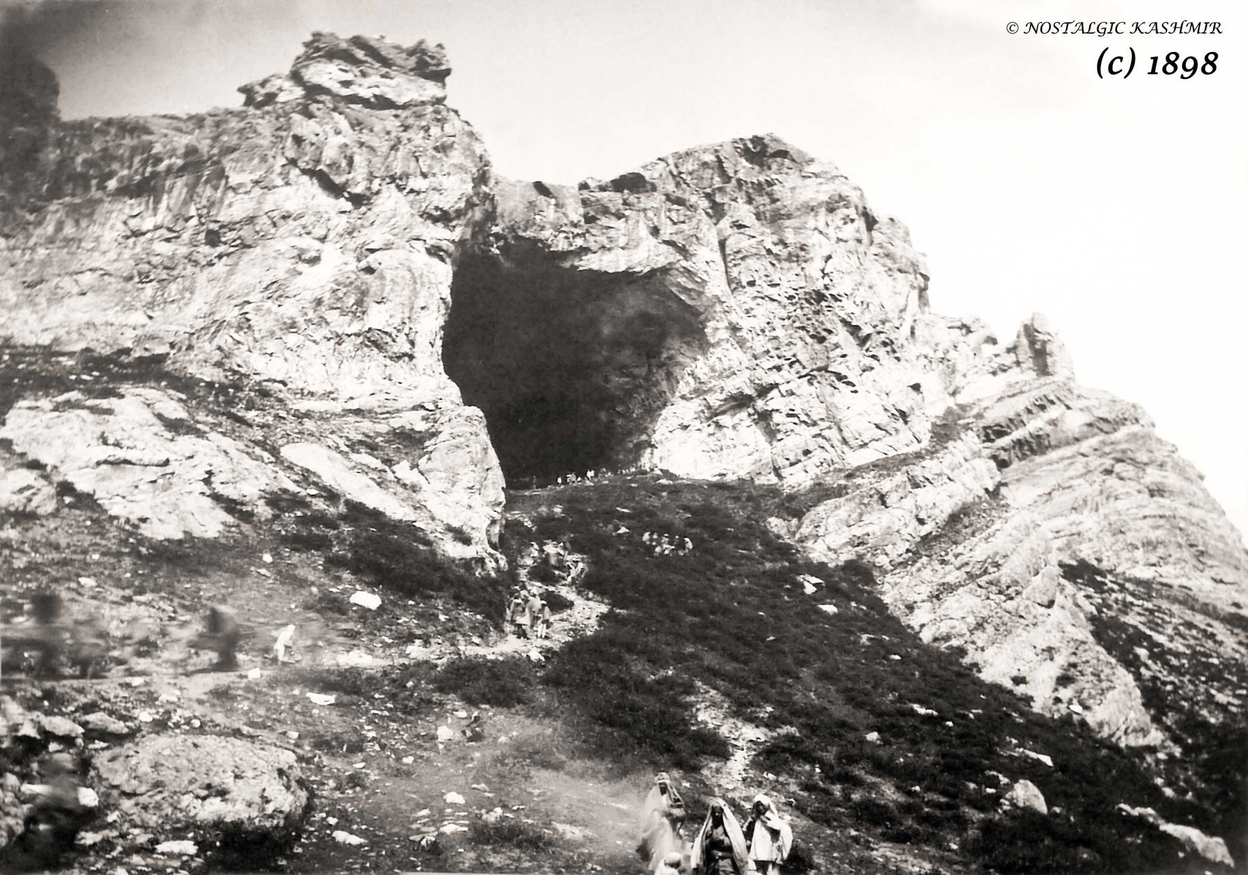
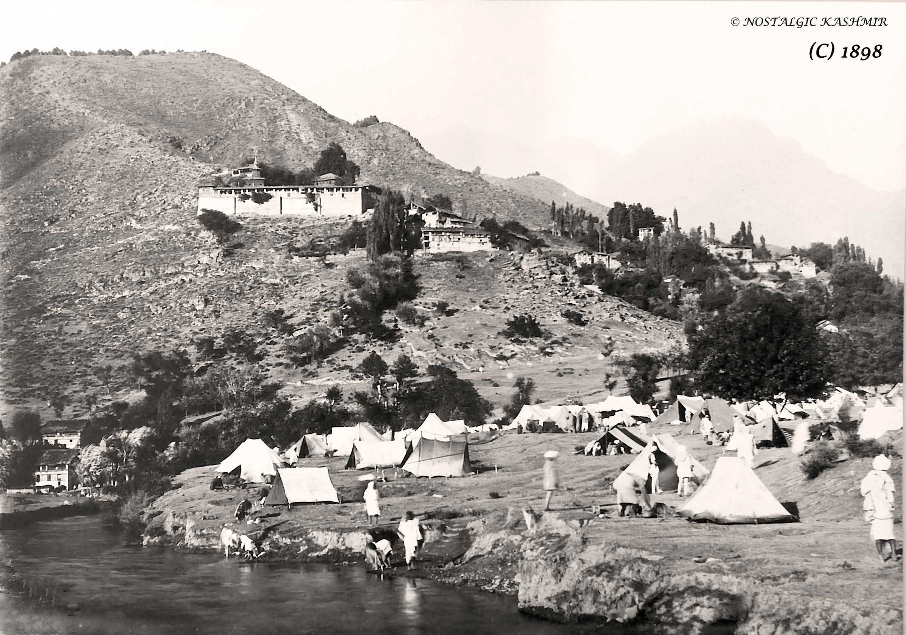
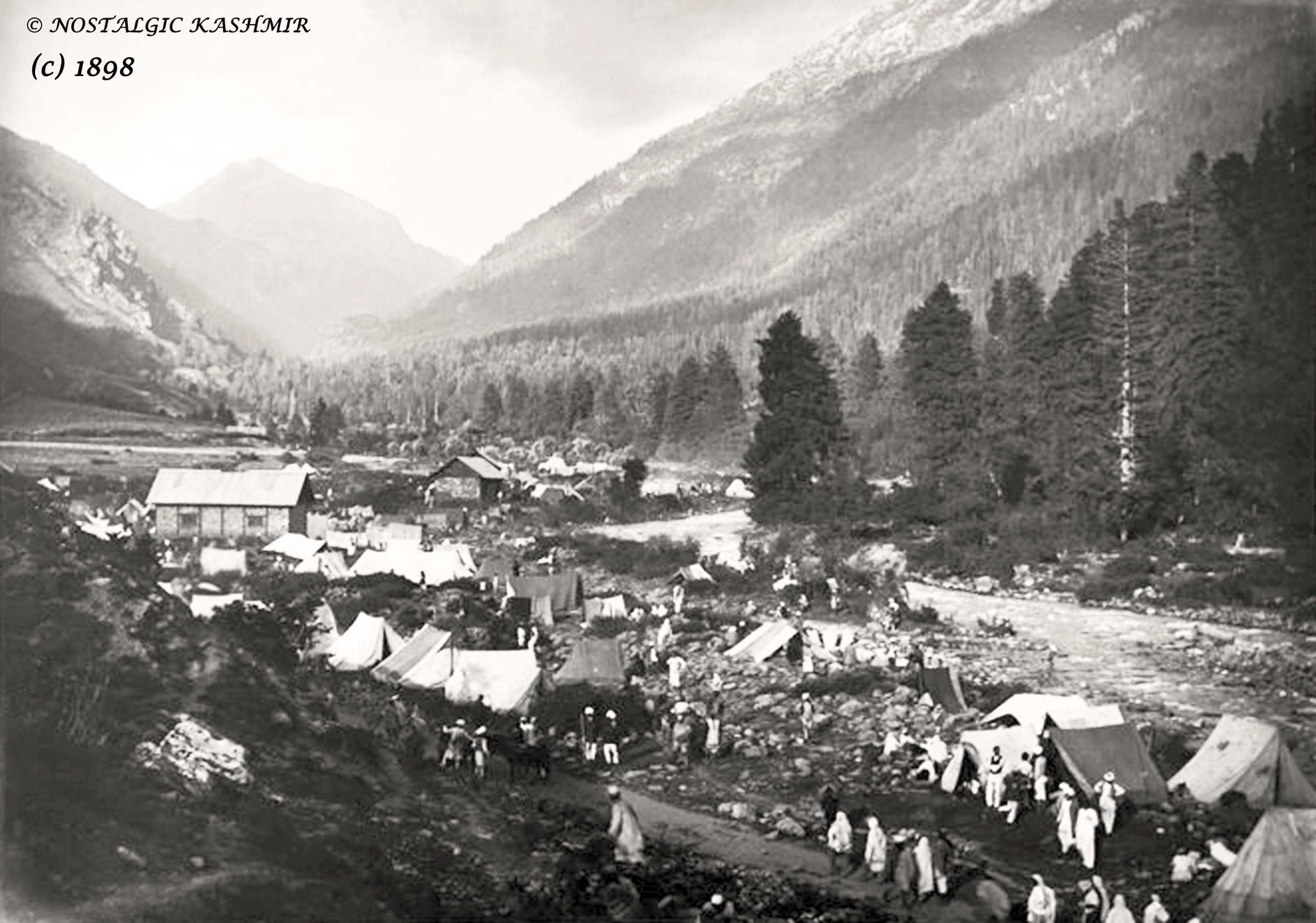
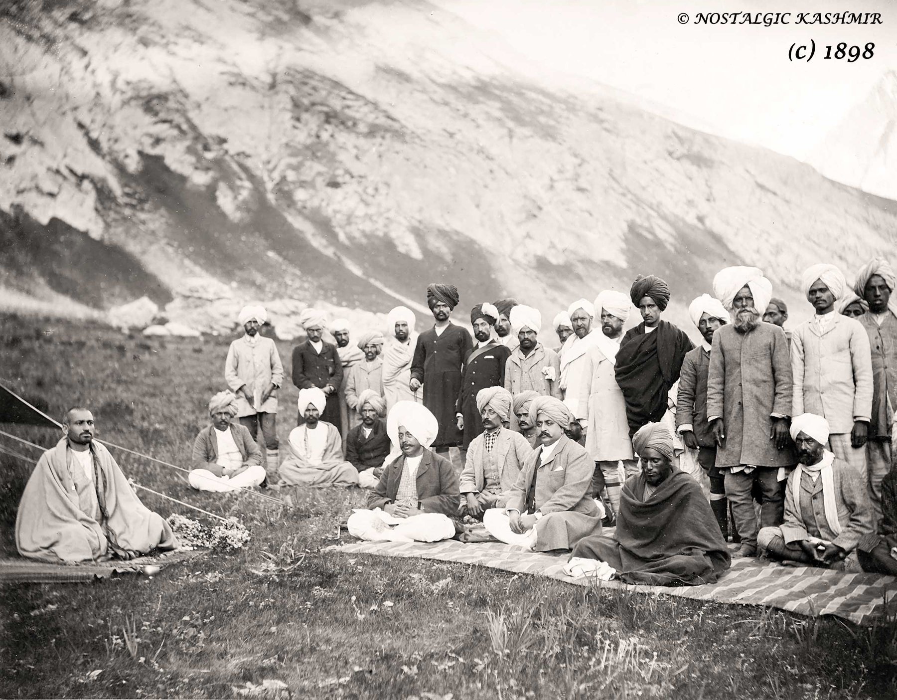
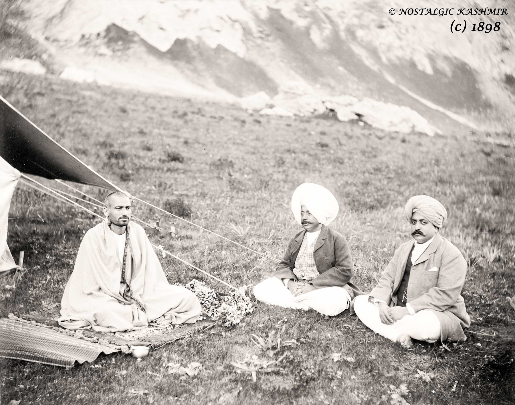
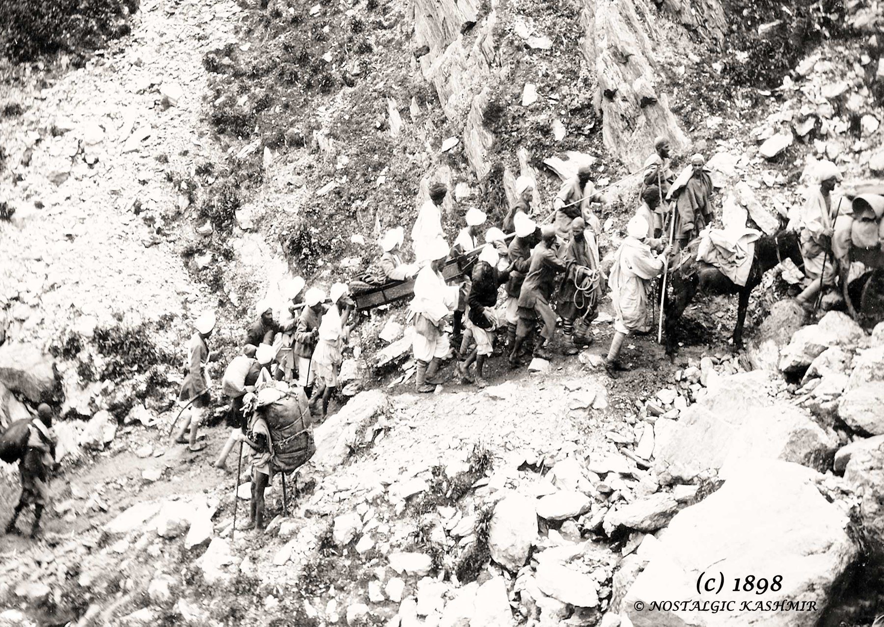
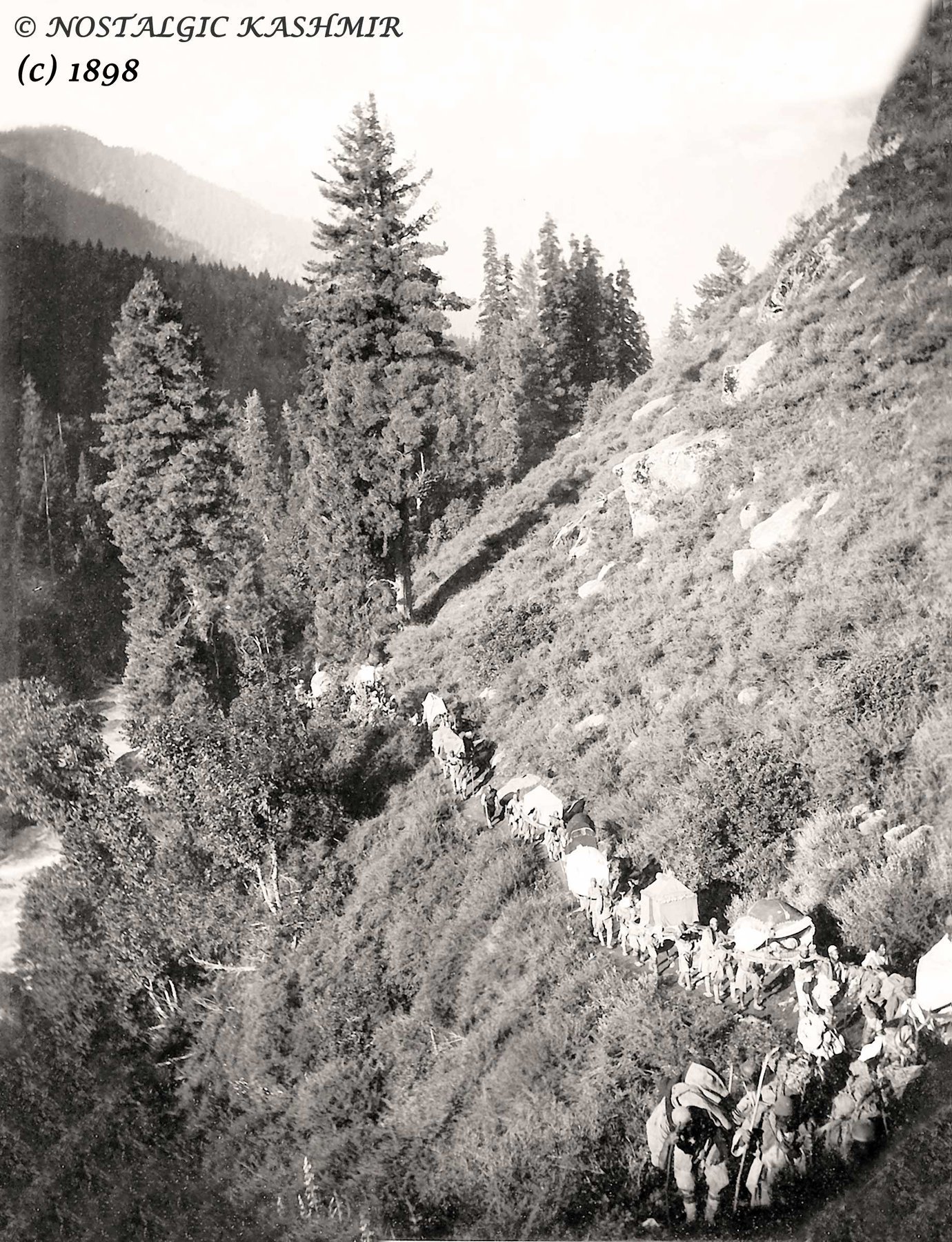
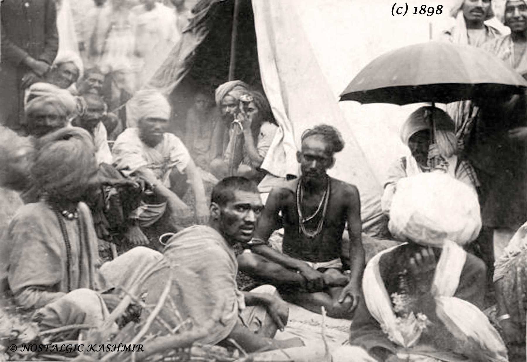
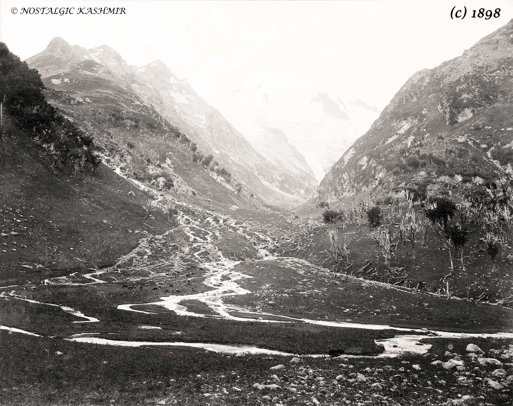
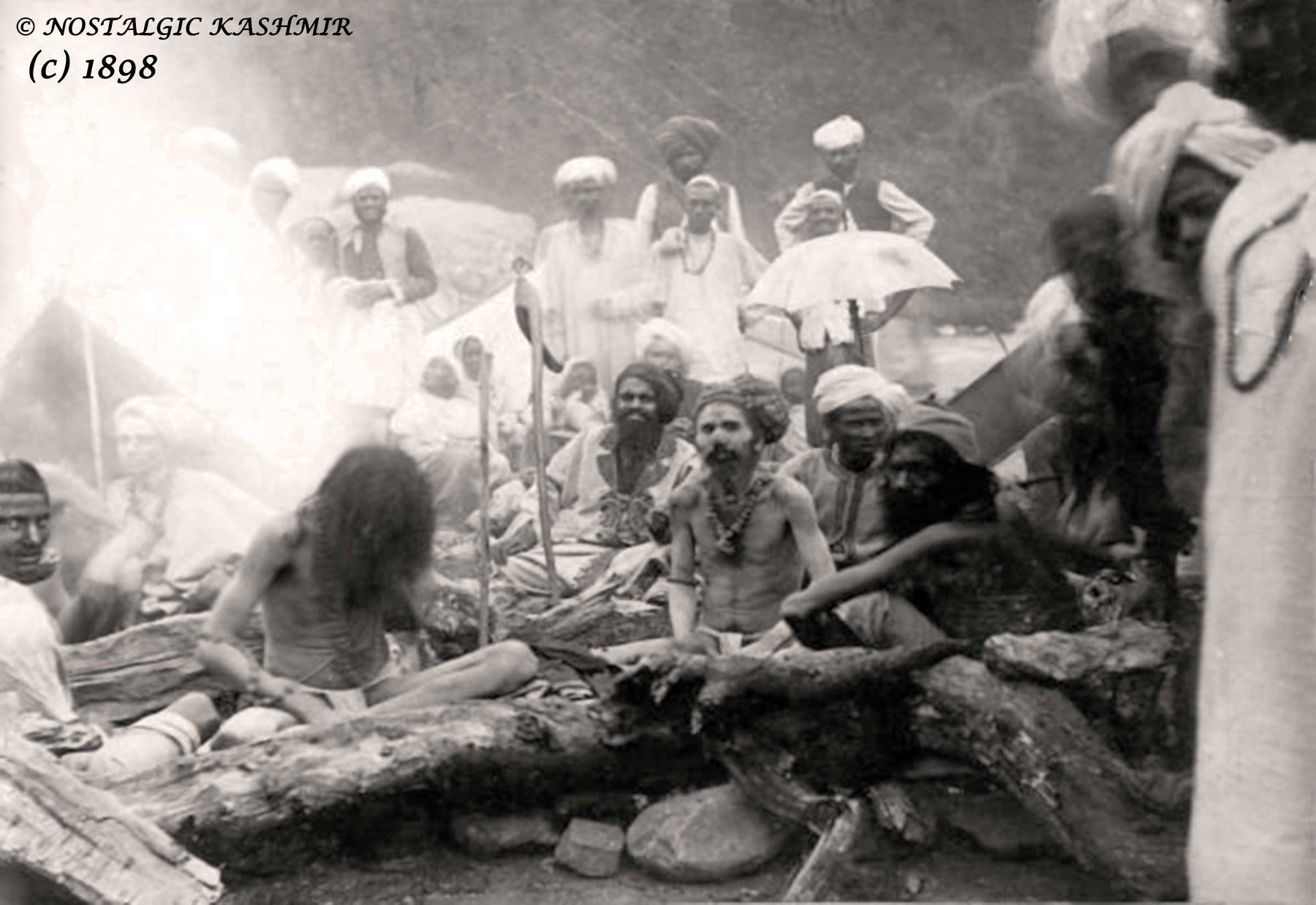
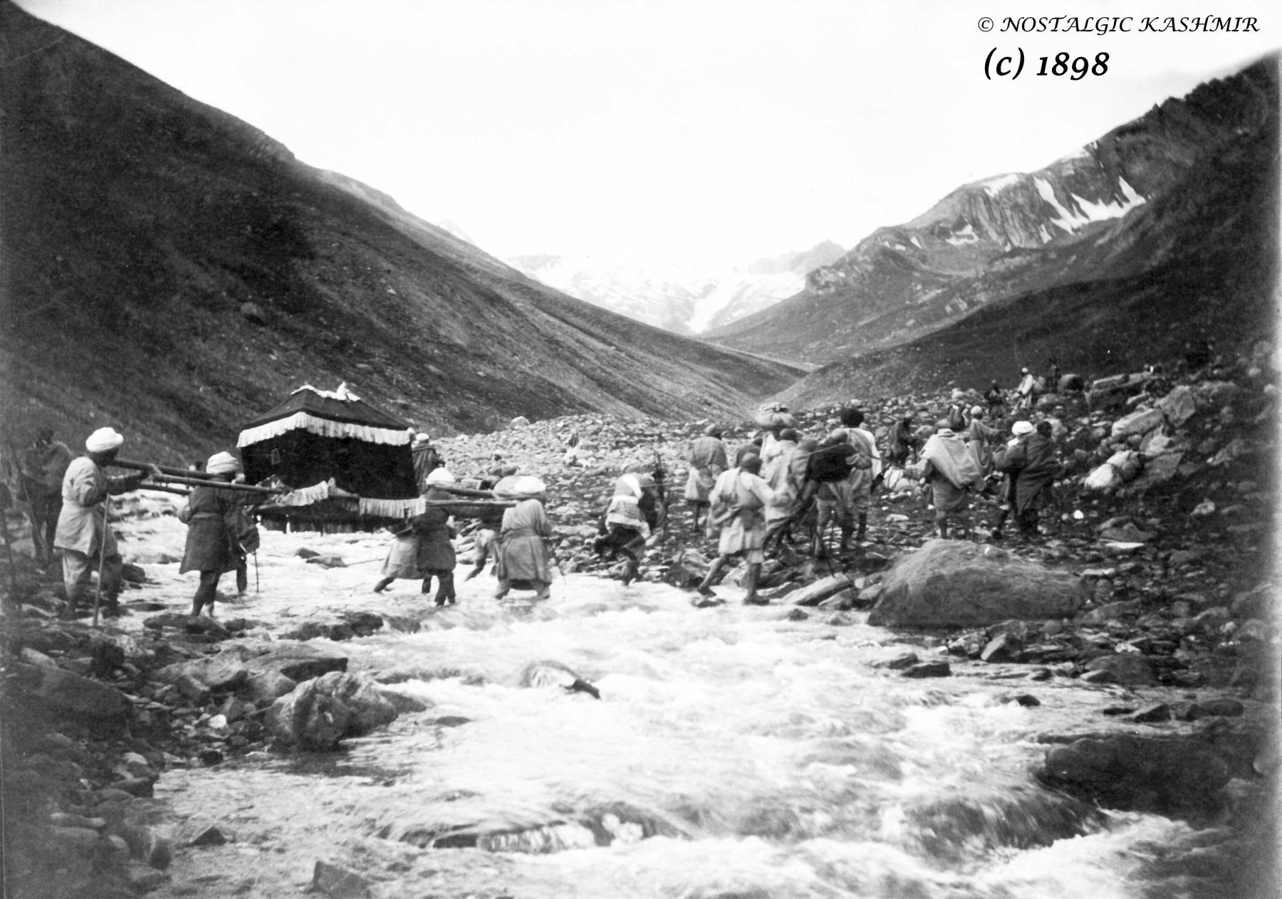
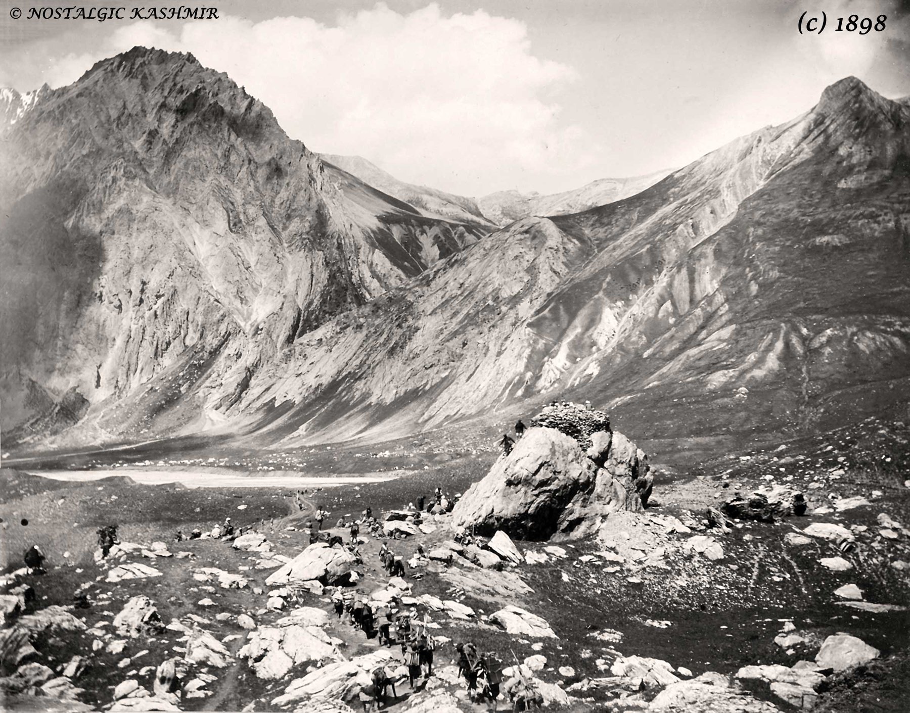
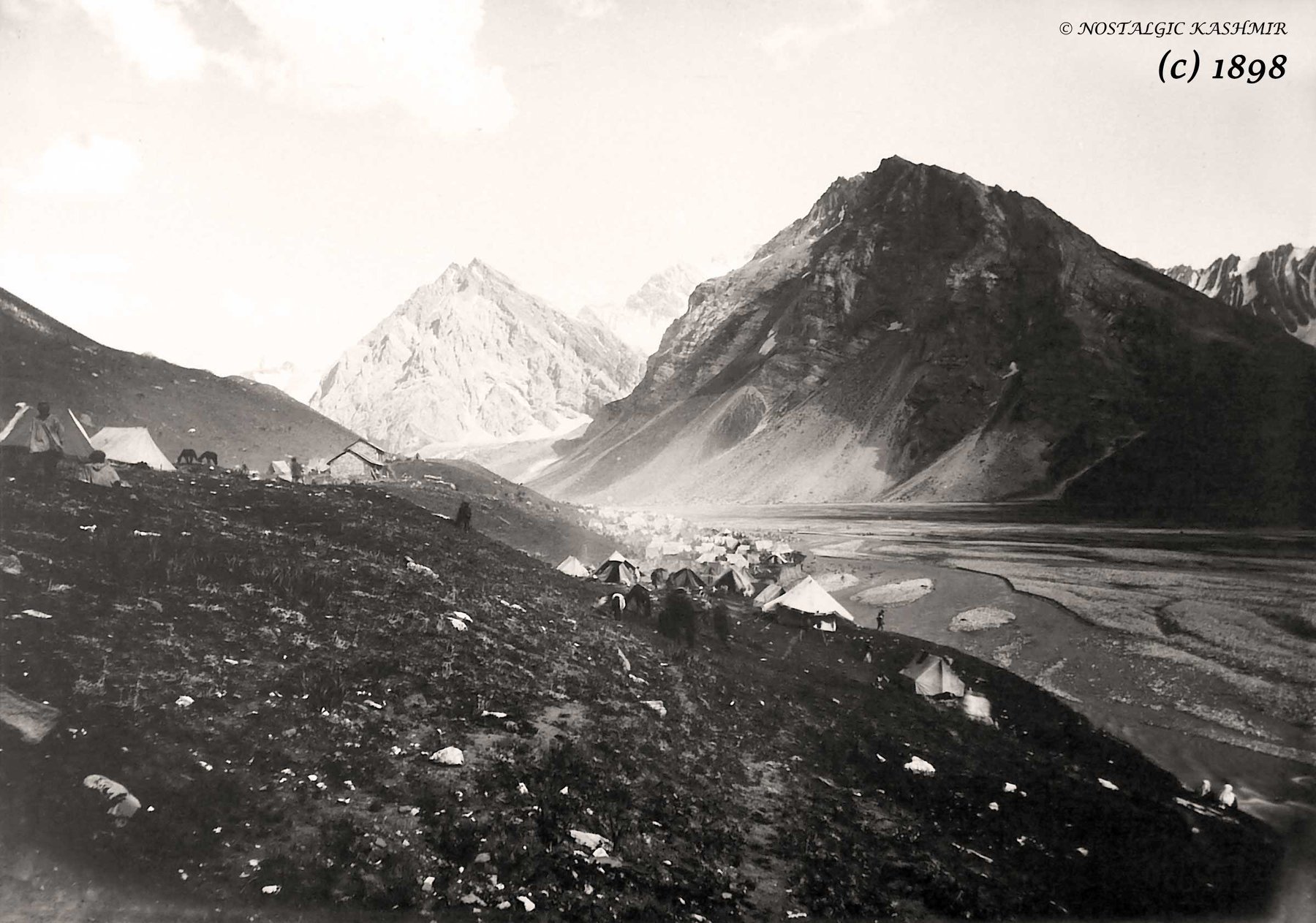
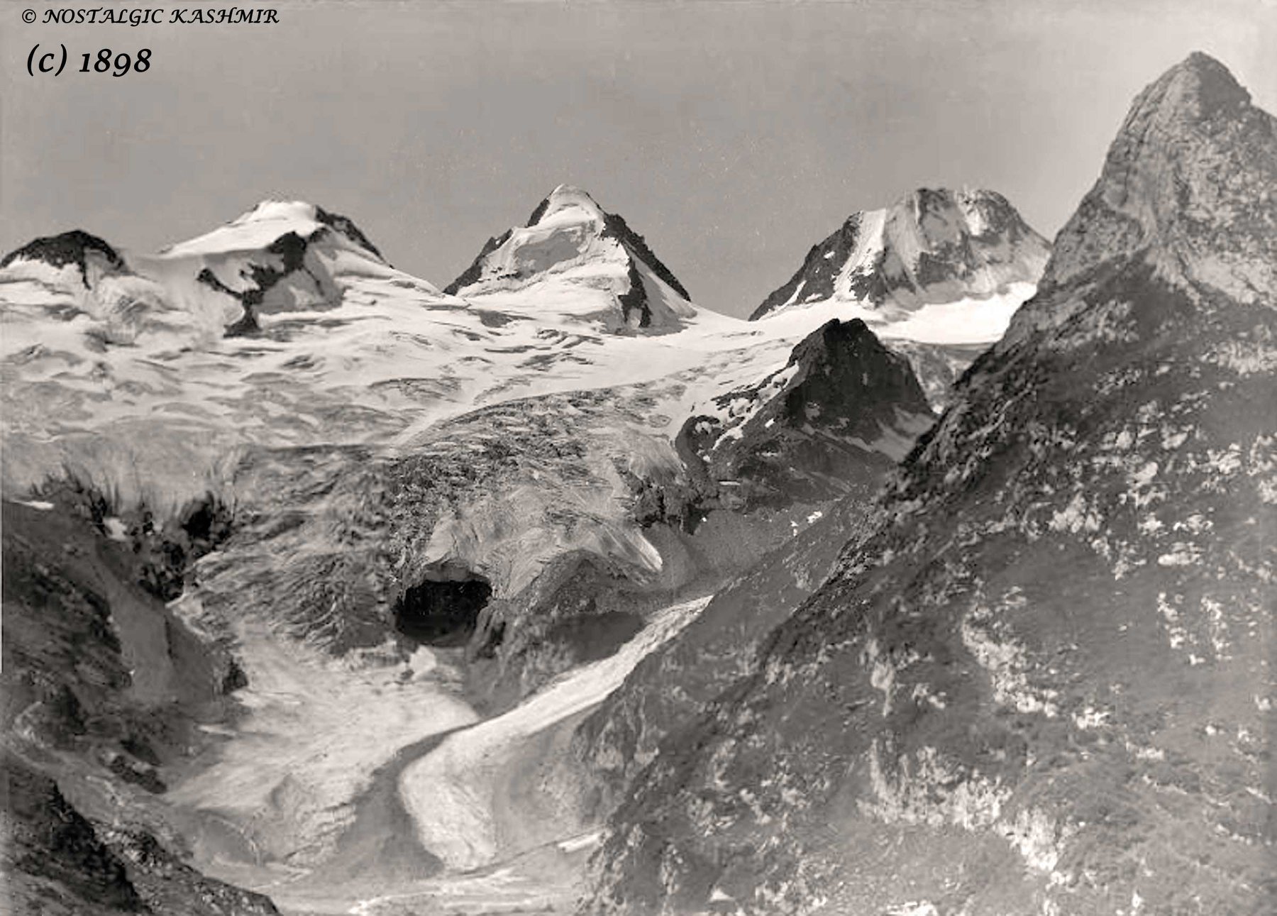
Pics Courtesy Nostalgic Kashmir and Showkat Rashid Wani Jinaab.

Wazir Lakhpat Rai Padari of Padar, Kishtwar
Well it starts with the Raja of Kishtwar called, very interestingly, Raja Mohammed Teg Singh also known as Saifullah Khan. Though the Rajas of Kishtwar had converted to Islam they kept a mix of Muslim Hindu names and followed many Hindu costums and this Raja was no different. He was a vassal of the Afhna Governor of Kashmir who fell out with the Rulers in Kabul. A force was sent to Kashmir from Kabul but the Governor stood up to it and was assisted in the same by forces from Kishtwar. And by this time Raja Mohammed Tegh Singh had got into a service a new Minister called Wazir Lakhpat Rai Padari, who as the name suggests was from Padar.

People familiar with Kashmir and Srinagar with particular must have seen it one time or the other though most of the time one misses it. Situated right on the Maulana Azad Road is the Smamadhi and accompanying it a small Temple which says Wazir Lakhpat Rai Trust from what I re-collect. It is the Samadhi of Wazir Lakhpat Rai Padiar, a Wazir and a Warrior who took part in many Battles and Intrigues in the first half of the 19th Century in the Western Himalayas. He is not to be confused with his namesake Lakhpat Rai, the Wazir under the Durranis in the 18th Century.
Well it starts with the Raja of Kishtwar called, very interestingly, Raja Mohammed Teg Singh also known as Saifullah Khan. Though the Rajas of Kishtwar had converted to Islam they kept a mix of Muslim Hindu names and followed many Hindu costums and this Raja was no different. He was a vassal of the Afhna Governor of Kashmir who fell out with the Rulers in Kabul. A force was sent to Kashmir from Kabul but the Governor stood up to it and was assisted in the same by forces from Kishtwar. And by this time Raja Mohammed Tegh Singh had got into a service a new Minister called Wazir Lakhpat Rai Padari, who as the name suggests was from Padar.
This done Raja Tegh Mohammed Singh set his sights on Bhaderwah which was under the suzerainty of Chamba, though it had its own Raja, and for the same he asked the Afghan Governor of Kashmir for assistance and soon his forces arrived in Kishtwar led by General Khuda Dost. Wazir Lakhpat led the Kishtwari forces and they advanced on Bhaderwah. A force was dispatched from Chamba under Wazir Nathu but they were defeated at Basnota and Gallugarh and the town of Bhaderwah was burnt. The Raja of Kishtwar was all praises for Wazir Lakhpat and a Jgir was bestowed upon him in Bonjwah, where his descendants still live. Later the Raja under the influence of his Hindu Purohit decided to revoke his alliance with Kashmir and decided to ally with Chamba and as a consequence an Army of from Kashmir landed in Kishtwar defeated the local forces and took away what it could and returned to Kashmir. But the Raja was still left in Power.
After that the Afghans in Kashmir were focused on the Sikhs and because of its location Kishtwar was pretty independent and not bothered by the intrigues going on in the Punjab Plains between the British, Sikhs and the Afghans. As it so happened the on the run Afghan King Shah Shuja landed in the custody of Maharaja Ranjit Singh (thats a separate story which includes the Koh I Noor). After enjoying his “hospitality” for sometime in 1815 Shah Shuja escaped from his custody and after swimming the Ravi and passing through Sialkot and Jammu landed up in Kishtwar. The reason he came to Kishtwar was obvious, as he assumed that the King being a Muslim would receive him well. And he was correct. Not only was he welcomed but also allowed to raise an Army to invade Kashmir. Shah Shuja went ahead with the invasion through the Marbal Pass but his Army was defeated and he had to return to Kishtwar defeated and his Army in tatters.

In the meanwhile the news of Shah Shuja being in Kishtwar reached Maharaja Ranjit Singh and at once a demand was raised upon Raja Mohammed Tegh Singh to hand over Shah Shuja. But Raja Mohammed Tegh Singh refused and this would have very grave consequences for him. Shah Shuja in the meanwhile escaped to Warwan Valley and from there on to Suru Valley. From there he went to Zanskar and then Lahaul and the Kulu Valley to finally land up in Ludhiana where he went to the British. Of course this greatly annoyed the Sher- E - Punjab and he deputed Gulab Singh of Jammu to take care of Kishtwar. And so Gulab Singh went about with a plan which would finally throw Kishtwar into his lap without any Military campaign.
Gulab Singh got in touch with Raja Mohammed Tegh Singh and told him that some of his own men were conspiring against him, their leader being none other than his faithful Wazir Lakhpat. He forged letters that were said to have been sent by the Wazir to Ranjit Singh inviting him to invade and take Kishtwar. The Kishtwar Raja was convinced and he planned to have the Wazir murdered in open Court. The eventful day two of his men fell over the Wazir who was grievously injured but survived. The Wazir also came to know that the plan was sanctioned by the Raja so on the purpose of getting back to health he asked the Kings leave to go back to his native Village. The King agreed but instead of going to his native Village he landed up with Gulab Singh and took up service with him and also pointed out how Kishtwar could be taken.
So Gulab Singh messaged the Kishtwar Raja to come and make a personal appearance in the Court of Ranjit Singh to mend fences with him. The reluctant Raja agreed but as soon as he reached Doda he was arrested and put into prison. Gulab Singh and Wazir Lakhpat Rai now took possession of Kishtwar without any resistance. And the person put in charge of Kishtwar was a gentleman Zorawar Singh. Of course assisted by the very able Wazir Lakhpat Rai.
Wazir Lakhpat Rai was also a part of Zorarwar’s Expeditions into Ladakh. During the the first Expedition he was instructed to take Zanskar while the main body of Zorarwar’s troops were engaged in Purik and further towards Leh. Wazir Lakhpat Rai marched to Zanksar and having subjugated it decided to return back via the Umasi La Pass which connected Zanskar directly with Padar and the Wazir being a Padari knew of it. Just the small thing that Padar at that time was under the Rule of Chamba. So whence the Wazir marched in there was some resistance which was taken care of by the Wazir’s troops. Also a small Group of Dogra soldiers were stationed in Padar as well which was again not taken kindly by Chamba. Wazir Lakhpat had an old History with Chamba and Wazir Ratanu, the Chamba Officer in charge of the Region was well too aware of it.

In the subsequent year there was again news of an uprising in Ladakh and in particular in Zanskar and the Dogra Garrison there was put to the sword. The news of the same drifted across the Great Himalayan Range and reached Padar and Wazir Ratanu. Emboldened, he decided to get rid of the Dogra soldiers stationed there and attacked them. A few were killed and many were taken as prisoners to Chamba. Of course this had extremely grave consequences as Zorawar Singh returned and had his vengeance. The whole Town of Chattargarh was burnt down and renamed Gulbagarh. To absolve himself of the blame the Raja of Chamba handed over Wazir Ratanu to Raja Gulab Singh.
In the aftermath of the death of Zorawar Singh there was again an uprising in Ladakh and Baltistan and the Dogra Garrison was under siege in Leh. Raja Gulab Singh who was engaged on the Afghan Frontier at that despatched Troops to quell the uprisings as well as to carry punitive actions against the Tibetans who had now occupied Ladakh. One body of Troops under Wazir Lakhpat Rai was assigned to go to Baltistan to take the situation in control over there. And thence he marched to Baltistan to do the needful and he relieved the Garrison in Skardu and got things under control. After that he teamed up with the other force which was assigned to Leh and they started fighting the Tibetans and driving them back. One of the Commanders of the Force sent to Leh was none other than the Wazir’s old friend, Wazi Ratanu of Chamba who had been handed over to Jammu. The Tibetans held up the the fortifications in Drangtse which were flooded by the Dogras. And finally they gave in and fled back beyond Chushul when finally Peace was made and the Treaty of Chushul which demarcated the boundary between Ladakh and Tibet which even stands today.
Even after that the Wazir wasnt quite done yet. In 1846 in the aftermath of the signing of Treaty of Amritsar, Kashmir was passed onto Raja Gulab Singh who paid the War indemnity on behalf of the Sikhs. It is pertinent to note that Jammu and neighbouring Regions, Ladakh and Baltistan were firmly in the possession of Raja Gulab Singh at that time due to actions carried by men like Wazir Lakhpat Rai who had seen action on all the fronts. A small Dogra Force led by none other than Wazir Lakhpat Rai, who was now the designated Governor of Kashmir, went to Kashmir in order to take possession of the territory from the Sikh Governor Shiekh Imam Ud Din. Its said that he was under instructions from General Lal Singh not to hand over possession without a fight and that's what he did. Unknowingly Wazir Lakhpat Rai turned up with his small Force asking for possession which was denied and a confrontation started. And it was in this confrontation that Wazir Lakhpat Rai lost his life. He was destined to be the first Governor of Kashmir but fate had other plans for him. Of course a Memorial was built for him on the M A Road in Srinagar probably close to the place he fell. The man though little known in contemporary History still left his mark in the different Regions of what came to be the Riyasat E Jammu Kashmir.
Old Soldiers Never Die, They Just Fade Away as they Say.
His descendants still continue to live in a place called Sarol Bagh near Bhaderwah and I am attaching some pics of the Heritage buildings over there some of them being built during the Wazir’s time. Photos by Shri D K Dogra.

The Bridges of Srinagar by Francis Firth
Srinagar City as most must be aware is settled on both Banks of the Jehlum and as such there were a number of Bridges which were put across the Jehlum originally starting with the First Bridge or Amira Kadal which was my favourite as it was closes to Home and we had a Shop there where I used to walk to often as a kid. Of course then the Zero Bridge was built which was without doubt everyone's favorite because of Little Hut. The Sardarji's shop which sold the best Softy in Kashmir.

This is view of Zaina Kadal taken from upstream side.
Francis Firth took a series of pics in Kashmir in 1875 and he did a few on the Bridges or Kadals as they are called in Kashmir.
Srinagar City as most must be aware is settled on both Banks of the Jehlum and as such there were a number of Bridges which were put across the Jehlum originally starting with the First Bridge or Amira Kadal which was my favourite as it was closes to Home and we had a Shop there where I used to walk to often as a kid. Of course then the Zero Bridge was built which was without doubt everyone's favorite because of Little Hut. The Sardarji's shop which sold the best Softy in Kashmir.

Photograph showing Aali Kadal AKA 5th Bridge on the veth( Jehlum) This bridge was originally built between 1414--1420 AD by Sultan Ali Shah brother of Budshah. This was the first Bridge built across Jehlum in Srinagar.In the floods of 1903 this bridge got washed away. Then Maharaja Partap Singh got it reconstructed at the same spot in 1904--05. (Credit Showkat Rasheid Wani)
And the construction technique of these Bridges is described in the Gazetteer of 1890 as under
The Kadal Bridge
These bridges are all made of deodar wood, upon the same plan. and are constructed in the following manner :
A triangular space, with its apex streamwards is formed in the bed of the river by strong stakes which are well driven down and covered with planks on the outside to a height of about 8’. This space is filled with heavy stones and forms the foundation of the pier. Each Pier consists of alternate layers of Deodar trunks. The Trunks are placed about a foot apart each succeeding layer is broader than the previous one and laid at right angles to it. The Trunks are fastened together at their ends by strong wooden pegs. The Piers are united by long and very stout Deodar trunks which stretch across from one to another and which are laid about two feet apart. The platform consists of rough Planks or Slender Poles which are closely laid across the trunks which connect the Piers and fastened at each end by wooden pegs. In some cases over the platform there is a coating of grass and Earth and the railing on each side but often there is neither.

This famous 92 yard Bridge was originally constructed by Sultan Zain- ul- Abidin Budshah in 1427 AD. It was a typical wooden bridge of cantilever design. In those days it was utilized as a Market as well. The bridge was dismantled completely as it was damaged beyond repairs in 1893 floods. The Bridge was reconstructed by Maharaja Partap Singh in 1897 & again a new bridge was constructed by Maharaja Hari Singh in 1926 which was repaired in 1953--54. The photograph has been taken looking upstream , Shah Hamadan Khanqah/Mosque can be seen on the left of the photograph. (Credit Showkat Rasheid Wani)
This kind of Bridge is very strong and durable, despite its rickety construction.
The Timber being Cedar is very durable and accidents rarely occur owing to the elasticity of the Construction and the outlet afforded to sudden floods through the many Passages in the substance of the Piers. Dr.Bellow witnesses the behaviour of these Bridges in the inundation of 1869, and though they were nearly swamped by the Flood none of them gave away.
The existing Kadal Bridges in the Valley in 1890 were as follows
Khanabal ; Bij behara ; Pampur
Amira ; Hubba ; Fateh ; Zaina ; Haili ; Naya ; Suffa
Sumbal ; Sopur ; Baramulla

The Bijbehara Bridge on the Jehlum

Gold Prospecting in the Riyasat e Jammu and Kashmir 1890
The Gazetteer of Kashmir and Ladakh of 1890 is a treasure trove of information regarding various aspects in the state. This is the small little Chapter in the Gazetteer which talks of Gold prospecting in the Riyasat. And of course it talks of some Gold mining in Baltistan.

A Man Sand Washing for Gold somewhere in Baltistan
The Gazetteer of Kashmir and Ladakh of 1890 is a treasure trove of information regarding various aspects in the state. This is the small little Chapter in the Gazetteer which talks of Gold prospecting in the Riyasat. And of course it talks of some Gold mining in Baltistan. But it mentions that Gold was still pretty tough to find and hardly an economically viable activity for the labour it involved. I wonder where did Herodotus get the reference for the Gold Digging Ants of Byltae ?
Gold.-Hugel is probably correct in his statement that neither gold nor silver has been found ; but he adds, "neither do the streams hear down gold dust, as in the neighboring countries."
This latter statement is disproved, as far as concerns the Shingo river, by Captain Montgomerie, R.E., who, in his account of the progress of the Kashmir survey, gives the following particulars regarding gold-washing in that stream "The drainage, escaping from the plains of Deosai, through a not easily distinguished gorge near the Katasiri station, falls into the Dras River above Kirkikhu. This tributary of the Dras River is called the Shigar and sometimes the Shingo river; it brings down gold with its waters, and gold-washing is carried on just below the junction. The Indus itself and several of its tributaries are known to produce gold.

The point at which the Shingo River meets the Drass River
The gold-washing in said not to be valuable, but it does sometimes give as much as one or two small rupees a day to a man, though a most barbarous method is employed in washing the earth. Thin earth is taken from the detritus which, I think, now generally lies above the highest flood line. After two or three washings, a black, heavyish sort of sand is left,, with the pieces of gold scattered here and there. As far as my own experience goes, I should say it was not a very profitable business, for after half an hour's washing I only got five very tiny nuggets hardly worth an anna, and I had, at the time, the benefit of the assistance of an Australian gentleman. This gentleman thought that something might be done by investing in a cradle aod apparatus. He said that a substance like the black send mentioned above had proved valuable in Australia."
Gold-washing is also carried on on the banks of the Jhelum, in the neighborhood of Tangrot, north of Jhelum, but to a very trifling extent. In the trans-Himalayan province gold is found in the bede of the Zanskar,Indus, and Basha rivers.

The Confluence of the Indus and the Zanskar
The people of Skardu are in the habit of coming every spring to the junction of the Zanskar river with the Indus, to search for Gold brought down by the melting of the winter Snow. Vigne says that on the banks of the Basha stream more gold is produced than in any other- part of Baltistan, and this was the only place which the former Raja reserved for himself. Any other person might wash the sand for gold elsewhere, but the value of the quantity collected at the end of the time expended is so nearly balanced that Vigne never saw any gold diggers but on one occasion (at Kiris). Here four or five men were employed, and must have washed and sifted a great many bushels of earth, but the quantity of gold dust obtained was not more than would cover a shilling.

Ladies learning Gold prospecting on the Shimsal River in Hunza
Apparently there still is a Tribe called Sonewal in the Shina language that pan the Rivers for Gold in Gilgit Baltistan and they sell their Gold to the jewellers in Gilgit apparently. But Gold prospecting still gives hope and some employment to people in these harsh Mountains.
Kashmir : Do’s and Donts from 1902
In 1902, the Foreign Department of the British Government in India issued a Guide for foreign visitors to the territories of the Maharajah of Jammu and Kashmir and especially to the Kashmir Valley. It was called Kashmir Visitor Rules : Rules and Regulations for Observance by Visitors and Residents in the Territories of H H The Maharaja of Jammu and Kashmir
Kashmir : Do’s and Donts from 1902
In 1902, the Foreign Department of the British Government in India issued a Guide for foreign visitors to the territories of the Maharajah of Jammu and Kashmir and especially to the Kashmir Valley. It was called Kashmir Visitor Rules : Rules and Regulations for Observance by Visitors and Residents in the Territories of H H The Maharaja of Jammu and Kashmir “ Listing some of the Rules and Regulations that were stipulated in the same. It is interesting to note that some of these are still in force in some way or the other. Please note that I have copied them verbatim as given in the Handbook of which I have a soft copy. (For some of the Rules I give an explanation in the brackets for more clarity)
Section 1 Travel Rules
Information as to the usual routes for entering and leaving Kashmir may be obtained from the Assistant Resident. The route via Jammu and Banihal is private, and may not be used except with the special permission of His Highness the Maharaja obtained through the Resident. (The present Highway Route was an exclusive preserve of the Maharaja as the normal Route which went from Rawalpindi would entail the Maharaja having to go through British territory to get to Kashmir )
Persons subject to these rules are not allowed to travel from Kashmir to Simla (or vice versa) across the hills, or the plains (or vice versa) vid Kishtwar, Bhadarwah and Chamba, except with special permission of His Highness the Maharaja obtained through the Resident. (So no Trekking into Kashmir :)) (Even to this day there are Roads and Passes which connect Kashmir with these places but except locals few people ever use them)
Section 2 General Rules Applicable to Jammu and Kashmir
Cows and bullocks are, under no circumstances, to be killed in Jammu and Kashmir, and visitors are requested to see that their dogs do not worry these animals.
Visitors are required to settle all accounts before leaving Kashmir ; and should see that their servants do likewise, otherwise their servants may be detained at the last moment by order of the Court on the plea of a Creditor.
Section 3 : Rules applicable for Srinagar
Servants of visitors found resorting to places other than the fixed latrines are liable to
Punishment.Grass-cutters are prohibited from cutting grass in, or in the neighbourhood of, the station occupied by Europeans.
Riding and cycling on the buud are strictly prohibited. The Police have had orders to see that this rule is rigorously enforced.
Section 4 : Camping Sites
Visitors to Srinagar are !lot ptt-mitted to encamp in the Dilawar Khan Bagh situated
within the city, nor in the Nishat, Shalimar, or Chashmah Shahi gardens in the Dal Lake. The fixed camping places are the Wunslli, Hari Singh, Ram Munshi, and Chenar Baghs at Srinagar and the Nasim Bagh on the Dal Lake. Visitors are also informed that the plot of ground at Sumbal, known as the " Nandi ICeshwar Bhairalva," should not be used for camping purposes.The Chenar Bagh is specially reserved for bachelors. No parties of which ladies are
members are permitted to encamp within it.
Section 5 : House Boat Rules (Since Europeans couldn't buy / lease Land in Kashmir most of them lived in House Boats)
No boats of any kind, including dungas, house boats, &c., shall have water-closets
leading into the river. The water-closets of all existing house boats shall be closed, and in future no house boats shall be built with such open closets.No sweeper or servant shall throw into the river any kind of offensive matter or
sewage ; sweepers of house boats must carry away all refuse and solid and liquid excreta. When in Srinagar, such offensive matter shall be deposited in places assigned by the Municipal Committee, aid while outside Srinagar, shall be deposited in some dry land away from the banks of river.
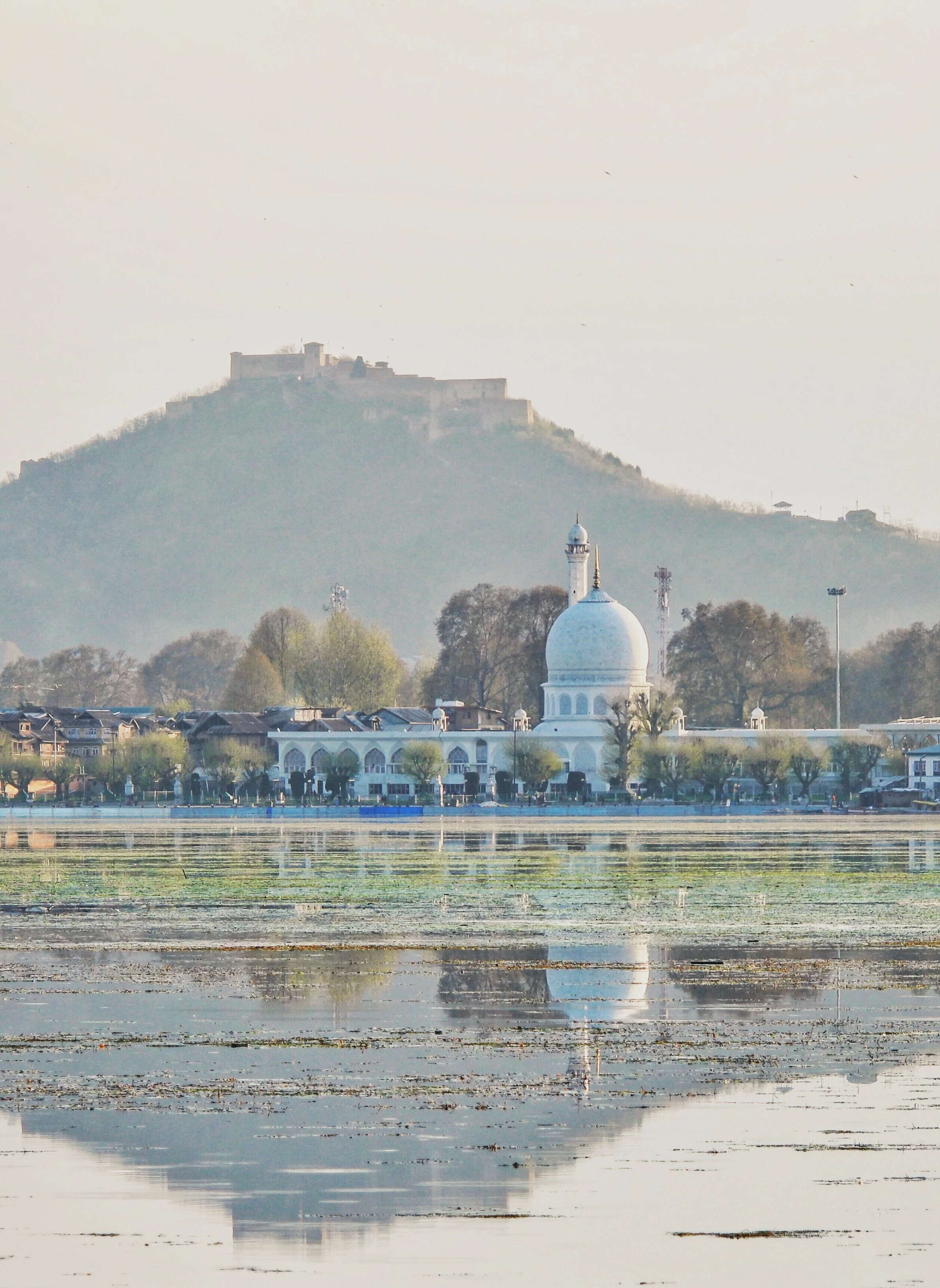
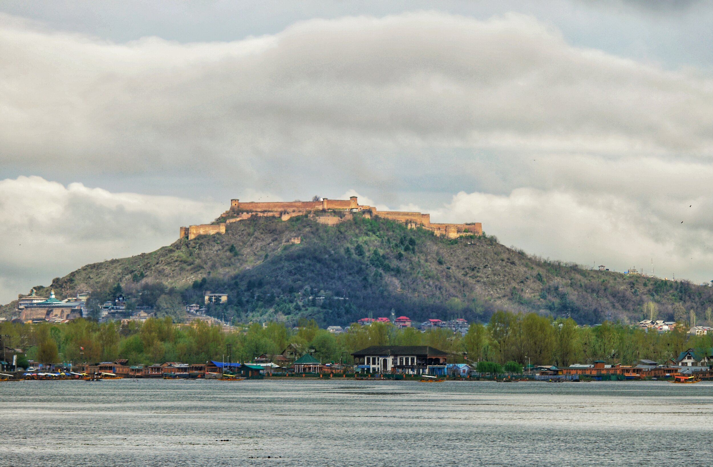
The Hari Parbat Fort over the Dal Lake. Pic from April 2017. Srinagar, Kashmir.
The Last Anglo Abor War 1911
The Anglo Abor War was a series of events which took place in 1911 between the British and the Abor Tribesmen in what is today Arunachal Pradesh. The British were keen to explore and Map out the almost impenetrable Jungles that the Siang River cut through in the Eastern Himalayas. And of course this put them on a collision course with the local Tribal communities who saw them as invaders and outsiders.

The Last Anglo Abor War 1911
By the beginning of the 19th Century the British were well in control of most of the parts of the subcontinent of India with the only exception being the areas in North and North West India which were firmly in the control of the Sikhs under the Sher-E-Punjab Maharaja Runjeet Singh. But after his death and the arrival of the mid part of the 19th Century the Sikh Empire was also shattered and gradually taken over by the British.
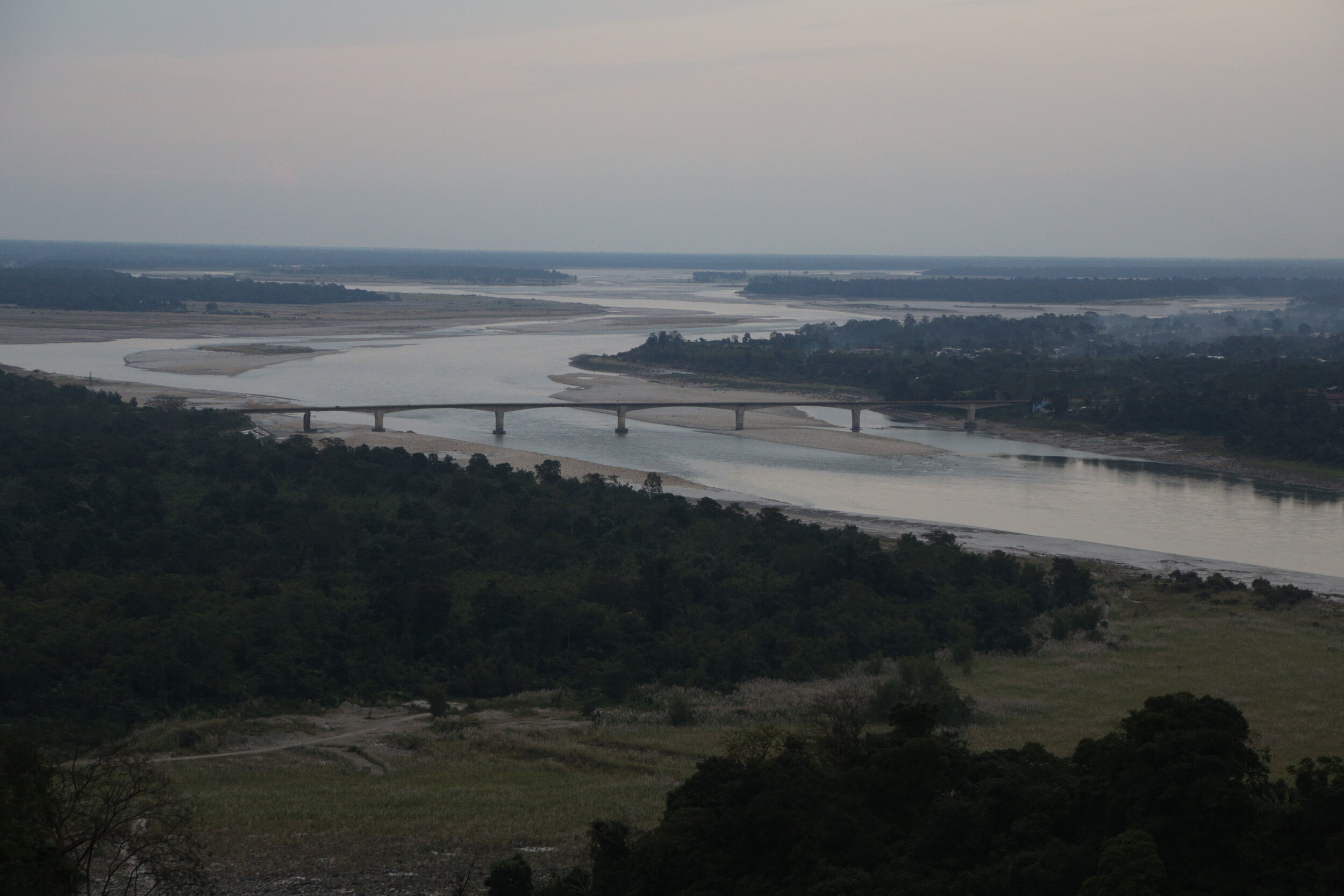
However in the Eastern part of India which was broadly described as Assam there were still areas and Tribes which held out. The British could penetrate into the the Brahmaputra Valley as far up as Pasighat but beyond that started the foothills of the Eastern Himalayas which unlike their counterpart in the West was virtually impenetrable due to the dense Jungle and the indegenous Tribes which inhabited these parts. Foreigners were extremely unwelcome and the Tribes of the Hills took no prisoners. As per their long laid down Tribal traditions they just couldn't let foreigners in their sacred Lands and Jungles where their deities presided and allowed them to make a living out of hunting gathering.
The Siang or the Brahmaputra before Pasighat
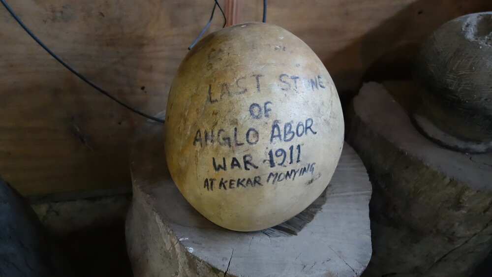
Let me first explain how I got to this point. We were driving around the North East in last November / December and while on the way from Pasighat to Aalo we stopped at one of the few local “Dhaba” if you could call it. These Dhabas serve quick Lunch / Dinner in the form of Dal Rice or Chicken Rice or Pork Rice or you could opt for Maggi instead. Or the regular Tea. Anyways since we were in a Group we ordered and some of the more curious ones started roaming around. And then I caught sight of what I though looked like an Ostrich’s egg and hence I decided to take a closer look. And then I realised that there was something written on it. It wasn't an Egg at all but a Stone which resembled an Egg. And the words written on it were “The Last Stone of the Anglo Abor War 1911 at Kekar Monying”
Well Kekar Monying is the name of certain cliffs in this area along the Siang River which goes onto to become the Brahmaputra as it hits the Assam Plains. And it was along these cliffs that an engagement in the cold December of 1911 was fought between the British and the Tribesmen who the British referred to as “Abor” at that time. The British carried all kind of modern weaponry whereas the Tribesmen were armed with their Bamboo Arrows and Stone Catapaults as their only “long range” weapons. Stone Catapaults which were used to launch big round stones like the one I saw there and you see in the pic at their adversary. And this particular Stone had the dubious distinction of being the last one used by the Tribesmen against the British. And how exactly it landed in that Roadside Dhaba is anybody’s guess. And of course I forgot to ask.
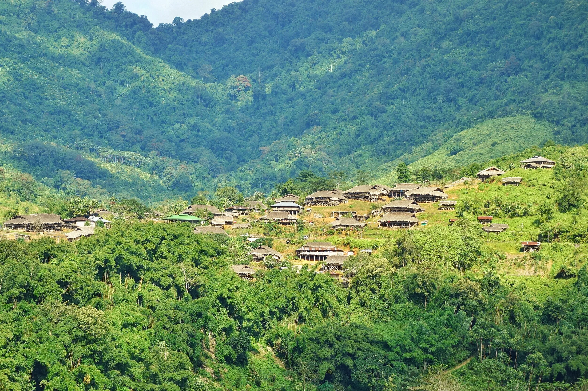
Typical Abor Country
This War which was fought in various segments started in the 1850s when the British began probing into these areas. There is a certain Village called Kebang spearheaded the campaign against the British. These were Adi Tribesmen (they were called Abor collectively by the British) and they fought no less than 4 Wars against the British and they had a name for each ie Bitbor Mimak (1858), Bongal Mimak (1859), Nijom Mimak (1894) and Poju Mimak(1911). The Adi were fierce warriors and towards the beginning of the 20th Century the British started to take them very seriously. They formed an Abor Expeditionary Force in order to penetrate the Region and establish firm control over it. The British were aware of the strategic importance of the area as they knew Tibet and China were not very far away but the territory between was largely unknown and they wanted to be in control of this unknown. But of course the Adis wouldnt have it that way. It was their Land. And they would fight tooth and nail to keep it.
Apparently the last War in 1911 was sparked off by a rather peculiar incident. A British Officer Williamson accompanied by another British Officer Dr.Greigerson, an interpreter, a couple of Coolies and a few Soldiers of the Assam Rifles were surveying the country and came to a Village. The Villagers offered them some gifts as offerings and there was a certain Villager who offered a Chicken as a gift but apparently this Villager had some skin disease and Williamson refused to accept his gift. This was of course a huge dishonour for the Villager who decided from thereon to follow Williamson till he accepted his gift.
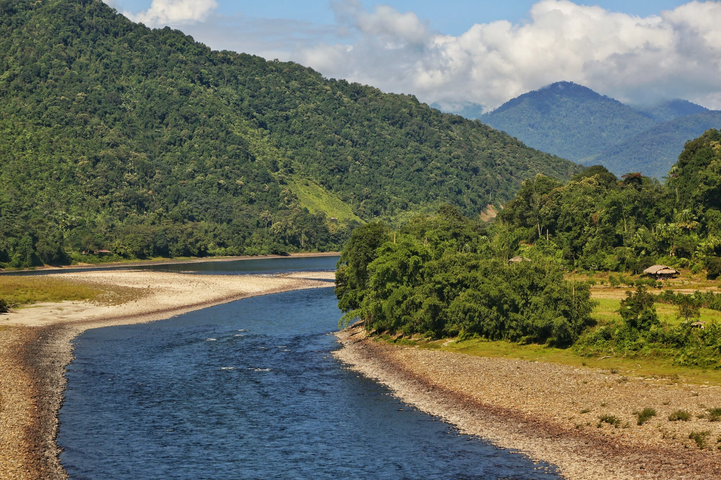
The Siang River
So when he moved to the next Village this Villager again came to him and offered the Chicken. Williamson was aware that this guy was following them and now he lost his temper and he used rough language and bad words in dealing with the Villager and to add insult to injury he struck him a couple of times with his stick. And this was now taken as a great dishonour by the whole Village. And they decided this would be avenged. But they would do this when they would be on their way down to the Plains.
But unknown to the Tribesmen Williamson and Dr.Grierson had a change of plan and decided to split into two different parties on their way back. On the night of March 31 while on his way to Dinner, Williamson was waylaid by the same Villager who had once offered him a Chicken. And killed. And they also killed his whole entourage. Dr.Grierson and his party were waylaid in Kadeng Village and put to death except one of the Coolies who was a Nepali and managed to somehow convince the Adi Tribesmen to spare his life. He of course went down and reported the whole incident to the authorities.
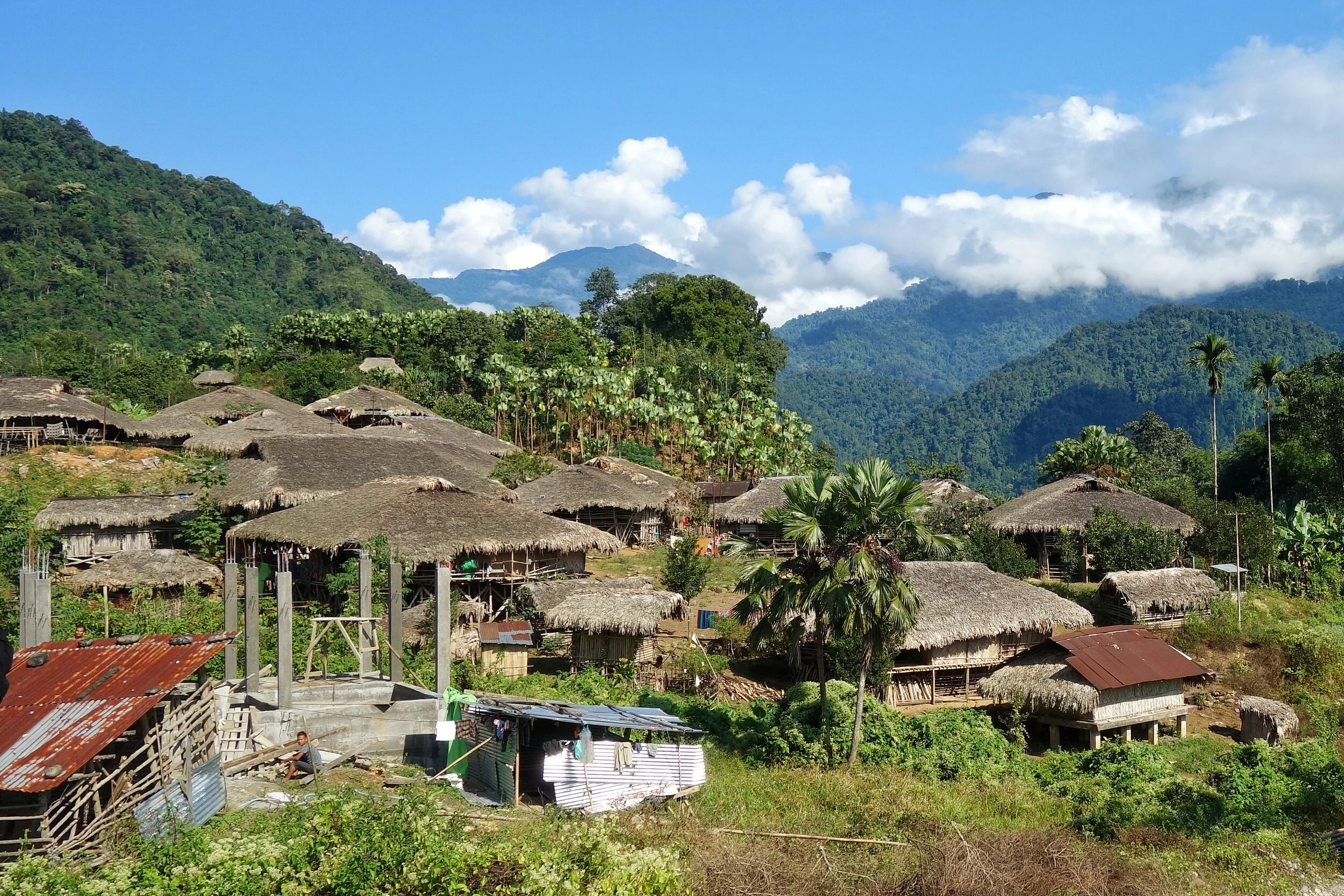
A typical Village in the area
And the Adi knew that now the British will come with full force and in December, the time most suitable to the British, the Abor Expeditionary Force showed up. The Adi fought bravely but of course were no match for the British with their modern Arms. The British marched up the Kadeng Village and the whole Village was then burned down. And there would not be another Abor War for the British to fight.
These Adi Tribesmen are the unrecognised Freedom Fighters of the country who have never got any recognition from the Government. Though I am aware of the name of some of the Adi Tribesmen who were a part of this, including the Villager who wanted to gift a Chicken, but that in my view would be an injustice to the thousands unnamed Adi and other Tribesmen who also fought for the country’s Independence like in other parts of the Country. Respect.
Pic from November 2019. On the Pasighat Aalo Road, Arunachal Pradesh
Inputs from various Online sources.
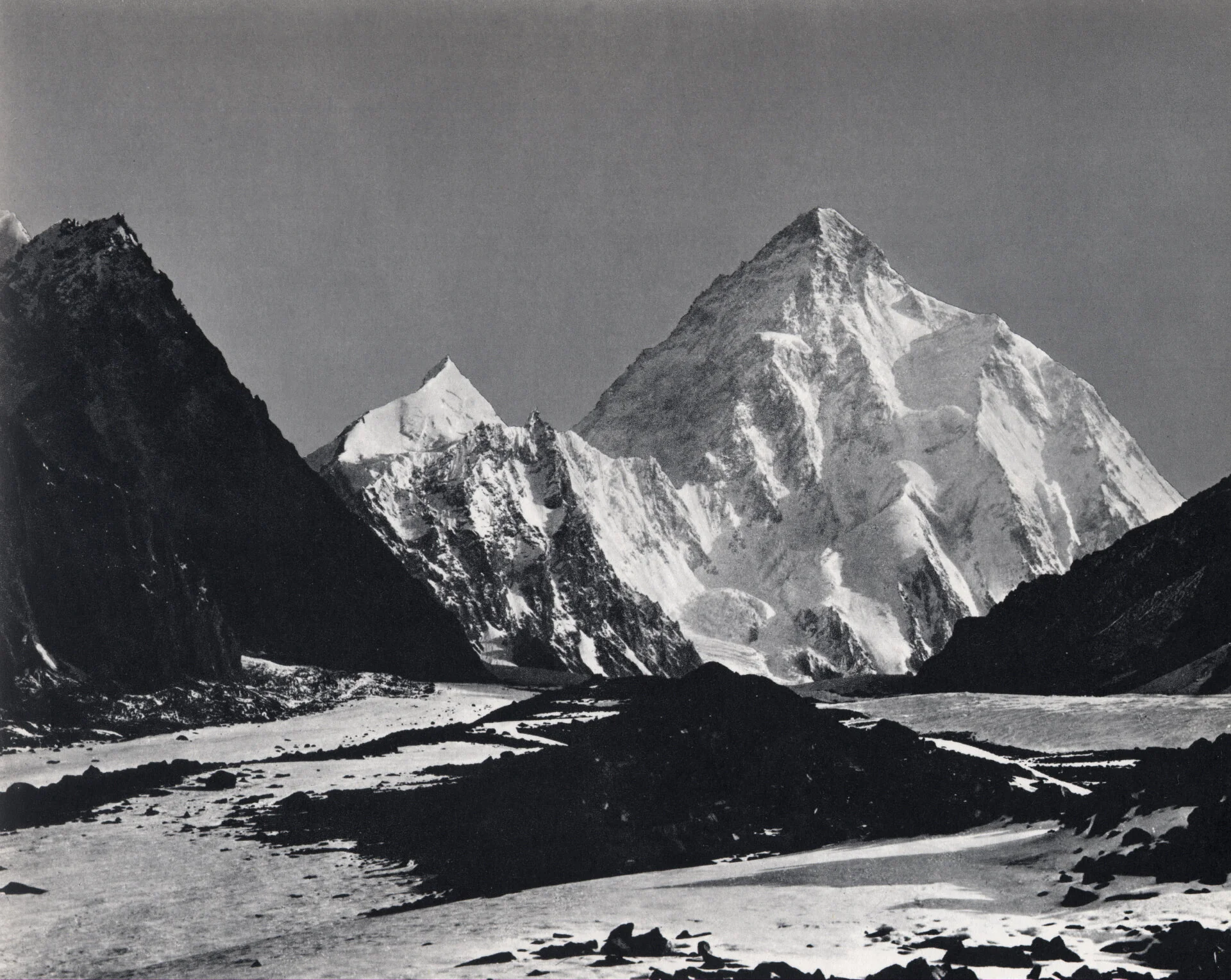
Video of Duke of Abruzzi’s Karakoram Expedition of 1909
An extremely rare Video of the Duke of Abruzzi’s Karakoram Expedition of 1909.
Duke of Abruzzi’s Karakoram Expedition of 1909
Prince Luigi Amedeo, Duke of the Abruzzi was an Italian Explorer and Mountaineer. He was from the Roual families of Italy and Spain and was a cousin of the Italian King.
The son of King Amadeus of Spain (who was also the Duke d’Aosta in Italy), Abruzzi was the first to ascend Mount St. Elias in Alaska (1897). His 1899 Arctic expedition reached latitude 86°34′ N—a record for the time. In 1906 he was the first to scale the highest summits of the Ruwenzori Range in east-central Africa. His expedition investigated the geology, topography, and glaciology of the range; it mapped the range and named its major peaks, passes, and glaciers. In 1909 Abruzzi climbed the world’s second highest mountain, K2, in the Himalayas, to a height of more than 20,000 feet (6,000 m).
In 1909 the Duke of Abruzzi as he was mostly known as set out on an Expedition to climb K2 and accompanying him was the ace photographer Vittorio Sella. Both these Men were pioneers in their fields.
In the said Expedition they reached a maximum height of 6250 m. The standard Route up the Peak goes over a feature now named in his memory as Abruzzi's spur. They tried to go for the Chogolisa as well but couldnt reach the summit but anyways set the World Record for the Highest Altitude achieved in a Mountaineering Expedition.
And now we have come across this Video of that Expedition from an unknown source. Though it says going up the Sind Valley but thats wrong. The Video starts with the Expedition reaching Srinagar via the Cart Road. Next we see vistas of Srinagar on the banks of the Dal Lake and the Jehlum I assume. We can see what appears to be a busy Market and a hustle bustle of Shikaras.
Next it shows the Expedition crossing the Indus River somewhere around Skardu I guess. They then go upto Shigar and then the Braldu Valley. They cross the Braldu River and go across the Burji La. And after that up the Skoro La and down.
They cross the Morraines of the Baltoro Glacier and finally arrive on the Glacier. Then we can see the Chogolisa (It was called the Bride’s Peak at that time by the Europeans). And finally we see the ethereal K2 in all its Glory.
This Video is worth its weight in Gold.
The Stilwell Road
The Stilwell Road Project once termed as an “impossible Engineering pipe dream” was not merely an Engineering feat accomplished but a saga of Valour, Grit and Determination. It stands as a testament to the Men responsible and the indomitable human spirit that made it possible.” This is the inscription at the Jairampura Cemetery, the largest Cemetery dating back to the Second World War and at the cemetery lie the remains of hundreds of Men who gave up their lives during the building of this Road. Amongst the dead were Indians including many local Tribals, Chinese, Americans and Burmese.

The Stilwell Road
“The Stilwell Road Project once termed as an “impossible Engineering pipe dream” was not merely an Engineering feat accomplished but a saga of Valour, Grit and Determination. It stands as a testament to the Men responsible and the indomitable human spirit that made it possible.” This is the inscription at the Jairampura Cemetery, the largest Cemetery dating back to the Second World War and at the cemetery lie the remains of hundreds of Men who gave up their lives during the building of this Road. Amongst the dead were Indians including many local Tribals, Chinese, Americans and Burmese.
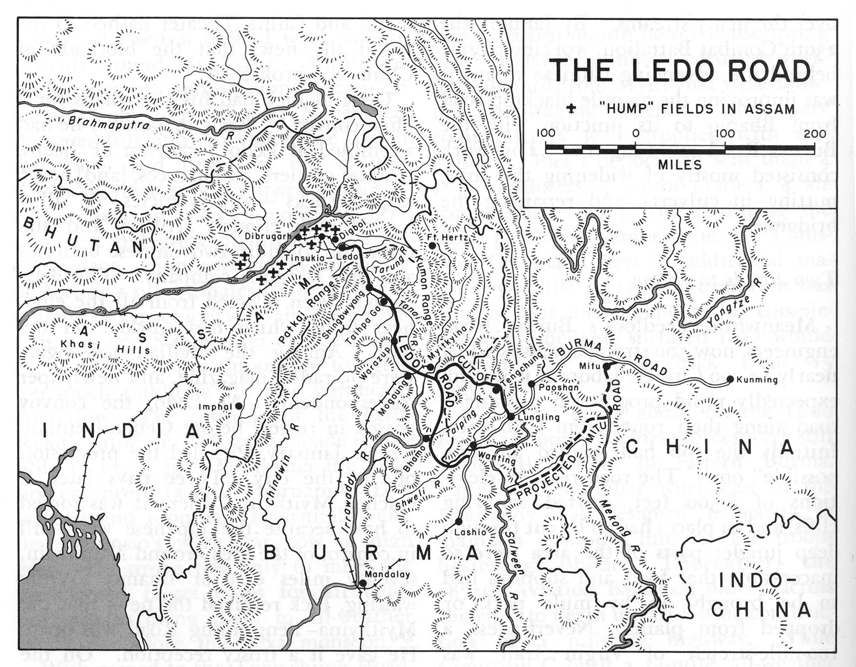
This Project was undertaken at a time when the Japanese were in possession of most of Burma and were inching forward towards India and Southern China. This Road was supposed to provide supplies to the beleaguered Chinese fighting the Chinese. There were already Plane lifts from the North East India to China over what was then called the Hump, the impenetrable Hills and Jungles of the Patkai Range and it was through this Patkai Range that the Road was to be built. Ledo was the last Railhead of the Indian Railways and the Road was proposed to be started from there for the same reason.

The Patkai Range which was the first main barrier on the Stilwell Road.
In the Himalayan context the altitude would not sound much but the fact remains that building a Road over this Pass was much more complex and dangerous than probably the one built over the Karakoram Pass. The road only became a possibility as it was a desperate situation and the desperate situation needed a desperate solution. The solution was called the Ledo Road only to be renamed later as the Stillwell Road. Though there was already an Air connect over the Hump, it had to be supplemented with a Road link as well to push the supplies of men and material into China to supplement the Chinese in their War effort against the Imperial Japanese Army.
The Project was the brainchild of the American General Joseph Stilwell who was deputed to the China India Burma theater in the Second World War as the Commander of the American Forces, Deputy Commander of the Allied Forces (second in Command to the famous Admiral Louis Mountabatten) and as an Adviser to Chiang Kai Shek, who was the Commander of the Chinese Forces. He was also nicknamed Vinegar Joe for his caustic personality. And he had a personal disdain for Military pomp and show. All these qualities put him forever at loggerheads with his British and Chinese Allies.
His main objective was to connect India with China with a Road starting from Ledo in Assam to Kunming, Yunnan, China. And he always advocated the fact that the supplies currently being sent by Air had to be supplemented by Road supply Route in order to withstand the Japanese. Of course there were many who disagreed with Stilwell who was still adamant. The British Field Marshal William Slim who commanded the British Fourteenth Army in India/Burma wrote of the Ledo Road:

American Army Trucks on the Stilwell Road
I agreed with Stilwell that the road could be built. I believed that, properly equipped and efficiently led, Chinese troops could defeat Japanese if, as would be the case with his Ledo force, they had a considerable numerical superiority. On the engineering side I had no doubts. We had built roads over country as difficult, with much less technical equipment than the Americans would have. My British engineers, who had surveyed the trace for the road for the first eighty miles [130 km], were quite confident about that. We were already, on the Central front, maintaining great labour forces over equally gimcrack lines of communication. Thus far Stilwell and I were in complete agreement, but I did not hold two articles of his faith. I doubted the overwhelming war-winning value of this road, and, in any case, I believed it was starting from the wrong place. The American amphibious strategy in the Pacific, of hopping from island to island would, I was sure, bring much quicker results than an overland advance across Asia with a Chinese army yet to be formed. In any case, if the road was to be really effective, its feeder railway should start from Rangoon, not Calcutta.

The Memorial to the people who laid down their lives while making the Stilwell Road
The construction of the Road began in 1942 and it is estimated that 15,000 American Troops were involved in the building of the Road, along with thousands of Indian, Allied, Burmese and Chinese soldiers and workers. It is said that over 1000 American lives were lost during the construction of the Road and there were casualties amongst the others in the same effort. It was called Man a Mile Road as more than one life was lost per 1079 Mile length of this Road. The first Convoy which successfully got to Kunming from the Ledo Road was in the beginning of 1945 and by that time the tide of War had changed and the Japanese were no longer as dominating as they were in 1942. But still supplies were sent over this Route though much more were going by Air over the Hump.

Chinese line-up the streets of Kunming as the first Supply Convoy comes down the Ledo Road from India
The Road was re-named at the Stilwell Road from Ledo Road by none other than Chang Kai Shek, a tribute to the spirit of General Joseph Stilwell and his complete faith in this endeavour. As of today most of the Road lies in unusable condition on the Burmese side from the India side as its a hot zone with many Insurgent hideouts. But all the way from Ledo to Nampong, the last Indian town and upto the Pangsau Pass the Road is in excellent condition and its a great Drive.
Here is a Tribute Video to the Stilwell Road and how it looks and feels today. Hoping that one day in better times we could drive all the way to Kunming through some of the most spectacular Forests in the Region.
Video from Novemeber 2019. Road from Ledo to Nampong, Arunachal Pradesh
Nampong - Hell’s Gate on the Stillwell Road
Nampong was the last town on the Indian side on the Stilwell or the Ledo Road as it was called. It was around 13 kms before the infamous Pangsau Pass which was also called the Hell’s Pass and Nampong was considered the gateway to Hell's Pass and hence the name Hell’s Gate. This was when the Road started a climb to get over the Pansau Pas which was at almost 1200 m and Nampong was at about 300 m.

The Church in Nampong
Nampong - Hell’s Gate on the Stillwell Road
Nampong was the last town on the Indian side on the Stilwell or the Ledo Road as it was called. It was around 13 kms before the infamous Pangsau Pass which was also called the Hell’s Pass and Nampong was considered the gateway to Hell's Pass and hence the name Hell’s Gate. This was when the Road started a climb to get over the Pansau Pas which was at almost 1200 m and Nampong was at about 300 m.
In the Himalayan context the altitude would not sound much but the fact remains that building a Road over this Pass was much more complex and dangerous than probably the one built over the Karakoram Pass. The road only became a possibility as it was a desperate situation and the desperate situation needed a desperate solution. The solution was called the Ledo Road only to be renamed later as the Stillwell Road. Though there was already an Air connect over the Hump, it had to be supplemented with a Road link as well to push the supplies of men and material into China to supplement the Chinese in their War effort against the Imperial Japanese Army.
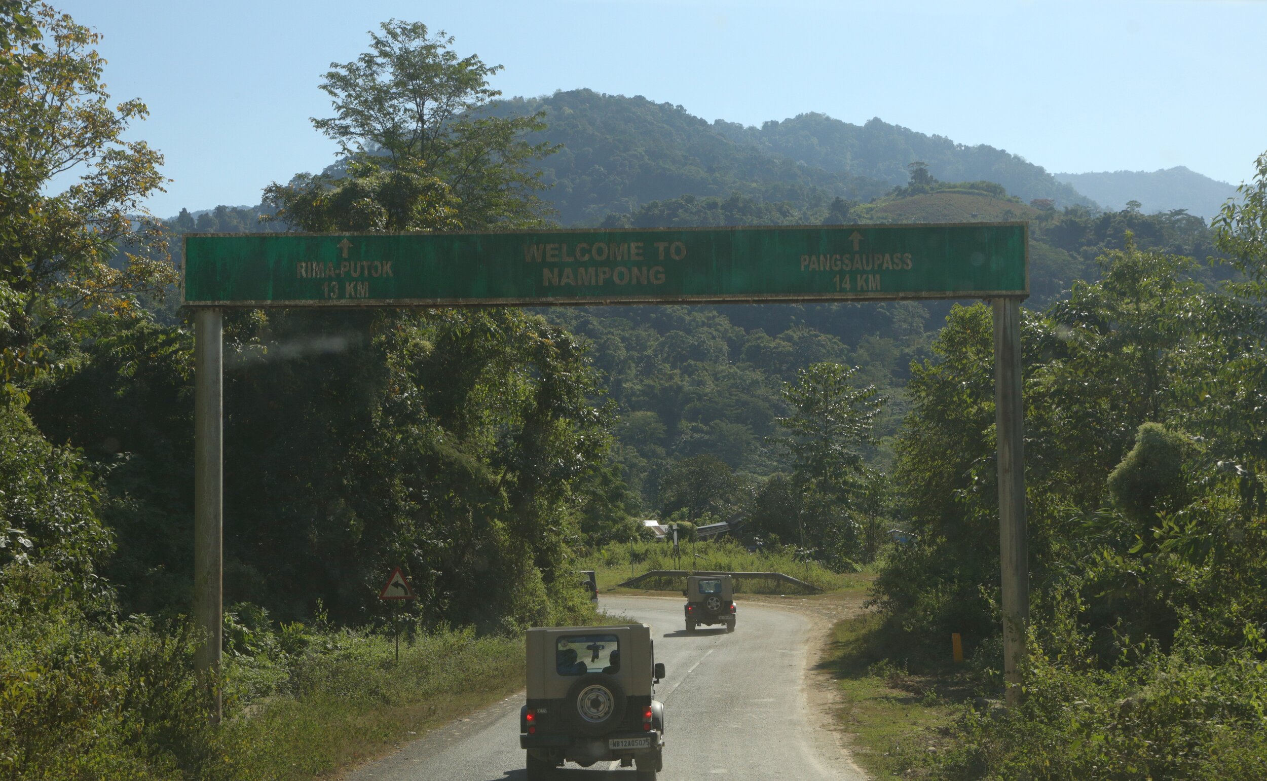
The Entrance to Nampong Town
Interestingly there is a Lake near the Pangsau Pass called the Pangsau Lake but the Amercians gave it another name. The Lake of no Return. It is said that many Planes crashed into this Lake but no traces of either the Planes or the Men or Supplies in it ever found. Hence the name the Lake of no Return. It was almost like the Bermuda Triangle in the Patkai Hills between Indian and Burma. The Lake even today is clearly visible on Google Earth but it lies on the Burmese side beyond the Pass so the possibility of going there is remote.
The town of Nampong (it used to be a Village but thanks to the Road its now a not so bustling Town of 4000+ people) was on our wishlist as I wanted to have a look at Hells Gate if not the Hell’s Pass itself. And a few years back the Indian authorities used to allow Indians all the way to Pangsau Pass but in recent years the access has been restricted. However there is a small window and the Army (the Assam Rifles actually) allow the locals across the Border on the 10th, 20th and 30th. And as luck would have it, it was the 30th of November so here was a chance which we could not miss. So with very high hopes we started from Miao in the morning with all hopes of getting to the Hells Pass.

The Patkai Hills beyond which lay Burma
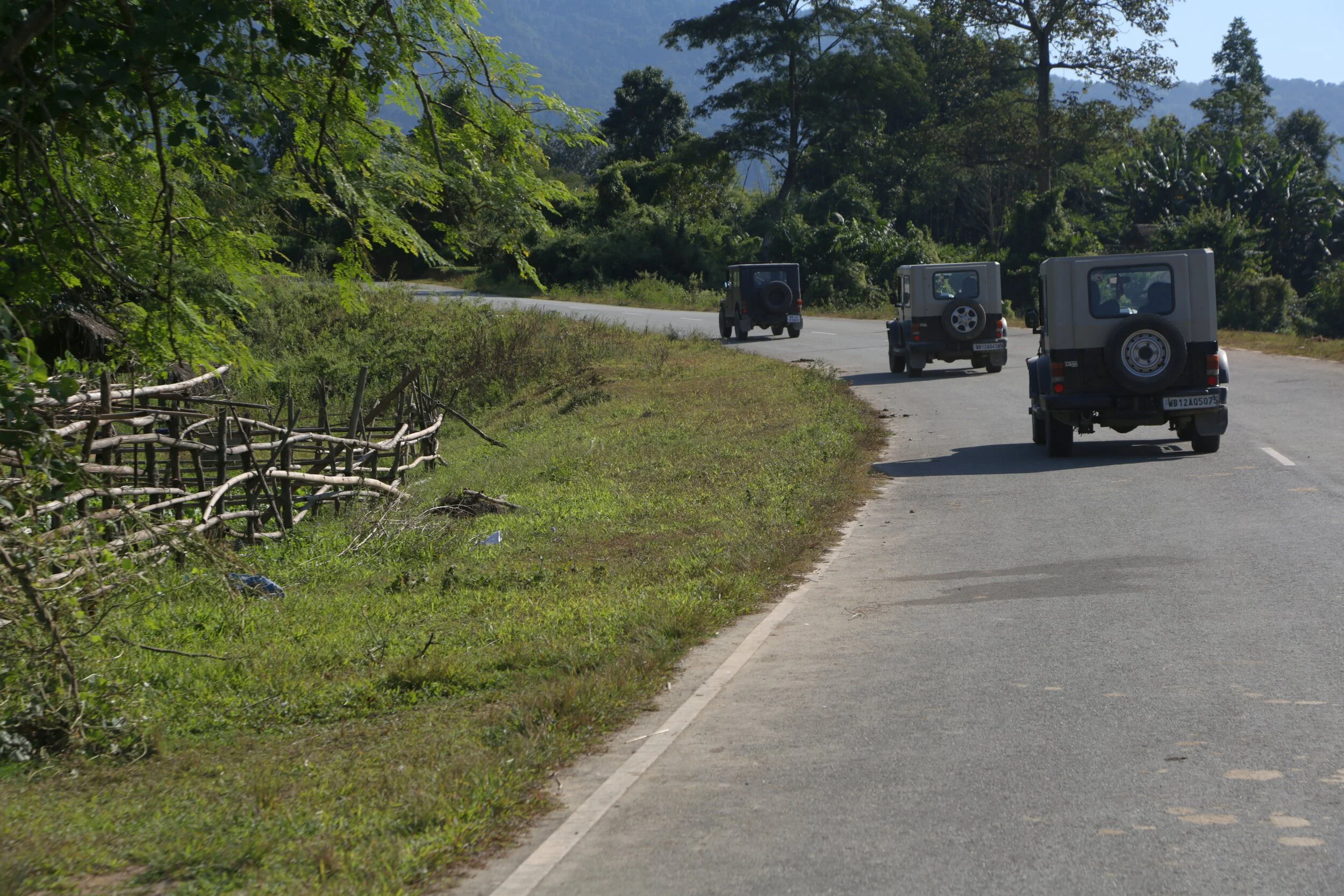
The Stillwell Road (its the National Highway now) is now a smooth two-lane excellent piece of tarmac winding through some of the greenest scenery you can see. Low undulating Hills, thick forests, Tea Garden and small streams and best of all hardly any people or traffic. Quite a contrast from the Stillwell Road of the old which induced nightmares. So we drove and I made Videos on the way and luckily it was a clear sunny day and it wasnt too hot also. And onwards we drove through the breathtaking scenery all the way to Nampong town.
I for one always insist on travelers to read about the places they plan to visit. Read about the history especially and any historical significance attached to the Town. It will just make the place much more attractive to you. What would otherwise have been a quite little border town not gets linked to the Stillwell Road, the Second World War and even the Bermuda Triangle. Who would even think of such stuff ?

On the Stillwell Road
Anyways we reached nampong after a quick drive sooner than we expected due to the super excellent Roads. And drove through Town which looked as sleepy as they come. And we passed the Town and started climbing. And it was hardly a km out of Town that we came across the Army check Post. We went and spoke to them and they told us that this is as far as you can go back. Not allowed beyond this point. But its the 30th and arent people allowed till the actual Border we asked them. That's only for the local people of Nampong and not outsiders. Where can we get permission from we asked ? The SDO (Sub-Divisonal Officer they said) they told us and also gave us the directions to the SDO’s office. So a couple of us went down to the SDO’s Office while I stood up taking a Video of the pretty little town. And as expected the SDO didn't give permission. Strict orders from the Home Ministry was cited as the reason. I had a fair idea why the permission was now diificult but thats another story for another day.
Well anyways we are happy to have come so far. Next time for sure we will get to the Hell’s Pass from Hell’s Gate and maybe even to the Lake of No Return :)
Video from November 30, 2019
Stillwell Road to Nampong Town and beyond.
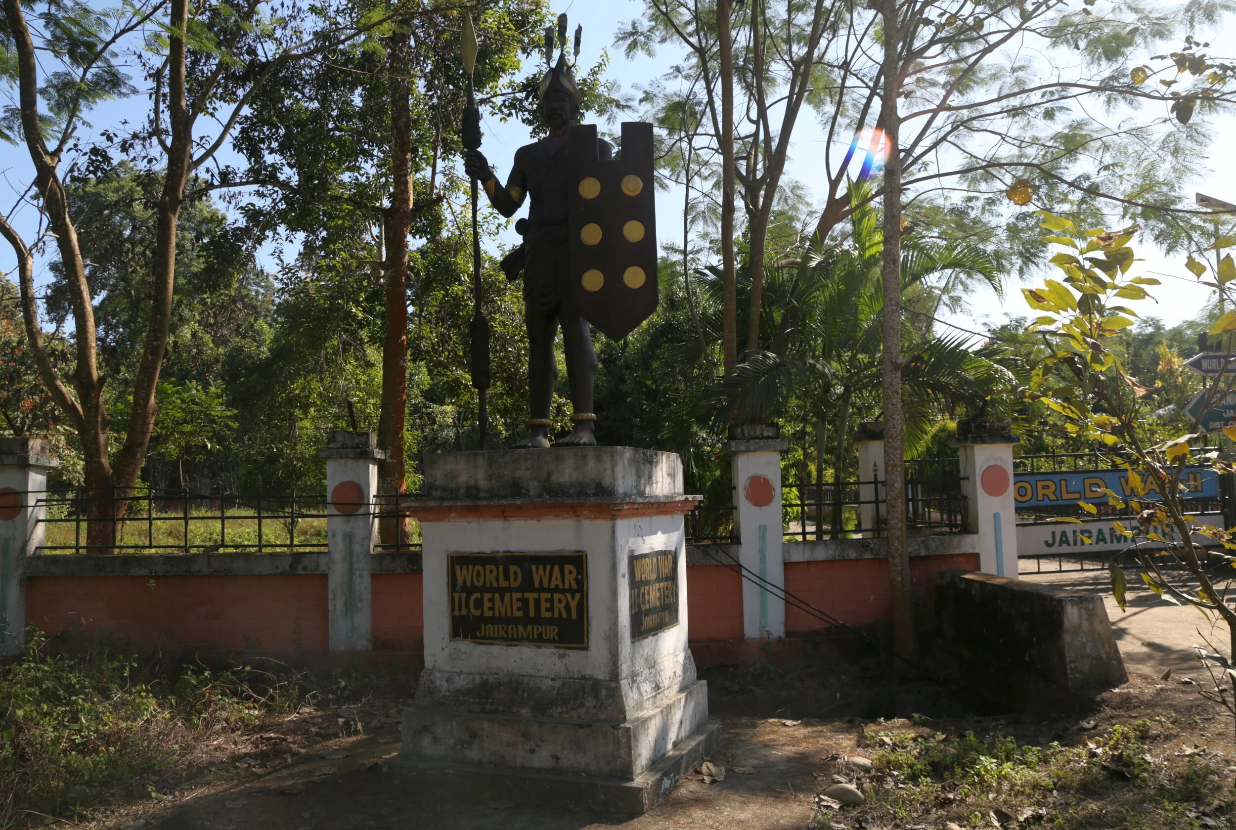
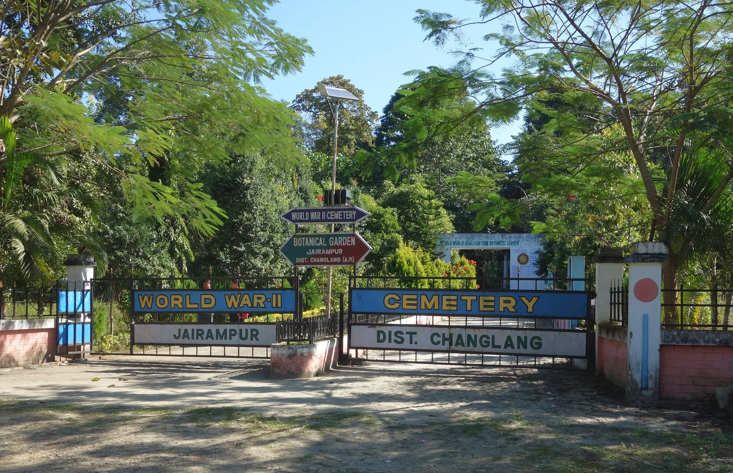
The Forgotten Jairampur Cemetery
The Forgotten Jairampur Cemetery on the Stillwell Road near the border of Arunachal with Burma. The largest WWII Cemetery in India which was lost to the jungle but re-discovered in 1997.

The Forgotten Jairampur Cemetery
In the Changlang District of Arunachal Pradesh close to the border of Arunachal Pradesh with Myanmar on the spurs of the Patkai Mountains lay a Cemetery where were buried a number of Soldiers from the Second World War. This Cemetery lies around 30 kms before the Hell Pass or the Pangsau Pass as its called now and all the people buried here were soldiers engaged in the building of the marvel of engineering that came to be known as the Ledo Road or by its more famous name the Stillwell Road as it was named after an Amercian General. Making a Road across the Patkai would never be easy every Mile came at the cost of a Man.
The graves are said to belong to Taiwanese, Chinese, Amercan, Kachin and Indian soldiers who worked as labourers and workers on the Ledo Road which intended to connect Ledo in Assam with Kunming in China. Some of the graveyards are of Adi (Abor), Mishmi and Jaintia soldiers who fought for the Allied Forces and worked on the Road as well, but there is very little evidence left of their antecedents. Most of these people have said to expired out of disease, fatigue, malnutrition and a combination of all these factors.
This Project was undertaken at a time when the Japanese were in possession of most of Burma and were inching forward towards India and Southern China. This Road was supposed to provide supplies to the beleaguered Chinese fighting the Chinese. There were already Plane lifts from the North East India to China over what was then called the Hump, the impenetrable Hills and Jungles of the Patkai Range and it was through this Patkai Range that the Road was to be built. And as the Cemetery stands as a solemn reminder of the number of lives this endeavour would entail.
The Cemetery which contains over 1000 Graves is by far the largest Second World War Cemetery in India but surprisingly it was taken over by the Jungle and was only re-discovered in 1997. It had not only been taken over by the Jungle but extensive damage caused to the Graves by apparently wild Elephants but I assume by Grave robbers as well. During the time I visited I could see that except a few Graves all had been damaged. One of the epitaphs still readable in the Cemetery is that of a 30 year old Chinese Major who was a Company Commander and it reads as such
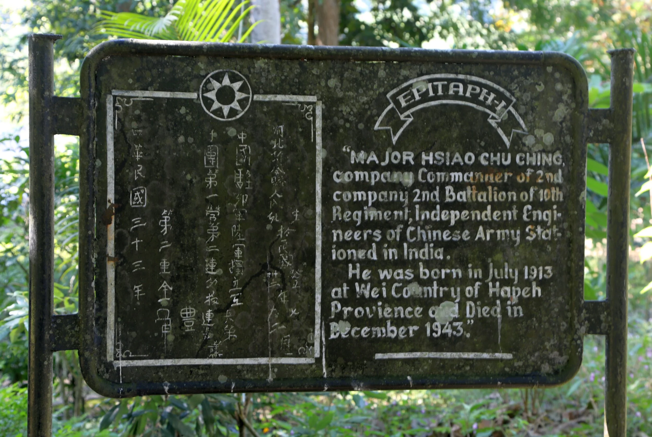
“Major Hsiao Chu Chung, Company Commander of the 2 nd Company, 2 nd Battalion of the 10th Regiment, Independent Engineers of Chinese Army stationed in India.
He was born in July 1913 at Wei Country of Hapeh Province and died in December 1943”
Almost all the Graves are now without an Epitaph and as I mentioned in a very bad state but the Botanical Garden built around the Cemetery does add grace to the place. And I noticed that a Tree was planted alongside each of the Graves, each Tree standing for someone who laid down their life in the War effort.
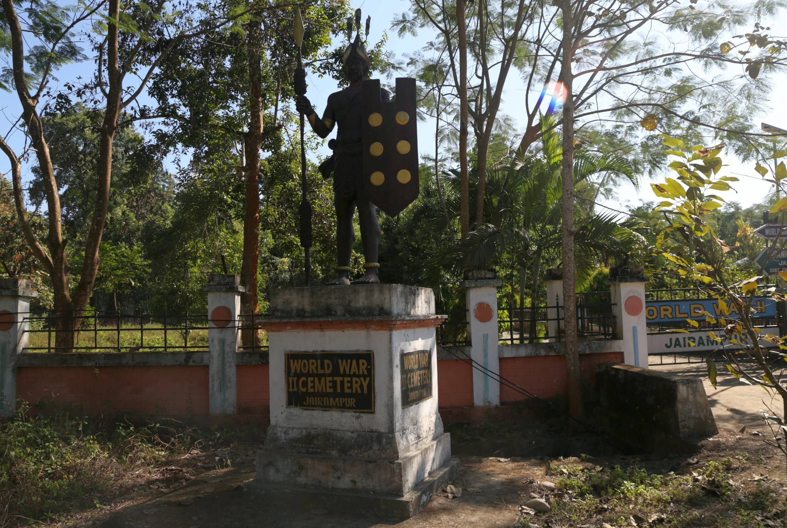
And Another board at the Cemetery, probably as a commemoration for all the unnamed Soldiers and Workers who now sleep in these decrepit Graves which reads as such
“World War Two Cemetery : These Graves bear silent testimony to those Soldiers, unlisted Workers and Labourers who ventured into the virgin Jungle amid blistering heat and laid down their lives in the line of duty during the Second World War, whilst a part of all the forces against the Imperial Japanese Army.
Their names liveth forever more”

Though the Government has now started some work on the Cemetery it is still a far cry from the very well preserved Cemeteries at Kohima and Imphal related to the same War. They are also building a Museum. But the cause of the most concern is the present status of the Graves. I can understand the neglect from the Indian side but i'm surprised that the Americans (the Road endeavour was led by the Amercians) haven't taken note and taken up the upkeep of the same. Maybe thats because no one is actually sure about the “Nationality” of these brave men.
I walked through the Cemetery and made a Video for you yourself to see the largest World War Two Cemetery in India. World War Two, the most brutal War in the History of Mankind.
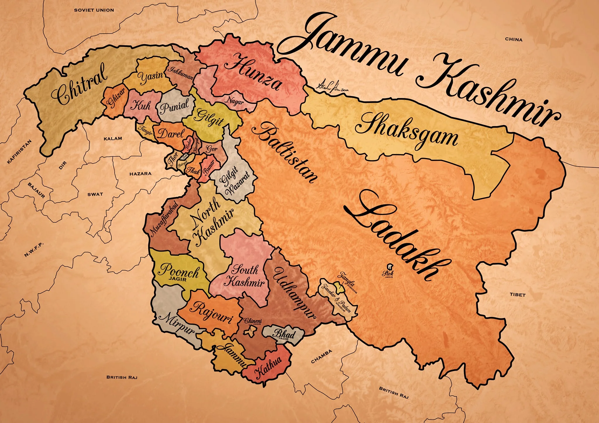
Historical Map of the Dogra Kingdom of Jammu and Kashmir
The State of Jammu and Kashmir as it was at its largest extent under the rule of the Dogras. This Map helps people understand the complicated Geography and Diversity of the erstwhile State of Jammu and Kashmir.

Historical Map of the Dogra Kingdom of Jammu and Kashmir
Another interesting Map of the previously E Jammu Kashmir by my talented friend Arsalan Khan who also belongs to the Riyasat. We had previously had an Article on the various Indigenous People of Jammu and Kashmir. Its not perfect, has its anomalies but it still an indicator of the diversity of the State from a Political angle. This Map shows the Dogra Kingdom at its most expansive. And i would like to point out that all these different areas were won over by the Dogras / Dogras under the Sikhs in War except Kashmir which was granted as a part of the Treaty between the British and Raja Gulab Singh on the payment of War Indemnity of 75 lakhs. It should be pertinent to mention that the Dogras also played a part in the Sikh conquest of Kashmir earlier from the Afghans. Also it suited the British in 1846, when the Sikh Kingdom still existed, to have a parallel power which they could use as counter against them and in this case it was Raja Gulab Singh and his hardy Hill Men. Here is an account of the transition of the Rulers in Kashmir From the Mughals to the Dogras giving a background of how Kashmir passed from the Mughals to the Afghans to the Sikhs and onto the Dogras.
Just an explanation on the parts :
Chitral : This is the most controversial inclusion as it always stirs up a Debate. Was Chitral at any point of time a part of the Dogra Kingdom ? Different historians had different versions on this but one thing was clear that the Chitral Kingdom did pay tribute to the Dogras. This has been verified by me personally with Members of the Chitral Royal Family. Of course later due to the Great Game Chitral was made a part of the Malakand Agency. Here is an account of the Chitral Expedition an important event in the History of Chitral
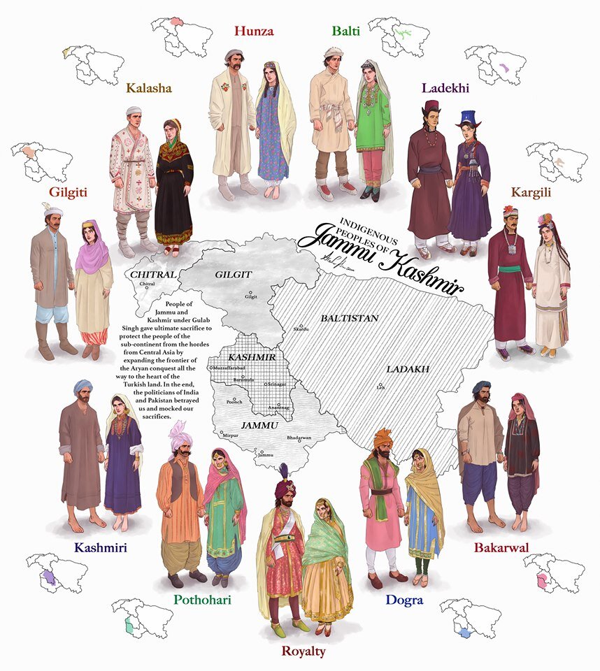
The Indigenous people of Jammu and Kashmir
Hunza / Gilgt and around : Besides Gilgit and Hunza there were other Hill States which used to be constantly at loggerheads with each other but used to occasionally unite against foreign aggression. These were Iskoman, Nagar, Yasin, Ghizer, Punial and Darel among the more notable ones. Gilgit was an important location and one of the most forward bases of the British in the Great Game which I have described in this article titled The Gilgit Game. In addition to these there were various other smaller “Shinaki Republics” which as the name suggests were Groups of Shina speaking people in communities in the area generally named as Chilas. The Imperial Gazzette of 1908 described them as such :
“A group of small republics in the valley of the Indus, lying west of Kashmir and south of Gilgit. The territory extends from the junction of the Astor river with the Indus to Seo on the right bank and Jalkot on the left bank of the latter river. Within this area the people are grouped in communities inhabiting one or more nullahs, each community forming a separate republic. Starting from the junction at Ramghat these are, in order : on the right bank, Gor, Kinergah, and Hodar ; and on the left bank, Bunar, Thak, Butogah, Giche, and Thor. They constitute the area known as the Chilas subdivision of the Gilgit Agency, while Chilas proper includes Kinergah, Butogah, and Giche. Lower down the river are Darel, Tangir, Khilli, and Seo on the right bank, and Harban, Sazln, and Jalkot on the left bank.
After the conquest of Chilas by Kashmir in 1851, the Maharaja imposed a tribute in gold-dust, and arranged for the administration of the country as part of the Gilgit district. A British Agency was re-established at Gilgit in 1889, which included, among other terri- tory, the Chilas subdivision described above except Thor. In 1892 a British mission to Gor was attacked by the Chilasis, which led to the occupation of their country and the appointment of a Political officer at Chilas. The right of the Kashmir Darbar to construct roads and station a limited number of troops in the territory was secured, but the autonomy of the Chilasis was guaranteed. Under the revised arrangements made in 1897 the republics pay small fixed sums to the Maharaja, and in 1899 Thor was incorporated in Chilas. Darel has rendered a tribute of gold-dust to Kashmir since 1866, when the Maharaja's troops raided the country. The tribute is now paid through the Punial governor. Tangir pays a small tribute to the governor of Yasin. The remaining communities have no political relations with either Kashmir or British India, except Jalkot, which from its position dominates Thor and the head of the Kagan valley in the North- West Frontier Province.”
Then on the other side we have Baltistan and Ladakh about who most people know a bit of the History and how these were conquered by General Zorawar Singh between 1834 and 1840. This is a brief account of the conquest of Ladakh and Baltistan by the Dogras. In Ladakh also once the Royal family was removed from Leh, the Ladakhi King was granted the Village of Stok and some surrounding area as a Jagir. Thats where the Stok Palace was built. Much the same way the Raja of Zanskar was granted the Jagirdari of Zangla. Or something to that effect. This is a general note on Zanskar to help in the understanding of this one of the most remote regions of the Himalayas. And ignore the Shaksgam part as its shown beyond its size. This article gives you an insight into the Shaksgam Valley. Another important part of the State which is missed out in this map is the region between the Karakorams and the Kun Lun Mountains called the Aksai Chin.
And then of course we have the Kashmir Valley itself. It was divided into North and South Kashmir for administrative purposes. To the West of Kashmir was Muzaffarabad which was the Pahari area along the Jhelum Valley starting from Uri. This is the part I belong to close to the town of Hatiann Bala. Muzzafarabad is also the Capital of the entity referred to as “Azad Jammu Kashmir”.
Then of course we have Poonch which was a Jagir granted to the family of Raja Suchet Singh, a brother of Raja Gulab Singh. It had a history of its own and struggled for a while to be independent of their Jamwal Cousins which only resulted in the Jagirdari being terminated for a bit. Here is an account of what transpired in the Kingdom of Poonch. There was also the very small Jagirdari of Chenani, which is a small Town on the Highway and I remember that there used to be a Palace of sorts over there. More than that I remember because the erstwhile Raja of Chenani was a friend of my Grandfather’s and i have seen him at my Grand Fathers’ place when I was very young.
And then there was Rajouri which is the stronghold of the Gujjars and most of them are based here during the Winters. Next to Rajouri was Mirpur which was really a part of Punjab and the people were called as Mirpuris. Due to the building of the Mangal Dam many Mirpuris went to the UK and thats the reason you have a strong Mirpuri community in the UK.
And then we had the Duggar heartland of Jammu and Kathua which bordered Chamba with which it shares a lot of Cultural similarities. The district of Udhampur at that time included the whole of Udhampur and Ramban as well as Doda and Kishtwar. The Jagirdari of Badh or Bhaderwah was granted to the Ruler of Bhaderwah who was installed by Gulab Singh after getting the Chambyalis to give up all their claims over Bhaderwah. It used to be an integral part of the Chamba Kingdom. This is an account of Bhaderwah. It connects with Chamba over the Padri Gali.
Of course this will get many people excited and there would be counter views but the views mentioned above are my own based on what I have read and experienced. Kindly feel free to disagree. But as a request just dont start a discussion 1947 onwards as it wont get us anywhere.
This Map is available in hi-res as well. Do let me know if you want.
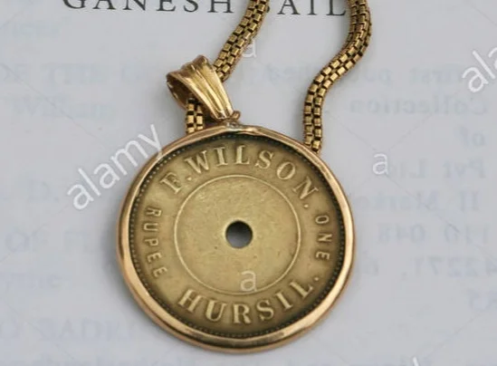
Pahadi Wilson : The English Raja of Harsil
Once upon a time there was an Englishman, called Pahadi Wilson who had crowned himself the Raja of Harsil so much so that he even issued his own currency, his own coin, for use in his own domain. Frederick E Wilson was his real name and his escapades could probably fill in a couple of Volumes. He was a Spy for the British Government and reportedly even had an affair with a Rani Sahib of Tehri it is said. And it is said that a curse was cast upon him and his coming generations by none other that Lord Shiva himself. Even the legendary Rudyard Kipling, who was a friend of his, described him as such, “lived a life that would have been the envy of kings”.

Pahadi Wilson : The English Raja of Harsil
Once upon a time there was an Englishman, called Pahadi Wilson who had crowned himself the Raja of Harsil so much so that he even issued his own currency, his own coin, for use in his own domain. Frederick E Wilson was his real name and his escapades could probably fill in a couple of Volumes. And his notoriety has lived up till the present day as a few years back, Sundar Lal Bahuguna, who started the Chipko Movement blamed Pahadi Wilson for the large scale damage caused to the Environment of Garhwal. He also supposedly was a Spy for the British Government and reportedly even had an affair with a Rani Sahib of Tehri it is said. And it is said that a curse was cast upon him and his coming generations by none other that Lord Shiva himself. Even the legendary Rudyard Kipling, who was a friend of his, described him as such, “lived a life that would have been the envy of kings”.
So who exactly was this Pahadi Wilson or Hyulsen Sahib as his neighbours called him and how exactly did he manage to land himself in the middle of all this action ?

Frederick E Wilson was a Soldier with the British Empire and was stationed in India. In around 1841 in circumstances that are still not very clear he deserted from the Army in Mussoorie. He was a young man of around 24 years age at that time. As per some sources he killed a fellow Soldier in a duel and that caused him to flee. He fled into the Mountains and entered the Kingdom of Tehri Garhwal where he asked the King to grant him some employment. But the King who was an ally of the British, would have nothing to do with him lest his British friends be unhappy to find out that the King was sheltering a fugitive from their Army. Left with no further recourse it is said that Pahadi Wilson went even deeper into the Mountains till he came to the Valley of the Bhagurathi at a place called Harsil and decided to set himself up over there far away from civilization in general and his fellow British in particular.
So there he settled and married a local lady as soon as the local Villagers accepted him into their Society. One would imagine that he acted like some important official and the local Villagers were scared of the Gora Babu and were generally very nice and accommodating with him. All except the Priests of the local Temples who probably thought of him as some kind of Missionary out to convert the people and hence render the powerful priests unemployed. But far from a Missionary Pahadi Wilson had Royal ambitions and wanted to make a lot of Money. Soon he got involved in the lucrative Timber trade in the Region. He also got involved in Trophy Hunting and he was a self taught Botanist and Ornithologist as well. He traded in all kinds of Exotci Wildlife products as well besides the Timber trade. He also introduced Rajma and Apples to the Region and put large tracts of land under cultivation of these Cash crops.

It is said and believed by many that he clandestinely spied on behalf of the British during the First War of Independence in 1857 and at many times supplied very vital information to the British. Through his informal network he not only kept an ear out in the plains but also in the Mountains and beyond and is also said to have played a part in the Great Game. Due to the invaluable service he rendered during the “Mutiny” he was pardoned for his offence of Deserting the Army and could now freely work with the British East India Company.
He convinced (some say coerced) the Raja of granting him the rights to fell Timber in the pristine Forests and it had just happened that the British were laying Railway Lines across the country and there was a great demand for Timber Sleepers of Sal for the Railway tracks. And this was where the Raja struck Gold and made a fortune beyond his wildest imagination. He set up sawmills along the Bhagirathi and vast amounts of Timber were floated down the River towards Haridwar.
Pahadi Wilson was truly a Raja now, and the first thing a Raja does is mint coin in his own name. And that's what Pahadi Wilson did and these are great Collector items today. He built a large Palace out of Deodar in Harsil. He married a couple of times and had numerous affairs. Everything seemed nice and dandy but his growing influence only made the Priests in Gangotri and Mukhba more sceptical of his real intentions.It is said that these than cast a curse on Pahadi Wilson and his coming generations. Of course the reason given for this was that Lord Someshwar had himself cursed him as he had almost completely hunted out all the Wildlife and destroyed all the Forests. As per the curse none of his progeny would live for long and one day his bloodline would disappear and everyone would forget about him.
Pahadi Wilson, in his wealthy prime decided to move out of Harsil to Mussoorie to live among his fellow British gentry as now he was a very well respected part of the Society. With all his wealth, he became one of the biggest landowners in the Mountains. He became friends with eminent people like A O Hume and Rudyard Kipling who’s Novel “The Man Who Would Be King” is said to have been inspired by Pahadi Wilson amongst others. And it was in Mussoorie that Pahadi Wilson passed away in 1883 but not before he witnessed the passing away of 2 of his 3 sons. His only surviving Son went into obscurity and his last known descendant was an Officer (probably a Grandson of his last surviving son) who served in the Indian Air Force but passed away in an Air Crash in 1953. Thus ended the line of Pahadi Wilson.
Maybe it was the curse of Lord Someshwar. The Gods, as it is said, neither forget nor forgive.
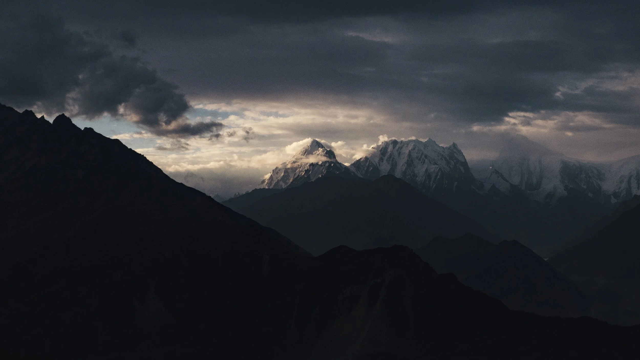
The Gilgit Game
Gilgit, strategically located is a vast valley around the point where the Gilgit and Hunza River meet beyond the Great Himalayan Range .. It was bound from the North on one side by the Karakoram Range and on the Western side by the Hindu Kush. Its location particularly later in history was one of immense importance once the Great Game started between Tsarist Russia and Imperial Britain.

Rakaposhi Peak as seen from the Gilgit Valley. Pic Courtesy Wikipedia
The Gilgit Game
Gilgit used to be a part of the Riyasat E Jammu Kashmir till it was occupied by Pakistan in 1947 and formed what was called the Northern Areas. A few years back it was made a “Province” along with Baltistan and re-named as Gilgit Batistan.
Gilgit lies in a Region which consisted Dardic populations and this was also called Dardistan. As per the Gazetteer of Jammu and Kashmir the district of Dardistan consisted of the following sub-divisions : Astore, Bunji, Chilas, Gilgit, Hunza, Nagar, Punial, Yasin and Chitral. On the whole the areas was called the Gilgit Wazarat and Gilgit was the main town.
Anyone familiar with the Geography of the Region would know the strategic location of Gilgit, which forms a vast valley around the point where the Gilgit and Hunza River meet beyond the Great Himalayan Range at an altitude of just 1500 m. It was bound from the North on one side by the Karakoram Range and on the Western side by the Hindu Kush. Its location particularly later in history was one of immense importance once the Great Game started between Tsarist Russia and Imperial Britain. Before the Great Game also its location with access to Central Asia, Afghanistan, Tibet and Kashmir and thereon to India made it an important center of Trade.

Somewhere in Hunza
The history of Gilgit is mostly obscure but at some point of time Buddhism held sway here and it was Ruled by the Patola Shahis. Gilgit was a great center of Buddhist learning and many pieces of Budhist religious iconry and Manuscripts like the Gilgit Manuscript have been found here. It was from Gilgit that many Buddhist Monks went further into Central Asia to spread the message of Buddha. However at some point of time Buddhism declined like in other places in North India and the Tra Dynasty came into power after a brief period of Tibetan and Chinese Rule in the region.
The names of the Ra Dynasty (The King was called Ra), who were Hindus (but some claim Hindu) is largely unknown except for the last one who was called Shri Badut. This Shri badut was apparently and cruel man and said to be a Cannibal as well. He was apparently killed by a Persian prince who married his Daughter and became the first Muslim ruler of Gilgit. The death of Shri Badut is still celebrated in Gilgit. The name of the Ruler hence was changed from Ra to Trakhan and its the Trakhan Dynasty which continued to Rule Gilgit for many centuries to come. And it continued to rule well into the starting of the 19th century.
As per the Kashmir Gazetteer of 1890 : “The history of Gilgit that is, its reliable history-does not go back further than the commencement of the present century, when it was conquered by the Yasinis under Suliman Shah, Khushwaktia. Azad Khan, of Payal or Punial, displaced the Yasinis, and Tahir Shah of the Nagar family overturned the Payali Raj. Tahir left Gilgit to his son Sikandar Khan, who was ousted by Gauhar Aman of Yasin about 1841. There upon Karim Khan, brother of Sikandar Khan, sought aid from the Governor of Kashmir,who, with the sanction of the Lahore darbar, sent a force of 1,000 men under Nathu Shah to assist him. In the meanwhile Sikandar Khan had been murdered; so Nathu Shah, feeling doubtful of success, sent for reinforcements. When these arrived, he assaulted the Fort and took it by storm. Gauhar Aman, ou hearing of this, fled precipitately to Mastuj. "
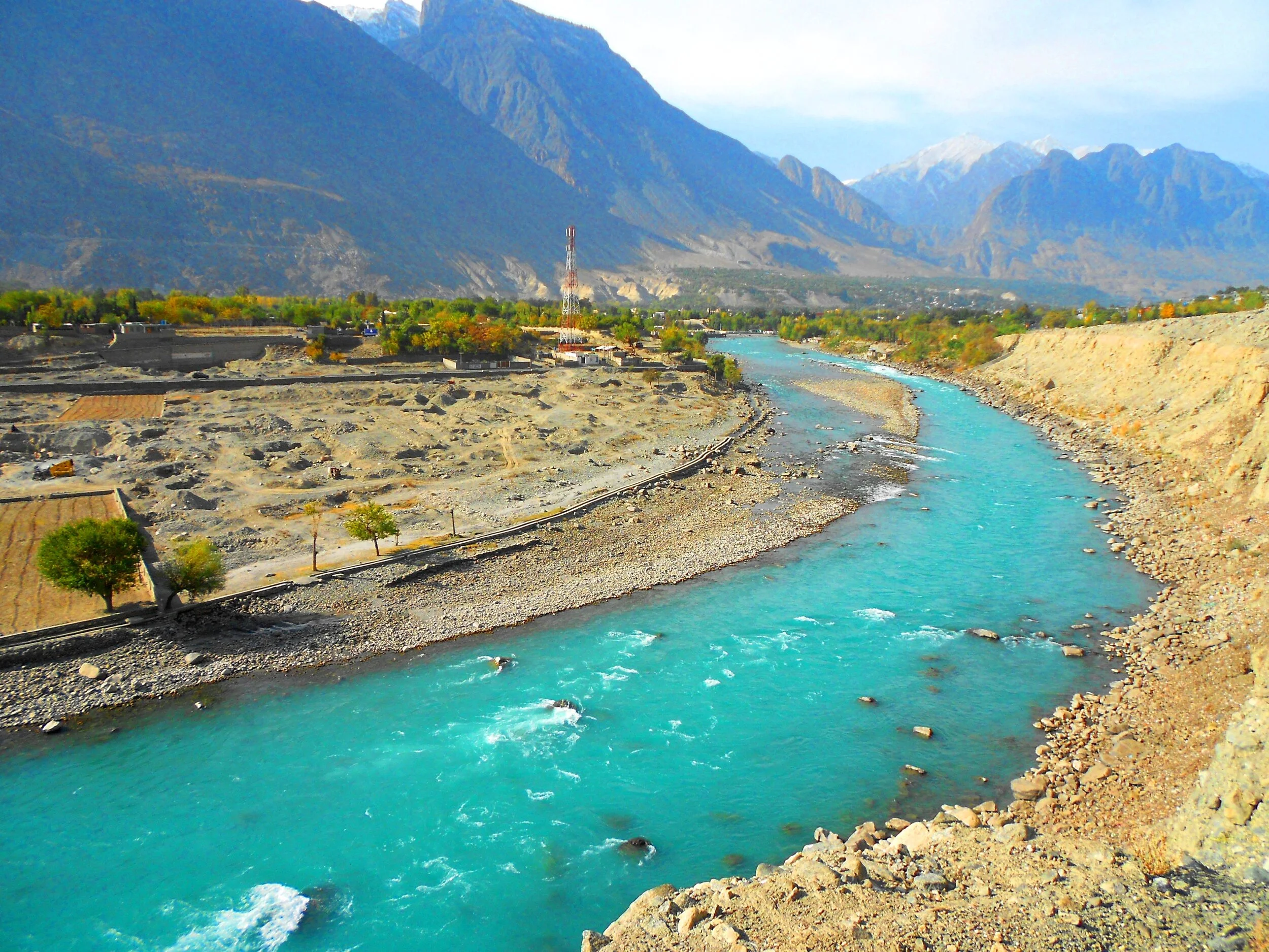
Gilgit River
From then on Gilgit became a part of the Sikh Kingdom and subsequently the Dogras. However it was not as easy as I am making it sound. There were multiple rebellions and it was during one such incident that Nathu Shah who was the Governor of Gilgit was killed. In 1856 again the Sikhs took Gilgit only to be relieved of it in the successive by Gauhar Khan. It was only after the 1857 and the First Mutiny that Maharaja Ranbir Singh sent a force to recover the country in 1860. In 1863 they rose again and another expedition was sent to Yasin. In 1866 Hunza was attacked by the Dogras along with their Nagar allies, but a trick was played on the Dogras and they were routed. A general alliance was formed against the Dogras by the Chitralis, Yasinis, Tangiris, Darelis and Hunzai and Punial was taken from them. However the Dogra garrison of 2500 at Gilgit held out and then reinforcements arrived and the Dogras re-claimed Gilgit and the surrounding country. Punitive missions were done and the status of Gilgit as an inevitable part of the Riyasat was finalised.
And by this time the Great Game had heated up and the Russians were right across the Hindu Kush and were almost at the Wakhan. This let the alarm bells ringing in the Empire Where the Sun Never Set. The British wanted to have greater influence on Gilgit and convinced the head strong Maharaja Ranbir Singh to let them station an Officer On Special duty to Gilgit in 1877. Gilgit was now the main listening Post in the Great Game and not far from there were the feared Cossacks of the Russian Army. After the death of the Maharaja the British appointed a Political Agent to Gilgit and effectively took over the administration of Gilgit. Gilgit Agency as it was called effectively became British and only in name was under the Maharaja’s rule. All the other neighbouring states were also slowly absorbed into the Gilgit Agency. Chitral was however made a part of Malakand Agency in NWFP. In 1935 the British leased out Gilgit from the Maharaja settling any doubts over Gilgit’s status.And so it stayed till Independence when the British on their return reverted Gilgit over to the Maharaja.

Gojal, Hunza - Nagar
It was now that the “Gilgit Rebellion” took place. The British left and the JK State took charge and Brig Ghansara Singh was appointed the Governor. The Gilgit Scouts, a regiment created by the British comprising of locals were incited by none other than their British officers to rebel and on 1st November after the Maharaja signed the Instrument of Accession they broke out in revolt. Both Brig. Ghansara Singh and his second in command Col.Majid were arrested by the Gilgit Scouts. And then the inevitable happened and the Non-Muslim population was put to the sword. The madness of the sub-continent spread to Gilgit as well. And of course the majority of the Population also wanted to be a part of the new nation on the West. The matter was thus settled for the time being. The same Gilgit Scouts moved further and sieged Skardu and captured kargil and even went as far as Zanskar.
The question remained as to why the British officers openly supported and even planned the whole operation. It was a Military Coup and no civilians took part. And even more strangely the British were eager that Gilgit be a part of Pakistan. The reason for the same was actually quite simple. The British as well as the Americans still wanted Gilgit as a base. The approach to Gilgit from Srinagar was mainly through the Burzil Pass which connected Guraiz with Gilgit. And then there was the Rajdhan Pass. Both these Passes were blocked for snow in the Winters and the Burzil would stay shut for atleast 6 months in a year. On the other hand the approach to Gilgit from NWFP was much easier and through an all Weather Road. Secondly the “Allies” were aware that they would be in a better position to influence Pakistan rather than India due to obvious reasons. And hence the whole operation planned and implemented. It was one of the smaller Games of the Great Game and is called by some as the Gilgit Game. There are many detailed writings on this so get a copy if you want more details.
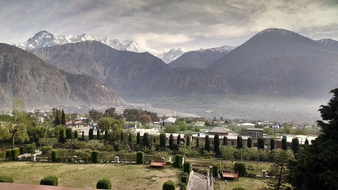
A view of the Gilgit Town and Valley. Image Courtesy Wikipedia
A pic of the Gilgit Town and the vast Valley surrounding it which made it perfect for an Airbase among other things. The Soviet union was just minutes away by flight. Pic courtesy Fehd Raza. Summer months.
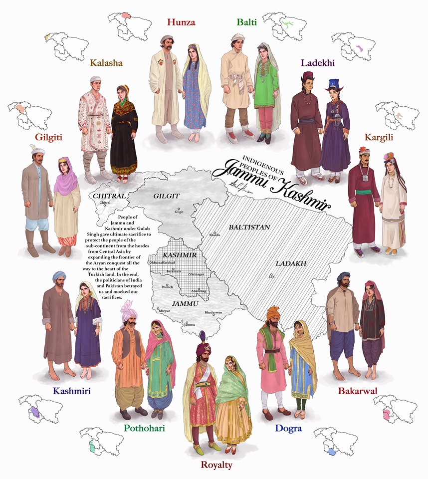
The Indigenous People of Jammu and Kashmir
The erstwhile State of Jammu and Kashmir was one of the most diverse State in the country in Ethnic, Religious and Lingual dimensions. The main "People" of Jammu and Kashmir and its different regions are briefly described in this Article.

The Indigenous People of Erstwhile State of Jammu and Kashmir.
This is a graphical representation of the people of Jammu and Kashmir made by Arsalan Khan and Rajja Sourav Singh Sarmal. A brief description of each by me to help in better understanding (Clockwise from top) :

Hunza (Burusho) Ladies. Pic credit Wikipedia
The Hunza : The Hunza or the Burusho people inhabit the Hunza Valley and neighboring Valleys in the extreme North of the state. They speak the Burushaski language which as a language has not been identified with any language Group. The Hunzai now mostly follow different schools of Islam.
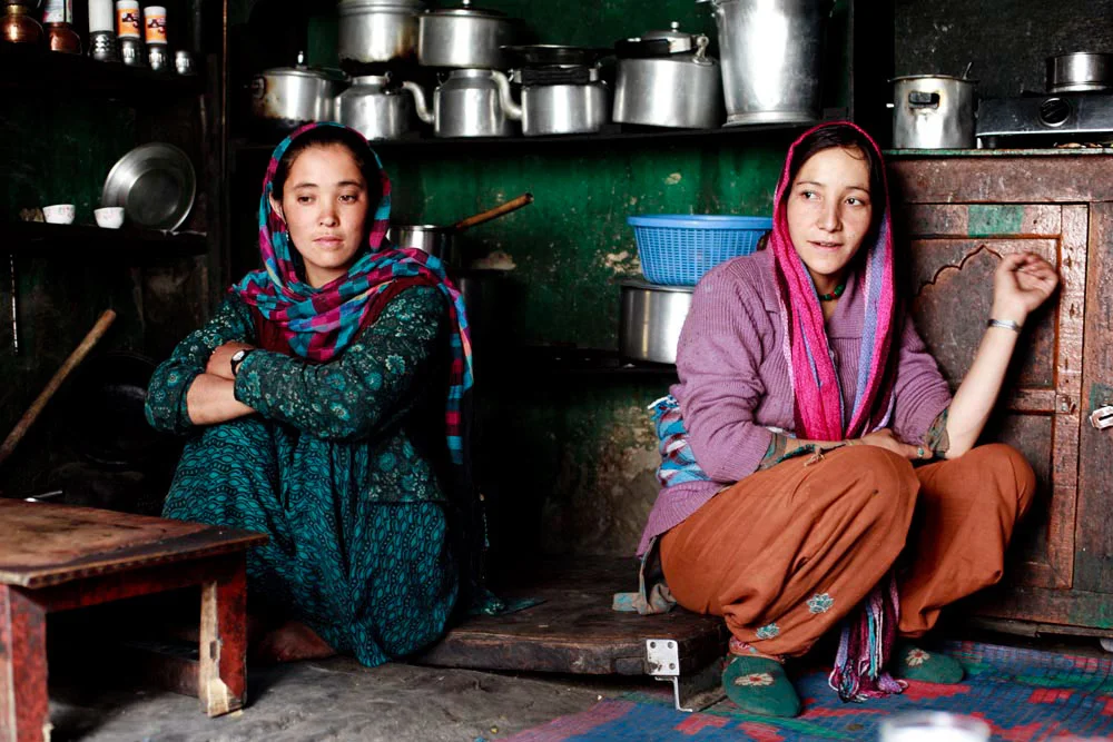
Balti Ladies. Pic Courtesy : https://www.behance.net/gallery/12289037/The-Balti-People-of-India
The Baltis : The Baltis are the inhabitants of the Baltistan and are of Tibetan origin with Dardic admix. Their language is Balti, which is a part of the Tibetan language Group. Infact it has the greatest similarity to old Tibetan. The Baltis follow Islam.

A :Ladakhi Lady in traditional Dress. Pic Courtesy Jimmy Nelson
The Ladakhis : The Ladakhis are the inhabitants of the Ladakh region and are of Tibetan descent. The Ladakhi language is from the Tibetan family. Ladakhis are Buddhists as well as Muslim.

Ladies in Kargil. Pic Courtesy Roots Ladakh
The Kargilis : The Kargilis or the Purigpas as they are called inhabit the Western part of Ladakh at the crossroads with Baltistan and Kashmir. Their language Purigi is a dialect of Balti and as such they are also a part of the Tibetan family. Purigis are mostly Muslim.

Bakarwal Men
The Bakarwals : The Bakarwals and their close cousins the Gujjars are traditionally nomadic pastoral people who inhabited the foothills of the Himalayas and moved to the Mountains in the Summers with their livestock. They (Gujjars/ Bakarwals) form the majority in the Poonch Rajouri region and spread among the Jammu Division and in Kashmir as well. They follow Islam.

Maharaja Ranbir Singh, the Dogra Ruler of Jammu and Kashmir state during who’s Rule the Dogra Kingdom reached it largest extent and also included Chitral
The Dogras : The traditional dwellers of the Jammu region or the “Duggar” as the region was known. They live in the foothills of Jammu and are spread into Himachal Pradesh as well. The Dogras speak the Dogri language which is from the Western Pahari Group of languages. The Dogras are mostly Hindu though a significant number converted to Islam and were referred to as Chibalis.
The Potohari : The Potohari/ Pahari are the most Punjabic people of Jammu and Kashmir and live across the Potohar Plateau which stretches well beyond Rawalpindi. They are in sizeable numbers in Poonch. Their language Pahari-Pothwari belongs to the Lhanda Family of Punjabi. They are majorly Muslim but there is a strong Hindu minority as well.
The Kashmiri : The people of the Kashmir area found mostly in the Kashmir Valley. They are the biggest Indegenous Group of people in the state. They speak Kashmiri language which belongs to the Dardic family of languages. Kashmiris are mostly Muslim though a small minority of Kashmiri Hindus also exists.

Dard - Shina People in Kargil
The Gilgiti : The Gilgiti or the Dards are the inhabitants of the vast Gilgit Valley in the North West of the state. They speak the Shina language. They (Dards) are also found in other areas of the state like Gurez and Drass where they have said to have migrated from Gilgit. They follow Islam though a few follow Buddhism as well in Ladakh.
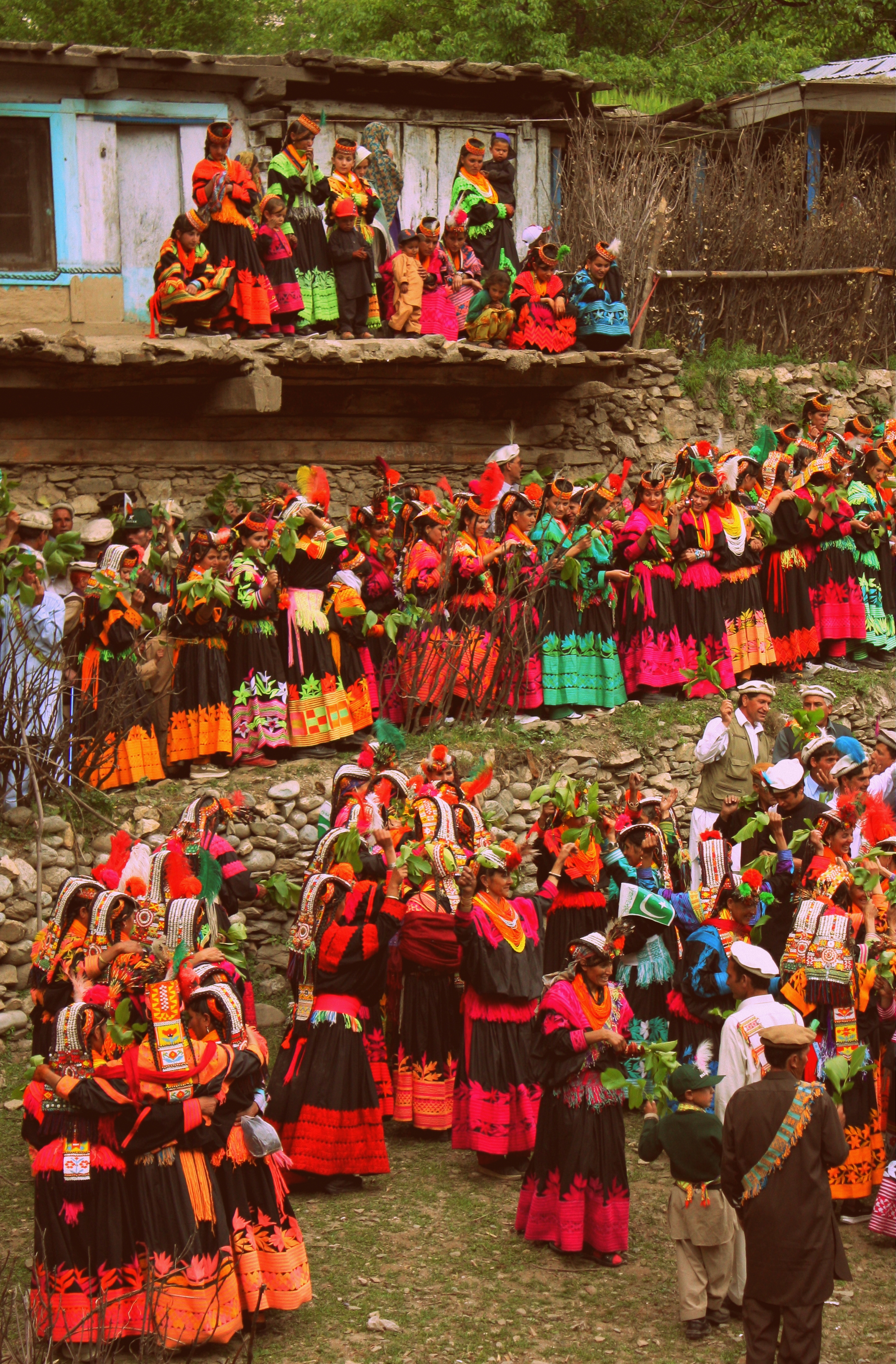
Kalash People during the Chillam Joshi Festiva. Pic Courtesy Wikipedia
The Kalash : The Kalash inhabit three Valleys in the Chitral Region now in KPK though at one time the Chitral Kingdom paid tribute to the Kingdom of Jammu and Kashmir. The Kalsha speak the Kalasha language which is a part of the Dardic family of languages. They have a distinct culture which has been under threat. Most Kalasha have converted to islam though a small number (3000 app) still follow traditional Animist beliefs.
Hi Res of Graphic can be downloaded from the link in the first comment.
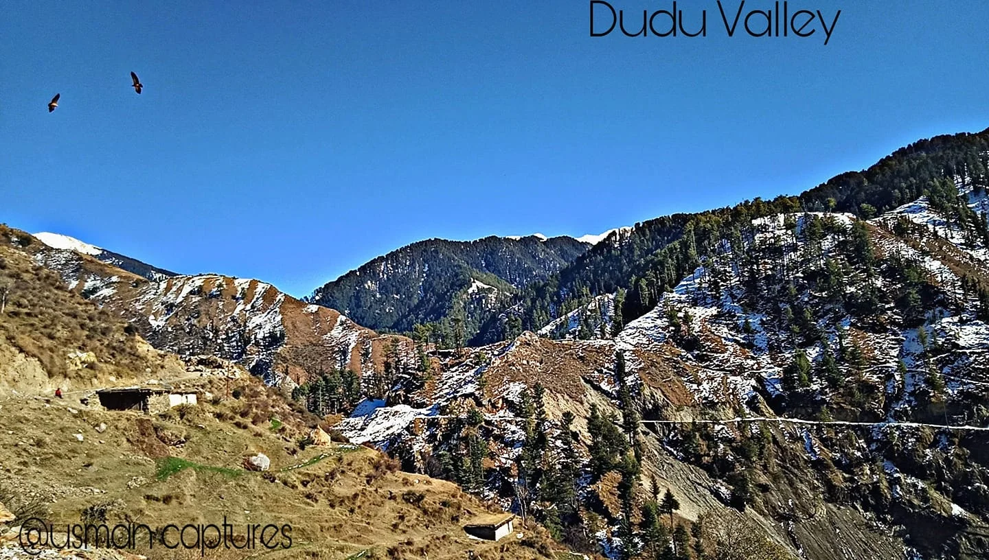
The Dudu Timber Saga
A tale from a time gone by when Forests were seen as great Resources of Timber and vast tract of these Himalayan Forests were given out on contract for Timber extraction. My Family was also involved in this Timber trade and were known as others in this business at Forest Leasees. This particular story is from the remote and unknown Dudu Latti Valley in Udhampur District in the Jammu Division of the Union Territory of J&K.
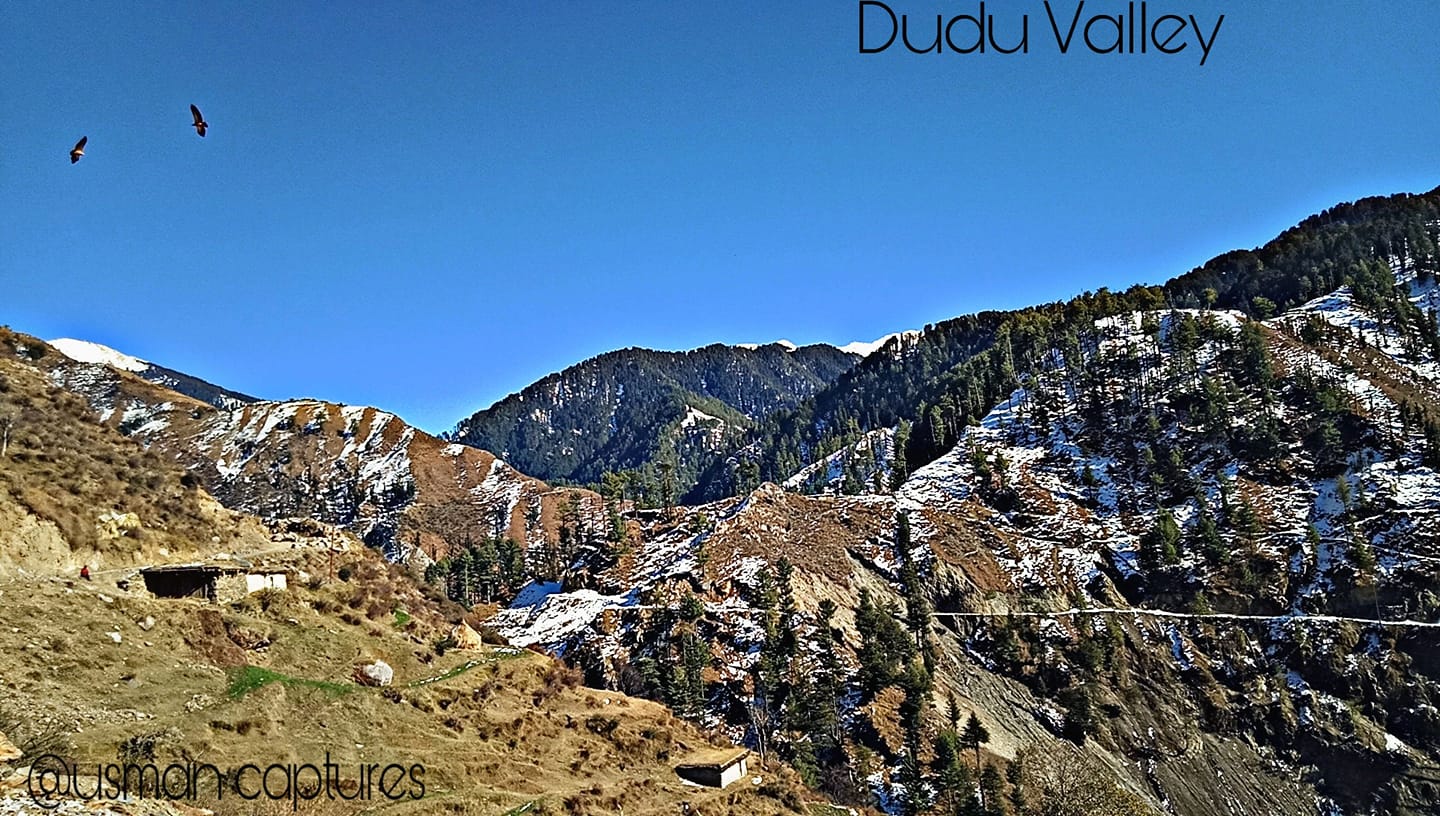
The Dudu Timber Saga
In today’s day and age the cutting of Forests is an abhorretion frowned upon by one and all. It was not always the same as once upon a time Timber was a great resource with multiple uses. Especially Himalayan Timber.
My family was involved in Timber business or “Jangalaat” as it was called back in the good old days when Timber and Forests were a resource to be exploited for Commercial gain. Cutting forests and selling them in the Market was an established big business in the Himalayan states especially in Jammu and Kashmir where Timber was one of the main resources of State Revenue.
Amongst the other hats he wore, my Grandfather was a Forest Leasee. A Forest Leasee was a person who took on contract a certain part of Mountain from the Government a part of Mountain. Under the terms of the Contract the Forest Leasee bid a certain amount for an area in Government floated Tenders. And once you got the Contract the whole Mountain was your and so were all the Trees. So once you landed up a Contract you sent your Men to the Jungle to cut down as many Trees as possible in the Contractual period.
It was a profitable Business I must say but not always as you would read as we go on. From the forests of Thandipora North of Kupwara, around Boniyar in Uri and even Pogal Paristan and Dudu Valley in Jammu. I grew up listening stories from my Father about those Forest Leasee days about how he would go to one of these remote Forestry Camps and spend the night there in Tents amidst the Bears and the Leopards. Of all the stories of those days my favourite one is about an incident which occured in a far away place in Jammu and Kashmir called the Dudu Valley in the Jammu Division somewhere in the wilderness between Udhampur and Kishtwar. Dudu Valley is now a part of the Latti Tehsil in Udhampur District.
Dudu Valley is today a secluded unknown beautiful part of Jammu so you can well imagine what it would have been back in those days over a 50 years back. But what Dudu had in those days were thick Forests which it still retains in parts till today as Iam made to believe. My Grandfather landed a Forest Contract in the Dudu Valley which was quite an isolated part of the state at that time. Also it was quite far from our base in Srinagar in Kashmir, in the back and beyond of Jammu Division. But my Grandfather thought he got a good deal and went ahead and took up the Contract along with a Partner who was based in Jammu and Pathankot.
Dudu Valley is drained by the Tawi River as it emerges out of its source near the Kailash Kund Lake from the Kailash Kund Glacier in the heights of the Pir Panjals. As it happened none of the younger men in the family were ready to go to this place in the back and beyond of nowhere. So it was upto my Grandfather to make the Journey all the way from Srinagar to Dudu Valley partly by Vehicle, partly by Horse and partly by foot. My Grandfather was a tough and sturdy Pahadi guy who was always up for the challenge. And he took it up.
So religiously he used to come to the place every other week to check on how stuff was going on at the isolated Camp.And of course things used to be fine when he was there but due to other business matters he could but spend just a few days in the wilderness of Dudu and had to return to Srinagar after a few days.
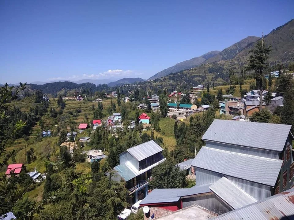
Now in those times half the challenge lay in getting the Contract for a lucrative Jungle and the other challenge was getting the cut Timber down to the Depots in Srinagar and Jammu from where it was sold in the Market. The way the Timber was transported in those days was kinda elementary. You just lobbed the cut Timber into the Mountain River and it would do the hard work and transport the Timber down River to more plainer areas where they were corralled and fished out of the River and sent to the Depot. This might sound very funny but this practice is still in use in parts of the World and even I have seen it being used in Kashmir long after we got out of the Forest Leasee business.
So one fine day when the Dudu harvest was done the logs were as usual tossed into the River. It was a good harvest and a large amount of high quality Dudu Forest Timber was now afloat the Tawi on its way downstream. And there were always teams of our guys downstream at the collection point to collect the Timber and get it out. But as it turned out that someone messed up and my Grandfather who was supposed to be on top of the operation was busy elsewhere, with full confidence in his Partner who was incharge of team for collection. The Timber arrived at the collection point but it seems no-one was there to corral it and the look out posted there had passed out after a bout of drinking. As a result all Timber just floated down. All the high quality Dudu Timber just floated downriver still and soon crossed over to Pakistan. It was a great loss.
Of course Daddy, as I used to call my Grandfather, let loose his wrath on all the incompetent people responsible for this debacle and decided that he would give up the Forest Business. And from the vast experience he had amassed working in areas in JK which even today most people have not heard of he decided to move to Government Contracts for construction in these areas. Besides the experience he had also at his behest a large Group of the hardiest men of these Mountains, the Gujjars in his employment as we shared Lingual similarity with them and our language dialects were quite similar. This of course helped him getting many Government and Military Contracts. The crowning glory of his career being bagging the prestigious Contract to build the High Altitude Warfare School at Gulmarg.
Sometimes I wonder what it would have been to have lived in those times. That Era. When Exploring Mountains could be made into a profitable business. Anyways.
Try visiting the Dudu Valley. Its still as pristine, almost, as it was during my Grandfather’s time. :)
A pic of the Dudu Valley. Summer’s, this year. Pic credit the FB Page of Latti Dudu https://www.facebook.com/LATTItehsil/
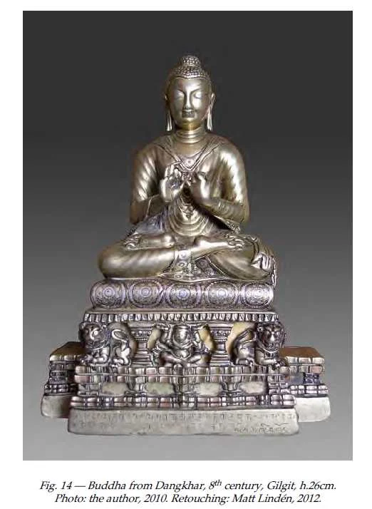
The Dhankar Buddha of Spiti
The Dhankar Gompa in Spiti as among st its posessions a metal Statue of the Buddha which was off limits to outsiders. A few people had ever seen and it was first photographed for open sources only in 2010. This is the story of the Buddha which came all the way from Gilgit

The Dhankar Buddha
Spiti or Piti as it was also called is probably as remote as any Trans Himalayan region and has for years lived in a time capsule but of course now things are changing. But like all the Lands Himalayan it holds its mysteries and secrets close to its chest. Just like neighbouring Lahaul and its ‘cultural / spiritual” big brother it was for most part of traceable history a part of the Guge Kingdom and subsequently the Central Tibetan Kingdom. Later on it became a part of Ladakh as the Kingdom grew powerful. It also became a bone of contention between Raja of Bushahr and the Ladakh Kingdom as the Bushahr Kingdom claimed Spiti as its own. Of course this led to the Raja of Bushahr to support the Central Tibetans and their Mongol allies when they decided to invade Ladakh over a religious dispute between the Dalai Lama and the King of Bhutan but that's a separate story.
Spiti because of its remoteness and isolation has preserved its culture and traditions, unlike many other such places. In the traditions of Tibetan Buddhism the Monastery is the center of life and the Monasteries are the keepers of ancient Manuscripts and Religious Iconry and these treasures have been very strictly guarded by generations of Monks who have lived in these Monasteries going back to thousands of years. The Monasteries of Spiti have survived plunder and ravage mostly through History except for a brief period when General Zorawar Singh took over Ladakh and Spiti was a part of Ladakh so he received Spiti as well.

The Dhankar Village and Gompa. Pic Courtesy : wikipedia Commons
Though Zorawar never came to Ladakh he appointed a certain zealous Officer in charge of Spiti. Now this Officer wasn't very fond of the local culture and tradition and went onto plunder many of the Monasteries and he was much despised for it. It should be pertinent to mention that the same Officer was a part of Zorawar’s Army which lost to the Tibetan / Chinese Army in the engagement in which the General was killed. But the said Officer was captured alive by the Tibetans and identified as the person responsible for the desecration of the Monasteries in Spiti and elsewhere. Suffice to say that he met a slow painful death as he was put in a cauldron of oil which was slowly heated.
Ok coming to the Topic of the Dhankar Monastery. It was one of the most important Monasteries in Spiti standing as it was above the confluence of the Spiti and the Pin Rivers. Dhankar had always been the traditional Capital of Spiti and the seat of the early “Local Rulers” of area called the Nonos. And of course the Dhankar Monastery had its own collection of Ancient Relics and Treasures though its is said that it was also plundered and ravaged during the Dogra Rule. And there was a certain Buddha statue highly revered and venerated but as closely guarded as well. It was called the Dhankar Buddha.
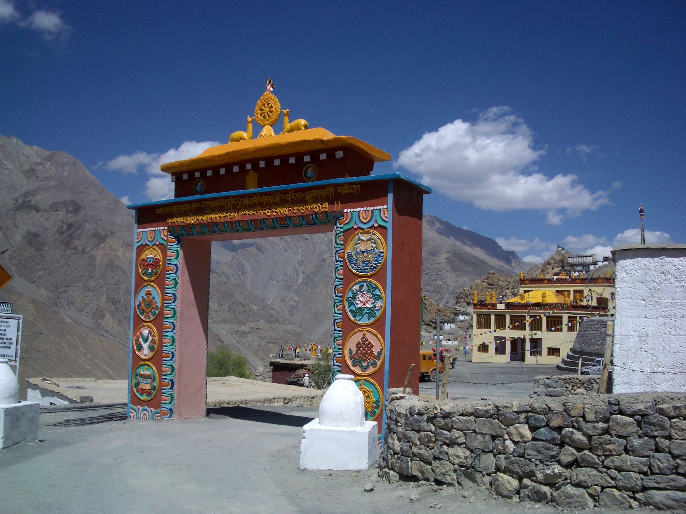
The Main Gate of the Dhankar Gompa. Pic Courtesy Wikipedia Commons.
Henry Lee Shutterworth was an Officer of the Raj who was posted in Kulu which was a British dominion. He also spent time in the most remote part of his jurisdiction in Lahaul and Spiti. With time he developed an interest in the local culture and tradition and began to record local Buddhist history and records. And this involved visiting various Monasteries in the area and trying to convince the Monks to show him some of the Treasures that the Monasteries so secretly guarded. And he had heard about the Dhankar Buddha and in time he was able to convince the Monks to show him the Dhankar Buddha. And he was totally taken aback when he saw the fine piece of Art and the quality of the Brass work. He wasnt allowed to take a Photo but was allowed to take a rub of the inscription at the bottom. Taking a Rub is akin to something we used to do as kids. Cover a coin with paper and then run a pencil over it so that the inscription on the coin is copied over the paper.
What he had stumbled upon was described by a Scholar of the subject as such “The Buddha from Dangkhar is in many ways one of the finest discoveries made in the field of Buddhist art and epigraphy for the cultural areas of Western Tibet and Greater Kashmir. We now know that the two inscriptions engraved on the lower part of the pedestal attest to the incredible journey of this image; produced in Gilgit in northern Pakistan in the eighth century, the statue was bestowed upon the royal monk from Guge, Lha lama Zhiwa Ö (lha bla ma zhi ba ’od) (1016–1111), about three hundred and fifty years later. Things were quite different then when Shuttleworth worked on the manuscript of his History of Spiti in the early 1930s. If the name of the Tibetan translator of royal descent had been easily identified, the main dedicatory inscription resisted easy decipherment.”

Another view of the Dhankar Gompa
That itself establishes the fact that Buddhism came to Tibet via what is now the Gilgit but via Central Asia. The fact that this sculpture made probably during the Rule of the Patola Shahis in Gilgit is an indicator enough. And from there it traveled all the way to the Kingdom of Guge in Western Tibet. And it was after 300 years of getting there that it was gifted to the Monastery in Spiti. And there it stayed, a mystery which was only solved by Shutterworth’s rubbing but Scholars yearned to have a look at it. The first time the Dhakar Buddha was photographed was in 1993 by a Government agency documenting India’s Arts under a Government legislation. It took a law for the Monks to reveal this Treasure and allow its Photography.
“In 2006, art historian Robert Linrothe took a glimpse at the metal sculpture but was not authorized to reproduce it. It is only in 2010 that the present author was entrusted by the monks from Dangkhar with the study of their sacred image, a request completed two years later.” These are the words of Yannick Laurent, a scholar at Oxford who was finally able to Photograph this much revered treasure. And for now the whole world can see it. It has a striking similarity to other Buddhas made during the Patola Shahi rule in Gilgit. That truly was a Golden Age of Buddhism in Gilgit and even the Gilgit Manuscripts, the most ancient and sacred of all Buddhist manuscripts are a testament to that.
So try your luck at the Dhankar Monastery next time. Maybe the Dhankar Buddha would give you an audience.
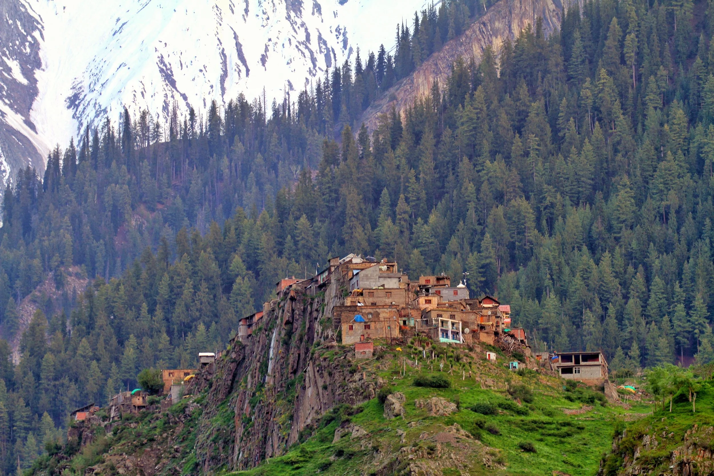
The Chamba Lahaul and the British Lahaul Story
Lahaul and Spiti have had a checkered fascinating history and lying on the Himalayan borderlines they have always been the bone of contention for various powers in the Region from the states of Kashmir, Chamba, Kullu, Bushahr, Ladakh, Guge, Tibet, the Chinese and even the Mongols, Baltis and Yarkandis. However little is known of the exact circumstances and the chain of events of History that followed as there are no written records. All the above powerful states / people left some mark or influence on these two adjoining Regions. This is an attempt to piece together their History though for most of the time the History followed its separate course in Lahaul and its own course in Spiti.
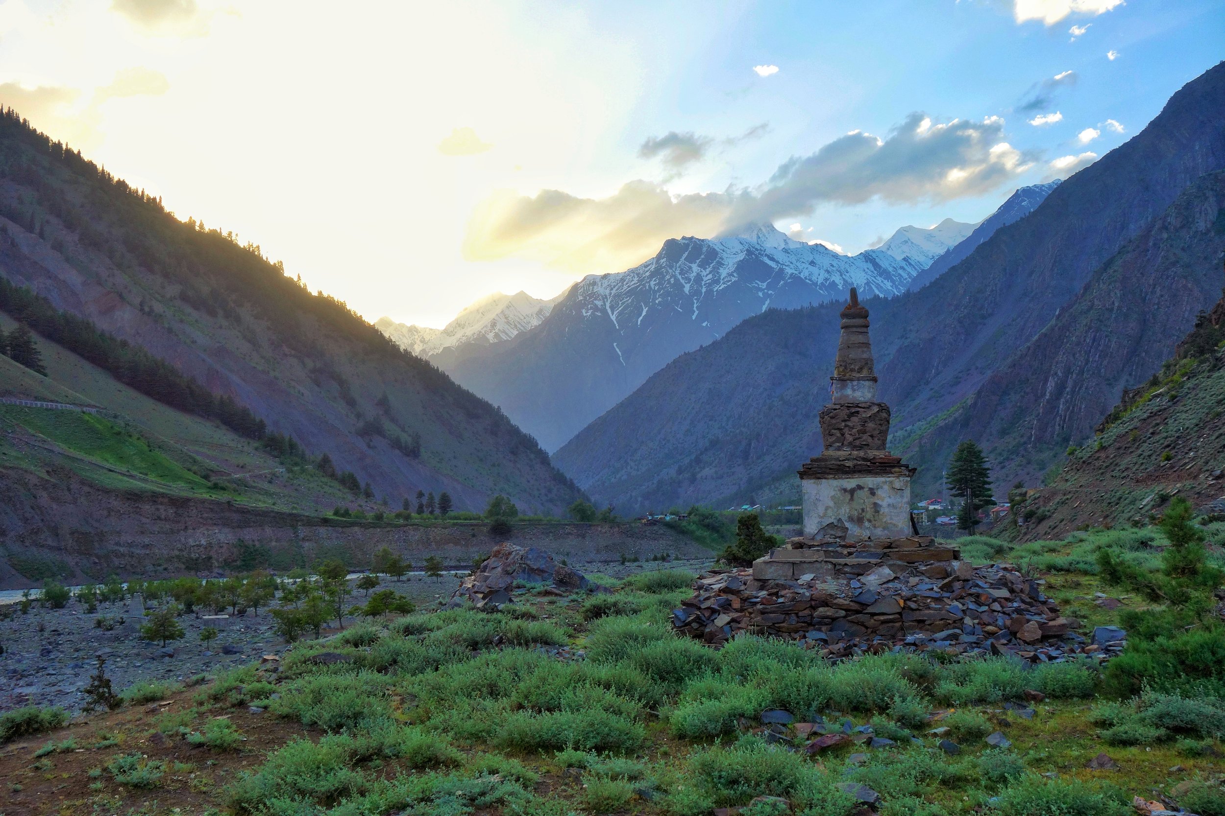
The Chamba Lahaul and the British Lahaul Story
The Himalayan / Trans Himalayan Region of Lahaul Spiti today stands as a district in the state of Himachal Pradesh. Both these Regions which were once and still are mostly Himalayan backwaters are now seeing rapid changes coming. The opening of the Rohtang Tunnel for public will open Lahaul at least to outside world like never before. And from a Tourist point of view it will grow more than a one night stop over on the way to Ladakh. Spiti will also be affected though it manages all year round connectivity from the other side. And Spiti has recently seen the influx of Tourists especially the younger generation like never before. Its like Spiti is like the new Ladakh and we see stuff on Spiti all the time.

Wife of Thakur Amar Chand of Lahaul as taken by Ralph Stewart 1913
Lahaul and Spiti have had a checkered fascinating history and lying on the Himalayan borderlines they have always been the bone of contention for various powers in the Region from the states of Kashmir, Chamba, Kullu, Bushahr, Ladakh, Guge, Tibet, the Chinese and even the Mongols, Baltis and Yarkandis. However little is known of the exact circumstances and the chain of events of History that followed as there are no written records. All the above powerful states / people left some mark or influence on these two adjoining Regions. This is an attempt to piece together their History though for most of the time the History followed its separate course in Lahaul and its own course in Spiti. Thats only fair as physically there is a contrast between the verticality of the Cis-Himalayan Lahaul Valley and the seeming Horizontality of the Trans-Himalayan Spiti Valley.

Lahual from somewhere near Keylong
The culture of Lahaul is also a curious mix of many influences mostly Hindu and Buddhist but also of the aboriginal Religion which was referred to as Loong Pai Chos which shared some similarity with the old Tibetan Bon traditions. This has resulted in a syncretic Religion in most of Lahaul and the Lahaulis like to mostly refer to themselves as Hindu-Bodh, which to me is a perfect example of peaceful co-existence of two major Religions. Spiti on the other hand has always been under great influence of Tibet and Ladakh and hence it has developed a strong tradition of Tibetan Buddhism as practiced in Tibet and Ladakh. And of course there are many Cultural similarities with the same Regions as well.

Somewhere in Lahaul by Ralph Stewart 1913
The origin of the name “Lahaul” is kinda not clear. The Ladakhis / Tibetans referred to Lahaul as Garzha or Garsa or vDvarska though some say the present name is derived from the Tibetan word Loh-Yul or the Land of the South. From the earliest records it is said that Lahaul was a part of the Kingdom of Chamba under Ajy Verman who became a Vassal of Kashmir sometime around the 8th Century. Thus Lahaul became a part of the Kashmir Kingdom and the influence of the most powerful King of Kashmir, Lalitaditya can be seen in Maylang and even in some early Temples in Kullu. But with time Kashmir lost its influence and it was Chamba Kingdom which prevailed over Lahaul it seems.

A Village near Darcha towards Zanskar.
Later it seems Lahaul became a part of the vast Kingdom of Guge in Western Tibet which included besides Lahaul, Spiti, Zanskar, Ladakh and even parts of Kashtwar and Paldar (as Kishtwar and Paddar were referred to by the Tibetans). At that time it is said that Lahaul was much bigger and included parts of Pangi and Paddar as they exist today. Since these Valleys are contiguous along the Chandrabhaga/ Chenab it is quite possible that the Guge influence was there as well. But after the fall of the Guge Kingdom, Lahaul was eyed upon by the neighbouring Kingdoms and it became somewhat of a bone of contention between the Chamba, the Kullu and the Bushahr Kingdoms. And it was during the Guge rule that Buddhism spread rapidly all over Lahaul and became the dominant Religious order. It was in the 16th Century that Raja Bahadur Singh of Kullu made certain incursions into Lahaul and loosened the grip of the Guge rule in the areas of Lahaul adjoining Kullu. The Kullu Rajas appointed local Chieftains who were mostly Buddhists. Their allegiance also varied between Kullu, Guge and even Ladakh depending on where the wind blew. This helped keep things mostly peaceful in Lahaul during these periods.
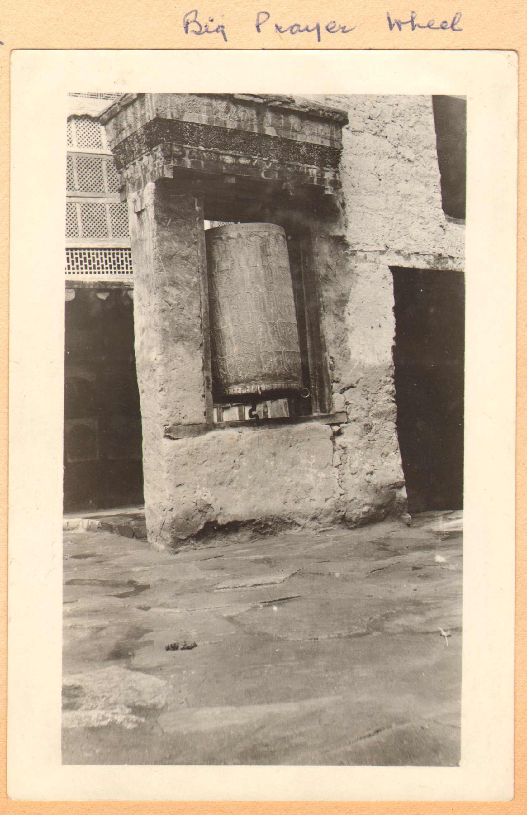
A Prayer Wheel in Lahaul by Ralph Stewart 1913
And Chamba Kingdom also started to take the lead and as the hold of the Guge weakened the Chamba Rajas began to assert their authority and advanced into areas which were associated with Western Lahaul rather than Chamba. They had advanced well into Pangi and Trilokinath which was the most important religious Center in Lahaul. The Chamba Rajas drew a nominal tribute from Lahaul, which the Lahaulis though still under the Gue Kingdom had no choice but to pay and one of the main items of tribute were 12 large dogs. I assume Lahauli Dogs for some reason held great value for the Chambyalis as I imagine these were Tibetan Mastiffs and they were good Dogs. Of course all these activities did not go unnoticed by the Rajas of Kullu and Bushahr. And the Kullu Raja decided to do something about it.Of course before also Kullu Rajas had made advances on the other side of the Rohtang. And there was a continuous power struggle between the Kullu Rajas with the Chambyalis on one side for Lahaul and with the Bushahris for Spiti on the other side. But nominally both Lahaul and Spiti were under Tibetan / Ladakhi Rule who were facing their own sets of problems with other neighbours mostly of Mongol origins.
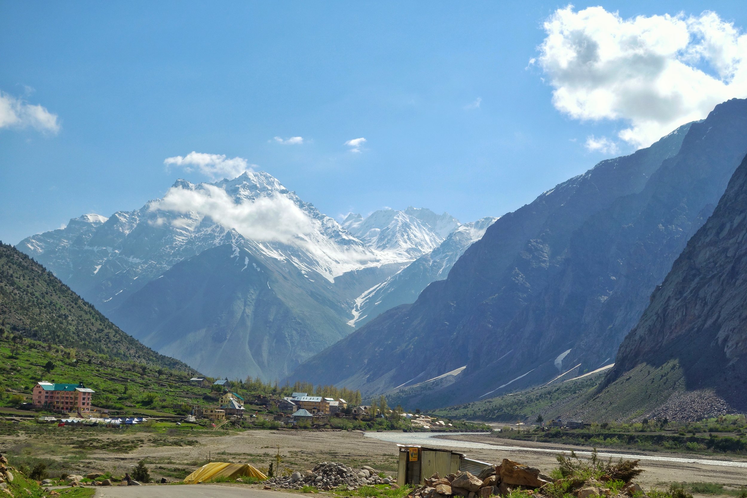
Jispa, Lahaul
And then in 1671 a Mongol Army attacked Lahaul and as usual they were in control for a few years. The Mongols probably wanted to assert the authority of the Central Tibetan Kingdom headed by the Dalai Lama and a claimant to all the territories of the Guge Kingdom. Interestingly there have been found graves and tombs in Lahaul of unknown people as both the Hindus and the Budhhists have never ritually buried the dead. They are supposed to be the remnants of people or perhaps a small force which came from Yarkand. But as usual the Mongols didnt stay put for long and left leaving Lahaul mostly to itself though still under Tibetan Rule.
Once they had left the Raja of Kullu decided to assert himself in a special way. The Kullu Raja married a Princess of Kishtwar for the same purpose.. And decided to go himself to Kishtwar to get his Bride. Of course the way he decided to assert to the Lahauli’s s that they should get rid of the Guge Rulers and be a part of Kullu. Thus his whole entourage was a show of strength of the Kullu Kingdom not only put on show for the Lahauli’s but for their friendly neighbourhood Chambyalis as well. And it seems the ploy worked but by then the Guge Kingdom was as good as collapsed. Lahaul was now firmly in Kullu’s grip except that the powerful Raja Chattar Singh of Chamba decided to re-assert his authority and again took Pangi and Trilokinath under strong Chamba control. And further Raja Chattar Singh’s son Raja Udai Singh further continued this Policy and even named the main Village where the Trilokinath Temple was situated as Udaipur, a name which still stands today. And the Kullu Rajas were firmly in the seat in other parts of Lahaul.

Above Keylong by Ralph Stewart 1913
But in the meantime things dramatically changed in Northern India and the British and the Sikhs under the Sher e Punjab Ranjit Singh were vying for power and the Western Himalayas came under the control of the Sikhs. Kullu and Chamba both became a part of the Sikh Kingdom and so did Lahaul. And it remained hence and this was enhanced when in 1840 the Sikh forces moved into Kullu and came down to Lahaul as well. And finally when the British defeated the Sikhs it passed onto the Brirtish. And as a result of the machinations which followed the formation of the state of Jammu and Kashmir, Chamba got to keep its part of Lahaul which was henceforth called as the Chamba Lahaul while Kullu was taken over by the British and the Kullu part of Lahaul was now called British Lahaul. Interestingly even Spiti had gone over to Raja Gulab Singh as it was a part of Ladakh but the British thought it prudent to have direct access to the Pashmina rich Region of Changthang and this could do this only if they kept Spiti.

Looking towards “British Lahaul” from outside Udaipur
And so it was till the British left and both Chamba and Kullu became a part of Himachal Pradesh and once again Chamba Lahaul and British Lahaul were merged to form Lahaul as we know it today.
Source : Various sources including Harcourt’s Himalayan Districts of Koloo, Lahoul and Spiti, 1874. Also History of Lahaul and Spiti by Sanjay Kumar. And of course a number of conjectures of my own. Please feel free to point out if you notice any discrepancy.
Pic: The Sun sets over what used to be Chamba Lahaul just outside the Village of Udaipur as the Chandrabhaga flows by. The Chorten was amongst the first reminder of the Cultural change in the Region as one comes in from the Pangi Valley side in Chamba.
Pic from June 2019. Near Udaipur, Lahaul, Himachal Pradesh.
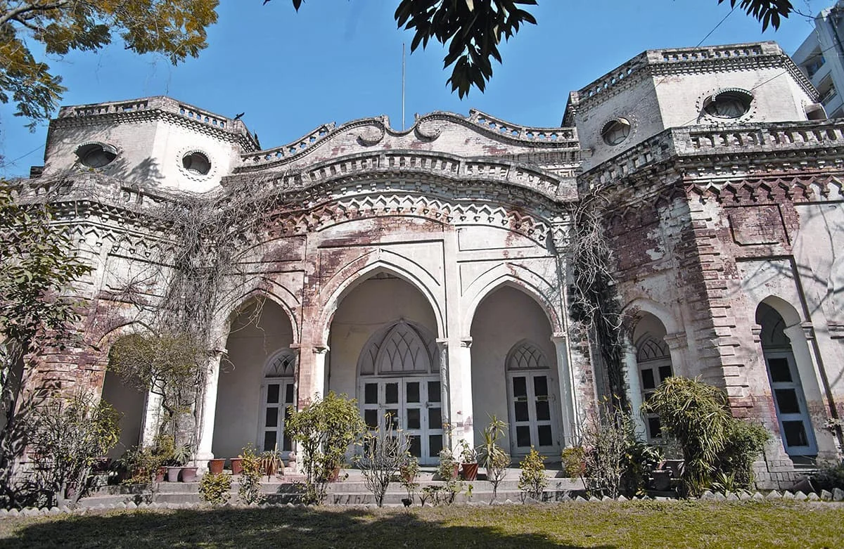
The Story of the Poonch Kingdom
Poonch is nowadays one of the most backward Districts of Jammu and Kashmir but it was once an important Hill Kingdom ruled by Rajput Hill Rajas, as was the norm in the lower Himalayas but over a period of time they had converted to Islam just like the Rajas of Kishtwar. The majority population of Poonch consists of Gujars and Bakarwals, along with Pahadis, Kashmiris, Punjabis, Rajputs and some Dogras.One feature which kinda unites the populace is that almost everyone speaks a version of Pahadi which is understood and spoken across the board. Traditionally Poonch has always been more of Punjabic / Potoharic (As in belonging to the Potohar Plateau) than Jammuic or Kashmiric.

The Story of the Poonch Kingdom
One of the most backward and in a certain way remote Districts of the state of Jammu and Kashmir is the district of Poonch which falls in the Jammu Division. Along with the neighbouring District of Rajouri its referred to as the Rajouri Poonch area or the Pir Panjal belt in the local political parlance just as the Doda/ Kishtwar area is called the Chenab Valley belt. This had further ramifications as both these belts have a Muslim majority in an otherwise Hindu majority Jammu Division. As I always say the most complicated part of India is the state of Jammu and Kashmir and it takes like forever to even begin to understand the complex make up of the state.
Coming back to Poonch, it was once an important Hill Kingdom ruled by Rajput Hill Rajas, as was the norm in the lower Himalayas but over a period of time they had converted to Islam just like the Rajas of Kishtwar. The majority population of Poonch consists of Gujars and Bakarwals, along with Pahadis, Kashmiris, Punjabis, Rajputs and some Dogras.One feature which kinda unites the populace is that almost everyone speaks a version of Pahadi which is understood and spoken across the board. Traditionally Poonch has always been more of Punjabic / Potoharic (As in belonging to the Potohar Plateau) than Jammuic or Kashmiric. I guess you get my drift.

Now the story of how Poonch came to be a part of the Riyasat (By Riyasat I mean the state of Jammu and Kashmir as it existed in 1947 before India got independence) is a rather interesting one, as Poonch and its Rulers always stressed on a separate identity for Poonch from Jammu or from Kashmir. As with all the regions in this Region Poonch came under the Rule of the Sikhs in 1819 when the Sikhs used the Region as a Platform for the acquisition of Kashmir after expelling the Afghans. The local Muslim Rulers were sidelined and the Hill Kingdoms in the area like Rajouri, Poonch, Bhimber etc were put under direct Sikh Rule.
And then in 1821 the Sher-E-Punjab appointed Gulab Singh as the Raja of Jammu even though he belonged to a minor faction of the Jammu Royal family. Raja Gulab Singh as he now came to be called had two other brothers as well Dhyan Singh and Suchet Singh, both of whom, just like Gulab Singh were in the service of the Sher-E-Punjab and together the Dogra brothers held immense power in the Sikh Court. In continuation to the favours shown to the Dogra brother in 1827 appointed Dhyan Singh as the Raja of Bhimber, Chibbal and Poonch. Just like his brother Dhyan Singh now became Raja Dhyan Singh and had a Kingdom of his own. As Raja Dhyan Singh was one of the most important Minister at the Court most of his time was spent in Lahore and on his behalf Raja Gulab Singh took care of Poonch and even crushed a rebellion there by the Hill tribes consisting of the Muslim Rajputs, the chibbalis and the Sudans.
In the vicissitudes that followed the death of the Sher-E-Punjab, saw the killing of Raja Dhyan Singh, Raja Suchet Singh (the 3rd Dogra Brother) and Raja Hira Singh (the son and Heir of Raja Dhyan Singh) and as a part of the whole mayhem when Raja Gulab Singh fell on the less favoured side and appeared weak the Poonch Kingdom was taken away by the Sarkar Khalsa and handed over to Faiz Talib Khan of Rajouri and so it stayed until a few years.
And the the first Anglo Sikh War took place and as a result Raja Gulab Singh became the Maharaja of Jammu and Kashmir and all the territory to the North of the Ravi River which included Poonch. The Maharaja handed over Poonch as a Jagir to Jawahir Singh and Moti Singh the surviving sons of his murdered Brother Raja Dhyan Singh.
But the brothers were not satisfied and took their case to the British arguing that Poonch was an independent Kingdom which was granted to them and they were not a part of the Maharaja’s Riyasat. But the British ruled otherwise and said that the Maharaja was still their suzerain. At the same time both Brothers starting quarreling with each other and their matter had to be settled. And by this time the Maharajaship had passed onto Maharaja Ranbir Singh, the son of Gulab Singh, who was a powerful Ruler as well as personality. He wasnt very fond of his cousin Jawahir and had him exiled to Amabala on an annual stipend for “treacherous conspiracy” and conveniently Jawahir Singh had no sons. Moti Singh’s son Baldev Singh contested this and said that Poonch belonged to the descendants of Raja Dhyan Singh. But the British were not amused and said Poonch was a Jagir (which Raja Dhyan Singh’s descendants vehemently opposed as they said it was a State) and an internal matter of the Maharaja of Jammu and Kashmir.

How ever Baldev Singh’s descendants though in nominal control of Poonch always contested this and send various emissaries and delegations to the British asking for a separate Poonch but the British disagreed. At the same time the Poonch “Rajas” maintained a good relation with their Cousins who Ruled the Riyasat and held high positions within the administration of the Maharaja’s Government, including Raja Jagatdev Singh who was at one time the Diwan of Kashmir. Raja Jagatdev Singh was also issued a Sanad by the Maharaja but they continued to question the status of Poonch vis a vis Jammu and Kashmir. The Poonch Rajas maintained “Poonch Houses” in Rawalpindi as well as later in Dehradun. There was also a Poonch House in Kud which was built as a present by Raja Jagatdev Singh for his favourite Queen. The Raja of Poonch as per the terms was the owner of all the land in Poonch and though there were reforms in Jammu and kashmir there were none in Poonch and this led to widespread discontent as the populace were heavily taxed by both the Raja and the Maharaja.
Finally this discontent boiled over after the Second World War and the almost 60000 Ponchis who had fought in the Second World War became a powerful force in the war over the Riyasat. They were Muslim Rajputs and most of the leaders pledged allegiance to Pakistan which was natural at that time. Without going into the details of the “Poonch Rebellion” which deserves a separate Story, let me just mention that the original Poonch is now split into two parts under India and Pakistan.
A pic of the dilapidated Poonch Fort by Safed Haathi. From 2017. This beautiful building is now sadly a Government Office and slowly falling into decay.
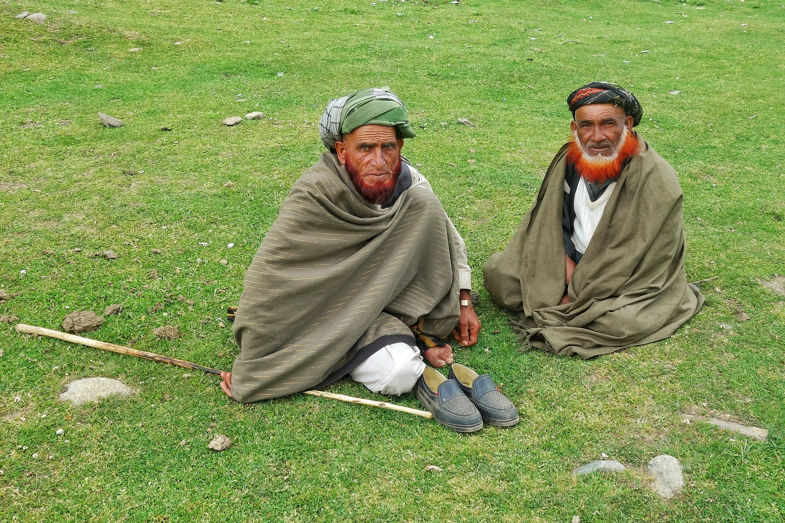
The Original Mountain Men and Women of the Western Himalayas
Ive had a childhood fascination for the Gujjars and especially the Bakarwals while growing up in Kashmir. Well they are almost the same thing except that nowadays the ones who live in fixed locations are called Gujjars while the ones which move up and down with their herds are referred to as the Bakarwals. Also as the name suggests it comes from the word Bakri, so a Bakarwal is also a keeper of the Sheep. Especially in the State of Jammu and Kashmir. There isnt a single Region in this vast State which is not familiar with the congenial Bakarwals who flocked to the highlands with their Goat/ Sheep / Buffaloes / Horses/ Mules which they term as “Maal” as in “Goods”. That is the commodity that they deal in and a Bakarwal is judged by the size of his Herd. And then there were my favourite part of a Bakarwal entourage, the Shepherd Dogs also called by the same name Bakarwal or Bakarwali.
The Original Mountain Men and Women of the Western Himalayas
Ive had a childhood fascination for the Gujjars and especially the Bakarwals while growing up in Kashmir. Well they are almost the same thing except that nowadays the ones who live in fixed locations are called Gujjars while the ones which move up and down with their herds are referred to as the Bakarwals. Also as the name suggests it comes from the word Bakri, so a Bakarwal is also a keeper of the Sheep. These Bakarwals are the original Mountain men of our parts. . Especially in the State of Jammu and Kashmir. There isnt a single Region in this vast State which is not familiar with the congenial Bakarwals who flocked to the highlands with their Goat/ Sheep / Buffaloes / Horses/ Mules which they term as “Maal” as in “Goods”. That is the commodity that they deal in and a Bakarwal is judged by the size of his Herd. And then there were my favourite part of a Bakarwal entourage, the Shepherd Dogs also called by the same name Bakarwal or Bakarwali.
Most of these Bakarwals are now based in the Winter time mainly in the Poonch Rajouri areas of J&K where they form a majority of the Population. However they are distributed all over the Jammu Division as well as neighbouring Regions of HP like Chamba and places like Nalagarh in Punjab and moving further East even as far as Dehradun in Uttarakhand. Infact in parts of Jammu and Himachal Pradesh they share the pastures with the other Mountain Men, the Gaddis. The main difference being that the Gujjars / Bakarwals of J&k are Muslim while the Gaddis are Hindu.
From the Jammu side they usually move towards the higher Regions in the state in all the 3 Divisions of the state. They cross the Pir Panjals to get into the Kashmir Valley and head onto the higher Alpine meadows dotted around the Valley. In the Jammu division they move towards the Kishtwar side and spread over the different Valleys like the Padar Valley from where some even go towards Zanskar. There are others who go towards Marwah and Wadwan and some even cross over to the Suru Valley in Ladakh. Some go to the higher reaches in Kathua District like Sarthal where I happened to meet both Bakarwal and Gaddi shepherds.
While on the Machail Road on the way back we gave a lift to a Bakarwal who had just left his herd at somewhere beyond Machail, areas which are inhabited by Buddhists who came to the Region from adjoining Zanskar. And we gave him a ride till Gulabgarh and on the way he asked us how hot it is in Jammu and we said that down in the foothills the temperatures were over 40 C. Ah he said then Ill go to Srinagar. I asked him why ? Well its cooler there he said and told me he had another Dera somewhere near Shopian in the higher reaches on the way to the Pir Ki Gali.
Kashmir Valley itself has quite a strong Gujjar population and they largely inhabit the areas in the higher reaches above Ganderbal all the way to Zoji La. They are also spread in the more sensitive Border Villages along the LOC. They actually live on both sides of the Border and the area that we belong to, ancestrally was also a Gujjar majority area. So we have a kind of language affinity with them as well and we can almost understand each other when they speak Gojri and I speak our Punjabi. Thats another reason why I get along with them famously. Infact in the time of Grandfather all the main guys handling the tougher side of business like the Forest Leasee and other Construction work was handled by the hardy and reliable Gujjars. And I remember my favourite one was a guy called Sitara, who drove one of our Trucks. Typical handsome Gujjar with a flowing orange (henna dyed) beard. And of course we use love going for a drive in the Truck.
Anyways with modern times creeping into their lifestyles as well many of the younger generation are now looking for alternative, more settled ways of life. Taking the heards over the high Passes into secret Valleys and Dhars best known to their forefathers and all the associated Risks are just not worth it for the newer generation. And of course every Bakarwal father wants to give education to their children and of course this is good. And education leads to aspirations and being a Shepherd doesnt rate high on any work list. I am afraid the Bakarwals we see now are the last of the Generation and the time is not far when coming across a Bakarwal entourage would be a rare thing. Its getting rarer but you can still manage if you know where to go.
And here is an entourage that we met on the way from Kishtwar to Gulabgarh. The younger and fitter men had already gone ahead with the “Maal” and this was the follow up party of the older men, women, kids and their well dressed Horses and Mules. They were a riot of Colour. And of course the younger Bakarwalis (I mean the Dog breed) as the strong amongst them were on duty with the Maal. And it was quite a sight.
Background Music is a Bakarwali song that I got from Youtube and not sure of the origin. The beautiful Song talks about a Lady (Young) talking about its only companion a Crow that used to sit on a Mountain Top. And the lady yearns for her loved ones and keeps sending many letters to her Baba, Chacha, Mama and Lala. Well thats what I understood .Enjoy the Video and the song.
PS: We took permission from the main Elder before shooting the Video and the ever genial Bakarwal gave it when I broke into my Mother tongue.
Video from June 2019. On way from Kishtwar to Gulabgarh. Jammu Division. J&K
Kiki’s Blog
Stories from the Himalayas








Five years ago the Galwan Valley was in the News for the wrong reasons after a deadly clash between the Indian and Chinese Armies in the Valley located in Ladakh lead to many deaths on the contentious Border between the two countries in wake of continued Chinese intrusions into Indian territory.
This area along the Shyok River, of which the Galwan Nallah or the Galwan River which forms the Galwan Valley has been off limits to Civilians since long but now the Indian Government has decided to open up the area for Civilians and we were amongst the First Civilians to venture into this beautifully desolate part of the Eastern Karakorams in Ladakh. Earlier Civilians could only venture upto the Village of Shyok from where the Shyok River takes a U turn and flows in a Northerly direction.