

Gold Prospecting in the Riyasat e Jammu and Kashmir 1890
The Gazetteer of Kashmir and Ladakh of 1890 is a treasure trove of information regarding various aspects in the state. This is the small little Chapter in the Gazetteer which talks of Gold prospecting in the Riyasat. And of course it talks of some Gold mining in Baltistan.

A Man Sand Washing for Gold somewhere in Baltistan
The Gazetteer of Kashmir and Ladakh of 1890 is a treasure trove of information regarding various aspects in the state. This is the small little Chapter in the Gazetteer which talks of Gold prospecting in the Riyasat. And of course it talks of some Gold mining in Baltistan. But it mentions that Gold was still pretty tough to find and hardly an economically viable activity for the labour it involved. I wonder where did Herodotus get the reference for the Gold Digging Ants of Byltae ?
Gold.-Hugel is probably correct in his statement that neither gold nor silver has been found ; but he adds, "neither do the streams hear down gold dust, as in the neighboring countries."
This latter statement is disproved, as far as concerns the Shingo river, by Captain Montgomerie, R.E., who, in his account of the progress of the Kashmir survey, gives the following particulars regarding gold-washing in that stream "The drainage, escaping from the plains of Deosai, through a not easily distinguished gorge near the Katasiri station, falls into the Dras River above Kirkikhu. This tributary of the Dras River is called the Shigar and sometimes the Shingo river; it brings down gold with its waters, and gold-washing is carried on just below the junction. The Indus itself and several of its tributaries are known to produce gold.

The point at which the Shingo River meets the Drass River
The gold-washing in said not to be valuable, but it does sometimes give as much as one or two small rupees a day to a man, though a most barbarous method is employed in washing the earth. Thin earth is taken from the detritus which, I think, now generally lies above the highest flood line. After two or three washings, a black, heavyish sort of sand is left,, with the pieces of gold scattered here and there. As far as my own experience goes, I should say it was not a very profitable business, for after half an hour's washing I only got five very tiny nuggets hardly worth an anna, and I had, at the time, the benefit of the assistance of an Australian gentleman. This gentleman thought that something might be done by investing in a cradle aod apparatus. He said that a substance like the black send mentioned above had proved valuable in Australia."
Gold-washing is also carried on on the banks of the Jhelum, in the neighborhood of Tangrot, north of Jhelum, but to a very trifling extent. In the trans-Himalayan province gold is found in the bede of the Zanskar,Indus, and Basha rivers.

The Confluence of the Indus and the Zanskar
The people of Skardu are in the habit of coming every spring to the junction of the Zanskar river with the Indus, to search for Gold brought down by the melting of the winter Snow. Vigne says that on the banks of the Basha stream more gold is produced than in any other- part of Baltistan, and this was the only place which the former Raja reserved for himself. Any other person might wash the sand for gold elsewhere, but the value of the quantity collected at the end of the time expended is so nearly balanced that Vigne never saw any gold diggers but on one occasion (at Kiris). Here four or five men were employed, and must have washed and sifted a great many bushels of earth, but the quantity of gold dust obtained was not more than would cover a shilling.

Ladies learning Gold prospecting on the Shimsal River in Hunza
Apparently there still is a Tribe called Sonewal in the Shina language that pan the Rivers for Gold in Gilgit Baltistan and they sell their Gold to the jewellers in Gilgit apparently. But Gold prospecting still gives hope and some employment to people in these harsh Mountains.

The Indus Ganges Divide
The Indus and the Ganges are the two great Rivers which originate in the Himalayas/ Trans-Himalayas and all the Rivers of the Western and Central Himalayas drain into either of these two Rivers. The Indo - Gangetic Plain as the combined basin of these two Rivers is called sustains well over a Billion people and is one of the most thickly populated Regions on the Planet. The story of the Indus and the Ganga is the story of India in historical, social and religious contexts.
The Indus Ganges Divide
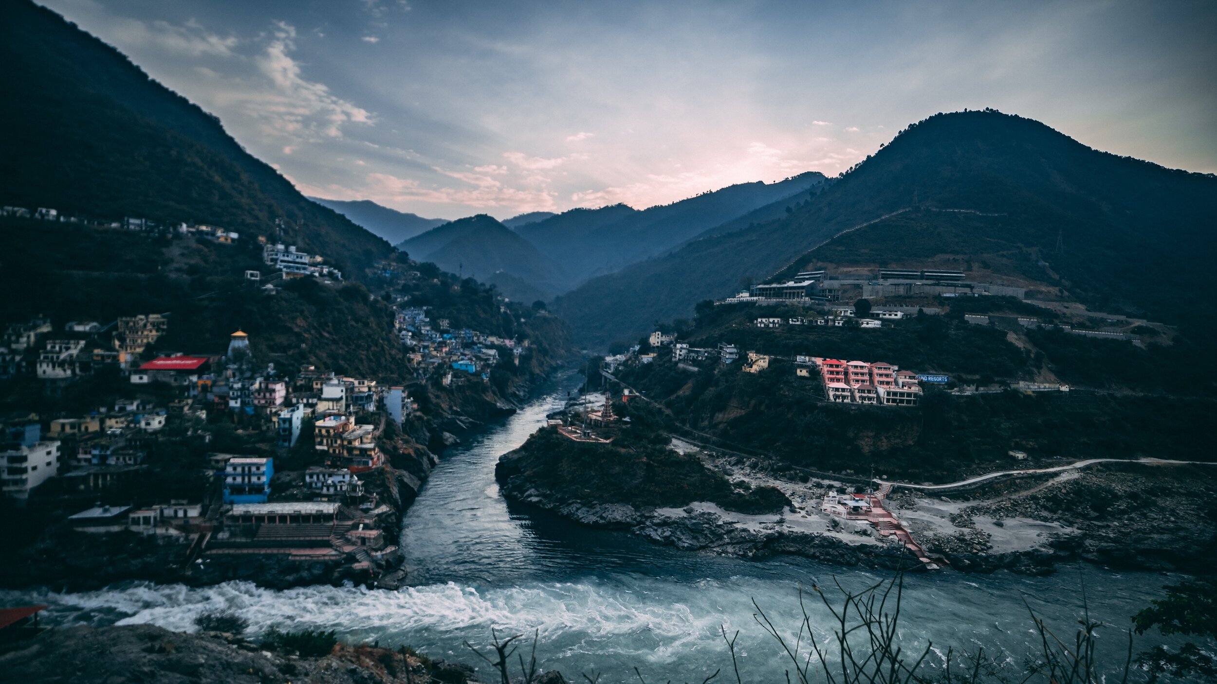
The Indus and the Ganges are the two great Rivers which originate in the Himalayas/ Trans-Himalayas and all the Rivers of the Western and Central Himalayas drain into either of these two Rivers. The Indo - Gangetic Plain as the combined basin of these two Rivers is called sustains well over a Billion people and is one of the most thickly populated Regions on the Planet. The story of the Indus and the Ganga is the story of India in historical, social and religious contexts.
Most of the Indus basin was turned over to Pakistan as a result of the partition though still a substantial part of Punjab, one of the most fertile of lands thanks to the Rivers coming down from the Himalayas still lies with us. The legendary land of the five Rivers traditionally stretched from Delhi to Peshawar though things have changed now. At the time of the Punjabi resurrection in early 1800’s under the indomitable Sher-E-Punjab, Maharaja Ranjit Singh it was the River Sutlej which served as the border between the powerful Sikh Kingdom of Punjab which stretched all the way to Tibet in the North and Balochistan in the South and the British Indian holdings.
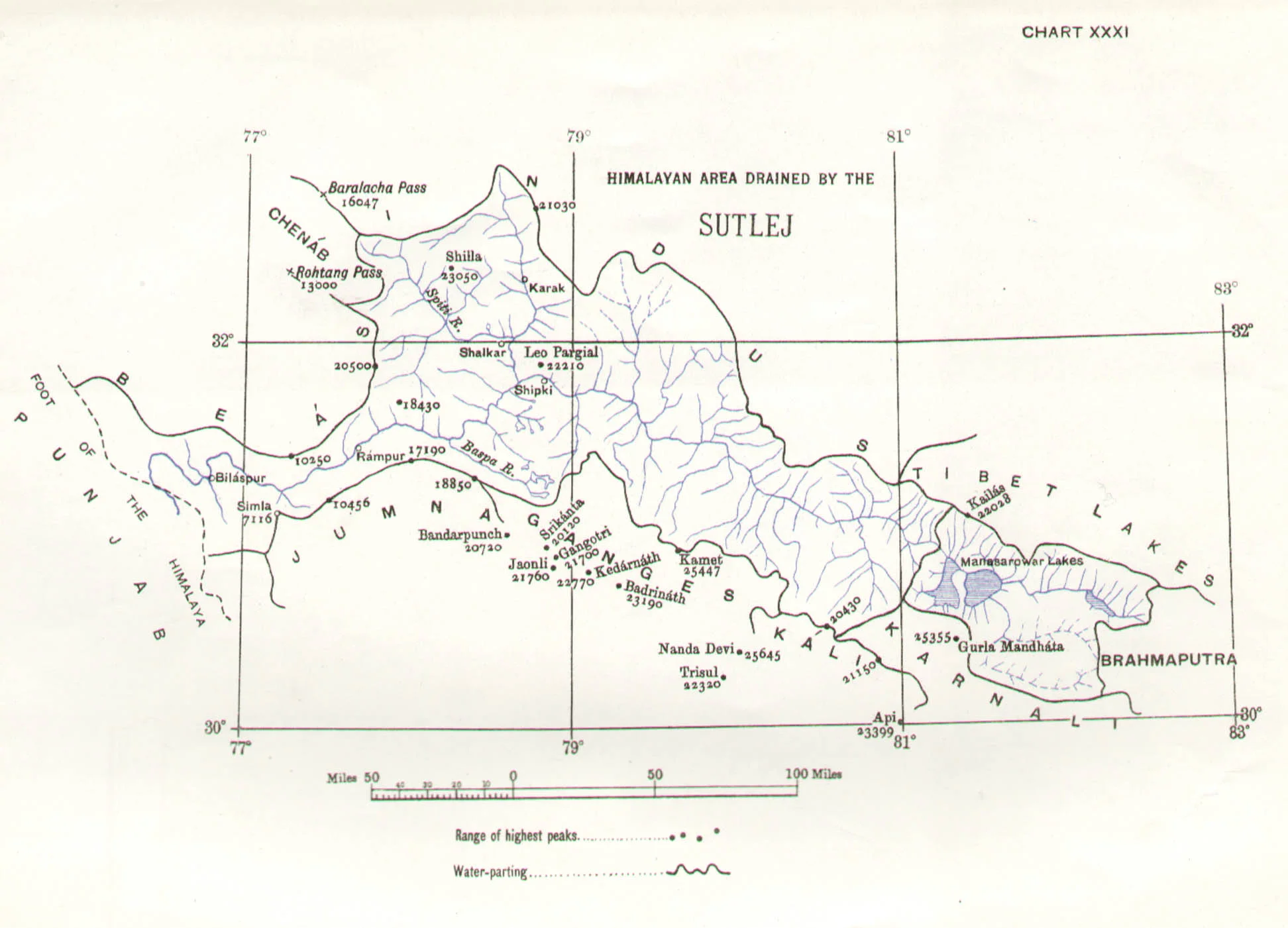
The Sutlej also happens to be the longest of the five Rivers that give the Punjab its name and its also the Easternmost tributary of the mighty Indus. And its some where in Eastern Himachal that the actual ridgelines exist which separate the Indus Basin from the ganges Basin. Its actually a series of Ridges which run from Shimla itself towards Narkand and towards Rampur which lies on the Satluj River.
On the other side of the Ridge lie the tributaries and Nallahs which join either the Giri River or the Pabbar River. I assume that the Pabbar which drains into the Tons and then into the Yamuna and finally into the Ganges would be the Westernmost tributary (indirect albeit) of the Ganges. And interestingly some of these Nallahs are just a few hundred meters apart but the waters of one would end up in the Arabian Sea while the waters of the other would end up in the Bay of Bengal.
As per what you can see on the Google Maps Nallahs or Streams of the area join either the Satluj or the Giri River or the Pabbar. The Giri River is yet another tributary of the Yamuna which rises at a place called the Giri Ganga in the Mountains above Kharapathar near Kotkhai. Some of the Nallahs in the area are as follows
The Brandii Khad eventually joins the Satluj : https://goo.gl/maps/rsCFNgMFhCo
Ashwani Khad eventually joins the Giri River: https://goo.gl/maps/N4g4iY2iGGm
Nauty Khad (Eventually joins the Satluj) : https://goo.gl/maps/8JVFsbrETa42
Teer Nallah / Thaila Khad / Bhaira Khad are other Nallahs which run either side of the divide.
Can someone familiar with the Hydrography of the area let me know where actually are the points of origins of two seperate Streams which go to either sides are closest to each other ? Or is there a point somewhere where the same source of water gets divided to go either way. I would really like to visit such a place if it exists. This little piece of exploration might sound strange to people but different people have different obsessions. Mine is mainly the Himalayas and the Rivers which rise from it.
Thanks for taking time out to read this.
Presenting a pic of the Pabbar River cutting through the Pabbar Valley coming down from its point of origin at the Chandranahan Lake.
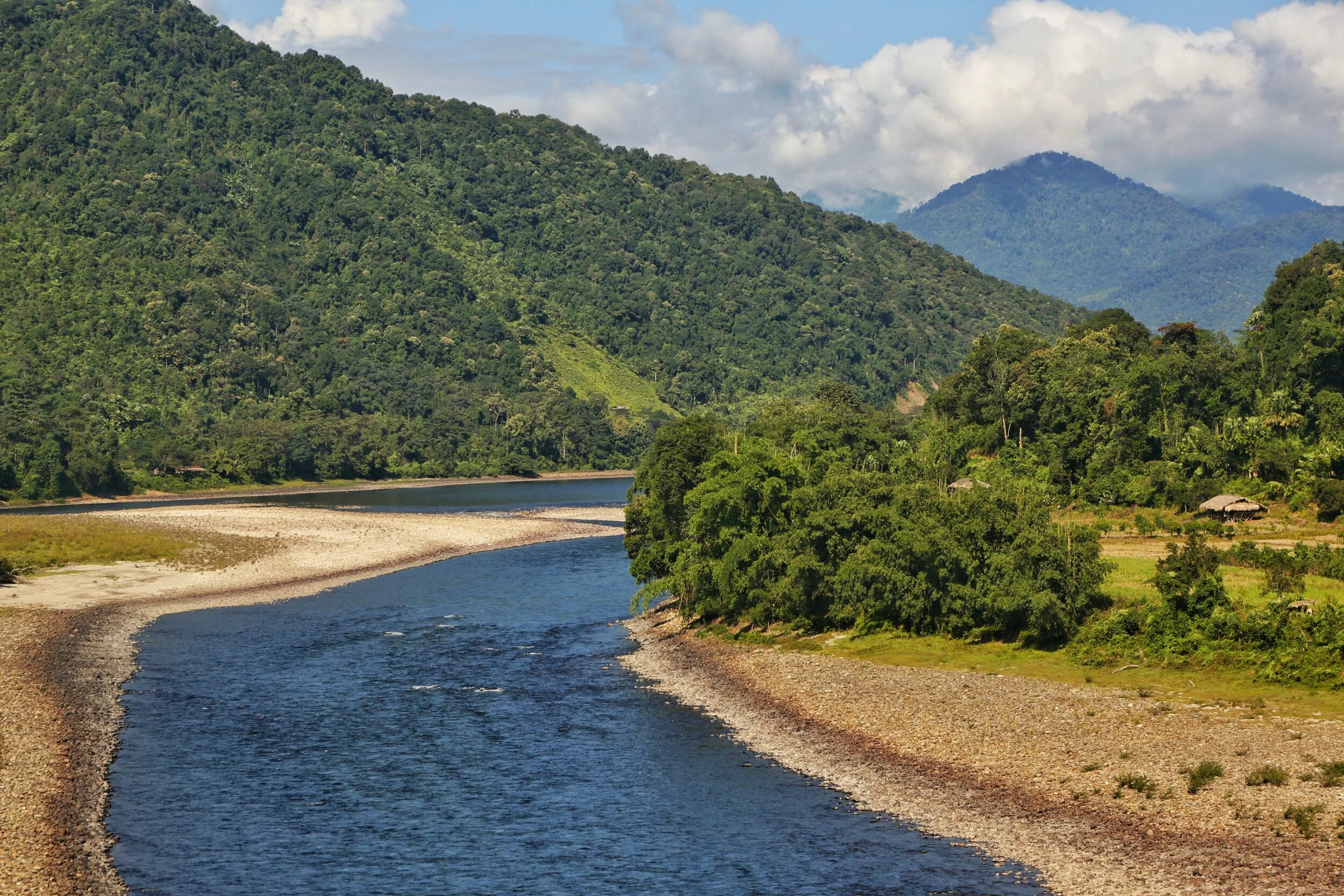
Of Mountains and Rivers
One of the most interesting thing about the Himalayas is how the Rivers interact with the Range and how the River Basins work. Since none of us is taught this in school in the Geography class the way one can study this fascinating aspect is to study Maps. Not the Maps of the new but the old Maps made by the Geological Surveys and the Royal Geographic Society Maps. The kind of detailing in these Maps is amazing when we keep in mind the fact that it was all done by boots on the Ground. No Aerial or Satellite Cartography.

Of the Himalayan Mountains and the Rivers
One of the most interesting thing about the Himalayas is how the Rivers interact with the Range and how the River Basins work. Since none of us is taught this in school in the Geography class the way one can study this fascinating aspect is to study Maps. Not the Maps of the new but the old Maps made by the Geological Surveys and the Royal Geographic Society Maps. The kind of detailing in these Maps is amazing when we keep in mind the fact that it was all done by boots on the Ground. No Aerial or Satellite Cartography.
And I finally found a Map which shows the River Basins / the Mountains / the Ridgelines / the Water Partings in a very simple and lucid fashion. Of course there are some explanations required for the un-initiated in the fine art of reading Maps. Not only does it show the Water Basins in the Himalayan context but it also shows the neighbouring River basins and how the Mountains affect the Course of the Rivers. You also need to understand that its this conflict between the Rivers and Mountains which has created the Valleys which has enabled Human communities to inhabit the Mountains.
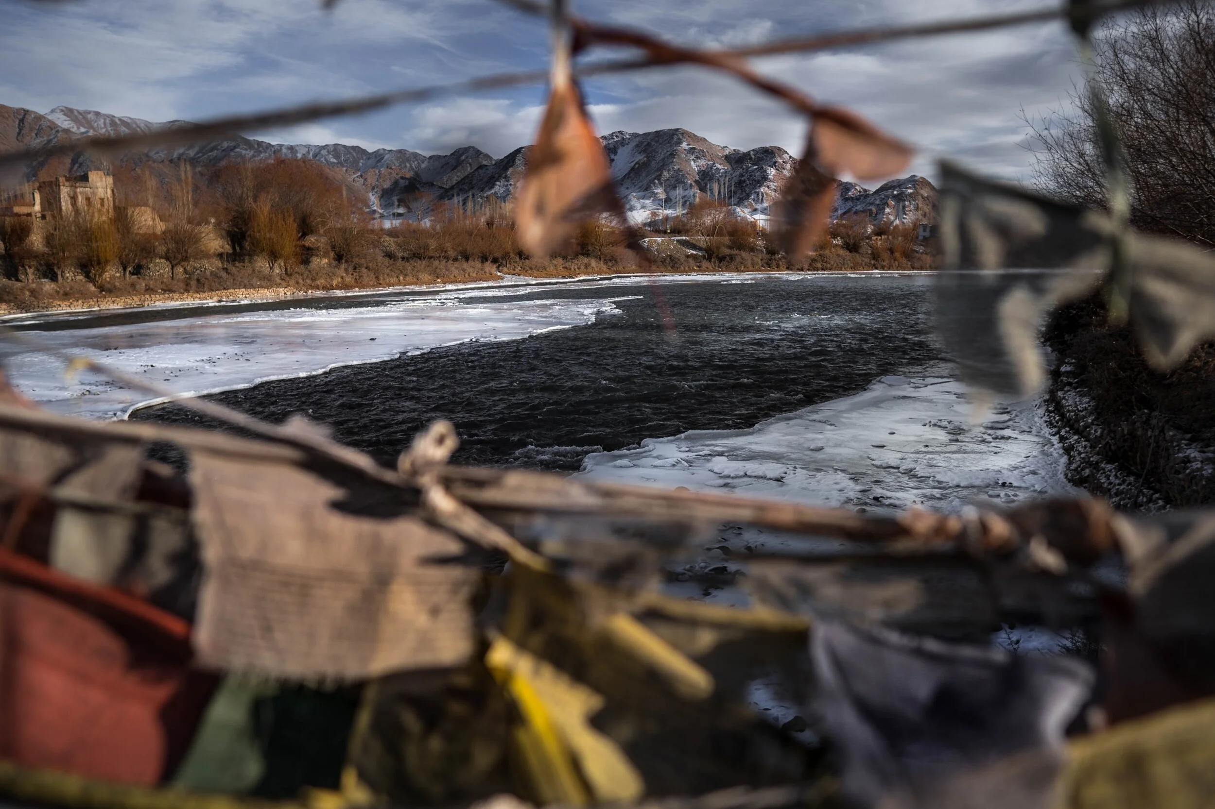
In the Himalayan context the Three main Rivers which drain the Himalayas are the Indus in the West, the Ganges in the Middle and the Brahmaputra in the East. It is common knowledge that the Indus and the Brahmaputra which rise from almost the same vicinity of each other near the Mansarovar Lake in the Tibetan Plateau hem in the Great Himalayan Range from the opposite sides. The Indus forms the boundary on the West as it passes by the Nanga Parbat and the Brahmaputra forms the boundary on the East and it rounds off the Namcha Barwa in the East. The Indus and the Brahmaputra both never breach the Main Himalayan Ridgeline and run alongside but behind the Main Himalayan Ridgeline on the Tibetan Plateau. Both flow along what Geologists call the Indus Tsangpo Suture or divide in simpler terms. I would also like to mention one major River which actually cuts through the main Himalayan Ridge line and forms the Eastern boundary of the Western Himalayas. This would be the Satluj which coincidentally also originates around the same area as the Indus and the Brahmaputra (which is called Tsangpo in Tibet) and follows an independent course cutting through the Himalayas though it finally ends up in the Indus once it reaches the Great Plains of the Punjab.
Beyond the Basins of the Himalayan Rivers we have in the neighbourhood the Tibetan Basin though a part of the Tibetan Plateau is drained by these Himalayan Rivers themselves. Further North the main Ridge line of the Karakorams forms the Water Parting between the Himalayan Rivers (the Indus system) and the Tarim Basin. The Tarim Basin is itself separated from the Tibetan Basin by the Kunlun Mountains. To the West of the Tarim Basin separated by the Pamirs in the South and the Tian Shan in the North is the Central Asian basin of the Oxus and Jaxartes of the old. The names Oxus and Jaxartes were enough in the old times to induce Explorers to go into a frenzy so inaccessible these areas were. However nowadays the Oxus and Jaxartes are better known by their present names, the Amur Darya and the Syr Darya. On the southern Edge the Oxus and Jaxartes Basin is separated from the Himalayan River Basin by the Hindu Kush. Further down the sub Ranges of the Hindu Kush like the Sulaiman Mountains divides the Himalayan River Basin from the Helmand River Basin. This rounds off the Water Partings of the Indus in the Western Himalayas.
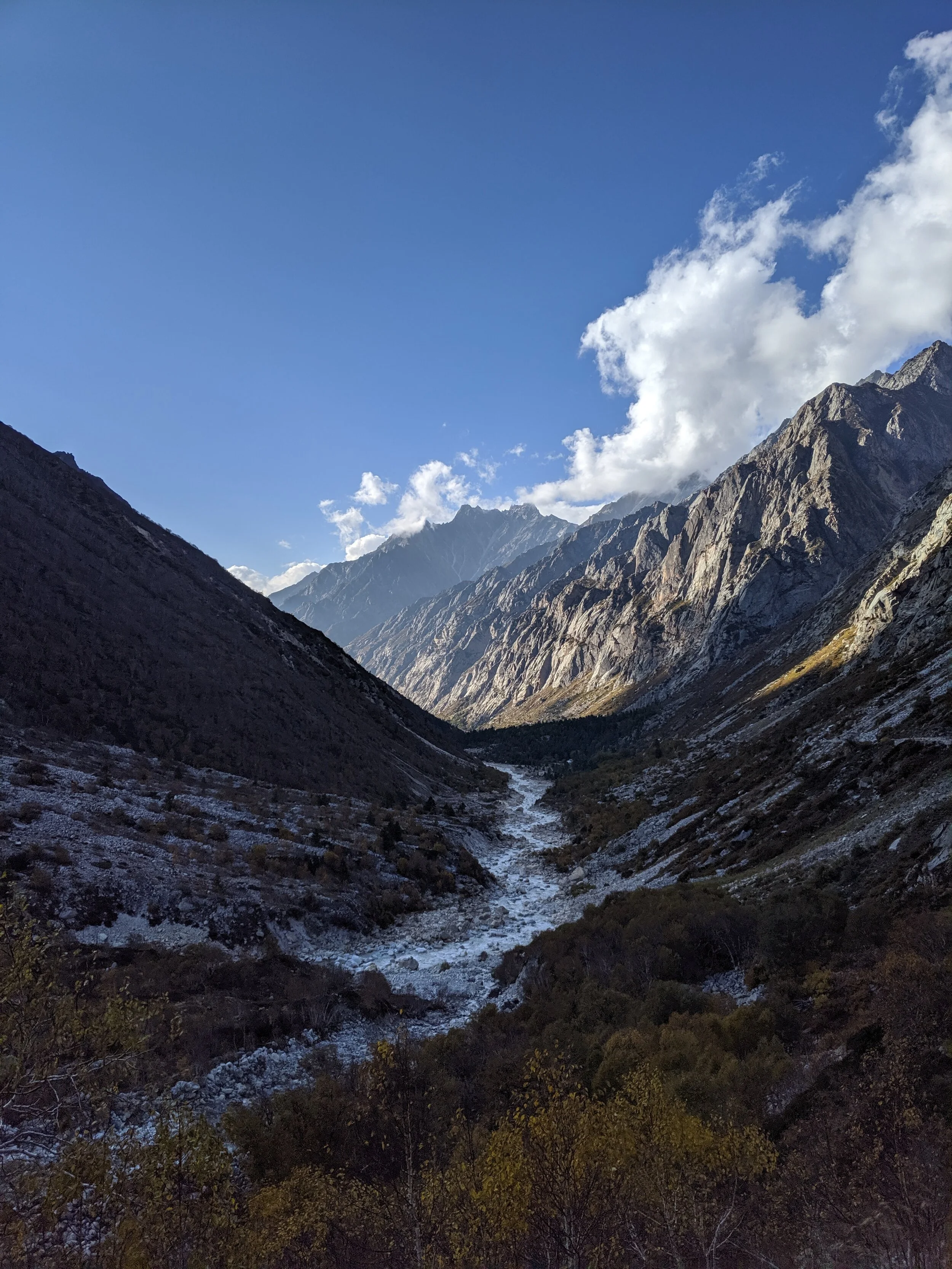
If you follow the Indus River in the Map you would see that after the point of origin the Main Waterparting of the Rivers runs behind the Main Himalayan Range rather than along the Main Ridge as classically should be the case. However at the point roughly at where it enters Ladakh from the Tibetan Plateau the River aligns itself with the Main Himalayan Range and continues the same course all the way to the Nanga Parbat where the Great Himalayan Range ends. The Water Parting however moves North towards the Karakorams and even across the Karakorams as seen in zone H. Close to the K2 however the Water Parting again moves along the main Himalayan Ridge line. But then after following the Main Ridge line of the Karakoram to West it again goes beyond the Karakorams as seen in zone C. It continues this trend until its behind the main Ridgeline of the Hindu Kush till at a point beyond the Tirich Mir it again aligns with the Main Ridge line to deviate again to form Zone B all the way to the Helmand Basin.
In pretty much the same way the Water Parting of the Tarim Basin also jumps beyond the Kun Lun, the Pamirs and the Tian Shans at places but it doesn't jump the main Ridge Line of the Karakorams as the reigning Peak of the K2 brings in a semblance of order and the Water Partings follow the K2 in the classical mode (I know this is complicated but once you co-relate with the Map and do some readings it will become more fascinating). Interestingly in the Hindu Kush its the highest Peak of the Hindu Kush the Tirich Mir which forces the Water Parting to run along the main Ridge line just like its supposed to be classically. However a point to be noted is that the Indus never concedes any of its “Mountains” the Western Himalayas or the Karakorams or the Hindu Kush to any River though itself it pushes its Basinal boundaries to well into the Kun Luns, the Pamirs and the Tian Shans though not quite making it to the main Ridge line.
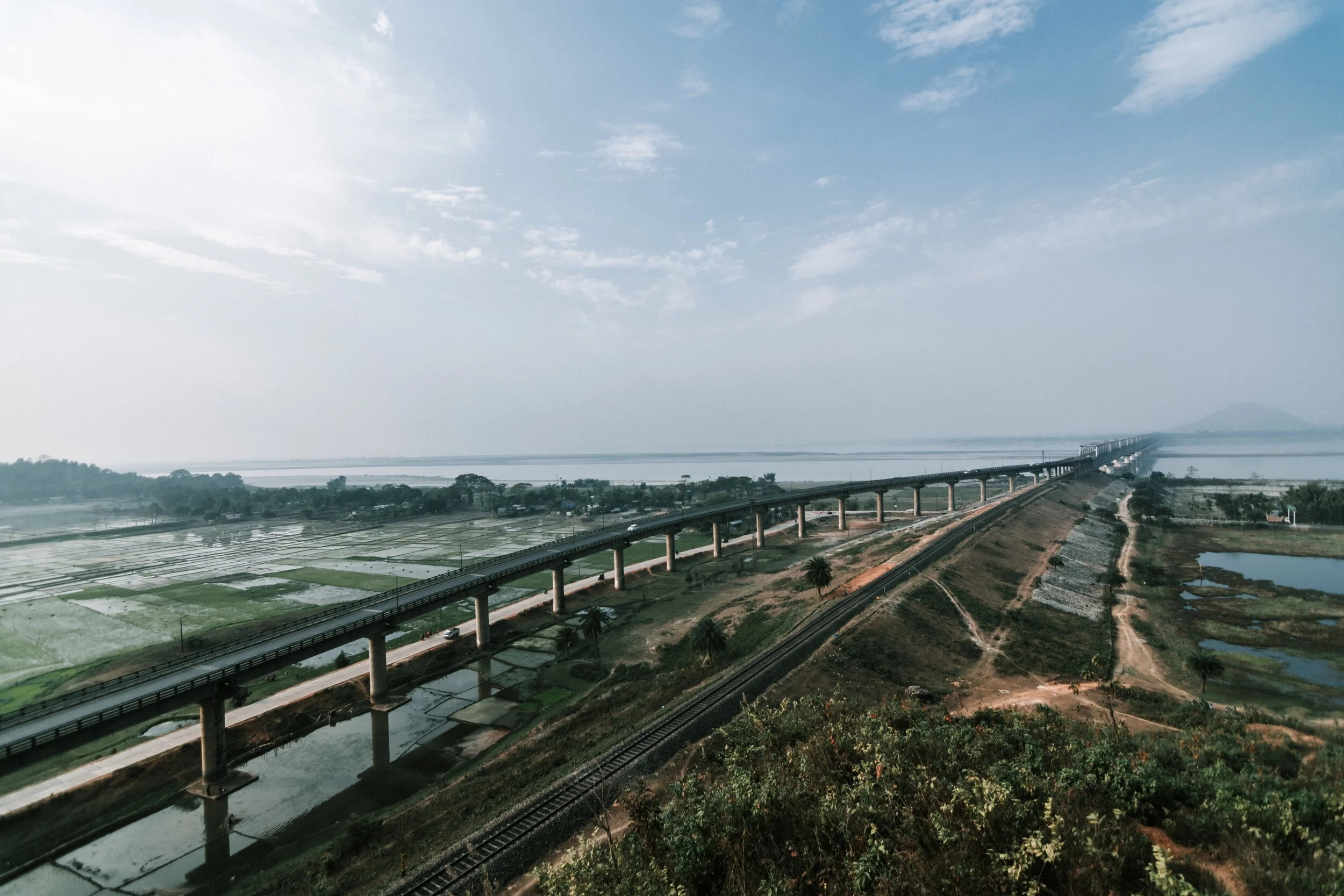
And of course as we all the Mountains are rising and the Rivers are just cutting the Gorges and the Valleys and this state of flux will continue over a period of time till the end of time. And because of this constant change the Water Partings are not as fixed or permanent as we would like to believe. They are also constantly changing and evolving in a Geological time frame. This also shows how the Rivers and the Basind connect these highest Mountains in the World in a closer relationship than we actually believe. The River and the Basins provide the linkages which connect the Himalayas with the Karakorams, the Hindu Kush, the Kun Lun, the Pamirs and the Tian Shans. I collectively like to use the term “Himalayas” when talking about all these Ranges and the Great Himalayan Range when I am referring to the Main Himalaya Range. The highest Range on the Planet.
May we one day get to behold the magnificent sights that these Mountains hold and their mighty Peaks. And may we one day get to drink water from all these Rivers. The transition zones between these Himalayas is probably even today one of the least explored in the World and they continue to hold their Mysteries, occasionally revealing them to us mere Mortals.
Of the Himalayan Mountains and Rivers
The Rivers and the Himalayas and the even the Mountain Ranges beyond it are always interacting in very interesting ways. In this article we see how the River Basins of the Indus, Ganges and Satluj and the Mountains interact and in some cases the River Basins extend beyond the Ranges themselves.

Of the Mountains and the Rivers
One of the most interesting thing about the Himalayas is how the Rivers interact with the Range and how the River Basins work. Since none of us is taught this in school in the Geography class the way one can study this fascinating aspect is to study Maps. Not the Maps of the new but the old Maps made by the Geological Surveys and the Royal Geographic Society Maps. The kind of detailing in these Maps is amazing when we keep in mind the fact that it was all done by boots on the Ground. No Aerial or Satellite Cartography.
And I finally found a Map which shows the River Basins / the Mountains / the Ridgelines / the Water Partings in a very simple and lucid fashion. Of course there are some explanations required for the un-initiated in the fine art of reading Maps. Not only does it show the Water Basins in the Himalayan context but it also shows the neighbouring River basins and how the Mountains affect the Course of the Rivers. You also need to understand that its this conflict between the Rivers and Mountains which has created the Valleys which has enabled Human communities to inhabit the Mountains.
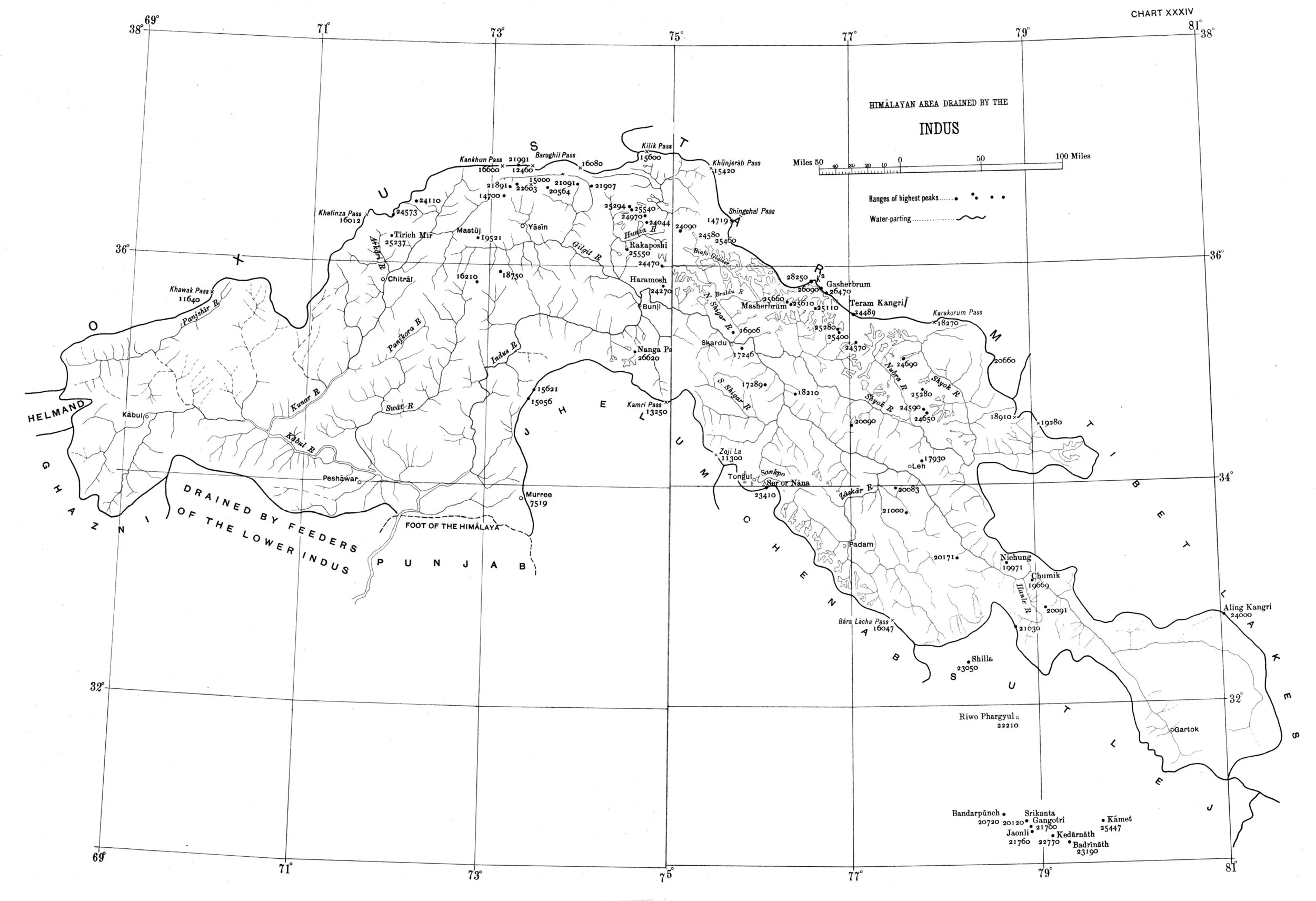
In the Himalayan context the Three main Rivers which drain the Himalayas are the Indus in the West, the Ganges in the Middle and the Brahmaputra in the East. It is common knowledge that the Indus and the Brahmaputra which rise from almost the same vicinity of each other near the Mansarovar Lake in the Tibetan Plateau hem in the Great Himalayan Range from the opposite sides. The Indus forms the boundary on the West as it passes by the Nanga Parbat and the Brahmaputra forms the boundary on the East and it rounds off the Namcha Barwa in the East. The Indus and the Brahmaputra both never breach the Main Himalayan Ridgeline and run alongside but behind the Main Himalayan Ridgeline on the Tibetan Plateau. Both flow along what Geologists call the Indus Tsangpo Suture or divide in simpler terms. I would also like to mention one major River which actually cuts through the main Himalayan Ridge line and forms the Eastern boundary of the Western Himalayas. This would be the Satluj which coincidentally also originates around the same area as the Indus and the Brahmaputra (which is called Tsangpo in Tibet) and follows an independent course cutting through the Himalayas though it finally ends up in the Indus once it reaches the Great Plains of the Punjab.
Beyond the Basins of the Himalayan Rivers we have in the neighbourhood the Tibetan Basin though a part of the Tibetan Plateau is drained by these Himalayan Rivers themselves. Further North the main Ridge line of the Karakorams forms the Water Parting between the Himalayan Rivers (the Indus system) and the Tarim Basin. The Tarim Basin is itself separated from the Tibetan Basin by the Kunlun Mountains. To the West of the Tarim Basin separated by the Pamirs in the South and the Tian Shan in the North is the Central Asian basin of the Oxus and Jaxartes of the old. The names Oxus and Jaxartes were enough in the old times to induce Explorers to go into a frenzy so inaccessible these areas were. However nowadays the Oxus and Jaxartes are better known by their present names, the Amur Darya and the Syr Darya. On the southern Edge the Oxus and Jaxartes Basin is separated from the Himalayan River Basin by the Hindu Kush. Further down the sub Ranges of the Hindu Kush like the Sulaiman Mountains divides the Himalayan River Basin from the Helmand River Basin. This rounds off the Water Partings of the Indus in the Western Himalayas.
If you follow the Indus River in the Map you would see that after the point of origin the Main Waterparting of the Rivers runs behind the Main Himalayan Range rather than along the Main Ridge as classically should be the case. However at the point roughly at where it enters Ladakh from the Tibetan Plateau the River aligns itself with the Main Himalayan Range and continues the same course all the way to the Nanga Parbat where the Great Himalayan Range ends. The Water Parting however moves North towards the Karakorams and even across the Karakorams as seen in zone H. Close to the K2 however the Water Parting again moves along the main Himalayan Ridge line. But then after following the Main Ridge line of the Karakoram to West it again goes beyond the Karakorams as seen in zone C. It continues this trend until its behind the main Ridgeline of the Hindu Kush till at a point beyond the Tirich Mir it again aligns with the Main Ridge line to deviate again to form Zone B all the way to the Helmand Basin.
In pretty much the same way the Water Parting of the Tarim Basin also jumps beyond the Kun Lun, the Pamirs and the Tian Shans at places but it doesn't jump the main Ridge Line of the Karakorams as the reigning Peak of the K2 brings in a semblance of order and the Water Partings follow the K2 in the classical mode (I know this is complicated but once you co-relate with the Map and do some readings it will become more fascinating). Interestingly in the Hindu Kush its the highest Peak of the Hindu Kush the Tirich Mir which forces the Water Parting to run along the main Ridge line just like its supposed to be classically. However a point to be noted is that the Indus never concedes any of its “Mountains” the Western Himalayas or the Karakorams or the Hindu Kush to any River though itself it pushes its Basinal boundaries to well into the Kun Luns, the Pamirs and the Tian Shans though not quite making it to the main Ridge line.
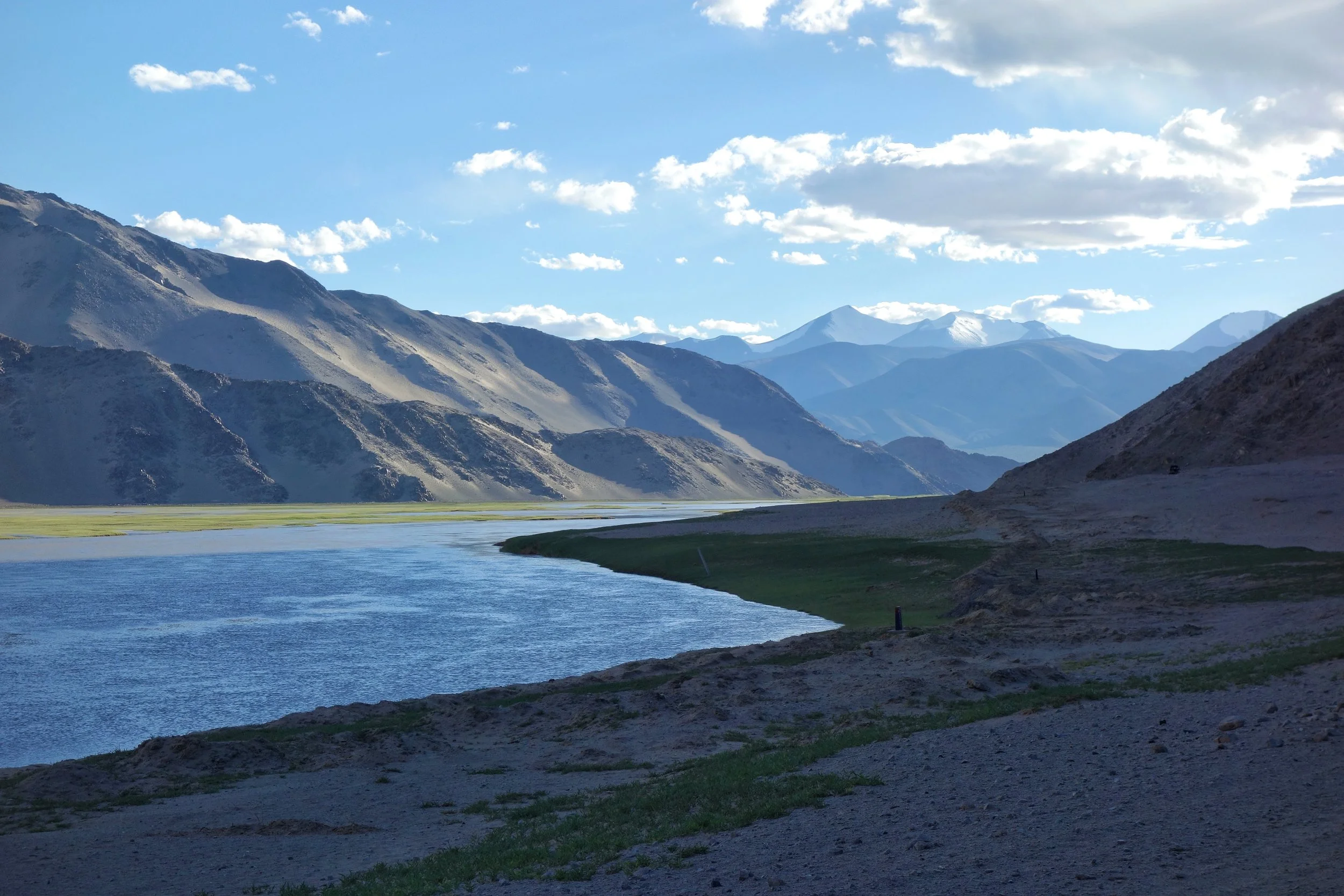
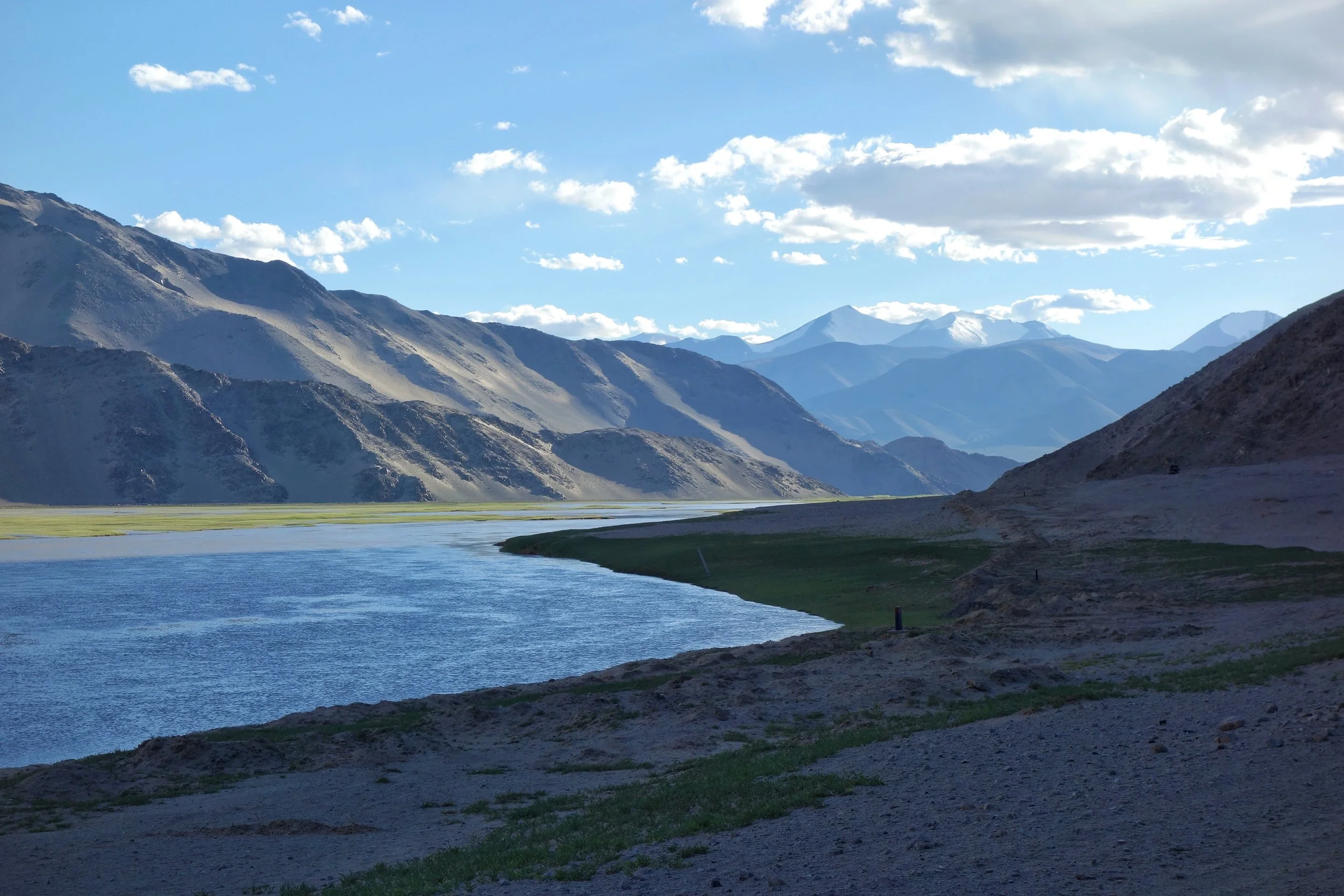
The Indus after it enters Ladakh from Tibet on the Chnagthang
And of course as we all the Mountains are rising and the Rivers are just cutting the Gorges and the Valleys and this state of flux will continue over a period of time till the end of time. And because of this constant change the Water Partings are not as fixed or permanent as we would like to believe. They are also constantly changing and evolving in a Geological time frame. This also shows how the Rivers and the Basind connect these highest Mountains in the World in a closer relationship than we actually believe. The River and the Basins provide the linkages which connect the Himalayas with the Karakorams, the Hindu Kush, the Kun Lun, the Pamirs and the Tian Shans. I collectively like to use the term “Himalayas” when talking about all these Ranges and the Great Himalayan Range when I am referring to the Main Himalaya Range. The highest Range on the Planet.
May we one day get to behold the magnificent sights that these Mountains hold and their mighty Peaks. And may we one day get to drink water from all these Rivers. The transition zones between these Himalayas is probably even today one of the most least explored in the World and they continue to hold their Mysteries, occasionally revealing them to us mere Mortals.
The Remanent of an Army
The only surviving member of the Army of the Indus, was the assistant Surgeon William Brydon who was immortalized in this classical Painting by Elizabeth Butler called the “Remnant of an Army” as he trudged on his tired horse with the Fort of Jalalabad in sight. One of the worst defeats suffered by the British Empire.
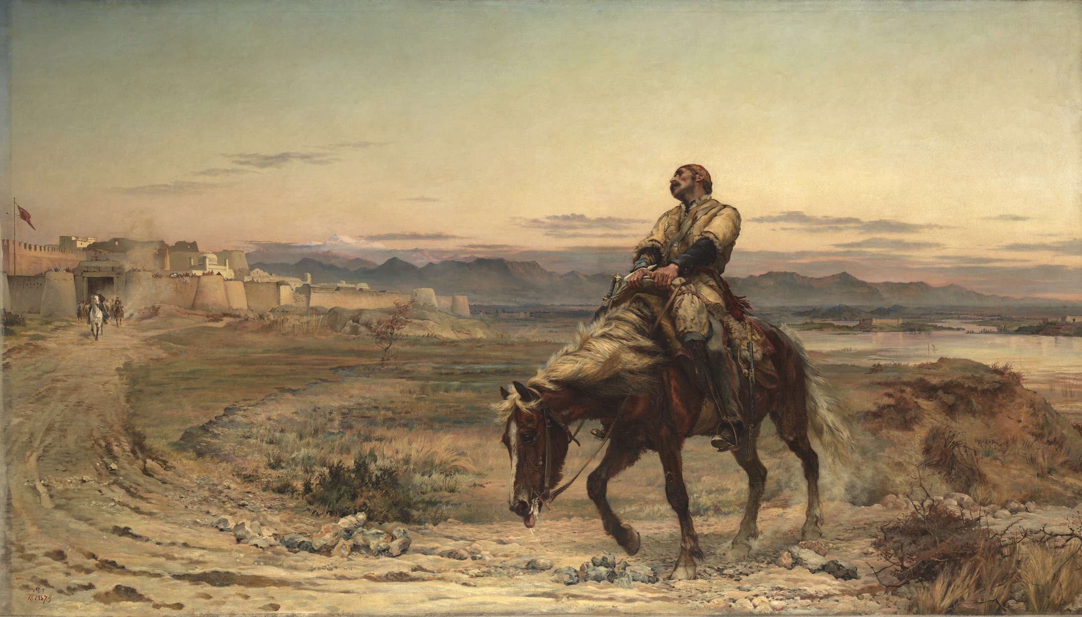
The Remanent of an Army
In John Keay’s epic "When Men and Mountains Meet: The Explorers of the Western Himalayas 1820-1875" there is mentioned a certain meeting between Raja Gulab Singh (The future Maharaja Gulab Singh of Jammu and Kashmir) and the British Governor of Punjab who’s name I cannot recall. It was sometime in 1842. And it was in Shimla. It was in the times of the Great Game.
After the traditional exchange of greetings between the two men, who didn't seem to be too fond of each other, they sat down. Raja Gulab Singh started the conversation. He said he had bad news coming from the side of Afghanistan. It seemed that the Sun had been eclipsed. The Great British Army of the Indus had been annihilated and only one person out of over 20,000 had made it back to safety into British territory. The Britisher looked up at the Raja of the Dogras, and without twitching an eyelid said that Raja Sahib I too have bad news for you. These come from the Trans Himalayan region of Tibet. Your General Zorawar Singh and his Army on its way to conquer Lhasa had been all killed in an engagement with a joint Chinese-Tibetan force and a few remnants of the Dogra Army had managed to make their way to the British Garrison in Almora. It seemed that the Moon too had been eclipsed, Raja Sahib.
Raja Gulab Singh had often retorted to the British that his (Sikh Kingdom) was a Moon in front of the Sun that the British Empire was. But for the time being both seemed eclipsed.
Whether both men were already aware of the happenings on either side of the Himalayas as they sat that day in Shimla is anyone’s guess. Both were tough Military men, being Generals in the most powerful Armies on the sub-continent were not me who would let go of their emotions. The Great Army of the Indus, of the powerful British had been all but massacred by the Afghans and on the other side the powerful Dogras led by General Zorawar Singh had met a similar fate at the hand of the Tibetans. It was a great set back to both parties and revenge was already on the cards.
It is often said that the achievements of General Zorawar Singh were overlooked by historians of that time as they were focused on the events in Afghanistan as the First Anglo Afghan battle was underway and even after winning the initial Battles and in control of Kabul they could not hold the Afghans under control for long. Kabul proved too much for the British to handle And in the beginning of January 1942 they decided to evacuate Kabul and crossover the Hindu Kush into friendly territory across the Khyber. The whole British enterprise into Afghanistan through Sikh territory was the fear of the Afghan Rulers getting an alliance with the Russians who were seen as actively trying to undermine British interest in Afghanistan like they had done in Persia.
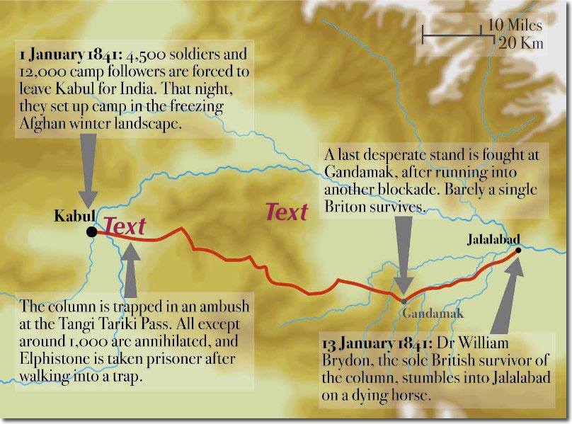
The only surviving member of the Army of the Indus, was the assistant Surgeon William Brydon who was immortalised in this classical Painting by Elizabeth Butler called the “Remnant of an Army” as he trudged on his tired horse with the Fort of Jalalabad in sight. It is said that the Horse died as soon as he was put into a stable. Dr.Brydon also survived by sheer good fortune although a part of skull was sheared off by an Afghan sword but he had stuffed a Magazine in his hat to keep his head warm in the freezing snowbound Passes of the Hindu Kush. The Magazine took the brunt of that Afghan sword swipe and hence the Doctor survived. The only survivor of the Army of the Indus.
The painting is dated January 13, 1942.
PS: There were other survivors but they emerged later as they were rescued by successive punitive Missions by the British.
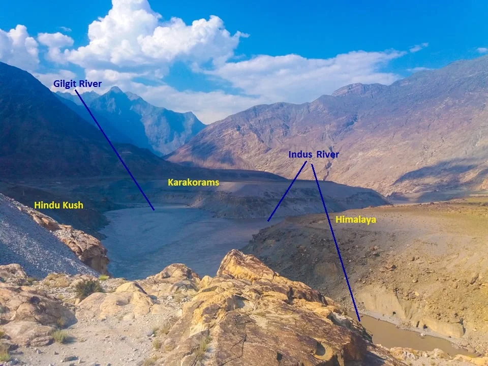
The Junction of the Three Mightiest Mountain Ranges
Jaglot near Gilgit is the point where the Three Mightiest Mountain Ranges of the world the Himalayas, the Karakorams and the Hindu Kush meet at the confluence of the Gilgit River with the Indus River

The Point where the Himalayas, the Karakorams and the Hindu Kush meet. At the confluemce of the Gilgit and the Indus Rivers.
The Place where the Himalayas, the Karakorams and the Hindu Kush Meet
Have you heard of Jaglot ?
It's a small little nondescript Village around 40 kms from Gilgit town which would have remained as such if not for a Geographical feature that the place holds. This point is located where the mighty Indus meets the Gilgit River in Gilgit Baltistan as the region is now called. This place is considered the meeting of the three mightiest Mountain Ranges in the World, the Himalaya which is home to 9 of the 10 highest Peaks in the World including the highest one Mt. Everest, the jagged Karakorams which is home to the K2 and the third one coming from the North West, the Hindu Kush which is come to the Tirich Mir which at 7708m is the highest Peak outside of the Himalayas-Karakoram Mountain System.
One of the oft asked questions is that is the Karakoram a sub Range of the Himalayas ? The answer is both no and yes and it depends on how you want to answer. They are in pure scientific terms different Ranges but a part of the same Mountain Complex that are referred to as the Great Himalayas.
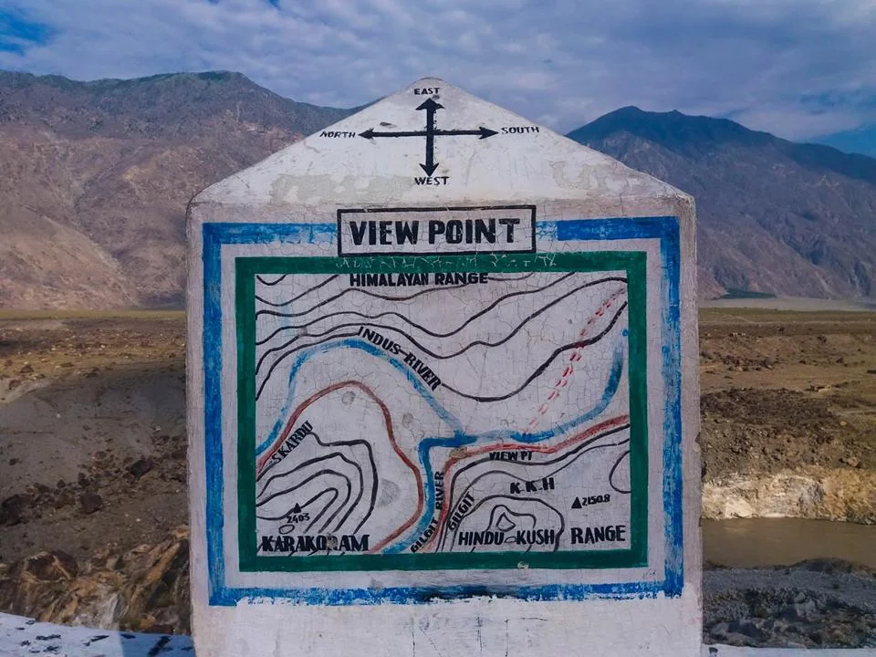
The point of convergence of the three Highest Ranges in the World !
Technically both are different Ranges as they were formed at different stages of one cataclysmic Event namely the collision/ subduction of the Indian Plate under the Eurasian Plate. Both follow their own separate Thrust lines and to really understand it you really need to get into Plate tectonics and understand stuff as I present to you below. This is taken from A Tectonic framework of the Himalaya, Karakoram and Tibet, and Problems of their Evolution by B F Windley :
“The Himalaya, the Karakoram and Tibet were assembled by the successive accretion to Asia of continental and arc terranes during the Mesozoic and early Tertiary. The Jinsha and Banggong Sutures in Tibet join continental terranes separated from Gondwana. Ophiolites were obducted onto the shelf of southern Tibet in the Jurassic before the formation of the Banggong Suture. The Kohistan--Ladakh Terrane contains an island arc that was accreted in the late Cretaceous on the Shyok Suture and consequently evolved into an Andean-type batholith. Further east this Trans-Himalayan batholith developed on the southern active margin of Tibet without the prior development of an island arc. Ophiolites were obducted onto the shelf of India in the late Cretaceous to Lower Palaeocene before the closing of Tethys and the formation of the Indus--Yarlung Zangbo Suture at about 50 Ma. Post-collisional northward indentation of India at ca. 5 cm a-1 since the Eocene has redeformed this accreted terrane collage; palaeomagnetic evidence suggests this indentation has given rise to some 2000 km of intracontinental shortening. Expressions of this shortening are the uplift of mid-crustal gneisses in the Karakoram on a late-Tertiary breakback thrust, folding of Palaeogene redbeds in Tibet, south-directed thrust imbrication of the foreland and shelf of the Indian Plate, north-directed back-thrusts along the Indus Suture Zone, post-Miocene spreading and uplift of thickened Tibet, giving rise to N--S extensional faults, and strike-slip faults, which allowed eastward escape of Tibetan fault blocks.”

The Public Viewing Point.
Now coming back to more simpler stuff as in Geographical terms the Karakorams are separated from the Himalayas by the Indus in its Upper Course. However in Ladakh the division is taken as the Shyok instead of the Indus. So when you are in Nubra Valley the Mountains on the other side of Shyok River as the Karakorams and this side as the Himalayas. However some people stick to the classical Indus division and by that norm the Ladakh Range would be part of the Karakorams and not the Himalayas. By the same definition Leh would be in the Karakorams and not the Himalayas.
However this ambiguity disappears once the Shyok River merges with the Indus at a place called Keris near the town of Skardu. The Nubra river also joins the Shyok in Nubra Valley and the River widens significantly. The fact that both these Rivers do a complete turnaround of 180 degrees from their original sources indicates the presence of fault lines.
The Hindu Kush on the other hand is separated from the Karakorams by the Gilgit River. The Gilgit rises somewhere between the mountain vastness of the Hindu Kush and the Karakorams. And it passes through Gilgit Town and eventually the joins the Indus at Jaglot. This is where eventually these three mighty Ranges meet. Of all the places that I would want to visit one day this would definitely be on the top.
If the ancients would have been able understand the significance of this location (which we do now due to years of research aided by modern scientific equipment) they would have built some great structures over here I would imagine. However there are still local legends about this place ie where the Indus meets the Gilgit (the legend has no relation to the meeting of the Three Great Ranges). As per the legend Fairies and other such creatures come to have a bath here at midnight or something on that lines.
So do note the name down. I'm sure you would like to go there.
The Indus Irony
The Indus is the River which has given the name to civilization, to a people and to a Country as well. And the country it has given its name to has been the fountainhead of spiritualism where the Mountains and the Rivers are worshiped. But ironically the Indus, the mighty Indus itself figures nowhere in the list of sacred Rivers and a River to its East, the Ganges being the most revered one. We ask why ?
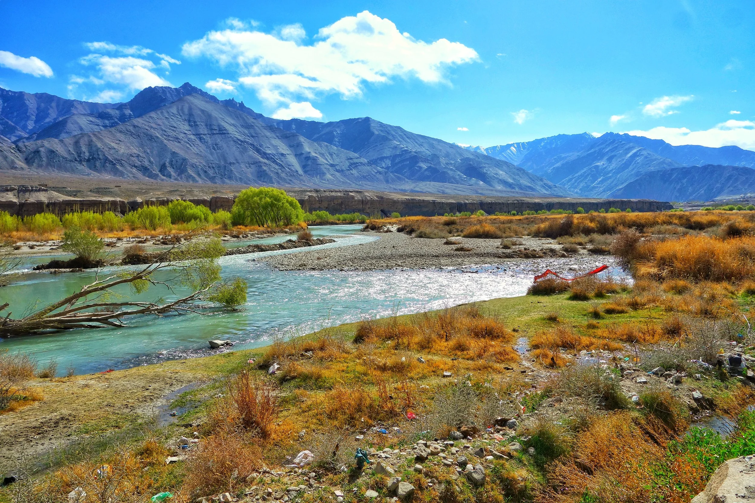
The Indus Irony
The Indus. The Sindhu. The River which gave a country its name. The River which gave a religion its name. The River where the earliest recorded organised human settlements were created. The River around which the most ancient of all the Religious scriptures (in a sense) were written. A river that drains the Western Himalayas, the Karakorams and the Hindu Kush. A River than dumps twice the amount of water that the Nile does in into the Ocean.
In the most mystical of lands that it gives its name to, where Rivers and Mountains are worshipped, the Indus should have been the Deity number 1. But its not. It’s not even a Deity. It isn’t even sacred. So what happened ? Why did the Indus lose all its “religious” (deemed) significance ? I will try and give my view on that. Now if you are a particularly religious person I would suggest you stop reading and go on to the next Post.
Let’s go back to the Indus Valley civilization. The Indus Valley Civilization arose in the Indus and the Ghaggar Hakra (Saraswati) basin. The Sutlej at one time flowed into Ghaggar Hakra system and not into the Indus as it does today but scientists don’t agree on when actual change took place. It should be remembered that the Satluj is today the easternmost tributary of the of the Indus. This is where the most developed civilization of the ancient world developed. Permanent settlements, planned sanitation and the works. And this advanced civilization was called the Indus Valley Civilization. Of course like all civilizations it came to an end due to reasons we will not dwell into.
And then it was in North Western Pakistan, in the Indus basin, just as the Indus enters the plains down from the might Himalayas, that the most sacred of the Vedic scriptures (I’m deliberately not using the term Hindu as in my view these aren’t the same things in the religious sense though Hindu itself is a geographic term), the Rig Veda was composed. The main “Devas” were Indra, Soma and Agni. The main River mentioned was the Sapta Sindhu (The Indus and its seven tributaries). The main Gods of the “Hindu” pantheon as it is today were hardly even mentioned. The holiest of the holy, the Ganges just gets two passing references and that too in the later Hymns.
The Rig Veda, as those of you who ever tried giving it a go is quite an enigma. Many a times I have tried but failed unless we have an accompanying translation (transliteration works to a limited extent). Now translations unlike transliterations are not mathematical. It is more or less what it is the translators perceives a Hymn to be. So you have to rely on the Translator’s interpretation of it. But until and unless you master the language of the Rig Veda and read it for yourself the only tools available are translation and transliteration.
That being said the Rig Veda has a very wide latitude, it included Monotheism, Pantheism, Animism, Agnosticism even Atheism (as put by my friend of mine). Yes Athieism. In today’s world order of rigid Religious beliefs, it is remarkable that the Rig Veda even questioned the existence of God itself. Yes you heard me right. I quote Rig Veda Hymn 10:129 also called the Hymn of Creation (Just the last two stanzas). Make whatever you want of this
But, after all, who knows, and who can say
Whence it all came, and how creation happened?
the Devas (gods) themselves are later than creation,
so who knows truly whence it has arisen?
Whence all creation had its origin,
he, whether he fashioned it or whether he did not,
he, who surveys it all from highest heaven,
he knows – or maybe even he does not know.
The point I’m trying to make is that it was very different from the Hindu religion of today. Over a period of time the Vedic religion began to be codified into the Upanishads called the Vedanta. Religious rituals and hierarchies were created. The breathing space in which the Rig Veda was created started to get muzzled. And in a reaction to this there arose different schools of thoughts like Buddhism and Jainism (these were Godless religions) and these began to challenge the dogmas of what the Vedic religion had become. Of course the different Kings/ Kingdoms of that time also played favorites with the Rulers using Religion as a powerful political tool. a

The Ganges at Haridwar
And in turn the institutionalisation of the Vedic religion got even stronger and this was particularly true in the Gangetic basin. A shift happened. The epicenter shifted to the Gangetic plains with the evolution of Brahmanism. A new trinity of Gods, Brahma, Vishnu and Mahesh came up. The Ganga, Yamuna and Saraswati became the Holy Rivers. The Gods of the Rig Veda were all but forgotten and the same happened with the River of the Vedas, the mighty Indus. As it happened the Indus basin became a stronghold of Buddhism and that is from where Buddhism spread all around Asia. It made sense for the “Institutionalisers” of the religion to associate what was formerly the Vedic religion with Geographics to the East of the place where it originated. And slowly “the sense” of importance of the Indus was diluted over a period of time. All the focus was on the heartland River than the borderland River. We were told a certain River was more sacred than the other River though both of them performed exactly the same function like all Rivers.
And this I call the Indus Irony. It isn’t sacred. It’s not revered. It’s not worshipped. Not that it will make a difference.
It’s the mighty Indus. As mighty as the Mountains that it comes down from. It will keep flowing.
PS I just read this on Wiki : In November 2011, satellite images showed that the Indus river had re-entered India, feeding Great Rann of Kutch, Little Rann of Kutch and a lake near Ahmedabad known as Nal Sarovar.
Disclaimer : This is entirely my own personal theory. No disrespect is meant towards any religious belief or any river or any scripture. It is a linear mathematical study trying to establish the facts keeping out the “God’s will” factor. In the spirit of the Rig Veda Hymn 10:129
Kiki’s Blog
Stories from the Himalayas








Five years ago the Galwan Valley was in the News for the wrong reasons after a deadly clash between the Indian and Chinese Armies in the Valley located in Ladakh lead to many deaths on the contentious Border between the two countries in wake of continued Chinese intrusions into Indian territory.
This area along the Shyok River, of which the Galwan Nallah or the Galwan River which forms the Galwan Valley has been off limits to Civilians since long but now the Indian Government has decided to open up the area for Civilians and we were amongst the First Civilians to venture into this beautifully desolate part of the Eastern Karakorams in Ladakh. Earlier Civilians could only venture upto the Village of Shyok from where the Shyok River takes a U turn and flows in a Northerly direction.