
The Great Game on the Roof of the World
There have been many Western Explorers who went on different assignments in these Mountains but one of the key reasons was always to find out more about the Politics and the Geography of the regions which were not under the Control of the Empire. The frontiers of the Punjab Empire of Maharaja Ranjit Singh were a key target as they bordered the wilds of Afghanistan as it slowly gave way to Central Asia. Also of great interest to them were the Routes that were traditionally taken from Kashmir via Ladakh into Central Asia.

A Popular cartoom based on the Great Game published in 1878
The Great Game was a Political and Military game of intrigue and one upmanship played between the two Greatest Empires of that time, the British Empire and the Tsarist Russian Empire that was played in the most of the Nineteenth Century. At stake for the British was the Jewel in the Crown, the Indian sub-continent while for the Tsarist Russia it was their Empire in Central Asia. Both these Empires met somewhere in high Asia in the midst of the Mountains of the Great Himalayan System. Today we are gonna look at exactly where they met in High Asia.
The British had constant nightmares of Cossacks riding over the great Mountains and making a dent in their Indian holdings. The fact that Tsarist Russia overran most of Central Asia during this time and that a body of Cossacks now sat on top of the Wakhan not very far from the Kashmir territories did not make things comfortable for them either. The Great Game was played in a region stretching from Persia to Afghanistan over to India and Tibet and the whole of Central Asia.

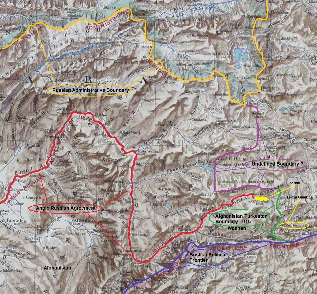
A Map on where the Boundaries met in High Asia
There have been many Western Explorers who went on different assignments in these Mountains but one of the key reasons was always to find out more about the Politics and the Geography of the regions which were not under the Control of the Empire. The frontiers of the Punjab Empire of Maharaja Ranjit Singh were a key target as they bordered the wilds of Afghanistan as it slowly gave way to Central Asia. Also of great interest to them were the Routes that were traditionally taken from Kashmir via Ladakh into Central Asia. The Cossacks had a reputation and the British wanted to have the information on all the possible Routes that the Cossacks would take in case they decided to lay their claim on the Jewel in the Crown.
This Map from 1885 really shows how close they were to each other and though most of the issues had been resolved between the British and the Russians, but like all Great Agreements and Pacts between Empires there was some Room left for further conflagurations on the same Boundary issues. The point was that the terrain was itself so inhospitable and few Russians and British had ever been to Ground Zero and all the final decisions were made far away in London and in Moscow. There was just this small matter of the area East of the Lake Victoria (yes there was a Lake Victoria in the Pamirs once upon a time) or as the Zorkhul as its called now.

A Painting of the Lake Zorkhul, 1870
As per the British and Russian agreement of 1885 the boundary matter was settled (almost) from the presumed source of the Oxus or the Amu Darya which was the the Zorkhul or Lake Victoria to the Harirud along the Afghanistan Russia border. For those who have read the works of Early Explorers the source of the Oxus was the greatest mystery of High Asia. And many Westerners disappeared forever looking for the legendary source of the Oxus. And even as of today (2020) the exact source of the Oxus hasnt been defined. Even last year a team from Oxford went looking and defining the Source out of 4 or 5 possible candidates. The question of the source of the Oxus still eludes us to this day and age. Anyways back then the Boundary was defined but the area to the East of the Lake where Russia, Afghanistan, Chinese Turkestan and British Empire actually met were left undefined. Both the Russian and the British were eager not to have a Border in high Asia so the Wakhan was deemed Afghan territory to serve as a no man’s land.
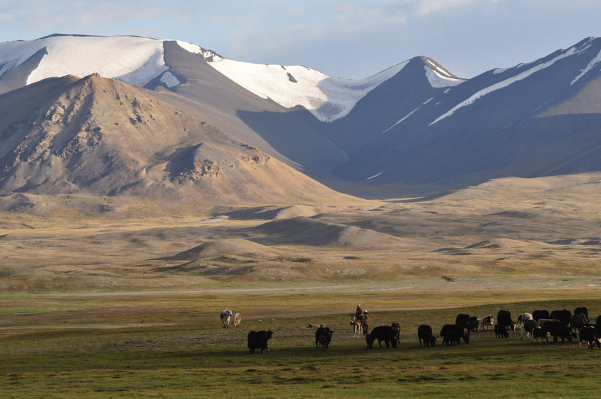
Kirghiz Nomads somewhere in the vicinity of the Lake
However later this area in itself became a matter of dispute and the Russians wanted to be the first in control just like they had done in Panjdeh. And as it would happen just around the same time Sir Francis Younghusband was in high Asia with his party not very far from the Lake. They were at the Bozai Gombaz in the Little Pamir (marked in the Map with a circle) and they were confronted by the Russian party and told they were in Russian territory and told to leave. As it had happened that Younghusband had trespassed into Russian territory before mistakenly (of course) and it turned out that the status of Bozai Gombaz was not defined in the earlier agreements with the Russians. So in order to avoid all further complications another boundary Commission was established and officials from both the British side and the Russian side met and as a consequence of it the border between Afghanistan and Turkestan was settled taking care that the Russian and the British Empire still didnt have a Land Border in High Asia.
Leaving you with a Map which makes the whole Geography more interesting. And some pics from here and there.
Of Mountains and Rivers
One of the most interesting thing about the Himalayas is how the Rivers interact with the Range and how the River Basins work. Since none of us is taught this in school in the Geography class the way one can study this fascinating aspect is to study Maps. Not the Maps of the new but the old Maps made by the Geological Surveys and the Royal Geographic Society Maps. The kind of detailing in these Maps is amazing when we keep in mind the fact that it was all done by boots on the Ground. No Aerial or Satellite Cartography.

Of the Himalayan Mountains and the Rivers
One of the most interesting thing about the Himalayas is how the Rivers interact with the Range and how the River Basins work. Since none of us is taught this in school in the Geography class the way one can study this fascinating aspect is to study Maps. Not the Maps of the new but the old Maps made by the Geological Surveys and the Royal Geographic Society Maps. The kind of detailing in these Maps is amazing when we keep in mind the fact that it was all done by boots on the Ground. No Aerial or Satellite Cartography.
And I finally found a Map which shows the River Basins / the Mountains / the Ridgelines / the Water Partings in a very simple and lucid fashion. Of course there are some explanations required for the un-initiated in the fine art of reading Maps. Not only does it show the Water Basins in the Himalayan context but it also shows the neighbouring River basins and how the Mountains affect the Course of the Rivers. You also need to understand that its this conflict between the Rivers and Mountains which has created the Valleys which has enabled Human communities to inhabit the Mountains.
In the Himalayan context the Three main Rivers which drain the Himalayas are the Indus in the West, the Ganges in the Middle and the Brahmaputra in the East. It is common knowledge that the Indus and the Brahmaputra which rise from almost the same vicinity of each other near the Mansarovar Lake in the Tibetan Plateau hem in the Great Himalayan Range from the opposite sides. The Indus forms the boundary on the West as it passes by the Nanga Parbat and the Brahmaputra forms the boundary on the East and it rounds off the Namcha Barwa in the East. The Indus and the Brahmaputra both never breach the Main Himalayan Ridgeline and run alongside but behind the Main Himalayan Ridgeline on the Tibetan Plateau. Both flow along what Geologists call the Indus Tsangpo Suture or divide in simpler terms. I would also like to mention one major River which actually cuts through the main Himalayan Ridge line and forms the Eastern boundary of the Western Himalayas. This would be the Satluj which coincidentally also originates around the same area as the Indus and the Brahmaputra (which is called Tsangpo in Tibet) and follows an independent course cutting through the Himalayas though it finally ends up in the Indus once it reaches the Great Plains of the Punjab.
Beyond the Basins of the Himalayan Rivers we have in the neighbourhood the Tibetan Basin though a part of the Tibetan Plateau is drained by these Himalayan Rivers themselves. Further North the main Ridge line of the Karakorams forms the Water Parting between the Himalayan Rivers (the Indus system) and the Tarim Basin. The Tarim Basin is itself separated from the Tibetan Basin by the Kunlun Mountains. To the West of the Tarim Basin separated by the Pamirs in the South and the Tian Shan in the North is the Central Asian basin of the Oxus and Jaxartes of the old. The names Oxus and Jaxartes were enough in the old times to induce Explorers to go into a frenzy so inaccessible these areas were. However nowadays the Oxus and Jaxartes are better known by their present names, the Amur Darya and the Syr Darya. On the southern Edge the Oxus and Jaxartes Basin is separated from the Himalayan River Basin by the Hindu Kush. Further down the sub Ranges of the Hindu Kush like the Sulaiman Mountains divides the Himalayan River Basin from the Helmand River Basin. This rounds off the Water Partings of the Indus in the Western Himalayas.
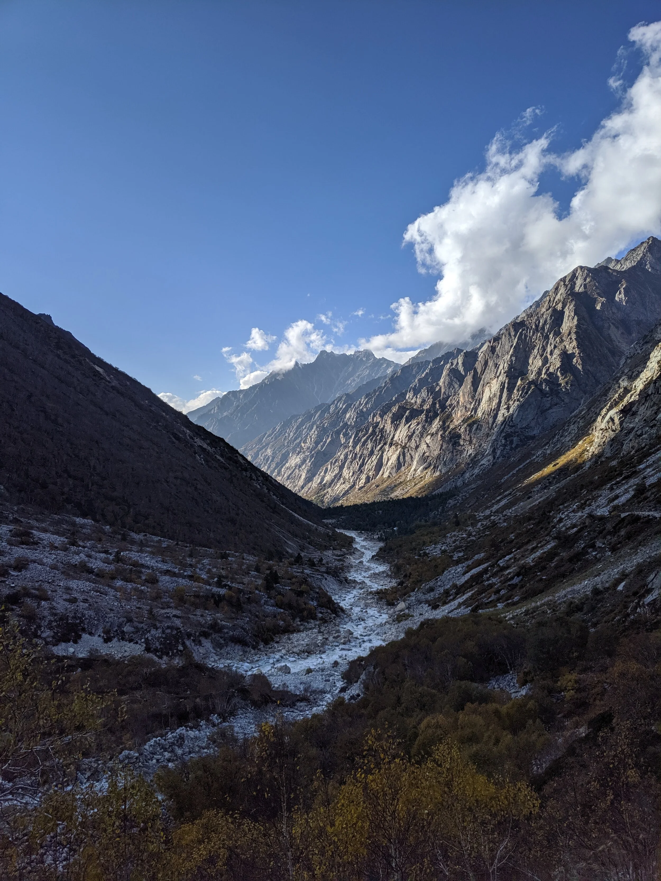
If you follow the Indus River in the Map you would see that after the point of origin the Main Waterparting of the Rivers runs behind the Main Himalayan Range rather than along the Main Ridge as classically should be the case. However at the point roughly at where it enters Ladakh from the Tibetan Plateau the River aligns itself with the Main Himalayan Range and continues the same course all the way to the Nanga Parbat where the Great Himalayan Range ends. The Water Parting however moves North towards the Karakorams and even across the Karakorams as seen in zone H. Close to the K2 however the Water Parting again moves along the main Himalayan Ridge line. But then after following the Main Ridge line of the Karakoram to West it again goes beyond the Karakorams as seen in zone C. It continues this trend until its behind the main Ridgeline of the Hindu Kush till at a point beyond the Tirich Mir it again aligns with the Main Ridge line to deviate again to form Zone B all the way to the Helmand Basin.
In pretty much the same way the Water Parting of the Tarim Basin also jumps beyond the Kun Lun, the Pamirs and the Tian Shans at places but it doesn't jump the main Ridge Line of the Karakorams as the reigning Peak of the K2 brings in a semblance of order and the Water Partings follow the K2 in the classical mode (I know this is complicated but once you co-relate with the Map and do some readings it will become more fascinating). Interestingly in the Hindu Kush its the highest Peak of the Hindu Kush the Tirich Mir which forces the Water Parting to run along the main Ridge line just like its supposed to be classically. However a point to be noted is that the Indus never concedes any of its “Mountains” the Western Himalayas or the Karakorams or the Hindu Kush to any River though itself it pushes its Basinal boundaries to well into the Kun Luns, the Pamirs and the Tian Shans though not quite making it to the main Ridge line.
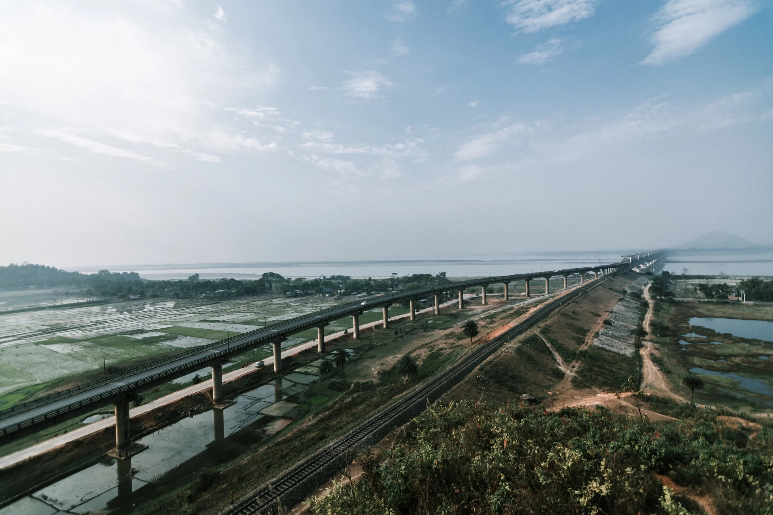
And of course as we all the Mountains are rising and the Rivers are just cutting the Gorges and the Valleys and this state of flux will continue over a period of time till the end of time. And because of this constant change the Water Partings are not as fixed or permanent as we would like to believe. They are also constantly changing and evolving in a Geological time frame. This also shows how the Rivers and the Basind connect these highest Mountains in the World in a closer relationship than we actually believe. The River and the Basins provide the linkages which connect the Himalayas with the Karakorams, the Hindu Kush, the Kun Lun, the Pamirs and the Tian Shans. I collectively like to use the term “Himalayas” when talking about all these Ranges and the Great Himalayan Range when I am referring to the Main Himalaya Range. The highest Range on the Planet.
May we one day get to behold the magnificent sights that these Mountains hold and their mighty Peaks. And may we one day get to drink water from all these Rivers. The transition zones between these Himalayas is probably even today one of the least explored in the World and they continue to hold their Mysteries, occasionally revealing them to us mere Mortals.
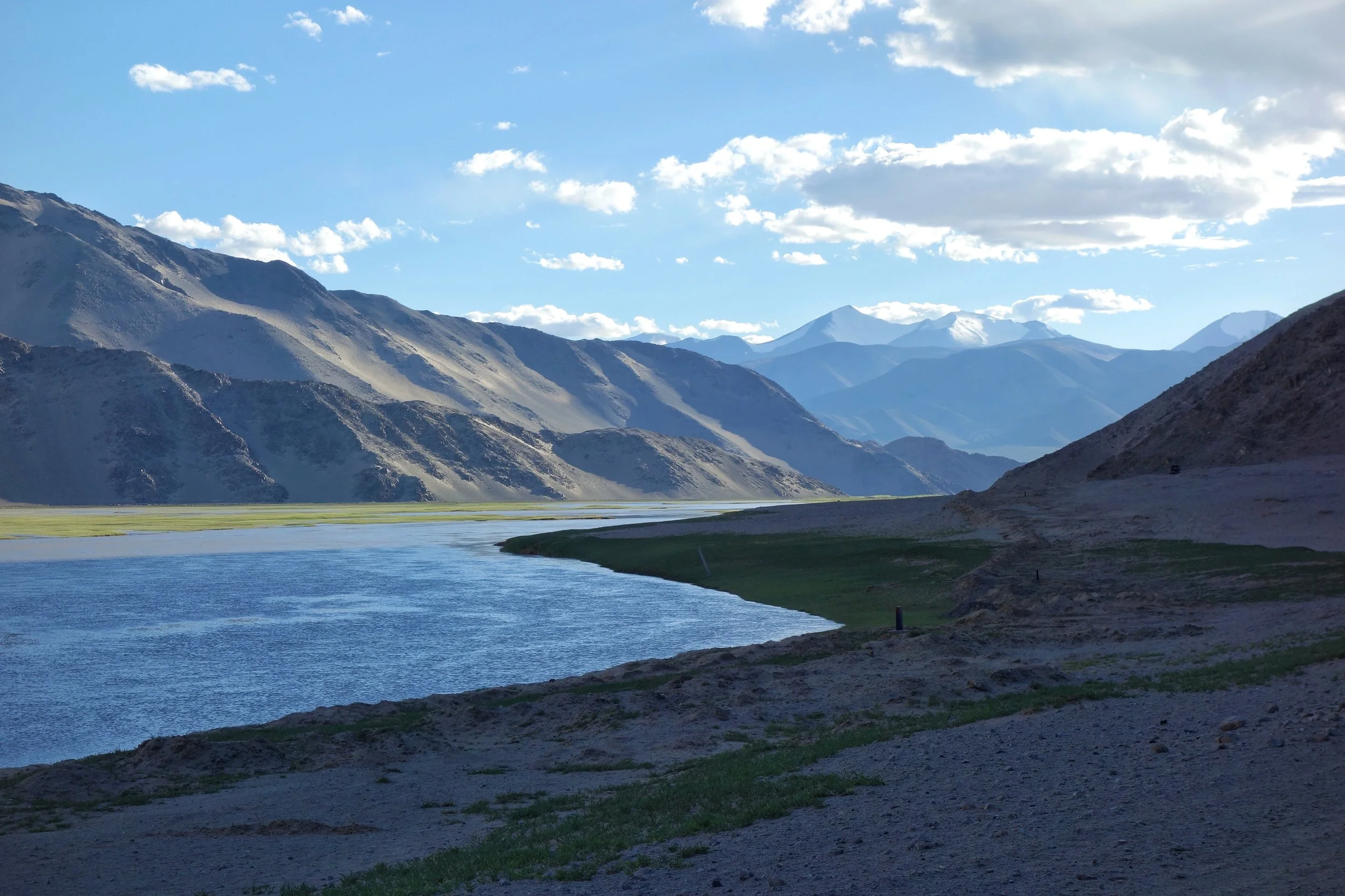
Of the Himalayan Mountains and Rivers
The Rivers and the Himalayas and the even the Mountain Ranges beyond it are always interacting in very interesting ways. In this article we see how the River Basins of the Indus, Ganges and Satluj and the Mountains interact and in some cases the River Basins extend beyond the Ranges themselves.

Of the Mountains and the Rivers
One of the most interesting thing about the Himalayas is how the Rivers interact with the Range and how the River Basins work. Since none of us is taught this in school in the Geography class the way one can study this fascinating aspect is to study Maps. Not the Maps of the new but the old Maps made by the Geological Surveys and the Royal Geographic Society Maps. The kind of detailing in these Maps is amazing when we keep in mind the fact that it was all done by boots on the Ground. No Aerial or Satellite Cartography.
And I finally found a Map which shows the River Basins / the Mountains / the Ridgelines / the Water Partings in a very simple and lucid fashion. Of course there are some explanations required for the un-initiated in the fine art of reading Maps. Not only does it show the Water Basins in the Himalayan context but it also shows the neighbouring River basins and how the Mountains affect the Course of the Rivers. You also need to understand that its this conflict between the Rivers and Mountains which has created the Valleys which has enabled Human communities to inhabit the Mountains.
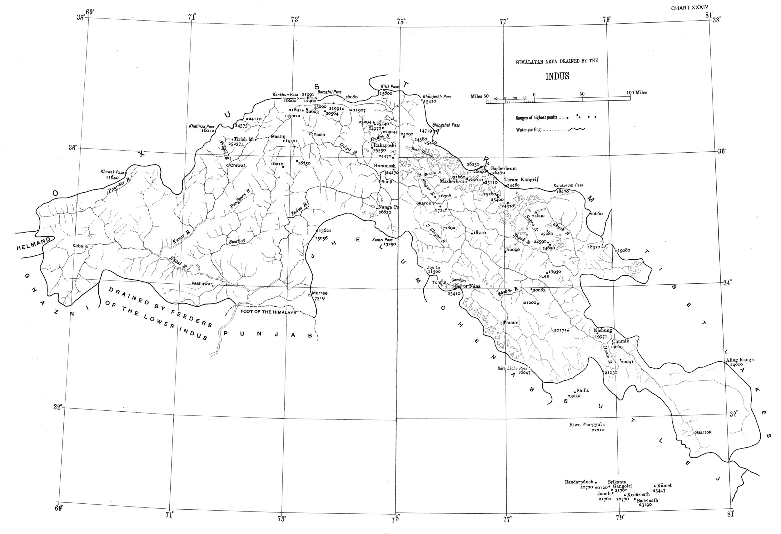
In the Himalayan context the Three main Rivers which drain the Himalayas are the Indus in the West, the Ganges in the Middle and the Brahmaputra in the East. It is common knowledge that the Indus and the Brahmaputra which rise from almost the same vicinity of each other near the Mansarovar Lake in the Tibetan Plateau hem in the Great Himalayan Range from the opposite sides. The Indus forms the boundary on the West as it passes by the Nanga Parbat and the Brahmaputra forms the boundary on the East and it rounds off the Namcha Barwa in the East. The Indus and the Brahmaputra both never breach the Main Himalayan Ridgeline and run alongside but behind the Main Himalayan Ridgeline on the Tibetan Plateau. Both flow along what Geologists call the Indus Tsangpo Suture or divide in simpler terms. I would also like to mention one major River which actually cuts through the main Himalayan Ridge line and forms the Eastern boundary of the Western Himalayas. This would be the Satluj which coincidentally also originates around the same area as the Indus and the Brahmaputra (which is called Tsangpo in Tibet) and follows an independent course cutting through the Himalayas though it finally ends up in the Indus once it reaches the Great Plains of the Punjab.
Beyond the Basins of the Himalayan Rivers we have in the neighbourhood the Tibetan Basin though a part of the Tibetan Plateau is drained by these Himalayan Rivers themselves. Further North the main Ridge line of the Karakorams forms the Water Parting between the Himalayan Rivers (the Indus system) and the Tarim Basin. The Tarim Basin is itself separated from the Tibetan Basin by the Kunlun Mountains. To the West of the Tarim Basin separated by the Pamirs in the South and the Tian Shan in the North is the Central Asian basin of the Oxus and Jaxartes of the old. The names Oxus and Jaxartes were enough in the old times to induce Explorers to go into a frenzy so inaccessible these areas were. However nowadays the Oxus and Jaxartes are better known by their present names, the Amur Darya and the Syr Darya. On the southern Edge the Oxus and Jaxartes Basin is separated from the Himalayan River Basin by the Hindu Kush. Further down the sub Ranges of the Hindu Kush like the Sulaiman Mountains divides the Himalayan River Basin from the Helmand River Basin. This rounds off the Water Partings of the Indus in the Western Himalayas.
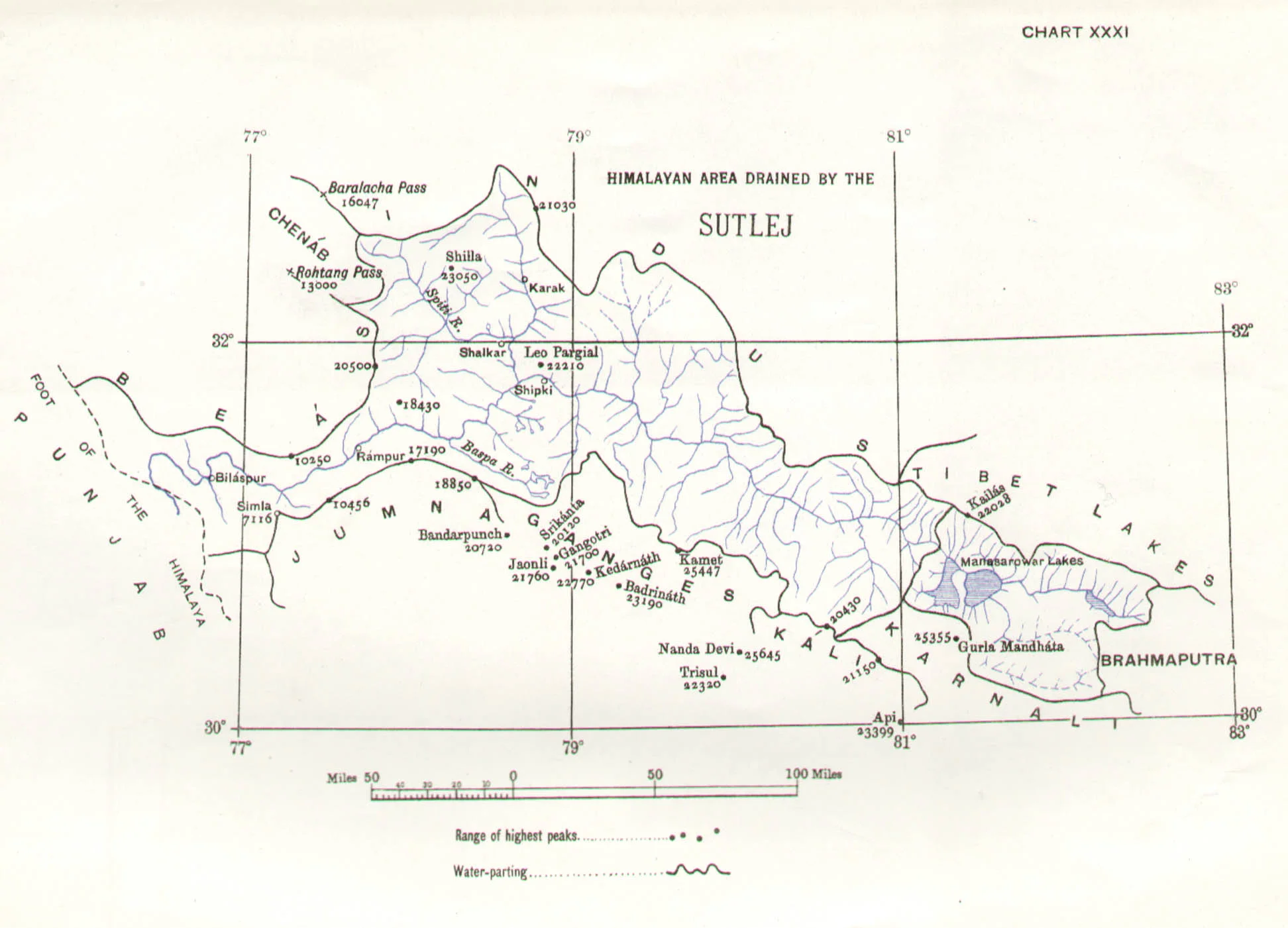
If you follow the Indus River in the Map you would see that after the point of origin the Main Waterparting of the Rivers runs behind the Main Himalayan Range rather than along the Main Ridge as classically should be the case. However at the point roughly at where it enters Ladakh from the Tibetan Plateau the River aligns itself with the Main Himalayan Range and continues the same course all the way to the Nanga Parbat where the Great Himalayan Range ends. The Water Parting however moves North towards the Karakorams and even across the Karakorams as seen in zone H. Close to the K2 however the Water Parting again moves along the main Himalayan Ridge line. But then after following the Main Ridge line of the Karakoram to West it again goes beyond the Karakorams as seen in zone C. It continues this trend until its behind the main Ridgeline of the Hindu Kush till at a point beyond the Tirich Mir it again aligns with the Main Ridge line to deviate again to form Zone B all the way to the Helmand Basin.
In pretty much the same way the Water Parting of the Tarim Basin also jumps beyond the Kun Lun, the Pamirs and the Tian Shans at places but it doesn't jump the main Ridge Line of the Karakorams as the reigning Peak of the K2 brings in a semblance of order and the Water Partings follow the K2 in the classical mode (I know this is complicated but once you co-relate with the Map and do some readings it will become more fascinating). Interestingly in the Hindu Kush its the highest Peak of the Hindu Kush the Tirich Mir which forces the Water Parting to run along the main Ridge line just like its supposed to be classically. However a point to be noted is that the Indus never concedes any of its “Mountains” the Western Himalayas or the Karakorams or the Hindu Kush to any River though itself it pushes its Basinal boundaries to well into the Kun Luns, the Pamirs and the Tian Shans though not quite making it to the main Ridge line.
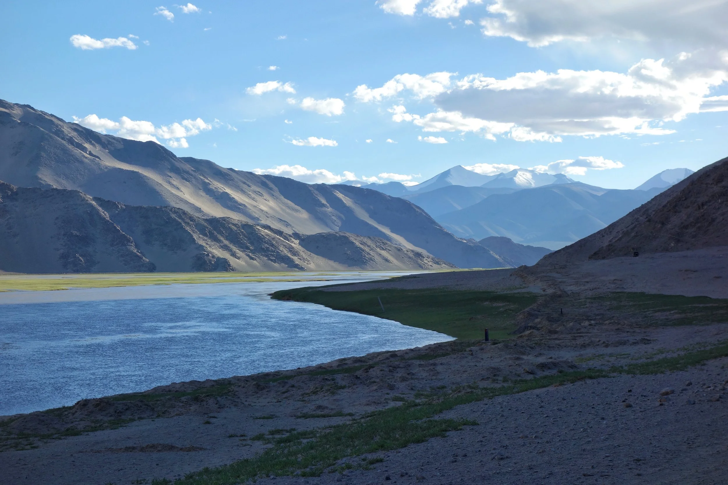
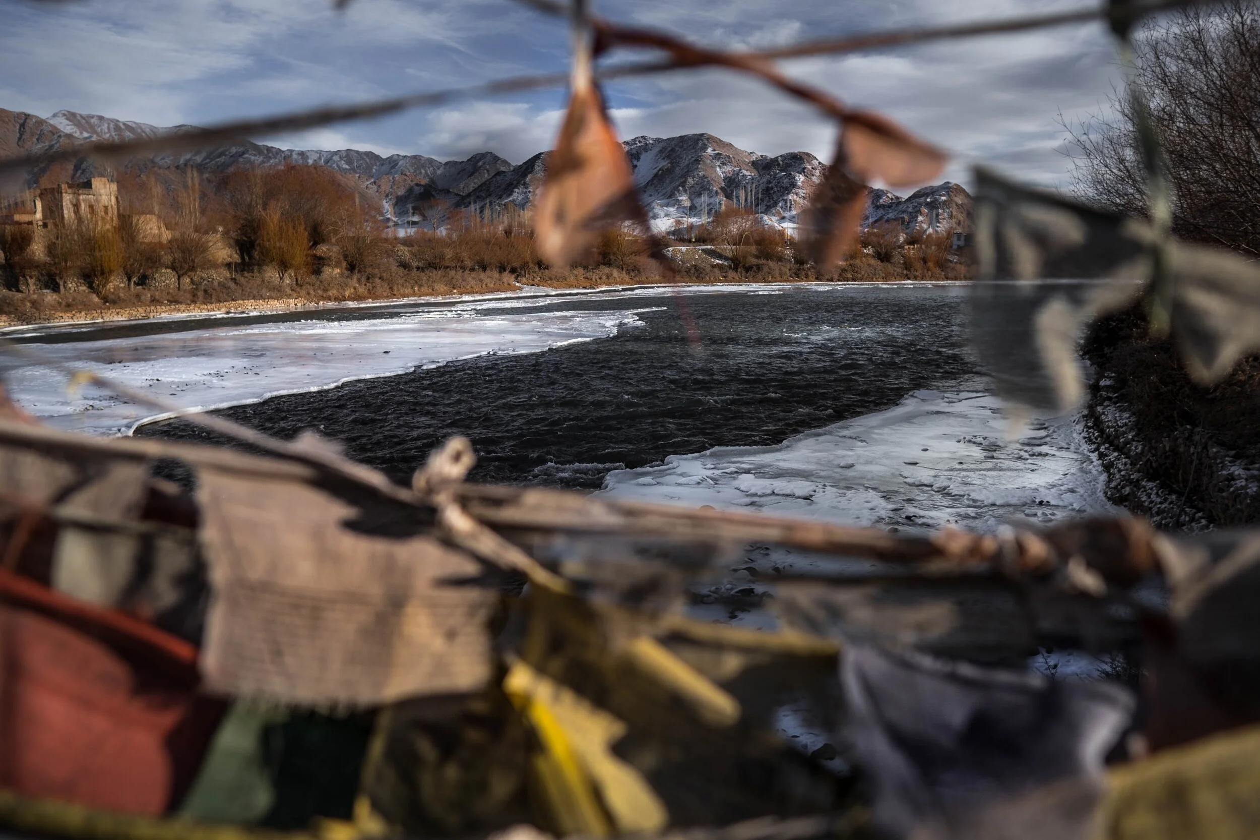
The Indus after it enters Ladakh from Tibet on the Chnagthang
And of course as we all the Mountains are rising and the Rivers are just cutting the Gorges and the Valleys and this state of flux will continue over a period of time till the end of time. And because of this constant change the Water Partings are not as fixed or permanent as we would like to believe. They are also constantly changing and evolving in a Geological time frame. This also shows how the Rivers and the Basind connect these highest Mountains in the World in a closer relationship than we actually believe. The River and the Basins provide the linkages which connect the Himalayas with the Karakorams, the Hindu Kush, the Kun Lun, the Pamirs and the Tian Shans. I collectively like to use the term “Himalayas” when talking about all these Ranges and the Great Himalayan Range when I am referring to the Main Himalaya Range. The highest Range on the Planet.
May we one day get to behold the magnificent sights that these Mountains hold and their mighty Peaks. And may we one day get to drink water from all these Rivers. The transition zones between these Himalayas is probably even today one of the most least explored in the World and they continue to hold their Mysteries, occasionally revealing them to us mere Mortals.

Humans of the Himalayas : The Wakhi People
Living literally on the Roof of the World or the Bam-I-Duniya are the Wakhi people, who predominantly live in the Wakhan Corridor, the narrow strip of Afghan territory that traditionally separated the British Empire from Tsarist Russia in days of the old. Also called the Khik at present they live in the Wakhan of today's Badakhshan region located in northeastern Afghanistan and southeastern Tajikistan.
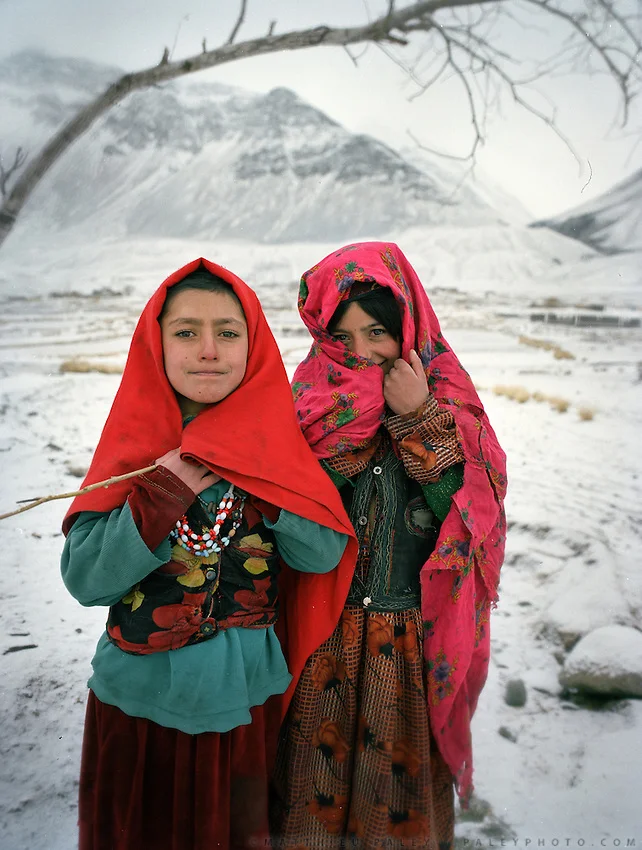
Wakhi Girls
Humans of the Himalayas : The Wakhis
Living literally on the Roof of the World or the Bam-I-Duniya are the Wakhi people, who predominantly live in the Wakhan Corridor, the narrow strip of Afghan territory that traditionally separated the British Empire from Tsarist Russia in days of the old. Also called the Khik at present they live in the Wakhan of today's Badakhshan region located in northeastern Afghanistan and southeastern Tajikistan.

Traditional Wakhi Women
The Wakhan sits at the junction of three major mountain ranges, the Hindu Kush, the Himalaya/ Karakoram, and the Pamirs – what is called the Pamir Knot. The valley is carved by the Wakhan River, fed by glacial meltwater from the surrounding mountains. From the town of Ishkashim, at 2,700 meters above sea level, the valley climbs steadily eastward, eventually reaching high altitude pasture land, above 4,000 meters, along the border with China. Due to its dramatic isolation the Wakhan corridor has been spared of the war in Afghanistan and has been mostly spared of the depredations of the war. But region still exists in a time warp due to the same isolation.

A Wakhi Family
The Wakhi are a Persian people as such of Tajik ancestry. The Wakhi speak the Wakhi language, which is a Indo-European language of the Iranian branch of the language family, distantly related to Persian Tajiks, and are Ismailis, a progressive branch of Shia Islam that eschews many conventional Muslim practices. They do not fast during Ramadan, for example, which is uncommon elsewhere in Afghanistan. The Wakhi practice combined mountain agriculture, growing wheat, barley, potatoes, beans, and peas in the valley, and herding their yak, sheep, and goat to high-altitude pastures above 4,000 meters during the summer. Their homes are made of stone and mud-plastered walls that are scattered around the valley floor around irrigated mountain oases. Those Wakhi that bring their animals to the high pastures live in nomadic yak-fur tents during the summer.
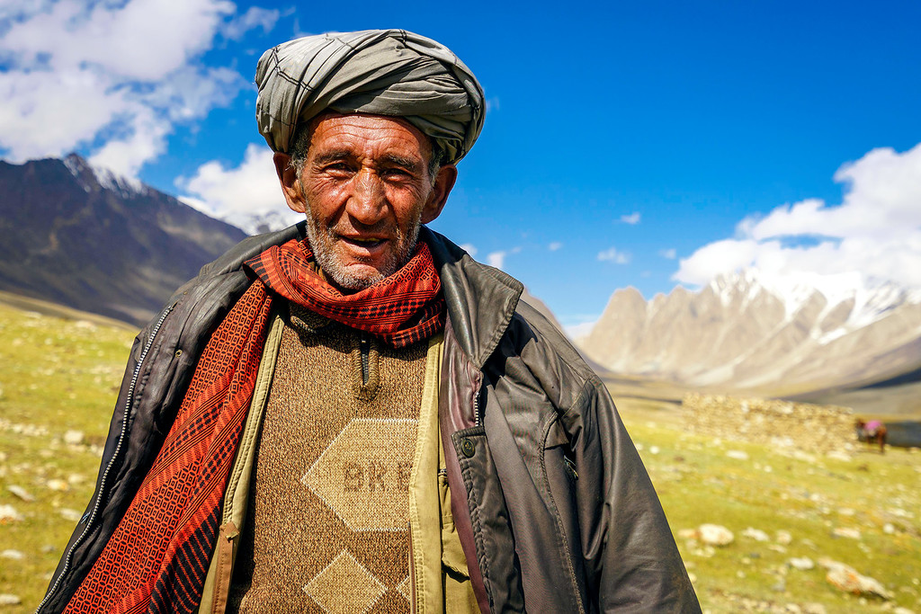
A Wakhi Chief
The Wakhi language belongs to the southern group of the Pamir languages, in the Iranian group of the Indo-European family of languages, where the different Ishkashmi and Wakhi languages are included. The Wakhi language, rich in archaisms, differs considerably from the Pamir languages, and generally from the southeastern group of Iranian languages, having certain common characteristics with the Indian languages. Although divided by borders, the Wakhi language is still very much the same, and dialectal differences are not great.
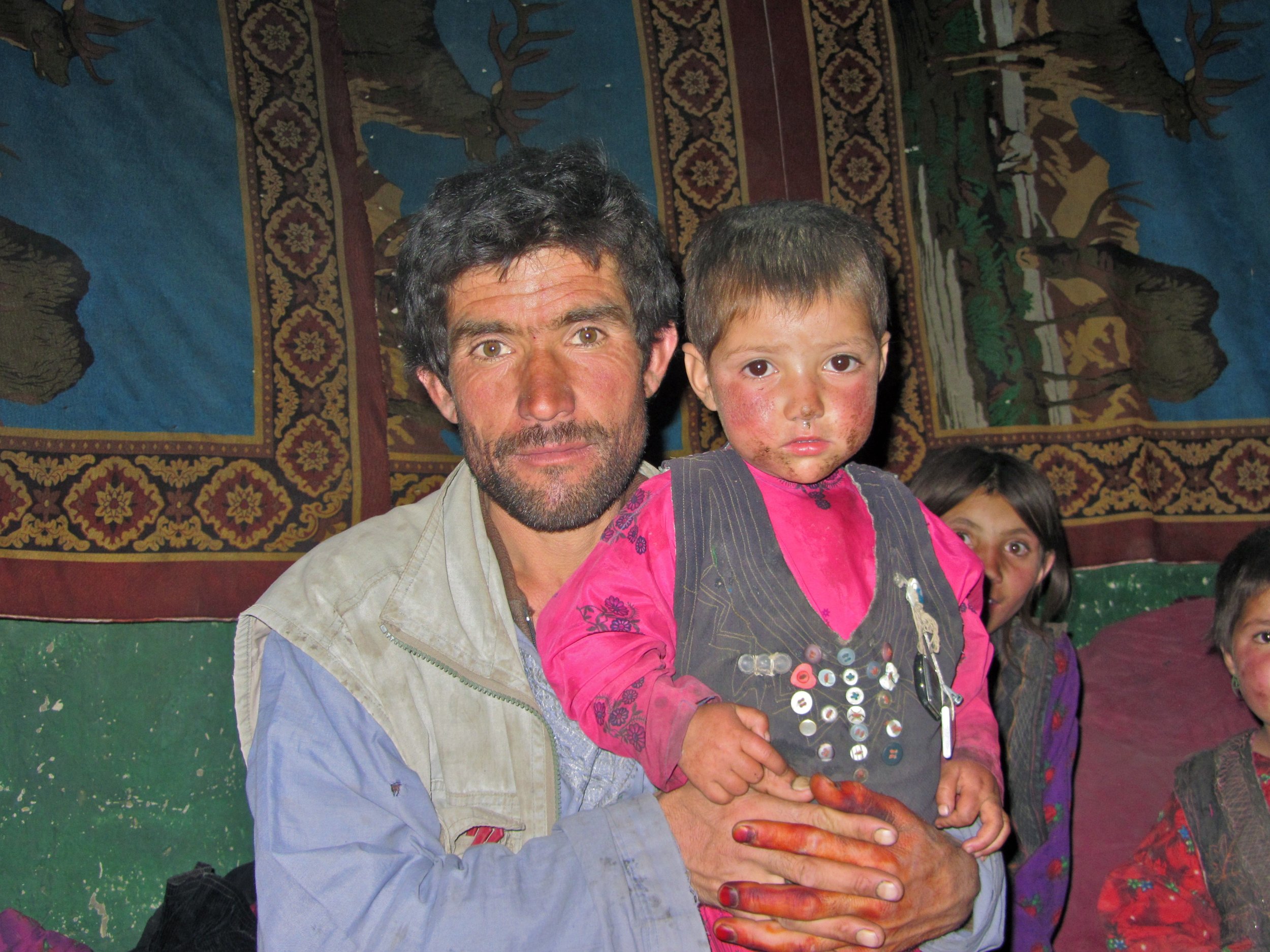
A Wakhi Father and son
The language of mutual communication, and the written language, for the Ismaelites of the small nations of Pamir has been the Tajik language. The Wakhi oral tradition is also bilingual (Wakhi and Tajik). On the Upper Wakhandarya, there are noticeable Turkic influences in place-names. Wakhi-Kirgiz contacts are maintained even today. Many Wakhs also speak the Shugni language. The Wakhi folksong bul’bulik is principally a women’s song, it is sung on the summer pastures. Before the establishment of the Soviet regime, the Wakhs were almost totally illiterate. Nowadays, schooling is obligatory for everyone. The language for schooling is, without exception, Tadzhik, which places Wakhi in a passive role and accelerates the disintegration of the language. In domestic situation, however, Wakhi is still preferred, whatever the subject, although most Wakhs speak Tadzhik quite fluently.

A Group of Wakhi Men
Besides the Wakhan Corridor there are smaller pockets of Wakhis who inhabit the higher reaches of the Hunza Valley in Gilgit Baltistan, Chiral in Khyber Pakhtunkhwa, in Tajikistan across the Pamirs, southern Xinijiang in China, some in Russia and even a few odd Wakhi villages in Turkey. As per the present estimate the total number of Wakhi people would be around 70,000 to 100,000.
In China along with the Sarikoli people the Wakhi are termed as the “Tajik” minority. In Afghanistan, they are officially called "Pamiris". In Tajikistan, the Wakhi are recognized by the state as "Tajiks", but they still self-identify as "Pamiris". In Pakistan, they refer to themselves as "Pamiris" or "Gujali".

Wakhi Old Women
When the Persians and Tartars subjugated the areas north of the Hindukush in the 12th century the southern valleys of the Hindukush gained a distinct identity under different names as Bolor, Dardistan, Tibet Gujal, Kashkar etc who were divided by the chains of mountains however the Ghalcha and Dard people living on the northern and southern side of the Hindukush have been close to each other despite the natural hurdle of the mountain chains.
Trade caravans and pilgrims from eastern Turkistan used to cross over the Kurambar Boroghil and Darwaza passes into Chitral and this caravan route served as a permanent link between these regions. Many people from Chitral crossed into Wakhan for permanent settlement. The Wakhi herdsmen usually came with their flocks to the Boroghil for summer camps. Wakhi horsemen used to visit for Polo and Buzkashi as far south as Razdan field in Torikho valley.The Wakhi art, craft and architecture occupy a distinct place in the neighboring area. There are certain festivities which mark particular occasions and vary from valley to valley. The Wakhi are fond of music Daf open drum and flute and Rabab are popularly played. Male members are responsible for farming, weaving woolen clothes. While women look after the house and cattle.

A Map of Wakhan and Pamir country
Compiled from various sources on the Net
All pics from the Net for educational purposes. In case you own the copyright for any of these and you want it removed please message me and i will remove it immediately.
Prior permission has been taken from the Admins (Other) for this series. If you think that you have a story that needs multiple pics and people pics please get in touch with the Admins.
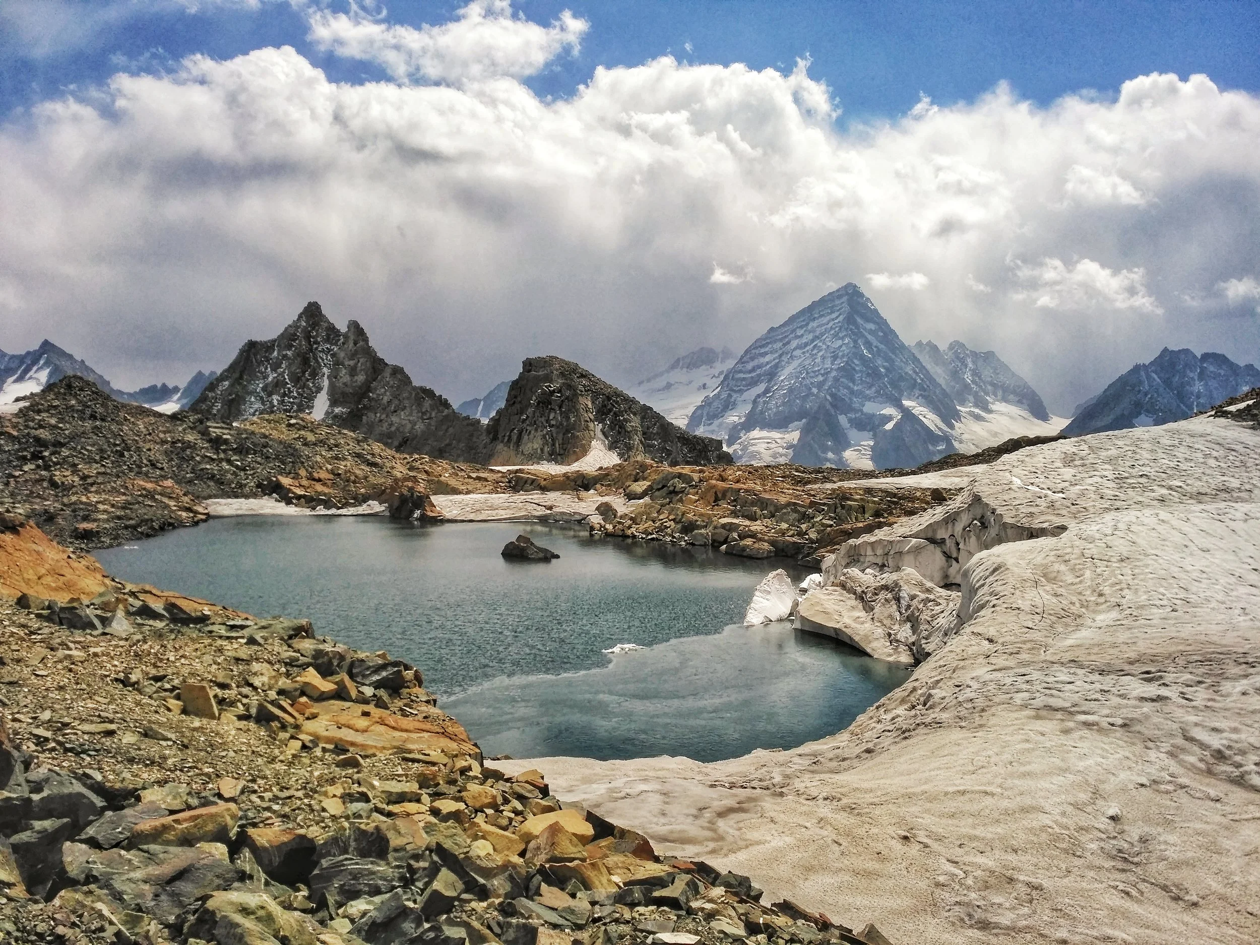
The Great Himalayan Mountain Complex
The Great Mountain Complex of the Himalayas is a vast expanse which includes the highest Peaks on the Planet and stretches all the way from Central Asia to South East Asia. We explain about some of the main Mountain Ranges of this Great Complex.

Dummy’s Guide to the Himalaya
THE GREAT MOUNTAIN COMPLEX OF THE HIMALAYA : The Western/ North Western Flank.
The Himalaya are a part of an extremely complex mountain system which includes the highest peaks on the planet. Created by great Tectonic plate movements millions of years ago, when the Indian plate collided with the Eurasian plate, the Himalaya are still rising. Most of the Ranges I mention below are regarded as separate ranges and are as such but in the broadest sense we have taken all the Mountain Systems between the Indian subcontinent and Central Asia and refer to them as the Himalaya, the name stemming from the Sanskrit words “Him” snow and “Alay” home.

The epicenter of this system lies somewhere in between the wild mountains north of Kashmir and the nodal orogenic uplift known as the Pamir Knot in Tajikistan. From the Pamir Knot rise the great ranges of Central Asia and they meet the Great Himalaya at the epicenter. The Great mountain wilderness north of Kashmir right upto the Pamirs are till today one of the least explored region on the planet. The last great Explorers of this region were mostly Europeans in the pre – Independence era. The physical factors aside, sadly, there are political reasons today which keep a large part of this great mountain wilderness off limits to explorers.
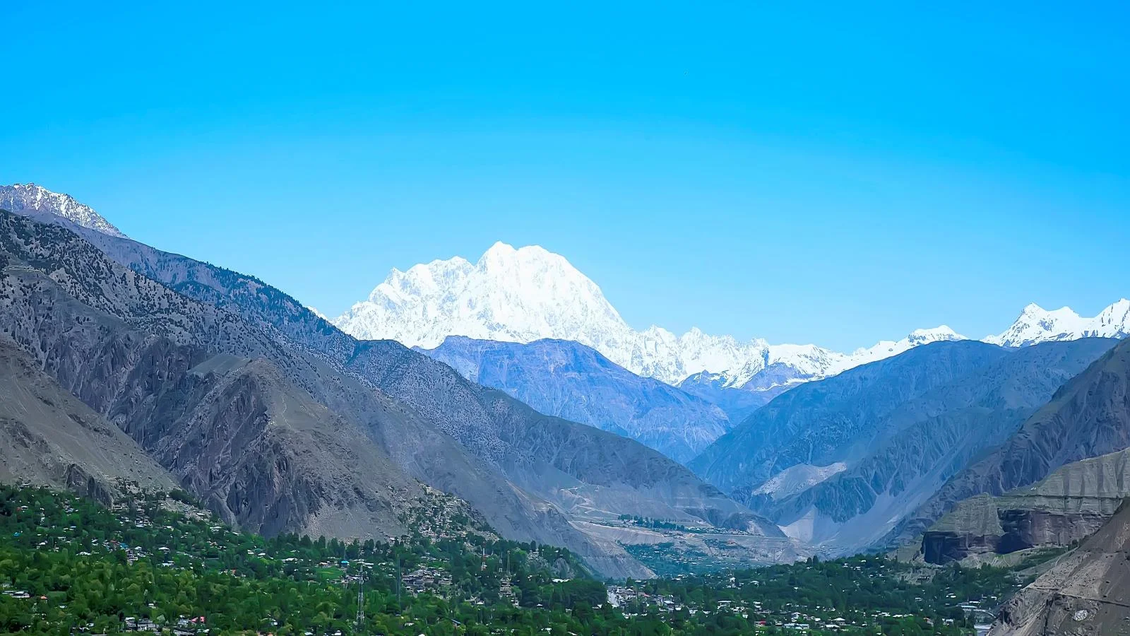
The Tirich Mir (Pic from 99wallpapers.com)
Starting from the West, from the arid hills of Afghanistan comes the Hindu Kush. Its brown treeless slopes rise up and get higher and steeper as the approach the meeting point of the giants. The Hindu Kush still has a hint of Middle Eastern deserts even below the Glaciers of the 7708 m high Tirich Mir. The term Hindu Kush derives from Persian stands for “Hindu Killer” probably in reference to the unknown number of Indian slaves who perished in the cold and snows of these mountains while sold into slavery in the Central Asia.
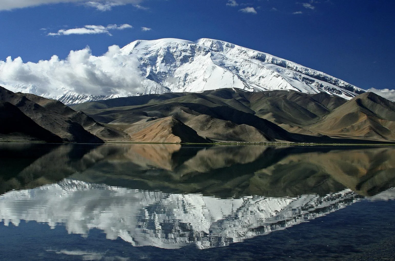
The Mustagh Ata (https://www.summitpost.org/muztagh-ata/151886
To the North of the Hindu Kush lie the rounded domes of the Pamirs. This is still a mysterious and almost polar region of several mountain ranges linked together, and to other ranges, by a north-south range which includes the peak of Muztagh Ata whose name means “The Father of Snowy Mountains” standing at 7509 m. The Arabs used to refer to the Pamirs as the “Bam i Duniya” or the Roof of the World. The name Pamirs comes from the Persian reference to these mountains.

The Kunlun Shan (https://www.summitpost.org/kunlun-shan/171011
Moving eastwards of the Pamirs we have the Kun Lun. It rises over the Tarim Basin in the Takla Makan desert and rise up as it moves towards the epi center. The highest peak of the Kun Lun is the Luishi Shan standing at 7167m. Overlooking the great Silk Route of Cathay they have always been historically regarded as the southern frontier of the Chinese empire. The Kun Lun were named after a semi-mythical reference in classical Chinese texts to the source of the Yellow River.

Where all these ranges meet lies the Karakoram. Mightiest of all these ranges, they radiate from an amphitheater of peaks called Concordia which holds three of the worlds highest peaks in the world. The Karakoram is a perpendicular wilderness where only mountaineers can venture. Glaciers thirty miles long and a quarter mile deep lie in the valleys. These Glaciers here are the largest that can be found outside of the Polar regions. The highest peak of the Karakoram if of course the K2 standing at 8611 m. The name Karakoram comes from the Turkic term “Black Gravel”, Kara being the Turkic term for “Black” very similar to the Hindi “Kala”.
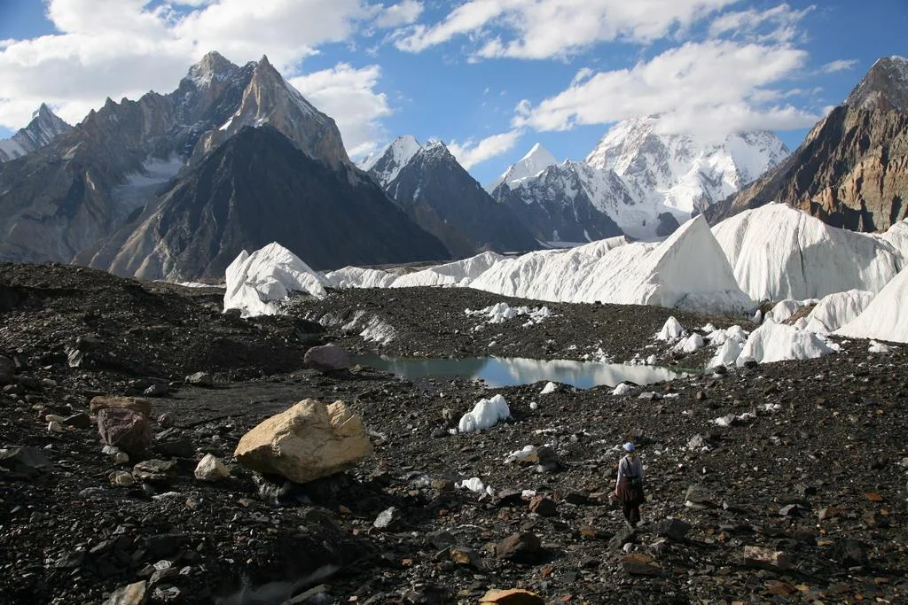
Concordia in the Karakorams (https://www.summitpost.org/concordia-the-amphitheatre-of-ten-of-the-world-s-thirty-greatest-mountains/534309
South of the Karakoram is the Ladakh Range which is considered a sub-range of the Karakoram itself as per Encyclopedia Brittanica though some consider it a part of the Great Himalaya. South of this Range is the Zanskar Range, which is a sub-range of the Great Himalaya, which seperates the Ladakh region from Kashmir and Jammu regions.

Joining from south west in the Mother Range the Great Himalaya, culminating in its giant sweep from across Nepal at the formidable Nanga Parbat standing at an imposing 8126 m. What makes this mountain so formidable is that it rises vertically from around the base of the Indus to its imposing height. This is same sweep of the most formidable mountains on the planet which includes the highest peak on the planet Mt. Everest. The Great Himalaya range stretches from the Nanga Parbat in the North West to the Namche Barwa in the East.The range varies in width from 400 kilometres (250 mi) in the west to 150 kilometres (93 mi) in the east.
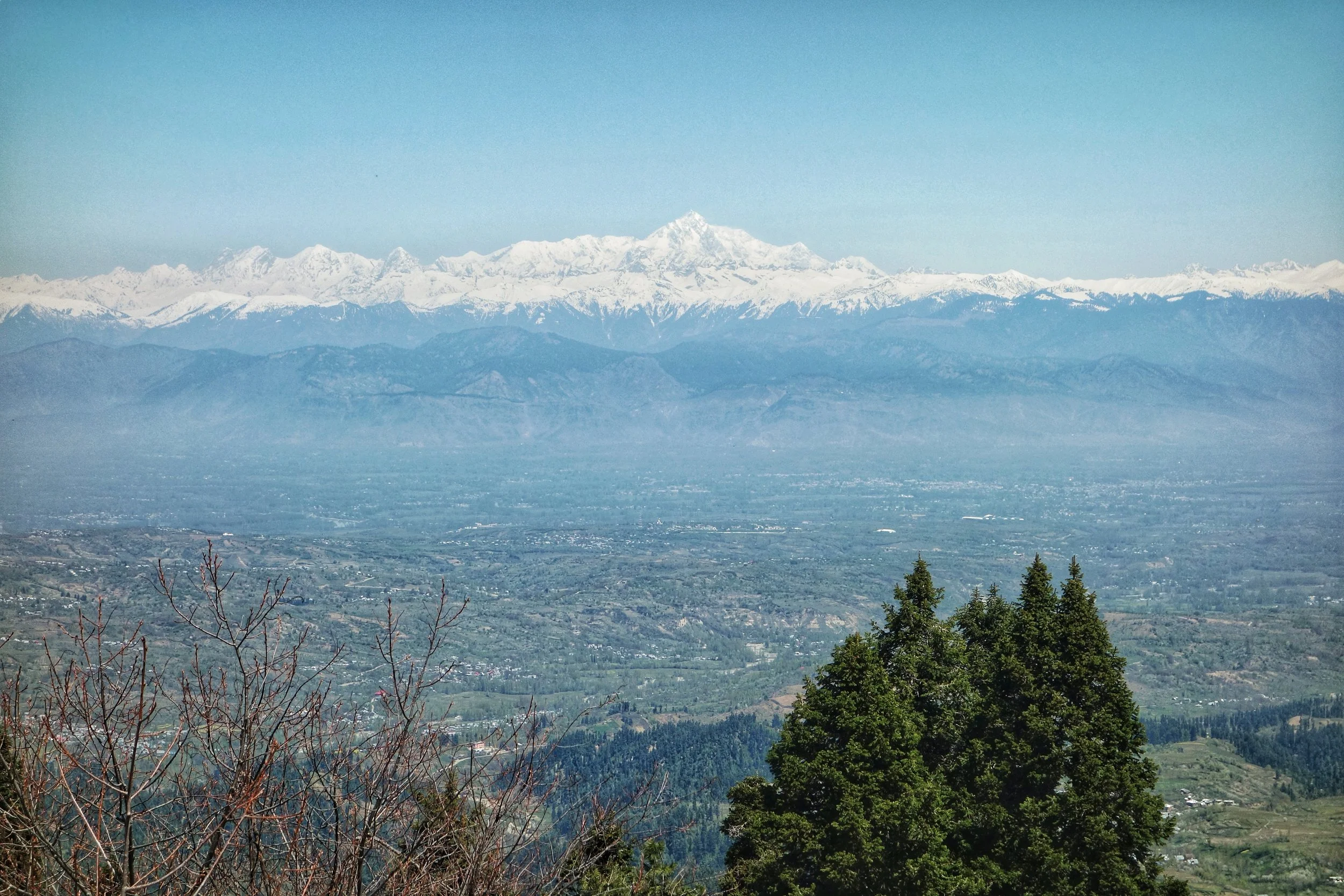
Nanga Parbat
Moving southwards we have the Pir Panjals which though considered a part of the Greater Himalaya, are as noble as a range can be and in another part of the world would have been a seperate Range itself. Though not high as per Himalayan standards it is the first snowcovered peaks tha you encounter moving up from Northern India. Compared to the barren mountains that lie north of it the Pir Panjals are all green and bountiful. The Pir Panjal gets more snow than anywhere in the Western Himalaya. The Pir Panjal gets its name from the Pir Panjal Pass, which was named according to one theory after “Five” “Panj” and “Saints” “Pir” or five pious brothers who lived around there. Another theory alludes the name to the Kashmiri word for a Pass “Pansal” and “Saint” “Pir”, a saint whose grave was supposed to be on this Pass.
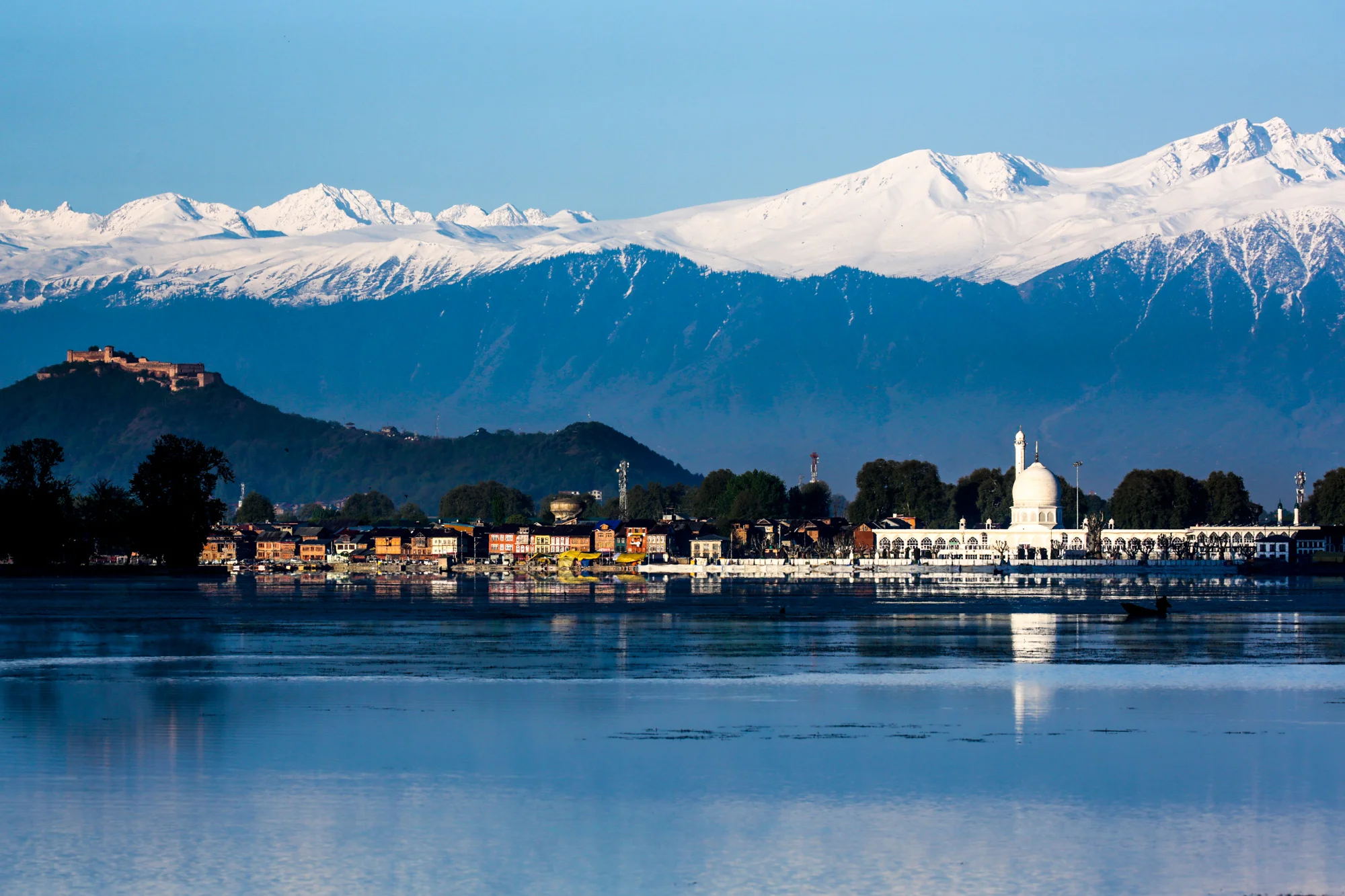
The Pir Panjals over the Kashmir Valley
South of the Pir Panjal we have the Dhauladhar Range though some consider the Dhauladhar to be a part of the Pir Panjal itself. The Dhaula Dhar is also reffered to as the Lesser Himalaya.
Finally the these Ranges give way to the gentle Sivalik Hills which finally merge into the Great Indian plains.
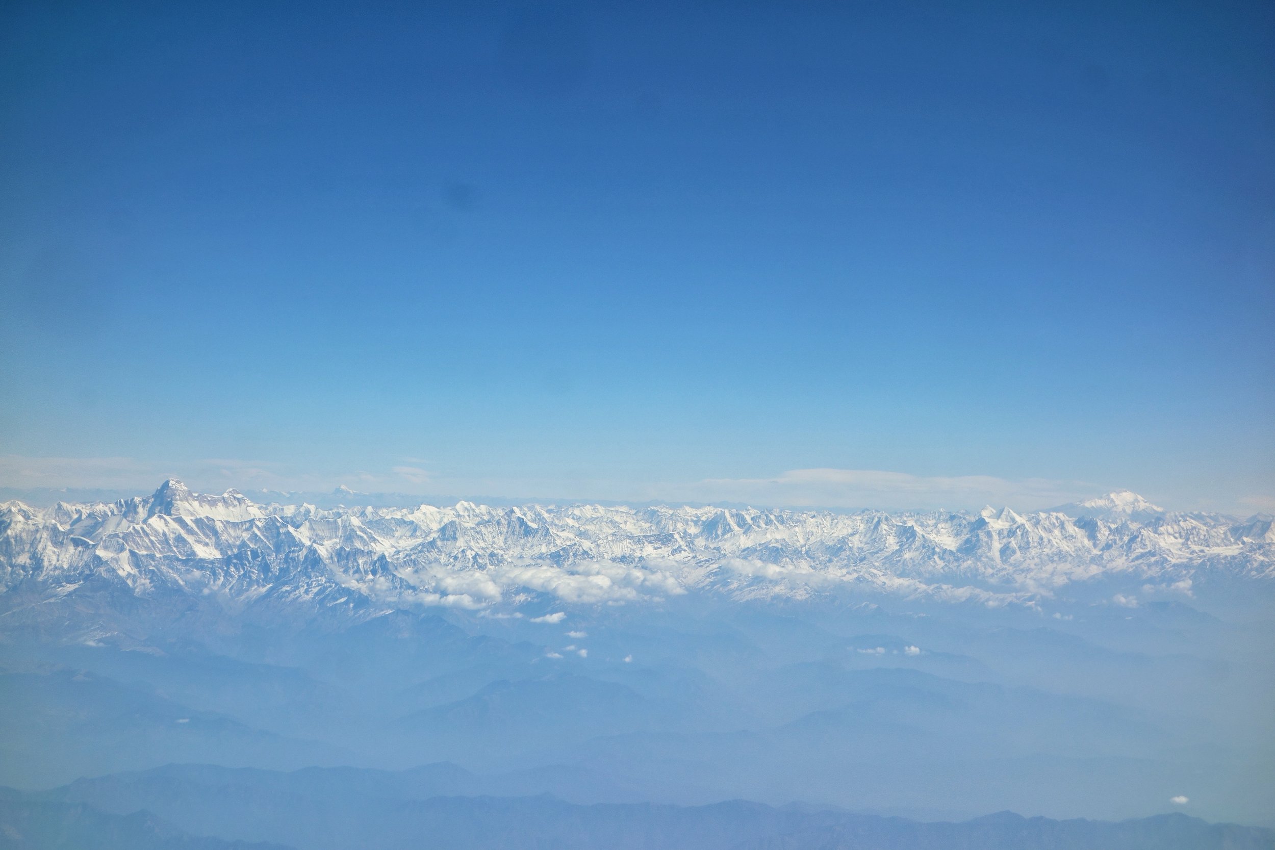
The Holy Mountains of the Himalayas : The Nanda Devi and the Kaliash Parbat
Major Inputs and extracts from the John Keay Classic : Where Mountains and Men Meet
PHOTO (Map) : A classical map of the Western Himalaya without national boundaries. Sourced from John Keays : Where Mountains and Men Meet :
NOTE : As mentioned before all scholars do not agree on the classification of these Ranges/ sub-Ranges. However a majority of them would agree on what I state above. The above article has been compiled from various sources.
Kiki’s Blog
Stories from the Himalayas








Five years ago the Galwan Valley was in the News for the wrong reasons after a deadly clash between the Indian and Chinese Armies in the Valley located in Ladakh lead to many deaths on the contentious Border between the two countries in wake of continued Chinese intrusions into Indian territory.
This area along the Shyok River, of which the Galwan Nallah or the Galwan River which forms the Galwan Valley has been off limits to Civilians since long but now the Indian Government has decided to open up the area for Civilians and we were amongst the First Civilians to venture into this beautifully desolate part of the Eastern Karakorams in Ladakh. Earlier Civilians could only venture upto the Village of Shyok from where the Shyok River takes a U turn and flows in a Northerly direction.