The Great Game on the Roof of the World
A Popular cartoom based on the Great Game published in 1878
The Great Game was a Political and Military game of intrigue and one upmanship played between the two Greatest Empires of that time, the British Empire and the Tsarist Russian Empire that was played in the most of the Nineteenth Century. At stake for the British was the Jewel in the Crown, the Indian sub-continent while for the Tsarist Russia it was their Empire in Central Asia. Both these Empires met somewhere in high Asia in the midst of the Mountains of the Great Himalayan System. Today we are gonna look at exactly where they met in High Asia.
The British had constant nightmares of Cossacks riding over the great Mountains and making a dent in their Indian holdings. The fact that Tsarist Russia overran most of Central Asia during this time and that a body of Cossacks now sat on top of the Wakhan not very far from the Kashmir territories did not make things comfortable for them either. The Great Game was played in a region stretching from Persia to Afghanistan over to India and Tibet and the whole of Central Asia.
A Map on where the Boundaries met in High Asia
There have been many Western Explorers who went on different assignments in these Mountains but one of the key reasons was always to find out more about the Politics and the Geography of the regions which were not under the Control of the Empire. The frontiers of the Punjab Empire of Maharaja Ranjit Singh were a key target as they bordered the wilds of Afghanistan as it slowly gave way to Central Asia. Also of great interest to them were the Routes that were traditionally taken from Kashmir via Ladakh into Central Asia. The Cossacks had a reputation and the British wanted to have the information on all the possible Routes that the Cossacks would take in case they decided to lay their claim on the Jewel in the Crown.
This Map from 1885 really shows how close they were to each other and though most of the issues had been resolved between the British and the Russians, but like all Great Agreements and Pacts between Empires there was some Room left for further conflagurations on the same Boundary issues. The point was that the terrain was itself so inhospitable and few Russians and British had ever been to Ground Zero and all the final decisions were made far away in London and in Moscow. There was just this small matter of the area East of the Lake Victoria (yes there was a Lake Victoria in the Pamirs once upon a time) or as the Zorkhul as its called now.
A Painting of the Lake Zorkhul, 1870
As per the British and Russian agreement of 1885 the boundary matter was settled (almost) from the presumed source of the Oxus or the Amu Darya which was the the Zorkhul or Lake Victoria to the Harirud along the Afghanistan Russia border. For those who have read the works of Early Explorers the source of the Oxus was the greatest mystery of High Asia. And many Westerners disappeared forever looking for the legendary source of the Oxus. And even as of today (2020) the exact source of the Oxus hasnt been defined. Even last year a team from Oxford went looking and defining the Source out of 4 or 5 possible candidates. The question of the source of the Oxus still eludes us to this day and age. Anyways back then the Boundary was defined but the area to the East of the Lake where Russia, Afghanistan, Chinese Turkestan and British Empire actually met were left undefined. Both the Russian and the British were eager not to have a Border in high Asia so the Wakhan was deemed Afghan territory to serve as a no man’s land.
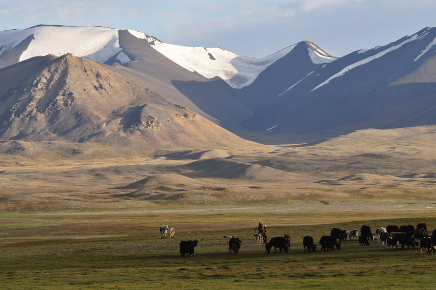
Kirghiz Nomads somewhere in the vicinity of the Lake
However later this area in itself became a matter of dispute and the Russians wanted to be the first in control just like they had done in Panjdeh. And as it would happen just around the same time Sir Francis Younghusband was in high Asia with his party not very far from the Lake. They were at the Bozai Gombaz in the Little Pamir (marked in the Map with a circle) and they were confronted by the Russian party and told they were in Russian territory and told to leave. As it had happened that Younghusband had trespassed into Russian territory before mistakenly (of course) and it turned out that the status of Bozai Gombaz was not defined in the earlier agreements with the Russians. So in order to avoid all further complications another boundary Commission was established and officials from both the British side and the Russian side met and as a consequence of it the border between Afghanistan and Turkestan was settled taking care that the Russian and the British Empire still didnt have a Land Border in High Asia.
Leaving you with a Map which makes the whole Geography more interesting. And some pics from here and there.


