
The Great Game on the Roof of the World
There have been many Western Explorers who went on different assignments in these Mountains but one of the key reasons was always to find out more about the Politics and the Geography of the regions which were not under the Control of the Empire. The frontiers of the Punjab Empire of Maharaja Ranjit Singh were a key target as they bordered the wilds of Afghanistan as it slowly gave way to Central Asia. Also of great interest to them were the Routes that were traditionally taken from Kashmir via Ladakh into Central Asia.

A Popular cartoom based on the Great Game published in 1878
The Great Game was a Political and Military game of intrigue and one upmanship played between the two Greatest Empires of that time, the British Empire and the Tsarist Russian Empire that was played in the most of the Nineteenth Century. At stake for the British was the Jewel in the Crown, the Indian sub-continent while for the Tsarist Russia it was their Empire in Central Asia. Both these Empires met somewhere in high Asia in the midst of the Mountains of the Great Himalayan System. Today we are gonna look at exactly where they met in High Asia.
The British had constant nightmares of Cossacks riding over the great Mountains and making a dent in their Indian holdings. The fact that Tsarist Russia overran most of Central Asia during this time and that a body of Cossacks now sat on top of the Wakhan not very far from the Kashmir territories did not make things comfortable for them either. The Great Game was played in a region stretching from Persia to Afghanistan over to India and Tibet and the whole of Central Asia.

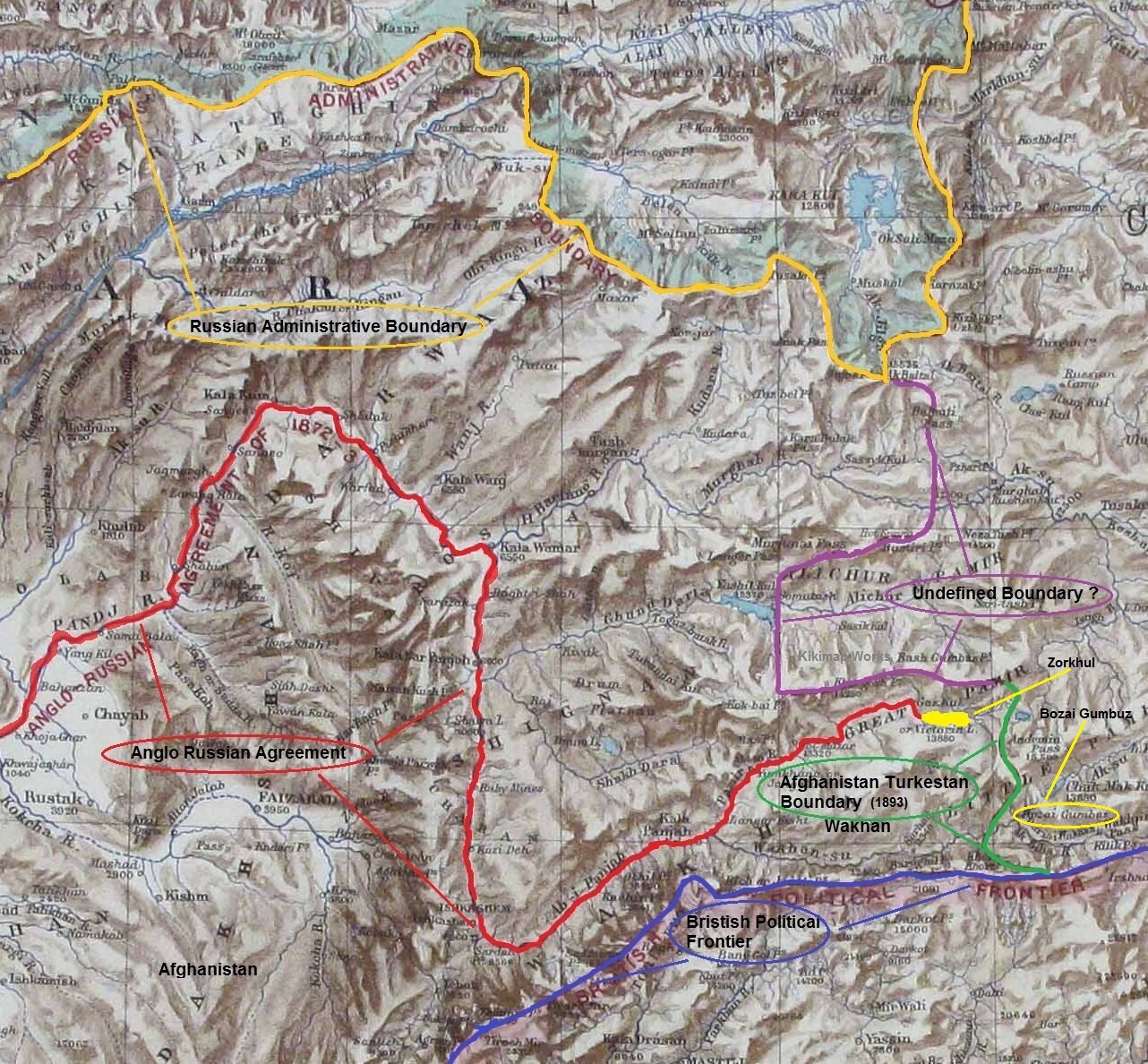
A Map on where the Boundaries met in High Asia
There have been many Western Explorers who went on different assignments in these Mountains but one of the key reasons was always to find out more about the Politics and the Geography of the regions which were not under the Control of the Empire. The frontiers of the Punjab Empire of Maharaja Ranjit Singh were a key target as they bordered the wilds of Afghanistan as it slowly gave way to Central Asia. Also of great interest to them were the Routes that were traditionally taken from Kashmir via Ladakh into Central Asia. The Cossacks had a reputation and the British wanted to have the information on all the possible Routes that the Cossacks would take in case they decided to lay their claim on the Jewel in the Crown.
This Map from 1885 really shows how close they were to each other and though most of the issues had been resolved between the British and the Russians, but like all Great Agreements and Pacts between Empires there was some Room left for further conflagurations on the same Boundary issues. The point was that the terrain was itself so inhospitable and few Russians and British had ever been to Ground Zero and all the final decisions were made far away in London and in Moscow. There was just this small matter of the area East of the Lake Victoria (yes there was a Lake Victoria in the Pamirs once upon a time) or as the Zorkhul as its called now.

A Painting of the Lake Zorkhul, 1870
As per the British and Russian agreement of 1885 the boundary matter was settled (almost) from the presumed source of the Oxus or the Amu Darya which was the the Zorkhul or Lake Victoria to the Harirud along the Afghanistan Russia border. For those who have read the works of Early Explorers the source of the Oxus was the greatest mystery of High Asia. And many Westerners disappeared forever looking for the legendary source of the Oxus. And even as of today (2020) the exact source of the Oxus hasnt been defined. Even last year a team from Oxford went looking and defining the Source out of 4 or 5 possible candidates. The question of the source of the Oxus still eludes us to this day and age. Anyways back then the Boundary was defined but the area to the East of the Lake where Russia, Afghanistan, Chinese Turkestan and British Empire actually met were left undefined. Both the Russian and the British were eager not to have a Border in high Asia so the Wakhan was deemed Afghan territory to serve as a no man’s land.
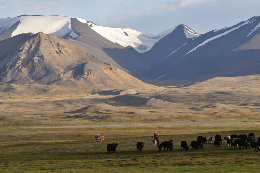
Kirghiz Nomads somewhere in the vicinity of the Lake
However later this area in itself became a matter of dispute and the Russians wanted to be the first in control just like they had done in Panjdeh. And as it would happen just around the same time Sir Francis Younghusband was in high Asia with his party not very far from the Lake. They were at the Bozai Gombaz in the Little Pamir (marked in the Map with a circle) and they were confronted by the Russian party and told they were in Russian territory and told to leave. As it had happened that Younghusband had trespassed into Russian territory before mistakenly (of course) and it turned out that the status of Bozai Gombaz was not defined in the earlier agreements with the Russians. So in order to avoid all further complications another boundary Commission was established and officials from both the British side and the Russian side met and as a consequence of it the border between Afghanistan and Turkestan was settled taking care that the Russian and the British Empire still didnt have a Land Border in High Asia.
Leaving you with a Map which makes the whole Geography more interesting. And some pics from here and there.
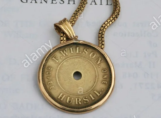
Pahadi Wilson : The English Raja of Harsil
Once upon a time there was an Englishman, called Pahadi Wilson who had crowned himself the Raja of Harsil so much so that he even issued his own currency, his own coin, for use in his own domain. Frederick E Wilson was his real name and his escapades could probably fill in a couple of Volumes. He was a Spy for the British Government and reportedly even had an affair with a Rani Sahib of Tehri it is said. And it is said that a curse was cast upon him and his coming generations by none other that Lord Shiva himself. Even the legendary Rudyard Kipling, who was a friend of his, described him as such, “lived a life that would have been the envy of kings”.

Pahadi Wilson : The English Raja of Harsil
Once upon a time there was an Englishman, called Pahadi Wilson who had crowned himself the Raja of Harsil so much so that he even issued his own currency, his own coin, for use in his own domain. Frederick E Wilson was his real name and his escapades could probably fill in a couple of Volumes. And his notoriety has lived up till the present day as a few years back, Sundar Lal Bahuguna, who started the Chipko Movement blamed Pahadi Wilson for the large scale damage caused to the Environment of Garhwal. He also supposedly was a Spy for the British Government and reportedly even had an affair with a Rani Sahib of Tehri it is said. And it is said that a curse was cast upon him and his coming generations by none other that Lord Shiva himself. Even the legendary Rudyard Kipling, who was a friend of his, described him as such, “lived a life that would have been the envy of kings”.
So who exactly was this Pahadi Wilson or Hyulsen Sahib as his neighbours called him and how exactly did he manage to land himself in the middle of all this action ?

Frederick E Wilson was a Soldier with the British Empire and was stationed in India. In around 1841 in circumstances that are still not very clear he deserted from the Army in Mussoorie. He was a young man of around 24 years age at that time. As per some sources he killed a fellow Soldier in a duel and that caused him to flee. He fled into the Mountains and entered the Kingdom of Tehri Garhwal where he asked the King to grant him some employment. But the King who was an ally of the British, would have nothing to do with him lest his British friends be unhappy to find out that the King was sheltering a fugitive from their Army. Left with no further recourse it is said that Pahadi Wilson went even deeper into the Mountains till he came to the Valley of the Bhagurathi at a place called Harsil and decided to set himself up over there far away from civilization in general and his fellow British in particular.
So there he settled and married a local lady as soon as the local Villagers accepted him into their Society. One would imagine that he acted like some important official and the local Villagers were scared of the Gora Babu and were generally very nice and accommodating with him. All except the Priests of the local Temples who probably thought of him as some kind of Missionary out to convert the people and hence render the powerful priests unemployed. But far from a Missionary Pahadi Wilson had Royal ambitions and wanted to make a lot of Money. Soon he got involved in the lucrative Timber trade in the Region. He also got involved in Trophy Hunting and he was a self taught Botanist and Ornithologist as well. He traded in all kinds of Exotci Wildlife products as well besides the Timber trade. He also introduced Rajma and Apples to the Region and put large tracts of land under cultivation of these Cash crops.

It is said and believed by many that he clandestinely spied on behalf of the British during the First War of Independence in 1857 and at many times supplied very vital information to the British. Through his informal network he not only kept an ear out in the plains but also in the Mountains and beyond and is also said to have played a part in the Great Game. Due to the invaluable service he rendered during the “Mutiny” he was pardoned for his offence of Deserting the Army and could now freely work with the British East India Company.
He convinced (some say coerced) the Raja of granting him the rights to fell Timber in the pristine Forests and it had just happened that the British were laying Railway Lines across the country and there was a great demand for Timber Sleepers of Sal for the Railway tracks. And this was where the Raja struck Gold and made a fortune beyond his wildest imagination. He set up sawmills along the Bhagirathi and vast amounts of Timber were floated down the River towards Haridwar.
Pahadi Wilson was truly a Raja now, and the first thing a Raja does is mint coin in his own name. And that's what Pahadi Wilson did and these are great Collector items today. He built a large Palace out of Deodar in Harsil. He married a couple of times and had numerous affairs. Everything seemed nice and dandy but his growing influence only made the Priests in Gangotri and Mukhba more sceptical of his real intentions.It is said that these than cast a curse on Pahadi Wilson and his coming generations. Of course the reason given for this was that Lord Someshwar had himself cursed him as he had almost completely hunted out all the Wildlife and destroyed all the Forests. As per the curse none of his progeny would live for long and one day his bloodline would disappear and everyone would forget about him.
Pahadi Wilson, in his wealthy prime decided to move out of Harsil to Mussoorie to live among his fellow British gentry as now he was a very well respected part of the Society. With all his wealth, he became one of the biggest landowners in the Mountains. He became friends with eminent people like A O Hume and Rudyard Kipling who’s Novel “The Man Who Would Be King” is said to have been inspired by Pahadi Wilson amongst others. And it was in Mussoorie that Pahadi Wilson passed away in 1883 but not before he witnessed the passing away of 2 of his 3 sons. His only surviving Son went into obscurity and his last known descendant was an Officer (probably a Grandson of his last surviving son) who served in the Indian Air Force but passed away in an Air Crash in 1953. Thus ended the line of Pahadi Wilson.
Maybe it was the curse of Lord Someshwar. The Gods, as it is said, neither forget nor forgive.
The Gilgit Game
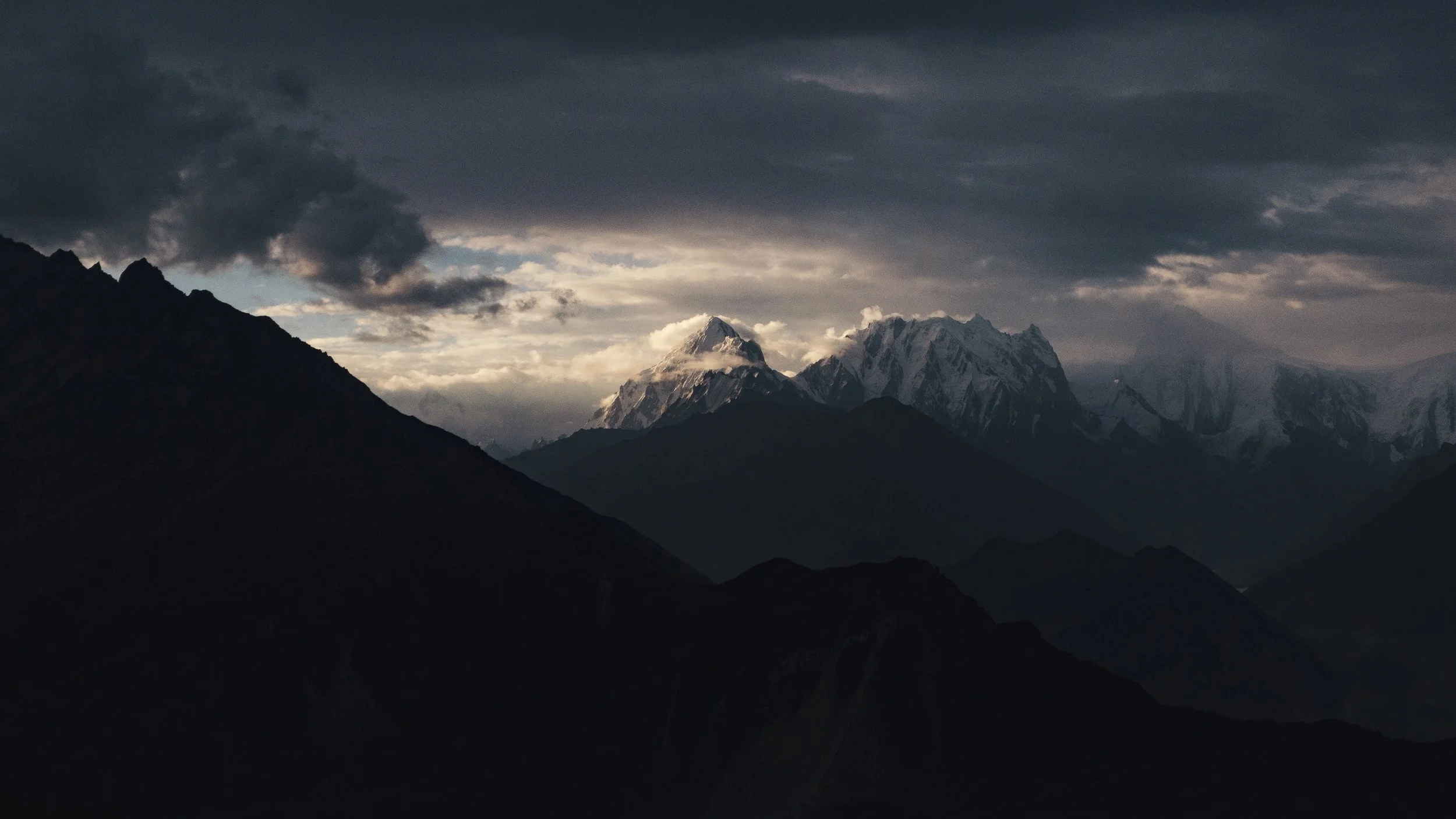
Gilgit, strategically located is a vast valley around the point where the Gilgit and Hunza River meet beyond the Great Himalayan Range .. It was bound from the North on one side by the Karakoram Range and on the Western side by the Hindu Kush. Its location particularly later in history was one of immense importance once the Great Game started between Tsarist Russia and Imperial Britain.

Rakaposhi Peak as seen from the Gilgit Valley. Pic Courtesy Wikipedia
The Gilgit Game
Gilgit used to be a part of the Riyasat E Jammu Kashmir till it was occupied by Pakistan in 1947 and formed what was called the Northern Areas. A few years back it was made a “Province” along with Baltistan and re-named as Gilgit Batistan.
Gilgit lies in a Region which consisted Dardic populations and this was also called Dardistan. As per the Gazetteer of Jammu and Kashmir the district of Dardistan consisted of the following sub-divisions : Astore, Bunji, Chilas, Gilgit, Hunza, Nagar, Punial, Yasin and Chitral. On the whole the areas was called the Gilgit Wazarat and Gilgit was the main town.
Anyone familiar with the Geography of the Region would know the strategic location of Gilgit, which forms a vast valley around the point where the Gilgit and Hunza River meet beyond the Great Himalayan Range at an altitude of just 1500 m. It was bound from the North on one side by the Karakoram Range and on the Western side by the Hindu Kush. Its location particularly later in history was one of immense importance once the Great Game started between Tsarist Russia and Imperial Britain. Before the Great Game also its location with access to Central Asia, Afghanistan, Tibet and Kashmir and thereon to India made it an important center of Trade.

Somewhere in Hunza
The history of Gilgit is mostly obscure but at some point of time Buddhism held sway here and it was Ruled by the Patola Shahis. Gilgit was a great center of Buddhist learning and many pieces of Budhist religious iconry and Manuscripts like the Gilgit Manuscript have been found here. It was from Gilgit that many Buddhist Monks went further into Central Asia to spread the message of Buddha. However at some point of time Buddhism declined like in other places in North India and the Tra Dynasty came into power after a brief period of Tibetan and Chinese Rule in the region.
The names of the Ra Dynasty (The King was called Ra), who were Hindus (but some claim Hindu) is largely unknown except for the last one who was called Shri Badut. This Shri badut was apparently and cruel man and said to be a Cannibal as well. He was apparently killed by a Persian prince who married his Daughter and became the first Muslim ruler of Gilgit. The death of Shri Badut is still celebrated in Gilgit. The name of the Ruler hence was changed from Ra to Trakhan and its the Trakhan Dynasty which continued to Rule Gilgit for many centuries to come. And it continued to rule well into the starting of the 19th century.
As per the Kashmir Gazetteer of 1890 : “The history of Gilgit that is, its reliable history-does not go back further than the commencement of the present century, when it was conquered by the Yasinis under Suliman Shah, Khushwaktia. Azad Khan, of Payal or Punial, displaced the Yasinis, and Tahir Shah of the Nagar family overturned the Payali Raj. Tahir left Gilgit to his son Sikandar Khan, who was ousted by Gauhar Aman of Yasin about 1841. There upon Karim Khan, brother of Sikandar Khan, sought aid from the Governor of Kashmir,who, with the sanction of the Lahore darbar, sent a force of 1,000 men under Nathu Shah to assist him. In the meanwhile Sikandar Khan had been murdered; so Nathu Shah, feeling doubtful of success, sent for reinforcements. When these arrived, he assaulted the Fort and took it by storm. Gauhar Aman, ou hearing of this, fled precipitately to Mastuj. "
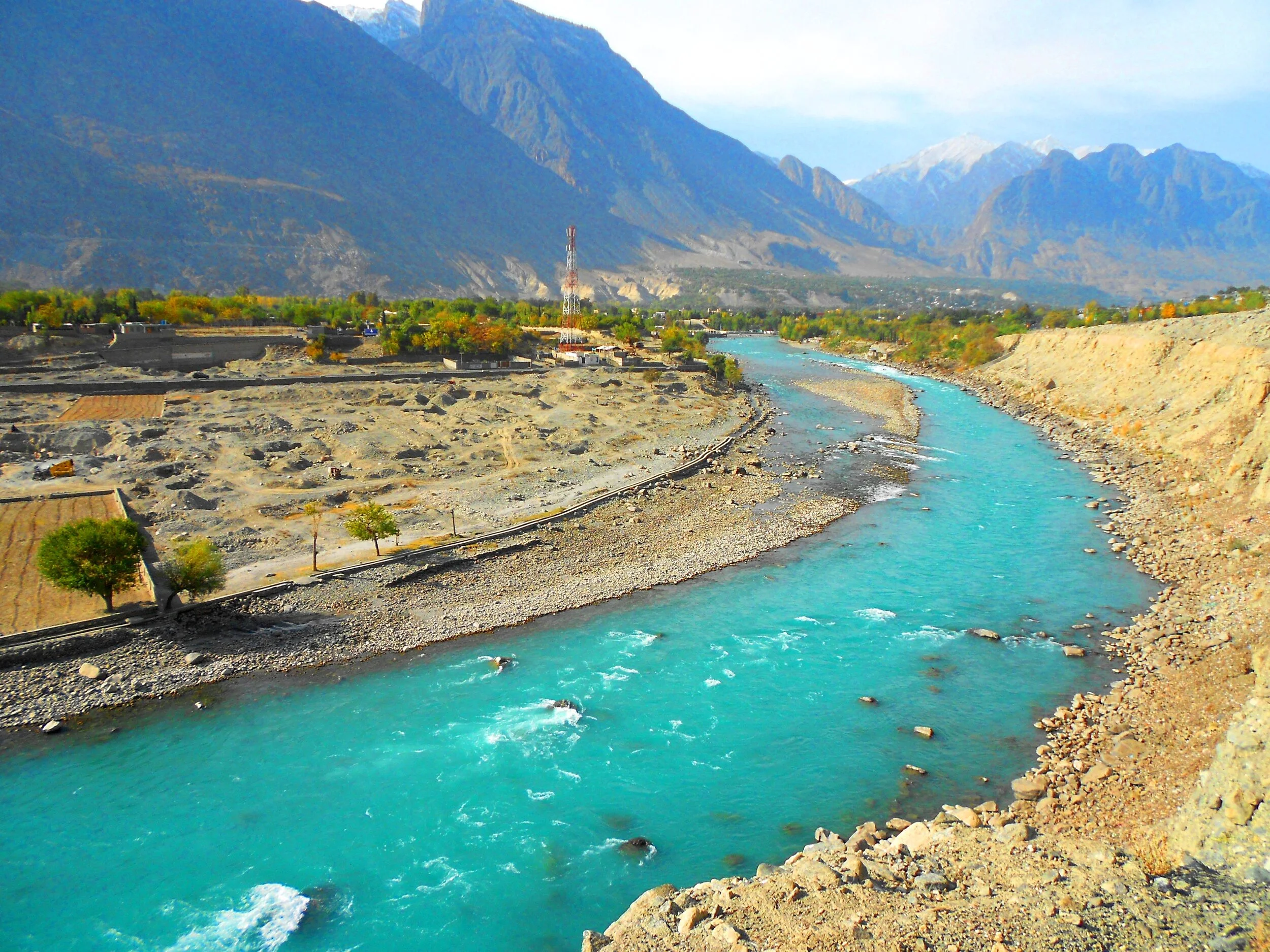
Gilgit River
From then on Gilgit became a part of the Sikh Kingdom and subsequently the Dogras. However it was not as easy as I am making it sound. There were multiple rebellions and it was during one such incident that Nathu Shah who was the Governor of Gilgit was killed. In 1856 again the Sikhs took Gilgit only to be relieved of it in the successive by Gauhar Khan. It was only after the 1857 and the First Mutiny that Maharaja Ranbir Singh sent a force to recover the country in 1860. In 1863 they rose again and another expedition was sent to Yasin. In 1866 Hunza was attacked by the Dogras along with their Nagar allies, but a trick was played on the Dogras and they were routed. A general alliance was formed against the Dogras by the Chitralis, Yasinis, Tangiris, Darelis and Hunzai and Punial was taken from them. However the Dogra garrison of 2500 at Gilgit held out and then reinforcements arrived and the Dogras re-claimed Gilgit and the surrounding country. Punitive missions were done and the status of Gilgit as an inevitable part of the Riyasat was finalised.
And by this time the Great Game had heated up and the Russians were right across the Hindu Kush and were almost at the Wakhan. This let the alarm bells ringing in the Empire Where the Sun Never Set. The British wanted to have greater influence on Gilgit and convinced the head strong Maharaja Ranbir Singh to let them station an Officer On Special duty to Gilgit in 1877. Gilgit was now the main listening Post in the Great Game and not far from there were the feared Cossacks of the Russian Army. After the death of the Maharaja the British appointed a Political Agent to Gilgit and effectively took over the administration of Gilgit. Gilgit Agency as it was called effectively became British and only in name was under the Maharaja’s rule. All the other neighbouring states were also slowly absorbed into the Gilgit Agency. Chitral was however made a part of Malakand Agency in NWFP. In 1935 the British leased out Gilgit from the Maharaja settling any doubts over Gilgit’s status.And so it stayed till Independence when the British on their return reverted Gilgit over to the Maharaja.

Gojal, Hunza - Nagar
It was now that the “Gilgit Rebellion” took place. The British left and the JK State took charge and Brig Ghansara Singh was appointed the Governor. The Gilgit Scouts, a regiment created by the British comprising of locals were incited by none other than their British officers to rebel and on 1st November after the Maharaja signed the Instrument of Accession they broke out in revolt. Both Brig. Ghansara Singh and his second in command Col.Majid were arrested by the Gilgit Scouts. And then the inevitable happened and the Non-Muslim population was put to the sword. The madness of the sub-continent spread to Gilgit as well. And of course the majority of the Population also wanted to be a part of the new nation on the West. The matter was thus settled for the time being. The same Gilgit Scouts moved further and sieged Skardu and captured kargil and even went as far as Zanskar.
The question remained as to why the British officers openly supported and even planned the whole operation. It was a Military Coup and no civilians took part. And even more strangely the British were eager that Gilgit be a part of Pakistan. The reason for the same was actually quite simple. The British as well as the Americans still wanted Gilgit as a base. The approach to Gilgit from Srinagar was mainly through the Burzil Pass which connected Guraiz with Gilgit. And then there was the Rajdhan Pass. Both these Passes were blocked for snow in the Winters and the Burzil would stay shut for atleast 6 months in a year. On the other hand the approach to Gilgit from NWFP was much easier and through an all Weather Road. Secondly the “Allies” were aware that they would be in a better position to influence Pakistan rather than India due to obvious reasons. And hence the whole operation planned and implemented. It was one of the smaller Games of the Great Game and is called by some as the Gilgit Game. There are many detailed writings on this so get a copy if you want more details.
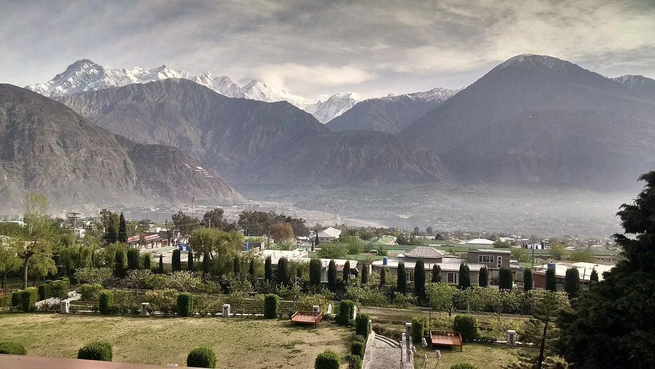
A view of the Gilgit Town and Valley. Image Courtesy Wikipedia
A pic of the Gilgit Town and the vast Valley surrounding it which made it perfect for an Airbase among other things. The Soviet union was just minutes away by flight. Pic courtesy Fehd Raza. Summer months.
Kiki’s Blog
Stories from the Himalayas








Five years ago the Galwan Valley was in the News for the wrong reasons after a deadly clash between the Indian and Chinese Armies in the Valley located in Ladakh lead to many deaths on the contentious Border between the two countries in wake of continued Chinese intrusions into Indian territory.
This area along the Shyok River, of which the Galwan Nallah or the Galwan River which forms the Galwan Valley has been off limits to Civilians since long but now the Indian Government has decided to open up the area for Civilians and we were amongst the First Civilians to venture into this beautifully desolate part of the Eastern Karakorams in Ladakh. Earlier Civilians could only venture upto the Village of Shyok from where the Shyok River takes a U turn and flows in a Northerly direction.