
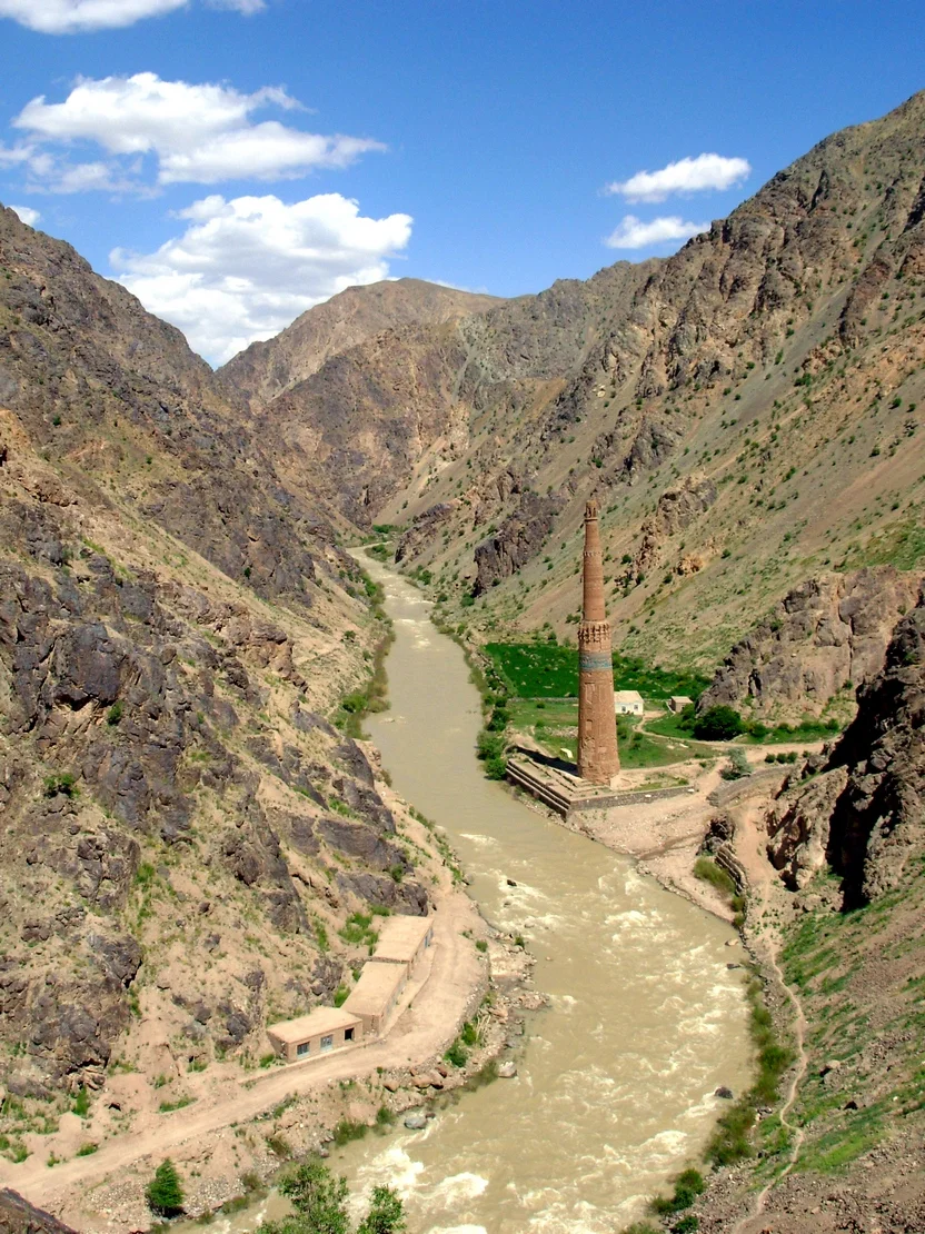
The Minaret of Jam
Deep in the heart of the Koh-Baba Mountains which is one of the most westerly extension of the Hindu Kush Range, at an elevation of around 1900 m above sea level and at the confluence of the Hari Raud (Herat) and the Jam Rud Rivers lies a magnificent Monument. This Monument is a free standing Minaret and is the second highest free standing Minaret in the World. Second only to our very own Qutab Minar it actually was the inspiration for the Qutab Minar.

The Minaret of Jam
Deep in the heart of the Koh-Baba Mountains which is one of the most westerly extension of the Hindu Kush Range, at an elevation of around 1900 m above sea level and at the confluence of the Hari Raud (Herat) and the Jam Rud Rivers lies a magnificent Monument. This Monument is a free standing Minaret and is the second highest free standing Minaret in the World. Second only to our very own Qutab Minar. But the Minaret in the desolate Hindu Kush sub Range of koh e Baba is the one which inspired the Qutab Minar and the Qutab Minar because of the same reason has a striking resemblance to the Original. The Original Minaret and Qutab Minar both now enjoy a UNESCO World Heritage Status. Just that Qutab Minar is much more famous and well known and gets more visitors per day than the Original Minaret has in years, most due to the situation in Afghanistan as well as the isolated Location of the Minaret. And it was probably its isolated location is the reason that the Minaret survives to this day. And it's called the Minaret of Jam.
The monument which stands at 65 m is not really much lower than the Qutab Minar which stands at 72 m and as per UNESCO the Qutab Minar was directly inspired by the Minaret of Jam. And it was built at a time when the Ghorid Empire was at its glory and this Minaret was built as a commemorative Monument to celebrate the victories of the Ghorids especially the ones across the Indus into India. Some say it was built to commemorate their victories over the Ghaznavids in Lahore while other scholars attribute it to the commemoration of their victory over Prithviraj Chauhan.

And apparently it was built close to the Ghorid Empire’s capital at that time Firozkoh of which little remains today and the Minaret is the only reminder of the glory of the Capital that must have been. But today it stands in isolation away from any civilization in a rugged rocky Valley where the two Rivers meet. The Tower represents the height of advancement of art and architecture under the Ghorids which would soon be laid to waste by the “calamity” as it was called descended upon the Region from the Steppes of Northern Central Asia. Yes you guessed it right. The Mongols under the Great Genghis Khan who probably never came across this Minaret and thats its good luck. The City of Firozkoh was completely laid to waste by Tolui, the youngest son of the Great Khan. Tolui himself was the ancestor of the Ilkhanids and he was the father of Kublai Khan, the founder of the Yuan Dynasty.
Coming to think of it I think there was no way the Mongols could have missed this Tower if it really was in the Golden City of Firozkoh so why didnt they really laid it to waste like they did to the City. Maybe even these Wild Horsemen of the Steppes looked at this Monument in awe and admired it in all its glory. I have this vision in my mind of Tolui Khan, the son of the Master of the Universe, the Great Khan himself, getting off his Horse while gazing at the Tower and telling his men to just leave it alone. It was just too beautiful to destroy and maybe this is something the Mongols agreed with. Of course later invaders and conquerors would have left this Tower alone as just like the Qutab Minar it has inscriptions from the Holy Koran inscribed on it and hence no Muslim would bring any harm to it.
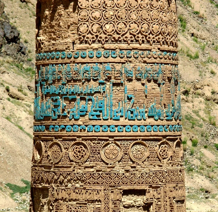
But of course the Tower is under threat from the passage of time and erosion. The Tower seems to be tilting and being close to the Rivers means that the constant ups and downs in the River’s course causes even more instability in the Tower’s base. And as recently as last year the Security forces guarding the Tower came under attack by the Taliban who set on fire a nearby Forest. Things sadly in Afghanistan are today not much different from the 13th Century.
The UNESCO describes the monument as such “The 65m-tall Minaret of Jam is a graceful, soaring structure, dating back to the 12th century. Covered in elaborate brickwork with a blue tile inscription at the top, it is noteworthy for the quality of its architecture and decoration, which represent the culmination of an architectural and artistic tradition in this region. Its impact is heightened by its dramatic setting, a deep river valley between towering mountains in the heart of the Ghur province.”
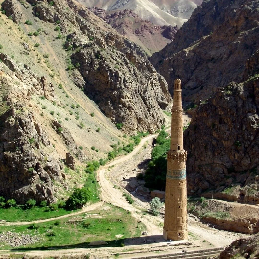
The criteria for it being chosen to be put in the elite UNESCO list are listed as the following “The innovative architecture and decoration of the Minaret of Jam played a significant role in the development of the arts and architecture of the Indian sub-continent and beyond. The Minaret of Jam and its associated archaeological remains constitute exceptional testimony to the power and quality of the Ghurid civilization that dominated its region in the 12th and 13th centuries. The Minaret of Jam is an outstanding example of Islamic architecture and ornamentation in this region and played a significant role in their further dissemination.
Leaving you with some pics of the Minaret of Jam from the Internet. Since a single pic doesnt do justice to its glory I am using multiple pics to highlight this hidden Gem of the Koh i Baba in the Hindu Kush. Maybe one day it gets the due attention as the Minaret it inspired gets.
All Pics from Wikipedia.
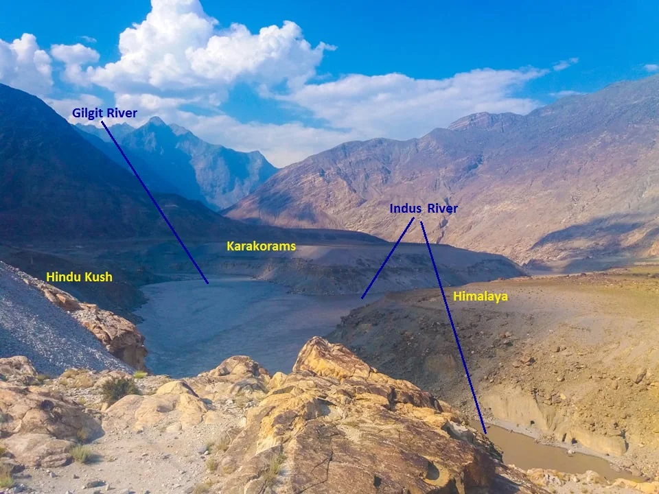
The Junction of the Three Mightiest Mountain Ranges
Jaglot near Gilgit is the point where the Three Mightiest Mountain Ranges of the world the Himalayas, the Karakorams and the Hindu Kush meet at the confluence of the Gilgit River with the Indus River

The Point where the Himalayas, the Karakorams and the Hindu Kush meet. At the confluemce of the Gilgit and the Indus Rivers.
The Place where the Himalayas, the Karakorams and the Hindu Kush Meet
Have you heard of Jaglot ?
It's a small little nondescript Village around 40 kms from Gilgit town which would have remained as such if not for a Geographical feature that the place holds. This point is located where the mighty Indus meets the Gilgit River in Gilgit Baltistan as the region is now called. This place is considered the meeting of the three mightiest Mountain Ranges in the World, the Himalaya which is home to 9 of the 10 highest Peaks in the World including the highest one Mt. Everest, the jagged Karakorams which is home to the K2 and the third one coming from the North West, the Hindu Kush which is come to the Tirich Mir which at 7708m is the highest Peak outside of the Himalayas-Karakoram Mountain System.
One of the oft asked questions is that is the Karakoram a sub Range of the Himalayas ? The answer is both no and yes and it depends on how you want to answer. They are in pure scientific terms different Ranges but a part of the same Mountain Complex that are referred to as the Great Himalayas.
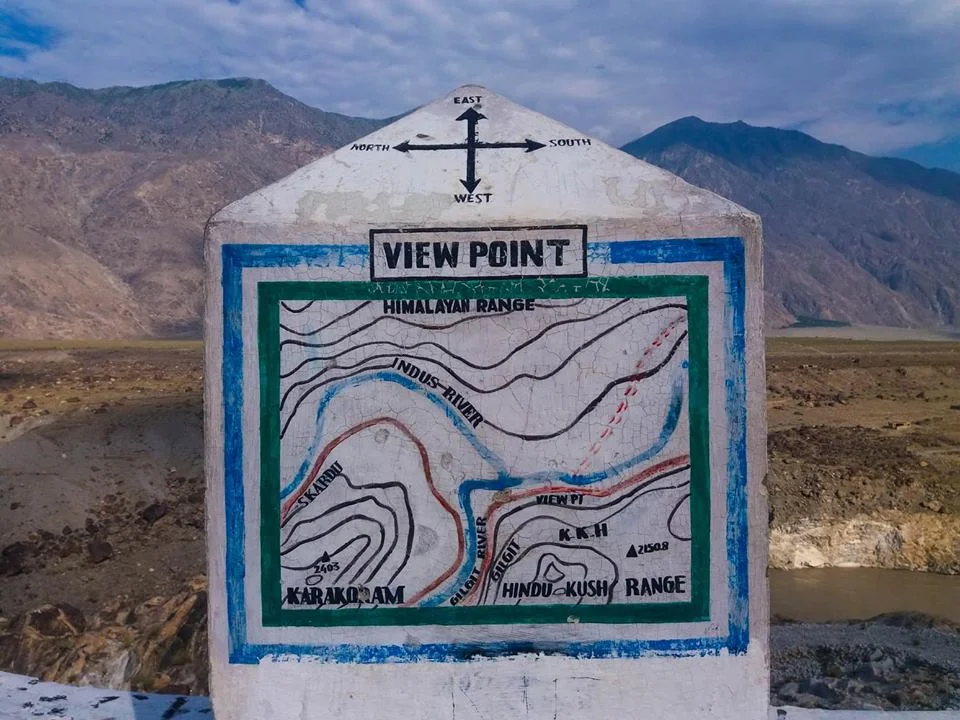
The point of convergence of the three Highest Ranges in the World !
Technically both are different Ranges as they were formed at different stages of one cataclysmic Event namely the collision/ subduction of the Indian Plate under the Eurasian Plate. Both follow their own separate Thrust lines and to really understand it you really need to get into Plate tectonics and understand stuff as I present to you below. This is taken from A Tectonic framework of the Himalaya, Karakoram and Tibet, and Problems of their Evolution by B F Windley :
“The Himalaya, the Karakoram and Tibet were assembled by the successive accretion to Asia of continental and arc terranes during the Mesozoic and early Tertiary. The Jinsha and Banggong Sutures in Tibet join continental terranes separated from Gondwana. Ophiolites were obducted onto the shelf of southern Tibet in the Jurassic before the formation of the Banggong Suture. The Kohistan--Ladakh Terrane contains an island arc that was accreted in the late Cretaceous on the Shyok Suture and consequently evolved into an Andean-type batholith. Further east this Trans-Himalayan batholith developed on the southern active margin of Tibet without the prior development of an island arc. Ophiolites were obducted onto the shelf of India in the late Cretaceous to Lower Palaeocene before the closing of Tethys and the formation of the Indus--Yarlung Zangbo Suture at about 50 Ma. Post-collisional northward indentation of India at ca. 5 cm a-1 since the Eocene has redeformed this accreted terrane collage; palaeomagnetic evidence suggests this indentation has given rise to some 2000 km of intracontinental shortening. Expressions of this shortening are the uplift of mid-crustal gneisses in the Karakoram on a late-Tertiary breakback thrust, folding of Palaeogene redbeds in Tibet, south-directed thrust imbrication of the foreland and shelf of the Indian Plate, north-directed back-thrusts along the Indus Suture Zone, post-Miocene spreading and uplift of thickened Tibet, giving rise to N--S extensional faults, and strike-slip faults, which allowed eastward escape of Tibetan fault blocks.”

The Public Viewing Point.
Now coming back to more simpler stuff as in Geographical terms the Karakorams are separated from the Himalayas by the Indus in its Upper Course. However in Ladakh the division is taken as the Shyok instead of the Indus. So when you are in Nubra Valley the Mountains on the other side of Shyok River as the Karakorams and this side as the Himalayas. However some people stick to the classical Indus division and by that norm the Ladakh Range would be part of the Karakorams and not the Himalayas. By the same definition Leh would be in the Karakorams and not the Himalayas.
However this ambiguity disappears once the Shyok River merges with the Indus at a place called Keris near the town of Skardu. The Nubra river also joins the Shyok in Nubra Valley and the River widens significantly. The fact that both these Rivers do a complete turnaround of 180 degrees from their original sources indicates the presence of fault lines.
The Hindu Kush on the other hand is separated from the Karakorams by the Gilgit River. The Gilgit rises somewhere between the mountain vastness of the Hindu Kush and the Karakorams. And it passes through Gilgit Town and eventually the joins the Indus at Jaglot. This is where eventually these three mighty Ranges meet. Of all the places that I would want to visit one day this would definitely be on the top.
If the ancients would have been able understand the significance of this location (which we do now due to years of research aided by modern scientific equipment) they would have built some great structures over here I would imagine. However there are still local legends about this place ie where the Indus meets the Gilgit (the legend has no relation to the meeting of the Three Great Ranges). As per the legend Fairies and other such creatures come to have a bath here at midnight or something on that lines.
So do note the name down. I'm sure you would like to go there.
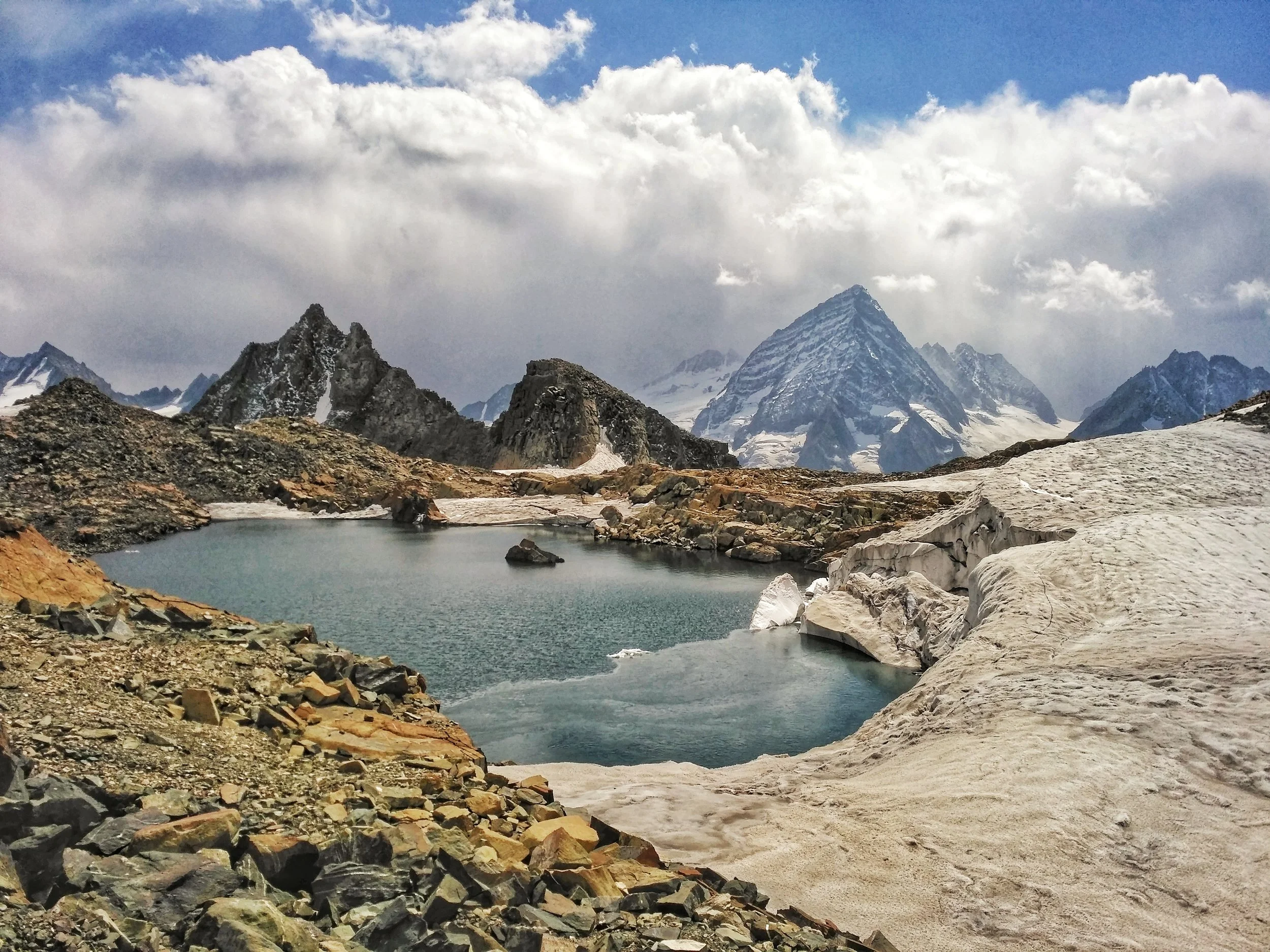
The Great Himalayan Mountain Complex
The Great Mountain Complex of the Himalayas is a vast expanse which includes the highest Peaks on the Planet and stretches all the way from Central Asia to South East Asia. We explain about some of the main Mountain Ranges of this Great Complex.

Dummy’s Guide to the Himalaya
THE GREAT MOUNTAIN COMPLEX OF THE HIMALAYA : The Western/ North Western Flank.
The Himalaya are a part of an extremely complex mountain system which includes the highest peaks on the planet. Created by great Tectonic plate movements millions of years ago, when the Indian plate collided with the Eurasian plate, the Himalaya are still rising. Most of the Ranges I mention below are regarded as separate ranges and are as such but in the broadest sense we have taken all the Mountain Systems between the Indian subcontinent and Central Asia and refer to them as the Himalaya, the name stemming from the Sanskrit words “Him” snow and “Alay” home.

The epicenter of this system lies somewhere in between the wild mountains north of Kashmir and the nodal orogenic uplift known as the Pamir Knot in Tajikistan. From the Pamir Knot rise the great ranges of Central Asia and they meet the Great Himalaya at the epicenter. The Great mountain wilderness north of Kashmir right upto the Pamirs are till today one of the least explored region on the planet. The last great Explorers of this region were mostly Europeans in the pre – Independence era. The physical factors aside, sadly, there are political reasons today which keep a large part of this great mountain wilderness off limits to explorers.
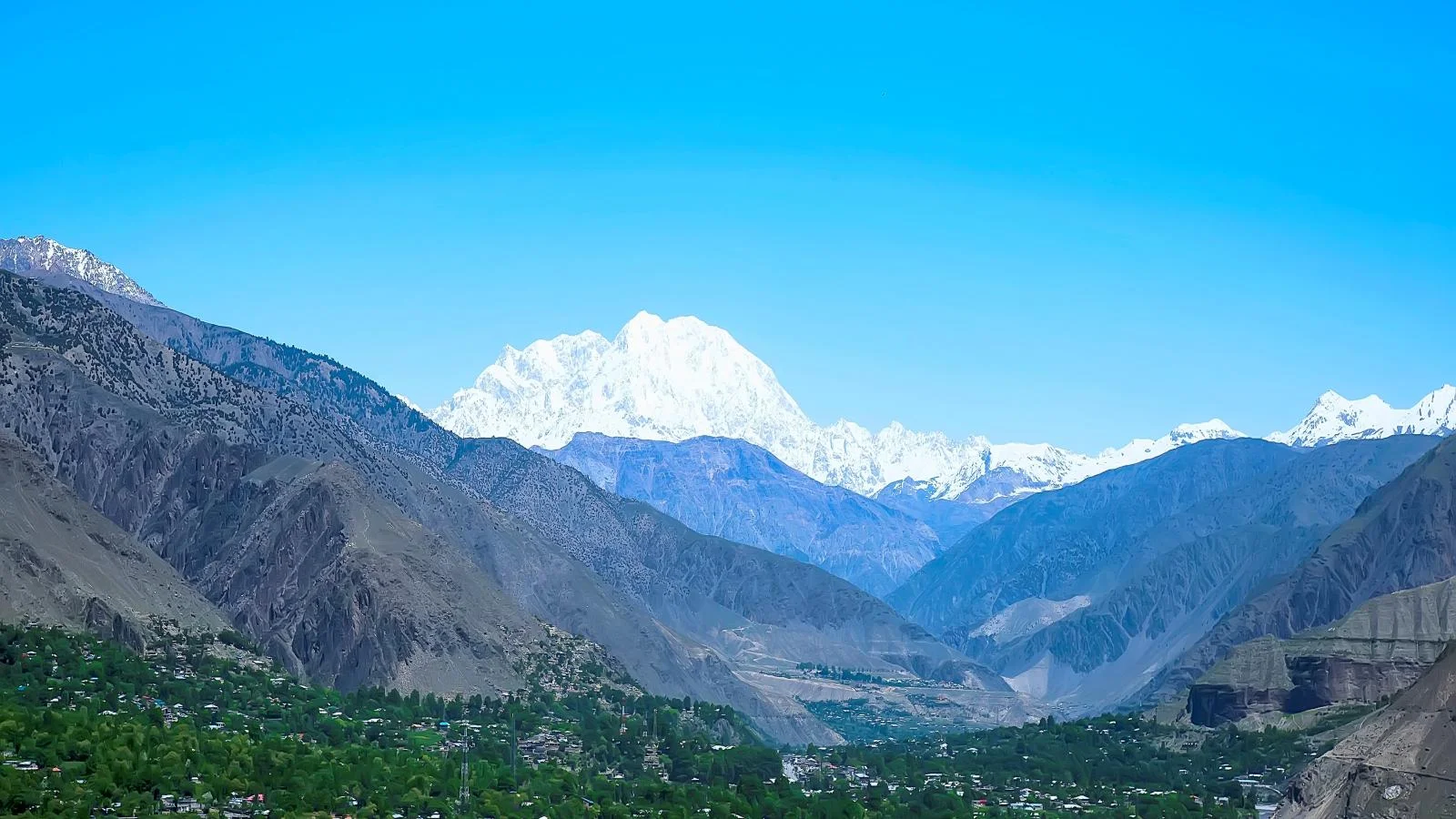
The Tirich Mir (Pic from 99wallpapers.com)
Starting from the West, from the arid hills of Afghanistan comes the Hindu Kush. Its brown treeless slopes rise up and get higher and steeper as the approach the meeting point of the giants. The Hindu Kush still has a hint of Middle Eastern deserts even below the Glaciers of the 7708 m high Tirich Mir. The term Hindu Kush derives from Persian stands for “Hindu Killer” probably in reference to the unknown number of Indian slaves who perished in the cold and snows of these mountains while sold into slavery in the Central Asia.
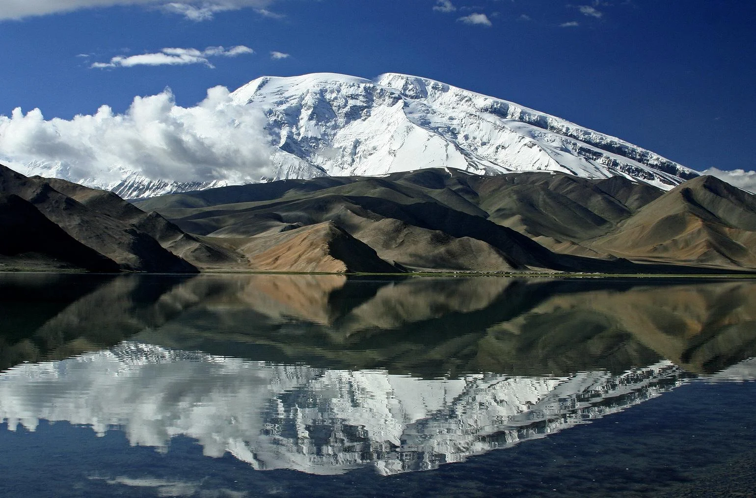
The Mustagh Ata (https://www.summitpost.org/muztagh-ata/151886
To the North of the Hindu Kush lie the rounded domes of the Pamirs. This is still a mysterious and almost polar region of several mountain ranges linked together, and to other ranges, by a north-south range which includes the peak of Muztagh Ata whose name means “The Father of Snowy Mountains” standing at 7509 m. The Arabs used to refer to the Pamirs as the “Bam i Duniya” or the Roof of the World. The name Pamirs comes from the Persian reference to these mountains.

The Kunlun Shan (https://www.summitpost.org/kunlun-shan/171011
Moving eastwards of the Pamirs we have the Kun Lun. It rises over the Tarim Basin in the Takla Makan desert and rise up as it moves towards the epi center. The highest peak of the Kun Lun is the Luishi Shan standing at 7167m. Overlooking the great Silk Route of Cathay they have always been historically regarded as the southern frontier of the Chinese empire. The Kun Lun were named after a semi-mythical reference in classical Chinese texts to the source of the Yellow River.

Where all these ranges meet lies the Karakoram. Mightiest of all these ranges, they radiate from an amphitheater of peaks called Concordia which holds three of the worlds highest peaks in the world. The Karakoram is a perpendicular wilderness where only mountaineers can venture. Glaciers thirty miles long and a quarter mile deep lie in the valleys. These Glaciers here are the largest that can be found outside of the Polar regions. The highest peak of the Karakoram if of course the K2 standing at 8611 m. The name Karakoram comes from the Turkic term “Black Gravel”, Kara being the Turkic term for “Black” very similar to the Hindi “Kala”.
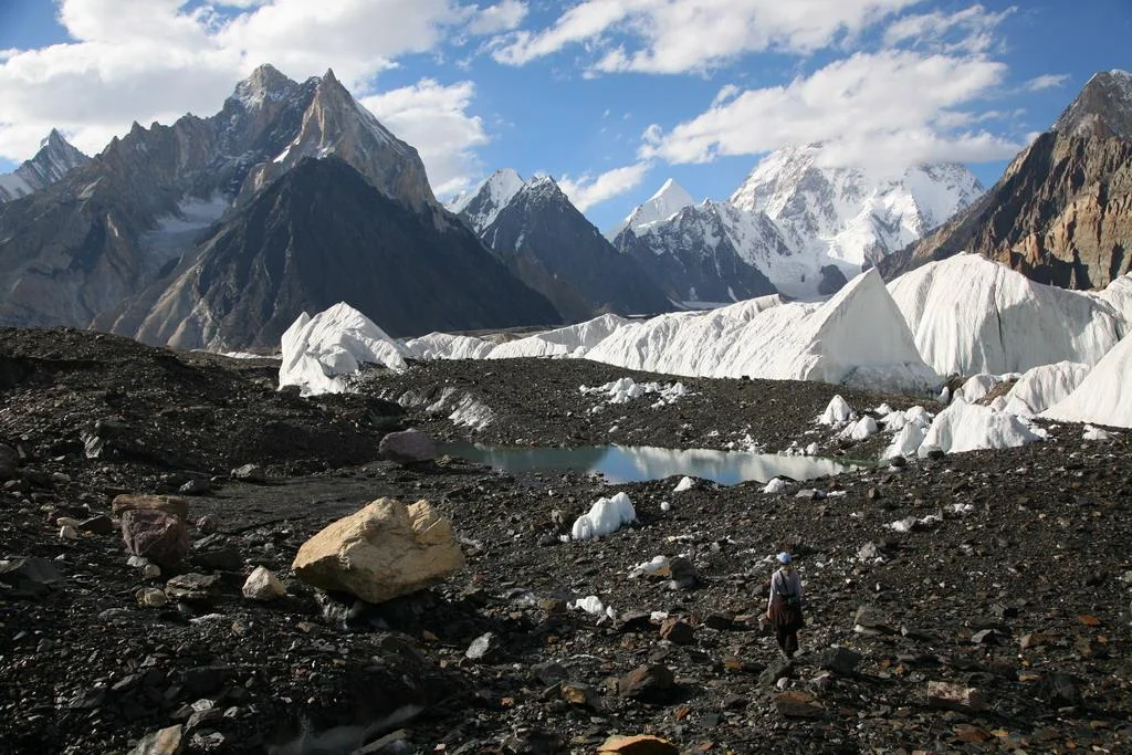
Concordia in the Karakorams (https://www.summitpost.org/concordia-the-amphitheatre-of-ten-of-the-world-s-thirty-greatest-mountains/534309
South of the Karakoram is the Ladakh Range which is considered a sub-range of the Karakoram itself as per Encyclopedia Brittanica though some consider it a part of the Great Himalaya. South of this Range is the Zanskar Range, which is a sub-range of the Great Himalaya, which seperates the Ladakh region from Kashmir and Jammu regions.

Joining from south west in the Mother Range the Great Himalaya, culminating in its giant sweep from across Nepal at the formidable Nanga Parbat standing at an imposing 8126 m. What makes this mountain so formidable is that it rises vertically from around the base of the Indus to its imposing height. This is same sweep of the most formidable mountains on the planet which includes the highest peak on the planet Mt. Everest. The Great Himalaya range stretches from the Nanga Parbat in the North West to the Namche Barwa in the East.The range varies in width from 400 kilometres (250 mi) in the west to 150 kilometres (93 mi) in the east.
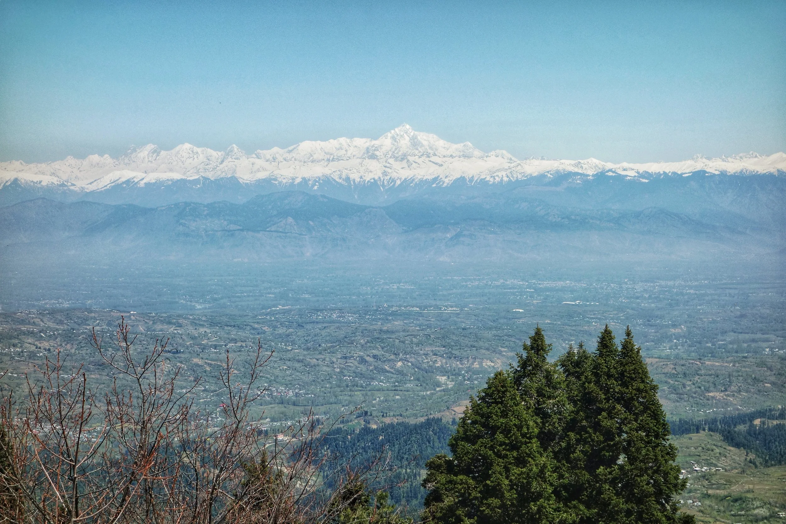
Nanga Parbat
Moving southwards we have the Pir Panjals which though considered a part of the Greater Himalaya, are as noble as a range can be and in another part of the world would have been a seperate Range itself. Though not high as per Himalayan standards it is the first snowcovered peaks tha you encounter moving up from Northern India. Compared to the barren mountains that lie north of it the Pir Panjals are all green and bountiful. The Pir Panjal gets more snow than anywhere in the Western Himalaya. The Pir Panjal gets its name from the Pir Panjal Pass, which was named according to one theory after “Five” “Panj” and “Saints” “Pir” or five pious brothers who lived around there. Another theory alludes the name to the Kashmiri word for a Pass “Pansal” and “Saint” “Pir”, a saint whose grave was supposed to be on this Pass.
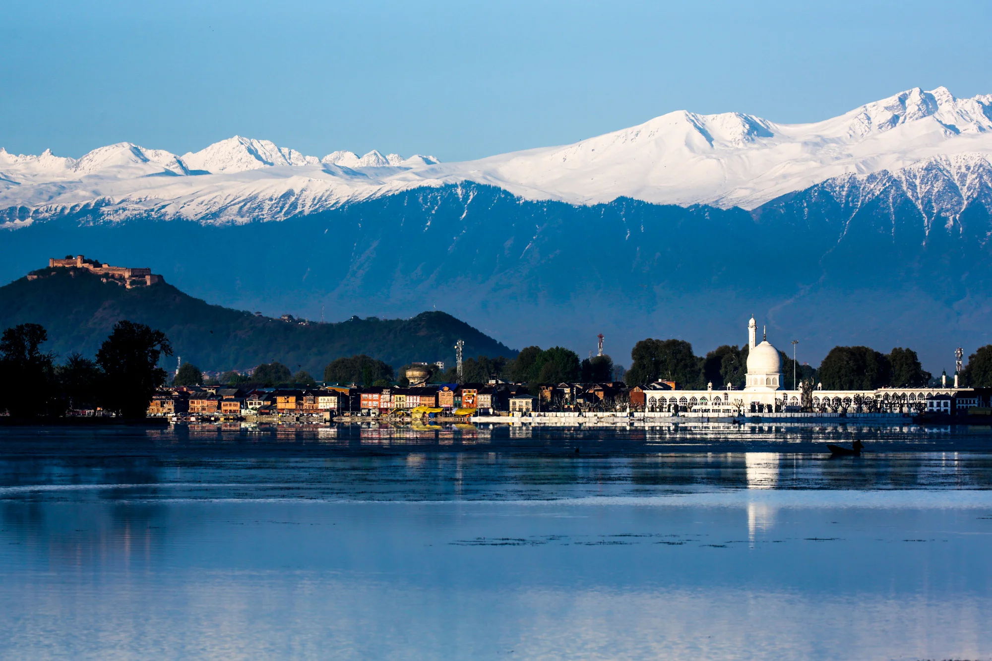
The Pir Panjals over the Kashmir Valley
South of the Pir Panjal we have the Dhauladhar Range though some consider the Dhauladhar to be a part of the Pir Panjal itself. The Dhaula Dhar is also reffered to as the Lesser Himalaya.
Finally the these Ranges give way to the gentle Sivalik Hills which finally merge into the Great Indian plains.
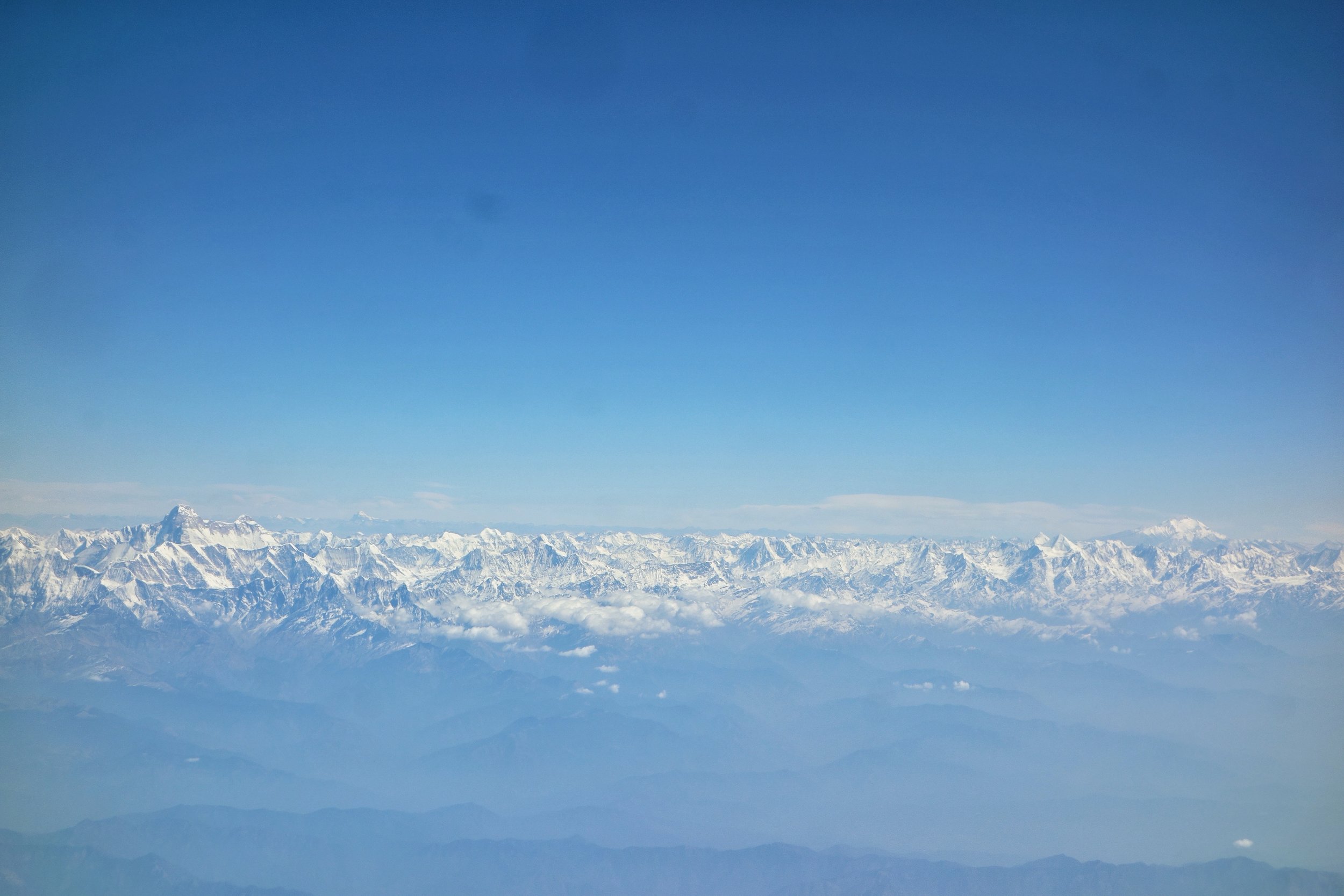
The Holy Mountains of the Himalayas : The Nanda Devi and the Kaliash Parbat
Major Inputs and extracts from the John Keay Classic : Where Mountains and Men Meet
PHOTO (Map) : A classical map of the Western Himalaya without national boundaries. Sourced from John Keays : Where Mountains and Men Meet :
NOTE : As mentioned before all scholars do not agree on the classification of these Ranges/ sub-Ranges. However a majority of them would agree on what I state above. The above article has been compiled from various sources.
Kiki’s Blog
Stories from the Himalayas








Five years ago the Galwan Valley was in the News for the wrong reasons after a deadly clash between the Indian and Chinese Armies in the Valley located in Ladakh lead to many deaths on the contentious Border between the two countries in wake of continued Chinese intrusions into Indian territory.
This area along the Shyok River, of which the Galwan Nallah or the Galwan River which forms the Galwan Valley has been off limits to Civilians since long but now the Indian Government has decided to open up the area for Civilians and we were amongst the First Civilians to venture into this beautifully desolate part of the Eastern Karakorams in Ladakh. Earlier Civilians could only venture upto the Village of Shyok from where the Shyok River takes a U turn and flows in a Northerly direction.