

Chorbat Valley : Where Ladakh Gives Way to Baltistan
So where exactly does Baltistan begin and Ladakh end ? Well to be honest there is no such defined physical feature but most consider the Chorbat Valley as a part of Baltistan rather than Ladakh. In the pre-partition days Chorbat was an “Ilakka” in the Baltistan Wazarat. Geographically the Chorbat Valley starts at the point where the Shyok Valley narrows and becomes a Gorge before the Village of Bogdang. Bogdang is considered the first Village of the Chorbat Valley and hence the first Village of Baltistan. Technically it lies sandwiched between the Ladakh Range and the Karakorams.
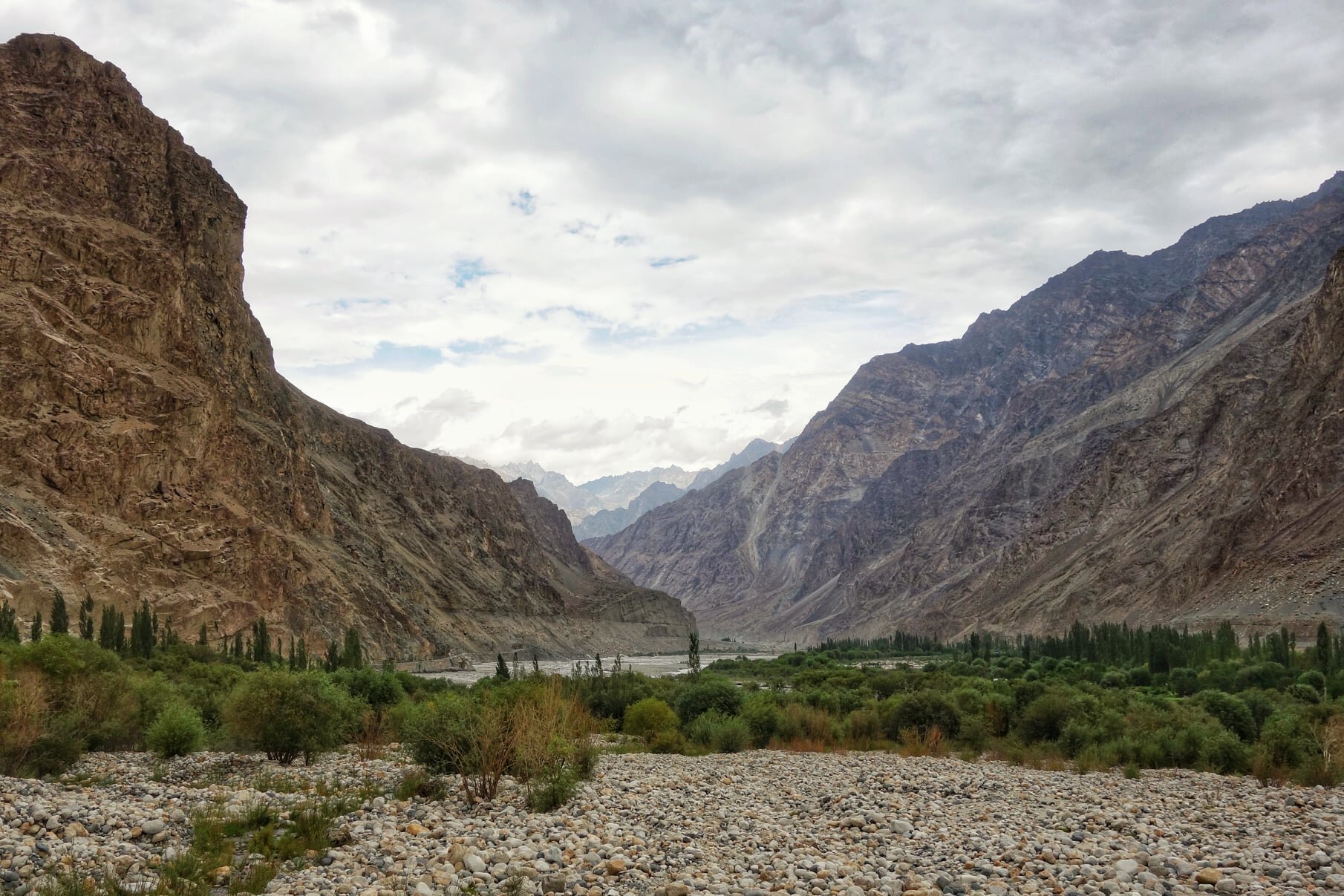
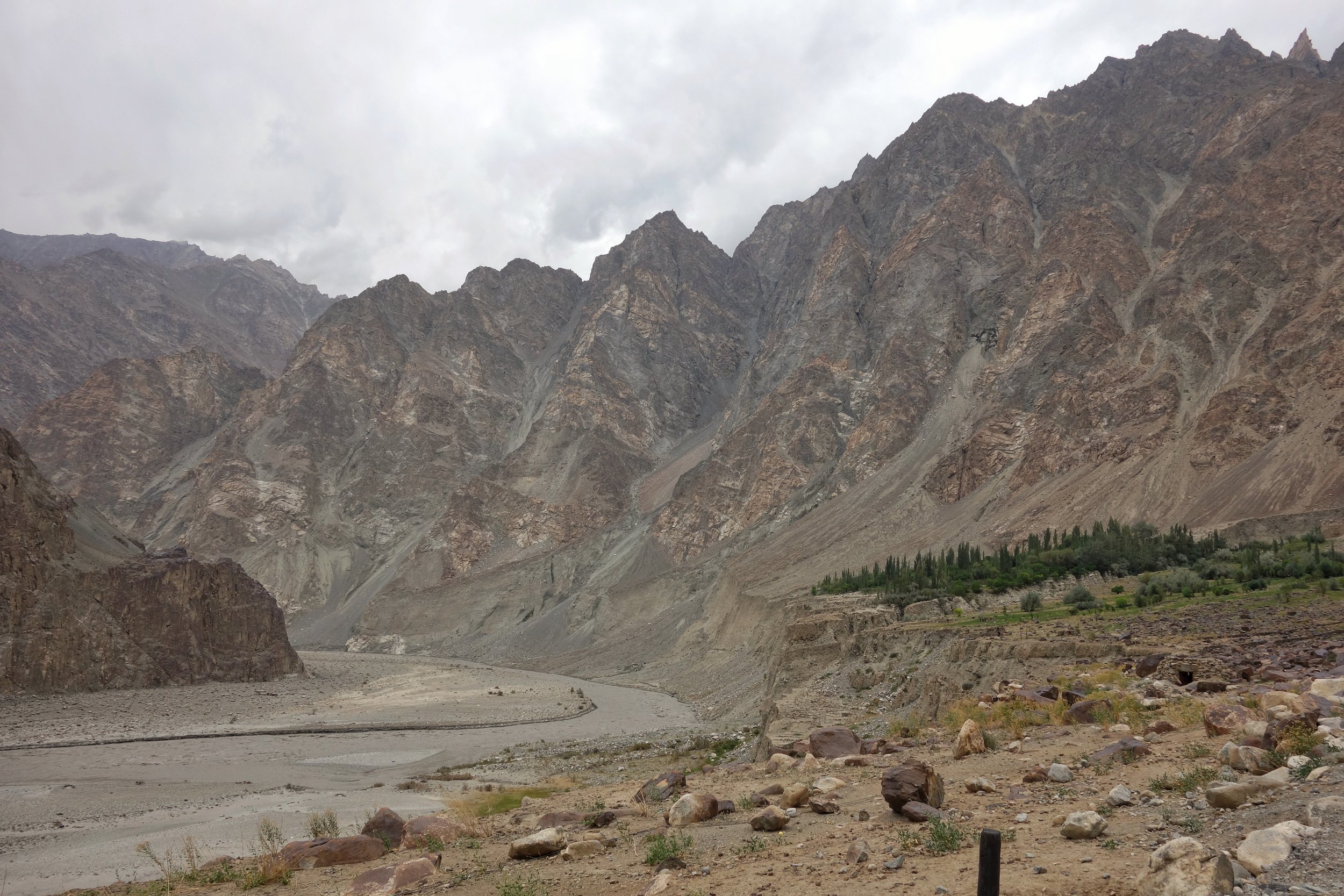
The Chorbat Valley at Turtuk
Many of us have traveled to Ladakh and many have visited the Nubra Valley and of course Turtuk is now a famous destination because of its Balti culture. Infact technically Turtuk lies in what was traditionally Baltistan though now divided by the Line of Control with most of Baltistan being on the other side though a small sliver of Baltistan lies on the Indian side. And most people are also aware of the fact that Turtuk came under Indian control in 1971.
So where exactly does Baltistan begin and Ladakh end ? Well to be honest there is no such defined physical feature but most consider the Chorbat Valley as a part of Baltistan rather than Ladakh. In the pre-partition days Chorbat was an “Ilakka” in the Baltistan Wazarat. Geographically the Chorbat Valley starts at the point where the Shyok Valley narrows and becomes a Gorge before the Village of Bogdang. Bogdang is considered the first Village of the Chorbat Valley and hence the first Village of Baltistan. Technically it lies sandwiched between the Ladakh Range and the Karakorams.

Chorbat as shown in the Classical Starchey’s Map of 1858

Chorbat as seen on Google Satellite View
The first Village being Bogdang, the next one is Chalunka and then its the biggest Balti Village, the famous Turtuk. Most people assume that Turtuk is the last Village before the LoC but its not. There is Tyakshi beyond Turtuk where one can go with permission and beyond Tyakshi lies the last Village on the Indian side of the LoC called Thang. One is allowed to go beyond Tyakshi but not all the way to Thang. One can see the Village of Thang from a distance though one is allowed to go to Thang only if one is a local or has relatives in the Village.

The first view o Thang
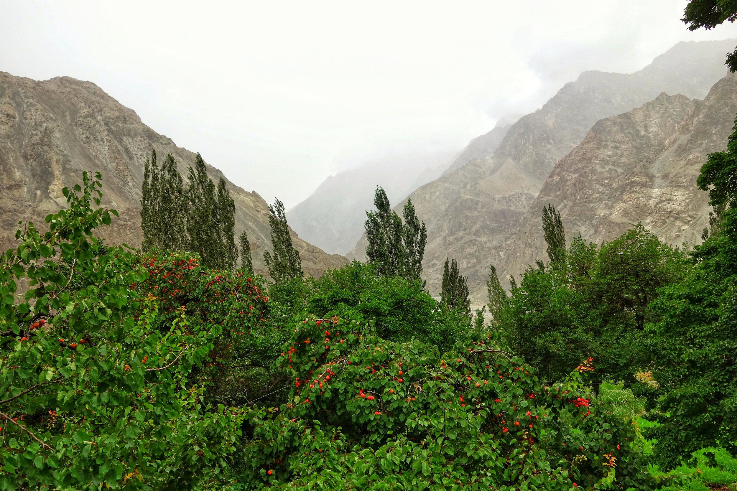
Though I was lucky enough to manage to go all the way to the Village and have a walk around and also got to Pluck Apricots for which the Region is famous. The Apricots of this area are jus something else. And from Thang in the distance one can see the Greenery of the first Village on the other side called Franu. Of course many people from the Villages who have relatives on the other side and have long demanded ease of Travel.

A sign welcoming you to the Northernmost Village of India

The first House in Thang
Infact in 1947 only Bogdang and Chalunka were on the Indian side but in 1971 Indian Forces took Turtuk, Tyakshi and Thang and overnight these Baltistani Villages became a part of India instead of Pakistan. Historically the Chorbat Valley which stretches from Bogdang all the way to Khaplu where the Shyok Valley opens up again. There are 13 Villages traditionally in the Chorbat Valley with 5 of them on the Indian side now. Also the Chorbat La was a traditional Pass which connected Ladakh with Baltistan from the Dah side along the Indus side.

The Starting point of the Chorbat Valley

The start of the Chrobat Valley where it widens up.
Chorbat was also a small Kingdom with the Capital at Siska which was also called Chorbat though later the Capital was moved to Turtuk and many Members of the Royal Family still live in Turtuk including the “King” who many people have had the pleasure of meeting in Turtuk. The Gentleman also has a very interesting Museum which has a Collection of old Personal and Royalty related items.

The Apricot Fields of Franu
And Chorbat was always heavily influenced by Ladakhi culture as well which is only expected as both Ladakhis and Baltis are of Tibetan stock and have various similarities especially in Language. Infact the Balti script and language is considered the closest one to Old Tibetan. This just adds another colorful dimension to the area known as Chorbat which is not really well known on the Tourist circuit.

One of those Natural Cold Storages common in the Region

The Green Fields of the Village of Franu across the Line of Control
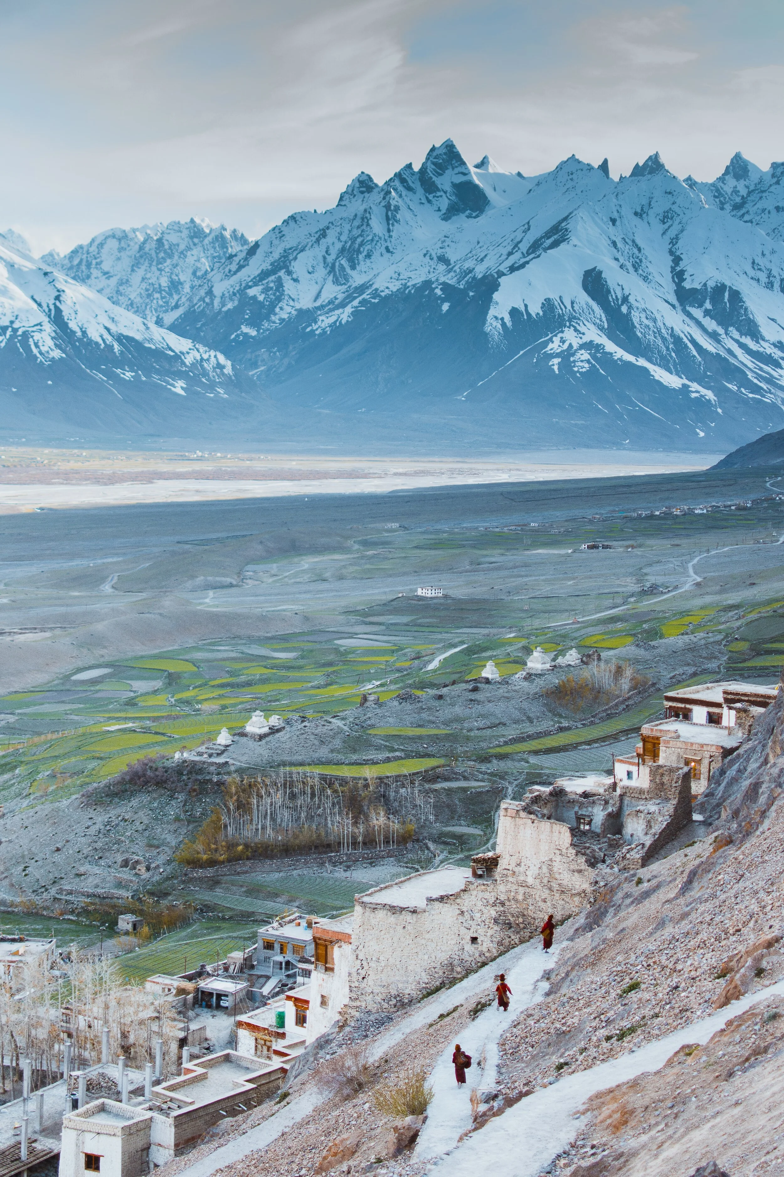
Pangi to Zanskar
The Ancient Routes which connected Pangi Valley in Chamba with Zanskar in Ladakh : Excerpts from Guide to Dalhousie Chamba and the Inner Mountains Between Shimla and Kashmir (1923)

The Village of Palamo on the Route connecting Lahaul with Zanskar via the Shinku La
Pangi to Zanskar
Excerpts from Guide to Dalhousie Chamba and the Inner Mountains Between Shimla and Kashmir (1923)
One of the most interesting readings of the recent times for me is this little Book. It was written by J Hucthison LRCP & SE, Chamba. It was printed at the Civil and Military Gazette Press in 1923 in Lahore and it was on sale for Rs.2.
Since at those times Motorable Roads / Motors were rare they hardly existed in the Himalayas. So a lot of stuff was written about different Routes which connected one Valley to another. And in today’s context we are sometimes surprised as the Routes were described between two areas which we don't really realise are close enough to be connected directly.
One such series is the section on the Routes which connected Pangi Valley to Zanskar. Yes you heard it right. These two were actually connected and still are though I doubt anyone uses these Routes anymore. We also need to remember that Pangi Valley in its higher reaches has Villages called Bhatoris which are Villages inhabited by “Bhots” as people of Tibetan/ Ladakhi origin were referred to. Just like in the neighbouring Paddar Valley of Kishtwar these “Bhots” are believed to have originally come over from Zanskar. Also worth remembering is the fact that Zanskar was at a point of time under Chamba Rule.

The Pangi Valley near the Killar Town
As per the Book, its says that in the earlier times a certain part of Trade to Central Asia was conducted from this Route while it was conducted from the Paddar and Umasi La Route as well. The Goods came to Pangi from Pathankot and Nurpur over the Sach and the Cheni Passes to Pangi. So what exactly does it say about the connecting Routes between Pangi and Zanskar. It mentions Six Routes which can be taken from Pangi to Zanskar and all these involve crossing the Great Himalaya itself. These are taken as stated in the Book.
1. From Darwas a branch ascends the Sural Nala and crosses the Sarsank Pass (16,200 feet), into the Danlong Nallah.
2. A similar branch from Kilar runs up the Hunan Nala and crosses the Shinkil Pass (16,300 feet).
3. From Sach a branch ascends the Saichu Nala to Saichu (10 miles), and Tuan (8 miles) and crosses the Mun La (16,500 feet), and unites with the two roads from Darwas and Kilar; the combined road then crosses the Poat La (17,500 feet) to Burdan Gompa in Zanskar. The roads from .Kilar and Tuan are seldom used. That from Darwas takes five days to Burda8n Gompa,. The stages are : Kansar, 8 miles ; Atyud, 1.0 miles ; Gokhun (over Sarsank Pass) 16 miles ; Sangati (Danlong N46), 6 miles ; Punchi (over Poat La) 12 miles ; Burdan Gompa, 6 miles. Large glaciers on both passes.

On the Road from Pangi to Lahaul along the Chandrabhaga
4. In the Saichu Nala an upper road runs from Kutal near Sach to Shun and rejoins the other road at Hillu, but it is rough and in places dangerous. From Saichu a Branch runs up the Chasag Nala to Bhotaur (10 miles) and crosses the Gurdhar Pass (16,791 feet), to Miyar (20 miles) in the Miyar Nala. This pass is so called owing to its being passable for ponies, which are brought from Lahul by this route to Pangi and over the Sach Pass to Chamba. Two men are needed to render help at difficult parts of the road.
5. At Udaipur a branch runs up the Miyar Nila and is narrow and difficult for four miles. From Chimrat (12 miles) the valley is open and the road good, up to the head of the Valley where it crosses the Kang La, 17,500 feet, in the Western Himalaya to Burdan Gompa. The journey from Kanjer, the last village, occupies five days. The stages are : Gompa, 8 miles ; Kesaryuncha, 7 miles ; Dutombn, 8 miles : Chural-pachan, (over Kang La), 12 miles : Bardan Gompa, 6 miles.

The Karsha Monastery in Zanskar. Pic by Klara Avsenik
6. Beyond Kanjer a branch ascends a side nala to croes the Tharang La, 17,133 feet, to the head of the Kado Tokpo stream in British Lahul. The journey from Kanjer to Darcha takes four days ; large glacier, but road fairly good ; no village till near Darcha.
Its amazing that most of these Passes and Routes are not in use and only the most hardened Trekkers venture into these most Inner parts of the Himalayas. This is where the opportunity lies for “Explorers” in the actual sense of the word to venture into see the beauty of the Inner Himalayas. As in the “wild” country which lies between “Shimla and Kashmir” as this hand Book called them.
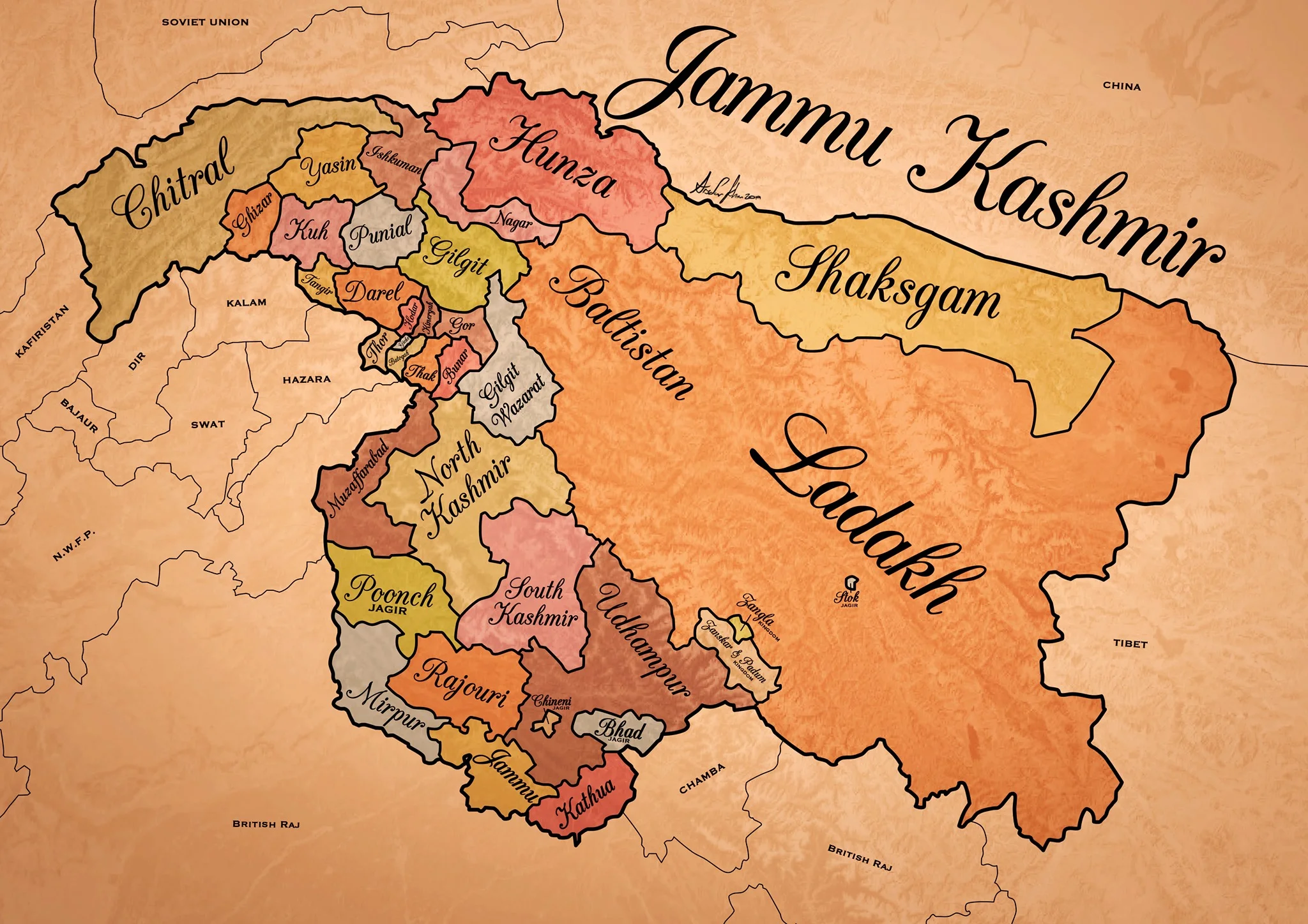
Historical Map of the Dogra Kingdom of Jammu and Kashmir
The State of Jammu and Kashmir as it was at its largest extent under the rule of the Dogras. This Map helps people understand the complicated Geography and Diversity of the erstwhile State of Jammu and Kashmir.

Historical Map of the Dogra Kingdom of Jammu and Kashmir
Another interesting Map of the previously E Jammu Kashmir by my talented friend Arsalan Khan who also belongs to the Riyasat. We had previously had an Article on the various Indigenous People of Jammu and Kashmir. Its not perfect, has its anomalies but it still an indicator of the diversity of the State from a Political angle. This Map shows the Dogra Kingdom at its most expansive. And i would like to point out that all these different areas were won over by the Dogras / Dogras under the Sikhs in War except Kashmir which was granted as a part of the Treaty between the British and Raja Gulab Singh on the payment of War Indemnity of 75 lakhs. It should be pertinent to mention that the Dogras also played a part in the Sikh conquest of Kashmir earlier from the Afghans. Also it suited the British in 1846, when the Sikh Kingdom still existed, to have a parallel power which they could use as counter against them and in this case it was Raja Gulab Singh and his hardy Hill Men. Here is an account of the transition of the Rulers in Kashmir From the Mughals to the Dogras giving a background of how Kashmir passed from the Mughals to the Afghans to the Sikhs and onto the Dogras.
Just an explanation on the parts :
Chitral : This is the most controversial inclusion as it always stirs up a Debate. Was Chitral at any point of time a part of the Dogra Kingdom ? Different historians had different versions on this but one thing was clear that the Chitral Kingdom did pay tribute to the Dogras. This has been verified by me personally with Members of the Chitral Royal Family. Of course later due to the Great Game Chitral was made a part of the Malakand Agency. Here is an account of the Chitral Expedition an important event in the History of Chitral
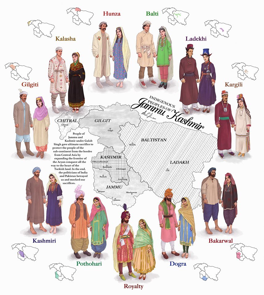
The Indigenous people of Jammu and Kashmir
Hunza / Gilgt and around : Besides Gilgit and Hunza there were other Hill States which used to be constantly at loggerheads with each other but used to occasionally unite against foreign aggression. These were Iskoman, Nagar, Yasin, Ghizer, Punial and Darel among the more notable ones. Gilgit was an important location and one of the most forward bases of the British in the Great Game which I have described in this article titled The Gilgit Game. In addition to these there were various other smaller “Shinaki Republics” which as the name suggests were Groups of Shina speaking people in communities in the area generally named as Chilas. The Imperial Gazzette of 1908 described them as such :
“A group of small republics in the valley of the Indus, lying west of Kashmir and south of Gilgit. The territory extends from the junction of the Astor river with the Indus to Seo on the right bank and Jalkot on the left bank of the latter river. Within this area the people are grouped in communities inhabiting one or more nullahs, each community forming a separate republic. Starting from the junction at Ramghat these are, in order : on the right bank, Gor, Kinergah, and Hodar ; and on the left bank, Bunar, Thak, Butogah, Giche, and Thor. They constitute the area known as the Chilas subdivision of the Gilgit Agency, while Chilas proper includes Kinergah, Butogah, and Giche. Lower down the river are Darel, Tangir, Khilli, and Seo on the right bank, and Harban, Sazln, and Jalkot on the left bank.
After the conquest of Chilas by Kashmir in 1851, the Maharaja imposed a tribute in gold-dust, and arranged for the administration of the country as part of the Gilgit district. A British Agency was re-established at Gilgit in 1889, which included, among other terri- tory, the Chilas subdivision described above except Thor. In 1892 a British mission to Gor was attacked by the Chilasis, which led to the occupation of their country and the appointment of a Political officer at Chilas. The right of the Kashmir Darbar to construct roads and station a limited number of troops in the territory was secured, but the autonomy of the Chilasis was guaranteed. Under the revised arrangements made in 1897 the republics pay small fixed sums to the Maharaja, and in 1899 Thor was incorporated in Chilas. Darel has rendered a tribute of gold-dust to Kashmir since 1866, when the Maharaja's troops raided the country. The tribute is now paid through the Punial governor. Tangir pays a small tribute to the governor of Yasin. The remaining communities have no political relations with either Kashmir or British India, except Jalkot, which from its position dominates Thor and the head of the Kagan valley in the North- West Frontier Province.”
Then on the other side we have Baltistan and Ladakh about who most people know a bit of the History and how these were conquered by General Zorawar Singh between 1834 and 1840. This is a brief account of the conquest of Ladakh and Baltistan by the Dogras. In Ladakh also once the Royal family was removed from Leh, the Ladakhi King was granted the Village of Stok and some surrounding area as a Jagir. Thats where the Stok Palace was built. Much the same way the Raja of Zanskar was granted the Jagirdari of Zangla. Or something to that effect. This is a general note on Zanskar to help in the understanding of this one of the most remote regions of the Himalayas. And ignore the Shaksgam part as its shown beyond its size. This article gives you an insight into the Shaksgam Valley. Another important part of the State which is missed out in this map is the region between the Karakorams and the Kun Lun Mountains called the Aksai Chin.
And then of course we have the Kashmir Valley itself. It was divided into North and South Kashmir for administrative purposes. To the West of Kashmir was Muzaffarabad which was the Pahari area along the Jhelum Valley starting from Uri. This is the part I belong to close to the town of Hatiann Bala. Muzzafarabad is also the Capital of the entity referred to as “Azad Jammu Kashmir”.
Then of course we have Poonch which was a Jagir granted to the family of Raja Suchet Singh, a brother of Raja Gulab Singh. It had a history of its own and struggled for a while to be independent of their Jamwal Cousins which only resulted in the Jagirdari being terminated for a bit. Here is an account of what transpired in the Kingdom of Poonch. There was also the very small Jagirdari of Chenani, which is a small Town on the Highway and I remember that there used to be a Palace of sorts over there. More than that I remember because the erstwhile Raja of Chenani was a friend of my Grandfather’s and i have seen him at my Grand Fathers’ place when I was very young.
And then there was Rajouri which is the stronghold of the Gujjars and most of them are based here during the Winters. Next to Rajouri was Mirpur which was really a part of Punjab and the people were called as Mirpuris. Due to the building of the Mangal Dam many Mirpuris went to the UK and thats the reason you have a strong Mirpuri community in the UK.
And then we had the Duggar heartland of Jammu and Kathua which bordered Chamba with which it shares a lot of Cultural similarities. The district of Udhampur at that time included the whole of Udhampur and Ramban as well as Doda and Kishtwar. The Jagirdari of Badh or Bhaderwah was granted to the Ruler of Bhaderwah who was installed by Gulab Singh after getting the Chambyalis to give up all their claims over Bhaderwah. It used to be an integral part of the Chamba Kingdom. This is an account of Bhaderwah. It connects with Chamba over the Padri Gali.
Of course this will get many people excited and there would be counter views but the views mentioned above are my own based on what I have read and experienced. Kindly feel free to disagree. But as a request just dont start a discussion 1947 onwards as it wont get us anywhere.
This Map is available in hi-res as well. Do let me know if you want.
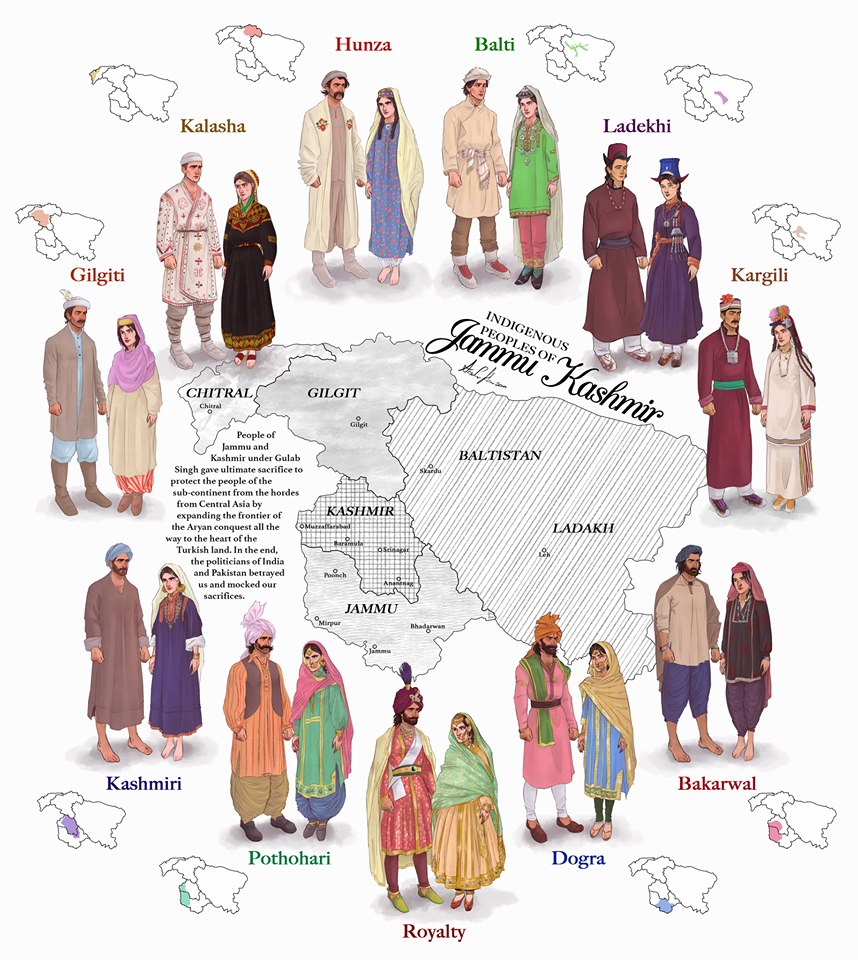
The Indigenous People of Jammu and Kashmir
The erstwhile State of Jammu and Kashmir was one of the most diverse State in the country in Ethnic, Religious and Lingual dimensions. The main "People" of Jammu and Kashmir and its different regions are briefly described in this Article.

The Indigenous People of Erstwhile State of Jammu and Kashmir.
This is a graphical representation of the people of Jammu and Kashmir made by Arsalan Khan and Rajja Sourav Singh Sarmal. A brief description of each by me to help in better understanding (Clockwise from top) :

Hunza (Burusho) Ladies. Pic credit Wikipedia
The Hunza : The Hunza or the Burusho people inhabit the Hunza Valley and neighboring Valleys in the extreme North of the state. They speak the Burushaski language which as a language has not been identified with any language Group. The Hunzai now mostly follow different schools of Islam.
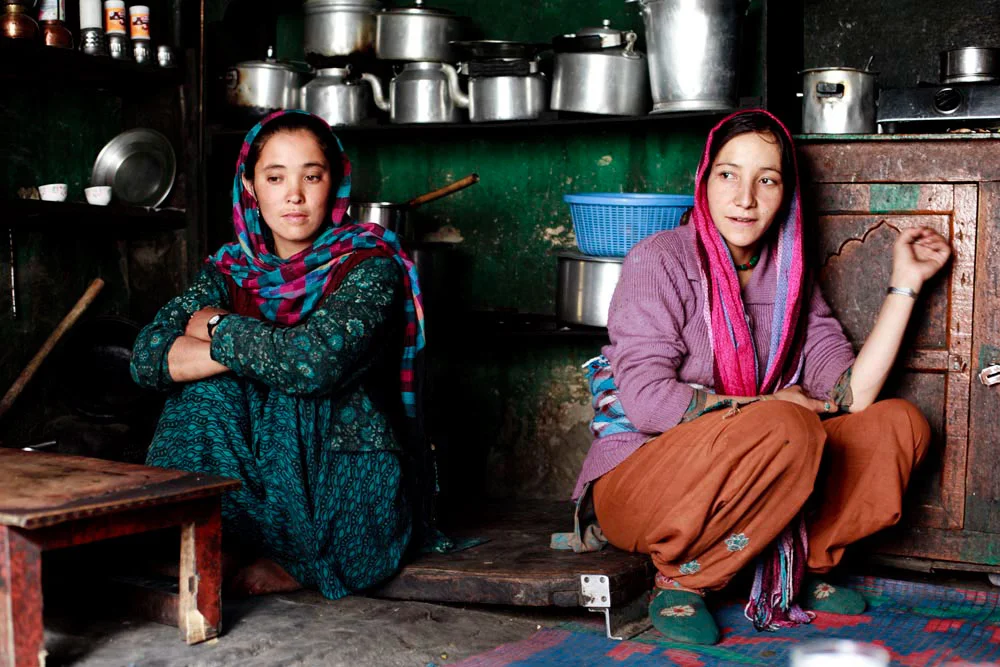
Balti Ladies. Pic Courtesy : https://www.behance.net/gallery/12289037/The-Balti-People-of-India
The Baltis : The Baltis are the inhabitants of the Baltistan and are of Tibetan origin with Dardic admix. Their language is Balti, which is a part of the Tibetan language Group. Infact it has the greatest similarity to old Tibetan. The Baltis follow Islam.

A :Ladakhi Lady in traditional Dress. Pic Courtesy Jimmy Nelson
The Ladakhis : The Ladakhis are the inhabitants of the Ladakh region and are of Tibetan descent. The Ladakhi language is from the Tibetan family. Ladakhis are Buddhists as well as Muslim.

Ladies in Kargil. Pic Courtesy Roots Ladakh
The Kargilis : The Kargilis or the Purigpas as they are called inhabit the Western part of Ladakh at the crossroads with Baltistan and Kashmir. Their language Purigi is a dialect of Balti and as such they are also a part of the Tibetan family. Purigis are mostly Muslim.

Bakarwal Men
The Bakarwals : The Bakarwals and their close cousins the Gujjars are traditionally nomadic pastoral people who inhabited the foothills of the Himalayas and moved to the Mountains in the Summers with their livestock. They (Gujjars/ Bakarwals) form the majority in the Poonch Rajouri region and spread among the Jammu Division and in Kashmir as well. They follow Islam.

Maharaja Ranbir Singh, the Dogra Ruler of Jammu and Kashmir state during who’s Rule the Dogra Kingdom reached it largest extent and also included Chitral
The Dogras : The traditional dwellers of the Jammu region or the “Duggar” as the region was known. They live in the foothills of Jammu and are spread into Himachal Pradesh as well. The Dogras speak the Dogri language which is from the Western Pahari Group of languages. The Dogras are mostly Hindu though a significant number converted to Islam and were referred to as Chibalis.
The Potohari : The Potohari/ Pahari are the most Punjabic people of Jammu and Kashmir and live across the Potohar Plateau which stretches well beyond Rawalpindi. They are in sizeable numbers in Poonch. Their language Pahari-Pothwari belongs to the Lhanda Family of Punjabi. They are majorly Muslim but there is a strong Hindu minority as well.
The Kashmiri : The people of the Kashmir area found mostly in the Kashmir Valley. They are the biggest Indegenous Group of people in the state. They speak Kashmiri language which belongs to the Dardic family of languages. Kashmiris are mostly Muslim though a small minority of Kashmiri Hindus also exists.

Dard - Shina People in Kargil
The Gilgiti : The Gilgiti or the Dards are the inhabitants of the vast Gilgit Valley in the North West of the state. They speak the Shina language. They (Dards) are also found in other areas of the state like Gurez and Drass where they have said to have migrated from Gilgit. They follow Islam though a few follow Buddhism as well in Ladakh.
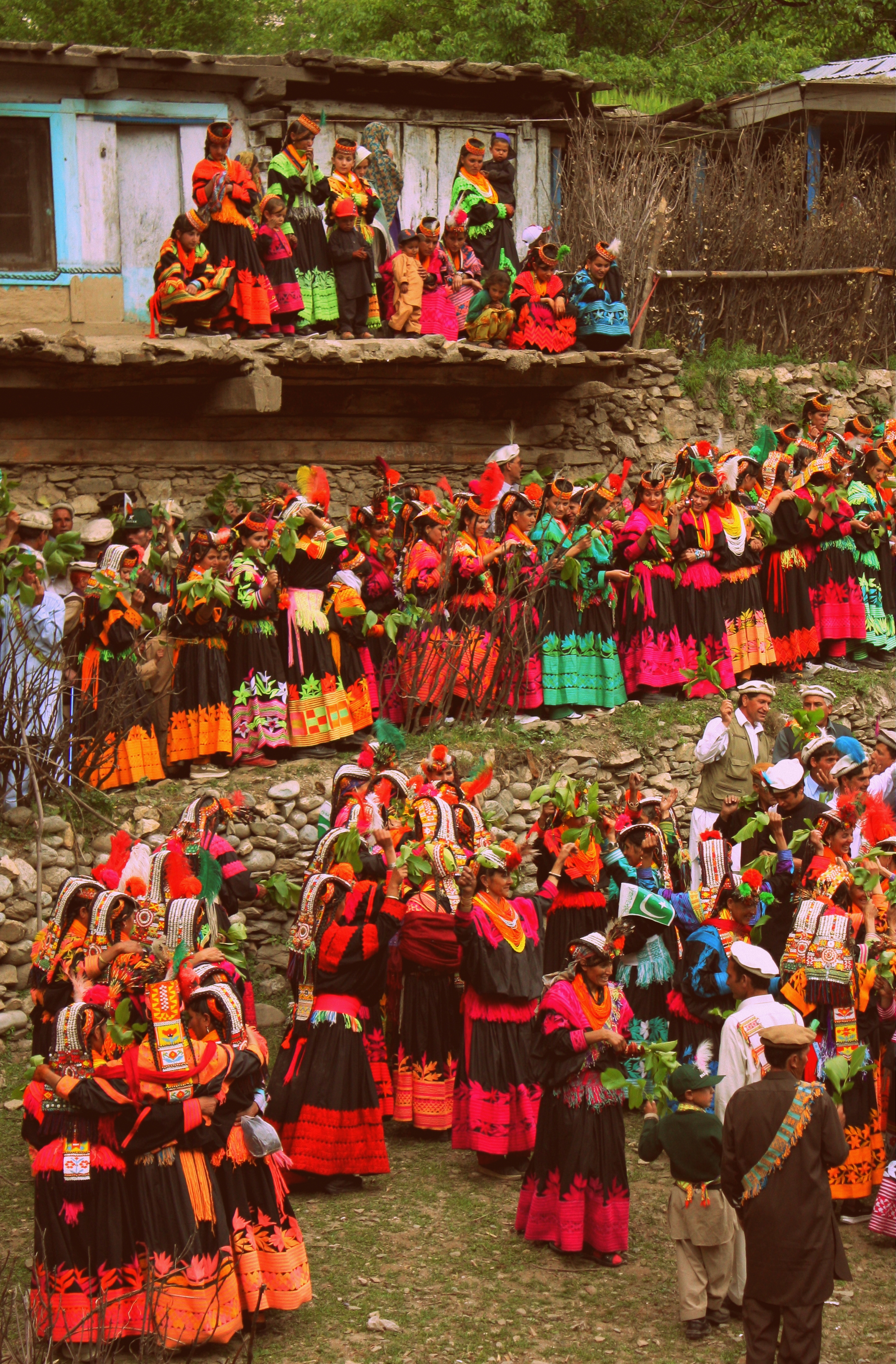
Kalash People during the Chillam Joshi Festiva. Pic Courtesy Wikipedia
The Kalash : The Kalash inhabit three Valleys in the Chitral Region now in KPK though at one time the Chitral Kingdom paid tribute to the Kingdom of Jammu and Kashmir. The Kalsha speak the Kalasha language which is a part of the Dardic family of languages. They have a distinct culture which has been under threat. Most Kalasha have converted to islam though a small number (3000 app) still follow traditional Animist beliefs.
Hi Res of Graphic can be downloaded from the link in the first comment.
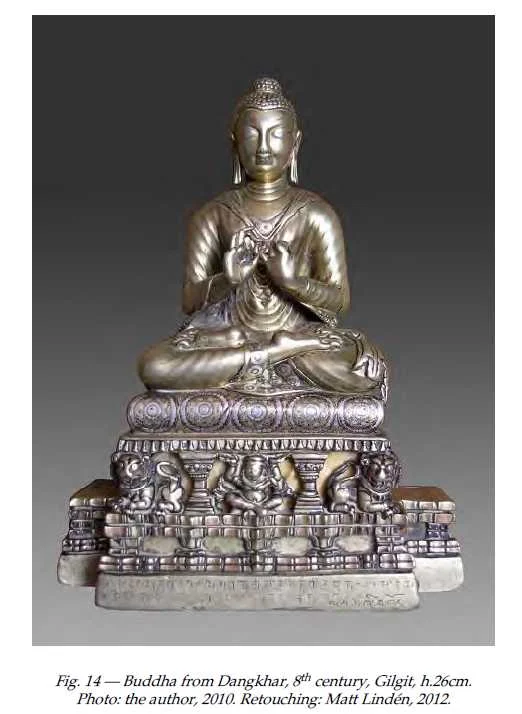
The Dhankar Buddha of Spiti
The Dhankar Gompa in Spiti as among st its posessions a metal Statue of the Buddha which was off limits to outsiders. A few people had ever seen and it was first photographed for open sources only in 2010. This is the story of the Buddha which came all the way from Gilgit

The Dhankar Buddha
Spiti or Piti as it was also called is probably as remote as any Trans Himalayan region and has for years lived in a time capsule but of course now things are changing. But like all the Lands Himalayan it holds its mysteries and secrets close to its chest. Just like neighbouring Lahaul and its ‘cultural / spiritual” big brother it was for most part of traceable history a part of the Guge Kingdom and subsequently the Central Tibetan Kingdom. Later on it became a part of Ladakh as the Kingdom grew powerful. It also became a bone of contention between Raja of Bushahr and the Ladakh Kingdom as the Bushahr Kingdom claimed Spiti as its own. Of course this led to the Raja of Bushahr to support the Central Tibetans and their Mongol allies when they decided to invade Ladakh over a religious dispute between the Dalai Lama and the King of Bhutan but that's a separate story.
Spiti because of its remoteness and isolation has preserved its culture and traditions, unlike many other such places. In the traditions of Tibetan Buddhism the Monastery is the center of life and the Monasteries are the keepers of ancient Manuscripts and Religious Iconry and these treasures have been very strictly guarded by generations of Monks who have lived in these Monasteries going back to thousands of years. The Monasteries of Spiti have survived plunder and ravage mostly through History except for a brief period when General Zorawar Singh took over Ladakh and Spiti was a part of Ladakh so he received Spiti as well.

The Dhankar Village and Gompa. Pic Courtesy : wikipedia Commons
Though Zorawar never came to Ladakh he appointed a certain zealous Officer in charge of Spiti. Now this Officer wasn't very fond of the local culture and tradition and went onto plunder many of the Monasteries and he was much despised for it. It should be pertinent to mention that the same Officer was a part of Zorawar’s Army which lost to the Tibetan / Chinese Army in the engagement in which the General was killed. But the said Officer was captured alive by the Tibetans and identified as the person responsible for the desecration of the Monasteries in Spiti and elsewhere. Suffice to say that he met a slow painful death as he was put in a cauldron of oil which was slowly heated.
Ok coming to the Topic of the Dhankar Monastery. It was one of the most important Monasteries in Spiti standing as it was above the confluence of the Spiti and the Pin Rivers. Dhankar had always been the traditional Capital of Spiti and the seat of the early “Local Rulers” of area called the Nonos. And of course the Dhankar Monastery had its own collection of Ancient Relics and Treasures though its is said that it was also plundered and ravaged during the Dogra Rule. And there was a certain Buddha statue highly revered and venerated but as closely guarded as well. It was called the Dhankar Buddha.
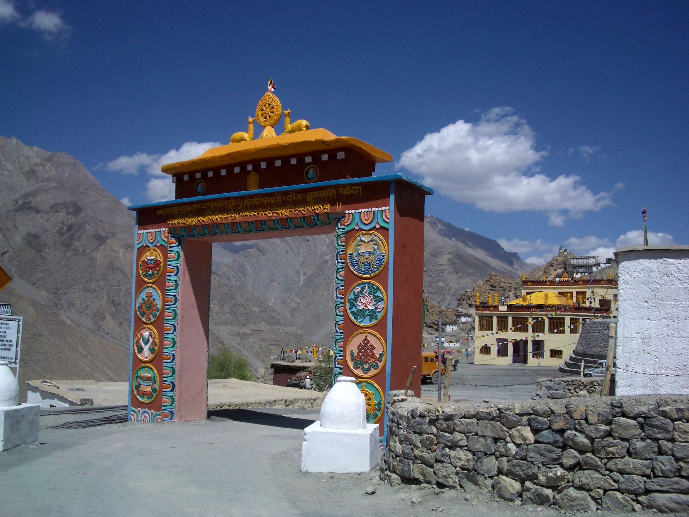
The Main Gate of the Dhankar Gompa. Pic Courtesy Wikipedia Commons.
Henry Lee Shutterworth was an Officer of the Raj who was posted in Kulu which was a British dominion. He also spent time in the most remote part of his jurisdiction in Lahaul and Spiti. With time he developed an interest in the local culture and tradition and began to record local Buddhist history and records. And this involved visiting various Monasteries in the area and trying to convince the Monks to show him some of the Treasures that the Monasteries so secretly guarded. And he had heard about the Dhankar Buddha and in time he was able to convince the Monks to show him the Dhankar Buddha. And he was totally taken aback when he saw the fine piece of Art and the quality of the Brass work. He wasnt allowed to take a Photo but was allowed to take a rub of the inscription at the bottom. Taking a Rub is akin to something we used to do as kids. Cover a coin with paper and then run a pencil over it so that the inscription on the coin is copied over the paper.
What he had stumbled upon was described by a Scholar of the subject as such “The Buddha from Dangkhar is in many ways one of the finest discoveries made in the field of Buddhist art and epigraphy for the cultural areas of Western Tibet and Greater Kashmir. We now know that the two inscriptions engraved on the lower part of the pedestal attest to the incredible journey of this image; produced in Gilgit in northern Pakistan in the eighth century, the statue was bestowed upon the royal monk from Guge, Lha lama Zhiwa Ö (lha bla ma zhi ba ’od) (1016–1111), about three hundred and fifty years later. Things were quite different then when Shuttleworth worked on the manuscript of his History of Spiti in the early 1930s. If the name of the Tibetan translator of royal descent had been easily identified, the main dedicatory inscription resisted easy decipherment.”

Another view of the Dhankar Gompa
That itself establishes the fact that Buddhism came to Tibet via what is now the Gilgit but via Central Asia. The fact that this sculpture made probably during the Rule of the Patola Shahis in Gilgit is an indicator enough. And from there it traveled all the way to the Kingdom of Guge in Western Tibet. And it was after 300 years of getting there that it was gifted to the Monastery in Spiti. And there it stayed, a mystery which was only solved by Shutterworth’s rubbing but Scholars yearned to have a look at it. The first time the Dhakar Buddha was photographed was in 1993 by a Government agency documenting India’s Arts under a Government legislation. It took a law for the Monks to reveal this Treasure and allow its Photography.
“In 2006, art historian Robert Linrothe took a glimpse at the metal sculpture but was not authorized to reproduce it. It is only in 2010 that the present author was entrusted by the monks from Dangkhar with the study of their sacred image, a request completed two years later.” These are the words of Yannick Laurent, a scholar at Oxford who was finally able to Photograph this much revered treasure. And for now the whole world can see it. It has a striking similarity to other Buddhas made during the Patola Shahi rule in Gilgit. That truly was a Golden Age of Buddhism in Gilgit and even the Gilgit Manuscripts, the most ancient and sacred of all Buddhist manuscripts are a testament to that.
So try your luck at the Dhankar Monastery next time. Maybe the Dhankar Buddha would give you an audience.
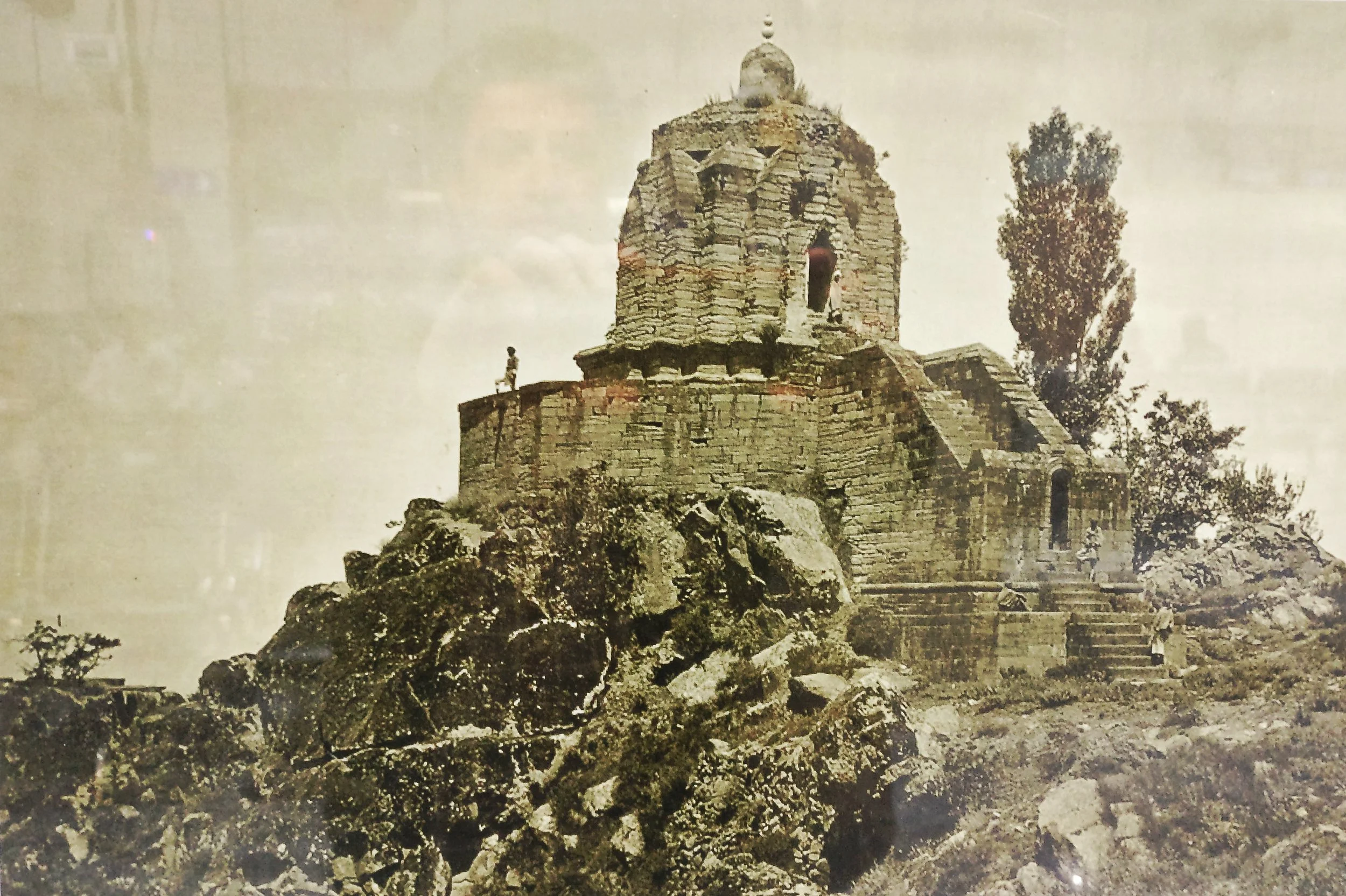
The Lingual Diversity of the state of Jammu and Kashmir
The state of Jammu and Kashmir is made up of a number of geographically separate Regions divided by Ranges of the Himalaya. Its home to a diverse variety of Ethnicity, Cultures, Religions and of course Languages and Dialects. This article looks at the language diversity in the state of Jammu and Kashmir.

The Lingual Diversity of the state of Jammu and Kashmir
The State of Jammu and Kashmir is not only Geographically and Ethnically diverse with the two Highest Ranges in the World, the Himalayas and the Karakorams and also hosting Peaks of over 8000m from both these Ranges. Ethically it has a diverse mixture of people and distinct Regions dominated by different Religions such as Islam, Buddhism and Hinduism. But one of the little understood and little know fact in the Lingual diversity that exists in this state which we study as it existed in 1947 before the Partition.
The state was basically made of of 5 different Regions which were all Mountainous and it was the Mountains and the Rivers which divided the Populations. The main Regions as we can name in today’s context were (in Alphabetical order) were Baltistan, Gilgit, Jammu, Kashmir and Ladakh. And of course we have a major language language associated with the Region. Balti with Baltistan, Shina with Gilgit, Dogri with Jammu, Kashmiri with Kashmir and Ladakhi with Ladakh. But these classifications only sum up the language of the perceived majority in that Region but doesn't really give a true picture of the lingual diversity and how the languages sometime merge to create hybrid languages.
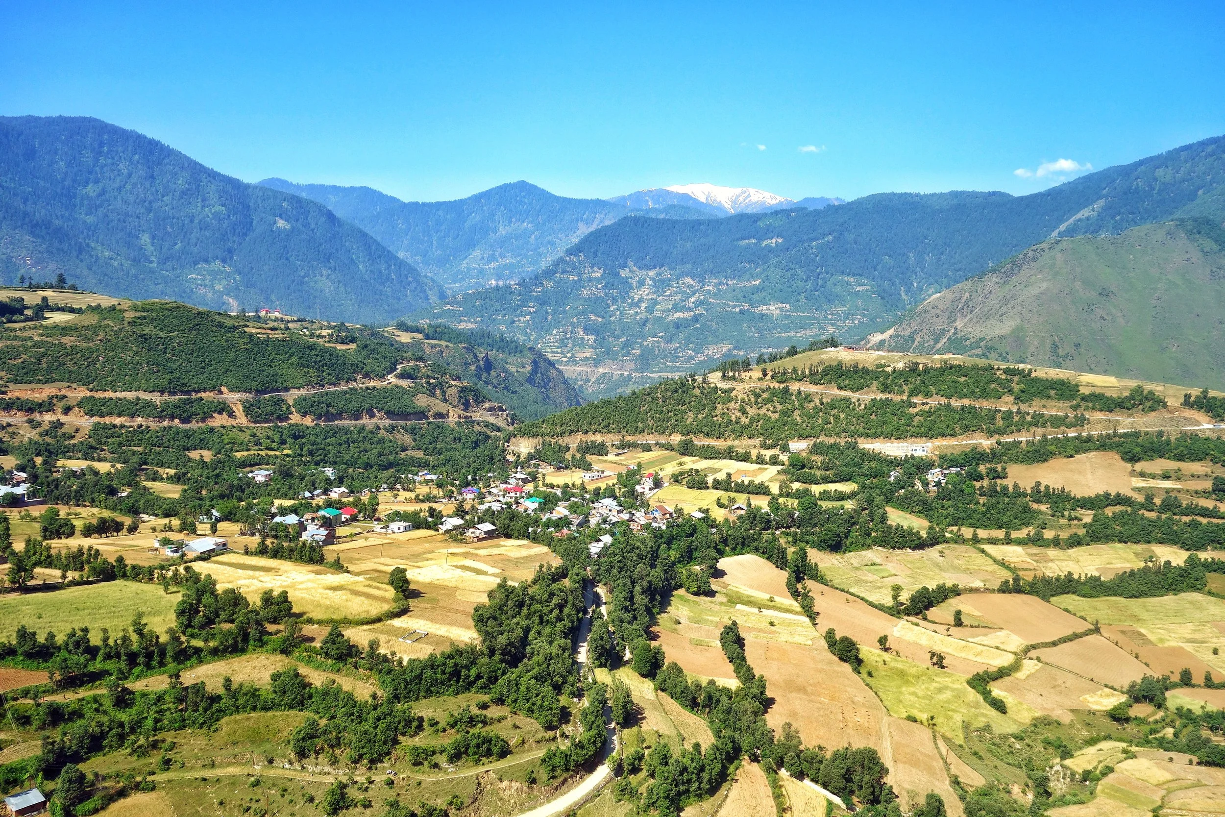
Starting from the Jammu Region which has a diverse language influences. Starting from the bottom at Poonch and Rajouri where the spoken language is Poonchi or Pahari or Potohari. This language belongs to the Lahnda/ Punjabi family of the Indo Aryan languages. Moving Eastward we have the Dogri language, which was considered as a Punjabic language and still has a lot of commonality with Punjabi. But now Dogri is considered an independent language and one of the main languages of the Western Himalayan Pahari language Group.
And then we have the Gurjuri spoken by the Gujjars. Gurjuri is closely allied to the Marwari dialect of Rajasthani and also has a fair mix of Punjabi in it. In fact the Gujars living in Punjab speak Punjabi and the languages are intermixed. Gurjuri is also spoken in the Kashmir Valley where also there are communities of Gujjars. However a number of Kashmiri words have overtime have become common usage by the Kashmiri Gujjars influenced by their Kashmiri neighbours.
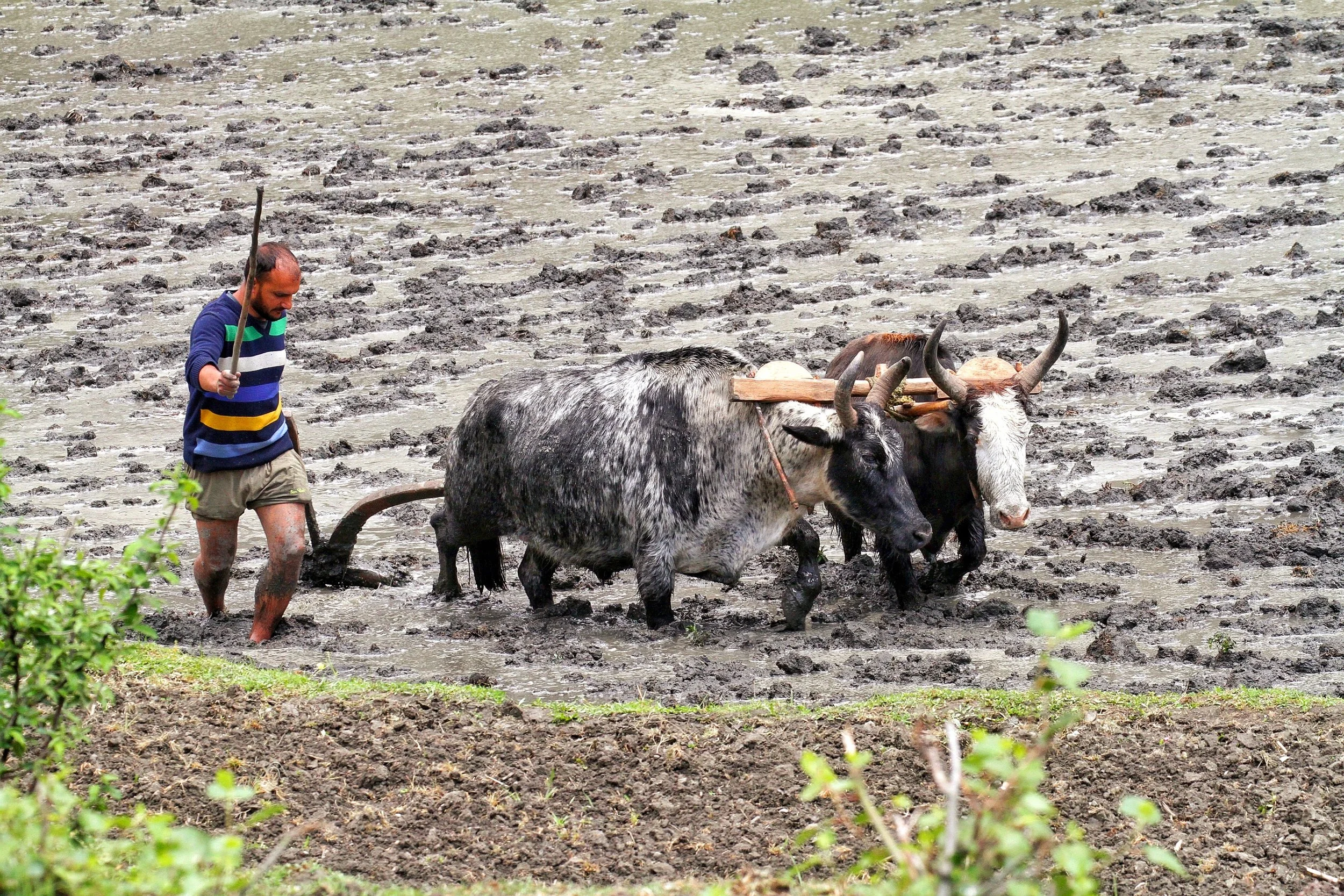
Moving upwards into other parts of the Jammu Division we see increasing influence of Kashmiri language which is a part of the Dardic Language family of the Indo Aryan language Group. Bhadarwahi, Bhalesi and Curahi from an intermediate forms of speech bridging the gap between the Punjabi or Dogri and the Kashmiri System. Padari is an extremely interesting dialect, spoken in Padar region of Kistwar on the banks of the Chinab. It has a striking similarity to Pangwali, spoken in the Pangi Valley in Chamba.
Siraji is the language spoken in country north of Chinab between Ramban and Bhart on the way to Kishtwar. It is central to Doda and is also called Doda Siraji at times. Due to its location, to the North it gives was to Kashmiri, on West to Rambani, on the North East to Kishtwari, and on the South and South West to Bhadarwahi and Chamba dialect. Its generally frameworked like Punjabi but has many points in agreement with Kashmiri.
Rambani as the name suggests is the language spoken around Ramban and like the Poguli which it closely resembles it is connected with Kashmiri though further away than it than Poguli. Rambani has a very largely Punjabi pronunciation whereas Poguli pronunciation is more like Kashmiri.
Poguli is a language spoken in a small area to the East of Ramsu. It resembles Kashmiri though it is unintelligible to speakers of the Kashmiri language. However it seems that all speakers of Poguli have some basic understanding of Kashmiri. Nearly all peculiarities of Kashmiri are found in Poguli which however contains a number of points in common with dialects which look to Punjabi as a fountainhead. Kishtwari is spoken around the Kishtwar area of the Kishtwar region. It is considered a sub-dialect of Kashmir which it resembles very much. Kashmiri is well understood in Kishtwar.
And of course then we come to the Valley itself where the main spoken language is Kashmiri. The second most spoken language in Kashmir is Gurjuri probably followed by Punjabi / Pahari spoken in the Border areas adjoining the LOC in the West. However there are still speakers of Shina in the Gurez Valley, a couple of Villages in Tral and the Sarbal Village in Sonamarg. There is also a small community of Shina people who live in Srinagar city and they also speak Shina. Shina BTW is the main language of people in Gilgit.

Shina itself is a part of the Dardic family, same as the Kashmiri language. Its the most spoken language of the Gilgit region and it has a number of dialects such as Gilgiti (the prestige dialect), Astori, Chilasi Kohistani, Drasi, Gurezi, Jalkoti, Kolai, and Palasi. Related languages spoken by ethnic Shina are Brokskat (the Shina of Baltistan and Dras), Domaa, Kohistani Shina, Palula, Savi, and Ushojo. Shina is also spoken in the Drass area, Dah and Hanu and other “Aryan” Villages of Ladakh. Shina is also spoken in areas adjoining Gilgit like Kohistan in Khyber Pakhtunkhwa.
And then we come to Baltistan, where the main language is Balti. Balti is a part of the Tibetan family and belongs to the Ladakhi Balti Group. Infact many words that were used in old Tibetan are still found to be in use in modern Balti whereas they are not used in modern Tibetan anymore. Balti is widely spoken in Baltistan and a dialect, the Puriki is spoken in the Kargil area and the Suru Valley. Proper Balti is spoken in the Turtuk area of Ladakh as well. The language is also used by Balti communities settled elsewhere including the small Group of Balti people settled around Dehradun in Uttarakhand.
And finally Ladakhi which like Balti belongs to the Tibetan language family and is related to Balti as well. Besides proper Ladakhi it has a dialect called the Zanskari which is spoken in the Zanskar region. Interestingly both Ladakhi and Balti belong to the Ladakhi Balti family of Tibetan language. These are also called Western Archaic Tibetan languages as they have a lot in common with Old Tibetan unlike the more modern Western Tibetan language of the Lahaul Spitian language. Ladakhi has other sub-dialects if you may like Lehskat after Leh, where it is spoken; Shamskat, spoken in the northwest of Leh; Stotskat, spoken in the Indus valley and which is tonal unlike the others; Nubra, spoken in the north of Leh. In my personal experience I think all these Tibetan languages are mutually intelligible to some extent as I see people speaking Puriki and Ladakhi being able to have a conversation.
This should give you an idea of the languages spoken in the state of Jammu and Kashmir and we know that in the Mountains in the older times populations evolved in isolation and hence the vast array of languages and dialects and sub dialects. Infact in some cases the language changes from Valley to Valley so the actual number of dialects are well impossible to even comprehend but this gives you an idea of the diversity.
Source : Language of Northern Himalayas by Bailey 1908 and other Internet sources including Wikipedia.
And adding a language Map of Jammu and Kashmir by Drew from the late 1800's.
The Pass of Shiva
The Pass of Shiva as it was originally called is one of the main Passes used since historical times and it connected Kashmir with Ladakh. A fascinating insight into the Pass of Shiva or the Sheoji Pass. Today this name has transformed into what we call the Zoji La.

The Pass of Shiva
Sometimes while going through historical documents you stumble upon information thats nothing short of fascinating. As I spend some time everyday browsing through historical Documents / Journals related to the Himalayas in general and the Western Himalayas I came upon a piece of information that I was also unaware of.
The mighty Zoji La which connects Kashmir with Ladakh above the Sind Valley was actually named after Lord Shiva. The name of the Pass used to be Shivji Pass or Sheoji Pass which was corrupted with the Passage of time and eventually Sheoji turned into Zoji. Now the thing that is fascinating about this is that this is the first time I am hearing of a Mountain Pass named after the most powerful God of the Hindu trinity.

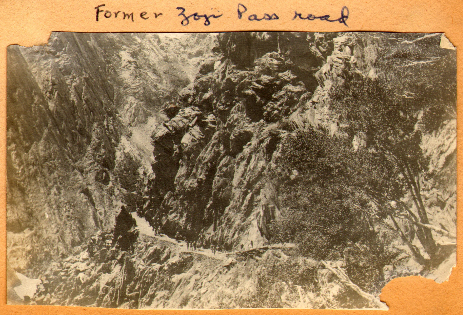
The Zoji La track as it was in 1913. Photography by Ralph Stewart.
This is what the 1890 Gazzetteer of Kashmir and Ladakh mentions about the Zoji Pass : Called Zoji La by the Ladakhis and Zoji Bal by the Kashmiris. The proper name is a corruption of Shivji or Sheoji, one of the three great Hindu deities. It leads over the Western Himalayas from the head of the Dras Valley to the Sind Valley in Kashmir. And is crossed on the Route from Srinagar to Leh between Baltal and Matayan.
It further mentions : The Pass has many names ; in the old Maps it is called Kantal, signifying the lofty hill, and under this name Jesuit missionary Desideri refers to it. Vigne calls it Palen-i-Kotal or Bal-tal (above-below) otherwise Shurji La, the hill of Shiva; the terminals “La” and “Bal” in the language of the Tibetans and Kashmiris, respectively, signify “Hill Pass”.
And interestingly it throws up some more interesting stuff from that day and age and mentions two approaches to the Pass from Kashmir : It is closed by Snow during nearly half the year, and is entirely impassable, except to Post couriers during two months. Two Routes lead up to it from the Kashmir side
1- Follows up the bed of the Sind River and passes over the blocks of Ice and Snowdrift which block the narrow Gorge through which it flows. This is the Winter Road and is only practicable for footmen.
2-Winds up the steep slope of the Hill rising above the Gorge of the Sind River to the North. It is a fair Road but is only used from July to December.
The top of the Pass is 2118 feet above Baltal. The descent on the Ladakh side is easy leading down to the Dras River and along its banks to Matayan crossing several tributary streams.
The Pass itself is the only section of the Road that closes to Dak services for more than a day or two at a time, in worst of Seasons. The Dak runners are sometimes unable to cross for two or three weeks the length of the impracticable section at such times is about 7 miles or so from Baltal to Gremen.
It should be noted that the British gave great importance to the Pass as they saw it as the first step on the way of setting up an all weather Trade Route between India and Turkestan and apparently the Pass of Shiva was the first of the mighty Passes that the Himalayas would throw at the Travelers. Maybe it because of the same reason that the Pass was held in reverence, I assume once upon a time and named after Shiva.

The Road climbing up from the Sind Valley as in the present day
In today’s day and time with all the Modern technology Engineers still struggle with the Pass though crossing it is no longer the ordeal it used to be once upon a time. But the approach is located in a fragile Mountain and shooting stones are still a clear and present danger. And landslides and avalanches still haunt the Pass. A lot of work keeps getting done but the Pass of Shiva doesn't stay quiet for long. Well, its Shiva’s Pass. What else would you expect !
The Exploration of the Siachen or Rose Glacier
The Story of the Exploration of the Siachen Glacier. This Glacier, now said to be the highest Battlefield in the World, was first Explored and Mapped by a team led by a Lady Fanny Bullock. This is her Story as well as Guide to explaining the Siachen Glacier with its main features and Glaciers around it.

The Siachen Map
The Exploration of the Siachen or Rose Glacier
The Siachen Glacier. It must be the most talked about Glacier in the Himalayan Karakoram region. A Glacier that has got famous for reasons that are just Political and I would steer clear of that. But there was a time before Partition when it was just another wonder in the Wilderness of the Himalayan Karakoram Mountains. One of the largest Glaciers outside the Polar Regions and for the early Explorers it was hard to believe that such massive Glaciers could exist anywhere outside the Polar Regions.

Ms.Fanny Bullock (Pic Courtesy Wikipedia)
The credit for the initial Exploration and Mapping goes to a Lady Fanny Bullock and her husband William Hunter Workman. They were actually a rich couple who liked to Tour the World and once they happened to come to India for a Cycling Tour. It was then that they got introduced to the Himalayas and it proved to be a life-long affair. The couple made 8 trips thereafter climbing and exploring the Himalayan and the Karakoram Mountains. They made many notable explorations during these Trips and during one of these Trips Ms.Fanny Bullock also managed to climb the Pinnacle Peak during their explorations of the Nun Kun Massif. The Pinnacle Peak is a side Peak to these Twin Peaks and at 6930 m it was a world record for a Lady at that time. It should be mentioned that being rich, they could afford Italian Porters and Guides though they also took local support.

Ms.Fanny Bullock atop Pinnacle with a Poster calling for Woman to be allowed to Vote (Pic Courtesy Wikipedia)
However they seemed to have an issue with the local Porters and many of their Travelogues were full of complaints against the local Porters and their behavior. I assume that it was a Cultural thing more than anything else. Born is a rich aristocratic American family which then moved to Europe she was far removed from the hardships of the people in the Mountains and it seems that the Lady got on very well with the Mountains but never did get along with the people who inhabited the same Mountains. Many people also accused the couple of exaggerating their actual accomplishments and always longing to be in the limelight. And their Maps were far from accurate. But all said and done they explored some of the least and even never ventured into areas especially in the Karakorams and this included many forays onto the many large Glaciers that the Range held.
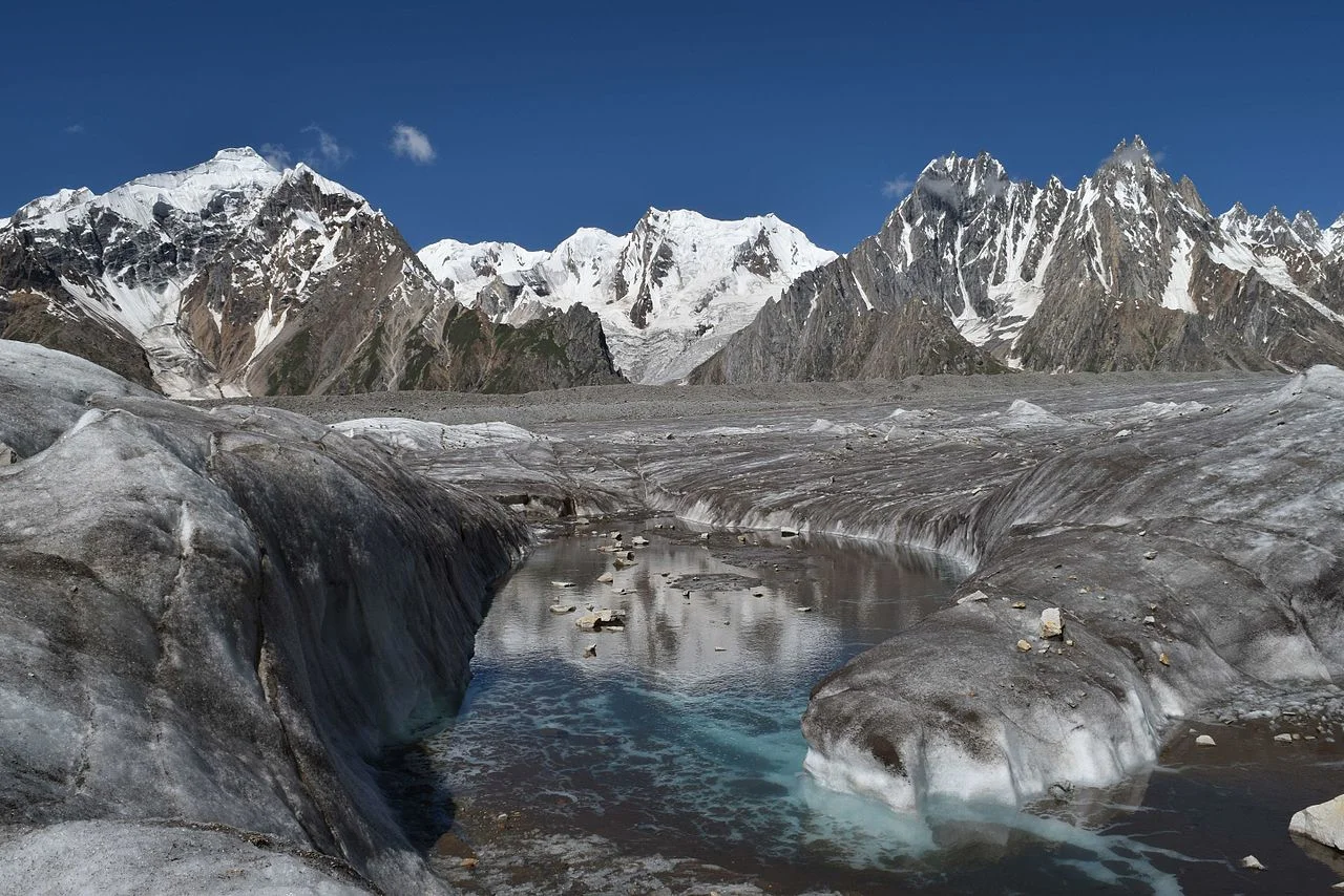
The Biafo Glacier (Pic Courtesy Wikipedia)
These Glaciers included the first attempt at the Biafo Glacier in 1899, an attempt they had to give up due to the Weather and the Crevasses so they moved onto exploring the Skara La Glacier instead. In 1902 they returned for the exploration of the Chogo Lungma Glacier. In 1907 they came to Kashmir and carried out the first exploration of the Nun Kun Massif. It was during this Exploration that at the age of 47, Fanny Bullock summited the Pinnacle Peak at 6930 m. Interestingly two years later a Lady competitor of hers claimed to have climbed a Peak in the Andes that stood at 7000m. But our Lady didn't believe her and actually paid an amount of USD 13000 to a Group of French Mountaineers to actually climb that Mountain in Andes and get the actual height. It turned out to be 6768 m. Fanny Bullock kept this Record to herself for a couple of decades.
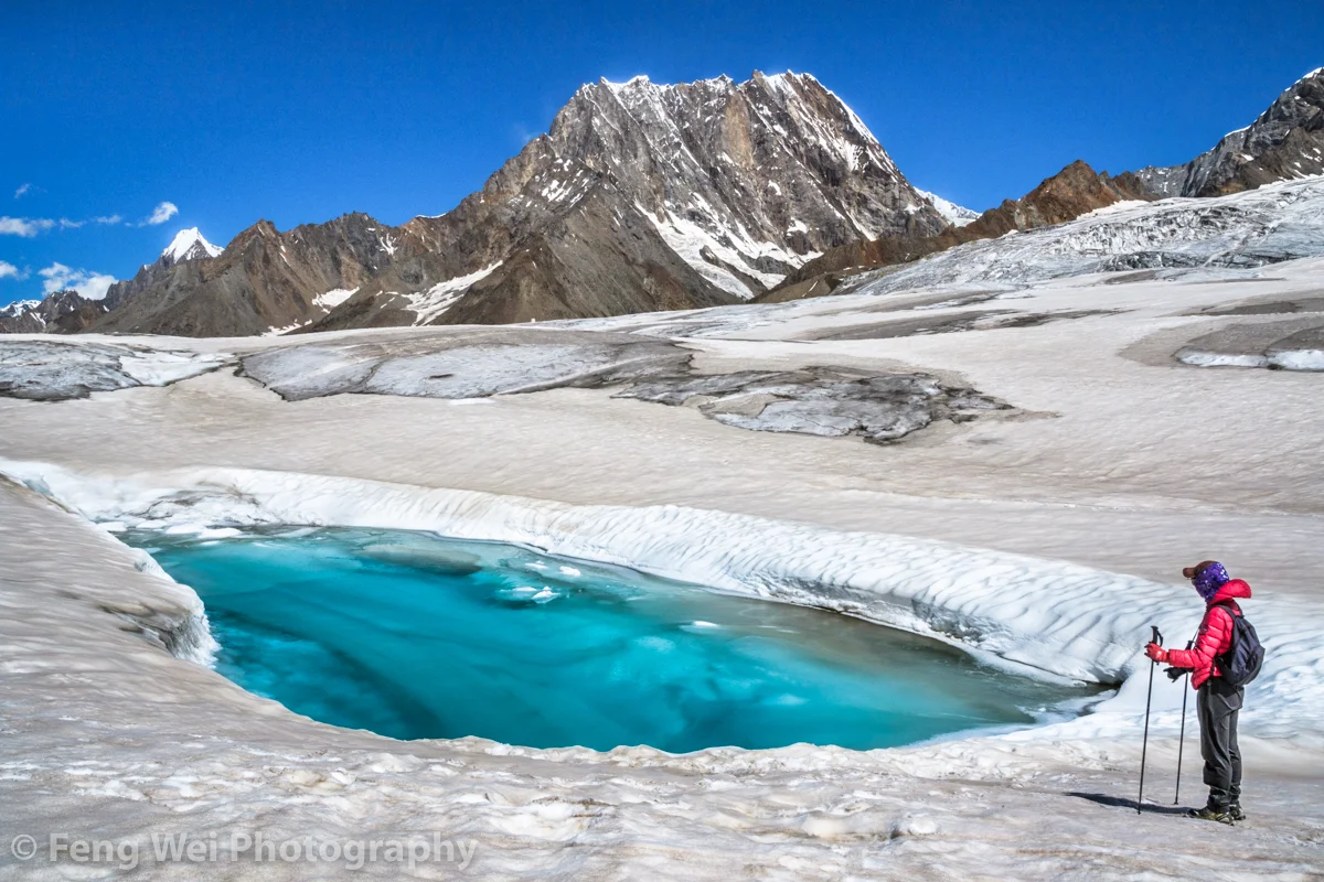
The Hispar Glacier (Courtesy Feng Wei Photography)
In 1908 the Lady with husband in tow arrived once again to explore the Hispar Glacier and even traversed across it and went to the Biafo Glacier setting another Record for ladies. They explored a number of side Glaciers and Peaks. In 1911 - 12 they finally decided to go and explore the biggest Glacier of them all. The Rose Glacier or the Siachen Glacier as we know it now. And they explored the Glacier and its sides for the two month period they spent there. It was a commendable piece of Exploration and as per all accounts this Exploration was led by Fanny Bullock herself. This was considered to be there greatest accomplishment and it also happened to be the last time in the Himalayan Karakoram Region due to the outbreak of the First World War.

A Wild Rose locally called a Sia (Pic Courtesy Wikipedia)
In her Book written after this Expedition, Two Summers in the Ice-Wilds of Eastern Karakoram , Fanny Workman writes : “The object of placing my full name in connection with the [Siachen Glacier] expedition ... is not because I wish in any way to thrust myself forward, but solely that in the accomplishments of women, now and in the future, it should be known to them and stated in print that a woman was the initiator and special leader of this expedition. When, later, woman occupies her acknowledged position as an individual worker in all fields, as well as those of exploration, no such emphasis of her work will be needed; but that day has not fully arrived, and at present it behooves women, for the benefit of their sex, to put what they do, at least, on record.”
And sharing the Map that was made by, as it came to be known as, the Fanny Bullock Workman Expedition of 1912 of the Siachen or Rose Glacier ( I am sure most of you are aware of the fact that the wod “Sia” in the local language stands for Wild Rose”). A very interesting Map indeed though not exactly accurate but still a great feat of Exploration, Mountaineering and Cartography.

The Indira Col and Turkestan La (Courtesy Josh Jagran)
Of course this is a Map which I love as to me its a work of art which has been worked hard at. And I have marked some important Passes which were used to access this Glacier (not that many people accessed this Glacier but these Passes were the ones used). The first one is of course the famous Indira Col at 18911 ft (The Workman Map wrongly describes it as 20880 ft) which is marked as Indira Col or Pass in the Map. No it isnt named after Indira Gandhi. It was named probably by the makers of this Map themselves as they gave names to all the features they saw as un-named in the Maps of their time that they were carrying (These Maps are described on the Map itself). They gave some features English names and some they gave Hindi names. Like the Indira Col (Named after Lord Indira) and Mt.Lakhsmi (self-explanatory) and they called a Group of Peaks as the “Apasaras”. Also itr signifies that the Indira Col was never used by the locals and hence never given a name. Its just too tough for anyone but a trained person.

The Kondus Glacier (Pic Courtesy the Amercan Alpine Journal)
Then there is the Bilafond La (No.2) at also known as the Saltoro Pass at 17881 ft on the Saltoro Ridge (The Workman Map puts the height at 18370 ft) . The name apparently comes from the Balti word for “Butterfly” or the Pass of the Butterflies. This was apparently one of the Passes that were used on the Silk Route which connected Ladakh and Baltistan with Central Asia. And then there is the Turkestan La (No. 3) said to be 19209 ft as per the Workman Map. This was probably another Pass into Turkestan as the area beyond the Karakorams referred to as. Not very significant anymore.

Dogs somewhere on the Siachen Glacier (Courtesy Wikipedia)
And then there is the Sia La (No.4) (The word Sia again derived from the local word for the Wild Roses that grew in the area). It stand at 18337 ft (The Workman Map puts the height as 18705 ft) on the main Saltoro Ridge. Further down is the Gyong La Pass which is not marked in the Map.
And then the Map also shows numerous side Glaciers and big Glaciers in the neighbourhood of the main Siachen Glacier. Like from below or the West the Kondus / Kaberi Glacier, the Bilaphond and Lolophond Glaciers, the Sher-Pi-Gang Glacier and the Peak 36 Glacier. Above or on the East (left side) of the Siachen are the Urdok Glacier and the Tarim Shehr Glacier.

Jammu and Kashmir dispute Map by the UN.
Of course we are all well aware of the situation on the Glacier and I would like to point out that all the Passes mentioned above are well in control of the Indian Army and they control the access to the Glacier. So in actual Geographic terms India controls the Siachen Glacier. And all the area running North of the point NJ 9842. But thats about all I can say about that.
The Inter-State Himalayan Boundary Dispute at 14000 ft
An Inter-State Boundary dispute at 14000 ft beyond the mighty Baralacha La between the Himalayan states of Jammu and Kashmir and Himachal Pradesh. The dispute involves the marking of the actual Border between Lahaul on the Himachal side and Ladakh on the Jammu and Kashmir side.

The Inter-State Himalayan Boundary Dispute at 14000 ft
In 2018 a rather quite interesting story cropped up in the news regarding a dispute on the Interstate Borders in the High Himalayas between Himachal Pradesh and Jammu and Kashmir. As per the Himachal Authorities the JK Police had set up a picket more than 18 kms than the designated Border between the two States. And this led to an altercation. Of course the matter was brought to the notice of the Central Government. There were other charges as well against the Jammu and Kashmir Government including that it had given land in Himachal across the Shinku La and around Sarchu.
The story started in 2014 when the JK Police set up a new border check Post supposedly in Himachal territory. The Himachal Government despatched CID Officials to ascertain the facts and they came back with the report that there was indeed an intrusion. The DC of Lahaul and Spiti wrote to the authorities in Padam and Leh as the JK part comes within the Kargil District and the Tehsil is Zanskar. But nothing much happened.
In the following years again the JK Police set up its check Post in what was said to be Himachali territory. Again the issue was raised and this time the Central Government intervened. A team of Experts was sent from the Geological Survey of India to demarcate the Border and they concluded after doing a scientific Satellite study that the JK Police was Post was 14 kms inside Himachal. The DCs of Leh, Kargil and Lahaul and Spiti were also present but the DC of Leh refused to go with the findings of the team and said that he will have to consult “higher authorities”. And the matter remains unresolved to this day. Lets see where the JK Police puts up its Post on this disputed inter state boundary which sits at over 14000 ft.
So how was the present day Boundary agreed upon and demarcated earlier. Well it was after Maharaja Gulab Singh had taken over as Rule of the whole of Jammu, Kashmir, Ladakh and Baltistan that a boundary demarcation was needed between the British territory of Lahaul and the Maharaja’s territory of Ladakh. The boundary was flexible in earlier times as the general area was the place where the boundaries of the Kulu and Chamba Kingdoms also met. And also of Lahul, Spiti and Ladakh. And there was constant struggle between Ladakh, Kulu, Chamba and Bushahr over Lahul and Spiti. So a settlement of the Border was needed.
And it was none other than Captain Alexander Cunningham who was assigned this job. People who have read on Himalayan explorations are well familiar with the Cunninghams. All the 4 Cunningham brothers wrote extensively on the History of India and were Military Officers as well. And Alexander was perfect for adventures in the Mountains. Infact it is Alexander Cunninghams account of the Battle of Toyo, where General Zorawar Singh fell in Battle with the Tibetan Chinese Army thats considered the most authentic.
And this is how the Boundary was finally marked. Leaving you with the actual Note on this by Alexander Cunningham published in 1848. Answers many questions and also gives an idea of how boundaries were demarcated in the Himalayas dependent on the Peaks, the Passes and of course the Rivers and the Nallahs and in some case a solitary big Rock. And leaving you with the final boundary Map as well.
Memorandum by Capt. A. CUNNINGHAM, detailing the boundary between the territories of Maharaja Gulab Singh and British India, as determined by the Commissioners, P. A. VANS AGNEW, Esq. and Capt. A. CUNNINGHAM of, Engineers.
1.In laying down a permanent boundary through a mountainous county it appeared to the Commissioners desirable to select such a plan as would completely preclude any possibility of future dispute. This the Commissioners believe that they have found in their adoption as a boundary of such mountain ranges as form water-shed lines between the drainages of different rivers, as detailed below.
2. In 1839, when Capt. A.Cunningham surveyed the Lahul district the boundary between the states of Kulu and Chamba was formed by the Nalda and Chukam Nullahs, two tributaries of the Chandrabhaga, the one on its left and the other on its right bank. From the head of the Chukam Nullah the Commissioners determined that all the county to the eastward which is drained by the Bhaga, the Chandrabhaga and their tributaries belonged to the British district of Lahul ; and that the boundary between Lahul and the Zanskar district was the snowy range (called Paralassa by Dr. Gerard) dividing the drainage of the Bhaga and Chandrabhaga from that of the Zanskar river, as marked in the Map.
3. Beyond the Bar Lacha Pass to the eastward, the Commissioners found that there was an old well known boundary stone, called the Phalangdanda, which marked the limit between Lahul and Ladak. This stone is noticed by Moorcroft . It stands in the midst of an open plain on the right bank of the Yunnam River. As there sno known or recognized boundary mark on the other side of the stream, the Commissioners selected a remarkable cream-coloured peak, called Turam, as the northern limit of the British territory on the left bank of the river. As this peak is situated at the end of one of the spun of the great snowy chain, already determined as the northern limit of the Lahul district, it forms a natural continuation of the boundary line from the westward. The bearing of the Turam peak from the Phalangdanda is 9" to the northward of west.
4. As it appeared that the country to the eastward of the Pha-langdanda belonged to Piti, the Commissioners determined that the boundary between Piti and Ladak on the westward should be the Yunam River. A straight line was accordingly drawn from the Pha-lang-danda to the junction of the first Nullah on the right bank of the Yunam, from which point the Yunam River forms the boundary as far as the junction of the Cherpa or Cherep river.
5. Almost due north-east from this junction there is a remarkable square rock on the top of the hill, which From its resemblance to a fort has received the name of Lanka. This curions and well know peak wan selected as another fixed point in the boundary, to which a straight line should be drawn from the junction of the Cherpa river. Beyond this to the eastward, the Commissioners, adhering to the principle which they had first laid down, determined that - the whole of the Cherpa valley and its tributaries belonged to the British Government; and that the snowy range on its right bank which feeds d l the northern affluents of the Cherpa river should be the boundary between Ladak and the British district of Piti. This same range extends towards the east past the southern end of the Chu-Mureri Lake, where it forms the well known boundary between Ladak and the Chinese territory. The Commissioners therefore determined that the boundary between Ladak and Piti should continue from the head of the Cherpa along this same range to the Chinese boundary; thus including within Piti all the streams which water that district, and giving to Ladak all the streams which water its southern district of Rutchu.
High Altitude Gear from the Hall of Fame in Leh
The Hall of Fame Museum near Leh in Ladakh has a section dedicated to the Equipment used by High Altitude Mountaineers generally and the Indian Army specifically while guarding the high frontiers in the Himalayas and the Karakorams. We have a look at some of the great Gear on display.

High Altitude Gear from the Hall of Fame in Leh
The Hall of Fame Museum near Leh in Ladakh has a section dedicated to the Equipment used by High Altitude Mountaineers generally and the Indian Army specifically while guarding the high frontiers in the Himalayas and the Karakorams. We have a look at some of the great Gear on display. The same Equipment is sued by the Indian Army deployed at the frozen heights of the Siachen Glacier in Northern Ladakh.

A high end Dome tent for two people.

Palletised loads. These are air dropped to various locations at places where access is difficult.

A Sled and a De-compression Bag

A low temperature high Altitude all Weather suit. along with different climbing aids displayed on the Wall.

Different Mountaineering Gear I

Different Mountaineering Gear II

A Snowmobile

A Dome Tent

A Siachen Soldier’s full Gear

Knots. different types of Knots
New Routes Opened in Ladakh
The Government has announced the Opening of some new Routes in Ladakh which were earlier Off Limits to the General Public except with Special Permits. Hopefully in the near future more such areas would be opened up for Tourism in Ladakh.
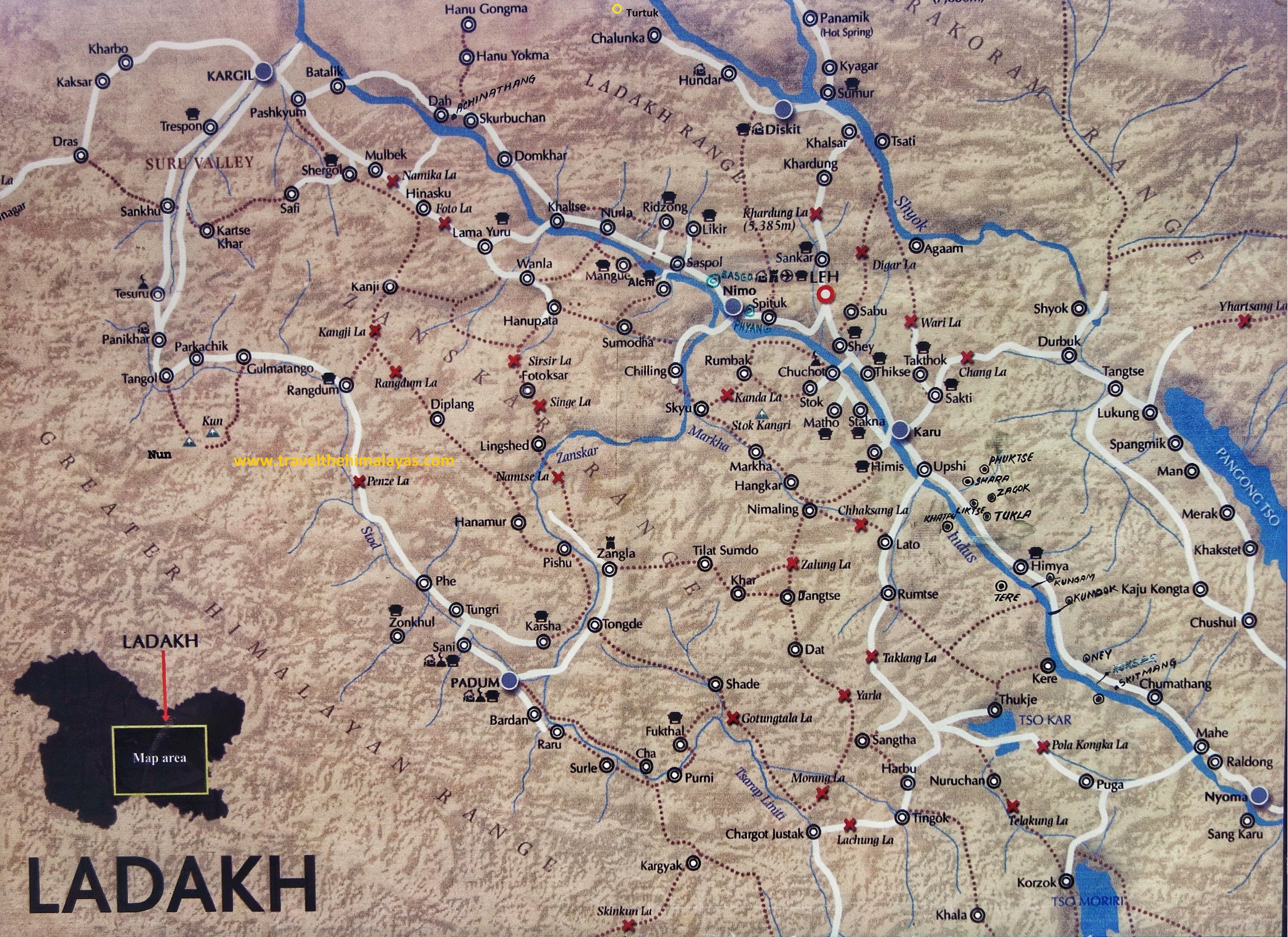
New Routes for Ladakh 2019
The Government has recently announced the Opening of new Routes in Ladakh in order to promote Tourism in some of the more Offbeat Locations in Ladakh. Some of these Routes have already been used by some Travelers who got a Permit but now its open for all.
This is a welcome step and will help the People living in these Remote areas as they now have the opportunity to make a living from Tourism as well. Also it shows that the Government is a mood to open up new areas in Ladakh, a large part of which still is off limits to the General Public due to the Border disputes we have with our neighbors in the Region. It also signals that relations with China are easing off and hopefully one day the Border disputes wil be settled and the whole of Western Ladakh would be open to the Public.
Below is the Map of the Areas around the Pangong Lake and the Tso Moriri Lake which are mostly covered in the new Routes that are opened. This would also enable greater access to one of the most mind blowing part of Ladakh, the Changthang which extends into Tibet.
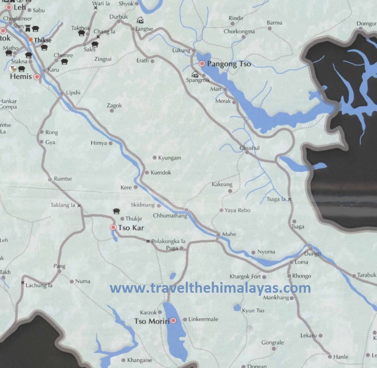
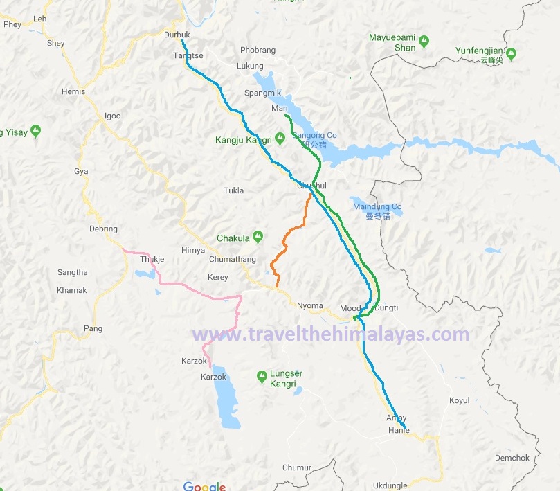
And these are the exact details of the Routes that have been opened and they have been Colour marked in the Map at the bottom
1. Merak - Loma Bend via Chushul (Instead of going straight from Chushul to Mahe you go left and get directly to Loma Bend. See Map 2 as well and this Route will take you over the Tsaga La Pass. (Shown in Green Colour)
2. Chushul to Mahe via Kakset La (The official release says Kartasangla but we assume this is an error). This is the direct Route over the Changthang and takes you to Mahe (Shown in Red Colour)
3. Dubruk - Erath - Chusul and then following no.1 Route onwards to Loma bend and then onto Hanle (Shown in Blue) : Instead of the traditional Route from Dubruk to Pangong Tso this Route will take you through the Route almost parallel to that and onwards to Chushul. From Chushul onwards you follow the Route 1 again.
4. Karzok - Nurbo - Sumdo - Parangla - Kazand (Shown in Pink)
Antiquities from Ladakh at the British Museum
The Collection of Antiquities and everyday use Items from Ladakh at the British Museum Collection.

Antiquities from Ladakh at the British Museum
Some antiquities and interesting everyday articles from Ladakh at the British Museum Collection. All pics and accompanying text is from the British Museum Website.
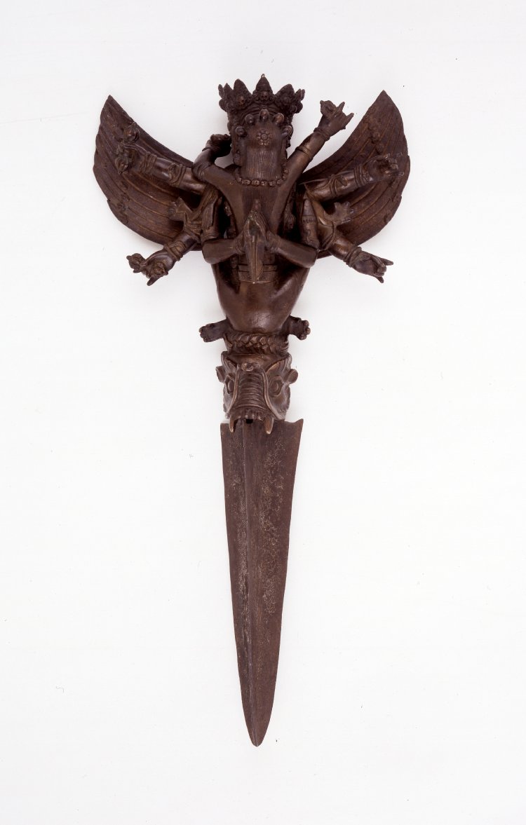
Phur-bu (part of), dagger (ceremonial). Snake design. Made of gilded bronze; also engraved iron

Phur Bu (part of), dagger (ceremonial). Snake design. Made of gilded bronze; also engraved iron. Finial (Phur Bu?). Figure of Hayagriva with 4 heads and 6 arms mounted on do-rje. Made of bronze.

A circular amulet-box (gau) with a pair of cylindrical loops for suspension attached to the sides, made of silver with copper alloy and silver filigree decoration; inside the box and behind a circular window is a painted clay plaque (tsa-tsa) depicting a seated Buddha flanked by bodhisattvas; below the opening, a pear-shaped fragment of turquoise is set into the filigree.
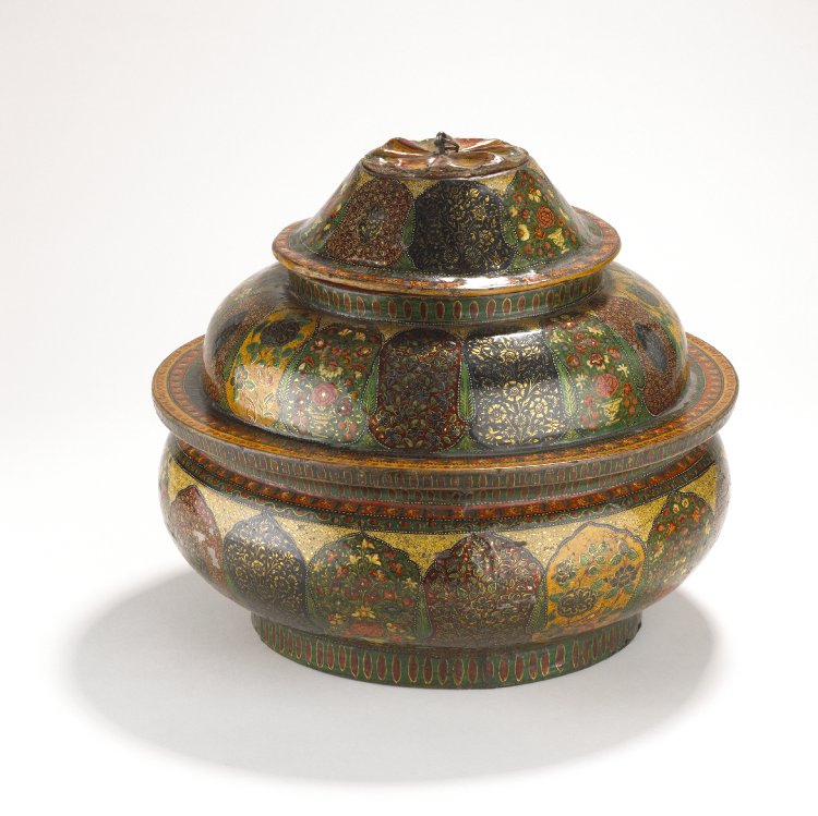
Food container in four parts. Made of lacquered wood and papier mâché. Decorated externally with Kashmiri floral designs and internally with fish. The base is also decorated with fish.

Lock and Key

Bell made of metal
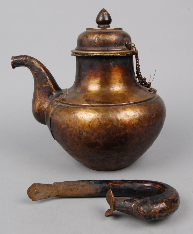
Lid made of metal with onion-shaped knob on top and chain at one side

Bell (for horse) made of metal, wood.

Bell (for horse) made of metal, wood.

Case (for charm) made of metal, stone, textile

Perak : Woman's head-dress made of cloth, cloth (canvas), coral, beads (lead), brass, pearls, turquoise

Pendant (one of a pair). Made of cloth, stones (semi-precious), turquoise, coral, bronze
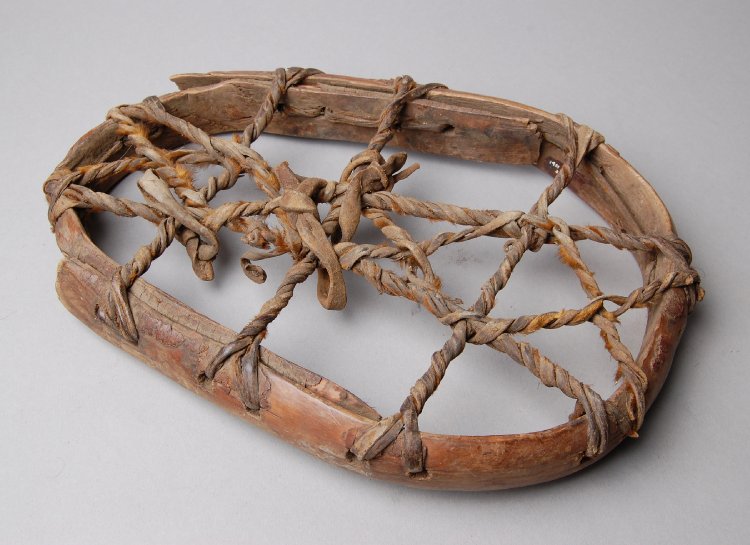
Snow-shoe (one of a pair) made of wood, hide.

A Crampon made of Wood and Hide.

Reverse side of the Crampon

Pack Saddle Wooden for Horse / Mule

Loom (part of) made of wood, textile
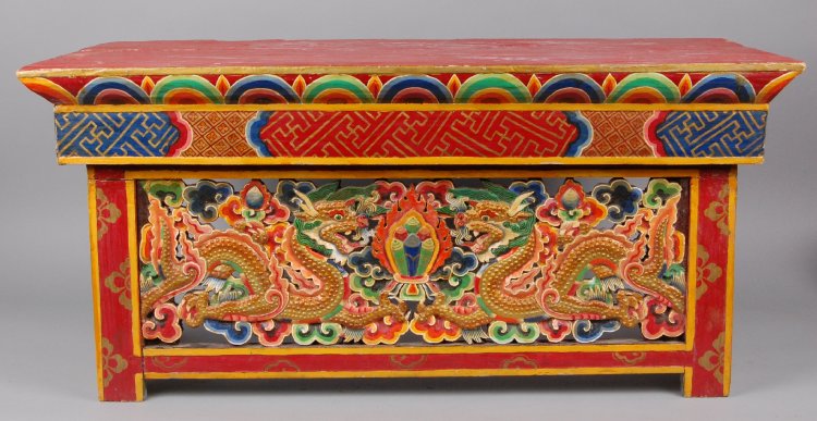
Wooden folding table intricately carved with traditional dragon, lion, cloud, geometric and floral motifs and laquered and painted red, yellow, orange, green, blue and gold. Red flat-top with multi-coloured semi-circles immediately below; underneath this, panel with Greek key style geometric design. Front panel with two dragons facing one another with group of six (scrolls?) surrounded by flames at centre; cloud designs all around. Front table legs painted red with yellow edges and gold floral motifs. Side folding legs similarly painted but central panels carved with lion design surrounded with clouds. Top and back sides of table roughly painted blue.

Another view of the Wooden Folding Table.
Thang : India's most Northernly Village
Thang is the last Village before the LOC in the Turtuk Sector. Entry to Thang is restricted and presenting some rare pics from inside the Village.
Right at the Line of Control. At the River bend lies the fence.
Thang : India's Most Northerly Village
The "Northernmost Village of India" as an Indian Army proclamation states there. On the banks of the Shyok.
The patch of green on the right is the Village of Thang. The Village lies a few kms beyond Turtuk and you cross Tyakashi Village to get to this point. To go beyond Turtuk you need permission from the Army and after that this is the Northernmost that the Army lets you get to. The Mountain heights on the right of the Shyok are all territory in Pakistani control. You can see a fence which denotes the LOC and 100 meters on each side are No Mans Land.

The best part is that a certain Gentleman over there even gives you a guided Tour and shows you stuff like the fence, Indian Army bunkers, Pakistan Army bunkers, Pakistani Flags on the Peaks as they dominate the heights. Quite revealing. And the best part is that you are allowed to take Pics and Videos. All authorized by the Indian Army.

Apricots at Thang Village
Going to Thang Village is not allowed except for the locals. And pesky little fellows who come with all sorts of excuses to be let into the Village, a beautiful one with Apricot, Walnut and Apple laden Trees. And from where you see the Village of Phorbu across the LOC. And nothing separates this Village from the other side besides certain Landmines. ;)
Looking across the LOC from Thang
On a personal level I actually find it good that the Army is slowly opening up areas which were otherwise no go for civilians. It reflects a higher degree of confidence and maybe we can look forward to more areas being opened up. Areas about which I have read since I was a kid. Maybe the Changchenmo or DBO or Siachen or Aksai Chin or Depsang.

The Green patch in the distance at the bottom of the Mountains is the first Village, Phranu on the other side.
Pic from last week. Thang, Ladakh
A Place Called Chushul
On the desolate Changthang region of the Tibetan Plateau lies the Village of Chushul. It lies close to the Border with China. And it was here that a Treaty was signed and Ladakh became a part of the Sikh Empire.
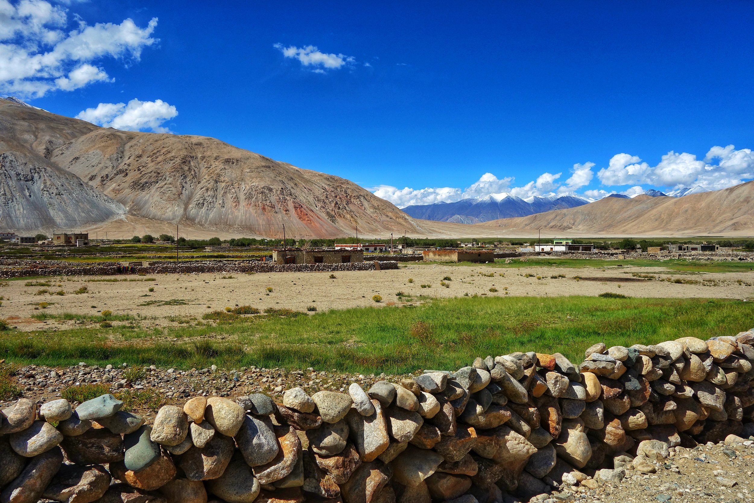
A Place Called Chushul
Chushul is a Village close to the Indian LAC with China in the Eastern Ladakh region close to Pangong Lake as well as Rezang La. At an altitude of around 4360 m it used to be the main Village of the Changthang block in the Ladakh region earlier. And it is one of the five designated locations along the LAC where the Border personnel from both countries meet to have formal meetings in order to maintain peace at the LAC.

On the way to Chushul and driving along the Pangong Tso.
We passed this place on our way from Pangong Lake to Tso Moriri which I must rate as one of the finest drive one can do in the Trans Himalayas cutting across the Changthang. Once we got to Chushul we realised that one of our Vehicles was short on fuel. And since Chushul was one of the main Villages on the way and uncertain of whether we will get fuel anywhere ahead we decided to look for Petrol in Chushul. We had already crossed Chushul when we decided to turn back and when we came back into the Village we passed by the Police Post . And there was an old Policeman sitting outside. We asked him where we could get Fuel. He told us and then suddenly he asked us for our Inner Line Permits.

The Village of Chushul and the Monastery in Yellow
All of us in 4 Vehicles were Residents of the state of Jammu and Kashmir and as such we dont require Inner Line Permits. J and K residents just need to show IDs to prove their credentials and they are good to go. And plus we had a letter from JK Tourism which pretty much gave us an open Pass as far as the ITBP/ Army guys were OK with it. The Policeman just saw the Letter and checked the IDs of the guys in the first Car and told us to go. Since I am no longer a permanent resident of JK being based in Gurugram I was carrying my old Passport photocopy which had been issued in Srinagar. But I had still got an ILP made for myself just in case. But it didnt come to that and the Policeman was satisfied that we were all JK residents and let us go.
And then we got the fuel had Lunch and we were on our way again. We again passed the Police Post and this time there was another younger Policeman there who signalled us to stop. We stopped and told him that we had already shown our papers. He looked at all of us. And then suddenly I realised that he was staring at me. The Policeman then said “ Iska permit Kidhar hai” pointing at me. He again said “Yeh foreigner ka Permit kahaan hai ?”. Out of all the Kashmiri guys he somehow assumed me to be a Foreigner. I was slightly amused and started smiling. I blurted “Sirji main Foreigner nahin hoon. Srinagar se aaya hoon” He started laughing and bade us n our way.

Before entering Chushul, traditional pile of Horns to ward off evil.
Now to more important stuff. Historically this was the place where the Treaty of Chushul was signed in 1842 which officially demarcated the border between Ladakh and Tibet as a consequence of which Ladakh became a part of the Sikh Kingdom of the Punjab. After the death of General Zorawar Singh in Tibet his Army had been routed. The Tibeto-Chinese Army then marched towards Leh and almost captured it. Except for a small Dogra detachment that was entrenched in the Fort. The Dogra Detachment held on till the time fresh troops arrived under Diwan Hari Chand and Wazir Ratnu. The Dogras drove out the Tibeto-Chinese and started chasing them and the Tibeto-Chinese forces dug in at Drangtse.
In a brilliant tactical move the Dogras flooded the Tibetan fortifications by diverting a local River and they were again forced to flee Eastwards. The Dogras were again on their heels as avenging the death of their beloved General Zorawar Singh was their most motivational factor. The opposing Forces finally met on the open fields at Chushul in August 1842 and in the engagement the Tibeto-Chinese force was defeated and their General was decapitated in a form of brutal medieval revenge. With their General avenged they could now go back as both sides had by now now lost the appetite for further engagements.

The fields of Chushul
Both sides then decided to have a treaty by the way of which their territories would be demarcated and recognised by each other. And the Tibetans and the Chinese gave up any claim whatsoever that they had over Ladakh. So on 16/ 17th September 1842 was signed the Treaty of Chushul at Chushul and it said
"As on this auspicious day, the 3nd of Assuj, samvat 1899 (16th/17th September 1842) we, the officers of the Lhasa (Governrnent), Kalon of Sokan and Bakshi Shajpuh, commander of the forces, and two officers on behalf of the most resplendent Sri Khalsa ji Sahib, the asylum of the world, King Sher Singh ji, and Sri Maharaja Sahib Raja-i-Rajagan Raja Sahib Bahadur Raja Gulab Singh, i.e.. the Muktar-ud-Daula Diwan Hari Chand and the asylum of vizirs, Vizir Ratnun. in a meeting called together for the promotion of peace and unity, and by professions and vows of friendship, unity and sincerity of heart and by taking oaths like those of Kunjak Sahib, have arranged and agreed that relations of peace, friendship and unity between Sri Khalsaji and Sri Maharaja Sahib Bahadur Raja Gulab Singh ji, and the Emperor of China and the Lama Guru of Lhasa will hence forward remain firmly established forever; and we declare in the presence of the Kunjak Sahib that on no account whatsoever will there be any deviation, difference of departure (from this agreement). We shall neither at present nor in the future have anything to do or interfere at all with the boundaries of Ladakh and its surroundings as fixed from ancient times and will allow the annual export of wool, shawls and tea by way of Ladakh according to the old established customs.
Should any of the Opponents of Sri Sarkar Khalsa ji and Sri Raja Sahib Bahadur at any time enter our territories, we shall not pay any heed to his words or allow him to remain in our country. We shall offer no hindrance to traders of Ladakh who visit our territories. We shall not even to the extent of a hair's breadth act in contravention of the terms that we have agreed to above regarding firm friendship, unity, the fixed boundaries of Ladakh and the keeping open of the route for wool, shawls and tea. We call Kunjak Sahib, Kairi, Lassi, Zhon Mahan, and Khushal Chon as witnesses to this treaty."
And to this day the territories as designated in this Treaty as held as the Official border as recognised by the Indian Government though the Chinese from time to time play some hanky panky as has become their norm in this Sector. But of course that doesnt take away from the significance of the Treaty or from the importance of Chushul itself.

Traditional Cow Dung for using as Fuel
A visit to Chushul would always be worth it if you love the Mountains and love some History as well.
Pic from August 2018. Chushul, Eastern Ladakh.
The Changthang
The Changthang is a part of the Tibetan Plateau which is located in the Western and North Western part of Tibet and it also includes Eastern Ladakh. Its a forbidding Plateau and is home to a number of Lakes like the Pangong Tso and the Tso Moriri. However it holds a large array of wildlife in its high altitude Wetlands. Its home to the Changpa People who are nomadic herders known to keep the best herd of Pashmina Goats.

The Changthang.
A place of immense beauty amidst desolation of the Tibetan Plateau. A place devoid of most human in habitation except for the Pashmina Goat rearing Changpas. With an average altitude of above 4000m it stretched from Tibet into Ladakh.

The Changthang is home surprisingly to a large number of wildlife species including the Snow Leopard, the Tibetan Wild Ass, the Chiru etc. The legendary Indus flows through the Changthang and it includes a number of wetlands and marshes which attract migratory birds such as the Black Necked Crane and the Bar Headed Geese.

The Changthang always fascinated the Western Explorers few of whom ever stepped into its splendid isolation. The unpredictable weather, the Artic conditions in the Winters and the paucity if human in habitation didnt help either.

I happened the drive from Pangong Lake to the Tso Moriri, two Lakes which lie within the Changthang. And to keep it simple it was one of the most beautiful places I have ever been to. The legendary Changthang. The home of the Changpa who produce the finest Pashmina bearing Goats. Pashm which for centuries bought neighbouring Kingdoms to War with each other.

Pic from this week. Some where on the Changthang between Pangong Tso and Tso Moriri.
The Karakorams in India
The Karakorams are the most vertical of all the Mountain Ranges in the World. A large part of the Karakoram falls within India but most people are unaware of it. We explain.

The Karakorams as seen from a flight coming into land at Leh.
The Karakorams in India
The Karakoram, with its named derived from the Turkic word "Kara' meaning Black and "Koram" meaning Gravel. These impenetrable Mountains were seen as citadels and Towers of black gravel by the Central Asians and hence the name. They were also referred to as the Muztagh which meant Ice Mountain by the Western Explorers as well. The term Muztagh is now used to denote the sub Ranges of the Karakorams. As per some historians they were referred to as the “Krishnagiris” in the Puranas.
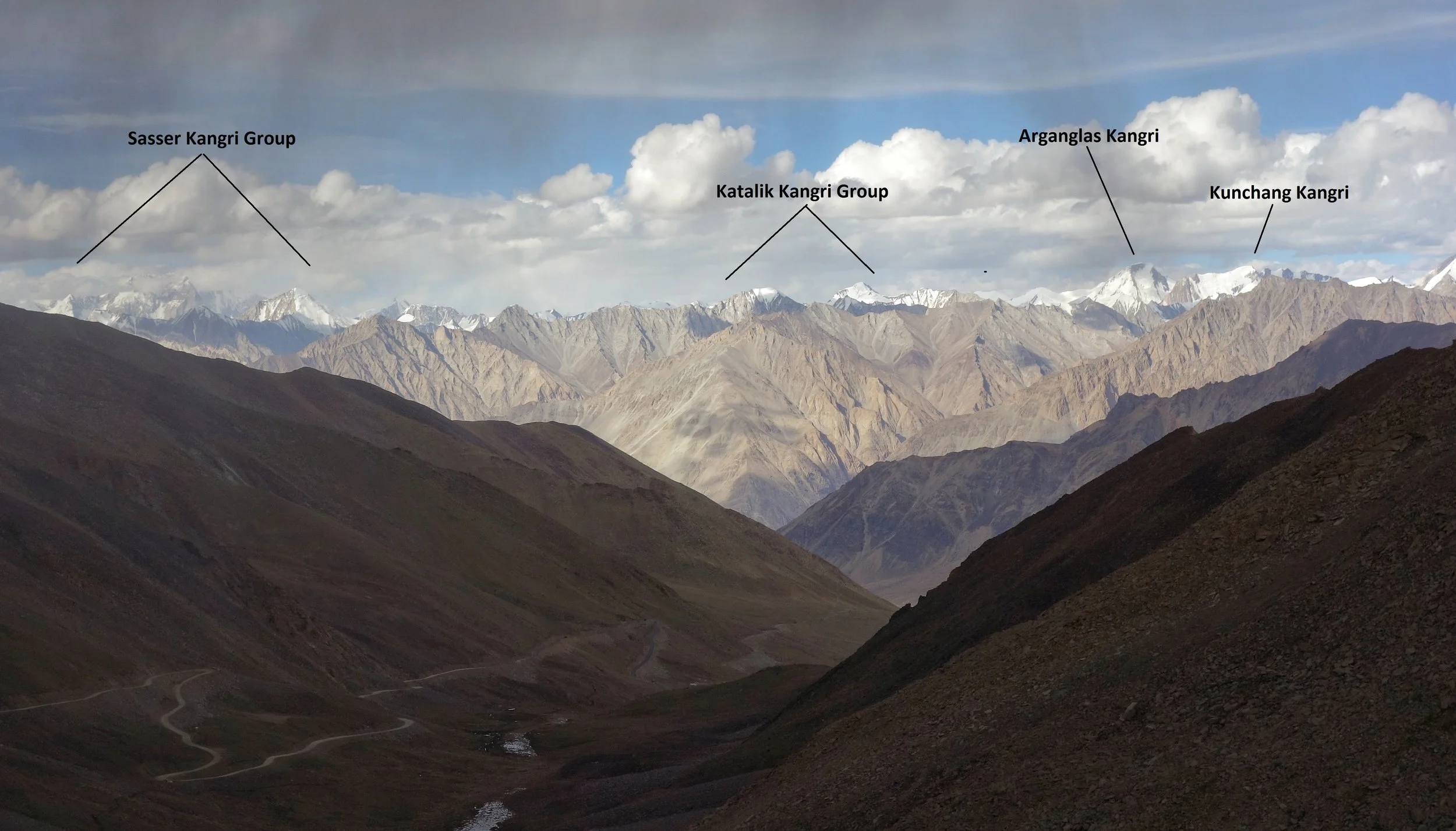
The Sasser Kangri Group and other Peaks of the Karakorams as seen from the Khardung La (Pass)
The Karakorams extend right from the Aksai Chin in the East to the Wakhan Corridor in the West and has other great Mountain Ranges like the Himalayas, the Hindu Kush, the Pamirs and the Kun Lun as its neighbors. It runs app. 550 kms from East to West starting at the Saser Muztagh in the East to the Batura Muztagh in the Hunza District.
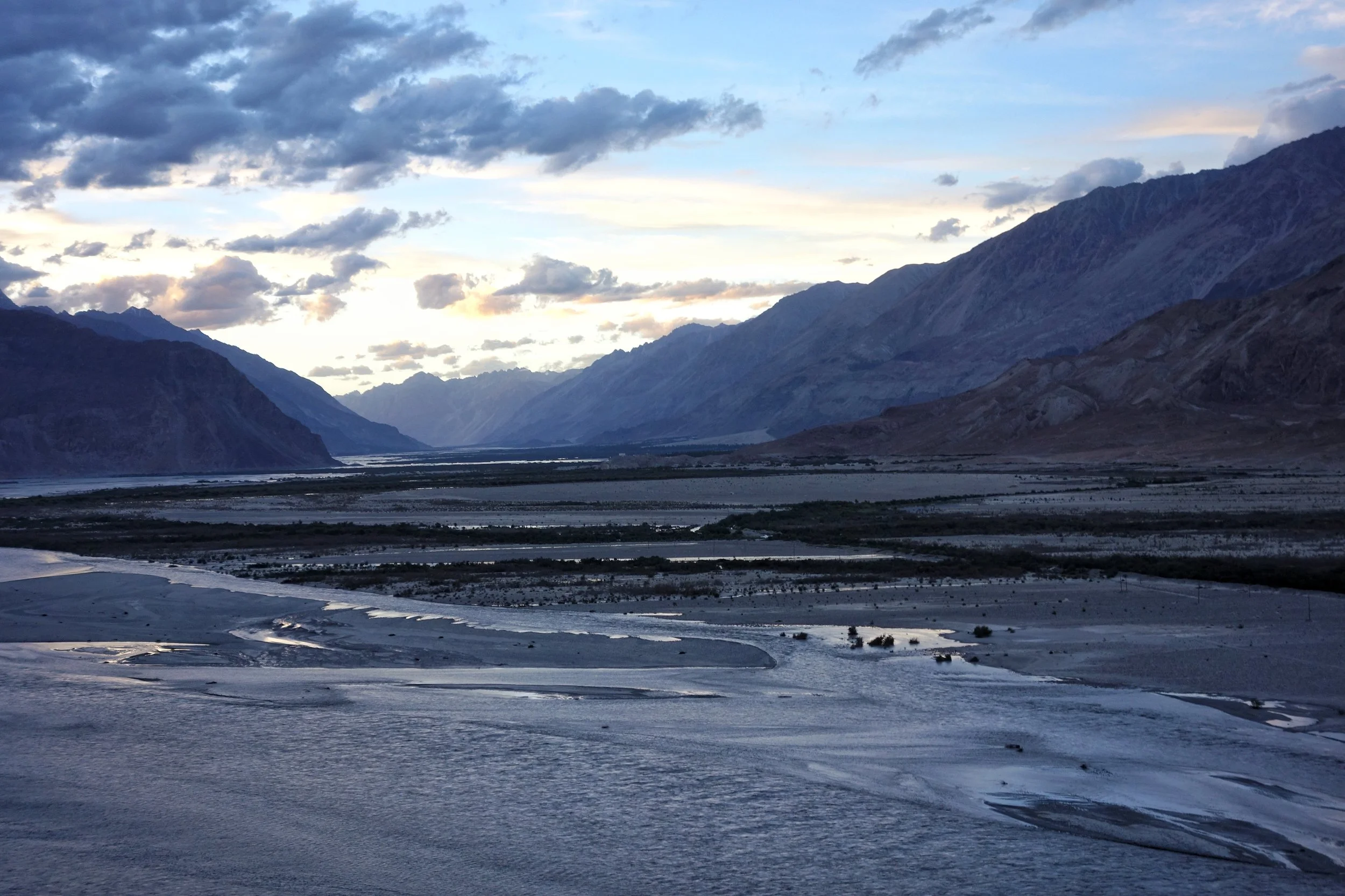
The Confluence of the Shyok and the Nubra. The Karakorams on the other side of the confluence.
Its Southern boundary is defined by the Gilgit, Indus and the Shyok Rivers which separate it from the Himalayan Range in the South. Infact in the Nubra Valley the Shyok River plays the boundary between the Himalayan Range and the Karakorams. In the North its the Karakash and the Yarkand Rivers which separate it from the Pamirs and the Kun Luns. The Karakorams actually lie right in the Center of the Great Himalayan Mountain Complex bounded by Ranges which are unparalleled in their sheer verticality. All these Ranges have Peaks exceeding 7000m which are not found in any other region on the Planet.
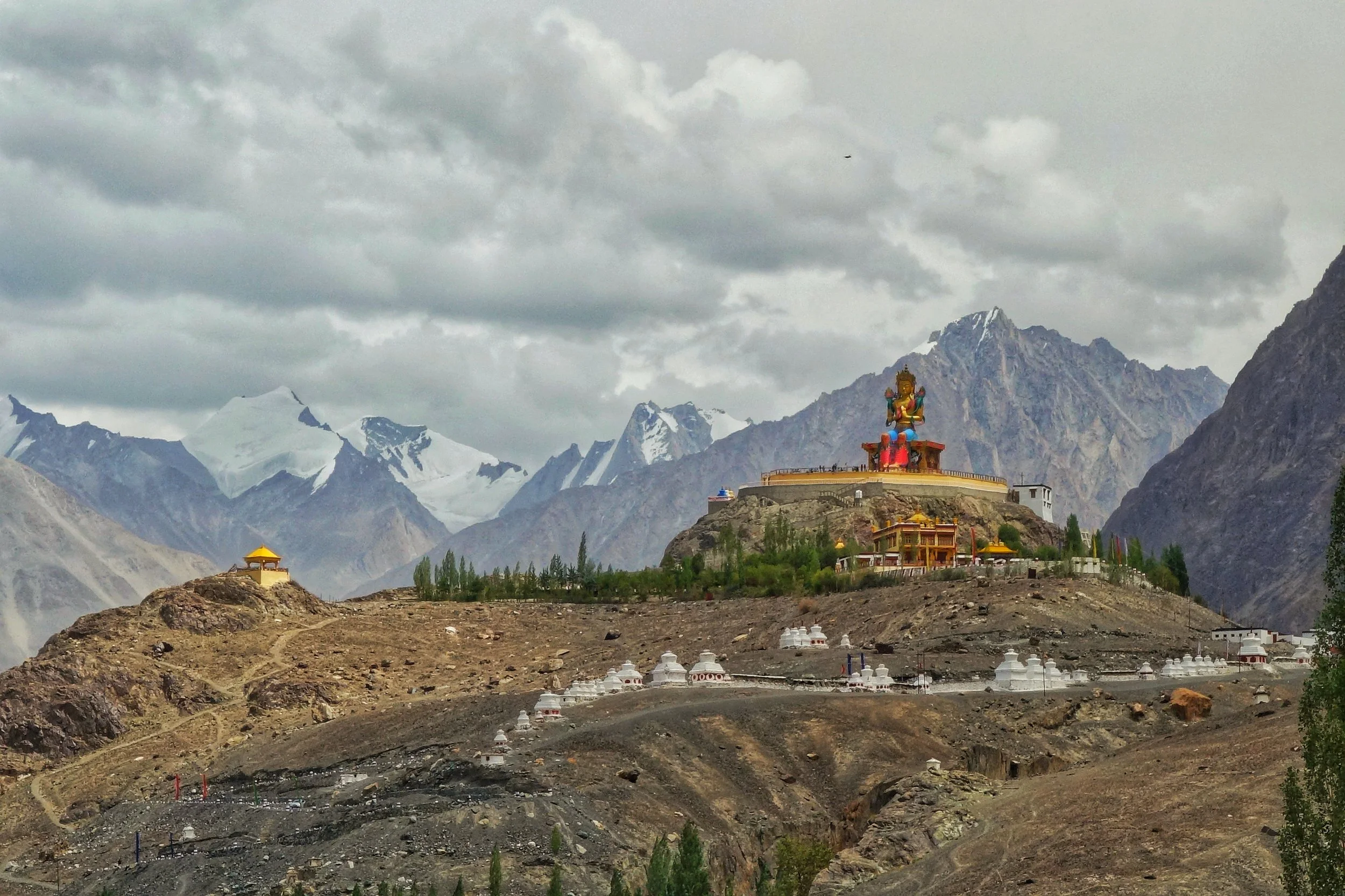
The Karakorams in the background of the Buddha Statue at Diskit in Nubra Valley
Broadly this most vertical of all the Mountain Ranges is subdivided into the following sub Ranges though experts differ on this aspect. The nine sub Ranges are as under
Sasser Muztagh
Rimo Muztagh
Siachen Muztagh
Baltoro Muztagh
Mashebrum Muztagh
Panmah Muztagh
Hispar Muztagh
Spantik Sosbun Muztagh
Rakaposhi Haramosh Muztagh
Batura Muztagh

Unnamed Karakoram Peaks along the Nubra Valley
Contrary to the popular perceptions a sizeable part of the Karakorams lies in territory well under Indian control though being in a sensitive border region most of it is off limits to Civilians and even climbing Expeditions to this area as the one carried out by the Himalayan Club and led by our Vice President, the acclaimed Mountaineer Divyesh Muni need various special permissions to visit these areas. Of the sub Ranges the Sasser Muztagh, the Rimo Muztagh and the Siachen Muztagh lie well within Indian held territory. Even a substantial part of the Baltoro Muztagh is within this territory. In Fact of the 10 highest Peaks in Indian territory (excluding the ones in Occupied territory) lie in the Karakorams. And three of these lie in the Sasser Massif and belong to the Sasser Kangri family. Infact these are clearly visible from the top of the Khardung if you look towards the North.
Herodotus's Legendary Fox Sized Gold Digging Ants
Herodotus was a famous Greek historian of the ancient times who lived around 500 BC and he was born in Asia Minor in the Persian Empire. He was referred to as the Father of History as he wrote a lot of history and tales of the unknown from lands far off. One of his most intriguing account was the one of the legendary Gold digging ants, as big as Foxes, which lived in the high Himalayas in a land he called Dardae.
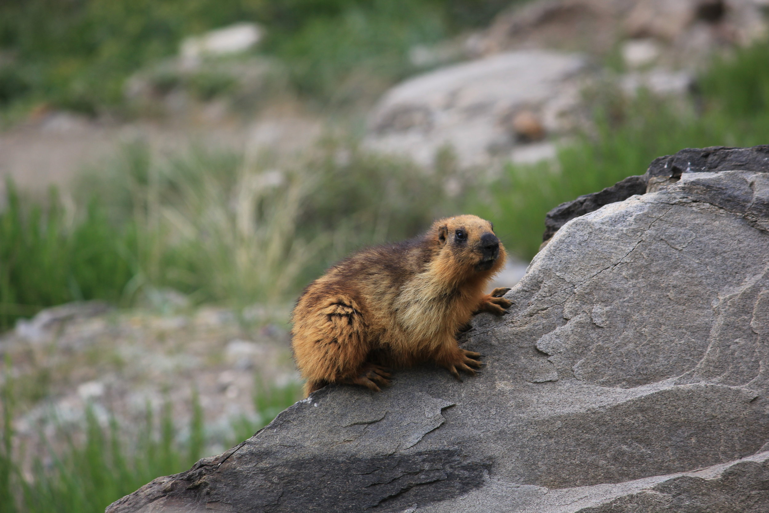
Herodotus's Legendary Fox Sized Gold Digging Ants
Herodotus was a famous Greek historian of the ancient times who lived around 500 BC and he was born in Asia Minor in the Persian Empire. He was referred to as the Father of History as he wrote a lot of history and tales of the unknown from lands far off. One of his most intriguing account was the one of the legendary Gold digging ants, as big as Foxes, which lived in the high Himalayas in a land he called Dardae (In Sanskrit is was called Dardesa, the Land of the Dards). Those who have studied history, especially accounts of history written by ancient Historians always had elements which were hard to believe and seemed more like flights of fantasy mixed with some facts. You always take it down with a pinch of salt.
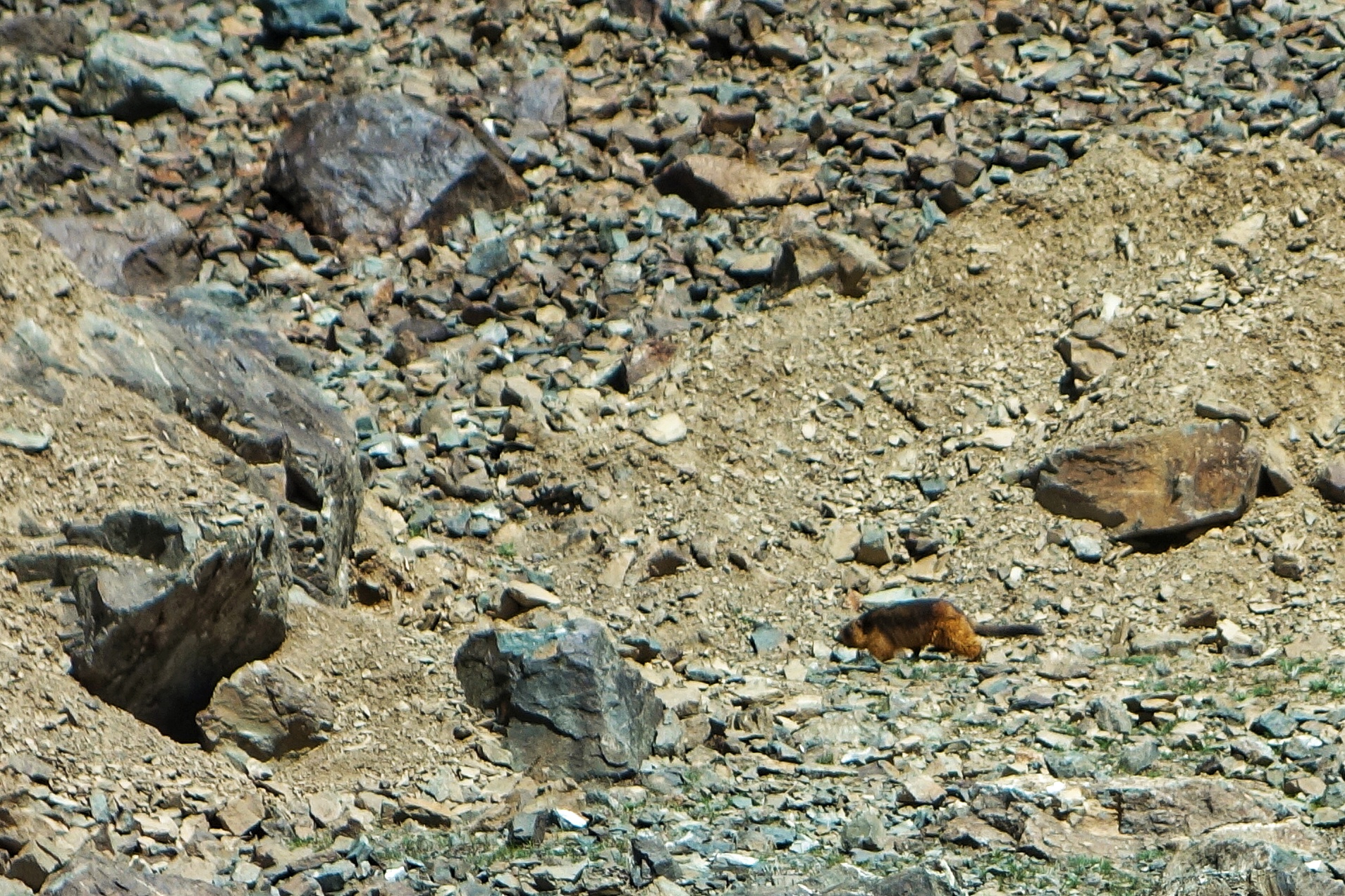
Herodotus wrote exactly this “ Another kind of Indians live in the neighbourhood of the town of Kaspatyros, and the land of of Paktyika (present day Paktia Province in Afghanistan) away towards the North from the rest of the Indians, their way of living is about the same as that of the Bactrians. These are the most warlike of all the Indians, and it is they who are sent for Gold; for in the this district there is the sandy desert. In this desert and this sand there are Ants which are smaller than Dogs but larger than Foxes for some which were caught are now in the possession of the King of Persia. These Ants make for themselves burrows below the Ground, and in doing so throw up the Earth, as ants do with us, and in the same manner they look exactly like ours. This thrown up sand contains the Gold and for the sake of this sand the Indians are sent into the desert…….” He also wrote this “ When the Indians arrive at the place of the Gold dust to fill their bags, they fill quickly and ride away as soon as possible. For the Ants, which, as the Persians would tell, have found out what has happened through their sense of smell, are at once after them and they are exceedingly swift. Thus if the Indians do not gain a good start before the ants have gathered, none of them would be able to escape…..”.
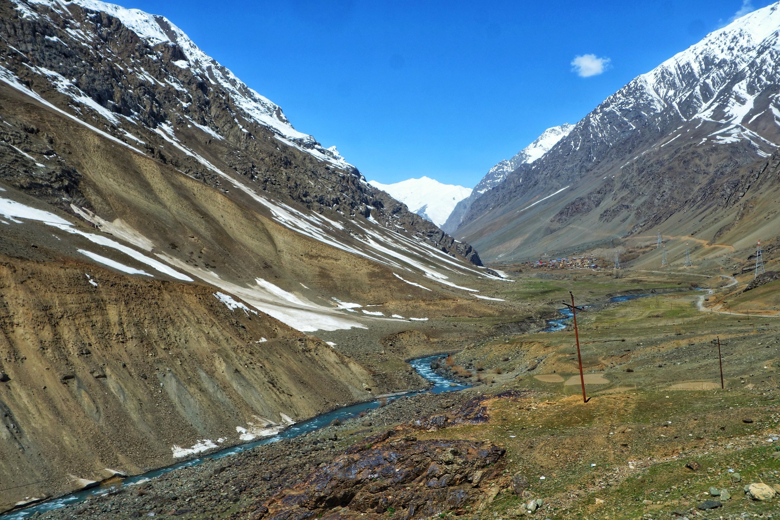
Even Megasthenes , the Greek Ambassador at the court of , relates a similar story of Gold digging ants who dig not for the Gold but for making their burrows. The Gold he says was incidental. Infact those of you who have read History of Western Tibet / Dardistan written by Westerners will know that this Legend of Gold digging Ants is described by every single one of them.This is the starting reference point for the History of this region from a Western perspective.
But it was not only the Greek / Roman historians who alluded to this legend. There was a reference to this ‘Ant Gold” in the Puranas and the Mahabharata. It is said that a Northern tribe, called the Khasas, bought Paipilika Gold (Paipilika is Sanskrit for Ant) as a tribute to Yudhishtir. Of course it's common knowledge that the Himalayas are rich in mineral deposits and that includes Gold as well. Gold was found under the ground as well as long the streams as fine dust. Cunningham describes how Gold sifting in the Indus and the Shyok River was done by Muslim Baltis as the Ladakhi Buddhists were forbidden from doing so as they were expected to work in the fields.
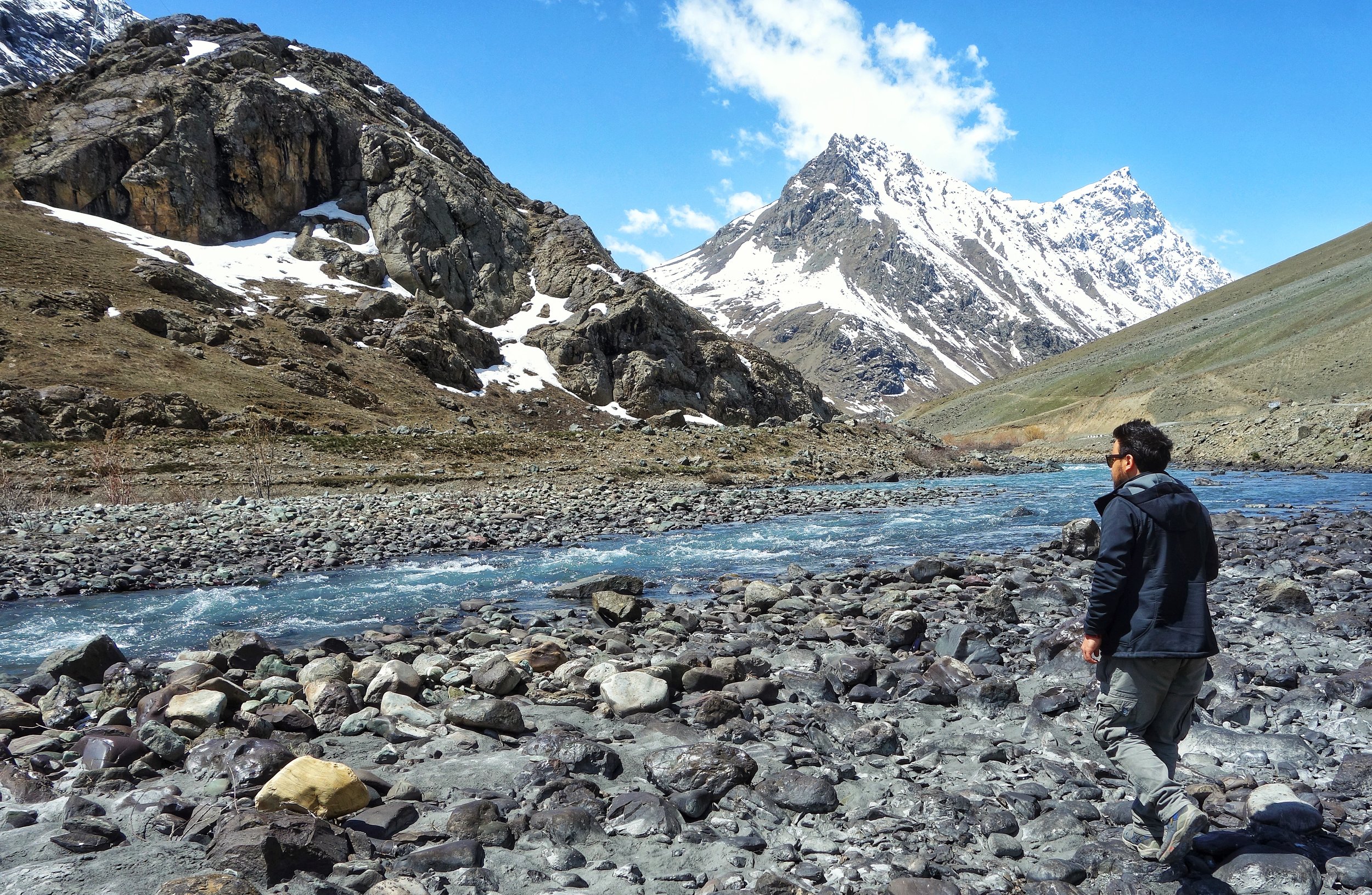
Francke in his classic “A History of Western Tibet” also alludes to this legend and describes how he was given accounts of these Gold digging Ants in the Village of Kalatse, which though now Ladakhi was at one time inhabited by Dards. He apparently saw one of these creatures but of course they were regular Ants and not the Giants that Herodotus described. Francke wrote “I was even shown the kind of Ant which, according to the belief of the Kalatse people, was the Gold digger. It was a very tiny, creature, and far from the size of a Dog or Fox, but we must allow the story to have grown a little on its was from India to Greece.”
Of course in my assumptions there must have been instances of Ants digging in an area rich in Gold deposits and digging up Gold as well and this being collected by the locals. This is a completely plausible Theory but what about the “Giant Ants bigger than Foxes but smaller than Dogs ? “
Through most of History other Historians took this Giant Gold Digging Ants theory as a figment of Herodotus’;s exaggeration and adding a adding a dose of fantastic to his historical records. Many of them them even decried him as a liar and a fancy story teller. So was Herodotus was entirely wrong and this was just a yarn he had spun ? Not exactly as it was proven by a Gentlemen who took upon himself to solve this Great Mystery of the Giant Gold Digging Ants.
The Gentleman was a French ethnologist Michel Peissel wrote a book named, “The Ants’ Gold: The Discovery of the Greek El Dorado in the Himalayas” in 1984. And he mentioned that the area described inhabited by these creatures was actually the Deosai Plateau in Baltistan.
And the creature which was being alluded to were not Ants but the Long Tailed Golden Marmot and the Himalayan Marmot (These are two different species but both are found in the Himalayas). The Long Tailed Golden is more of a species found in Central Asia and the Hindu Kush, Pamirs and the Tian Shans though some are found in the Himalayas as well. A Golden Marmot which digs for Gold sounds just about right actually.
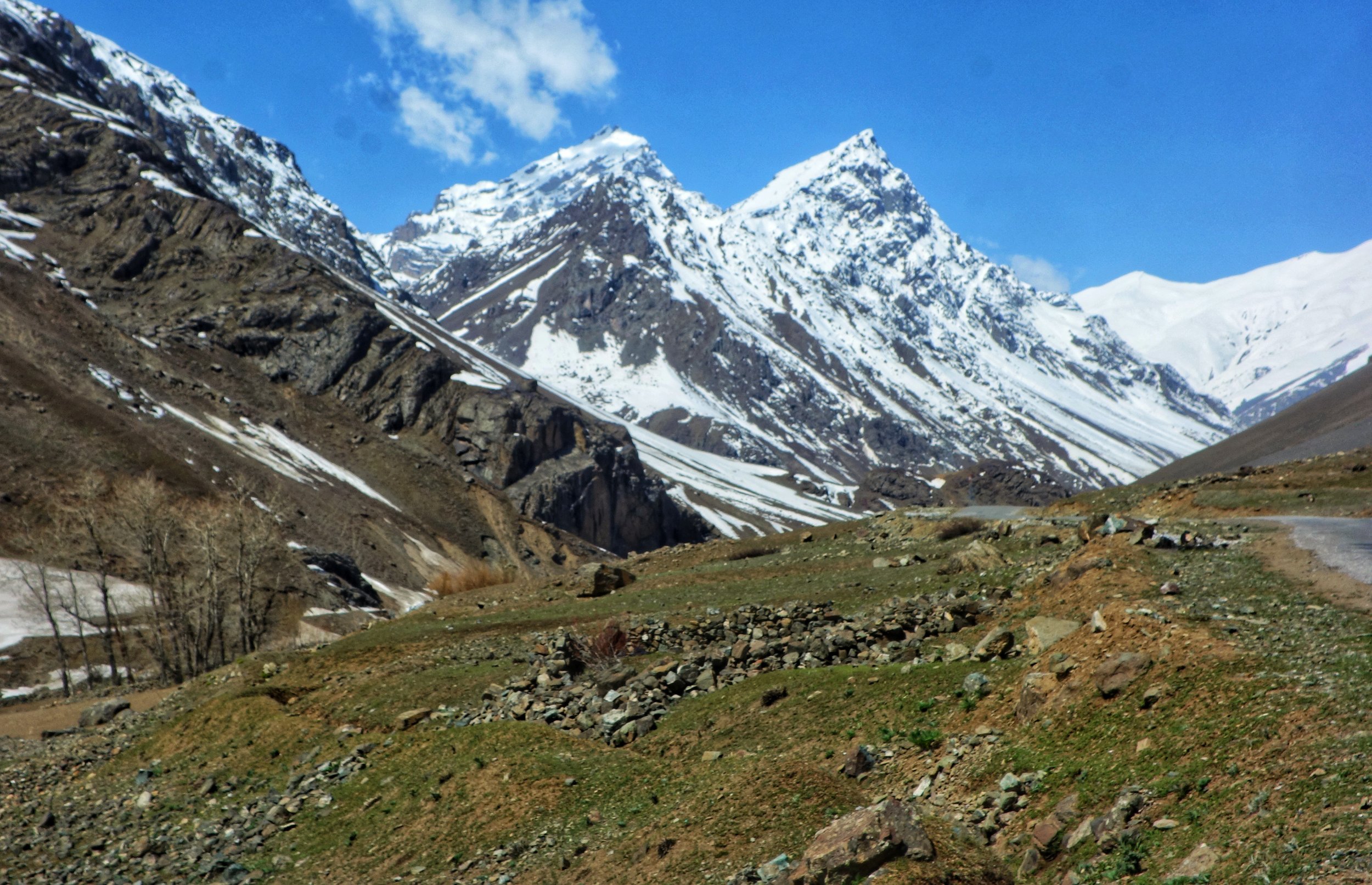
We are all aware that Marmots live underground and for the same they dig deep burrows and have a maze of interconnecting burrows underground. All this burrowing entails that they throw up a lot of earth. And the Deosai Plateau is said to be rich in Gold Dust deposits. The Marmots dug up the earth and included in this were fine Gold dust particles that were then taken by humans.
But which humans was the question again. Peissel claimed to have interviewed groups of people from Tribes living on the Deosai ie the Minaro, Maruts or Sonival tribes and apparently they confirmed this method of collection of Gold. And I have also been told Stories by people in the Kargil area about how the Marmots supposedly pile up Gold inside their burrows. So something is starting to make sense.
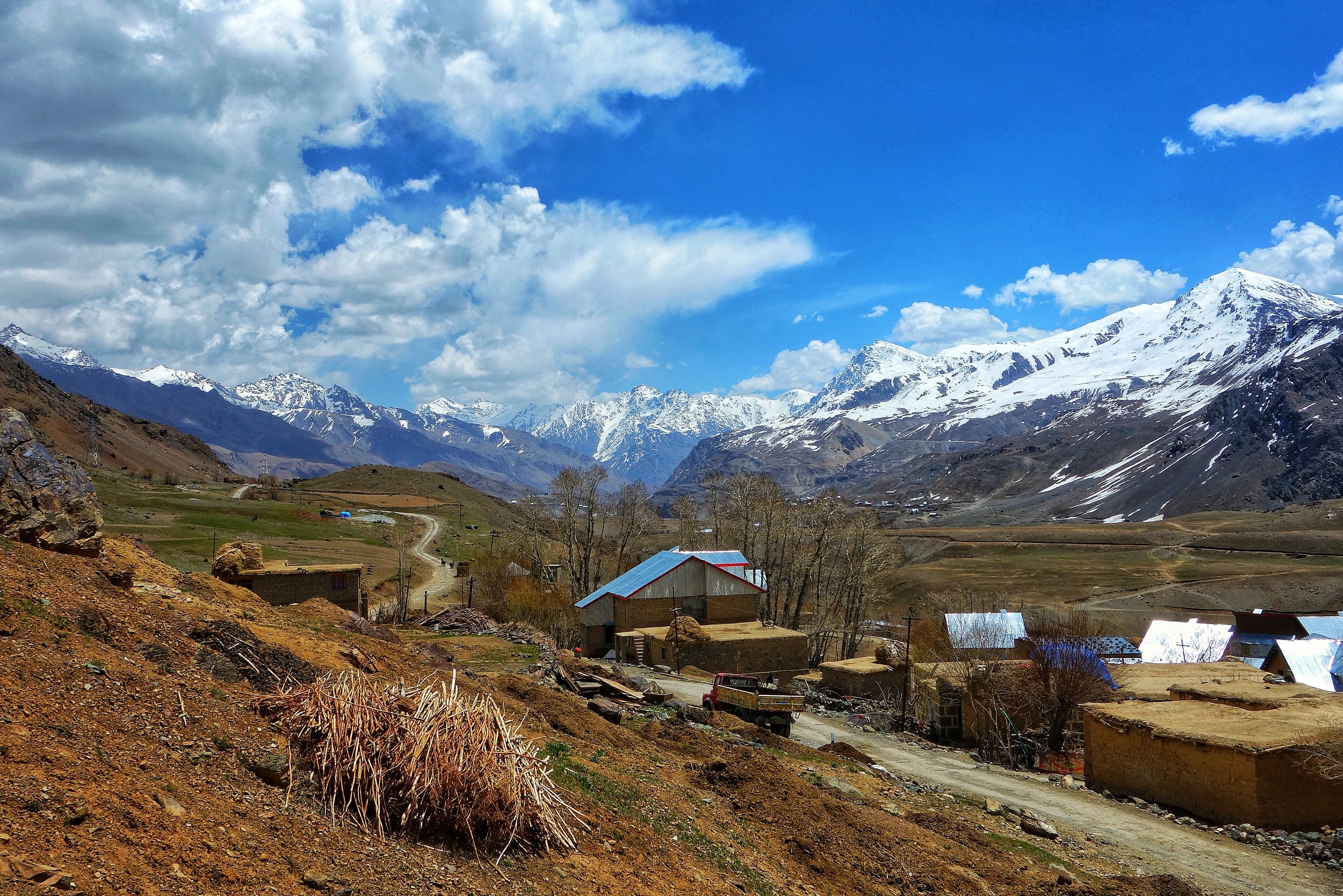
It was the Long Tailed Golden Marmot or the Himalayan Marmot which fits the description and Herodotus is proven to be partially correct. But how did he confuse the Marmots with the Ants ? Peissel has an explanation for this last piece of the puzzle as well. Apparently the Persian word for “Marmot” and “Mountain Ants” is very similar so somewhere along the line the word which was meant to mean Marmot was taken as Ant and the legend of the Giant Gold Digging Ants took birth. To be fair to Herodotus he had never mentioned that he saw one of these Ants. And the creatures kept by the King of Persia (the most powerful sovereign in the World at that time ) were just that Marmots.
Just one last part about the ferociousness of the Gold digging Ants described by Herodotus. Many of us regularly come across Himalayan Marmots while visiting Ladakh and there is a lot of Human and Marmot interaction (totally uncalled for and something to be discouraged) and they mostly come across as gentle Creatures. Maybe back in the days when they were much less habituated to humans they would react differently. Long Tailed Golden Marmots are however much more rarer. I remember coming across a Long Tailed Golden Marmot somewhere in the Muskoh area, which actually lies at the edge of Deosai, and that guy wasn't exactly pleased to see us. We of course kept our distance though the Marmot wasn't aggressive. Maybe if we would have gone closer he could have shown aggression. Can't really guess.
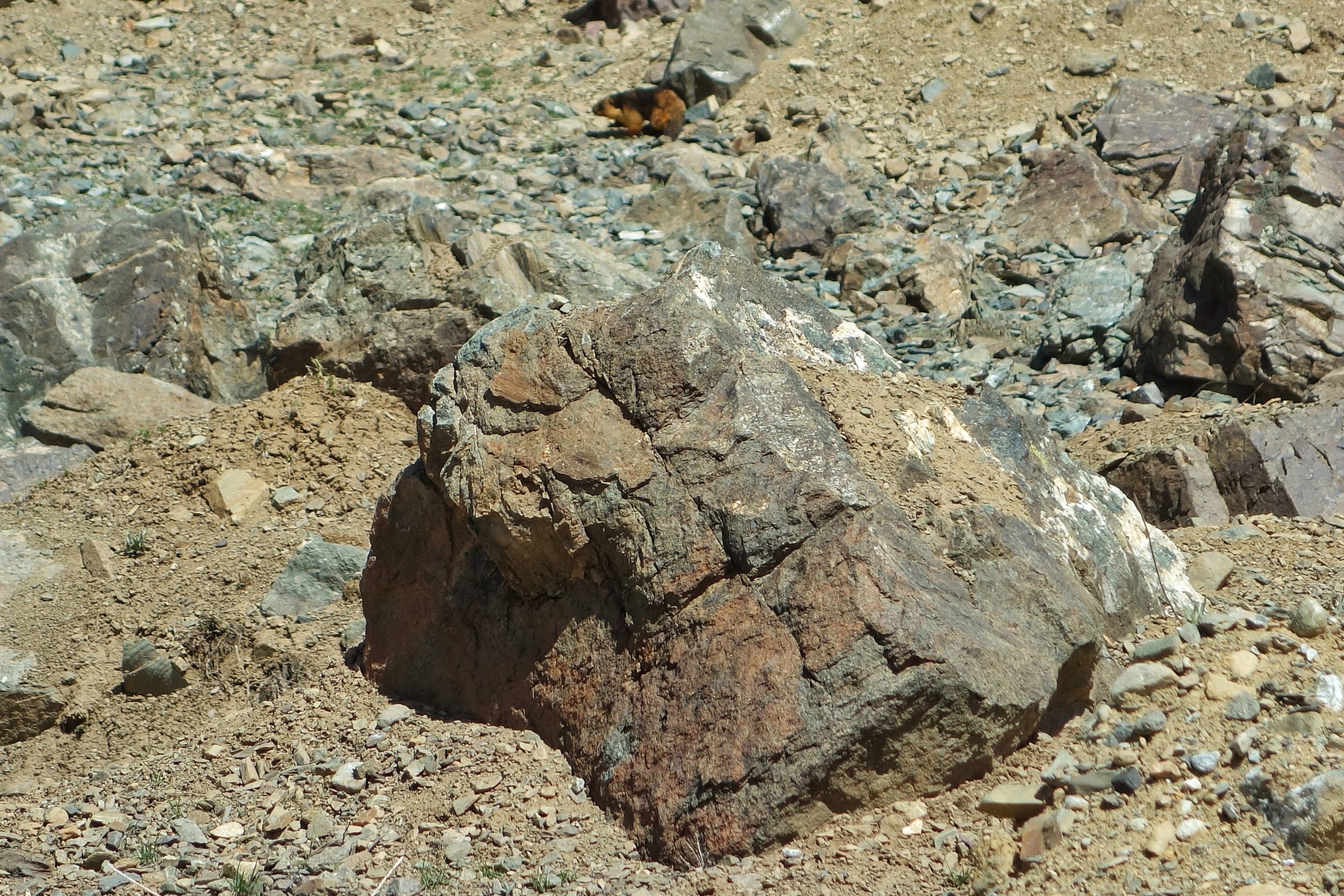
Or maybe this story of the “ferociousness” of the creatures was invented by the same people who harvested the Marmot Gold but wanted to discourage anyone else from coming and claiming a right on their Gold. In those times people could believe anything. Whatever was the reason it surely kept people away and the mystery took well over two thousand years to get solved.
So the next time you come across a Himalayan Marmot or better still a Long Tailed Golden Marmot do try and think of the Legend of Herodotus’s Fox Sized Ants.
Pic from April 2018. A Long Tailed Golden Marmot on the go, Muskoh Valley, Drass, Ladakh.
La Dvags : Ladakh The Land of Passes
Ladakh, the word comes from the derivation of the of the Tibetan word for the region “La Dvags” which literally means the Land of Passes. Of course there are N number of Passes within Ladakh so we try and enumerate the Passes which connect Ladakh with its neighboring Regions and well as the Passes within Ladakh connecting the different areas in Ladakh. We try and list them up
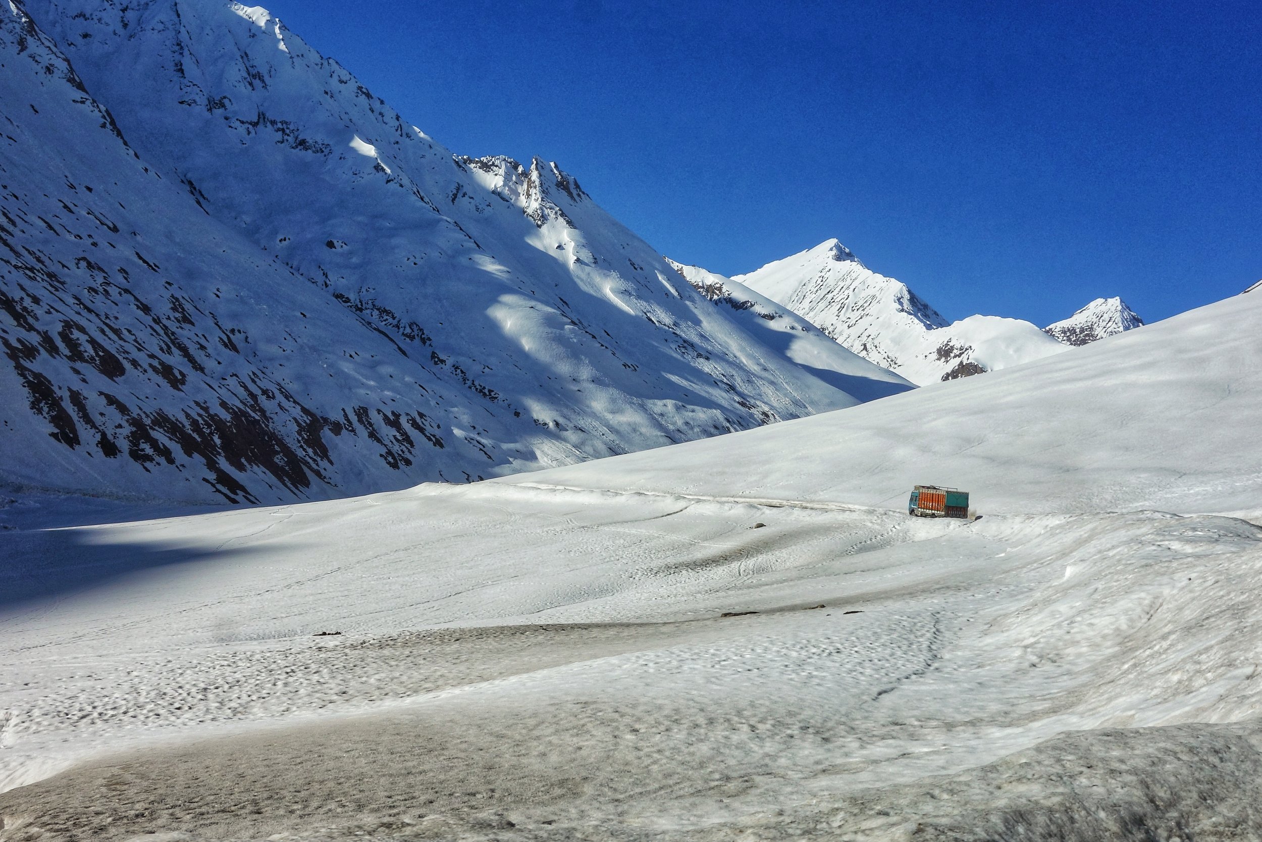
La - Dvags : Ladakh, The Land of Passes
Ladakh, the word comes from the derivation of the of the Tibetan word for the region “La Dvags” which literally means the Land of Passes. Of course there are N number of Passes within Ladakh so we try and enumerate the Passes which connect Ladakh with its neighbouring Regions and well as the Passes within Ladakh connecting the different areas in Ladakh.
To the South
Zoji La (3505 m) : The most famous of all the Passes and also one of the lowest altitude Passes in the Great Himalayan Range. Its motorable for almost 7 months in the years
Bhotkol Pass/ Lonvilad Gali (4200m) : A Pass between Suru starting from Panikhar and Warwan Valley. Also called the Salt Route in the days of the old. Also connects to the Lidder Valley through the Gulol Pass.
Shafat La : Another Pass between Suru and Warwan Valley in Kishtwar. The Pass lies beyond the Shafat Glacier at the base of the Nun Kun
Chilung La (5294 m) : A Pass between Zanskar and the Marwah Valley in Kishtwar
Omasi La : (5590 m) : The Omasi La (5590m) trek is a lesser known trek in the Indian Himalayas. The trek begins from the village of Gulabgarh on the J&K - Himachal Border. The areas has been closed for many years after the insurgency began in Kashmir
Hagshu La :
Poat La (5490 m) : Poat La 5490 m/18011 ft consider to be one of the highest passes in whole of Himalaya and the Sersank pass a.k.a. Shiv Shankar La 5130 m / 16,830 ft located at the head of Lugai Nala,
Kang La : (5468 m) : The Kang La was the traditional route used by Lahaulis(people from Lahaul) to cross over into Zanskar and on to Ladakh.
Shinkun La : Connects Zanskar with Lahaul in the south. A Motorable Road is now being built here.
Baralacha La (4892 m) : I guess everyone has heard of this one. Motorable for 6 months
Parang La : Connects Spiti with Ladakh through Rupshu
Long Lacha La : Connected Ladakh with Rampur Bushahr ?
Thung Lung La : Connected Ladakh with Rampur Bushahr ?
To the North
Khardung La (5615m ?) : One of the highest Motorable Passes in the World and connects the Indus Valley to the Nubra Valley.
Sasser La (5411 m) : A Pass in the Karakorams on the old Leh Yarkand Route towards Central Asia.
Karakoram La : Ahead of the Sasser La is the Karakoram Pass. A Strategic Pass where Ladakh meets Turkestan (Xinijang)
To the West
Fotu La (4108 m) : It is a Pass which connect Leh with the Kargil Region (Purig). Fully Motorable and open almost throughout the Year.
Namika La (3719 m) : It is a Pass which connect Leh with the Kargil Region (Purig). Fully Motorable and open almost throughout the Year.
Chorbat La (5145 m) : A Pass which connected Skardu to Leh via Khaplu and the Nubra Valley over the Khardung La
Marpo La (5353) : In the Drass Sector on the Line of Control
Kaobal La : Connects Drass in Ladakh to the Gurez Valley through Muskoh. Motorable but restricted for Civilians
To the East
Chang La (5360 m) : Connects the Leh area with the Changthang.
Marsimik La (5582 m)
OTHER PASSES
Ane La : The Easternmost of the Passes listed here. Lead towards the Changthang Wildlife Sanctuary from beyond Pangong Tso
Charchar La : This Pass connects Zangla to Sumdo in the Zanskar Valley
Digar La : This Pass connects Leh with Agham in the Nubra Valley. An alternative for Khardung La
Horlam La : Connects Tso Moriri and Karzok to Debring on the Manali Leh Road and comes after the Kartse La
Kakset La : This Pass connects Chusul to Mahe in Chumathang Valley
Kangla Jal La
Kanji La : Connects Rangdum to Henasku in the Indus Valley along the Leh Kargil Road
Kartse La : Connects Tso Moriri and Karzok to Debring on the Manali Leh Road after further crossing the Panguangu La.
Kiagar La : Connects the Kiagar Tso to Puga Sumdo.
Lachulung La (5059 m) : A Pass on the main Manali Leh Highway after the Baralacha La and before the More Plains
Lamzo La : This Pass connects Lukung on the banks of the Tso Moriri to Changra in the Changthang.
Lenak La : This Pass connects Hanle to Chumur
Lumkang La (5769 m) : A Pass in the Changthang close to Chamkang and Nischu
Namshang La (4960 m)
Marang La : This Pass connects Sangtha in Lower Markha Valley to Sutak in Zanskar
Panguangu La : This Pass connects Niyar by the Tso Kar to Debring on the Manali Leh Road
Parpi La : This Pass connects Pidma to Lingshet in the Zanskar Valley.
Pensi La (4400 m) : This Pass connects the Zanskar Valley with the Suru Valley.
Phitse La : This Pass comes after Shinku La on the way to Zanskar from Lahaul. Would be connected by Motorable Road in the coming future.
Pogmar La : This Pass connects Pang to Sanghta in the Lower Markha Valley
Polokong Ka La (5000 m) : This Pass connects Puga Sumdo to Nilyar by the Tso Kar.
Rubarung La : This Pass connects Tilut Sumdo in the Zanskar Valley to Hankar in Markha Valley.
Salsal La : Connects Nayoma to Chumur passing by the Chilling Tso and the Kyun Tso after coming through the Thit Zarbo Pass.
Singe La : This Pass connects Nerag in the Zanskar Valley to the Indus Valley at Hanupatta.
Tanglang La (5359m): Another famous Pass which connects the More Plains with the Indus Valley and on the main Manali Leh Highway.
Telekon La : This Pass connects Tangleb on the banks of the Tso Moriri to Pang on the Manali Leh Highway.
Thit Zarbo La : Connects Nayoma to Chumur passing by the Chilling Tso and the Kyun Tso after further crossing the Salsal La
Umba La : This Pass connects the Drass Valley with the Suru Valley and bypasses Kargil
Umling La (5883 m)
Wakha La : The Pass after Kanji La which connects Rangdum in Zanskar to Henasku in the Indus Valley on the main Leh Kargil Road.
Wari La (5300 m): Connects Karu on the Leh Manali Road to Agham in the Nubra Valley.
Yar La : Connects Sangtha in Lower Markha Valley to Khurna in the Markha Valley.
Zalung Karpo La (5200m) : Connects the Indus Valley with the Markha Valley
The Curious Case of the Baltis of Dehradun
The story of Balti people, originally from Baltistan, who now live in Vikas Nagar near Dehradun. They operate seasonal Dhabas in the Kargil District both in Kargil and Drass. We find out how they ended up in Dehradun
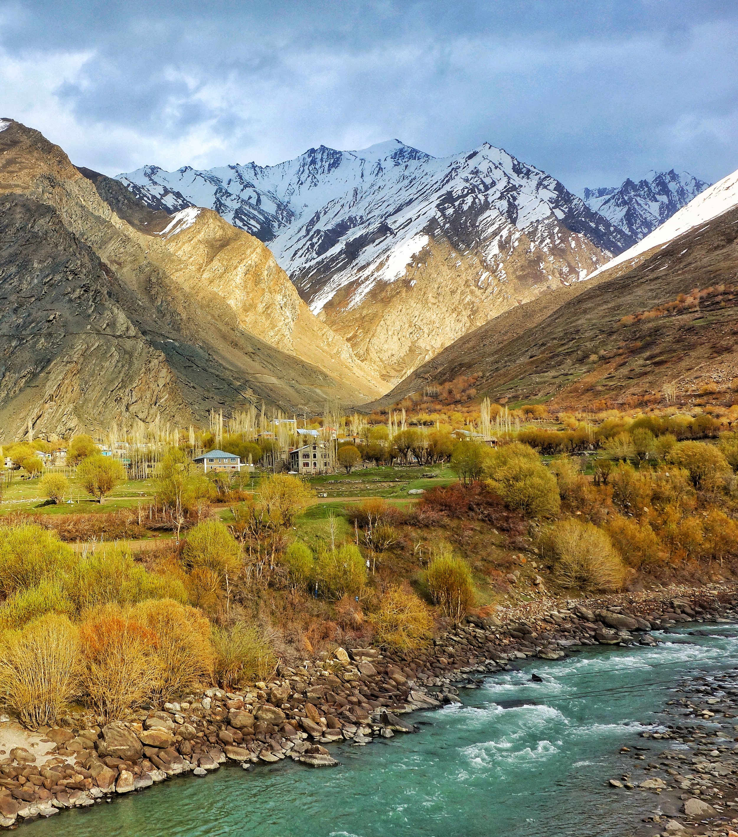
The Curious Case of the Baltis of Dehradun
On my random ramblings here and there I was in Drass and we decided have some Tea and Snacks at a Dhaba in Kargil. The guys running the Dhaba looked like almost a local but he was speaking in a strange accent to his wife. It wasnt the local accent.
Out of curiosity I asked him where he was from. He said Dehradun. I was like how did you land up here. He answered that they only stay there during the Spring/ Summers and return back to Dehradun before the onset of Winter. Ok I said.
But why here of all place. Then he told me there are Dhabas run by people from Dehradun as well and quite a lot of them. I asked again why here of all the places. There are other Hill Stations much closer to Dehradun in UK itself and you wouldnt even have to leave the state.
I then casually told him well you can pass of as a local. How come I asked ? Well we are from the same area originally he said. From Drass ? No he said. I was like OK he is not a Shina speaker so must be a Purigi speaker from Kargil or Suru. Nope he said. Then where I asked ?
Well we are originally from Baltistan but settled in Dehradun. I was like “Come again” please. I think I heard you wrong. He repeated and then the fact was revealed me to me of the story of a community of Baltis that exists in a place called Ambari in Vikasnagar near Dehradun.
Baltis are originally the inhabitants of what is now called Baltistan in Pakistan Occupied Kashmir where they are the majority.. The Baltis are of Tibetan origin with a significant Dardic admixture. In the state of Jammu and Kashmir the majority people of Kargil area as well the people in the Villages around Turtuk are also Balti.
Coming back to the Baltis of Dehradun i wondered how and why they landed up there. Also at the same time I got to know that some Baltis were also living in Shimla. And the community still exists in some form over there. And also about a smaller Balti community thats exists in Nainital and even smaller ones dotted at other places in Uttarakhand.
So as it seems in the days before Partition many people from Baltistan used to come down to the Hill Stations and lower foothills in search of work. These hardy mountain men were sought after for their great ability to carry heavy loads over rugged mountain paths. They were employed by the Armed Forces and as a general heavy load specialists. There were also a large number of them who were employed in the stone quarries in the foothills especially around Dehradun. The fact that you still find sturdy Kashmiri/ Gujjars from Kashmir still being used as heavy load specialists in Hill Stations like Shimla and Mussoorie are a testimony to this. As well as the testimony to the fact that sturdy mountain men are always in demand at our Hill Stations.
As it so happened suddenly the tragedy of Partition took place and all the Baltis who came for the area that was occupied by the Pakistani forces were now stranded in India wherever they were. The more luckier ones who hailed from the Kargil area still had a home within India when Indian forces forced te Pakistani forces out of the Kargil area which also they had occupied. That day is still celebrated in Kargi as the “Kargil Yom-e-Fateh” day on May 24 every year.
For all the Baltis that had no home to go back to as it was now under Pakistani control there was no option but to settle down at wherever they were at. The biggest settlement was at Vikas Nagar in a village called Amabari where they continue to thrive and live today as proud Indian citizens.
So next time in Dehradun do try and check these guys out and click some pics.
Pic from what I consider to be our part of Baltistan. The beautiful Suru Valley with vistas which match with the pics posted from Gilgit Baltistan.
Pic from April 2018. Suru Valley, Kargil District, Ladakh, Jammu and Kashmir.
The Battle of Basgo
There once was Battle fought in Ladakh where a Mughal Army in support of the King of Ladakh fought against a joint Mongol Tibetan Army which had laid siege to the Fort of Basgo. The Mughals were supported by allies such as the Raja of Kullu wheres as the Mongol-Tibetans had support from the Raja Bushahr.

The Battle of Basgo : When the Mughals fought the Mongols
Here is an interesting tale which encompasses a vast myriad of actors and shows how the history of the Himalayas intertwines containing threads that includes the various people living in and around the Himalayas.
Around 1643 Tibet was a dependency of the Mongols and the Mongols played an important part in the power struggle between the various sects of Tibetan Buddhism who seemed to be engaged in a permanent duel. It was primarily a struggle between the Yellow hat sect and the Red hat sect. The Mongols were the military power who decided on the matter of which sect would come out on top in this struggle.

The Mongol Gushi Khan, the ruler of the Dzungar Khanate, put his weight behind the Fifth Dalai Lama, who was the head of the Yellow Hat sect. But as a quid pro quo the whole of Tibet came under Mongol suzernity and was a welcome addition to the Dzungar Mongol Empire, an Empire which strecthed from Tibet to Kazakhstan to the Mongol steppes and well into Siberia. At that time it doesnt seem to have occured to the Mongols or to the Dalai Lama to subjugate Western Tibet (Ladakh) which was a seperate kingdom though which paid tribute to the Tibetan kingdom.
But then circumstances played up and created a situation which caused the Mongols to cast their gaze on Ladakh along with their Tibetan allies.
It so happened that the King of Bhutan was a follower of the Red Hat sect and this got him into a spat with the Dalai Lama who was the most dominant figure of the Yellow Hat sect and his Mongol allies. As it happened the King of Ladakh at that time, Delek Namgyal of the powerful Namgyal dyanasty sided with the King of Bhutan in this spat as the head Lama of Bhutan was his patron Lama as well.
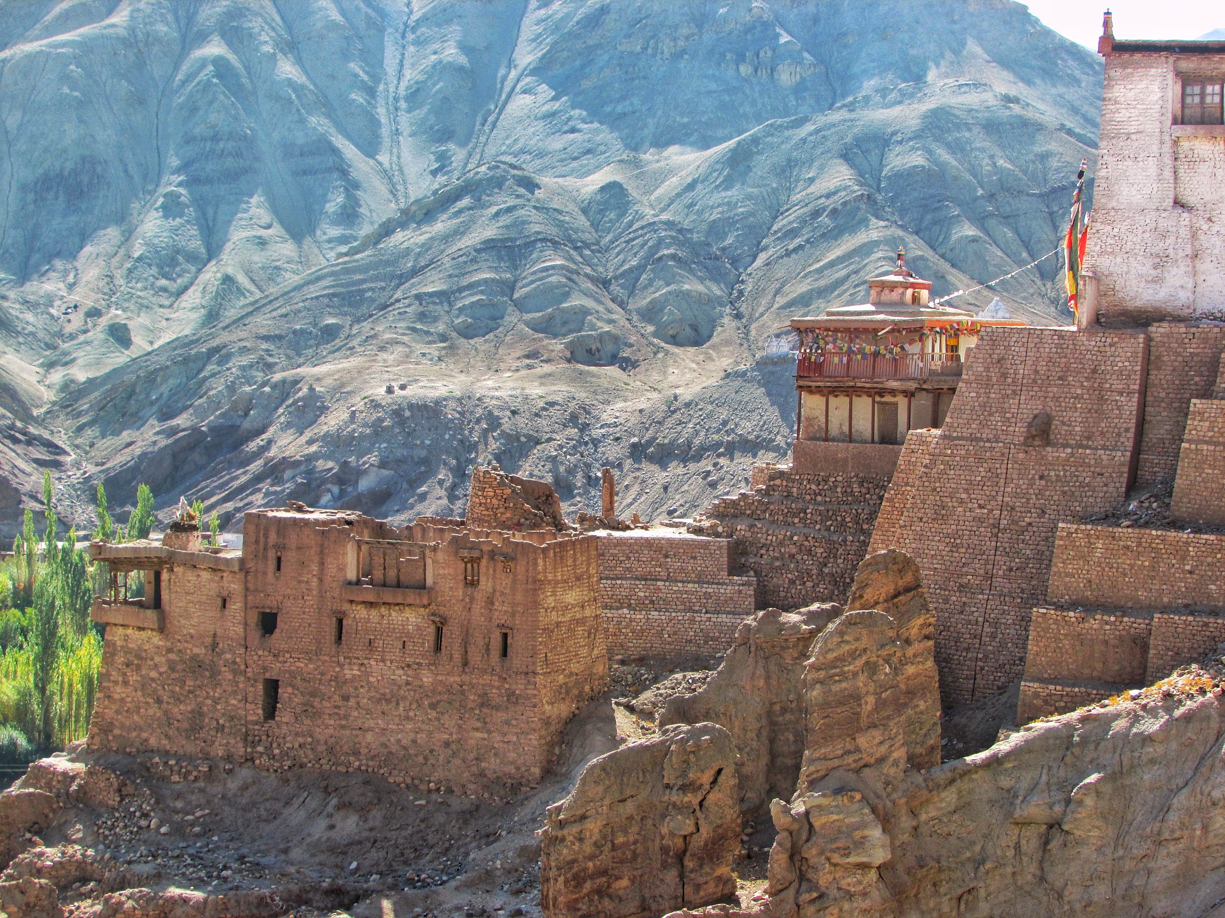
This incensed the Mongol Tibetan rulers of Tibet and soon an army was despatched to Ladakh let by a Mongol Lama named Tsang consisting of both the Mongols and Tibetans. In the first engagement the Ladakhi Army met the Tibeto-Mongol Army near the Pangong Lake and were driven back to their capital and castle which at that time was at Basgo.
It should be noted that the Raja of Bushahr, Raja Kehari Singh also supported the Tibeto-Mongol invasion as he wanted to recover parts of Kinnaur which were claimed by the Namgyals of Ladakh.
Finding himself in the midst of being surrounded in his castle at Basgo by the Tibeto-Mongol, the Gyalpo (Ladakhi word for the King) decided to ask help from the only power he knew could take on the Mongols and the Tibetans. He wrote to the Mughal Governor of Kashmir to come to his rescue in exchange for which he will switch his allegiance to the Moghuls instead of the Tibetans in the future. The Mughal Governor forwarded the request to Emperor Aurangzeb,who agreed to help on two conditions, first the Pashmina trade should be an exclusive Mughal preserve and the Gyalpo should convert to Islam.

The Gyalpo found himself between a rock and a hard place. Atleast agreeing to the Mughla conditions would ensure that he had a good chance of getting through this crisis. Alive. He agreed and soon a Mughal force was despatched to take on the Mongols and the Tibetans.
Interestingly the Mughals themselves were of Turkic-Mongol origin. Infact the word "Mughal" was the Persian word for the Mongols. Emperor Babur was himself a descendent of Timurlane and a princess of the Chagatai order. The Chagtais were descended from Chagatai, the second son of the Great Khan himself. The stage was now set for these Mughlas to meet on the field their long lost Mongol cousins.
As a side act the Raja of Kullu, Raja Bidhi Singh, also sided with the Mughals, as Lahaul and Kullu used to pay tributes to the Ladakh kingdom and as such he was obliged to side with the Namgyals. On a side note the Raja plundered the Zanskar Valley while the stage was being set for the main engagement.

The Mughal force crossed the Indus over two wooden bridges at Khalaste and marched towards Basgo. The two armies met at a plain called Jargyal between Basgo and Nimmu. This is referred to as the Battle of Basgo fought in 1679. And the battle hardened Mughals along with their Ladakhi and Kullu allies proved too strong for the Tibeto-Mongols and their Bushahri allies. The Tibeto-Mongols were pushed back and routed all the way to Spituk where after a brief lull the fighting erupted again until they were driven beyond the Pangong Lake to a place called Trashisgang. They built themselves a Fort and shut themselves in and the Mughal Army now turned back, confident that the Tibeto-Mongols were gone for good. But of course Mongols being Mongols, they were wrong, but more of that later.
In the meanwhile the Gyalpo had moved west to the Fort of Tinmogang, around 30 west of the Fort at Basgo. And the Mughals now turned up to get their pound of flesh. All the Pashmin trade rights were given to the Mughals and as per Mughal chronicles the Gyalpo converted to Islam and took on the name Akbat Mahmud Khan. As a guarantee the Mughals took with them to Kashmir as "guests" a few members of the Royal family including one of his sons.
The Ladakhi chronicles however make no mention of his conversion to Islam. Maybe the King didnt want to reveal this fact to his subjects and especially to the Orthodox Buddhist Lamas who would get extremely incensed at the fact that their King converted to Islam. As per outside historians the King converted to Islam but this information was kept secret and not recorded anywhere in the Ladakhi chronicles. He simply could not afford to face the wrath of the Lamas.

Having been satisfied and their conditions fulfilled the Mughals went back over the Zoji La to Kashmir leaving the Gyalpo in charge as before.
Once the Mughals went back, the Tibetians with new re-enforcements from the new Dzungarian Khan, Galdan Boshugtu Khan, attacked again in 1684. This time the Tibeto-Mongols were victorious and the Gyalpo just didnt have the time or the inclination to call upon his Mughal allies and neither were the Mughlas perpared or interested in intervening again.
In the aftermath a Treaty was signed between the Tibetans and the Ladakhis which set the border between Ladakh and Tibet and it restricted the Kashmir hold on the Pashmina trade only till Spituk. It also set the annual tribute that Ladakh had to send to Tibet.
This fragile peace would hold on for another 150 years till General Zorawar Singh happened. Another story for another day.
References : Francke : History of Western Tibet, O.C. Handa:'Buddhist Western Himalaya: A Politico-Religious History' and Vinayak Razdan who had written a Post on the same and I added more information to his Post.
Kiki’s Blog
Stories from the Himalayas








Five years ago the Galwan Valley was in the News for the wrong reasons after a deadly clash between the Indian and Chinese Armies in the Valley located in Ladakh lead to many deaths on the contentious Border between the two countries in wake of continued Chinese intrusions into Indian territory.
This area along the Shyok River, of which the Galwan Nallah or the Galwan River which forms the Galwan Valley has been off limits to Civilians since long but now the Indian Government has decided to open up the area for Civilians and we were amongst the First Civilians to venture into this beautifully desolate part of the Eastern Karakorams in Ladakh. Earlier Civilians could only venture upto the Village of Shyok from where the Shyok River takes a U turn and flows in a Northerly direction.