
The Illustrated Mountain Geography of Ladakh
The Mountain Geography of Ladakh makes for interesting reading situated as it is between the Great Himalayan Range and the Karakoram Range. Also running within Ladakh are the Ladakh Range and the Zanskar Range but most people do not have a clear idea as to which Pass co-relates to which Pass.

The mighty Nun Peak of the Great Himalayan Range at 7135 m its the highest Himalayan Peak in Jammu ans Kashmir (not including the areas under occupation). On the side is the Saddle Peak.
The Illustrated Mountain Geography of Ladakh
Ladakh, the name comes from “ La Dvags” which means the Land of the High Passes. Most of us are well aware of the fact that it's a Trans Himalayan Desert. But there are other finer parts of the Geography which make it more interesting.
If you are driving to Leh whether from the Srinagar side or from the Manali side you have to cross the first major Range which falls in the way. These are the Pir Panjals. From the Srinagar side you cross it before coming into the Kashmir Valley through the Banihal Tunnel which was built under what used to be the Banihal Pass. You can also come from the Mughal Road and on that Road you cross the Pir Panjals at the Pir Ki Gali Pass. In case you are coming from the Manali side you cross the Pir Panjals at the famous Rohtang Pass. But the Rohtang Pass will soon meet the fate of the Banihal Pass as the Rohtang Tunnel is expected to be operational by the end of the Year. But it might survive as a Tourist attraction for people who want to see and experience Snow. Though the Passes on the Pir Panjals are not as high as some of the higher Passes further afield yet they are notorious as they get the maximum amount of precipitation in the Western Himalayas in the form of both Snow and Rain.

The transition between the Great Himalayan Range and the Zanskar Range as seen from a flight.
After crossing the Pir Panjal Range it's time to now cross the big Daddy. The Great Himalayan Range itself. From the Kashmir side you do it from the Zoji La and from the Lahaul side you do it via the Baralacha La. Both of these Passes are quite notorious and give a hard time to many though in recent years they have been tamed to some extent. There is talk of a Tunnel itself under the Zoji La but I guess that is many years away for now. After crossing the Great Himalayan Range from the Manali side after passing over a couple of passes you need to cross the Zanskar Range and this is does at the Tanglang La. While coming from the Kashmir side you cross the the Zanskar Range at Namika La and Fotu La.
And then if you want to go further North you have to go across the Ladakh Range which is crossed over at the famous Khardung La and now you come face to face with the most perpendicular of all the Mountain Ranges in the World. The Karakorams. Standing atop the Khardung La you can see the difference. The nicely rounded Peaks of the Zanskar and Ladakh Range in deep contrast to the craggy Towers of the Karakorams. Of course you can cross the Karakorams also (in a perfect world) over the Karakoram Pass but that's quite out of the question as of now.

A Truck astride the Great Himalayan Range as it approaches Zoji La.
Traditionally the Indus has been considered the dividing line between the Karakorams and the Himalayas. The Ladakh Range is considered by some to be a part of the Karakorams. Even the Encyclopaedia Britannica says its a part of the Karakorams but a majority of researchers consider it a part of the Himalayas as the Ladakh Range (and its sub Range the Changthang Range) along with the Kailash Range and the Nyeng-Chin-Thanla Range run almost parallel to the Great Himalayan Range all the to its Eastern extremity and hence its considered a part of the Himalayas rather than the Karakorams.
Most people who visit the fact are usually oblivious to the fact that Ladakh is located within the Karakoram Range and the Great Himalayan Range. One marks the Northern Boundary the other makes up the Southern Boundary. And most actually miss seeing the Great Himalayan Range up close from the other side. We all usually see the Great Himalayan Range from this side ie the side which faces the Indian subcontinent but seldom do we see it from the other side and Ladakh gives the perfect opportunity to do the same. Infact this is the only Place where you could have Breakfast under the shadows of the Great Himalayan Range and have dinner in the shadow of the Karakoram Range (or one of its Muztaghs as its sub-Ranges are also called). But in order to view the spectacular Great Himalayan Range you have to come down to Kargil and head into the Suru Valley. Its here in the Suru Valley sandwiched between the Zanskar Range and the Great Himalayan Range is where you get spectacular view of the Great Himalayan Range with its craggy Peaks quite different from the ones of the Zanskar or the Ladakh Range. Ah to look at the Nun Kun Peaks from Panikhar is one of the most spectacular views in the Himalayan Region but most just miss it.

The Karakorams as seen from Khardung La.
And of course you get great views of the Karakorams from the Khardung La but the views from Nubra Valley and beyond are not so spectacular but there are areas in Ladakh from where you can get great views of the Karakorams but these areas are off limits due to reasons which do not need to be elucidated here. But hopefully they will be opened someday and the beauty of the Karakorams in all their vertical glory is revealed to all of us.
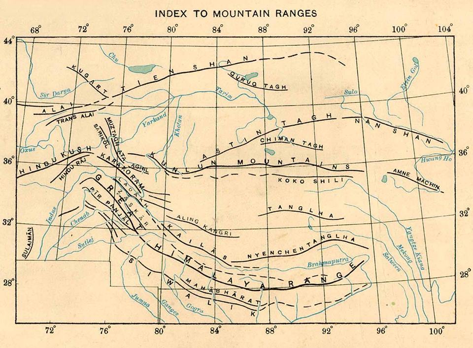
The pics below show some of the things mentioned above. The magnificent Nun Kun Peaks as seen from the Suru Valley, a pic from a Flight showing the transition from the Great Himalayan Range to the Zanskar Range, a Truck astride the Great Himalayan Range near Zoji La, a pic of the mighty Karakorams as seen from Khardung La and lastly a Map for guidance on the Himalayan Range.
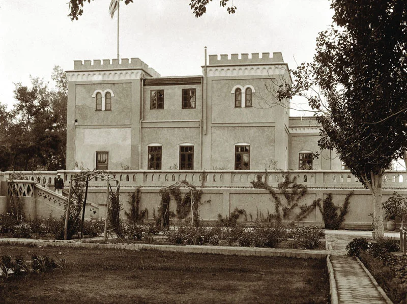
The Consulate at Chini Bagh
The story of Chinni Bagh, which at once upon a time was the Consulate of the British Empire in Kashgar to facilitate the Trade between India and Central Asia and also keeping a watch on the Russians during the Great Game.
The Consulate at Chini Bagh
Many stories have been told about the Great Yarakand to Leh Trade Route which went across some of the highest Mountains in the World and over some of the most inhospitable terrains. The Trade went up considerably after the Maharaja of Jammu and Kashmir and the British started to encourage the Trade in a big way and the so called Treaty Road was established. Those were the days of the Great Game and Trade was a perfect way for the British to compete with Russia over influence in Central Asia.
For facilitating the same the British had set up a Consulate in Kashgar which was on the Yarkand Leh trail and the first big city (If you could call it that) once you got over the Mountain wilderness in Central Asia. The Consulate for some reasons was called the Chini Bagh.Of course the Russians also had a Consulate in the same City. And the Russian and the British Consulates and the officials were constantly engaged in a games of one upmanship in order to gain favour with the Turkestanis as well as the Chinese who were nominally in control of the Region.
The Chinni Bagh Consulate
A some of you must be aware that most of the Trading from the Indian side was done by the industrious Punjabi traders from Hoshiarpur, many of whom were based in Leh and Kargil for doing this Trade. Initially they used to only stay there during the Summers when the Trade was maximum and used to go down to the plains of the Punjab in the Winters. But with time many of them settled there permanently.
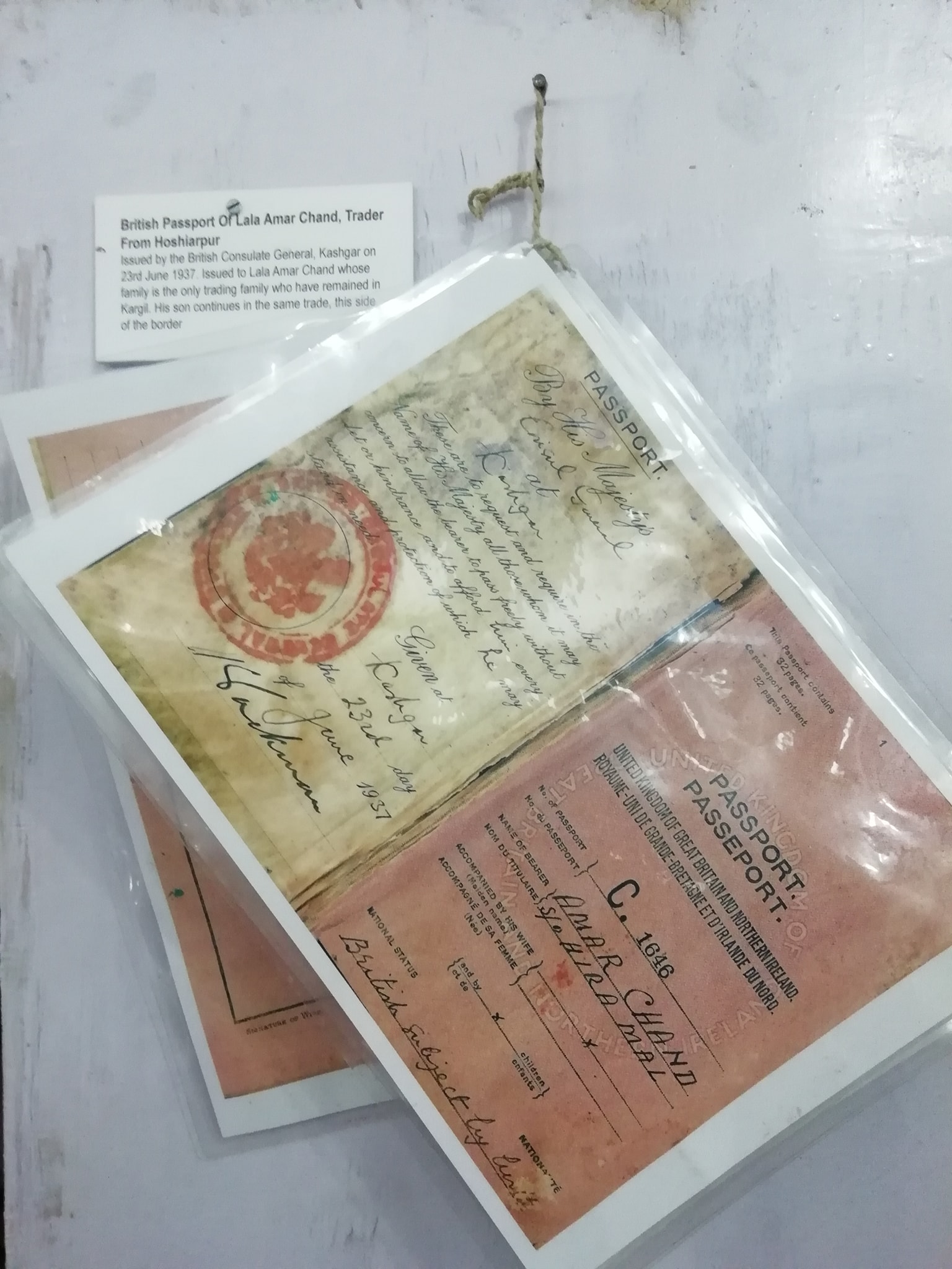
Presenting a British Passport issued to a Hoshiarpuri trader from Kargil, Shri Amar Chandji who was one of the big traders involved in this trade. And this Passport was issued at the British Consulate at Chini Bagh on June 1937 and he was referred to as a British Citizen by birth as I assume all Indians would be at the time the subcontinent was colonised by the Britishers. Amazingly enough it was Amar Chandji’s family which still lives and trades in Kargil. They are the only remaining Hoshiarpuri family living in Kargil as most of the Traders left when the Trade ended abruptly in the early 1950’s. There is still a sign in the main Market saying Amar Chand Diwan Chand Traders and they have a prominent shop in the Kargil Bazaar where Amar Chandji’s son still looks at business. I had the pleasure of having Tea with him at his shop and I was accompanied by a friend, whose family was also originally from Hoshiarpur, but settled since long in the Kulu Valley and presently cultivating Apples in the Raison area. And of course within a couple of minutes the Hoshirapuri’s from Kulu and Kargil established that they were related also through some complicated family history. The World is indeed a small place.
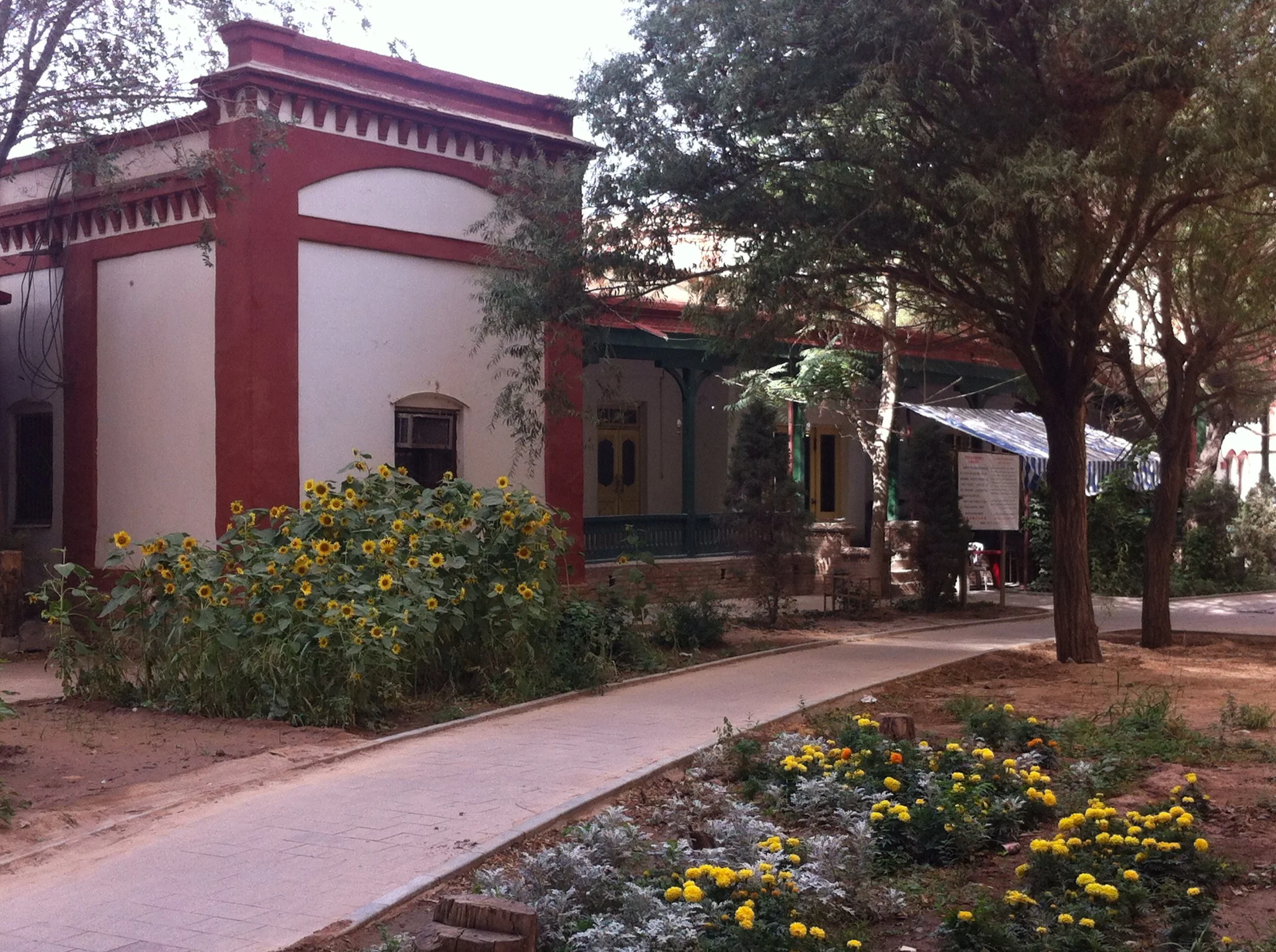
Chini Bagh as it exists today. Pic credit flashme.wordpress.com
Moving on back to the Consulate. It continued as the British Consulate till 1947 when the British decided to grant Independence to India. With the British gone the Consulate was renamed as the India Pakistan Consulate. Yes India Pakistan Consulate and it was like a joint Consulate. And things went on for a couple of years till as per now declassified CIA report things started happening and the Communist Revolution started making its presence felt. As a result the Consulate Generals of Pakistan and India were shut in 1949. It needs to be noted that Trade even at this time was on at full swing and not affected by this development. And it seems that the Indian Consulate officials continued to work well into 1950 when one fine day they decided to leave. The Consulate Incharge at that time was Capt.Sathe (he later became the Indian Ambassador to China) and all of the Indians had to leave via the most dangerous Route ie over the Karakoram Pass into Ladakh. Even the American Deputy Consulate Head took the same Route to Ladakh and the onto Srinagar and thence to Delhi from where they flew back to the US.
So why did the Consulates close or were ordered to close. Well its a complicated different story and maybe it will be told here some day. To put it simply the Communists were not very trusting of foreigners especially in a frontier Region inhabited by Uighurs who were themselves not very fond of the Chinese.
The Great Game had long ended and the Cold War had started and one of its sad legacy was the closing of my beloved “Worst Trade Route in the World”.
As for the Passport it lies in the Munshi Aziz Bhatt Museum in Kargil, a little distance from where the son of Sh. Amar Chand runs his business establishment.
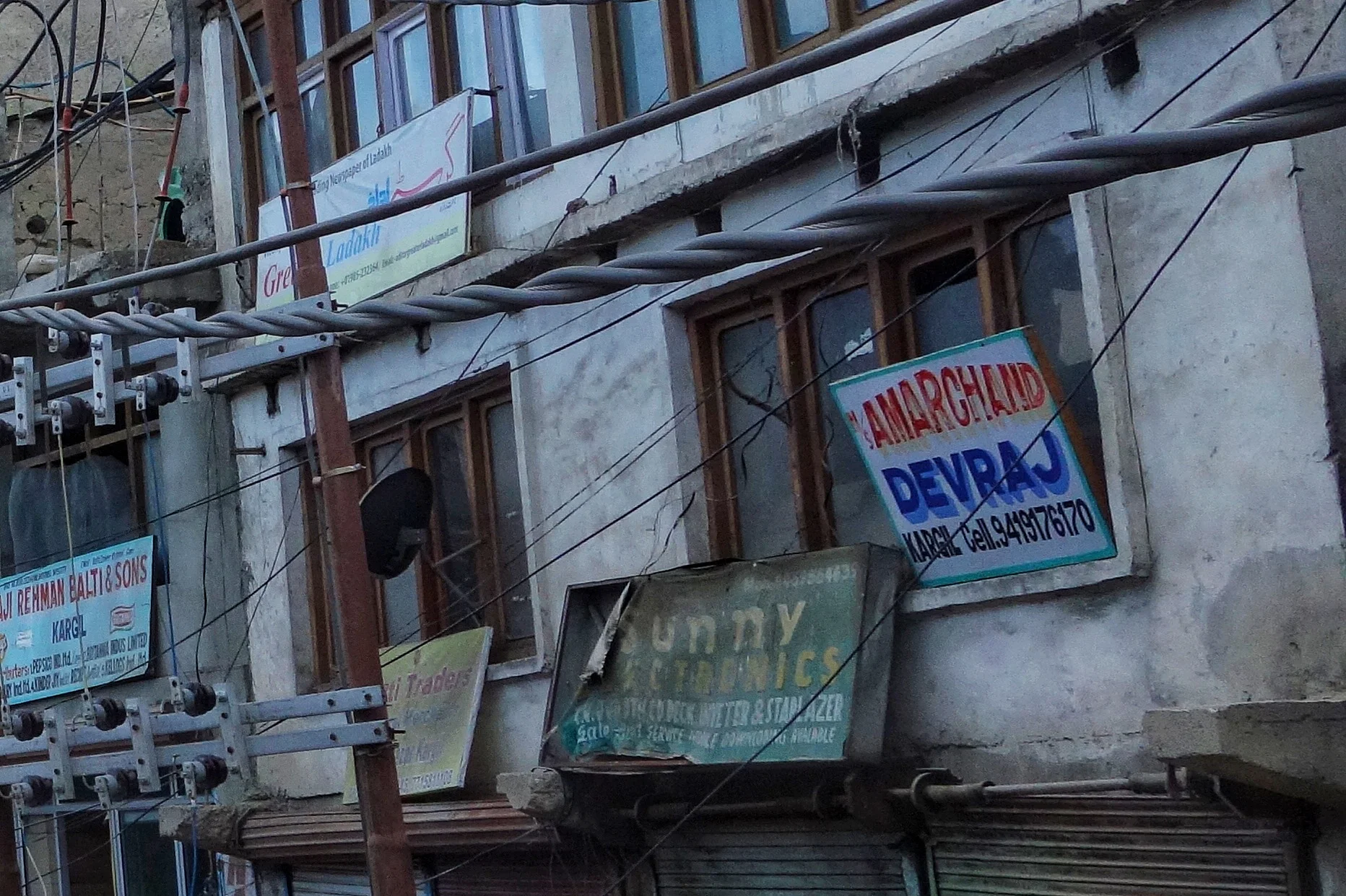
And business is still being carried out in the name of Sh.Amar Chand in the Kargil Bazaar.
Pic from May 2018. Kargil, Ladakh
Saddles of the Horse Empires
The Horse and its Saddle were the main means of transport and one of the most important weapons in Warfare especially on the Central Asian steppes. No wonder the Empires built by the Nomads of Asian Steppes including the one built by Mongols under Changez Khan were also known as Horse Empires.

Central Asian Wooden Saddle.
The Saddles of the Horse Empires
I have already told you the story of the Munshi Aziz Bhat Museum. Of course like all Museums it holds so many Items and so many stories attached to them. Like a small cannon that belonged to General Zorawar Singh himself, Horse Bells gifted by the Raja of Kharmang to Munshi Aziz Bhatt, old Korans from the 16th Century and even a Rug made for one Shyam Lal who was a secretary to Alexander Burnes.
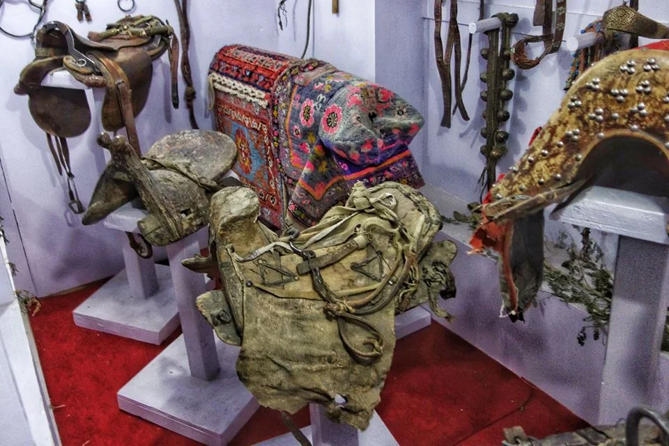
Saddles Central Asia at the Mushi Aziz Bhat Museum
One of the most significant and important set of items on display is a collection of Saddles and Horse riding items from Central Asia, Tibet and even a Saddle of the mighty Mongols themselves. Of course these items carry little significance but in those days before the Internal Combustion engine came around the Horse was the means of transport and one of the most important weapons in Warfare especially on the Central Asian steppes. No wonder the Empires built by the Nomads of Asian Steppes including the one built by Mongols under Changez Khan were also known as Horse Empires. The tenacity of the Central Asian Horse and its amazing stamina and resilience made it one of the main factor in the conquest of the “civilized” world by these so called “Barbarians” who came in from the North riding their Horses. In fact Historians have credited the Horse as being the strongest strength of the largest contiguous Empire the world has ever seen, the Mongol Empire.
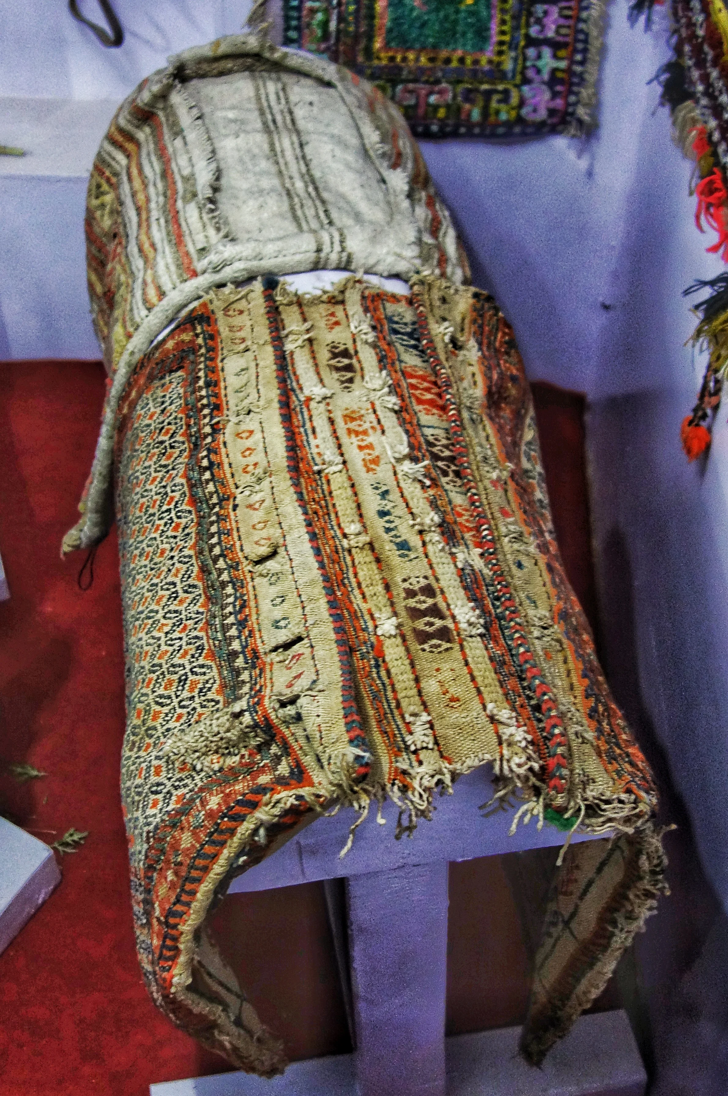
Tibetan Saddle
The Central Asian people from the Mongols to the Turkic people of the Central Asia like the Kyrgyz, Uzbek, Kazakh to the Persian Tajiks all revered the Horse and they were their most valued possessions. And of course one of most important Item required to ride a Horse was the Saddle of course and all other attached paraphernalia like the Stirrups and decorative ornaments and stuff for the Horses.
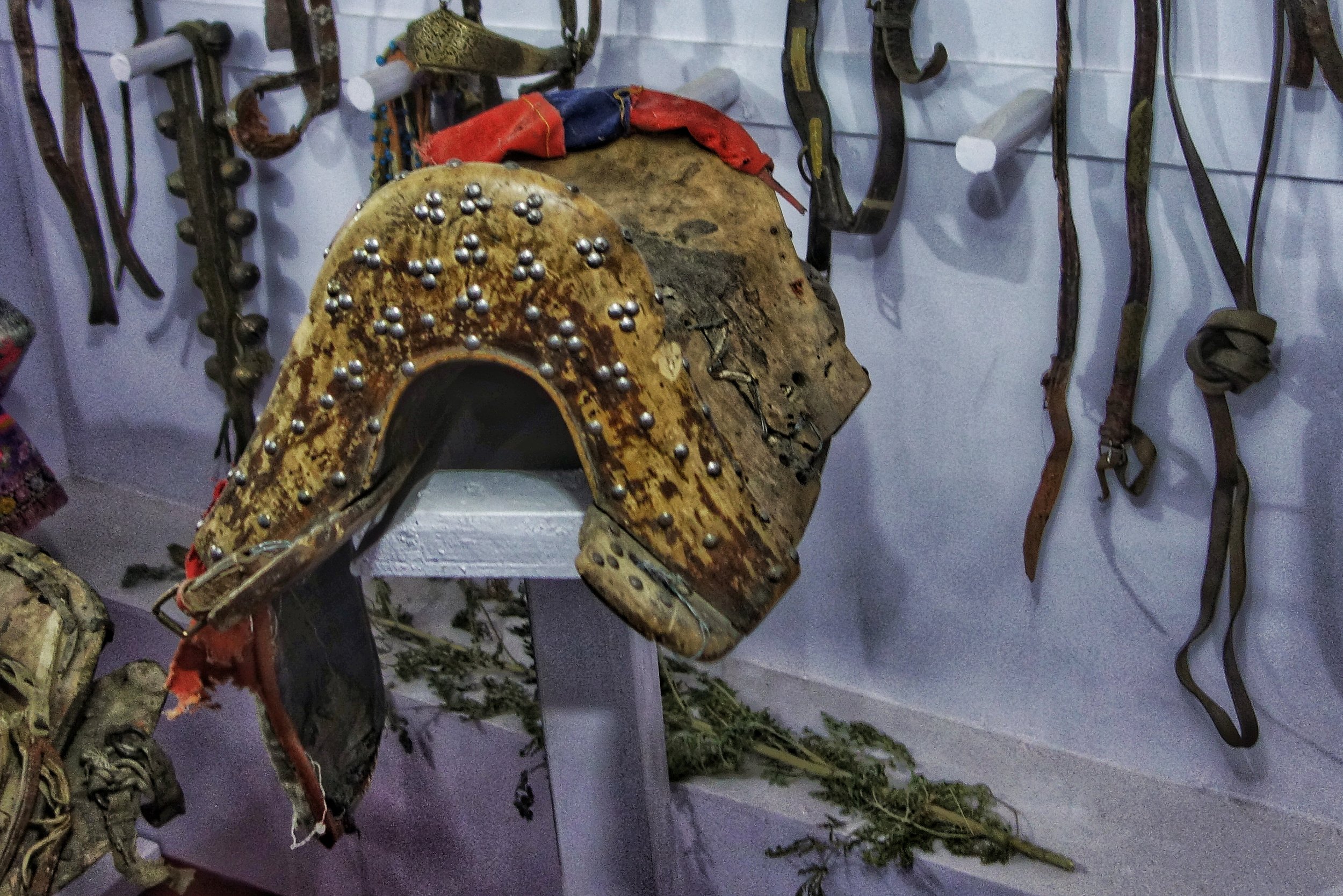
Kirgiz Saddle
The display at the Museum has a great collection of these items as mentioned earlier. There are Saddles from Kyrgyz, the Uzbek, the Tibetans, even an English saddle and the most decorative being a Mongol Saddle. These Saddles are the same design that have come down from Millennia and not much has changed as far as the Saddles and their designs are meant. The fact that there is a great possibility that the Great Khan himself rode a similar Saddle when he subjugated the World is of course quite an overwhelming though.
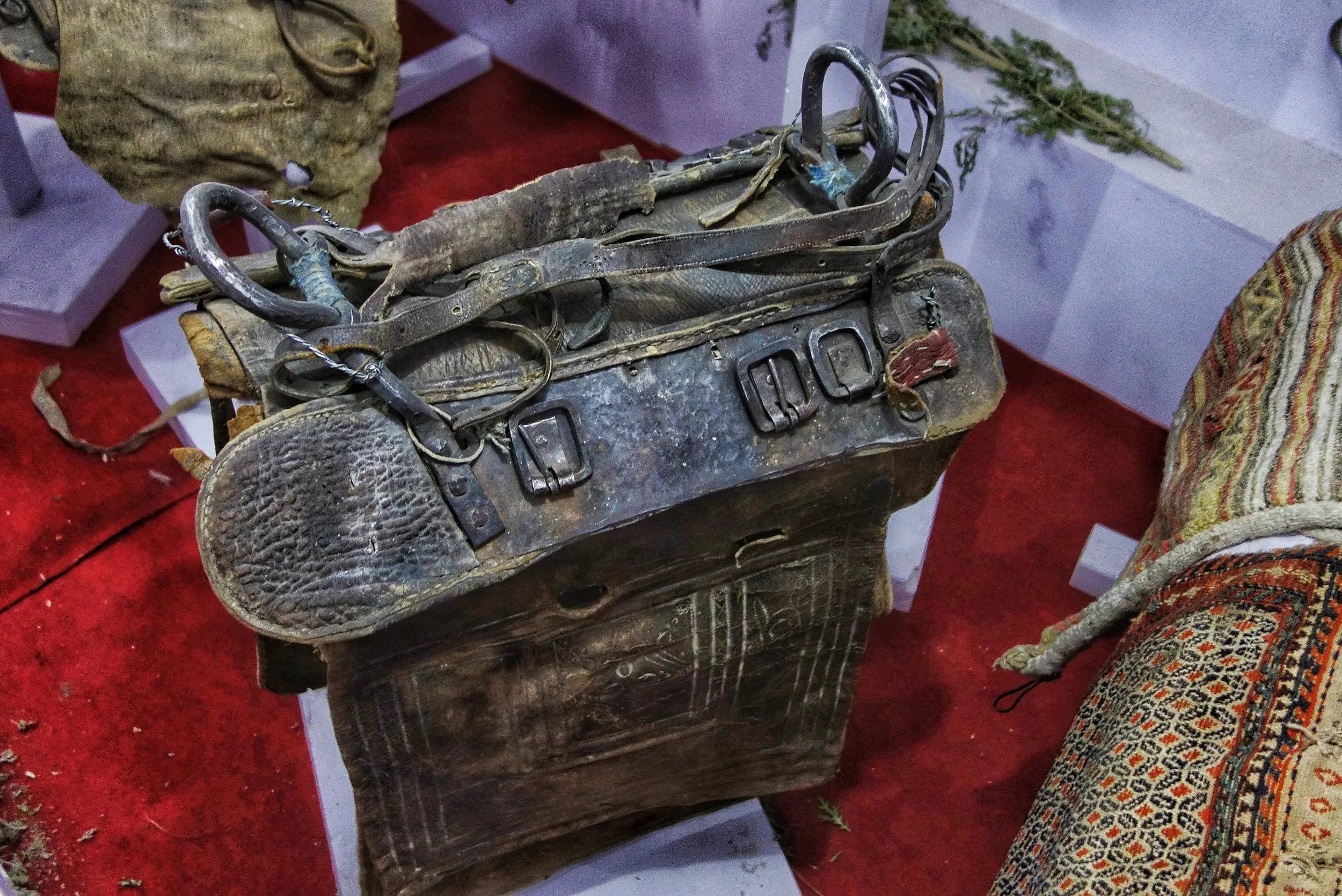
English Saddle
Of course the Horse Saddles were important items of Trade on the Kashmir to Yarkand Silk Route Trail. I would assume that Horse Saddles from Central Asia were in demand on this side of the Great Mountain Wall. And the Central Asians were more sophisticated at this though the Europeans in the later ear were turning out good Saddles as well. One of the main difference was that Central Asian Saddles were made of Wood and Leather and were highly decorated reflecting the status of the Person riding that Saddle. European Saddles made of Leather and Metal were more work like and devoid of any decorative element.
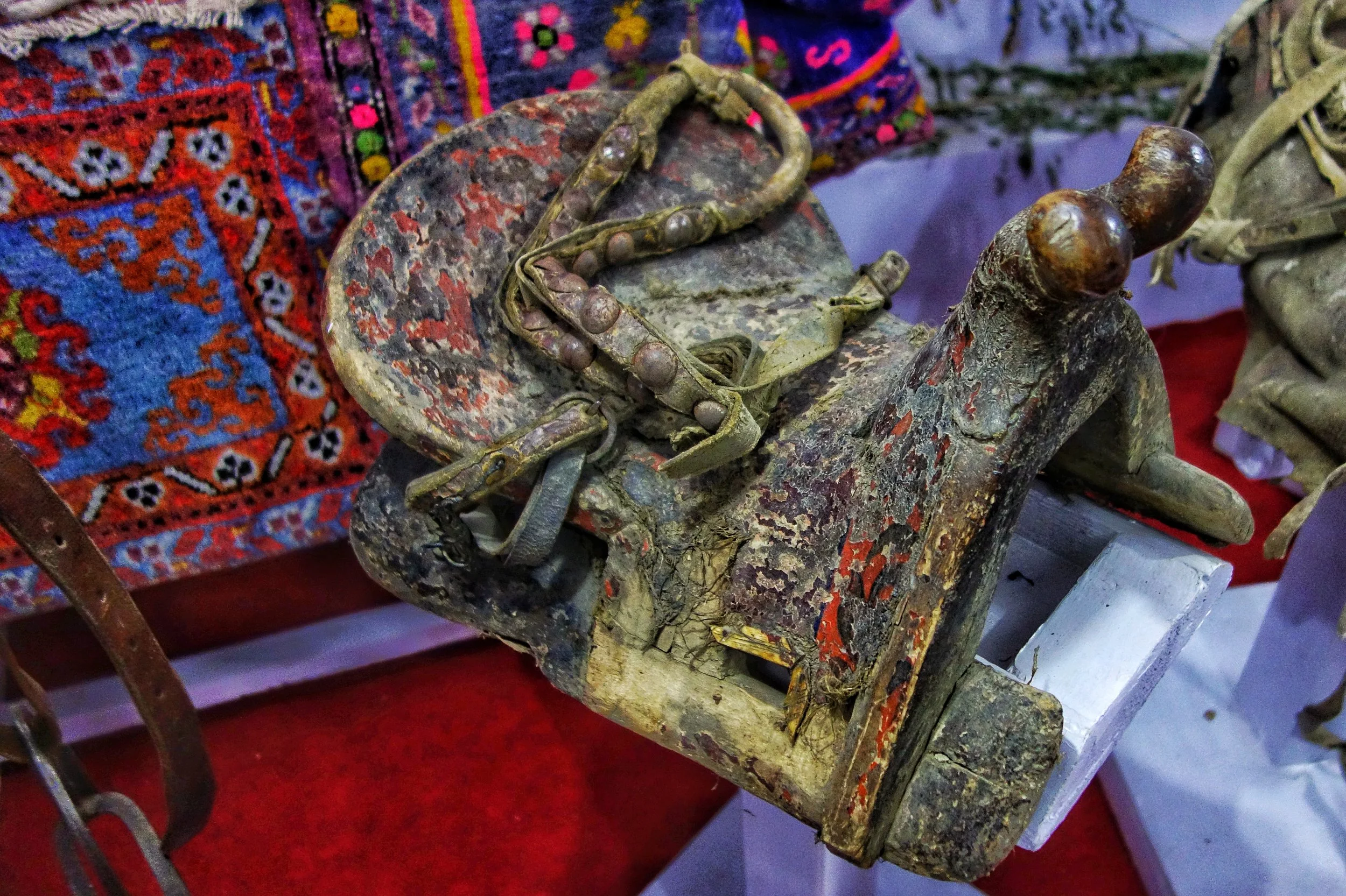
Mongol Saddle
In the pic below a few of the Saddles in the Museums collection are shown. The one on the right with Metal Studs is a Kyrgyz saddle from the 18th Century. The one in front is an Uyghur saddle from Eastern Turkestan. The one with a Carpet like covering is a Tibetan Saddle. The one next to it is the most prized one : A Mongol Saddle with a lot of decorations which sadly have deteriorated over time. And last but not the least an English Saddle in Leather and Metal.
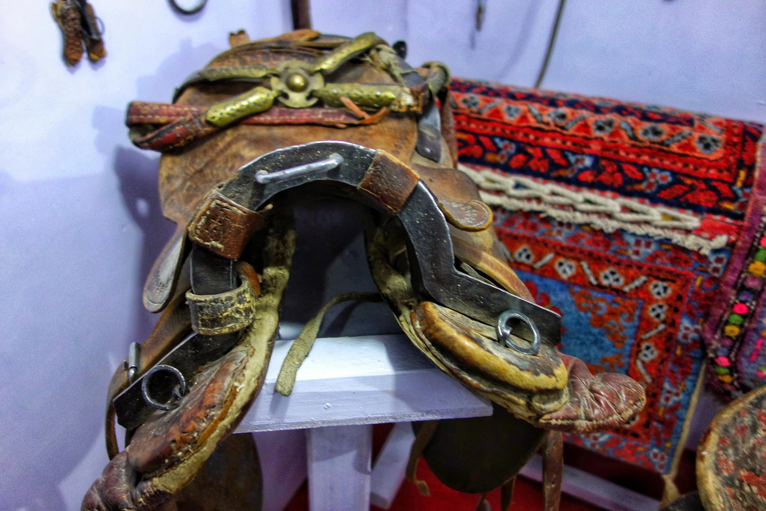
European Saddle
The fact that people sat on these Saddles while crossing the Great Wall as I call it consisting of the Kun Luns, the Pamirs, the Hindu Kush, the Karakorams and finally the Great Himalayas themselves again gives one a sense of awe of the great Tradesmen and Soldiers who crossed this most formidable barrier for Trade and War. And their most faithful companion in both case was none other than the Horse.
Munshi Aziz Bhat Museum of Central Asian Antiquities
The Munshi Aziz Bhatt Museum of Central Antiquities which holds a priceless treasure of Items and Objects which were once traded on the legendary Kashmir to Yarkand Silk Route via Ladakh.

A decorated Mongol Horse Saddle
Munshi Aziz Bhat Museum of Central Asian Antiquities
The name Kargil is famous now. Mainly because it is associated with a War that was given its name as it was fought in this area almost 20 years back and it was the country’s first televised War. But few would imagine that once upon a time it was a major trading Route on the Silk Route which connected Northern and Peninsular India with Central Asia and China.
Kargil is at a strategic location and is as such almost equidistant from Skardu, Leh , Padam in Zanskar and Srinagar. Infact its name itself is derived from its location. Kargil literally means a place to stop from all directions. Its etymology has evolved from the word Garkill. Where “Gar” means from all places and “Khil” to stop. And true to its name, all historical accounts of British and European travellers reveal Kargil to be just that. Situated along the river Suru (a tributary of the Indus, which flows into Gilgit Baltistan) it boasted of a fort built by the Ladakhi King in the 19th century. The old caravan bazaar ran along the river and a few mud houses by the slopes nestled in a green oasis of the Suru valley.

The old crumbling Kargil Sarai
Traders from all over the region and beyond converged upon Kargil. There were Punjabis, Kashmiris, Baltis, Yarkandis, Ladakhi, Tibetans, Afghans, Arghuns, Pathans, Kirghiz and all other ethnicities from the neighbouring Regions. The Dogra Rulers as well as the British promoted this Trade after the Dogras came into power and consolidated their Rule in the Region. They also improved and facilitated the creation of the Treaty Road which was a Trade Route all the way from Srinagar to Yarkand.
At the time that the trade was flourishing there was a certain Gentleman by the name of Munshi Aziz Bhat of Kargil who was the official petition writer for the Maharaja of Jammu and Kashmir for the Baltistan Wazarat. A Petition writer in those days was a powerful man, as if you had an issue that you wanted to bring to the higher authorities and the highest being the Maharaja, who had to approach the Petition writer to do it on your behalf. So the strength of your case basically lay on how the Petition writer presented it. As such Munshi Aziz Bhat was a very well respected man in Kargil.

The Kargil Sarai facing the Suru River.
Munshi Aziz Bhat was a trader also being on the Central Asian trade Route and owned a number of shops in Kargil and his trading company was called Munshi Aziz Bhat and Sons. He set up a Serai, the Kargil Serai in 1920 to offer boarding lodging and storage places to the Traders. Soon the Serai became a stopover place for all kinds of traders from all kinds of places in Kargil. The Kargil Serai also served as a kind of an unofficial Post Office which received a lot of mail especially from the Hoshiarpuri Punjabi traders. The Serai had in its front a couple of shops as well which the Traders could use to display their wares. The Serai was a busy one in the late 1800s as well as the early 1900s and it saw many traders come and go.
Janet Rizvi in her epic Trans-Himalayan Caravans, Merchant Princes and Peasant Traders in Ladakh (p 260) mentions “ …it would seem that for the transporters belonging to the villages downriver from Drass, Kargil (rather than Srinagar) was the centre to which they went in the first instance in search of work. The hub of this activity was Munshi Aziz Bhat’s sarai, which was a depot for goods going in all four directions...there was in particular plenty of coming and going between Kargil and Skardu…”

An old style Building in the Kargil Bazar
And then came the turmoil of 1947 when initially Kargil was occupied by invaders from the other side. And ofcourse with the Chinese occupation of Xinjiang and its move on Tibet the Trade Route was finally shut down by the Chinese in 1949. A once buzzing trade route and all its dependencies were suddenly shut. The Kargi Serai lost its guests as even the Hoshiarpuri merchants went away. The Serai fell into disrepair and meanwhile Munshi saab also passed away.
The Seari was however bequeathed as family property to Aziz Saab’ descendents and so the three storied Serai remained for decades. A lonely relic in the Kargil bazaar of a time long gone. It remained under lock and key for a good 50 years but its condition kept on deteriorating. No one it seems was aware of what lay inside the Serai since decades.
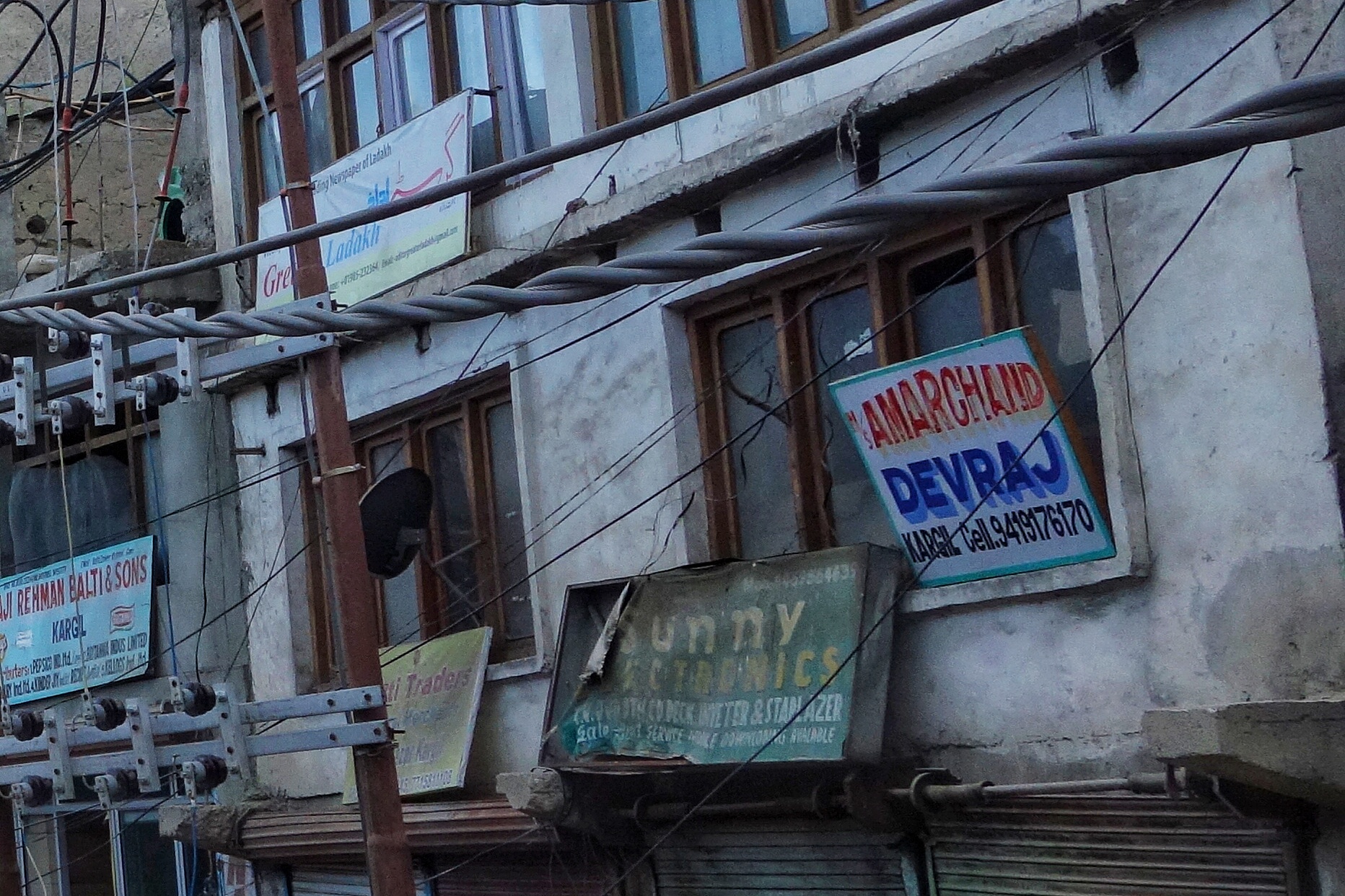
An establishment still run by descendants of the Punjabi traders from Hoshiarpur who were at the frontline of the Central Asian trade.
In was a chance discovery in the beginning of this century that some workers were sent to the place to clear some mess as parts of the structure had collapsed. The workers unearthed some very interesting items and reported these to the owners. The Owners then decided to come and check for themselves and they unearthed in what can only be called a priceless treasure in form of various items related to the Central Asian trade and items from all over Central Asia, the Indian sub-continent, Tibet and even Europe. As luck would have it a visiting historian persuaded the family to preserve this price less collection instead of it ending up in some antique shops. And so was set up the Aziz Bhat Museum of Central Asian and Kargil Trade Artifacts to display the Collection of items unearthed.
The range of artifacts unearthed from the Munshi Aziz Bhat Sarai has given invaluable insights into not only the forgotten trade history but also into the corss-cultural, cosmopolitan past of Kargil. These artifacts aren’t mere antiques but they are a testimony to the fact that Kargil was a melting pot of cultures, languages, lifestyles and ideas. They are now on display in a part of the Munshi family’s house that has now been converted into the Musuem.

Saddles from Central Asia.
The diverse collection of artifacts include not only the goods that were traded along the route but also the items used by the traders and people involved in the trade. Some of the choicest artifacts include hookah pipes from Yarkand, rugs from Kashgar, fabrics — dyed and raw silk from Khotan in China, natural dyes, costumes, jewellery, coins, shoes, utensils and ammunition. Apart from these, the museum incorporates mercantile items from the late 19th and early 18th centuries like leather skins, coarse cotton cloth, carpets from Central Asia, British horse seats and saddles, buttons from Italy and items from the factory of the Nizam of Hyderabad. Over the years, the museum has also acquired various local artifacts that are relevant to Kargil, some of the key artifacts have been the first hand written Quran by the Buddhist Ruler King Namgyal of Kartse sometime in the 14th/15h century and a number of legal manuscripts that are written both in Tibetan and Urdu for the benefit of the King as well as his people. This was at the time when Islam was spreading across Ladakh and most of the rulers were Buddhists.
This Museum is a must go recommended place to go to in Kargil in case you are interested in the history of the Central Asian Trade along with the Central Asian Museum.

In the pic above
1. Toiletries / Soap, Lux soap, Tooth Brush, / Shaving Brush, Pear soap, and Shaving Soap. / Place: - England, Germany, Italy, USA./ Period : 1903, 1905,1926, 1939. All these finished & believed to be luxury, were imported From England, Germany & USA. After reaching the Mumbai Coast, these luxury items travels all the way from Mumbai To Central Asia, Via Yarkand, Khotan, & Kashgar. The merchants with caravans of these goods either batter or sold these items to nobles.
2. Local Name :- Jola / Place : Cuba / Period : 18th Cent 100 LBS, Sugar sack from Cuba imported to Central Asia.
3. Modern medicines / Place : Britain ,USA / Period:- 18th Century / Introduced by the different Moravian Missionaries these medicines were unknown to Central Asia & Tibet.
4. Raw silk thread, Plain Silk & Imperial silk / Local Name : Shahi. / Place : Khotan/ Preiod : 17th Century Known as Shahi, or the Imperial cloth, introduced to the world from Khotan.
5. Thanka (Paintings) / Local Name : Thanka / Place : Rangdum. / Period : 16th Century
A rare Thanka Painting, gifted to Munshi Aziz Bhat, by the villager of Rangdum. Showing the wheel of life.
6. A Rug from Bukhara / Local Name : Namdah (Fingma). / Place : Bhokara. / Period : 1822.
A Central Asian Rug from Bhokara, Name of Mohan Lal (from Kashmir) who happens to be the Assistance of Sir. Alexender Burnes, a British officer of the company is written in the Center.
Herodotus's Legendary Fox Sized Gold Digging Ants
Herodotus was a famous Greek historian of the ancient times who lived around 500 BC and he was born in Asia Minor in the Persian Empire. He was referred to as the Father of History as he wrote a lot of history and tales of the unknown from lands far off. One of his most intriguing account was the one of the legendary Gold digging ants, as big as Foxes, which lived in the high Himalayas in a land he called Dardae.
Herodotus's Legendary Fox Sized Gold Digging Ants
Herodotus was a famous Greek historian of the ancient times who lived around 500 BC and he was born in Asia Minor in the Persian Empire. He was referred to as the Father of History as he wrote a lot of history and tales of the unknown from lands far off. One of his most intriguing account was the one of the legendary Gold digging ants, as big as Foxes, which lived in the high Himalayas in a land he called Dardae (In Sanskrit is was called Dardesa, the Land of the Dards). Those who have studied history, especially accounts of history written by ancient Historians always had elements which were hard to believe and seemed more like flights of fantasy mixed with some facts. You always take it down with a pinch of salt.
Herodotus wrote exactly this “ Another kind of Indians live in the neighbourhood of the town of Kaspatyros, and the land of of Paktyika (present day Paktia Province in Afghanistan) away towards the North from the rest of the Indians, their way of living is about the same as that of the Bactrians. These are the most warlike of all the Indians, and it is they who are sent for Gold; for in the this district there is the sandy desert. In this desert and this sand there are Ants which are smaller than Dogs but larger than Foxes for some which were caught are now in the possession of the King of Persia. These Ants make for themselves burrows below the Ground, and in doing so throw up the Earth, as ants do with us, and in the same manner they look exactly like ours. This thrown up sand contains the Gold and for the sake of this sand the Indians are sent into the desert…….” He also wrote this “ When the Indians arrive at the place of the Gold dust to fill their bags, they fill quickly and ride away as soon as possible. For the Ants, which, as the Persians would tell, have found out what has happened through their sense of smell, are at once after them and they are exceedingly swift. Thus if the Indians do not gain a good start before the ants have gathered, none of them would be able to escape…..”.
Even Megasthenes , the Greek Ambassador at the court of , relates a similar story of Gold digging ants who dig not for the Gold but for making their burrows. The Gold he says was incidental. Infact those of you who have read History of Western Tibet / Dardistan written by Westerners will know that this Legend of Gold digging Ants is described by every single one of them.This is the starting reference point for the History of this region from a Western perspective.
But it was not only the Greek / Roman historians who alluded to this legend. There was a reference to this ‘Ant Gold” in the Puranas and the Mahabharata. It is said that a Northern tribe, called the Khasas, bought Paipilika Gold (Paipilika is Sanskrit for Ant) as a tribute to Yudhishtir. Of course it's common knowledge that the Himalayas are rich in mineral deposits and that includes Gold as well. Gold was found under the ground as well as long the streams as fine dust. Cunningham describes how Gold sifting in the Indus and the Shyok River was done by Muslim Baltis as the Ladakhi Buddhists were forbidden from doing so as they were expected to work in the fields.
Francke in his classic “A History of Western Tibet” also alludes to this legend and describes how he was given accounts of these Gold digging Ants in the Village of Kalatse, which though now Ladakhi was at one time inhabited by Dards. He apparently saw one of these creatures but of course they were regular Ants and not the Giants that Herodotus described. Francke wrote “I was even shown the kind of Ant which, according to the belief of the Kalatse people, was the Gold digger. It was a very tiny, creature, and far from the size of a Dog or Fox, but we must allow the story to have grown a little on its was from India to Greece.”
Of course in my assumptions there must have been instances of Ants digging in an area rich in Gold deposits and digging up Gold as well and this being collected by the locals. This is a completely plausible Theory but what about the “Giant Ants bigger than Foxes but smaller than Dogs ? “
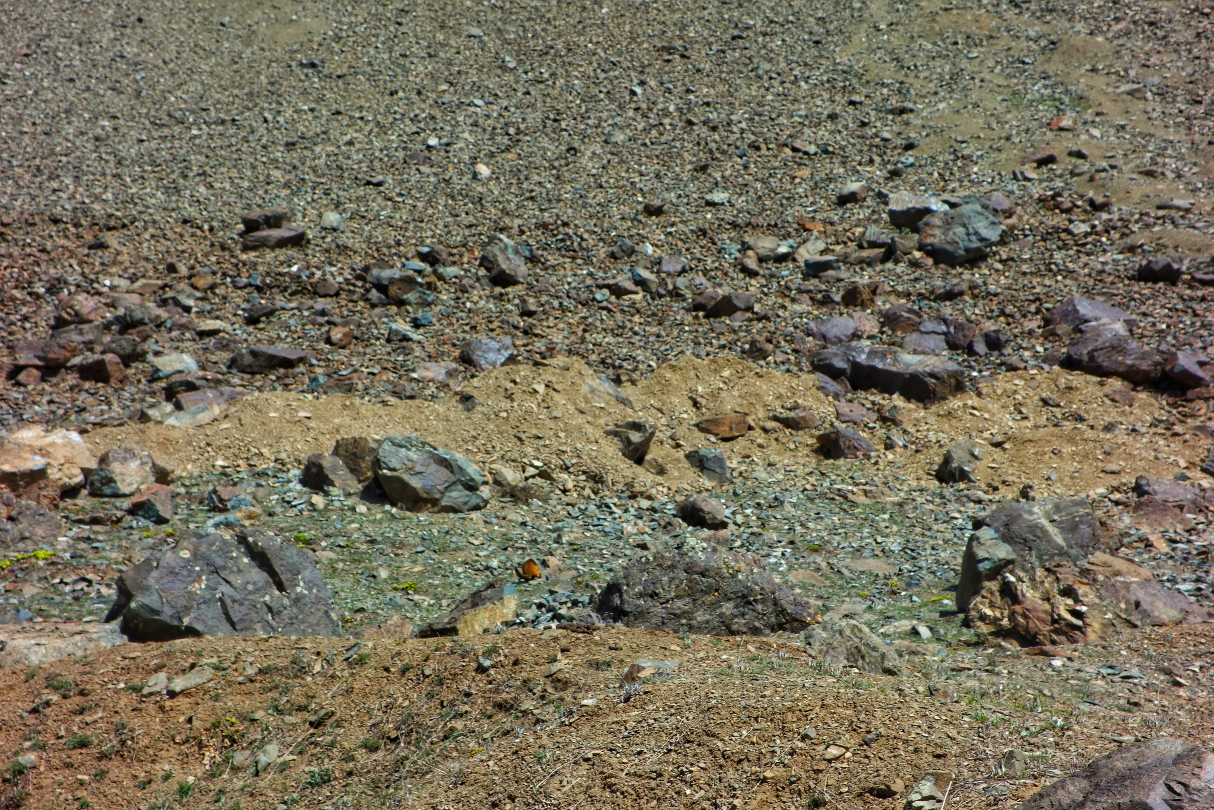
Through most of History other Historians took this Giant Gold Digging Ants theory as a figment of Herodotus’;s exaggeration and adding a adding a dose of fantastic to his historical records. Many of them them even decried him as a liar and a fancy story teller. So was Herodotus was entirely wrong and this was just a yarn he had spun ? Not exactly as it was proven by a Gentlemen who took upon himself to solve this Great Mystery of the Giant Gold Digging Ants.
The Gentleman was a French ethnologist Michel Peissel wrote a book named, “The Ants’ Gold: The Discovery of the Greek El Dorado in the Himalayas” in 1984. And he mentioned that the area described inhabited by these creatures was actually the Deosai Plateau in Baltistan.
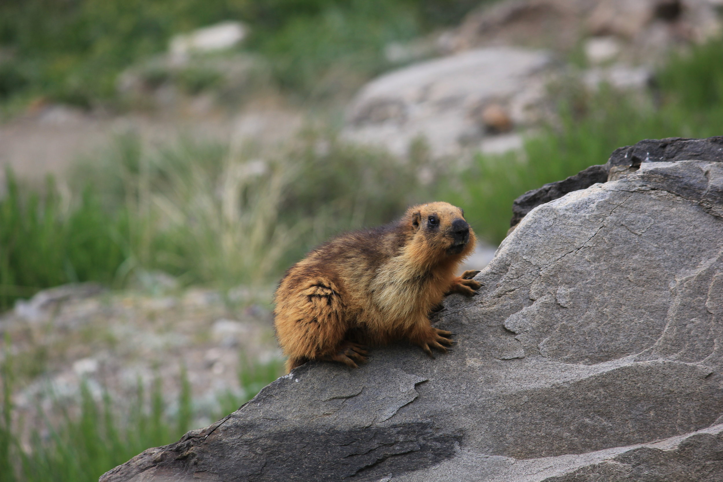
And the creature which was being alluded to were not Ants but the Long Tailed Golden Marmot and the Himalayan Marmot (These are two different species but both are found in the Himalayas). The Long Tailed Golden is more of a species found in Central Asia and the Hindu Kush, Pamirs and the Tian Shans though some are found in the Himalayas as well. A Golden Marmot which digs for Gold sounds just about right actually.
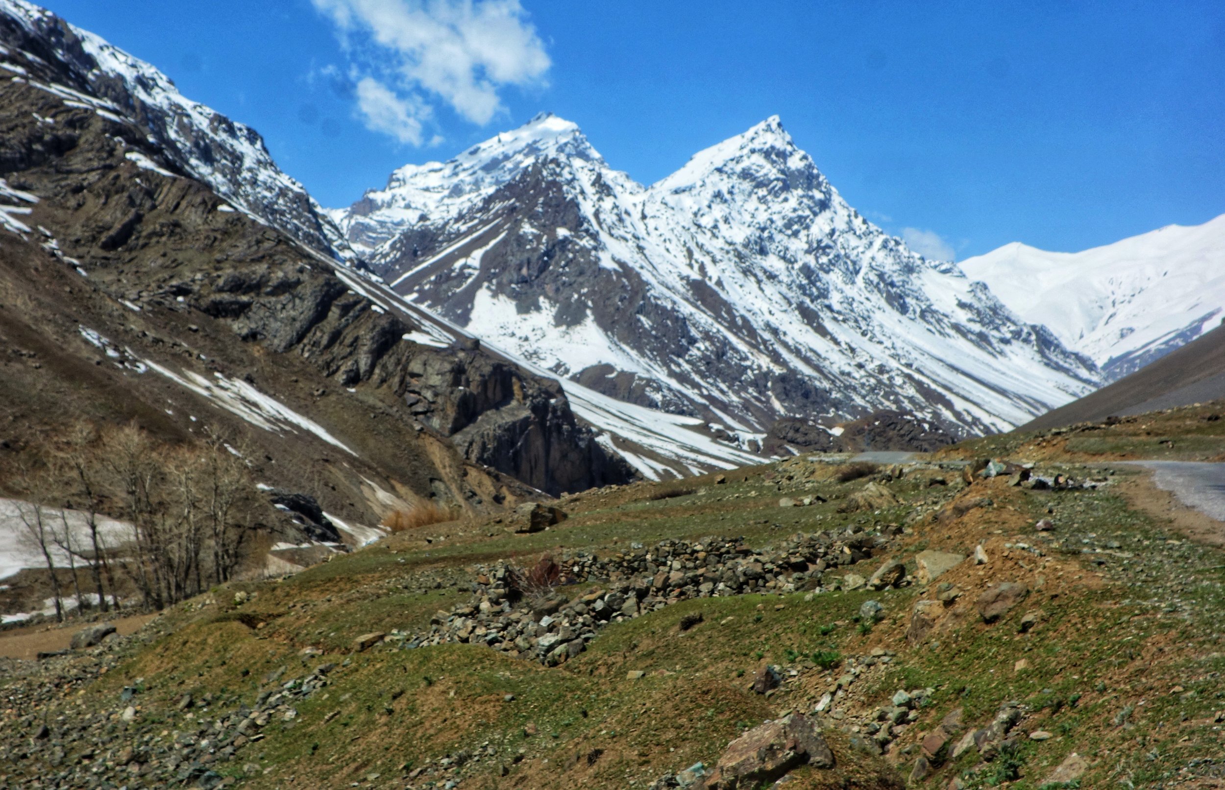
We are all aware that Marmots live underground and for the same they dig deep burrows and have a maze of interconnecting burrows underground. All this burrowing entails that they throw up a lot of earth. And the Deosai Plateau is said to be rich in Gold Dust deposits. The Marmots dug up the earth and included in this were fine Gold dust particles that were then taken by humans.
But which humans was the question again. Peissel claimed to have interviewed groups of people from Tribes living on the Deosai ie the Minaro, Maruts or Sonival tribes and apparently they confirmed this method of collection of Gold. And I have also been told Stories by people in the Kargil area about how the Marmots supposedly pile up Gold inside their burrows. So something is starting to make sense.
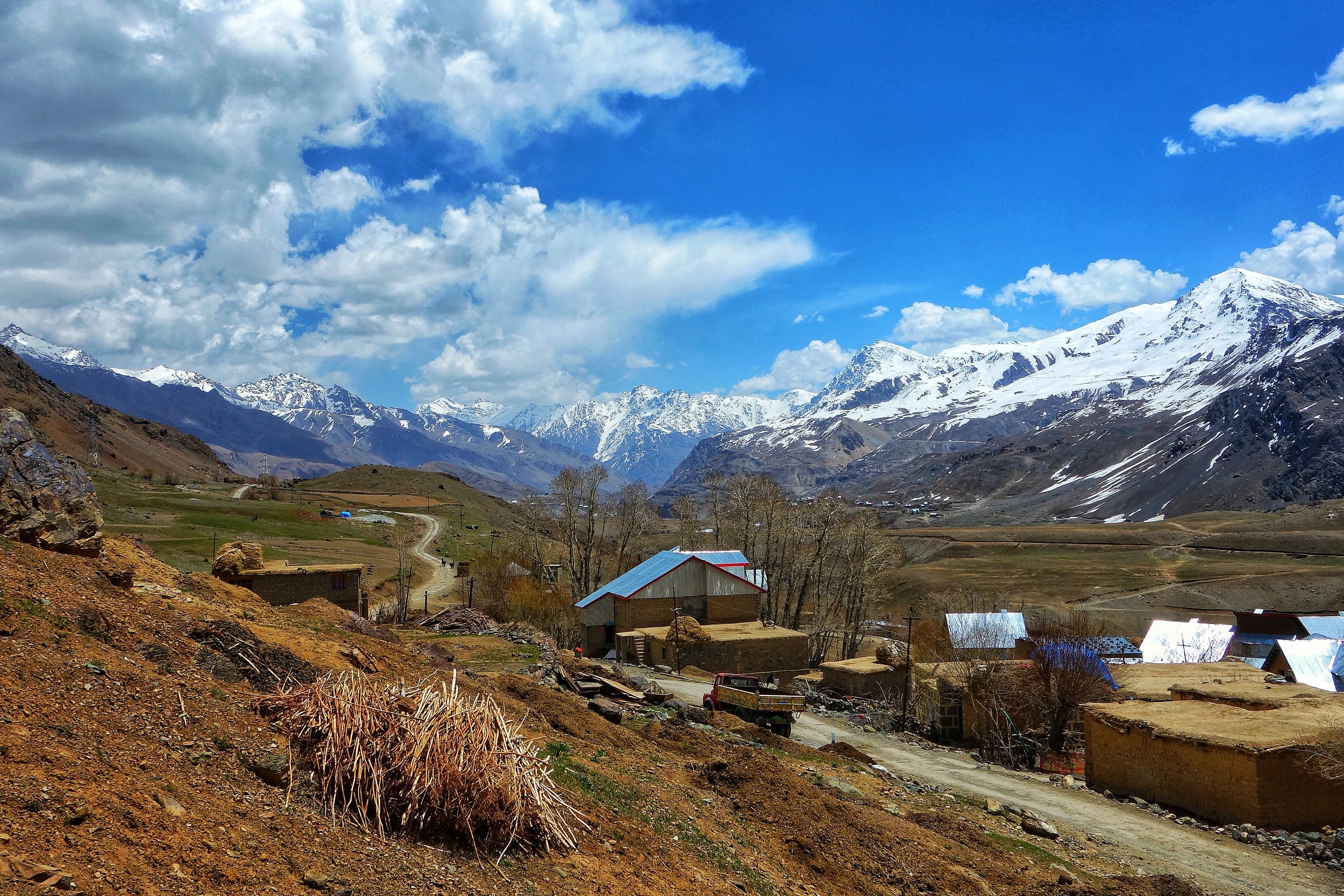
It was the Long Tailed Golden Marmot or the Himalayan Marmot which fits the description and Herodotus is proven to be partially correct. But how did he confuse the Marmots with the Ants ? Peissel has an explanation for this last piece of the puzzle as well. Apparently the Persian word for “Marmot” and “Mountain Ants” is very similar so somewhere along the line the word which was meant to mean Marmot was taken as Ant and the legend of the Giant Gold Digging Ants took birth. To be fair to Herodotus he had never mentioned that he saw one of these Ants. And the creatures kept by the King of Persia (the most powerful sovereign in the World at that time ) were just that Marmots.
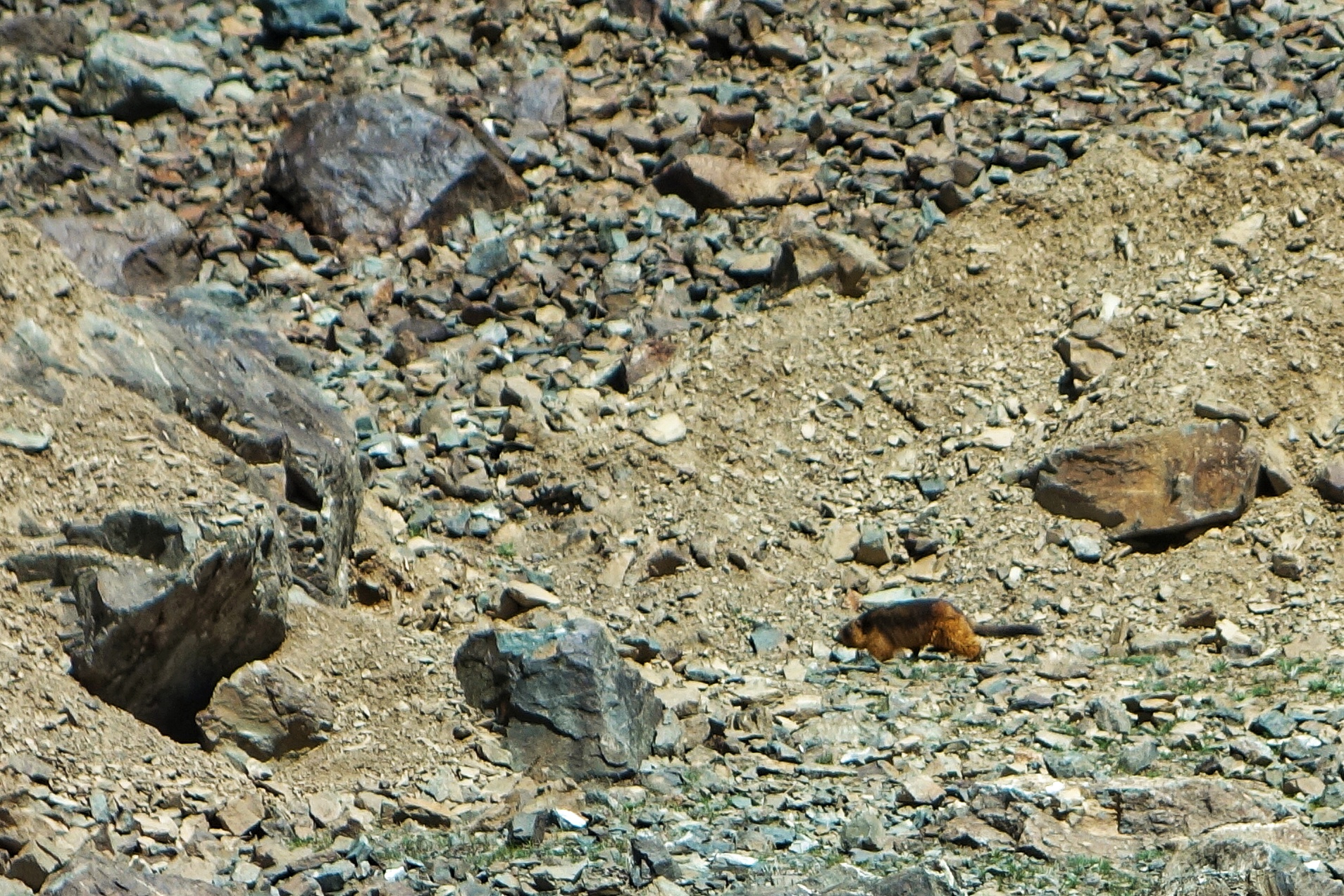
Just one last part about the ferociousness of the Gold digging Ants described by Herodotus. Many of us regularly come across Himalayan Marmots while visiting Ladakh and there is a lot of Human and Marmot interaction (totally uncalled for and something to be discouraged) and they mostly come across as gentle Creatures. Maybe back in the days when they were much less habituated to humans they would react differently. Long Tailed Golden Marmots are however much more rarer. I remember coming across a Long Tailed Golden Marmot somewhere in the Muskoh area, which actually lies at the edge of Deosai, and that guy wasn't exactly pleased to see us. We of course kept our distance though the Marmot wasn't aggressive. Maybe if we would have gone closer he could have shown aggression. Can't really guess.
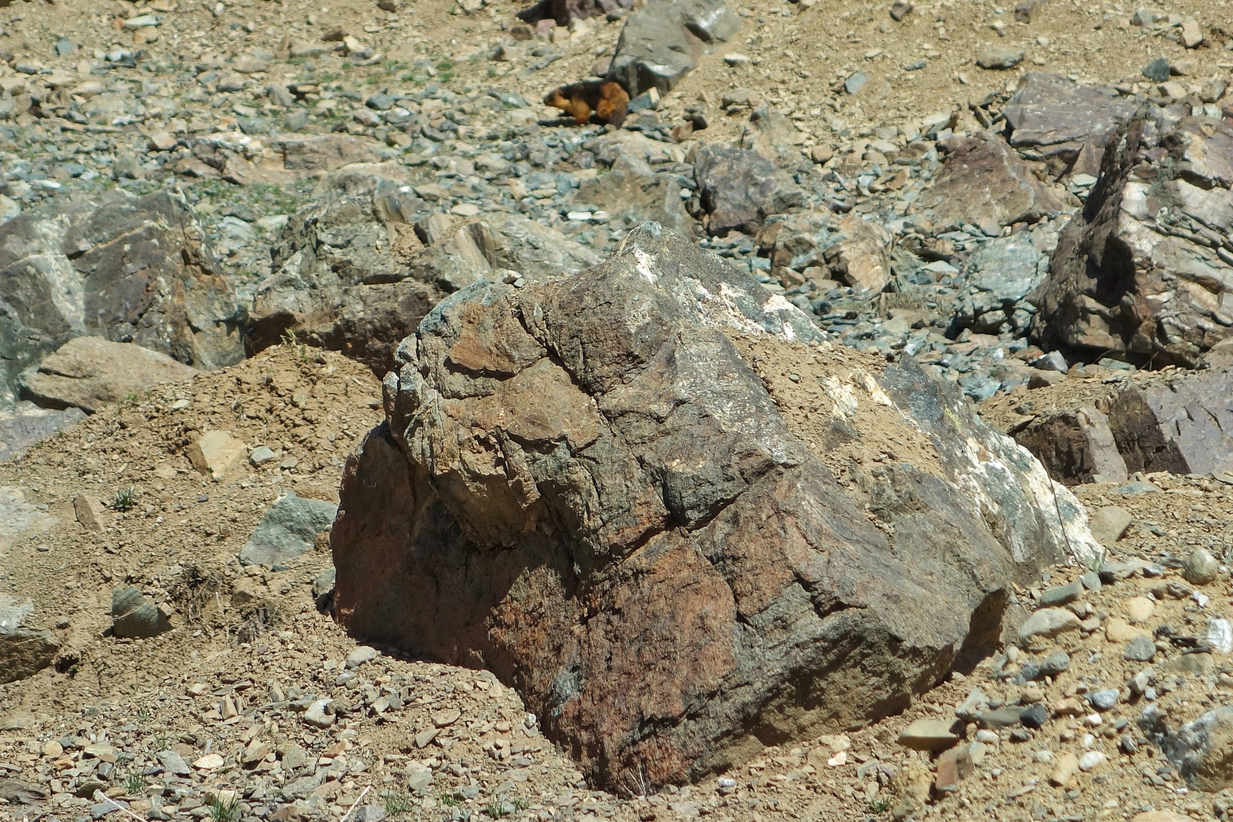
Or maybe this story of the “ferociousness” of the creatures was invented by the same people who harvested the Marmot Gold but wanted to discourage anyone else from coming and claiming a right on their Gold. In those times people could believe anything. Whatever was the reason it surely kept people away and the mystery took well over two thousand years to get solved.
So the next time you come across a Himalayan Marmot or better still a Long Tailed Golden Marmot do try and think of the Legend of Herodotus’s Fox Sized Ants.
Pic from April 2018. A Long Tailed Golden Marmot on the go, Muskoh Valley, Drass, Ladakh.
Zanskar : The Valley of Copper
Zanskar has an area exceeding 7000 sq km and a population estimated to be between 18000 to 20000. It is located bang in the middle of the Great Himalayas which separate it from Kishtwar and Lahaul in the South. In the East it touches Tibet almost and in the North is Ladakh and to the East is what used to be Baltistan but now better known as the Kargil area. Zanskar gets its name from the Tibetan word for Copper "Zang" and Valley. So probably it was because of the Copper deposits it was called so. And the name stuck.

Zanskar : The Valley of Copper
Zanskar has an area exceeding 7000 sq km and a population estimated to be between 18000 to 20000. It is located bang in the middle of the Great Himalayas which separate it from Kishtwar and Lahaul in the South. In the East it touches Tibet almost and in the North is Ladakh and to the East is what used to be Baltistan but now better known as the Kargil area.
Zanskar gets its name from the Tibetan word for Copper "Zang" and Valley. So probably it was because of the Copper deposits it was called so. And the name stuck.
It used to be a part of the Tibetan Kingdom of Guge at a point of time. The Kingdom included Ladakh, Zanskar, Spiti and part of Western Tibet around the Holy Kailash Mountain. The Kingdom was split into separate Kingdoms at one point of time and Zanskar Spiti became an independent Kingdom under a King who was one of the sons of the last ruler of Guge. Even today the Royal lineage of Zanskar is help in great esteem as they are deemed the successors of the main Tibetan Royal family.
The Kingdom of Zanskar was further split later into Padum, Zangla and Kishtwar (yes Kishtwar was a part of the Zanskar kingdom) but at the same time it came under the influence of the powerful Ladakh kingdom.
Due to its land locked location Zanskar has always been pretty isolated and under the influence of Buddhism it has a distinct identity as in the people are generally very genial in nature and this has always been taken advantage of by outsiders.
Kashmiris, Chambyalis, Lahaulis, Dogras, Gujjars etc have all at different times invaded, plundered and looted this land.
Even in the 1800s it was first the Chamba forces which swept Zanskar and later a combined Kulu and Lahaul and Chamba force again plundered. And then again the Dogras under General Zorawar Singh swept through Zanskar on his way to capture Ladakh.
The thing was the usual way to Ladakh from Kashmir was up the Zoji La Pass but at the time of General Zorawar Singh the Governor of Kashmir, Mihan Singh was not well disposed towards Raja Gulab Singh and the Dogras. So he didnt permit any Dogra force into Kashmir. General Zorawar Singh had been the Governor of Kishtwar and knew of the way into Ladakh through Zanskar. Otherwise in probability Zanskar would have been left to its own devices but it became a victim of power sturggles within the Lahore Kingdom.

The main Village of Padum
But the worst was still to come. In 1947 when the country got independence the Gilgit Scouts capitulated to Pakistan and they began their campaign to capture the whole of Ladakh region. They captured Kargil and a group of soldiers of the Gilgit Scouts made their way down to Padum in Zanskar. Even after the Indian forces re-captured Kargil and the Zoji La these Gilgit Scouts remained in Padam. This was probably the worst time the Zanskaris ever saw. Without going into the gruesome details let me just say that they were subjected to all kinds of deprivations by the Gilgit Scouts.
The Indian Forces were too busy consolidating and building their defences in the forward areas and really had no resources to focus on Zanskar. However a group of ex-soldiers from Lahaul did band up and went upto Padum to fight the Gilgit Scouts but they were beaten back by the Gilgit Scouts.
It was only after the ceasefire that the Indian troops came in and the Gilgit Scouts were escorted over the border. But they pretty much left a very deep mark on the local population and the inter relationship between the majority Buddhists and the minority Muslims.
The troubles didnt go away though. There were still ocassional raids by the Gujjars who used to descend the Zanskari pastures in the Summers. Worse still the Policemen deployed in Zanskar were usually outsiders and being in such an isolated place they took full advantage. Every household had to pay a tax to the cops failing which the cops would cook up false charges and the person would be dragged all the way to Kargil to face the local court and be put in Jail.
Also being clubbed with Kargil was another source of great concern for the Zanskarpa. Culturally and spiritually the Zanskarpa was much more closer to the Ladakhis than to the people from Kargil who followed a different religion and spoke a different language. Kargil was probably as alien to the Zanskarpa as Kishtwar or Kashmir.
The only Road link with the outside world also goes thorugh Kargil. Even when they have to go to Ladakh they have to take a circuitious Route via Kargil. Hence it has been a long standing demand of their to be connected directly with Ladakh via Road. The Road was promised to them around Independence but the said Road, now called the Chadar Road is still under construction. And on top of that their only life line connect with the outside world, over the forzen Zanskar is now over run with tourists which doesnt enable the Zanskar to get frozen properly.
The tale of Zanskar is one of constant broken promises made by the Government of India as well as the state Government. The Zanskarpa still continues to be neglected like no other. They dont even have an MLA of their own (another one of their demands) as they are clubbed together with Suru Valley and the representative in always someone from Suru.
Apparently its hoped now that one day the Road connecting it directly to Leh as well as the other one to Lahaul will become operational and for atleast 6 months they can enjoy the better connectivity and all the benefits it brings.
As for the winters please leave the Zanskar river alone. Its their only connecting lifeline. If cannot do anything to improve their condition atleast try not to worsen it. There are plenty of other frozen Rivers in Ladakh you can walk on. Say no to Chadar.
Kiki’s Blog
Stories from the Himalayas








Five years ago the Galwan Valley was in the News for the wrong reasons after a deadly clash between the Indian and Chinese Armies in the Valley located in Ladakh lead to many deaths on the contentious Border between the two countries in wake of continued Chinese intrusions into Indian territory.
This area along the Shyok River, of which the Galwan Nallah or the Galwan River which forms the Galwan Valley has been off limits to Civilians since long but now the Indian Government has decided to open up the area for Civilians and we were amongst the First Civilians to venture into this beautifully desolate part of the Eastern Karakorams in Ladakh. Earlier Civilians could only venture upto the Village of Shyok from where the Shyok River takes a U turn and flows in a Northerly direction.