
The Inter-State Himalayan Boundary Dispute at 14000 ft
An Inter-State Boundary dispute at 14000 ft beyond the mighty Baralacha La between the Himalayan states of Jammu and Kashmir and Himachal Pradesh. The dispute involves the marking of the actual Border between Lahaul on the Himachal side and Ladakh on the Jammu and Kashmir side.

The Inter-State Himalayan Boundary Dispute at 14000 ft
In 2018 a rather quite interesting story cropped up in the news regarding a dispute on the Interstate Borders in the High Himalayas between Himachal Pradesh and Jammu and Kashmir. As per the Himachal Authorities the JK Police had set up a picket more than 18 kms than the designated Border between the two States. And this led to an altercation. Of course the matter was brought to the notice of the Central Government. There were other charges as well against the Jammu and Kashmir Government including that it had given land in Himachal across the Shinku La and around Sarchu.
The story started in 2014 when the JK Police set up a new border check Post supposedly in Himachal territory. The Himachal Government despatched CID Officials to ascertain the facts and they came back with the report that there was indeed an intrusion. The DC of Lahaul and Spiti wrote to the authorities in Padam and Leh as the JK part comes within the Kargil District and the Tehsil is Zanskar. But nothing much happened.
In the following years again the JK Police set up its check Post in what was said to be Himachali territory. Again the issue was raised and this time the Central Government intervened. A team of Experts was sent from the Geological Survey of India to demarcate the Border and they concluded after doing a scientific Satellite study that the JK Police was Post was 14 kms inside Himachal. The DCs of Leh, Kargil and Lahaul and Spiti were also present but the DC of Leh refused to go with the findings of the team and said that he will have to consult “higher authorities”. And the matter remains unresolved to this day. Lets see where the JK Police puts up its Post on this disputed inter state boundary which sits at over 14000 ft.
So how was the present day Boundary agreed upon and demarcated earlier. Well it was after Maharaja Gulab Singh had taken over as Rule of the whole of Jammu, Kashmir, Ladakh and Baltistan that a boundary demarcation was needed between the British territory of Lahaul and the Maharaja’s territory of Ladakh. The boundary was flexible in earlier times as the general area was the place where the boundaries of the Kulu and Chamba Kingdoms also met. And also of Lahul, Spiti and Ladakh. And there was constant struggle between Ladakh, Kulu, Chamba and Bushahr over Lahul and Spiti. So a settlement of the Border was needed.
And it was none other than Captain Alexander Cunningham who was assigned this job. People who have read on Himalayan explorations are well familiar with the Cunninghams. All the 4 Cunningham brothers wrote extensively on the History of India and were Military Officers as well. And Alexander was perfect for adventures in the Mountains. Infact it is Alexander Cunninghams account of the Battle of Toyo, where General Zorawar Singh fell in Battle with the Tibetan Chinese Army thats considered the most authentic.
And this is how the Boundary was finally marked. Leaving you with the actual Note on this by Alexander Cunningham published in 1848. Answers many questions and also gives an idea of how boundaries were demarcated in the Himalayas dependent on the Peaks, the Passes and of course the Rivers and the Nallahs and in some case a solitary big Rock. And leaving you with the final boundary Map as well.
Memorandum by Capt. A. CUNNINGHAM, detailing the boundary between the territories of Maharaja Gulab Singh and British India, as determined by the Commissioners, P. A. VANS AGNEW, Esq. and Capt. A. CUNNINGHAM of, Engineers.
1.In laying down a permanent boundary through a mountainous county it appeared to the Commissioners desirable to select such a plan as would completely preclude any possibility of future dispute. This the Commissioners believe that they have found in their adoption as a boundary of such mountain ranges as form water-shed lines between the drainages of different rivers, as detailed below.
2. In 1839, when Capt. A.Cunningham surveyed the Lahul district the boundary between the states of Kulu and Chamba was formed by the Nalda and Chukam Nullahs, two tributaries of the Chandrabhaga, the one on its left and the other on its right bank. From the head of the Chukam Nullah the Commissioners determined that all the county to the eastward which is drained by the Bhaga, the Chandrabhaga and their tributaries belonged to the British district of Lahul ; and that the boundary between Lahul and the Zanskar district was the snowy range (called Paralassa by Dr. Gerard) dividing the drainage of the Bhaga and Chandrabhaga from that of the Zanskar river, as marked in the Map.
3. Beyond the Bar Lacha Pass to the eastward, the Commissioners found that there was an old well known boundary stone, called the Phalangdanda, which marked the limit between Lahul and Ladak. This stone is noticed by Moorcroft . It stands in the midst of an open plain on the right bank of the Yunnam River. As there sno known or recognized boundary mark on the other side of the stream, the Commissioners selected a remarkable cream-coloured peak, called Turam, as the northern limit of the British territory on the left bank of the river. As this peak is situated at the end of one of the spun of the great snowy chain, already determined as the northern limit of the Lahul district, it forms a natural continuation of the boundary line from the westward. The bearing of the Turam peak from the Phalangdanda is 9" to the northward of west.
4. As it appeared that the country to the eastward of the Pha-langdanda belonged to Piti, the Commissioners determined that the boundary between Piti and Ladak on the westward should be the Yunam River. A straight line was accordingly drawn from the Pha-lang-danda to the junction of the first Nullah on the right bank of the Yunam, from which point the Yunam River forms the boundary as far as the junction of the Cherpa or Cherep river.
5. Almost due north-east from this junction there is a remarkable square rock on the top of the hill, which From its resemblance to a fort has received the name of Lanka. This curions and well know peak wan selected as another fixed point in the boundary, to which a straight line should be drawn from the junction of the Cherpa river. Beyond this to the eastward, the Commissioners, adhering to the principle which they had first laid down, determined that - the whole of the Cherpa valley and its tributaries belonged to the British Government; and that the snowy range on its right bank which feeds d l the northern affluents of the Cherpa river should be the boundary between Ladak and the British district of Piti. This same range extends towards the east past the southern end of the Chu-Mureri Lake, where it forms the well known boundary between Ladak and the Chinese territory. The Commissioners therefore determined that the boundary between Ladak and Piti should continue from the head of the Cherpa along this same range to the Chinese boundary; thus including within Piti all the streams which water that district, and giving to Ladak all the streams which water its southern district of Rutchu.
High Altitude Gear from the Hall of Fame in Leh
The Hall of Fame Museum near Leh in Ladakh has a section dedicated to the Equipment used by High Altitude Mountaineers generally and the Indian Army specifically while guarding the high frontiers in the Himalayas and the Karakorams. We have a look at some of the great Gear on display.

High Altitude Gear from the Hall of Fame in Leh
The Hall of Fame Museum near Leh in Ladakh has a section dedicated to the Equipment used by High Altitude Mountaineers generally and the Indian Army specifically while guarding the high frontiers in the Himalayas and the Karakorams. We have a look at some of the great Gear on display. The same Equipment is sued by the Indian Army deployed at the frozen heights of the Siachen Glacier in Northern Ladakh.

A high end Dome tent for two people.

Palletised loads. These are air dropped to various locations at places where access is difficult.

A Sled and a De-compression Bag

A low temperature high Altitude all Weather suit. along with different climbing aids displayed on the Wall.

Different Mountaineering Gear I

Different Mountaineering Gear II

A Snowmobile

A Dome Tent

A Siachen Soldier’s full Gear

Knots. different types of Knots
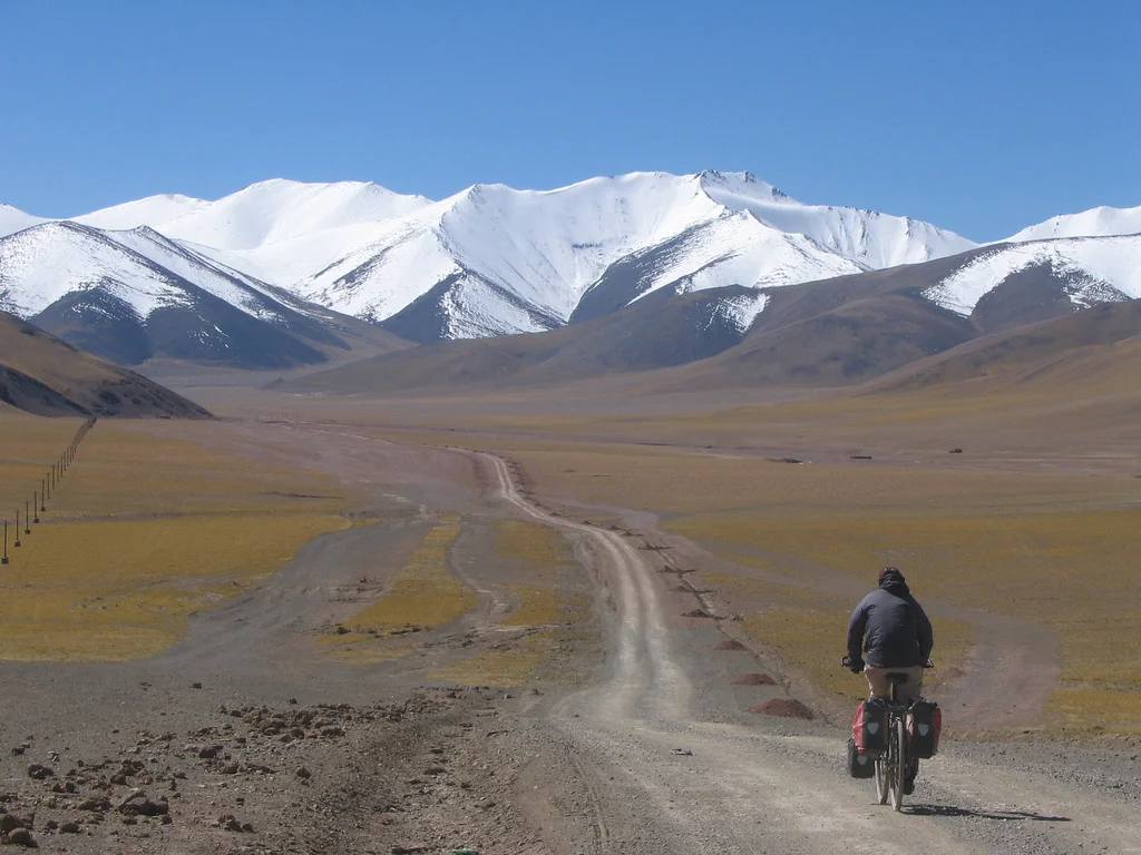
The Case of Aksai Chin
Aksai Chin a high altitude desert which lies between the Karakorams and the Kun Lun is a disputed territory between India and China in the Trans Himalayas. Here is the story.

The Case of Aksai Chin
Most people interested in the Mountains of India are usually familiar with the name Aksai Chin. It's supposed to be a part of India but is under illegal occupation by China. Most of us are aware how a large part of the Jammu and Kashmir was taken by our neighbour and which are today named as Gilgit Pakistan and “Azad Kashmir”. And the Indian Government calls it Pakistan Occupied Kashmir (Technically the correct term that should have been used was Pakistan Occupied Jammu and Kashmir). But for some strange reason the Government never uses the term China Occupied Kashmir/ Jammu and Kashmir for Aksai Chin or the Shaksgam Valley which was illegally cede to China by Pakistan as a part of a border settlement.

The Aksai Chin Soda Plains
So what is Aksai Chian ? Well its a Mountain desert wilderness beyond the Karakoram Mountains with an area of around 15000 sq km and its lowest point is around 4300 m. As the altitude would suggest its a largely uninhabited area and the population traditionally consisted of nomadic herders.
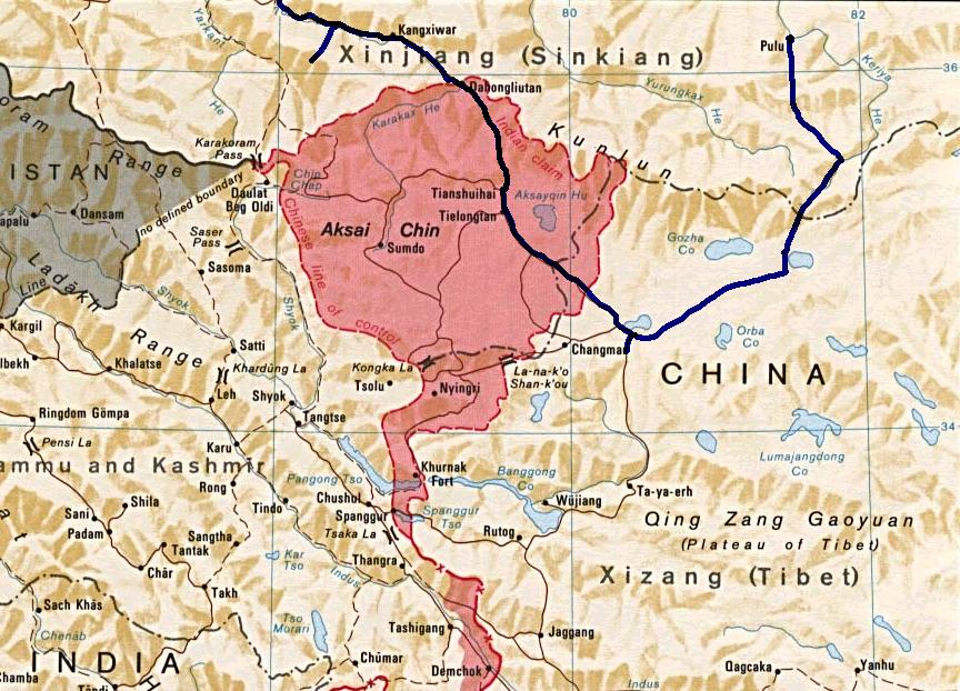
The Disputed Region of Aksai Chin
Actually unlike on the Western side the borders of the state of Jammu and Kashmir were never really defined in these parts as no one really ventured into this territory. And this region lay somewhere between the Eastern Turkestan (now called Xinjiang) and Tibet both of which came under actual Chinese control in the late 1940s and by that time the state of Jammu and Kashmir was already a point of conflict. And because of the conflicts on the Western front India never paid any attention to this region and China’s own issues in settling the restive newly taken provinces of Xinjiang and Tibet kept both countries busy in their own affairs.
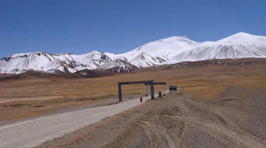
https://aboutoutdoors.wordpress.com/2016/07/14/the-ladakh-photos/aksai-chin/
So once the Chinese had settled the matters in Xinjiang as well as Tibet they decided to build a highway which connected these two Regions. This was to connect both the Regions but the only issue was that this Highway was supposed to run through Aksai Chin and the Chinese built this Highway with the Indian Government totally unaware though there are reasons to believe that the Indian Government was in the know but didn't decide to act till it was too late. The Chinese state that the Road has been built through territory which is a part of Chinese territory. The Highway itself is a marvel of engineering mostly between the altitudes of 4000 to 5000 m.
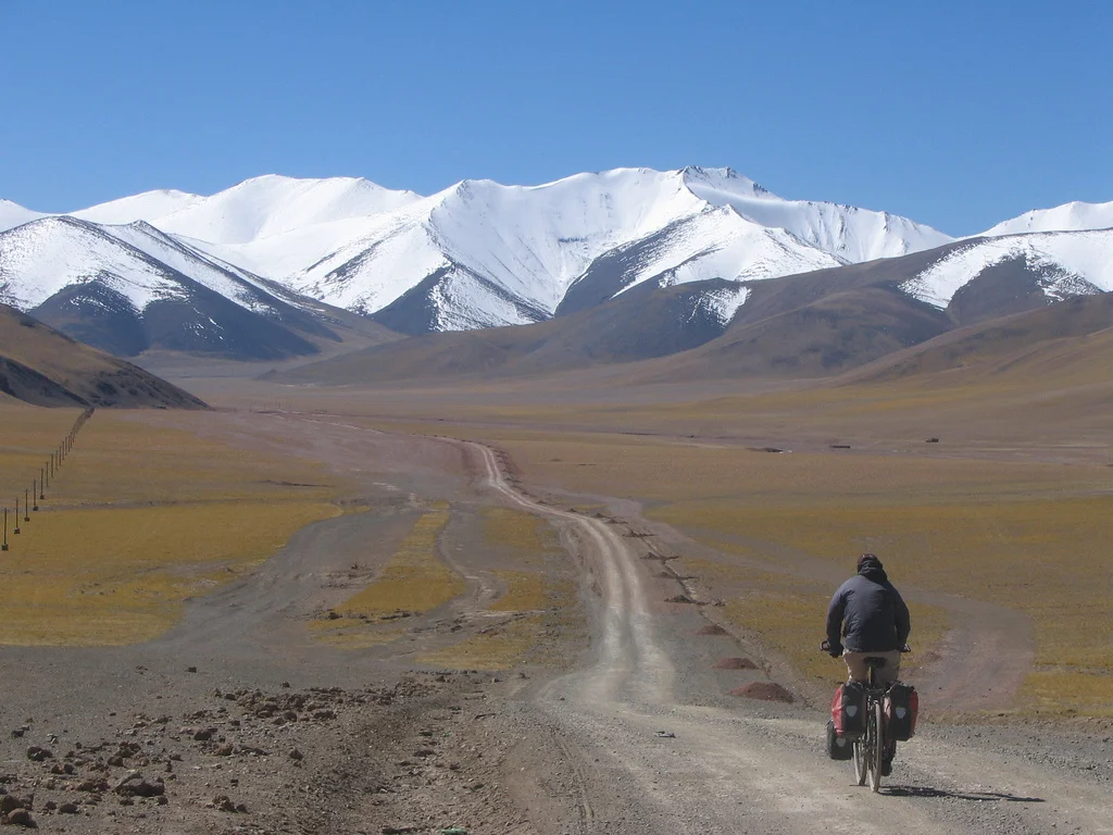
https://www.flickr.com/photos/45689575@N00/315010853
This conflict in the Indian and Chinese stands stems from a historical baggage of different demarcations of the Border at different times in History. The original Indian claim was based on the Johnson line of 1865. Then there was the Macartney-MacDonald Line of 1899 accepted by Chinese till 1959. And then there was the Foreign Office Line of 1875. All these lines as you can see in the Map are different. And then there is the absurd Chinese claim line of post 1962 which more than doubles the territory that it had claimed earlier.
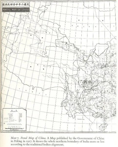
Postal Map of China published in 1917 which shows Aksai Chin as a part of India.
The Johnson Line of 1865 gave the whole of the Aksai Chin to India all the way to the Kun Lun Mountains. The Macartney-MacDonald line on the other hand gave most of Aksai Chin to the Chinese with the main Karakoram acting as the border between the two Countries.The Chinese had earlier shown the Johnson Line in their Maps as well. The Macartney - McDonald Line was drawn keeping in mind the Great Game which was on at that time between the British and the Russians. So the British decided to give away Aksai Chin to the Chinese. However the proposed Macartney- MacDonald Line was never confirmed by the Chinese but however they took it to be the border. On the other hand the British kept changing the Border between the Johnson Line and the Macartney Line as per their convenience. They could do this easily as this area was/is mostly uninhabited
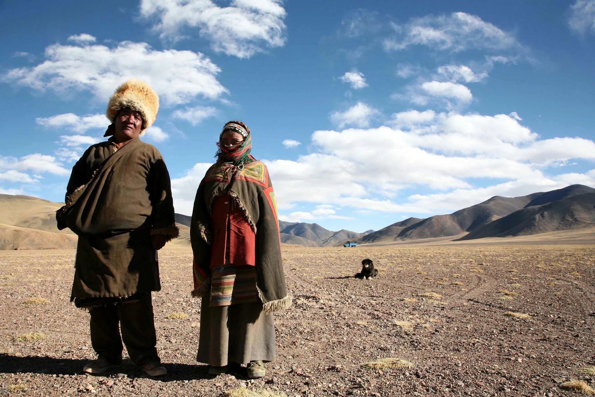
A Nomad Couple in Aksai Chin (https://www.flickr.com/photos/eriagn/)
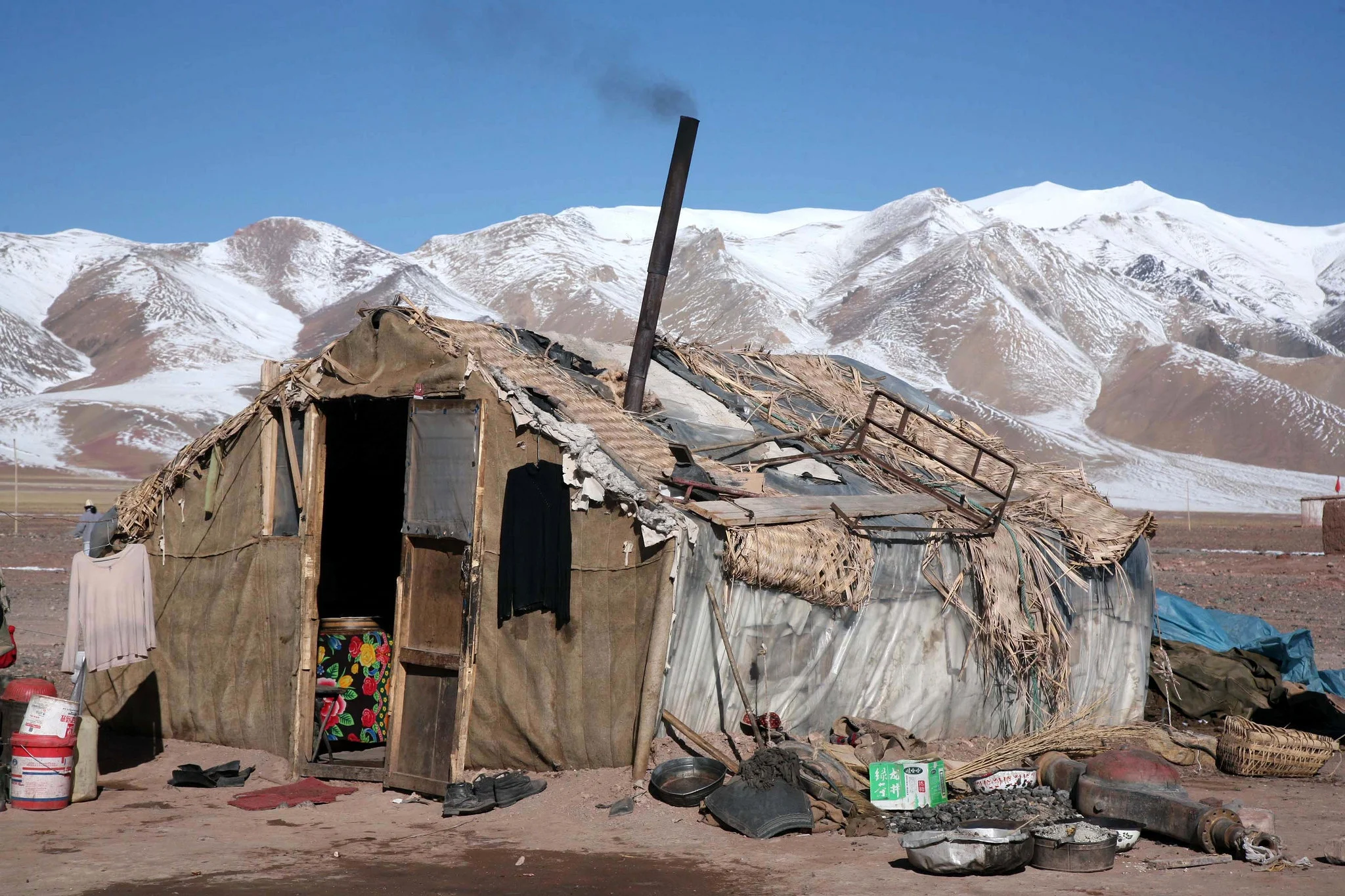
A Dwelling at Aksai Chin ((https://www.flickr.com/photos/eriagn/)
China and Pakistan also settled their border as per the Macartney-McDonald Line and the Shaksgam Valley was turned over to the Chinese as per this line. So there are no longer any border issues between the two countries now.
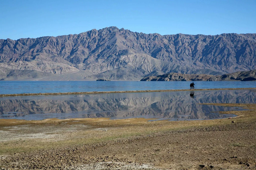
A Lake on the Soda Plains ((https://www.flickr.com/photos/eriagn/)
In conclusion we can say that this dispute carries historical baggage which comes down from much before Independence unlike the Pakistani occupation which was a result of actions at the time of the Partition. Both India and China have held many rounds of Border Talks and there is also talk of India recognising Aksai Chin as a part of China and China accepting Arunachal Pradesh as a part of India. Of course both countries would want a face saving solution where both look as the winner. Difficult surely but not impossible.
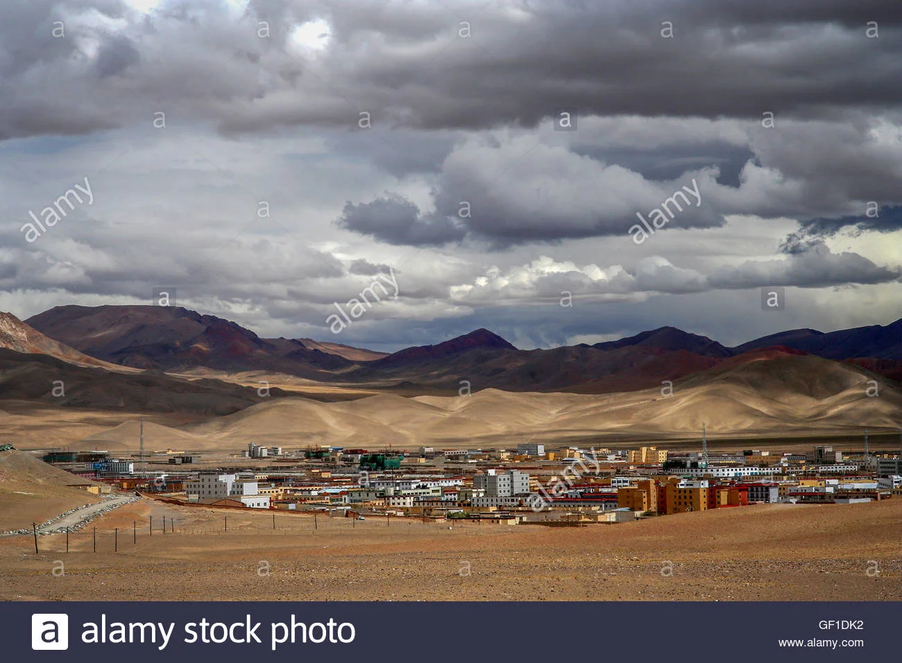
A Chinese "City' called Ali in Aksai Chin.
And here is a Video of the Xinijiang to Tibet Road as it snakes through the Pamirs and the Kun Luns.
Kiki’s Blog
Stories from the Himalayas








Five years ago the Galwan Valley was in the News for the wrong reasons after a deadly clash between the Indian and Chinese Armies in the Valley located in Ladakh lead to many deaths on the contentious Border between the two countries in wake of continued Chinese intrusions into Indian territory.
This area along the Shyok River, of which the Galwan Nallah or the Galwan River which forms the Galwan Valley has been off limits to Civilians since long but now the Indian Government has decided to open up the area for Civilians and we were amongst the First Civilians to venture into this beautifully desolate part of the Eastern Karakorams in Ladakh. Earlier Civilians could only venture upto the Village of Shyok from where the Shyok River takes a U turn and flows in a Northerly direction.