• Home Page
  • Ladakh Tours
    • The Karakoram Odyssey
    • Trans Himalayan Silk Route Trail
    • Ladakh Sojourn
  • Kashmir Tours
    • Kashmir With Gurez
    • Kashmir Gurez Keran Bangus
    • Kashmir Boutique Experience
    • Kashmir LOC Experience
  • Other Himalayan Tours
    • The Chenab Chandrabhaga Trail
    • Himachal Sojourn
  • Himalayan Motoring
    • LOC Unravel
    • Kashmir Snow Drive
    • The High Pass Challenge JK Edition
    • The High Pass Challenge Ladakh Edition
    • Along the Himalayan Rivers Drive
    • Zanskar Extreme
    • Customised Drives
  • Kishtwar- Bhaderwah
  • Lahaul Pangi
  • Zanskar
  • Kashmir Border
  • Karakorams
  • Gurez
  • Blog
  • About
  • Articles
    • Himalayan Geography Articles
    • Himalayan Vignettes
  • Menu

Travel The Himalayas -Kashmir 360

Curated Experiences in the Himalayas
  • Home Page
  • Ladakh Tours
    • The Karakoram Odyssey
    • Trans Himalayan Silk Route Trail
    • Ladakh Sojourn
  • Kashmir Tours
    • Kashmir With Gurez
    • Kashmir Gurez Keran Bangus
    • Kashmir Boutique Experience
    • Kashmir LOC Experience
  • Other Himalayan Tours
    • The Chenab Chandrabhaga Trail
    • Himachal Sojourn
  • Himalayan Motoring
    • LOC Unravel
    • Kashmir Snow Drive
    • The High Pass Challenge JK Edition
    • The High Pass Challenge Ladakh Edition
    • Along the Himalayan Rivers Drive
    • Zanskar Extreme
    • Customised Drives
  • Kishtwar- Bhaderwah
  • Lahaul Pangi
  • Zanskar
  • Kashmir Border
  • Karakorams
  • Gurez
  • Blog
  • About
  • Articles
    • Himalayan Geography Articles
    • Himalayan Vignettes
aksai chin

The Case of Aksai Chin

August 01, 2018 in Himalayan Politics

The Case of Aksai Chin

Most people interested in the Mountains of India are usually familiar with the name Aksai Chin. It's supposed to be a part of India but is under illegal occupation by China. Most of us are aware how a large part of the Jammu and Kashmir was taken by our neighbour and which are today named as Gilgit Pakistan and “Azad Kashmir”. And the Indian Government calls it Pakistan Occupied Kashmir (Technically the correct term that should have been used was Pakistan Occupied Jammu and Kashmir). But for some strange reason the Government never uses the term China Occupied Kashmir/ Jammu and Kashmir for Aksai Chin or the Shaksgam Valley which was illegally cede to China by Pakistan as a part of a border settlement.

The Aksai Chin Soda Plains

The Aksai Chin Soda Plains

So what is Aksai Chian ? Well its a Mountain desert wilderness beyond the Karakoram Mountains with an area of around 15000 sq km and its lowest point is around 4300 m. As the altitude would suggest its a largely uninhabited area and the population traditionally consisted of nomadic herders.
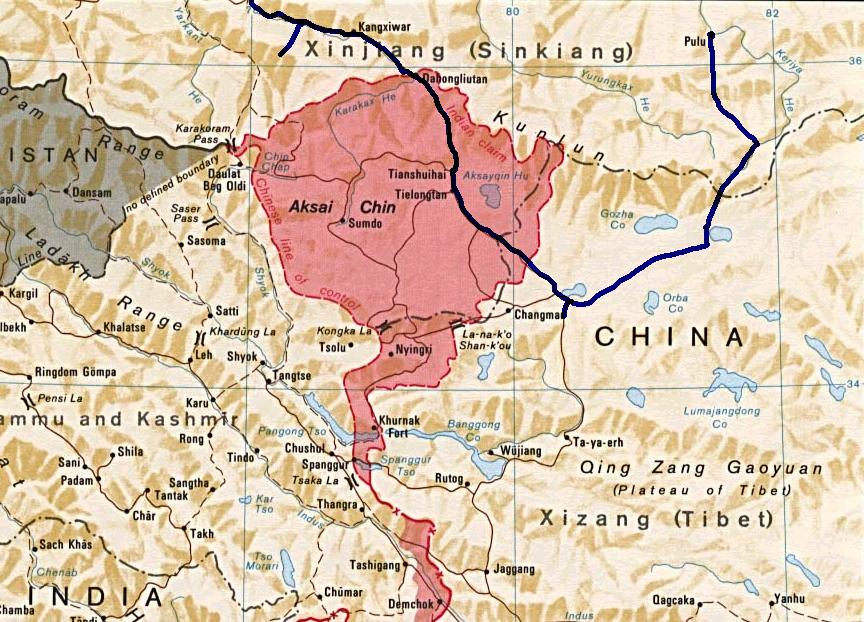
The Disputed Region of Aksai Chin

The Disputed Region of Aksai Chin

Actually unlike on the Western side the borders of the state of Jammu and Kashmir were never really defined in these parts as no one really ventured into this territory. And this region lay somewhere between the Eastern Turkestan (now called Xinjiang) and Tibet both of which came under actual Chinese control in the late 1940s and by that time the state of Jammu and Kashmir was already a point of conflict. And because of the conflicts on the Western front India never paid any attention to this region and China’s own issues in settling the restive newly taken provinces of Xinjiang and Tibet kept both countries busy in their own affairs.
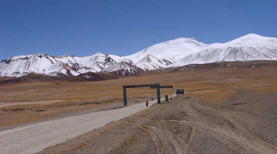
https://aboutoutdoors.wordpress.com/2016/07/14/the-ladakh-photos/aksai-chin/

https://aboutoutdoors.wordpress.com/2016/07/14/the-ladakh-photos/aksai-chin/

So once the Chinese had settled the matters in Xinjiang as well as Tibet they decided to build a highway which connected these two Regions. This was to connect both the Regions but the only issue was that this Highway was supposed to run through Aksai Chin and the Chinese built this Highway with the Indian Government totally unaware though there are reasons to believe that the Indian Government was in the know but didn't decide to act till it was too late. The Chinese state that the Road has been built through territory which is a part of Chinese territory. The Highway itself is a marvel of engineering mostly between the altitudes of 4000 to 5000 m.
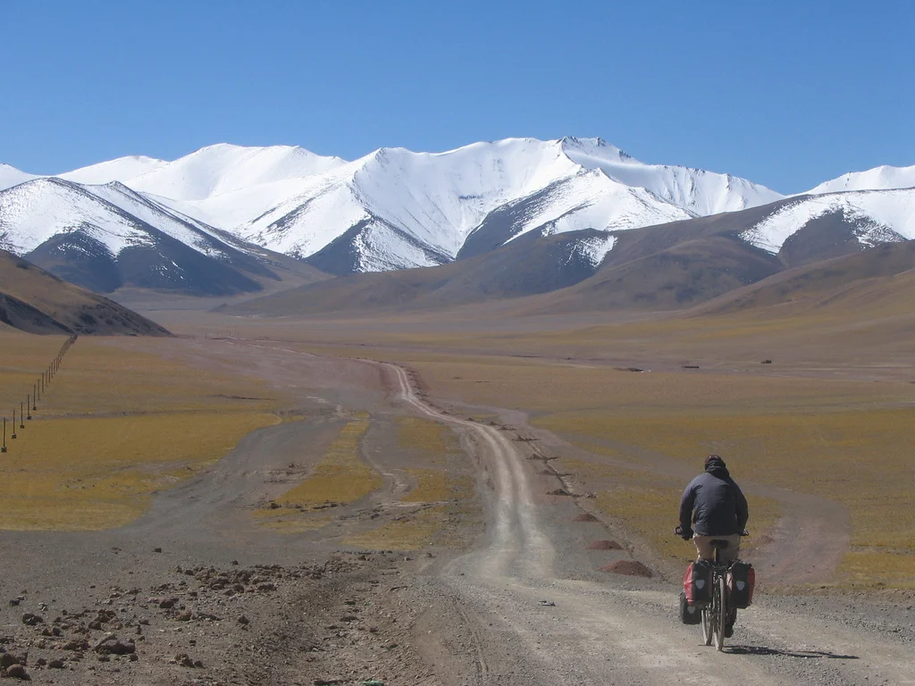
https://www.flickr.com/photos/45689575@N00/315010853

https://www.flickr.com/photos/45689575@N00/315010853

This conflict in the Indian and Chinese stands stems from a historical baggage of different demarcations of the Border at different times in History. The original Indian claim was based on the Johnson line of 1865. Then there was the Macartney-MacDonald Line of 1899 accepted by Chinese till 1959. And then there was the Foreign Office Line of 1875. All these lines as you can see in the Map are different. And then there is the absurd Chinese claim line of post 1962 which more than doubles the territory that it had claimed earlier.
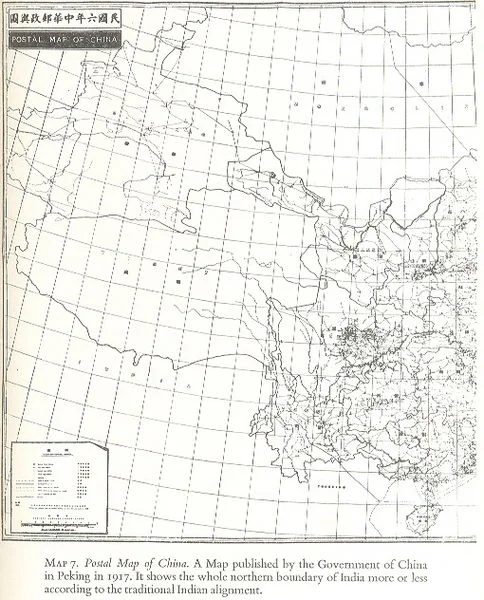
Postal Map of China published in 1917 which shows Aksai Chin as a part of India.

Postal Map of China published in 1917 which shows Aksai Chin as a part of India.

The Johnson Line of 1865 gave the whole of the Aksai Chin to India all the way to the Kun Lun Mountains. The Macartney-MacDonald line on the other hand gave most of Aksai Chin to the Chinese with the main Karakoram acting as the border between the two Countries.The Chinese had earlier shown the Johnson Line in their Maps as well. The Macartney - McDonald Line was drawn keeping in mind the Great Game which was on at that time between the British and the Russians. So the British decided to give away Aksai Chin to the Chinese. However the proposed Macartney- MacDonald Line was never confirmed by the Chinese but however they took it to be the border. On the other hand the British kept changing the Border between the Johnson Line and the Macartney Line as per their convenience. They could do this easily as this area was/is mostly uninhabited
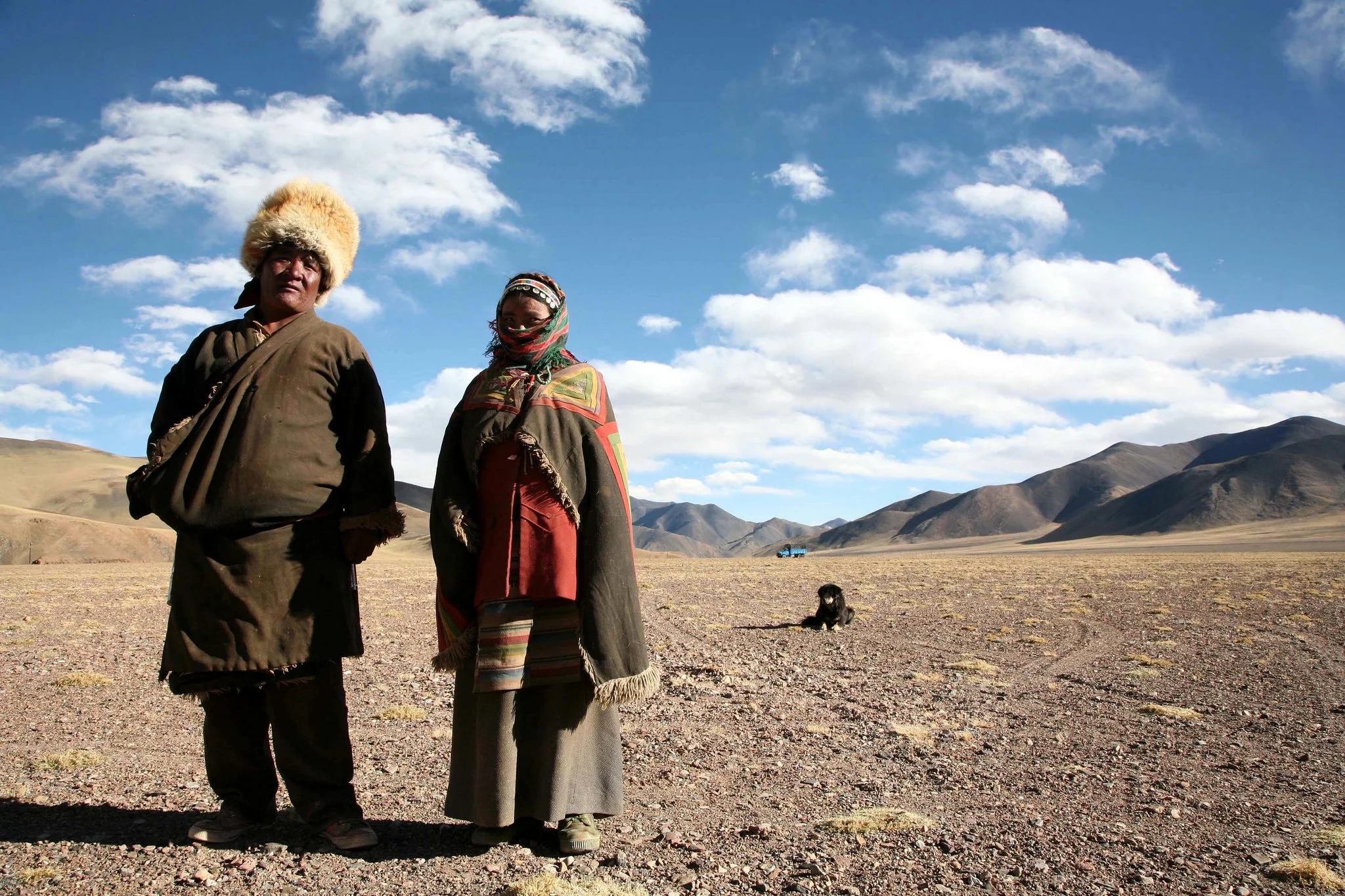
A Nomad Couple in Aksai Chin (https://www.flickr.com/photos/eriagn/)
A Nomad Couple in Aksai Chin (https://www.flickr.com/photos/eriagn/)

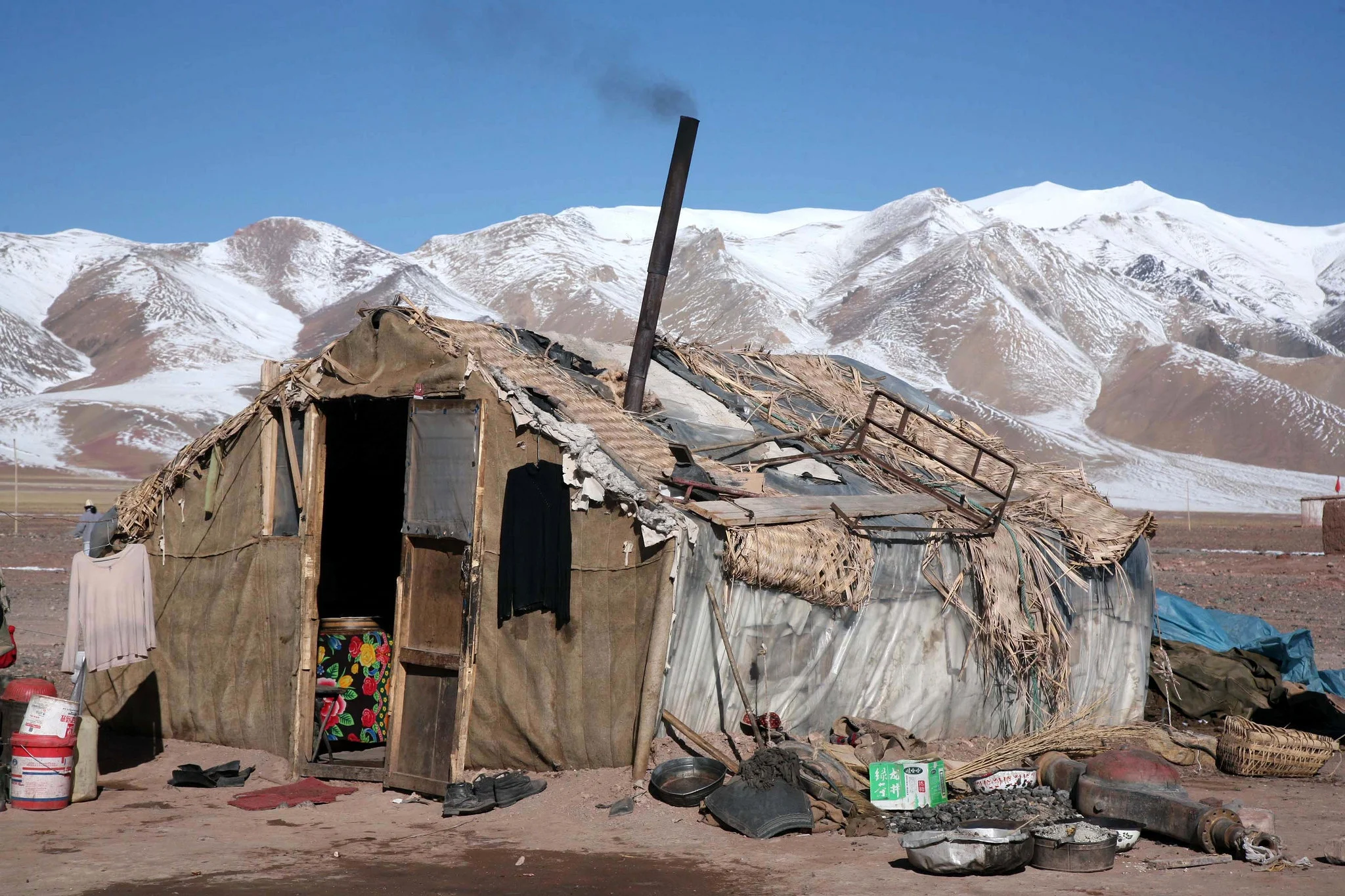
A Dwelling at Aksai Chin ((https://www.flickr.com/photos/eriagn/)

A Dwelling at Aksai Chin ((https://www.flickr.com/photos/eriagn/)

China and Pakistan also settled their border as per the Macartney-McDonald Line and the Shaksgam Valley was turned over to the Chinese as per this line. So there are no longer any border issues between the two countries now.
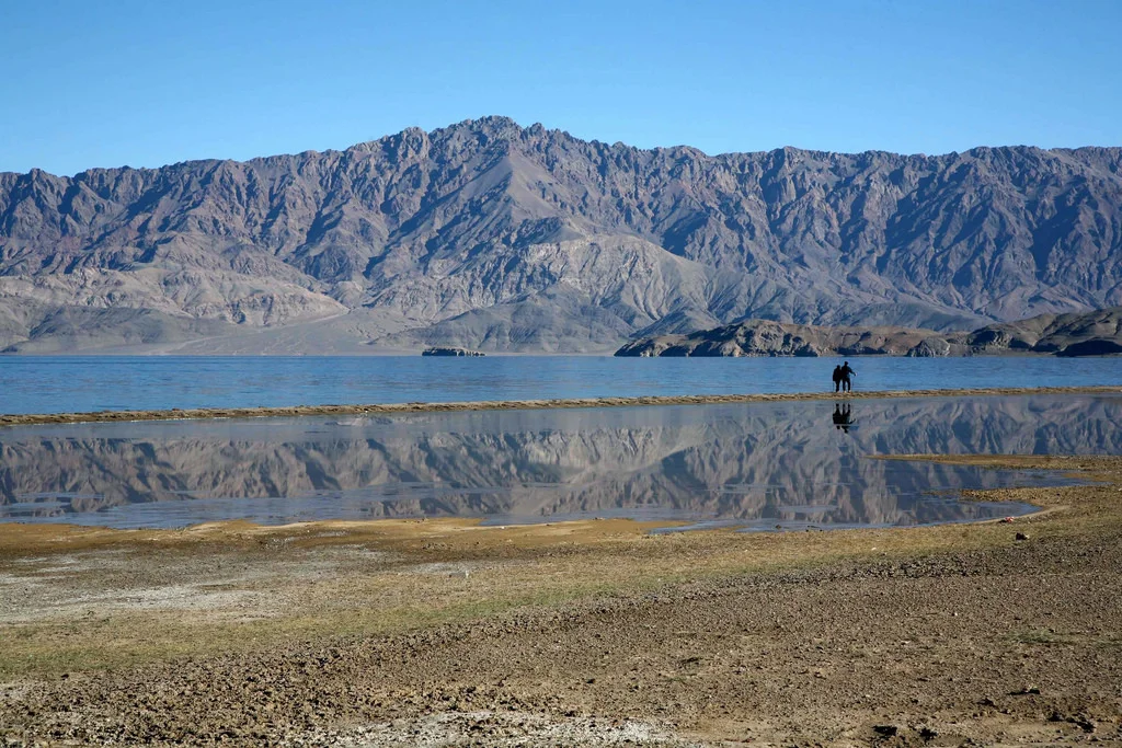
A Lake on the Soda Plains ((https://www.flickr.com/photos/eriagn/)

A Lake on the Soda Plains ((https://www.flickr.com/photos/eriagn/)

In conclusion we can say that this dispute carries historical baggage which comes down from much before Independence unlike the Pakistani occupation which was a result of actions at the time of the Partition. Both India and China have held many rounds of Border Talks and there is also talk of India recognising Aksai Chin as a part of China and China accepting Arunachal Pradesh as a part of India. Of course both countries would want a face saving solution where both look as the winner. Difficult surely but not impossible.
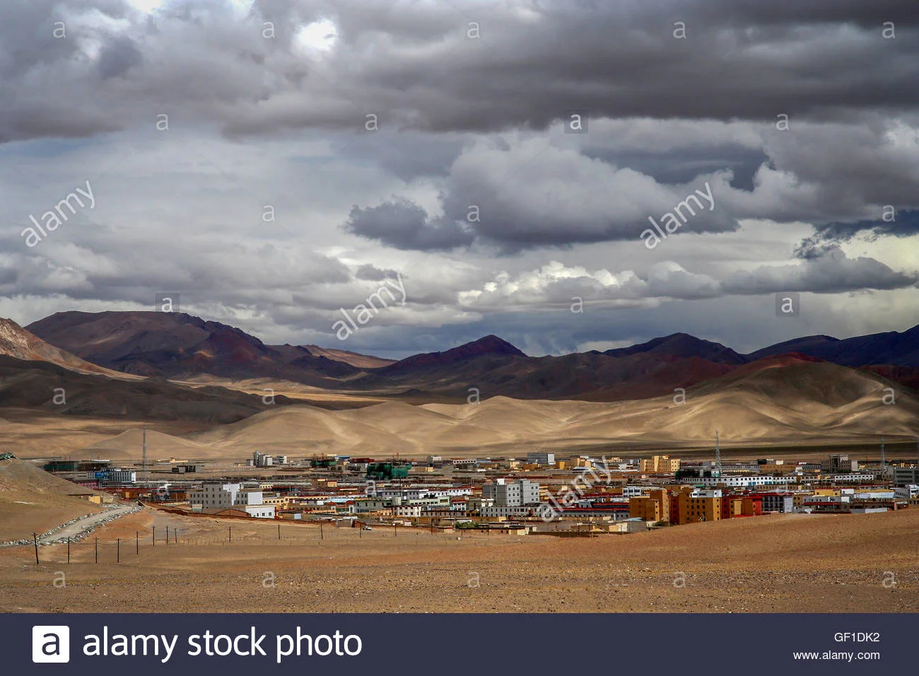
A Chinese "City' called Ali in Aksai Chin.

A Chinese "City' called Ali in Aksai Chin.

And here is a Video of the Xinijiang to Tibet Road as it snakes through the Pamirs and the Kun Luns.

Tags: aksai chin, india, china kashmir, dispute
Prev / Next

Kiki’s Blog

Stories from the Himalayas


Featured Posts

Featured
Kashmir_Region_November_2019.jpg
July 8, 2026
The Three Kashmirs
July 8, 2026
Read more →
July 8, 2026
chisotikkk.jpg
August 16, 2025
Chisoti : The Anatomy of a Disaster 
August 16, 2025
Read more →
August 16, 2025
A Journey to Galwan Valley
June 18, 2025
A Journey to Galwan Valley
June 18, 2025

Five years ago the Galwan Valley was in the News for the wrong reasons after a deadly clash between the Indian and Chinese Armies in the Valley located in Ladakh lead to many deaths on the contentious Border between the two countries in wake of continued Chinese intrusions into Indian territory. 


This area along the Shyok River, of which the Galwan Nallah or the Galwan River which forms the Galwan Valley has been off limits to Civilians since long but now the Indian Government has decided to open up the area for Civilians and we were amongst the First Civilians to venture into this beautifully desolate part of the Eastern Karakorams in Ladakh. Earlier Civilians could only venture upto the Village of Shyok from where the Shyok River takes a U turn and flows in a Northerly direction.

Read more →
June 18, 2025
January 29, 2025
Galwan Valley opened for Tourists
January 29, 2025
Read more →
January 29, 2025
Slide2.JPG
December 29, 2024
Ten Offbeat Locations in Kashmir
December 29, 2024
Read more →
December 29, 2024
18814512_10210684155593724_8491219869639660581_o.jpg
July 26, 2024
The Nanga Parbat from the Kashmir Valley
July 26, 2024
Read more →
July 26, 2024
A Culinary Holiday in Kashmir by Marryam Reshii
May 25, 2024
A Culinary Holiday in Kashmir by Marryam Reshii
May 25, 2024

A holiday in Kashmir involves much travelling around by car from Srinagar (not only the capital but the base of most visitors), a shikara ride, walking around markets and the Old City – a heritage site in its own right. That’s all very well, but it is convenient to know where you can grab a bite, preferably in the area where you are seeing the sights.

Read more →
May 25, 2024
Keran : Where a River Runs Through
December 17, 2023
Keran : Where a River Runs Through
December 17, 2023

A Photo Gallery of Keran along the Line of Control in Jammu and Kashmir

Read more →
December 17, 2023
Ten Offbeat Things to Do in Ladakh
October 19, 2023
Ten Offbeat Things to Do in Ladakh
October 19, 2023

Most People while visiting Ladakh just visit the same old Places, popular Tourist places and ones popularized by Bollywood and Influencers on Social Media. As a result a few Places bear the brunt of the Tourist footfalls which has serious Environmental and Social Impact.

I have always subscribed to the Philosophy that instead of sending 100 people to 5 places send 20 people to 25 places. Ecologically viable Tourism starts by spreading the load of the Tourists. And here is a list of Ten Things that I would recommend to do in Ladakh. And please remember that Ladakh is a large Region and most of it is rather unknown for most people. Ive added a Note on the Mountain Geography of Ladakh for easier understanding. You can also read my Ladakh Travel Guide for General Information.

So I have compiled a list of Ten Things that I would do in Ladakh, keeping in view all my Visits and Readings on Ladakh. They are in no particular order and each One is a Unique experience in its own.

Read more →
October 19, 2023
The Elusive Kaobal Gali
September 4, 2023
The Elusive Kaobal Gali
September 4, 2023

The Kaobal Gali stands at an Elevation of 4167 metres (app 13600 ft) on the main Great Himalayan Range has traditionally connected the Tulail and Gurez Valleys with the Mushkoh Valley in the Drass Region. Interestingly people on both sides of the Pass are Shina and speak Shina language just like their fellow Dardic Shina people in Gilgit. This is a peculiarity as usually when you cross a Pass on the Great Himalayan Range the Culture Language and People change. 

Read more →
September 4, 2023