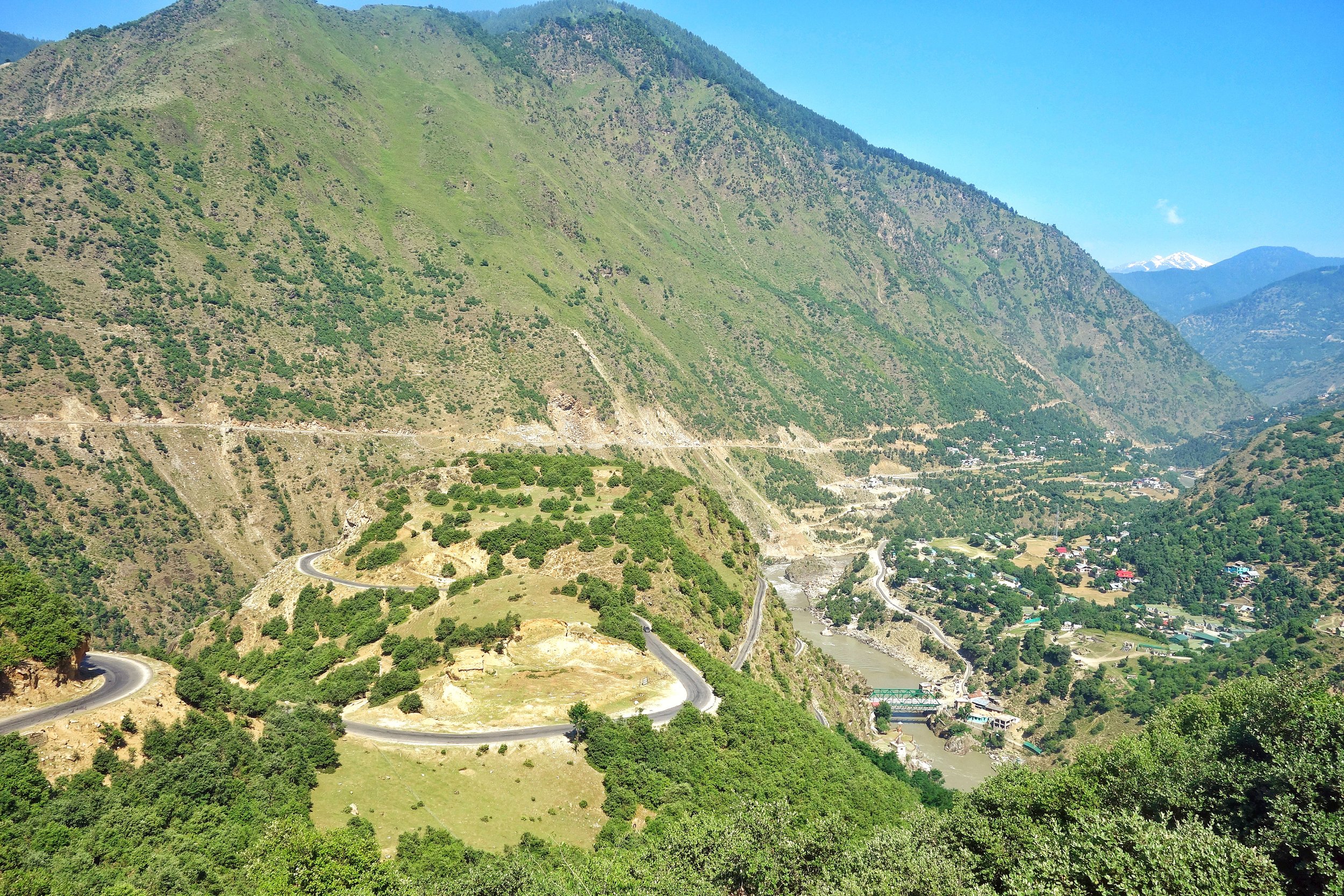
The Dichotomy of the Moon River
The Moon River or the Chandrabhaga or the Chenab is a River that flows through some of the most rugged parts of the Himalayas starting its journey in the Lahaul Valley and making its way through Pangi Valley and into Padar Valley and Kishtwar in Jammu and Kashmir. It is a River of many legends and we try and Map its jurney from the Chandrabhaga to the Chenab.
Bandarkoot near Kishtwar where the Marsudar meets the Chenab / Chandrabhaga
The Dichotomy of the Moon River
The Moon River as I like to call it or the Chandrabhaga or the Chenab, as its commonly known as, is truly a Himalayan River in all senses. This River and its tributaries run through some of the wildest and the ruggedest country in the Himalayas.Lahaul, Pangi and Kishtwar Valleys and their sub-Valleys are homes to this River. All these three Valleys have some of the craggiest Peaks in the Himalayas and the beauty is just mind blowing. Its the River of folktales and in the Punjab many love stories were written about Lovers being seperated by the Chenab. Who can forget the immortal lines from the classical Punjabi romance Sohni Mahiwal :
Sohni Chenab de kinare, Te Pukarey, Tere naam ve, aaja aaja aaja
Of course it ended in tragedy when both Sohni and Mahiwal were taken by the Chenab and the romance turned into a Tragedy for people to talk about.
Most are well aware that the Chandra and Bhaga River which rise around the Baralacha La Pass and then flow down into Lahaul and they finally merge. But the Chandrabhaga or the Chenab is the only major Himalayan River who’s name changes for apparently no reason. And also it has two starting points as well and there is debate whether the Chandra is a tributary of the Bhaga or the other way round. Its mostly an academic debate as they both rise close to each other and as by scientific definition the main River is the one which rises the farthest from the point it hits the Sea or another River that it merges into. And the Moon River finally becomes a part of the mighty Indus, after combining with the Sutlej as the Panjnad, as it makes its way to the Ocean.
Video of Driving along the Chandrabhaga Gorge between Killar in Pangi Valley, Chamba to Udaipur in the Lahaul Valley.
So why the 2 names ? The Moon River was referred to as the Askini in the Rig Veda. It meant the River with dark waters which holds true till today. The Waters of the River are rather murky as I couldnt help but notice as I travelled along the River from Kishtwar all the way till Tandi. The Gorge of the Moon River is amazingly spectacular. Its sparsely populated because of the verticality and its only now with the building of Roads can we humans even venture into this forbidden land of the Moon River. It was refferd to as the Chandrabhaga in the Mahabharata as well and the Greeks also called it Sandraphogus / Sandabaga / Cantabaga. Infact Alexander the Great established an Alexandria on the Indus at the point where the Panjnad (combination of the Chandarbhaga/ Chenab and Sutlej) met the Indus. The name Chenab is also a further development of the name with Persian cognates. Chen meaning Moon and Ab meaning water. The Moon River.
So where exactly does the River change its name ? On the maps, the regular ones officially once the River crosses into J&K from Himachal Pradesh which is at the point where the Sansari Nallah meets the River. The Sansari Nallah is considered the Border between the two states though some Maps of JK claim areas beyond the Sansari Nallah like Dharwas before Killar to be a part of J&K. The Sansari Nallah is a typical wild Himalayan River of the Region and this The photo below is taken exactly at the point where this Nallah meets the Moon River.
The Sansari Nallah as it meets the Chandrabhaga at the border between Himachal Pradesh and Jammu and Kashmir. This is where the Chandrabhaga becomes the Chenab.
The Sansari Nallah as it meets the Chandrabhaga at the border between Himachal Pradesh and Jammu and Kashmir. This is where the Chandrabhaga becomes the Chenab as per one account.
But there is more to it. Many purists consider the River to be still the Chandrabhaga as it enters the state of J&K. One of the main proponent of this theory is a Slovakian gentleman by the name of Altos Mlonk. He is an absolute Guru. He is the absolute master of Kishtwar and knows stuff beyond our imagination. As per Altos the point where the Chandrabhaga becomes the Chenab is at Bandarkoot near Kishtwar town where the turbulent Marsudar meets the Chandarbhaga. Infact the Marsudar carries more water than the main River itself when it merges into it.
The Marsudar rises at around 5175 mts and its begins life as the Gumbar and the Batkot Nallah which merge and form the Warwan River. This River has carved out the Warwan Valley which in my opinion is one of the most beautiful Valleys of the Himalayas. And the Warwan flows down and is joined by many other Rivulets in the Marwah and Dachan areas. The Marsudar flows throw some of the most unknown areas of the Himalayas which most wouldnt even know of. I trekked the Warwan in in 1989 and still remember the quaint River unlike the wild Marsudar that it becomes.
So I take it as such. And believe that the Chandrabhaga becomes the Chenab when the Marsudar joins it at Kishtwar. The place where these wild Rivers meet is like a pilgrimage spot for someone like me. Its just magical when you think about the places these Waters come from. The Moon River enchants forever.
The Inter-State Himalayan Boundary Dispute at 14000 ft
An Inter-State Boundary dispute at 14000 ft beyond the mighty Baralacha La between the Himalayan states of Jammu and Kashmir and Himachal Pradesh. The dispute involves the marking of the actual Border between Lahaul on the Himachal side and Ladakh on the Jammu and Kashmir side.
The Inter-State Himalayan Boundary Dispute at 14000 ft
In 2018 a rather quite interesting story cropped up in the news regarding a dispute on the Interstate Borders in the High Himalayas between Himachal Pradesh and Jammu and Kashmir. As per the Himachal Authorities the JK Police had set up a picket more than 18 kms than the designated Border between the two States. And this led to an altercation. Of course the matter was brought to the notice of the Central Government. There were other charges as well against the Jammu and Kashmir Government including that it had given land in Himachal across the Shinku La and around Sarchu.
The story started in 2014 when the JK Police set up a new border check Post supposedly in Himachal territory. The Himachal Government despatched CID Officials to ascertain the facts and they came back with the report that there was indeed an intrusion. The DC of Lahaul and Spiti wrote to the authorities in Padam and Leh as the JK part comes within the Kargil District and the Tehsil is Zanskar. But nothing much happened.
In the following years again the JK Police set up its check Post in what was said to be Himachali territory. Again the issue was raised and this time the Central Government intervened. A team of Experts was sent from the Geological Survey of India to demarcate the Border and they concluded after doing a scientific Satellite study that the JK Police was Post was 14 kms inside Himachal. The DCs of Leh, Kargil and Lahaul and Spiti were also present but the DC of Leh refused to go with the findings of the team and said that he will have to consult “higher authorities”. And the matter remains unresolved to this day. Lets see where the JK Police puts up its Post on this disputed inter state boundary which sits at over 14000 ft.
So how was the present day Boundary agreed upon and demarcated earlier. Well it was after Maharaja Gulab Singh had taken over as Rule of the whole of Jammu, Kashmir, Ladakh and Baltistan that a boundary demarcation was needed between the British territory of Lahaul and the Maharaja’s territory of Ladakh. The boundary was flexible in earlier times as the general area was the place where the boundaries of the Kulu and Chamba Kingdoms also met. And also of Lahul, Spiti and Ladakh. And there was constant struggle between Ladakh, Kulu, Chamba and Bushahr over Lahul and Spiti. So a settlement of the Border was needed.
And it was none other than Captain Alexander Cunningham who was assigned this job. People who have read on Himalayan explorations are well familiar with the Cunninghams. All the 4 Cunningham brothers wrote extensively on the History of India and were Military Officers as well. And Alexander was perfect for adventures in the Mountains. Infact it is Alexander Cunninghams account of the Battle of Toyo, where General Zorawar Singh fell in Battle with the Tibetan Chinese Army thats considered the most authentic.
And this is how the Boundary was finally marked. Leaving you with the actual Note on this by Alexander Cunningham published in 1848. Answers many questions and also gives an idea of how boundaries were demarcated in the Himalayas dependent on the Peaks, the Passes and of course the Rivers and the Nallahs and in some case a solitary big Rock. And leaving you with the final boundary Map as well.
Memorandum by Capt. A. CUNNINGHAM, detailing the boundary between the territories of Maharaja Gulab Singh and British India, as determined by the Commissioners, P. A. VANS AGNEW, Esq. and Capt. A. CUNNINGHAM of, Engineers.
1.In laying down a permanent boundary through a mountainous county it appeared to the Commissioners desirable to select such a plan as would completely preclude any possibility of future dispute. This the Commissioners believe that they have found in their adoption as a boundary of such mountain ranges as form water-shed lines between the drainages of different rivers, as detailed below.
2. In 1839, when Capt. A.Cunningham surveyed the Lahul district the boundary between the states of Kulu and Chamba was formed by the Nalda and Chukam Nullahs, two tributaries of the Chandrabhaga, the one on its left and the other on its right bank. From the head of the Chukam Nullah the Commissioners determined that all the county to the eastward which is drained by the Bhaga, the Chandrabhaga and their tributaries belonged to the British district of Lahul ; and that the boundary between Lahul and the Zanskar district was the snowy range (called Paralassa by Dr. Gerard) dividing the drainage of the Bhaga and Chandrabhaga from that of the Zanskar river, as marked in the Map.
3. Beyond the Bar Lacha Pass to the eastward, the Commissioners found that there was an old well known boundary stone, called the Phalangdanda, which marked the limit between Lahul and Ladak. This stone is noticed by Moorcroft . It stands in the midst of an open plain on the right bank of the Yunnam River. As there sno known or recognized boundary mark on the other side of the stream, the Commissioners selected a remarkable cream-coloured peak, called Turam, as the northern limit of the British territory on the left bank of the river. As this peak is situated at the end of one of the spun of the great snowy chain, already determined as the northern limit of the Lahul district, it forms a natural continuation of the boundary line from the westward. The bearing of the Turam peak from the Phalangdanda is 9" to the northward of west.
4. As it appeared that the country to the eastward of the Pha-langdanda belonged to Piti, the Commissioners determined that the boundary between Piti and Ladak on the westward should be the Yunam River. A straight line was accordingly drawn from the Pha-lang-danda to the junction of the first Nullah on the right bank of the Yunam, from which point the Yunam River forms the boundary as far as the junction of the Cherpa or Cherep river.
5. Almost due north-east from this junction there is a remarkable square rock on the top of the hill, which From its resemblance to a fort has received the name of Lanka. This curions and well know peak wan selected as another fixed point in the boundary, to which a straight line should be drawn from the junction of the Cherpa river. Beyond this to the eastward, the Commissioners, adhering to the principle which they had first laid down, determined that - the whole of the Cherpa valley and its tributaries belonged to the British Government; and that the snowy range on its right bank which feeds d l the northern affluents of the Cherpa river should be the boundary between Ladak and the British district of Piti. This same range extends towards the east past the southern end of the Chu-Mureri Lake, where it forms the well known boundary between Ladak and the Chinese territory. The Commissioners therefore determined that the boundary between Ladak and Piti should continue from the head of the Cherpa along this same range to the Chinese boundary; thus including within Piti all the streams which water that district, and giving to Ladak all the streams which water its southern district of Rutchu.
Kiki’s Blog
Stories from the Himalayas
Five years ago the Galwan Valley was in the News for the wrong reasons after a deadly clash between the Indian and Chinese Armies in the Valley located in Ladakh lead to many deaths on the contentious Border between the two countries in wake of continued Chinese intrusions into Indian territory.
This area along the Shyok River, of which the Galwan Nallah or the Galwan River which forms the Galwan Valley has been off limits to Civilians since long but now the Indian Government has decided to open up the area for Civilians and we were amongst the First Civilians to venture into this beautifully desolate part of the Eastern Karakorams in Ladakh. Earlier Civilians could only venture upto the Village of Shyok from where the Shyok River takes a U turn and flows in a Northerly direction.