
The Exploration of the Siachen or Rose Glacier

The Siachen Map
The Exploration of the Siachen or Rose Glacier
The Siachen Glacier. It must be the most talked about Glacier in the Himalayan Karakoram region. A Glacier that has got famous for reasons that are just Political and I would steer clear of that. But there was a time before Partition when it was just another wonder in the Wilderness of the Himalayan Karakoram Mountains. One of the largest Glaciers outside the Polar Regions and for the early Explorers it was hard to believe that such massive Glaciers could exist anywhere outside the Polar Regions.

Ms.Fanny Bullock (Pic Courtesy Wikipedia)
The credit for the initial Exploration and Mapping goes to a Lady Fanny Bullock and her husband William Hunter Workman. They were actually a rich couple who liked to Tour the World and once they happened to come to India for a Cycling Tour. It was then that they got introduced to the Himalayas and it proved to be a life-long affair. The couple made 8 trips thereafter climbing and exploring the Himalayan and the Karakoram Mountains. They made many notable explorations during these Trips and during one of these Trips Ms.Fanny Bullock also managed to climb the Pinnacle Peak during their explorations of the Nun Kun Massif. The Pinnacle Peak is a side Peak to these Twin Peaks and at 6930 m it was a world record for a Lady at that time. It should be mentioned that being rich, they could afford Italian Porters and Guides though they also took local support.

Ms.Fanny Bullock atop Pinnacle with a Poster calling for Woman to be allowed to Vote (Pic Courtesy Wikipedia)
However they seemed to have an issue with the local Porters and many of their Travelogues were full of complaints against the local Porters and their behavior. I assume that it was a Cultural thing more than anything else. Born is a rich aristocratic American family which then moved to Europe she was far removed from the hardships of the people in the Mountains and it seems that the Lady got on very well with the Mountains but never did get along with the people who inhabited the same Mountains. Many people also accused the couple of exaggerating their actual accomplishments and always longing to be in the limelight. And their Maps were far from accurate. But all said and done they explored some of the least and even never ventured into areas especially in the Karakorams and this included many forays onto the many large Glaciers that the Range held.
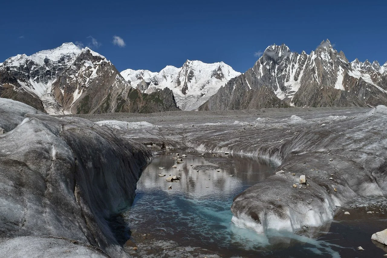
The Biafo Glacier (Pic Courtesy Wikipedia)
These Glaciers included the first attempt at the Biafo Glacier in 1899, an attempt they had to give up due to the Weather and the Crevasses so they moved onto exploring the Skara La Glacier instead. In 1902 they returned for the exploration of the Chogo Lungma Glacier. In 1907 they came to Kashmir and carried out the first exploration of the Nun Kun Massif. It was during this Exploration that at the age of 47, Fanny Bullock summited the Pinnacle Peak at 6930 m. Interestingly two years later a Lady competitor of hers claimed to have climbed a Peak in the Andes that stood at 7000m. But our Lady didn't believe her and actually paid an amount of USD 13000 to a Group of French Mountaineers to actually climb that Mountain in Andes and get the actual height. It turned out to be 6768 m. Fanny Bullock kept this Record to herself for a couple of decades.
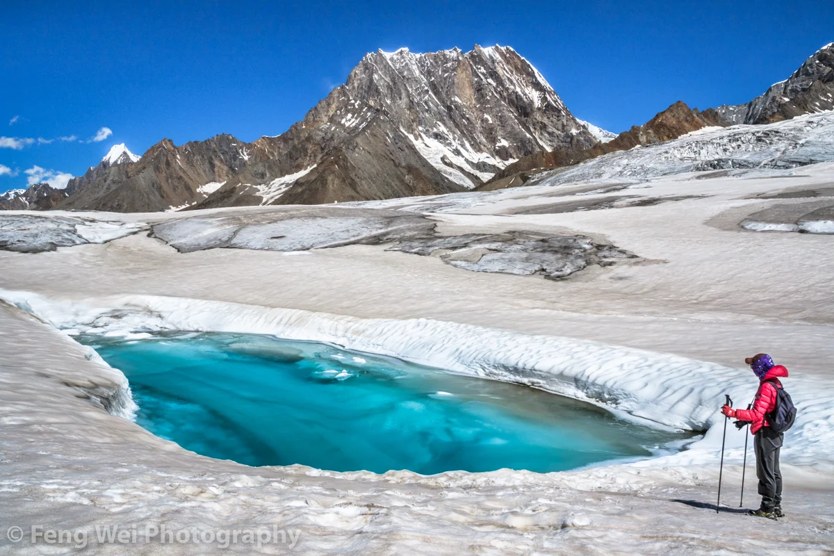
The Hispar Glacier (Courtesy Feng Wei Photography)
In 1908 the Lady with husband in tow arrived once again to explore the Hispar Glacier and even traversed across it and went to the Biafo Glacier setting another Record for ladies. They explored a number of side Glaciers and Peaks. In 1911 - 12 they finally decided to go and explore the biggest Glacier of them all. The Rose Glacier or the Siachen Glacier as we know it now. And they explored the Glacier and its sides for the two month period they spent there. It was a commendable piece of Exploration and as per all accounts this Exploration was led by Fanny Bullock herself. This was considered to be there greatest accomplishment and it also happened to be the last time in the Himalayan Karakoram Region due to the outbreak of the First World War.

A Wild Rose locally called a Sia (Pic Courtesy Wikipedia)
In her Book written after this Expedition, Two Summers in the Ice-Wilds of Eastern Karakoram , Fanny Workman writes : “The object of placing my full name in connection with the [Siachen Glacier] expedition ... is not because I wish in any way to thrust myself forward, but solely that in the accomplishments of women, now and in the future, it should be known to them and stated in print that a woman was the initiator and special leader of this expedition. When, later, woman occupies her acknowledged position as an individual worker in all fields, as well as those of exploration, no such emphasis of her work will be needed; but that day has not fully arrived, and at present it behooves women, for the benefit of their sex, to put what they do, at least, on record.”
And sharing the Map that was made by, as it came to be known as, the Fanny Bullock Workman Expedition of 1912 of the Siachen or Rose Glacier ( I am sure most of you are aware of the fact that the wod “Sia” in the local language stands for Wild Rose”). A very interesting Map indeed though not exactly accurate but still a great feat of Exploration, Mountaineering and Cartography.

The Indira Col and Turkestan La (Courtesy Josh Jagran)
Of course this is a Map which I love as to me its a work of art which has been worked hard at. And I have marked some important Passes which were used to access this Glacier (not that many people accessed this Glacier but these Passes were the ones used). The first one is of course the famous Indira Col at 18911 ft (The Workman Map wrongly describes it as 20880 ft) which is marked as Indira Col or Pass in the Map. No it isnt named after Indira Gandhi. It was named probably by the makers of this Map themselves as they gave names to all the features they saw as un-named in the Maps of their time that they were carrying (These Maps are described on the Map itself). They gave some features English names and some they gave Hindi names. Like the Indira Col (Named after Lord Indira) and Mt.Lakhsmi (self-explanatory) and they called a Group of Peaks as the “Apasaras”. Also itr signifies that the Indira Col was never used by the locals and hence never given a name. Its just too tough for anyone but a trained person.

The Kondus Glacier (Pic Courtesy the Amercan Alpine Journal)
Then there is the Bilafond La (No.2) at also known as the Saltoro Pass at 17881 ft on the Saltoro Ridge (The Workman Map puts the height at 18370 ft) . The name apparently comes from the Balti word for “Butterfly” or the Pass of the Butterflies. This was apparently one of the Passes that were used on the Silk Route which connected Ladakh and Baltistan with Central Asia. And then there is the Turkestan La (No. 3) said to be 19209 ft as per the Workman Map. This was probably another Pass into Turkestan as the area beyond the Karakorams referred to as. Not very significant anymore.

Dogs somewhere on the Siachen Glacier (Courtesy Wikipedia)
And then there is the Sia La (No.4) (The word Sia again derived from the local word for the Wild Roses that grew in the area). It stand at 18337 ft (The Workman Map puts the height as 18705 ft) on the main Saltoro Ridge. Further down is the Gyong La Pass which is not marked in the Map.
And then the Map also shows numerous side Glaciers and big Glaciers in the neighbourhood of the main Siachen Glacier. Like from below or the West the Kondus / Kaberi Glacier, the Bilaphond and Lolophond Glaciers, the Sher-Pi-Gang Glacier and the Peak 36 Glacier. Above or on the East (left side) of the Siachen are the Urdok Glacier and the Tarim Shehr Glacier.

Jammu and Kashmir dispute Map by the UN.
Of course we are all well aware of the situation on the Glacier and I would like to point out that all the Passes mentioned above are well in control of the Indian Army and they control the access to the Glacier. So in actual Geographic terms India controls the Siachen Glacier. And all the area running North of the point NJ 9842. But thats about all I can say about that.