
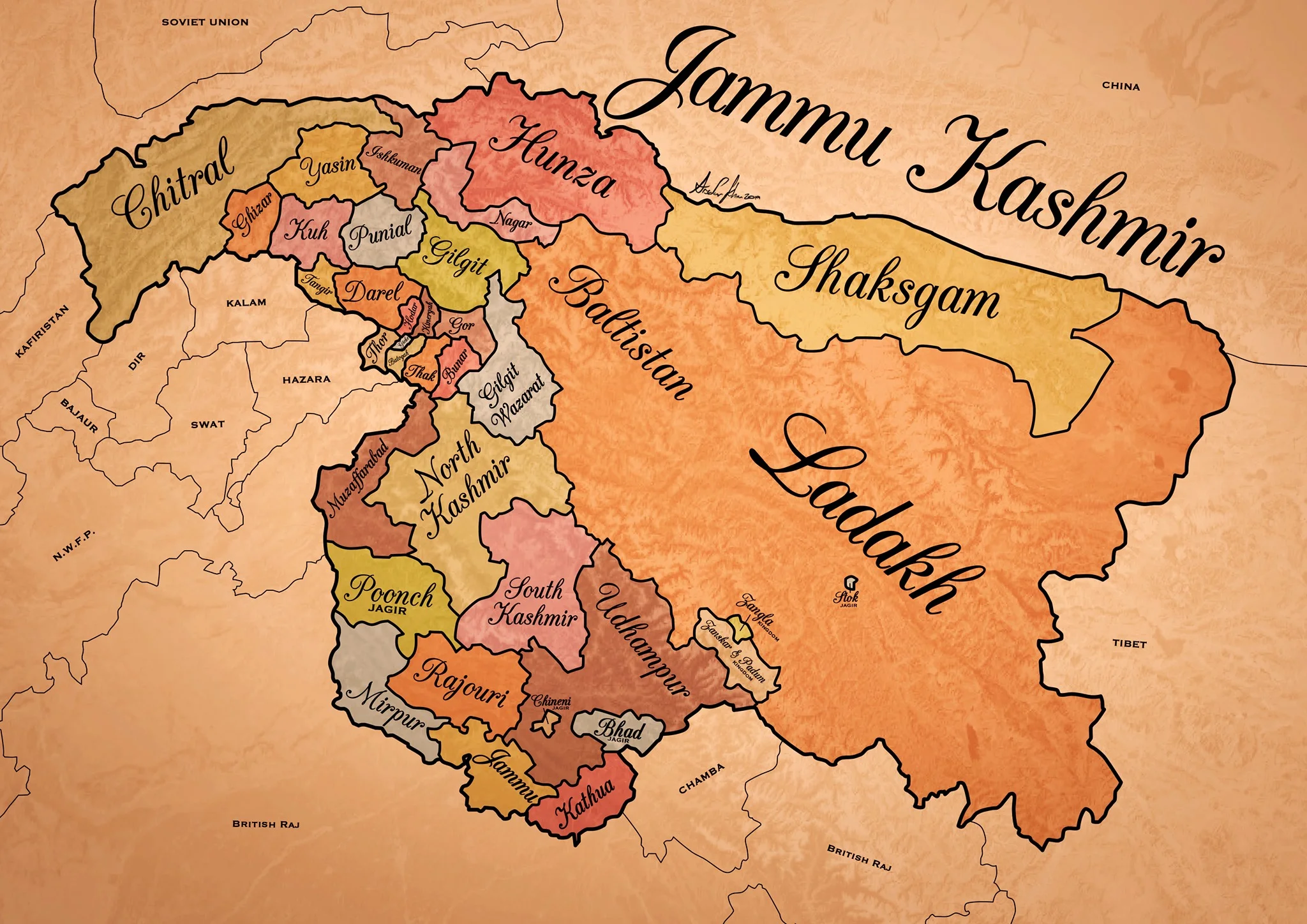
Historical Map of the Dogra Kingdom of Jammu and Kashmir
The State of Jammu and Kashmir as it was at its largest extent under the rule of the Dogras. This Map helps people understand the complicated Geography and Diversity of the erstwhile State of Jammu and Kashmir.

Historical Map of the Dogra Kingdom of Jammu and Kashmir
Another interesting Map of the previously E Jammu Kashmir by my talented friend Arsalan Khan who also belongs to the Riyasat. We had previously had an Article on the various Indigenous People of Jammu and Kashmir. Its not perfect, has its anomalies but it still an indicator of the diversity of the State from a Political angle. This Map shows the Dogra Kingdom at its most expansive. And i would like to point out that all these different areas were won over by the Dogras / Dogras under the Sikhs in War except Kashmir which was granted as a part of the Treaty between the British and Raja Gulab Singh on the payment of War Indemnity of 75 lakhs. It should be pertinent to mention that the Dogras also played a part in the Sikh conquest of Kashmir earlier from the Afghans. Also it suited the British in 1846, when the Sikh Kingdom still existed, to have a parallel power which they could use as counter against them and in this case it was Raja Gulab Singh and his hardy Hill Men. Here is an account of the transition of the Rulers in Kashmir From the Mughals to the Dogras giving a background of how Kashmir passed from the Mughals to the Afghans to the Sikhs and onto the Dogras.
Just an explanation on the parts :
Chitral : This is the most controversial inclusion as it always stirs up a Debate. Was Chitral at any point of time a part of the Dogra Kingdom ? Different historians had different versions on this but one thing was clear that the Chitral Kingdom did pay tribute to the Dogras. This has been verified by me personally with Members of the Chitral Royal Family. Of course later due to the Great Game Chitral was made a part of the Malakand Agency. Here is an account of the Chitral Expedition an important event in the History of Chitral
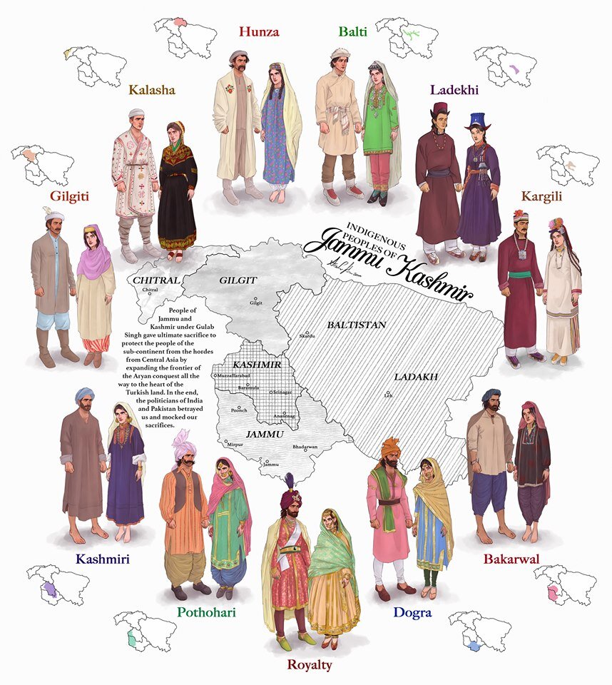
The Indigenous people of Jammu and Kashmir
Hunza / Gilgt and around : Besides Gilgit and Hunza there were other Hill States which used to be constantly at loggerheads with each other but used to occasionally unite against foreign aggression. These were Iskoman, Nagar, Yasin, Ghizer, Punial and Darel among the more notable ones. Gilgit was an important location and one of the most forward bases of the British in the Great Game which I have described in this article titled The Gilgit Game. In addition to these there were various other smaller “Shinaki Republics” which as the name suggests were Groups of Shina speaking people in communities in the area generally named as Chilas. The Imperial Gazzette of 1908 described them as such :
“A group of small republics in the valley of the Indus, lying west of Kashmir and south of Gilgit. The territory extends from the junction of the Astor river with the Indus to Seo on the right bank and Jalkot on the left bank of the latter river. Within this area the people are grouped in communities inhabiting one or more nullahs, each community forming a separate republic. Starting from the junction at Ramghat these are, in order : on the right bank, Gor, Kinergah, and Hodar ; and on the left bank, Bunar, Thak, Butogah, Giche, and Thor. They constitute the area known as the Chilas subdivision of the Gilgit Agency, while Chilas proper includes Kinergah, Butogah, and Giche. Lower down the river are Darel, Tangir, Khilli, and Seo on the right bank, and Harban, Sazln, and Jalkot on the left bank.
After the conquest of Chilas by Kashmir in 1851, the Maharaja imposed a tribute in gold-dust, and arranged for the administration of the country as part of the Gilgit district. A British Agency was re-established at Gilgit in 1889, which included, among other terri- tory, the Chilas subdivision described above except Thor. In 1892 a British mission to Gor was attacked by the Chilasis, which led to the occupation of their country and the appointment of a Political officer at Chilas. The right of the Kashmir Darbar to construct roads and station a limited number of troops in the territory was secured, but the autonomy of the Chilasis was guaranteed. Under the revised arrangements made in 1897 the republics pay small fixed sums to the Maharaja, and in 1899 Thor was incorporated in Chilas. Darel has rendered a tribute of gold-dust to Kashmir since 1866, when the Maharaja's troops raided the country. The tribute is now paid through the Punial governor. Tangir pays a small tribute to the governor of Yasin. The remaining communities have no political relations with either Kashmir or British India, except Jalkot, which from its position dominates Thor and the head of the Kagan valley in the North- West Frontier Province.”
Then on the other side we have Baltistan and Ladakh about who most people know a bit of the History and how these were conquered by General Zorawar Singh between 1834 and 1840. This is a brief account of the conquest of Ladakh and Baltistan by the Dogras. In Ladakh also once the Royal family was removed from Leh, the Ladakhi King was granted the Village of Stok and some surrounding area as a Jagir. Thats where the Stok Palace was built. Much the same way the Raja of Zanskar was granted the Jagirdari of Zangla. Or something to that effect. This is a general note on Zanskar to help in the understanding of this one of the most remote regions of the Himalayas. And ignore the Shaksgam part as its shown beyond its size. This article gives you an insight into the Shaksgam Valley. Another important part of the State which is missed out in this map is the region between the Karakorams and the Kun Lun Mountains called the Aksai Chin.
And then of course we have the Kashmir Valley itself. It was divided into North and South Kashmir for administrative purposes. To the West of Kashmir was Muzaffarabad which was the Pahari area along the Jhelum Valley starting from Uri. This is the part I belong to close to the town of Hatiann Bala. Muzzafarabad is also the Capital of the entity referred to as “Azad Jammu Kashmir”.
Then of course we have Poonch which was a Jagir granted to the family of Raja Suchet Singh, a brother of Raja Gulab Singh. It had a history of its own and struggled for a while to be independent of their Jamwal Cousins which only resulted in the Jagirdari being terminated for a bit. Here is an account of what transpired in the Kingdom of Poonch. There was also the very small Jagirdari of Chenani, which is a small Town on the Highway and I remember that there used to be a Palace of sorts over there. More than that I remember because the erstwhile Raja of Chenani was a friend of my Grandfather’s and i have seen him at my Grand Fathers’ place when I was very young.
And then there was Rajouri which is the stronghold of the Gujjars and most of them are based here during the Winters. Next to Rajouri was Mirpur which was really a part of Punjab and the people were called as Mirpuris. Due to the building of the Mangal Dam many Mirpuris went to the UK and thats the reason you have a strong Mirpuri community in the UK.
And then we had the Duggar heartland of Jammu and Kathua which bordered Chamba with which it shares a lot of Cultural similarities. The district of Udhampur at that time included the whole of Udhampur and Ramban as well as Doda and Kishtwar. The Jagirdari of Badh or Bhaderwah was granted to the Ruler of Bhaderwah who was installed by Gulab Singh after getting the Chambyalis to give up all their claims over Bhaderwah. It used to be an integral part of the Chamba Kingdom. This is an account of Bhaderwah. It connects with Chamba over the Padri Gali.
Of course this will get many people excited and there would be counter views but the views mentioned above are my own based on what I have read and experienced. Kindly feel free to disagree. But as a request just dont start a discussion 1947 onwards as it wont get us anywhere.
This Map is available in hi-res as well. Do let me know if you want.
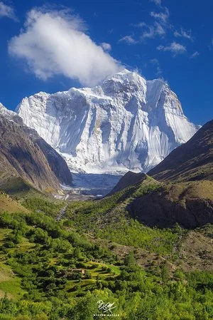
The Hindu Raj Mountains
The Hindu Raj Mountains is a little known Mountain Range sandwiched between the Hindus Kush and the Karakoram Ranges located mostly in the Khyber Pakhtunkhwa Province of Pakistan. And till date many few people outside the region know of this Range which purists consider separate from the Hindu Kush Range.
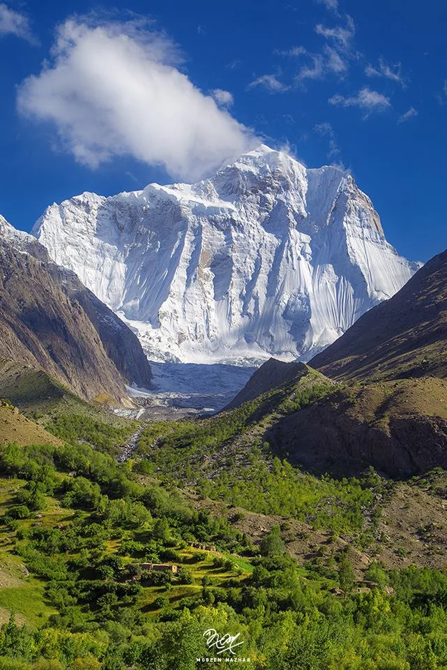
The Hindu Raj Mountains
There lies somewhere in the Northern wilderness of Gilgit Baltistan and Khyber Pakhtunkhwa nestled between the mighty Karakorams and the Hindu Kush a Mountain Range called the Hindu Raj Mountains. Most people consider it a part of the Hindu Kush Mountains but many Geographers and purists consider the Hindu Raj as a separate Range. And surprisingly very few people have ever heard of it in the sub-continent. Though everyone is quite aware of the Hindu Kush Range and the many versions how it came to be named as such. The same should have been the case with the Hindu Raj but I guess someone missed the Memo.
The Hindu Raj Mountains are a noble Range in their own right but just like the Pir Panjals to the South across the Great Himalayan Range it gets dwarfed by the giant Peaks of the Karakoram and the Hindu Kush. Not that it lacks heavy weights just that in a Region which abounds with numerous 7000 m plus Peaks and even 8000 m plus Peaks the tallest Peak of the Hindu Raj Mountains, the Koyo Zum tops in at 6872 m (22,546 ft) which is by no means less but it just gets dwarfed as mentioned earlier. To put that height into perspective the tallest Peak of the Andes, the Aconcagua stands at 6962 m.
As per Encyclopedia Britannica “A wider definition of the Hindu Kush would include a fourth region known as Hindu Raj in Pakistan. This region is formed by a long, winding chain of mountains—with some lofty peaks, such as Mounts Darkot (22,447 feet [6,842 metres]) and Buni Zom (21,499 feet [6,553 metres])—which strikes southward from the Lupsuk Peak (18,861 feet [5,749 metres]) in the eastern region, then continues to the Lawarai / Lowari Pass (12,100 feet [3,688 metres]) and beyond to the Kābul River. (The Lowari Pass is a Pass which connects Dir in Khyber Pakhtunkhwa with Chitral which also falls in the same province. The Lowari Pass is the lowest of the 4 traditional Passes which connected Chitral with the outside world. The Lowari Pass is famous for its avalanches and the number of people who died on it historically. Think of it like you think of the Rohtang or the Zoji). If this chain is considered part of the Hindu Kush, then the outlying mountains of the Swat Kohistan region of Pakistan to the south also form part of the complex.”
As per another definition by “Batholith Saltoro” the range that lies between the true left bank of the valley of the Yarkhun/ Mastuj River in the West and North and the Northern watershed of Swat Kohistan in the South, is the Hindu Raj. The main range of the Hindu Kush lies to the East and North of the Yarkhun/ Mastuj/ Chitral/ Kunar River system.
Now most of us are familiar with the Etymology of the Hindu Kush which as per one definition meant the “Killer of the Hindus” which was a reference to the fierce avalanches that the Hindu Kush would let loose. It was also supposedly a reference to the large number of people from the subcontinent who were taken as slaves to Central Asia across the Hindu Kush and many perished while crossing this formidable Mountain Range. But as per the Encyclopaedia Britannica the term Hindu Kush is derived from Arabic and it simply means the Mountains of India. But then this is a debatable issue and we leave it as such to ponder over it another day.
So I assume the Hindu Raj reference must have come from the Hindu Shahi Rulers who held power in this Region. But this is just an assumption. You need to keep in mind that at that time “Hindu” was a geographic term and it still has but now it has a different connotation. Or since the area is in the same vicinity where the Kalasha people live maybe its a reference to them and their ancestors when most people here were Kalsha. This remains a matter of my personal speculation as I am yet to come across a source which mentions why exactly these Mountains were called the “Hindu Raj” Mountains.
And culturally also the area has a very interesting history. As per “Batholight Saltoro” “Culturally, the linguistic mixture is interesting, containing as it does a mixture of Shina, Burushaski, Khowar, Gujar, and Wakhi speakers which reflects the complex history of the area. It has been ruled variously from Chitral, both by the Kushwaqt and the Ul Mulk dynasties, from Gilgit, from Srinagar, from Tibet, from Persia. The original inhabitants of its Eastern Valleys seem to have been Burushaski speakers, preserving, as they do, what is considered to be a purer version of that language as compared to that which is spoken in the Hunza region. The Yasin valley, the pass at the head of which served as a conduit for the Chinese to invade and conquer the Tibetan held Lesser Bolor, is also the valley where the explorer/journalist George Hayward was murdered, perhaps for being a tad too investigative.
Another interesting Range in the Great Himalayan System now somehow obscured by other more famous Ranges / Sub ranges of the system.
Chitral Expedition
The Story of the the Chitral Expedition, a conflict in the shadows of the Hindu Kush and the Karakorams between the local Rulers and his tribesmen against the British and the soldiers of the Jammu and Kashmir state. A story of a seige and how it was finally broken.
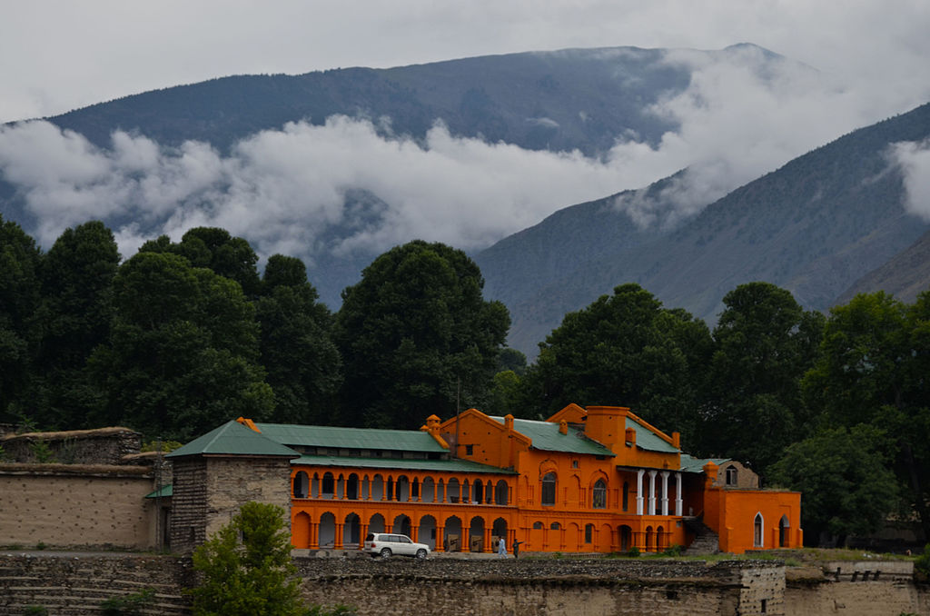
Chitral Expedition
Chitral is a town located at al elevation of around 1800 m in the Hindu Kush Mountains and its the district HQ of Chitral district in the Khyber Pakhtunkhwa of Pakistan near the border with Afghanistan.
Because of its strategic location it was witness to many events in the Great Game as it played out between the British Empire and the Tsarist Russia. With the formation of the state of Jammu and Kashmir in 1846 and the subsequent conquest of Gilgit / Hunza the Chitral region also came under the influence of the Maharaja of Jammu and Kashmir in 1876 with the blessings of the British. However once they leased out Gilgit from the Maharaja to keep on eye on the Russians and thus the Gilgit Agency was formed. Chitral was taken out of the Maharaja’s realm of influence and made a part of what came to be called the NWFP.

However there was an incident in Chitral which tested the resolve of the British to hold on to Chitral. Chitral had a semi-independent Ruler called the Mehtar who was subservient to the British. In 1892 the Ruler of Chitral, Aman ul Mulk expired and he had ruled since 1857. His death was followed by a brutal war of succession between his sons. And the British watched this and so did their Garrison of 400 men who were housed inside the Chitral Fort by the Chitral River. The old Ruler was succeeded by a son but his brother (the departed Mehtar’s) also appeared on the scene from exile in Kabul. And so did another son who was under British protection. And if that wasn't enough an Afghan tribal leader with his men also turned up. Without getting into details let me say it was a mess and the British Garrison which had 5 British Officers commanding the 14th Sikh and Kashmiri Infantrymen from the Maharaja’s Army were under siege.
Meanwhile the British decided to send some relief columns to the aid of the defenders of the Fort. The troops were gathered in Gilgit and they consisted of 400 Sikh Pioneers mostly Road Builders, some 50 Kashmiri Sappers and a troop of irregular Hunzais numbering around 800 men. All tough Mountain men. They needed to be tough as it was March and between Chitral and Gilgit lay the formidable Shandur Pass crossing which in Winter was never really thought of as a possibility. This is the same Shandur Pass where nowadays the Shandur Polo Match is held between the Chitralis and the Gilgitis. At 3700 m it lay where the Karakorams met the Hindu Kush. Col James Kelly didn't really have an option and this was the option he had.

And they set off on March 23rd. By March 30 they had crossed 10,000 ft and well into the snowline and the snow was deep. But they had the element of surprise and the Chitralis on the other side of the Pass had no inkling that a whole body of troop could cross the Pass in late Winter. It's said that after crossing the Snowline the porters saw what was in store for them as the snow around Shandur was waist deep. And they decided to drop their loads and go back. But the Soldiers didn't really agree with them and you can't really win an argument with Men who carry guns. They got back to their duty and Sledges were used to transport the heavy Guns over the Pass. Once they were over the Pass did the Chitralis realise that they had uninvited Guests coming over to the aid of the besieged Garrison in the Chitral Fort.
In the meanwhile a huge British Force of 15000 was assembled in Peshawar and set off. Joining them unofficially was our old friend, Lt Col Francis Edward Younghusband. This force set off a week after Kelly’s force under General Law. The serious British reaction to this incident was due to the fear of the Russians taking advantage and Ivan and Cossacks coming to the party. They also faced the formidable Malakand Pass and the eventually the Lowari Pass. The Malakand Pass defended by Umar Khan’s 12,000 Afghan fighters which they overcame as the Afghans dispersed. And they crossed the Lowari on the same day that Kelly’s force entered Chitral and the Fort. And it is said that Younghusband ran in front of the detachment and was the first from this force to enter Chitral. And apparently they had finished the last bottle of Brandy the night before. Hangover makes you do crazy things.

Anyways at the end of the day the British got the Fort and the control of Chitral. Many of the Troops got the Chitral Relief Medal. And i should mention that my fellow team Member Rijul Gill’s grandfather was also awarded a Chitral Relief Medal which he still has in his possession.
As for Chitral once they re-established control in 1895 the British installed Shuja-ul -Mulk, a 12 year old son of the late Mehtar as the Mehtar and he ruled for a period 41 years till 1936 and peace returned for good to Chitral.
And I should mention that Chitral is beautiful country. And its the home of the Kalash. It used to be called Peristan as it was said that fairies lived there. If I was a Fairy I would Chitral as home. Its just beautiful.
Pic of the Chitral Fort by the Chitral River. Phot credit Syed Imran Scach.
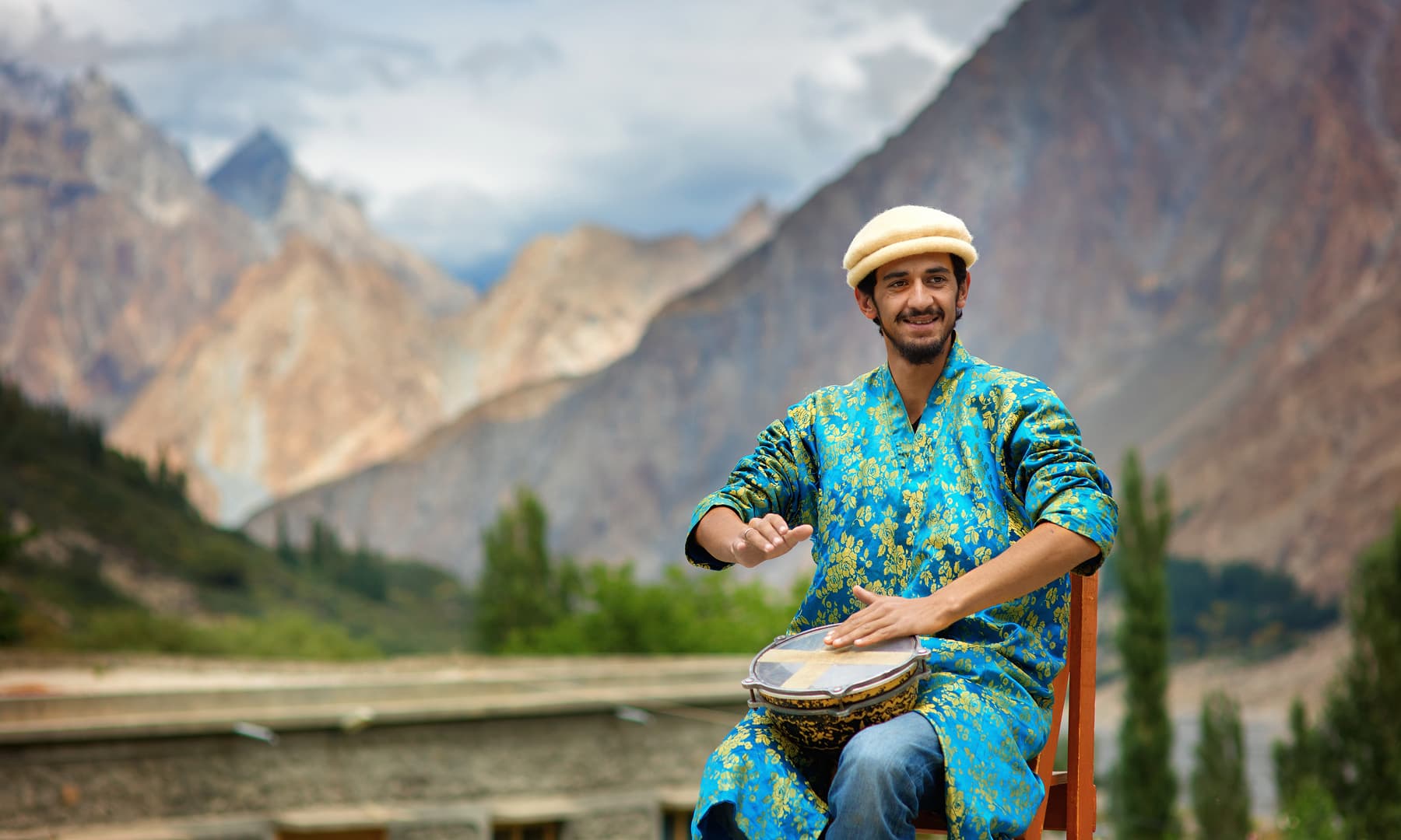
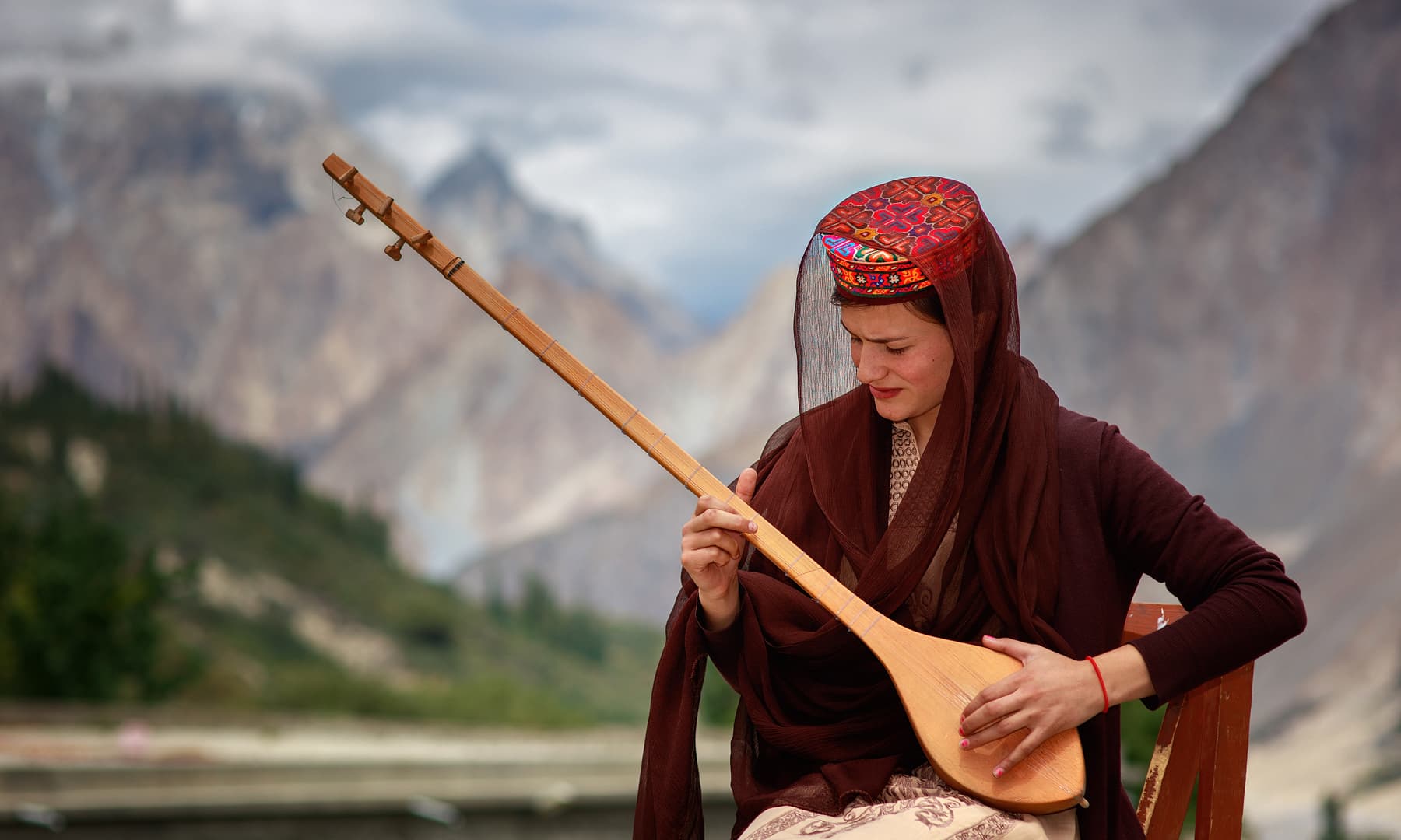
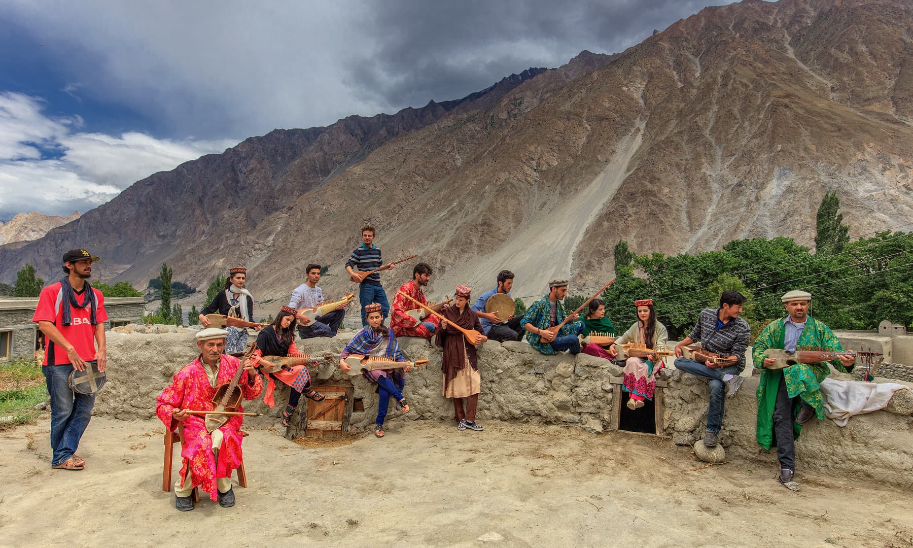
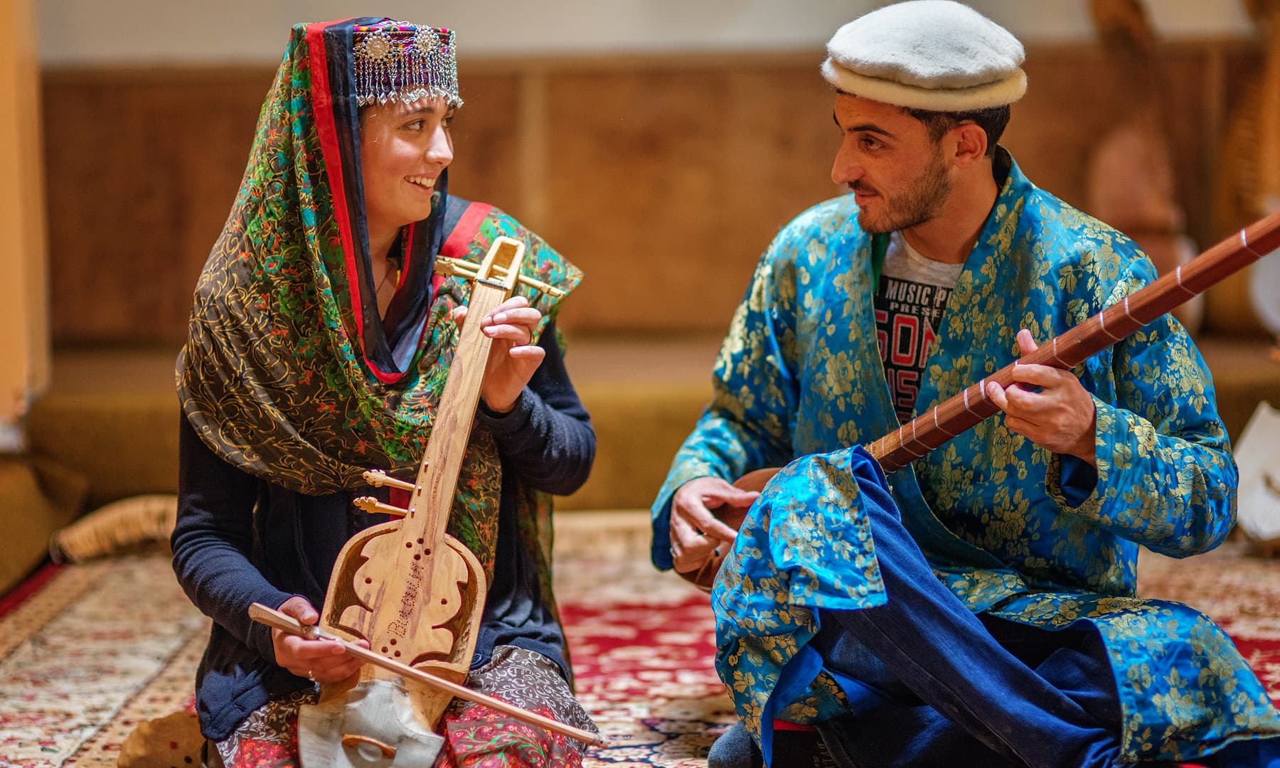
Bulbulik Music School, Gojal Valley, Gilgit
The Bulbulik Music School in Gojal Valley, Gilgit is making efforts to revive musical traditions that are on the verge of extinction. Run by Gulmit Educational and Social Welfare Society, Bubulik is named after nightingales which are frequently mentioned in Persian and Urdu poetry. The school takes its name from Wakhi folk culture known as Bulbulik. Shepherds of lowland areas sing while they travel to the highlands to send messages back home. Taken from the Dawn

Bulbulik Music School, Gojal Valley, Gilgit
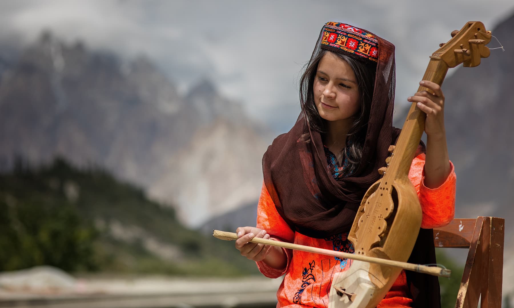
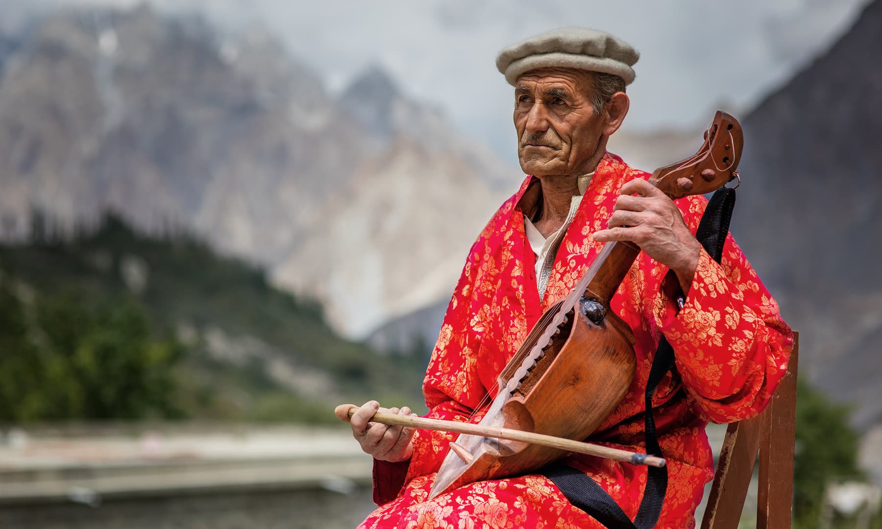
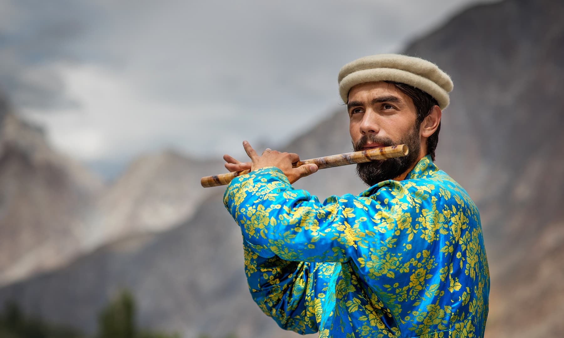
Impeccably dressed in crisp white garb, black waistcoats and neatly-polished black shoes, the students of the indigenous music school Bulbulik in Gojal Valley, Gilgit is making efforts to revive musical traditions that are on the verge of extinction.
There may be little support but that has not discouraged the institution from doing what it loves: playing freestyle/Pamiri music with conventional instruments like Ghazxek, Surnaye, Tutek, Gabi and Sitar. The musicians feel happy when onlookers cheer for them; when they play their soothing lullabies, the native Parmiri find a voice.
“Bulbulik is the first folk music school in the area and have even given opportunities to female students to come and learn alongside their male counterparts,” said Didar Ali, the culture development officer of Bubulik. “In the past, music was neither widely accepted nor were women allowed to play musical instruments.” He added that so far, some 35 female artists have been trained in various folk instruments.
Run by Gulmit Educational and Social Welfare Society, Bubulik is named after nightingales which are frequently mentioned in Persian and Urdu poetry. The school takes its name from Wakhi folk culture known as Bulbulik. Shepherds of lowland areas sing while they travel to the highlands to send messages back home. Its roots can be traced back to 1985, when a small school was set up by Muzafaruddin Shah to create awareness about protecting one’s own melodies. The present initiative, however, is hardly a year old.
Article and Photos from :
https://tribune.com.pk/…/music-school-chitral-keeping-indi…/
Humans of Himalayas : The Kalash
The Kalash is a name given to a Group of people who exist in three isolated Valleys of Chitral in the Khyber Pakhtunkhwa region of Pakistan. As of today Kalash people include people who follow Islam and another Group which still practices its ancient religion. As on the present day their numbers of those following the original religion are in a few thousands and they have been under threat since a long time though lately due to Government intervention they have been relatively free to go on with their lives and traditions as they have for thousands of years.

Humans of the Himalayas : The Kalash
This is the first in a series of Posts on the different People and the Cultures that exist in the vast Himalayan Karakoram Hindu Kush (HKH) System. We will be looking more closely at the relatively smaller Groups of people who have existed in the Mountains and Valleys of this system. Cultures have developed and evolved in isolation from other Groups due to the lay of the land and the Mountains and Rivers which served as the main barriers. Over the passage of time each of these Cultures have developed their own languages, social structures, religious beliefs, traditions, arts and crafts.
Today we start off with the Kalash. Please note that most pics Ill be using would be from the Internet and try and give credit. In case you by any chance see that your picture is being used and want it taken down please let me know and it will be taken down. The purpose of these articles is purely Educational/ Academic. Kindly feel free to share and use the same.
The Kalash
The Kalash is a name given to a Group of people who exist in three isolated Valleys of Chitral in the Khyber Pakhtunkhwa region of Pakistan. As of today Kalash people include people who follow Islam and another Group which still practices its ancient religion. As on the present day their numbers of those following the original religion are in a few thousands and they have been under threat since a long time though lately due to Government intervention they have been relatively free to go on with their lives and traditions as they have for thousands of years.
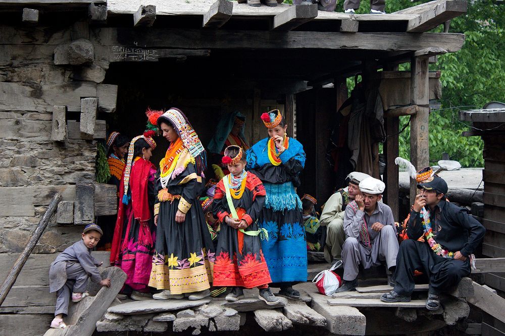
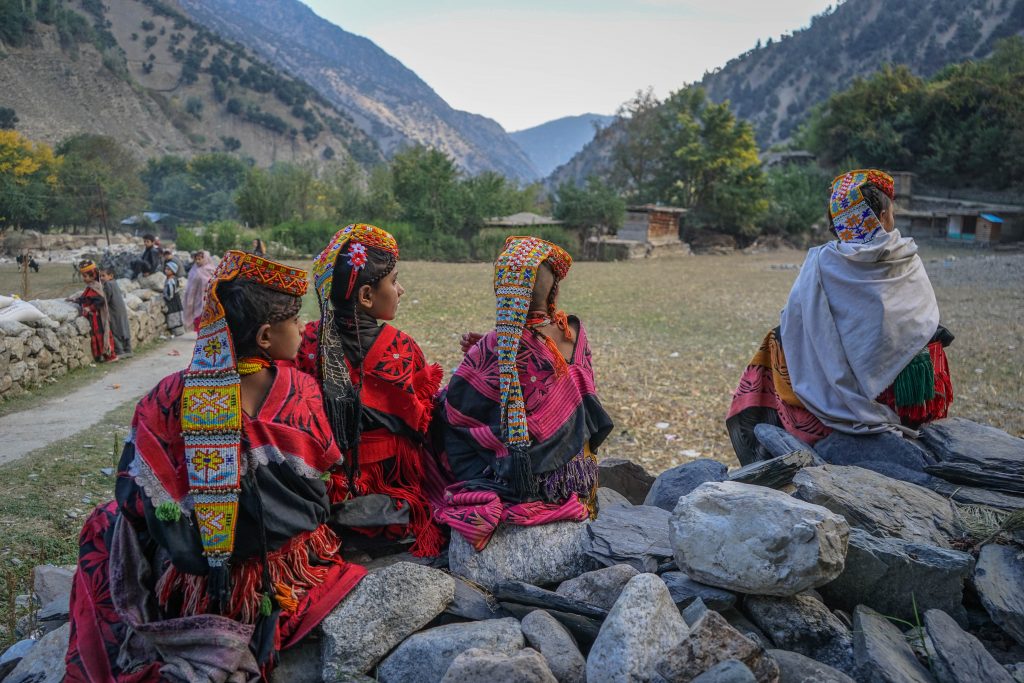
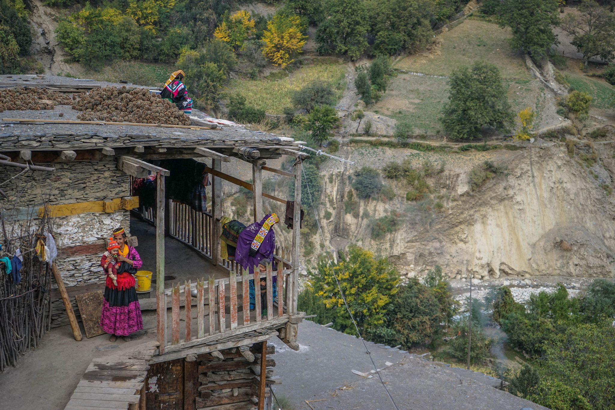
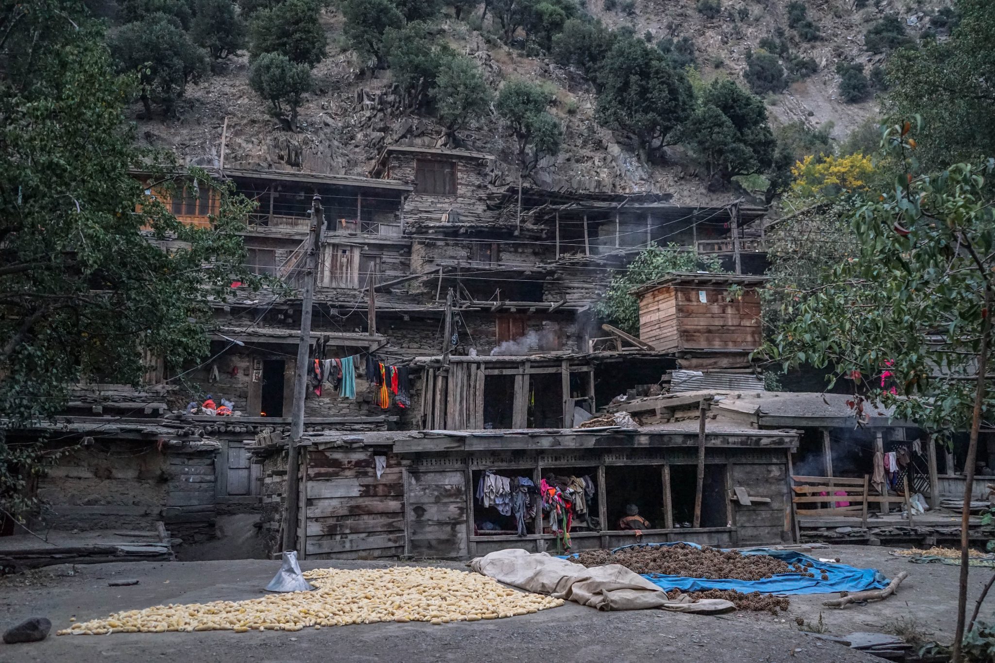
The Kalash are found in three Valleys near Chitral namely the Bumburet, Rumbur and Birir near the Kunar River. These River Valleys are extremely fertile and all kinds of mountain fruits grow here. They speak a language called the Kalash / Kalsha which belongs to the Dardic language Group of the Indo European language Group.
Due to their fair skin color and light colored eyes they have long thought to have some connection with the Europeans and the most obvious connection is made with remnants of the Army of Alexander who decided to stay back in the beautiful Valleys and mixed with the local population. There are other People/ Tribes in the Himalayas as well who claim to have a connection with the Greeks through the Army of Alexander and other claim to be direct descendants of the Greek soldiers.
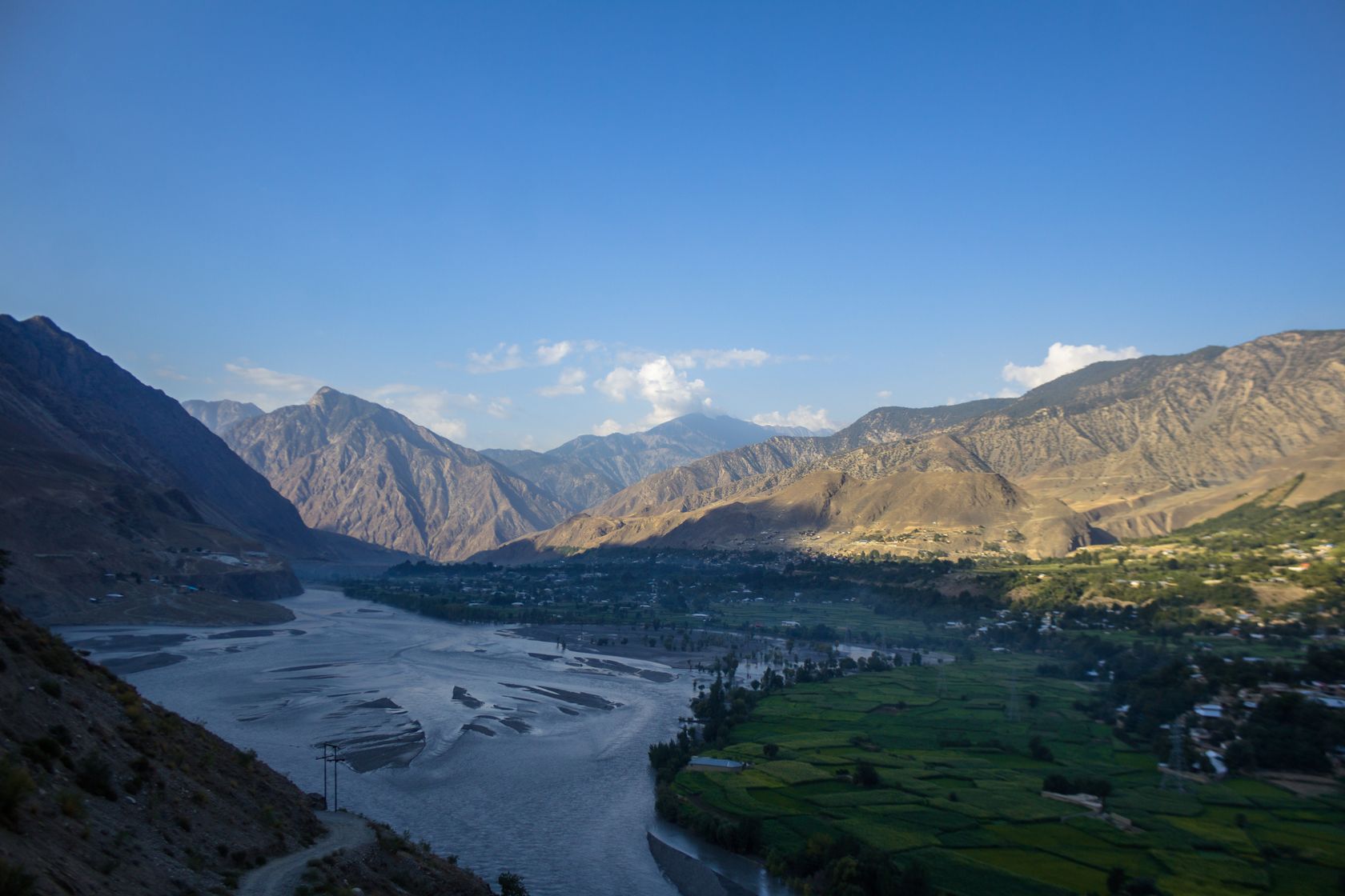
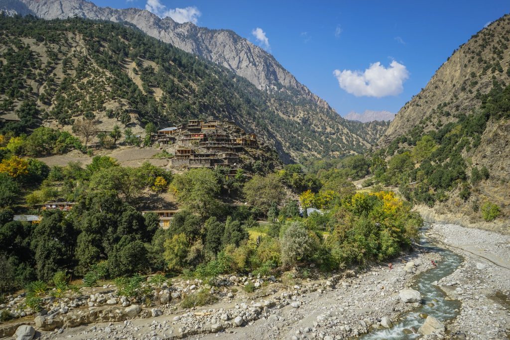

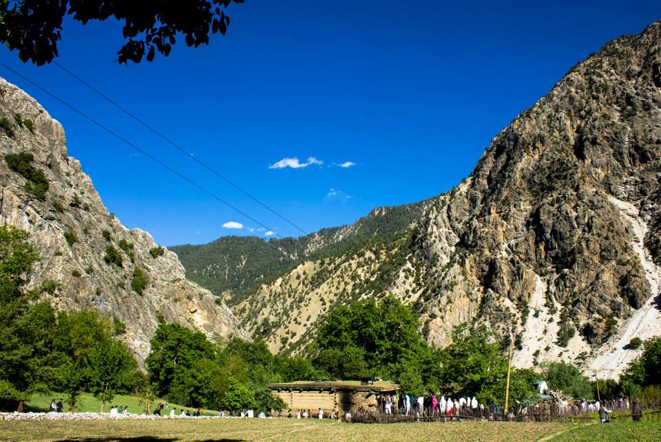
From what I have read around their origins are still disputed among the scholars. Some say there indeed are evidences which prove a connection to Greece while others are quite convinced that there was no such connection and that is proved by the Genetic analysis of the Kalash people. We will steer clear of that Discussion and keep our minds open on that issue for now.
The closest relatives of the Kalash are the Nuristanis (earlier this region was called Kafiristan as a reference to their beliefs) who were at the turn of the previous Century converted by the Afghans and they have embraced Islam and have done away with most of their religious and cultural traditions and have become more Islamised in a sense. Many of the Kalash were also hence converted. The remaining Kalash were able to stick to their way of life because of firstly the isolation of the Valleys where they exist as well as the fact that when the Durand Line was drawn they became a part of India as it was at that time. Hence the Afghans were unable to get to them to convert some of them. However over a period of time many were converted especially when the Taliban influence was strong and they were under a lot of pressure to give up their traditions especially their traditional beliefs. But thankfully that threat is now gone and things are better with Government intervention as I mentioned earlier.
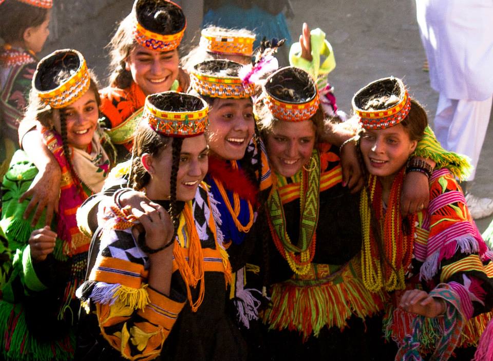


The Kalash religion has been described as Animism but many similarities are seen with the ancient Vedic religion or in other words an ancient form of Hinduism with Animist beliefs thrown into it aplenty. It is probably the form of religion as it existed at the time when the Rig Veda was composed. However due to their isolation most probably they remained cut off from the post Rig Vedic development of Hindu religion. The name of some of their deities are the same as the ones in the ancient Vedic religion. They have references to the “Devlok” and one of their deities is called Indra.
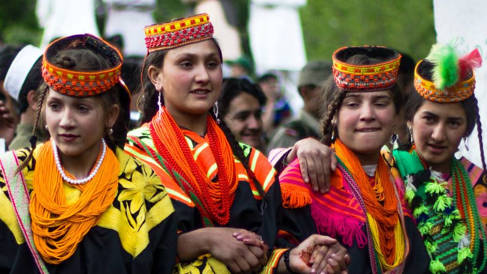
The Kalasha celebrate a number of festivals including the most well known one known as the “Chillum Joshi” which attracts a lot of outsiders to flock to the Village and see the Kalash, especially the women in all their finery. Traditionally the woman wear black robes but on the days of the Festival all are ordained in multi-color jewelry as well as very exquisite headgear.Two other important festivals of the Kalasha are the Uchau in autumn, and the Caumus in winter.
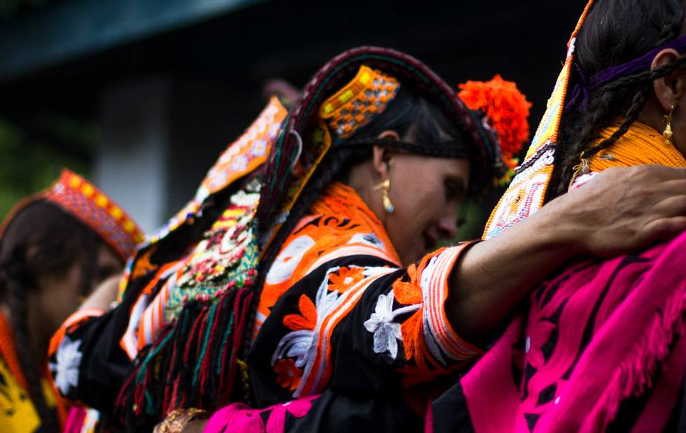
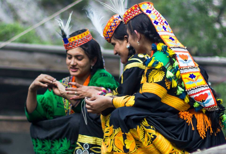
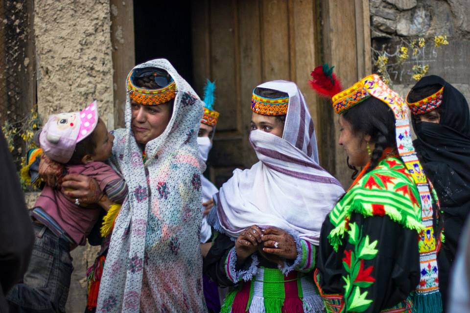
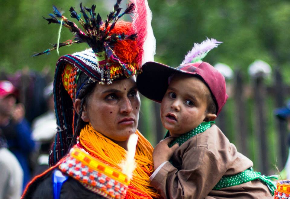
As of today the number of Kalash who still practice their ancient beliefs are believed to be numbered at around 3000 individuals and have been holding steady. They are also a big draw for tourists who converge in large numbers to see these extra-ordinarily beautiful people in the equally beautiful mountain settings.
You are encouraged to read up on these fascinating People through different resources available on the Net. As for now I leave you with some pics of these people from various sources on the Net. These are being used only for Educational purpose and if you hold the copyright to any of these pics and want it removed, please drop a message and we will remove the pic. Thanks
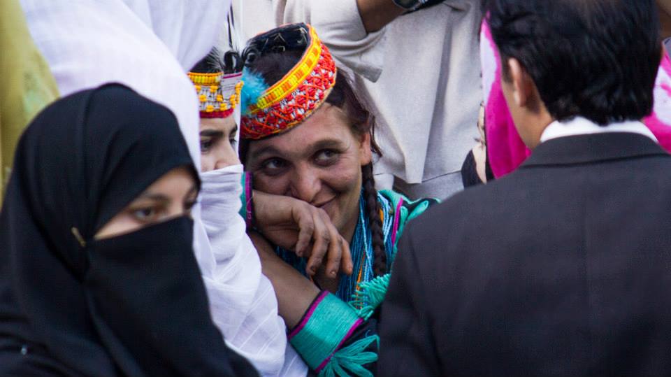

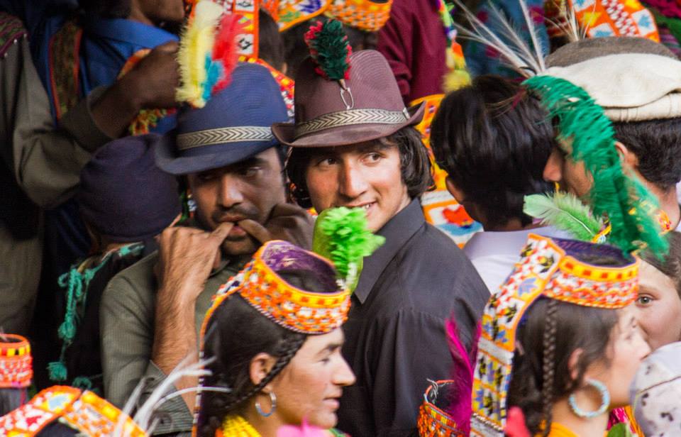
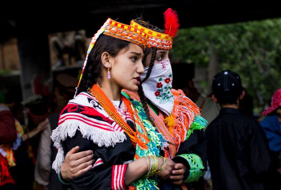
Photos Credit : Syed Imran Schah.
Kiki’s Blog
Stories from the Himalayas








Five years ago the Galwan Valley was in the News for the wrong reasons after a deadly clash between the Indian and Chinese Armies in the Valley located in Ladakh lead to many deaths on the contentious Border between the two countries in wake of continued Chinese intrusions into Indian territory.
This area along the Shyok River, of which the Galwan Nallah or the Galwan River which forms the Galwan Valley has been off limits to Civilians since long but now the Indian Government has decided to open up the area for Civilians and we were amongst the First Civilians to venture into this beautifully desolate part of the Eastern Karakorams in Ladakh. Earlier Civilians could only venture upto the Village of Shyok from where the Shyok River takes a U turn and flows in a Northerly direction.