

The Elusive Kaobal Gali
The Kaobal Gali stands at an Elevation of 4167 metres (app 13600 ft) on the main Great Himalayan Range has traditionally connected the Tulail and Gurez Valleys with the Mushkoh Valley in the Drass Region. Interestingly people on both sides of the Pass are Shina and speak Shina language just like their fellow Dardic Shina people in Gilgit. This is a peculiarity as usually when you cross a Pass on the Great Himalayan Range the Culture Language and People change.
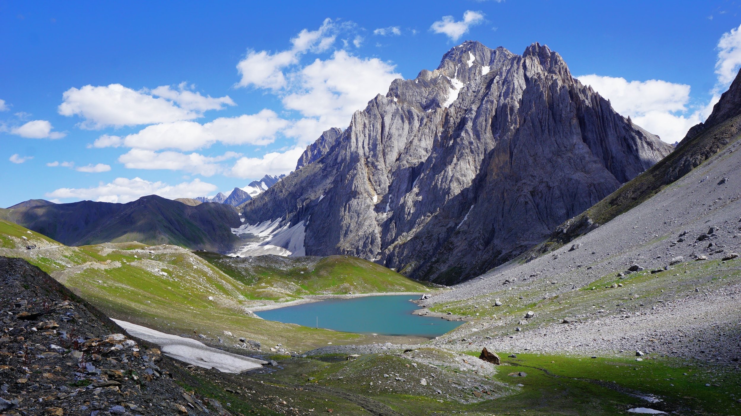
The Kaobal Gali with the Kaobal Sar or Draupadi Kund at its foot
The Great Himalayan Range is a formidable barrier with its monumental Mountains but Humans for centuries have endured to cross this Range to go beyond this Range into Ladakh and Tibet and beyond into Central Asia.
In the Western Himalayas there were a series of Passes which were used the cross this Great Mountain barrier with the main ones starting from the East were the Parang La which connected Ladakh with Spiti, the Baralacha La which connected Lahaul with Ladakh, the Sinku La which connected Lahaul with Zanskar in Ladakh, and then a series of difficult Passes which connected Padar in Kishtwar with Zanskar in Ladakh like the Umas La, Poat La and Hagshu La.
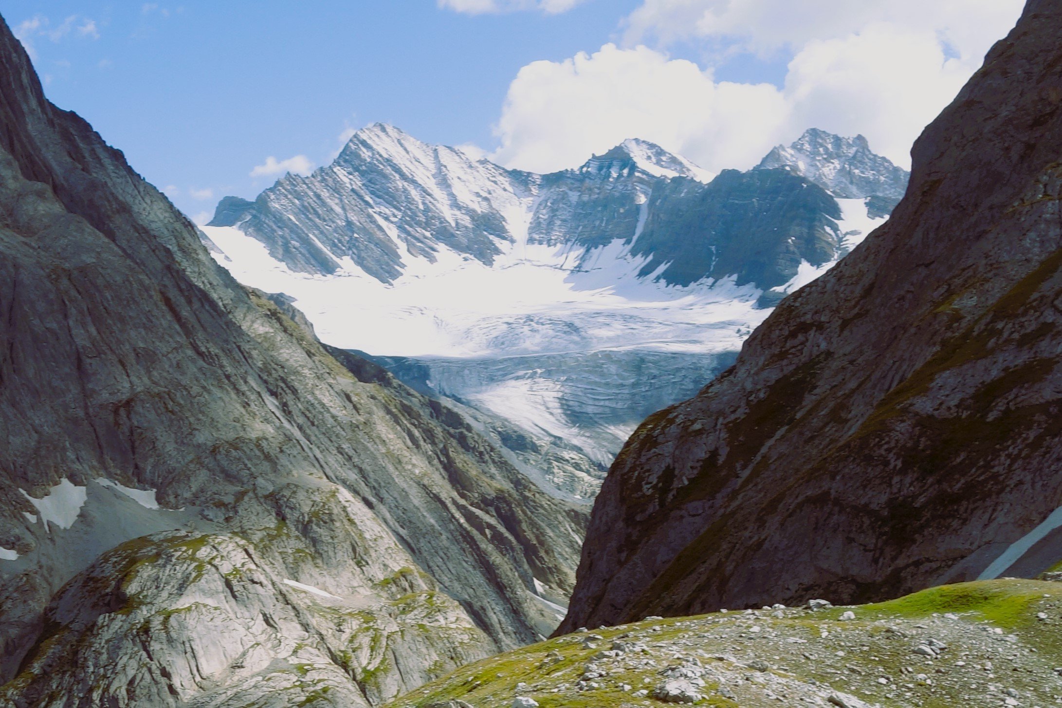
The Kaobal Glacier
Moving further West we again had a series of Passes which connected Warwan in like the Bhotkol Pass / Lonvilad Gali. And then we had the one of the lowest but one of the most notorious Passes over the Great Himalayan Range, the Zoji La. And then the last one is mostly unknown Kaobal Gali which connected the Tulail Valley in Gurez with the Mushkoh Valley in Drass in Ladakh.
The Pass stands at an Elevation of 4167 metres (app 13600 ft) on the main Great Himalayan Range has traditionally connected the Tulail and Gurez Valleys with the Mushkoh Valley in the Drass Region. Interestingly people on both sides of the Pass are Shina and speak Shina language just like their fellow Dardic Shina people in Gilgit. This is a peculiarity as usually when you cross a Pass on the Great Himalayan Range the Culture Language and People change.

Closer View of the Kaobal Sar also known as the Draupadi Kund
Another factor which makes this Pass different in todays context is that it lies at a very sensitive position along the Line of Control and on one side is the Mushkoh Valley which had seen a lot of Military action during the Kargil War. As a result of this Pass is strictly off limits to all Civilians and till date very few Civilians have been allowed to visit this Pass and recently we were among the lucky few who have got access to the Pass.
The Pass itself is set in a spectacular location. The Kaobal Peak and the Kaobal Glacier loom over the Pass and there is a beautiful Alpine Lake at the foot of the Pass called the Kaobal Sar but also more commonly referred to as the Draupadi Kund. The setting of the Lake is so beautiful that you cant help but give it a celestial connection. On one side are the Greens of Tulail and on the other side are the Trans Himalayan browns of Mushkoh in Drass. The Contrast is quite stunning.

The Tulail Gurez side of the Pass
The Pass also marks the Border between the Union Territory of Jammu and Kashmir and Ladakh. At the time we were there we had gone from the Tulail side and had initially planned to descend the other side of the Pass into Drass but that was not to be as there was a Landslide on the other side and the Road was shut for all kinds of traffic. Also the Road onwards from Chakwali Village which is the last Village on the Jammu and Kashmir side is extremely Rough and can only be attempted in clear Weather with proper 4x4 Vehicle.
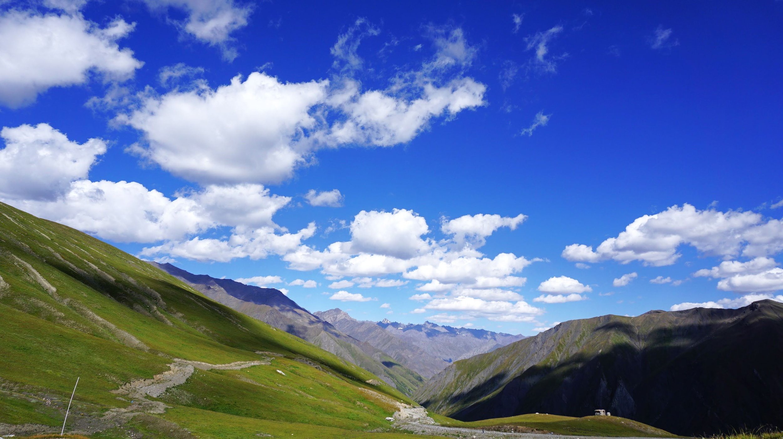
The Drass side of the Pass
There was a recent Report that the Government is planning to open the Road from Gurez to Drass via Kaobal Gali to Tourists at some point in future. So hopefully one day a controlled number of Tourists will get access to this absolute Gem of the Himalayas.

Gurez and Tulail : Then and Now
Gurez is a Valley in the north of Kashmir. It stretches from a short way above Gurais Fort to below Sirdari. The main road, leading from Kashmir into the Valley, crosses the Rajdihgan Pass ; the distance from Bandipura, at the head of the Wular lake, to Kanzalwan, on the left bank of the Kishanganga, being about 25 miles, which is usually divided into three stages. The entrance to the valley is exceedingly picturesque, as the river comes dashing along through a rich meadow, partly covered with lindens, walnut, mud willow trees, while the mountains on either side present nothing but a succession of most abrupt precipices, end alpine ledges, covered with fir trees. It is nowhere above a mile in width, and is surrounded on every side by lofty peaks, chiefly of mountain limestone, rising far above the limit of forest which covers their lower slopes.

The Habba Khatoon Peak with the Kishanganga River in the foreground
Gurais / Gurez
Notes from the Gazetteer of Kashmir and Ladakh of 1890 on Gurez (which was also referred to as Gurais or Gurys) and Tulail (referred to as Tilail or Tlyl ). The Gazetteer was a treasure of vital information on all parts of Kashmir and Ladakh and it also carried detailed Route Maps and Details in the Mountains. Presenting the Notes on both Gurez and Tulail and some Explanatory addendums.
Gurez is a Valley in the north of Kashmir. It stretches from a short way above Gurais Fort to below Sirdari. The main road, leading from Kashmir into the Valley, crosses the Rajdihgan Pass ; the distance from Bandipura, at the head of the Wular lake, to Kanzalwan, on the left bank of the Kishanganga, being about 25 miles, which is usually divided into three stages. The entrance to the valley is exceedingly picturesque, as the river comes dashing along through a rich meadow, partly covered with lindens, walnut, mud willow trees, while the mountains on either side present nothing but a succession of most abrupt precipices, end alpine ledges, covered with fir trees. It is nowhere above a mile in width, and is surrounded on every side by lofty peaks, chiefly of mountain limestone, rising far above the limit of forest which covers their lower slopes.
As the Note states Gurez is located North of the main Kashmir Valley across the Razdan Pass and the Journey now from Srinagar to Dawar which is the main Village in Gurez takes around 6 to 7 Hours. There are a number of Check Posts that you need to Pass while going into Gurez and the details of all Visitors are duly Noted as its a Militarily sensitive Region as the present Line of Control between India and Pakistan runs the Region. The Gurez Valley also now stands divided between the two Countries.

The View of the Mountains North from the Razdan Pass
The south-east end of the valley ie occupied by a superb peak of mountain limestone, rising nearly 5,000 feet above it, and dividing the Tilail valley from that of Gurais; to the north of this mountain is an immense mass of alluvium, which must once have up the entrance to the north-east end of the valley, and through which the Burzil stream .appears to have worn its way. This part of the valley, which lies north-east and south-west, is very narrow at its lower end. It is bounded by precipitous mountains, which are somewhat scantily fringed with forest, the greater lying on the left bank of the stream.
The Peak being referred to in the above Note is the iconic Habba Khatoon Peak which stands over the Village of Dawar in an almost perfect Pyramidical form. The Peak is named after the famous Poetess Habba Khatoon who was from the area and who’s Lovestory with the Chak Sultan of Kashmir is the stuff legends are made of. The Peak lies at the Junction of the Kishenganga with the Burzil stream. Also the extent of Gurez Valley is till the Peak and after the Peak moving along the Kishenganga the Tulail Valley starts.

The Kishanganga Reservoir
The South portion of the valley about the Fort is wide and level, offers a beautiful prospect, the mountains on the South side being clothed with forest, while to the north they rise in precipitous masses of Grey rock with here and there a few pine trees. The scenery in the west portion of the valley between Kanzalwan and Sirdari is likewise very pleasing,the river winding amid dense forests of pine and cedar.
The elevation is between 7,000 and 8,200 feet.
Taking a leftern Route from Kanzalwan takes one towards the Southern part of the Gurez valley which traditionally extended till the Village of Sirdari which now lies on the other side of the Line of Control. Now the last Village on the Indian side is Bagtore and after that the Kishanganga crosses over the Line of Control.

The Village of Dawar, the main Village of the Gurez Valley
The road from Srinagar crosses the Kishanganga at Kanzalwan by a single span bridge about 6 feet wide. The river-bed here is about 70 yards broad. The road lies uniformly along the right bank of the River. It is repaired annually by the Maharajas troop, preparatory to the dispatch of commissariat stores for the frontier garrisons, and is consequently a good and, for the most part, level road, quite practicable for laden animals and mountain artillery.
A regular postal establishment is maintained on this road, but the intervals at which the mails are dispatched are uncertain; during the summer months the dak-runners are stationed in pairs, at 2 kos apart, but in winter, parties of eight or ten men are located in stages of 5 kos; the line is worked as high up as the village of Dudgay by Gurais men, and beyond that point by Tilailis. These men are said to be paid at the rate of R6 (Kashmir currency) per mensem. The path from Gurais to Tilail crosses the Burzil stream by a bridge at, or above, the village of Tsenial and ascends the mountain, the distance from the fort to the Tilail valley being about 13 miles. From Kanzalwan, in a westerly direction, the path lies at first on the left bank of the Kishan' Ganga, crossing the river by the bridge between Bakthaor and Thaobut ; it then lies along the right bank as far as Sirdari, after passing which village it becomes impracticable,
Now the Road is well Motorable all the way to the extreme end of Tulail on the other side. In the earlier days begore the era of Motorcars there was a System of Dak Runners who used to deliver letters up and down between Gurais and the main Kashmir Valley. These Dak Runners were placed at regular intervals and their Job was just that, Run to the next Dak Runner station and deliver the Messages.

The Kishanganga River flowing through the Gorge which separates Gurez from Tulail
The inhabitants dress differently to the Kashmiris ; they invariably wear very loose puttu pajamas coming down as low as the calf, and a kamarband outside the choga or coat. They also wear the Dard cap in place of a pagri. In the village of Gurais itself there is a mixture of Dards and Kashmiris.
The inhabitants of Gurez are mostly Shina people and speak primarily the Shina language though many of them due to the linkage with Kashmir are fluent in Kashmiri as well. Nowadays their dressing is no different than in Kashmir.
Their houses are built of unhewn timber, dovetailed at the corner, the interstices being plastered with mud ; they are built as close as possible to each other for the sake of warmth and communication, and are usually disposed in squares facing inwards, a small aperture serving the triple purpose of door, window, and chimney. In some of the villages in the western portion of the valley, they are beginning to build houses of a more commodious pattern, copied from those in Kashmir. There is a great want of trees and shade about the villages, which is explained by the statement that the heavy load of snow by which they are weighed down in winter destroys them. The villages in the Gurais valley are Walpur (twenty-five houses), Khandial (thirty houses), Murkot (forty houses) and Digar (twenty eight Houses)
There are still many Houses made in the traditional way out of timber though slowly and steadily these are being replaced with Concrete and Brick structures with Tin Roofing as is prevalent in most of the Kashmir Valley.

The First Views of the Gurez Valley after descending from the Razdan Pass
The climate of the Gurais Valley ia very rigorous, and the harvest scanty and uncertain; seasons of dearth, caused either by want of sun or rain are not infrequent, but flocks and herds abound, and from their profits the inhabitants are enabled to import grain in seasons of scarcity. '
Gurez has a Cold Climate and experiences heavy Snowfall in the Winters as a result of which it remains cut-off for 4 to 5 Months every year from the main Kashmir Valley. Also many of the local Gurezis now have Property in Bandipura and other parts of the Kashmir Valley and they prefer spending the Winters in these places instead of being stuck in Gurez. It needs to be Noted that Gurez has no regular Electricity supply though they get some Supply in the Evenings through Army run Gensets.
The only crops are millet, buckwheat, and peas; and of these there is but one harvest in the year. Besides willows, a few crab-apples and pears are met with, and in the south and west portions of the valley walnut trees of scant dimensions are found, but the fruit is said to be hard and small; in the west also strawberries are usually plentiful, and raspberries and mild currants are not uncommon. The aromatic plant called burrish is found in great quantities on the slopes of the mountains on the north side of the valley. It is of a whitish-green colour, very similar in appearance to the tetwan or wormwood, but rather larger; its roots, ,which are large and fibrous, are extensively used as fuel at elevations where wood is not procurable. Rice will not ripen. Very good ponies can be obtained at Gurais. The valley affords splendid pasturage.

The Burzil River which joins the Kishanganga at the foot of the Habba Khatoon Peak
Gurais was originally governed by a Nawab, tributary to the Gaor Aman Rajas of Gilgit ; the present Nawab, by name Malik Wafadar, is the eighth or ninth of his family, who has borne the title in regular succession. His father, Malik Dilawar, having been invited to Srinagar by Shaikh Ghulam Maihidhin, the Governor under the Sikh rule, was treacherously thrown into prison, from which be managed to effect his escape after a captivity of three years; he retired to the mountains north of the Kishanganga river, where he collected his followers, but the Sikh force opposed to him being vastly superior in numbers, he thought it prudent when the flood subsided, rendering the passage of the river feasible, to withdraw to Gilgit, where he was eventually treacherously murdered. His son the present Nawab, was, at the time the events occurred, a hostage in the hands of Colonel Mia Singh, who had succeeded to the governorship of Kashmir. On attaining man's estate he took service under the Maharaja, and is now Thanadar of the Valley his forefathers ruled. Malik Wafadar is an intelligent man of pleasing address; he has a son, Baktawar, a child of about five years of age.

Gurais is, most probably, the Urasa of the Raja Taringini.
During the winter months the road from Kanzalwan to Gurais is extremely difficult and dangerous for the first 4 miles, as the sides of the mountain along the face of which the road is made are extremely steep, and the Snow lying at the slope of the ground makes the difficulty of cutting a track through it very.great.
(Vigne-Drew-Barrow-Manifold.)
Tilail / Tulail

TILAIL-Lat. 34' 30' and 34' 35'. Long. 75' and 7S0 %Of. Elev. The name of a long and narrow valley lying to the north-east of Kashmir, which is traversed by the incipient Kishan Ganga.
It in nowhere more than a mile in width, and is encompassed by lofty mountains which exhibit a like peculiarity to those in Kashmir, inasmuch as the elopes having a southern aspect, are uniformly bare of forest, and are here clothed with grass or masses of prangos, while on the south side there is no want of timber, except towards the west end of the valley between the villages of Purana Tilail and Zergay, where the mountains are too precipitous to give footing to any vegetation, excepting here and there a few pine trees which cling to the bare face of the rock.
The general appearance of the valley presenta a great contrast to Kashmir, as the sylvan beauty of the earthly paradise is entirely wanting, and the mountains that enclose it are not bold enough in outline to compensate by the wild grandeur of their scenery.

In the upper portion of the valley the fall is considerable, and the Kishan Ganga flows a turbid and impetuous torrent, which finds an exit at the western extremity through a narrow gorge which only gives passage to the river; and the main path traversing the valley, which has hitherto followed the right bank of the stream, crosses the range of mountains to the north-west into Gurais.
This path forms the high road between Gurais and Dras, and is that by which the Tilail valley is usually entered. It may, however, be reached more directly from Kashmir by a path which ascends from Wangat to Gangarbal ; there are also two roads from Sonamarg in the Sind valley ; the one known as the Nikka Nai road lies by the Krishun Sar and Vishun Sar lakes, the other, called Bara Nai, follows the course of the Raman stream. From the Tilail valley, the Shingo river and Deosai plains, and Skardu, may, it is said, be reached at certain seasons of the year by a path which ascends the Grati Nar.

Traditional Wooden Structures in Gurez and Tulail
The inhabitants of this valley differ somewhat in appearance from those of Kashmir, their features approaching the Mongolian type. Their dress is much the same, except that the women wear an exaggerated copy of the common red head-dress. The Dard language is universally spoken.
The Valley is sparsely populated; the houses are all huddled together in the village or ranged in a square enclosing a courtyard, in which the cattle are herded ; this disposition is adopted for the sake of warmth and communication during the long and rigorous winter. The dwellings, which are frequently double-storied, are constructed of unhewn timbers dovetailed at the corners, and having the interstices plastered with mud. They have no chimneys, and are all very dirty. The villages, with scarcely an exception, are entirely bare of trees, and have but little vegetation of any description about them ; barley, peas, trumba, and pinga are the only products of theValley ; rice is of course unknown at this elevation.

The harvests are not abundant, and are scarcely in excess of the requirements of the inhabitants.
It is the custom to bury the grain in caches ; this appears to be a remnant of the precautions which were taken during the old marauding days, but the habit is still adhered to, owing to the want of proper vessels to contain the grain, and of space in the homes. in which to store it, The holes are usually constructed in some dry spot near the village ; they are called dis in the Dard language and sus in Kashmiri. The grain is carefully fully wrapped in birch bark before being consigned to these receptacles; the hole is then filled in with stones, above which a layer of earth is spread. When well dried and securely packed, the grain is said to keep good for six months, but it is not usually preserved so long.

The inhabitants of Tilail seem to be extremely fond of fruit, of which the only indigenous varieties are the strawberry and a few wild para, but a great deal is imported from Skardu, principally dried mulberries of a very inferior description, and a small apricot called but but sair by the Kashmiris; for these luxuries the people barter the woollen stuffs they have manufactured during the winter. Ths mild flowers and grasses common to the British Isles are found throughout the valley, and roses in Tilail are scarcely less abundant than those of Kashmir, exhibiting, if anything, more beautiful tints.
Though extremely poor, the Tilailis pay 60 rupees (chilki) at their marriages ; this sum is paid by the bridegroom to the bride's family either before or on the day of marriage. Flocks of sheep constitute their most valuable possession ; the Kashrniri butchers buy much of their meat in this valley, paying for the animals at the rate of 14 or 15 rupee (chilki) a kharwa taken at an estimation.

The government tax is calculated at half the produce of the lands and is paid either in money or in kind. Vigne states that when Tillail was subject to Abmad Shah, the Gyalpo or Raja of Skardu, he, instead taking a tribute of money, contented himself with receiving annually a present of a sheep and a coil of rope from each house.
The government likewise levies a duty of an anna in the rupee on all articles exported from Tilail to Kashmir.

The administration of justice is provided for in the following manner: Small cases are decided by the village mokaddams ; more important matters are referred to the thanadar, who resides in Badgam, from whom appeal lies to the governor of Kashmir.
It is said that on all suits having a pecuniary value the Government levies a duty equal to one-fourth of the value in dispute.
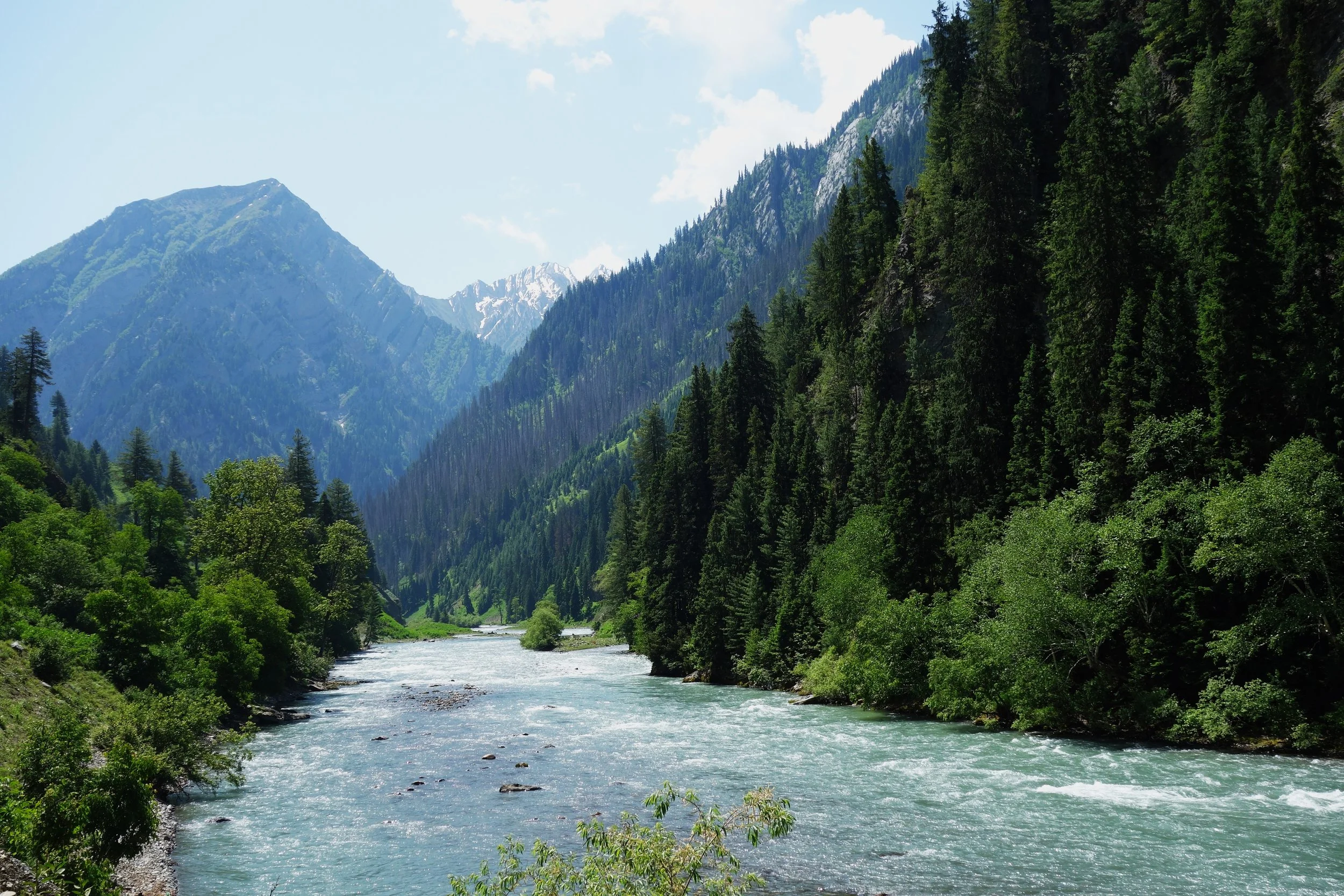
The Border River : Kishanganga aka Neelam
The Kishanganga is the main River flowing through the enchanting Gurez Valley rising in the Kishansar Lake (which is a part of the Group of Lakes commonly referred to as the Great Lakes) and flowing through some great Mountain scenery until its confluence with the Jhelum around Muzaffarabad in Pakistani held Kashmir. The River was renamed as the Neelam in Pakistan in the 1950s. Old Maps and Books still refer to it as the Kishanganga.

The Kishanganga is the main River flowing through the enchanting Gurez Valley rising in the Kishansar Lake (which is a part of the Group of Lakes commonly referred to as the Great Lakes) and flowing through some great Mountain scenery until its confluence with the Jhelum around Muzaffarabad in Pakistani held Kashmir. The River was renamed as the Neelam in Pakistan in the 1950s. Old Maps and Books still refer to it as the Kishanganga.
The River as mentioned originates at the Kishansar Lake which lies in the Mountains above Sonamarg and is joined by the Raman Sind and then it flows in a Western direction and enters Gurez where its joined by the Burzil Nallah which comes down from the direction of the Burzil Pass which was the Pass on the Trade Route which connected Kashmir with Astore and Gilgit. Of course now the Route is not used anymore and Burzil Pass is on the Pakistani side.

The Gazzetteer describes the tributaries as such : The principal tributaries of the KishanGanga are the Raman Sind has been mentioned as joining it from the south side of the Tilai Valley; the Burzil stream, which flows through the north~east portion of the Gurais Valley ; the Matsil a considerable stream which drains the mountainous tract to the North of the Kashmir valley ; the Kel dara, which drains a similar district on the right bank of the Kishanganga, South of Chilas and Astor, and flows in nearly opposite the Matsil. The natives describe the Kel river as running into KishanGanga at right angles, with such force and volume as to arrest its course, causing a large whirlpool just above the junction. At. the north end of the' Drawar district, the Kishanganga is joined on the right bank, nearly opposite to Sharidi, by the Kankatori or Samgan, and in the middle of the same district, also on the right bank, by the Jagran river, receiving the united waters of the Shamahabari and Kazi Nag streams, the drainage of the Karnao valley, by its left bank at the village of Tetwal. Besides the tributaries above enumerated, the Kishanganga receives contributions from innumerable streams and torrents.
Sadly today the beautiful Geography stands defeated by the vagaries of Politics. Of its app 250 kms length, app 50 kms lies on the Indian side while the rest is either the border or on the other side. The Valleys on both sides of the River are incredibly beautiful but in most places you can see across the River but never can go across. It is the border River but in Geographic terms as well the Kishanganga River marked the limit of the Kashmir Valley in a broader sense. Its point of origin is not very far from the point Kashmir ends and Ladakh starts. And the point where it merges with the Jehlum around Muzzafarabad is the edge of Kashmir where traditionally Kashmir meets the Potohar Plateau and the Plains of the Punjab.

Historically as well the Kishanganga has made its mark. The area drained by the Kishanganga was referred to as the Shardadesh which is in reference to ancient Sharda University or the Sharda Peeth which was a great centre of Learning and one of the most revered places for the Kashmiris. It was referred to as one of the most revered Holy Places in India by Al Beruni as well.
Also it was along the Kishanganga ran the Trade Route which connected Kashmir with Astore and Gilgit. One had to cross the Rajdhanigan Pass or the Tragbal Pass to enter Gurez. Then you went upstream the Kishanganga to the Tulail Valley where you followed the Burzil Nallah up the Burzil Pass and where there on descend into Astore and further into Gilgit. There would have been few Trade Routes which could have rivalled this one in beauty. Of course many like to give it the fancy moniker of “Silk Route” but then any Route which crossed the Himalayas and connected with Central Asia and in turn with China was called the Silk Route. But after the events of 1947 Trade along this Route stopped and the Route lost its relevance.

From the Indian side you can of course see the River in its glory in Gurez and in the areas along the LoC like Karnah, Titwal and Machil. These areas have recently been opened for Tourists starting with Gurez where a few Tourists are going nowadays though the Government is now promoting Tourism in other areas as well along this River.
And the Indian Government is building a Dam on the Kishanganga and work is already underway and it has created a large Reservoir near the Village of Dawar and the waters would be diverted via a Tunnel towards Bandipora and into the Wular Lake. Of course the Volume of water now after the Dam will become lesser and the difference between the River before the Dawar and after the Dam is apparent.
The Border River now controversially stands tamed.
Kiki’s Blog
Stories from the Himalayas







Five years ago the Galwan Valley was in the News for the wrong reasons after a deadly clash between the Indian and Chinese Armies in the Valley located in Ladakh lead to many deaths on the contentious Border between the two countries in wake of continued Chinese intrusions into Indian territory.
This area along the Shyok River, of which the Galwan Nallah or the Galwan River which forms the Galwan Valley has been off limits to Civilians since long but now the Indian Government has decided to open up the area for Civilians and we were amongst the First Civilians to venture into this beautifully desolate part of the Eastern Karakorams in Ladakh. Earlier Civilians could only venture upto the Village of Shyok from where the Shyok River takes a U turn and flows in a Northerly direction.