
The Tiger Leaping Rock
The Tiger Leaping Rock in the middle of the Tiger Leaping Gorge, which is one of the deepest River Gorges in the world in Yunnan, forces the Jinsha or the Upper Yangtze through a narrow channel just a few meters wide. The result of a River which is almost a km wide being forced through a Channel just a few meters wide is indeed spectacular.
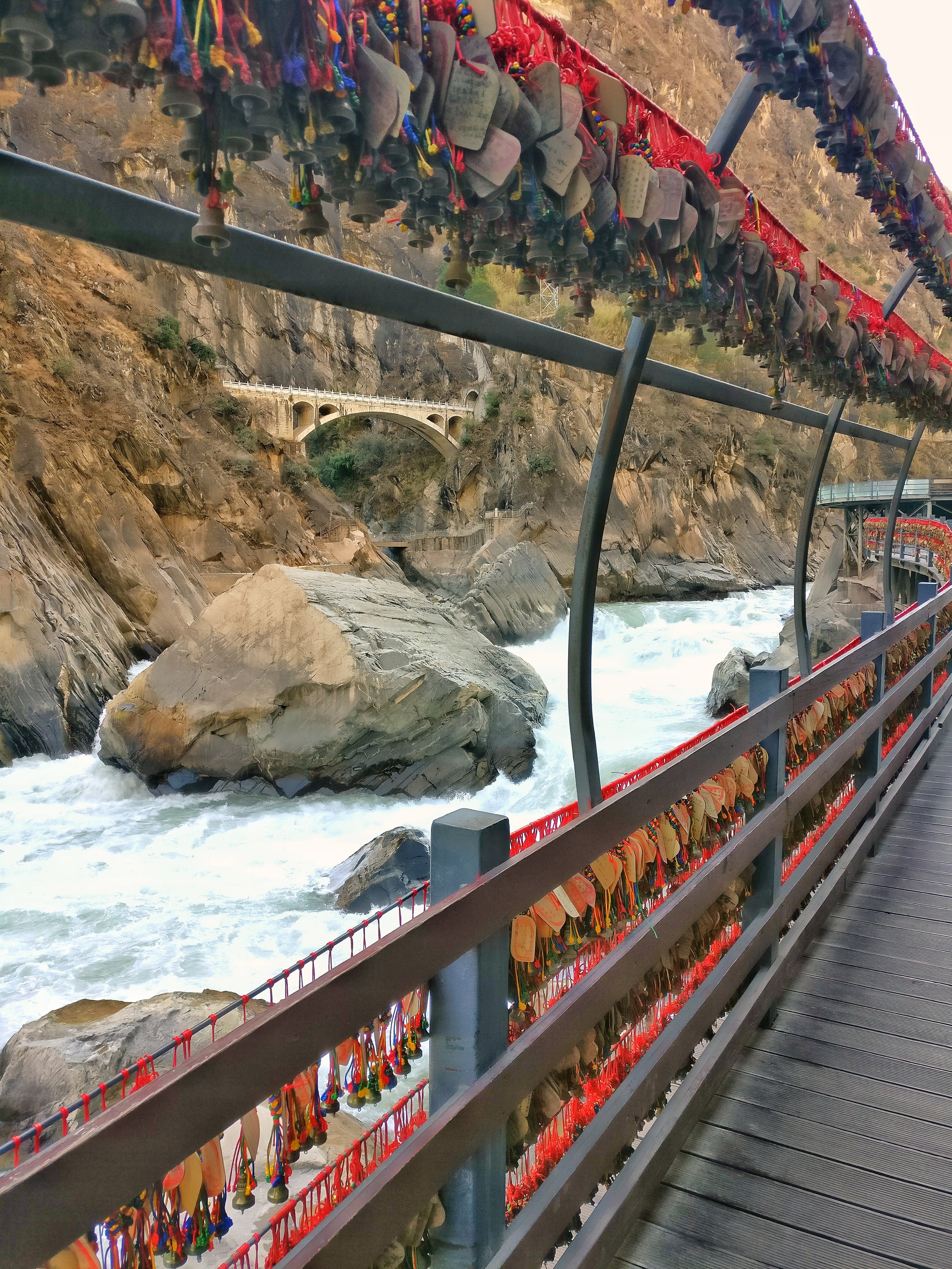
The Tiger Leaping Rock in the Middle of the Gorge, Tiger Leaping Gorge, Yunnan
The Tiger Leaping Rock
I first heard of the Tiger Leaping Gorge while watching Palin's Himalayas. The Tiger Leaping Gorge was the Easternmost place that Palin visited in the epic Journey.
This is the legendary Tiger Leaping Rock right in the middle of the Tiger Leaping Gorge. This rock forces the Jinsha or the Upper Yangtze through a 10 meter wide corridor. It was dry season when I took this pic but in the rainy season it's a sight to behold and it seems the whole earth trembles due to the force of the water as it squeezes through this narrow corridor.
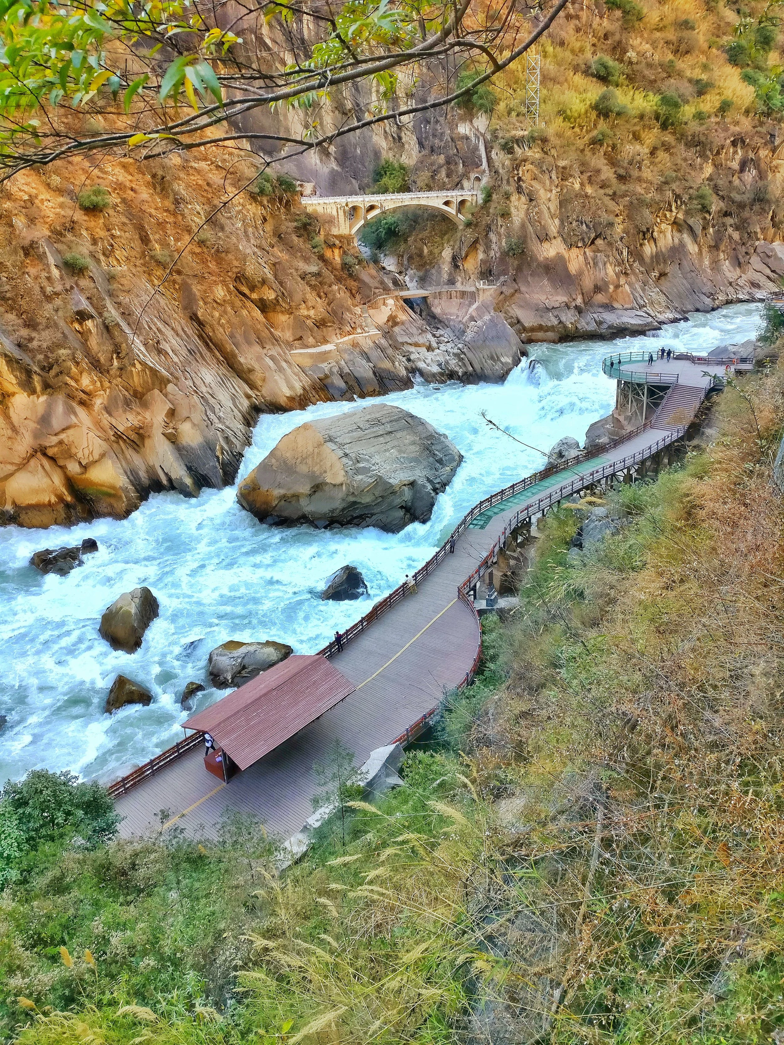
A view from above of the Tiger Leaping Rock with the viewing Platform, Tiger Leaping Gorge, Yunnan
In the rainy season the whole 13 meter rock rumbles under the pressure of all the water furiously trying to make it's way down. It's really a spectacle when a River more than half a mile wide if forced through a channel just a few meters wide thanks to the rock.
As per the story told by Palin the Gorge got it's name from the story of Tiger which jumped across the Yangtze while being chased by a hunter. The Tiger jumped into this rock and then across the the River to the other side. Hence the name Tiger Leaping Gorge.

The point at which the Jinsha or the Upper Yangtze enters the Tiger Leaping Gorge under the shadow of the Haba Snow Mountain, Tiger Leaping Gorge, Yunnan
And on the other side are Peaks which have a vertical elevation of almost 4000 m from the level at which the water flows. To put it into perspective this Canyon is more than twice the height of the Grand Canyon in the US. The level of the River flow is at an altitude of around 1800 m and its surrounded by Peaks touching almost 6000 m. These are the Hengduan Mountains which form the Eastern edge of the Tibetan Plateau.
Those little bells with the red tags are good luck charms that the local Naxi people use to tie to honor the spirits of their ancestors.
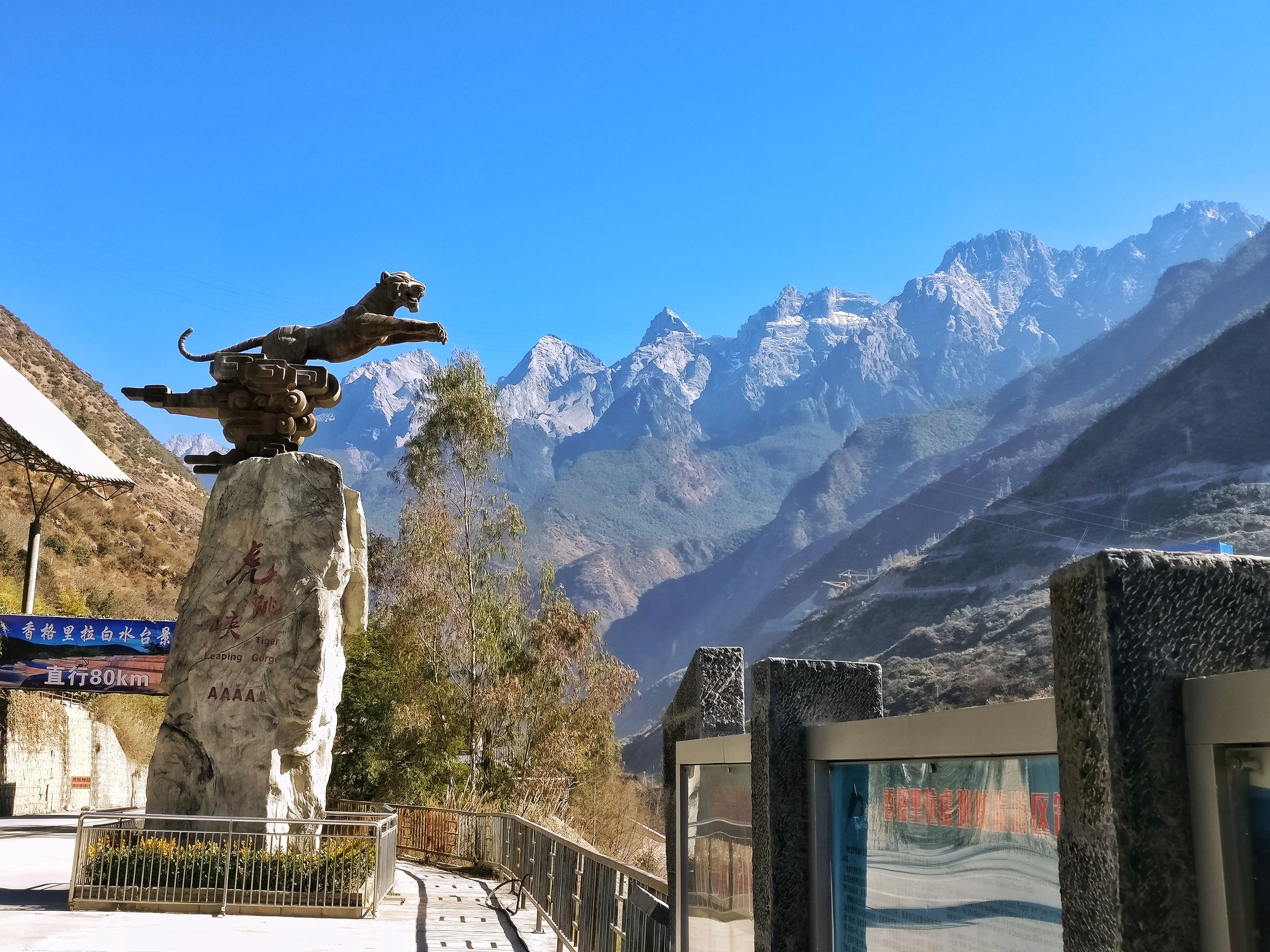
The statue of the Leaping Tiger, Tiger Leaping Gorge, Yunnan
This place, if you understand the significance and the geography that went into it makes the hair stand on the back of your neck. Its where Tibet meets South Asia and China. No wonder it's a UNESCO designated World Heritage Site under the Three Parallel Rivers of Yunnan Protected Area. The three of the mightiest rivers of Asia, the Yangtze, the Salween and the Mekong cutting across the jagged Peaks of the Hengduan Mountains around this area.
This place was opened to foreigners only in the 1990's and now attracts Mountain lovers from all over the World who want to witness the epic scenery that the place offers.

Spectacular.
Pic from January 2017. The Tiger Leaping Gorge, Deqen Tibetan Autonomous Prefecture, Western Yunnan, China
The Great First Bend of the Yangtze River
The Great First Bend of the River Yangtze is situated near the town of Shigu in North Western Yunnan. It is the point at which the Yangtze (called the Jinsha at this stage) takes a u turn and heads north and goes onto become the heart and soul of the Chinese Civilization. And it all starts at this bend.

The Great First Bend of the River Yangtze
The Great Bend of the Yangtze at Shigu : This is the famous Great Bend of the Yangtze at Shigu. At first appearance its just a River bend but if you know enough then you would be awed in the fact how this place has shaped human history. The beautiful Jinsha or the Upper Yangtze just after it takes that famous first bend and turns 180 degrees and starts flowing North.

Of all the Great Rivers rising in the Himalayas and Trans Himalayas, besides the one we are familiar with ie the Indus, the Ganga and the Brahmaputra, the others like the Salween, the Irrawady, the Mekong and the Yangtze all meet the Oceans to the South of the Himalayas.

All except one. The mighty Yangtze. It's at this point precisely that the Yangtze decides to do a u turn and go North. All the other parallel Rivers in this area, the Salween, the Irrawady and the Mekong go South. Due to some geological phenomenon connected with the tectonic events which took place when the Indian plate collided with the Eurasian plate and this was the meeting point. Of all the great rivers rising in the Great Himalaya system the Yangtze is the only one which meets the Ocean to the North of the Himalaya.
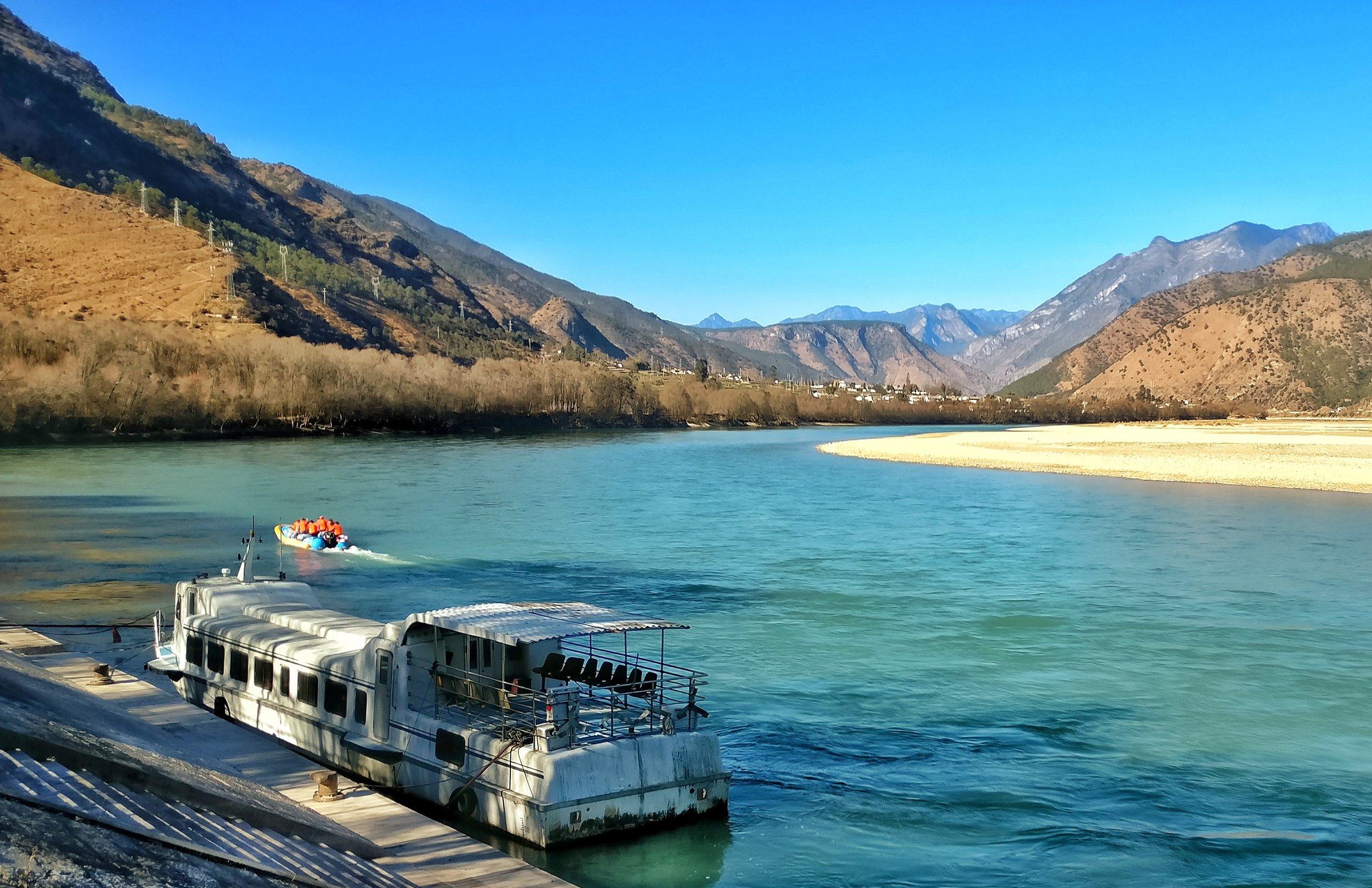
From Michael Palin's Himalayas:
"A thousand miles of tumbling water heading for Vietnam and the Gulf of Tonkin is, within a few hundred yards, spun round to the north and, though it twists and turns and tries to find its way south again, it is now effectively a Chinese river, heading east to create the enormous bowl of fertility and prosperity that is the heart and soul of the Middle Kingdom".

The Yangtze Rive Basin is home to 500 million people or a third of the the population of China. Both historically and today, it is responsible for much of the wildlife, culture and economic wellbeing of China.

To stand at the first bend is quite a mind numbing affair if you understand how this simple turn of a river has effected the historyof Humankind. The Himalaya effects human history in more ways than we can ever comprehend.

Kiki’s Blog
Stories from the Himalayas








Five years ago the Galwan Valley was in the News for the wrong reasons after a deadly clash between the Indian and Chinese Armies in the Valley located in Ladakh lead to many deaths on the contentious Border between the two countries in wake of continued Chinese intrusions into Indian territory.
This area along the Shyok River, of which the Galwan Nallah or the Galwan River which forms the Galwan Valley has been off limits to Civilians since long but now the Indian Government has decided to open up the area for Civilians and we were amongst the First Civilians to venture into this beautifully desolate part of the Eastern Karakorams in Ladakh. Earlier Civilians could only venture upto the Village of Shyok from where the Shyok River takes a U turn and flows in a Northerly direction.