A Photo Gallery of Keran along the Line of Control in Jammu and Kashmir
Read MoreKeran : Where a River Runs Through
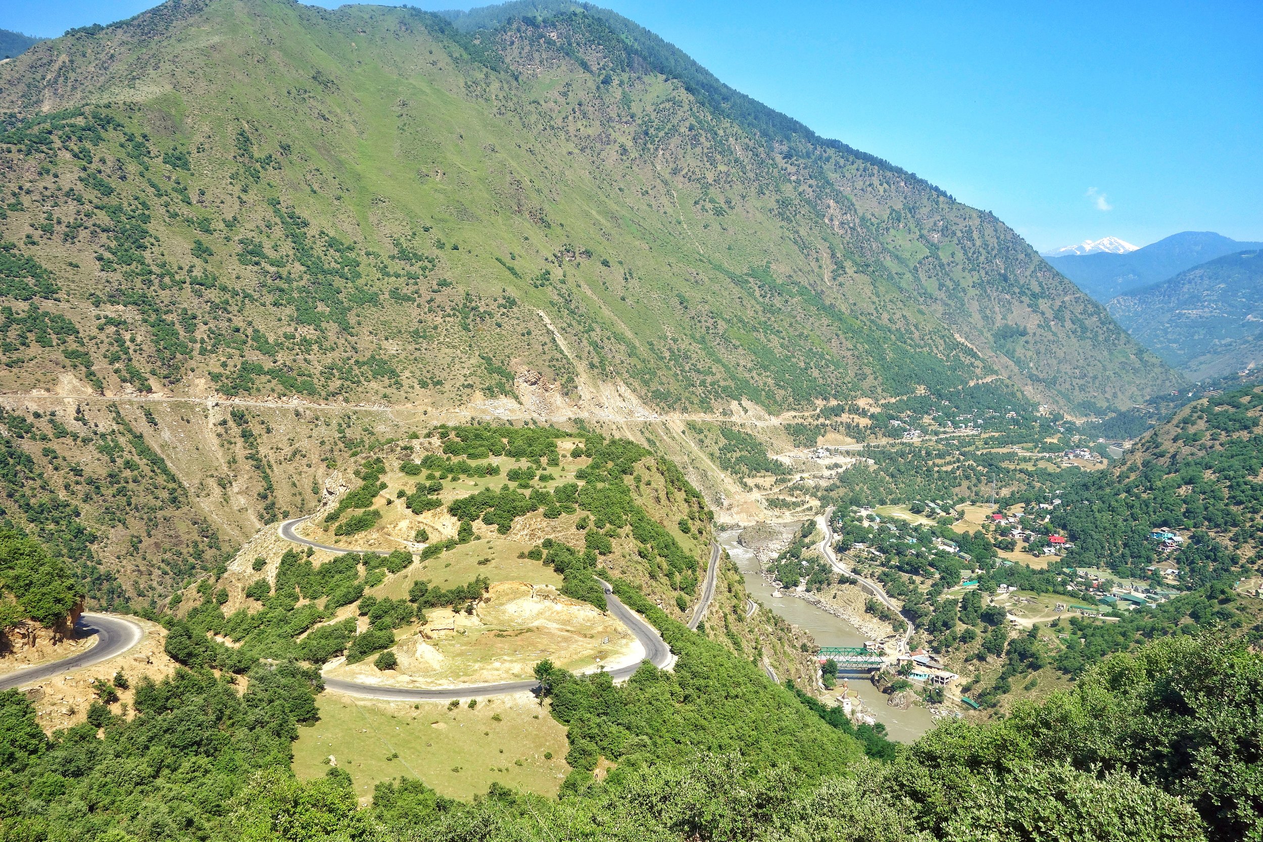
Himalayan Geography
A Photo Gallery of Keran along the Line of Control in Jammu and Kashmir
Read More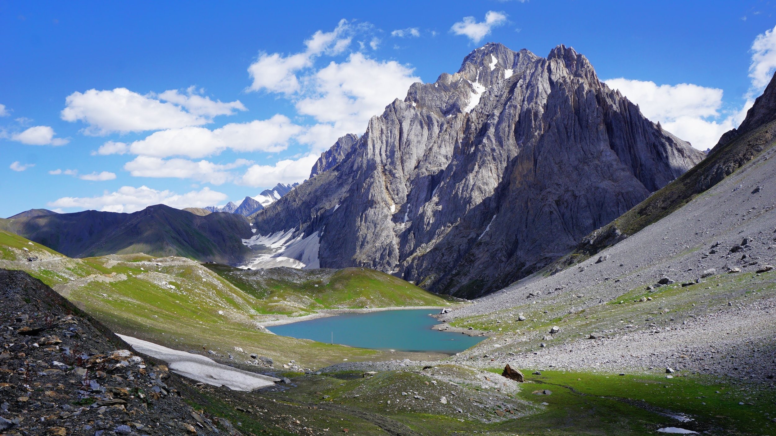
The Kaobal Gali with the Kaobal Sar or Draupadi Kund at its foot
The Kaobal Gali stands at an Elevation of 4167 metres (app 13600 ft) on the main Great Himalayan Range has traditionally connected the Tulail and Gurez Valleys with the Mushkoh Valley in the Drass Region. Interestingly people on both sides of the Pass are Shina and speak Shina language just like their fellow Dardic Shina people in Gilgit. This is a peculiarity as usually when you cross a Pass on the Great Himalayan Range the Culture Language and People change.
Read More
The Complete Beirut to Beijing Route
Once the Expedition commenced there arose new Challenges. Though the Afghanistan Civil War had ended, the situation in North Afghanistan and Routes into the Pamirs were far from being safe for the Expedition. So another detour was decided. It was decided that the Expedition would now crossover into India from Afghanistan and then they would take the Mountain track that connected Srinagar in Kashmir with Yarkand / Tashkurgan in Chinese Turkestan or what is now Xinjiang
Read More
The Kazinag Mountains as seen from the Road to Uri
For the ones unaware of Uri it lies along the Jhelum Gorge as it swirls out of the Kashmir Valley and enters PoK and Uri is the last major Town before the LoC which lies around a dozen kms ahead of Uri. Ahead of Uri lies the Village of Salamabad which was the point for the Cross Border trade and Trucks from the other side of the LoC used to visit in better times. And then of course there is the Kaman Seu which is the LoC between the 2 Countries.
Read More
The Gazetteer of Kashmir and Ladakh of 1890 is a treasure trove of information regarding various aspects in the state. This is the small little Chapter in the Gazetteer which talks of Gold prospecting in the Riyasat. And of course it talks of some Gold mining in Baltistan.
Read MoreThe Indus and the Ganges are the two great Rivers which originate in the Himalayas/ Trans-Himalayas and all the Rivers of the Western and Central Himalayas drain into either of these two Rivers. The Indo - Gangetic Plain as the combined basin of these two Rivers is called sustains well over a Billion people and is one of the most thickly populated Regions on the Planet. The story of the Indus and the Ganga is the story of India in historical, social and religious contexts.
Read More
One of the most interesting thing about the Himalayas is how the Rivers interact with the Range and how the River Basins work. Since none of us is taught this in school in the Geography class the way one can study this fascinating aspect is to study Maps. Not the Maps of the new but the old Maps made by the Geological Surveys and the Royal Geographic Society Maps. The kind of detailing in these Maps is amazing when we keep in mind the fact that it was all done by boots on the Ground. No Aerial or Satellite Cartography.
Read More
The Brahmaputra is one of the great Rivers of the World and its named after the Hindu God Brahma. The Son of Brahma actually. The River originates close to the Mansrover Lake and makes it’s journey across the Tibetan Plateau and then it turns around the Himalayas and finally arrives on the plains of Assam. Its course from the Tibetan Plateau to the plains of Assam was for years an endearing mystery.
Read More
The Ancient Routes which connected Pangi Valley in Chamba with Zanskar in Ladakh : Excerpts from Guide to Dalhousie Chamba and the Inner Mountains Between Shimla and Kashmir (1923)
Read More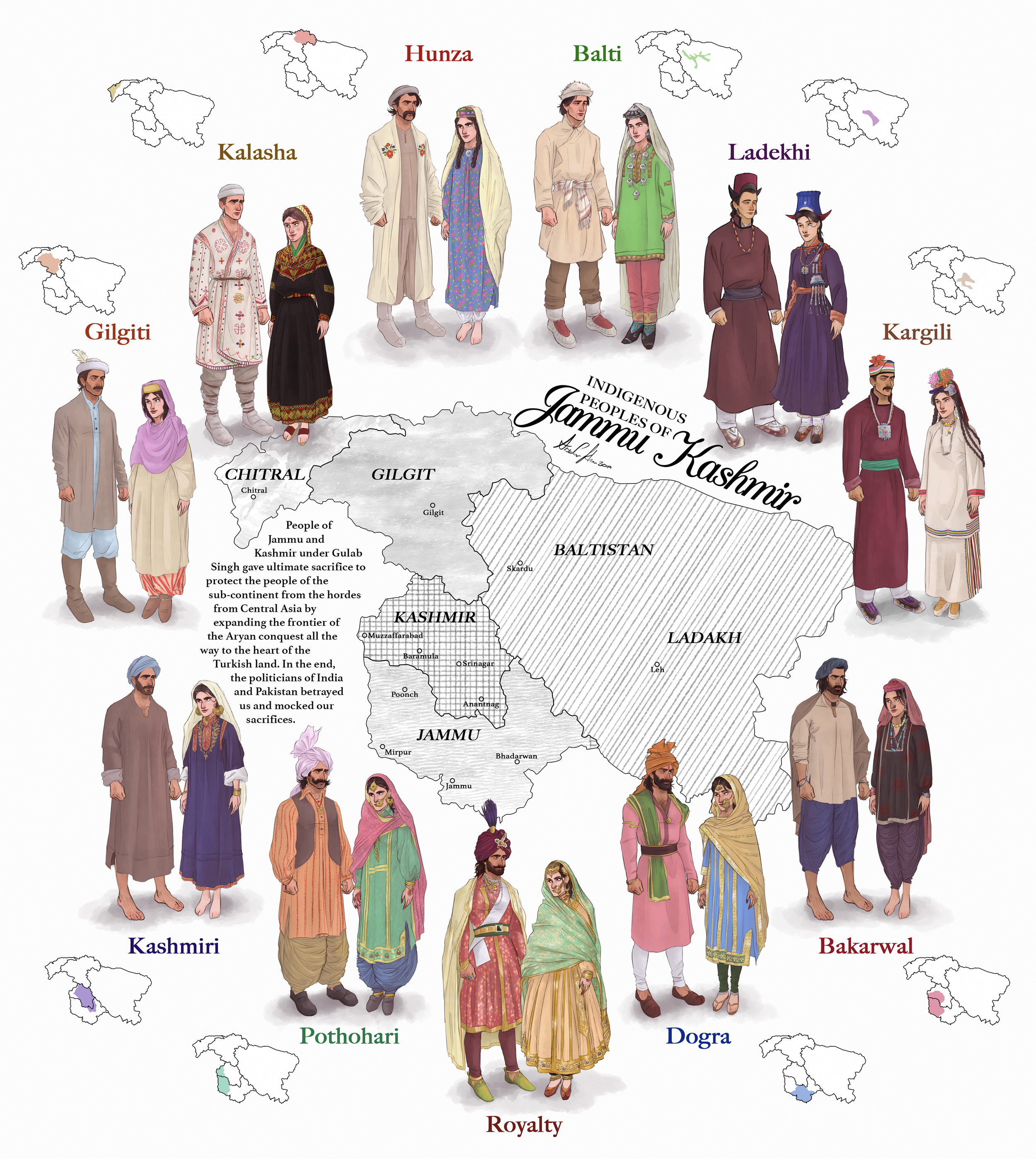
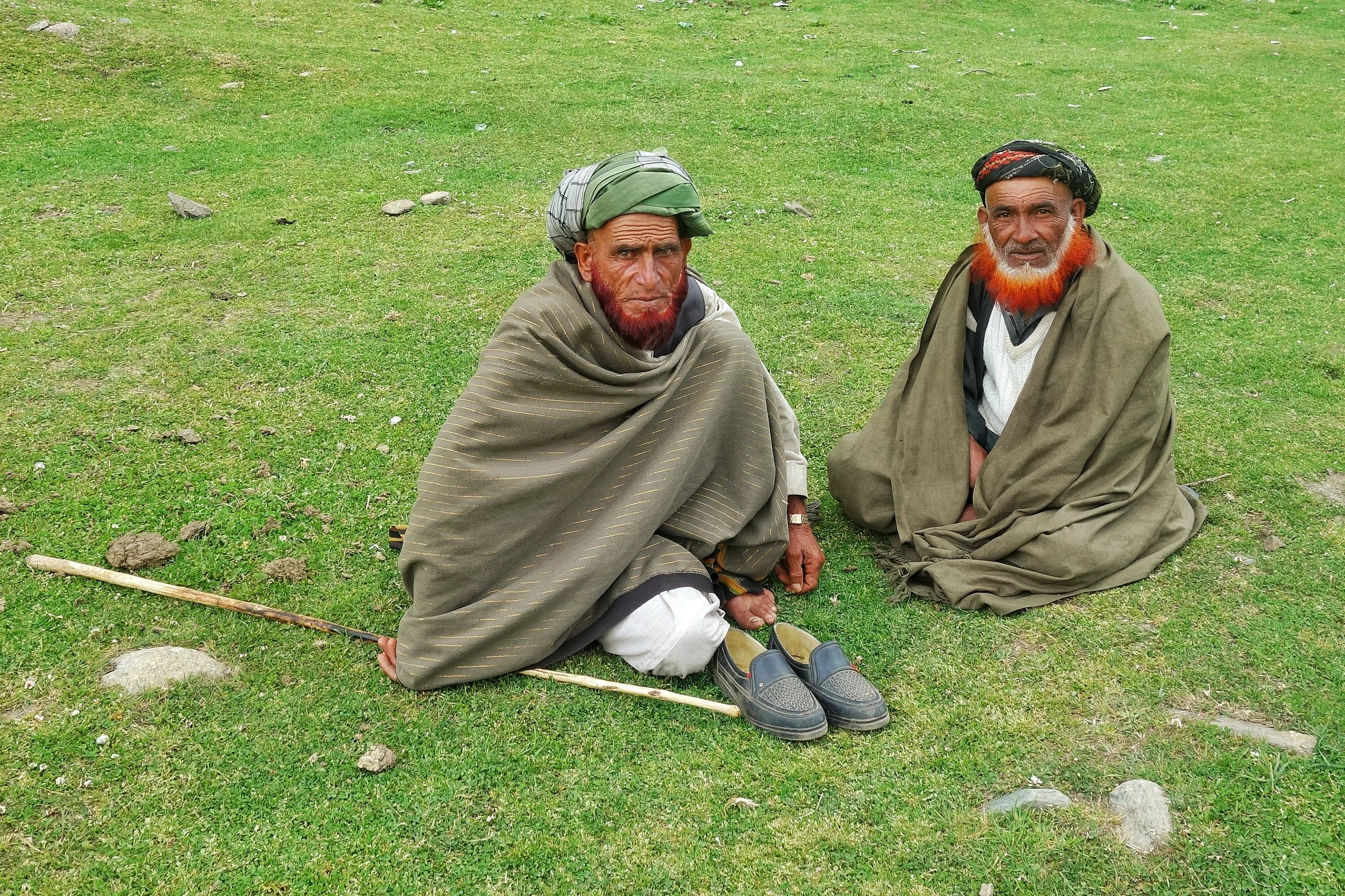
The erstwhile State of Jammu and Kashmir was one of the most diverse State in the country in Ethnic, Religious and Lingual dimensions. The main "People" of Jammu and Kashmir and its different regions are briefly described in this Article.
Read More
There is a place called Pogal and Paristan/ sometimes written as Peristan as well. Pogal and Peristan are both Rivers and they together give their name to this area. As per some Paristan name is derived from the word “Pari” for fairy and hence it meant the Land of Fairies and it is really that beautiful from what I have read and seen. Sargali, Sunseri, GaganTop, Nandigarh, Hans Raj Peak, Sharvadhar and the beautiful Gugli Meadows are said to be some of the places worth visiting here. And the language spoken here is a seperate one called the Pogali which is considered close to Kishtwari and Kashmiri. But the fact that they have developed a dialect of their own speaks about the separate character of this Region.
Read More
The state of Jammu and Kashmir is made up of a number of geographically separate Regions divided by Ranges of the Himalaya. Its home to a diverse variety of Ethnicity, Cultures, Religions and of course Languages and Dialects. This article looks at the language diversity in the state of Jammu and Kashmir.
Read MoreIve had a childhood fascination for the Gujjars and especially the Bakarwals while growing up in Kashmir. Well they are almost the same thing except that nowadays the ones who live in fixed locations are called Gujjars while the ones which move up and down with their herds are referred to as the Bakarwals. Also as the name suggests it comes from the word Bakri, so a Bakarwal is also a keeper of the Sheep. Especially in the State of Jammu and Kashmir. There isnt a single Region in this vast State which is not familiar with the congenial Bakarwals who flocked to the highlands with their Goat/ Sheep / Buffaloes / Horses/ Mules which they term as “Maal” as in “Goods”. That is the commodity that they deal in and a Bakarwal is judged by the size of his Herd. And then there were my favourite part of a Bakarwal entourage, the Shepherd Dogs also called by the same name Bakarwal or Bakarwali.
The Moon River or the Chandrabhaga or the Chenab is a River that flows through some of the most rugged parts of the Himalayas starting its journey in the Lahaul Valley and making its way through Pangi Valley and into Padar Valley and Kishtwar in Jammu and Kashmir. It is a River of many legends and we try and Map its jurney from the Chandrabhaga to the Chenab.
Read More
The Pass of Shiva as it was originally called is one of the main Passes used since historical times and it connected Kashmir with Ladakh. A fascinating insight into the Pass of Shiva or the Sheoji Pass. Today this name has transformed into what we call the Zoji La.
Read More
The Rivers and the Himalayas and the even the Mountain Ranges beyond it are always interacting in very interesting ways. In this article we see how the River Basins of the Indus, Ganges and Satluj and the Mountains interact and in some cases the River Basins extend beyond the Ranges themselves.
Read More
The mighty Nun Peak of the Great Himalayan Range at 7135 m its the highest Himalayan Peak in Jammu ans Kashmir (not including the areas under occupation). On the side is the Saddle Peak.
The Mountain Geography of Ladakh makes for interesting reading situated as it is between the Great Himalayan Range and the Karakoram Range. Also running within Ladakh are the Ladakh Range and the Zanskar Range but most people do not have a clear idea as to which Pass co-relates to which Pass.
Read More
The Siachen Map
The Story of the Exploration of the Siachen Glacier. This Glacier, now said to be the highest Battlefield in the World, was first Explored and Mapped by a team led by a Lady Fanny Bullock. This is her Story as well as Guide to explaining the Siachen Glacier with its main features and Glaciers around it.
Read More
The enchanting Padri Pass or Padri Galli or Padri Top which connects Chamba in Himachal Pradesh with Bhaderwah in the Jammu Division of Jammu and Kashmir at around 10,400 feet amsl. It is located around 110 kms from Chamba Town and around 40 kms from Bhaderwah and is the highest point of the Chamba Bhaderwah Highway. This is one of the important Passes which connects J and K with Himachal. In older times Bhaderwah was a part of the powerful Chamba Kingdom which held Kishtwar as well and even Zanskar.
Read More
An Inter-State Boundary dispute at 14000 ft beyond the mighty Baralacha La between the Himalayan states of Jammu and Kashmir and Himachal Pradesh. The dispute involves the marking of the actual Border between Lahaul on the Himachal side and Ladakh on the Jammu and Kashmir side.
Read More