

The Brahui of the Bolan Pass, Baluchistan
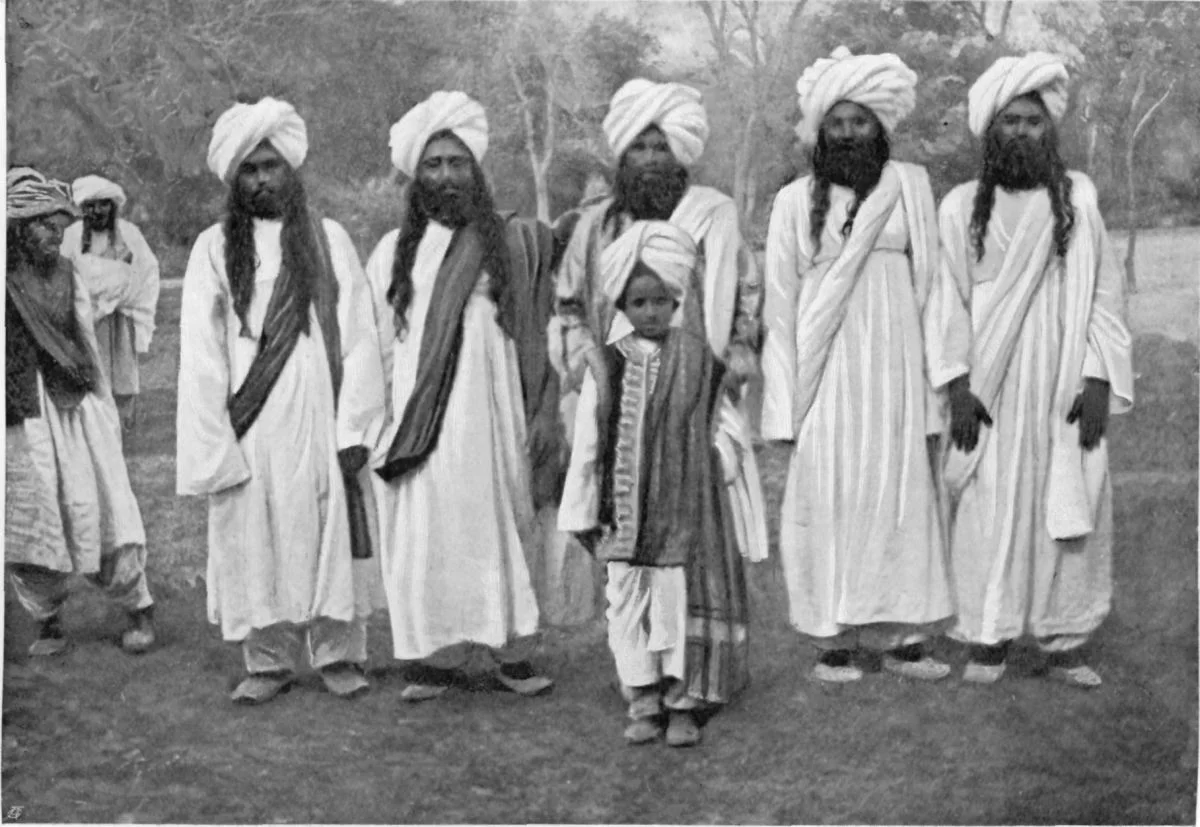
The Brahui are a Tribe that inhabit Balochistan around the Bolan Pass traditionally. However unlike other Tribes in the area which speak Indo European languages, the language of the Brahui, also called Brahui belongs to the Dravidian family of languages pointing out there relationship with people living in South India where the Dravidian family languages are spoken.

The Brahui of the Bolan Pass, Balochistan
Traditionally there was one Pass that was used by most people coming into the Indian-subcontinent and that was the famous Khyber Pass. However the second most popular Pass to gain access into the sub-continent was a Pass located to the South of the Pass in present day Balochistan called the Bolan Pass.
In the Toba Kakkar Range of Mountains in Northern Balochistan lies the Bolan Pass. It was one of the two traditional Passages into the Indian sub-continent the other being the more famous and the more busier Khyber up to the North. The Toba Kakkar is a southern offshoot of the Hindu Kush as it sweeps down to the Arabian Sea through the Sulaiman Range and other associated Ranges. Though it stands only at around 1800m it still formed the Southern gateway to India.
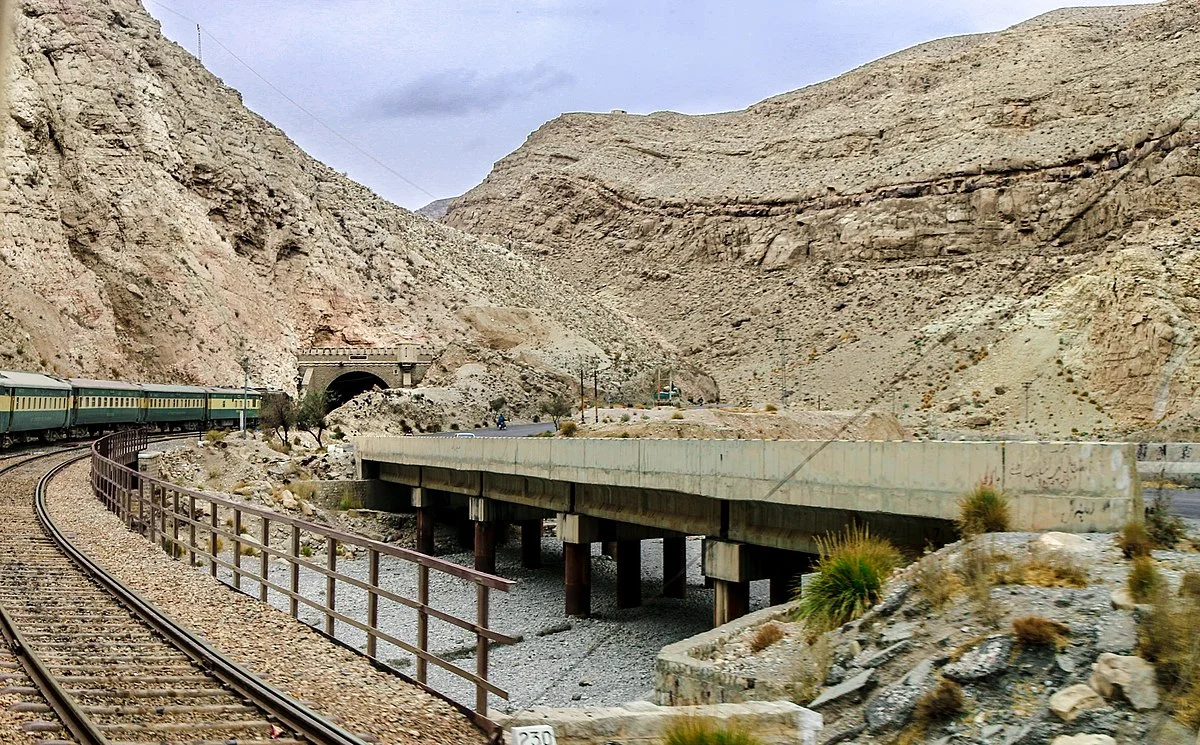
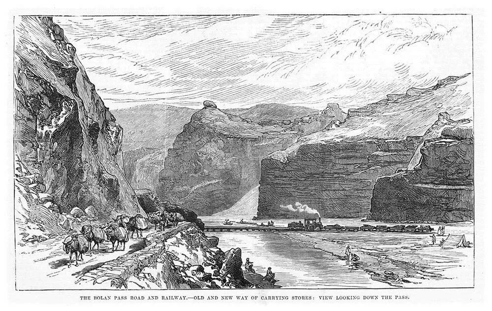
The passage to the Pass winds along the Bolan River Valley and runs around 80 kms and the Road connects Quetta with Sibi. So important did the British consider this Pass that they didnt only build a Road over the Pass but laid a Railway line as well and Trains still run across the bolan Pass. The region around the Bolan Pass is inhabited by a people called the Bravhui or the Brahui. They would normally have been considered just another Baloch Tribe like the Bugti or the Marri or the Zardari but the fact is that they are different. The difference comes from their Language which is called the Brahui and it is not related to any of the languages spoken in the Region. It belongs to a different family Group altogether. The Brahui Language belongs to the Dravidian Family of Languages. Yes the same Dravidian Family of languages that Tamil, Telugu, Kannada and Malayalam belong to. This is one of the only two instances of a Dravidian Family language used by the Natives outside of Southern India the other being the Dhangar dialect of the Kurukh language spoken in Nepal and Bhutan.
And its not like the Brahui are a small Tribe. As per estimates the number of speakers of Brahui number number well over 4 million mostly in Pakistan and a few among Pakistani origin people living abroad especially in the Middle East. So now they are well spread over all over Balochistan and neighbouring regions and not just centered around the Bolan Pass. So now we come to the their most amazing aspect, the fact that they speak a language of the Dravidian family up here in the Mountains of Balochistan. So how did this happen ?
Researchers do not really agree on this. According to some researchers the Brahui were the remnants of a population that once lived in this area but gradually shifted South. This could be due to certain Invasions from the North and while mostly migrated downwards a Group probably got isolated in the higher Mountains where the Invaders did not or could not reach.As per some researchers these people were a part of an invading Army from Southern India who decided to stay back in this area after the conquest of this area in the 3 rd Century BC. Others point out that this invasion could have only taken place after 1000 AD as the language still appears to be modern and doesnt have many Iranian / Avestan loan words which was the case in the languages of this area from the older times. Some say that they are also connected with the population which was responsible for the Great Civilization at Mehrgarh which pre-dates the Indus Valley Civilization.
According to a study An Ethnolinguistic and Genetic Perspective on the Origins of the Dravidian- Speaking Brahui in Pakistan by Luca Pagani and Vincenza Colonna “ The Brahui are the only Dravidian-speaking population in Pakistan, where they are surrounded by Indo-European speakers, and are well separated from all other extant Dravidian-speaking populations who currently reside in southern India and parts of Sri-Lanka. This Dravidian-speaking population resides in the Balochistan province in south western Pakistan, in the vicinity of Mehrgarh, the earliest example of sub-continental Neolithic culture. Y-chromosomal, mitochondrial DNA and more recent high-resolution surveys of DNA variation have shown them to be genetically similar to their neighbours in Pakistan, who show varying proportions of west and south asian ancestry that extends in a continuum along a north-east to south-west gradient”.

Modern Genetics show that they are genetically similar to their neighbours, the Baloch and the Pathans and exhibit similar Genetic Haplogroups. This points out to the fact that they intermixed with the local population to an extent that their own Genetic markers were diluted but due to some reason they held onto the language of their ancestors.
The study above also concludes “ In summary, we show that the Brahui, the only Dravidian-speaking population of Pakistan, do not show a higher genetic affinity with Dravidian Indians than any of their neighbouring Indo-European-speaking Pakistani populations. While this is still compatible with an ancient Dravidian genetic substrate (putatively, the yellow component in Figure 3C) shared by all the Pakistani populations, this does not highlight a preferential link between Brahui and the other Dravidian-speaking populations. Furthermore, a shared Dravidian substrate in all the Pakistani populations would not explain why most speak Indo-European languages, and only one a Dravidian language. Therefore, the most plausible scenario to explain the presence of Dravidian-speakers in Pakistan is a genetic or linguistic replacement. Formally, two models could be considered. In model 1, the ancestors of the Brahui people were a pre-existing Dravidian-speaking group in Pakistan, who were gradually assimilated by the Indo-European migrants, who arrived ~3,000 years ago, while their language was preserved. In model 2, the Brahui ancestors were Indo-European speakers, who later adopted a Dravidian language. No historical or linguistic data support model 2, so model 1 provides the best explanation for the unique characteristics of the Brahui. Interestingly, a similar phenomenon might have occurred in the Hazaras after their arrival in this region. They speak an Indo-European language and show genetic affiliation with other Pakistani populations, but retain considerable evidence of an East Asian genetic signature, consistent with their relatively recent Mongolian origin (Hellenthal et al., 2014).”
And yes the Brahui also has the distinction of being the only Dravidian language which is not written in a Brahmi script but in an Arabic script. There have been recent attempts to introduce Roman script for the language.
All said and done the Brahui, the only Dravidian language speakers inhabiting a sub-range of the Hindu Kush continue to thrive in their Homeland and though the Genetic link to South Indians might be weak but the Linguistic remains as strong as ever.
The Enchanting Padri Gali
The enchanting Padri Pass or Padri Galli or Padri Top which connects Chamba in Himachal Pradesh with Bhaderwah in the Jammu Division of Jammu and Kashmir at around 10,400 feet amsl. It is located around 110 kms from Chamba Town and around 40 kms from Bhaderwah and is the highest point of the Chamba Bhaderwah Highway. This is one of the important Passes which connects J and K with Himachal. In older times Bhaderwah was a part of the powerful Chamba Kingdom which held Kishtwar as well and even Zanskar.

The Enchanting Padri
The enchanting Padri Pass or Padri Galli or Padri Top which connects Chamba in Himachal Pradesh with Bhaderwah in the Jammu Division of Jammu and Kashmir at around 10,400 feet amsl. It is located around 110 kms from Chamba Town and around 40 kms from Bhaderwah and is the highest point of the Chamba Bhaderwah Highway.
This is one of the important Passes which connects J and K with Himachal. In older times Bhaderwah was a part of the powerful Chamba Kingdom which held Kishtwar as well and even Zanskar. For many years Bhaderwah was the bone of contention between the Jammu Kingdom and the Chamba Kingdom until in the mid 1800’s it was taken over by Raja Gulab Singh of Jammu as terms of settlement of the Territorial boundary with the Chamba Kingdom after he acquired Kashmir as per the Treaty of Amritsar.

Bhaderwah today is a part of the Doda district and lies in the lap of the Pir Panjals. The Town of Bhaderwah itself was an important one and the Bhaderwah Fort stands watch over Town. Bhaderwah has a mixed population of Hindus and Muslims and the languages spoken include Bhaderwahi and Kashmiri.
There are many beautiful places in Bhaderwah which have for long been away from the Tourist lime light. Some of them are described below (Taken from JK Tourism Catalog) :
Kailash Kund : The Kailash Mountain overlooking the Bhaderwah Valley is supposed to be the abode of Shri Vasuki Nag. At 13067 ft the Kailash Kund is the source of the River Neeru which drains the Bhaderwah Valley. The Yatra follows Mani Mahesh Yatra and starts with the Chari Mubarak from the Village of Gatha in Bhaderwah and then goes to Vasuki Nag Temple in the heart of the Town. At Ramkund one halts for the night and there on to Kailash Kund. The annual Kailash Yatra takes place in the month of August.
Seoj Meadows : The Meadow of Seoj is flanked by a gushing River on its West which emanates from the Hills surrounding the Kailash Kund. The Landscape across the River is a replica of Pahalgam whereas on the Eastern side there are long stretches of Grasslands. On the Western side the Meadows take a descent along the crystalline water of the Seoj Rivulet and roll towards Ramnagar area of Udhampur District.
Chinta Valley : Situated at a height of 6500 ft Chinta Valley is a beautiful Valley with thick Coniferous Forests on all sides and the Chinta Nallah flowing through it. A grassy Meadow called Bagan on one side of the Village is favoured by picnickers.
Jai Valley : Ten kilometers from the Chinta Valley is the picturesque longitudinal Jai Valley at a height of around 7000 ft. Located around 32 kms from Bhaderwah it is an extremely beautiful Region spread over 6 kms. The Valley is surrounded by thick Deodar forests on steep slopes with a sprawling Meadow in the middle.
Khellani : Khellani, overlooking the Kellar Valley is a Deodar clad Plateau 15 kms from Bhaderwah. Drained by the Bankut Nallah it is an ideal leisure spot. From late Summer to Autumn the Valley provides a bounty of fruits like Apricots, Peaches, Plums and Apples. While at Khellani one can walk through Khellani Pass amidst various Villages connected at Maulote and take the Road back to Khellani.
Pic from March end, 2018
The Inter-State Himalayan Boundary Dispute at 14000 ft
An Inter-State Boundary dispute at 14000 ft beyond the mighty Baralacha La between the Himalayan states of Jammu and Kashmir and Himachal Pradesh. The dispute involves the marking of the actual Border between Lahaul on the Himachal side and Ladakh on the Jammu and Kashmir side.

The Inter-State Himalayan Boundary Dispute at 14000 ft
In 2018 a rather quite interesting story cropped up in the news regarding a dispute on the Interstate Borders in the High Himalayas between Himachal Pradesh and Jammu and Kashmir. As per the Himachal Authorities the JK Police had set up a picket more than 18 kms than the designated Border between the two States. And this led to an altercation. Of course the matter was brought to the notice of the Central Government. There were other charges as well against the Jammu and Kashmir Government including that it had given land in Himachal across the Shinku La and around Sarchu.
The story started in 2014 when the JK Police set up a new border check Post supposedly in Himachal territory. The Himachal Government despatched CID Officials to ascertain the facts and they came back with the report that there was indeed an intrusion. The DC of Lahaul and Spiti wrote to the authorities in Padam and Leh as the JK part comes within the Kargil District and the Tehsil is Zanskar. But nothing much happened.
In the following years again the JK Police set up its check Post in what was said to be Himachali territory. Again the issue was raised and this time the Central Government intervened. A team of Experts was sent from the Geological Survey of India to demarcate the Border and they concluded after doing a scientific Satellite study that the JK Police was Post was 14 kms inside Himachal. The DCs of Leh, Kargil and Lahaul and Spiti were also present but the DC of Leh refused to go with the findings of the team and said that he will have to consult “higher authorities”. And the matter remains unresolved to this day. Lets see where the JK Police puts up its Post on this disputed inter state boundary which sits at over 14000 ft.
So how was the present day Boundary agreed upon and demarcated earlier. Well it was after Maharaja Gulab Singh had taken over as Rule of the whole of Jammu, Kashmir, Ladakh and Baltistan that a boundary demarcation was needed between the British territory of Lahaul and the Maharaja’s territory of Ladakh. The boundary was flexible in earlier times as the general area was the place where the boundaries of the Kulu and Chamba Kingdoms also met. And also of Lahul, Spiti and Ladakh. And there was constant struggle between Ladakh, Kulu, Chamba and Bushahr over Lahul and Spiti. So a settlement of the Border was needed.
And it was none other than Captain Alexander Cunningham who was assigned this job. People who have read on Himalayan explorations are well familiar with the Cunninghams. All the 4 Cunningham brothers wrote extensively on the History of India and were Military Officers as well. And Alexander was perfect for adventures in the Mountains. Infact it is Alexander Cunninghams account of the Battle of Toyo, where General Zorawar Singh fell in Battle with the Tibetan Chinese Army thats considered the most authentic.
And this is how the Boundary was finally marked. Leaving you with the actual Note on this by Alexander Cunningham published in 1848. Answers many questions and also gives an idea of how boundaries were demarcated in the Himalayas dependent on the Peaks, the Passes and of course the Rivers and the Nallahs and in some case a solitary big Rock. And leaving you with the final boundary Map as well.
Memorandum by Capt. A. CUNNINGHAM, detailing the boundary between the territories of Maharaja Gulab Singh and British India, as determined by the Commissioners, P. A. VANS AGNEW, Esq. and Capt. A. CUNNINGHAM of, Engineers.
1.In laying down a permanent boundary through a mountainous county it appeared to the Commissioners desirable to select such a plan as would completely preclude any possibility of future dispute. This the Commissioners believe that they have found in their adoption as a boundary of such mountain ranges as form water-shed lines between the drainages of different rivers, as detailed below.
2. In 1839, when Capt. A.Cunningham surveyed the Lahul district the boundary between the states of Kulu and Chamba was formed by the Nalda and Chukam Nullahs, two tributaries of the Chandrabhaga, the one on its left and the other on its right bank. From the head of the Chukam Nullah the Commissioners determined that all the county to the eastward which is drained by the Bhaga, the Chandrabhaga and their tributaries belonged to the British district of Lahul ; and that the boundary between Lahul and the Zanskar district was the snowy range (called Paralassa by Dr. Gerard) dividing the drainage of the Bhaga and Chandrabhaga from that of the Zanskar river, as marked in the Map.
3. Beyond the Bar Lacha Pass to the eastward, the Commissioners found that there was an old well known boundary stone, called the Phalangdanda, which marked the limit between Lahul and Ladak. This stone is noticed by Moorcroft . It stands in the midst of an open plain on the right bank of the Yunnam River. As there sno known or recognized boundary mark on the other side of the stream, the Commissioners selected a remarkable cream-coloured peak, called Turam, as the northern limit of the British territory on the left bank of the river. As this peak is situated at the end of one of the spun of the great snowy chain, already determined as the northern limit of the Lahul district, it forms a natural continuation of the boundary line from the westward. The bearing of the Turam peak from the Phalangdanda is 9" to the northward of west.
4. As it appeared that the country to the eastward of the Pha-langdanda belonged to Piti, the Commissioners determined that the boundary between Piti and Ladak on the westward should be the Yunam River. A straight line was accordingly drawn from the Pha-lang-danda to the junction of the first Nullah on the right bank of the Yunam, from which point the Yunam River forms the boundary as far as the junction of the Cherpa or Cherep river.
5. Almost due north-east from this junction there is a remarkable square rock on the top of the hill, which From its resemblance to a fort has received the name of Lanka. This curions and well know peak wan selected as another fixed point in the boundary, to which a straight line should be drawn from the junction of the Cherpa river. Beyond this to the eastward, the Commissioners, adhering to the principle which they had first laid down, determined that - the whole of the Cherpa valley and its tributaries belonged to the British Government; and that the snowy range on its right bank which feeds d l the northern affluents of the Cherpa river should be the boundary between Ladak and the British district of Piti. This same range extends towards the east past the southern end of the Chu-Mureri Lake, where it forms the well known boundary between Ladak and the Chinese territory. The Commissioners therefore determined that the boundary between Ladak and Piti should continue from the head of the Cherpa along this same range to the Chinese boundary; thus including within Piti all the streams which water that district, and giving to Ladak all the streams which water its southern district of Rutchu.
The Burmese Tamils of Moreh
There live in the Border town of Moreh, in Manipur on the India Myanmar Border a community of Tamils who came from Burma where they had settled Centuries ago after migrating from Tamil Nadu. The Community of Tamils still control the majority of the cross-border Trade between India and Myanmar that takes place here.

The Burmese Tamils of Moreh
In my days at the Delhi University I had a large number of friends from the North East. A common taste in Heavy Metal music was the main reason for the same. And ofcourse I used to love the stories told about the North East by these guys. We also had another commonality that we came from lands from where Insurgency was rife and only someone who has grown up in an Insurgency can really understand how it feels. And of course last but not the least was our common love for the Mountains / Hills.
And from my friends amongst the Nagas, I had Angami, Ao, Konyak and Tangkhul and from Manipur I had Meties and the Kukis. This interrelation of the tribes was another thing fascinated me as well. An often our conversation would drift to the our respective worlds where I would speak of Kashmir and they would speak of the fascinating North East. I still remember I almost broke up with a Naga girlfriend who told me that Dzukou Valley was more beautiful than Kashmir. Of course I couldn't take it lying down. I asked her if it Snowed there ? She said yes it does Snow there. I said it doesn't Snow in Nagaland. She said I didn't know anything. And of course then the argument went overboard to the point that we didn't speak for many days. Not that it mattered but since that day the name Dzukou Valley was stuck in my mind and will surely visit one day as now I have seen many pics of this beautiful place.
Anyways coming to the point. While discussing the Insurgency and the various Insurgents Groups the most dangerous place which was always mentioned was the border town of Moreh in Manipur right on the border with Burma as it used to be. I heard tales of strong Insurgent-Smuggler-Drug Runners mafia which ran things over there and apparently the area was such that even the Security forces would stick to the regular areas. And of course there were deadly rivalries between the different Insurgent Groups due to their different Tribal loyalties. But the strangest fact was that most of the border trade was controlled by not someone from North East but originally from South India. It was controlled by the Tamils who had settled here. And these were Burmese Tamils.
Of course I used to ask how come the Tamils ? And that too Burmese Tamils ? Did something called a Burmese Tamil even exist ? And how do they manage as “outsiders” in what was considered an environment very hostile to the outsiders. I could never get a satisfactory answer for the same and over a period of time I also lost interest in this particular subject. But lately as I get more into Research and History I tried to actually find out the History behind the Tamils of Moreh and how they came to settle in these lands far removed from their ancestral Tamil lands down South. And settle in lands which were considered too hostile for any outsider to even come for a visit.
So this is what I found out. In Burma Indians from various parts of India have come over the centuries for various trades and practices. Among them were Tamils many of whom were Chettiars who were into Money lending and trading. And over a period of time many Tamils came and settled here like they did in other places like British Malaya and Singapore. However in the 1930s started a wave of Nationalism initially targeted at the British but which soon turned into a agitation against all perceived outsiders and as a result many Indian started to leave Burma and go elsewhere. After the Burmese secured Independence the problem just got exaggerated as the Burmese Government refused to recognise the Indians living there since Generations as citizens. So another mass exodus started and this included a large number of Tamils who returned to Tamil Nadu.
Once back in Tamil Nadu many got used to life in their new Homeland but many were not at ease with the move and found life difficult. They decided that life in Burma was still better than life in Tamil Nadu and they decided to go back to Burma. Since going by Ship would entail many problems with documentation and such so they decided to try the overland Route via the North East. Many of you must be aware that the Indo Burmese border is quite a porous Border unlike our Borders with other countries and its relatively easy to cross it. So all the Tamils who wanted to go back to Burma landed up in Moreh which was the last Border town in Manipur before Burma. But once again the Burmese refused to admit them and recognise them as Burmese nationals.
The returning Tamils were however in no mood to go back to Tamil Nadu and decided to stay put in Moreh and keep trying their luck with the Burmese and maybe they liked the environs of Moreh. And I assume most of these Tamils could speak Burmese so they could live by the Border and take part in the trade from Burma. So they stayed put and became an important part of the trading community in the Border town and they relatively large numbers and nowhere to go status gave them some resilience against the Underground Outfits active in the Region. And hence they became a part of the border town of Moreh. Along with some Punjabi and Marwari businessmen who had also settled here in the past.
As of today the Tamil community is a vibrant one in Moreh with numbers in excess of 3000 and they have their own Temples and Schools in Moreh. They are still a very important part of the cross Border trade and continue to control most of it. And especially since the opening of official Border trade from Moreh, with Moreh recognised as an important Border trading town, in August 2018. The Town has itself has seen a power struggle between the Kuki and the Nagas over the “control” of the Town and as of now the Town is Kuki dominated. All throughout this struggle which at time included Members of various armed Underground Outfits the Tamils managed to somehow stay clear and still be dominant in the business in this Town but many of them still left the Town. The local Vayapar Mandal or Traders Association is made up almost exclusively of Tamils and the head of the Tamils is often referred to as the “King of Moreh”.
The Chakma Raja who gave away a Kingdom !
The Story of the King of the Chakmas, a Tribe found in the Chittagoing Hill Tracts who gave up his Kingdom and was at one time offered the President ship of the state of Pakistan. He ended up being an Ambassador to South America for decades and was the head of the Buddhist Society of Pakistan.

The Chakma Raja who gave away a Kingdom
In the highlands of Bangladesh called the Chittagong Hill tracts bordering Myanmar live a number of Tribes which are collectively referred to as the Jumma people by the majority Bangla population. The name derives from the the term Jhum cultivation which is also referred to as the slash and burn type of Cultivation wherein a tract of Jungle was cleared by slashing and burning and cultivation was then done there. t the time of Partition of India for some inconceivable reason these areas were ceded to “East Pakistan” though the population was mainly Tribal who practiced Theravada Buddhism.
The “Jumma People’ themselves are divided into various tribes all of whom have their own Religious practices though most have adopted Buddhism, there are still a few that are Hindu and Christian and even Muslim. Most of them still maintain some level of their indigenous animist beliefs as well. The main Tribes of the region are the Chakma, Arakanese (Rakhine), Marma, Tripuri, Tanchangya, Chak, Pankho, Mru, Bawm, Lushai, Khyang, Gurkha, indigenous Assamese, Keot (Kaibarta), Santal, and Khumi as per Wiki.
Among these people the most well known ones and the most dominant ones are the Chakmas. The Chakmas are Theravada Buddhists and many of them live across the Borders as well in India and Myanmar. In India they are found in almost all the states in the North East and even in West Bengal. The name Chakma is supposed to have been derived from the Sanskrit word “Shaktiman” as many Chakmas served in the Kingdoms of the Rakhine Kings and they wielded great power. The Chakmas themselves are divided into various Clans and reigning over all the clans is the powerful Chakma Raja.

Some of your must be aware that there was long running dispute between India and Bangladesh as a number of Chakmas had taken refuge in India citing discrimination and harassment by the Authorities in Bangladesh and this for long was a prickly issue with its roots going back to Independence. There still are Chakmas living in refugee Camps in certain areas of North East India.
At the time of Independence the Raja of Chakmas was Raja Nalinaksha Roy. Though the Chittagong Hill Tracts had a 98% non-Muslim population they were still assigned to Pakistan by the Boundary Commision. The Raja had come into power in 1935 and had Ruled for 12 years at the time of Independence. He acceded to East Pakistan as there little else he could do and was given Autonomy by the Pakistani Government to make him easier to win over. The Raja passed away in 1951 and after sometime as in Chakma tradition his eldest son Raja Tridev Roy was formally annointed as the 50th Chakma Raja in 1953.
Once the Mukti Bahini started its campaign in the 1960s the Chakma Raja decided that they will remain neutral as they didnt want to rub the Mukti Bahini or the Pakistani Army the wrong way. But Raja Tridev Roy became increasingly inclined towards the Pakistani Government. Infact Sheikh Mujibur Rehman offered him a seat to fight on behalf of the Awami League but Raja Sahib disagreed and instead stood up as an Independent and won the Seat though overall the Awami League got a landslide victory in East Pakistan. And soon after a series of Events the Liberation War, as the Bangladeshis called it started. But once again Raja Sahib sided with Pakistan as I think he assumed that the Pakistanis would hold ground. But things went rather the other way and Raja Sahib found himself in deep trouble. With his Allies close to defeat the Raja Sahib knew that life would be hard for him in an independent Bangladesh due to the stands he had taken. So he decided to abdicate.
Raja Tridev Roy abdicated in 1971 in favor of his eldest Son, the 12 year old Raja Devashish Roy. The Raja knew that even Abdication would not be enough as people would come to settle scores with him. Also he felt that the position of the Chakmas would become precarious in a new Bangladesh and their special rights and privileges would be taken away. He was in many ways right. The Raja had only one option now and he went over to West Pakistan or Pakistan as it came to be known thereon. He was welcomed very warmly on his arrival in Pakistan and conferred the status of a Federal Minister for life. But more was still to come.
The first task he undertook was to head the Pakistani Mission to UN which opposed the admission of Bangladesh to the United Nations. In answer to this the Bangladeshi delegation was led by the Chakma Rajamata Benita Roy who happened to be his Mother. I wonder what transpired between the Son and the Mother. Two Chakma Royalty Members, from the Hills of the North East, both devout Buddhists, headed important delegations from two countries which were overwhelmingly Muslim and with the largest Muslim populations besides Indonesia. It was indeed something straight out of a Thriller. Anyways Bangladesh became a Member of the United Nations and that was that.
However, Raja Sahib wasn't done yet and he joined the Bhutto Government. And when Bhutto became the Prime Minister of Pakistan he offered the Presidentship of Pakistan to Raja Tridev Roy. This was a great opportunity but it came with a rider. As per the new Constitution of Pakistan only a Muslim could become the President of Pakistan. And of course this wasn't acceptable to the erstwhile Raja Sahib of the Chakmas. So now after giving up the Kingship of the Chakmas, the Raja Sahib declined the Presidentship of Pakistan.
And then Gen. Zia came into power and Mr.Bhutto was hanged and all Bhutto loyalists came under the attack and none escaped the Generals wrath. Well all except the Raja Sahib. Bhutto knew better than to let any harm come to Raja Tridev Roy. Raja Sahib stayed active in Politics and there was little that Gen Zia could do to him but after a couple of years he decided he didnt want him to be around. So a new Role was found for the Raja Sahib and he was appointed as the Pakistani Ambassador to Argentina in 1981 and off he went to South America. And at the same time he was made the Ambassador to Chile, Ecuador, Peru and Uruguay. The Raja Sahib from what was considered the Himalayan foothills by many could now while his time in the Andes Mountains it seemed. And he stayed in South America for many years till the time Gen. Zia passed away.
After Gen Zias death Raja Sahib was brought back to the sub-continent at least from South America and appointed as the Ambassador to Sri Lanka. Being a Buddhist he made a good choice as an Ambassador to a Buddhist majority country. And finally in 1995 Raja Sahib returned to Pakistan after his Ambassadorial assignments abroad. He now turned his attention to working for the Buddhist Community in Pakistan and decided to devote more of his life to Religious pursuits and also became the head of the Pakistan Buddhist Society.
Raja Tridev Roy finally passed away in 2012 (less than 7 years back) due to cardiac arrest as his home in Islamabad. His House in E-7 had a Plaque on the outside and it said “Chakma House”. And he was largely alone when the end came. No one in Pakistan by that time had any recollection of the soft spoken King of the Chakmas who gave up his Kingdom and declined the Presidentship of Pakistan. No one really cared.
Do Google Raja Tridev Roy. Was a Handsome guy !
Pic from the Internet. Somewhere in the Chittagong Hill Tracts
The Shaksgam Valley
The Shaksgam Valley situated beyond the Karakorams, and also referred to as the Trans Karakoram Tract is one of the most inhospitable places on Earth and as of now its disputed Territory, claimed by India but illegally ceded to China by Pakistan. Few people have ever ventured in the one of the last remaining wildernesses of the World.

08 View Of Shaksgam Valley To The West Towards Gasherbrums From Terrace Above The Shaksgam River On Trek To K2 North Face In China. Pic credit Jerome Ryan
The Shaksgam Valley
One of the Valleys lying hidden in the inaccessible depths of the Trans Karakorams is the Shaksgam Valley but thats not its real claim to fame. It is purported to be an integral part of the state of Jammu and Kashmir but under Pakistani control and has since been “ceded” to China by Pakistan as per the terms of their Border Settlement Agreement.It is also referred to as the Trans Karakoram Tract and the Tract has an area of almost 7000 sq km.
And as soon as it became a part of China access and approach to it became much more complicated and has been out of bounds till the Chinese decided to open the Valley as it serves as a an alternative Basecamp from the North for the K2, the second highest Peak on the Planet. The Valley itself is around the Shaksgam River and as said before its bounded by the Karakorams in the South and the Kun Luns in the North. Its political status notwithstanding the Shaksgam valley is one of the most inhospitable places on the planet.

Mountain Across The Shaksgam Valley On Descent From Aghil Pass On Trek To K2 North Face In China. Pic credit Jerome Ryan
As mentioned one Passes through this Valley on the way to the North Base Camp of the K2 which is situated in the same Region and you descend into this amazing wilderness after crossing the Aghil Pass which serves as the Gateway to the Shaksgam Valley. The Shaksgam River itself is a tributary of the Yarkand River and hence the water ends of in the void of the Tarim Basin. The Shaksgam Valley was explored by sir Francis Younghusband once upon a time though he referred to it as the Oprang. Few Explorers had ventured into this Mountain wilderness before Younghusband.
And then suddenly I come across an Article on one of the Most Travel Aggregator Sites which puts it as thus “If only this paradise was open for tourism, Shaksgam would have beaten Switzerland and Iceland as the most favoured exotic travel destination. The world is a beautiful place, and sometimes this beauty becomes the reason for conflict among admirers. Shaksgam is that enchantress who has been veiled.” Really ? Dude ? And of course it was accompanied by beautiful pics with Tall Pine Trees and Flowing Rivers. Quite unlike Shaksgam if I may mention.

View Of Descent From Aghil Pass 4810m Towards Shaksgam Valley On Trek To K2 North Face In China. Pic credit Jerome Ryan
Eric Shipton and TG Longstaff, two of the greatest explorers of these Mountains of the Himalayan Complex went exploring in this Region and came up with their masterpiece “Blank on the Map: Pioneering exploration in the Shaksgam valley and Karakoram mountains. And it is described as such “As I studied the maps, one thing about them captured my imagination … Across this blank space was written one challenging word, "Unexplored"' In 1937 two of the twentieth century's greatest explorers set off to explore an unknown area of the Himalaya, the breath-taking Shaksgam mountains. With a team of surveyors and Sherpas, Eric Shipton and H.W. Tilman located and mapped the land around K2, the second-highest mountain in the world. It was their greatest venture, and one that paved the way for all future mountaineering in that area of the Himalaya.

Looking West Nearing Sunset From Kerqin Camp In The Shaksgam Valley On Trek To K2 North Face In China. Pic credit Jerome Ryan
For Shipton and Tilman, exploration was everything, with a summit a welcome bonus, and Blank on the Map is the book that best captures their spirit of adventure. With an observant eye and keen sense of humor, Shipton tells how the expedition entered the unknown Shaksgam mountains, crossing impenetrable gorges, huge rivers and endless snow fields. There's a very human element to in Shipton's dealings with his Sherpa friends, and with his Balti porters, some of whom were helpful, while some were less so. The expedition uncovers traces of ancient cultures and visits vibrant modern civilizations living during the last days of the British Empire. Only when all supplies are exhausted, their clothes in tatters and all equipment lost do the men finally return home. A mountain exploration classic.

Large Flat Rocky Expanse Of The Terrace Above The Shaksgam River On Trek To K2 North Face In China. Pic by Jerome Ryan
Ill leave it at that. And add a pic of the Shaksgam Valley taken by Jerome Ryan a couple of years back.
Ethical Trekking
Simple 6 steps you should follow to be an Ethical Trekker. You owe this to the Mountains at least.

ETHICAL TREKKING
Many of you must be planning on going on Treks this year. And its a good feeling to see so many people now taking to our Mountain Outdoors and enjoying the thrill which comes from walking the Mountains.
However with the growing number of people going into the Mountains the pressure on the fragile Mountain Environments is growing. Many of us, both knowingly and unknowingly are bringing harm to the Mountains. So the least you can do is follow the concept of "Ethical Trekking" and refuse to Trek with a Company which doesn't follow these basic concepts :

1. No Fixed Camps : Traditionally Trekking never involves fixed Camps. These are a bane which has been brought about by large Trekking Companies and Aggregators. Always go for Camp at afternoon, Decamp at Morning operation. Fixed Camps are a bane, as already mentioned, to the Mountains and cause untold immense damage. Do not go with a Company that follows fixed Camp format. The Environment will thank you for it.
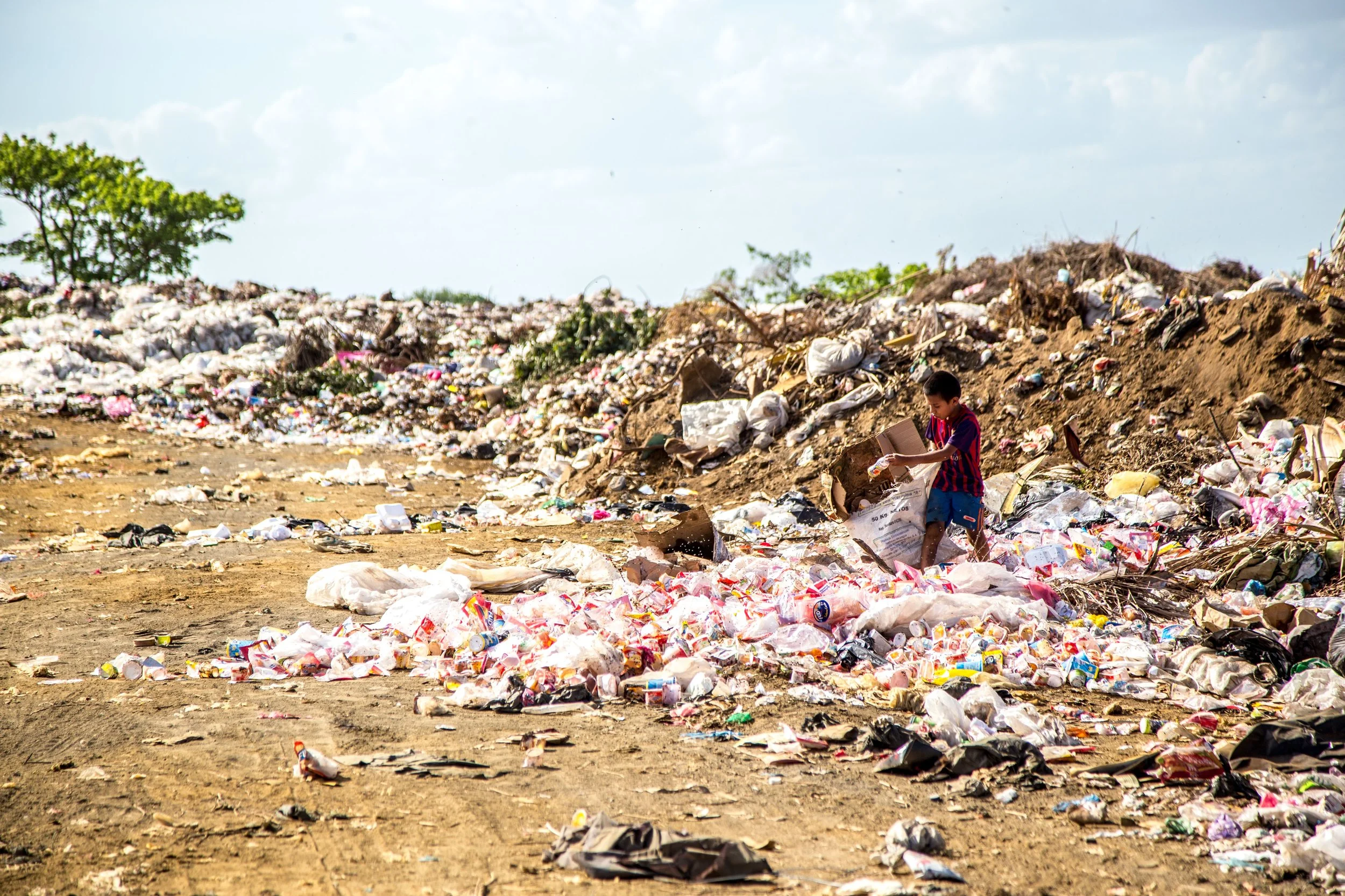
2. No Instant Noodles : See no to your favorite brand of Instant Noodles when in the Mountains. Their plastic packaging is one of the most Polluting items up in the Mountains. Always check the Menu and refuse to have these. Stick to Rice, Dal, Chapati etc simple fresh foods. Keep energy Bars and Dry Fruits for emergencies.
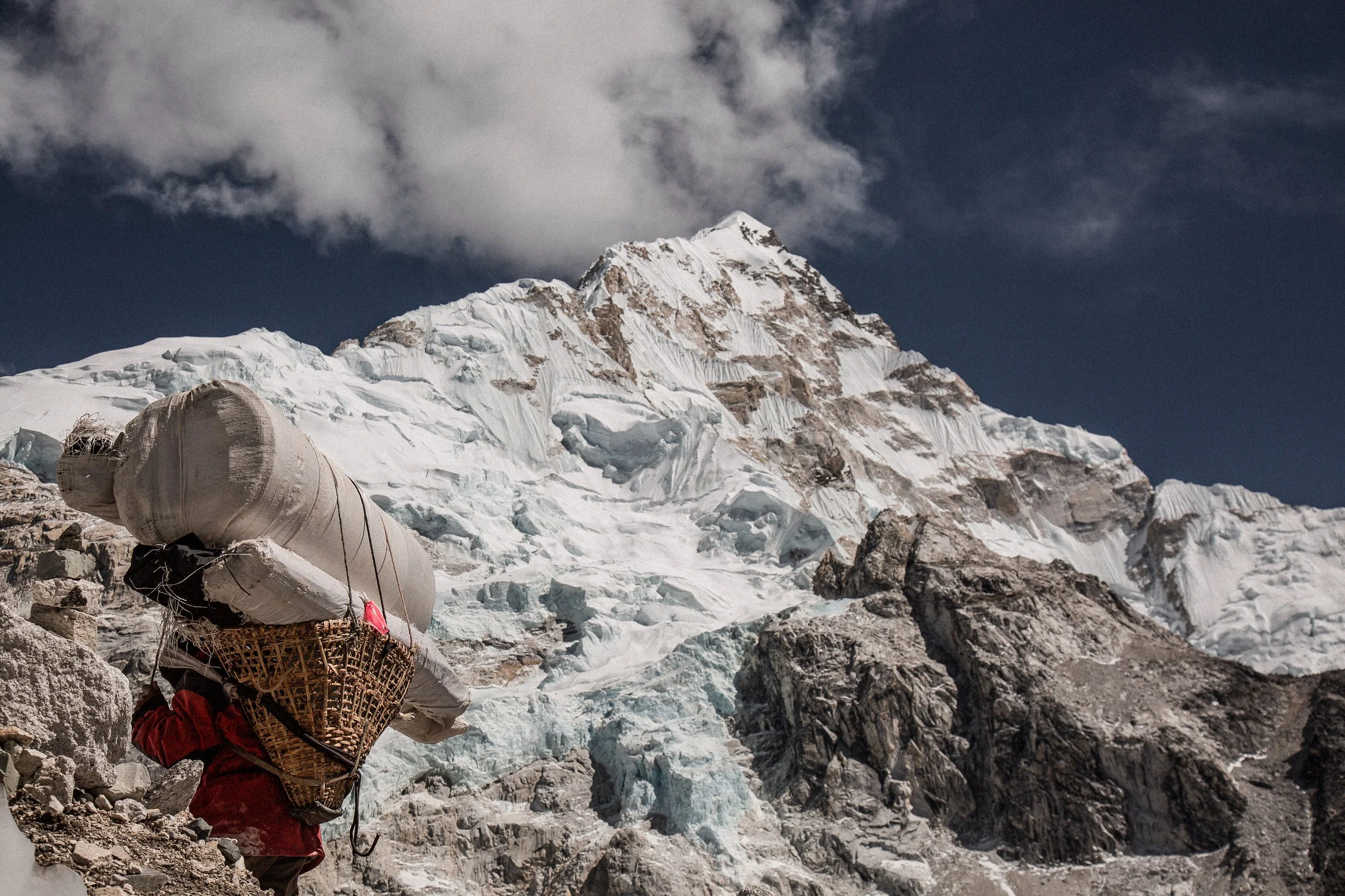
3. Lookout for the Porters : The Porters are the most hardworking and least paid component of the Trek. There is nothing you can do about the pay but insist that the Porters get the same Food that you get and their sleeping conditions are satisfactory. And just that you know each Porter shouldn't carry more than 25 kgs. That's the least you can do.
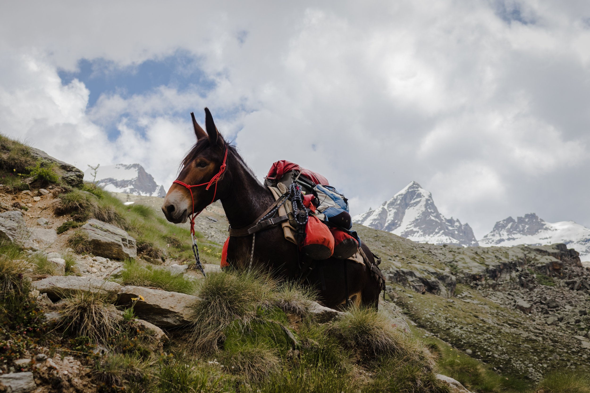
4. The Ponies and the Mules Matter Too : Make sure that the Pack Animals are not overloaded. And watch out for any sign of injury or illness in an Animal. They are an indispensable part of your Team. You need to watch out for all Team Members.

5. Take Back all your Non-Biodegradable Waste : Ensure that all Non-Biodegradable Waste is taken back to the base Town or Village where its disposed off. We are all well aware that even at the Bases there is no proper disposal System but it's much better than leaving in up their on the Mountains. As for Human Waste, in an ideal situation even that should be bought back, but since situations are not ideal you should at least use Cat pits for the same. Always cover the Human Waste with Mud or Sand before leaving a Campsite.
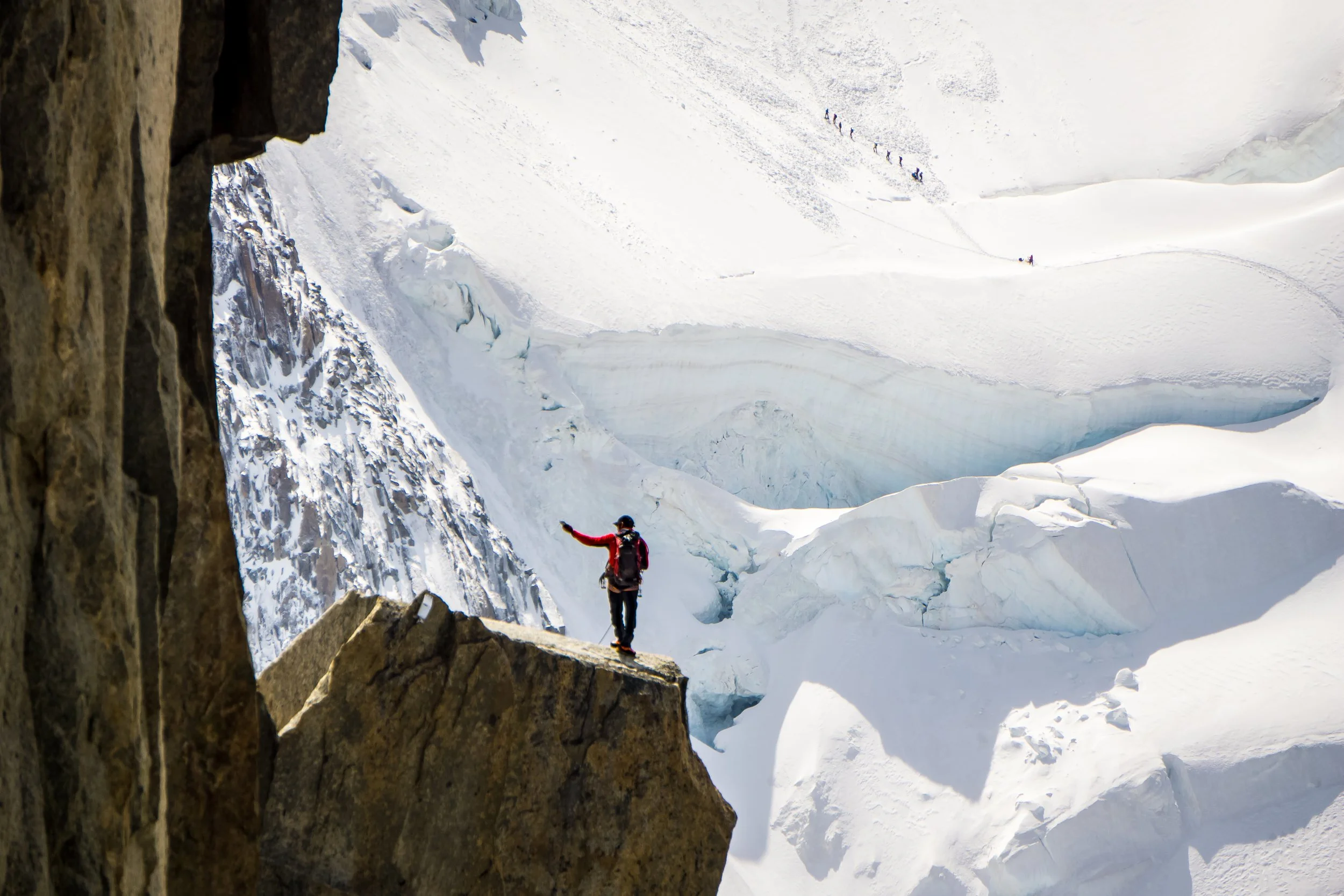
6. Make Sure you know your Trek Leader : Ask for the Qualification / experience of the Trek Leaders. He is the guy your life will depend on during the duration of the Trek so you better go through his CV.
We at Travel The Himalayas are proud that we will follow all the above Norms and though it pushes the Costing up we are OK as we know that there are many people aware of the damage being caused to the Fragile Mountain Eco Systems and they are ready to play their part for it.
The Hindu Raj Mountains
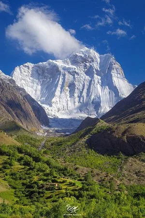
The Hindu Raj Mountains is a little known Mountain Range sandwiched between the Hindus Kush and the Karakoram Ranges located mostly in the Khyber Pakhtunkhwa Province of Pakistan. And till date many few people outside the region know of this Range which purists consider separate from the Hindu Kush Range.
The Hindu Raj Mountains
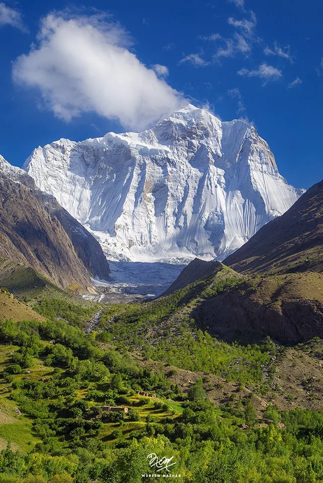
There lies somewhere in the Northern wilderness of Gilgit Baltistan and Khyber Pakhtunkhwa nestled between the mighty Karakorams and the Hindu Kush a Mountain Range called the Hindu Raj Mountains. Most people consider it a part of the Hindu Kush Mountains but many Geographers and purists consider the Hindu Raj as a separate Range. And surprisingly very few people have ever heard of it in the sub-continent. Though everyone is quite aware of the Hindu Kush Range and the many versions how it came to be named as such. The same should have been the case with the Hindu Raj but I guess someone missed the Memo.
The Hindu Raj Mountains are a noble Range in their own right but just like the Pir Panjals to the South across the Great Himalayan Range it gets dwarfed by the giant Peaks of the Karakoram and the Hindu Kush. Not that it lacks heavy weights just that in a Region which abounds with numerous 7000 m plus Peaks and even 8000 m plus Peaks the tallest Peak of the Hindu Raj Mountains, the Koyo Zum tops in at 6872 m (22,546 ft) which is by no means less but it just gets dwarfed as mentioned earlier. To put that height into perspective the tallest Peak of the Andes, the Aconcagua stands at 6962 m.
As per Encyclopedia Britannica “A wider definition of the Hindu Kush would include a fourth region known as Hindu Raj in Pakistan. This region is formed by a long, winding chain of mountains—with some lofty peaks, such as Mounts Darkot (22,447 feet [6,842 metres]) and Buni Zom (21,499 feet [6,553 metres])—which strikes southward from the Lupsuk Peak (18,861 feet [5,749 metres]) in the eastern region, then continues to the Lawarai / Lowari Pass (12,100 feet [3,688 metres]) and beyond to the Kābul River. (The Lowari Pass is a Pass which connects Dir in Khyber Pakhtunkhwa with Chitral which also falls in the same province. The Lowari Pass is the lowest of the 4 traditional Passes which connected Chitral with the outside world. The Lowari Pass is famous for its avalanches and the number of people who died on it historically. Think of it like you think of the Rohtang or the Zoji). If this chain is considered part of the Hindu Kush, then the outlying mountains of the Swat Kohistan region of Pakistan to the south also form part of the complex.”
As per another definition by “Batholith Saltoro” the range that lies between the true left bank of the valley of the Yarkhun/ Mastuj River in the West and North and the Northern watershed of Swat Kohistan in the South, is the Hindu Raj. The main range of the Hindu Kush lies to the East and North of the Yarkhun/ Mastuj/ Chitral/ Kunar River system.
Now most of us are familiar with the Etymology of the Hindu Kush which as per one definition meant the “Killer of the Hindus” which was a reference to the fierce avalanches that the Hindu Kush would let loose. It was also supposedly a reference to the large number of people from the subcontinent who were taken as slaves to Central Asia across the Hindu Kush and many perished while crossing this formidable Mountain Range. But as per the Encyclopaedia Britannica the term Hindu Kush is derived from Arabic and it simply means the Mountains of India. But then this is a debatable issue and we leave it as such to ponder over it another day.
So I assume the Hindu Raj reference must have come from the Hindu Shahi Rulers who held power in this Region. But this is just an assumption. You need to keep in mind that at that time “Hindu” was a geographic term and it still has but now it has a different connotation. Or since the area is in the same vicinity where the Kalasha people live maybe its a reference to them and their ancestors when most people here were Kalsha. This remains a matter of my personal speculation as I am yet to come across a source which mentions why exactly these Mountains were called the “Hindu Raj” Mountains.
And culturally also the area has a very interesting history. As per “Batholight Saltoro” “Culturally, the linguistic mixture is interesting, containing as it does a mixture of Shina, Burushaski, Khowar, Gujar, and Wakhi speakers which reflects the complex history of the area. It has been ruled variously from Chitral, both by the Kushwaqt and the Ul Mulk dynasties, from Gilgit, from Srinagar, from Tibet, from Persia. The original inhabitants of its Eastern Valleys seem to have been Burushaski speakers, preserving, as they do, what is considered to be a purer version of that language as compared to that which is spoken in the Hunza region. The Yasin valley, the pass at the head of which served as a conduit for the Chinese to invade and conquer the Tibetan held Lesser Bolor, is also the valley where the explorer/journalist George Hayward was murdered, perhaps for being a tad too investigative.
Another interesting Range in the Great Himalayan System now somehow obscured by other more famous Ranges / Sub ranges of the system.
Kintup and the Everest of Rivers
The unsung Story of one of the Indian Explorers and Surveyors, popularly called as the Pandits, who went onto Chart the course of the Zarlung Tsangbo as it Journeys through the Tibetan highlands and enters Assam through one of the most unexplored Regions of the Himalayas.

Kintup and the Everest of the Rivers
A lot has been written on the exploration of the Western Himalayas by various Explorers as it was a politically very active region in the 18th and 19th Centuries with various powers come into conflict to push their interests in these parts. In stark contrast very less has been written about the Eastern edge of the Himalayas and even fewer people have ventured into this enigmatic part of the Himalayas. The jungles which surrounded the Eastern Himalayas made them almost impossible to get to and the Weather didn't help as the Eastern Himalayas get 3 times the precipitation that the Western Himalayas do.

And was in the Eastern Himalayas that a great mystery evolved which took hundreds of years to finally decipher and figure it out. It was a great Geographical puzzle and it involved the main River that runs through North East India, the Brahmaputra. Its a huge River as we are aware of and early Explorers wanted to find more and one of the favourite Explorations of these Explorers was the charting of the Route of the River from its source right till where it met the Sea. There are two ways to achieve its objective. You either start from the point it originates or you start from the point it hits the Seas or the Plains. The problem with the Brahmaputra was that tracing it back to the source was almost impossible due to a number of factors. First was the simple fact that the forests in the Foot Hills were impenetrable. And more than that the Tribes and the Indigenous People living in these Hills were very hostile to any outsiders and stories of head hunting were common. And another third point was that at the Brahmaputra was composed of 4 main tributaries which entered India from the East. So which was the main and which one was a Tributary was another question.
And in the highlands of Tibet, which was mostly inaccessible to Western explorers and outsiders, was a great River called the Tsangpo or the Yarlung Tsangpo who’s point of origin was known to be the Mansarover Lake at the foot of the Holy Kailash Mountain but no one was sure of where the River disappeared once it went off the Tibetan Plateau. Westerners who had heard accounts of this great River were also intrigued as to where about this great River go and where did it discharge into the sea. You need to remember that this impenetrable Region into which the Yarlung Tsangpo disappeared was also called Pemako and nothing much was known about it to the outside World. And beyond Pemako draining off the Tibetan Plateau were not one but 5 Great Rivers of Asia who create deep Gorges as they cut through some of the Highest Mountains. The Brahmaputra, the Irrawaddy, the Salween, the Mekong and the Jinsha or the Great Yangtze all flow almost parallel to each other in an area less than a 100 km wide. This Region is a true wilderness and you need to experience it to know how impossible it is to access.

I had travelled to this Region in 2018 and saw the breathtaking sight of the Jinsha or the Yangtze raving and frothing its way through the Tiger Leaping Gorge. Of course Chinese engineering has meant that the area is now accessible and the Chinese Government opened up this area in 1990’s to the outside World. This area is now a World Heritage Area, called the Three Parallel Rivers of Yunnan World Heritage. And as mentioned besides these Three the other two Great Rivers also skirt around the Himalayas in the same region.
Coming back to where we started. This question puzzled western Explorers as well till someone put two and two together and said “Hey, maybe the Tsangpo is the Brahmaputra”. Now at that time this suggestion looked incredible as it was hard to believe that a River would loose all that elevation within a stretch of 150 kms. From the high Tibetan Plateau to the low Assam Valleys. But then it was the only plausible explanation and the two Rivers were connected. There was another school of thought which said that the Tsangpo was actually the Irrawaddy and that also looked like a possibility. Many papers were return and letters were exchanged on both the possibilities. The only way to get a definite answer was to send someone to Tibet and actually follow the course of the River and come up with conclusive evidence which would rest the matter for the future. Hence for many Explorers just like climbing the Everest was the ultimate prize, the same way exploring the Yarlung Tsangpo all the way to the Sea was called a feat equivalent of scaling the Everest, hence the term the Everest of Rivers.

Only there was a problem. Tibet was off limits and there was no chance of Tibetans letting in anyone from outside to Survey their Rivers. So the British decided on the next best option. The Pandits. The Legendary Pandits were Indian natives, mostly from the Mountains, who penetrated deep into Tibet under the guide of Pilgrims or Merchants or a Monks and surveyed the land for the British who ran the Missions from across the Himalayas. Many of us have heard of Nain Singh, Kishan Singh, Kalyan Singh and even Abdul Hamid and Hari Ram. And of course a large number of these Pandits just went into oblivion or disappeared in the Himalayan vastness their stories mostly untold. And then there was Kintup. Kintup the Tailor.
Kintup was a Tailor based in Gangtok in Sikkim and he was also an Explorer and could pass off very well as a Tibetan. The first time one of the Pandits, Nem Singh was sent to explore the course of the Yarlung Zangbo and Kintup went along as an assistant in 1878. Their Mission was to chart the Route all the way from the Tibetan Plateau to Assam. They partly succeeded but due to the inherent impenetrable ness of the Terrain there was still a gap of 160 kms which they couldn't explore. It is said that though Kintup wanted to push on but Nem Singh wasn't so keen on the same and both returned to India where their British bosses were not too pleased with Nem Singh’s decision to come back without exploring the complete course of the River.
In a couple of years an Expedition was put together again and Kintup was again a part of it along with a Chinese Lama who said he knew these parts. And just to be sure they came up with a ingenious Plan which didnt require Exploring the whole course but one that would still prove that the Yarlung Tsangpo was infact the Brahmaputra of Assam. The Plan involved floating down 500 logs with special carvings the Yarlung Tsangpo and stationing teams of people in lower Assam to watch out for these Logs and even if one log was picked up by the team it would mean that the mystery was solved. Sounded like quite a plan and so the Expedition was soon underway.

But as fate would have it the Chinese Lama turned out to be treacherous. And once they were in the Kham he revealed his secret as well as that of Kintup to the Tibetan Authorities and he was rewarded for the act while Kintup was thrown into the prison. But after a few months Kintup managed to escape and made his way to Monastery. His captors soon caught up with him but the Head Lama of the Monastery bought them off by giving them some money and now Kintup was in the employment of the Head Lama. He worked very diligently for the Lama and I assume he took a liking for his spirit and the Lama decided to give him his freedom. What Kintup did next speaks for the character of a man. Kintup decided to go to Lhasa and sent a message to his British boss from there narrating the misfortune that had befallen him during the Expedition but at the same time he said that he would carry out with his Mission and he would soon start sending the Logs down the Yarlung Zangbo.
And that is what he did. He collected 500 logs and carved them and floated them down the River at the rate of one log per day. But unfortunately there was no Team to look for them as his message had not reached India and it had been more than a year since he had left and had no communication with his Bosses. They had just given up on him. Another Explorer lost in the vastness of the Trans Himalayas. After having done that Kintup decided to again explore down the course of the River anyways. He spent a couple of Years exploring the the Region and came quite close to reaching all the way down to Assam but again the terrain and the hostile Tribes made it impossible and Kintup decided to return to India. And he was almost lost in oblivion until someone took interest in his Journals and these were finally published in 1889, many years after he had returned from a Journey that few could even imagine possible.

His Journal conjured up a magical World of Deep Gorges, Waterfalls and Impenetrable Jungle with hostile Tribes. A Region that the Tibetans used to call Pemako. It inspired many people to go Explore the Region but many people were also sceptical as there was no way to confirm all the information that he had got. He in particular mentioned a 150 feet high Waterfall with a Lake at its bottom. This is what was called the Hidden Falls. Kintup still accompanied the occasional forays into Tibet but it was finally only after 1905 when the British led by Col.Francis Younghusband defeated the Tibetan and the area was opened that the British realised that Kintup was right in all his observations. Though he wasnt literate but he had an excellent memory and was intelligent as well to minutely observe his surroundings. It took more than 15 years for observations to be validated and added to the Survey of India archives. The final validation of his extraordinary Journeys and Explorations was validated by a team of Explorers sent to run the Course of the River. They were also astounded to find out how accurate Kintup was. And yes he was still around in 1914. They found the Hidden Waterfall as well though it wasn't as high as Kintup had mentioned.
Anyways the area was closed for further Explorations after the Chinese took Tibet and in wake of the Sino Indian conflict the whole area was off limits. And as I mentioned before the area was opened for foreigners only in the 1990s and two Expeditions one Japanese and one Western tried to Canoe/ Raft down the Yarlung Tsangpo but both lost a member each and couldnt complete the Mission. It was only in 2002-2003 that the first Expedition finally succeeded in navigating the Upper Brahmaputra. The highest Falls was visited and recorded again in 1998 when it was found out to be around 108 feet. And then it later dawned upon the Explorers that Kintup who always got his Maths right hadn't misjudged the height. He was talking about a seperate Waterfall which was made by a Tributary of the Yarlung Tsangpo as it fell over a Cliff.

The person responsible for this was Richard Fisher who first established this as one of the Deepest Gorges of the World. Fisher further goes onto mention about the “Everest of Rivers”comparison “"I did not want this incredible canyon to become an Everest-style killing fields." This canyon cannot be "knocked off" or conquered. Everest is a holy mountain as the Tsangpo is an equally important sacred canyon. Everest represents the male earth and the Tsangpo, the female hidden lands of this planet. It is a great blessing for all those who love the earth that, god willing, we have passed into a new era for the Tsangpo. This living canyon has withstood an almost military western style assault. "Today this chasm remains as elusive, beautiful and fresh as the first day I saw it in 1992," Fisher said.
As for Kintup he died in 1914 only months after he was officially recognised for his contributions and given a princely sum of Rs.3000 for his endeavors.
PS : The Yarlung Tsangpo Gorge it still remains a impenetrable area and even if you Google for pics you would find only a few and far between giving you an idea of how remote this Region still is.
The Legendary Gurkha Bulbudder
The Story of a brave Gurkha Soldier who stood up the British during a Battle near Dehradun during the Anglo Gurkha Wars and was later the General in charge of Maharaja Ranjit Singh’s Gurkha soldiers. Commemorated by the British in the form of a Memorial at Nalapani.

The Legendary Gurkha Bulbudder
At a place called Nalapani near Dehradun stand these two Pillars as a memorial to the men who died fighting a Battle here more than 200 years back. One of the Pillars is dedicated to the British soldiers and one, strangely enough, is dedicated to their rivals in that battle, the Gurkhas. And out of the Gurkhas there was a dedication to one particular Gurkha. The Plaque says
“This is inscribed as a Tribute of Respect for our Gallant Adversary Bulbudder, Commander of the Fort and his brave Goorkas, who were afterwards while in the service of Ranjit Singh shot down in their Ranks to the last man by Afghan Artillery”.
So its a tribute to a Gurkha by the British, who died fighting for the Sikhs against the Afghans. Pretty intriguing but here is how it went.
At the beginning of the 19th Century there were three Powers who were engaged in a duel (not necessarily against each other) to gain supremacy over Northern India especially the Himalayas. These were the British, the Sikhs and the Gurkhas and it was but a matter of time before these powers ran into each other and taste the other’s sword.
The Gurkhas had in a series of Campaigns over the Himalayas subjugated Kumaon and Garhwal. From there on they swept into Sirmour and Bushahr as well and within a short period of time they had snatched the all important citadel, Kangra Fort from the powerful Katoch Hill Chief, Sansar Chand Katoch. Of course this put them on a course of collision with the Sikhs, and after a series of failed negotiations the Gurkhas were driven from the Fort by the Sikhs of Maharaja Ranjit Singh and the Gurkhas now crossed back over the Satluj knowing that the Sikhs wouldn't cross it due to their Treaty obligations with the British.
And the the inevitable clash between the British and the Gurkhas came. And one of the heroes of the Anglo Gurkha War from the Gurkha side was a certain gentleman called Captain Kaji Bal Bhadra who the British would come to know as Bulbudder once the hostilities broke out between the two.
It was Captain Kaji Bal Bhadra Kunwar, a Nepalese Gurkha officer who took on the might of the British Army at the Fort of Nalapani near Dehradun during the Anglo Gurkha War in 1814. Bal Bhadra Kunwar and his Gurkha braves held the Fort for a long time till the British cut off the water supply. The was one of the first major engagement of the War.
There were a series of engagements as the British Army fought hard to dislodge the Gurkhas from their various strongholds in and around Dehradun. The Gurkha resistance was legendary to say the least.
A Nepali musical- Nalapanima (written by Bal Krishna Sama) - dramatizes the plight of a wounded Gorkha soldier in the Battle of Nalapani, fought between the forces of the British East India Company and Nepal( then ruled by the House of Gorkha). This true story has been chronicled by a passing Scottish traveller James Baillie Fraser “While the batteries were playing, a man was perceived on the breach, advancing and waving his hand. The guns ceased firing for a while, and the man came into the batteries: he proved to be a Ghoorkha, whose lower jaw had been shattered by a cannon shot, and who came thus frankly to solicit assistance from his enemy.”
The soldier was administered medical assistance and once he recovered, he desired to return to his fighting unit….. to combat the British once again!!! (Thanks Sidharth Pradhan for this anecdote)
After their water supply was cut off they resisted for 4 days but couldn't go on any longer. At the end of the 4 th day Captain Bal Bhadra came out with his Khukri and roared "You could not win the Fort by War but now I abandon it to you". After saying this along with the other Gurkha survivors they disappeared into the hills. Eventually the Treaty of Sagauli was signed when the British finally evicted the Gurkhas from Garhwal, Kumaon, Himachal and Sikkim.
Having witnessed the Gurkhas at war, the British wanted to recruit the Gurkhas in the British Indian Army. And of so did the good old Sher E Punjab who had also seen the Gurkhas in action against his own Sikhs at Kangra. A large group of Gurkhas went onto to join the Khalsa Army at Lahore. They were also referred to as the "Lahures" bank home in Nepal. And the commander of the Sarkar Khalsa Gurkha battalion was none other than Captain Bal Bhadra Kunwar. He was appointed a General and head of all the Gurkhali / Nepalese troops serving the Lahore Darbar.
The Gurkhas distinguished themselves in battle being praised several times by the Maharaja himself. The Gurkhas also played an important role in the conquering of Kashmir by General Hari Singh Nalwa and the eviction of the Afghans. General Bal Bhadra Kunwar as usual always led from the front and as such lost his life when when hit by Afghan artillery in an engagement near Naushera in 1823 where the Lahore Darbar was fighting the Afghans.
The Prime Minister of Nepal, Bhimsen Thapa sent a group of men to Lahore to take back the ashes of General Bal Bhadra Kunwar to Nepal. Bal Bhadra Kunwar was a nephew of his. He was only 34 years old. The Rana Dynasty of Nepal descended from his family.
Afterwards in recognition of his great bravery the British erected this plaque at Nalapani alongside another memorial for Gen. Gillespie and his men who were killed in the engagement with Captain Kaji Bal Bhadra Kunwar.
Pic from Gurkha Antiques and Sir Kukri. Nalapani, Dehradun.
Romancing the Mall
The British established Hill Stations, as they were called in the Himalayas as places where they could escape the heat of the Indian Plains. These Hill Stations acquired a European flavor and the Mall Roads in these Hill Stations became the playground of Scandals and Romances. My personal ode to my favorite Mall Road.

Romancing the Mall
For many of the younger lot the word “Mall”stands for the glitzy Structures which have all kinds of branded stores for all kinds of stuff and Multiplexes and Bowling Alleys and Go Karting and Beer Breweries and Pubs / Lounges / Night Clubs etc. but there was a time when it wasnt really so. The word Mall stood for something else.
When the British took over the sub-continent the thing that bothered them the most was very likely the Weather. The hot Weather of the Northern Plains of the sub-continent can indeed be very harsh for someone not accustomed to it (as I had learnt the hard way once upon a time ). But luckily for the British the tallest Mountain Range on the Planet happened to run right along the Northern Plains and it was in these Mountains that the British went looking for refuge from the searing heat of the Plains. Over a period of many years the British created a number of what they called “Hill Stations” stretching from Assam all the way to the Afghan territories.

These Hill Stations as they were in the beginning meant to be used by Soldiers for Rest and Recuperation slowly over a period of time came to resemble Villages in the English countryside with similar Cottages being built and given fancy English names. It was almost like a piece of the English countryside was transported over to the Himalayas. And then came up the Malls. They probably started with a few Shops which stocked the essentials in the beginning but over the passage of time as the British as well as the local population grew these local Shops started to take on a character of their own. Fancy eclectic Stores started to come up dealing in a wide variety of wares. As the Shops became stylish so did the people.
The Malls soon became places where the people especially the Europeans came dressed in their finery. Some of these Hill Stations and the Malls were off limits to the “Natives” and it was an all “White” affair. The Malls soon became places where you could socialise and meet other people especially of the opposite sex as Victorian sensibilities had to be kept in mind. Of course there were the Regal Balls, Pageants and the Parties but it was more often than not the Mall where things happened. It was also the place where Gossip spread and wild stories were told.

And of these Hill Stations the “Queen” of all the Hill Stations was of course, Shimla or Simla as it was called. And of course the British liked it so much that it became the Summer Capital of India. Of course it had a lot to do with the fact that Shimla was strategically located and within reach from Delhi, the Punjab, the Northern Provinces, Kashmir and even Tibet. And over time the City grew and became quite a fashionable and scandalous place for the English as well as the Indian Royalty. And of course it had the Mall. And the Malls had its stories. Stories of a place called the Scandal Point. Stories of the Gaiety Palace. Story about the Raja Patiala who was not allowed into Shimla and he then set up Chail. And ironically it was from his ancestors that the original land on which Shimla was built was taken. And endless other stories.
And of course then I had my own connection and feelings with the Malls. I grew up in the Vale of Kashmir and one of the most celebrated of “Hill” Stations called Srinagar. Though it isnt really a Hill Station if you know what I mean. We never had a Mall Road there like in other Hill Stations. We just had the Bund, which at one time was the fashionable part of Srinagar and the place where the foreigners used to throng to. You need to remember that even during the British Raj time there were restrictions on foreigners. For example they were not allowed to own land or build houses thats why no fancy British Cottages in Srinagar. There was infact a Handbook of Do’s and Dont’s issued to Europeans visiting Kashmir. But by the time we were growing up the Bund had lost its glory but we had the Boulevard and Polo View but they just didn't make the cut. The only place which I considered close to a Mall in Kashmir was the Pahalgam Market.

The Mall for me was and always would be associated with the Mall at Shimla. Though I have been to the Malls at Mussoorie or Nainital and other places but Shimla was always the one. I used to visit Shimla often while growing up as it fell on the way to our Apple Orchards further afield. We used to enjoy the Shopping and the Ice Creams and lots of other things to eat and enjoy. Well that was till we entered adolescence and there was a big shifting of our Goal Posts as to what our favourite activity would be on the Mall.
Yes you guessed it right. It was the Girls or the Ladies as I would now call them more appropriately and it seemed that out of all the places, it was the Shimla Mall on which you would see the prettiest Ladies that God seemed to have made. Going to the Mall always called for Hair Gel and some expensive foreign Eau D Cologne. And boy was the Mall an excitable places. Walking up and down the Mall seeing the pretty Lasses of Shimla. Assuming myself to be the Gentleman that I really wasnt I used to make sure that I didn't stare at any Lady as it was bad manners. It was more like sideways stolen glances and just an occasional eye contact. And mostly like proper Ladies they would look away. And so the game went on and on usually.

It was just another of these days. And it was the Shimla Mall again. And again we started playing the game. I still remember distinctly she was wearing a Red sweater as it was kinda nippy in April beginning. Same old stolen glances a couple of times and then the eye contact for a flash but this time she didn't look away. And I think I blushed and turned all Red. And thus it started. We spoke, numbers were exchanged and I even gave her a pic, which I ripped off my Admit Card for Class XII exams which had just gotten over. And she was from St.Bedes. Ah St.Bedes. Finally I had made it. I had a Girl in St.Bedes. It was probably one of the best feelings I have ever had. Ah Romancing the Mall was never gonna get better.
And thus the romance continues to this day though now I don't even remember the last time I was on the Shimla Mall. I have always crossed Shimla but never stopped and the only thing that calls me to Shimla is that feeling. The Mall. The Ladies. Maybe St.Bedes. It all seems a like a pleasant dream from a time long gone by. Those were the days as someone would say.
Those days of Romancing the Mall.
Oh yes. Ms.Red Sweater from St.Bedes. Didnt work out. Like it never does in such Romantic environs :)
High Altitude Gear from the Hall of Fame in Leh
The Hall of Fame Museum near Leh in Ladakh has a section dedicated to the Equipment used by High Altitude Mountaineers generally and the Indian Army specifically while guarding the high frontiers in the Himalayas and the Karakorams. We have a look at some of the great Gear on display.

High Altitude Gear from the Hall of Fame in Leh
The Hall of Fame Museum near Leh in Ladakh has a section dedicated to the Equipment used by High Altitude Mountaineers generally and the Indian Army specifically while guarding the high frontiers in the Himalayas and the Karakorams. We have a look at some of the great Gear on display. The same Equipment is sued by the Indian Army deployed at the frozen heights of the Siachen Glacier in Northern Ladakh.

A high end Dome tent for two people.

Palletised loads. These are air dropped to various locations at places where access is difficult.

A Sled and a De-compression Bag

A low temperature high Altitude all Weather suit. along with different climbing aids displayed on the Wall.

Different Mountaineering Gear I

Different Mountaineering Gear II

A Snowmobile

A Dome Tent

A Siachen Soldier’s full Gear

Knots. different types of Knots
The Muztagh
People who read Books about old explorations in the Western Himalayas and Karakoram and the Hindu Kush come across a term quite often “Muztagh”. The first time I read this name, and though I was unaware of the meaning I knew it was a strong word. For a long time Muztagh was the name given to the almost impenetrable wall of Mountains which separate Kashmir from Central Asia. An of course with everything in Central Asia the word has Turkic origins.
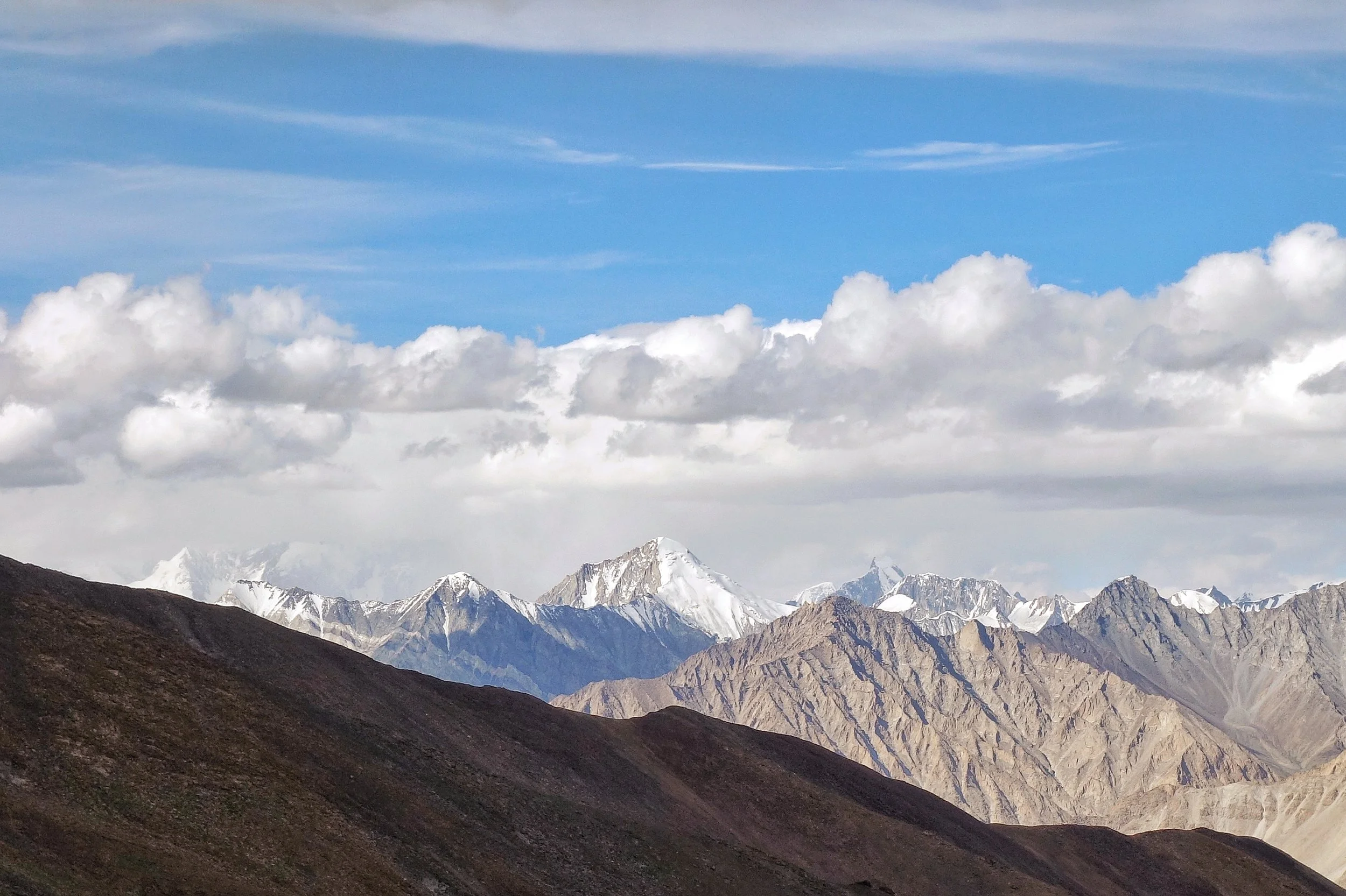
The Muztagh
People who read Books about old explorations in the Western Himalayas and Karakoram and the Hindu Kush come across a term quite often “Muztagh”. The first time I read this name, and though I was unaware of the meaning I knew it was a strong word. For a long time Muztagh was the name given to the almost impenetrable wall of Mountains which separate Kashmir from Central Asia. An of course with everything in Central Asia the word has Turkic origins.
Muztagh is made up of two words : Muz/ Buz which means Ice and Tagh/Dagh which means Mountain. So it means Ice Mountain which is similar to the word Himalayas which gets its from Sanskrit words Him meaning Snow and Alaya which means home. To the Ancients in India any Mountain which was permanently Snow covered was a Himalaya and in the same way the word Muztagh was the term used by the Turkic people to describe any Mountain that was permanently covered with Snow. Simple implication is that Snow covered Mountains always had a certain degree of reverential awe attached to them and it is no wonder that in may beliefs the Mountains were supposed to be the place the Gods resided.
The Karakoram was for the longest time referred to as Muztagh. The Karakorams because of their perpendicularity are the most impenetrable Mountain Ranges in the World and the people never went into them and there is simply no inhabitation. That's why it took Westerners to actually figure out that K2 was the second highest Mountain in the World. To the locals (as in the people living closest to the K2) it was simply a Muztagh out of many Muztaghs. And to them any Mountain in any direction was simply a Muztagh. They didn't really care if it was the Karakorams, the Himalayas, the Hindu Kush or the Pamirs. And this is unlike say in Nepal where the Everest was known as the Sagarmatha or “The Goddess of the Sky’ and the Tibetans called it the Chomolungma or the Holy Mother.
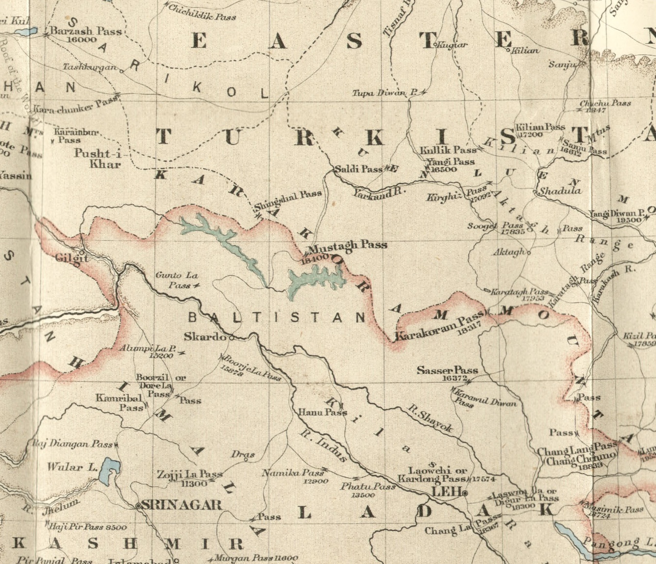
And as of today the term Muztagh is still in use for some Mighty Peaks in the Karakorams, in the Pamirs and even on the Northern edge of the Tibetan Plateau near Mongolia. And it was also the name of a very famous Pass which connected Baltistan with Central Asia made famous by Francis Younghusband who came down from Central Asia into Baltistan via the Mustagh Pass. Infact Younghusband identified two Passes as the Muztagh pass. One was the Old Muztagh Pass and the other was the New Muztagh Pass. Both Passes were well over 5000 m and were on the watershed between the Tarim Basin to the North and the Indus Basin to the South. The Muztagh Pass was the shortest Route between Skardu and Yarkand and by extension the shortest Route between Kashmir / Punjab bypassing Ladakh and into Central Asia and was a part of the Silk Route in those days. The Pass had gradually been abandoned as it became treacherous to cross due to Glacial movements.

By Jialiang Gao www.peace-on-earth.org - Own work, CC BY-SA 3.0, https://commons.wikimedia.org/w/index.php?curid=2626699
And now coming to the Mighty mountains that carry the Muztagh name. The mightiest is of them all and one of my favourite Mountains is the Muztagh Ata. Not only is it a “Muztagh” but its an “Ata”. Ata is the Turkic word for Father/ Ancestor. So Muztagh Ata means the Ice Mountain Father. At 7509 m it is one of the highest Peaks in Central Asia and though regarded as a part of the Kun Lun Range by some it is considered a part of the “Eastern Pamirs” by most. Whatever Range its classified in it is a majestic Mountain and said to be one of the few 7000+ m Peaks which is considered easier to climb than most other Peaks of that classification. And as per one scholar the Rig Veda also mentions a Mountain called Mujavant from where the best Soma came from and he is certain that the Mountain in question is none other than the Muztagh Ata. Interesting to say the least.

The Muztagh Tower : By Kogo (talk · contribs) - Own work by the original uploader, GFDL, https://commons.wikimedia.org/w/index.php?curid=35803
Now we come to another interesting Mountain called the Muztagh Tower which is in the Baltoro Range of the Karakorams. This Tower shaped Mountain was first immortalized on film by none other than Vittoria Sella who took a picture of this impressive Peak. At 7276 m it just great justice to its status as a Muztagh. Infact the pic of the Muztagh Tower was used in some Book where it was titled simply as the “Last Citadel” and it is almost one. The “Last Citadel” was climbed in 1956 when Sella’s pic set off a race between two separate teams of Mountaineers.
And the most isolated Muztagh. The “Great” Muztagh or the Ulugh Muztagh. The word Ulugh in Turkic stands for “Great”. This is an extremely remote Group of Mountains at the North of the Tibetan Plateau and its lies on the Northern front of the Kun Lun Mountains. For a long time the elevation of this Mountain was said to be 7700m plus but in 1985 using modern equipment the height was measured to be 6973 m but didnt do anything to take from the Ulugh part. It still is unclimbed and it is said that many Expeditions have even failed to reach the base of the Mountain due to its remoteness and due to the fact that driving to the Mountain involves going through terrain of between 4000 m to 5000 m. And it is a beautiful Mountain. Doing great justice to the Muztagh part as well.

The Ulugh Muztagh
And lastly even today the Karakorams are sometimes referred to as the Karakoram Muztagh or even Muztagh. Infact Eric Shipton mentions that once upon a time there were certain Scholars who wanted the Karakorams to be re-named as the Muztagh. But that didnt really happen but even today the sub Ranges of the Karakoram carry the Muztagh title. Some of these Muztagh sub Ranges of the Karakorams is as under
Baltoro Muztagh
Batura Muztagh
Hispar Muztagh
Panmah Muztagh
Rimo Muztagh
Sasser Muztagh
Siachen Muztagh
And leaving you with a pic of the Sasser Muztagh (also known as Saser Kangri as Kangri is the Tibetan word for a Mountain) as seen from the Khardung La. At 7672 m it does great justice to its title as a Muztagh. And once you are done with with your selfies at the superlative sign boards at the top take a look North. And when you spot the Saser Muztagh just bow down. A little. You just saw a Muztagh.
Pic from August 2018. The Saser Muztagh/ Kangri, Khardung La, Ladakh
The Kashmir Mammoths : A Tragic Comedy Almost
Kashmir was once home to the Woolly Mammoths at the time of the last Ice Age. To date there have been remains of two Mammoths that have been found in the same area in Kashmir at the Interval of 70 years. And tragically both were taken out of Kashmir. One set of the Mammoth remains were subsequently returned while a struggle is on to get the other set.

The Kashmir Mammoths : A Tragic Comedy Almost.
The Woolly Mammoth, the giant of the North which roamed the expanses of Central and Northern Asia among-st other places. And it was also the ancestor of both the Asian and the African Elephants but became extinct after the ending of the Ice Age from what we know.
Many remains of the prehistoric Mammoths have been found all over the world, most notably in Siberia where the remains buried in the permafrost have emerged as fresh as probably the day the mammoth died. And all thanks to the frozen Ground and the low temperatures. In-fact the remains are so fresh that DNA samples have been taken and some scientists are trying to clone and resurrect the Mammoth. I am sure many of you must have seen the “Raising The Mammoth” series on Discovery or was it on National Geographic. Not very sure.
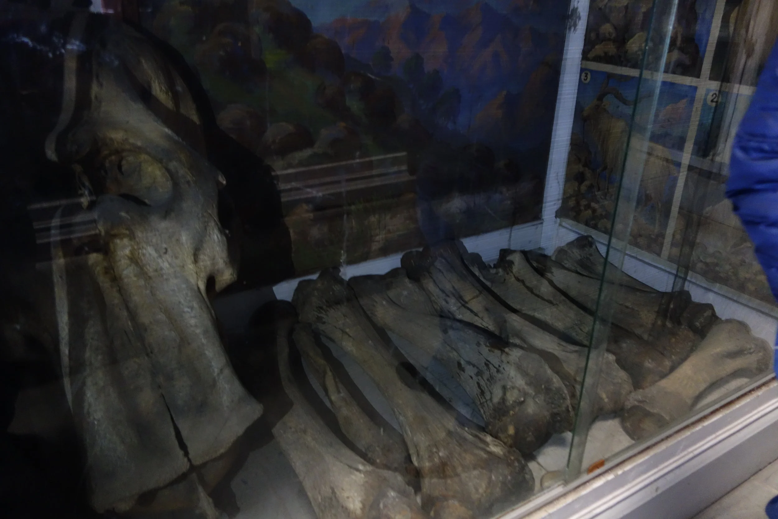
And now the story of not one, but remains of two Woolly Mammoths found in the Himalayas from where else but Kashmir. The thing is that Kashmir is so beautiful that even a couple of Mammoths decided to move in and make it their home. Now this was unprecedented and apparently the second Mammoth found was said to be the biggest Mammoth remains ever found. The Skull was 5 feet by 4 feet. A broken Tusk almost 3 feet along was also found. Experts later calculated the size of the Tusks to be a staggering 12 feet. Yes 12 feet. That's like One and half Stories. This was really some find. But in Kashmir even such finds can get embroiled in comical situations.
The first Mammoth was found in 1931 by an American called Dr. De Terra who was a researcher with the Carnegie foundation in the United States. He was working for the Yale University and visited Kashmir twice while on the trail of the remains of prehistoric man in Kashmir. He found some remains of prehistoric times but his most exciting find was the remains of a Mammoth at the same general location where the second Mammoth remains would be found 70 years hence. But the good scientist on his return took all the Mammoth remains with him to the good old United States of America. The Mammoth remains were then put on display at the Yale University in New Haven. And it was then that this news reached the Maharaja of Jammu and Kashmir. Of course he was infuriated at his people to let go of such a significant prehistoric find. So letters were sent by the Maharaja to the Yale University asking for the return of the Mammoth remains as they were taken without any Official consent. Under pressure the University and more importantly Dr. De Terra relented and the Mammoth remains were sent back to Kashmir. The Doctor maintained he had got the necessary permissions to take the remains but had relented to return them as he wanted to go to Kashmir again.
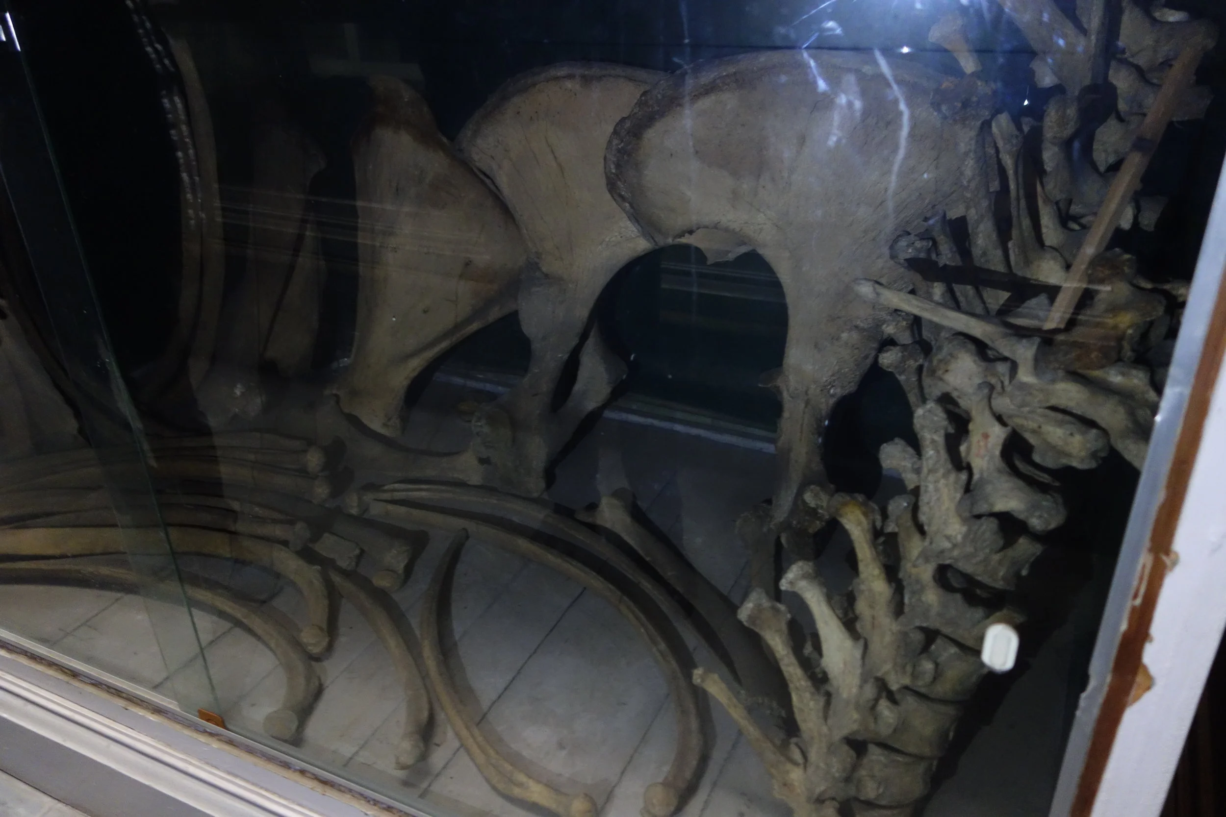
So the first Mammoth returned to its beautiful Motherland, Mouj Kashir (Mother Kashmir). And now it was put on display at the new Palace of the Maharaja of Jammu and Kashmir. And the Tusks of the Mammoth worked well as Coat Hangers. To be honest who can think of a more impressive Coat Hanger than prehistoric Mammoth Tusks. But soon enough better sense prevailed and in around 1935 the Mammoth remains were shifted to the Sri Pratap Singh Museum in Srinagar. And its there where it rests to this day and were damaged a little in the Floods. As a result they are not on display for Public and is in the Archives.
Coming to the second, bigger, Mammoth which was discovered in 2001 by a Group of students on a field trip around the Karewa in Pampore. The find was a great one and got top publicity in the National Newspapers as well. There was great euphoria among the Scholars and the Students for obvious reasons. And samples were sent to to forensic labs for carbon dating and other stuff. All was nice and dandy. But good things rarely last especially in Kashmir. One fine day in 2007 a Scholar went to the site and discovered to his horror that the Mammoth remains had disappeared from the Site. Not even a trace was left behind. It was obviously a professional job.
Well the Mammoth was soon found in the corridors of the Geology Department of Jammu University. The comedy transpired in this way, one of the Scholars co-opted for studying the remains on behalf of Kashmir University had actually come from Jammu. And on his return to Jammu he decided to take all the remains with him to Jammu University. Come on not again. It was like Deja Vu. Were the Mammoth God's not happy with Kashmir ?
And soon of course a war of words ensued between both Universities. With accusations flying in both directions. And while all this was going on Jammu University announced that it no longer had the Mammoth remains. What do mean you don't have the Mammoth remains, they were asked. Well we have given the mammoth remains to the Wadia Museum of Natural History in the Jammu University itself. So technically they were in the Jammu University but were installed in the Museum and hence Museum property. Kashmir University people were of course furious as Kashmiri Mammoth belongs to Kashmir. And RTIs were filled and Cases were filed. I think. Or I would assume that being the only resort to get the Mammoth back.
Now the funniest part of the whole Mammoth story. In response to the RTI’s, Jammu University came back with a reply which made many Experts fall off their Chairs. What Mammoth ? They said. They were just remains of an Elephant, what’s all this talk of Mammoths ? Claiming that the Mammoth remains were actually that of an Elephant would of ofcourse lessen the severity of the consequences that it would entail. Even the head of Geology and the boss at the Wadia Museum of Natural History “clarified” that there is no “Mammoth” on display at the Museum. This was in 2018. “Mammoth Lies” say the Scholars from Kashmir University.
Anyways.
At least we got one back from the United States of America.
I am an eyewitness. I even took pics on a Visit to the Museum when the officials at the Museum were kind enough to let me see and photograph the Mammoth remains. For the record I am Posting a couple of pics for the record. We already lost one. We don't want to loose another one.
“And that's all i have a say about that” as a line goes in one of my favorite Movies.
Pics from October 2017. Sri Partap Singh Museum, Srinagar, Kashmir
Himalayan Geology / Tectonics
A detailed Map explaining the Plate Tectonics and the Geology of the Himalayas and their formation. Helps us understand the basic fault lines between the Indian and the Eurasian Plate. Many other smaller details make it a good guide to understanding the formation and the evolution of the Himalayas.

Source: An Yin 2005
Himalayan Geology / Tectonics
Most of us are aware of the process of the formation of the Himalayas which were formed by the Collision and subsequent subduction between the Indian Plate and the Eurasian Plate. But that's about all we care to know. Well most of us though.
Now here is a splendid map that shows the Geology as well as the Tectonics of the Himalayas and how actually the boundaries are defined. It also shows the distinction between the Lesser Himalayas / the Greater Himalayas / the Tethys Himalayas / the Trans Himalayas as well as the Karakorams. It is very complicated as well and took me, an Amatuer, a lot of time to really figure out this stuff. But the more you understand the more interesting it becomes.
Some points I will run you through so that you also get a basic handle on this rather complicated Map. Many times a fundamental question is asked, are the Karakorams a part of the Himalayas ? Well the answer based on Geology and Tectonics is that its not. The Indus Tsangpo suture lies between the Tethys Himalayas on one side of the suture and the Karakoram-Tibet on the other side.
You can see the Thrust lines marked with little arrows. The main one in front in the Main Mantle Thrust which more or less follows the Indus Tsangpo suture. In simpler words the Indus and the Tsangpo (called the Brahmaputra in India) flow along the Main Mantle Thrust. However the Main Karakoram Thrust deviates as a separate fault form somewhere near the Pangong Lake. It from there on follows a course of its own. Where as the Main Mantle Thrust follows the Indus (it's actually the other way round) till beyond the Nanga Parbat which is considered the Western anchor of the Himalayas. And on the Eastern side the Namche Barwa is the considered the Eastern end of the Himalayas.
And then you can also see that the Salt Range in the Punjab is the youngest sub-Range of the Himalayan System. And interestingly it also shows Himalayan Tethyan sequence as the Blue colour indicates.
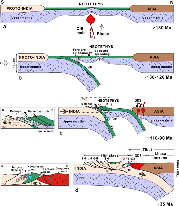
Another diagram shows how the Indian plate subducted under the Eurasian Plate. And how the Tethys Himalayas was formed when a part of the Ocean Floor was uplifted and placed right on the top between the Great Himalayas and the Tibet mainland. As the diagram shows the Indian plate is subducting or sliding under the Asian plate and this isn't without some friction. And this friction and this to and from between the two land masses resulted in the emergence of the Himalayas. And the subduction still continues and the Himalayas continue to rise and as per experts the rise is maximum in the Nanga Parbat region as it lies on the edge and gets pressure from the other side as well.
Some of the terms used explained in simple terms from various sources from the Net :
Faults : A fault is simply a fracture in a layer of Rocks or a discontinuity or a separation if you may. And these are the hot-spots where all the Tectonic and subsequently Volcanic eruptions. Think of faults as the Borders between two masses which are constantly changing and engaging each other. Besides the Main Thrusts (Main Frontal / Main Boundary / Main Central / Main Mantle / Main Karakoram ) there are smaller localised Thrusts named properly in this map with the local annotations which makes it more fascinating.
Ophiolites : Ophiolites are pieces of oceanic plate that have been thrusted (obducted) onto the edge of continental plates. They provide models for processes at mid-ocean ridges. Ophiolites are an assemblage of mafic and ultramafic lavas and hypabyssal rocks found in association with sedimentary rocks like greywackes and cherts.
STD Klippe : A klippe (German for cliff or crag) is a geological feature of thrust fault terrains. The klippe is the remnant portion of a nappe after erosion has removed connecting portions of the nappe. This process results in an outlier of exotic, often nearly horizontally translated strata overlying autochthonous strata.
Nappe : In geology, a nappe or thrust sheet is a large sheetlike body of rock that has been moved more than 2 km (1.2 mi) or 5 km (3.1 mi) above a thrust fault from its original position. Nappes form in compressional tectonic settings like continental collision zones or on the overriding plate in active subduction zones. Nappes form when a mass of rock is forced (or "thrust") over another rock mass, typically on a low angle fault plane. The resulting structure may include large-scale recumbent folds, shearing along the fault plane, imbricate thrust stacks, fensters and klippe.
MCT Windows : A tectonic window (Fenster in German) is a geological structure formed by the erosion or by normal faulting on a thrust system. A huge sheet of rock mass (hanging wall block) that has been transported to a considerable distance by movement along the thrust is called a nappe
The Map Shawl of Kashmir
One of the most exquisite creation of man on Fabric, arguably the finest. The Legendary Map Shawl of Kashmir commissioned by Maharaja Ranbir Singh of Jammu and Kashmir for Queen Victoria of the British Empire and it took 30 years to create this masterpiece. We present for the first time, the Map deciphered as shown on the Shawl which is now on display at the Victoria and Albert Museum.

The Legendary Map Shawl of Kashmir
This has to be one of the most the amazing piece of Art on Fabric ever created. The master piece of Kashmiri kani work on a Pashmina Shawl.
The amazing and exquisite Map Shawl of Srinagar. This Shawl took 30 years in the making. There are 3 or 4 such specimens in the world. And these were made in the late 1800’s.
One was reportedly presented to Queen Victoria by Maharaja Ranbir Singh and is presently at the Victoria and Albert Museum in London. One more is with a Museum in Australia. One is with a private collector and this piece is at the Shri Pratap Singh Museum in Srinagar though it’s not on display as it needs some refurbishing after the Floods.
These are the photos of the specimen at the Victoria and Albert Museum and all the pics are from their. This was presented to them by Mrs.Estelle Fuller in 1970 and this specimen as per the Museum was made in 1870.
Have spilt up the Shawl in Grids for better and in depth views of intricate Work done on these Shawls. The attention to details are just mind blowing.

1. Safa Kadal Bridge on the Right Top corner.

2. The Shergarhi Palace,built by the Afghans, which was the residence of the Rulers of Jammu and Kashmir until 1920.

3. The Bulbul Shah Mosque between Ali Kadal and Naw Kadal

4. Shankaracharya Temple on the extreme top right.

5. The Harwan Area.
6. The Nishat Garden

7. The Parade Ground next to the Shergarhi Palace

8. The Main City Neighbourhoods

9.

10.

11.
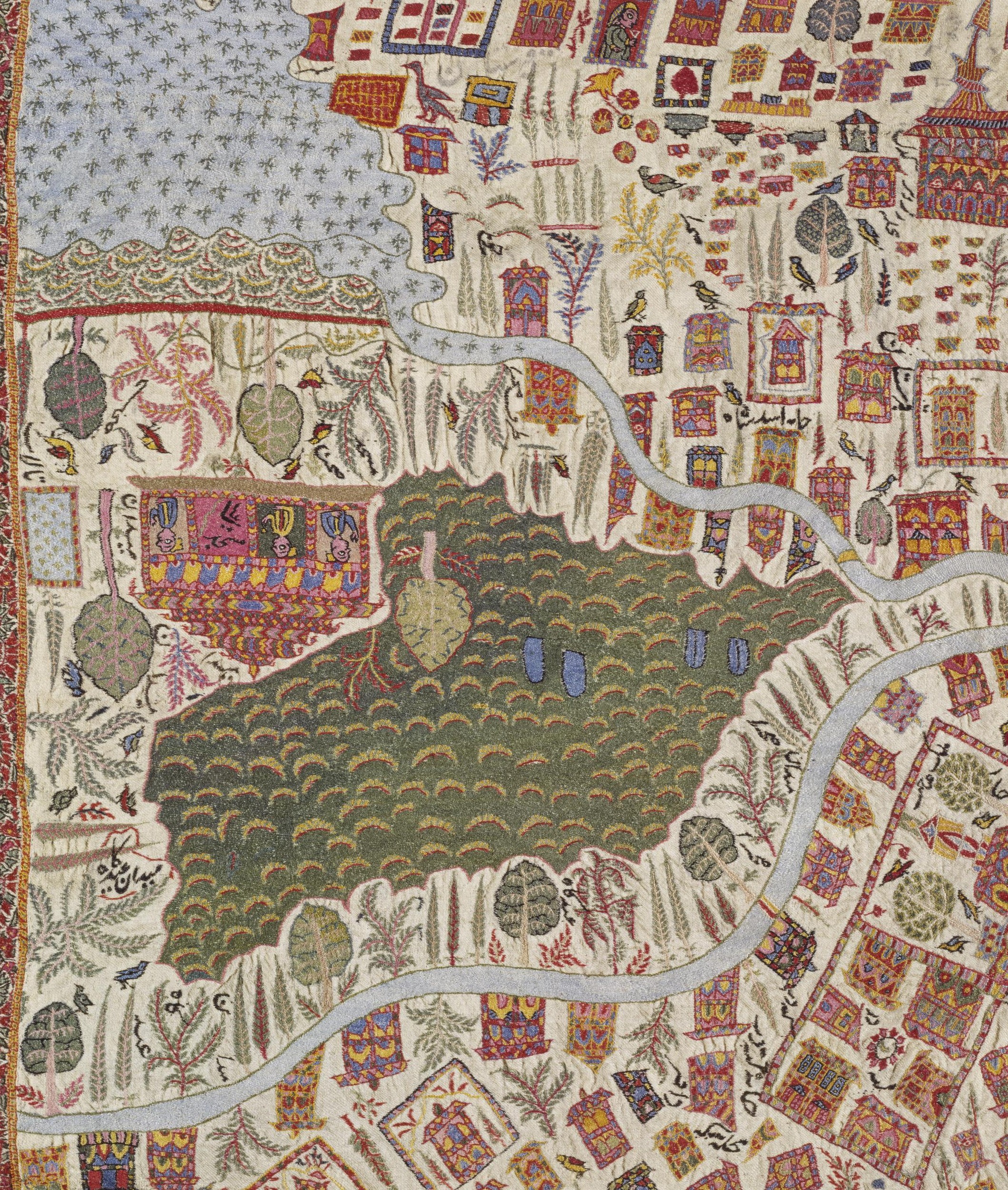
12.

13. The Dal Lake in front of the Nishat Bagh

14. Shikaras on the Dal Lake in front of the Shalimar Bagh. The figure riding in the Boat with a halo around his head is supposedly Maharajah Ranbir Singh.
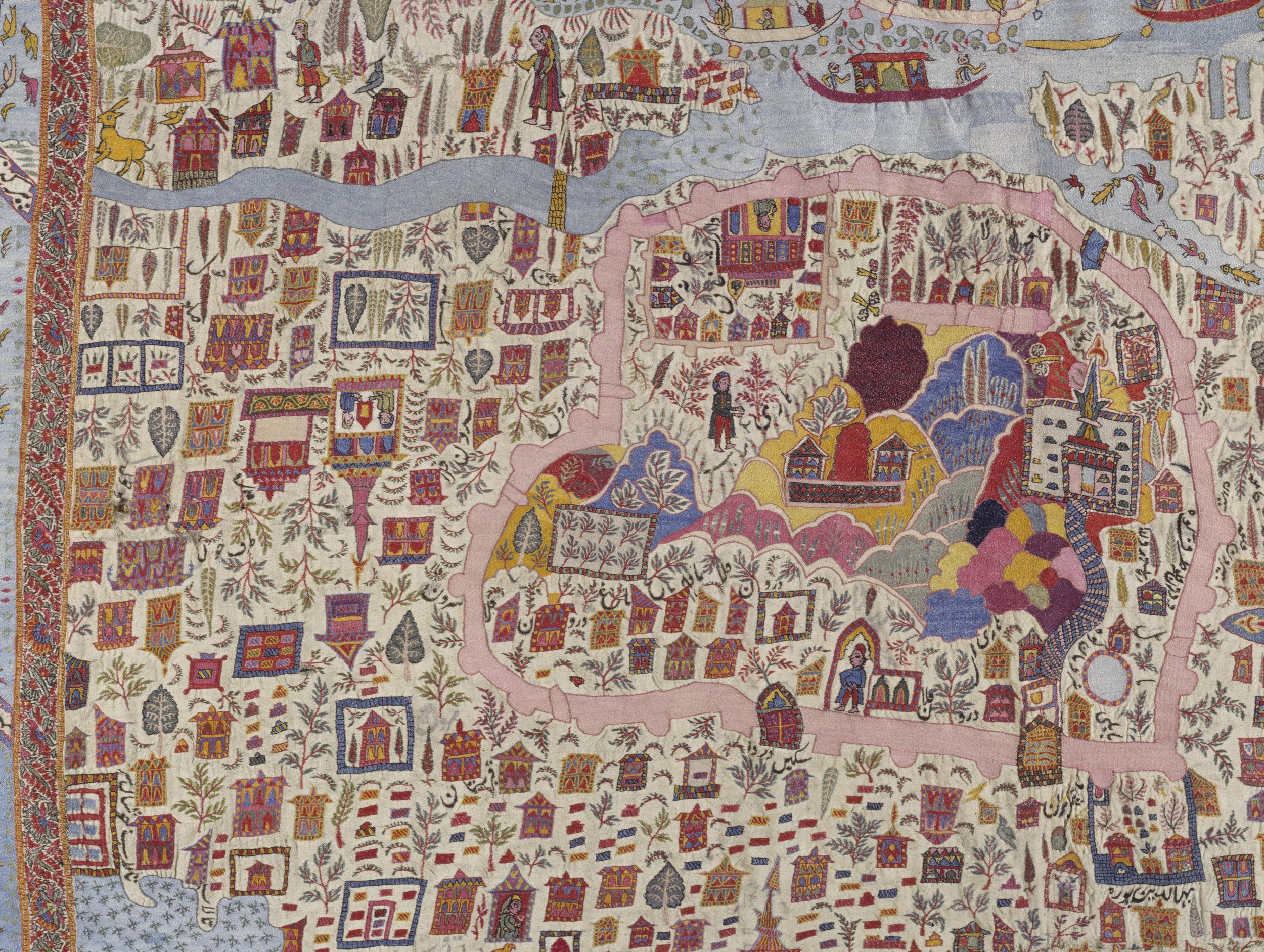
15. The Hari Parbat Fort area.

16. The backwaters of the Nigeen Lake and the Dal Lake

17. The Jama Masjid.

18. The Shalimar Garden

19. Bagh e Dilawar Khan

20.

21. The Shanakaracharya Temple at the top right

22.

23. The Shah Hamadan Mosque, the Patthar Masjid and the Budshah Tomb.

24. The Shergarhi Palace and the Parade Grounds.
New Routes Opened in Ladakh
The Government has announced the Opening of some new Routes in Ladakh which were earlier Off Limits to the General Public except with Special Permits. Hopefully in the near future more such areas would be opened up for Tourism in Ladakh.
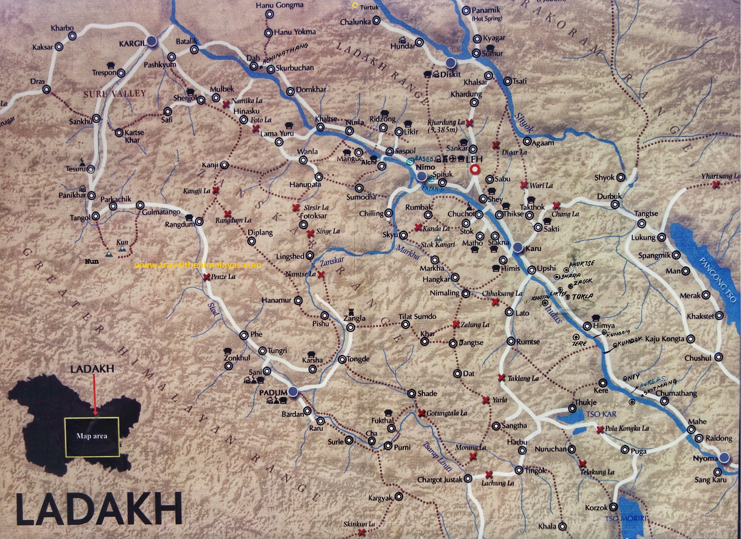
New Routes for Ladakh 2019
The Government has recently announced the Opening of new Routes in Ladakh in order to promote Tourism in some of the more Offbeat Locations in Ladakh. Some of these Routes have already been used by some Travelers who got a Permit but now its open for all.
This is a welcome step and will help the People living in these Remote areas as they now have the opportunity to make a living from Tourism as well. Also it shows that the Government is a mood to open up new areas in Ladakh, a large part of which still is off limits to the General Public due to the Border disputes we have with our neighbors in the Region. It also signals that relations with China are easing off and hopefully one day the Border disputes wil be settled and the whole of Western Ladakh would be open to the Public.
Below is the Map of the Areas around the Pangong Lake and the Tso Moriri Lake which are mostly covered in the new Routes that are opened. This would also enable greater access to one of the most mind blowing part of Ladakh, the Changthang which extends into Tibet.
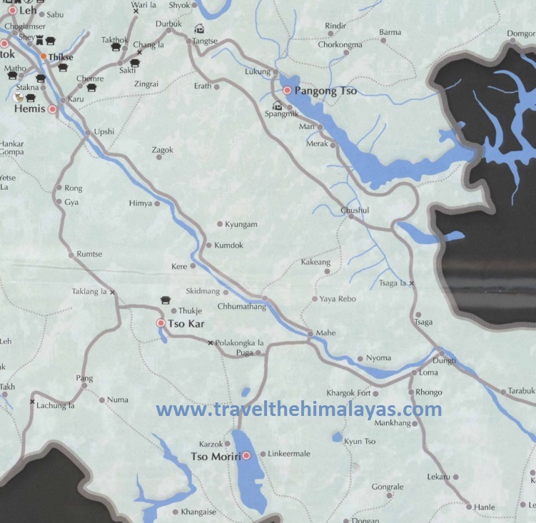
And these are the exact details of the Routes that have been opened and they have been Colour marked in the Map at the bottom
1. Merak - Loma Bend via Chushul (Instead of going straight from Chushul to Mahe you go left and get directly to Loma Bend. See Map 2 as well and this Route will take you over the Tsaga La Pass. (Shown in Green Colour)
2. Chushul to Mahe via Kakset La (The official release says Kartasangla but we assume this is an error). This is the direct Route over the Changthang and takes you to Mahe (Shown in Red Colour)
3. Dubruk - Erath - Chusul and then following no.1 Route onwards to Loma bend and then onto Hanle (Shown in Blue) : Instead of the traditional Route from Dubruk to Pangong Tso this Route will take you through the Route almost parallel to that and onwards to Chushul. From Chushul onwards you follow the Route 1 again.
4. Karzok - Nurbo - Sumdo - Parangla - Kazand (Shown in Pink)
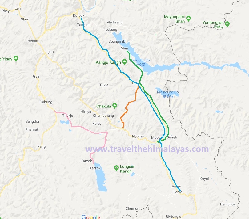
The Elusive Kashmir Sapphires
The Story of the Kashmir Sapphire, the finest Sapphire that exists. Very few true Kashmir Sapphires exist today and are mostly held in Museums and Private Collections. We delve into the fascinating history of when and where did these Kashmir Sapphires came from and why they are so rare.

The Elusive Kashmir Sapphires
It was a cold November day of 2015 in Geneva when Ronny Totah got the phone call. It was about a Sapphire coming up for auction. And not any ordinary Sapphire, it was the finest Sapphire known to exist, the elusive Kashmir Sapphire. The bidding for this Sapphire would open at just 12 million Dollars and this was an invitation to Ronny Totah to attend a viewing of the Sapphire in New York before the bidding. The description and details sounded hauntingly familiar.

The Kashmir Sapphire Bracelet that was stolen from the Four Seasons in Milan in 1996
If someone knew the value of a Kashmir Sapphire and as someone who could afford it, Ronny Totah, the partner in the Jewellery House, Horovitz and Totah was the man. But the phone call got Ronny thinking about an incident that took place 20 years ago from that date. Horovitz and Torah had an exclusive Kashmir Sapphire set in a Cartier bracelet which was supposed to be put up in an auction exclusively of Cartier pieces. And a few days before the Auction some of the pieces were put up on display at the exclusive Four Seasons Hotel in Milan. It was the November of 1996. On the fateful day there were 50 people in the Exhibition Hall and the unthinkable happened. The Cartier bracelet with the Kashmir Sapphire disappeared. Seemingly into thin air it seemed. At that time.

A Pic of the Sapphire Mine by LaTouche
So where did these exclusive Kashmir Sapphires come from ? Like with all famous precious stones there are several versions to this story. A popular version goes like this. A Group of Lahouli traders turned at a Jewelers shop in Shimla and what caught the Jewelers eye were the brilliant Blue Sapphires they had to offer. And of course the Lahouli traders were averse to stating the exact origin of the Stones for obvious reasons. On being further pressed for information they conceded that they got the stones from the Mountains on the border with Zanskar. And apparently they didn't know the exact location as they in turn had got the Stones from a Shikari who had lost his flint. And he wanted to light his smoke. So he looked around for a quartz or a hard stone and found a blue stone which served his purpose rather well. He decided to carry it and later on gave it to one of the Lahouli traders. Even Shikari saab wasn't too sure where he found the Stones.

A Pic of the Apparatus used for Mining by LaTouche
But the news of the Blue Sapphires spread in Shimla and soon a few more stones turned and sooner rather than later the news wafted across and reached the the ears of the Maharajah in who’s realm these Stones originated. And he got his men working. Soon it was heard that the Stones had their origin in Padar, a Valley along the Chenab which bordered Himachal on one side and Zanskar on the other side. But initially it was mistaken as Padam instead of Padar so guys turned up in Padam in Zanskar looking for the whereabouts of the source of these priceless stones. But finally Padar was identified as the source and a body of Maharaja’s soldiers were dispatched to secure the Mine for the Maharaja of Jammu and Kashmir or the “Maharaja of Kashmir” as was more commonly known and hence the Sapphires got a name. The Kashmir Sapphires.

An unknown Trekker sitting in front of one of the Mine Shafts in the 80’s.
It was in 1882 when the Mine was secured and samples sent to the Indian Museum, where the experts were also astonished at the quality of these Sapphires. They were by far the best Sapphires that were ever seen. This was Music to the ears of the Maharaja and soon large scale mining of the Kashmir Sapphire started and it was soon on the wishlist of all the Maharajas and the Mem Saabs in the summer capital of British India, Simla. But exactly 5 years down the line after reaping great benefits the Mines seem to run out of Sapphires and the operation became unprofitable.

Gulabgarh, the main Village in Padar and the last Roadhead.
The Maharaja was alarmed and he invited experts from the Geological Survey of India to visit the Mines and give their expert advice. Tom D Latouche, the Deputy Superintendent of the Geological Survey of India led the team. And they managed to reach the Mines but not without some difficulty as the are to this day doesn't have Roads or Electricity and a 5 day walk apparently from the nearest Road head. He noted that the deposits in the Main Mine were almost exhausted and there was Mining activity a 100 meters below the main on the Valley floor. However the Sapphires from this location were inferior in quality to the Sapphires at the main Mine. However they did a study over a couple of months and made a detailed Report to the Maharaja. But it did nothing revive the Mining operations as the profitability was down as it seems the place had run out of Sapphires. Simple.

Typical topography of the area where the Sapphire Mines are located
Mining operations were shut down completely in 1889 till 1905 though Poachers would sometimes hit upon the Mines. In 1906 the Mines were leased out to a private Company who mined for 2 years without much success. And so the story carried on with a new Company / Individual taking the lease every few years and then walking out as it was just too costly because of the inhospitable terrain and overall remoteness. After Independence JK Minerals took the Mines and again a number of classified Surveys and Mappings were done of the area. But nothing much came out of it. Every few years the Government of Jammu and Kashmir comes out with a new Scheme to lease out the Mines but nothing really happens knowing the dysfunctionality of my State.
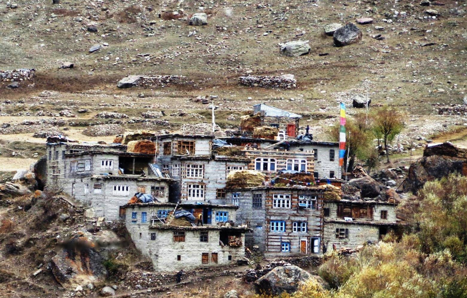
Sumcham, the last Village on the trail that leads to the Hagshu La and into Zanskar
In the meanwhile the Mines are Guarded by the Police and are strictly off limits for everyone. Well almost everyone if you know what I mean. No one is simply allowed in the area and though you will find the location on the Internet I have purposely left out the exact location and details of the Mines. People who need to know already know it. Anyways its off limits so nothing much can be done even if you know the place. I will let it rest at that.
Hence the value of Kashmir Sapphires has only gone up and few are seen outside of Museums and Private collections. They are simply not found anymore.

Kashmir Sapphires in ready as well as raw form.
Ah and coming back to Ronny. After going through more details Ronny was convinced this is the same Kashmir Sapphire which was stolen in Milan. Though reduced in Caratage (thieves normally do that and alter the shape of the Stone for obvious reasons) the characteristics mentioned in the certificate were exactly like his Stone. The Stone was withdrawn from the Auction but Ronny didnt stop there. Though he got insurance amount of around 1.8 Million dollars in 1996 after the Theft but he needed the culprits to be caught. As we speak now Ronny is fighting out in the Courts with present owners to get viewing of the Kashmir Sapphire and have it verified by independent experts. More on that when something happens.
Coming back to the Kashmir Sapphires and this is what a Gemologist says about them “The Sapphires of Kashmir form an exclusive class of their own. In the Jewel trade it is customary to attach the appellation 'Kashmir' to any fine Sapphire regardless of its geographical origin. This is an indication of the outstanding qualities of Kashmir Sapphires. The colour of these Sapphires resembles the beautiful hue of the peacock's neck. Even a small concentration of that fine colour illuminates the entire structure of the Gem.”
The Elusive Kashmir Sapphires
Mahasu Temple Hanol
Mahasu Devta is the main Devta / Deity of the people living in the Jaunsar Bawar region of Uttarakhand as well as in the neighboring districts of Himachal Pradesh. The main Temple to Mahasu Devta is located in Hanol in Uttrakhand close to the border with Himachal Pradesh. Interestingly Mahsu Devta has a Kashmiri connection. We explore.

One little thing has always struck me since childhood. In the Western Himalayas there are a lot of places connected with Hindu mythology and the Mahabharata to be particular. And out of the Mahabharata about the Pandavas and the time spent in “Vanvas”. Any and every place had something or the other to do with the Pandavas. So it seemed everything which couldn't be explained or attributed to someone was made a part of the Pandavas vanvas. All this sounded nice and dandy till the time you don't put your mind to it. And then I thought how could they be at all these places at the same time ? And then I asked myself who were the Pandavas. Well they were a part of the Epic. But these places do exist for real and they must be someone’s handiwork. And looking deeper a pattern emerged. Of course at that time no one really questioned the authenticity of these claims. Most will not even now. But I have the right to know who built the “Pandava Temple”, who made the Horses at Ghoda Gali attributed to the “Pandavas” or the countless other things that are attributed to them. Because if I keep believing the Pandava theory then it means I keep denying myself the history of the people who actually built this. And on a larger scale everything was attributed to Hindu mythology / Gods which again was a something hard for me to swallow. I guess you would have got the gist of what I am saying. Ok moving on to a more particular example.
In parts of Western Uttarakhand and Eastern Himachal Pradesh the people share reverence to a particular Devta, known as the Mahasu devta. Infact the Mahasu Devta seems to reign supreme in the Hilly/Mountainous areas between the Satluj and the Yamuna River. His domain also spreads to neighbouring areas in the lower Hills. The main stronghold of Mahasu Devta domain is the Jaunsar Bawar area in Dehradun District but Mahasu Devta is also revered in the neighbouring parts of Himachal Pradesh in Shimla and Sirmaur Districts.
I have been hearing of Mahasu Devta since I was born as my Mother's family had Apple Orchards in the Kotkhai region and we used to visit on and off. The Village where we had the Orchards came under the purview of a bigger Village known as Mahasu. Infact during the older times the whole belt of Himachal from Chopal to Kotkhai to Jubbal to Rohru was known as the Mahasu District. Also in the neighbouring areas of Uttarakhand especially the Jaunsar Bawar region also Mahasu Devta was the one of the main deities. Infact one of the main Temples of Mahasu Devta lies in Hanol which is in Uttarakhand adjacent to the border with Himachal Pradesh. Infact its now the Jaunsar Bawar Region that is considered the stronghold of Mahasu Devta.
Mahasu Devta now holds precedence over all the other local Gods and Goddesses and is the the supreme Lord of the Region. As per the legend there are four main Deities and Mahasu Devta is the numero uno. It is said that Lord Shiva’s son Kartik is personified by the four Mahasu deities, who are brothers, as Botha Mahasu, Bashik Mahasu, Pavashi Mahasu and Chalda Mahasu. Out of all the four the most important one if Botha Mahasu or simple referred to as the Mahasu Devta. Of course in the present time all the Devi Devatas are connected with Hindu mythology and their actual origin has gone into obscurity.
Moving away from the mythological account, as per some accounts the name Mahasu is a derivation of the word Mahashiv and and it came along when Shaivism was introduced in the region. Infact the deity worshipped as Mahasu Devta at Hanol is still actually a Buddha in a seated position. This points out to the fact that Buddhism was prevalent in the Ref]gion before the Shiva cult came in and a majority of the people turned to worship him. This was a continuation of the same events that took place in Kashmir. Infact it is said that it was a Brahmin from Kashmir, Huna Bhat who introduced Mahasu Devta in this area. It is said that the Brahmin was earlier serving the ruler of Kashmir at that time, Mihirakula who was an avid Shivite. Now Mihirakula who was an Alchon Hun (or Svet Huna / White Huns) , was deemed to be very cruel and destructive towards Buddhism and he is supposed to have destroyed many Buddhist Temples and icons. The Alchon Huns had themselves come down from Central Asia and conquered the Gandhar and the Kashmir region and even carried on their conquests in the Northern Plains. Mihirkula sent emissaries to spread the cult of Shiva into other places in the Himalayas as well. And Mihirakula is detested in Buddhist text for the destruction he wrought upon the Buddhists in Kashmir and its him thought to be responsible for the eventual disappearance of Buddhism from Kashmir.
Huna Bhatt, was probably a name given to this Priest who was himself probably a Hun or of Hunnic descent. And Hanol was named after him. Think about it. A Central Asian Hun who came down from Kashmir to Garhwal and laid the foundation of one of the most revered Devatas, Mahasu Devta and introduced the cult of Shiva.
Of course there is another tale which does rounds of how Huna Bhatt was a local Brahmin who was sent for penance into the Mountains of Kashmir and how Lord Shiva himself appeared before him and granted him….he thence returned to Hanol and set up the Temple.
What this points out to the fact that the whole of the Himalayan Region from Kashmir to Himachal to Uttarakhand was predominantly Buddhist or Animist/ Local Devta worshipping by some accounts. And to counter Buddhism and the Buddha in particular the cult of Shiva was propagated. And it helped that Shiva was shown as the God of the Mountains with his home on the mighty Kailash but the fact remains that the first time Lord Shiva or Osheo as he was called appeared in any physical form was in the First Century in a coin issued by Great Kushan Emperor Kanishka. The physical postulation of the Buddha in the form of visuals and sculptures pre-dates those of Shiva, which is a clear evidence of who came first. It would also be pertinent to point out that the name “Shiva” does not appear in the Rig Veda and it is said by some that he was called Rudra in the Rig Veda.
Anyways before ruffling more feathers let me state that the Himalayas predate “Religion” by millions of years. Religion is matter of personal belief but the Himalayas are the eternal fact. And quite a big one at that.
Disclaimer : The Vedic Religion of the Vedas is the fountainhead of Hinduism, Buddhism and Jainism. All are Vedic Religions.
And I quote the Rig Veda Hymn 10:129
"But, after all, who knows, and who can say
Whence it all came, and how creation happened?
the devas (gods) themselves are later than creation,
so who knows truly whence it has arisen?"
This is what I believe in.
The Last Queen of Kashmir
The story of Queen Kota or Kota Rani as she was also known. The trials and tribulations that she witnessed during a very volatile period in History. And of course the tragic end of the Last Queen of Kashmir.

The Last Queen of Kashmir
And back to Kashmir to tell you the story of an interesting time in the history of Kashmir. A story of the last Queen of Kashmir. A story of the first Muslim King of Kashmir who came from Ladakh. A story of Shah Mir. And a story of a Tragedy.
It was the 14th Century and the Lohara Dynasty was in power in the Kashmir Valley and as was usual with the Loharas there was intense infighting amongst the Loharas and with the local Chieftains known as the Damaras. And the Loharas had already repulsed a number of attacks by the Ghanivids but however Kashmir being a protected natural Fortress was a big advantage and the Invaders concentrated more on the easier conquests in the plains of North India.
Besides there were invasions from the Central Asian side by the Mongols and Turks who use to come in and occasionally raid the country. The later Loharas were weak incompetent Rulers and it was just a matter if time before they would fall. It was imminent and at the same time they relied more on outsiders in the matters of importance given the distrust between them. There were two notable outsiders there at that time who’s name would go down in history.
One was the Buddhist Ladakhi Prince Rinchen, who after failing in an attempt to take over the Kingdom of Ladakh had crossed over the Mountains into Kashmir and found employment with the King. The King Suhadeva who was in power made the Ladakhi Prince, who’s full name was Lhachan Gualbu Rinchana, a Minister in his administration. But he wasnt the only prominent outsider who King Suhadeva made apart of his administration.
The other one was Shams-ud-Din Shah Mir, a Muslim who had come to Kashmir from the region Swat which once was a part of the Gandharan Kingdom just like Kashmir and a great center of Buddhist learning. His exact origin is not known but most probably a Swati of Tajik origin (a Gebbari) and his exact reason of leaving his homeland unknown. Whatever the reason was it didn't matter and he was also appointed as a Minister by King Suhadeva.
And then like in every story the Villains turned up. This was a Mongol and Turkic Army under the Command of Dulacha which decided to march into and plunder Kashmir. The Pagan Mongol Commander was about give a lesson in Central Asian Warfare to the Kashmiris. And it hit them like only the Mongols could hit in those times. The King Suhadeva tried to bribe the Mongols into going back but this only increased the burden on the population and he became even more unpopular. He had no option but to flee and he did that and ran away to Kishtwar. The only person in the Kingdom who showed some semblance of resistance was Suhadeva’s General Ramchandra. And in doing so he also became the King. And in the meanwhile the general populace went into hiding and this included the wily Prince Rinchen with his band also went into hiding in what was known as Lars.
And finally the Mongols decided to leave and the country was utterly devastated. Ramachandra had managed to survived the onslaught but soon they had a problem of outlaws coming in from neighbouring regions coming in like Vultures to pick off whatever was left after the Mongol invasion. Ramachandra decided to put Rinchen in charge of whatever was left of the Army to drive out these brigands. This he did but in the process he managed to get a hold over the Army and knew they were at his beck and call. So what does the Prince, who always wanted to be the King do ? He marches back and kills Ramachandra and takes the throne of Kashmir. And he also did one more thing. He married Kota, the beautiful daughter of Ramachandra.
Now to get popular support of the local population who were largely Hindu he decided to convert to Hinduism so as to get maximum support but the powerful Brahmins straight away rejected this for reasons best known to them. And then, Shah Mir who was now a Minister suggested that he could convert to Islam as by this time there was a strong minority of Muslims in Kashmir. The exact story of why Prince Rinchen converted to Islam has many versions so just leave it to that. And soon Kashmir had a its first Muslim King, the first Sultan, Sultan Sadruddin Shah or Hazrat Sadruddin Shah or Hazrat Rinchan Shah as he is also called.
He soon had a son with the Kota Rani, Haidar Khan who was under the tutelage of Shah Mir who was his most trusted Minster. But the state was still under constant threat from Rebels and Brigands and it was on a campaign that Prince Rinchan, as he was originally known was assassinated which again plunged the Kingdom into crisis. And this was the opportunity that Udyanadeva, brother of the last Lohara King Suhadeva came into the picture and usurped the Throne. And not only did he usurp the throne but he also married Rinchan’s Kota Rani. King Udyanadeva was destined the last Hindu King of Kashmir of Medieval times.
But Udyanadeva provide to be a inept Ruler and the real power was held And as his ill-luck would have it another Mongol Turkic Army turned up at the gates and this time it was headed by Allacha, again a Mongol Pagan bent upon giving a dose of Mongol warcraft to the Hindu, Muslims and Buddhists alike. Just like his brother Suhadeva, Udyanadeva fled but to Tibet. And just like her father, Ramachandra, the Kota Queen decided to stand her ground. And she gave strong resistance to the Mongols and took the fight to them and managed to defeat Achalla and the Mongols but at great costs. But she had won and the Mongols left.
And Kashmir had probably its first reigning Queen, Kota Rani and unfortunately she would also be the last.
Shah Mir had played second fiddle for the longest time. It was already 1339 He had served under the different Kings and now with the Queen and her power weakened he decided to make his play. Shah Mir played well and managed to take the reigns of power from the Queen. But that wasnt all, he wanted to marry the Kota Rani as well.
What happened next is well known but how exactly it transpired is not known. And I am one for dramatic endings. It is said that the Queen agreed to marry Shah Mir, who established himself as the first Sultan of what would come to be known as the Shah Miri Dynasty. And the day they got married and Shah Mir came to her, Queen Kota cut her stomach with a dagger and offered her intestines to Shah Mir as a wedding gift. And thus ended Queen Kota.
The Last Queen of Kashmir.
PS: This is my version of Events. And it is an attempt at explaining simply a very complicated time in the History of Kashmir. A time which mostly doesnt figure in public discourse anymore.
To know more about the Queen do read The Last Queen of Kashmir by Rakesh Kaul. Harper Collins. Available on Amazon.
Kiki’s Blog
Stories from the Himalayas








Five years ago the Galwan Valley was in the News for the wrong reasons after a deadly clash between the Indian and Chinese Armies in the Valley located in Ladakh lead to many deaths on the contentious Border between the two countries in wake of continued Chinese intrusions into Indian territory.
This area along the Shyok River, of which the Galwan Nallah or the Galwan River which forms the Galwan Valley has been off limits to Civilians since long but now the Indian Government has decided to open up the area for Civilians and we were amongst the First Civilians to venture into this beautifully desolate part of the Eastern Karakorams in Ladakh. Earlier Civilians could only venture upto the Village of Shyok from where the Shyok River takes a U turn and flows in a Northerly direction.