

Humans of the Himalayas : The Wakhi People
Living literally on the Roof of the World or the Bam-I-Duniya are the Wakhi people, who predominantly live in the Wakhan Corridor, the narrow strip of Afghan territory that traditionally separated the British Empire from Tsarist Russia in days of the old. Also called the Khik at present they live in the Wakhan of today's Badakhshan region located in northeastern Afghanistan and southeastern Tajikistan.
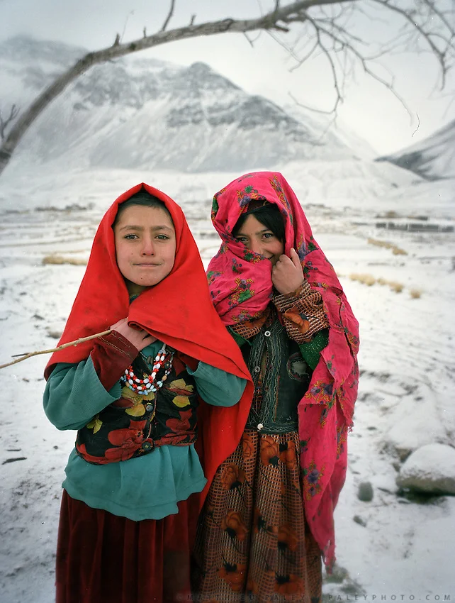
Wakhi Girls
Humans of the Himalayas : The Wakhis
Living literally on the Roof of the World or the Bam-I-Duniya are the Wakhi people, who predominantly live in the Wakhan Corridor, the narrow strip of Afghan territory that traditionally separated the British Empire from Tsarist Russia in days of the old. Also called the Khik at present they live in the Wakhan of today's Badakhshan region located in northeastern Afghanistan and southeastern Tajikistan.

Traditional Wakhi Women
The Wakhan sits at the junction of three major mountain ranges, the Hindu Kush, the Himalaya/ Karakoram, and the Pamirs – what is called the Pamir Knot. The valley is carved by the Wakhan River, fed by glacial meltwater from the surrounding mountains. From the town of Ishkashim, at 2,700 meters above sea level, the valley climbs steadily eastward, eventually reaching high altitude pasture land, above 4,000 meters, along the border with China. Due to its dramatic isolation the Wakhan corridor has been spared of the war in Afghanistan and has been mostly spared of the depredations of the war. But region still exists in a time warp due to the same isolation.

A Wakhi Family
The Wakhi are a Persian people as such of Tajik ancestry. The Wakhi speak the Wakhi language, which is a Indo-European language of the Iranian branch of the language family, distantly related to Persian Tajiks, and are Ismailis, a progressive branch of Shia Islam that eschews many conventional Muslim practices. They do not fast during Ramadan, for example, which is uncommon elsewhere in Afghanistan. The Wakhi practice combined mountain agriculture, growing wheat, barley, potatoes, beans, and peas in the valley, and herding their yak, sheep, and goat to high-altitude pastures above 4,000 meters during the summer. Their homes are made of stone and mud-plastered walls that are scattered around the valley floor around irrigated mountain oases. Those Wakhi that bring their animals to the high pastures live in nomadic yak-fur tents during the summer.
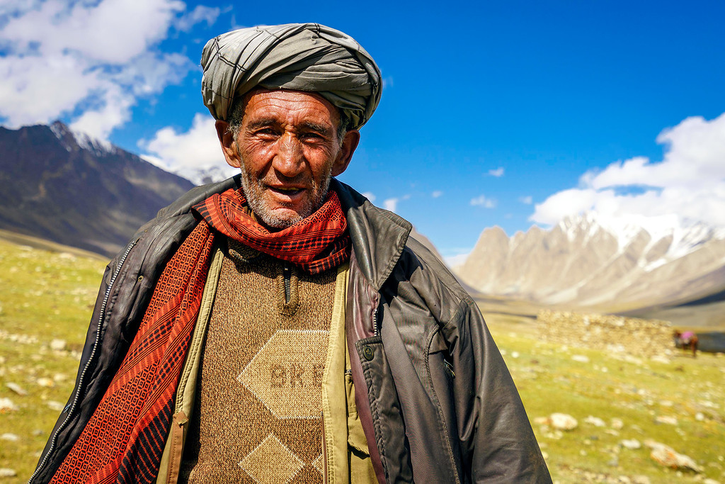
A Wakhi Chief
The Wakhi language belongs to the southern group of the Pamir languages, in the Iranian group of the Indo-European family of languages, where the different Ishkashmi and Wakhi languages are included. The Wakhi language, rich in archaisms, differs considerably from the Pamir languages, and generally from the southeastern group of Iranian languages, having certain common characteristics with the Indian languages. Although divided by borders, the Wakhi language is still very much the same, and dialectal differences are not great.
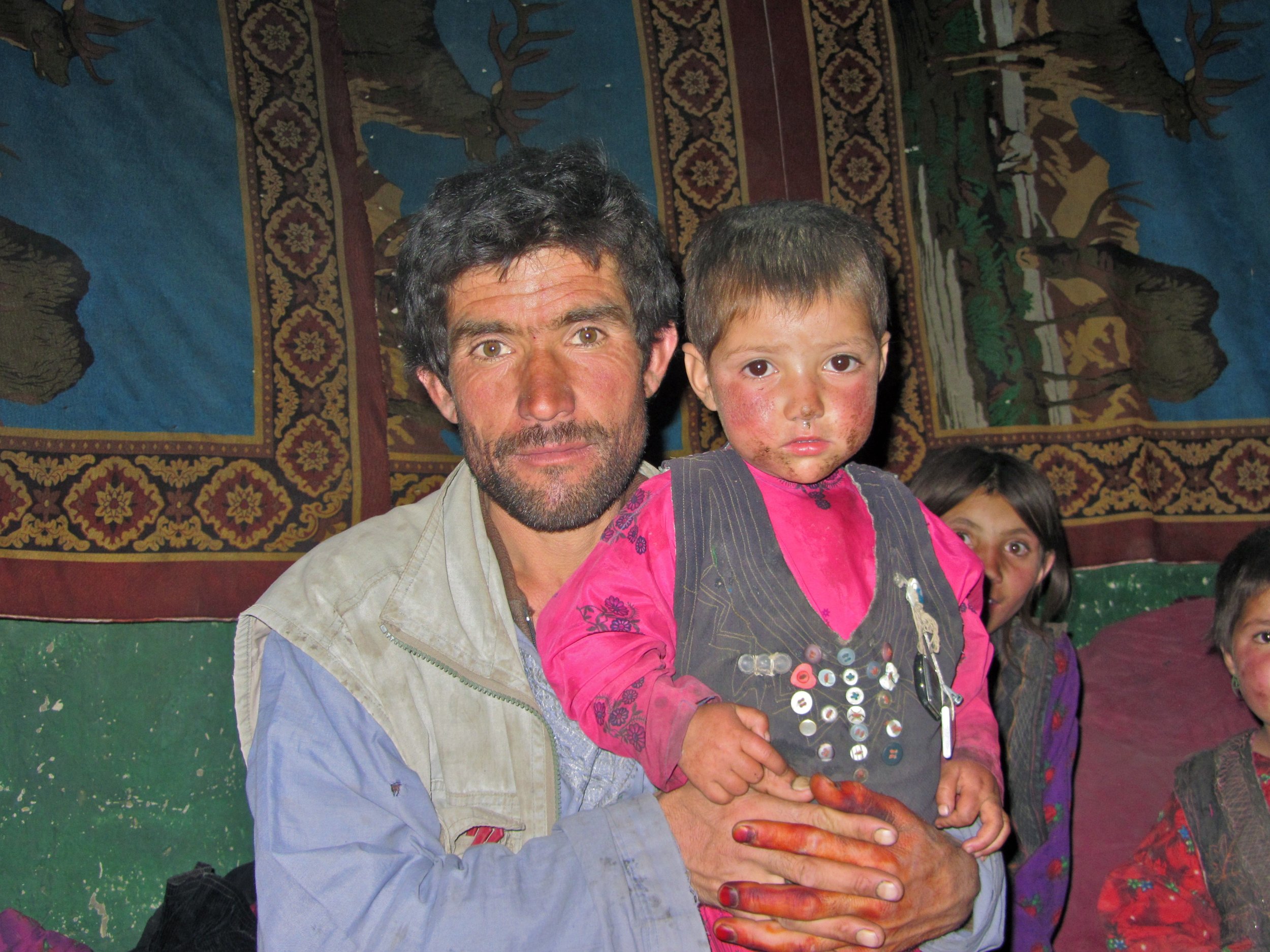
A Wakhi Father and son
The language of mutual communication, and the written language, for the Ismaelites of the small nations of Pamir has been the Tajik language. The Wakhi oral tradition is also bilingual (Wakhi and Tajik). On the Upper Wakhandarya, there are noticeable Turkic influences in place-names. Wakhi-Kirgiz contacts are maintained even today. Many Wakhs also speak the Shugni language. The Wakhi folksong bul’bulik is principally a women’s song, it is sung on the summer pastures. Before the establishment of the Soviet regime, the Wakhs were almost totally illiterate. Nowadays, schooling is obligatory for everyone. The language for schooling is, without exception, Tadzhik, which places Wakhi in a passive role and accelerates the disintegration of the language. In domestic situation, however, Wakhi is still preferred, whatever the subject, although most Wakhs speak Tadzhik quite fluently.

A Group of Wakhi Men
Besides the Wakhan Corridor there are smaller pockets of Wakhis who inhabit the higher reaches of the Hunza Valley in Gilgit Baltistan, Chiral in Khyber Pakhtunkhwa, in Tajikistan across the Pamirs, southern Xinijiang in China, some in Russia and even a few odd Wakhi villages in Turkey. As per the present estimate the total number of Wakhi people would be around 70,000 to 100,000.
In China along with the Sarikoli people the Wakhi are termed as the “Tajik” minority. In Afghanistan, they are officially called "Pamiris". In Tajikistan, the Wakhi are recognized by the state as "Tajiks", but they still self-identify as "Pamiris". In Pakistan, they refer to themselves as "Pamiris" or "Gujali".

Wakhi Old Women
When the Persians and Tartars subjugated the areas north of the Hindukush in the 12th century the southern valleys of the Hindukush gained a distinct identity under different names as Bolor, Dardistan, Tibet Gujal, Kashkar etc who were divided by the chains of mountains however the Ghalcha and Dard people living on the northern and southern side of the Hindukush have been close to each other despite the natural hurdle of the mountain chains.
Trade caravans and pilgrims from eastern Turkistan used to cross over the Kurambar Boroghil and Darwaza passes into Chitral and this caravan route served as a permanent link between these regions. Many people from Chitral crossed into Wakhan for permanent settlement. The Wakhi herdsmen usually came with their flocks to the Boroghil for summer camps. Wakhi horsemen used to visit for Polo and Buzkashi as far south as Razdan field in Torikho valley.The Wakhi art, craft and architecture occupy a distinct place in the neighboring area. There are certain festivities which mark particular occasions and vary from valley to valley. The Wakhi are fond of music Daf open drum and flute and Rabab are popularly played. Male members are responsible for farming, weaving woolen clothes. While women look after the house and cattle.

A Map of Wakhan and Pamir country
Compiled from various sources on the Net
All pics from the Net for educational purposes. In case you own the copyright for any of these and you want it removed please message me and i will remove it immediately.
Prior permission has been taken from the Admins (Other) for this series. If you think that you have a story that needs multiple pics and people pics please get in touch with the Admins.
The Tibetan Mastiffs Business
The Story of one of the largest Dog Breeds in the World, the Tibetan Mastiffs who have protected people and live stock for centuries on the Tibetan Plateau.
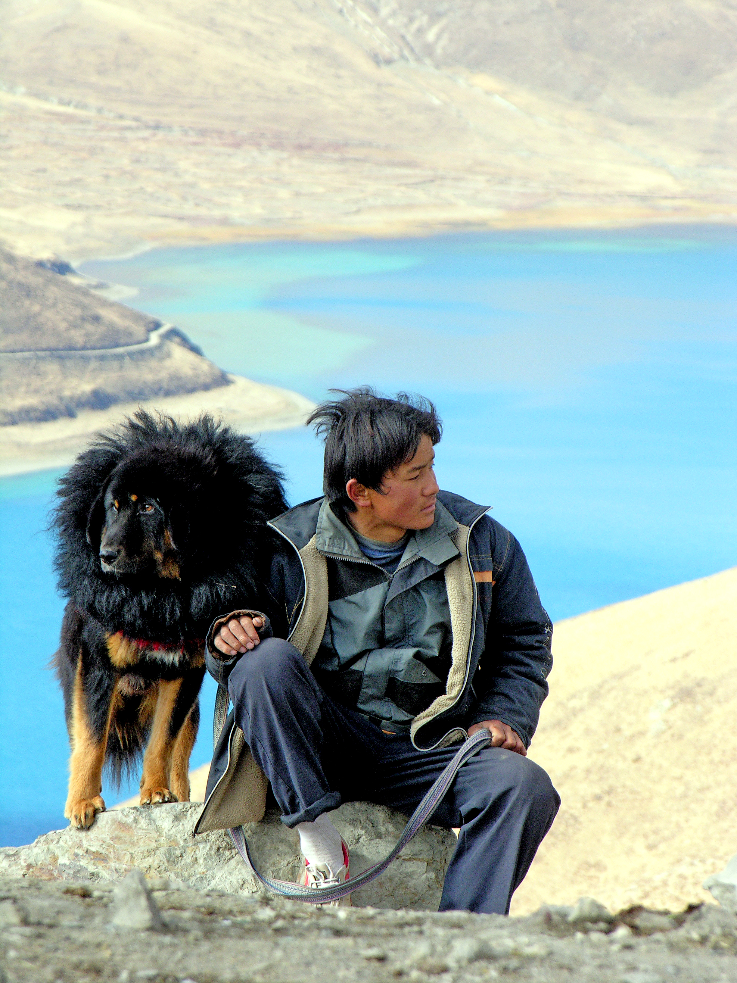
A Tibetan Mastiff in Tibet (Pic from Wikipedia)
The Tibetan Mastiff Business
Ever heard of the Tibetan Mastiffs ? I am sure most of you must have heard of these monsters of Dogs that lived on the Tibetan Plateau and grew into large proportions to the point that instead of resembling Dogs they looked like Bears. They are known for their ferocity and loyalty as well. And of course their shaggy coat which protects them from the extreme cold on the Tibetan Plateau makes them look much bigger than they actually are. And last but not the least their Gruff Bark which literally sends shivers down one's spine. I have kept a Himalayan Sheep Dog or what we called a Bakarwal at my home in Kashmir but its Gruff was nowhere close to what a Tibetan Mastiff Gruff sounds like. They are almost like Bass Speakers. Bigger the speaker, deeper is the Gruff and its more bone chilling.

A Pair of Tibetan Mastiffs goign into a frenzy as they see me trying to take their pics.
I have never really encountered a pure Tibetan Mastiff in India though have occasionally come across what I call the Himalayan Mastiff during wanderings in the Mountains. But I know people who have pure ones in India but I have never had a chance to visit them. And I am sure many people have purer varieties in the Regions bordering Tibet.
Anyways I had my first real encounter with these Monsters of the Canine World when last winters, in January 2017, I decided to visit a part of the Tibetan Plateau which lay on the eastern edge along the Hengduan Mountains. Of course I was told its no use going there at the height of Winters and that too solo but I had the time and opportunity so I decided to take a detour while on a Business trip.

Another pic of a Tibetan Mastiff with the hair standing on the back of its neck.
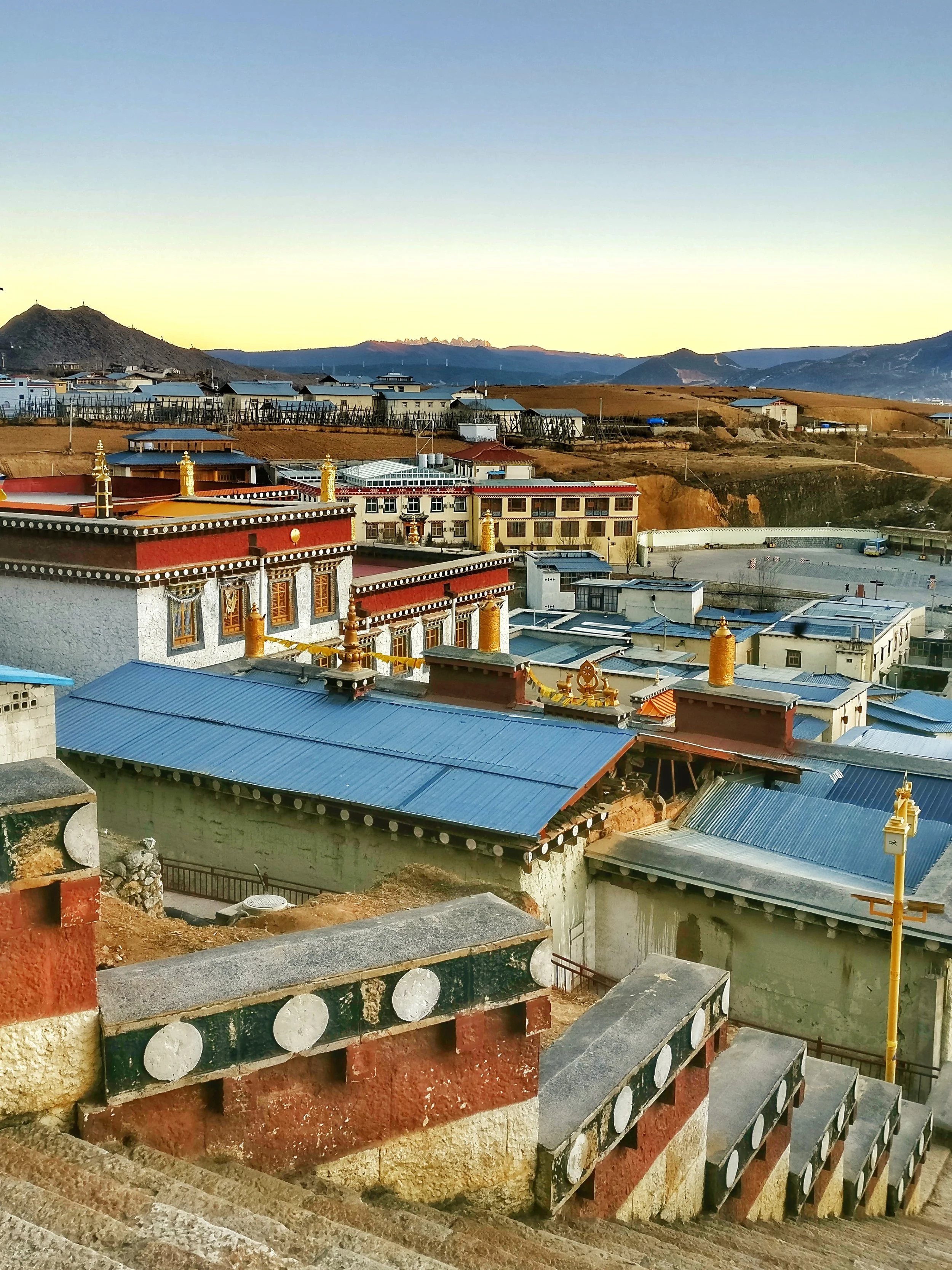
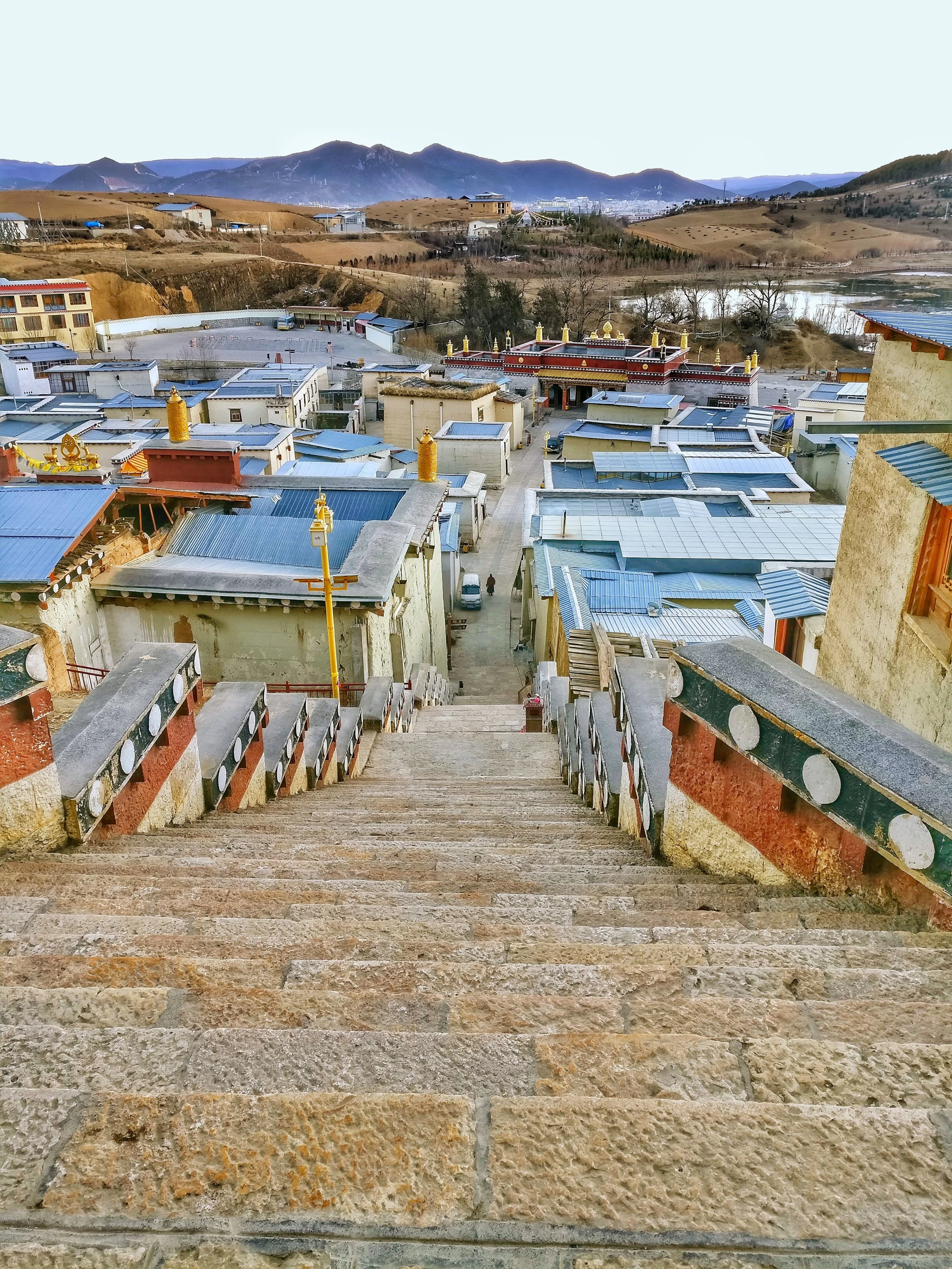
It was in Shangri La or Zhongdian that I first encountered these guys. Zhongdian or the fancy name, Shangri La, that the Chinese Government has given it is home to the beautiful Ganden Sumtseling Monastery and is the seat of the local Government in the Deqin Tibetan Autonomous Prefecture. The Tibetan name for the town is Gyalthang. The Town is situated at around 3200 m above sea level on the Eastern edge of the Tibetan Plateau.
I had booked a Tibetan Lodge near the Monastery and as the Weather was nice I decided to take a walk around the Lamucyang Tso, a small Lake facing the Monastery. The Lodge was a typical Guest House built like a Traditional Tibetan home in a typical traditional Tibetan Village. While on the walk I came across the first Monster and it was lying lazily in the Grass asleep. I went past it keep a safe distance and then I encountered another but this was on Guard duty outside his House and luckily he was chained up. The moment he realised my presence he went crazy off the hook. And it was big. I am lucky the Chain held on but it did give me a scare.

The guy I saw lazing by the Lake. Chilled out !
The next morning I woke up early around 5 AM as I wanted to take pics of the Sunrise and the Monastery as I felt the Monastery would look good when the first rays of the Sun fall on its gilded Roof. It was still dark when I got out of my Lodge and the temperature was 15 Degrees below zero. And there was this small Hill that I wanted to climb as it would give me a good view of the Monastery as well as the Sun as it rose over the Mountains. And i started walking but I did not take into account that I had to pass the House with the crazy Tibetan Mastiff again. I realized it just when I was in front of the House and I heard his growl. There have been few times that I have been so scared in my life. He went wild again and I just prayed to whichever God was up at that time to ensure that his Chain holds. It did and I thankfully got some shots.
The next day I decided to take a walk through the Village as I wanted to hike up a Mountain Peak which looked quite inviting. And then I came across all kinds of Tibetan Mastiffs as it seemed every house in the Village had at least one. And every time a stranger crossed they went into a frenzy. But I rather enjoyed the Tibetan Mastiff Symphony (Cacophony actually) that I created every time I walked the Village, which for some strange reason had very few people and mostly Yaks, Pigs, Chickens and Tibetan mastiffs. The most endearing sight for me was one of two huge Tibetan Mastiffs sleeping alongside with a couple of the Pot Bellied Black Pigs. It was surreal but I didn't have the courage to walk into someone’s House and take pics of the Mastiffs and Pigs enjoying their siesta.
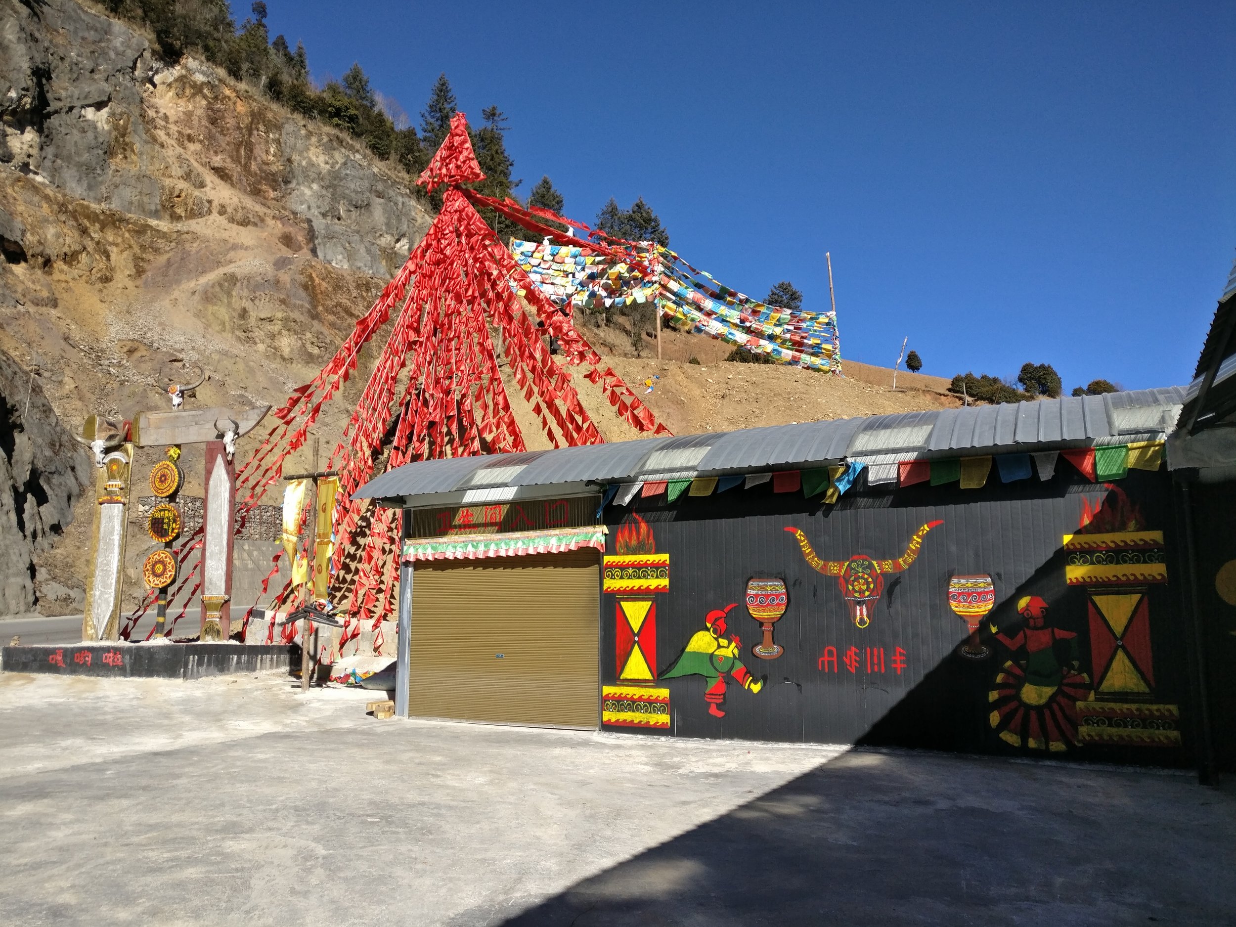
A Shop selling Tibetan Mastiffs.
Anyways coming down to more serious business, as the Chinese have grown wealthier, so has their craze for keeping Tibetan Mastiffs more as status symbols though I admit I have seen some crazy love for Dogs in China which I simply can't imagine anywhere else. So much in fashion are these Tibetan Mastiffs that there are reports of a puppy being sold for 2 Million USD, that's a whopping 14 Crores in Indian Rupees. Of course with this Breed being in so much demand what has happened is that the breeding and sale of these Mastiffs is happening on a big scale. And of course what this means many unscrupulous people getting into this business and trying to maximize profits they keep these animals in despicable conditions. And of course the business couldn't sustain forever and the business fell in 2013 with the supply overwhelming in demand putting many out of business.

One of the "Showrooms" selling Tibetan Mastiffs
And i saw it up close and personal. From Gyalthang I took a taxi down to Lijiang as i wanted to visit the Tiger leaping Gorge. Now most Chinese Tourists come by High Speed Train to Lijiang and then do the 4 hour trip to Shangri La or Xianggelila as they call it by Luxury buses. And this Road in its upper stretch had at least 10 Showrooms (yes Showrooms) selling just Tibetan Mastiffs. I stopped at a couple but they were mostly shut as it was off season but I could see that they still had a few Mastiffs held on the backside in cages. And the way these majestic creatures were kept was just pathetic. Filthy cages which didn't seem to have been cleaned since ages and very smelly. And the Dogs had all shaggy coats which seemed all matted. I clicked some pics but never had the heart to post them online as they are just simply disgusting. But I was amazed at the scale of this Business and wondered how long will the craze last and what would happen to the Mastiffs when they fell out of favor with their fashionable owners. Let's admit it. Keeping a Dog so large is no easy task as it has to be given enough food, space, grooming and care for it to thrive. And plus you need to make sure that the Dog is provide facilities to survive the environment in hotter areas

Wooden Cages inside which the Tibetan Mastiffs are kept.
So as result what has happened is that many Tibetan Mastiffs are now abandoned by either the Owners or the unscrupulous Breeders who due to massive competition can no longer make profit so they just abandon the Dogs to roam the streets. An that is a sad sight for such Dogs which once were almost Royalty. Even sadder is the fact that many are sold to Dog slaughter houses which process them for Dog meat which is still liked as food in parts of China. And also there are reports of abandoned Tibetan Mastiffs teaming up with Wild Wolves to attack livestock !
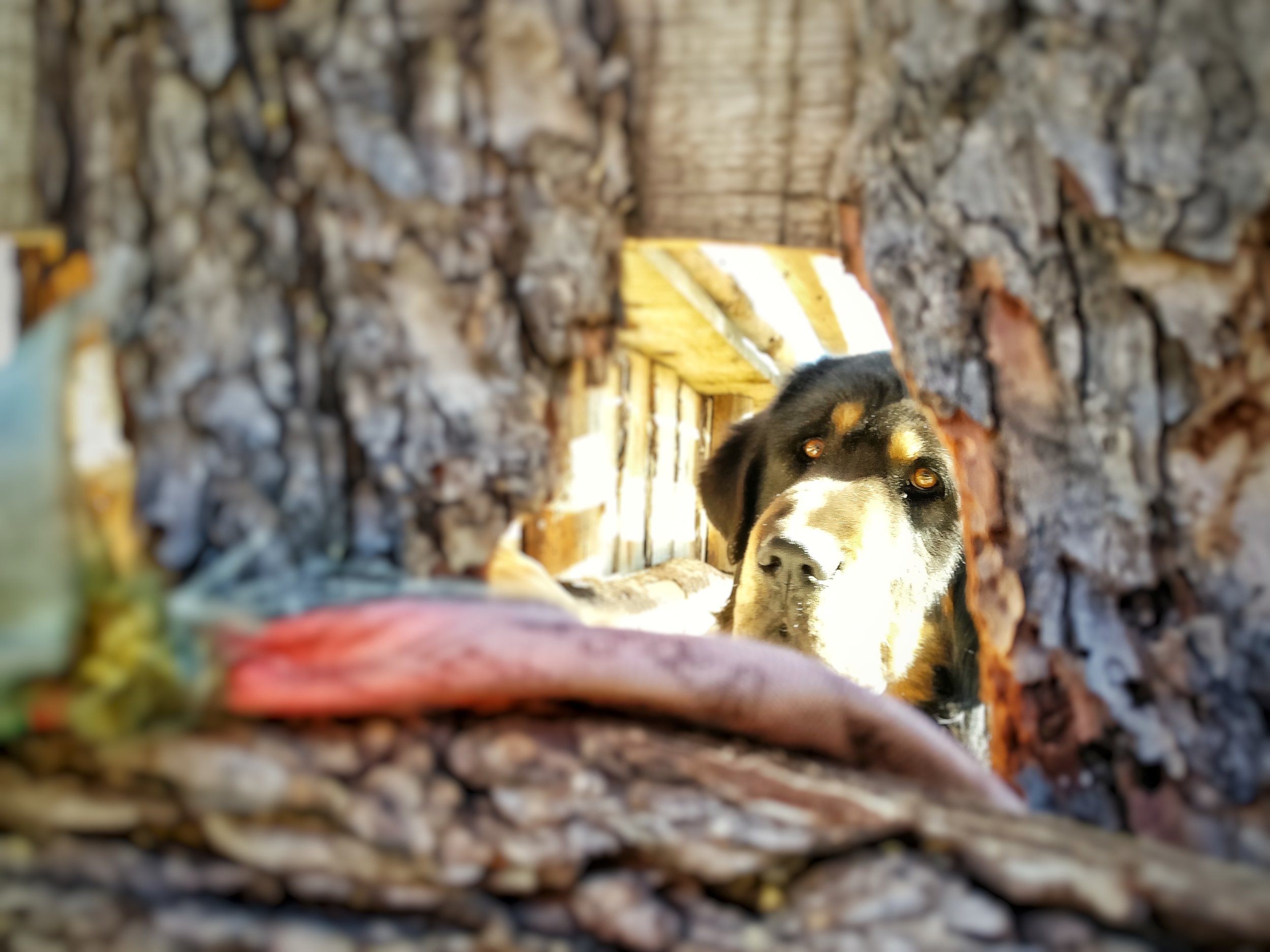
A Tibetan Mastiff inside the wooden cage looking at me.
Here is a heartbreaking Video of more than a 1000 Tibetan Mastiffs at a shelter set up by the Surmang Namgyal Monastery. But i guess these are the lucky ones who will no longer have to beg on streets for scraps of food or end up as Meat themselves on a Chinese Table.

Not much we can do but as a penance maybe we should start taking care of the street Dogs wherever we live and never buy Dogs from Breeders. Dont shop. Please adopt.
Munshi Aziz Bhat Museum of Central Asian Antiquities
The Munshi Aziz Bhatt Museum of Central Antiquities which holds a priceless treasure of Items and Objects which were once traded on the legendary Kashmir to Yarkand Silk Route via Ladakh.

A decorated Mongol Horse Saddle
Munshi Aziz Bhat Museum of Central Asian Antiquities
The name Kargil is famous now. Mainly because it is associated with a War that was given its name as it was fought in this area almost 20 years back and it was the country’s first televised War. But few would imagine that once upon a time it was a major trading Route on the Silk Route which connected Northern and Peninsular India with Central Asia and China.
Kargil is at a strategic location and is as such almost equidistant from Skardu, Leh , Padam in Zanskar and Srinagar. Infact its name itself is derived from its location. Kargil literally means a place to stop from all directions. Its etymology has evolved from the word Garkill. Where “Gar” means from all places and “Khil” to stop. And true to its name, all historical accounts of British and European travellers reveal Kargil to be just that. Situated along the river Suru (a tributary of the Indus, which flows into Gilgit Baltistan) it boasted of a fort built by the Ladakhi King in the 19th century. The old caravan bazaar ran along the river and a few mud houses by the slopes nestled in a green oasis of the Suru valley.

The old crumbling Kargil Sarai
Traders from all over the region and beyond converged upon Kargil. There were Punjabis, Kashmiris, Baltis, Yarkandis, Ladakhi, Tibetans, Afghans, Arghuns, Pathans, Kirghiz and all other ethnicities from the neighbouring Regions. The Dogra Rulers as well as the British promoted this Trade after the Dogras came into power and consolidated their Rule in the Region. They also improved and facilitated the creation of the Treaty Road which was a Trade Route all the way from Srinagar to Yarkand.
At the time that the trade was flourishing there was a certain Gentleman by the name of Munshi Aziz Bhat of Kargil who was the official petition writer for the Maharaja of Jammu and Kashmir for the Baltistan Wazarat. A Petition writer in those days was a powerful man, as if you had an issue that you wanted to bring to the higher authorities and the highest being the Maharaja, who had to approach the Petition writer to do it on your behalf. So the strength of your case basically lay on how the Petition writer presented it. As such Munshi Aziz Bhat was a very well respected man in Kargil.

The Kargil Sarai facing the Suru River.
Munshi Aziz Bhat was a trader also being on the Central Asian trade Route and owned a number of shops in Kargil and his trading company was called Munshi Aziz Bhat and Sons. He set up a Serai, the Kargil Serai in 1920 to offer boarding lodging and storage places to the Traders. Soon the Serai became a stopover place for all kinds of traders from all kinds of places in Kargil. The Kargil Serai also served as a kind of an unofficial Post Office which received a lot of mail especially from the Hoshiarpuri Punjabi traders. The Serai had in its front a couple of shops as well which the Traders could use to display their wares. The Serai was a busy one in the late 1800s as well as the early 1900s and it saw many traders come and go.
Janet Rizvi in her epic Trans-Himalayan Caravans, Merchant Princes and Peasant Traders in Ladakh (p 260) mentions “ …it would seem that for the transporters belonging to the villages downriver from Drass, Kargil (rather than Srinagar) was the centre to which they went in the first instance in search of work. The hub of this activity was Munshi Aziz Bhat’s sarai, which was a depot for goods going in all four directions...there was in particular plenty of coming and going between Kargil and Skardu…”

An old style Building in the Kargil Bazar
And then came the turmoil of 1947 when initially Kargil was occupied by invaders from the other side. And ofcourse with the Chinese occupation of Xinjiang and its move on Tibet the Trade Route was finally shut down by the Chinese in 1949. A once buzzing trade route and all its dependencies were suddenly shut. The Kargi Serai lost its guests as even the Hoshiarpuri merchants went away. The Serai fell into disrepair and meanwhile Munshi saab also passed away.
The Seari was however bequeathed as family property to Aziz Saab’ descendents and so the three storied Serai remained for decades. A lonely relic in the Kargil bazaar of a time long gone. It remained under lock and key for a good 50 years but its condition kept on deteriorating. No one it seems was aware of what lay inside the Serai since decades.
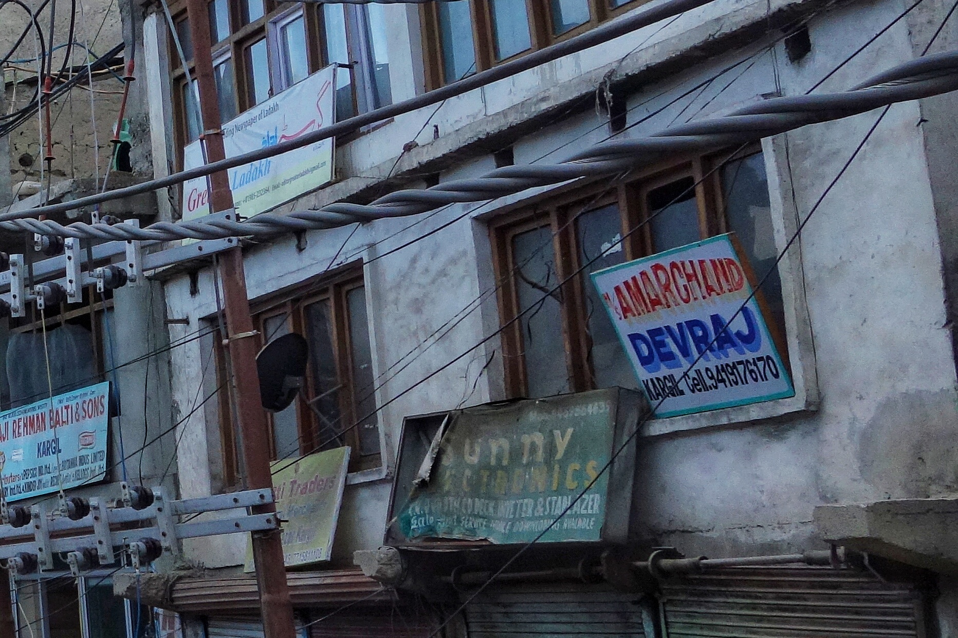
An establishment still run by descendants of the Punjabi traders from Hoshiarpur who were at the frontline of the Central Asian trade.
In was a chance discovery in the beginning of this century that some workers were sent to the place to clear some mess as parts of the structure had collapsed. The workers unearthed some very interesting items and reported these to the owners. The Owners then decided to come and check for themselves and they unearthed in what can only be called a priceless treasure in form of various items related to the Central Asian trade and items from all over Central Asia, the Indian sub-continent, Tibet and even Europe. As luck would have it a visiting historian persuaded the family to preserve this price less collection instead of it ending up in some antique shops. And so was set up the Aziz Bhat Museum of Central Asian and Kargil Trade Artifacts to display the Collection of items unearthed.
The range of artifacts unearthed from the Munshi Aziz Bhat Sarai has given invaluable insights into not only the forgotten trade history but also into the corss-cultural, cosmopolitan past of Kargil. These artifacts aren’t mere antiques but they are a testimony to the fact that Kargil was a melting pot of cultures, languages, lifestyles and ideas. They are now on display in a part of the Munshi family’s house that has now been converted into the Musuem.

Saddles from Central Asia.
The diverse collection of artifacts include not only the goods that were traded along the route but also the items used by the traders and people involved in the trade. Some of the choicest artifacts include hookah pipes from Yarkand, rugs from Kashgar, fabrics — dyed and raw silk from Khotan in China, natural dyes, costumes, jewellery, coins, shoes, utensils and ammunition. Apart from these, the museum incorporates mercantile items from the late 19th and early 18th centuries like leather skins, coarse cotton cloth, carpets from Central Asia, British horse seats and saddles, buttons from Italy and items from the factory of the Nizam of Hyderabad. Over the years, the museum has also acquired various local artifacts that are relevant to Kargil, some of the key artifacts have been the first hand written Quran by the Buddhist Ruler King Namgyal of Kartse sometime in the 14th/15h century and a number of legal manuscripts that are written both in Tibetan and Urdu for the benefit of the King as well as his people. This was at the time when Islam was spreading across Ladakh and most of the rulers were Buddhists.
This Museum is a must go recommended place to go to in Kargil in case you are interested in the history of the Central Asian Trade along with the Central Asian Museum.

In the pic above
1. Toiletries / Soap, Lux soap, Tooth Brush, / Shaving Brush, Pear soap, and Shaving Soap. / Place: - England, Germany, Italy, USA./ Period : 1903, 1905,1926, 1939. All these finished & believed to be luxury, were imported From England, Germany & USA. After reaching the Mumbai Coast, these luxury items travels all the way from Mumbai To Central Asia, Via Yarkand, Khotan, & Kashgar. The merchants with caravans of these goods either batter or sold these items to nobles.
2. Local Name :- Jola / Place : Cuba / Period : 18th Cent 100 LBS, Sugar sack from Cuba imported to Central Asia.
3. Modern medicines / Place : Britain ,USA / Period:- 18th Century / Introduced by the different Moravian Missionaries these medicines were unknown to Central Asia & Tibet.
4. Raw silk thread, Plain Silk & Imperial silk / Local Name : Shahi. / Place : Khotan/ Preiod : 17th Century Known as Shahi, or the Imperial cloth, introduced to the world from Khotan.
5. Thanka (Paintings) / Local Name : Thanka / Place : Rangdum. / Period : 16th Century
A rare Thanka Painting, gifted to Munshi Aziz Bhat, by the villager of Rangdum. Showing the wheel of life.
6. A Rug from Bukhara / Local Name : Namdah (Fingma). / Place : Bhokara. / Period : 1822.
A Central Asian Rug from Bhokara, Name of Mohan Lal (from Kashmir) who happens to be the Assistance of Sir. Alexender Burnes, a British officer of the company is written in the Center.
The Gilgit Manuscripts
The Gilgit Manuscripts discovered in the early 1900s in Gilgit are one of the oldest Buddhist Manuscripts discovered in India. Believed to be one of the most revered Buddhist scriptures, it represents the discourse delivered by Buddha towards the end of his life.

A leaf from the Gilgit Manuscript
The Gilgit Manuscripts : A Treasure Forgotten
A couple of cattle grazers in 1931, in a village Naurpur near Gilgit once came upon a wooden box in a circular chamber in side a Buddhist stupa which contained a large number old Manuscripts pertaining to Buddhism. Little did they know that they had stumbled upon one of the most important finds of the century. The Gilgit Manuscripts are the oldest surviving religious Manuscripts from the sub-continent and of the oldest ones in Buddhism.
The cattle grazers took the collection to the Wazir of Gilgit who in turn turned it over to the Maharaja of Jammu and Kashmir and the news of the discovery of this Great Treasure spread world wide. Opinions vary about the date of this manuscript. One branch of scholars says it was written in the second century AD., while another puts the date at somewhere between the sixth and seventh centuries.
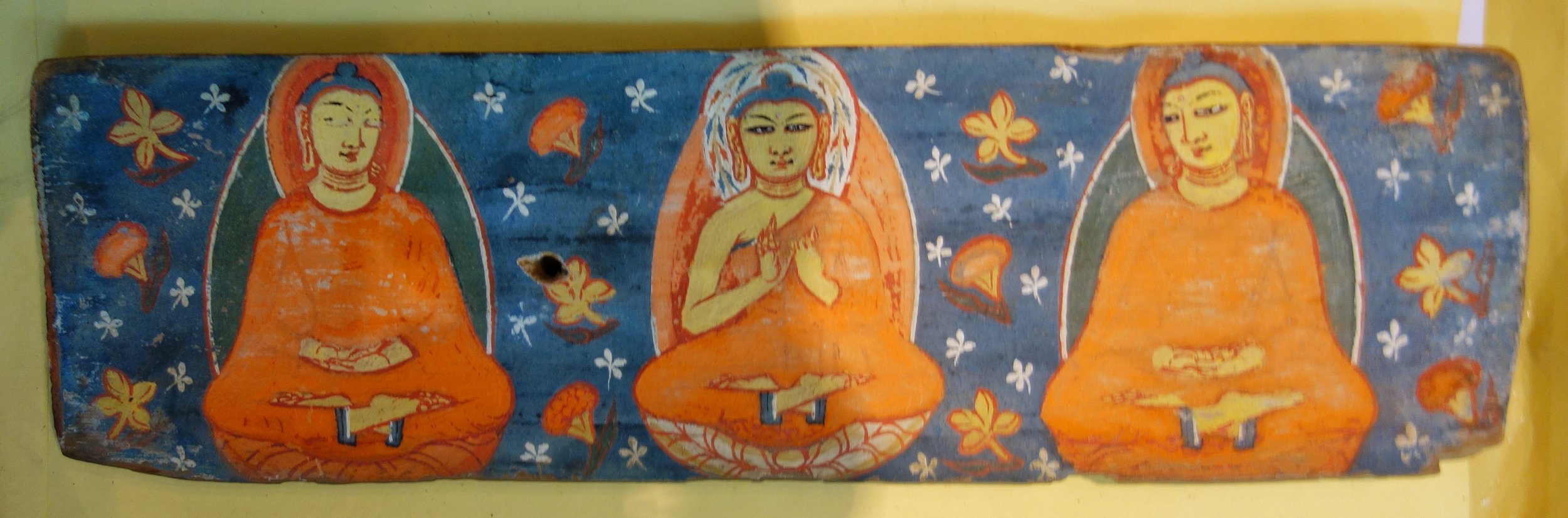
The Hand Painted Covers in which the Manuscripts were kept
Gilgit was at that time at the cross roads where South Asia, Central Asia and Eastern Asia met and it was an important stop on the Silk Road. Many monks from India carried the message of the Buddha from here to Tibet, China, Korea and even as far as Japan. It was along the Silk Road that Buddhism spread eastwards towards the rest of Asia. Gilgit hence played an important part in the spread of Buddhism and hence this find.
The almost seventeen centuries old Gilgit Manuscript has been giving historians a hard time, as no one has yet been able to fully decipher it. The lamination of the manuscript by the National Archives of India sometime ago has once again put the limelight back on this all-important literature concerning India, Tibet, China, Japan and other neighbouring countries.

Another leaf from the Gilgit Manuscipt
In fact in 1897 - 34 years before it was discovered - the Buddhist Text Society of Calcutta had published references to the Gilgit Manuscript saying that if it were ever to be found it would unravel the ancient history of several communities as it is considered to be the oldest Buddhist manuscript.
A corpus of many Buddhist texts such as the Four Sutras from the Buddhist canon, including the famous Lotus Sutra, the Manuscripts survived because they were written on the bark of the Bhoj (Birch) Tree which does not decay and obviously helped by the sub zero temperatures in Gilgit. They were written in the Buddhist form of Sanskrit in the Sarada or the Sharda Script. The Gilgit Manuscripts deciphered thus far cover a wide range of subjects such as religion, religious rituals, philosophy, iconometry, monastic discipline, folk tales, medicine and culinary art.
The most famous of the Gilgit manuscripts, the Gilgit Lotus Sutra is preserved in the National Archives of India in Delhi. Known as the Saddharma Pundarika Sutra – or the teachings of the white lotus and sun – the sutra is the basis of the Tiantai and Nichiren schools of Buddhism. In 2012 a facsimile edition of it was published by by the National Archives jointly with the Institute of Oriental Philosophy and Soka Gakkai, a Japan-based non-governmental organization.

Another cover for the Gilgit Manuscript
"In August 1938, seven years after the discovery of the texts, the archaeologist Madhusudan Kaul Shastri led a systematic excavation of the Naupur site and discovered another larger chamber at the base of the structure. The chamber contained another set of the Gilgit Manuscripts along with votive objects and probably Buddhist cult bronzes.
"According to renowned scholar Karl Jettmar, inscriptions on these bronzes “reveal that they were produced and dedicated due to the generosity and the religious zeal of a Patola Shahi”. The Patola Shahis, also known as Palola Shahis, were the rulers of Gilgit and Baltistan from the late sixth to the early eighth centuries AD.
"Shortly after, Kaul Shastri and his team outlined the specifications of the second group of manuscripts and other finds from the site including the hand painted covers of two manuscripts.
"In the third phase, the well-known Italian scholar Giuseppe Tucci secured another small group of the manuscripts in 1956. Obtaining them from a street vendor in Rawalpindi, he presented them to the Karachi museum.
"Roughly 60 manuscripts and 17 Avadnas emerging from Naupur are of unmatched significance in Buddhist studies. These are the oldest surviving collection of religious texts in the subcontinent. Based on the paleographical evidence, scholars agree that local Buddhist devotees compiled these texts between the fifth and sixth century AD. With the exception of only a few scripts, all the manuscripts were written on birch bark in Buddhist hybrid Sanskrit language in the Gupta Brahmi and post-Gupta Brahmi script.

More leaves from the Gilgit Manuscript
"The manuscripts contain sutras from the Buddhist canon, the Samghata Sutra, Samadhiraja Sutra, Saddharma Pundarika Sutra, and Bhaisajyaguru Sutra.The Samadhiraja Sutra is one of the important Mahayana canonical texts, which are collectively called Navadharma. The Saddharma Pundarika Sutra, popularly known as Lotus Sutra, figures prominently in the Gilgit Manuscripts and scholars agree it was the most venerated sutra of the Buddhists from the Gilgit area"
Though the grammatical and literature aspects of the text are gradually becoming more of historical interest in the contemporary world, what is of interest is the social relevance of some of the sutras mentioned in the manuscript. Experts feel that when the full text is deciphered a common thread will be found in the language and people of countries like India China, Japan, Thailand, Tibet and Korea which would have the potential of altering the very geo-political map of the region.
At present the main collection is with the National Archives in New Delhi and some parts with the British Museum in London and at the Karachi Museum. Apparently Nehru had the many body of the Manuscripts bought by a special Plane from Srinagar in 1948 after the Tribal Invasion. However a small part of the manu scripts still lie at the Shri Partap Museum in Srinagar though not on display.
The importance of the Gilgit Manuscripts can be guaged from this Report in the BBC :
http://www.bbc.com/news/world-asia-india-17935041
As luck would have it I managed to have a look and some parts of this Great Treasure at the Sri Partap Singh Museum yesterday and was even allowed to take pics. :)

Some more leaves
To come face to face with such a great treasure is truly a humbling experience and I could not help but tremble with excitement as the significance of what I was going to see. This is the Holy Grail of Buddhist Learning.
NOTE : Compiled from nformation on the Gilgit Manuscripts from various references on the Net.
PS : The Museum plans to put this on Display as it is shifting to a new Building and some Galleries are already open for Public viewing. The Museum has a great collection and is a must see when you visit Srinagar. I will try and share more treasures from the Museum here.
Kashmir Stone and Bronze Sculptures from Antiquity (SPS Museum)
The Sri Partap Singh Museum in Srinagar, Kashmir holds an exquisite collection of Kashmiri Stone and Metal work from the ancient times. We take a look at some of these great works of Art.
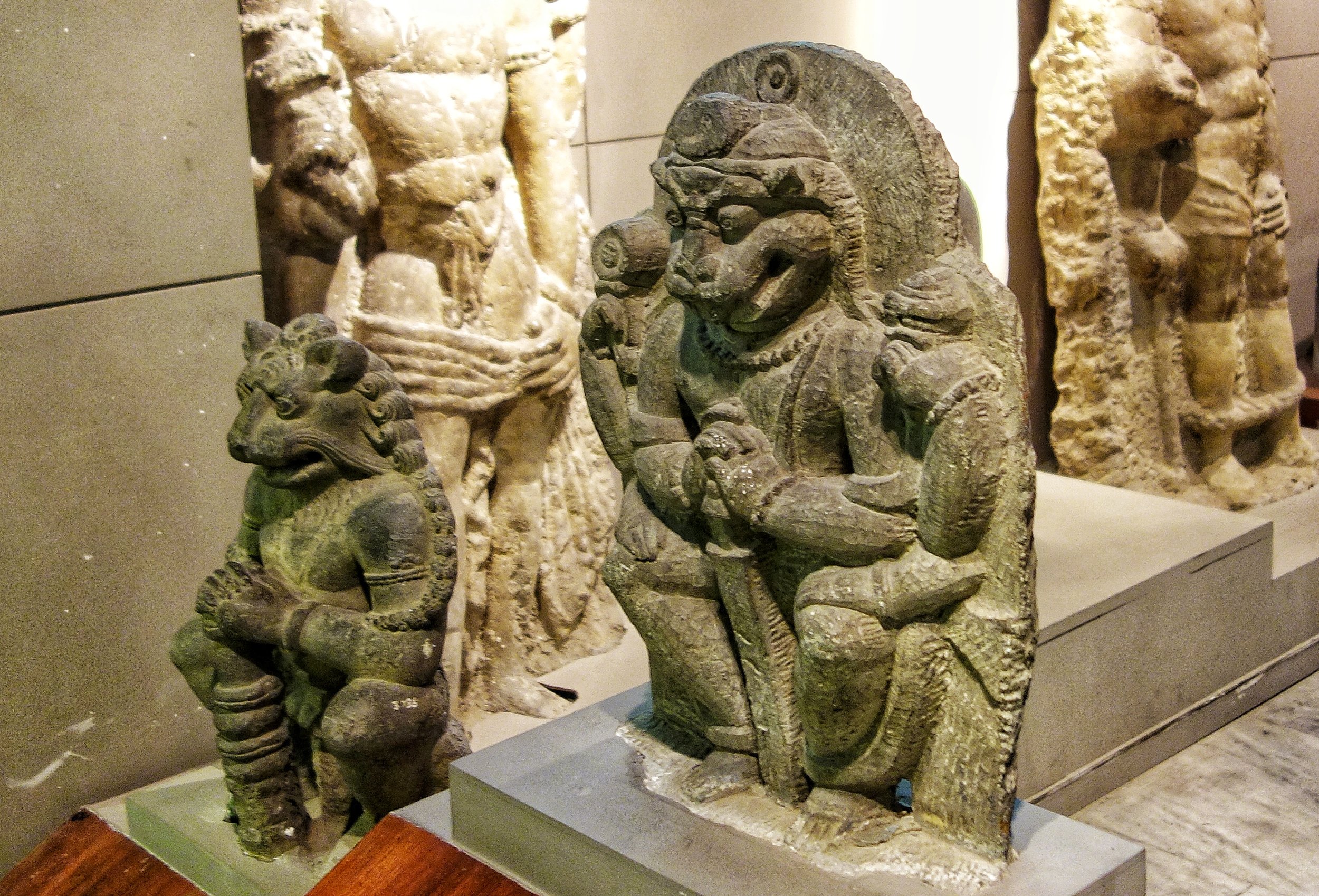
The Kashmir Stone and Bronze Collection at SPS Museum
The Shri Pratap Singh (SPS) Museum was set up around 1898 AD when a memorandum was submitted to the then Dogra ruler of the Jammu & Kashmir State, Maharaja Pratap Singh, by his younger brother, General Raja Sir Amar Singh, and a European scholar, Captain S.H. Godmerry, proposing the establishment of a museum in Srinagar to house exhibits and artifacts covering the region of Jammu, Kashmir, Baltistan and Gilgit. The museum was set up in a building belonging to the state at Lal Mandi, Srinagar, on the left bank of the river Jhelum.
The establishment of the museum was supervised by Sir John Marshal, the Director General of the Archaeological Survey of India. The Accountant General of the state, Mr. Blerjee, served as the first head of the institution. Mr. Blerjee was responsible for preparing a catalogue of the various coins kept in the museum.
The museum collection initially comprised displays of shawls and armory that were obtained from the Tosh Khana. After the reorganization of the Archaeological Department in 1913 under Rai Bhadur Daya Ram Sahni, artifacts excavated at Panderenthan, Parihaspora and Avantipura were first exhibited in the museum. This rich endowment formed one of the major additions to the museum’s collection. Subsequently, a number of objects, mostly decorative household items, were acquired by the museum from private owners. The museum’s various artifacts have been tentatively dated on the basis of style, period and material, etc.
Here is a pre-view of the great collection of Kashmiri Stone and Metal Art from the the 7th Century to the 12th Century. One of the finest collections of Kashmiri Art including the Tengpora Durga.
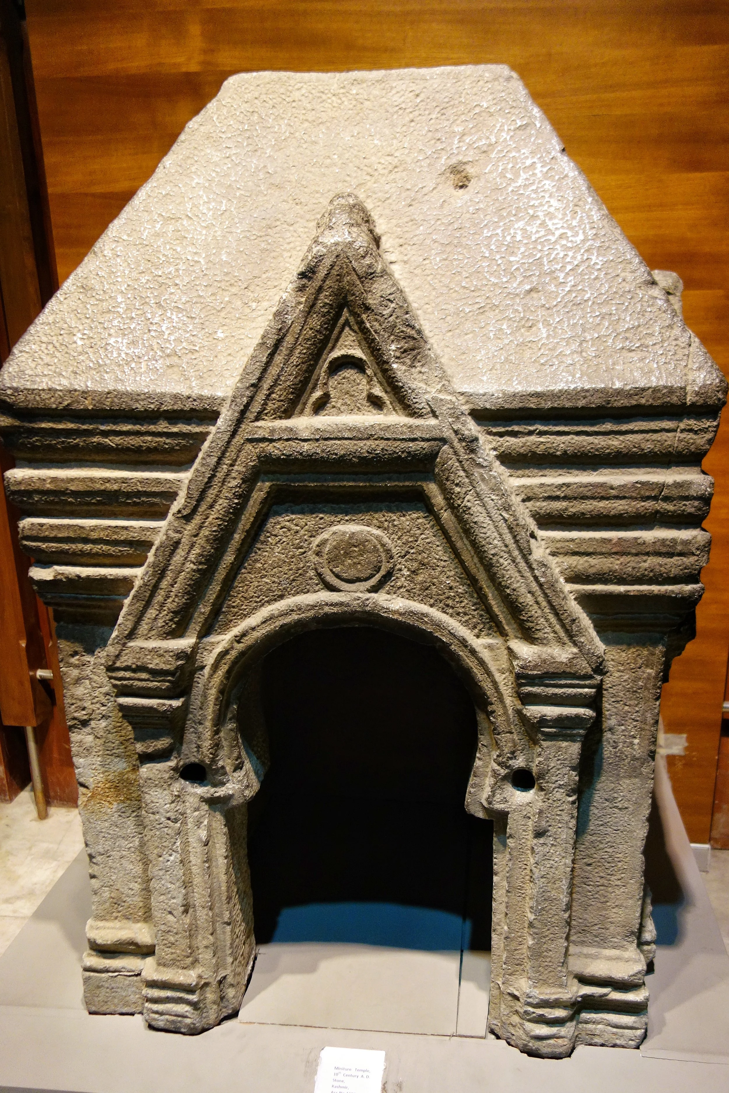
Miniature Temple : 10 th Century, Stone
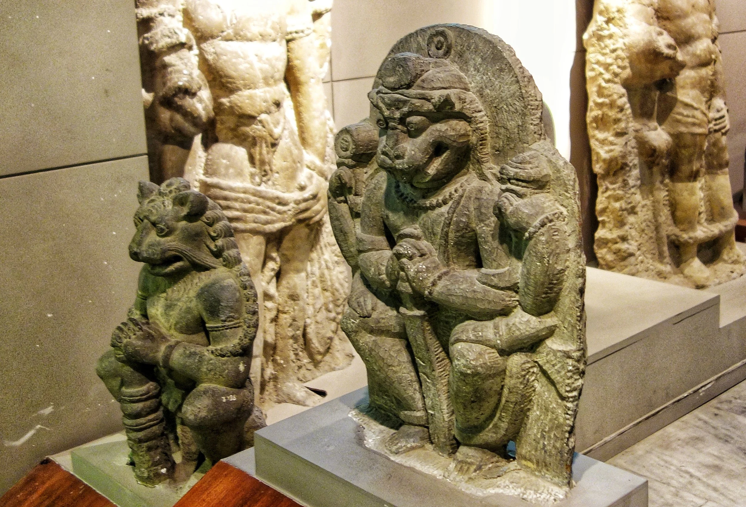
Narsimha : 10th Century, Stone
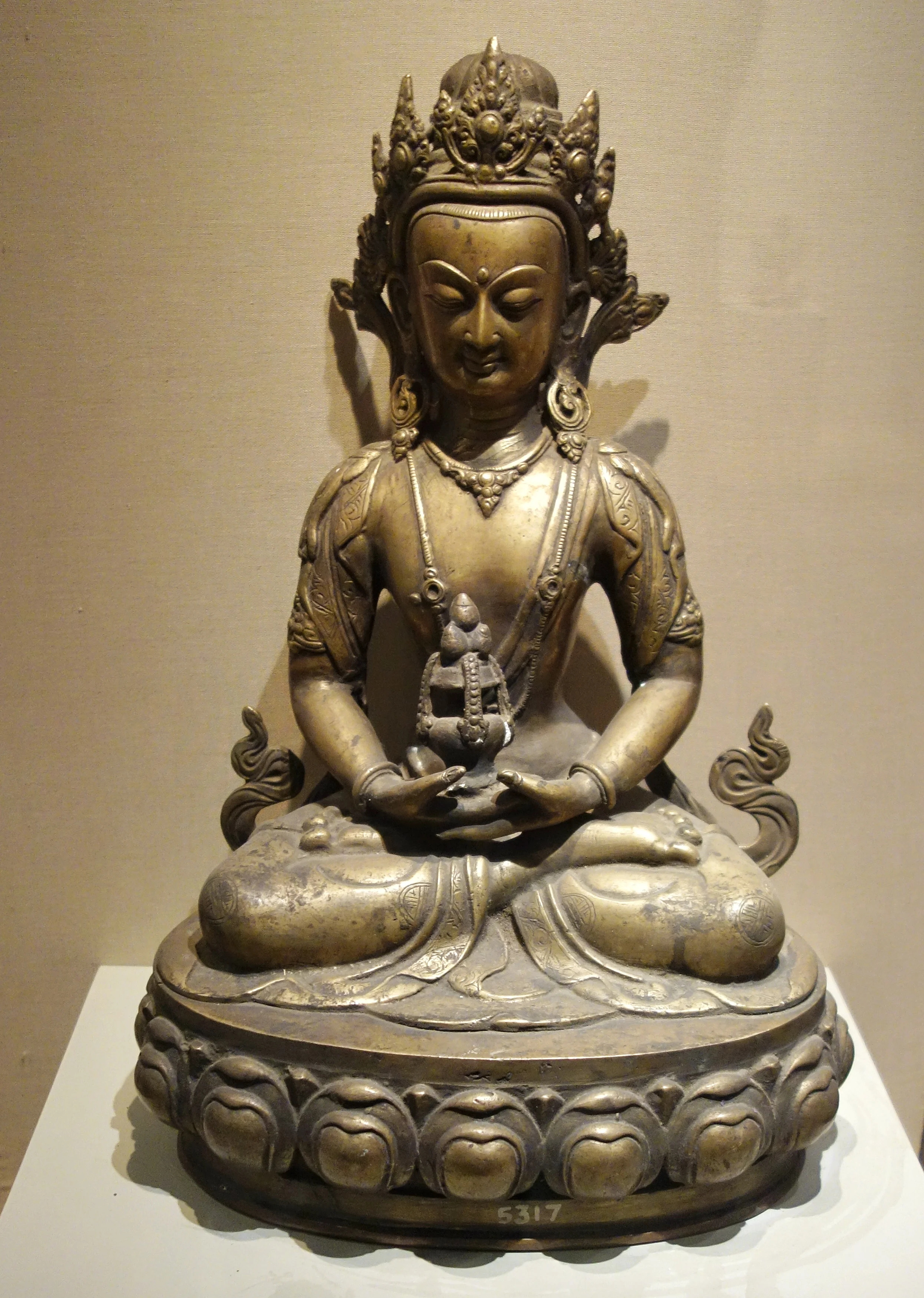
Image of a Crowned Deity : 9th Century, Bronze
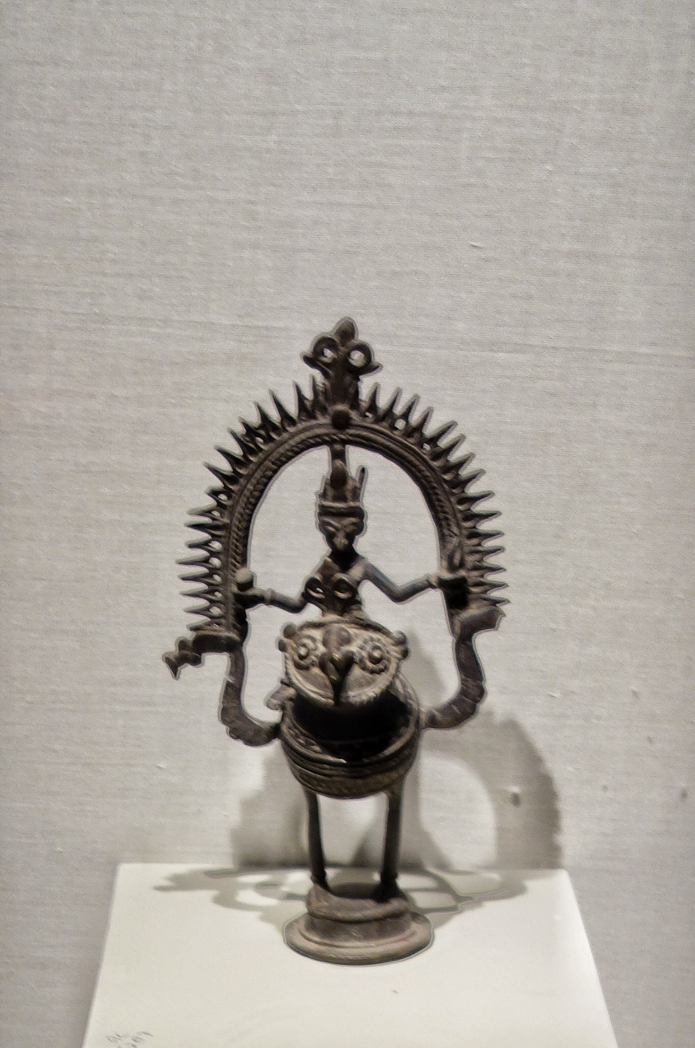
Tribal Deity on a Peacock : 9th Century, Bronze
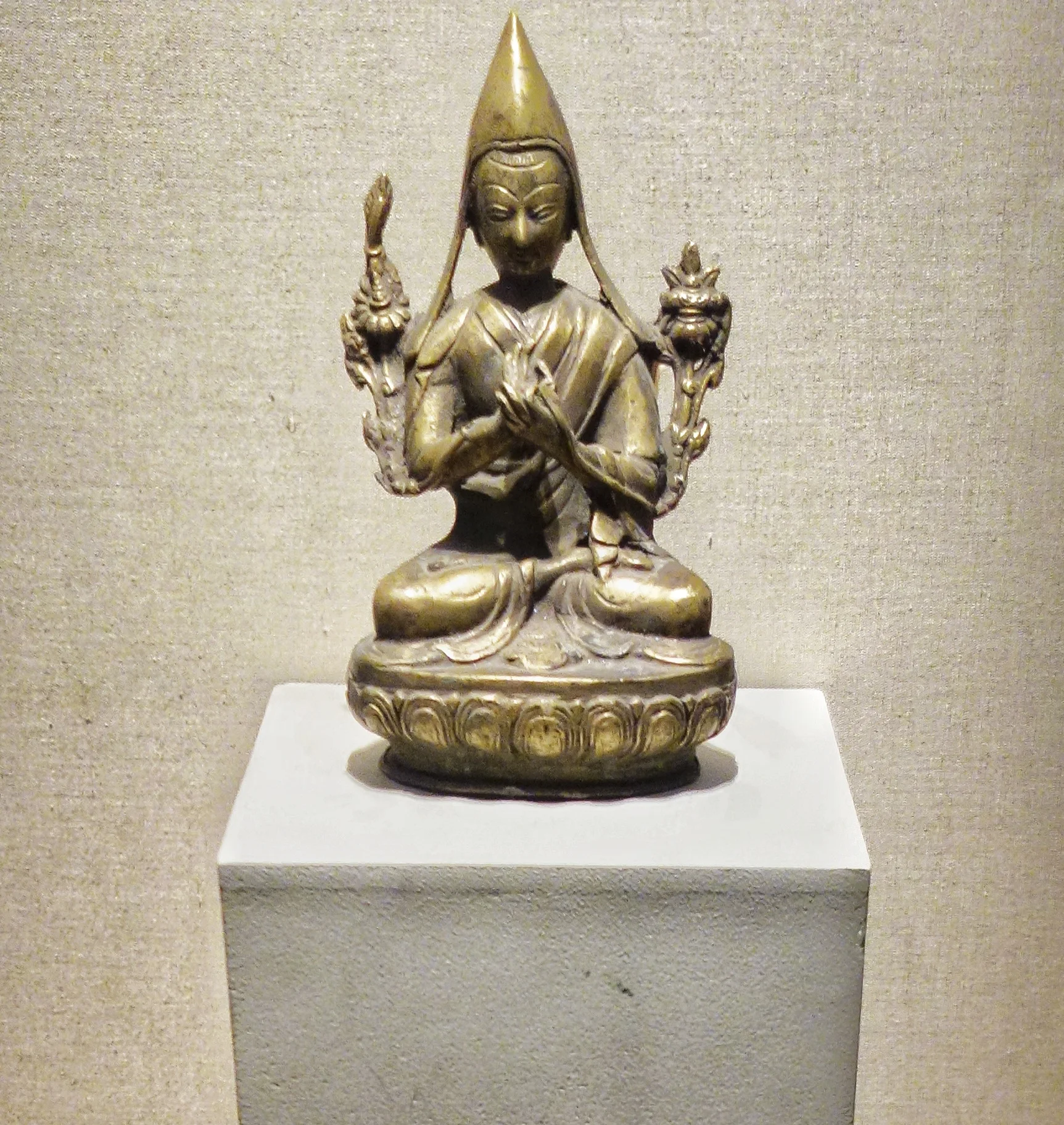
Seated Figure on Lotus : 9th Century

Head Lama : 9th Century, Bronze
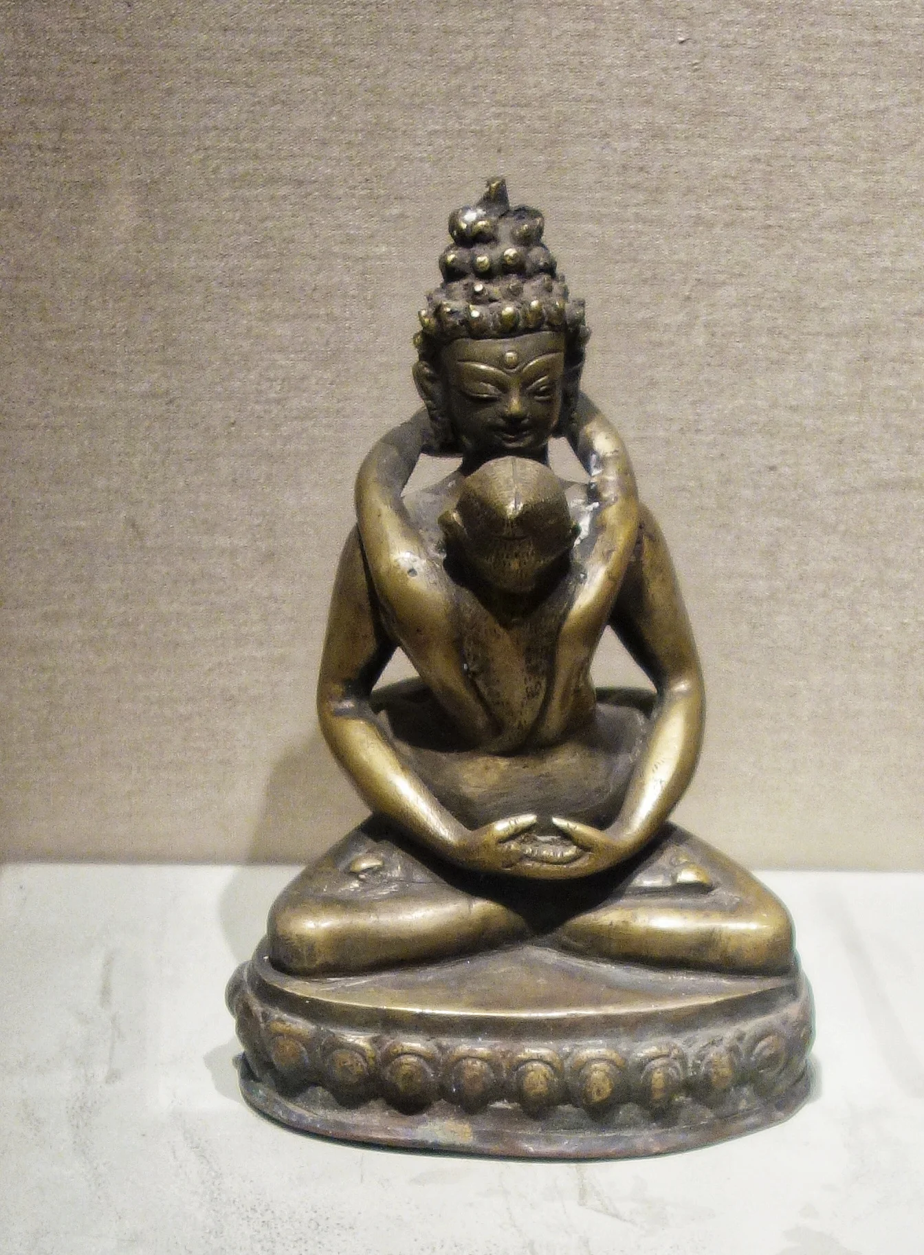
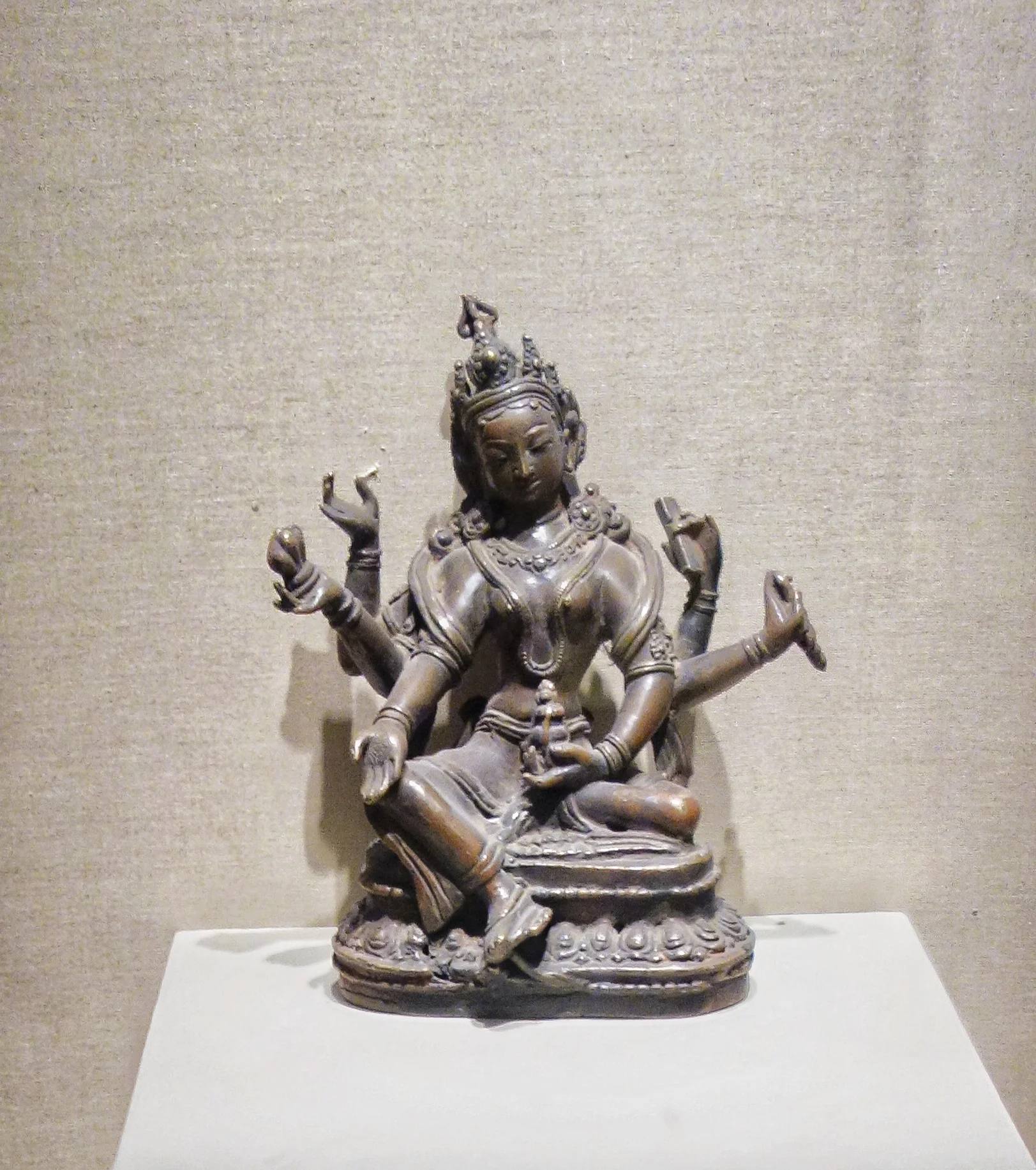
Tara : 9th Century, Bronze
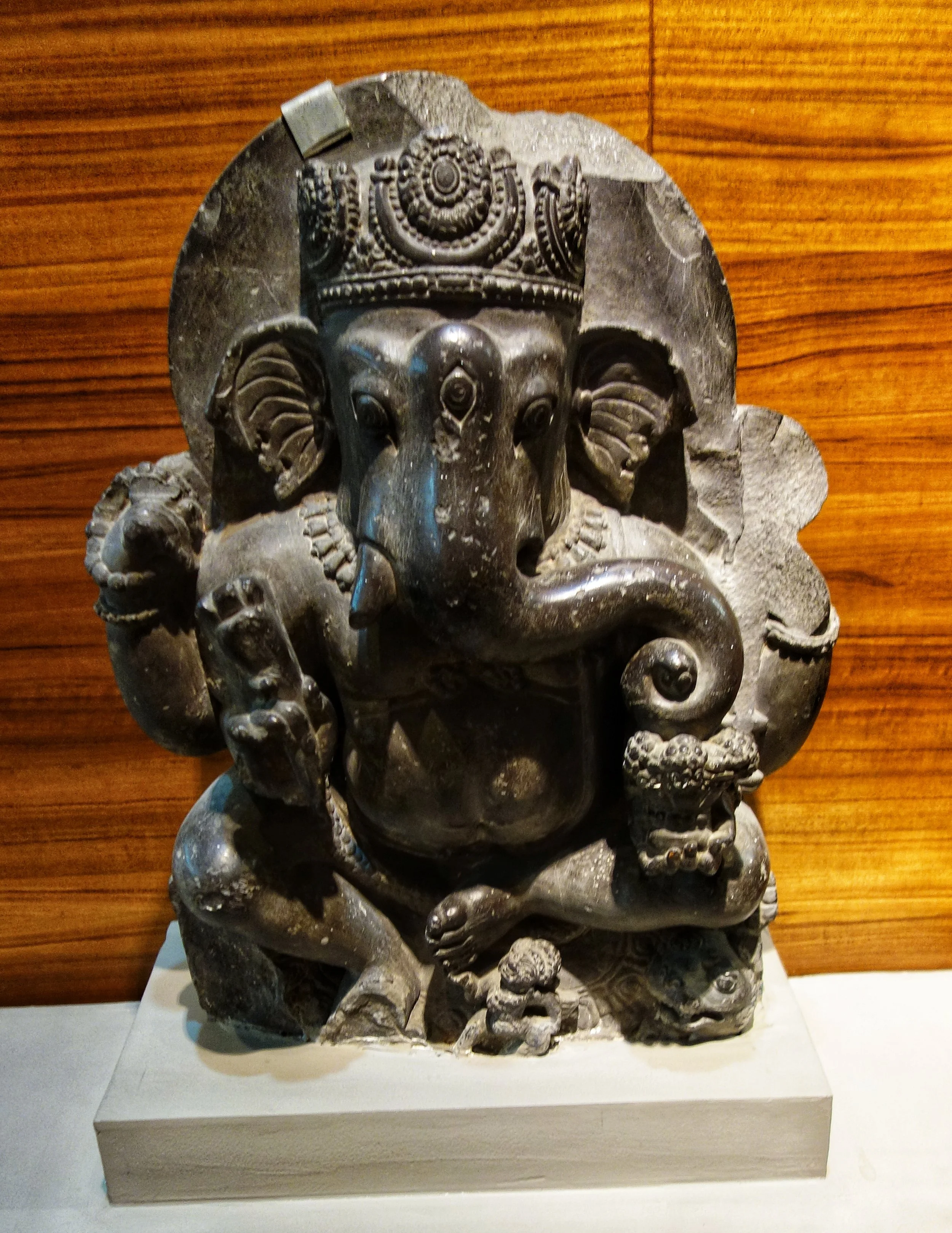
Ganesh : 8th Century, Stone
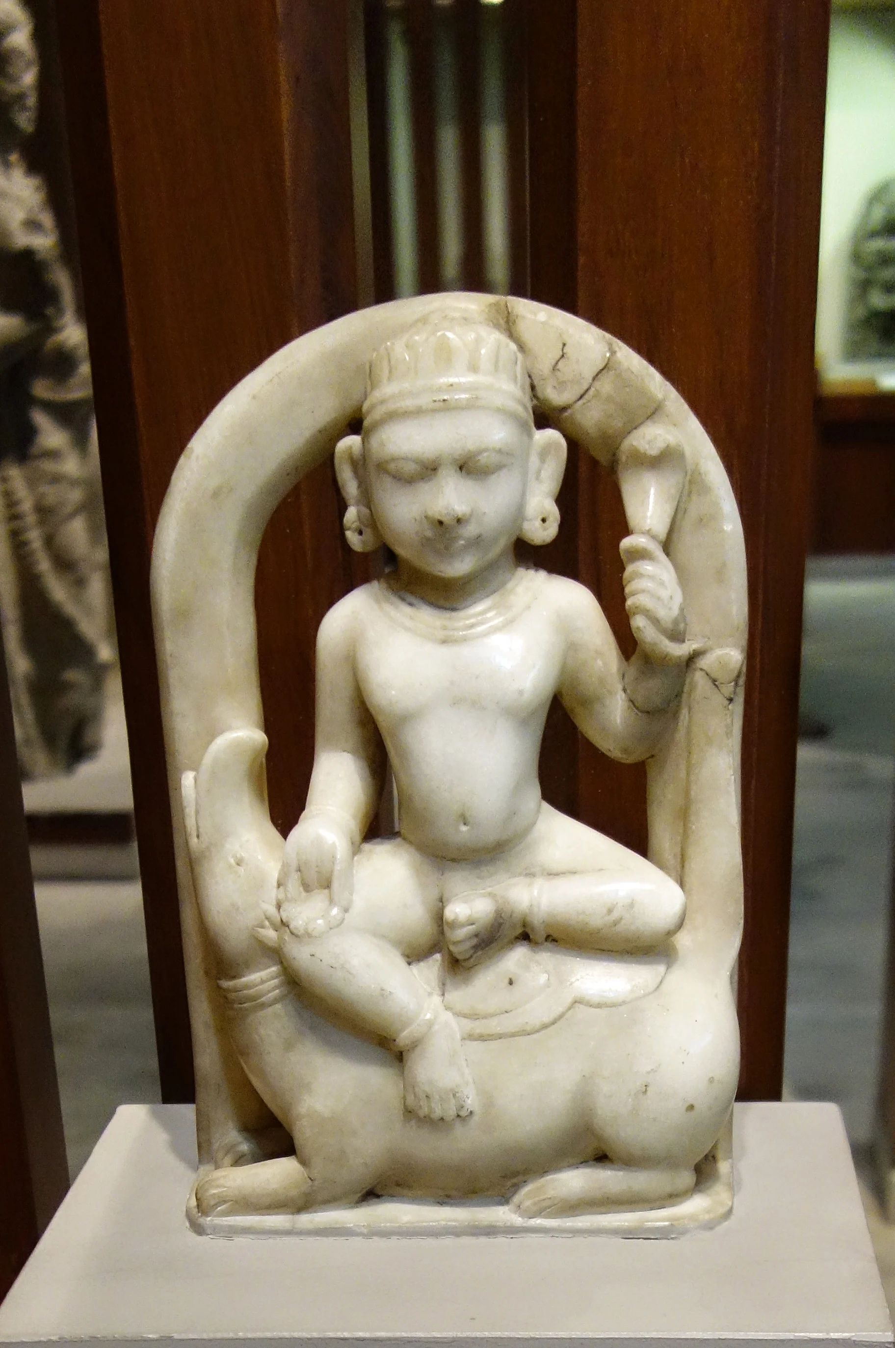
Varuna : 9th Century, Stone
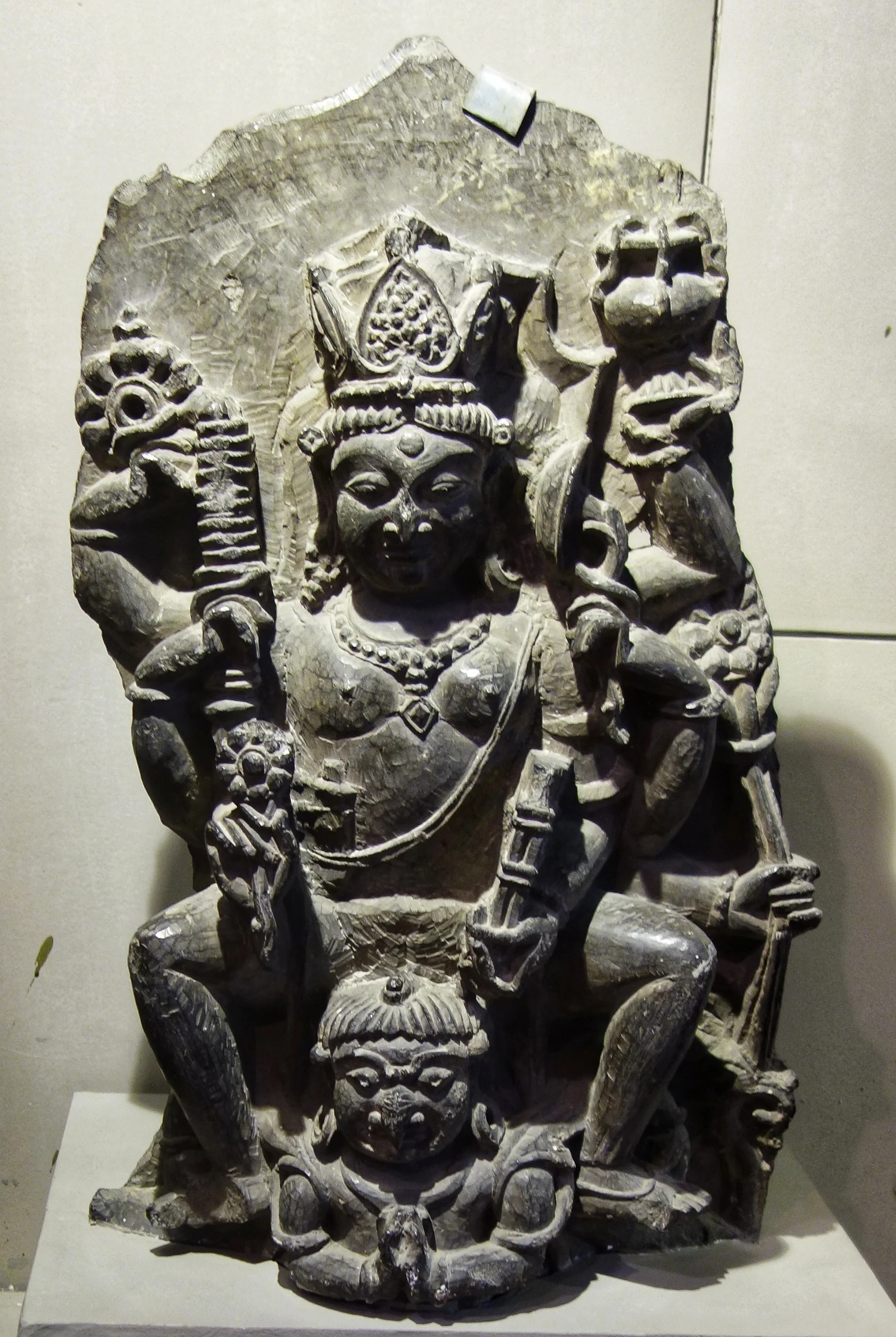
Vishnu : 10th Century, Stone
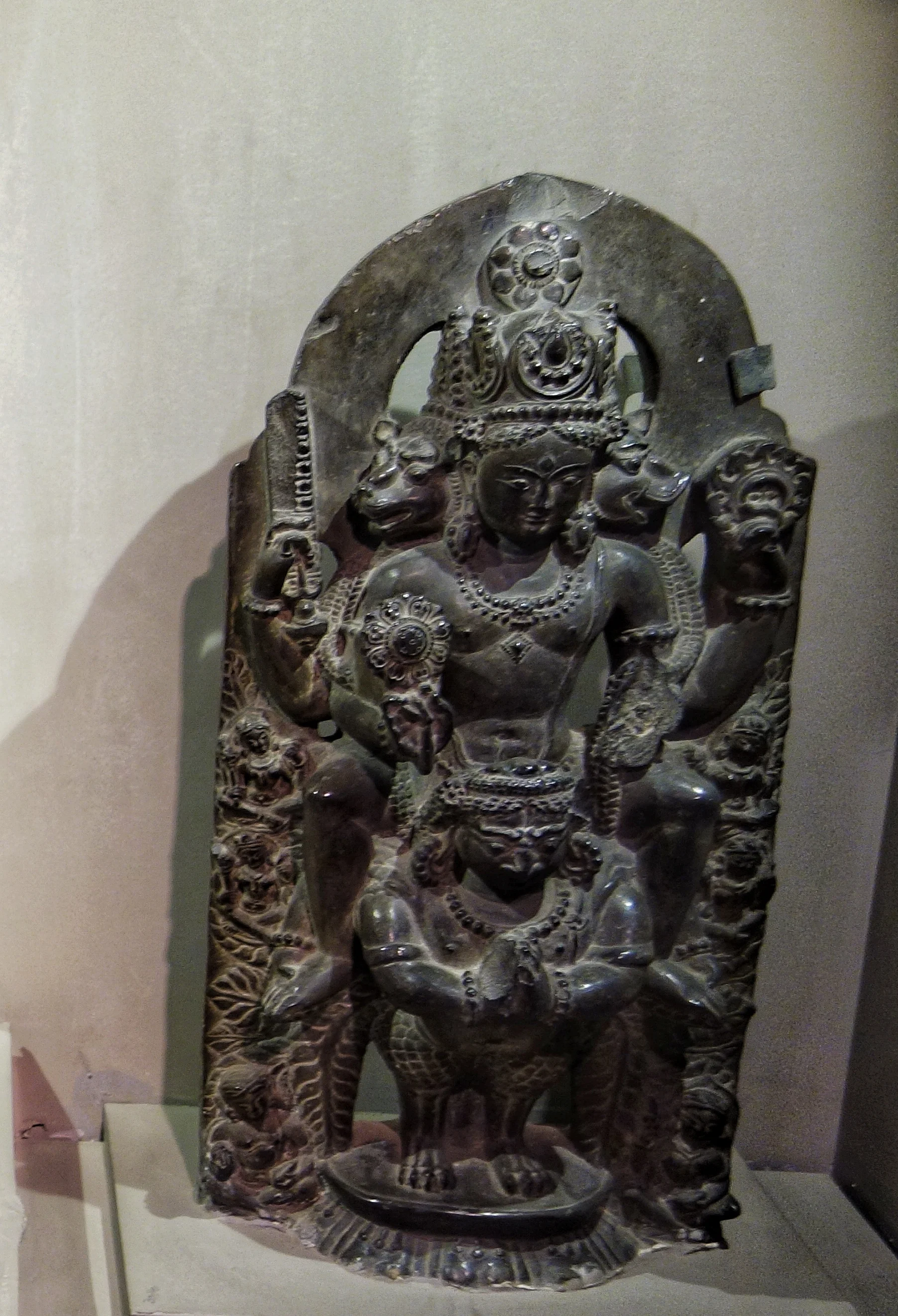
Vishnu : 10th Century, Stone
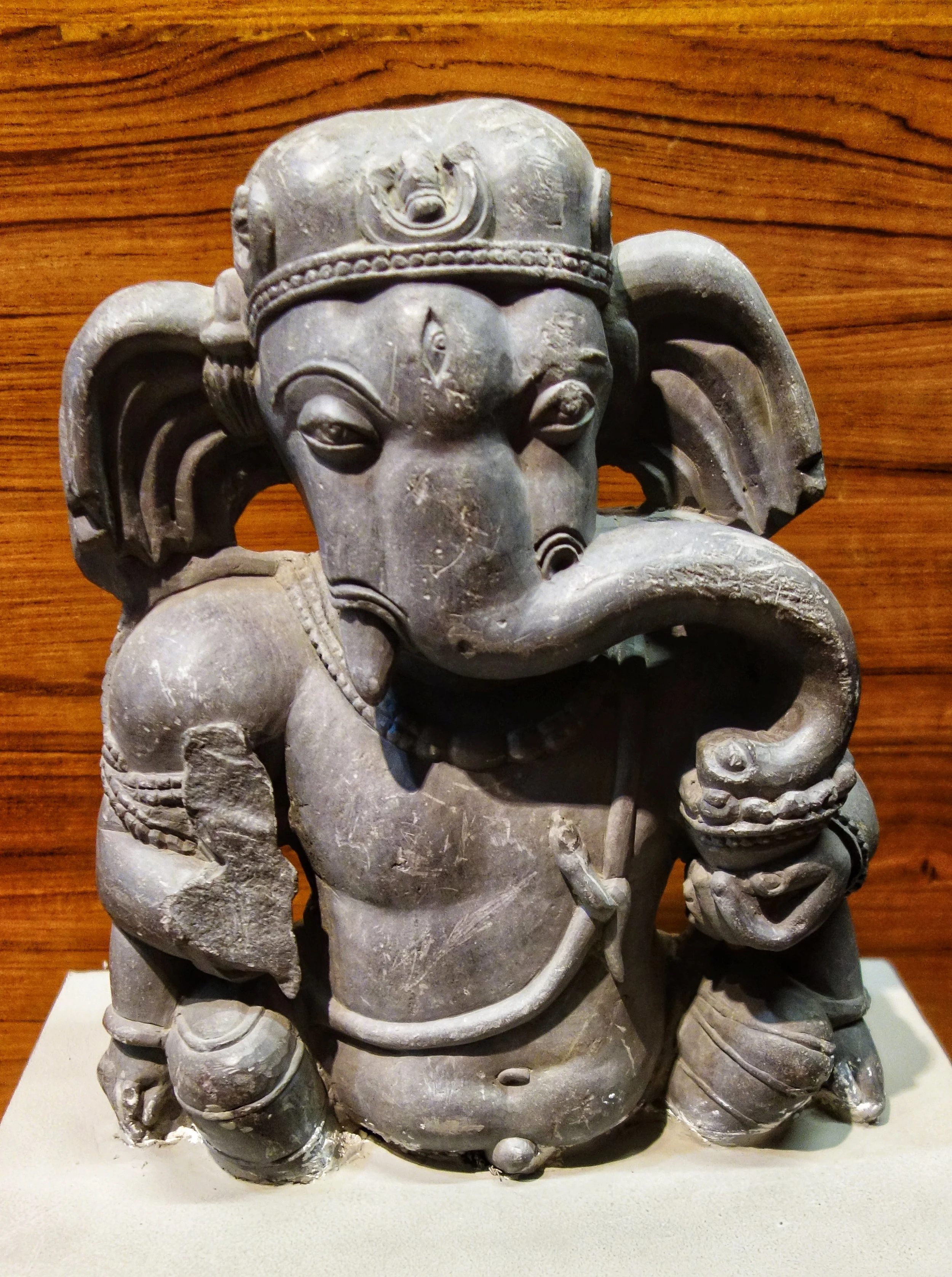
Ganesha : 9th Century, Stone
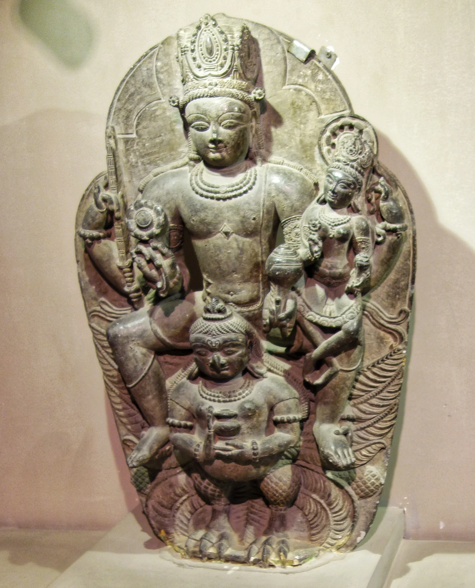
Vishnu : 12th Century, Stone
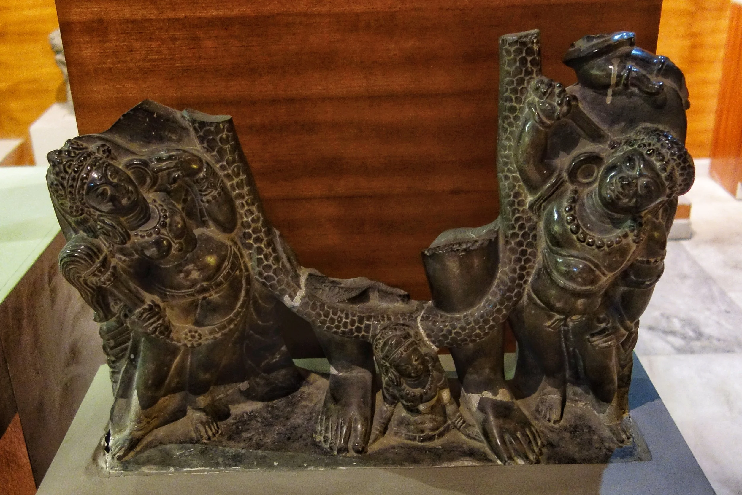
Vishnu, Gadadevi, Chakrapursha and Bahu Devi : 9th Century, Stone
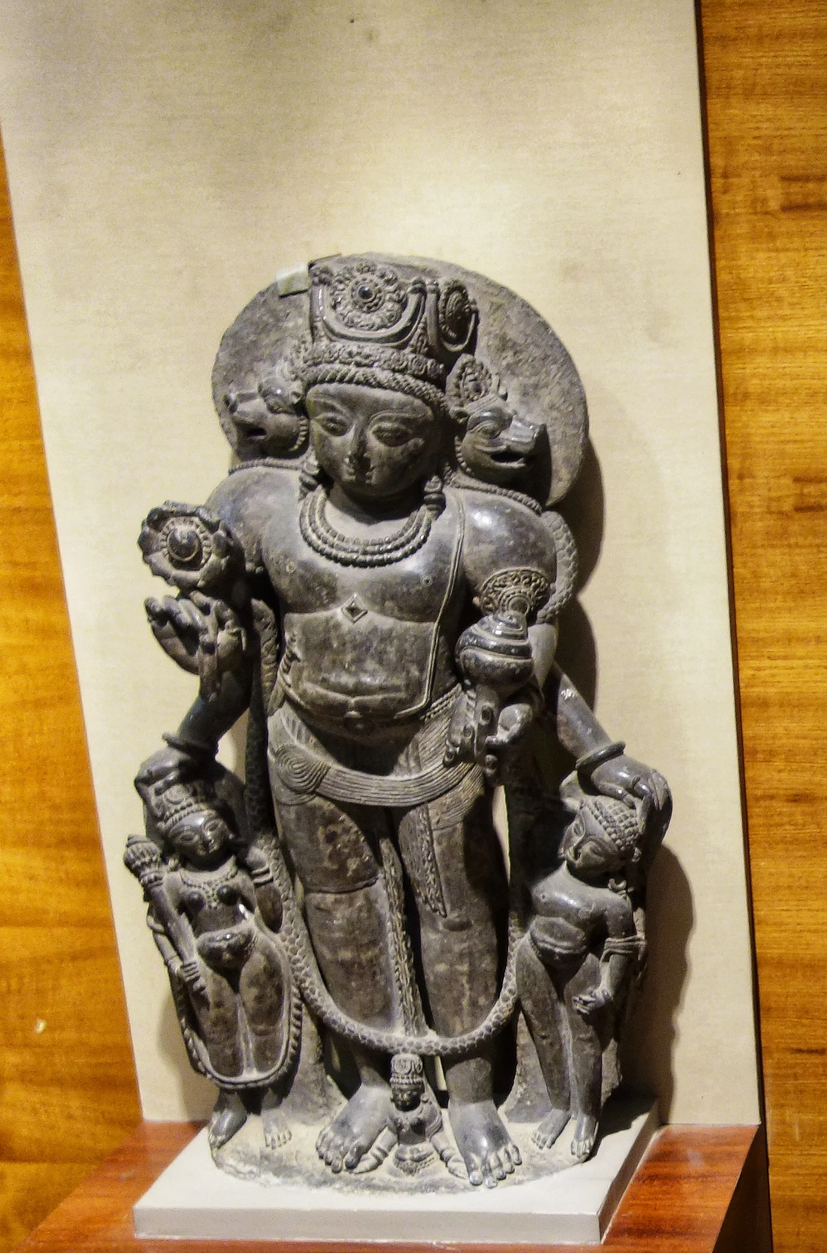
Vishnu : 10th Century, Stone
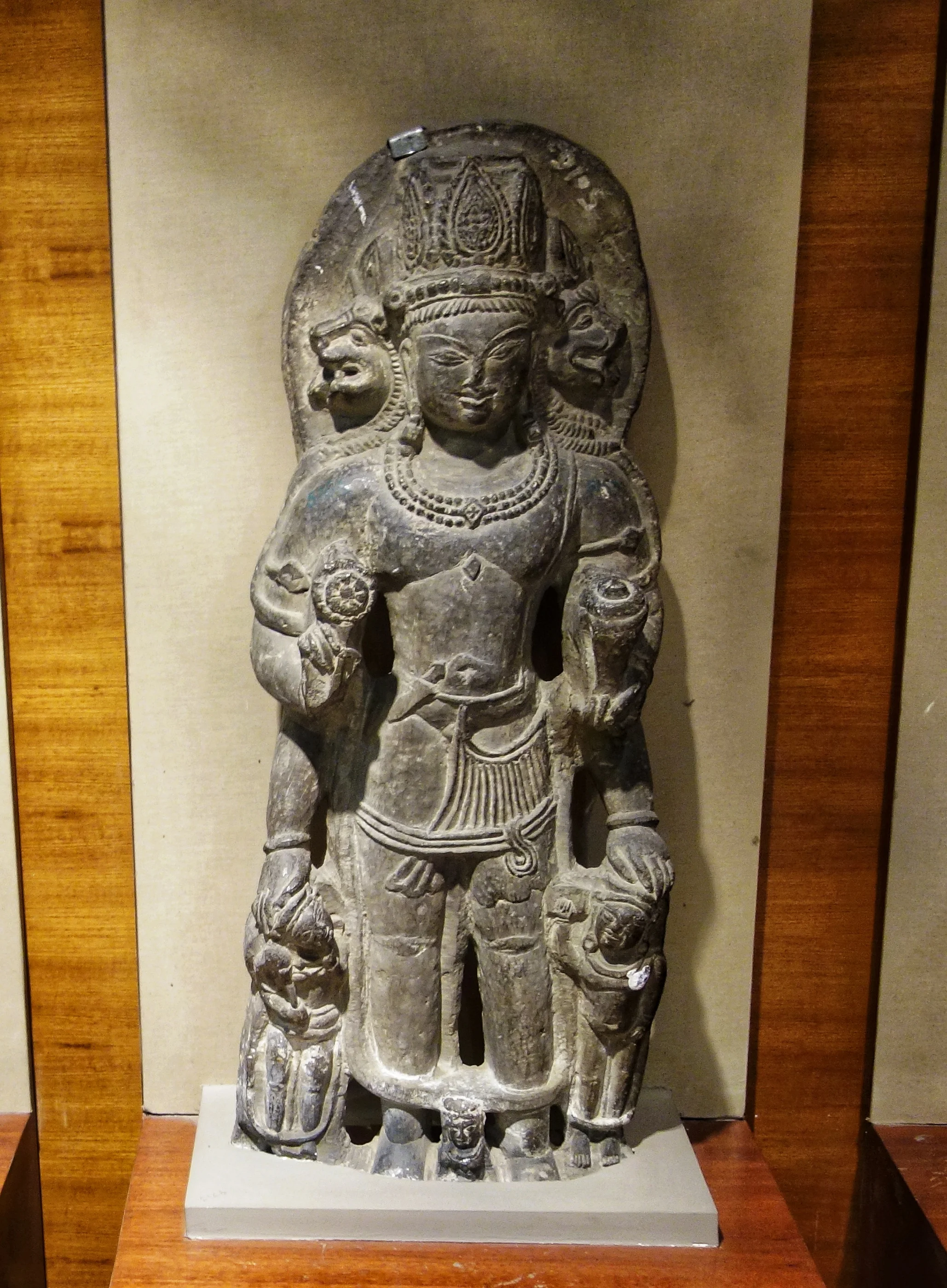
Vishnu : 10th Century, Stone

Vishnu : 10th Century, Stone
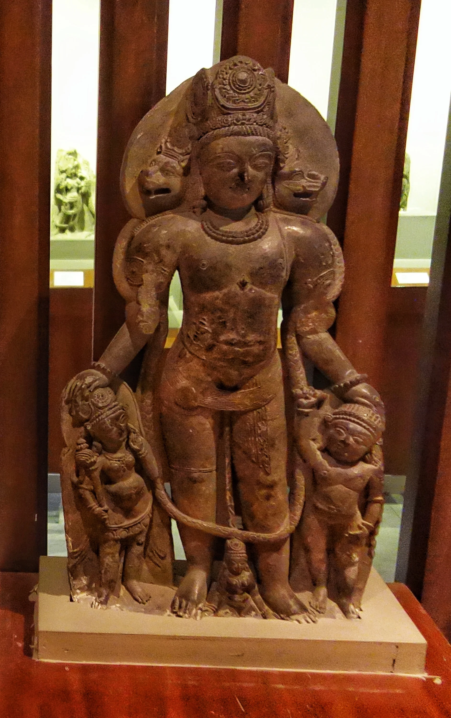
Vishnu : 10th Century, Stone
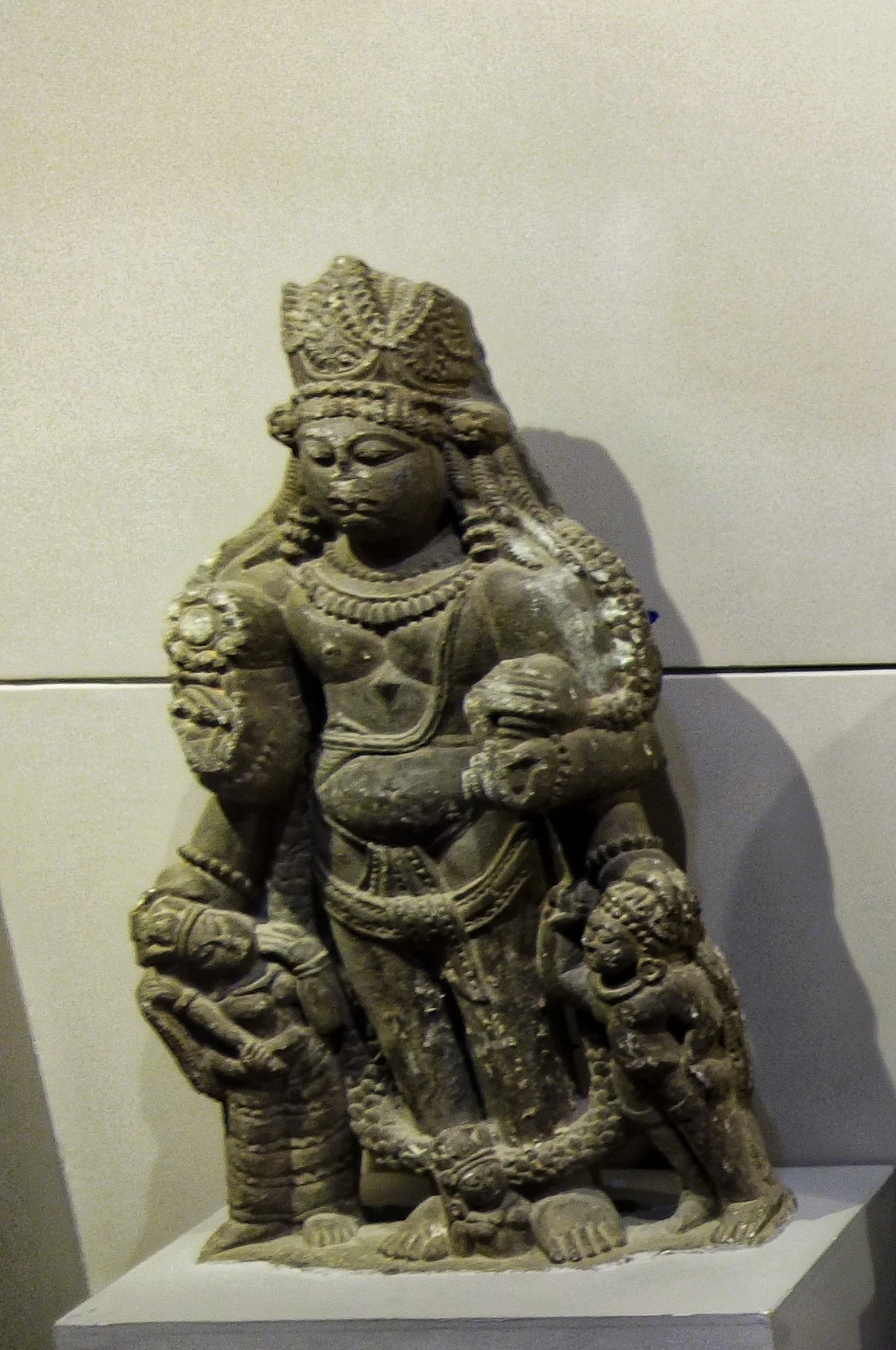
Male Figure : 9th Century, Stone
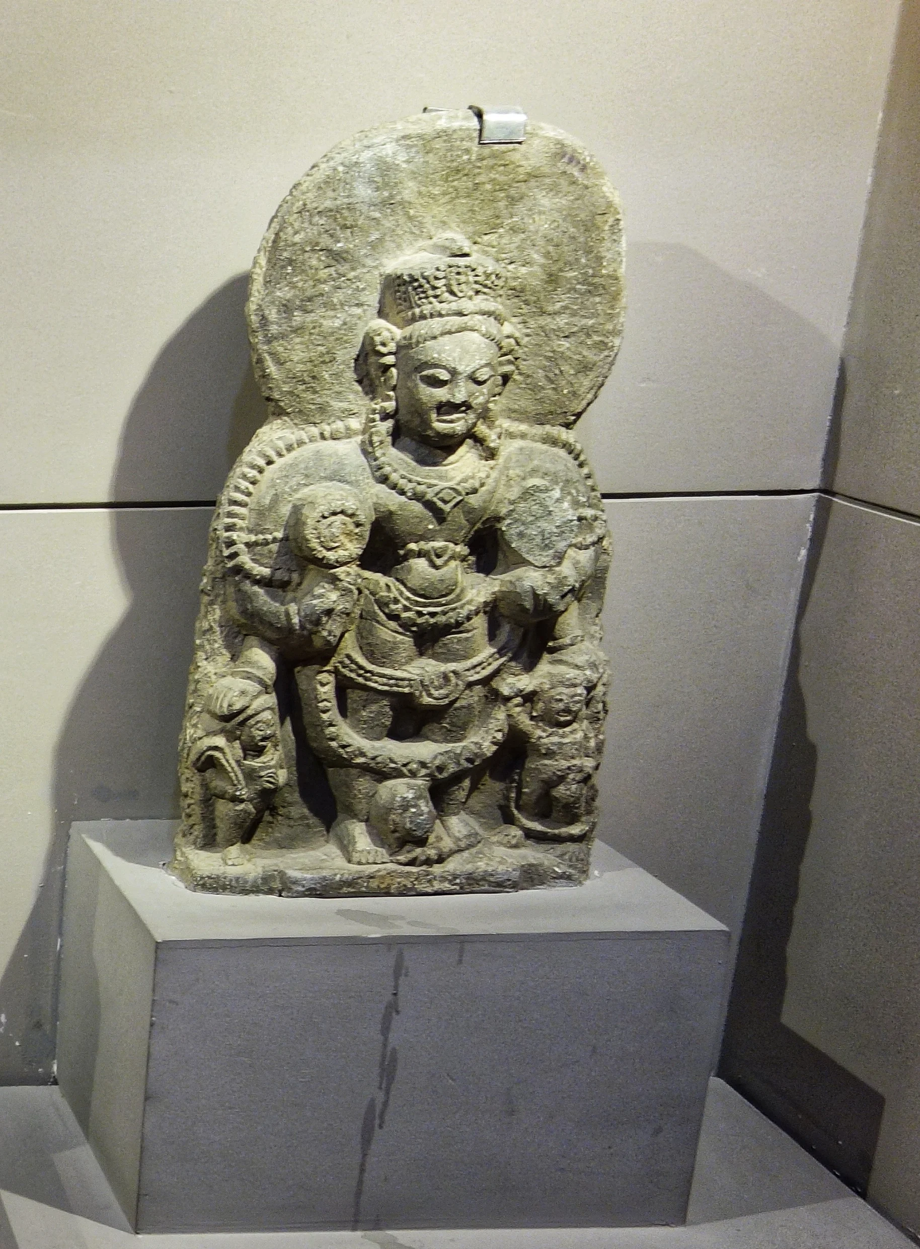
Male figure : 9th Century, Stone
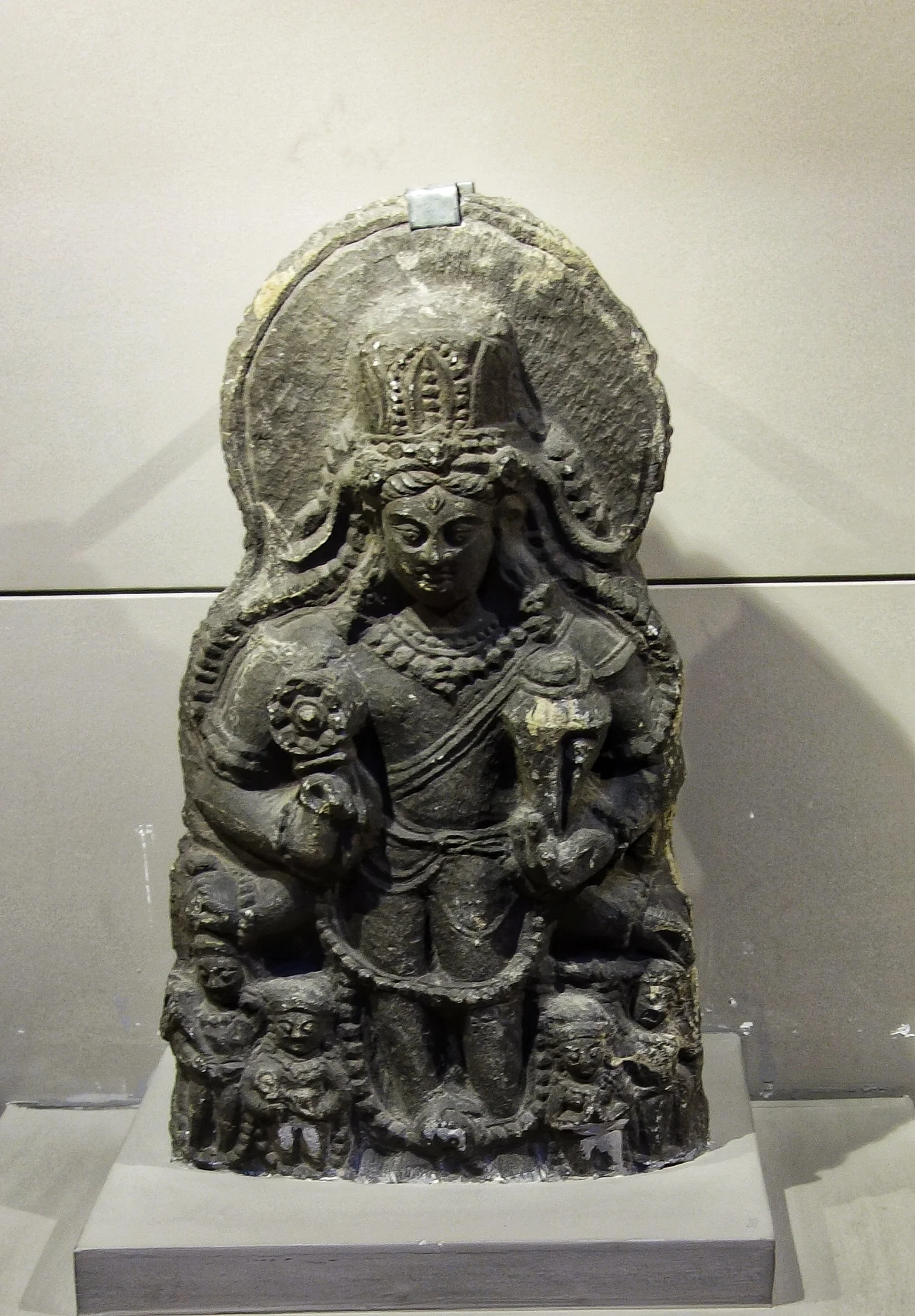
Vasudeva : 10th Century, Stone
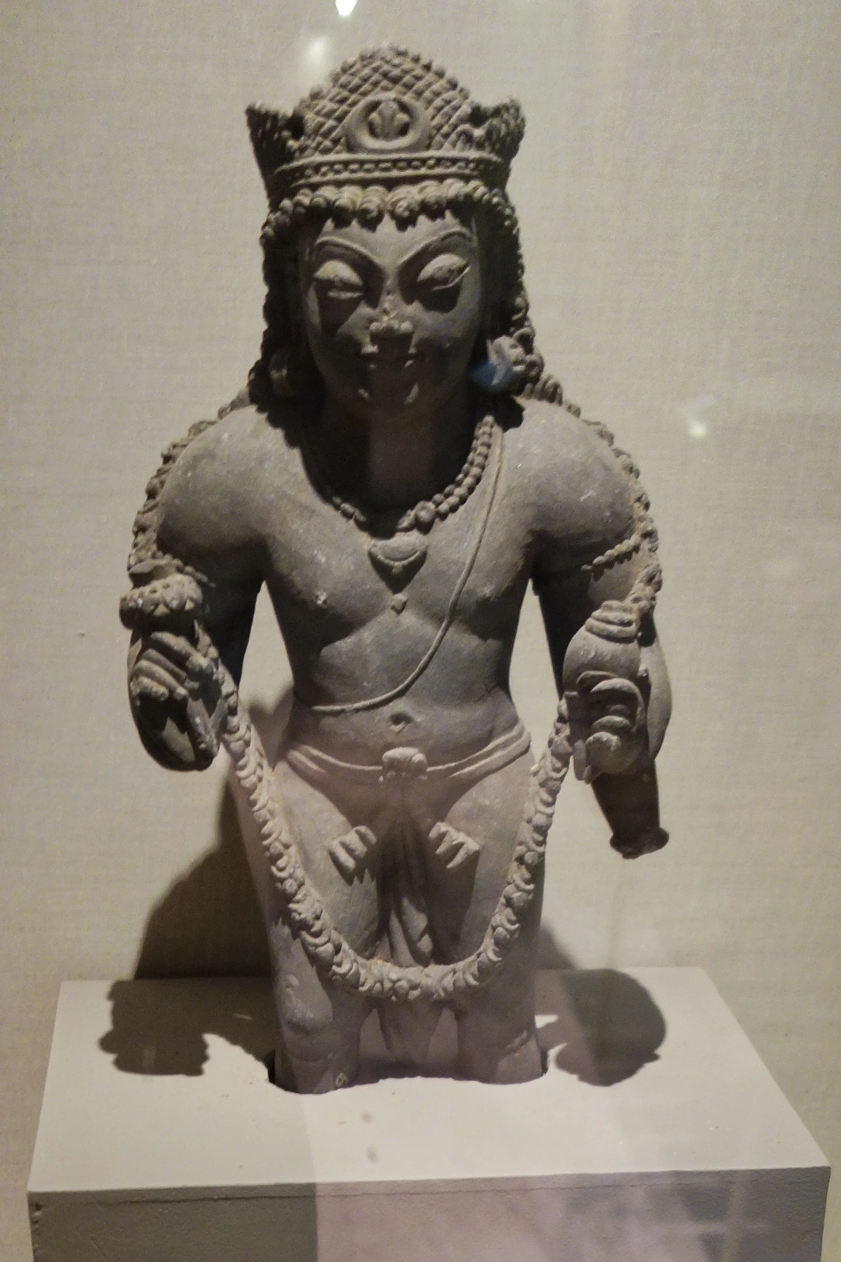
Vishnu : 10th Century, Stone
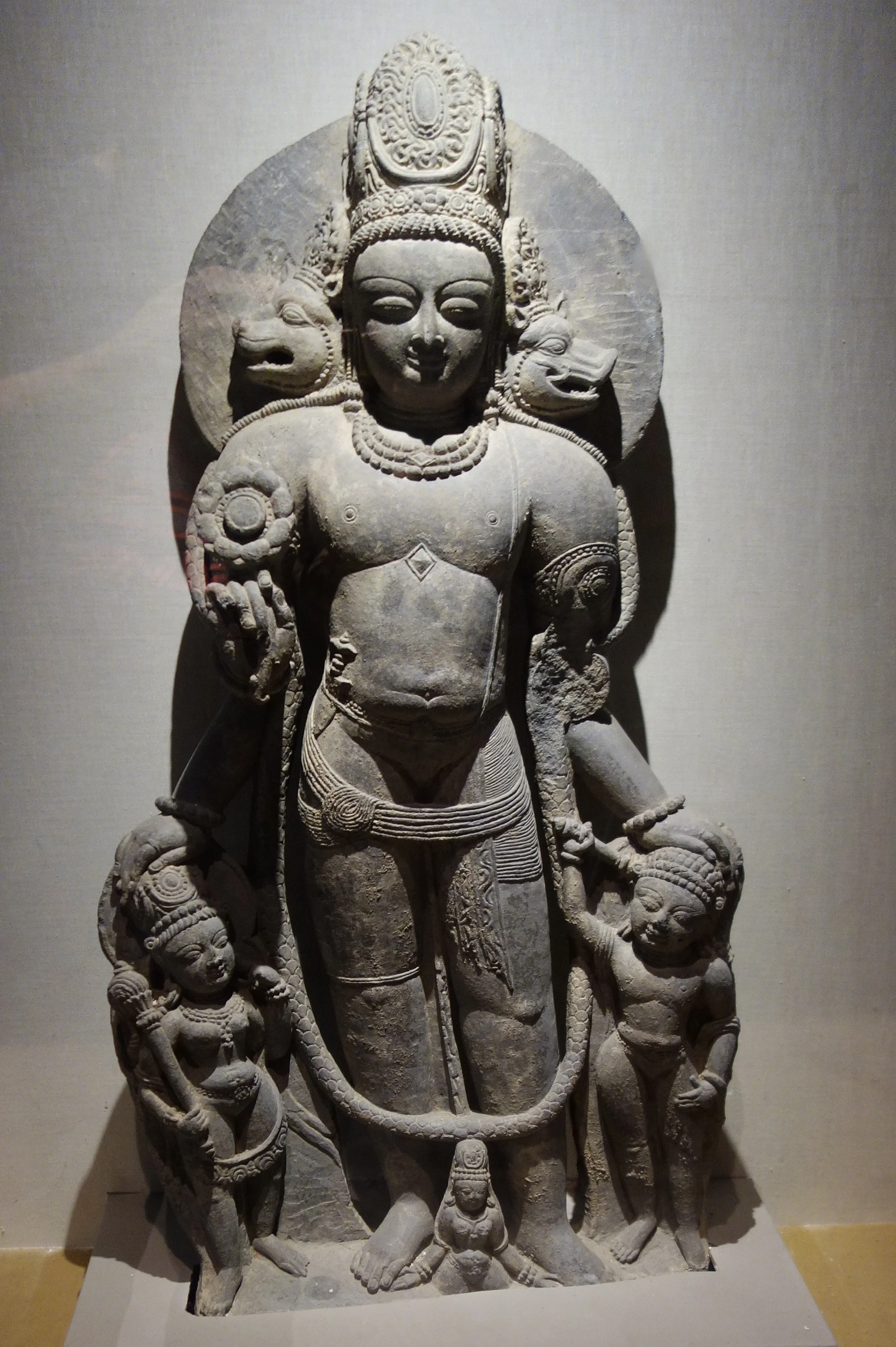
Vishnu : 12th Century, Stone
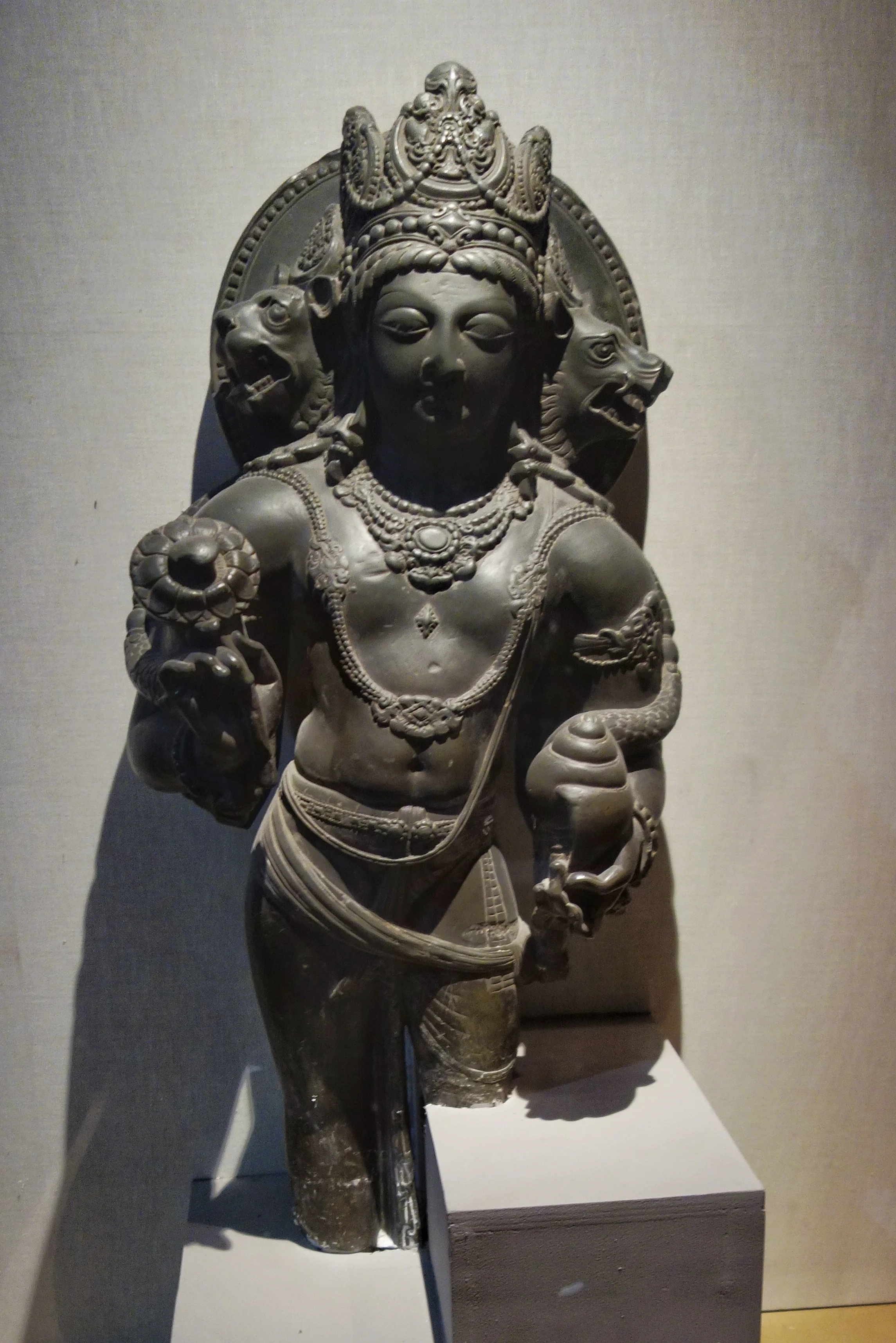
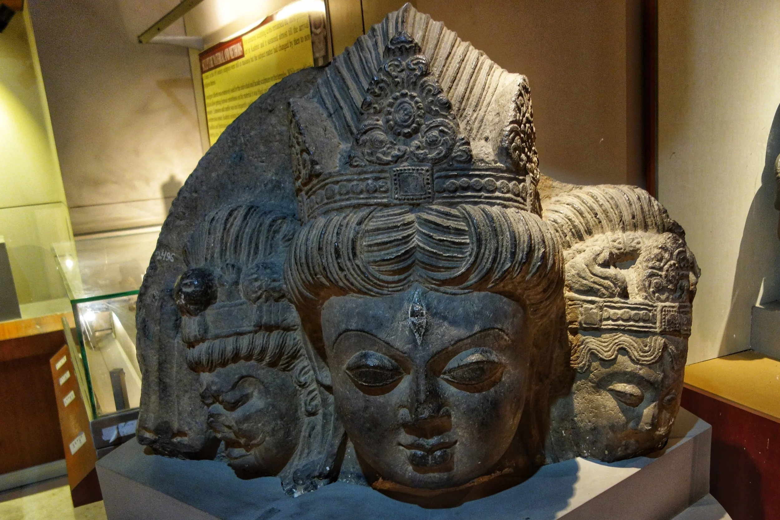
Shiva : 10th Century, Stone, Gupkar, Srinagar
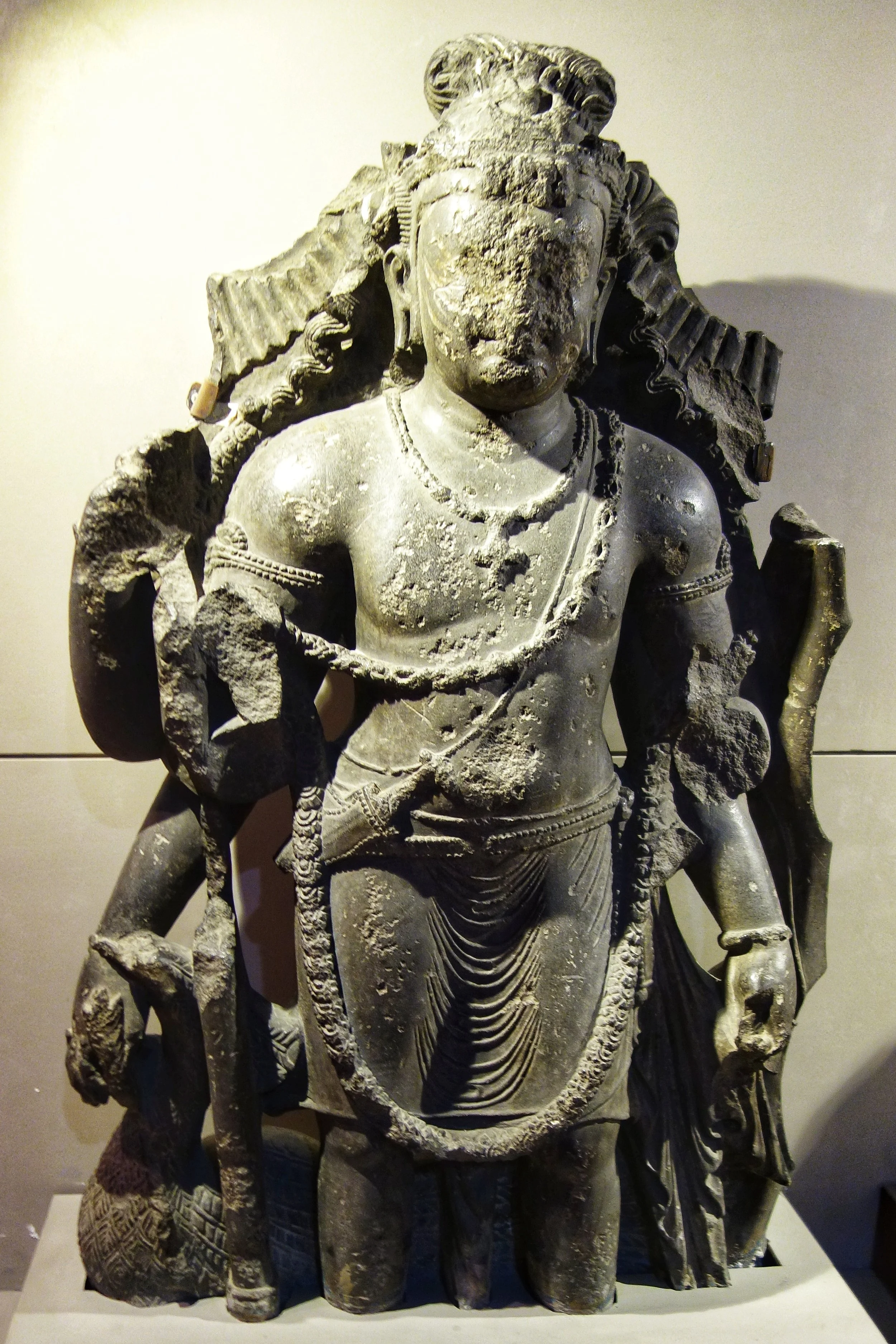
Kartikeya : 6th Century, Stone, Bij Behara
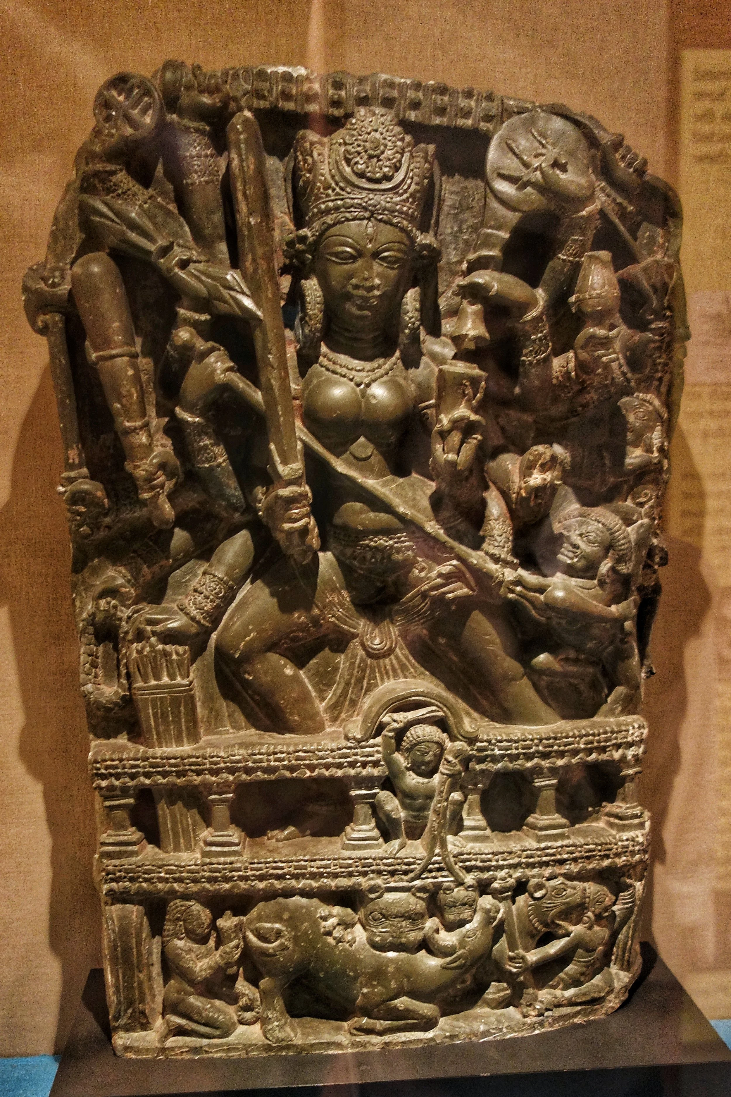
Durga : 8th Century, Stone, Pulwama
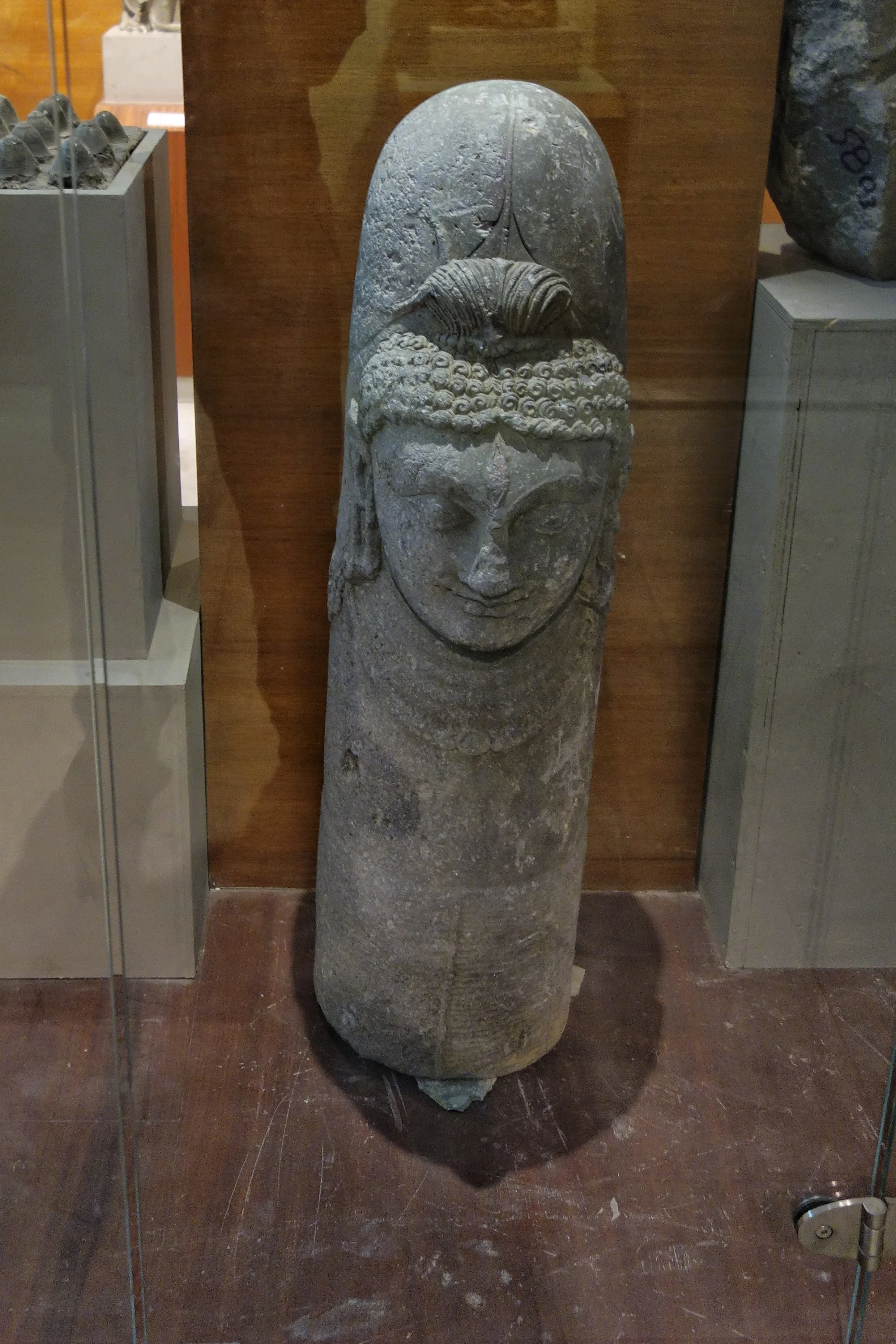
Ek Mukh Linga : 7th Century, Harwan (Recent find)
The Karakorams in India
The Karakorams are the most vertical of all the Mountain Ranges in the World. A large part of the Karakoram falls within India but most people are unaware of it. We explain.

The Karakorams as seen from a flight coming into land at Leh.
The Karakorams in India
The Karakoram, with its named derived from the Turkic word "Kara' meaning Black and "Koram" meaning Gravel. These impenetrable Mountains were seen as citadels and Towers of black gravel by the Central Asians and hence the name. They were also referred to as the Muztagh which meant Ice Mountain by the Western Explorers as well. The term Muztagh is now used to denote the sub Ranges of the Karakorams. As per some historians they were referred to as the “Krishnagiris” in the Puranas.
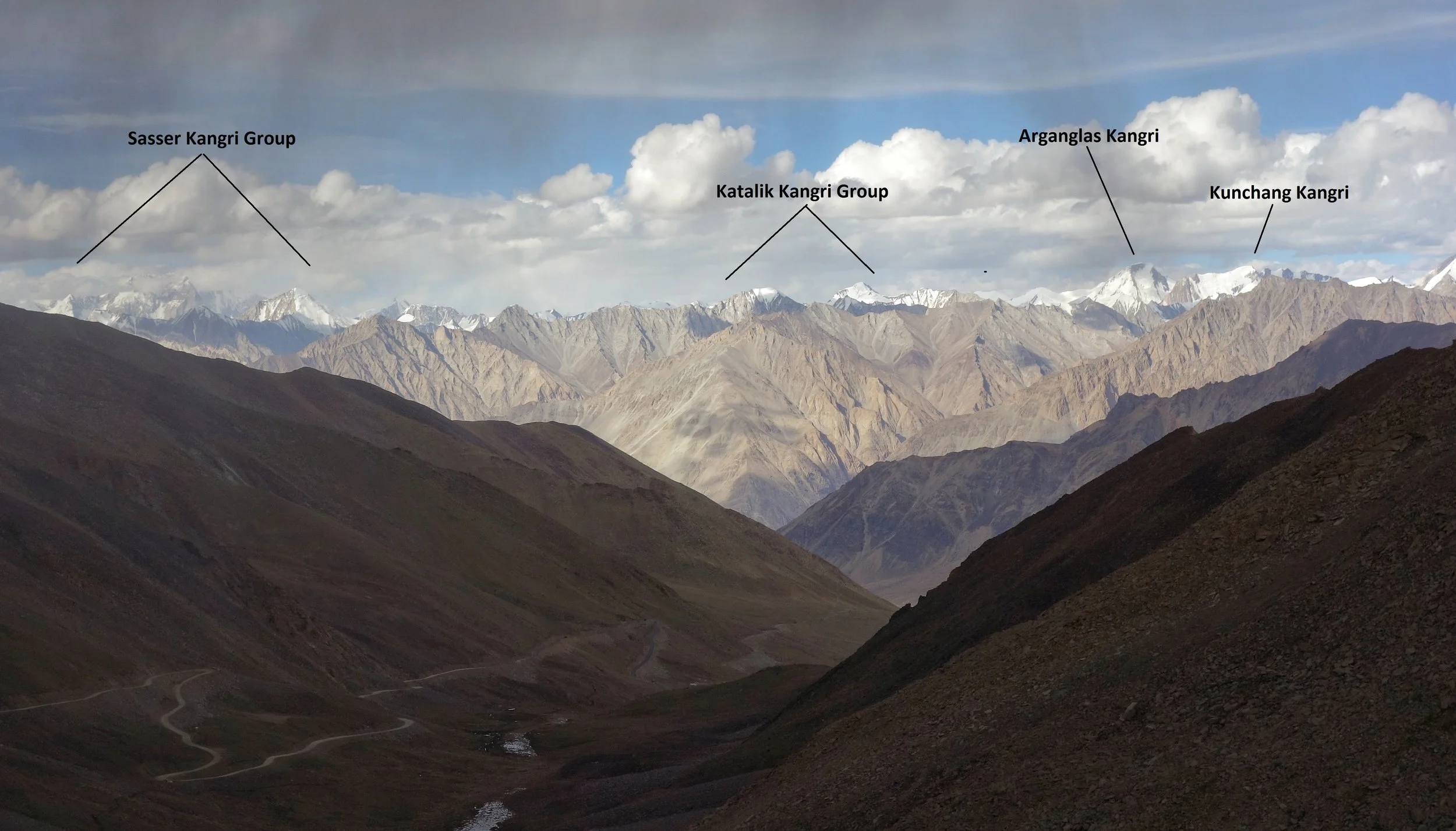
The Sasser Kangri Group and other Peaks of the Karakorams as seen from the Khardung La (Pass)
The Karakorams extend right from the Aksai Chin in the East to the Wakhan Corridor in the West and has other great Mountain Ranges like the Himalayas, the Hindu Kush, the Pamirs and the Kun Lun as its neighbors. It runs app. 550 kms from East to West starting at the Saser Muztagh in the East to the Batura Muztagh in the Hunza District.
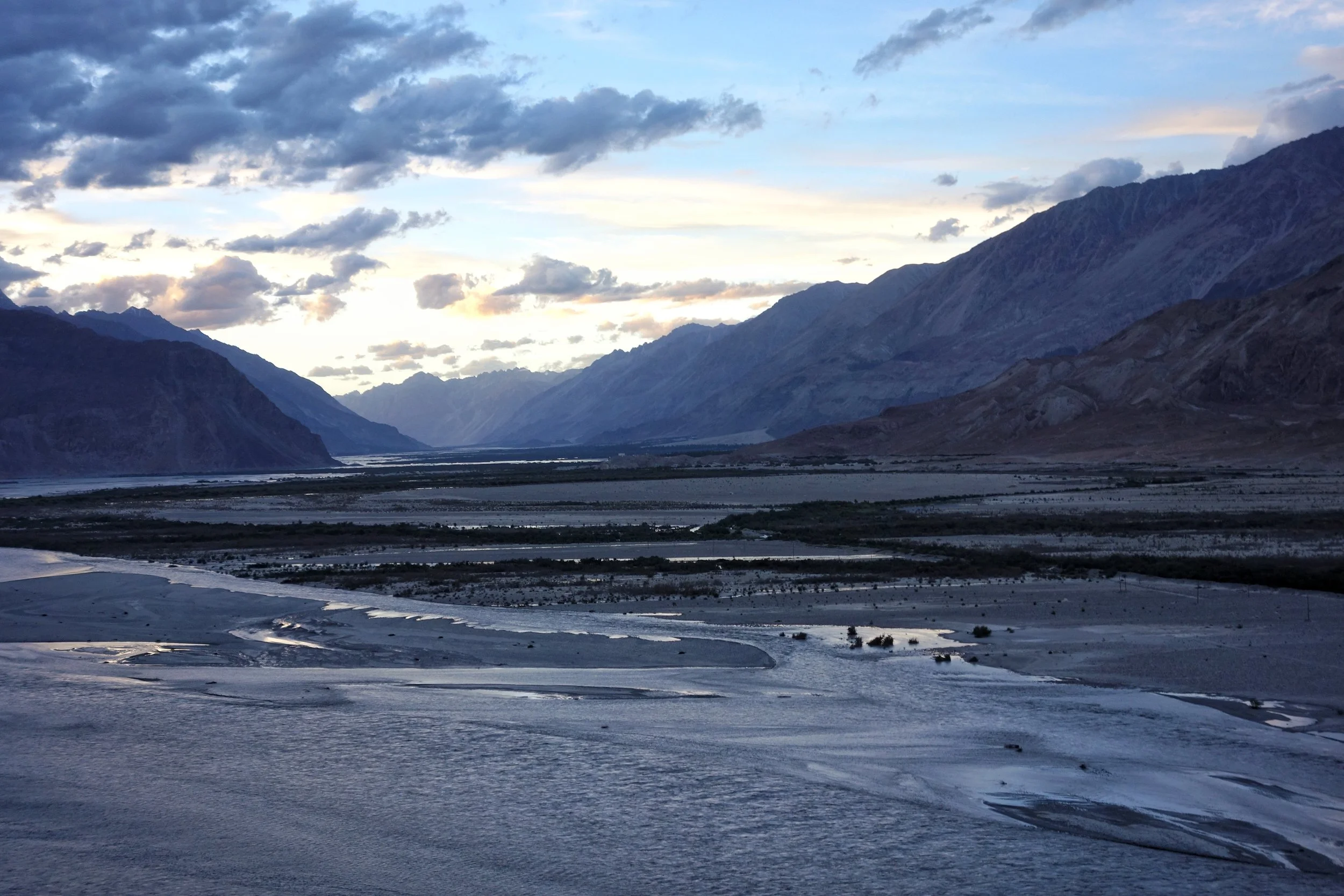
The Confluence of the Shyok and the Nubra. The Karakorams on the other side of the confluence.
Its Southern boundary is defined by the Gilgit, Indus and the Shyok Rivers which separate it from the Himalayan Range in the South. Infact in the Nubra Valley the Shyok River plays the boundary between the Himalayan Range and the Karakorams. In the North its the Karakash and the Yarkand Rivers which separate it from the Pamirs and the Kun Luns. The Karakorams actually lie right in the Center of the Great Himalayan Mountain Complex bounded by Ranges which are unparalleled in their sheer verticality. All these Ranges have Peaks exceeding 7000m which are not found in any other region on the Planet.
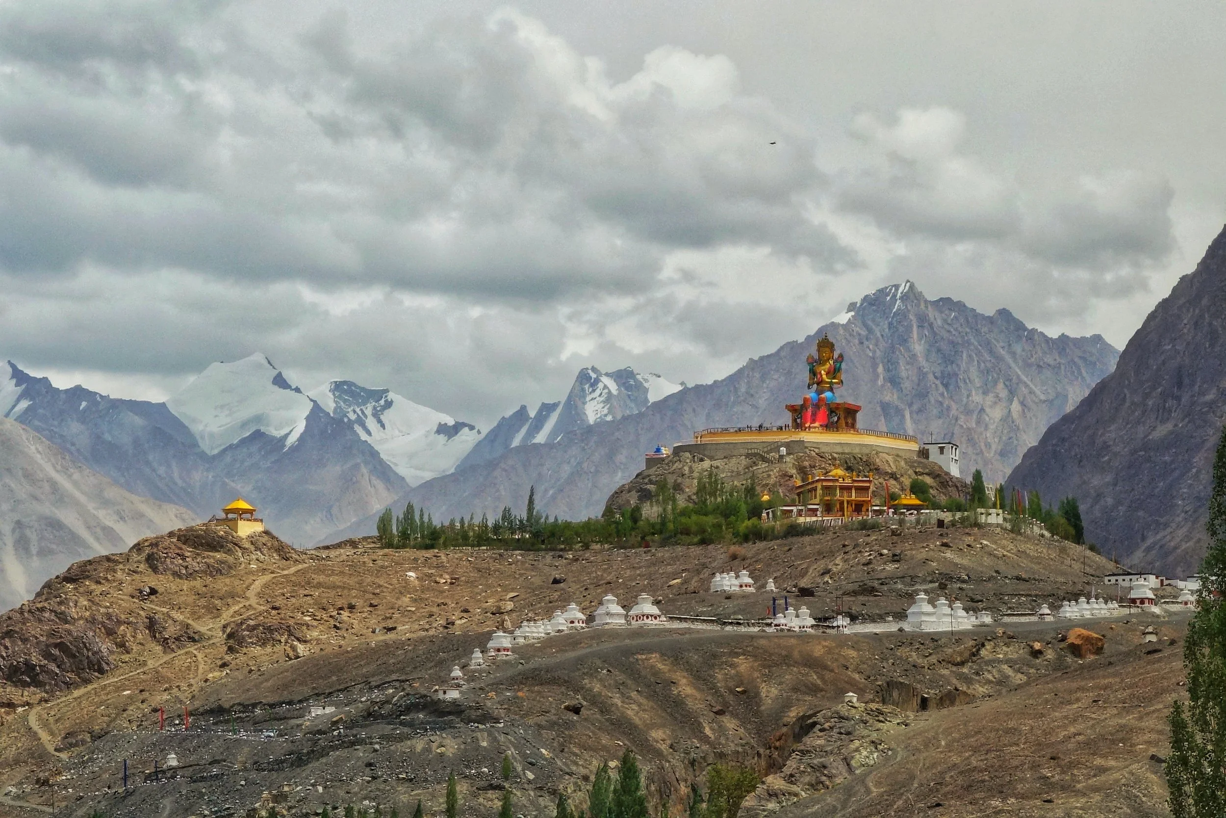
The Karakorams in the background of the Buddha Statue at Diskit in Nubra Valley
Broadly this most vertical of all the Mountain Ranges is subdivided into the following sub Ranges though experts differ on this aspect. The nine sub Ranges are as under
Sasser Muztagh
Rimo Muztagh
Siachen Muztagh
Baltoro Muztagh
Mashebrum Muztagh
Panmah Muztagh
Hispar Muztagh
Spantik Sosbun Muztagh
Rakaposhi Haramosh Muztagh
Batura Muztagh

Unnamed Karakoram Peaks along the Nubra Valley
Contrary to the popular perceptions a sizeable part of the Karakorams lies in territory well under Indian control though being in a sensitive border region most of it is off limits to Civilians and even climbing Expeditions to this area as the one carried out by the Himalayan Club and led by our Vice President, the acclaimed Mountaineer Divyesh Muni need various special permissions to visit these areas. Of the sub Ranges the Sasser Muztagh, the Rimo Muztagh and the Siachen Muztagh lie well within Indian held territory. Even a substantial part of the Baltoro Muztagh is within this territory. In Fact of the 10 highest Peaks in Indian territory (excluding the ones in Occupied territory) lie in the Karakorams. And three of these lie in the Sasser Massif and belong to the Sasser Kangri family. Infact these are clearly visible from the top of the Khardung if you look towards the North.
The Tengpora Durga : From Kashmir to Manhattan to Germany !
The Story of the of the highly revered idol of Tengpura Durga which went missing from Kashmir in the early 1990’s during the Militancy and later appeared at an Antiques showroom on Manhattan in New York and then onto a renowned Museum in Germany and finally back home to India and Kashmir.

The Tengpora Durga : From Kashmir to Manhattan to Germany !
Here is a tale of a fantastic Durga statue which disappeared from the Temple in Kashmir in the early 1990’s. It involves the militancy in Kashmir, International Antique smuggling syndicates, Museums, International Diplomacy, the Un, the Governments of India and Germany, the respective Prime Ministers and Chancellors and one man’s quest to bring it back home. A true international thriller if you may.
The Tengpora Durga is a 8th Century masterpiece of Kashmiri stone work. It was produced at a time when this art had reached its zenith. It goes without saying that some of the best Stone sculptures in the world were the Kashmiri craftsmen. I have been studying these sculptures from the Himalayas especially from Kashmir, Tibet and Nepal and can say that both Tibet and Nepal were influenced by the Kashmir sculptures. And the Kashmiris were influenced by the Gandhara School.
This particular idol of Durga is special as it portrays an Eighteen handed Durga instead of the Ten handed Durga that was the norm usually. The Statue was supposed to be the longest continuously worshipped statue of Durga in the Indian subcontinent and was kept at a Temple in Tengpora in Kashmir located in Pulwama. The Temple was held in high reverence and the Idol was worshipped here since the 8th Century.
However everything changed with the turmoil in Kashmir with the rise of Militancy and Conflict. Sometimes in the early 1990’s the famous Tengpora Durag disappeared from the Temple. At the same time many such antiquities from Temples disappeared in Kashmir and began appearing elsewhere. Similarly the Tengpora Durga was also lost.
Mr.Rakesh Kaul, a Kashmiri, who was the CEO of an American listed Company first came across the Tengpora Durga in 1999, at the Madison Avenue Gallery of Mr.Subhash Kapoor, a well know Indian Antiques dealer not really known for being the cleanest guy in the trade. Mr.kaul came across a vast array of other Devis and Devtas who’s sourcing was also a matter of mystery.
As it happened Dr.Pratapaditya Pal, an authority on ancient Indian Art also visited the showroom of Mr.Subhash Kapoor and on seeing the Durga brought it to Mr.Kapoor’s notice that it was a stolen piece which disappeared from Kashmir. Mr.Kapoor, smooth as he was feigned ignorance and said he would look into the matter and that was that.
After sometime Dr.Pratapaditya Pal was invited as a speaker at the Linden Museum in Germany and to his utter surprise he found the the Tengpora Durga on display over there. On making enquiries he was told that the Museum had acquired this masterpiece of Kashmiri Art from Subhash Kapoor who sold it to the Museum for a pittance amount of USD 250,000. Subhash Kapoor must have realise that since it was a “Hot’ piece of Art he needed to get rid of it at the earliest and that's what he did and sold it for that amount.
Mr.Kaul was in touch was Dr.Pal and discussed ways and means of getting the Durga back to India. But he understood that it wasn't going to be easy as the exact sequence of its disappearance from Kashmir to the tile it appeared in the Linden Museum could not be established. But he kept up his effort and also met folks at ASI who offered him all the help but at the same time said that there is a long list of items that they have been claiming from many countries and this Durga is also down there somewhere on the waiting list.
The big breakthrough came when the police in the US arrested Subhash Kapoor for smuggling Antiques. He was already under the scanner as previously a consignment labeled “Marble Furniture” from India had actually turned out to be smuggled Antiques. Subhash Kapoor had feigned ignorance and didn't claim the consignment and was out of the Net. But the Police was onto him. Further the Us Government agreed to extradite Subhash Kapoor to India as he was wanted with theft of various Nataraja Bronzes from Tamil Nadu.
Mr.Kaul now approached the Linden Museum directly who were now aware of the antecedents of Mr.Subhash Kapoor and how he turned out to be an International Antique Smuggler. The Linden Museum quietly removed the Tengpora Durga from the display. Mr.Kaul again requested the Museum to return the Durga to India. Another representation went to the Linden Museum who now said that we would now take up the matter with the German Ministry of Culture and Art.
Mr.Kaul also wrote to the Indian Ambassador in Germany at that time on the same issue. And the Ambassador also offered to help. By another series of coincidence a British author who had for decades on Kashmir’s Stone antiquities came out with an illustrated book which featured the Durga taken much earlier. Now there was proof in the Public domain attested by a renowned expert on the subject that the piece was from Kashmir and he had last seen it in 1990. But at that time he wasn't allowed to photograph as the locals in the Village were afraid that someone might steal the Durga.
Through the same expert the Linden Museum made an informal offer to Mr.Kaul, who was now on a mission of his own to get the Durga back to India. As per the offer they would acknowledge that the piece belongs to the Indian Government but at the same time wanted the Indian Government to give the piece of Art on permanent loan to the Linden Museum. A convenient way to keep the Durga in the Museum and at the same time make the Indian Government happy. However when Mr.Kaul conveyed the same to ASI they flatly refused and Mr.Kaul also told them that they would not settle for anything less than the Durga being returned back.
The Linden Museum and the German Government now found themselves in a piquant situation. This was an Antique which was sold to them by an Antiques dealer who was already behind bars with charges filed against him both in the US and in India. Further the piece came from a conflict ridden region which often headlined the News. They knew they were on weak wicket as far as the Durga was concerned.
Soon the pressure was being mounted and finally with the new Government in India sworn in in May 2014 a strong impetus was given to such cases. At last the Germans yielded and said that the Chancellor Angela Merkel would bring back and return the Durga to India during her visit in 2015 as a goodwill gesture as it was ethically wrong to keep it in the Museum in Germany. Finally Mr.Rakesh Kaul won and all the effort he had put in bore fruit.
I first saw the the Tengpora Durga at the Sri Pratap Museum in Srinagar in 2017 October. I couldn't help but admire this amazing piece of work. I remember standing for a long time admiring the detailing of this sculpture. At that time of course I had no idea of the history and the events that had transacted between the time it disappeared from Kashmir in the early 1990’s and the time it came back to Kashmir to be displayed at the SPS Museum in 2015. It was only while I was Cataloging the collection at the Sri Pratap Museum that I stumbled upon this thriller of story behind the Tengpora Durga.
The Durga is best described in Mr.Kaul’s own words “ She was incarnated in her moorthy roopa in the eighth century out of green chlorite stone. She is approximately 68.6 cm in height and 43.2 cm wide. She is in pristine condition. Consistent with the unique style of Kashmir she rides in a chariot with wheels on the side drawn by two lions over the mountain ranges. A diminutive charioteer in charge as is typical in Surya, the Sun God’s chariot. Jingling Bells hanging from the balustrade, supported by six pillars, announce her arrival. She stands in the alidha (warrior) stance telling us to be forever fearless. The two lions grip the buffalo tightly but it is the third lion that crushes within its powerful jaws the mace armed demon of ignorance, which as the egoist essence of the physical buffalo has been released from inside it. The Durga tells us to never be a believer because a believer is bound by ignorance and is a Pashu an animal. Instead one should be a fearless seeker of Truth.
This Durga is eighteen armed. Again, Kashmir with the Nilamatapurana text was the earliest in giving a representation of the Durga as having eighteen arms when ten was the rule for all pre 7th century portrayals. In two of her left arms she holds the demons Sumbha and Nisumbha over whom she gained Victory. The right hand holds the lance, a quiver of arrows, a ring wreath, a club, an axe, an upright sword, a vajra and a mace while the left-hand holds a bow, a round shield, a bell, a Kamandalu, a trisula, a horn and an askamala with one hand placed on her left thigh. She wears a tight bodice and a long lower garment with a sash tied across her thighs, the end falling between her legs and a chain girdle of bells around her waist. Annular earrings and bracelets along with a trefoil crown complete her dazzling attire. She is the ruler of eighteen dimensions and she is beautiful. She tells us that a fearless seeker becomes free and freedom is a prerequisite to overcoming Tamas the darkness of inertia. It is only freedom which yields the experience of the beauty of the ultimate truth of reality!
Pic from October 2017. SPS Museum, Srinagar
The Potatso National Park in Yunnan
The Potatso or Pudacoa National Park In China was the first National Park of China and is situated at an altitude of an average 3400 m. The Park contains dense forests, Lakes and Wetlands. Its also a part of the Three Parallel Rivers of Yunnan Protected Area World Heritage Site.

The Shudu Lake at the Potatso National Park in Yunnan.
The Potatso National Park
The Potatso or Pudacoa National Park In China was the first National Park of China and opened to public just 10 years back. Situated at an altitude of an average 3400 m the Park contains dense forests, Lakes and Wetlands. Its also a part of the Three Parallel Rivers of Yunnan Protected Area World Heritage Site. Truly well deserved for one of the most bio diverse areas in the World. The Park contains 20% of all the flora found in China as well as one fifth of all the animal species.
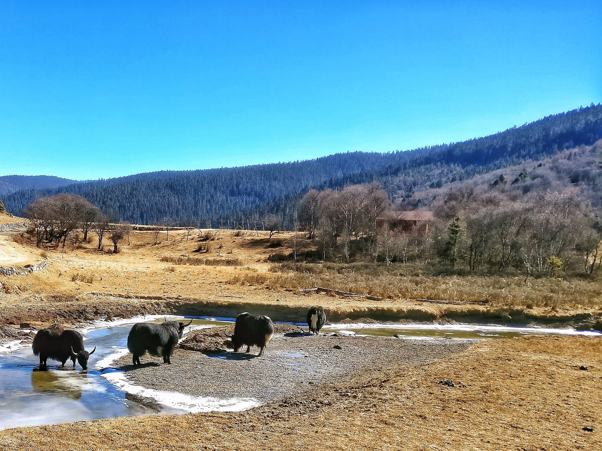
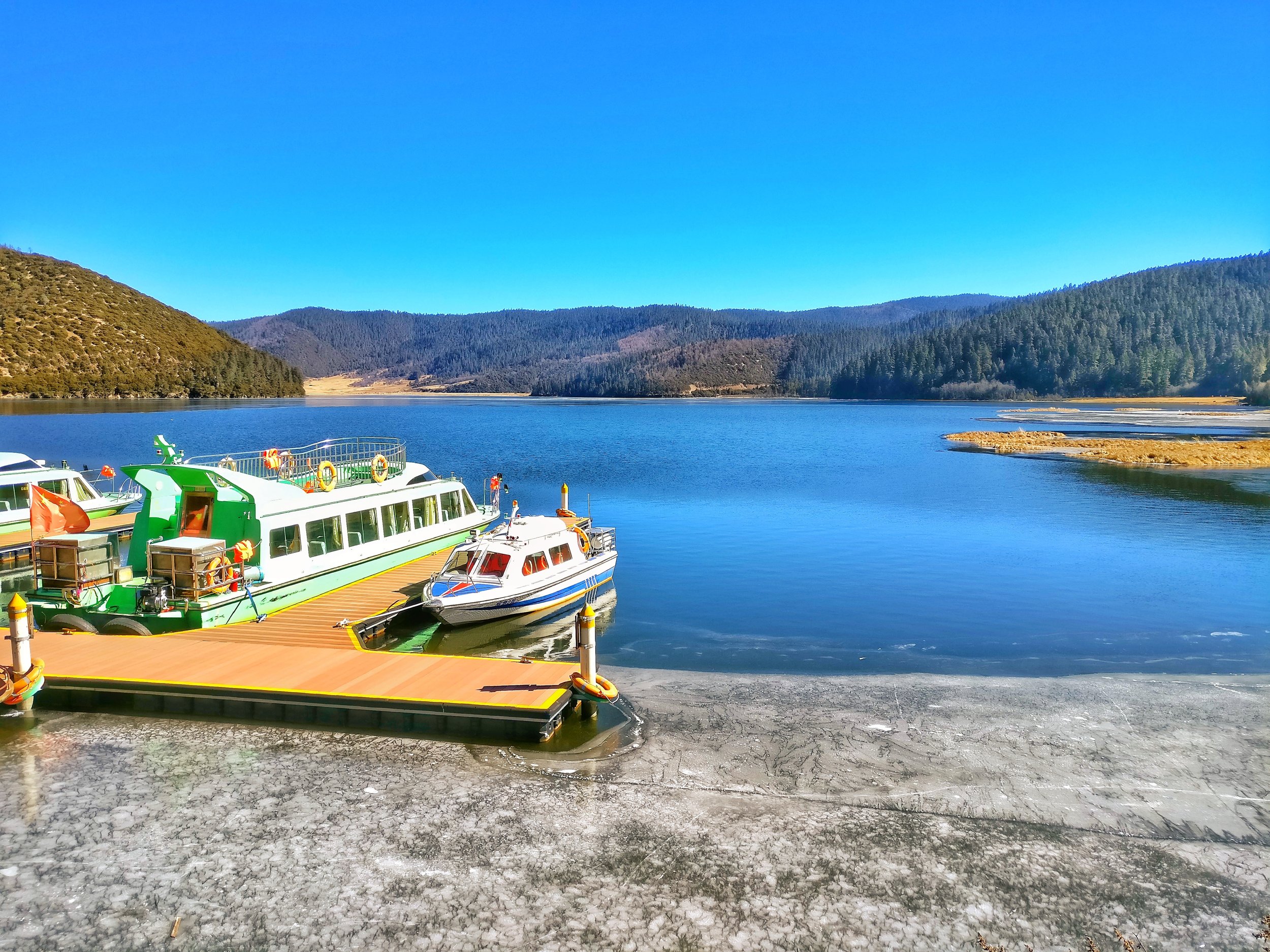
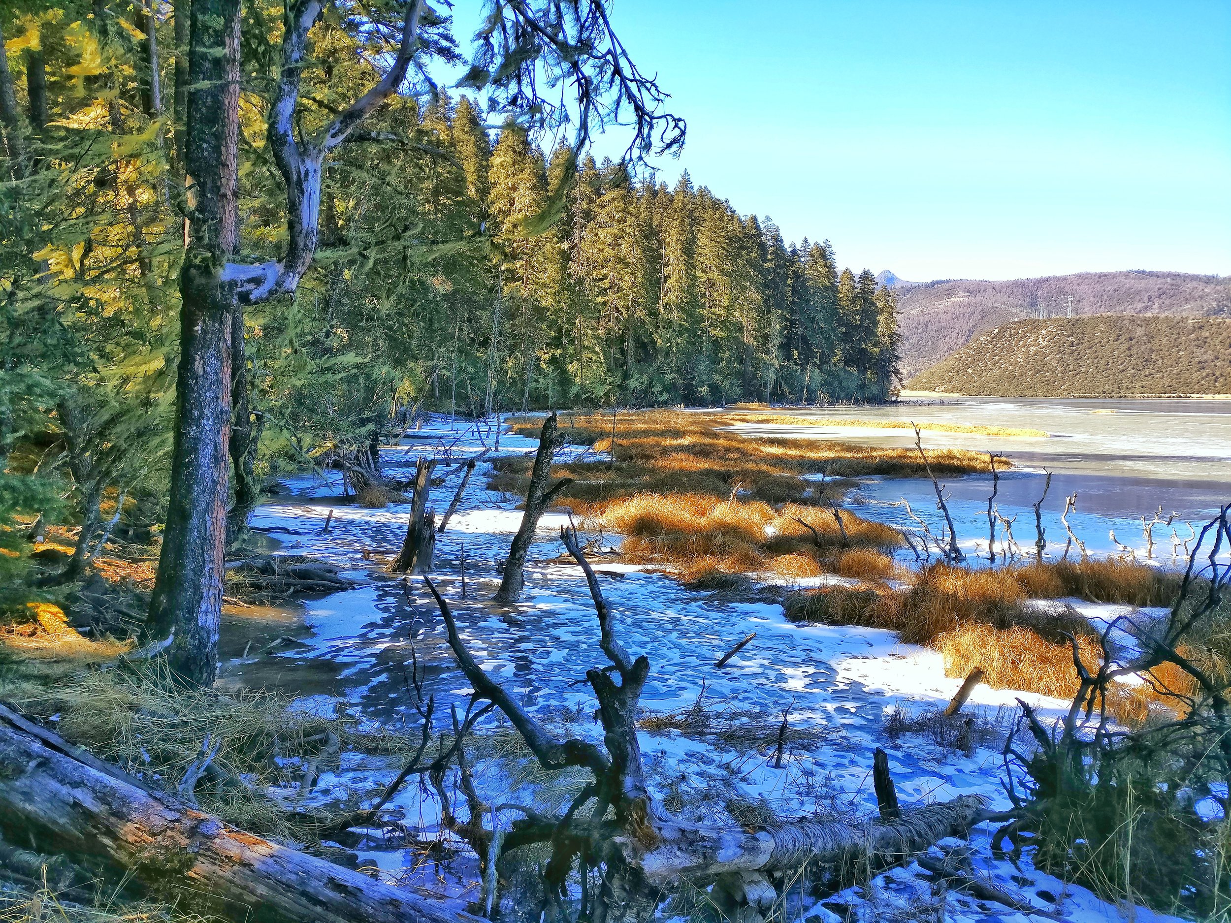
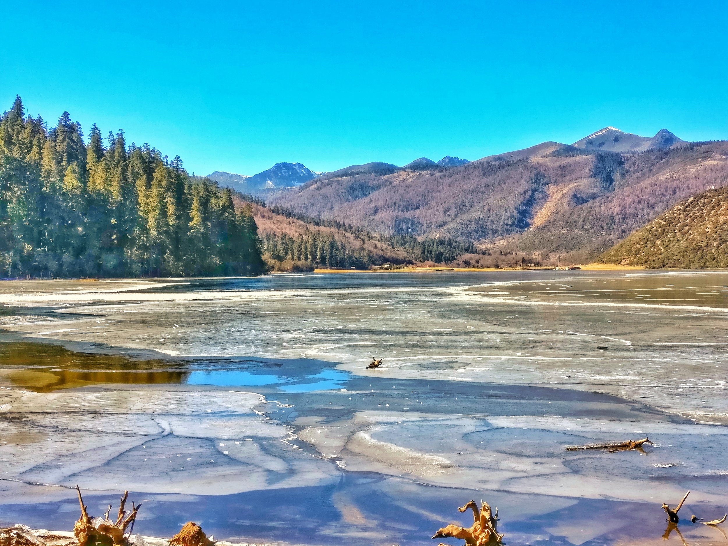
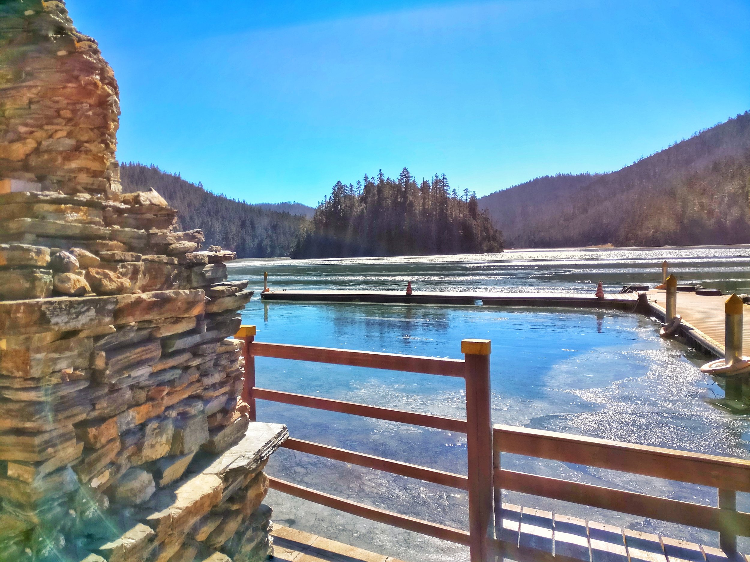
The primeval forests on the shore of the Shudu Lake in the Potatso National Park. This park is a part of the UNESCO designated World Heritage Site of the Three Parallel Rivers of Yunnan Protected Area.

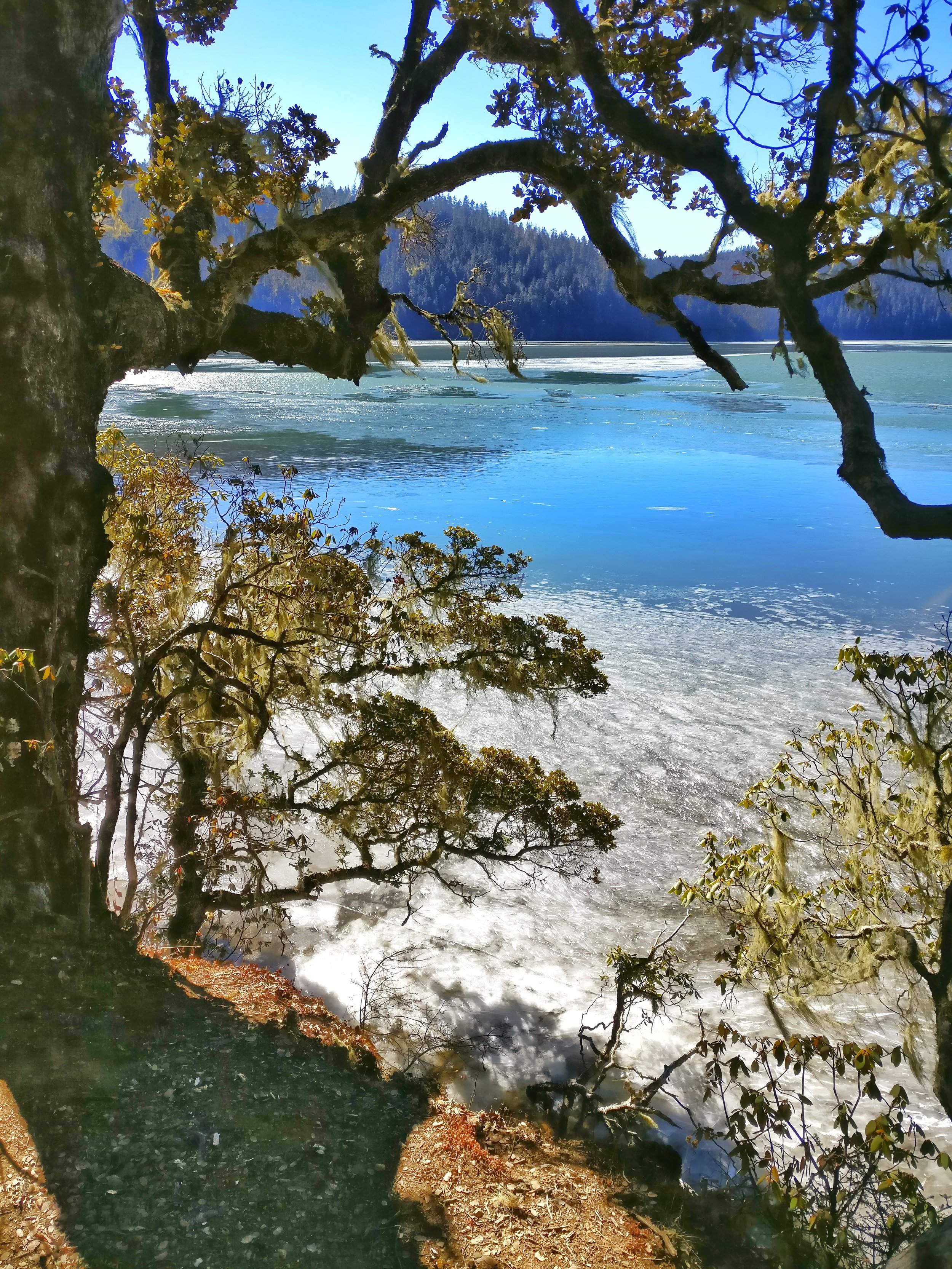
This Lake itself is situated at an altitude of 3700 m but still has dense woodlands on the banks consisting of Pine, Fir and Beech. And at the time I went there was a constant interplay between the ice, snow and the water along the shoreline.

This Park is a great biodiversity hotspot as it sits at the Junction of the Tibetan and Yunnan Plateaus with the Indian tectonic plate. That coupled with the high altitude but a lower latitude create a very unique bio-system.

The Park consists of many Lakes, open Pasture lands, wet lands and Marshes besides the rolling hills and the snow covered Peaks. The Park is said to hold 30% of all the Flora and 20 % of all the Fauna species of China. This includes the Brown Bear, Red Panda and even the elusive Snow Leopard some scientists claim.
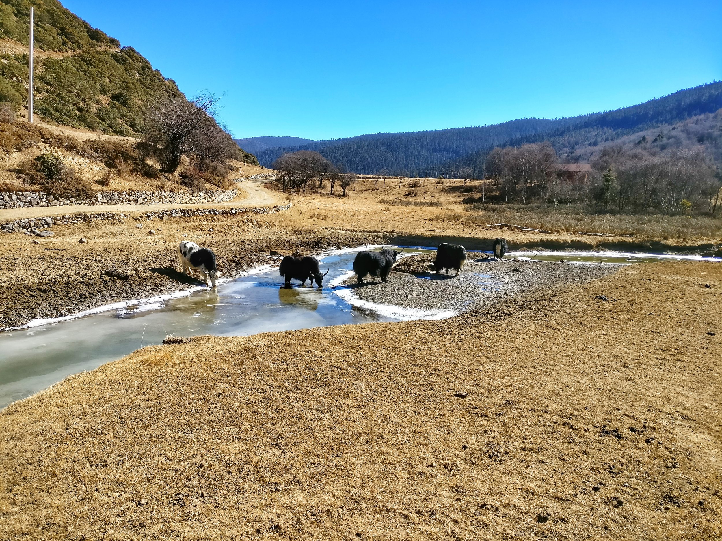
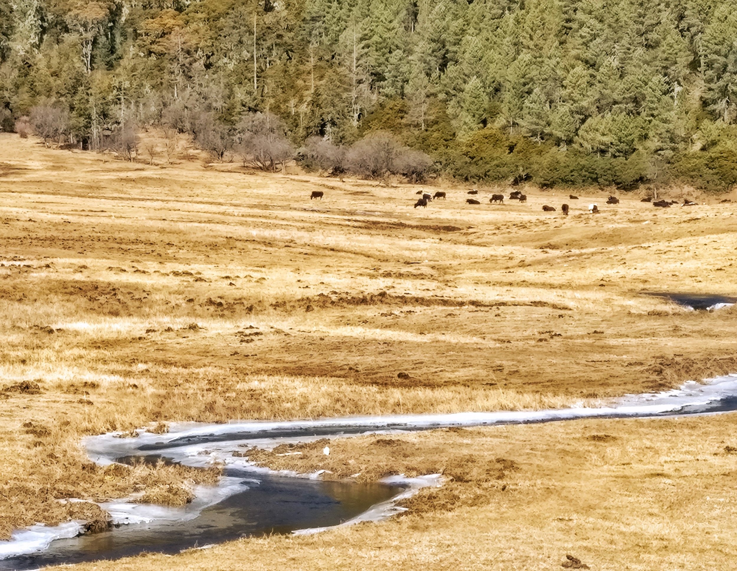
Peacefully grazing by the banks of the semi frozen Shudu Lake at 3700 m amsl in the Potatso National Park as the remnants of the last snow hold onto their last refuges in the shade. This pristine habitat was only opened to visitors around 20 years ago. It is a part of the Three Parallel Rivers of Yunnan Protected Area World Heritage Site.

This is one of the most diverse Eco systems in the world with a mixture of flora and fauna unlike anywhere else in the planet. The main reason being that it less at the junction of South Asia, Tibet and South East Asia. Also during the last Ice Age this region didn't ice over giving a bridge for the flora and fauna to move into this region. The bio diversity of this area is simply mind boggling.

The Bita Lake or as I just found the Putou Tso Lake in the Potatso National Park. It was only after bit of research that I found out that the Potatso/ Pudacuo National Park, where this lake is located is actually named after the original Tibetan name of the Lake Putuo Tso. Must be the Eastern most Lake with the Tso at the end.
Located as it is in one of the world's most bio-deiversity hot spot it offers spectacular views and centuries old forests of Oaks, Spruces and Firs and of course Rhododendrons. It is a primeval place and was opened to Tourists only around 10 years back. It is one of the Core areas of the Three Parallel Rivers of Yunnan Protected Area, a World Heritage site.
From the Official Yunnan Tourism Website:
Pudacuo is the transliteration of “Mandala” or “Putuo” which refers to a sacred mountain of Avalokiteshvara (Goddess of Mercy). “Putuo” or “Puda” means a boat to ferry people from sufferings. “Cuo” or “Tso” in Tibetan refers to a lake; so Pudacuo together means “Boat Lake”. Pudacuo or Puda used to be the original Tibetan name for Bita Lake where we can see an isle called Mandala or
Mantuluo. Pudacuo is an unearthly world without pollution, far away from the bustle and hustle world.
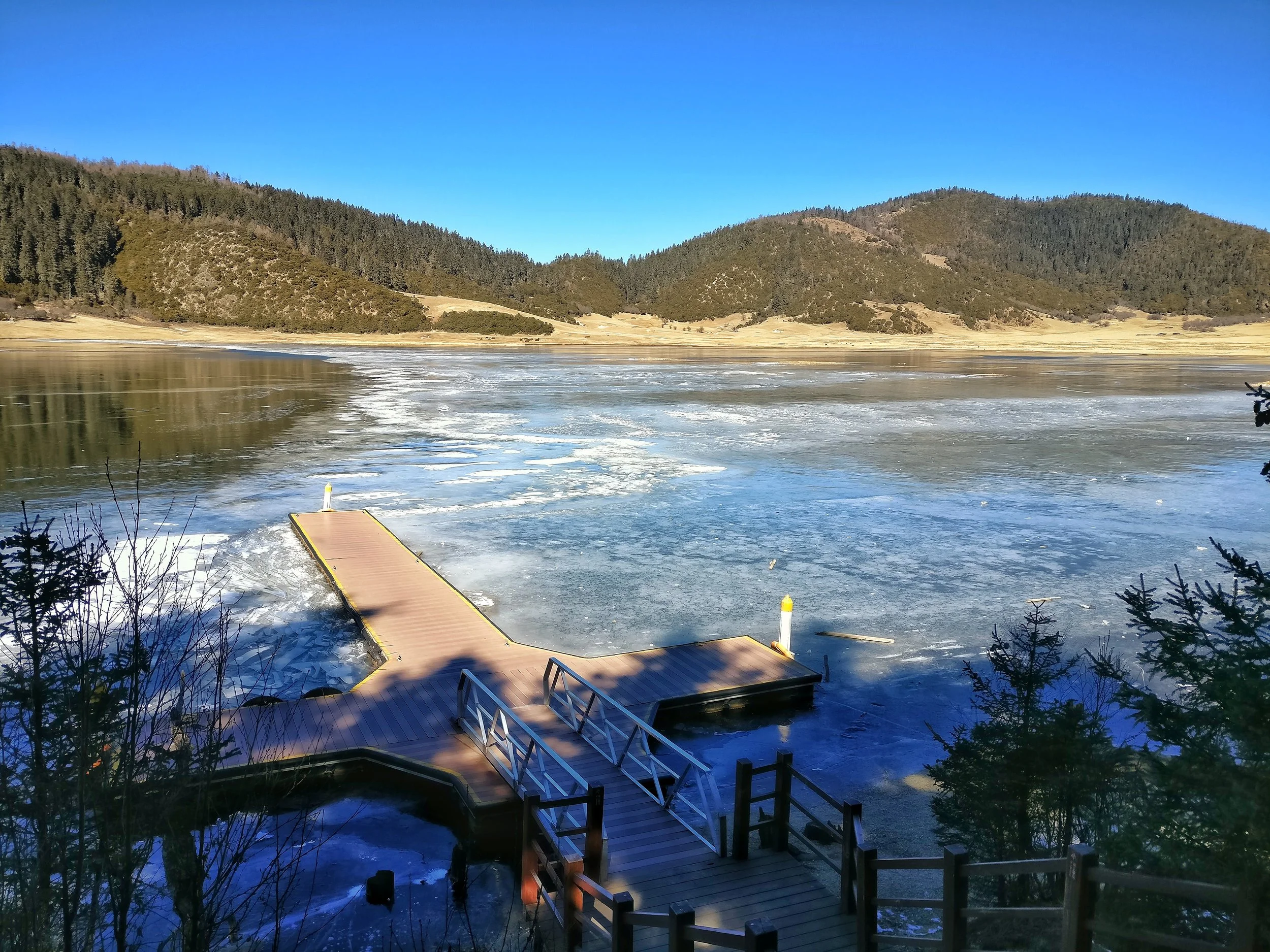
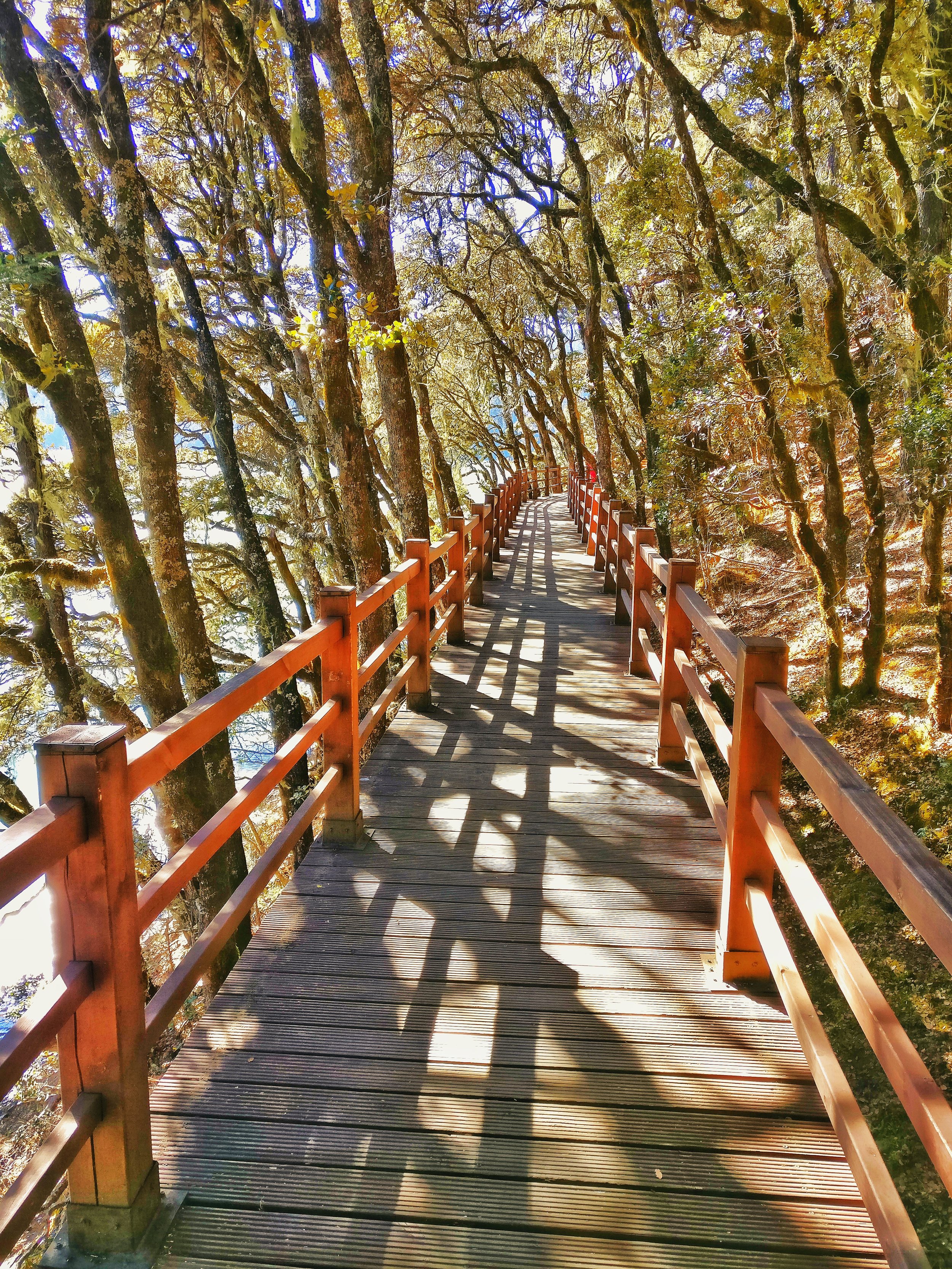
Bita Lake is a fault lake lying in the heart of Pudacuo Park. Being 3 kilometers long and 1 kilometer wide, it exhibits an altitude of 3,530 meters and a biggest depth of 40 meters. Along the sightseeing planked passage ashore, growing are multitudes of centuries-old oak trees, spruces, firs with usneas on.

Among the local Tibetans, Bita Lake is said to be incarnated from a piece of mirror of a fairy lady who broke her mirror when combing in the heaven. “Bita” in Tibetan also refers to a place where lots of oak trees are growing. In the centre of the lake, a small wooded island is made the shelter for many rare species of birds. If you are lucky enough to be in the non-windy day, the rosy clouds, the snow-capped mountains and the nearby forests are all mirrored in the lake.
The Great First Bend of the Yangtze River
The Great First Bend of the River Yangtze is situated near the town of Shigu in North Western Yunnan. It is the point at which the Yangtze (called the Jinsha at this stage) takes a u turn and heads north and goes onto become the heart and soul of the Chinese Civilization. And it all starts at this bend.

The Great First Bend of the River Yangtze
The Great Bend of the Yangtze at Shigu : This is the famous Great Bend of the Yangtze at Shigu. At first appearance its just a River bend but if you know enough then you would be awed in the fact how this place has shaped human history. The beautiful Jinsha or the Upper Yangtze just after it takes that famous first bend and turns 180 degrees and starts flowing North.

Of all the Great Rivers rising in the Himalayas and Trans Himalayas, besides the one we are familiar with ie the Indus, the Ganga and the Brahmaputra, the others like the Salween, the Irrawady, the Mekong and the Yangtze all meet the Oceans to the South of the Himalayas.

All except one. The mighty Yangtze. It's at this point precisely that the Yangtze decides to do a u turn and go North. All the other parallel Rivers in this area, the Salween, the Irrawady and the Mekong go South. Due to some geological phenomenon connected with the tectonic events which took place when the Indian plate collided with the Eurasian plate and this was the meeting point. Of all the great rivers rising in the Great Himalaya system the Yangtze is the only one which meets the Ocean to the North of the Himalaya.
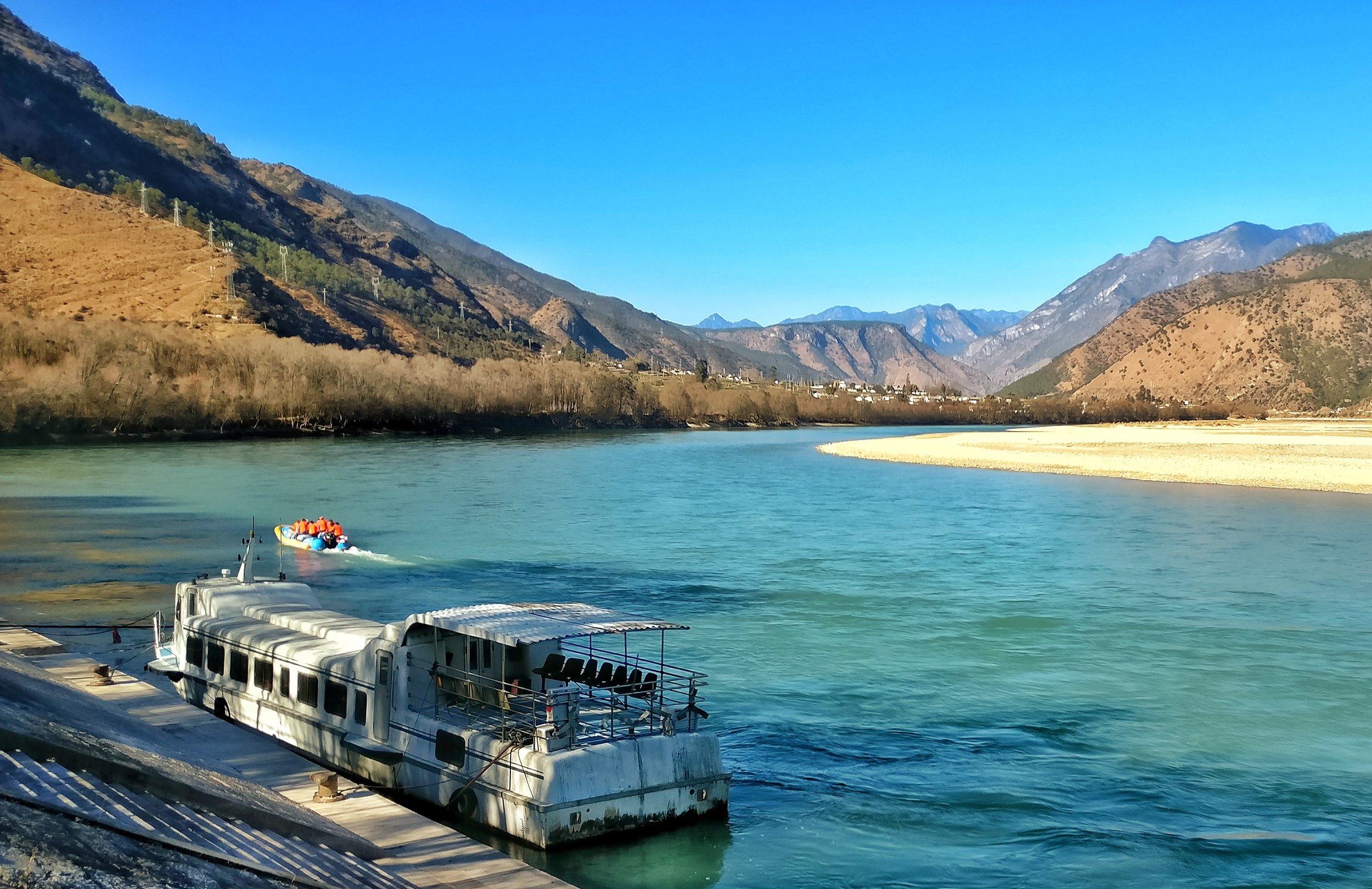
From Michael Palin's Himalayas:
"A thousand miles of tumbling water heading for Vietnam and the Gulf of Tonkin is, within a few hundred yards, spun round to the north and, though it twists and turns and tries to find its way south again, it is now effectively a Chinese river, heading east to create the enormous bowl of fertility and prosperity that is the heart and soul of the Middle Kingdom".

The Yangtze Rive Basin is home to 500 million people or a third of the the population of China. Both historically and today, it is responsible for much of the wildlife, culture and economic wellbeing of China.

To stand at the first bend is quite a mind numbing affair if you understand how this simple turn of a river has effected the historyof Humankind. The Himalaya effects human history in more ways than we can ever comprehend.

The Ganden Sumtseling Tibetan Monastery in Yunnan
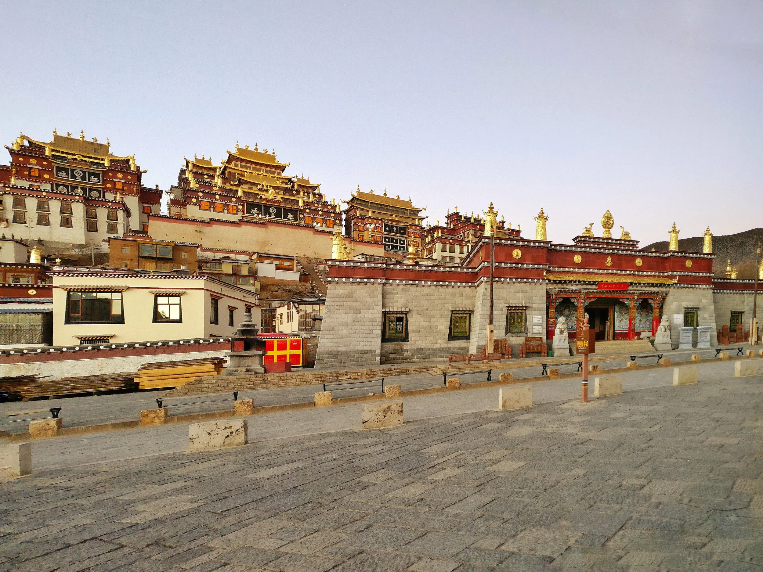
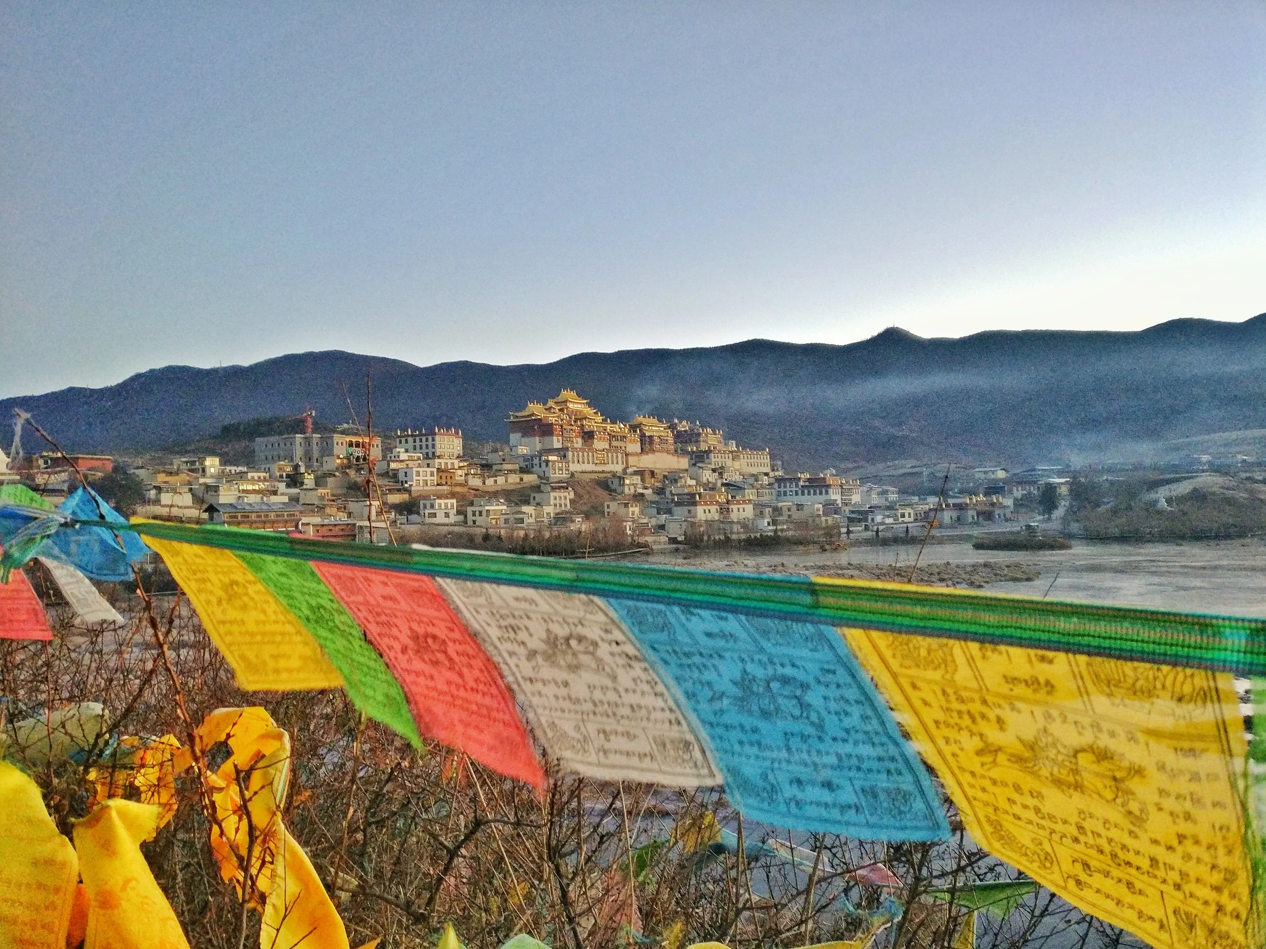
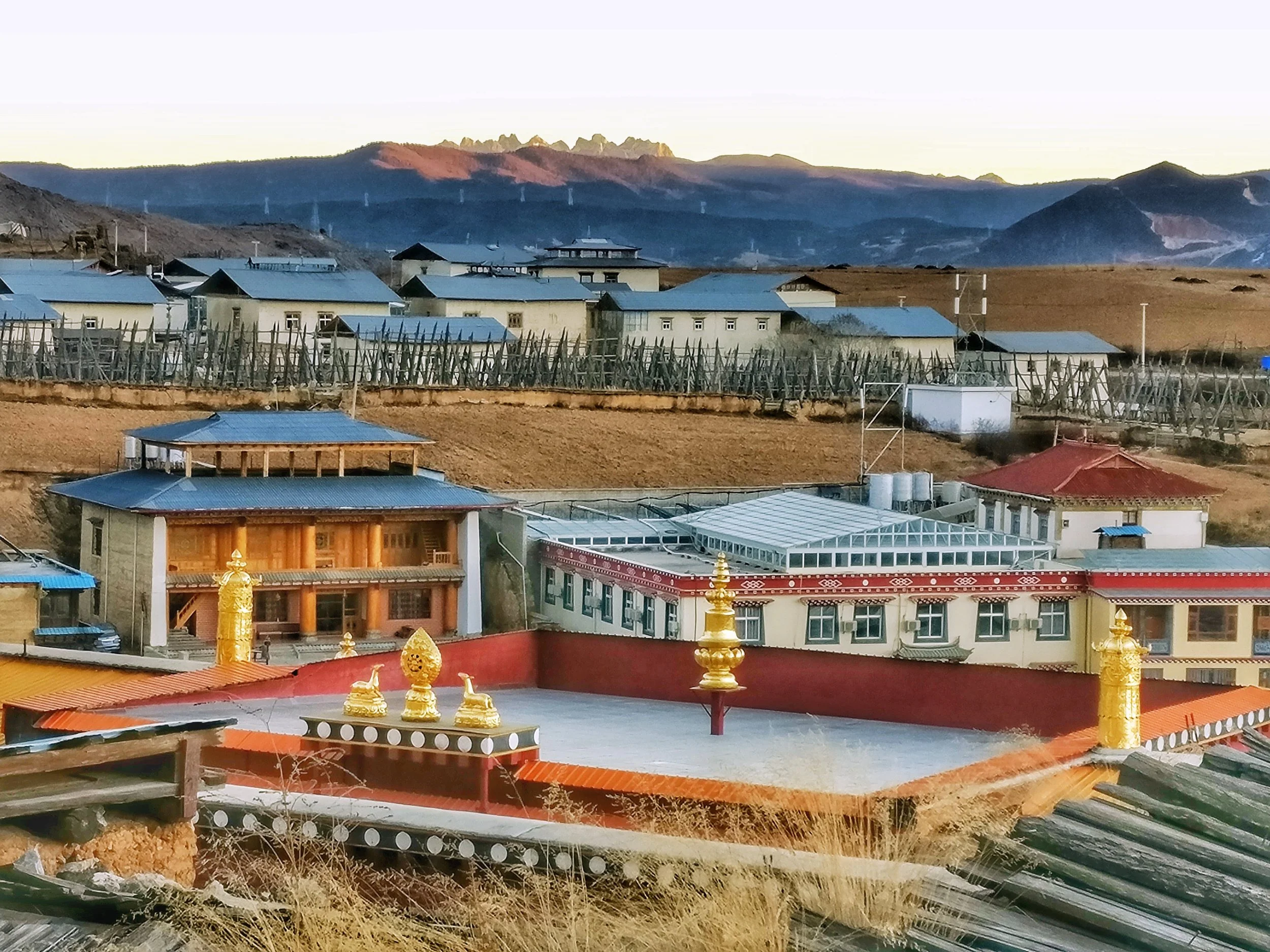
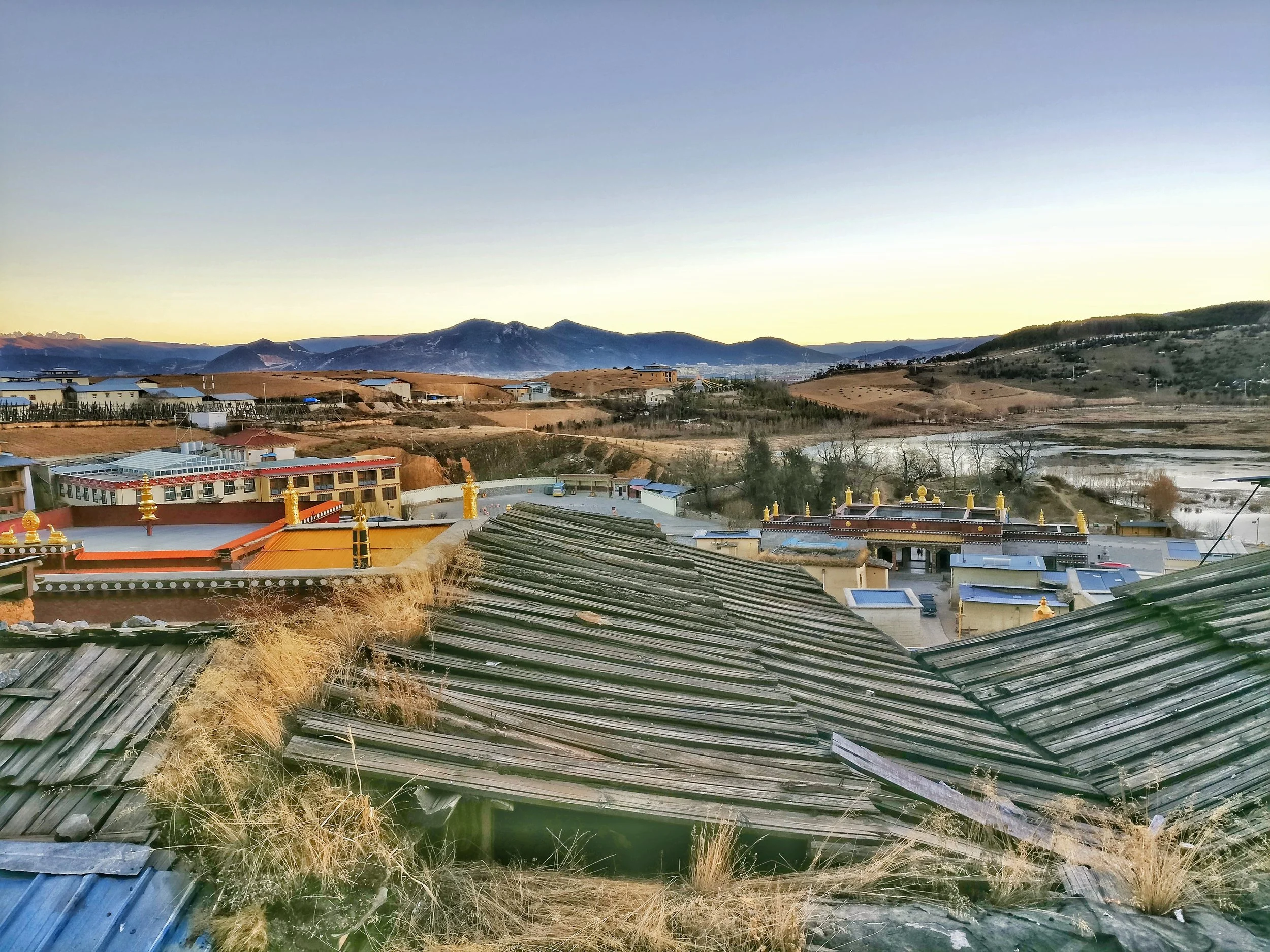
The Ganden Sumtsenling Monastery, also known as Sungtseling and Guihuasi is a Tibetan Buddhist monastery situated 5 kilometres (3.1 mi) from the city of Zhongdian at elevation 3,380 metres (11,090 ft) in Yunnan province, China. Built in 1679, the monastery is the largest Tibetan Buddhist monastery in Yunnan province and is sometimes referred to as the Little Potala Palace.

The Ganden Sumtseling Tibetan Monastery
The Ganden Sumtseling Tibetan Monastery in all its glory reflecting the first rays of the sun in the morning. The Lake reflected is glory in its unfrozen part. This is truly Shangrila. One of the largest Tibetan Monasteries it is also called the Little Potala Palace.
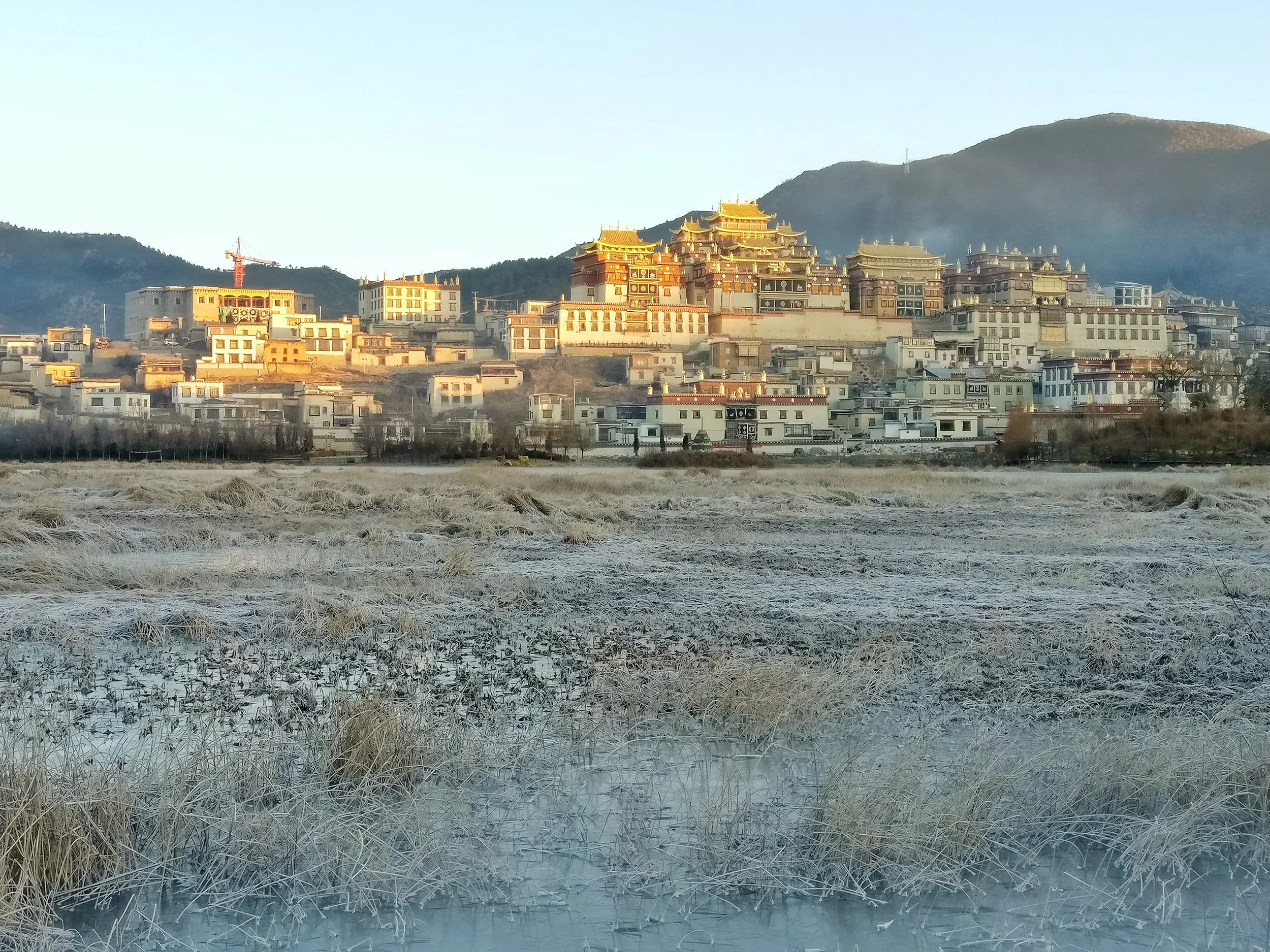
At an altitude of almost 3400 m it stands at the banks of the Lamuyang Tso in North Western Yunnan in a region which used to be historically a part of the Kham region of Tibet.
In January early morning the Lake was semi frozen and I guess the temperature was around minus 10 and the sun was just rising. The bird life of the Lake was just waking up and stir around.
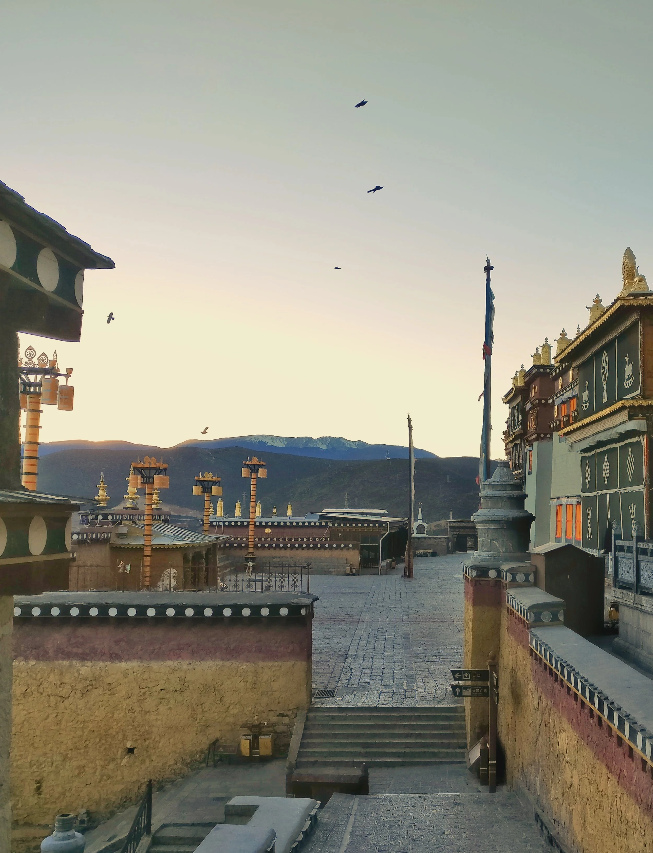
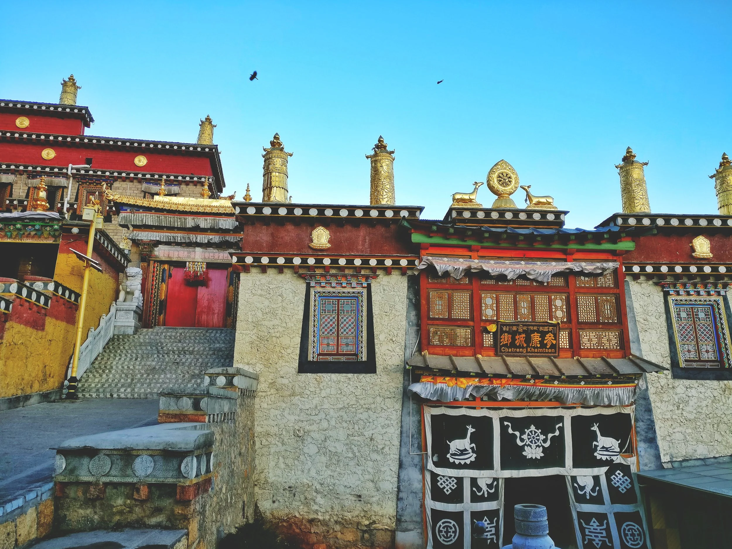
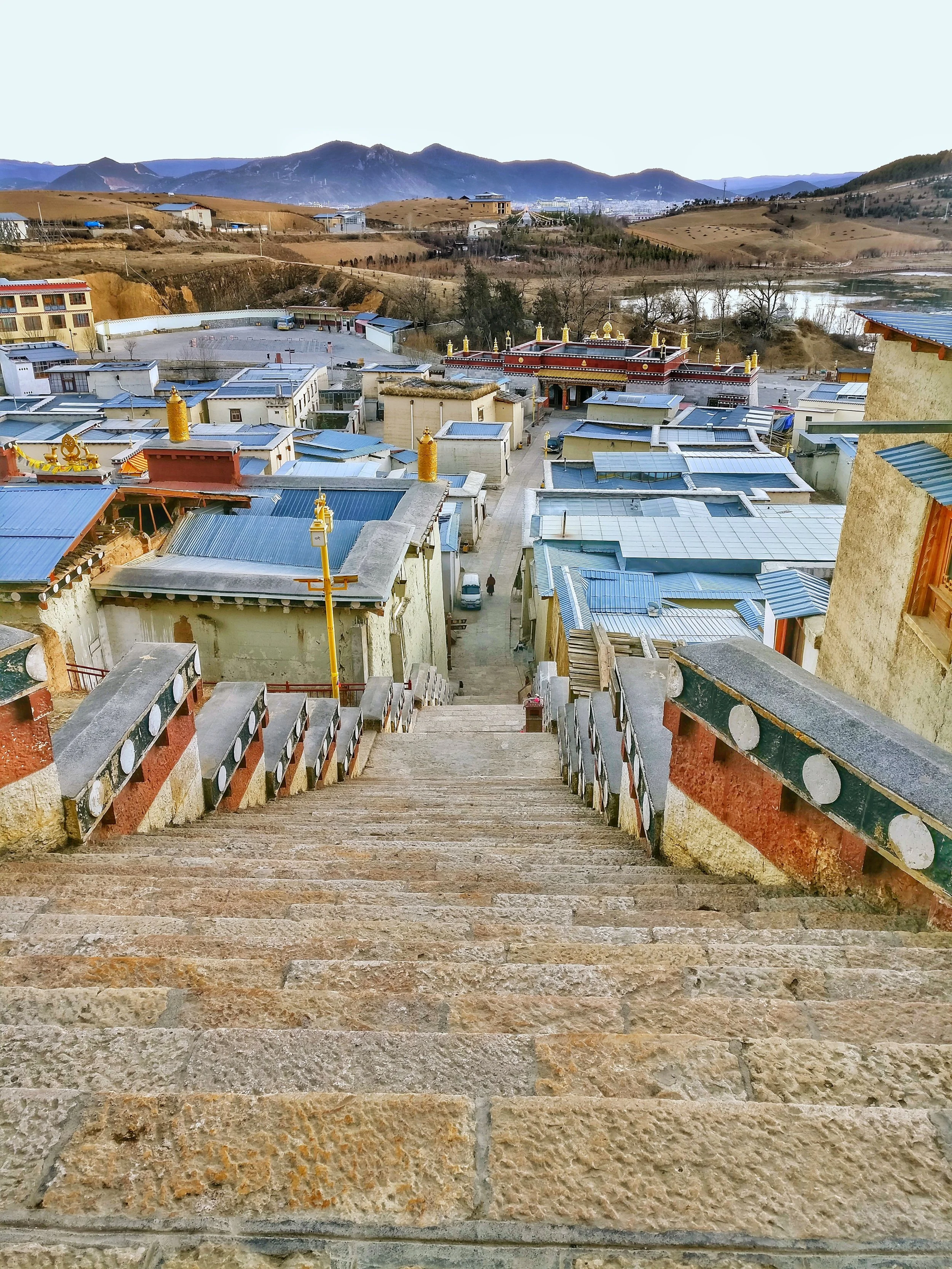
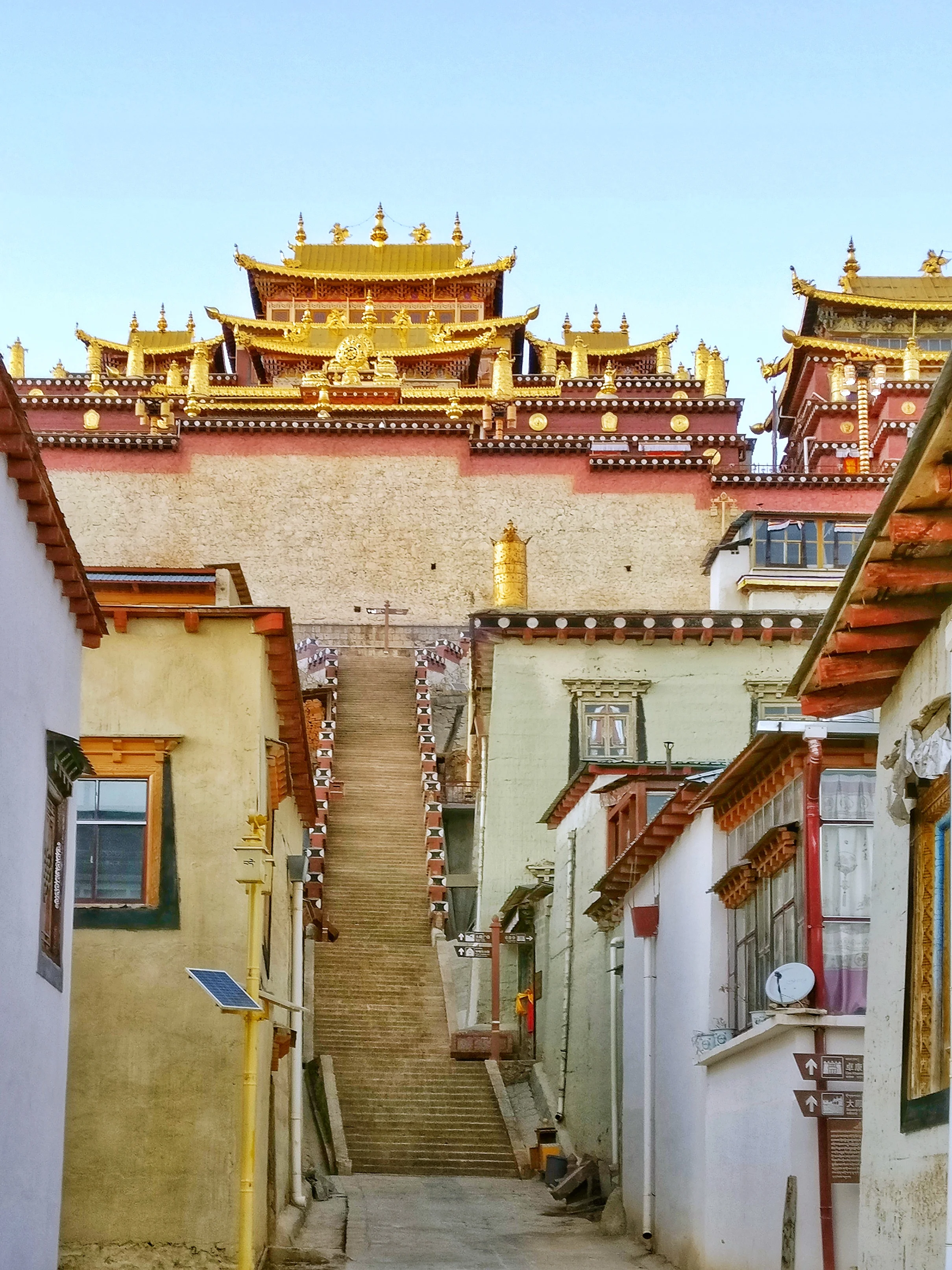
The first rays of the sun reflecting off the Gilded domes of the Monastery was indeed a sight to behold.
Originally built by the fifth Dalai Lama more than 500 years ago. Destroyed by the Communists in 1959. Rebuilt again in the 1980s.
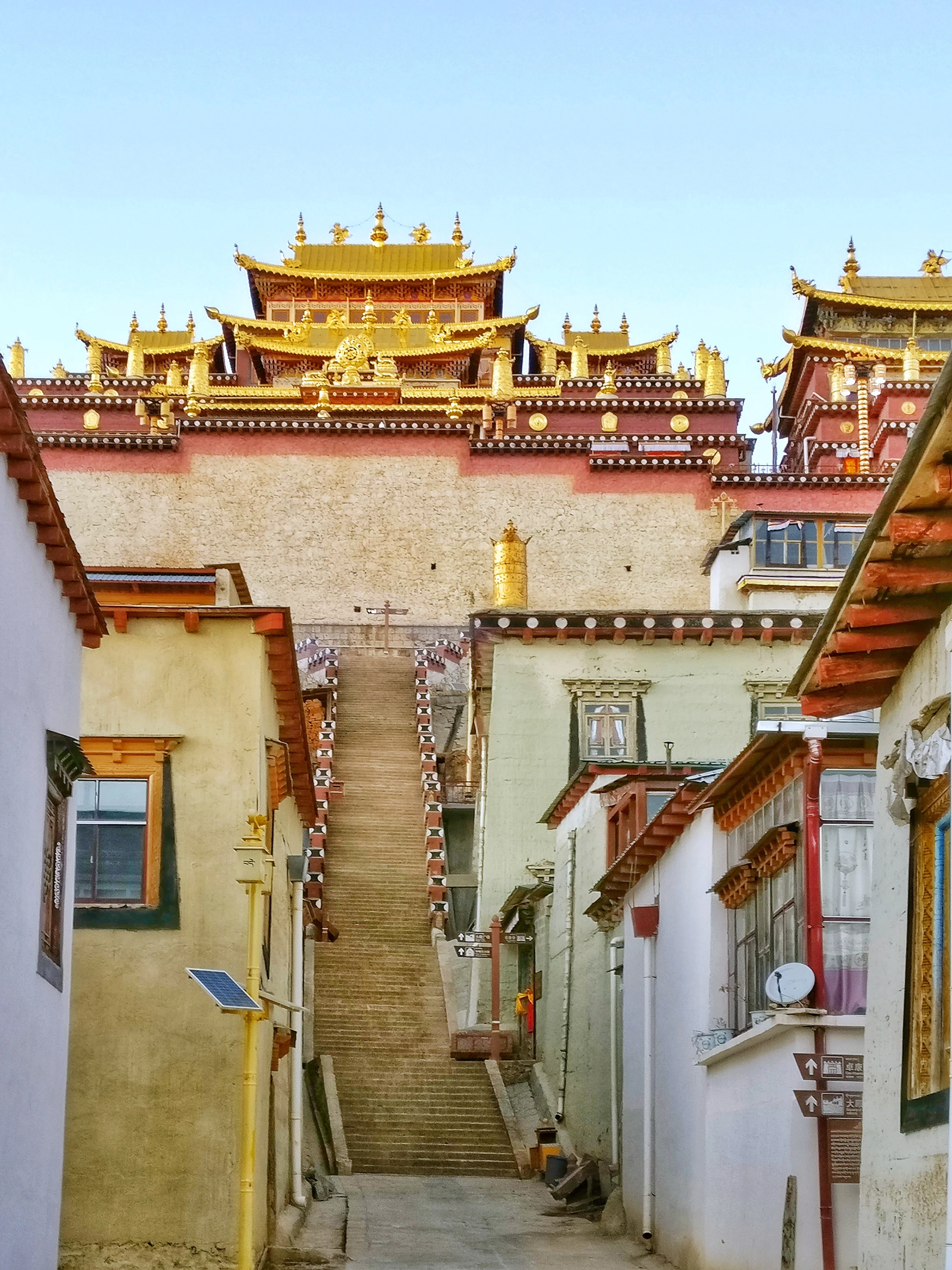
A true marvel of Tibetan Architecture with its enormous size and gilded domes.
Herodotus's Legendary Fox Sized Gold Digging Ants
Herodotus was a famous Greek historian of the ancient times who lived around 500 BC and he was born in Asia Minor in the Persian Empire. He was referred to as the Father of History as he wrote a lot of history and tales of the unknown from lands far off. One of his most intriguing account was the one of the legendary Gold digging ants, as big as Foxes, which lived in the high Himalayas in a land he called Dardae.
Herodotus's Legendary Fox Sized Gold Digging Ants
Herodotus was a famous Greek historian of the ancient times who lived around 500 BC and he was born in Asia Minor in the Persian Empire. He was referred to as the Father of History as he wrote a lot of history and tales of the unknown from lands far off. One of his most intriguing account was the one of the legendary Gold digging ants, as big as Foxes, which lived in the high Himalayas in a land he called Dardae (In Sanskrit is was called Dardesa, the Land of the Dards). Those who have studied history, especially accounts of history written by ancient Historians always had elements which were hard to believe and seemed more like flights of fantasy mixed with some facts. You always take it down with a pinch of salt.
Herodotus wrote exactly this “ Another kind of Indians live in the neighbourhood of the town of Kaspatyros, and the land of of Paktyika (present day Paktia Province in Afghanistan) away towards the North from the rest of the Indians, their way of living is about the same as that of the Bactrians. These are the most warlike of all the Indians, and it is they who are sent for Gold; for in the this district there is the sandy desert. In this desert and this sand there are Ants which are smaller than Dogs but larger than Foxes for some which were caught are now in the possession of the King of Persia. These Ants make for themselves burrows below the Ground, and in doing so throw up the Earth, as ants do with us, and in the same manner they look exactly like ours. This thrown up sand contains the Gold and for the sake of this sand the Indians are sent into the desert…….” He also wrote this “ When the Indians arrive at the place of the Gold dust to fill their bags, they fill quickly and ride away as soon as possible. For the Ants, which, as the Persians would tell, have found out what has happened through their sense of smell, are at once after them and they are exceedingly swift. Thus if the Indians do not gain a good start before the ants have gathered, none of them would be able to escape…..”.
Even Megasthenes , the Greek Ambassador at the court of , relates a similar story of Gold digging ants who dig not for the Gold but for making their burrows. The Gold he says was incidental. Infact those of you who have read History of Western Tibet / Dardistan written by Westerners will know that this Legend of Gold digging Ants is described by every single one of them.This is the starting reference point for the History of this region from a Western perspective.
But it was not only the Greek / Roman historians who alluded to this legend. There was a reference to this ‘Ant Gold” in the Puranas and the Mahabharata. It is said that a Northern tribe, called the Khasas, bought Paipilika Gold (Paipilika is Sanskrit for Ant) as a tribute to Yudhishtir. Of course it's common knowledge that the Himalayas are rich in mineral deposits and that includes Gold as well. Gold was found under the ground as well as long the streams as fine dust. Cunningham describes how Gold sifting in the Indus and the Shyok River was done by Muslim Baltis as the Ladakhi Buddhists were forbidden from doing so as they were expected to work in the fields.
Francke in his classic “A History of Western Tibet” also alludes to this legend and describes how he was given accounts of these Gold digging Ants in the Village of Kalatse, which though now Ladakhi was at one time inhabited by Dards. He apparently saw one of these creatures but of course they were regular Ants and not the Giants that Herodotus described. Francke wrote “I was even shown the kind of Ant which, according to the belief of the Kalatse people, was the Gold digger. It was a very tiny, creature, and far from the size of a Dog or Fox, but we must allow the story to have grown a little on its was from India to Greece.”
Of course in my assumptions there must have been instances of Ants digging in an area rich in Gold deposits and digging up Gold as well and this being collected by the locals. This is a completely plausible Theory but what about the “Giant Ants bigger than Foxes but smaller than Dogs ? “
Through most of History other Historians took this Giant Gold Digging Ants theory as a figment of Herodotus’;s exaggeration and adding a adding a dose of fantastic to his historical records. Many of them them even decried him as a liar and a fancy story teller. So was Herodotus was entirely wrong and this was just a yarn he had spun ? Not exactly as it was proven by a Gentlemen who took upon himself to solve this Great Mystery of the Giant Gold Digging Ants.
The Gentleman was a French ethnologist Michel Peissel wrote a book named, “The Ants’ Gold: The Discovery of the Greek El Dorado in the Himalayas” in 1984. And he mentioned that the area described inhabited by these creatures was actually the Deosai Plateau in Baltistan.
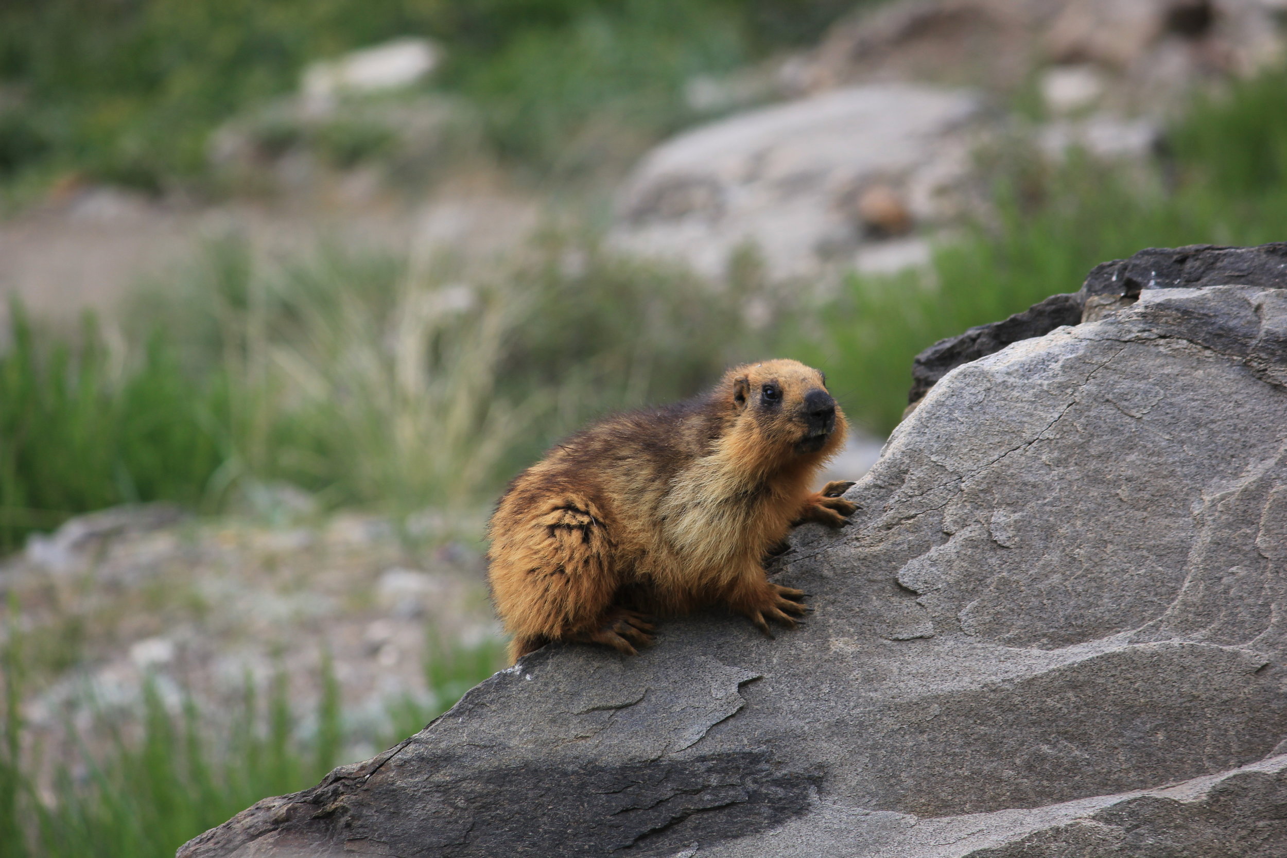
And the creature which was being alluded to were not Ants but the Long Tailed Golden Marmot and the Himalayan Marmot (These are two different species but both are found in the Himalayas). The Long Tailed Golden is more of a species found in Central Asia and the Hindu Kush, Pamirs and the Tian Shans though some are found in the Himalayas as well. A Golden Marmot which digs for Gold sounds just about right actually.
We are all aware that Marmots live underground and for the same they dig deep burrows and have a maze of interconnecting burrows underground. All this burrowing entails that they throw up a lot of earth. And the Deosai Plateau is said to be rich in Gold Dust deposits. The Marmots dug up the earth and included in this were fine Gold dust particles that were then taken by humans.
But which humans was the question again. Peissel claimed to have interviewed groups of people from Tribes living on the Deosai ie the Minaro, Maruts or Sonival tribes and apparently they confirmed this method of collection of Gold. And I have also been told Stories by people in the Kargil area about how the Marmots supposedly pile up Gold inside their burrows. So something is starting to make sense.
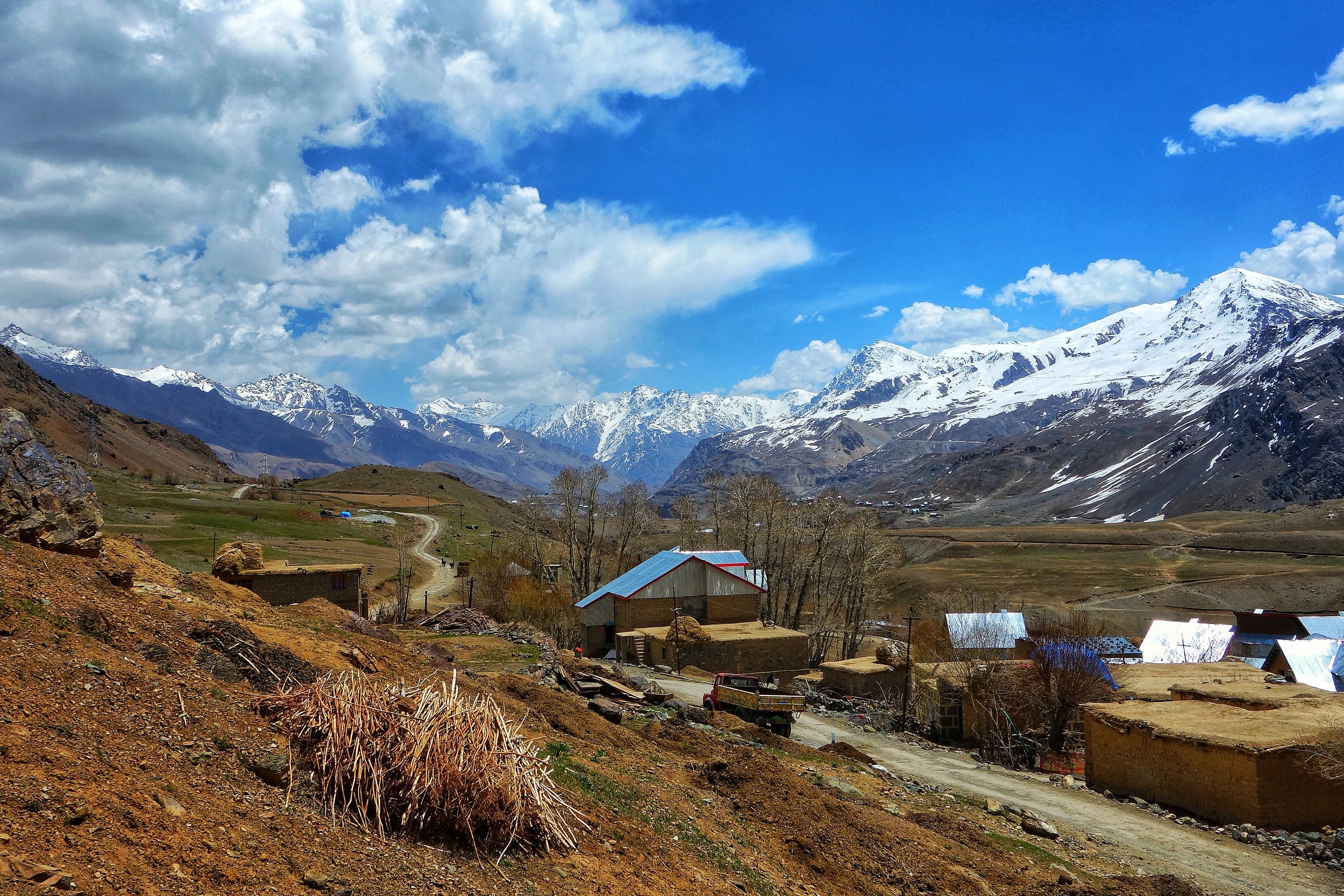
It was the Long Tailed Golden Marmot or the Himalayan Marmot which fits the description and Herodotus is proven to be partially correct. But how did he confuse the Marmots with the Ants ? Peissel has an explanation for this last piece of the puzzle as well. Apparently the Persian word for “Marmot” and “Mountain Ants” is very similar so somewhere along the line the word which was meant to mean Marmot was taken as Ant and the legend of the Giant Gold Digging Ants took birth. To be fair to Herodotus he had never mentioned that he saw one of these Ants. And the creatures kept by the King of Persia (the most powerful sovereign in the World at that time ) were just that Marmots.
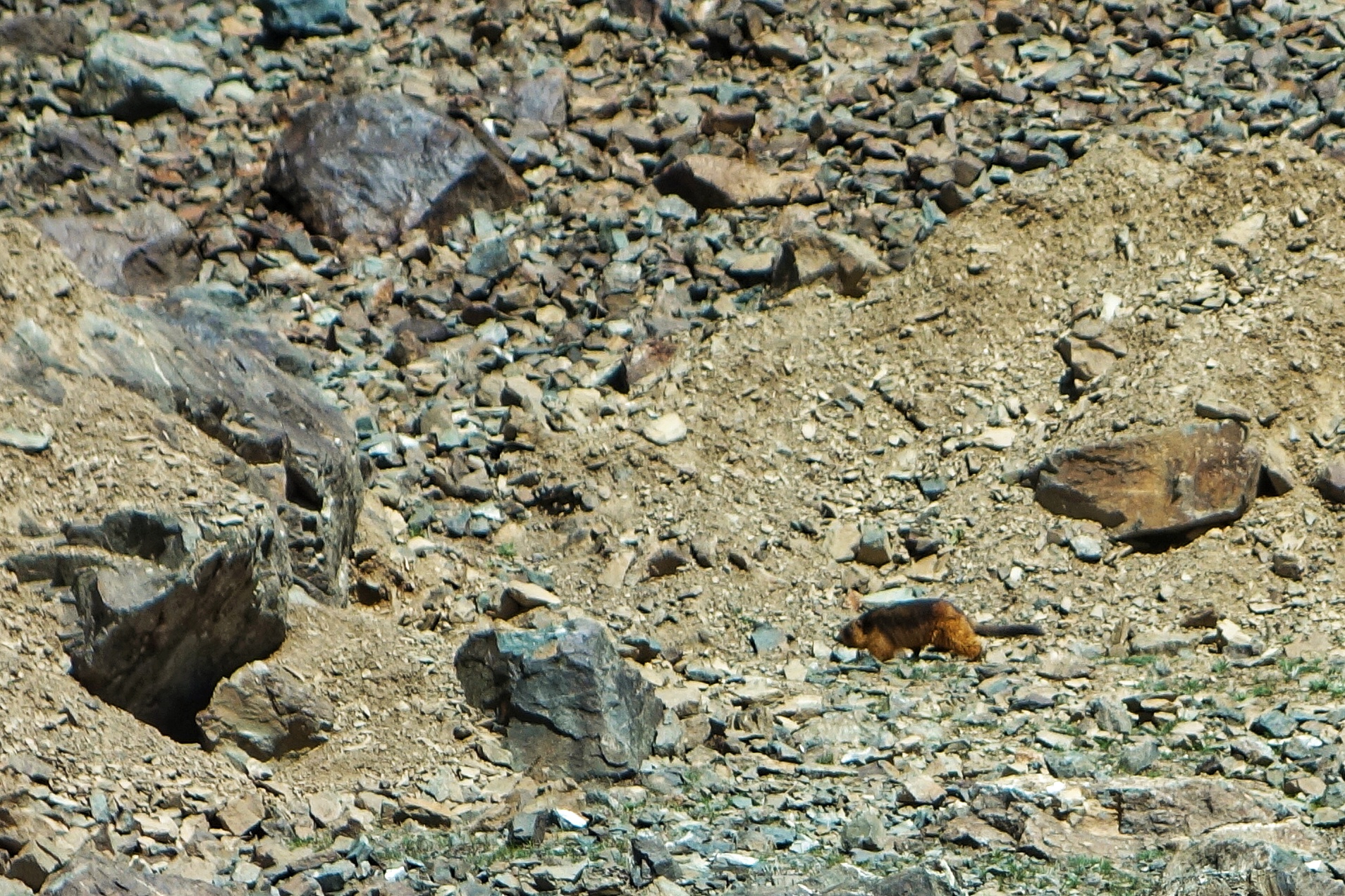
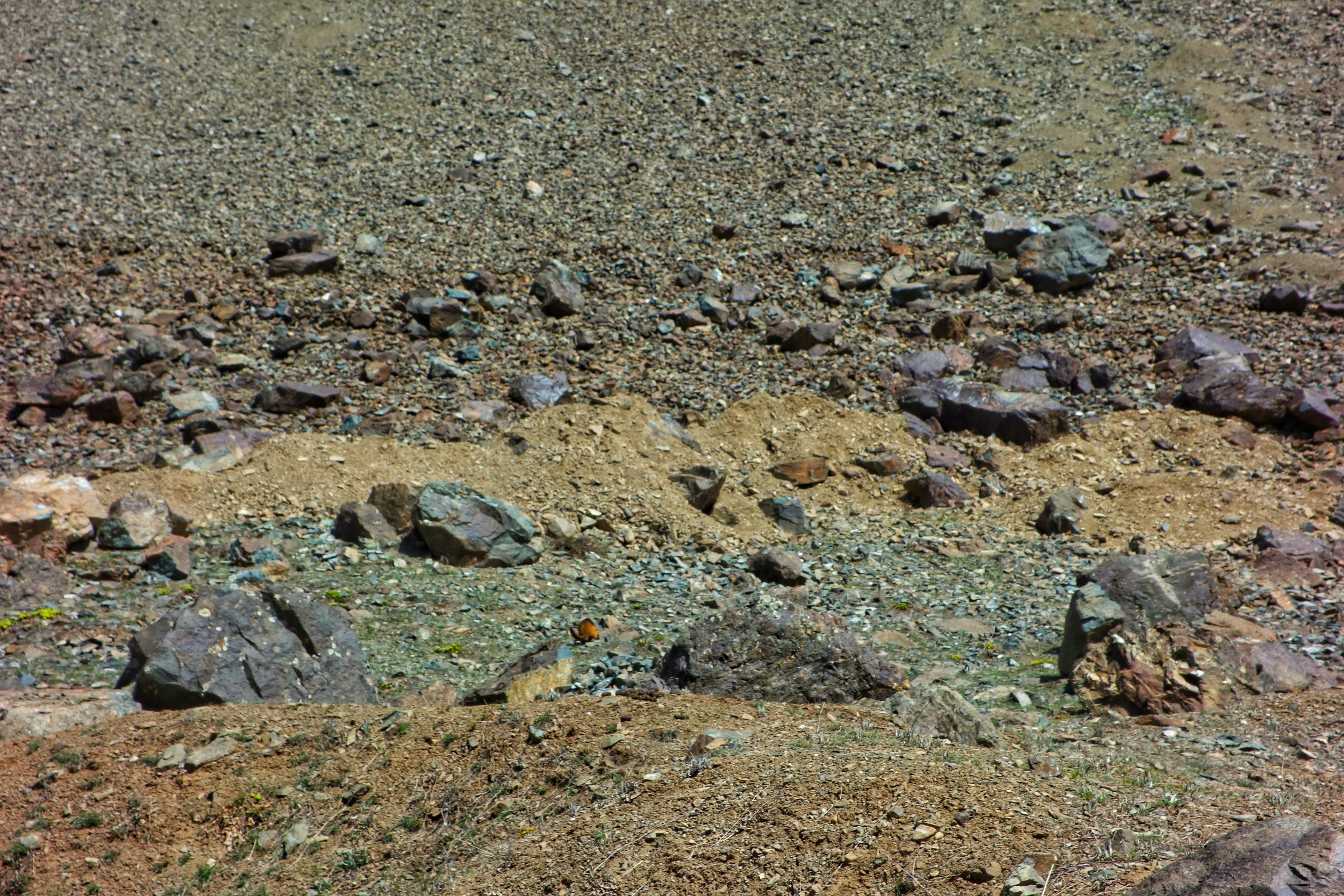
Just one last part about the ferociousness of the Gold digging Ants described by Herodotus. Many of us regularly come across Himalayan Marmots while visiting Ladakh and there is a lot of Human and Marmot interaction (totally uncalled for and something to be discouraged) and they mostly come across as gentle Creatures. Maybe back in the days when they were much less habituated to humans they would react differently. Long Tailed Golden Marmots are however much more rarer. I remember coming across a Long Tailed Golden Marmot somewhere in the Muskoh area, which actually lies at the edge of Deosai, and that guy wasn't exactly pleased to see us. We of course kept our distance though the Marmot wasn't aggressive. Maybe if we would have gone closer he could have shown aggression. Can't really guess.
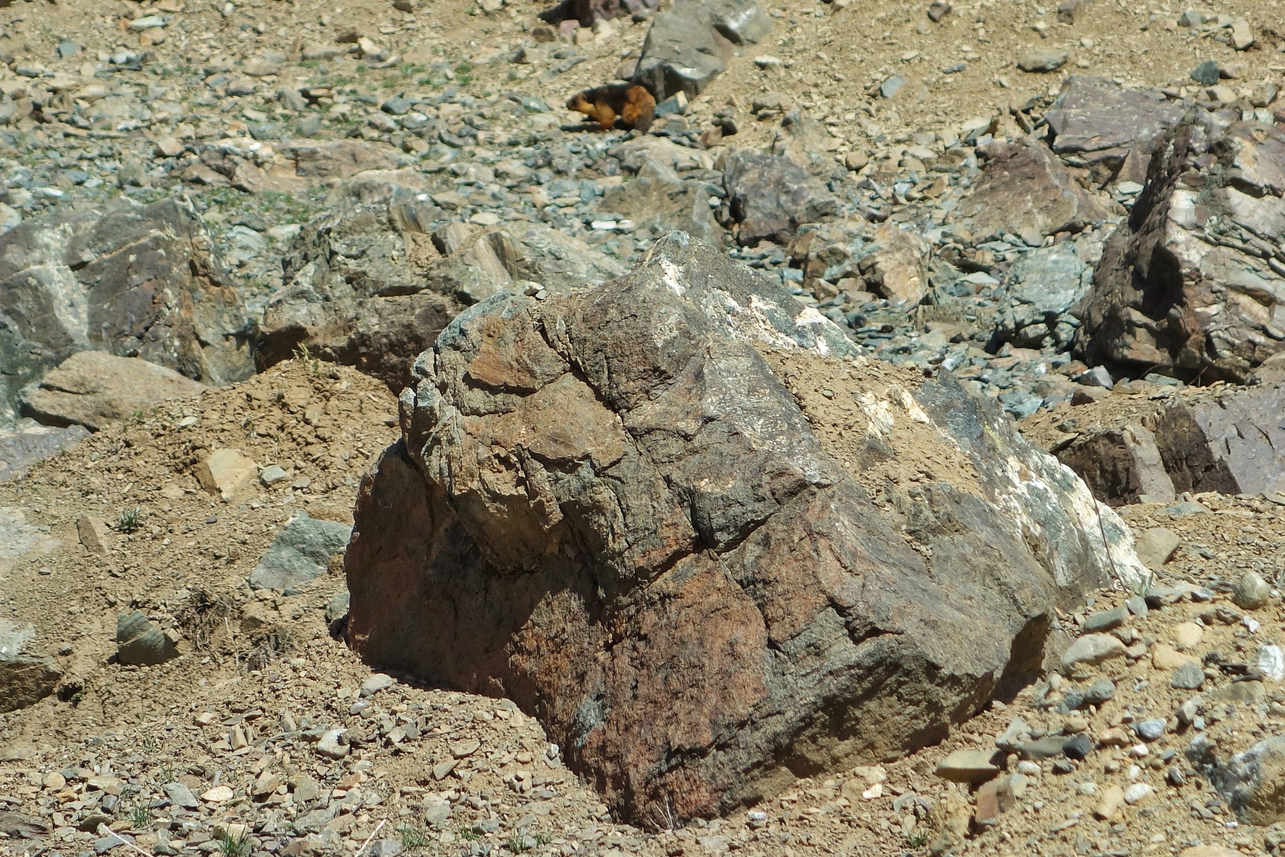
Or maybe this story of the “ferociousness” of the creatures was invented by the same people who harvested the Marmot Gold but wanted to discourage anyone else from coming and claiming a right on their Gold. In those times people could believe anything. Whatever was the reason it surely kept people away and the mystery took well over two thousand years to get solved.
So the next time you come across a Himalayan Marmot or better still a Long Tailed Golden Marmot do try and think of the Legend of Herodotus’s Fox Sized Ants.
Pic from April 2018. A Long Tailed Golden Marmot on the go, Muskoh Valley, Drass, Ladakh.
Kashmir Collection at Metropolitan Museum of Art, New York
The Metropolitan Musuem in New York is one of the largest Art Museums in the World. The Museum has a great collection of Kashmir Art.

The Kashmir Collection at the Metropolitan Museum of Art
The Metropolitan Museum of Art of New York, colloquially "the Met", is the largest art museum in the United States. With 7.06 million visitors in 2016, it was the third most visited art museum in the world, and the fifth most visited museum of any kind. Its permanent collection contains over two million works,divided among seventeen curatorial departments.
The Met's Asian department holds a collection of Asian art, of more than 35,000 pieces,[26] that is arguably the most comprehensive in the US. The collection dates back almost to the founding of the museum: many of the philanthropists who made the earliest gifts to the museum included Asian art in their collections. Today, an entire wing of the museum is dedicated to the Asian collection, and spans 4,000 years of Asian art. Every Asian civilization is represented in the Met's Asian department, and the pieces on display include every type of decorative art, from painting and printmaking to sculpture and metalworking. The department is well known for its comprehensive collection of Chinese calligraphy and painting, as well as for its Indian sculptures, Nepalese and Tibetan works, and the arts of Burma (Myanmar), Cambodia and Thailand. All three ancient religions of India – Hinduism, Buddhism and Jainism – are well represented in these sculptures.
From the Indian Art one of the most elegant Collection is the one of Kashmiri Stone / Bronze and other sculptures which underline the development of this Art by the Kashmiri Carftsman who were without any doubt one of the best when it came to sculpting Stone and Metal. Some of the pieces are Cataloged as under.

Buddha
Date: ca. 9th century / Culture: India (Jammu and Kashmir, ancient kingdom of Kashmir) / Medium: Copper with silver inlay / Dimensions: H. 7 1/16 in. (17.9 cm); W. 3 7/8 in. (9.8 cm) / Classification: Metalwork
Buddha sits in a yogic posture, wearing a high tripartite crown and fully articulated robes. His lowered hand grants boons to the male donor kneeling before him presenting an offering, likely a garland. The crown with flying ribbons demonstrates the powerful influence of Sasanian royal imagery on later Kashmiri art.

Buddha Bust
Date: 8th century / Culture: India (Jammu & Kashmir, ancient kingdom of Kashmir) / Medium: Stone / Dimensions: Gr. H. 2 5/16 x Gr. W. 1 3/4 in. (5.9 x 4.5 cm) / Classification: Sculpture

Gaja Lakshmi, Goddess of Fortune
Date: 8th century / Culture: India (Jammu and Kashmir, ancient kingdom of Kashmir) / Medium: Stone / Dimensions: H. 6 3/8 in. (16.2 cm); W. 5 3/4 (14.6 cm); D. 2 1/16 in. (5.2 cm) / Classification: Sculpture

Panel from a Portable Shrine: The Descent of the Buddha from Trayastrimsha Heaven
Date: 7th–8th century / Culture: India (Jammu and Kashmir, ancient kingdom of Kashmir), / Medium: Ivory with traces of color / Dimensions: H. 2 1/2 (6.4 cm); W. 1 3/4 in. (4.5 cm) / Classification: Ivories
This diminutive panel depicts the Buddha’s descent from Trayastrimsha heaven, where he visited to preach the Buddhist gospel (dharma) to his mother, who had died soon after his birth. The three steps below his feet indicate the ladder upon which he descended. This miracle was widely depicted in the early Buddhist world. Here, umbrella and flywhisk bearers attend the Buddha, while airborne celebrants present garlands.

Torso of Vishnu
Date: ca. 6th century / Culture: India (Jammu & Kashmir, ancient kingdom of Kashmir) / Medium: Stone / Dimensions: H. 7 13/16 x W. 3 3/16 x D. 1 1/8 in. (19.9 x 8.1 x 2.9 cm) / Classification: Sculpture

Kamadeva, the God of Love
Date: second half of the 8th century / Culture: India (Jammu and Kashmir, ancient kingdom of Kashmir) / Medium: Stone / Dimensions: H. 14 5/8 in. (37.2 cm); W. 2 3/8 in. (6 cm); D. 11 5/8 in. (29.5 cm) / Classification: Sculpture
Though rarely represented in Kashmiri art, Kama, the god of love, is here identified by a wondrous mythical creature (makara), who spews arrows from its jaws. The bow and arrow and a pair of lovebirds are Kamadeva’s principal identifiers. This subject is a rare survivor from early medieval Kashmir.

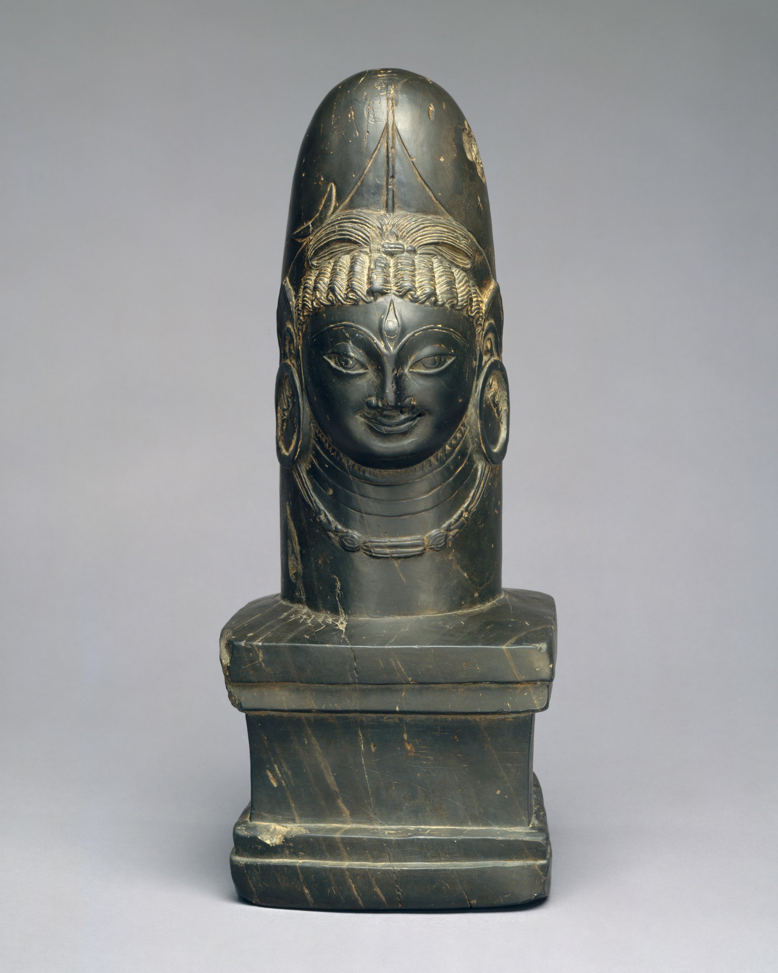
Linga with Face of Shiva (Ekamukhalinga)
Date: 7th century / Culture: India (Jammu and Kashmir, ancient kingdom of Kashmir) / Medium: Stone / Dimensions: H. 14 in. (35.5 cm) / Classification: Sculpture

Head of a Male Figure
Date: 6th–7th century / Culture: India (Jammu and Kashmir, possibly Akhnur) / Medium: Terracotta / Dimensions: H. ca. 5 1/4 in. (13.3 cm) / Classification: Sculpture
A major Buddhist monastery and stupa site was excavated at Akhnur (Akhnoor), near Jammu, revealing a series of both large- and small-scale terracotta reliefs decorating the monuments. These heads once formed part of those sculptural programs and likely depict Buddhist laity.

Reliquary in the Shape of a Stupa
Date: 7th–9th century / Culture: Northwest India (Jammu and Kashmir, ancient kingdom of Kashmir) / Medium: Copper alloy / Dimensions: H. 4 in. (10.2 cm) / Classification: Metalwork

Vajrapani
Date: late 6th–7th century / Culture: India (Kashmir) / Medium: Gray chorite / Dimensions: H. 9 in. (22.9 cm); H. inc. base 10 1/4 in. (26 cm); W. 5 3/8 in. (13.7 cm) / Classification: Sculpture
This powerful figurine is best understood as the Mahayana bodhisattva Vajrapani, who appropriated the lighting-bolt scepter (Skt: vajra) of Indra, the Vedic storm god, and repurposed it. Its meaning shifted from that being associated with the life-affirming power of storms (e.g. the monsoons), to the Buddhist savior Vajrapani, who facilitates journeying the path of enlightenment and aiding crystal clear thought as penetrating as a lighting strike.
In this, among the earliest representations known from the greater Kashmir world, the double-ended thunderbolt symbol is imposingly large, the shaft of which extends the length of Vajrapani’s figure. In addition to the massive device with its distinctive prongs, the bodhisattva holds a rosary (aksamala). His face is somewhat abraded but traces of a moustache remain, and he wears a distinctive headdress of an elaborate cockade with hanging strings of pearls disgorging from the center, in the Gupta-manner. Large annular earplugs, also of known Gupta type, are shown frontally. He wears a sacred cord (yanopavita) and short waist cloth with a sheathed dagger secured in the belt. In his raised proper left hand he holds the oversized vajra, and his head is framed by a large unadorned circular halo.

Section of a Diptych in Linga Form, Interior Depicting Shiva, Parvati, and the Calf Bull
Date: 7th century / Culture: India (Jammu and Kashmir, ancient kingdom of Kashmir) / Medium: Chlorite schist / Dimensions: H. 3 1/4 in. (8.3 cm) / Classification: Sculpture

Pedestal with Yaksha and Two Lions
Date: 9th century / Culture: India (Jammu & Kashmir, ancient kingdom of Kashmir) / Medium: Stone / Dimensions: H. 2 3/4 in. (7 cm); W. 6 1/4 in. (15.9 cm) / Classification: Sculpture

Linga, Shiva’s Aniconic Symbol
Date: 8th century or earlier / Culture: India (Jammu and Kashmir, ancient kingdom of Kashmir) / Medium: Stone / Dimensions: H. 2 1/2 in. (6.4 cm); W. (incl. base) 3 7/8 in. (9.7 cm) / Classification: Sculpture

Surya (The God of the Sun) with Attendants
Date: 7th century(?) / Culture: India (Jammu & Kashmir, ancient kingdom of Kashmir) / Medium: Bronze / Dimensions: H. 5 in. (12.7 cm) / Classification: Sculpture

Crowned Buddha
Date: 9th century / Culture: India, Ancient kingdom of Kashmir / Medium: Brass / Dimensions: H. 20 3/8 in. x W. 9 in. (51.8cm x 22.9 cm); D. (from hands) 3 in. (7.6 cm) / Classification: Sculpture
The Buddha is usually depicted in a monk’s simple garments; however, when he wears rich jewelry and a crown, he evokes the special form of Buddha as a cakravartin, or universal monarch. In Kashmir this form also recalls the splendor of the Buddha in heaven, where he reveals himself to the bodhisattvas. Both the high tripartite diadem and tasseled cape reflect Central Asian influence on Kashmiri Buddhist art of this period.

Chakrapurusha (The Personification of Vishnu's War Discus)
Date: 8th century / Culture: India (Jammu & Kashmir, ancient kingdom of Kashmir) / Medium: Stone / Dimensions: H. 5 in. (12.7 cm); W. 2 3/16 in. (5.5 cm) / Classification: Sculpture

Vishnu Rescuing Gajendra, the Lord of the Elephants
Date: 8th–9th century / Culture: India (Jammu and Kashmir, ancient kingdom of Kashmir) / Medium: Stone / Dimensions: H. 3 1/4 in. (8.3 cm); W. 2 3/4 in. (7 cm); D. 1/2 in. (1.3 cm) / Classification: Sculpture

Mask of Bhairava
Date: Late 6th–7th century / Culture: India (Jammu and Kashmir, ancient kingdom of Kashmir) / Medium: Copper alloy, possibly brass / Dimensions: H. 7 5/8 in. (19.4 cm); W. 5 1/4 in. (13.3 cm); D. 2 3/8 in. (6 cm) / Classification: Sculpture
This object is from a rare group of early Brahmanical masks. The small fangs seen rising from the corners of the open mouth and the exposed upper teeth identify this deity as Bhairava, a wrathful form of Shiva. Such masks were employed as temporary fixtures during worship and used to enliven processional icons in the Brahmanical cultures of northwestern India and the territories of Gandhara in Pakistan.

Mirror Handle with a Woman Playing the Lute
Date: 6th–7th century / Culture: India (Jammu and Kashmir, ancient kingdom of Kashmir) / Medium: Chlorite schist / Dimensions: H. 3 3/4 in. (9.5 cm) / Classification: Sculpture
This figurine belongs to a group of objects depicting ladies at leisure; here, the woman plays a stringed instrument. They likely served as mirror handles: each has a hole drilled from the top to receive the mirror fixture. Similar objects have been recorded at Khotan, in Central Asia, and are presumably the legacy of a luxury trade in such
goods.

Standing Four-Armed Vishnu
Date: 8th century / Culture: India (Jammu & Kashmir, ancient kingdom of Kashmir) / Medium: Stone / Dimensions: H. 8 1/4 in. (21 cm) / Classification: Sculpture

Bodhisattva with Radiate Halo and Mandorla
Date: 6th century / Culture: Pakistan (ancient region of Gandhara) or India (Jammu & Kashmir) / Medium: Phyllitic grey schist / Dimensions: H. 5 1/4 in. (13.3 cm) / Classification: Sculpture
This bodhisattva, holding a lotus (padma), likely represents Avalokitesvara Padmapani. Portable images stylistically related to this one circulated in Gandhara, Kashmir, and as far north as the Central Asian Buddhist kingdom of Khotan, an important trading center on the Silk Road.

Section of a Diptych in Linga Form, Interior Depicting Parvati, the Consort of Shiva
Date: 6th–7th century / Culture: India (Jammu and Kashmir, ancient kingdom of Kashmir) / Medium: Chlorite schist / Dimensions: H. 3 in. (7.6 cm) / Classification: Sculpture
Note: All pics and texts from the Met Museum.
The Kashmiri Spy in Tibet
The Story of a Kashmiri Spy in Tibet during the time of the British Empire. This Gentlemen was the first person to spy for the British in what latter became a routine affair with “Pandits” like Nain Singh Rawat doing their bidding.

The painting from the Qing Era shows the Induction of the 9th Dalai Lama, Lungtok Gyatso, in 1808 as its watched by the Ambans and Qing officials on one side and by Tibetan Clergy and other Tibetans on the other side.
The Kashmiri Spy in Tibet
In the early 1700’s the region of Tibet as as well as Turkestan (as Xinjiang used to be called at that time) come under the control of the Chinese Imperial Qing Dynasty as they defeated the Dzungar Mongols who had come to occupy Tibet. As a result of this the Qing Dynasty was now in control of Tibet and in order to exercise this control the appointed an Officer called the Amban to overlook the running of the state and especially keep his eyes and ears open for ambitions that a foreign nation / power might have on Tibet.
For the same purpose the Ambans and their network of informers and spies were always taking stock of various Traders who visited Tibet and Lhasa and soon after the Qing assumed dominance they imposed restrictions on many Traders coming from Nations that were assumed to be a threat to the Qing control over Tibet. And this was most severely applied to Europeans who the Qing saw as the most obvious threat. And then there were the Russians who were also expanding their Empire towards the East. The Europeans were restricted to trade only through Canton (Hong Kong) while traders from Russia could only come through the trading Post at Kyakhta.
While impositions were imposed on almost all outsiders, there were three Groups of traders that were allowed relatively freer access to Lhasa. These were the Newaris of the Kathmandu Valley, the Andijanis of the Ferghana Valley and the Kashmiris. For some reason these three Groups of people were left alone to their own devices. One of the reasons was that these people had been trading with Tibet for hundreds of years and many of them had even settled there. And they connected the region with the important markets in the Indian subcontinent in case of the Newaris and the Kashmiris and to Central Asia vai the Andijanis. An important consideration for the Qing was that as per their own assessment all these traders came from Countries / Regions that were not a threat to their sovereignty over Tibet.
Towards the end of the 18th Century however the Qing perceptions begin to change. The Gurkhas attacked Tibet twice and though peace was restored after the intervention of the Qing, the Qing were now suspicious of the Newaris as they couldn't really distinguish between them and the Gurkhas as both were from Nepal, though the Gurkhas had taken the Kathmandu Valley from the Newari Rulers. And in the beginning of the 19th Century the Afaqi Khojas revolted in Turkestan and for some time they held the main cities of the Tarim Basin and they lost their confidence in the Andijanis of Ferghana as well.
Through it all one community which kept up its “neutrality” in the eyes of the Qing were the Kashmiris. The Kashmiris were known as Kachee by the Tibetan and Kashmir was called Kachee Yul. Infact the term Kachee came to be used for all Muslims in Tibet irrespective of where they came from. Kashmiri traders and craftsmen had been visiting Tibet since the 10th Century as many Kashmiri craftsmen were bought in to decorate the Monasteries as Buddhism grew in Kashmir and the Kashmiris were supposed to be the best at this trade. As a result Tibetan art shows even till day a great Kashmiri influence. Also as a result many Kashmiris settled in Tibet and took Tibetan wives and intermixed with the local populations.
Now as far the Qing and their Ambans were concerned they knew of the Kashmiris and their long standing Trade relations with the Kashmiris. But one thing they weren't sure was about the location of Kashmir. They knew it was a Region to the West of the Tibetan plateau but that was about it. They had no idea about the Political affiliations of Kashmir or of the Kashmiri people. And the Kashmiri people were seen as outsiders who usually minded their own business with little interest in the Politics of Tibet or of the Qing. And they were good Traders who did a large volume of business in Lhasa. And the point to be noted is that most Kashmiris used to visit Lhasa through Patna and Nepal instead of of the Route over the Himalayas.
The fact that Kashmiris had easy access to Tibet did not go unnoticed to the British. The British for long held ambitions on getting through to Tibet as it was uncharted territory to the North of the their greatest possession. Also there was a constant fear of Imperial Russia gaining influence in Tibet. Many British and Western explorers had wanted to break into this Forbidden Land but were not very successful. So the British had to fall upon its native subjects to do their bidding in Tibet.
In the wake of the Anglo Gurkha War of 1814 and the British Victory, the British came to be in possession of Garhwal and gained direct access to Tibet from there but the British were always turned back at the frontier by the Tibetans who themselves were wary of any unknown foreigners. It was around this time that an enterprising Kashmiri trader, Ahmed Ali offered his services to the British. Ahmed ali presented himself as a well connected Kashmiri who had a relatives who lived in Lhasa and had travelled to Lhasa many times on his own. The British were very interested in this guy and the key to Tibet that he might hold. But they could not give him any Official sanction as they wanted to exercise plausible deniability in case Ahmed Ali was caught. The point was that the Qing had not realised the the same guys they were having a tough time with in Canton were now sending spies into Tibet. As far as the Qing were concerned the “Pilangi” as they called them (Tibetan / Chinese version of Firangi as they were referred to in India) and the Britishers in Canton were two distinct people from different Countries. And the British of course didn't want this little secret revealed to the Qing.
All said and done Ahmed Ali proposed that he also be made the agent for trading Indian goods in Tibet on behalf of the British. And of course the British would not give him any legal standing. As it so happened Ahmed Ali himself was no old Tibetan hand. He spoke no Tibetan and in fact his business in Tibet was taken care of by an old Kashmiri employee Abdullah and he was also joined by Ahmed’s brother. However the business didn't go as well as proposed though all the time Ahmed was collecting information through his guys in Tibet. In 1827 Ahmed was called to Tibet by his brother and Abdullah to settle the losses they had incurred.
Ahmed Ali had no option but to go to Lhasa as his brother insisted on the same. He went to Lhasa and due to the losses he had a falling out with his brother and Abdullah and the matter was brought to the notice of the local authorities. Somehow the matter was settled but now Ahmed Ali had no one to handle his operations in Lhasa. Another old Tibetan Kashmiri suggested that he take the services of his brother Fazlullah Fakroo, another Tibetan Kashmiri. And again his enterprise started. However his affairs with his brother and Abdullah were not settled. His brother sued him for his share of family property back home and the case was taken to Court and representing Ahmed Ali in his absence was his new employee Fazlullah.
Through all his business troubles Ahmed Ali kept on compiling information on Tibet through Abdullah and his brother when things were good and later on through Fazlullah. He had considerable information on hand gleaned through various sources including Route maps and distances and also the Political situations in the different towns and Villages. Just that he was good Spy but no so good a Businessman. Anyways there was no end to his financial woes as the Court ruled in the favour of his brother and Abdullah and now the Spy was bankrupt as well. So he bade his time by hanging around the Mosque in Lhasa. And as ill luck would have it he had a falling out with Fazlullah who he accused of causing great losses in business and filed a case against him.
On the Court disposition Fazlullah first made a suggestion to the Court about the suspicious activity that Ahmed Ali was indulging in. About all the questions he always kept on asking and noting them down. The Court brought this to the notice of the Amban and now everyone was interested in the Spy. As a result the Spy was son picked up by the Qing authorities and all his papers and notes were confiscated and he hauled up for interrogation.
Now the thing was Ahmed Ali did not speak Tibetan or Chinese and all his notes were in Persian and English. So the authorities had to gather a group of people to decipher and translate his papers. Translators were found for Persian and it is said it took them two months to decipher and translate all the notes. The notes contained information about the Routes, Passes and general Topography of Tibet, the strength of Chinese and Tibetan soldiers, the working of the Financial departments, the general dispositions in Sichuan and Gansu and other such information deemed as sensitive. But for the English notes they could not find any any translator. The Spy was caught red handed it seems.
The Spy however would not give in so easily. He said he took notes only as per the “custom of his homeland” and he intended to write a book which could be used by other Traders from Kashmir and elsewhere to visit Tibet for trade. He was promoting Trade in Tibet through this. And he swore that not an iota of information had been sent over the Himalayas to any power inimical to the British. The Qing officials of course had a hard time believing his theory and were convinced that he was a Spy. Though who exactly he was spying for was never very clear to them. At the same time Ahmed Ali sent a message to the East India Company asking them for help as he was working for them. He played his Ace.
The British were now in a delicate situation as they didnt want Ahmed Ali to put them in the spot and jeopardise their relations with the Qing which would surely have repercussions in their Trading Post in Canton as they were aware that Ahmed Ali would reveal their little secret to the Qing. The British made a secret appeal for help to the powerful Nepali Prime Minister Bhim Sen Thapa to use his good relations with the Tibetan and the Qing to secure the release of the Spy. But they were surprised when they were told by Bhim Sen Thapa that Ahmed Ali had already been released by the authorities and was probably already on his way back.
So why did the Qing authorities release Ahmed Ali without any punishment ? Well for one he was expelled from the Country and handed over to the Nepalese authorities with requests to send him over the border to India. It seems that the matter was quite a sensitive one but the Qing didn't really want to undermine the confidence of the Kashmiri traders. As they were the people through which they could still have a lucrative trade with other Regions without compromising on their own strict no foreigner’s Rule. There were also suggestions that Ahmed Ali had agreed to supply some information from the British side to the Tibetan and Qing authorities. Maybe he was just a smart Guy who somehow managed to squeeze out of the situation. What was the exact reason of his release is still shrouded in somewhat of a Mystery and hence we can only now try and and make guesses on the actual circumstances that led to him being just deported instead of being severely punished. Maybe we will never know.
Of course even after this incident the British intrigues in the region didn't cease and we saw the Era of the “Pundits”, native men who went to Tibet to carry out surveys for the British including people like Pandit Nain Singh Rawat and others. However whatever happened to Ahmed Ali after his return is unknown. The Kashmiri Spy just vanished from the annals of of the history of Political Intrigue in the History of the Himalayas.
The panting from the Qing Era shows the Induction of the 9th Dalai Lama, Lungtok Gyatso, in 1808 as its watched by the Ambans and Qing officials on one side and by Tibetan Clergy and other Tibetans on the other side.
Amarnath Yatra pics from 1920 by Ralph Stewart
Ralph Randles Stewart was an American botanist who spent a lot of time collecting Plants and taking Photographs in the Western Himalayas in the early part of the 20th century. In 1920 Ralph went on the Amarnath Yatra and took pics of the same giving us a priceless treasure and a window into how things were in these Mountains a hundred years back.

The Amarnath Cave Entrance in 1920
Amarnath Yatra Pics by Ralph Stewart in 1920
Ralph Randles Stewart was an American botanist who spent a lot of time collecting Plants and taking Photographs in the Western Himalayas in the early part of the 20th century. In his memoirs he describes his Journey in the Western Himalayas as follows
“As a fresh graduate of Columbia University in New York City … I began to lecture in Botany and Zoology in a tiny Presbyterian Mission college in Rawalpindi with only 86 students. I had a three-year appointment and not expecting to be in India again, I wondered what would be the most interesting way to spend the two summers I expected to have in the East, on a slender budget (my salary was $600 a year with a room in a dormitory).
In 1911, with four young men (two Americans, a Bengali and a Scot) who wanted an adventurous summer vacation, we decided that a good way to utilize the summer of 1912 would be to hike in Kashmir and Western Tibet (Ladak). Two of us worked in Gordon College, Rawalpindi, at the beginning of the cart road to Kashmir constructed in 1890 with a good deal of cost and difficulty. It crossed the first Himalayan Range at Jhicca Gali near Murree (2100 m), descended to the Jhelum River at Kohala and then followed the river to Srinagar, a distance of 196 miles. We had nearly three months of vacation and we left Rawalpindi at the beginning of July on our push-bikes. It was still in the horse and buggy age, just before the Model-T Fords and the buses began to carry visitors to Kashmir. Our cook and baggage traveled in a one-horse, spring less vehicle called an Ekka. I was the only botanist in the party. The other were interested in taking pictures and seeing new country.
We spent the summer in Kashmir and Ladak and I enjoyed the trip so much that I helped organize an even longer expedition for the summer of 1913. We again rode bicycles to the Kashmir Valley and again hiked to Leh, the capital of Ladak. Instead of returning to Kashmir we turned east from Leh, crossed the Rupshu plains and entered Lahul by the Baralacha Pass; left Lahul by the Rotang La, visited Kulu and then walked further east to Simla and returned home from there by train.”
In 1920 Ralph went on the Amarnath Yatra and took pics of the same giving us a priceless treasure and a window into how things were in these Mountains a hundred years back.

150 1920 To Amarnath, Kashmir by Ralph Stewart

151 1920 Amarnath cave entrance by Ralph Stewart

152 1920 Encampment of Amarnath pilgrims at Pahlgam by Ralph Stewart

154 1920 Route to Amarnath by Ralph Stewart

159 1920 Tents of pilgrims, Pahlgam, Kashmir by Ralph Stewart

160 1920 Pilgrim Camp, Pahlgam, Kashmir by Ralph Stewart

161 1920 Food shop for Amarnath pilgrims, Pahlgam, Kashmir by Ralph Stewart

165 1920 Amarnath pilgrim route, Pahlgam by Ralph Stewart

166 1920 Headquarters tent of Amarnath pilgrimage, Pahlgam, Kashmir by Ralph Stewart

167 1920 Some of the sadhus on Amarnath pilgrimage, Pahlgam, Kashmir by Ralph Stewart

169 1920 Amarnath pilgrim camp, Kashmir by Ralph Stewart.jpg
Driving in the Himalayan Mountains
We get many queries on People wanting to drive in the Himalayas and asking for Tips and advice on the same. Here are the basic things you need to keep in your mind while driving in the Mountains. And these are especially relevant to driving in the Indian Himalayas !

Driving in the Himalayan Mountains
We get many queries on People wanting to drive in the Himalayas and asking for Tips and advice on the same.
Here are the basic things you need to keep in your mind while driving in the Mountains
First and Foremost give way to Uphill traffic or the Vehicle which is climbing. When you are coming downhill always stop to give way to the Vehicles coming Uphill. Even on the toughest Roads there are points two Vehicles can pass so keep a mental note of such points that you see on the way. And learn how to reverse by using all the three rear view mirrors.
On the winding Roads always try and anticipate by looking at the Road as far as you can see as to when there is a vehicle coming especially when going downhill as reversing a Car uphill on a narrow Road with a steep fall on one side can become somewhat of a task. It's better to just stop at a broader part of the Road to let the Vehicle Pass.
I personally prefer driving at Night in the Hills as you can anticipate much better as you can see the headlights gleaming from afar. But this holds true only for the Metalled/ Semi Metalled / Kucha type drivable Roads. However if its a tough Mountain Road like the ones we get while crossing one of the Passes its recommended to drive only in the daylight hours.
Never ever overtake anything on a blind curve until and unless 100% sure that nothing will come from the other side. Since none of us can see the future hence we cant be 100% sure its better to be late than never.
And of course you need to follow the regular Traffic Rules especially wear your seat belts, use low beam if there is oncoming traffic, use rear view Mirrors on both wings and blow horn when you see a sign telling you to do so.
Besides these basic Rules there are certain points I would like to mention which are especially pertinent when you are driving a Hatchback or a Sedan and have Ground clearance issues. Having driven all kinds of vehicles in the Mountains ranging from a Maruti 800 to a Subaru Forester AWD I have developed certain techniques which I use while driving on these Roads
The basic Rule if your Car has low Ground Clearance try and keep one side of the wheels on the highest elevated point on the Road. This point usually lies right in the center of the Road. This lets you use the topography of the Road to overcome your lack of Ground Clearance.
Always use 2nd Gear while ascending and going up as it gives enough low end grunt to the Car to get you almost over most inclines and you still have the option of going to First gear if the need arises and you need more Power.
While descending again use the 2nd or the 3rd Gear as you will have a better control of the Vehicle and Engine braking will be on your side if you ever need to come to a sudden halt. Also remember the most sensitive part of your Car the Chamber or the Sump needs to kept away from the nasty stones and bumps on the Road. Most Sumps/ Chambers get busted while going down Hill as the speeds are higher and hence the impacts are stronger. Keeping control of your vehicle while descending is a very crucial part of completing your Journey without any damage.
Whenever you think that something has hit the Chamber be sure to stop and check. In case you dont all the Oil will leak from your Car and you will end up with a seized Engine. In case its leaking there are certain Jugaads that can be done like applying M Seal or something similar. People have also used Chewing Gum and Soap for the same. But its a serious issue and needs to be treated as such.
Always carry some water and eatables as back up just in case. A good tool kit also makes sense and make sure that the spare tyre is ready for action.
Having said that always take your decisions wisely while going on a Road trip in tough Mountain terrain. Even people who give a lot of Gyaan on the Mountains like me can find themselves in quite a sticky situation as recently happened with me on a Trip to Chansal Pass.

I was staying in Rohru and decided to drive upto Dodra Kwar via Chansal Pass. The only issue was that I was in a VW Polo. To me smaller Cars are quite handy on narrow Mountain Roads especially when going to Orchards as they are easier to maneuver. I asked people about the Road and they said you can have a go. I always think of it this way that if I see the Road is too much for the Vehicle I just turn back. So I took the stupid decision (in hindsight) to have a go. Stupid mostly because I just had my wife and little Daughter with me.
The drive was beautiful and Road was kinda manageable and before Larot the first incident took place. A Bolero pickup coming down at some speed caused me to take the Vehicle too close to the Mountain and both tyres on the passenger side went into a drain and I was stuck. I managed to gather a few guys working in the Orchards around. They pushed and all but the Vehicle was stuck. And then came another Bolero pickup on its way to Dodra Kwar to deliver Gas Cylinders. Three young guys in the pick up. I hailed them down, they assessed the situation, reversed their Bolero, took out a tow Rope and in the next 5 minutes the Car was out. I thanked them and gave them Apricots and Plums as a reward :). They told me that they will follow me and take me all the way to Doda. I laughed and said please dont bother and be on your way.
Anyways after a very bone shaking drive I reached Chansal with the Mrs not in the best of moods as she isnt very fond of steep mountain cliffs. She told me to turn back. But i did a deal. Lets go till Dodra. Kwar can wait. And on our way we started. It was then that I realised the other side was even rougher and steeper and I would have a tough time driving up especially if dusk fell. I was thinking what to do and suddenly I saw mud which was a good one foot thick. Ok thats it and I decided to turn back.
While on the way back I had just got down to Larot and had a lapse of concentration while driving. I went over a stone too fast and it hit the chamber. And I had a leak. I didnt realise and kept driving till I reached Shiladesh where I stopped to take some pics. Some guys behind me in a pick up stopped and told me about the leak. Damn I thought. And it was around 5 o clock and the weather was cloudy.
Soon a mini crowd gathered and I parked my Car at the Tempo stand. But of course the people were extremely helpful. They called up the Village mechanic and also a local Homestay and within 15 minutes a lady drove down in a Bolero and took my wife and kid to the Homestay while I waited at the Car as the Mechanic and his team had also arrived. With the team we proceeded to open the Chamber and get it off and it was to be sent to Rohru next morning for repair. I went to the Homestay.
Next day in the afternoon around 3 PM the Chamber came back after being repaired in Rohru and the Car got fixed and we were on our way back. Not much of an ordeal but I was lucky this happened in the Village and not somewhere near the Pass or on the other side of it.
In the end it was my stupidity which landed us in this Soup. Lesson learnt. Learnt very well.
The Karakoram Anomaly
In this time and age of Global warming and changes in the overall global weather patterns one of the most established fact is the shrinking of the Polar Ice Caps and the reduction of Glaciers in the Glacial non Polar Regions of the World. However there are certain Glaciers in the Karakorams which are growing and this has been termed as the Karakoram Anamoly by the experts.

The Karakoram Anomaly
In this time and age of Global warming and changes in the overall global weather patterns one of the most established fact is the shrinking of the Polar Ice Caps and the reduction of Glaciers in the Glacial non Polar Regions of the World.
We have seen the the alarming consequences closer to home with the shrinking of Glaciers in the Himalayan Regions especially in the Central Himalayas. But there is one Region which defies this Global trend and the Glaciers have actually remained the same or have actually increased. This Region is the extreme Western Part of the Himalayas and mainly in the Karakorams.
This my friends is called the Karakoram Anomaly and it has baffled leading scientists for some time now. How the Karakorams buck the trend of Glacial reduction is still to be answered in all its nuances. However some reasons have been attributed to be the cause of this Anomaly.
Firstly unlike the main Himalayan Range which gets a bulk of its precipitation (in the form of Rain in the lower reaches and in the form of Snow in the higher reaches) in the Summer season thanks to the Monsoon the Karakoram remains largely dry during the season. The Himalayas block the Monsoon and at the same time block the heat from the Indian Plains to get to the Karakorams. The Karakorams on the other hand get most of their precipitation in the Winters and most of it in the form of Snow with the clouds coming in from Central Asia and the Western disturbance.
Also a few degrees change in temperature would not really affect the snowfall in the Karakoram Range in the Winters however the same change would have drastic effects for the Himalayan Glaciers in the Summers. As the Snow would be less and Rain would be more. And people who have lived in snowy Regions would understand how Rain cuts through Snow and Ice.
Another theory purported is that the Glaciers of the Karakorams have a large amount of debris built up over the ages. A thick layer of debri which turns the top Ice of the Glacier into a dark colour attracts more heat and accelerates Glacial melt. However if the debris are thicker they actually act as insulators and preserve the Ice underneath.
Yet another Theory being put out there is the fact that the lowest areas of the Karakorams are now cultivated at a larger scale then at any time in the past. This insinuates the use of a larger amount of water for cultivation and this leads to more moisture in the atmosphere and hence more precipitation in the area creating a different microclimate in the area.
Personally I see the first theory making the most sense though the other two also make sense. And I assume it's a mixture of all the above stated factors.
Hopefully one day Scientists will find out the exact reason for the Karakoram Anomaly.
Till then we can probably take some solace in the fact that the Glaciers in at least one Region are not shrinking.
A pic of the Drang Drung Glacier of the Great Himalayan Range. Pic from April 2018. On a flight from Delhi to Leh
La Dvags : Ladakh The Land of Passes
Ladakh, the word comes from the derivation of the of the Tibetan word for the region “La Dvags” which literally means the Land of Passes. Of course there are N number of Passes within Ladakh so we try and enumerate the Passes which connect Ladakh with its neighboring Regions and well as the Passes within Ladakh connecting the different areas in Ladakh. We try and list them up
La - Dvags : Ladakh, The Land of Passes
Ladakh, the word comes from the derivation of the of the Tibetan word for the region “La Dvags” which literally means the Land of Passes. Of course there are N number of Passes within Ladakh so we try and enumerate the Passes which connect Ladakh with its neighbouring Regions and well as the Passes within Ladakh connecting the different areas in Ladakh.
To the South
Zoji La (3505 m) : The most famous of all the Passes and also one of the lowest altitude Passes in the Great Himalayan Range. Its motorable for almost 7 months in the years
Bhotkol Pass/ Lonvilad Gali (4200m) : A Pass between Suru starting from Panikhar and Warwan Valley. Also called the Salt Route in the days of the old. Also connects to the Lidder Valley through the Gulol Pass.
Shafat La : Another Pass between Suru and Warwan Valley in Kishtwar. The Pass lies beyond the Shafat Glacier at the base of the Nun Kun
Chilung La (5294 m) : A Pass between Zanskar and the Marwah Valley in Kishtwar
Omasi La : (5590 m) : The Omasi La (5590m) trek is a lesser known trek in the Indian Himalayas. The trek begins from the village of Gulabgarh on the J&K - Himachal Border. The areas has been closed for many years after the insurgency began in Kashmir
Hagshu La :
Poat La (5490 m) : Poat La 5490 m/18011 ft consider to be one of the highest passes in whole of Himalaya and the Sersank pass a.k.a. Shiv Shankar La 5130 m / 16,830 ft located at the head of Lugai Nala,
Kang La : (5468 m) : The Kang La was the traditional route used by Lahaulis(people from Lahaul) to cross over into Zanskar and on to Ladakh.
Shinkun La : Connects Zanskar with Lahaul in the south. A Motorable Road is now being built here.
Baralacha La (4892 m) : I guess everyone has heard of this one. Motorable for 6 months
Parang La : Connects Spiti with Ladakh through Rupshu
Long Lacha La : Connected Ladakh with Rampur Bushahr ?
Thung Lung La : Connected Ladakh with Rampur Bushahr ?
To the North
Khardung La (5615m ?) : One of the highest Motorable Passes in the World and connects the Indus Valley to the Nubra Valley.
Sasser La (5411 m) : A Pass in the Karakorams on the old Leh Yarkand Route towards Central Asia.
Karakoram La : Ahead of the Sasser La is the Karakoram Pass. A Strategic Pass where Ladakh meets Turkestan (Xinijang)
To the West
Fotu La (4108 m) : It is a Pass which connect Leh with the Kargil Region (Purig). Fully Motorable and open almost throughout the Year.
Namika La (3719 m) : It is a Pass which connect Leh with the Kargil Region (Purig). Fully Motorable and open almost throughout the Year.
Chorbat La (5145 m) : A Pass which connected Skardu to Leh via Khaplu and the Nubra Valley over the Khardung La
Marpo La (5353) : In the Drass Sector on the Line of Control
Kaobal La : Connects Drass in Ladakh to the Gurez Valley through Muskoh. Motorable but restricted for Civilians
To the East
Chang La (5360 m) : Connects the Leh area with the Changthang.
Marsimik La (5582 m)
OTHER PASSES
Ane La : The Easternmost of the Passes listed here. Lead towards the Changthang Wildlife Sanctuary from beyond Pangong Tso
Charchar La : This Pass connects Zangla to Sumdo in the Zanskar Valley
Digar La : This Pass connects Leh with Agham in the Nubra Valley. An alternative for Khardung La
Horlam La : Connects Tso Moriri and Karzok to Debring on the Manali Leh Road and comes after the Kartse La
Kakset La : This Pass connects Chusul to Mahe in Chumathang Valley
Kangla Jal La
Kanji La : Connects Rangdum to Henasku in the Indus Valley along the Leh Kargil Road
Kartse La : Connects Tso Moriri and Karzok to Debring on the Manali Leh Road after further crossing the Panguangu La.
Kiagar La : Connects the Kiagar Tso to Puga Sumdo.
Lachulung La (5059 m) : A Pass on the main Manali Leh Highway after the Baralacha La and before the More Plains
Lamzo La : This Pass connects Lukung on the banks of the Tso Moriri to Changra in the Changthang.
Lenak La : This Pass connects Hanle to Chumur
Lumkang La (5769 m) : A Pass in the Changthang close to Chamkang and Nischu
Namshang La (4960 m)
Marang La : This Pass connects Sangtha in Lower Markha Valley to Sutak in Zanskar
Panguangu La : This Pass connects Niyar by the Tso Kar to Debring on the Manali Leh Road
Parpi La : This Pass connects Pidma to Lingshet in the Zanskar Valley.
Pensi La (4400 m) : This Pass connects the Zanskar Valley with the Suru Valley.
Phitse La : This Pass comes after Shinku La on the way to Zanskar from Lahaul. Would be connected by Motorable Road in the coming future.
Pogmar La : This Pass connects Pang to Sanghta in the Lower Markha Valley
Polokong Ka La (5000 m) : This Pass connects Puga Sumdo to Nilyar by the Tso Kar.
Rubarung La : This Pass connects Tilut Sumdo in the Zanskar Valley to Hankar in Markha Valley.
Salsal La : Connects Nayoma to Chumur passing by the Chilling Tso and the Kyun Tso after coming through the Thit Zarbo Pass.
Singe La : This Pass connects Nerag in the Zanskar Valley to the Indus Valley at Hanupatta.
Tanglang La (5359m): Another famous Pass which connects the More Plains with the Indus Valley and on the main Manali Leh Highway.
Telekon La : This Pass connects Tangleb on the banks of the Tso Moriri to Pang on the Manali Leh Highway.
Thit Zarbo La : Connects Nayoma to Chumur passing by the Chilling Tso and the Kyun Tso after further crossing the Salsal La
Umba La : This Pass connects the Drass Valley with the Suru Valley and bypasses Kargil
Umling La (5883 m)
Wakha La : The Pass after Kanji La which connects Rangdum in Zanskar to Henasku in the Indus Valley on the main Leh Kargil Road.
Wari La (5300 m): Connects Karu on the Leh Manali Road to Agham in the Nubra Valley.
Yar La : Connects Sangtha in Lower Markha Valley to Khurna in the Markha Valley.
Zalung Karpo La (5200m) : Connects the Indus Valley with the Markha Valley
The Curious Case of the Baltis of Dehradun
The story of Balti people, originally from Baltistan, who now live in Vikas Nagar near Dehradun. They operate seasonal Dhabas in the Kargil District both in Kargil and Drass. We find out how they ended up in Dehradun
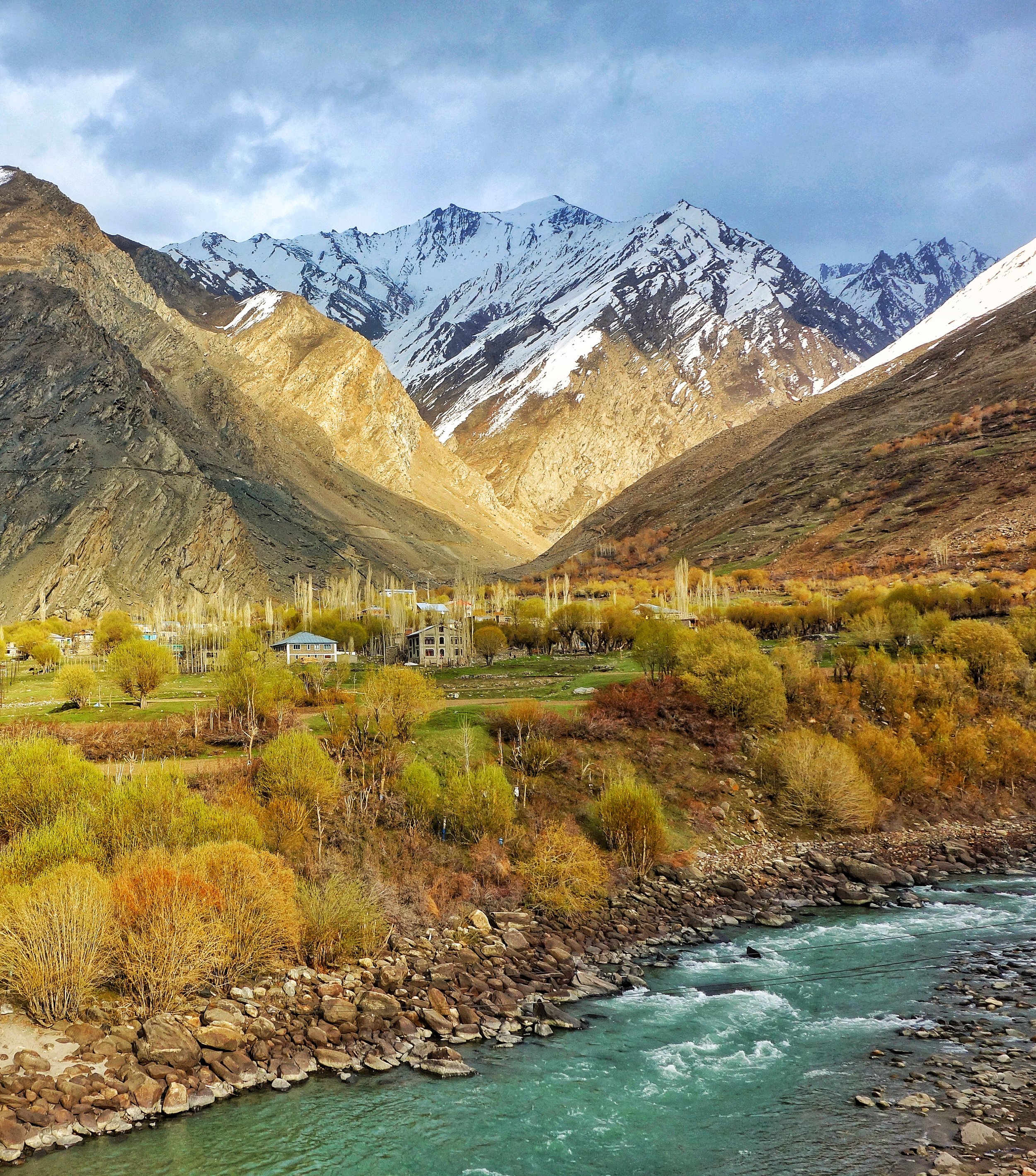
The Curious Case of the Baltis of Dehradun
On my random ramblings here and there I was in Drass and we decided have some Tea and Snacks at a Dhaba in Kargil. The guys running the Dhaba looked like almost a local but he was speaking in a strange accent to his wife. It wasnt the local accent.
Out of curiosity I asked him where he was from. He said Dehradun. I was like how did you land up here. He answered that they only stay there during the Spring/ Summers and return back to Dehradun before the onset of Winter. Ok I said.
But why here of all place. Then he told me there are Dhabas run by people from Dehradun as well and quite a lot of them. I asked again why here of all the places. There are other Hill Stations much closer to Dehradun in UK itself and you wouldnt even have to leave the state.
I then casually told him well you can pass of as a local. How come I asked ? Well we are from the same area originally he said. From Drass ? No he said. I was like OK he is not a Shina speaker so must be a Purigi speaker from Kargil or Suru. Nope he said. Then where I asked ?
Well we are originally from Baltistan but settled in Dehradun. I was like “Come again” please. I think I heard you wrong. He repeated and then the fact was revealed me to me of the story of a community of Baltis that exists in a place called Ambari in Vikasnagar near Dehradun.
Baltis are originally the inhabitants of what is now called Baltistan in Pakistan Occupied Kashmir where they are the majority.. The Baltis are of Tibetan origin with a significant Dardic admixture. In the state of Jammu and Kashmir the majority people of Kargil area as well the people in the Villages around Turtuk are also Balti.
Coming back to the Baltis of Dehradun i wondered how and why they landed up there. Also at the same time I got to know that some Baltis were also living in Shimla. And the community still exists in some form over there. And also about a smaller Balti community thats exists in Nainital and even smaller ones dotted at other places in Uttarakhand.
So as it seems in the days before Partition many people from Baltistan used to come down to the Hill Stations and lower foothills in search of work. These hardy mountain men were sought after for their great ability to carry heavy loads over rugged mountain paths. They were employed by the Armed Forces and as a general heavy load specialists. There were also a large number of them who were employed in the stone quarries in the foothills especially around Dehradun. The fact that you still find sturdy Kashmiri/ Gujjars from Kashmir still being used as heavy load specialists in Hill Stations like Shimla and Mussoorie are a testimony to this. As well as the testimony to the fact that sturdy mountain men are always in demand at our Hill Stations.
As it so happened suddenly the tragedy of Partition took place and all the Baltis who came for the area that was occupied by the Pakistani forces were now stranded in India wherever they were. The more luckier ones who hailed from the Kargil area still had a home within India when Indian forces forced te Pakistani forces out of the Kargil area which also they had occupied. That day is still celebrated in Kargi as the “Kargil Yom-e-Fateh” day on May 24 every year.
For all the Baltis that had no home to go back to as it was now under Pakistani control there was no option but to settle down at wherever they were at. The biggest settlement was at Vikas Nagar in a village called Amabari where they continue to thrive and live today as proud Indian citizens.
So next time in Dehradun do try and check these guys out and click some pics.
Pic from what I consider to be our part of Baltistan. The beautiful Suru Valley with vistas which match with the pics posted from Gilgit Baltistan.
Pic from April 2018. Suru Valley, Kargil District, Ladakh, Jammu and Kashmir.
The Gurudwara and the Hindu Dharamshala at Leh
The Gurudwara and the Hindu Dharamshala at Leh. A link back to the time when Punjabi traders connected the Trans Himalayas with the Indian Plains. Mostly from Hoshairpur they were major players in the trade with Central Asia via Ladakh. And some are still there

The Gurudwara and the Hindu Dharamshala at Leh
I had previously done a Post on the almost impossible Trade Route which connected Leh to Yarkand.
This time I had gone to Ladakh on a specific reason to go looking for clues that still survived of the great Trading Route.Of course there were other agendas on my plate as well but I wanted to find out more about this Trade and the People and commodities involved in the Trade. Of course there is mention of the Great Trade Route in the Books but since most people have lost interest in this all the remnants lie kinda forgotten.
The Trade ended in around 1949 when China closed the trading Route to what they now called Xinjiang. And it was almost 70 years now since the show ended. No one had a clue and no one seemed interested. And most asked what I was doing roaming around seemingly aimlessly where as I could be at Penguin Lake getting photographed sitting on a Scooter. Or go and meet Alexander’s family members. Or try to get permission to go to Umingting Ta, where if I could get a selfie with my tough guy look I could own Social Media for 3 days I imagine. Jokes apart I was trying my best to find something at least connected to the legendary Trade.
As luck would have it I happened to meet Sajid bhai who runs a well known Hotel in Leh and at his Hotel lobby he has a great collection of antiques and memorabilia. Sajid bhai told me that his family was involved in the Central Asian Trade and the place where his Hotel exists today was the site of a great Sarai where the Merchants from Yarkand would come down and stay. His family enjoyed Royal Patronage and this land was right next to the Leh Palace. But the most interesting fact was when Sajid bhai told me that his Mother was from Kashgar, another fabled city in Eastern Turkestan making the troika of the great cities at the edge of Tarim Basin viz Yarkand, Khotan and Kashgar. Some connect was being made. He directed me to the Central Asian Museum newly set up in Leh.
Next I visited the Central Asian Museum in Leh. A great building and very well set up though I must mention that I was a tad bit disappointed by the Collection they had. I was even more disappointed by the fact that Photography wasn't allowed inside the Museum as they had some interesting stuff. But still it had an impressive amount of information and Photos on display and one interesting information was the Volume of Trade for a certain period measured by the number of Laden Mules/ Horses : Donkeys : Camels came into Leh and were registered with the authorities. The numbers of Caravan Animals in 1871 are as given under (I copied the information on a Paper) :
From Kullu : Laden Horses/ Mules : 388 ; Donkeys : 35
From Rampur : Laden Horses/ Mules : 15 ; Donkeys : 35
From Turkestan : Laden Horses/ Mules : 956 ; Donkeys : 13 ; Camels : 18
From Kashmir : Laden Horses/ Mules : 464
From Changthang / Tibet : Laden Horses/ Mules : 460
Imports to Ladakh from North India included dyes, cotton cloth, spices, pears, rice, sugar, tobacco as well as personal items such as Needles, Soap and Combs. From China and Turkestan came Silk, carpets, cloth, gold, silver, turquoise, corals, brocades and velvet. At that time the distance between Leh and Yarkand was 548 miles and the Journey took around a month. On the other hand the time from Leh to Lhasa was around 3 months.
As mentioned in another Post the trade from the plains of Punjab used to start from Hoshiarpur and it was mostly Hoshiarpuri trader who were involved in this Trade and a number of them used to come to Leh from the Plains and some would even go to Yarkand. As time went by many of them settled partially in Leh and down in the Plains many Hoshiarpuri traders moved to Kullu.
And then I decided to take a walk in the Leh Market which is now a cobblestone street off-limits to cars. The first clue lies in the fact that a number of Shops/ Trading Marts in Leh are operated by Punjabis. Lajpat Rai Trilok Chand and Het Ram Vinay Kumar were the shops that caught my eye. Typical Punjabi trader names. Of course there are many newer Punjabi traders but most of them go away in the harsh winter but return as the Sun warms the high Desert. On enquiry at Lajpat Rai Trilok Chand, who have a big store in the main Bazaar a gentleman confirmed their link to Hoshiarpur and that they were originally from there.
And then I came across this old building which stood out amongst the new buildings in the Bazaar. And then i noticed a Saffron Flag on top and on getting closer I noticed the “Khanda” on the Flag. So it was an old Gurudwara in the Main Bazaar. And looking at the building I suddenly noticed another old board which said “Hindu Dharamshala” and it had a date in Hindi which I assume said 1933 but Im not quite sure. It turns out that the second Floor was a Gurudwara, the first Floor was a Hindu Dharamshala and the Ground Floor was shops. Im sure this served as the resting place for the Punjabi traders coming from Hoshiarpur as that was the main point of Trade in the Punjab with the Hills and the Mountains beyond. And the Shops were used by them to probably display their merchandise.
And below is the pic of the said Building which probably no-one even gives a second look to. I wish I could rummage through the stuff they have probably stacked away somewhere in the Dharamshala.
That would make a great Story for another day I guess.

Kishtwar : At the Himalayan Crossroads
Kishtwar is a region in the Jammu division of the state of Jammu and Kashmir. Due to its unique location just under the shadow of the Great Himalayas and at the place where the religions and cultures of the Himalayas meet. They give Kishtwar a unique flavor which remains largely unexplored.
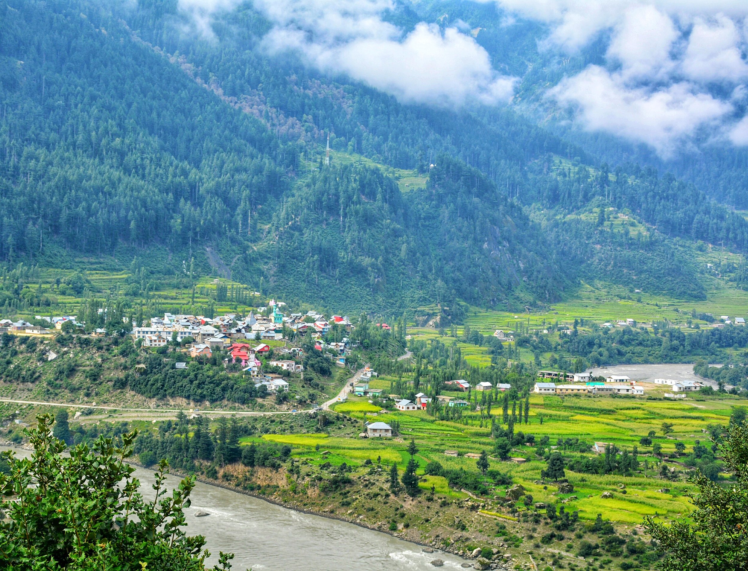
Kishtwar : At The Himalayan Crossroads
Kishtwar today is just a district in the Jammu Division of the state of Jammu and Kashmir. It borders the Kashmir Valley on one side, Doda on the other, Zanskar in the North, Chamba in the South. It has been noticed by some hard core mainly foreign Monatineers in the past and even recently for the great climbing opportunities it offers in the Kishtwar Himalayas.
Ok coming to what I wanted to write about. The Great Himalayan Range and its related Ranges stretch from the Pamir Knot down to the Hengduan Mountains in North Western Kunming. Besides all the ethnic and cultural variety there are also a variety of Religions practiced in these Mountains. Since Religion is a hot topic of debate and discussion and even derision on the Himalayan Club I decided to write on a subject related to it. To me the Religion of a place carries as much value as the ethnicity or the culture or the language does.
In the Himalayas there is the basic presence of three of our great religions. In the Western and Northern part of the Western Himalayas it is Islam which dominates. However beyond the Himalayas in the North its Buddhism. Towards the Eastern and Southern Part of the Western Himalayas it is Hinduism. And of course Buddhism in the Trans Himalayan reaches. The Central Himalayas are a stronghold of Hinduism stretching all the way across to Sikkim. But again as a feature seen earlier its Buddhism which dominates the higher Himalayas and the Trans Himalayas. Beyond Sikkim its predominantly Buddhism which is the majority religion.
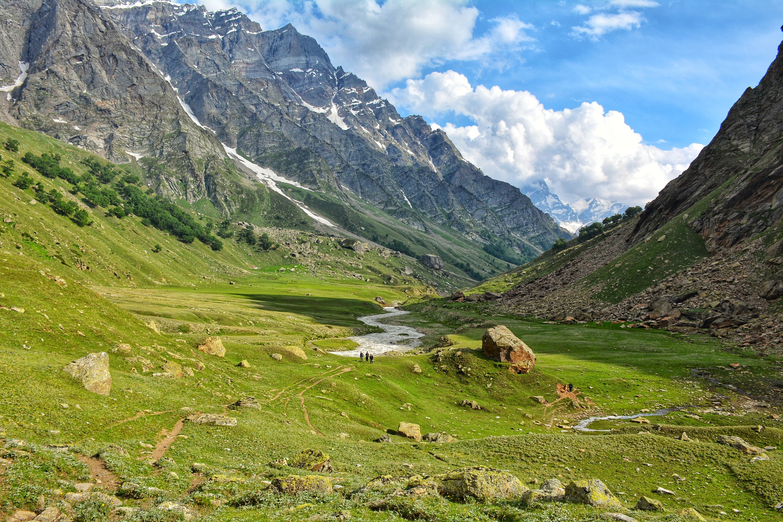
Its in Kishtwar that the three belief systems merge and hence it gives unique place in the Himalayas. The majority population follows Islam, a large minority follows Hinduism and a very small minority of Buddhists also exist in Kishtwar. Its in the upper reaches of Padar (which used to be called Paldar by the Ladakhis / Tibetans) that there are exist Buddhist villages which follow the same Tibetan Buddhist traditions that are followed across the Great Himalayan divide in Zanskar. Infact in some of these Villages in Kishtwar there still exists an animal which is associated more with Ladakh or Tibet ie the Yak. In the Padar Region in the upper reaches along the Machail River there are the twin hamlets of Halo and Hango on the left side of the Machail River and the Villages of Lossaini, Dangali, Scham and Jashari which are all Buddhist Villages.
Towards the south bordering Doda and Chamba are a majority of Hindus contiguous with the populations to the South. The main Kishtwar town and to the North of it are majority Muslim population many of whom have actually come in from adjoining areas in Kashmir. In Fact the Kashmiri spoken by the people in the Warwan Valley, which is a part of Kishtwar, is supposed to be the purest form of Kashmiri as it was spoken in the olden days. The Warwan Valley runs parallel to the Suru Valley in Ladakh separated by the Great Himalayan Range itself.
Kishtwar is first referred to in the Rajatarangini by the ancient name Kashthavata, during the reign of Raja Kalsa of Kashmir (1063–1089), when "Uttamaraja", the ruler of Kashthavata visited the court of the Kashmir King in company with several other hill chiefs to pay their respects to the Raja.
It was more or less an independent Hill Kingdom ruled by Rajput Hill Rajas as was the norm in the region. The Royal family had supposedly descended from the Royal family of Suket.
However subsequently a part of it also became a part of the Western Tibetan Kingdom and the one of the Kings divided his Kingdom between his sons and they got Zanskar, Purig and Kishtwar as separate Kingdoms. However in the absence of any written historical records of history of the Region the timelines are just approximate guesses and due to the Geography of the region it is well possible that a part of Kishtwar was under the Rajput Hindu Rajas and the more higher and remote areas like Padar was under the rule of Ladakhi/ Tibetan Rajas.
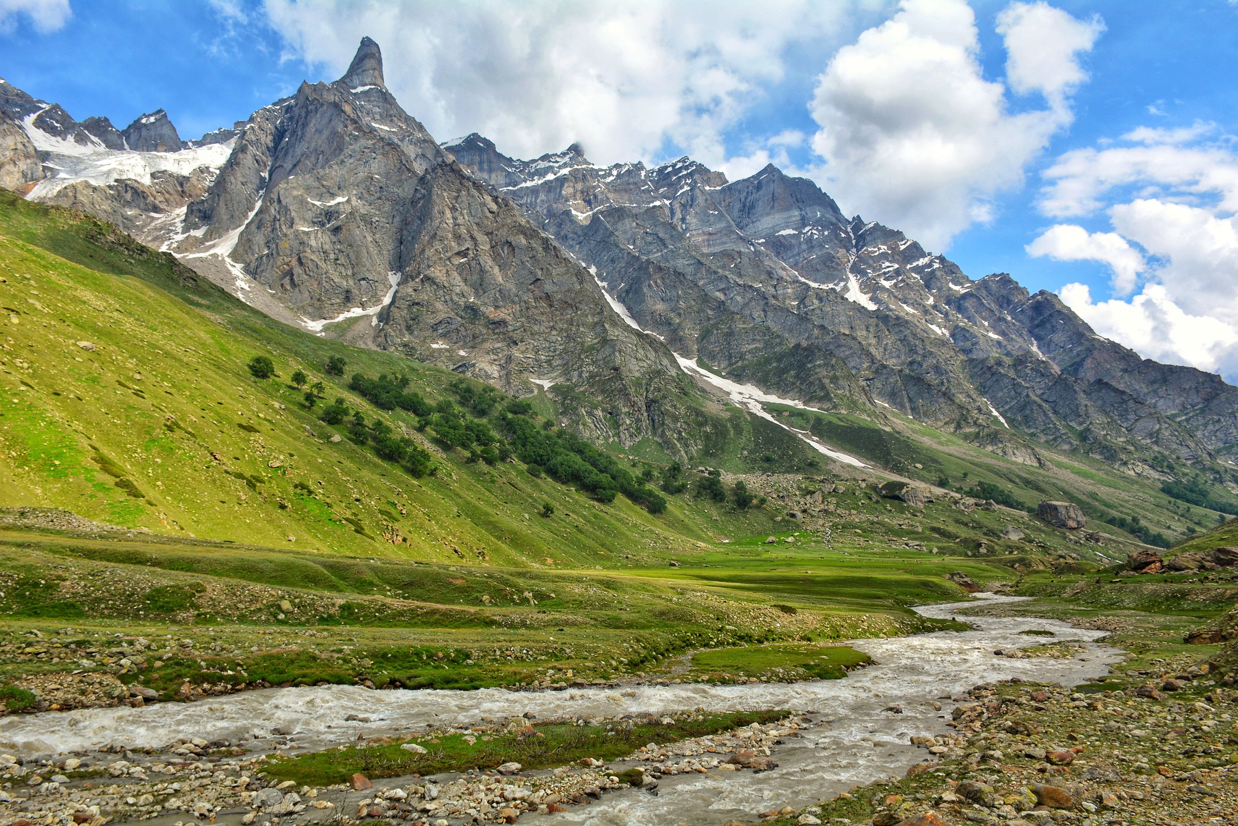
In the 17th Century the Rajas of Kishtwar converted to Islam so did a large part of the population. But in an odd adaption the Rajas, though Muslims by religion, had Hindu Rajput names and this continued till the 1820 when it was captured by Raja Gulab Singh, a vassal of Maharaja Ranjit Singh. The name of the last ruling was Raja Muhammed Teg Singh s/o Raja Inayatullah Singh. The campaign for the capture of the Kingdoms of Kishtwar, Reasi and Arnos was carried on by none other than General Zorawar Singh who subsequently became the Governor of these erstwhile Kingdoms and it was from here that he planned his invasions of Ladakh, Baltistan and Tibet. And one of his main Officers, Col Mehta Basti Ram, of the well known Mehta clan of Kishtwar, who campaigned fearlessly with General Zorawar Singh in all his Campaigns. After the death of General Zorawar Singh and the subsequent signing of the Treaty of Chusul, it was Col Mehta Basti Ram who became the first Governor of Ladakh.
As of today this most beautiful part (arguably) of Himalayas lies mostly unknown to outsiders except a few adventure seekers. Lying in the shadow of Kashmir and Ladakh but a part of Jammu that can give both these places more than a run for their money just with its amazing Geographical and Cultural diversity.
Kiki’s Blog
Stories from the Himalayas








Five years ago the Galwan Valley was in the News for the wrong reasons after a deadly clash between the Indian and Chinese Armies in the Valley located in Ladakh lead to many deaths on the contentious Border between the two countries in wake of continued Chinese intrusions into Indian territory.
This area along the Shyok River, of which the Galwan Nallah or the Galwan River which forms the Galwan Valley has been off limits to Civilians since long but now the Indian Government has decided to open up the area for Civilians and we were amongst the First Civilians to venture into this beautifully desolate part of the Eastern Karakorams in Ladakh. Earlier Civilians could only venture upto the Village of Shyok from where the Shyok River takes a U turn and flows in a Northerly direction.