
The Battle of Basgo
There once was Battle fought in Ladakh where a Mughal Army in support of the King of Ladakh fought against a joint Mongol Tibetan Army which had laid siege to the Fort of Basgo. The Mughals were supported by allies such as the Raja of Kullu wheres as the Mongol-Tibetans had support from the Raja Bushahr.

The Battle of Basgo : When the Mughals fought the Mongols
Here is an interesting tale which encompasses a vast myriad of actors and shows how the history of the Himalayas intertwines containing threads that includes the various people living in and around the Himalayas.
Around 1643 Tibet was a dependency of the Mongols and the Mongols played an important part in the power struggle between the various sects of Tibetan Buddhism who seemed to be engaged in a permanent duel. It was primarily a struggle between the Yellow hat sect and the Red hat sect. The Mongols were the military power who decided on the matter of which sect would come out on top in this struggle.

The Mongol Gushi Khan, the ruler of the Dzungar Khanate, put his weight behind the Fifth Dalai Lama, who was the head of the Yellow Hat sect. But as a quid pro quo the whole of Tibet came under Mongol suzernity and was a welcome addition to the Dzungar Mongol Empire, an Empire which strecthed from Tibet to Kazakhstan to the Mongol steppes and well into Siberia. At that time it doesnt seem to have occured to the Mongols or to the Dalai Lama to subjugate Western Tibet (Ladakh) which was a seperate kingdom though which paid tribute to the Tibetan kingdom.
But then circumstances played up and created a situation which caused the Mongols to cast their gaze on Ladakh along with their Tibetan allies.
It so happened that the King of Bhutan was a follower of the Red Hat sect and this got him into a spat with the Dalai Lama who was the most dominant figure of the Yellow Hat sect and his Mongol allies. As it happened the King of Ladakh at that time, Delek Namgyal of the powerful Namgyal dyanasty sided with the King of Bhutan in this spat as the head Lama of Bhutan was his patron Lama as well.
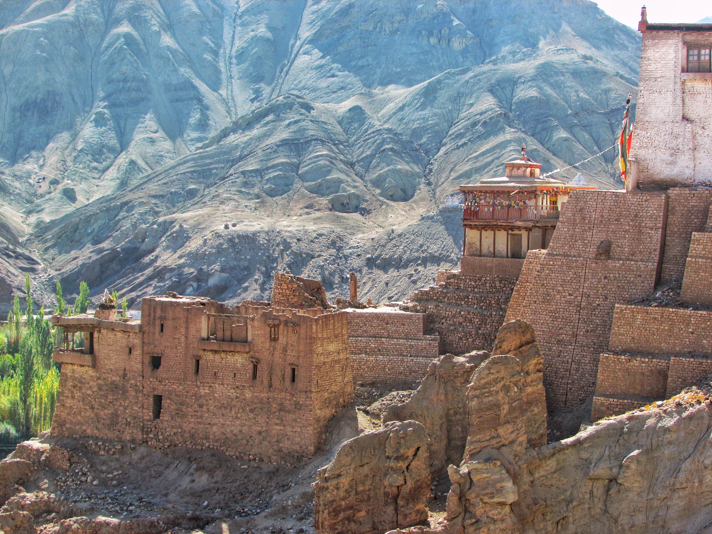
This incensed the Mongol Tibetan rulers of Tibet and soon an army was despatched to Ladakh let by a Mongol Lama named Tsang consisting of both the Mongols and Tibetans. In the first engagement the Ladakhi Army met the Tibeto-Mongol Army near the Pangong Lake and were driven back to their capital and castle which at that time was at Basgo.
It should be noted that the Raja of Bushahr, Raja Kehari Singh also supported the Tibeto-Mongol invasion as he wanted to recover parts of Kinnaur which were claimed by the Namgyals of Ladakh.
Finding himself in the midst of being surrounded in his castle at Basgo by the Tibeto-Mongol, the Gyalpo (Ladakhi word for the King) decided to ask help from the only power he knew could take on the Mongols and the Tibetans. He wrote to the Mughal Governor of Kashmir to come to his rescue in exchange for which he will switch his allegiance to the Moghuls instead of the Tibetans in the future. The Mughal Governor forwarded the request to Emperor Aurangzeb,who agreed to help on two conditions, first the Pashmina trade should be an exclusive Mughal preserve and the Gyalpo should convert to Islam.

The Gyalpo found himself between a rock and a hard place. Atleast agreeing to the Mughla conditions would ensure that he had a good chance of getting through this crisis. Alive. He agreed and soon a Mughal force was despatched to take on the Mongols and the Tibetans.
Interestingly the Mughals themselves were of Turkic-Mongol origin. Infact the word "Mughal" was the Persian word for the Mongols. Emperor Babur was himself a descendent of Timurlane and a princess of the Chagatai order. The Chagtais were descended from Chagatai, the second son of the Great Khan himself. The stage was now set for these Mughlas to meet on the field their long lost Mongol cousins.
As a side act the Raja of Kullu, Raja Bidhi Singh, also sided with the Mughals, as Lahaul and Kullu used to pay tributes to the Ladakh kingdom and as such he was obliged to side with the Namgyals. On a side note the Raja plundered the Zanskar Valley while the stage was being set for the main engagement.

The Mughal force crossed the Indus over two wooden bridges at Khalaste and marched towards Basgo. The two armies met at a plain called Jargyal between Basgo and Nimmu. This is referred to as the Battle of Basgo fought in 1679. And the battle hardened Mughals along with their Ladakhi and Kullu allies proved too strong for the Tibeto-Mongols and their Bushahri allies. The Tibeto-Mongols were pushed back and routed all the way to Spituk where after a brief lull the fighting erupted again until they were driven beyond the Pangong Lake to a place called Trashisgang. They built themselves a Fort and shut themselves in and the Mughal Army now turned back, confident that the Tibeto-Mongols were gone for good. But of course Mongols being Mongols, they were wrong, but more of that later.
In the meanwhile the Gyalpo had moved west to the Fort of Tinmogang, around 30 west of the Fort at Basgo. And the Mughals now turned up to get their pound of flesh. All the Pashmin trade rights were given to the Mughals and as per Mughal chronicles the Gyalpo converted to Islam and took on the name Akbat Mahmud Khan. As a guarantee the Mughals took with them to Kashmir as "guests" a few members of the Royal family including one of his sons.
The Ladakhi chronicles however make no mention of his conversion to Islam. Maybe the King didnt want to reveal this fact to his subjects and especially to the Orthodox Buddhist Lamas who would get extremely incensed at the fact that their King converted to Islam. As per outside historians the King converted to Islam but this information was kept secret and not recorded anywhere in the Ladakhi chronicles. He simply could not afford to face the wrath of the Lamas.

Having been satisfied and their conditions fulfilled the Mughals went back over the Zoji La to Kashmir leaving the Gyalpo in charge as before.
Once the Mughals went back, the Tibetians with new re-enforcements from the new Dzungarian Khan, Galdan Boshugtu Khan, attacked again in 1684. This time the Tibeto-Mongols were victorious and the Gyalpo just didnt have the time or the inclination to call upon his Mughal allies and neither were the Mughlas perpared or interested in intervening again.
In the aftermath a Treaty was signed between the Tibetans and the Ladakhis which set the border between Ladakh and Tibet and it restricted the Kashmir hold on the Pashmina trade only till Spituk. It also set the annual tribute that Ladakh had to send to Tibet.
This fragile peace would hold on for another 150 years till General Zorawar Singh happened. Another story for another day.
References : Francke : History of Western Tibet, O.C. Handa:'Buddhist Western Himalaya: A Politico-Religious History' and Vinayak Razdan who had written a Post on the same and I added more information to his Post.
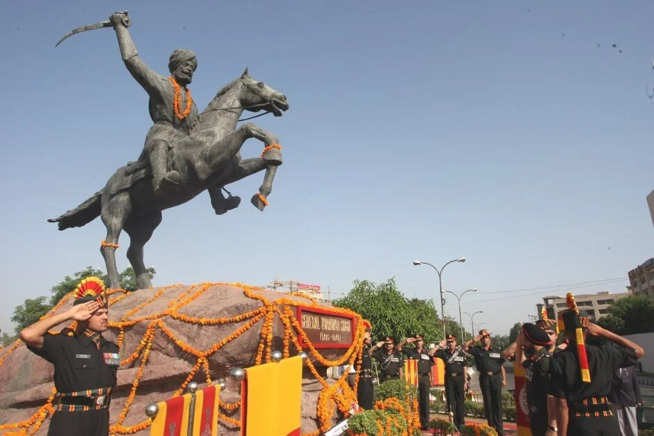
The Brave Shen - Pa
The last stand of General Zorawar Singh, the Dogra General who conquered Ladakh and Baltistan at the behest of Raja Gulab Singh and Maharaja Ranjit Singh. An outstanding General who wrote new annals in the history of Mountain Warfare who went down fighting in his last Battle on the frozen Plateau of Tibet.
The Brave Shen Pa
In the beginning of December 1841 at an altitude of over 14000 ft on the Tibetan Plateau with the temperatures well below freezing he got the news that a large contingent of the Imperial Chinese Army consisting of more than 10,000 soldiers along with their Tibetan allies was coming for him and stop his whirlwind advance. He had already faced smaller contingents and had already snatched, the Imperial Chinese Banner, the Mantalai Standard from them in an encounter. That had given them a measure of this man.
In a fashion typical to him and only him he must have weighed the odds. His Troops, about 3000 in number, were out of supplies, hungry, suffering badly from the intense Cold to the point that they had sawed off the butts of their Guns to burn them for warmth. He had already added more than 150,000 sq km of territory to his King’s domain and fought and come up on top in extremely difficult situations like taking his Army up the Umasi La at the onset of Winter. He had captured the holiest of the holy, the Kailash Parbat and Mansrover for his King. No King would want more.

A Replica of the Chinese Imperial Mantalai Standar kept at the Zorawar Musuem at the Zorarwar Fort in Leh
But not him. He had promised Lhasa. And Lhasa he would deliver. The Western Tibetan Kingdom including Rudok, Guge, Purang and Spiti were already under his wing. He was in Tirathpuri by the Satluj when he got the news of the advance. He despatched a small band of advanced troops under Nono Sonam to lead the initial forays into the rival Army. His men were massacred but Nono Sonam managed to escape and get back. Next a bigger band of around 600 men under Ghulam Khan and Nono Sonam were despatched to check the advance of the adversary. They fought well and they fought hard but they were routed by overwhelming number of the opposing force. Both Ghulam Khan and Nono Sonam were taken prisoners.
When he had started on his Trans Himalayan Expeditions he was accompanied by the following 12 Officers who led his Army and now after 7 years of Campaigns in the highest Himalayas and now just a couple of them were alive :
Mian Rai Singh
Mehta Basti Ram
Mirza Rasool Beg
Rana Zalim Singh
Abdul Razak Singh Mankotia
Mian Tota
Sardar Uttam Singh
Wazir Khwaja Bhanjal
Sardar Samad Khan
Nardeep Singh
Imam Malik
Syed Madin Shah
Out of all these Officers only probably Col Mehta Basti Ram of Kishtwar would die of old age. All of them were completely dedicated to him.

Replica of a Pistol presented to Raja Gulab Singh by General Zorarwar Singh
He decided to act in the only way of defence he knew. Attack. On the 10th of December with the remnants of his Army he decided to fall upon the oncoming Army though he knew the odds were stacked up against him. Heavily. But the “Shen - Pa” as their adversaries called them fell upon them with all the ferocity they were well known for. The Shen - Pas first attack on the Chinese / Tibetan Army has been described as “lightning fury” by a noted historian. Hell was unleashed in the biting cold between the two Armies engaged in Battle at over 4800 m above sea level.
The a fierce Battle ensued for two days. On the 12th December he himself decided to lead a charge on the enemy positions with his last best men left. While leading the charge with his signature fury he got a bullet in his thigh and fell off his Horse. Seeing him fall immediately he was surrounded by enemy soldiers. He was down but not out and he drew his sword. He dealt terrific blows to anyone who came close. Eventually a Horseman thrust his Lance at him and it went through his Chest. He fell. Dead.
His men now panicked and fled in all directions and were cut down by the enemy. Around 600 to 700 were taken prisoners. Col Mehta Bast Ram who was holding the Fort at Taklakot also decided to withdraw and crossed over into Almora. They were defeated. And he was dead.

The Nallah in Susru Valley near Panikhar where General Zorawar Singh first emerged in Ladakh.
But now the victors had a new problem. His body. They held him in reverential awe as the bravest of the Shen-pas. They cut off his head and carried it off to Lhasa as a Trophy. It was apparently entombed in a stupa. Parts of his remains were taken to the Simbiling and the Sakya Monasteries. All other remains were scattered so that this feared Shen - Pa might not rise again to do what he did. A Stupa was built to him somewhere around Mansrover. It stands there to this day.
Many engagements and Battles were fought thereupon between the same adversaries and finally Peace was reached with the signing of the Treaty of Chushul. And Col Mehta Basti became the First Governor of Ladakh.
In The History of Western Tibet by Rev.A.H. Francke who was a Moravian Missionary in Ladakh mentions that the Ladakhi's sing a poignant song of His wife, whom they believe to have accompanied her husband to Ladakh, and who had to return alone across the Zoji Pass. In this song Urdu words are mixed in a quaint way with the Tibetan:
I do not wish to eat bread received from the sinful Northerners, I do not wish to drink water received from the sinful Northerners
Amidst the inhabitants of this land I have no friends and relations, In the Northern Plain I have no brothers and friends
In the place of friends and relations I had only You
In the place of brothers and friends I had only You
And it was only You who made me a despised widow
And it was only You who made his Queen a despised widow
When arriving on the Zoji Pass, my fatherland can be seen
When arriving on the Zoji Pass, Lahore and the Panjab can be seen
Although I can see my Fatherland, I shall not arrive there
Although I can see my Fatherland, Your Queen will not arrive there......
And he further wrote : Now that the greatest General the Dogras have ever had has found his death on the battle-field, let us pause for a moment and place a wreath of tribute on his grave. For, Oriental though he was, we cannot help admiring a greatness in this man by which he far surpassed his surroundings. In the beginning of his conquests he was extremely cautious ; but this was essentially necessary, considering the naturally protected position of Western Tibet, and his entire want of knowledge of the geographical conditions of this country. But, as he had a keen eye for the defects of his enemy, and was a great strategist, all these difficulties were overcome. After the conquest was complete, the continual insurrections presented a new problem for his ingenuity to solve. By the manner in which he treated them, and in which he quelled them one after another, without any extra amount of cruelty, he showed not a little measure of wisdom. He proved himself a true soldier in the endurance of extraordinary hardships and in setting an example of personal courage ; and if he had not met with an early end on the battle-field, he might have impressed his name on the pages of the great history of the world.
His name was General Zorawar Singh Kahluria.
On Flight of Fancy to Leh
A commentary on the Flight from Delhi to Leh which takes one over the Himalayan Range. It is one of the most spectacular Aeroplane journey for the sights it offers. Starting over the Plains, then over the Lower Himalayas or the Shivaliks, then over the Middle Himalayas / Pir Panjals and finally over the Great Himalayan Range itself before finally landing in the Trans Himalayan landscape of Ladakh.


The Great Himalayan Wilderness
On a Flight of Fancy to Leh
A flight to Leh from the Plains gives you an actual chance to view the awesomeness of the mightiest Mountain Range on the Planet especially just as Winter gives way to Spring and the Peaks have the maximum amount of Snow which accentuates the appearance of the Mountains.

The Lower Hills with the Rivers coming through
The endless Plains first give way to the lower Hills and the Shivaliks. Its just ahead and coming out of these lower Hills are a number of Rivers as they enter the Plains. And the effect of man's work is also visible as you see the Reservoirs of various Dams appear once into the lower Hills.
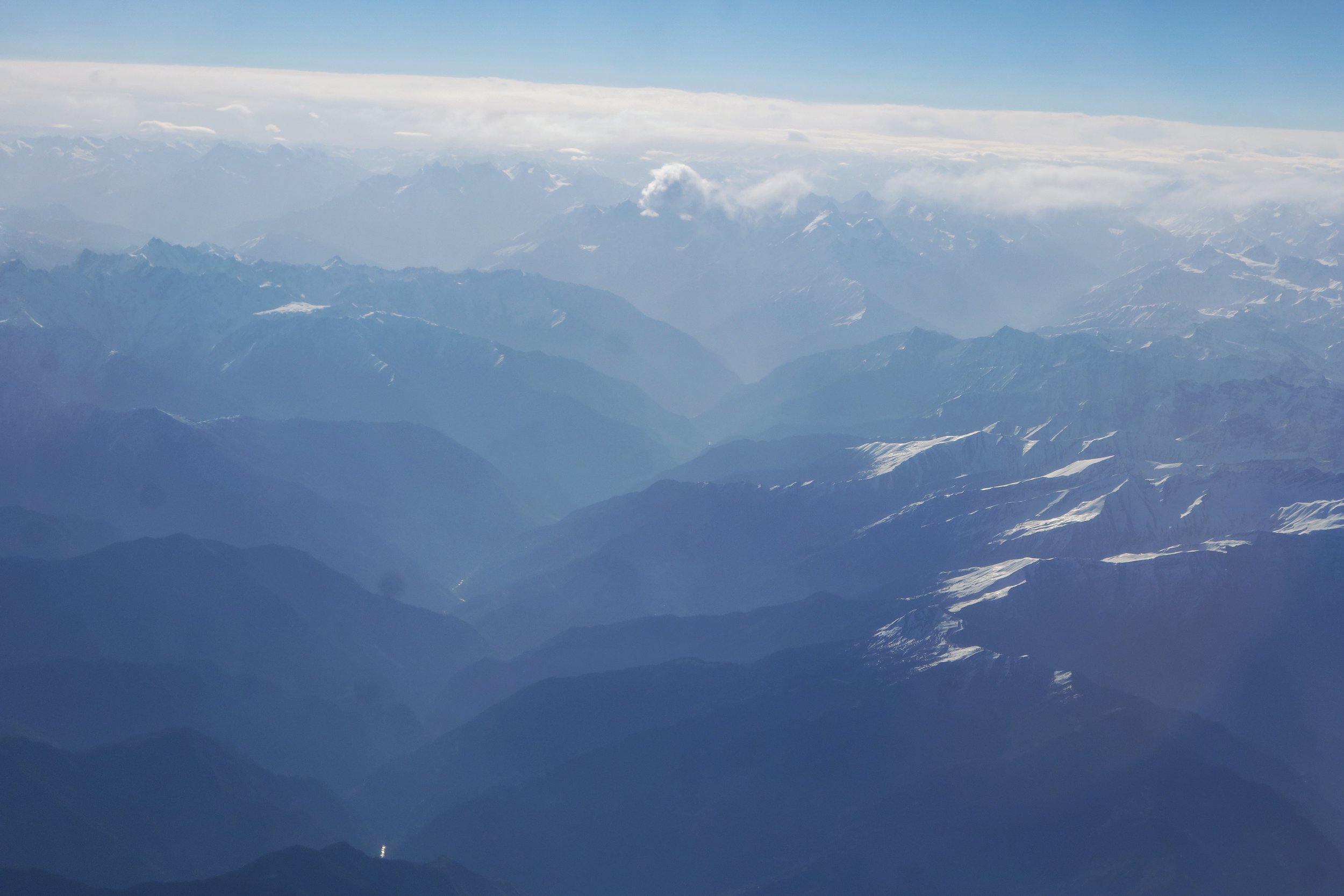
The Lower Hills giving way to the Lesser Himalayas at the Dhauladhars and the Pir Panjals.
The lower Hills give way to the Lesser Himalayan Ranges like the Dhauladhar and the Pir Panjals. These appear as big mountains with craggy tops and snow higher up with a some small Glaciers.

The Lesser Himalayas giving way to the Great Himalayas
Once across this suddenly you see an elevation in the lay of the land and suddenly till the eyes can see are visible craggy Peaks all white with massive Glaciers between the Massifs. This is the sign that you are now on the Great Himalayan Range itself. The main and the highest Spine of this Mountain Range. And it goes without saying this appears as the most dramatic part of the Range as its a virtual Ocean of thousands of Spires.

The Glaciers of the Great Himalayas

The endless Spires of the Great Himalayas
But like all good things must end so does this this.And then you start noticing that the landscape gets browner with lesser Snow and the Mounatins appear to be rounder rather than craggy. These are the Trans Himalayas. And also making their appearance are certain large water bodies that exist on this Trans Himalayan desert.

The Great Himalayas giving way to the Trans Himalayan Plateau
In the pic below you can see the dramatic change as you cross from the Great Himalayas over to the Trans Himalayas with a River acting like a border. The Mountains to the right of the River are craggier and whiter than the ones to the left. Also in the left corner you see a large water body which is the Tso Moriri Lake.
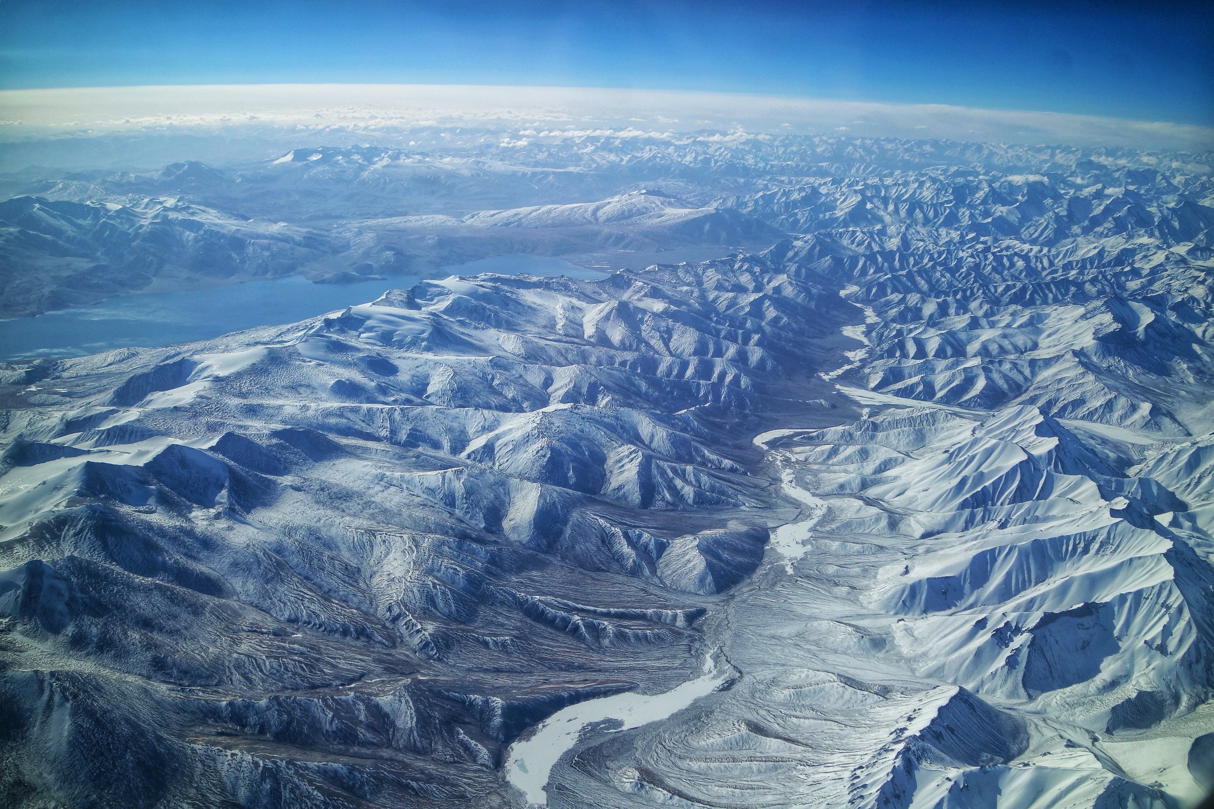
The Lakes of the Trans Himalayas : The Tso Moriri

Typical Trans Himalayan Landscape
However the Trans Himalayas dont last long as soon appearing on the horizon are Mountains ever craggier than the Great Himalayan Range. These are the what were called in Turkic language as the Black Rock Mountains and even today we use that term for them, the Karakoram, arguably the most impenetrable Range of the whole system. From the Leh flight as it starts its descent on the first view of the Karakaorams they appear even more formidable till they disappear behind the Ladakh Range and the plane lands along the Indus River.

The gently sloping Peaks of the Trans Himalayan Plateau
However if by some luck we were able to continue to fly northwards we would cross the first line of the Karakorams and come across the formidable Deosai and the Depsang with the Changthang of the Tibetan Plateau further afield on the right alongwith Changchenmo. Soon we would be flying over the mighty K2 and the Trans Karakoram Tract. But the fun doesnt end until you run into the spires of Kun Lun and the Pamirs at the point they meet and converge. Another great Mountain vista awaits you you cross another of these Great Mountain barriers which seperate the Indian sub-continent from Central Asia. And finally our imaginary flight would land at Yarkand at the edge of the Tarim Basin.

The Spires of the mighty Karakorams appearing beyond the Ladakh Range. In this case the Saser Massif.
You have just flown over the most formidable Mountain barrier on the Planet. Now think of the Men who crossed these barriers on foot. And let me know if a chill passes down your spine when I tell you their stories on a day I decide to tell that story :)

Looking in the opposite direction towards the plains we have the Zanskar Range with the Great Himalayas in the background.
Do walk the Mountains someday instead of flying or driving over them
Pic from April 2018. Delhi to Leh flight.
Drass : Hembabs / Hembaps
Drass is supposedly the “Second Coldest Inhabited Place in the World”. Do take that with a pinch of salt. Traditionally Drass was known as Hembabs with the word "Hem" meaning the same as it does in "Him" of the Himalayas. Basically a place which gets a lot of snow as this area got the most snow in the whole region.

Drass : Hembabs/ Hembaps
A Village with a great background in what used to be called "Hembabs / Hembaps" now known as Drass. This was on the way to Umba La which connects Drass to the Suru Valley at Sankoo.
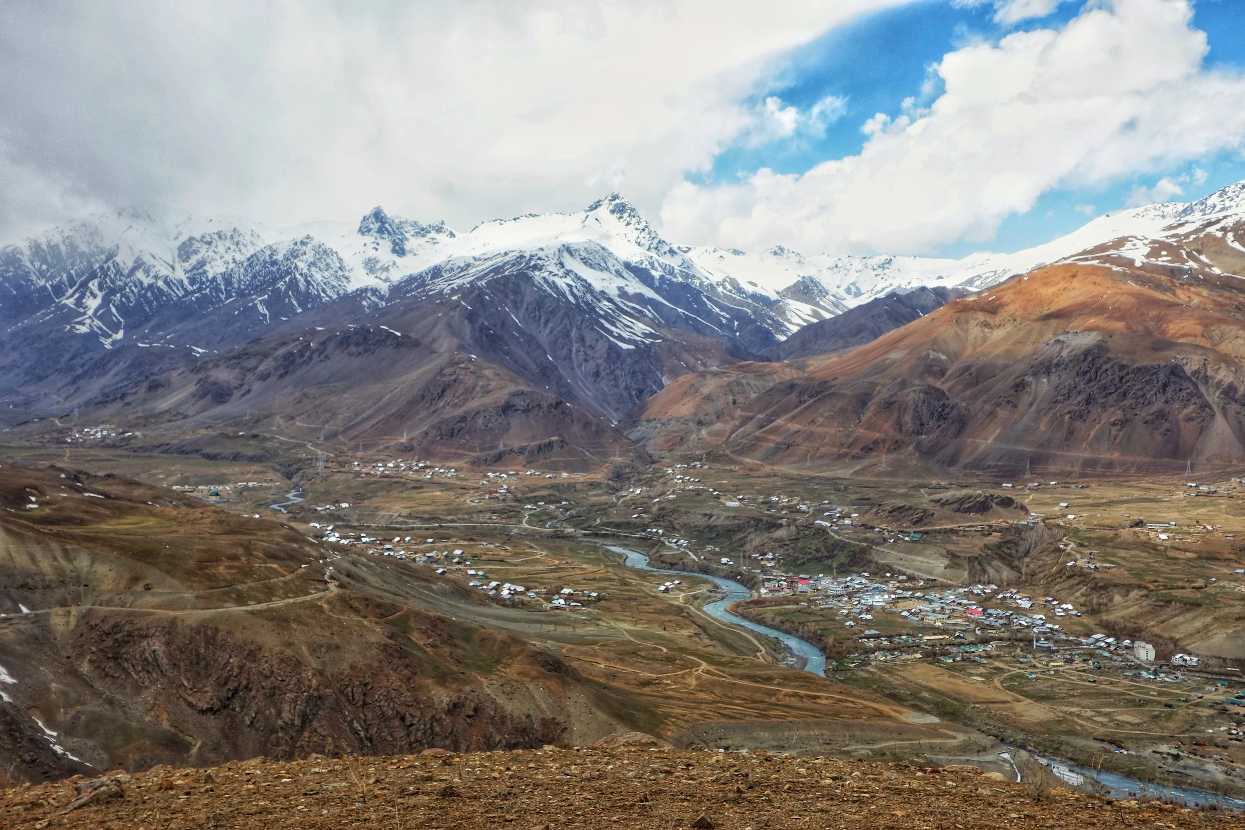
A view of the Drass Valley from the Rpad to the Umba La Pass. In the background you can see the famous Tiger Hill
Besides being famous for being "The Second Coldest Inhabited Place in the World" (I often wonder where they came up with this stupidity ; it could well be the coldest inhabited place in India, which I would agree with) it also holds a unique place in the Geographically of Ladakh. Traditionally Drass was known as Hembabs with the word "Hem" meaning the same as it does in "Him" of the Himalayas. Basically a place which gets a lot of snow as this area got the most snow in the whole region.
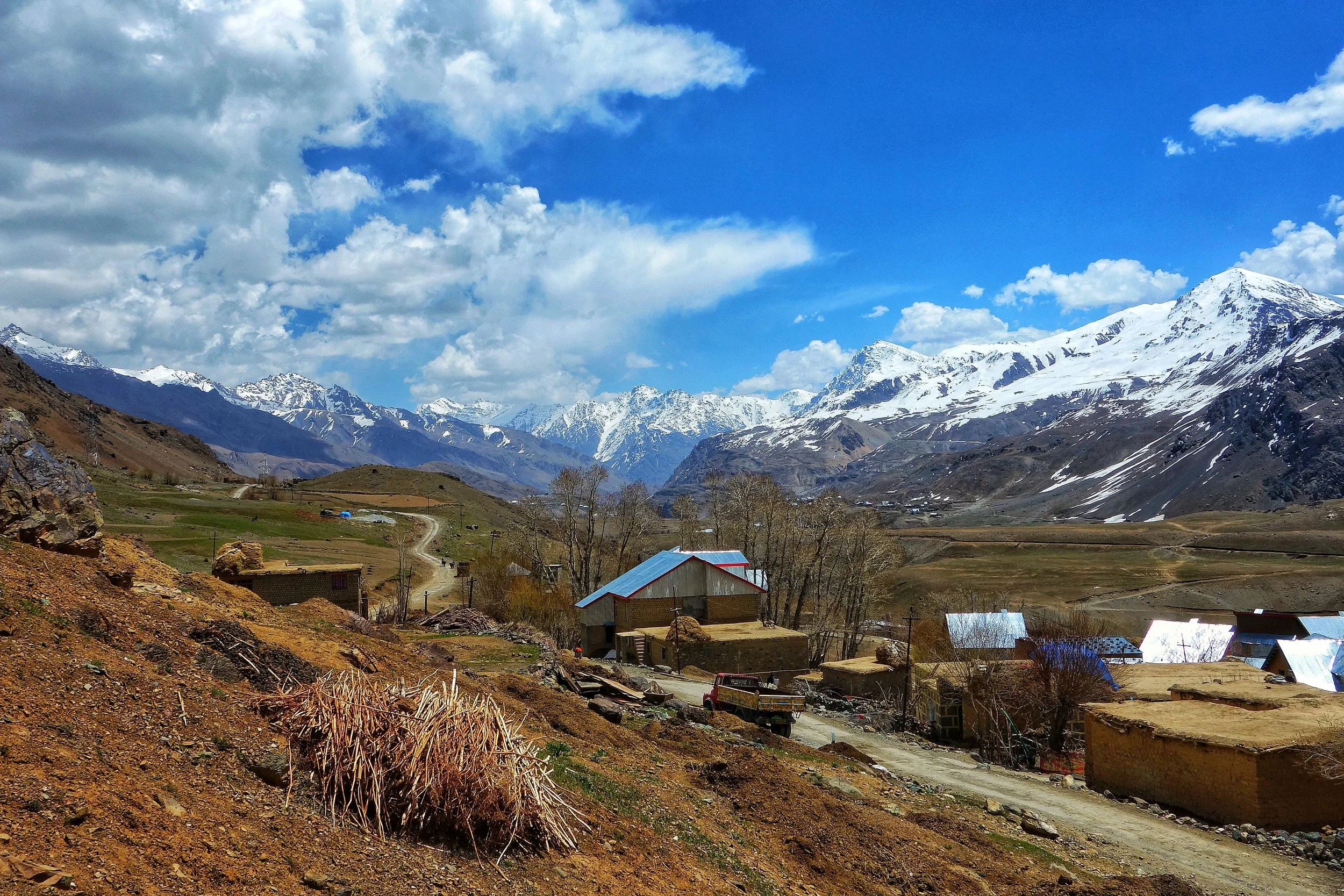
A Village in the Drass Valley
And also Hembabs is also the place with the most influence of Kacheeyul, which is the traditional Tibetan/ Ladakhi word for Kashmir. And a number of Kashmiris have traditionally come over here and settled here.
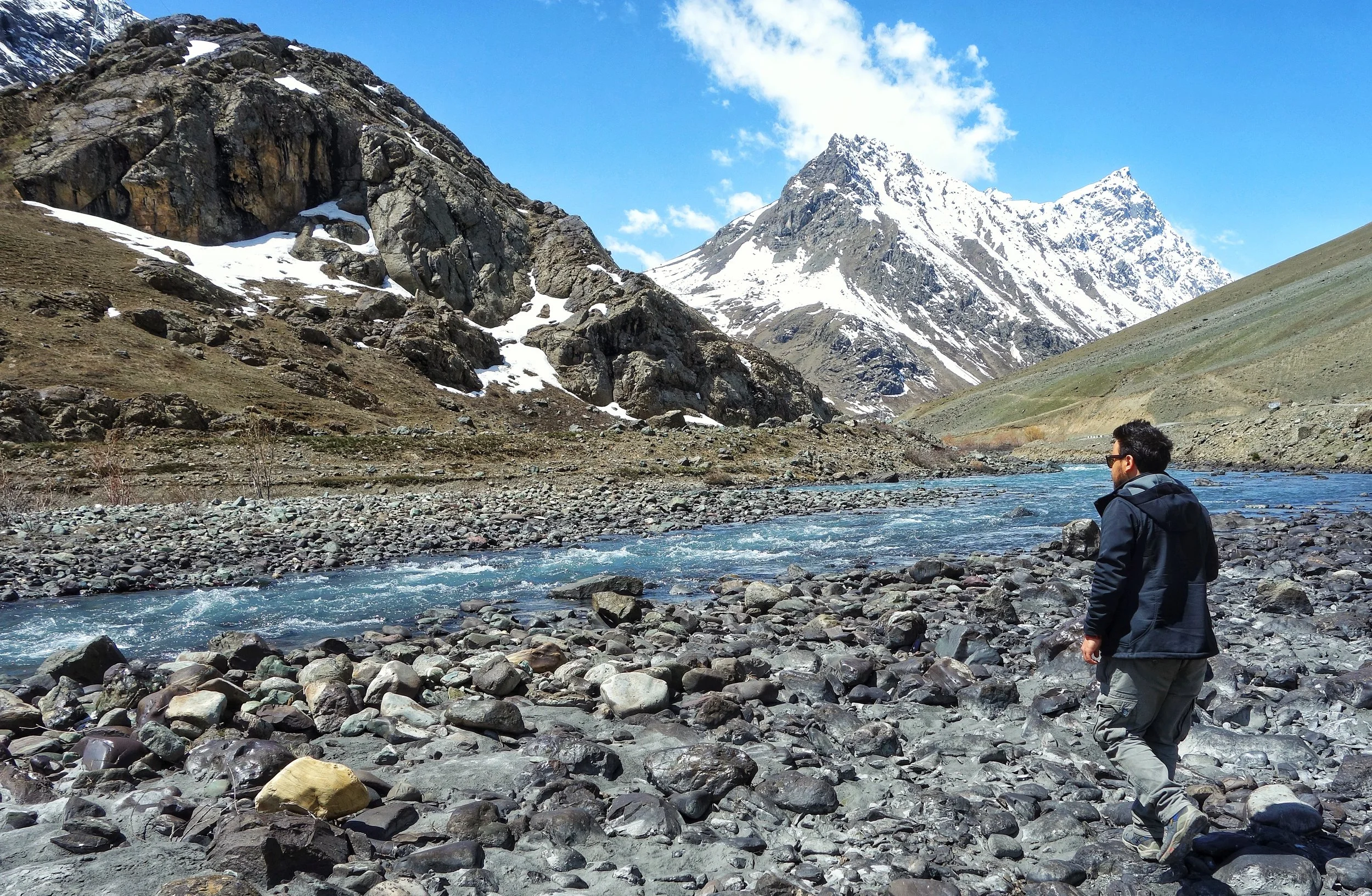
The Mushkoh River
And most interestingly the language spoken in Drass is Shina unlike the Purigi version of Balti spoken in Kargil and Suru Valley. The same language is spoken in the Gurez Valley in Kashmir as well. Shina is a one of the major languages of Gilgit Baltistan as well with 40% of the population supposedly speak Shina.
For most people this is just a cold place in way to Leh. But this place holds much more than that.
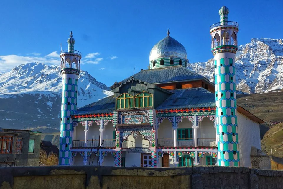
A beautiful Mosque in Drass.
On a side Note these are the Ladakhi / Tibetan names for the regions which bordered Ladakh ( Got them from an old Map that I happen to come across ) :
Kashmir - Kachee Yul
Kulu - Nyungti
Kinnaur - Kunu
Drass - Hembaps
Marwah Warwan - Maru Wardwan
Chamba - Chamba
Kishtwar - Kishtwar
Padar - Paldar
Badarwah - Badarwar
Pangi - Panga
Bharmour - Barmaur
Lahaul - Garzha
All these places are the Cathedrals of the Himalayas and in my view one of the most intriguing Mountain geographies on the Planet. With an amazing array of ethnic, cultural, lingual, religious and societal diversities. May we all get a chance to visit these places.
Pic from April end, 2018. On the way to Umba La, Drass Sector
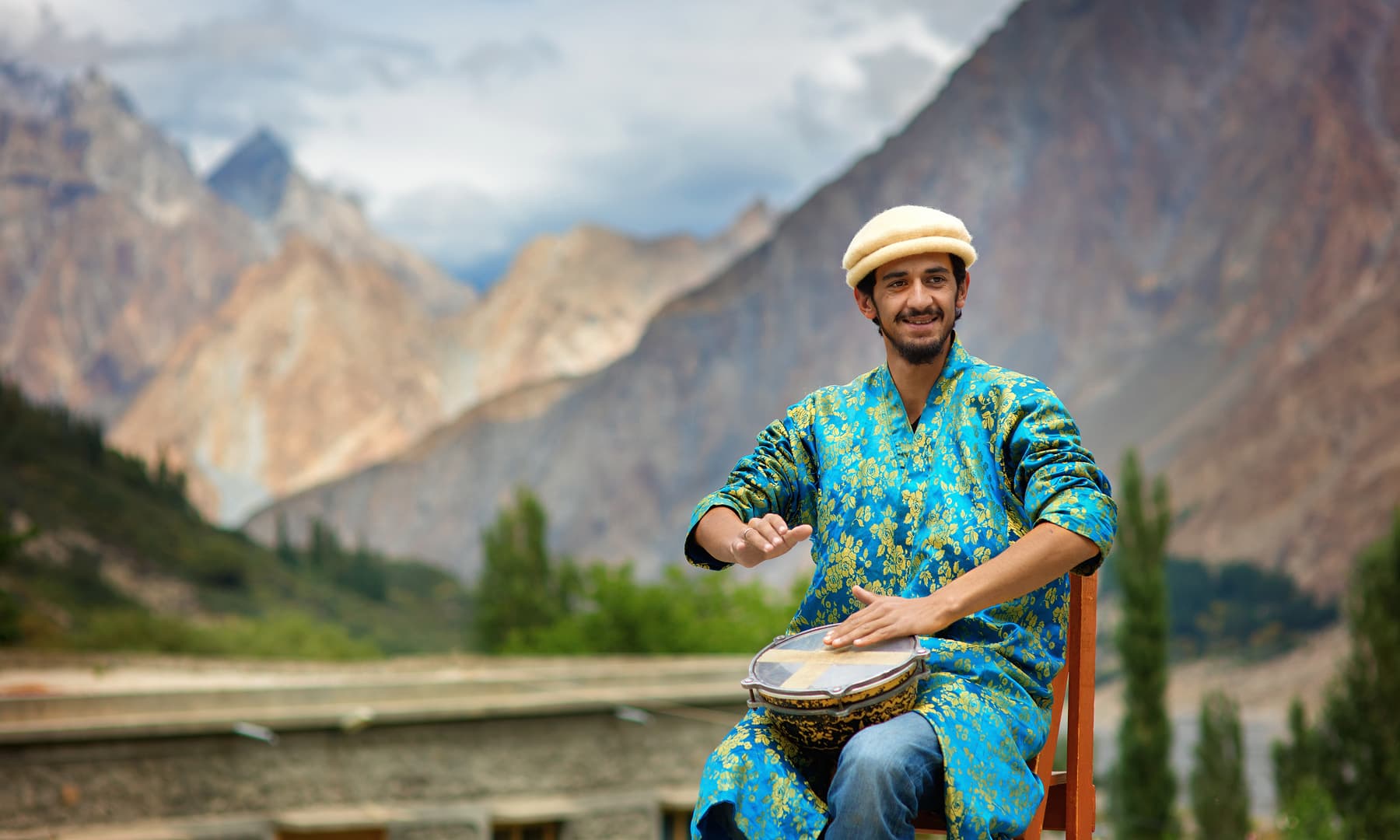
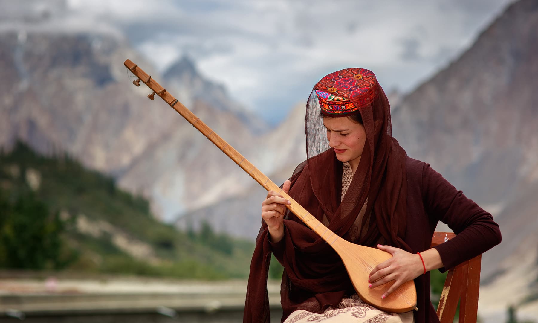
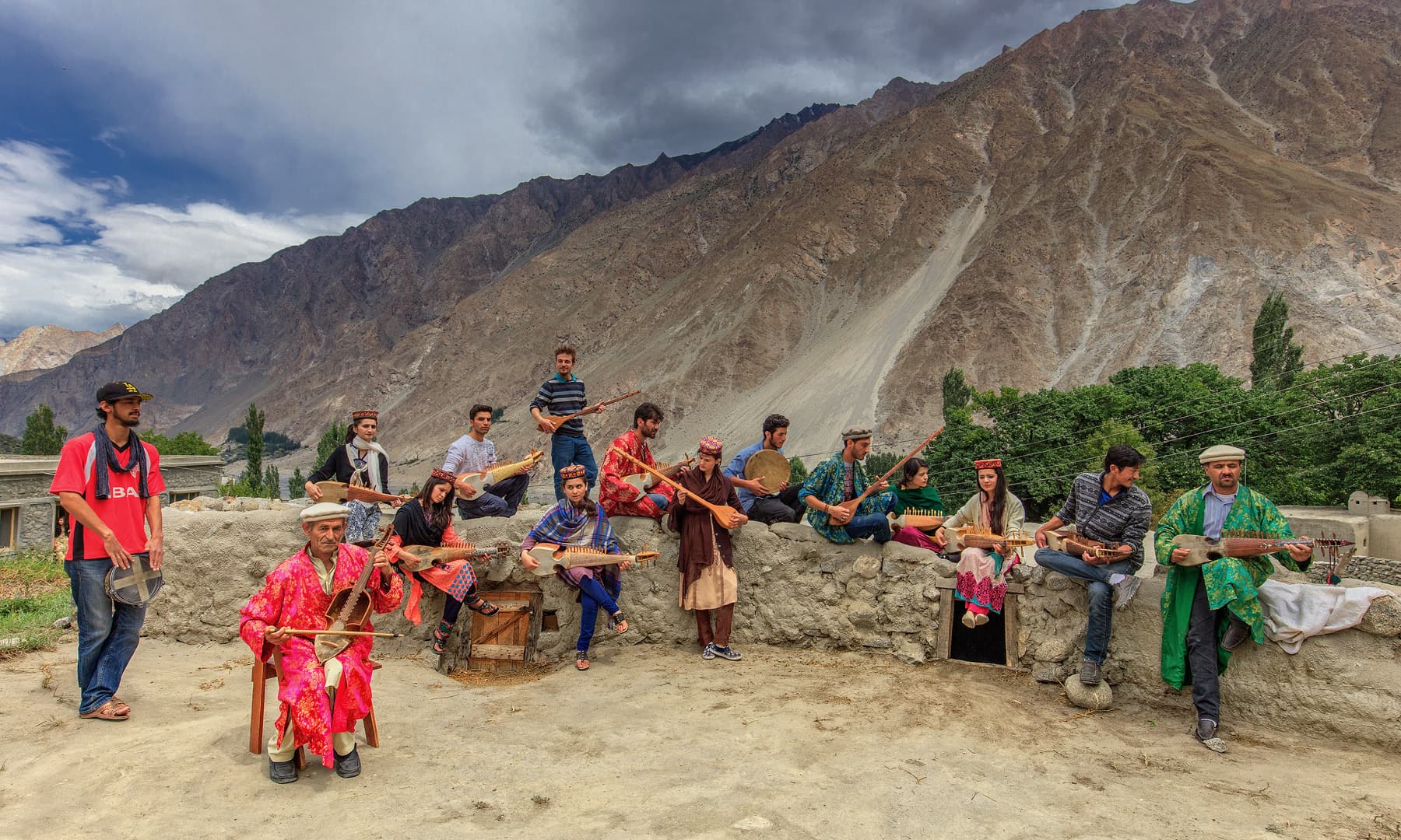
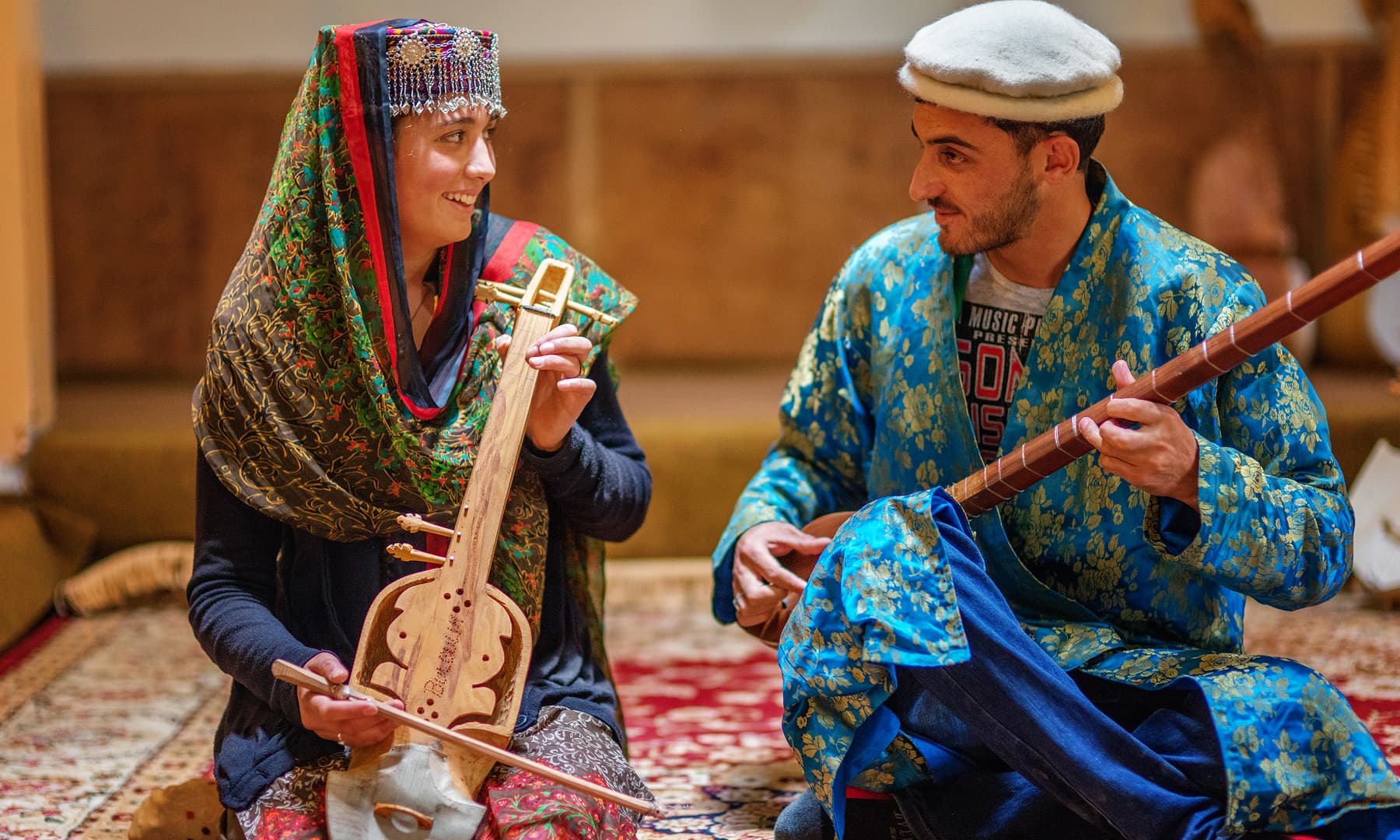
Bulbulik Music School, Gojal Valley, Gilgit
The Bulbulik Music School in Gojal Valley, Gilgit is making efforts to revive musical traditions that are on the verge of extinction. Run by Gulmit Educational and Social Welfare Society, Bubulik is named after nightingales which are frequently mentioned in Persian and Urdu poetry. The school takes its name from Wakhi folk culture known as Bulbulik. Shepherds of lowland areas sing while they travel to the highlands to send messages back home. Taken from the Dawn

Bulbulik Music School, Gojal Valley, Gilgit
Impeccably dressed in crisp white garb, black waistcoats and neatly-polished black shoes, the students of the indigenous music school Bulbulik in Gojal Valley, Gilgit is making efforts to revive musical traditions that are on the verge of extinction.
There may be little support but that has not discouraged the institution from doing what it loves: playing freestyle/Pamiri music with conventional instruments like Ghazxek, Surnaye, Tutek, Gabi and Sitar. The musicians feel happy when onlookers cheer for them; when they play their soothing lullabies, the native Parmiri find a voice.
“Bulbulik is the first folk music school in the area and have even given opportunities to female students to come and learn alongside their male counterparts,” said Didar Ali, the culture development officer of Bubulik. “In the past, music was neither widely accepted nor were women allowed to play musical instruments.” He added that so far, some 35 female artists have been trained in various folk instruments.
Run by Gulmit Educational and Social Welfare Society, Bubulik is named after nightingales which are frequently mentioned in Persian and Urdu poetry. The school takes its name from Wakhi folk culture known as Bulbulik. Shepherds of lowland areas sing while they travel to the highlands to send messages back home. Its roots can be traced back to 1985, when a small school was set up by Muzafaruddin Shah to create awareness about protecting one’s own melodies. The present initiative, however, is hardly a year old.
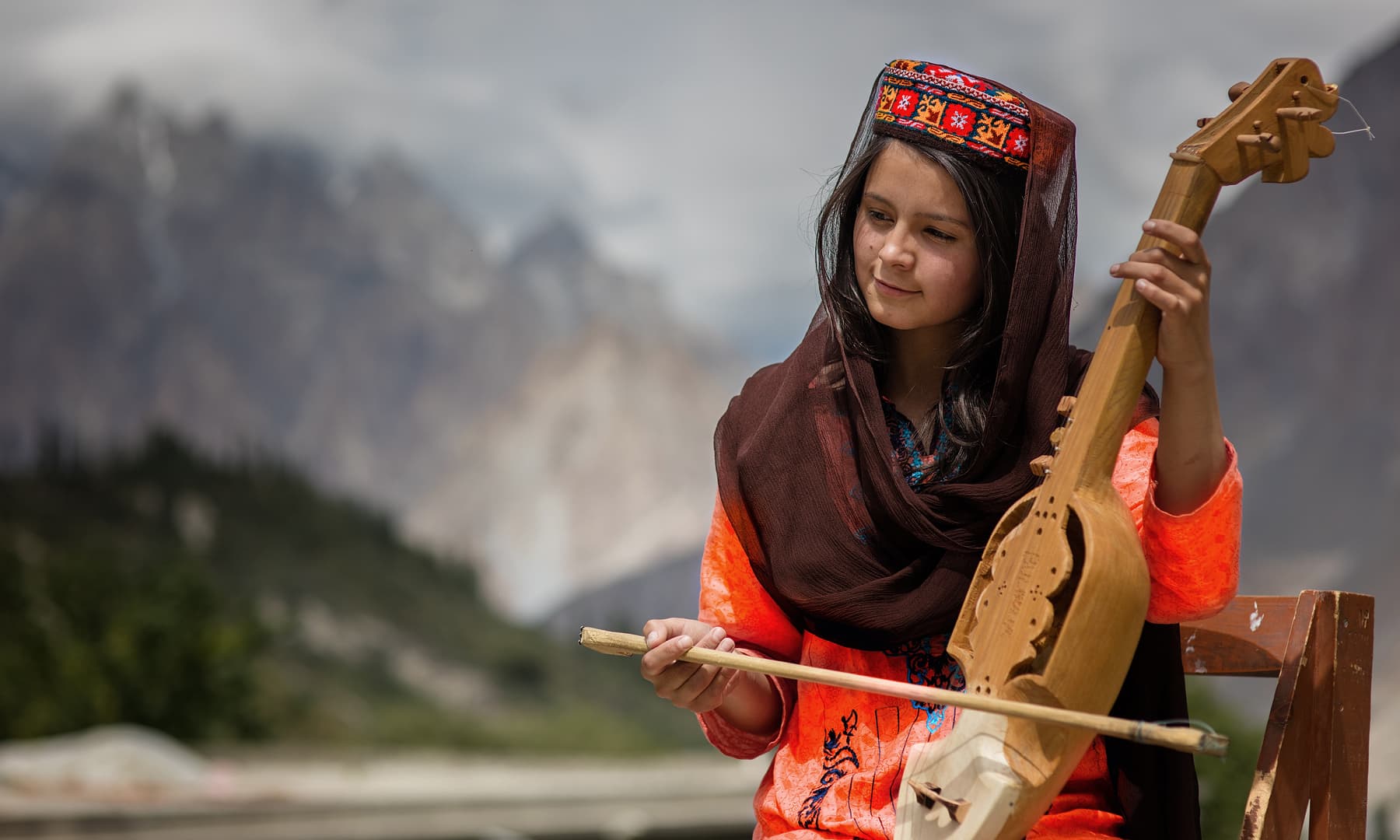
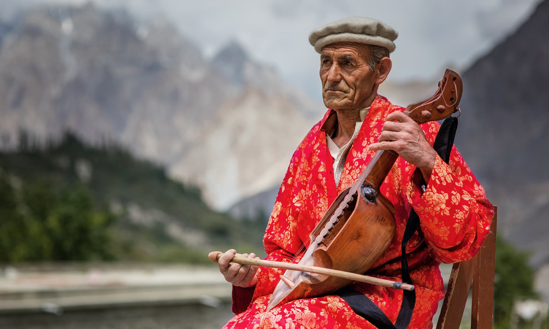
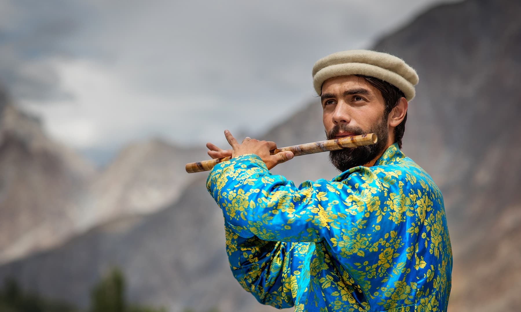
Article and Photos from :
https://tribune.com.pk/…/music-school-chitral-keeping-indi…/
The Hari Parbat Fort, Srinagar, Kashmir
The Hari Parbat is the only surviving Fort in the Kashmir region of the state of Jammu and Kashmir. It stands over a hill also known as the Koh-I-Maraan and originally was the site of a Fort built by Emperor Akbar. He had also built a large fortification Wall at the base of the Hill parts of which survive till today.
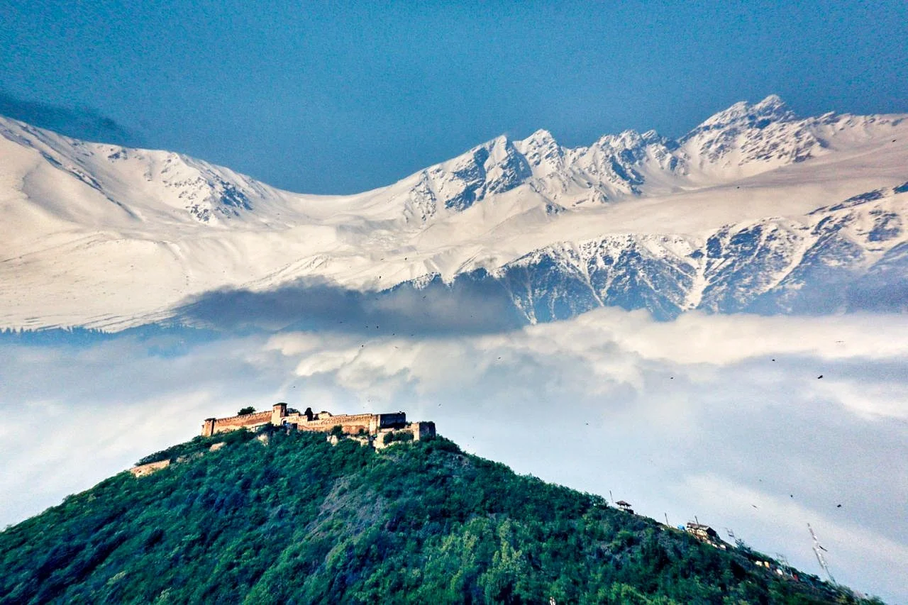
The Hari Parbat Fort
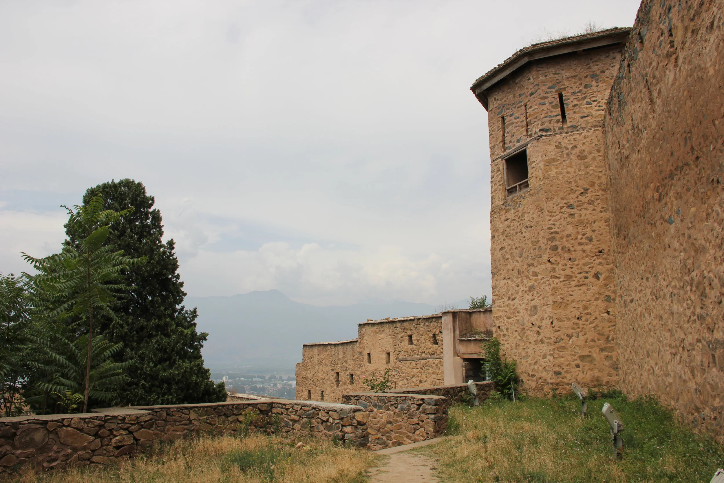
Standing next to the massive Fort walls
The Hari Parbat is the only surviving Fort in the Kashmir region of the state of Jammu and Kashmir. It stands over a hill also known as the Koh-I-Maraan and originally was the site of a Fort built by Emperor Akbar. He had also built a large fortification Wall at the base of the Hill parts of which survive till today.
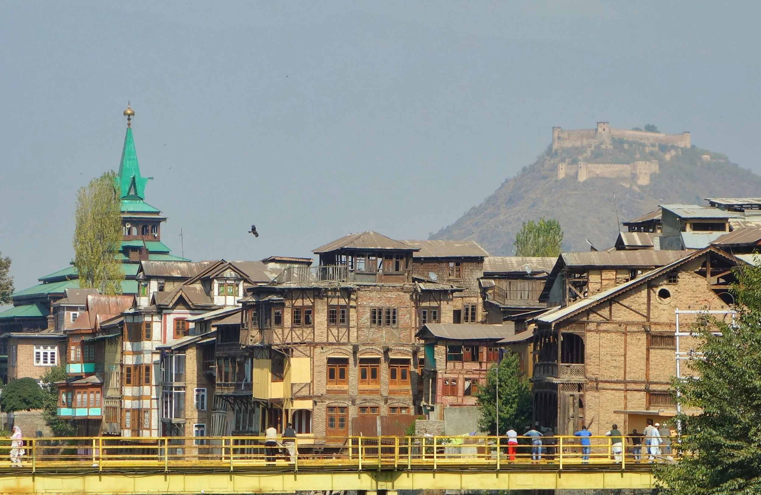
The Hari Parbat Fort as it looms above the Old City of Srinagar
The present structure was built by the Afghans when Kashmir was a part of the Afghan Durrani Empire under Shah Shuja Durrani. Ironically Shah Shuja Durrani was himself held prisoner in the Fort by the Governor of Kashmir, Atta Muhammed Khan. Atta Muhammed Khan had declared himself pretty much independent after his father was murdered in Kabul by supporters of a certain claimant to the Throne. As it so happened in 1808, the Afghan King Shah Shuja was ousted by the same individual, Muhammed Shah and his minister Fateh Khan. Atta Muhammed Khan invited Shah Shuja to come to Kashmir from where he could still go on ruling as the King of Afghanistan. Shah Shuja took the offer and landed up in Srinagar only to find himself Atta Muhammed Khan's prisoner at the Hari Parbat Fort.
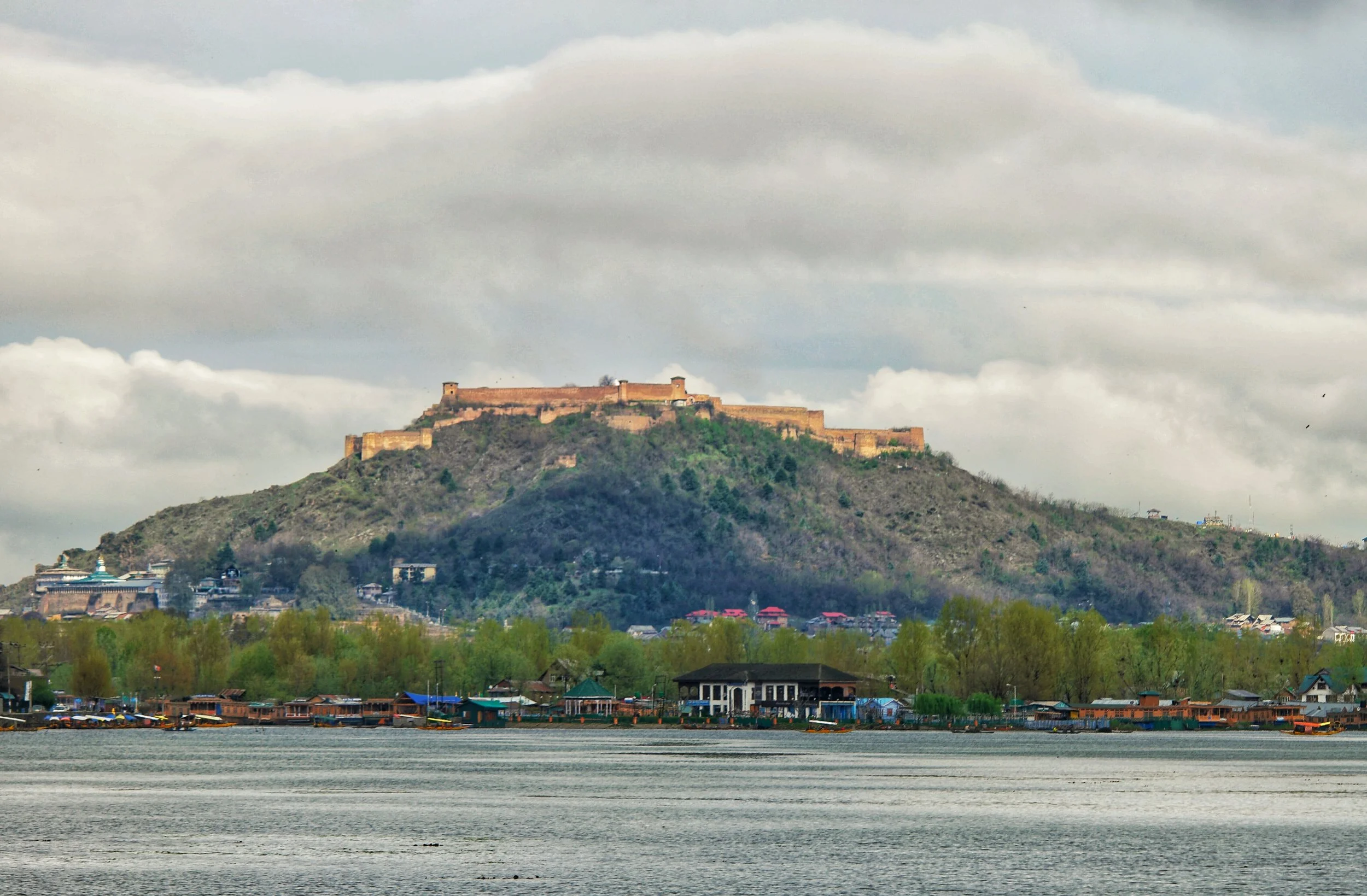
The Fort from the Dal Lake side.
However a force of Durrani Afghans in alliance with the Sikhs of Maharaja Ranjit Singh landed in Kashmir soon after and the Sikhs got Shah Shuja Durrani free from his prison inside the Hari Parbat Fort. As per Sikh history sources the ultimate prize promised to Maharaja Ranjit Singh for getting Shah Shuja Durrani freed from the Hari Parbat Fort was the Koh-I-Noor Diamond. Having done his part of the deal and having delivered Shah Shuja Durrani safely to his wife in Lahore the Maharaja of Punjab soon got the possession of the fabled diamond. Maharaja Ranjit Singh who being a Cavalry man had great love for Horses and had the Kohinoor mounted as a head piece on his favorite Horse which he used to ride.

Inside the Fort
The Sikh flag of Maharaja Ranjit Singh finally flew over the Hari Parbat Fort when the Sikhs under the able leadership of General Hari Singh Nalwa finally defeated the Afghans in 1820. After a brief period of Sikh rule Kashmir and the Fort changed hands and landed in the hands of the Dogras led by Raja Gulab Singh after the Sikh loss in the First Anglo Sikh War of 1846. The Dogra Rule lasted for just a fraction over 100 years and in 1947 it became a part of India and since then the Fort has been occupied by the Security Forces.

The Fort from Pari Mahal
The Fort still stands as proud as ever on ite vantage point overlooking the Srinagar city. The Fort Hillside holds some important places of worship for varied religious inclinations. There is the Shrine of Makhdoom Sahib, a saint held in great reverence by the Kashmiri Muslims. There is the Sharika Devi Mandir who is worshipped as an incarnation of Shakti. On the day celebrated as Sharika's birthday, devotees make a sacrificial offering of taher-charvan to the goddess (taher - rice boiled with turmeric powder and mixed with oil and salt; charvan – cooked goat liver). Then there is the Chatti Padshahi Gurudwara where the Sixth Guru, Guru Hargobind had supposedly preached and stayed for a few days during a visit to Kashmir. This Gurudwara is considered the holiest Sikh shrine in Kashmir.

The Hazratbal Shrine with the Hari Parbat Fort in the Background.
For me the Hari Parbat stands as a sentinel which silently watches over the myriads of events which have happened in this thence troubled land. And it keeps watching. With the mighty Pir Panjals in the background.
It looks beautiful when its lit up in the evening but this capture by Ramesh Tahlan Sir captures the essence of this mighty Fort, the only Fort in the Valley of Kashmir which still stands strong having withstood the vagaries of time.
Humans of Himalayas : The Khampa
The Khampa as the people of Kham are called were the most warlike of all the Tibetan people. The Khampa Horsemen were greatly feared and their horses were in great demand. Infact some Khampas kept on fighting the Chinese well into the 70s. They were called the Buddha's warriors. They were aremed by the CIA and gave resistance to the Chinese in Tibet through their bases based in the Mustang region in Nepal.

Humans of the Himalayas : The Khampa
Tibet was traditionally divided into three regions. The U Tsang region in the West, the Kham region in the South West and Amdo region in the North West.
The traditional Kham region consisted of parts of the present day TAR, Sichuan, Gansu and Yunnan. This whole region is a mountainous one and main mountain Range here is the Hengduan Mountains. It used to be one upon a time called the Chinese Himalayas and is considered the Eastern most Range of the Great Himalayan Mountain System.
The region is quite rugged and has craggy mountains and many of the great Rivers of South East Asia come through this Region. The Yangtze, the Irrawady, the Salween and the mighty Mekong also cut through enormous Gorges in this Region.
The Khampa as the people of Kham are called were the most warlike of all the Tibetan people. The Khampa Horsemen were greatly feared and their horses were in great demand. Infact some Khampas kept on fighting the Chinese well into the 70s. They were called the Buddha's warriors. They were aremed by the CIA and gave resistance to the Chinese in Tibet through their bases based in the Mustang region in Nepal.
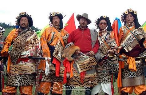
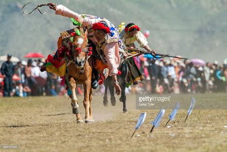
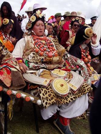
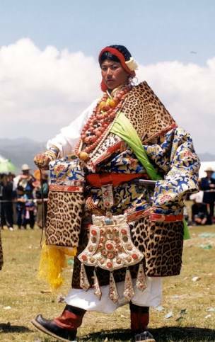
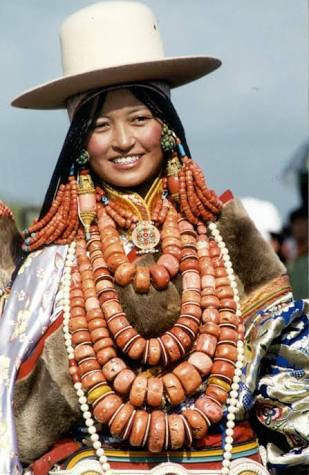
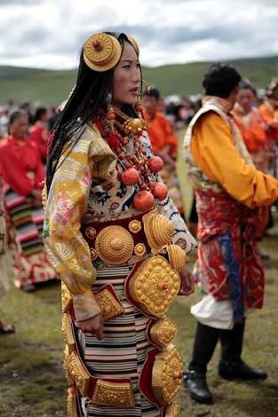
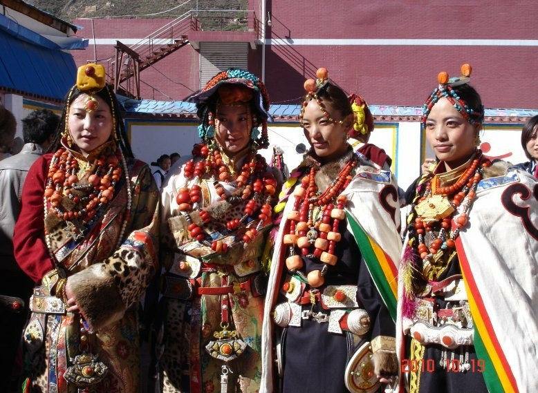
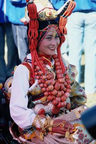
Every August they hold a festival on the Eastern edge of the Tibetan Plateau where the famed Khampa Horsemen converge at a place called Litang at 14000 ft above sea level in Sichuan. The Khampa both the men and ladies are all adorned in all their finery. Gold, silver, turquoise and coral jewelry in all its opulence.
As one Khampa gentleman said "To the Khampa men, riding horses is a glorious thing. We feel proud to be the descendants of the heroic King Gesar. To gallop on horseback across the boundless grasslands makes us feel extremely confident and happy".
King Gesar is a tradionally revered figure in Tibetan Buddhism and is held in great respect in area ranging from Baltistan, Ladakh, Tibet, Mongolia and even by the Oryuts of Siberia. That's another story to be told another day. Even Roerich made many references to King Gesar in quest for Shambhala.
I had visited the Region last January though I could only go to the most southernly part of Kham in North West Yunnan. It in a mind blowingly beautiful Region as it sits on the edge of the Tibetan Plateau. I have posted pics from there earlier and will post again.
And now coming back to these magnificently adorned ladies. They have a saying that the Khampa men are born brave and the Khampa ladies are born pretty. And also a legend that they never fall ill. :)
All said and done their jewellery is absolutely outstanding and it adds to the natural beauty of these people.
Another one of the people of our great Himalayas.
Pics are from the Internet. Only for educational purposes. If you hold a copy right to any of these pics and want it removed please let us know and I will remove it immediately. Thanks
The Horsemen of the Pir Panjals
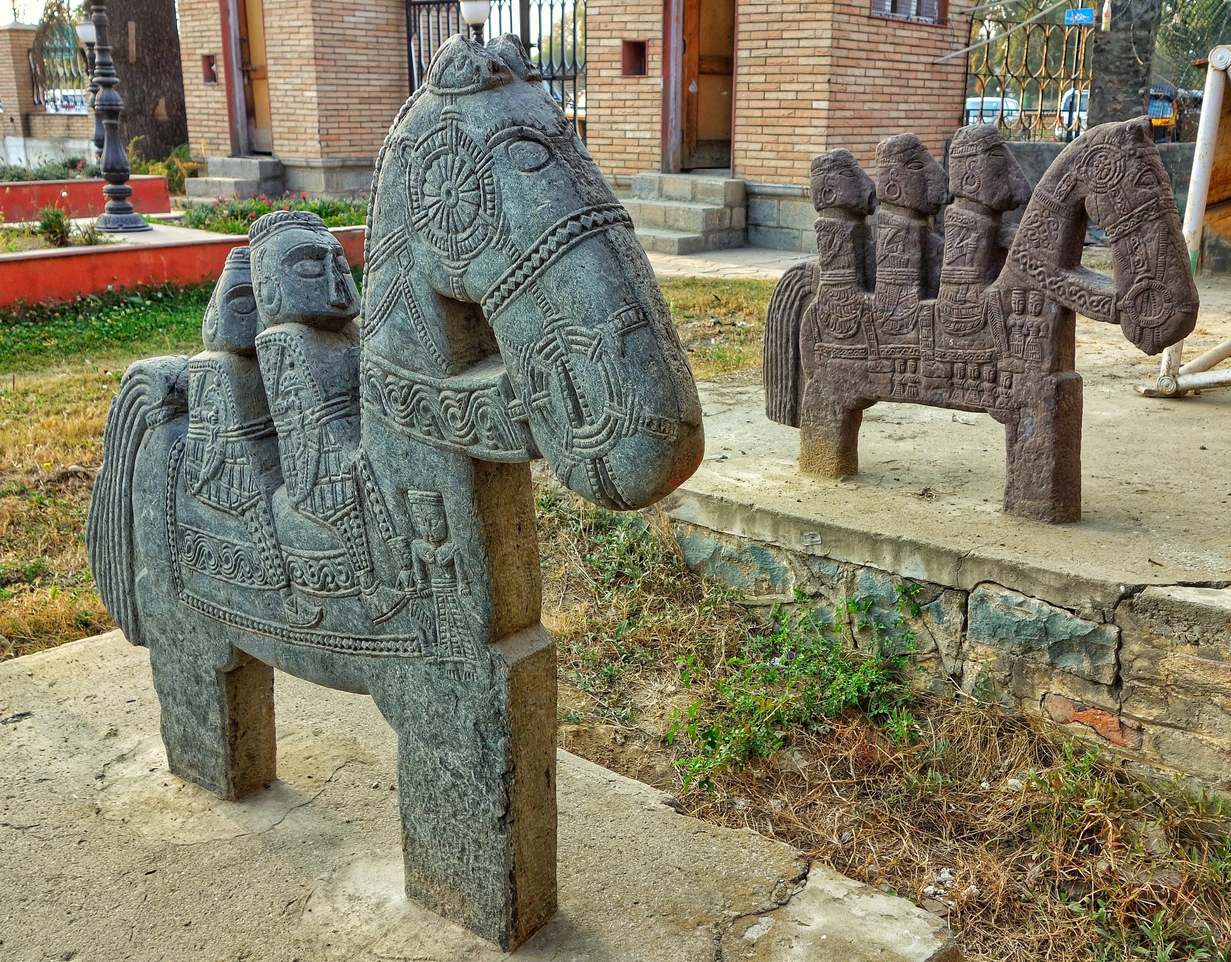
The mysterious Warrior Horsemen of the Pir Panjals. These group of Horsemen sculptures exist at a number of places in the Pir Panjals and till today no one has been able to explain why these were built or who built them or even when they were built. A true Himalayan heritage.

Horsemen of the Pir Panjals

The Horsemen and the man-made points around the natural springs
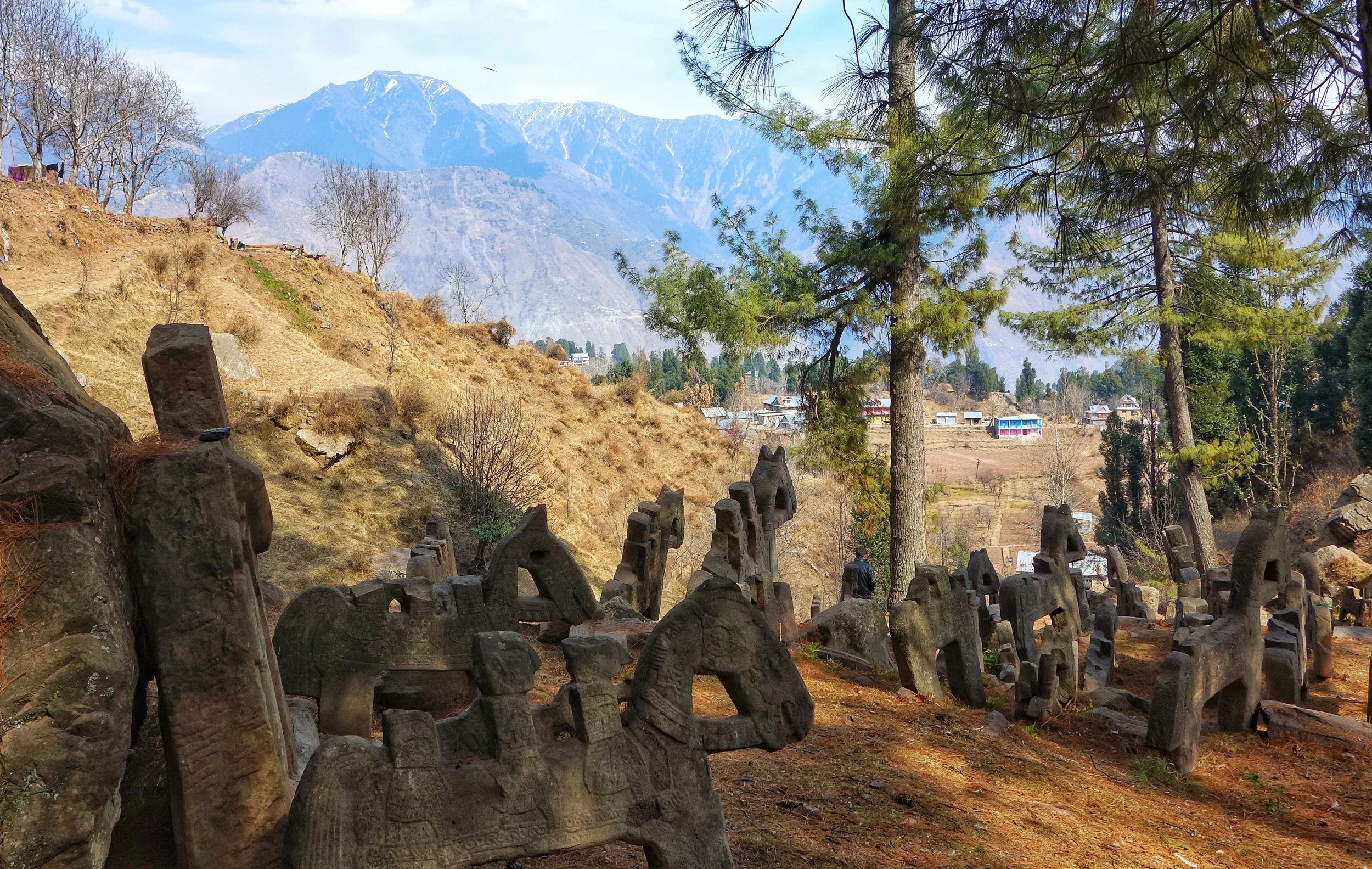
The Horsemen of the Pir Panjal are a group of rock sculptures and reliefs found at similar locations at the foot of the “Galis” or on the main Gali itself. The sculptures are mostly of Horsemen along with some other reliefs of what seem to be local Gods and Devtas. And they usually have a natural water spring nearby and an accompanying pond. Few of the people who have studied these amazing sculptures agree that these were strategic locations on ancient Routes that connected different villages in the Pir Panjals. These probably served as resting areas after a particular Gali was crossed and the men as well as the horses could then refresh themselves. And they probably served a navigational purpose on the Routes that they are found on.
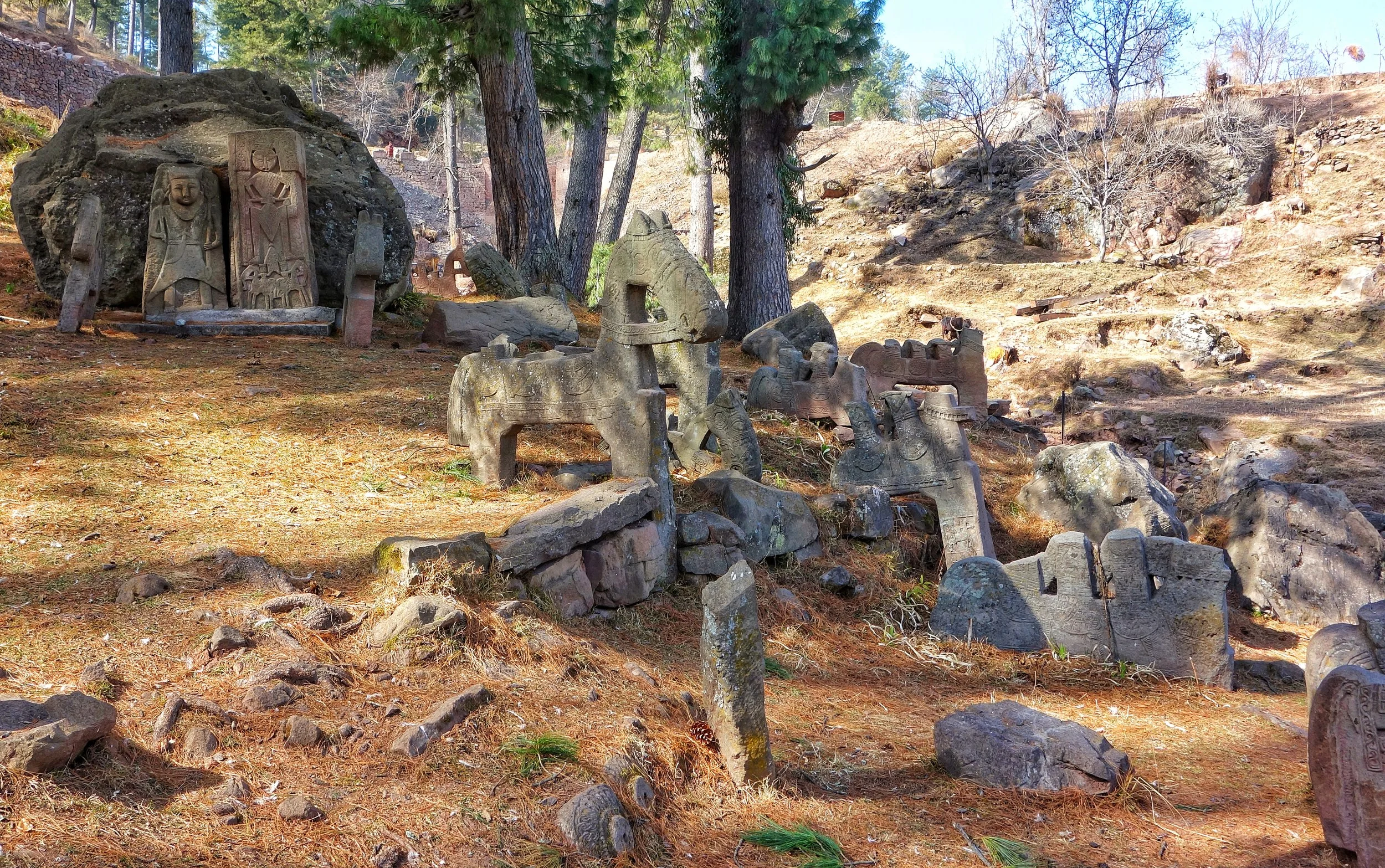
The Horsemen with reliefs of local gods in the background
In the Jammu region these are found in the Ramban area of Jammu on the Sangaldan Gool road near Gool Village and also at Gadi Nalla and Nar area of Tehsil Gool and Sildhar area of district Reasi near Mahore. This area is also referred to as the Gool Gulabgarh area. This area lies at the point where the Jammu Region gives way to the Kashmir region and as a consequence has a mixed population of Dogri, Gujri and Kashmiri speaking people. Out of these locations only the first one is accessible by a Road while the others require to hike up in the mountains to these long forgotten sculptures. The one near the Gool Village is called the “Ghora Gali” which is an obvious reference to these Horse sculptures. There are said to many other such locations which dot the mountain landscape but no one is really sure of how many locations.
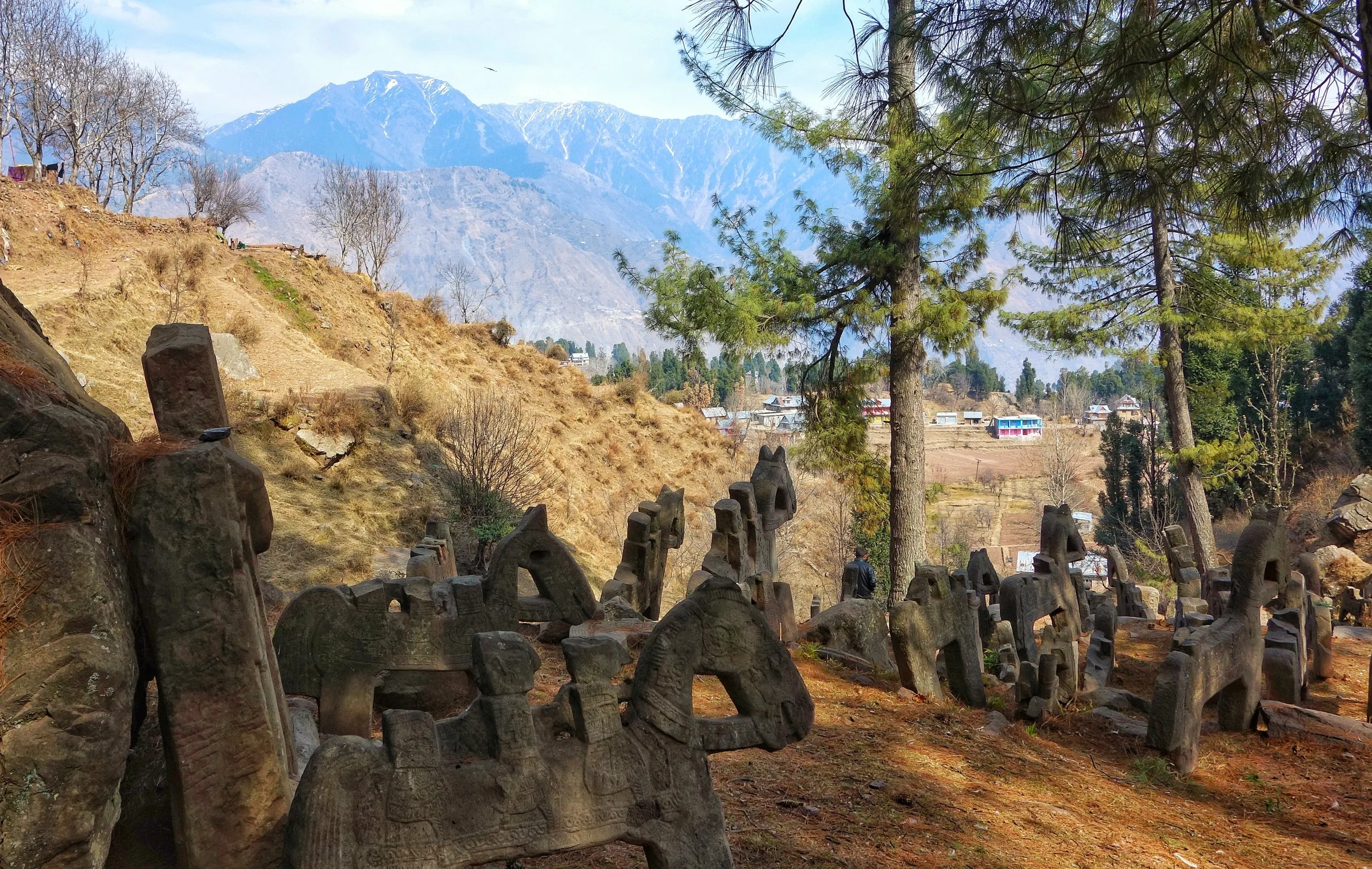
At the top of Ghora Gali, overlooking the scenic Gool area
The sculptures themselves show a great detail especially for the Horsemen.And these Horsemen came in different sizes even at the same site. There are sculptures in different sizes with one or two or even three people astride the horse. Interestingly all the Horsemen appear to be armed and carry different kinds of weapons as were prevalent in the day and age these were erected. They appear to be some kind of warriors of an Army on a campaign and these structures are representations of that. Also there are a a few reliefs showing local deities and geometrical figures but overall its the Horsemen who overwhelmingly dominate these sites.
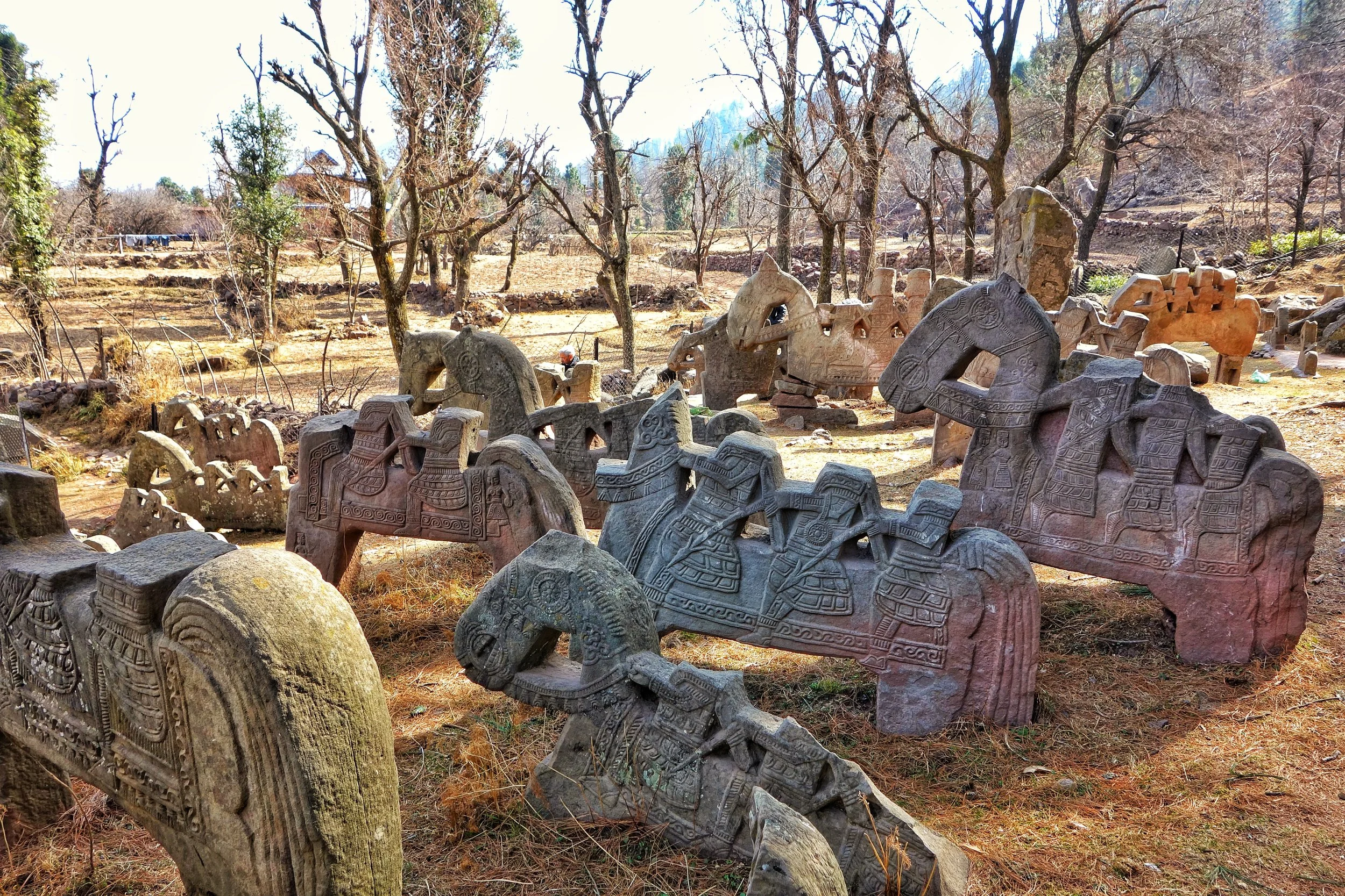
The Horsemen are in different sizes and configurations
As per the local folklore these Horsemen were sculpted by the Pandavas themselves during the time of their exile as they were purported to have spent some time in this area. That’s as far as the legend goes. These were sculpted by the local people themselves as per some sources. They seem to be more Bactrian inspired than Indic which is reflected in how the Horsemen are dressed and the styling of the arms they carry. Even the figures of the deities etched on the stone slabs have little resemblance to the contemporary deities. And the geometric figures just add another element of mystery. And then the whole mystery of when these great sculptures were created. The people who created these Sculptures reflect a very developed art of sculpting looking at the fine details that are shown in the Horsemen. Who exactly were these local people and under what influence were these created and why so many Horsemen ?
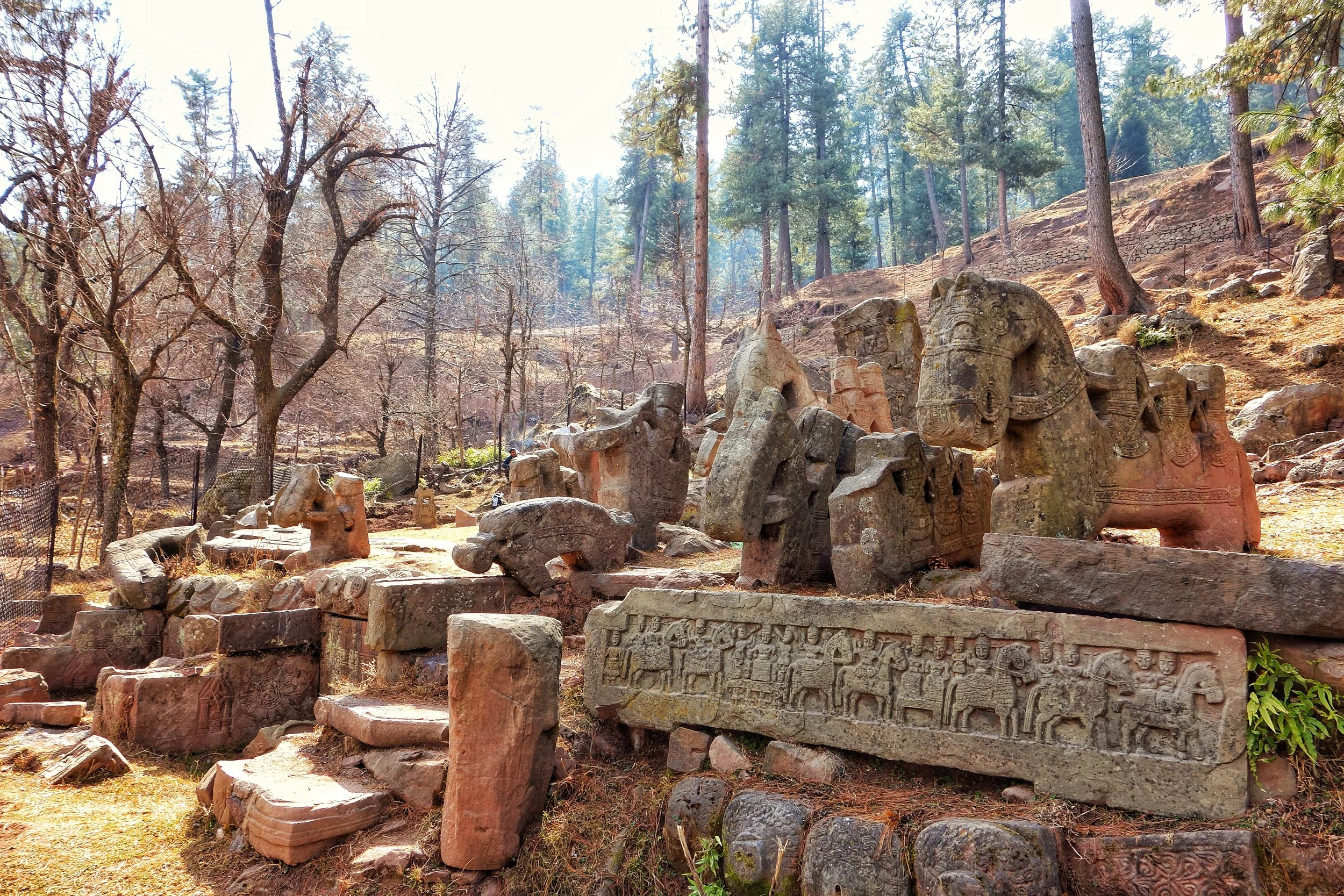
The reliefs of Horsemen can also be seen on the base
As per Indic traditions of that time it was usually a small Temple or sculpture of the contemporary Hindu Gods at that time that adorned such Mountain passes and along the tracks along the mountains. But the fact that these sites contain mostly these finely sculpted Horsemen should hold some significance. And no such Horsemen sculptures exist anywhere else in the Indian subcontinent except this region. Maybe it points to these being created by an Army of Horsemen from outside, from one of those cultures which held the Horsemen in great reverence, again a reference to a link to Central Asia. Maybe they came in settled here for a while on a campaign and then got assimilated in the local population or they just left and this is the only visible clue that they left behind.
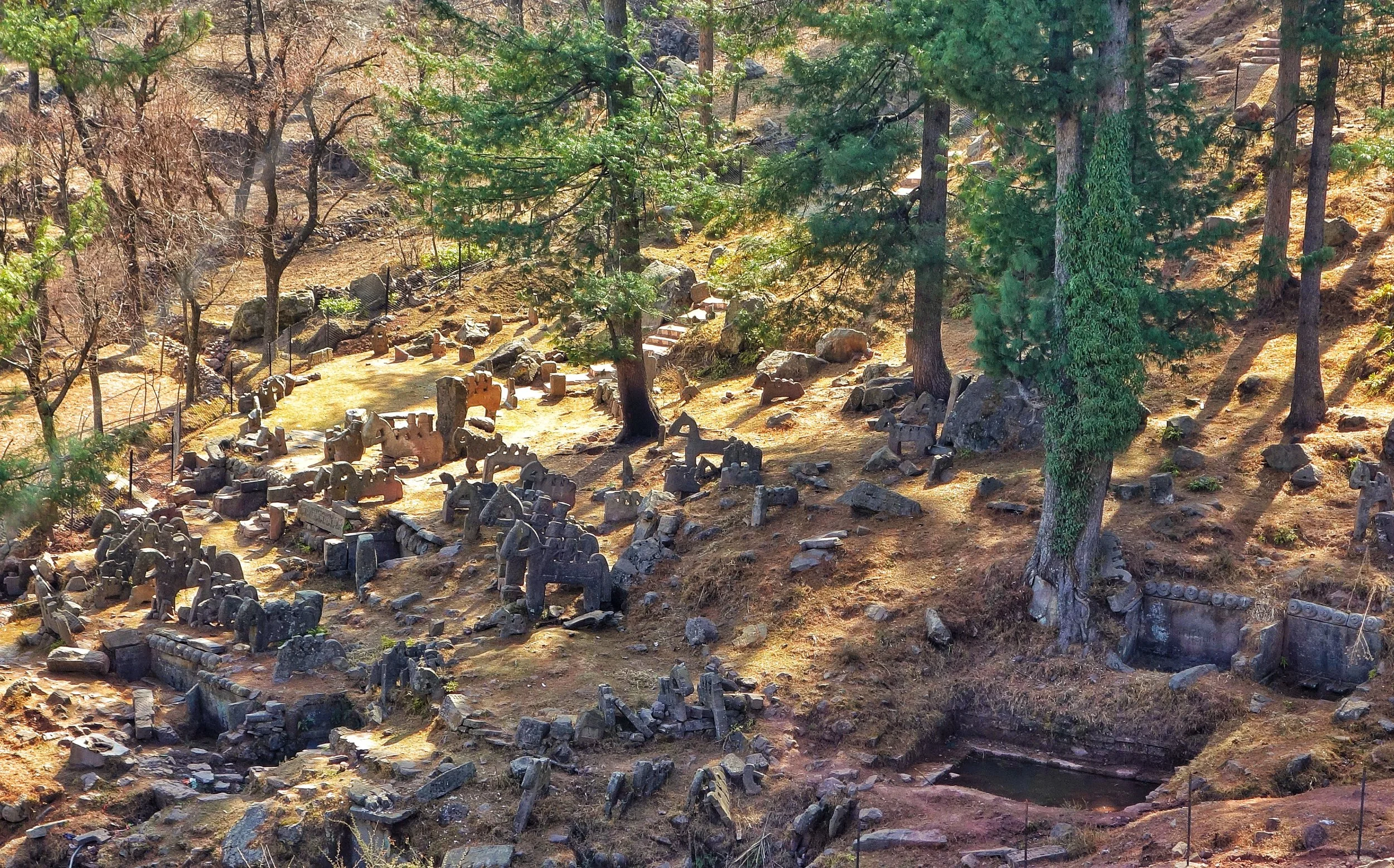
Overview of the site from the Gool Sangaldan Road
At the Ghora Gali site itself I counted well over a 200 Horsemen in various sizes and conditions. Some still standing, some broken, some lying flat on the ground and still others which appeared to be buried. Further excavation of the site will probably reveal more of these Horsemen that have been completely buried over a period of time.
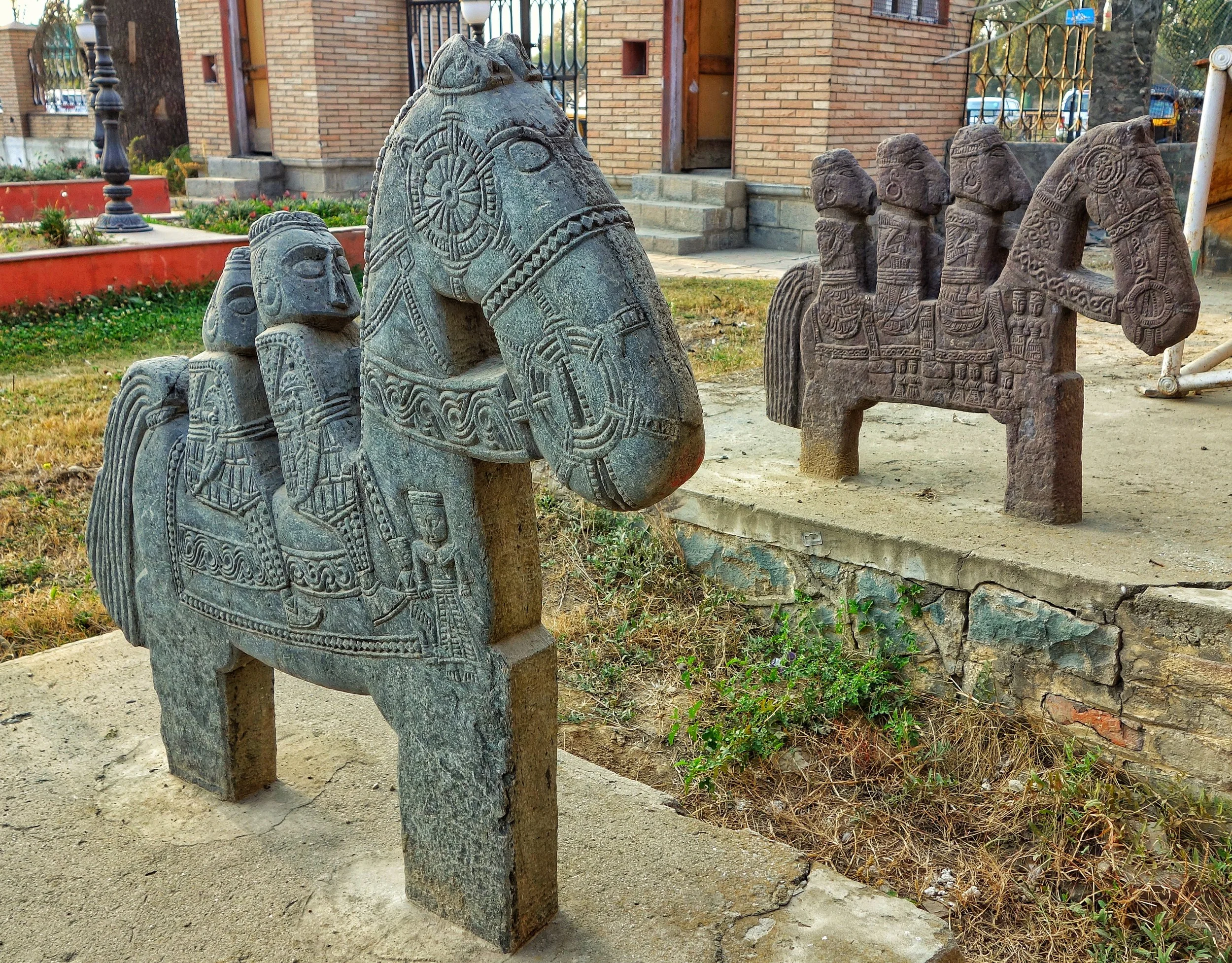
The specimen kept at the Shri Pratap Singh Museum, Srinagar
The lack of scientific research is the reason that all these questions mostly remain unanswered. On top of that these sites mostly lie neglected and many of the magnificent Horsemen sculptures have just fallen to the ground as the locations where they are at usually receive a lot of rain and snow. Astoundingly on the Ghora Gali site itself there was no board of the ASI and these sculptures are not even listed on the ASi site. The state Directorate of Archives, Archaeology and Museums had however listed this as a protected site in 1986. In fact three of these Horsemen were taken and put on display at the Shri Pratap Singh Museum in Srinagar. While speaking to an official at the Museum about these Horsemen even he replied that these showed remarkable Bactrian/ Greek influence but more research has to go into these as to establish the facts.
A semi frozen pond on the site fed by a natural spring
As of today even the Ghora Gali site, which lies right on the Roadhead the picture is of neglect. More and more of these Horsemen are falling over and getting destroyed. Though it seems that now there is some work being done on fencing off the site to keep the grazing livestock off the site. There is also talk of the Tourism Department promoting the site as a Tourist spot in the coming time along with other tourist destinations in the area like the Hot Springs at Tatapani. Hopefully with more people coming to visit these wonderful sculptures would get the attention that they deserve. With the attention will come further research into these Sculptures and the sites associated with them and finally we might get definitive answers on the Horsemen of the Pir Panjals.

The Boali or Ponds fed by natural spring water
Original article here : https://www.livehistoryindia.com/cover-story/2018/03/18/the-mysterious-horsemen-of-the-pir-panjal
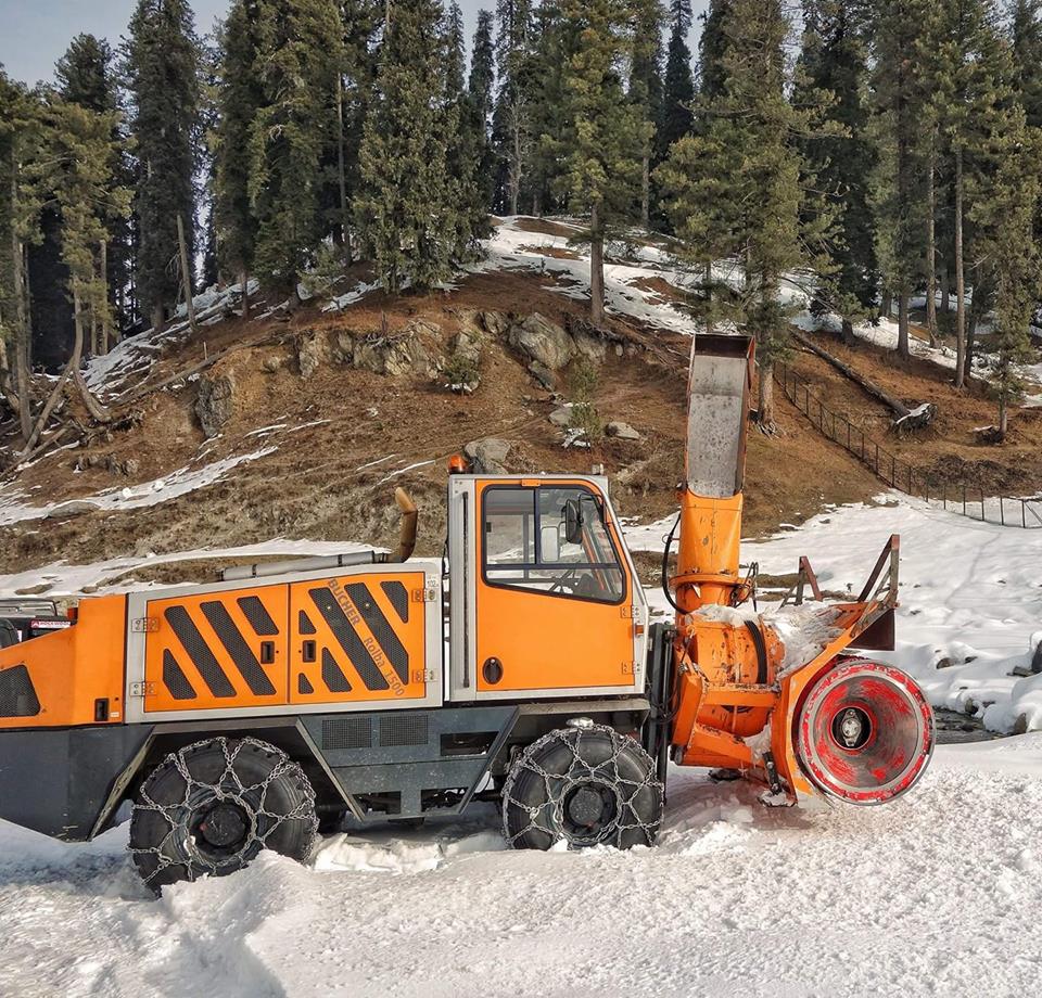
The Monster of the Snows : Rolba 1500
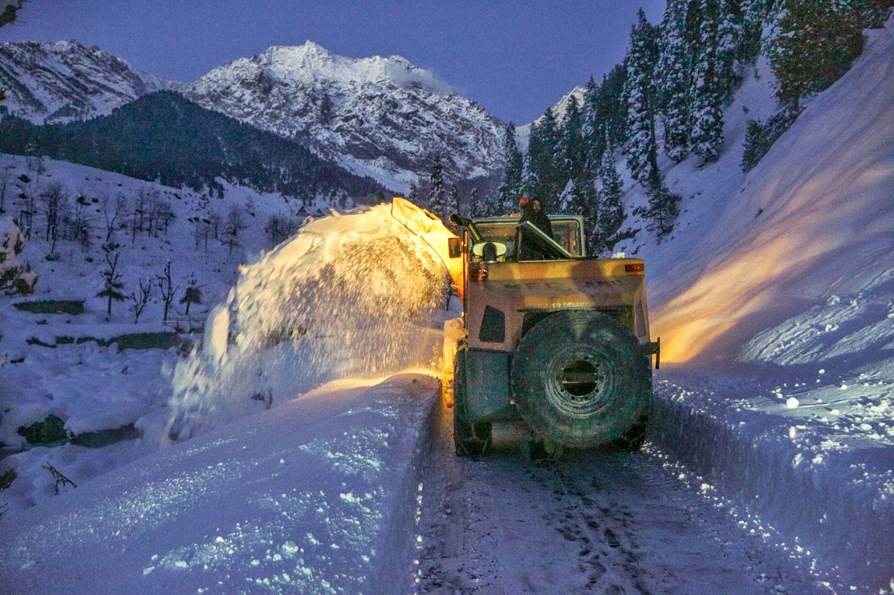
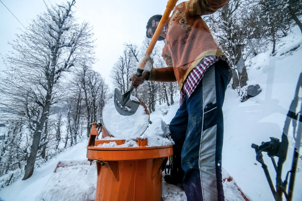
The Ultimate Snow Cutting Machine, the Rolba 500, widely used at Airports world wide to removes snows. It is also effectively used to open the Himalayan Passes like Zoji La and Rohtang. A fine pieces of Swiss Engineering.

The Monster of the Snows : Rolba 500
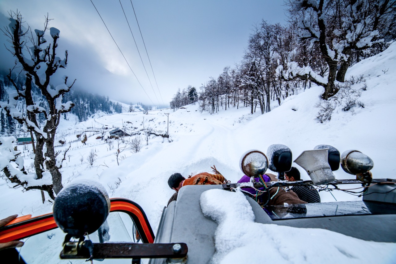
That yellow Machine on the top is a Rolba 1500 with a Massive Snow Blowing Capacity used for clearing heavy snows.
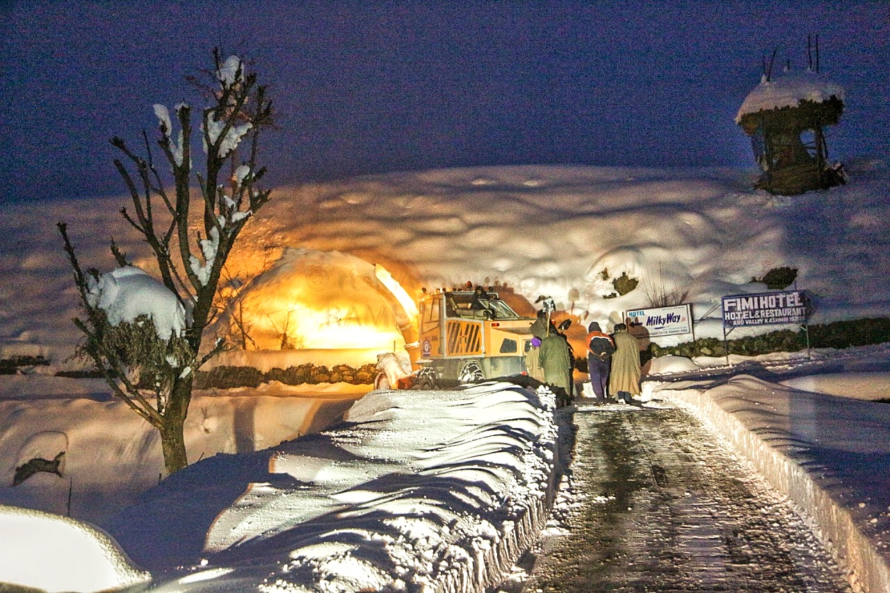
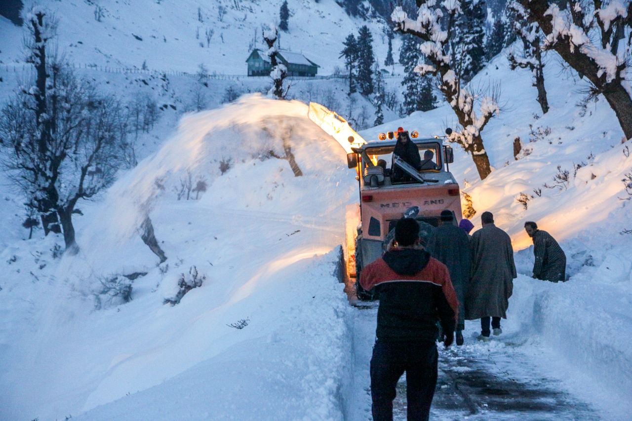
The Snow Warriors with the Monster Rolba 1500, the destroyer of the snows. Swiss engineering at its best. Snow blowers are amazing machines.
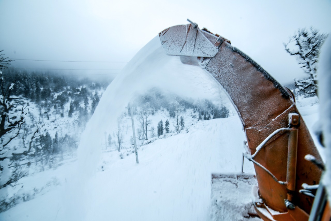
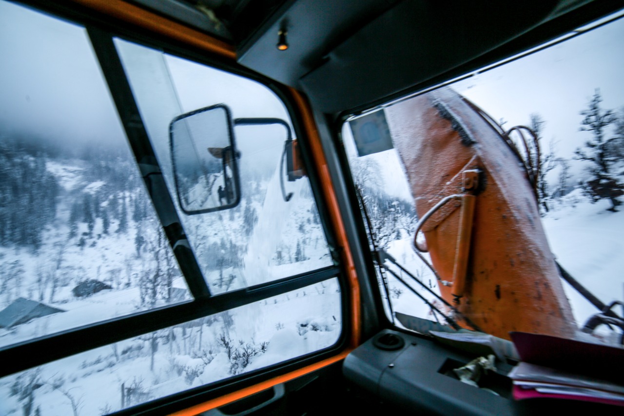
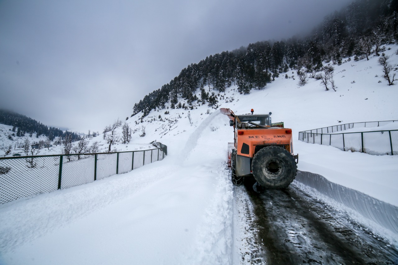
The robust Rolba 1500 is designed for snow clearance on mountain passes and airports. This machine’s optimized weight distribution allows it to drive excellently uphill on snow! It is used in India at places like Gulmarg, Rohtang and Zojila Passes.
Rolba 1500 Specs
Clearing Performance: over 3,500 t/h
Clearing Width: 250 cm / 98 in
Clearing Height in one pass: 4.9 ft
Ejection Range: over 130 ft
Turning Radius: 17.2 ft
Clearing Speed: up to 25 mph
Road Speed: up to 31 mph
Engine Output: 442 hp
Fuel Tank: 132 gal
Weight: approx. 23,000 lbs
Drive: Infinite hydrostatic traction and clearing drive.
Pic from February 2017. Aru Pahalgam Road, Kashmir
Humans of Himalayas : The Kalash
The Kalash is a name given to a Group of people who exist in three isolated Valleys of Chitral in the Khyber Pakhtunkhwa region of Pakistan. As of today Kalash people include people who follow Islam and another Group which still practices its ancient religion. As on the present day their numbers of those following the original religion are in a few thousands and they have been under threat since a long time though lately due to Government intervention they have been relatively free to go on with their lives and traditions as they have for thousands of years.

Humans of the Himalayas : The Kalash
This is the first in a series of Posts on the different People and the Cultures that exist in the vast Himalayan Karakoram Hindu Kush (HKH) System. We will be looking more closely at the relatively smaller Groups of people who have existed in the Mountains and Valleys of this system. Cultures have developed and evolved in isolation from other Groups due to the lay of the land and the Mountains and Rivers which served as the main barriers. Over the passage of time each of these Cultures have developed their own languages, social structures, religious beliefs, traditions, arts and crafts.
Today we start off with the Kalash. Please note that most pics Ill be using would be from the Internet and try and give credit. In case you by any chance see that your picture is being used and want it taken down please let me know and it will be taken down. The purpose of these articles is purely Educational/ Academic. Kindly feel free to share and use the same.
The Kalash
The Kalash is a name given to a Group of people who exist in three isolated Valleys of Chitral in the Khyber Pakhtunkhwa region of Pakistan. As of today Kalash people include people who follow Islam and another Group which still practices its ancient religion. As on the present day their numbers of those following the original religion are in a few thousands and they have been under threat since a long time though lately due to Government intervention they have been relatively free to go on with their lives and traditions as they have for thousands of years.
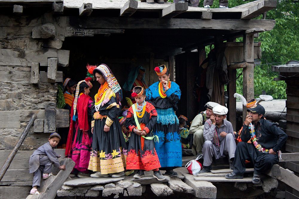
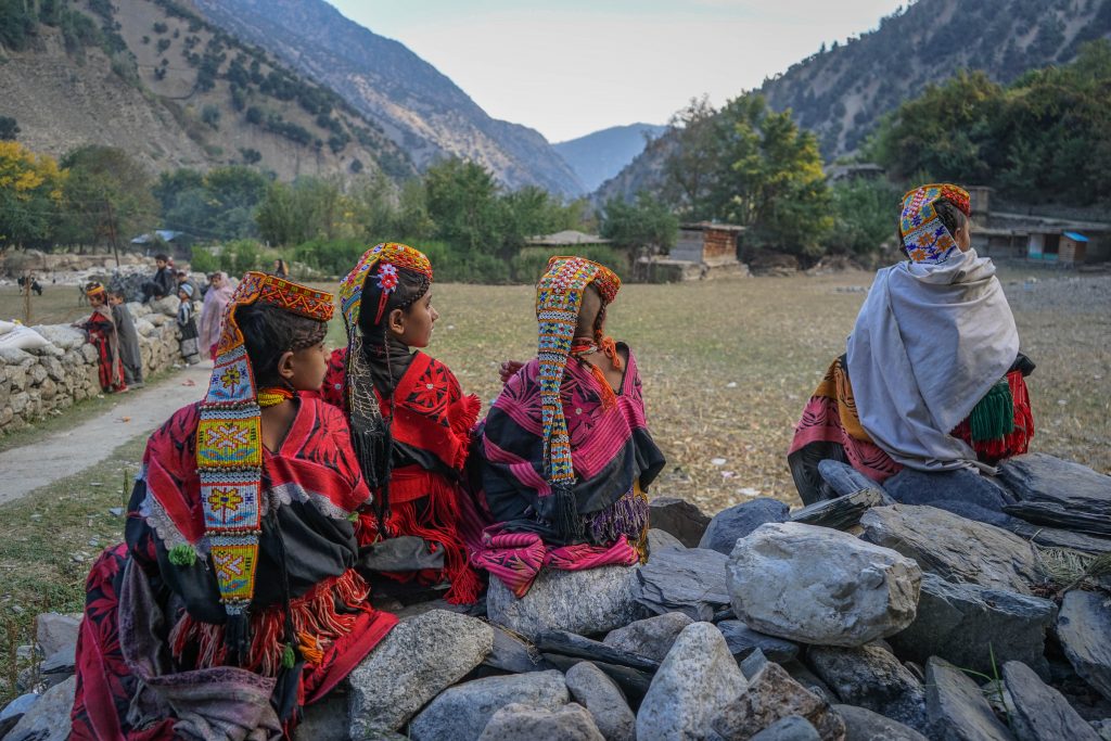
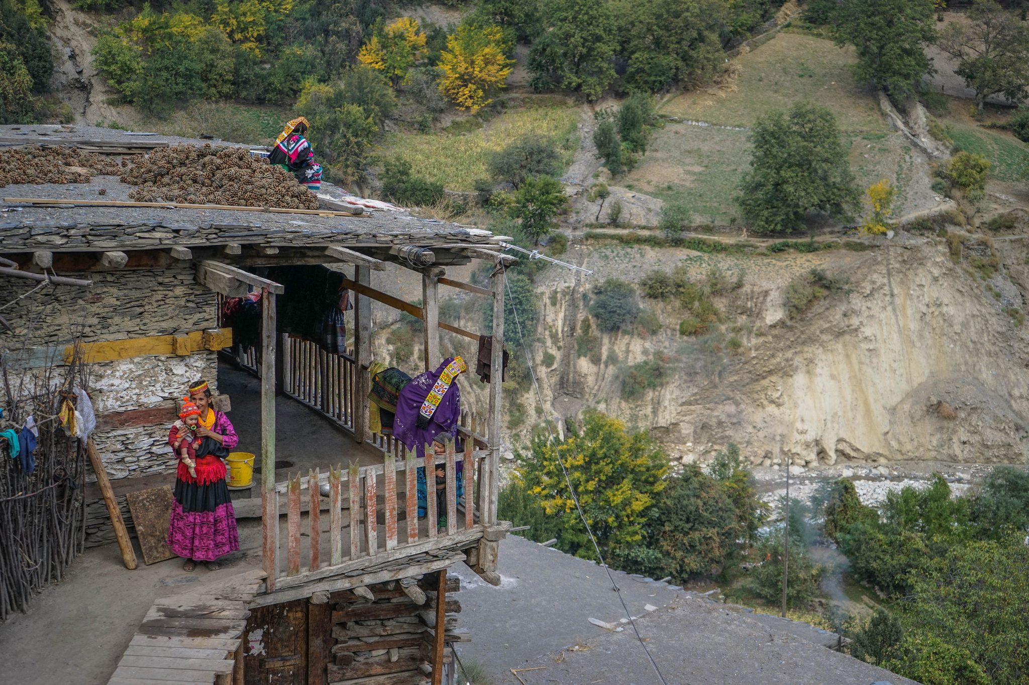
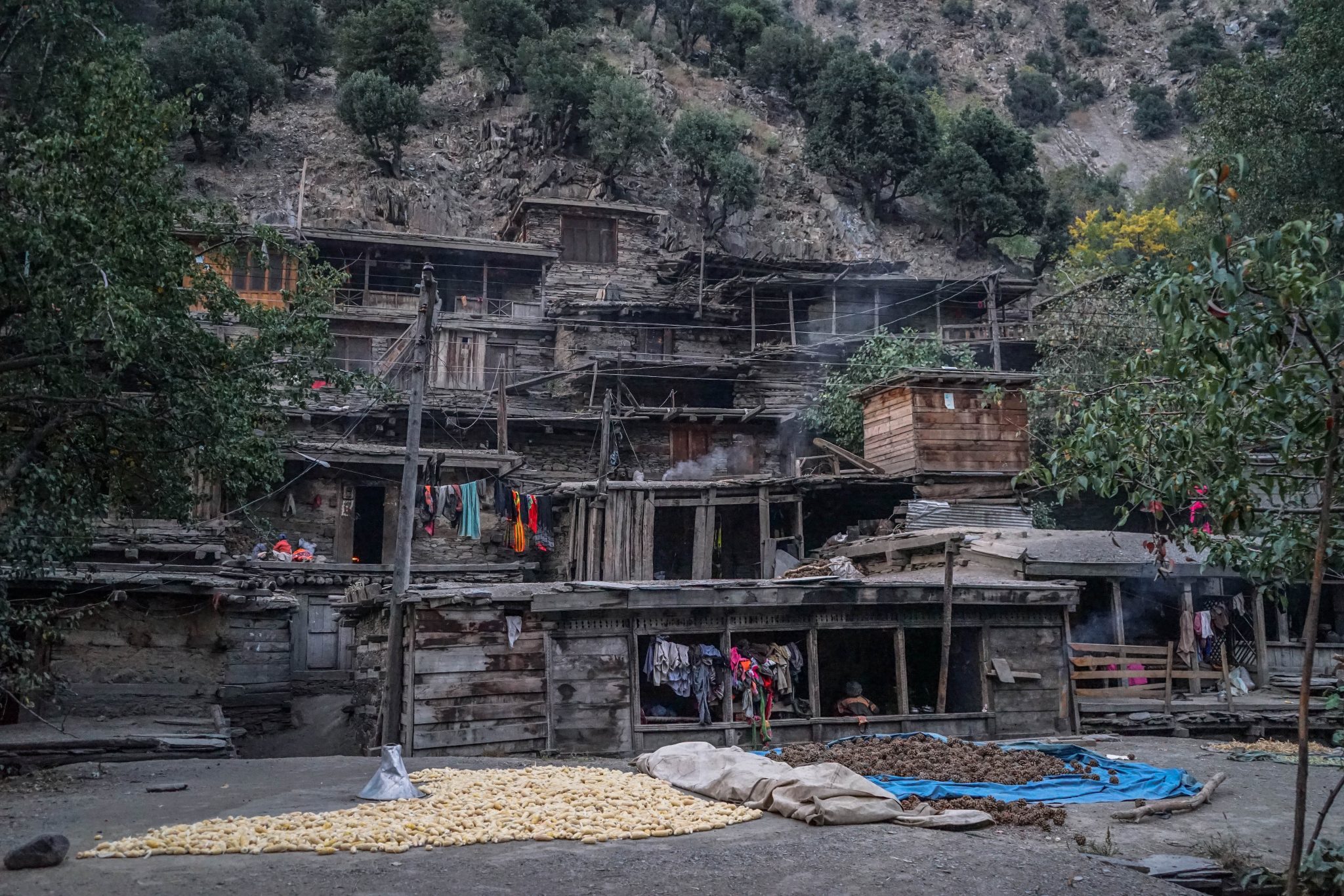
The Kalash are found in three Valleys near Chitral namely the Bumburet, Rumbur and Birir near the Kunar River. These River Valleys are extremely fertile and all kinds of mountain fruits grow here. They speak a language called the Kalash / Kalsha which belongs to the Dardic language Group of the Indo European language Group.
Due to their fair skin color and light colored eyes they have long thought to have some connection with the Europeans and the most obvious connection is made with remnants of the Army of Alexander who decided to stay back in the beautiful Valleys and mixed with the local population. There are other People/ Tribes in the Himalayas as well who claim to have a connection with the Greeks through the Army of Alexander and other claim to be direct descendants of the Greek soldiers.
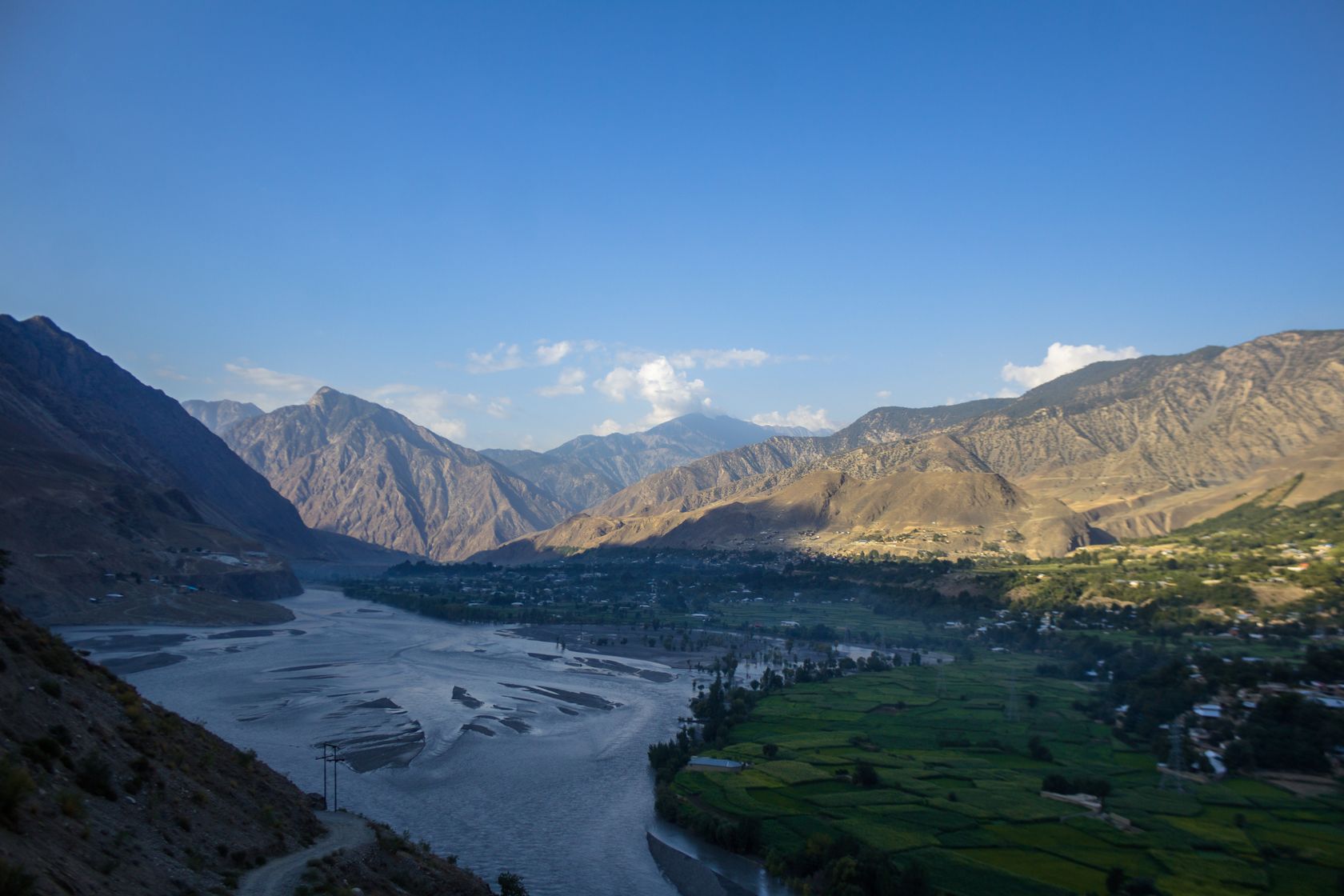
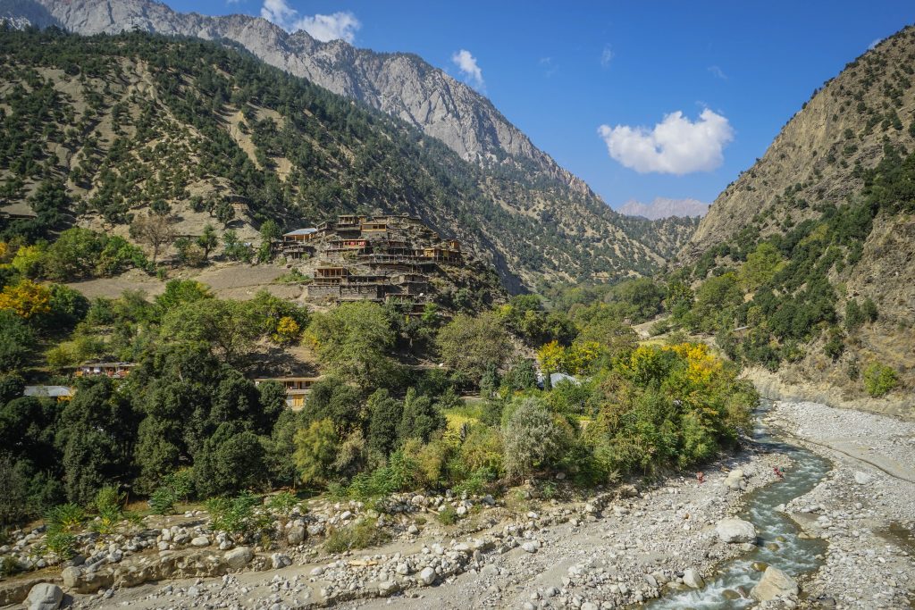

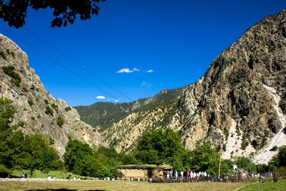
From what I have read around their origins are still disputed among the scholars. Some say there indeed are evidences which prove a connection to Greece while others are quite convinced that there was no such connection and that is proved by the Genetic analysis of the Kalash people. We will steer clear of that Discussion and keep our minds open on that issue for now.
The closest relatives of the Kalash are the Nuristanis (earlier this region was called Kafiristan as a reference to their beliefs) who were at the turn of the previous Century converted by the Afghans and they have embraced Islam and have done away with most of their religious and cultural traditions and have become more Islamised in a sense. Many of the Kalash were also hence converted. The remaining Kalash were able to stick to their way of life because of firstly the isolation of the Valleys where they exist as well as the fact that when the Durand Line was drawn they became a part of India as it was at that time. Hence the Afghans were unable to get to them to convert some of them. However over a period of time many were converted especially when the Taliban influence was strong and they were under a lot of pressure to give up their traditions especially their traditional beliefs. But thankfully that threat is now gone and things are better with Government intervention as I mentioned earlier.
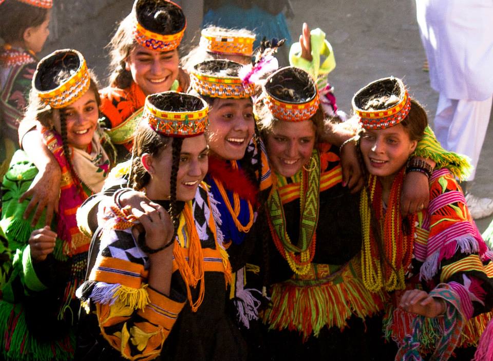


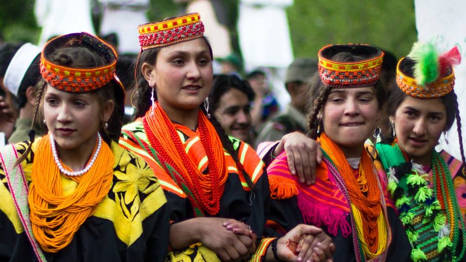
The Kalash religion has been described as Animism but many similarities are seen with the ancient Vedic religion or in other words an ancient form of Hinduism with Animist beliefs thrown into it aplenty. It is probably the form of religion as it existed at the time when the Rig Veda was composed. However due to their isolation most probably they remained cut off from the post Rig Vedic development of Hindu religion. The name of some of their deities are the same as the ones in the ancient Vedic religion. They have references to the “Devlok” and one of their deities is called Indra.
The Kalasha celebrate a number of festivals including the most well known one known as the “Chillum Joshi” which attracts a lot of outsiders to flock to the Village and see the Kalash, especially the women in all their finery. Traditionally the woman wear black robes but on the days of the Festival all are ordained in multi-color jewelry as well as very exquisite headgear.Two other important festivals of the Kalasha are the Uchau in autumn, and the Caumus in winter.
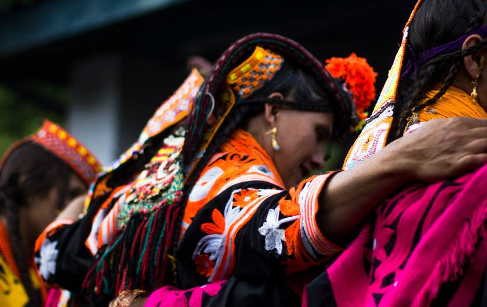
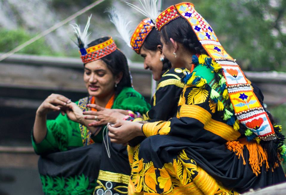
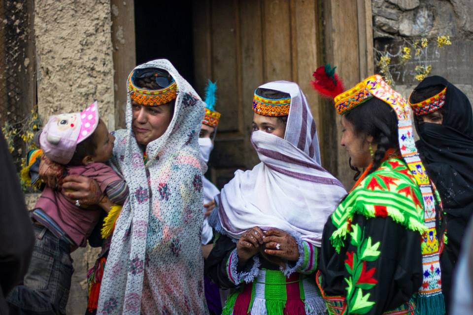
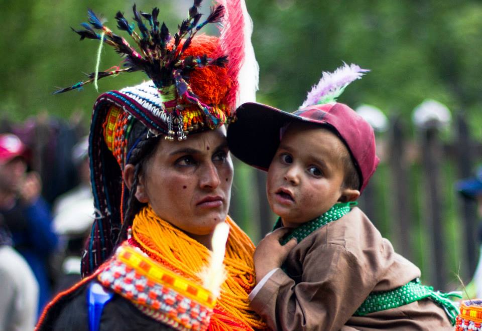
As of today the number of Kalash who still practice their ancient beliefs are believed to be numbered at around 3000 individuals and have been holding steady. They are also a big draw for tourists who converge in large numbers to see these extra-ordinarily beautiful people in the equally beautiful mountain settings.
You are encouraged to read up on these fascinating People through different resources available on the Net. As for now I leave you with some pics of these people from various sources on the Net. These are being used only for Educational purpose and if you hold the copyright to any of these pics and want it removed, please drop a message and we will remove the pic. Thanks
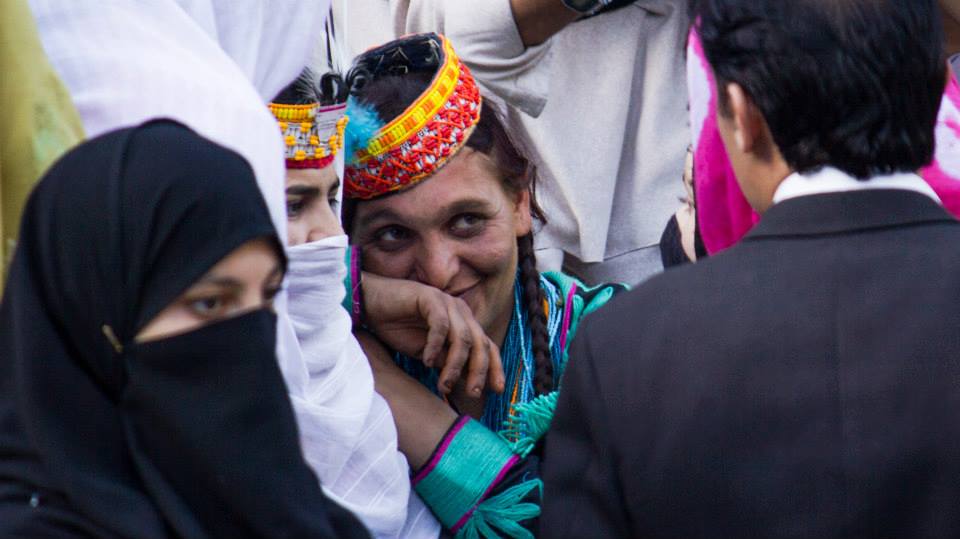

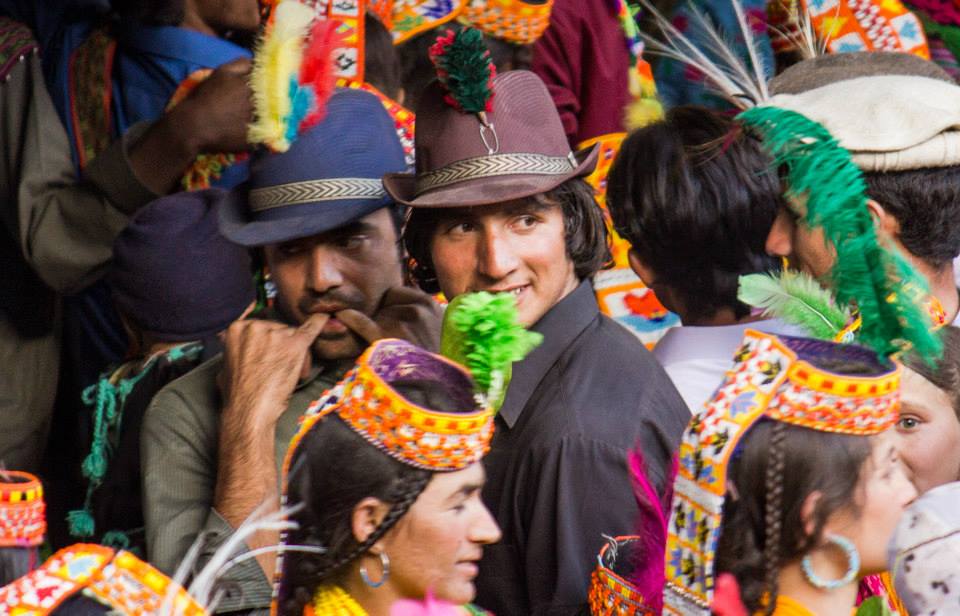
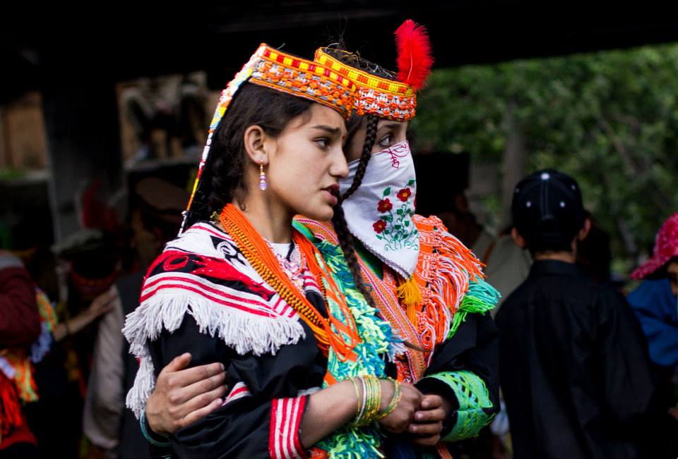
Photos Credit : Syed Imran Schah.
Zanskar : The Valley of Copper
Zanskar has an area exceeding 7000 sq km and a population estimated to be between 18000 to 20000. It is located bang in the middle of the Great Himalayas which separate it from Kishtwar and Lahaul in the South. In the East it touches Tibet almost and in the North is Ladakh and to the East is what used to be Baltistan but now better known as the Kargil area. Zanskar gets its name from the Tibetan word for Copper "Zang" and Valley. So probably it was because of the Copper deposits it was called so. And the name stuck.

Zanskar : The Valley of Copper
Zanskar has an area exceeding 7000 sq km and a population estimated to be between 18000 to 20000. It is located bang in the middle of the Great Himalayas which separate it from Kishtwar and Lahaul in the South. In the East it touches Tibet almost and in the North is Ladakh and to the East is what used to be Baltistan but now better known as the Kargil area.
Zanskar gets its name from the Tibetan word for Copper "Zang" and Valley. So probably it was because of the Copper deposits it was called so. And the name stuck.
It used to be a part of the Tibetan Kingdom of Guge at a point of time. The Kingdom included Ladakh, Zanskar, Spiti and part of Western Tibet around the Holy Kailash Mountain. The Kingdom was split into separate Kingdoms at one point of time and Zanskar Spiti became an independent Kingdom under a King who was one of the sons of the last ruler of Guge. Even today the Royal lineage of Zanskar is help in great esteem as they are deemed the successors of the main Tibetan Royal family.
The Kingdom of Zanskar was further split later into Padum, Zangla and Kishtwar (yes Kishtwar was a part of the Zanskar kingdom) but at the same time it came under the influence of the powerful Ladakh kingdom.
Due to its land locked location Zanskar has always been pretty isolated and under the influence of Buddhism it has a distinct identity as in the people are generally very genial in nature and this has always been taken advantage of by outsiders.
Kashmiris, Chambyalis, Lahaulis, Dogras, Gujjars etc have all at different times invaded, plundered and looted this land.
Even in the 1800s it was first the Chamba forces which swept Zanskar and later a combined Kulu and Lahaul and Chamba force again plundered. And then again the Dogras under General Zorawar Singh swept through Zanskar on his way to capture Ladakh.
The thing was the usual way to Ladakh from Kashmir was up the Zoji La Pass but at the time of General Zorawar Singh the Governor of Kashmir, Mihan Singh was not well disposed towards Raja Gulab Singh and the Dogras. So he didnt permit any Dogra force into Kashmir. General Zorawar Singh had been the Governor of Kishtwar and knew of the way into Ladakh through Zanskar. Otherwise in probability Zanskar would have been left to its own devices but it became a victim of power sturggles within the Lahore Kingdom.

The main Village of Padum
But the worst was still to come. In 1947 when the country got independence the Gilgit Scouts capitulated to Pakistan and they began their campaign to capture the whole of Ladakh region. They captured Kargil and a group of soldiers of the Gilgit Scouts made their way down to Padum in Zanskar. Even after the Indian forces re-captured Kargil and the Zoji La these Gilgit Scouts remained in Padam. This was probably the worst time the Zanskaris ever saw. Without going into the gruesome details let me just say that they were subjected to all kinds of deprivations by the Gilgit Scouts.
The Indian Forces were too busy consolidating and building their defences in the forward areas and really had no resources to focus on Zanskar. However a group of ex-soldiers from Lahaul did band up and went upto Padum to fight the Gilgit Scouts but they were beaten back by the Gilgit Scouts.
It was only after the ceasefire that the Indian troops came in and the Gilgit Scouts were escorted over the border. But they pretty much left a very deep mark on the local population and the inter relationship between the majority Buddhists and the minority Muslims.
The troubles didnt go away though. There were still ocassional raids by the Gujjars who used to descend the Zanskari pastures in the Summers. Worse still the Policemen deployed in Zanskar were usually outsiders and being in such an isolated place they took full advantage. Every household had to pay a tax to the cops failing which the cops would cook up false charges and the person would be dragged all the way to Kargil to face the local court and be put in Jail.
Also being clubbed with Kargil was another source of great concern for the Zanskarpa. Culturally and spiritually the Zanskarpa was much more closer to the Ladakhis than to the people from Kargil who followed a different religion and spoke a different language. Kargil was probably as alien to the Zanskarpa as Kishtwar or Kashmir.
The only Road link with the outside world also goes thorugh Kargil. Even when they have to go to Ladakh they have to take a circuitious Route via Kargil. Hence it has been a long standing demand of their to be connected directly with Ladakh via Road. The Road was promised to them around Independence but the said Road, now called the Chadar Road is still under construction. And on top of that their only life line connect with the outside world, over the forzen Zanskar is now over run with tourists which doesnt enable the Zanskar to get frozen properly.
The tale of Zanskar is one of constant broken promises made by the Government of India as well as the state Government. The Zanskarpa still continues to be neglected like no other. They dont even have an MLA of their own (another one of their demands) as they are clubbed together with Suru Valley and the representative in always someone from Suru.
Apparently its hoped now that one day the Road connecting it directly to Leh as well as the other one to Lahaul will become operational and for atleast 6 months they can enjoy the better connectivity and all the benefits it brings.
As for the winters please leave the Zanskar river alone. Its their only connecting lifeline. If cannot do anything to improve their condition atleast try not to worsen it. There are plenty of other frozen Rivers in Ladakh you can walk on. Say no to Chadar.
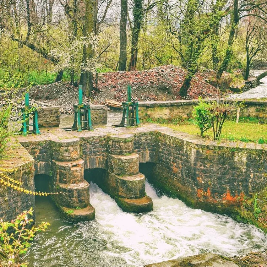
The Dagwan Nallah, Dachigam National Park
The Dagwan Nallah is a stream that flows through the Dachigam National Park. At the edge of the Park this little piece of engineering diverts some of the water from the Dagwan Nallah / River into the Sarband Lake, that traditionally was used to supply drinking water to Srinagar city. This system was set up way back in 1906. And for many years the water was just supplied raw so pristine was the water.

The Dagwan Nallah, Dachigam National Park
Every pic has a story and it's upto us how we tell it.
This little piece of engineering diverts some of the water from the Dagwan Nallah / River into the Sarband Lake, that traditionally was used to supply drinking water to Srinagar city. This system was set up way back in 1906. And for many years the water was just supplied raw so pristine was the water.

The Dagwan nallah as it winds through the Park
The Dagwan Nallah originates from the high altitude Marsar Lake which relies on the snow melt of the Peaks of the Kolahoi group at the base of which it lies. The Kolahoi itself the highest peak of the Valley.
The Marsar Lake itself lies in the Upper part of the Dachigam National Park and the Dagwan flows down through it, in an area devoid of all human inhabitation, through the magical forests of Dachigam until it reaches this point from where a part of its water gets diverted to the Sarband.

Another pic of the Dagwan Nallah
The Dagwan itself finally gets amalgamated into the Jehlum into the journey south.
Coming back to the pic and this piece of engineering thanks to which at one time the whole of Srinagar used to enjoy the purest natural water coming down right from the laps of the Himalayas from snow melts since of them above 5000 m and then further enriched by the primeval forest around it.

The Sarband Reservoir next to Harwan.
Thankfully even today most humans are kept away as you can only enter Dachigam after getting special permissions from the Regional Wildlife Warden.
Pic from April 2017. Dachigam National Park, Kashmir
Roerich Himalaya
And I'm a happy man today. As I just received my copy of the original limited edition (No.217 of 500 copies) Roerich Himalaya published in 1926. It contains writings and lithographs with 24 Colorplates and 78 Halftones of the paintings by Nicholas Roerich.
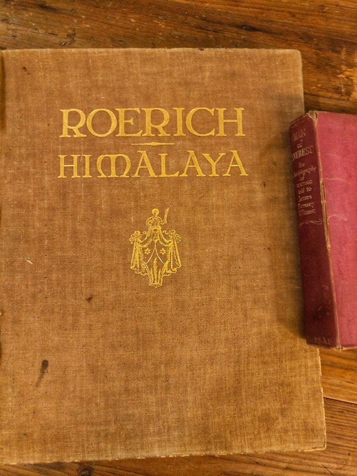
Roerich Himalaya
And I'm a happy man today. As I just received my copy of the original limited edition (No.217 of 500 copies) Roerich Himalaya published in 1926. It contains writings and lithographs with 24 Colorplates and 78 Halftones of the paintings by Nicholas Roerich.
A lady had offered this book on sale in the Himalayan Club and I was the first one who took on the offer. Let me clarify that as an Admin I didn't approve and it was approved by another Admin and the moment I saw it I asked for this masterpiece.
It was apparently owned by a Russian lady who was in South Africa and it got passed on to the Lady who put it up for sale. And finally a deal was struck and the courier arrived today at my place all the way from Knysna, South Africa.
And its a big heavy book just the way I like it.
And soney pe suhaga as they say as I picked up an original 1955 edition of Man of Everest : The Autobiography of Tenzing as told to James Ullman from my father in laws collection of books last week.
The small start to what I hope would be one day be a good collection of vintage Himalayan books.
Thakur of Gondla
Roerich did a series of paintings on Lahul, which included a painting on the Rohtang Pass, the Chandra River, Koksar and Gundhla. I have come across three different paintings of his on Gundhla. Maybe the Tower of Gundhla was the thing that excited him. In all three paintings on Gundhla the Tower figures prominently. I'm posting two of his paintings from Gundhla, a part of the Lahul series. As per his own writings Roerich was astounded on seeing the ancient castle of the Thakur of Gundla. The Gondhla Fort is the only existing Fort in Lahaul today and is under ASI protection now.

The Thakur of Gondla
Roerich did a series of paintings on Lahul, which included a painting on the Rohtang Pass, the Chandra River, Koksar and Gundhla. I have come across three different paintings of his on Gundhla. Maybe the Tower of Gundhla was the thing that excited him. In all three paintings on Gundhla the Tower figures prominently. I'm posting two of his paintings from Gundhla, a part of the Lahul series. As per his own writings Roerich was astounded on seeing the ancient castle of the Thakur of Gundla. The Gondhla Fort is the only existing Fort in Lahaul today and is under ASI protection now.
The Roerichs while settled in Naggar spent a couple of their summer vacations in Lahaul. Roerich, besides a painter, was an explorer, archaeologist, medicinal botanist, mystic, a practitioner of the "occult" and a host of another things. Thye also set up something of a Himalayan Institute there to do extensive research on the local people, their lifestyle and their beliefs and their religion. Of course as a good "Occultist" he took great interest in the local healers, the soothsayers, the shamans, the witch doctors etc and I assume you get the drift. And of course in between all his pursuits he managed to paint and sketch and create the artworks that he is most renowned for.

In his search for Eastern mysticism Lahaul may have been perfect as it is the melting pot of Hindu and Buddhist beliefs. Both religions co-exist seemlessly into each other. The locals refer to their religion as Hindu-Bodh and it is a mixture of both great systems of belief. The two religions intertwine in a way which could be a model for any two religions to exist side by side. Lahaul is where India and Tibet meet and merge unlike at other places where one culture gives way to another.
The first time I experienced this when a close friend of mine, a Lahauli, got married in a village close to Manali. Being a part of his Baraat, when we arrived at the Bride's place, standing there to welcome the Baraat, Beau's the family, were traditional Hindu Pandits and Lamas from the local Monastery as well as from Lahaul. Both did their rituals and the Baraatis were welcomed. During the
marriage ceremony both the Pandits and the Lamas sat together doing whatever they are supposed to do. It was in short a beautiful sight. Needs to be witnessed to get that feeling of how we can all coexist in perfect harmony.
And yes, this friend of mine was getting married to the daughter of the present Thakur of, where else, but Gondla. This was almost 8 years back. More recently my friends brother in law got married. The heir apparent to the Gondla Thakurai. And I happened the meet the Thakurji himself. It was only now that my friend told me about him and his connection to Gondla. I had previously posted a picture of the Dham I had attended for the same. I wish I had time to sit down with him but he was busy. But as they say there is always a next time.
The Tower of Gondla still exists in all its glory in Lahaul.
Do have a look next time in Lahaul. If it excited the Master so much I'm sure it will be worth the effort.
And if you happen to have pics of the same please post in the comments.
Dusshera in Quetta
A Classical Image of a Dusshera Celebration in Quetta in the pre-independence era.

Dusshera in Quetta
Dusshera in Quetta, Balochistan.
In 1930.
Quetta itself lies at an elevation of app 1600 m above sea level just like Srinagar. The climate is also like Srinagar though drier.
Reminds me of the Dusshera we used to have at the Iqbal Park in Srinagar.
BTW Dusshera Celebrations in Kashmir are now held at the Polo Ground, Srinagar since they restarted in 2007.
Pic from Getty Images
AMS : Effects of Altitude
Th effects that a sudden exposure to a higher altitude and the effects of AMS, or Acute Mountain Sickness as experience on the Jade Dragon Snow Mountain in Lijiang in North Western Yunnan in the Hengduan Mountain Range.

AMS : Effects of Altitude
When you feel the altitude at over 4600 m above mean sea level and you use your supplemental Oxygen.
Clicked from the top of the Wooden walkway that takes one to the highest point on the Jade Dragon Snow Mountain at around 4680 m.
The Gondola starts from around 2200 m and drops you off at around 3700 m. Then you need to climb up the wooden walkway if you want all the way to the top and you get a Medal with your name if you get to the top (which however you have to pay for).
Apparently this is the second highest Gondola in the world the first one being somewhere in South America.
A lot of the local tourists are not really well prepared and the altitude hits them. Carrying canned oxygen is mandatory and there are enough warning sign boards. I have never seen so many people getting hit by Altitude sickness. The walk up was full of people showing different signs of AMS from puking to sitting in a dazed state to gulping down oxygen. Not a very nice thing to witness.
I was thank fully kinda acclimatized as I had spent the last couple of days on the Tibetan Plateau. But the view from the top was great even though it was January. And you can imagine the temperature at 4680 m.
This mountain is the last of the permanently Glaciated Peaks of the Great Himalayan system in the Hengduan Mountains and is the most Southernly Glacier in the Nothern Hemisphere from what I know.
Pic from January 2017. Yulong Shan, Lijiang Nuxi Autonomous County, North Western Yunnan, China
Apple Grafters
The Apple Grafters of the Apple Country in Kotkhai and else where in Apple growing regions are highly sought after men who specialize in grafting any Apple variety on any Apple tree. Their Story.

Apple Grafters
This is what all Apple trees should be like. Just dripping with Apples.
This was in a neighbouring Orchard and the amount of fruit on this particular Tree was quite amazing. As per the tradition here, an Orchardist can ask a fellow Orchardist here for a "Kalam" from the said Tree. The Kalam or a small branch can then be grafted on another Tree to hopefully get similar results as the parent Tree the Kalam came from.
But it's the master Grafts men who hold the key. They come around in the Grafting season and create their magic. Technically a single Apple Tree can grow as many as 10 or 20 or even 50 varieties of Apple as long as it's done by an expert Graftsman.
These Graftsmen are men of their own moods and need to be handled well. For example we pay an expert Graftsman Rs. 2000 per day plus a "Bottal". They work on the Grafts for a few days and then disappear into their own oblivion till the Grafting season comes again.
I should add that a grafted Kalam doesn't always give the same results as the parent Tree due to changes in the soil, location, sun angles etc etc of its new host Tree.
Anyways buy Himalayan Apples
Pic from August 2017. Mahasu Village, Kotkhai Tehsil, Himachal Pradesh
When East met West
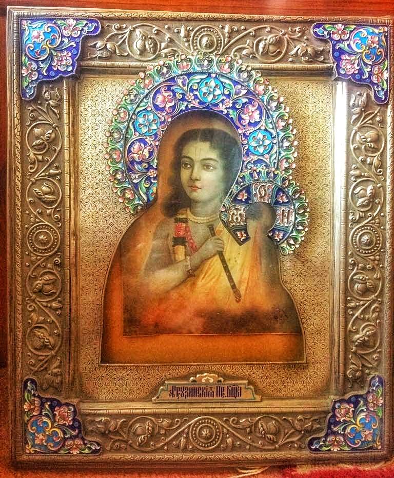
When East met West. A Lord Krishna picture in a Christian frame made in Russia. An import from Yarkand !
When East met West
A friend was kind enough to share this pic with me of a Metal Frame with Lord Krishna inside. This frame and pic was bought by someone in his family from Yarkand across the Great Himalayan divide. His family at that time was involved in Trading with Yarkand initially based at Hoshiarpur but eventually moving to Kullu.
This is a Russian frame used for the Holy Mother and the child but someone in Yarkand was smart enough to replace that with Lord Krishna and sell it to the Hindu traders / Indian traders. But looks kinda odd but I guess it was a good item to sell at that time. The metal work on the frame is quite exquisite though. And it has a Russian or a Georgian inscription as well.
Yarkand served as Center where goods from all over Asia and Europe could be traded. It was an important point in the Silk Route and also had "Route" to India. I have written at length about this Route in another Post earlier.
One of the great trading centers of Central Asia is now lost as a dusty outpost in Xinjiang. Having lost its glory for good.
Pic from July 2017. Raison, Himachal Pradesh
Annapurna and Dhaulagiri
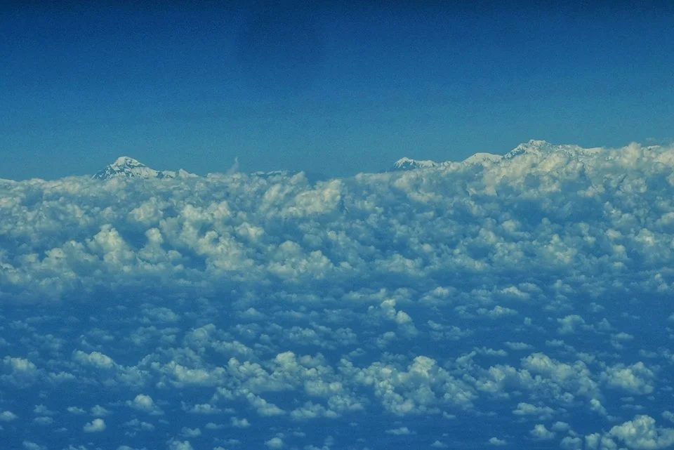
Dhaulagiri on the left and the Annapurna Massif on the right.
Taken from a flight headed East. October 2017.
Srinagar Old Town : Walkhrough
A walk around the old part of Srinagar and across the many Monuments and places of Worship spread around the Old Town including the Khanqah-e-Moula, Pathar Masjid, Tomb of Zainulabidin’s Mother, Chatti Padshahi Gurudwara, Sharika Temple and the Hazratbal Shrine.

Srinagar Old Town : A Walk Through
Today was a Diwali day well spent as early in the morning I decided to walk my home town especially the area called "Downtown" where all the troubles usually are.
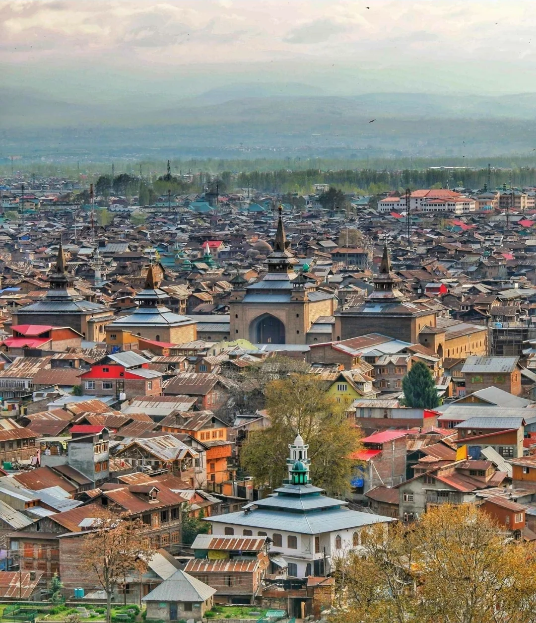
Jama Masjid
Hopped onto an auto and went straight to the beautiful wooden Dargah called the Khanqah e Moula. Located in Zainakadal it's a Mosque and Shrine of Mir Sayyid Ali Hamadani. Built in 1395 AD its one of the oldest Mosques in the Valley. The pic below features this Mosque with the Hari Parbat Fort in the back ground.
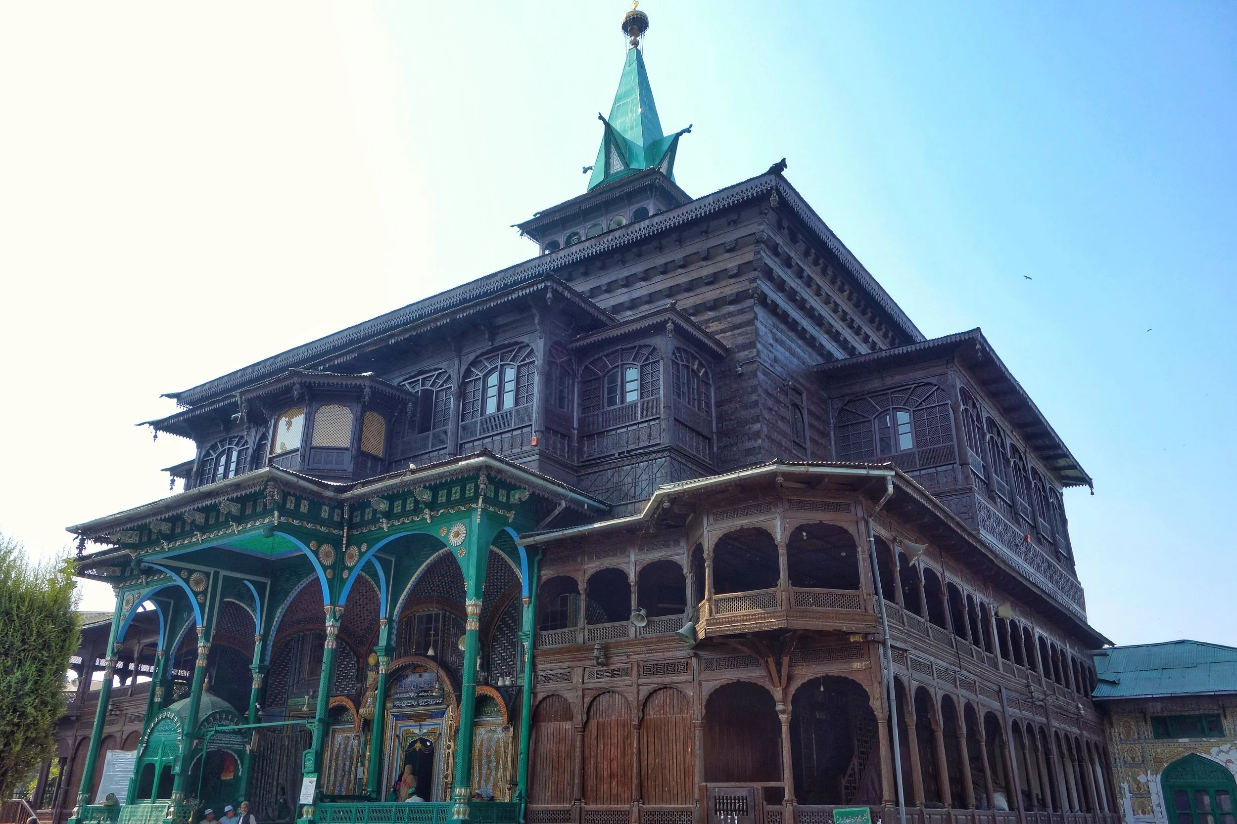
The Khanqah E Moula
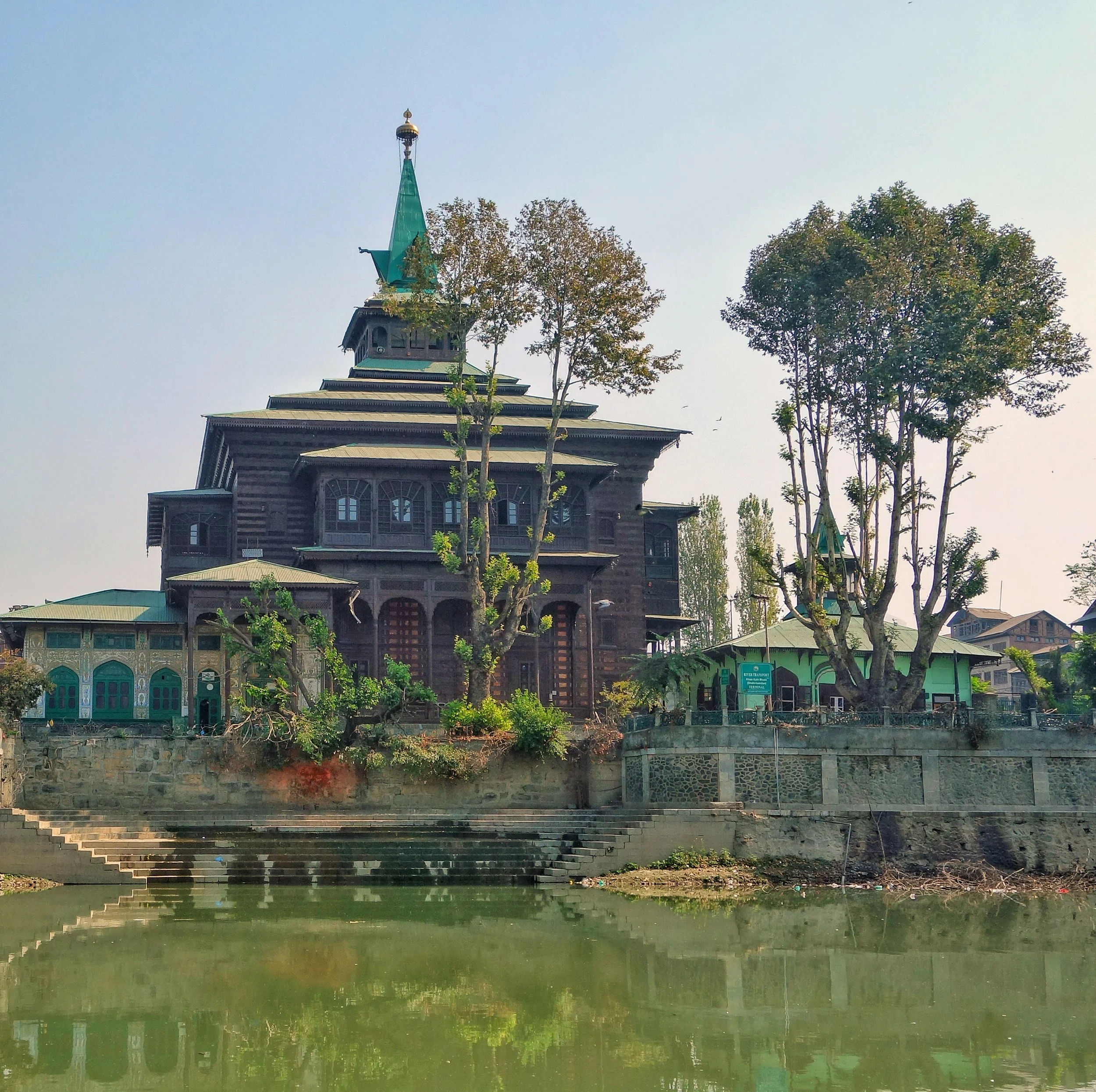
The Khanqahemoula
After that I walked across the Bohrikadal Bridge and visited the Pathar Masjid in Nowhatta. It's a Mughal Era stone Mosque opposite the Khanqah on the opposite back of the Jehlum. It was built around the 1620's.
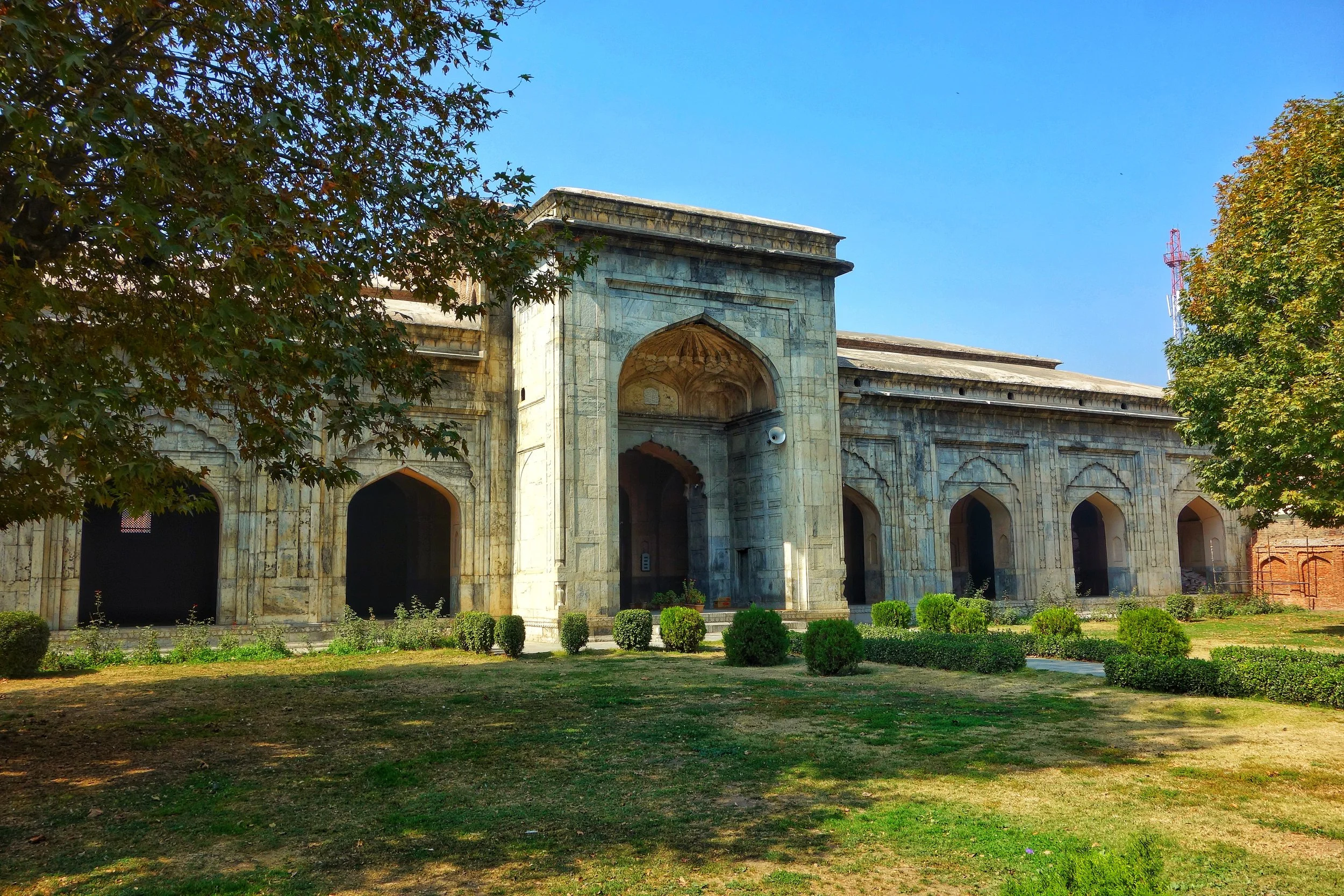
Pathar Masjid
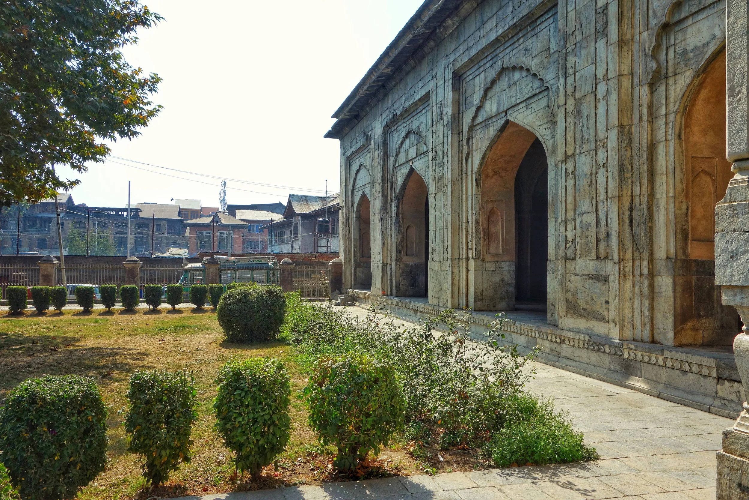
Another pic of the Pathar masjid
Then I walked to the Budshah Tomb in Zainakadal. This is the final resting place of the mother of Sultan Zain ul Abidin a renowned Sultan of Kashmir. This was built in 1430.
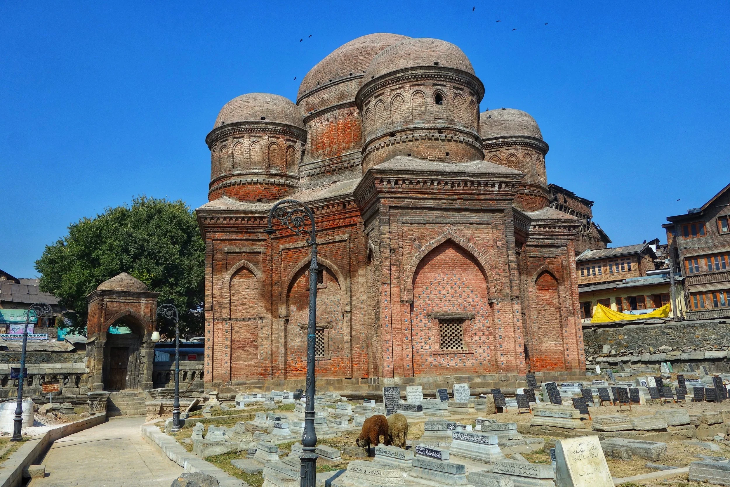
The Tomb of Sultan Zainul Abidin's Mother
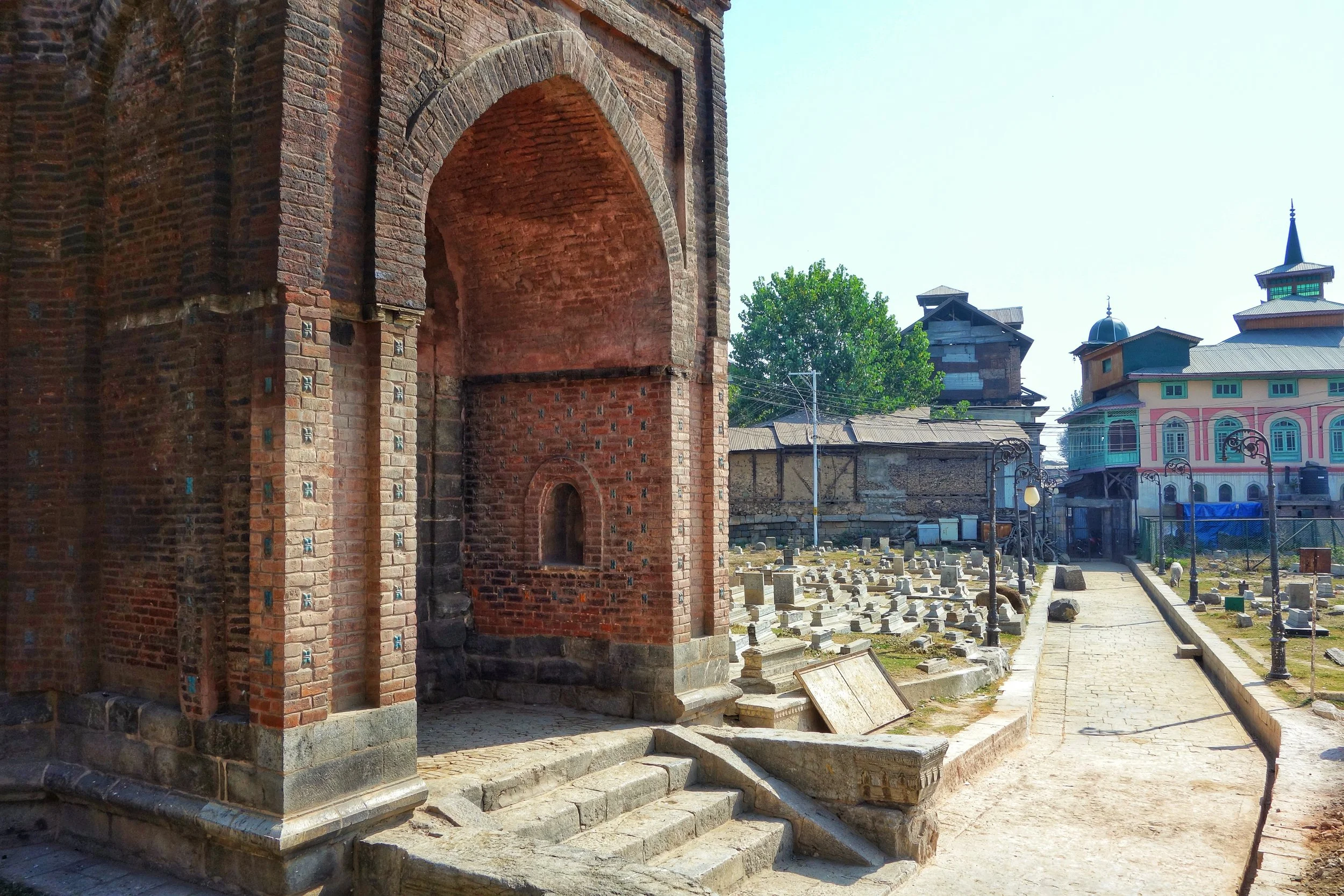
The Tomb of Zainaul Abidin's Mother
Then I again hopped into an auto and went to pay my obeisance at the Chatti Padshahi Gurudwara. The Gurudwara is associated with the Sixth Guru, Guru Hargobind. It is situated just outside the main gate of the Hari Parbat Fort, the Kathi Darwaza. Was offered Tea and had a cup. Someone invited me to the Langar but I had to move on.
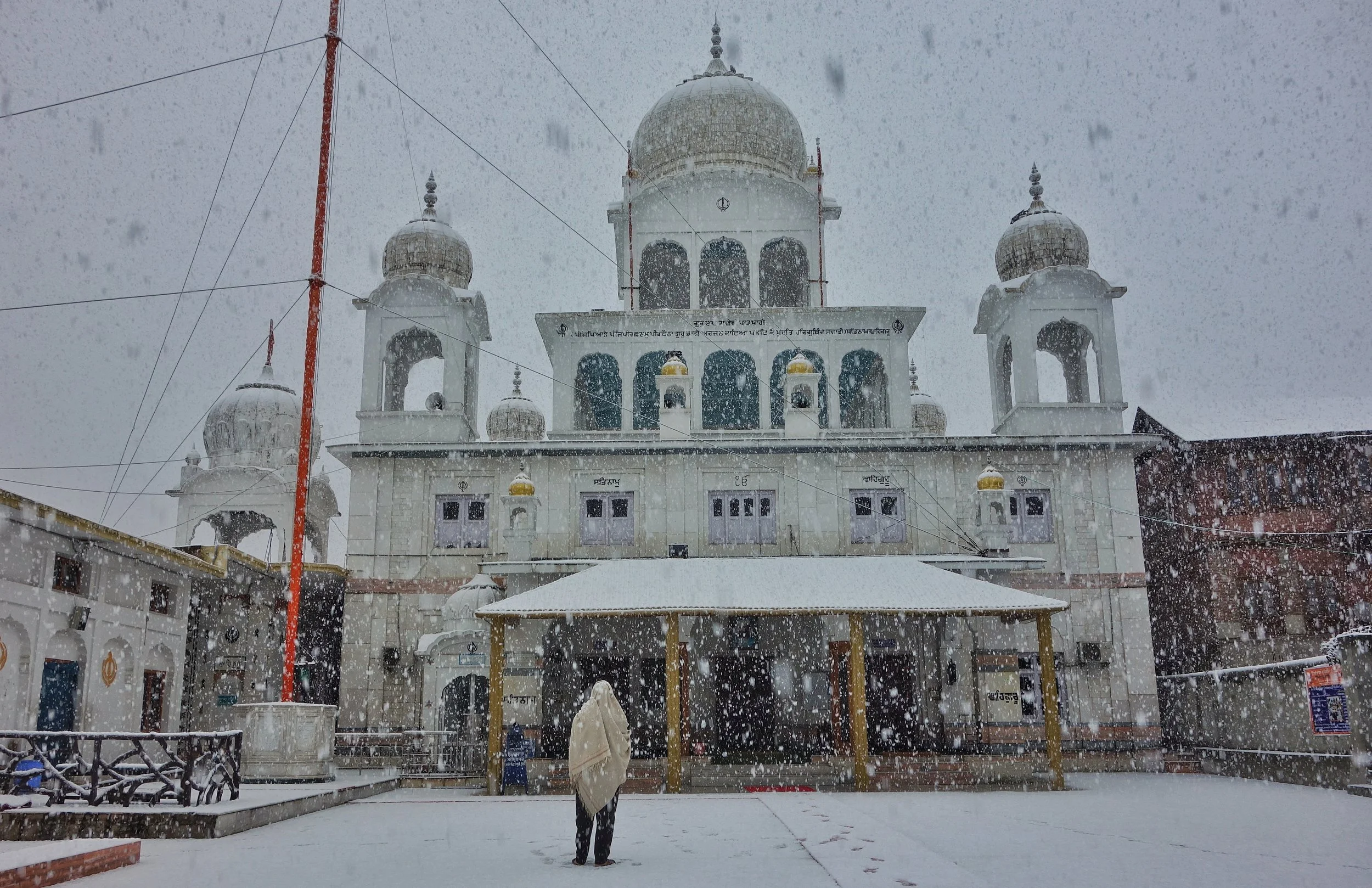
The Chatti Padshahi Gurudwara during a Snowfall
Walked into the Kathi Darwaza there on and went to Badamwari on my way to the Sharika Devi Temple, which unfortunately was locked. The Temple is dedicated to Shakti who is worshipped as Jagadamba Sharika Bhagwati or simply Sharika Devi. She is considered the presiding Diety (isht Devi) of Srinagar.
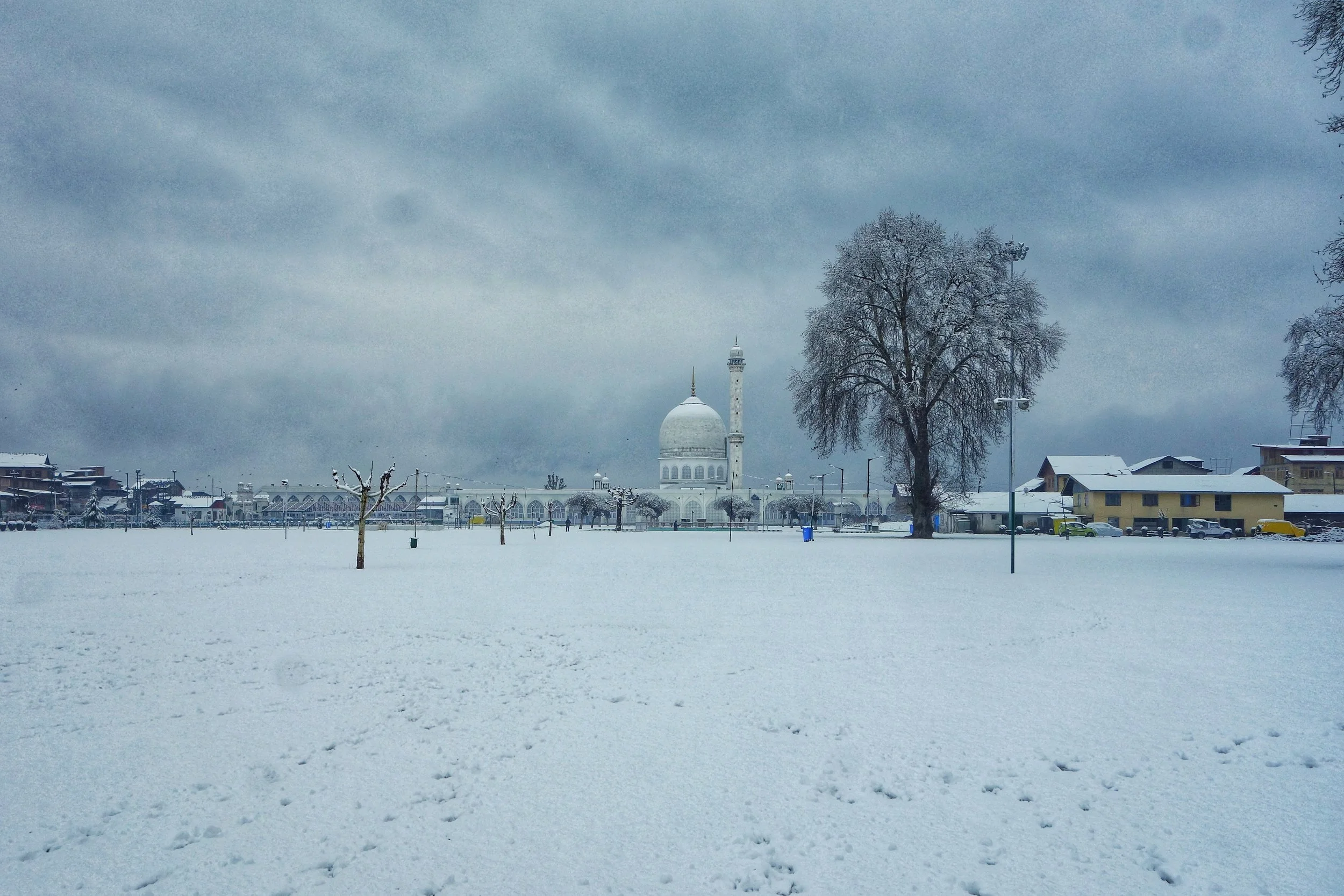
The Hazratbal Shrine after a Snowfall
And again took an auto to round off the tour with a visit to the Holiest Mosque and Shrine in Kashmir, the Hazratbal Dargah. The Mosque houses a holy relic of the Prophet Mohammed (PBUH). The Shrine was built around the 1630's. The best part is the Pigeons who fly around there're. A beautiful place nonetheless.
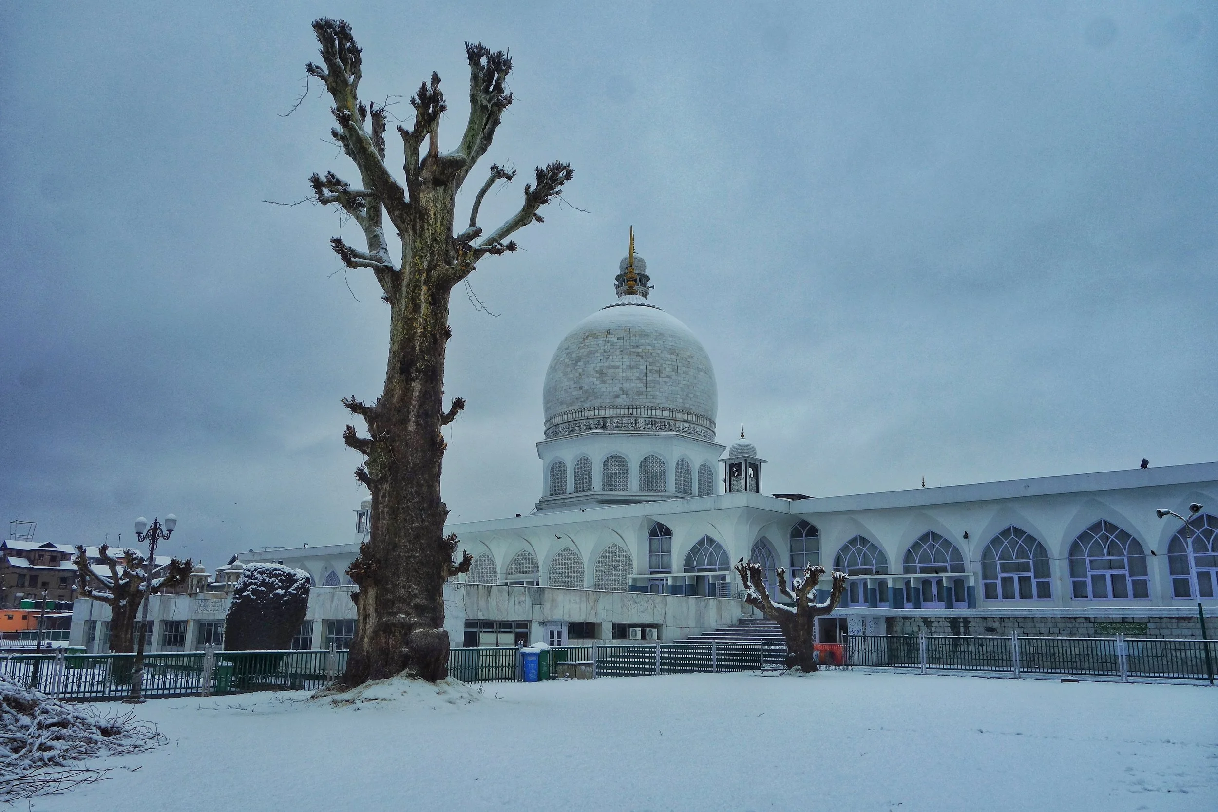
The Hazratbal Dargah
So that's how Diwali day of an atheist was spent. Visiting Holy Places and requesting all Gods to let peace and harmony prevail.
Happy Diwali Everyone.
Pic from today. Taken from Zainakadal Bridge, showing the Khanqah with the green conical Roof and the Hari Parbat in the back ground.
Kiki’s Blog
Stories from the Himalayas








Five years ago the Galwan Valley was in the News for the wrong reasons after a deadly clash between the Indian and Chinese Armies in the Valley located in Ladakh lead to many deaths on the contentious Border between the two countries in wake of continued Chinese intrusions into Indian territory.
This area along the Shyok River, of which the Galwan Nallah or the Galwan River which forms the Galwan Valley has been off limits to Civilians since long but now the Indian Government has decided to open up the area for Civilians and we were amongst the First Civilians to venture into this beautifully desolate part of the Eastern Karakorams in Ladakh. Earlier Civilians could only venture upto the Village of Shyok from where the Shyok River takes a U turn and flows in a Northerly direction.