A holiday in Kashmir involves much travelling around by car from Srinagar (not only the capital but the base of most visitors), a shikara ride, walking around markets and the Old City – a heritage site in its own right. That’s all very well, but it is convenient to know where you can grab a bite, preferably in the area where you are seeing the sights.
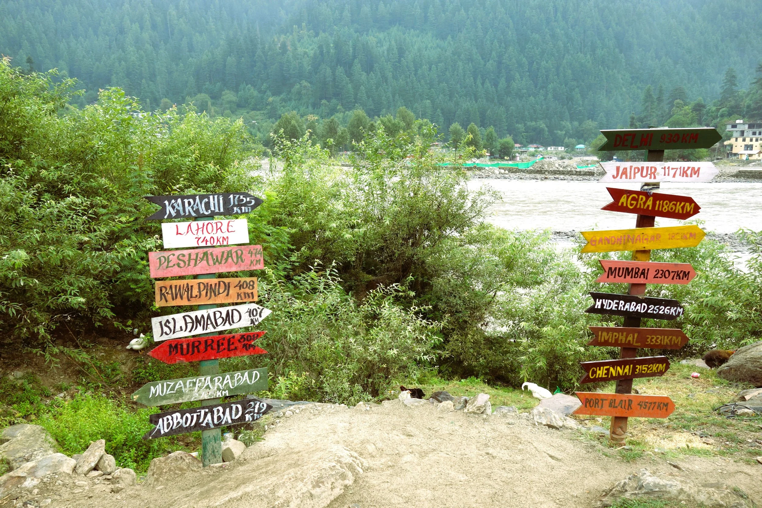
A Photo Gallery of Keran along the Line of Control in Jammu and Kashmir
Most People while visiting Ladakh just visit the same old Places, popular Tourist places and ones popularized by Bollywood and Influencers on Social Media. As a result a few Places bear the brunt of the Tourist footfalls which has serious Environmental and Social Impact.
I have always subscribed to the Philosophy that instead of sending 100 people to 5 places send 20 people to 25 places. Ecologically viable Tourism starts by spreading the load of the Tourists. And here is a list of Ten Things that I would recommend to do in Ladakh. And please remember that Ladakh is a large Region and most of it is rather unknown for most people. Ive added a Note on the Mountain Geography of Ladakh for easier understanding. You can also read my Ladakh Travel Guide for General Information.
So I have compiled a list of Ten Things that I would do in Ladakh, keeping in view all my Visits and Readings on Ladakh. They are in no particular order and each One is a Unique experience in its own.
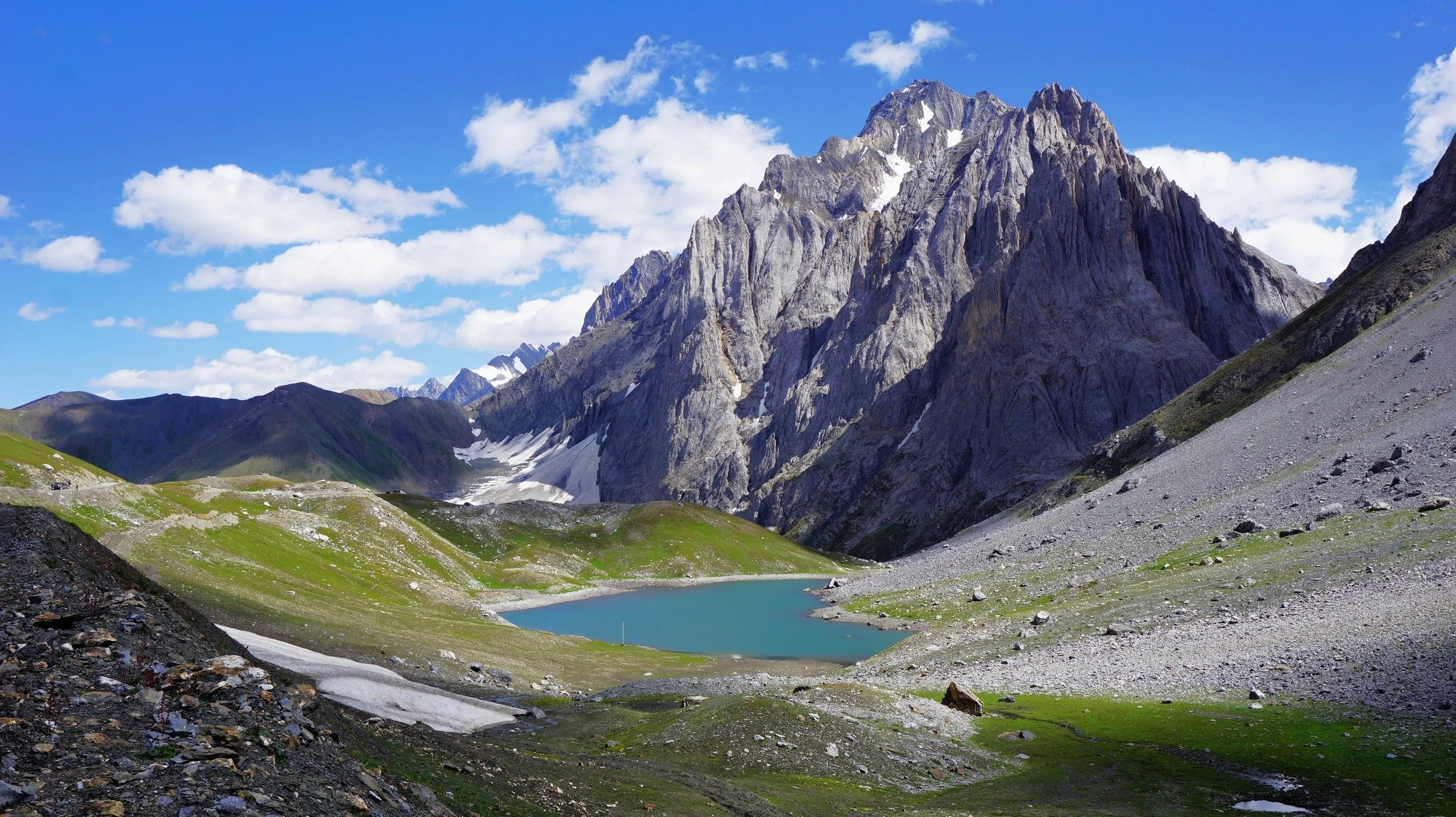
The Kaobal Gali stands at an Elevation of 4167 metres (app 13600 ft) on the main Great Himalayan Range has traditionally connected the Tulail and Gurez Valleys with the Mushkoh Valley in the Drass Region. Interestingly people on both sides of the Pass are Shina and speak Shina language just like their fellow Dardic Shina people in Gilgit. This is a peculiarity as usually when you cross a Pass on the Great Himalayan Range the Culture Language and People change.
Most People while visiting Ladakh just visit the same old Places, popular Tourist places and ones popularized by Bollywood and Influencers on Social Media. As a result a few Places bear the brunt of the Tourist footfalls which has serious Environmental and Social Impact.
I have always subscribed to the Philosophy that instead of sending 100 people to 5 places send 20 people to 25 places. Ecologically viable Tourism starts by spreading the load of the Tourists. And here is a list of Ten Things that I would recommend to do in Ladakh. And please remember that Ladakh is a large Region and most of it is rather unknown for most people. Ive added a Note on the Mountain Geography of Ladakh for easier understanding. You can also read my Ladakh Travel Guide for General Information.
So I have compiled a list of Ten Things that I would do in Ladakh, keeping in view all my Visits and Readings on Ladakh. They are in no particular order and each One is a Unique experience in its own.
Most people are eternally confused about the location of the LoC in Kashmir. And Tourists are shown the LoC from almost everywhere. Even the Pahalgam side.
Anyways this is a simple Map which explains the LoC in Kashmir.
Once the Expedition commenced there arose new Challenges. Though the Afghanistan Civil War had ended, the situation in North Afghanistan and Routes into the Pamirs were far from being safe for the Expedition. So another detour was decided. It was decided that the Expedition would now crossover into India from Afghanistan and then they would take the Mountain track that connected Srinagar in Kashmir with Yarkand / Tashkurgan in Chinese Turkestan or what is now Xinjiang
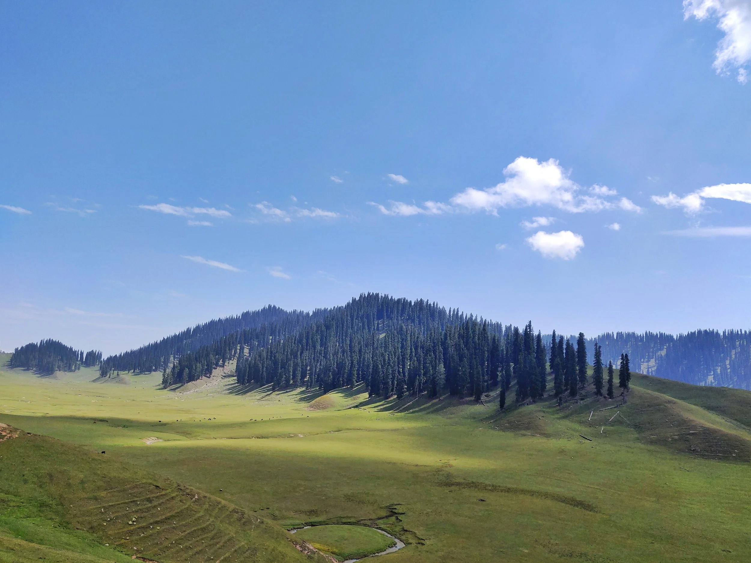
One of the relatively unknown areas of Kashmir with vast tourism potential is the Valley of Bangus. Lying within the Trans Himalayan Area, Bangus is a unique combination of ecological area, compromising Mountain Biome, which includes Grassland Biome with flora at lower altitudes, and Taiga or Coniferous forest.
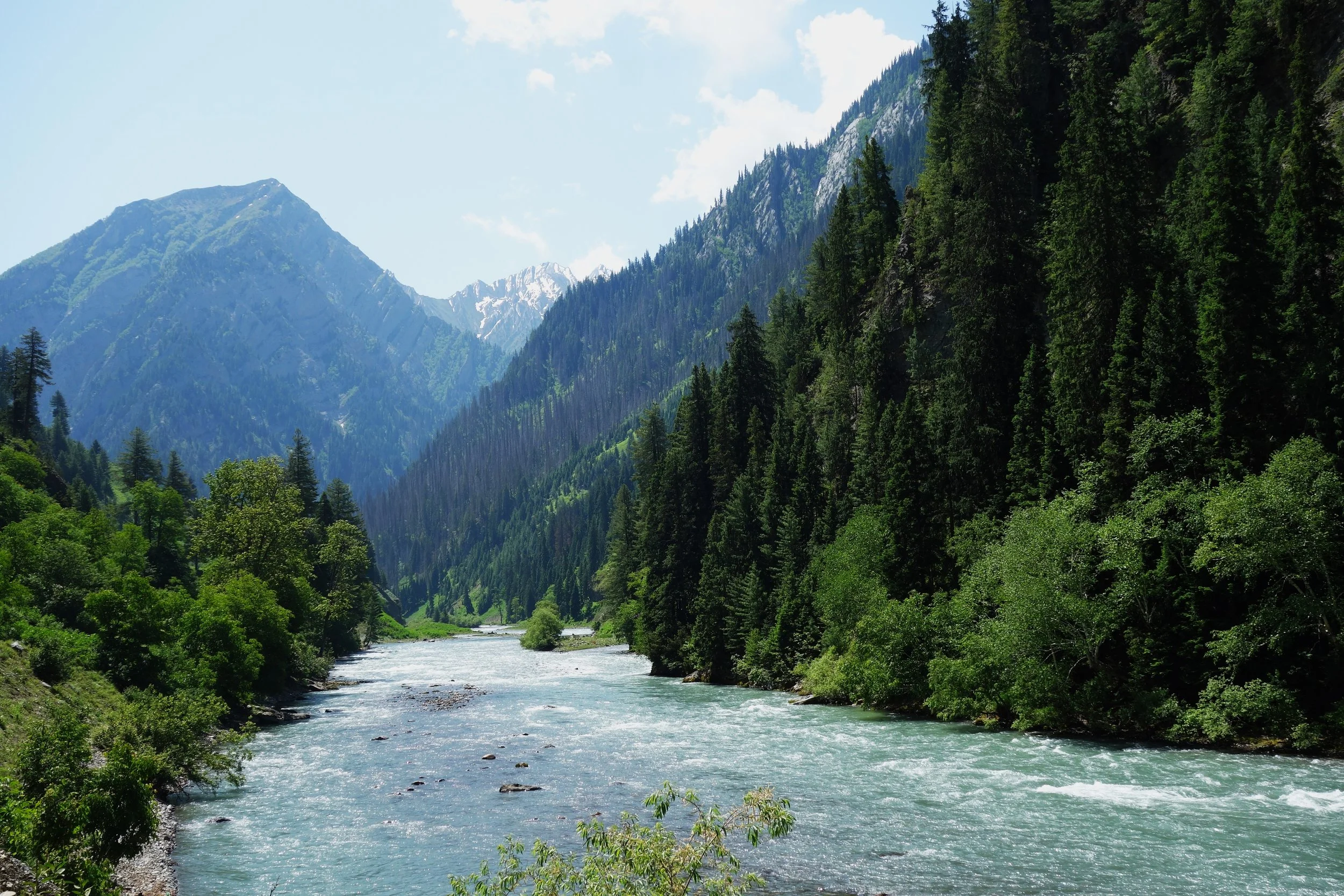
Gurez is a Valley in the north of Kashmir. It stretches from a short way above Gurais Fort to below Sirdari. The main road, leading from Kashmir into the Valley, crosses the Rajdihgan Pass ; the distance from Bandipura, at the head of the Wular lake, to Kanzalwan, on the left bank of the Kishanganga, being about 25 miles, which is usually divided into three stages. The entrance to the valley is exceedingly picturesque, as the river comes dashing along through a rich meadow, partly covered with lindens, walnut, mud willow trees, while the mountains on either side present nothing but a succession of most abrupt precipices, end alpine ledges, covered with fir trees. It is nowhere above a mile in width, and is surrounded on every side by lofty peaks, chiefly of mountain limestone, rising far above the limit of forest which covers their lower slopes.
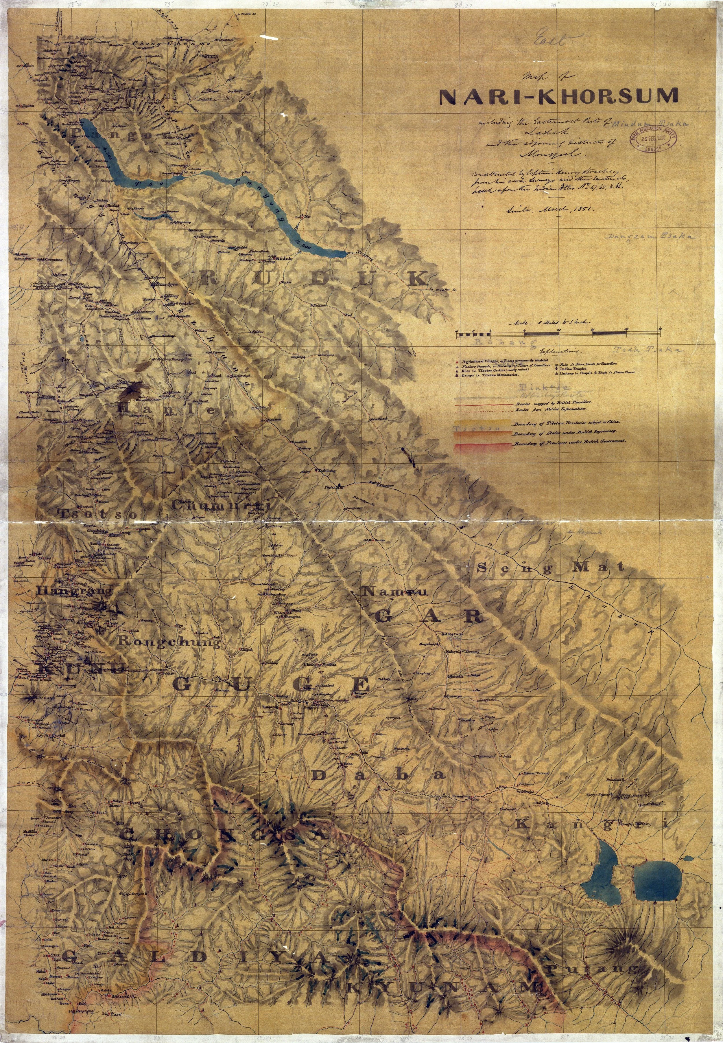
Col Starchey was an Officer in the British Army and was involved in the Surveying and Mapping the unmapped Regions to the North of the Great Himalayan Range as well as around Tibet. He made various Journey’s to the Region and came up with some Great Maps of the area and one of the most prominent being the Maps of Ladakh (Western Tibet as it was called) and the Regions around it.
But as the Weather Readings below will testify the Monsoon is not consistent over the Himalayas. Different areas in the Himalayas get different amounts of Rainfall during the Monsoons. And the Monsoons are not the only Rainy Season in the Western Himalayas. There is another Rainy Season which arrives in December and it comes in the form of what we call Western Disturbances which are Rain bearing Clouds rising above the Mediterranean and making its way to the Western Himalayas.
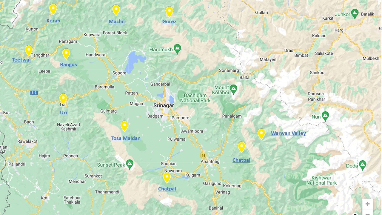
A Rough Guide for People planning to visit the Kashmir Valley. And notes on the History, Culture and most importantly the Geography of the Region. And taking you beyond the normal Tourist Hotspots into more Offbeat and even unheard of places in Kashmir.
Kishtwar itself is remote and always under the shadow of Kashmir but this part of Kishtwar which lies next to Kashmir on one side and the Suru Valley of Ladakh on the other side is probably one of the last great wildernesses in the Inner Himalayas. This is the Warwan- Marwah - Dachchan belt lies along the Maru Wadwan River or as its also known Warwan / Marwah (Marev) / Marsu Dhar River along different parts of its course, which is a major tributary of the Chenab.
The Kishanganga is the main River flowing through the enchanting Gurez Valley rising in the Kishansar Lake (which is a part of the Group of Lakes commonly referred to as the Great Lakes) and flowing through some great Mountain scenery until its confluence with the Jhelum around Muzaffarabad in Pakistani held Kashmir. The River was renamed as the Neelam in Pakistan in the 1950s. Old Maps and Books still refer to it as the Kishanganga.
The Himalayas might be the highest Range in the World but when it comes to sheer perpendicularity nothing compares to the mighty Karakorams. Many people consider the Karakoram to be a part of the Himalayas but its not. Its a separate Range in its own right. It might be considered at a part of the Great Himalayan Complex of Mountains that radiate out of the Pamir Knot. In common parlance the term Karakoram is synonymous with its most famous Peak, the K2 or the Godwin Austen as it was once called. But other Peaks and parts of it are relatively unknown.
Diwan Alim Chand was a Pioneering Photographer attached to the Court of the Dogra Maharajas of Jammu and Kashmir. Diwan Alim Chand also had the privilege of having taken the first Photographs of the Amarnath Yatra back in 1898 when Maharaja Partap Singh, the Maharaja at that time had gone on a Pilgrimage to the Holy Cave.
For the ones unaware of Uri it lies along the Jhelum Gorge as it swirls out of the Kashmir Valley and enters PoK and Uri is the last major Town before the LoC which lies around a dozen kms ahead of Uri. Ahead of Uri lies the Village of Salamabad which was the point for the Cross Border trade and Trucks from the other side of the LoC used to visit in better times. And then of course there is the Kaman Seu which is the LoC between the 2 Countries.
So where exactly does Baltistan begin and Ladakh end ? Well to be honest there is no such defined physical feature but most consider the Chorbat Valley as a part of Baltistan rather than Ladakh. In the pre-partition days Chorbat was an “Ilakka” in the Baltistan Wazarat. Geographically the Chorbat Valley starts at the point where the Shyok Valley narrows and becomes a Gorge before the Village of Bogdang. Bogdang is considered the first Village of the Chorbat Valley and hence the first Village of Baltistan. Technically it lies sandwiched between the Ladakh Range and the Karakorams.
Anybody who grew up in Srinagar in the good old 1970s and 80s must be familiar with the famous Pestonjee Ka Ghoda on the Residency Road. The Pestonjee Ka Ghoda or the White Horse was installed outside the Pestonjee Building which was next to the Building which housed the famous Mahattas Photographers as well as the Grindlays Bank. As a kid I was always fascinated by this White Horse and used to see it quite often whenever we went to that side of Town.
And one of the most famous Pass over the Range was called the Pir Panjal Pass and as per some versions of History the entire Range got its name from the name of the said Pass. The word Panjal probably came from the word Panchal. This Pass connects the Kashmir Valley with the Poonch Region of Jammu and thereon to the Northern Plains of India. This was the Pass used by the Mughals on what is now called the Mughal Road on their forays into Kashmir. Nowadays mostly the Pass is called the Pir ki Gali which is a reference to a Pir or Holy Man buried somewhere near the Pass.
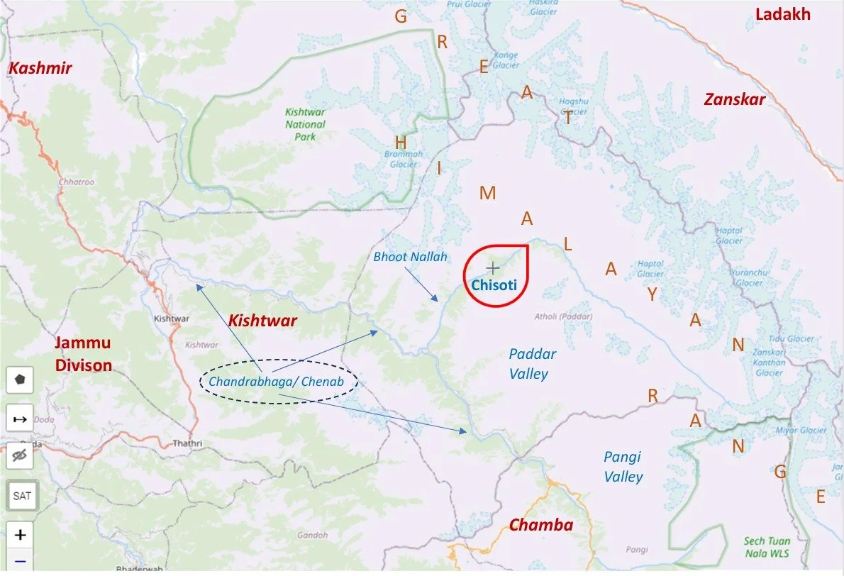
The Road which connects Killar in Pangi Valley in the Chamba District of Himachal Pradesh to Gulabgarh in the Padar Valley of Kistwar District is often reffered to as the Most Dangerous Road in the World. The Road runs along the Chenab / Chandrabhaga River’s Gorge.
The most dangerous section of the Road is between Tyari and Ishtyari in the Padar Tehsil of the Kishtwar District of the Jammu Division of the Union Territory of Jammu and Kashmir. The Cliffhanger section is cut through a solid Rock face and the River runs thousands of feet below the Road with a sheer fall. An alternative to this Cliffhanger is being built and once that is complete the Cliffhanger will be closed.
Well it starts with the Raja of Kishtwar called, very interestingly, Raja Mohammed Teg Singh also known as Saifullah Khan. Though the Rajas of Kishtwar had converted to Islam they kept a mix of Muslim Hindu names and followed many Hindu costums and this Raja was no different. He was a vassal of the Afhna Governor of Kashmir who fell out with the Rulers in Kabul. A force was sent to Kashmir from Kabul but the Governor stood up to it and was assisted in the same by forces from Kishtwar. And by this time Raja Mohammed Tegh Singh had got into a service a new Minister called Wazir Lakhpat Rai Padari, who as the name suggests was from Padar.
Srinagar City as most must be aware is settled on both Banks of the Jehlum and as such there were a number of Bridges which were put across the Jehlum originally starting with the First Bridge or Amira Kadal which was my favourite as it was closes to Home and we had a Shop there where I used to walk to often as a kid. Of course then the Zero Bridge was built which was without doubt everyone's favorite because of Little Hut. The Sardarji's shop which sold the best Softy in Kashmir.
The Gazetteer of Kashmir and Ladakh of 1890 is a treasure trove of information regarding various aspects in the state. This is the small little Chapter in the Gazetteer which talks of Gold prospecting in the Riyasat. And of course it talks of some Gold mining in Baltistan.
The Indus and the Ganges are the two great Rivers which originate in the Himalayas/ Trans-Himalayas and all the Rivers of the Western and Central Himalayas drain into either of these two Rivers. The Indo - Gangetic Plain as the combined basin of these two Rivers is called sustains well over a Billion people and is one of the most thickly populated Regions on the Planet. The story of the Indus and the Ganga is the story of India in historical, social and religious contexts.
Once the Expedition commenced there arose new Challenges. Though the Afghanistan Civil War had ended, the situation in North Afghanistan and Routes into the Pamirs were far from being safe for the Expedition. So another detour was decided. It was decided that the Expedition would now crossover into India from Afghanistan and then they would take the Mountain track that connected Srinagar in Kashmir with Yarkand / Tashkurgan in Chinese Turkestan or what is now Xinjiang
Diwan Alim Chand was a Pioneering Photographer attached to the Court of the Dogra Maharajas of Jammu and Kashmir. Diwan Alim Chand also had the privilege of having taken the first Photographs of the Amarnath Yatra back in 1898 when Maharaja Partap Singh, the Maharaja at that time had gone on a Pilgrimage to the Holy Cave.
Well it starts with the Raja of Kishtwar called, very interestingly, Raja Mohammed Teg Singh also known as Saifullah Khan. Though the Rajas of Kishtwar had converted to Islam they kept a mix of Muslim Hindu names and followed many Hindu costums and this Raja was no different. He was a vassal of the Afhna Governor of Kashmir who fell out with the Rulers in Kabul. A force was sent to Kashmir from Kabul but the Governor stood up to it and was assisted in the same by forces from Kishtwar. And by this time Raja Mohammed Tegh Singh had got into a service a new Minister called Wazir Lakhpat Rai Padari, who as the name suggests was from Padar.











Five years ago the Galwan Valley was in the News for the wrong reasons after a deadly clash between the Indian and Chinese Armies in the Valley located in Ladakh lead to many deaths on the contentious Border between the two countries in wake of continued Chinese intrusions into Indian territory.
This area along the Shyok River, of which the Galwan Nallah or the Galwan River which forms the Galwan Valley has been off limits to Civilians since long but now the Indian Government has decided to open up the area for Civilians and we were amongst the First Civilians to venture into this beautifully desolate part of the Eastern Karakorams in Ladakh. Earlier Civilians could only venture upto the Village of Shyok from where the Shyok River takes a U turn and flows in a Northerly direction.