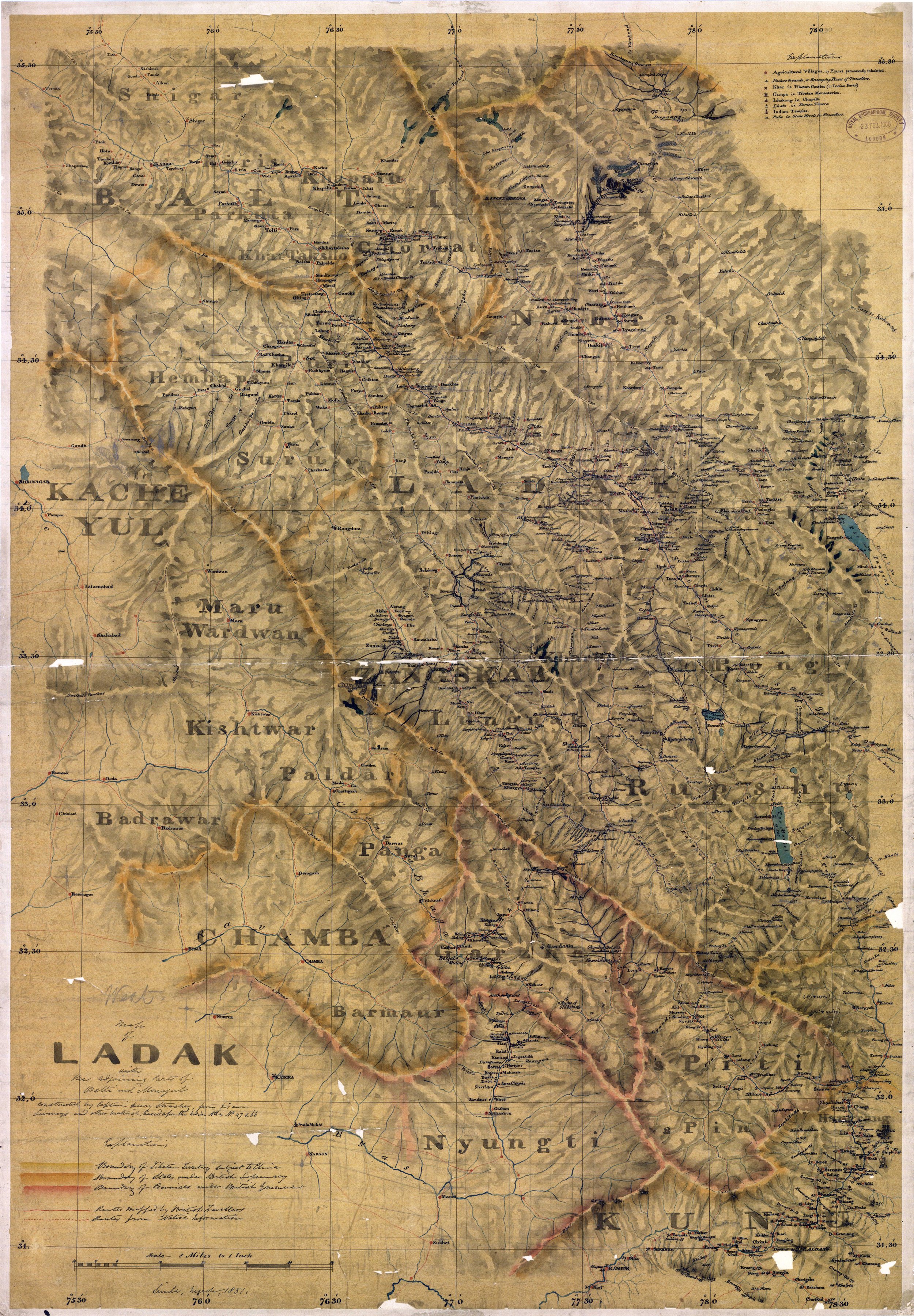
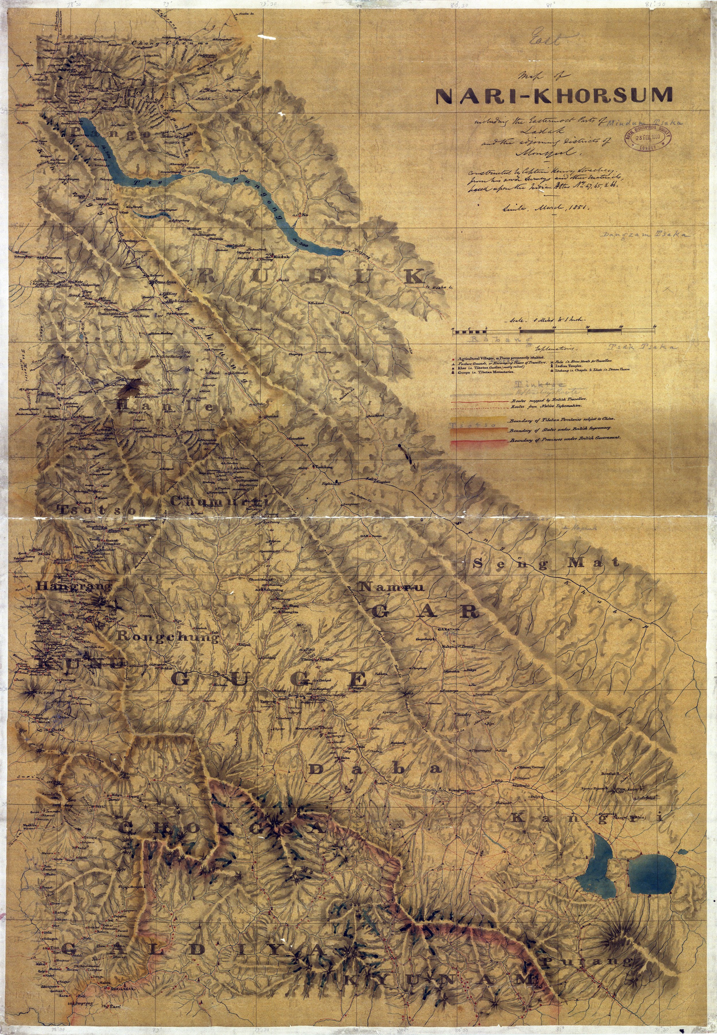
Col Starchey was an Officer in the British Army and was involved in the Surveying and Mapping the unmapped Regions to the North of the Great Himalayan Range as well as around Tibet. He made various Journey’s to the Region and came up with some Great Maps of the area and one of the most prominent being the Maps of Ladakh (Western Tibet as it was called) and the Regions around it.
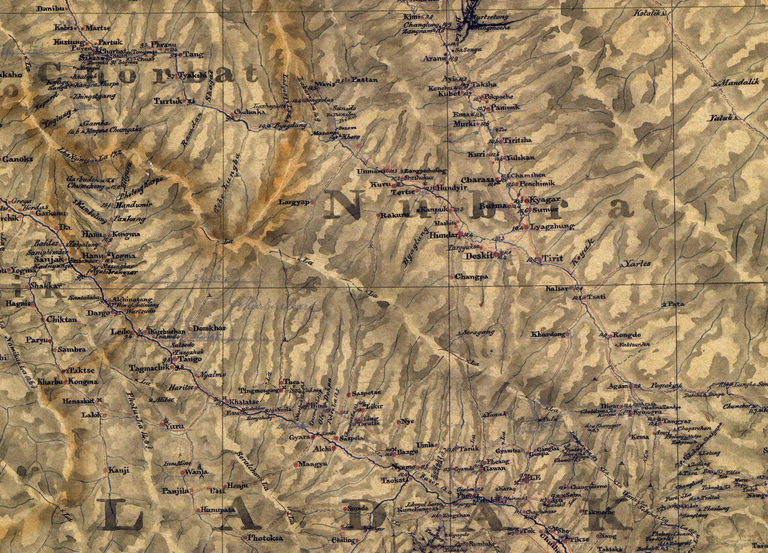
In this Note we will go through his legendary Ladakh map which came out in Two Parts, the first being Ladakh West with Parts of Balti and Monyul 1851 (labelled as the Ladak Map) and the second one being Ladakh East with Parts of Balti and Monyul 1851 (labelled as the Nari-Khorsum Map)
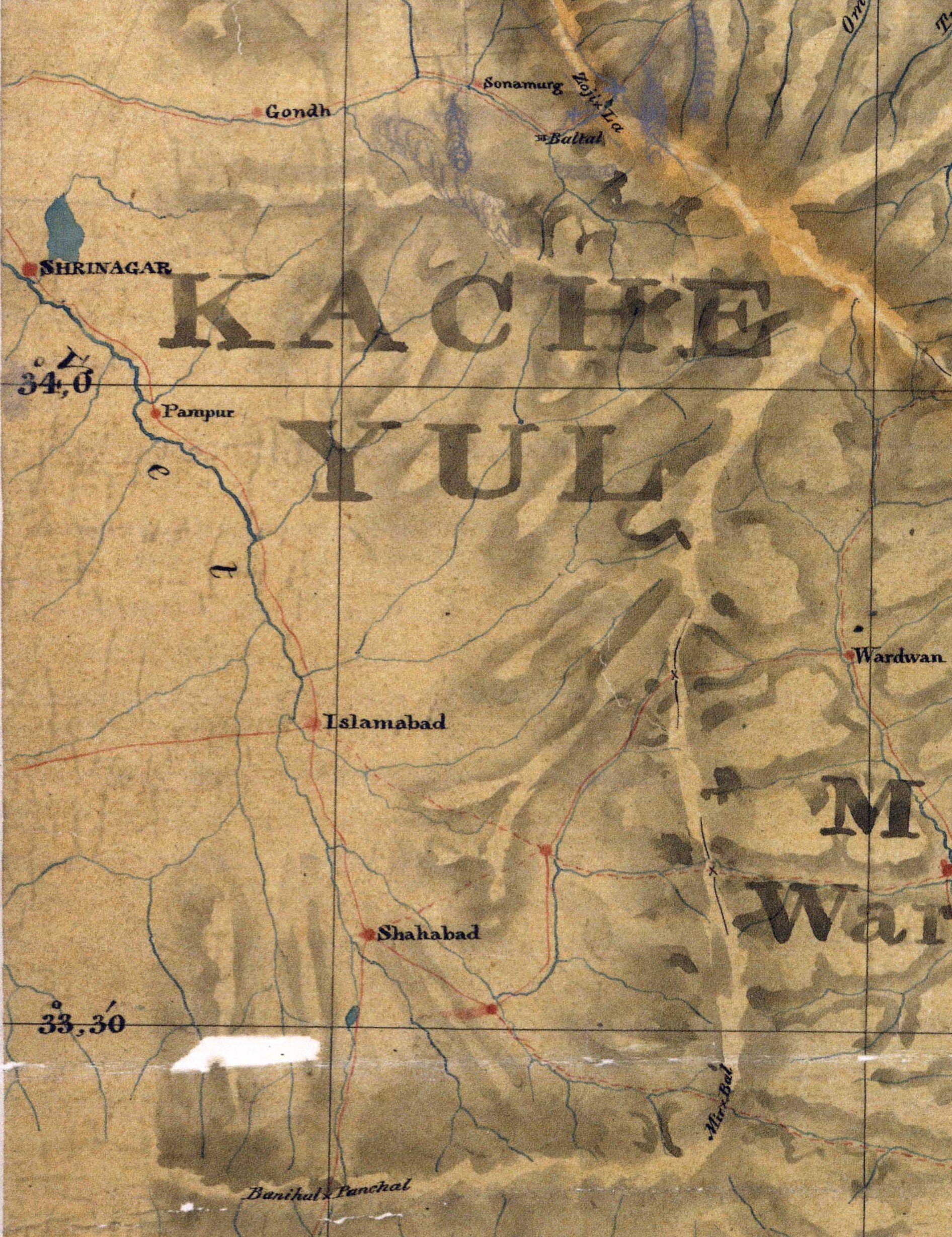
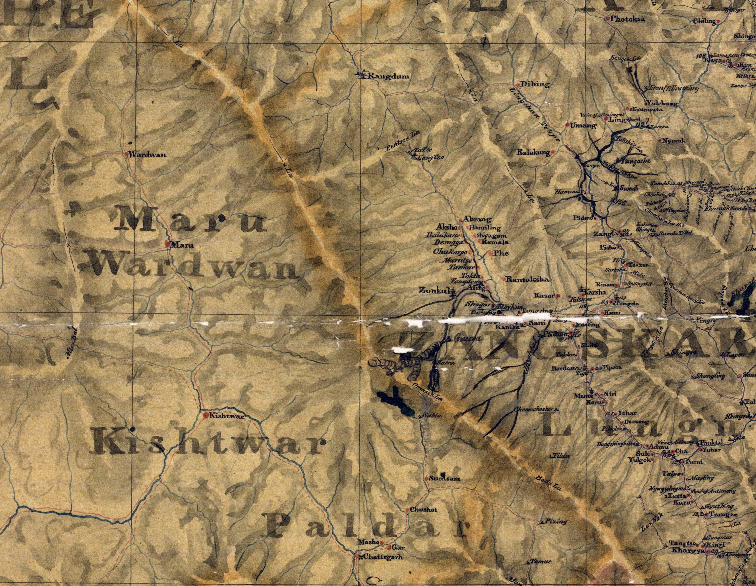
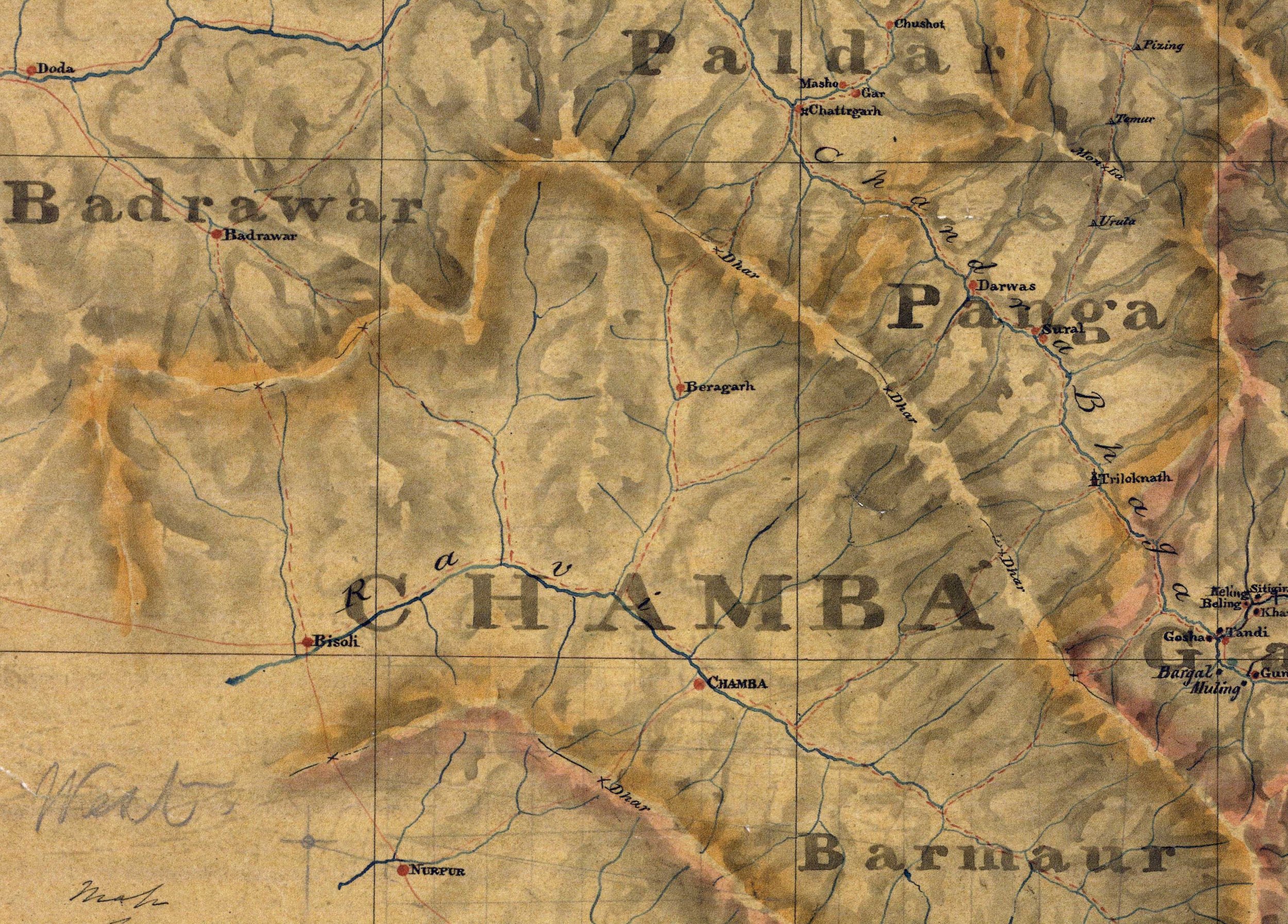
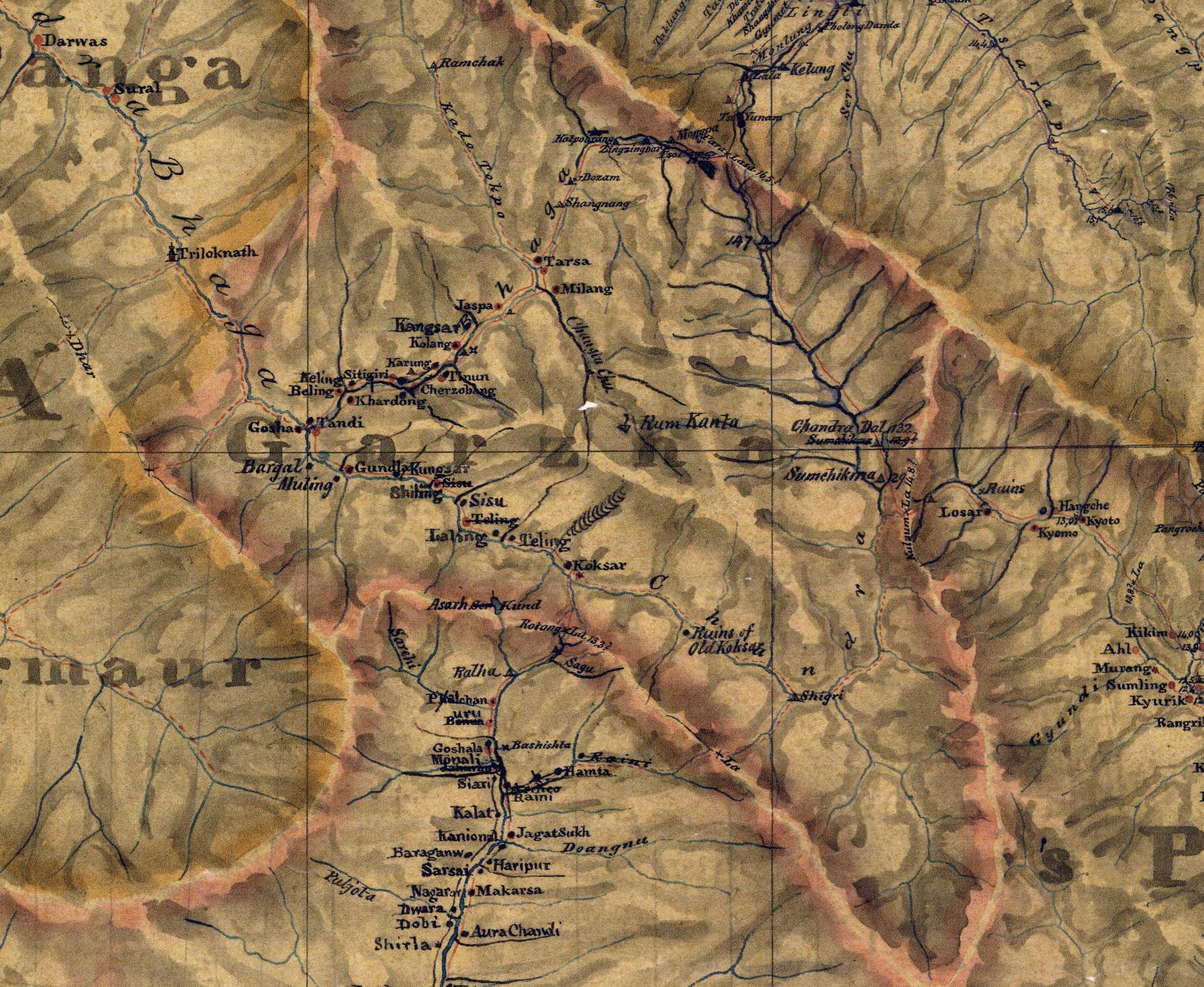
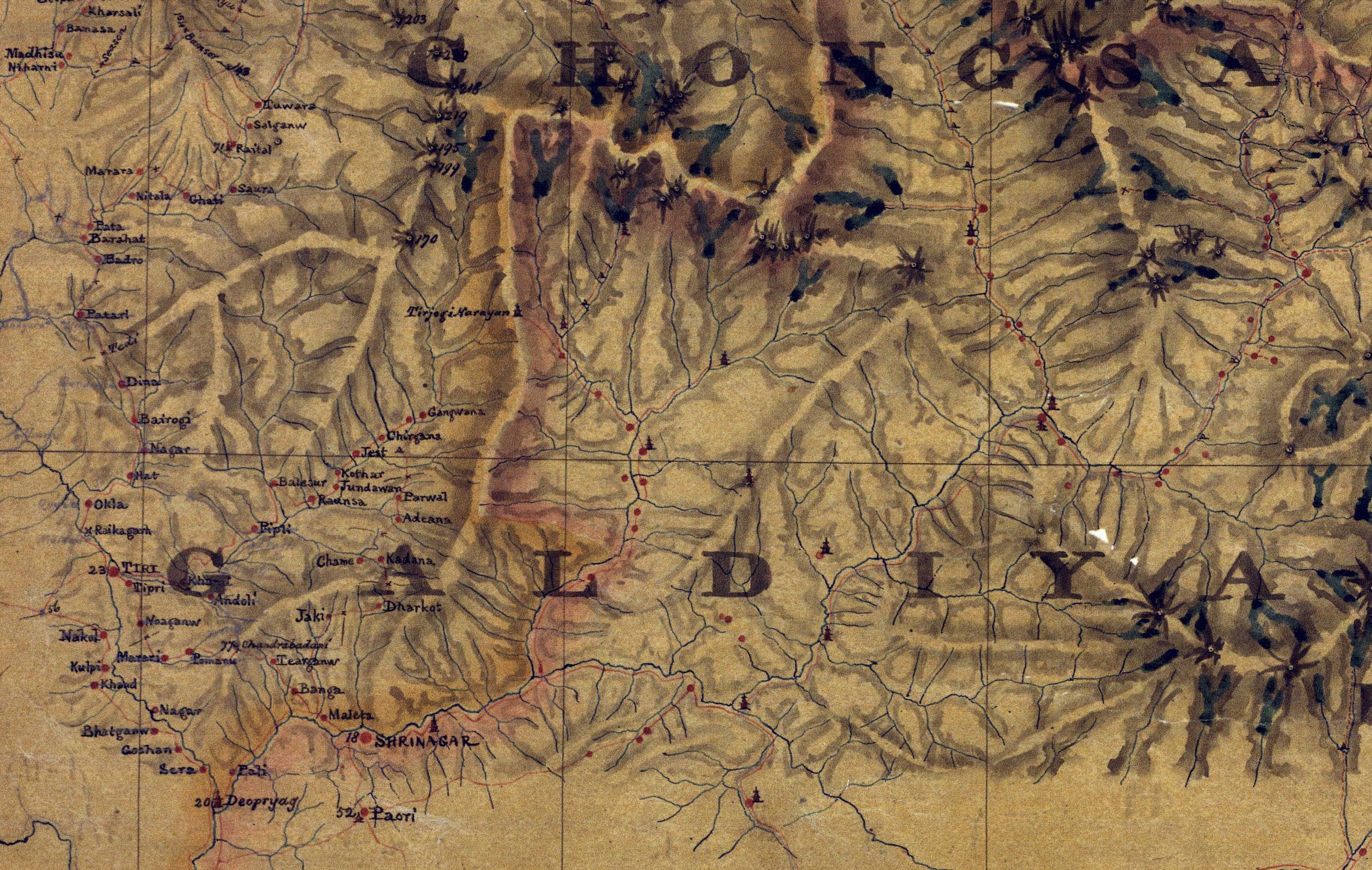
One of the interesting things is that the names of all the neighbouring Regions are as per what the Tibetans / Ladakhis referred to these Regions as for eg Kacheyul instead of Kashmir.
Also what the Map does is show the names of the Regions in Capital and it reflects on how prominent a certain name was for a Region and how prominent was that Region in itself. This was one of the first Maps of the Region and it came just three years after the first European stood on top of the Karakoram Pass which is the watershed between the Himalayas and Turkestan of old.
The Regions listed in bold in both the Maps are as such :
In the West Ladakh Map
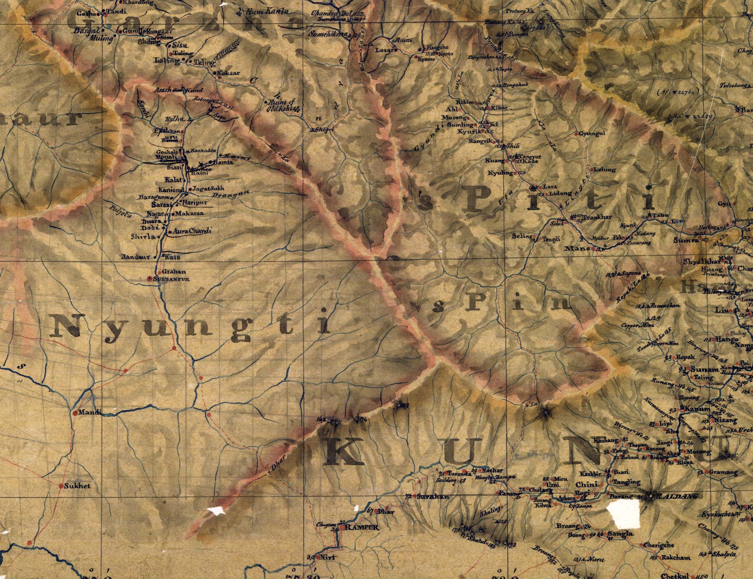
Ladak (Ladakh) : Balti (Baltistan) : Zangskar (Zanskar) : Kacheyul (Kashmir) : Chamba : Kunu (Kinnaur)
In the East Ladakh Map (besides the ones already mentioned)
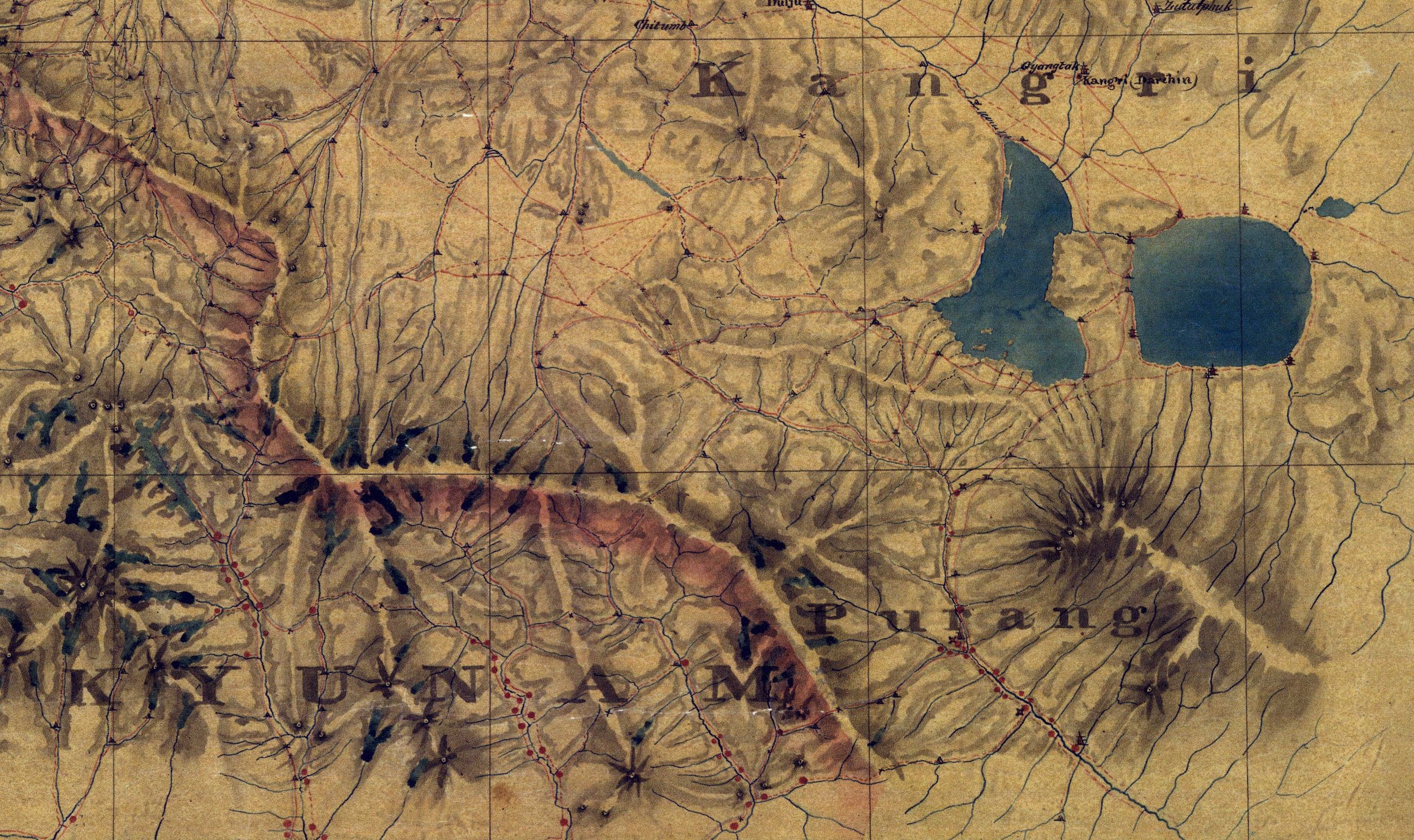
Ruduk : Gar : Guge : Chongsa : Galdiya : Kyunam
In his account called “ Physical Geography of Western Tibet” written for the Journal of the Royal Geographic Society writes as such ;
The Indian Provinces next adjoining to Tibet are Ashong i e Acham or Assam. Monyul the whole of the Indian Himalaya especially the Sub Himalaya inhabited by Mon i e Hill Indians. Lhopato, Lho dukor Lho mon, the Bhotant of Bengal or Bootan of the English. Its capital b Krashismchhosdzong or pronounceably Tashichuzong i e the August City of Religion improved by the English to Tassisudon and the like Demojongs i e the Goodly Region, the Shikim Shikimpati or Sikkim of Indians and English the British cantonment in its lower part is r Dorjegling or Dorjeling corrupted to Darjeeling and the like a name equivalent to Vajrapura or in plain Saxon Thunderbolton otherwise the Place of the Heavenly Sceptre or of the Precious Stone or Diamond Kangschan hJing i e the Icy Mass is the great snowy mountain on the N border of this province famous as the highest measured peak on the globe
Palbo is Naipal (Nepal), Kyunam is Kumaon, Galdiya is Garhwul, Chongsa is Himalayan Garhwal. Kunu is the District of Knor Kanor Kanoring Kanaur Kunawar (Kinnaur), c Nyungti is Kullu, Garzha is Lahaul, Panga of Himalayan Chamba, Paldar and Maru Wardwan of Himalayan Kishtwar are called by their native names Kacheyul vulgo Kachul is Kashmir