
Martand Sun Temple : Then and Now
The famous Martand Sun Temple in Kashmir and how it has faced the ravages of time. With some old sketches and photos compared with some pics of the modern times we take a journey in time.

The Original Martand Sun Temple
Martand Sun Temple : Then and Now
On top : A Sketch from 1870 showing a Restored Version of the Temple.
The Martand Sun Temple (मार्तंड सूर्य मंदिर) is a Kashmiri Hindu temple dedicated to Surya (the chief solar deity in Hinduism) and built during the 8th century CE. Martand is another Sanskrit name for the Hindu Sun-god. Now in ruins, the temple is located five miles from Anantnag in the Indian state of Jammu and Kashmir.
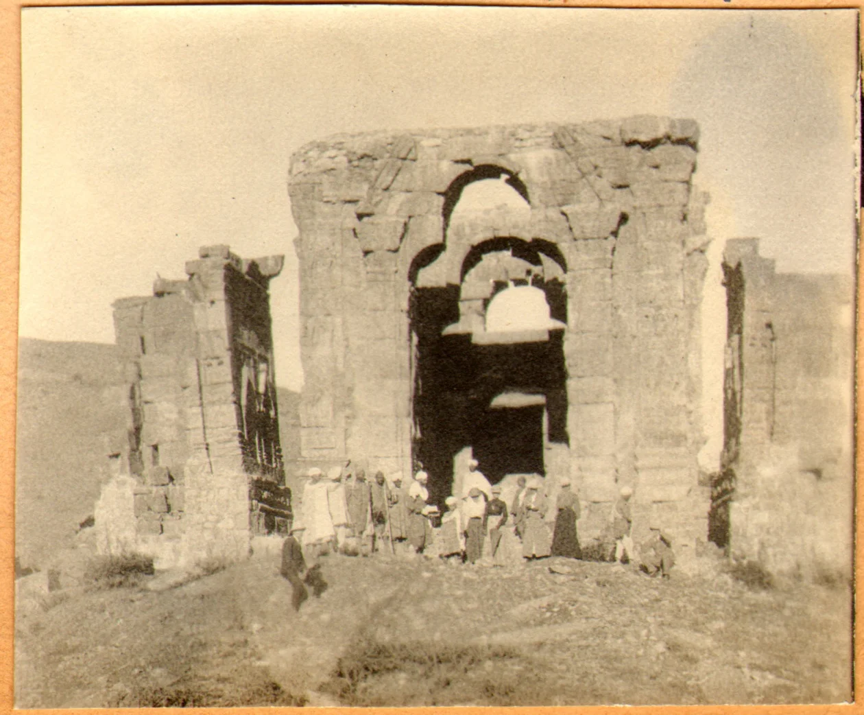
The Temple in 1913
A photo of the site from the turn of the last Century
The Martand Sun Temple was built by the third ruler of the Karkota Dynasty, Lalitaditya Muktapida, in the 8th century CE.[2][3] It is said to have been built during 725-756 CE.[4] The foundation of the temple is said to have been around since 370-500 CE, with some attributing the construction of the temple to have begun with Ranaditya. The Temple is said to have been destroyed by Sultan Sikandar.

A Sketch from 1874
Present state of the Temple Complex
Of course this was one of the grandest Temple structures in the Kashmir Valley and its ruins are still quite impressive. In my view the most impressive ruins of Temples in Kashmir are the Martand Temple, the Temples at Naranag and the ruins at Parihaspora and all these were built by the Lalitaditya who was one of the greatest Kings of Kashmir.

Present state of the Temple Complex
This Temple got a lot of coverage when it was covered in the Movie “Haider” and a particular song in the movie was picturised at the same site. Of course this has aroused people’s interest in the Temple.

A Water Tank at the Site probably used for Ritual Bathing
Presenting some images on how the Temple looked in its original format, another pic taken in 1875 and another by Ralph Stewart in 1912. And finally a pic taken last year by my friend Ramesh Tahlan.

A pic by Ralph Stewart from 1912A corresponding pic to the above pic from the present day.
Of course it is clear that the Temple in its original format was just mind blowingly awesome. And the pics from 1875 and 1912 show the neglected and almost half buried in the Ground. It is pertinent to note that during the Dogra Dynasty was ruling Kashmir and of course restoration of old Temples was never high on their agenda. Infact Auriel Stein had noted that stones from the Parihaspora ruins were being used to build the Jehlum Cart Road. It was only when Auriel Stien bought this to the notice of the British Resident that the Maharaja was requested to spare the ruins and the Maharaja agreed.

A Sketch of the Main Temple structure from 1875
As is clear from the pics a lot of work seems to have been done in the last Century. All of the main structure has now been excavated. The Stair cases were all buried if you notice the pics from the turn of the last Century. They are now prominent. Same way many structures which were earlier totally buried are now excavated and the whole site looks in a much better shape to be honest.

A pic by Ralph Stewart from 1912 of the main Temple structure. Note that the Stairs are buried under the Mounds.Corresponding to the above pic a Pic from the present day giving you an idea of how much excavation has been done in the said area.

The photos if Temple ruins from Kashmir always evokes a strong emotion in people. I always like to tell them two things. Temple ruins are dotted all over India and not only Kashmir. And secondly history is not as linear as we tend to assume. The reasons for the the present state of a historical site are multiple and not a single reason. So I always recommend that we cherish and preserve what we have instead of constantly bemoaning the state they are in and starting a blame game.

The Entrance from the other side.
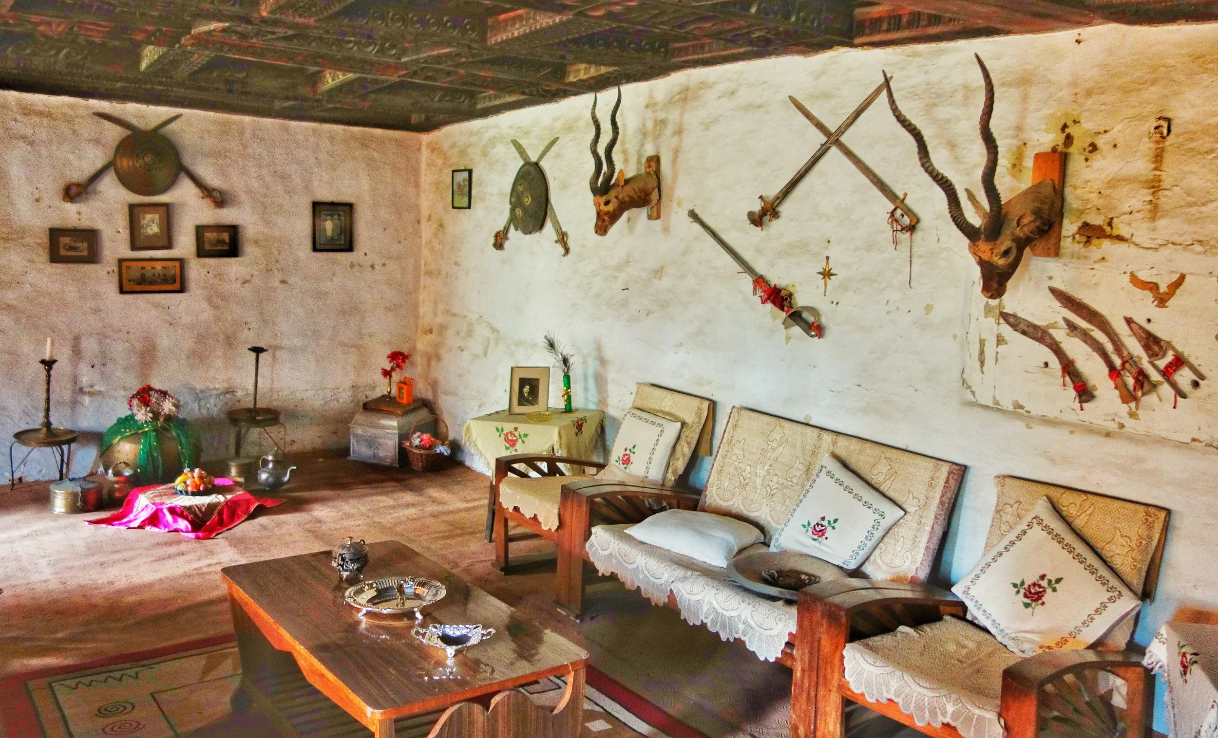
The Khukris of Kotkhai Palace
The Story of how the Gurkhas once met on the battlefield and how they came close to fighting the British together but alas its a tale of missed chances. And how the Gurkhas Kingdom once stretched all the way from the present day Nepal to Kangra valley.

The Khukris of the Kotkhai Fort
As they say every pic tells a story.
This pic was clicked in the Diwan E Khas of the Fort Palace of the Rana Sahib of Kotkhai. I had earlier posted another pic from the same place.
Like any Royal places of audience it had the customary display of weapons of war and trophies of hunts. There were Shields, Swords, Matchlocks, Bows, Kataars and most intruigingly Khukris. And this opened the Pandora Box of the time when the Gurkhas were in control of this area along with Garhwal and Kumaon and which eventually brought them into conflict with the British.

The Gurkha war machine after over running Garhwal and Kumaon and certain parts of Himachal laid a siege on one of the most important Forts of the Lower Himalayas, the Fort of Kangra in 1806. Led by General Amar Singh Thapa, also referred to as Kazi, the Gurkhas were simply unstoppable. The House of Gurkha, inspired by the Great Prithvi Narayan Shah were expanding their Empire like never before and led by Generals like the Kazi, who was the Military Commander of the Gurkha armies to the west of the Sutlej they were on a roll. Soon they over came the defenders of the Fort and the Kangra Fort was now in the hands of the Gurkhas. As per a report of a British Officer Captain C.P Kennedy in 1824 after Kangra the next target for the Gurkhas was Kashmir, which at that time was under the Afghans.
Except that another equally powerful entity had its eyes on the Kangra Fort, the Hill States and Kashmir and beyond. This was Maharaja Ranjit Singh and his equally warlike Army of the Khalsa ie the Confederacy of the Sikhs. After the fall of the Fort the ruler of Kangra, Raja Sansar Chand Katoch approached Maharaja Ranjit Singh asking for his help in evicting the Gurkhas. It has to be noted that the Sikh and the Katoch armies had also fought against each other as Maharaja Ranjit Singh had set his eyes on the Himalayas as mentioned earlier and they were not really the best of friends. But for now the best recourse available to the Hill Raja was to seek the help of Maharaja Ranjit Singh. The Kangra Raja offered the Sikhs the Fort for the long term if they could make the Gurkhas leave.
Maharaja Ranjit Singh was not only a great military genius and organiser of the Sikh armies, he also had great sagicity and foresight. He knew exactly what it would entail taking on the Gurkhas, they had a reputation for all the right reasons. And he knew that the biggest victors in an all out clash between the Sikhs and the Gurkhas would be the British as both these forces would be greatly weakened if they got into a war. And he did what he thought would be in everyone’s best interest. Of course his own interest and the interest of his statecraft was paramount.
Ludwig Stiller writes in his epic book “The Rise of the House of Gorkha” that Maharaja Ranjit Singh sent a letter to General Amar Singh Thapa in August 1809 asking him to peacefully give up the Kangra Fort and vacate the whole area to the Sikhs and in return he offered Gurkhas military help, whenever they came into conflict with the British, which was clearly inevitable. Just to push his point in, being the Great Military Genius he was, he had cut off the supply lines of the Gurkhas and had the Fort surrounded. The Kazi offered money to Maharaja Ranjit Singh in order to withdraw but it was Kangra the Maharaja wanted and not money. That was when the Letter was sent.
General Amar Singh Thapa was incensed when he read the letter and even imprisoned the messenger. The reason for this was that he was aware that the Maharaja and the British had signed the Treaty of Amritsar in 1809 in which it was agreed that the Maharaja would keep to the other side of Satluj and not interfere with the British dominions and protectrates below it. It was however set him free to do whatever to the North and the West of the Sutlej. The Kazi found it hypocritical that the Maharaja would sign a Treaty with the British on one hand and offer help to the Gurkhas against them on the other hand. This is how the greatest Empires were built but I assume the Kazi was more of a military man. The Kazi refused the offer.
Maharaja Ranjit Singh had no other option except the Military one now as a conflict with the Gurkhas could not be avoided. The Gurkhas had spurned his offer. There ensued a short War, called the Sikh Gurkha war, both sides fought tooth and nail but the Gurkhas had a disavantage as their supply trains were cut. The Gurkhas lost in the end and as a result of which the Gurkhas were evicted from the Kangra Fort and all the territories there of. Maharaja Ranjit Singh now sat firmly in command of the Kangra Fort and surrounding Hill States braced up for the Gurkha retaliation. And later of course Maharaja Ranjit Singh conquered Kashmir as well from the Afghans.
So the Gurkhas lost the Kangra Fort and eventually they had to fight the British in 1815 and they had to fight them alone. Maybe theyshould have taken Ranjit Singh’s offer and the course of history would have been different. Alas. But lets rewind again.
Coming back to 1809, after their eviction the Gurkhas tried to take Nalagarh as it was beyond Maharaj Ranjit Singh’s reach due to the terms of the Treaty Of Amritsar and at the same time they captured the Fort at Subathu (it still serves as a Gurkha Regimental Center)and the went onto conquer the other Shimla Hil States like Theog, Keonthal, Balsan, Jubbal Kotkhai and Rampur Bushahr. The KotkhaiFort was also now under the control of the Gurkhas and now a clearer picture of the mystery of the Khukris at the Diwan e Khas emerges.
On a broader front the Gurkhas were now, with all their conquests were now heading for a collision with the British. The powerful Nepalese Prime Minister, Bhim Sen Thapa knew war was coming. Bhim Sen Thapa was also a great tactican and it was apparent to himthat the greatest weakness of the British was that they could not stand up to a combined force of a confideracy of the local powers. He sent emissaries to various princely states, amongst them the Marathas of Gwalior. The Scindia had admiration for the Gorkhali courage that they had displayed in standing upto the British. But in order to form an alliance he set one condition. He would only join in an alliance if the most dominant local power in North West India ie good old Maharaja Ranjit Singh would also join the alliance. The clock had turned a full circle in 5 years.
It was now Amar Singh Thapa’s turn to send a missive to Maharaja Ranjit Singh, which offered the Sher-e-Punjab, “a division of the Gangetic plains from Delhi to Calcutta between the Sikhs, the Gurkhas and the Marathas” and also appealed to Maharaja Ranjit Singhto throw out the British in the name of Hinduism. Prime Minister Bhim Sen Thapa had made his move and had also thrown in an emotive religious angle into it. He knew this game. He knew it well.
I still wonder what the Sher-e-Punjab would have made of all this. And I am sure he must have considered it very seriously. He could think keeping all emotions, including religious ones aside. His armies consisted of Sikhs, Muslims, Hindus, Europeans and even Gurkha and Rohilla soldiers. After givng it much thought, I assume, he decided to lay low and not get himself imbroiled in this affair. He had made his offer long back and it was refused. Now it was payback time. At the same time he mobilised his Army of the Sutlej to “take advantage of any situation that may arise” out of the coming clash between the British and the Gurkhas.
The First Anglo Gurkha war finally broke out in October 1814. The British attacked on the Western and Eastern front, in an area from the Sutlej to the Kosi. In the eastern front the charge through the Terai towards the Kathmandu Valley was led by Maj Gen Marley and Maj Gen Wood and the western front was led by Maj Gen Gillespie and Col Ochterlony. Facing them were the Nepalese Army columns led by none other than our old friend, the Kazi, General Amar Singh Thapa.
On the Himachal Hill States front, when the British and the Gurkhas crossed swords the local Hill Rajas supported the British, as they were promised their Kingdoms/ Riyasats/ Thakurais back. That the British afterwards reneged on their promises is another story. All the Kings of the region however now use the title Rana, though I am not sure if its significance or if it had anything to do with the Gurkhas. However I am pretty sure they all have collections of Khukris.
I leave the details of the Anglo Gurkha War for you to read up on but at the end the Treaty of Sagauli was signed and the Gurkhas lost all their dominions in Garhwal, Kumaon, Himachal Pradesh as well as Sikkim and Darjeeling. The borders of Nepal as it stands today were defined by this Treaty.
I cant help but wonder what would have been different had the Kazi accepted the Sher-E-Punjabs offer or vice versa 5 years later.
The British eventually overcame the Sikhs as well almost 10 years after the Sher passed away. Having faced the Gurkhas and Sikhs in war the British had a great sense of admiration for their sheer courage and tenacity. No wonder both the Gurkhas and Sikhs were recruited as soldiers and boy did they prove themselves in all the Wars they fought for the British.
The Political History of the Himalayas is indeed as intriuging as the Himalayas themselves.
PS : Some of the Forts that the Gurkhas built still exist in Himachal Pradesh like the Dhar Mountain Fort, the Malaon Fort, Bansar Fort, Subathu Fortand Parwanoo Fort. Maybe this tale will inspire some of you guys to go take a look at these old dilapidated structures take some pics and post around here.
Travelling to Tibet
Your Guide to Travelling in Tibet as it used to be. Besides the present Tibetan Autonomous Region (TAR) it also included parts of Sichaun, Qinghai and Yunnan. Travelling to TAR involves a lot of Permits and a lot of restrictions. However in the Tibetan areas of Sichuan, Qinghai and Yunnan you can move around in the Tibetan areas with out any restrictions.

Travelling Guide to Tibet
We are all very familiar with this side of the Himalayas and some parts of the Trans Himalaya which falls inside our country like Ladakh and Lahaul-Spiti but there is a whole new world out there beyond these areas.
As you are well aware most of these Great Himalaya lie besides our Country in Pakistan and China (also in Nepal and Bhutan but those are easily accessible). As fate would have due to International Geo-Politics we cannot really travel overland as we would love to into the vast expanse of the Trans-Himalayas which lies mainly in the Tibetan Plateau. Travelling to Pakistan to see the mountains is pretty much out of the question. So that leaves us with China where Indians can and do travel but mostly on business trips.
For me on a personal basis the Trans-Himalaya and its its adjoining Ranges lie in three different parts of China for which the Ground rules and access differs. As per the political division of China these three are the Tibetan Autonomous Region, the Xinjiang Autonomous Region and Yunnan.
1. TIBETAN AUTONOMOUS REGION : This is what we also called as Tibet proper as defined by the Chinese Government. Of course there are parts of Tibet (historically/ geographically/ ethnically) which are not a part of TAR but are included in the neighboring Provinces but more on that later.
Out of all the regions in China, travel is most restricted in the TAR. As many as 3 Different permits besides the Chinese Visa are required if you need to visit all the parts of Tibet and even then you would be refused access to certain areas. These three Permits are
A. Tibet Travel Permit : The Tibet Travel Permit is issued by Tibet Tourism Bureau (TTB). It is also called Tibet visa, for the purpose of entering Tibet. Travelers need to have Tibet Travel Permit to enter into Lhasa or any other parts of the Tibetan Autonomous Region. It is obtained through tour operators for most tourists. When you take a flight or train to Lhasa, you will be asked to show this permit during check-in. Even if you have the Tibet Travel Permit, you are not allowed to travel anywhere outside of Lhasa city. If you want to get out of Lhasa, you have to apply for another permit, Aliens’ Travel Permit.
B. Alien’s Travel Permit : The Alien’s Travel Permit is issued by the Public Security Bureau. It is required when tourists are planning to travel to the ‘unopened’ areas of Tibet, like Mount Everest Base Camp in Shigatse, Samye Monastery in Tsedang. Aliens’ Travel Permit is required to visit ‘unopened’ areas. It is issued by the police (Public Security Bureau, “PSB”). Usually, you can apply for it once you arrive at Lhasa. For tour groups, our guide will ask you for the passport and Tibet Travel Permit, which they will submit to the Foreign Affairs Division of the PSB for the Aliens’ Permit. It normally takes several hours and the cost is 50 CNY per person. If you travel alone, you need to join local tours to ‘unopened’ areas, and the local travel agencies will arrange the PSB for you as well. Pay attention, no travel agency can provide ‘Alien’s Travel permit-only’ service. You need this for Mansrover as well.
C. Militray Area Entry Permit : The military area entry permit is required if tourists are planning to travel to some military sensitive areas in Tibet. Like Mount Kailash in Ali, Rowok Lake in Chamdo.Sensitive borders such as Mt. Kailash and eastern Tibet not only require a Military Area Entry Permit, but also a Foreign Affairs Permit. For Tholing and Tsaparang in western Tibet, you will also need a permit from the local Cultural Antiquities Department. All these will be arranged by our travel agency one month before you enter Tibet. The Military Area Entry Permit is issued by the military affairs office while the Foreign Affairs Permit is issued by the Foreign affairs office in Lhasa. It normally takes 10-15 working days to get them all.
So travelling in TAR requires a lot of preparation and permits and involves Tour agencies. Hence it is not a cheap affair.Of course there is a special agreement between India and China for the Pilgrimage to Lake Mansrover but that is just limited to the Lake.There are some agencies which do this through Nepal as well but again the scope is limited to the Lake Mansrover and the areas around it.
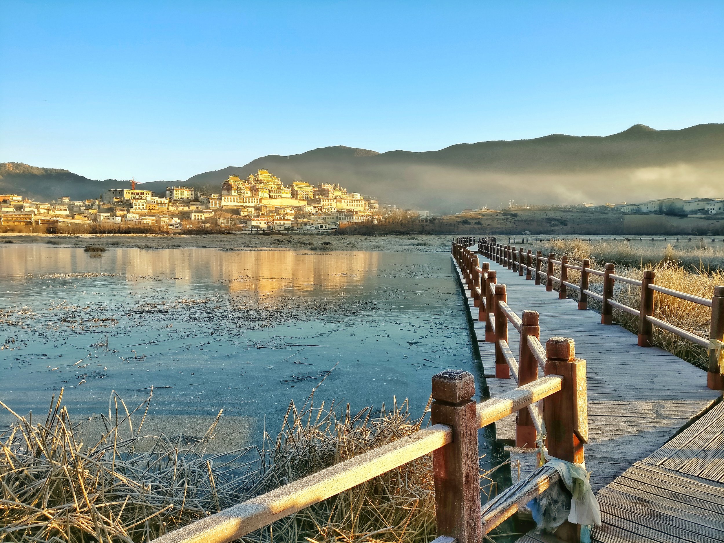
2. YUNNAN : Yunnan is the adjoining state to the TAR on the South Eastern side of TAR. Western Yunnan is a very interesting area in the sense that it is where the the Himalaya, the Tibetan Plateau and the Yunnan Plateau meet. It is one of the world’s most biodiverse regions. Also many parts of Western Yunnan bordering TAR are actually parts of the historical Tibetan Region called Kham. However many of these areas are actually a part of the Tibetan Plateau with the average elevation above 3000 m. Note that other regions of China such as Qinghai and Sichuan also have substantial areas which used to be a part of Tibet. These areas are also free to travel to.
There are no special permits required to visit Yunnan. Just get a Chinese Visa and you are good to go. Also there is now a direct flight between New Delhi and Kunming, which is the capital city of Yunnan. This is the same Kunming where the famous Stillwell or the Ledo Road ended connecting Assam to Yunnan in the good old days. Kunming itself at 1800 m plus is a beautiful place. Using Kunming as the base you can move further West using flights/ trains/ buses to go to places such as Lijiang, Dali and further to ShangriLa in Deqen or Zhongdian.

TBH honest Western Yunnan with its high elevation but Southernly latitude is unlike any other place. The sharp jagged Peaks and the deep canyons and the rolling Mountains and Hills just take your breath away. The Tiger Leaping Gorge and the bends of the Yangtze are special attractions as well as the various Snow Mountains as they are called.
I recently travelled in this Region and it was truly worth it. Here is a link to a small Video I made in Shangrila which was earlier called Zongdian or Gyal Thang. https://www.facebook.com/groups/TheHimalayanClub/10154875267365775/?notif_t=like¬if_id=1485522719531162
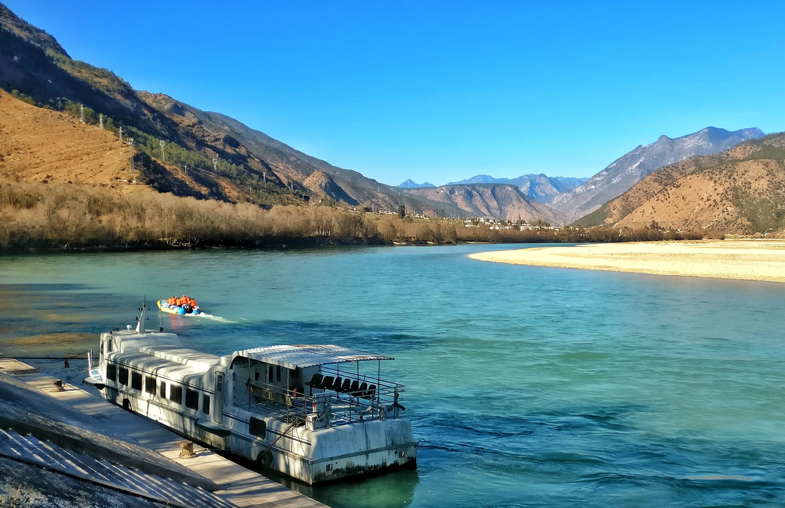
3. XINJIANG UYGHUR AUTONOMOUS REGION : This the region which borders Tibet on the West / North West. This Region used to be called East Turkestan and is a part of Central Asia with a majority of the population being Uyghurs, who are a Turkic people. Xinjiang is a land of extremes and includes parts of the Karakoram, the Pamirs and the Kun Lun mountains.
Being on the main Silk Route this has for long been the fabled land that explorers wanted to get to. The names of exotic places like Kashgar, Yarkand and Hotan still fill your mind with visions of exotic lands surrounded by Mountains and Deserts. For me with a special interest in early exploration of the Western Himalayas these names are almost out of a dream.
Now the good part. No special permit is required to travel to Xinjiang. You can take a direct flight to Urumqi which is the capital city. Please note that Xinijang is almost one third the size of India pretty much like the TAR. As an ideal base for someone like me I would choose the city of Kashgar 1500 km down to south.Kashgar is the end point of the Karakoram Highway coming from Pakistan. Again there are options of travelling to Kashgar by Air/ Train / Bus as per what suits you the best.
Kashgar serves as a base to go to the Sarakul Lake and the monster called Mustagh Ata. You can further go down the Karakoram Highway till the town of Tashkurgan for which you will require a special permit. Once you have this permit you can even try your luck going till the Khunjerab Pass but usually they dont let foreigners proceed beyond a point a 2 or kms before the Kunjerab Pass. Note that as Indians travelling on Indian Passports we would be least liked people hanging around especially the authorities. So when you try doing this keep in mind that, though not illlegal, it can get you into a situation which might require you to answer some questions raised by certain Authoirities. Do this only if you are confident enough about yourself and your backup getting you out of any situation that might arise. Being confident would be the key.
You could also travel from Kashgar to Yarkand and onto Hotan to see the Taklamakan Desert. Yarkand was where the trade route used to go to from Leh. So its a town that just cannot be missed IMO. There are also other interesting places around but for that you need to do some research.
So go out. Travel. See unseen worlds.
I will do a further post on “How to travel in China” and how to get “Bookings Done for Hotel / Travel” as I have travelled
extensively in China mostly for work purposes.
Feel free to ask any questions.
Most of this information is based on the best of my research and getting some information from Agents. Some of it is based on actual travels. Kindly verify the information from other sources as well.
#transhimalaya #yunnan #xinjiang #tibet #pamir #karakoram #kunlun#hengduan
Pic from January 2017. In the shadow of the Shika Snow Mountain, Tibetan Plateau, ShangriLa, Deqen Tibetan Autonomous Prefecture, Western Yunnan.
Ladakh / Baltistan / Gilgit Story
We try an together the story of Ladakh, Gilgit and Baltistan and how they became a part of the erst-while Riyasat of Jammu and Kashmir.

Ladakh / Baltistan / Gilgit Story
As a second part of my series on the state of Jammu and Kashmir and its complex geography / history. I wont get into the history of Kashmir Valley as it is usually well known. Please note that what I write below is from an Indian POV of the history of the region.
In this part I will try and comment on the Ladakh region and Gilgit Baltistan, the Trans Karakoram Tract (Shaksgam Valley) and last but not the least Aksai Chin. Out of all these regions most parts of Ladakh is under Indian control as well as a tiny part of what used to be the Baltistan Wazarat. All the rest are under de facto Chinese and Pakistani control and visiting these is impossible for Indian citizens so all what I state here has been through different sources in Books and on the Internet. Please note that to really understand the Geography at present we will need to dwell into History as to how things ended up how they are today.

The Zorawar Fort , Leh
We start off with Ladakh which is geographically and culturally much closer to Tibet and was usually referred to as Western Tibet by the Europeans. Ladakh was first conquered by the Sikh / Dogra armies led by General Zorawar Singh. As per a Treaty with the British, Maharaja Ranjit Singh’s was free to add territory to the North of the Sutlej River but not to the South of it. Jammu was already held by the Dogra Raja Gulab Singh who was a vassal of the Maharaja. Kashmir was already held by the Sikhs in the 1820’s and was ruled by an appointed Governor from the Court of Ranjit Singh.
Due to some bad blood between the Governor and Raja Gulab Singh, General Zorawar Singh was forced to go through Kishtwar on his first expedition to Ladakh. He ended up entering Ladakh region through the Suru Valley and went on to subjugate the whole of Ladakh in a series of expeditions starting in 1836.

The first engagement between Zorarwar and the Ladakh Army took place around here in the Suru Valley.
After the conquest of Ladakh, General Zorawar turned his attention towards Baltistan and Skardu. As it happened one of the sons of the Raja of Skardu/ Baltistan, Muhammed Shah, sought his help in a war of succession for the Skardu throne. Not one to let go of this opportunity General Zorawar Singh went on to invade Skardu and after a tough campaign finally managed to add Skardu and Baltistan to the Sikh Empire with Muhammed Shah as the nominal ruler paying an annual tribute to the Sikhs. Another contingent of his Army went on to conquer Astore.
Zorawar Singh was subsequently killed while on a campaign in Tibet and the Tiebtan and Chinese forces re-occupied Leh and most Ladakh. But subsequently the Sikh / Dogra armies returned, wanting to take revenge for the death of their beloved General Zorawar, and they ousted the Tibetan Chinese combined forces from Leh and subsequently a Treaty, the Treaty of Chususl, was signed between on the behalf the Sikh Maharaja and the Dogra Raja on one side and the Tibetan Dalai Lama and the Chinese Emperor on the other side, which demarcated the border pretty much as it stands today. Ladakh was hence ordained to be a part of India as the Chinese/Tibetans gave up all claims over it. The Treaty stated

The Village of Chushul where the Treaty of Chushul was signed.
“As on this auspicious day, the 3nd of Assuj, samvat 1899 (16th/17th September 1842) we, the officers of the Lhasa (Government), Kalon of Sokan and Bakshi Shajpuh, commander of the forces, and two officers on behalf of the most resplendent Sri Khalsa ji Sahib, the asylum of the world, King Sher Singh ji, and Sri Maharaja Sahib Raja-i-Rajagan Raja Sahib Bahadur Raja Gulab Singh, i.e.. the Muktar-ud-Daula Diwan Hari Chand and the asylum of vizirs, Vizir Ratnun. In a meeting called together for the promotion of peace and unity, and by professions and vows of friendship, unity and sincerity of heart and by taking oaths like those of Kunjak Sahib, have arranged and agreed that relations of peace, friendship and unity between Sri Khalsaji and Sri Maharaja Sahib Bahadur Raja Gulab Singh ji, and the Emperor of China and the Lama Guru of Lhasa will hence forward remain firmly established forever; and we declare in the presence of the Kunjak Sahib that on no account whatsoever will there be any deviation, difference of departure (from this agreement). We shall neither at present nor in the future have anything to do or interfere at all with the boundaries of Ladakh and its surroundings as fixed from ancient times and will allow the annual export of wool, shawls and tea by way of Ladakh according to
the old established customs.
Should any of the Opponents of Sri Sarkar Khalsa ji and Sri Raja Sahib Bahadur at any time enter our territories, we shall not pay any heed to his words or allow him to remain in our country. We shall offer no hindrance to traders of Ladakh who visit our territories. We shall not even to the extent of a hair’s breadth act in contravention of the terms that we have agreed to above regarding firm friendship, unity, the fixed boundaries of Ladakh and the keeping open of the route for wool, shawls and tea. We call Kunjak Sahib, Kairi, Lassi, Zhon Mahan, and Khushal Chon as witnesses to this treaty.”
Gilgit was again captured by the Sikh/Dogra forces in a repeat of events as they happened in Baltistan. One of the sons of the Raja of Gilgit sought the help of the Sikh Maharaja Sher Singh in expelling the Raja of Yasin who had conquered Gilgit. With the help of the Sikhs he was able to expel the Yasin Raja and Gilgit also became a vassal state of the Sikh Empire with a contingent of Sikh Army
permanently stationed there under Nathu Shah. With the passage of time the Sikh/ Dogra rule extended over to Yasin, Hunza, Darel, Chilas, Chitral and Nagar.

The Baltit Fort in Hunza
However the British took over the Gilgit Wazarat and called it as the Gilgit Agency. It acted as a listening post into Central Asia and more importantly it was just a few miles south of the borders of Imperial Russia and acted as one of the main stage where the Great Game in High Asia was played out. And the Brirtish pretty much ran the affairs of the Gilgit Agency and set up the Gilgit Scouts.
Thus the state of Jammu and Kashmir came into being as it existed on the day of independence.
It quickly unravelled after the British left who returned the Gilgit Agency back to the Maharaja. The Gilgit Scouts revolted against the Dogra Maharaja’s Governor on November 01, 1947. Brig Ghansara Singh, the Dogra Governor was taken prisoner and Gilgit was proclaimed, after some to and fro, as a part of Pakistan. The Commander of the state troops in Skardu, Col.Majid came in with re-enforcements for the Brig, but his own troops revolted and Col. Majid was also arrested. The Gilgit Scouts then turned their attention towards Skardu which had a garrison of the Maharajs’s state troops whose Commander Col.Majid was already in their custody. With no supplies coming in the Maharaja’s State troops were thought be easy targets by the Gilgit Scouts. Only they didnt factor in one fine detail. The second in command at the Skardu Garrison was a young Gurkha Officer, Major Sher Jung Thapa.
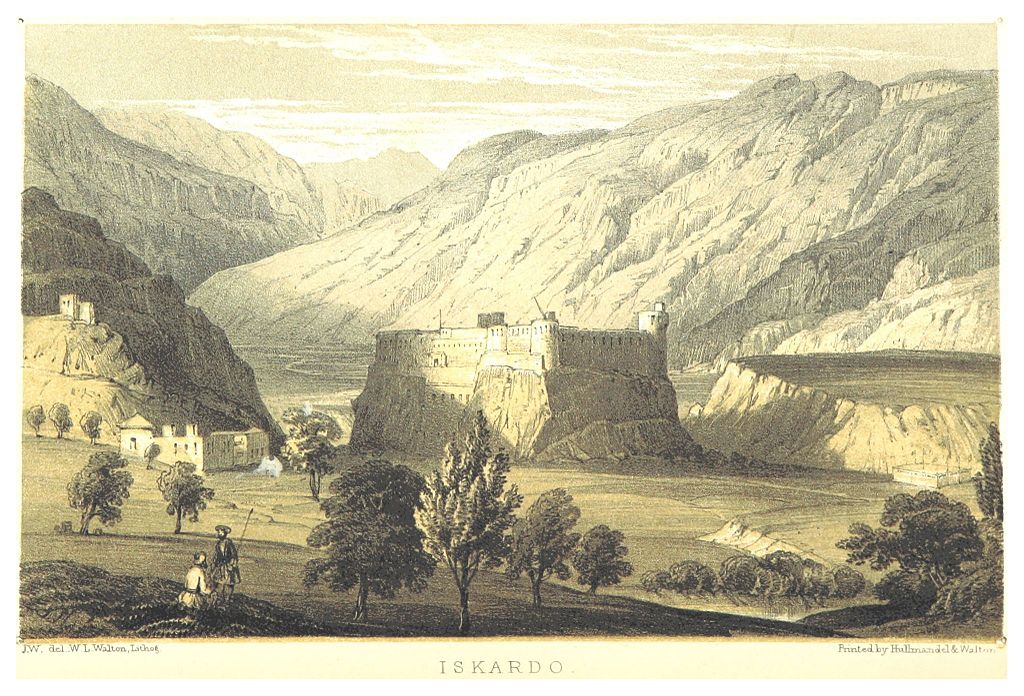
Skardu by Thompson 1852
The Gilgit Scouts attacked the Skardu Garrisson in February but the forces led by Maj. Sher Jung Thapa kept repelling all their attacks. The indomitable Gurkha Major held out for seven months until he rant out of all supplies and ammunition and he turned down many offers to surrender. Finally after firing the last bullet and throwing the last stone the Major finally surrendered on August 14. All the people in the Garrisson was put to the sword. All except Maj. Thapa who was taken a prisoner and later repatriated to India. The Indian Government decorated him with a Maha Vir Chakra and he was named “The Hero of Skardu” and was inducted into the Indian Army. He went on to become a Brigadier in the Indian Army and after retirement he peacefully passed away in 1999 in New Delhi.
The different acts of valour notwithstanding almost the whole of Gilgit Baltistan was lost and at the same time Ladakh was held onto inspite of great challenges.

The Khorpocho Fort overlooking the Indus at Skardu.
As for Aksai Chin it was always an uninhabited area and was not seen worth as keeping a garrison on. The boundaries were never officially recognized by the Chinese and the Kashmir Maharaja/ British Authorities. At present the Indian claim is based on the Johnson Line of 1865 where as the Chinese claim till 1959 was the MacCartney MacDonald Line of 1899. After 1959 however the Chinese came across this line which resulted in the conflict of 1962 and subsequently most of Aksai Chin came under Chinese control. For Chinese the area holds importance as the Tibet to Xinjiang Road runs through this region.
The Trans Karakoram Tract or the Shaksgam Valley was ceded to China by Pakistan as a part of their boundary agreement which settled the borders between these two countries.
To think of how beautiful and challenging the mountains in this whole region are but due to events in our history we are unable to enjoy the beauty which now stands divided by man made borders.
Lets hope and wait
The Worst Trade Route in the World
The Story of the Trade Route or the Silk Route which connected Kashmir with Yarkand in Central Asia via Ladakh. The Route passed through some of the most inhospitable Mountain terrain and over the highest Passes in the World. No wonder some one called it “The Worst Trade Route in the World”

The Worst Trade Route in the World
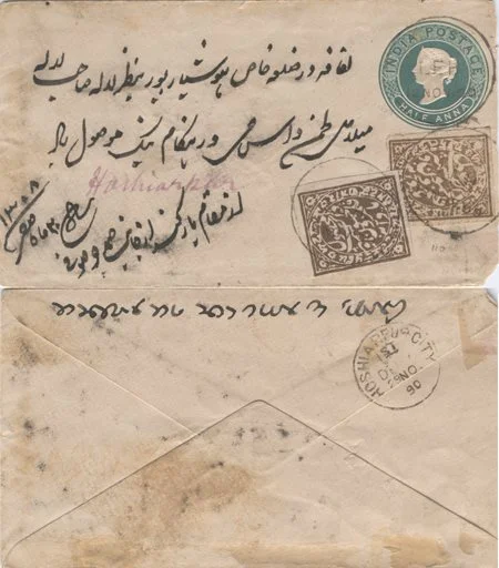
Came across this inocous looking Envelope cover during one random search on the Net while trying to know more about Mail runners in the Himalayas, you know the guys who used to take letters / Posts during the 19th century.
Looked at it closely it and the writings on it in Persian, English and Dogri in Takri script got me more interested. And then I read on it. It was letter sent from Yarkand in the Tarim Basin in Xinjiang (Sinkiang) or East Turkestan as it was known at that time to someone in Hoshiarpur in Punjab. There was a constant trade from Hoshiarpur to Yarkand via Mandi, through Kullu Valley onto Leh and onwards to Yarkand. It was in my opinion the hardest trade route in the world. (Thanks to kashmirstamps website for this invaluable photo and details)
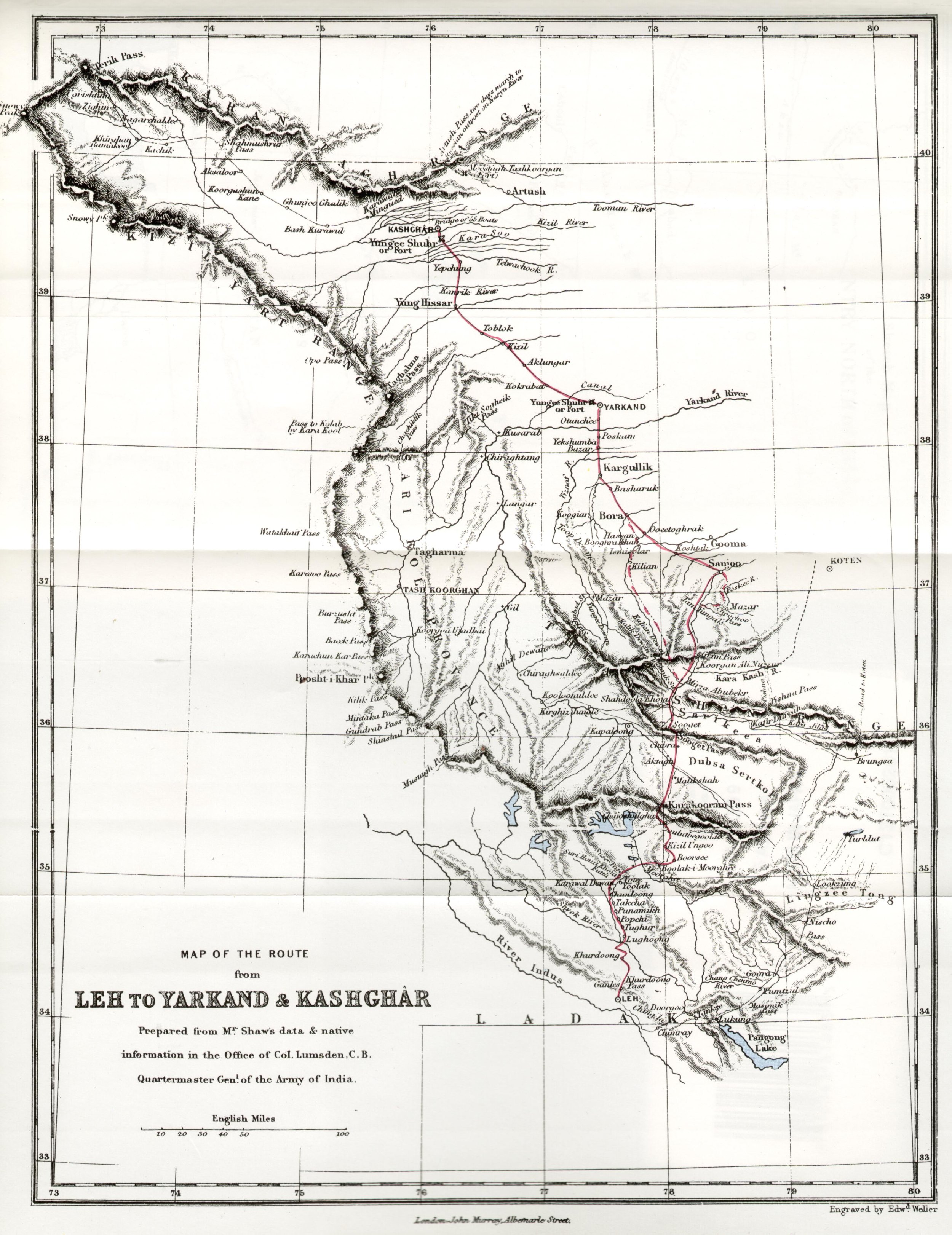
A large quantum of the trade was carried on through the classical trade route from Ladakh to Yarkand in the Tarim Basin in Turkestan of the old ( Xinjiang Province of China at present ). The traders from Ladakh took to Yarkand (which served as the gateway to Central Asia) items like Shawls, Indigo, Tea, Corals, Muslin etc. On the other from Yarkand into Ladakh (and further into Kashmir and North India) came in Silk, Precious Metals, Costumes, Jewellery and oddly Russian currency towards the end of the Nineteenth century.
Now the letter this Envelope contained was posted on October 05, 1890 and it was delivered at Hoshairpur on November 29, 1890 after a total of 55 days. It entered the Bristish India Postal system once it reached Leh, which it did on November 12, 1890 and the Dogri stamps/writings were affixed on November 17, 1890 somewhere on the way which is speculated as Mandi but I seriously doubt anyone could get from Leh to Mandi in 5 days. So that place remains a mystery. Also it seems to be at a point under Dogra suzerainity which Mandi never was. My best guess is that it was somewhere in the Ladakh but where exactly is a mystery.

The Sasser La
To understand the dynamics of the whole journey from the Hoshiarpur to Yarkand you need to consider that it involved crossing the Dhauladhar Range, the Great Himalaya itself, the Karakorams and finally the Kun Luns itself. It involved crossing over 10 Passes, some of which are the highest in the World. It also included crossing the extremely inhospitable Depsang Plains. If ever there was a difficult “trade route” this was it. Infact one English gentleman called it the “Worst Trade Route in the World”

The Tullung putti la: The cliff you see in the background has been surmounted by a path cut through with 42 bends
Most of us are familiar with the Route from Hoshiarpur to Leh. Form the plains upto Mandi into the Kullu Valley and then upto the first great Pass, the Rohtang La. At around 13000 ft Rohtang may be dwarfed by some of the other passes which come later but with the amount of snow it received it came with a reputation. No wonder it derived its named from “A pile of Corpses”. After crossing into the vertically dramatic Lahaul Valley the route went upto the the Baralacha La, lying on the water shed of the Great Himalayas. After the getting into the Trans Himalayan Ladakh region the route crossed the Lachulang La and the Tangang La after crossing the Plateau known as the More Plains. And then we got to Leh.

Team trekking from Murgo towards Karakoram Pass
Leh was the midway point in some ways and as such was full of businessmen from both ends of the Route and places in between as well as traders from Kashmir who came up through the Zoji La Pass. Leh was a busy trade town at that time with a mix of Yarkandi, Kashmiri, Punjabi, Tibetan, Europeans as well as the very interesting Arguns (these were people born out of mixed marriages between Yarkandi and Kashmiri traders and local Ladakhi women) people besides the local Ladakhis.

The Karakoram Pass
The great passes that had to be crossed in this great trasnverse starting from the Leh side included the now “world famous” Khardung La. From the head of the Nubra Valley started the descent into the second Pass, Sasser La,at 5411 m. From this pass the route descended into the Depsang Plains. From the Depsang Plains, which are as desolate as any place on the planet with an average elevation of 5300 m the route headed over the Karakoram Pass which stood at 5540 m. The Karakoram Pass was/is totally bereft of any kind of vegetation and lot of the livestock just gave up. It is said that the path up the Pass is still strewn with hundreds of bones and skeletons of pack animals that just gave up and died. After crossing the the Karakoram Pass the route went towards the relatively easy Suget La.
After crossing the easiest pass on the route, Suget La, ~ 5500, which was in the Kun Lun mountains the route descended into the staging post of Shahidullah which offered some rough pastures for the load animals to refuel. It is interesting to know the British considered Shahidullah as the frontier of the state of Jammu and Kashmir and not the Karakoram Pass as some others assumed it to be.

The famous Karakoram Mules crossing the Shyok river at Saser Brangza on their way to Chongtash, Murgo... KK Pass.
After Shahidullah came the last pass before descending into the plains of Central Asia, the Sanju La at 5364 m. From this Pass the mountains gave way and the trade route made its way into the fabled city of Yarkand.
Of course this letter came in the opposite direction and I tried to get a transalation done from a friend (Thanks to Seema Bhatt for helping out here). In Persian the letter says “Lifafa dar Zila Khas Hoshyarpur ba nazre Lala Sahib Mela Das Hangame naik mosool howa. Az muqam e Yarqand az janabe Samad Joo Soofi. 20th of safar 1308 Safar.” The meaning with all the Persian respects and adab, means that the letter is addressed to one Lala Mela Das of Hoshiarpur and it is sent by Janaab Samad Joo Soofi. The sender in all probability was a Kashmiri trader based in Yarkand, guessing from his surname but as with a lot of Punjabis earlier the surname of Lala Mela Das remains a mystery. I checked up with a friend, who’s ancestors also used to trade with Yarkand, also from Hoshiarpur if he knew of this gentleman but till now ive drawn a blank.

One of the Trekkers in one of the "polu" shelters on the Karakoram Trail
Anyways this just goes to show what all is revealed when one digs into a simple old enevlope. The people/ the route it took/ the language/languages used/ the scripts/ the dates/ the reason etc etc. Truly something worth getting into the depth of.
For me the quest will continue as I plan to visit Yarkand some times in August I guess as I have always been fascinated by the Trans Himalayan Central Asian towns which were at the end of the Silk Road from our side and have a glimpse of the Worst Trade Route in the world. Yarkand, Kashgar, Khotan, Tashkurgan and of course the Karakoram Highway are all on my list
Additional inputs from : When Men and Mountain Meet : The Explorers of the Western Himalayas 1820 – 75. This has to be one of my favorite books on the Himalaya.
Photo from the kashmiristamps website
Dummy's Guide to Kashmir
A Guide to people visiting Kashmir. Compiled by a person who was born and brought up in this most beautiful of all Himalayan Valleys. Straight from the horses mouth as some would say.

Dummy’s Guide to Kashmir
A truly fascinating place which gives people the visions of beauty and is referred to as the “Paradise on Earth”. The name is enough to conjure up images of snow covered mountain peaks, valleys with a shroud of flowers, enchanting Mountain streams and beautiful lakes. Well the geography and the de facto political boundaries of the state are a bit more complicated. Here I try to explain the complexities of what used to be the Riyasat-e-Jammu and Kashmir in 1947. I will use that as the reference point and as a geographical unit will refer to it as RJ&K.
Moving beyond the territorial claims that individual countries have on RJK and avoiding the political baggage that comes with the veracity of each claim I will just mention the geography and the political status as it exists as on date. Based upon the actual territory that is being held by the various countries which have a claim on RJK. That being said, I would like to emphasise that the purpose of this article is to educate travellers and mountain lovers about where they can go and where they cannot, which is governed basically by their nationality and the relationships which exist between individual countries.

A United Nations Map of the current situation in the state of Jammu and Kashmir
RJK consisted basically of the regions Jammu, Kashmir, Ladakh, Baltistan, Gilgit and the uninhabited Aksai Chin. I would first comment on the areas of RJ&K that are under de facto Indian control which I will call J&K. J&K broadly consists of the regions of Jammu, Kashmir and it used to include Ladakh. Until they were divided into two separate Union Territories, one J&K and one Ladakh. However there are little parts of the former Baltistan that exist in J&K like the Kargil district and even Gilgit like Gurez. Jammu consists of the Jammu district as well areas along the border like Poonch, Rajouri, Udhampur and Doda. The beautiful Valleys of Bhadarwah and Kishtwar are also a part of the Jammu region. Jammu has its share of mountains especially the rugged region of Kishtwar but they are largely unknown and away from the glare of the outside world. I will cover the Jammu region in detail in a later post but for now we move on to Kashmir.
From Jammu we move onto the fabled “Vale of Cashmere” as it was called. Technically the Valley starts once you cross the Banihal Pass/ Banihal Tunnel (Pir Panjals) on the highway or when you cross the Pir Ki Gali Pass (Pir Panjals) on the Mughal Road when coming from the South. The original road to the Valley via Muzuffarabad is no longer in use due to political reasons. Also you can alternately cross the Sinthan Pass or the Margan Pass to go to Kishtwar or Warvan. Up North the Zoji La marks the exit from the Valley while to the North West the Razdhan Pass would also entail technically leaving Kashmir Valley but those areas of Gurez are still considered a part of the Kashmir region.
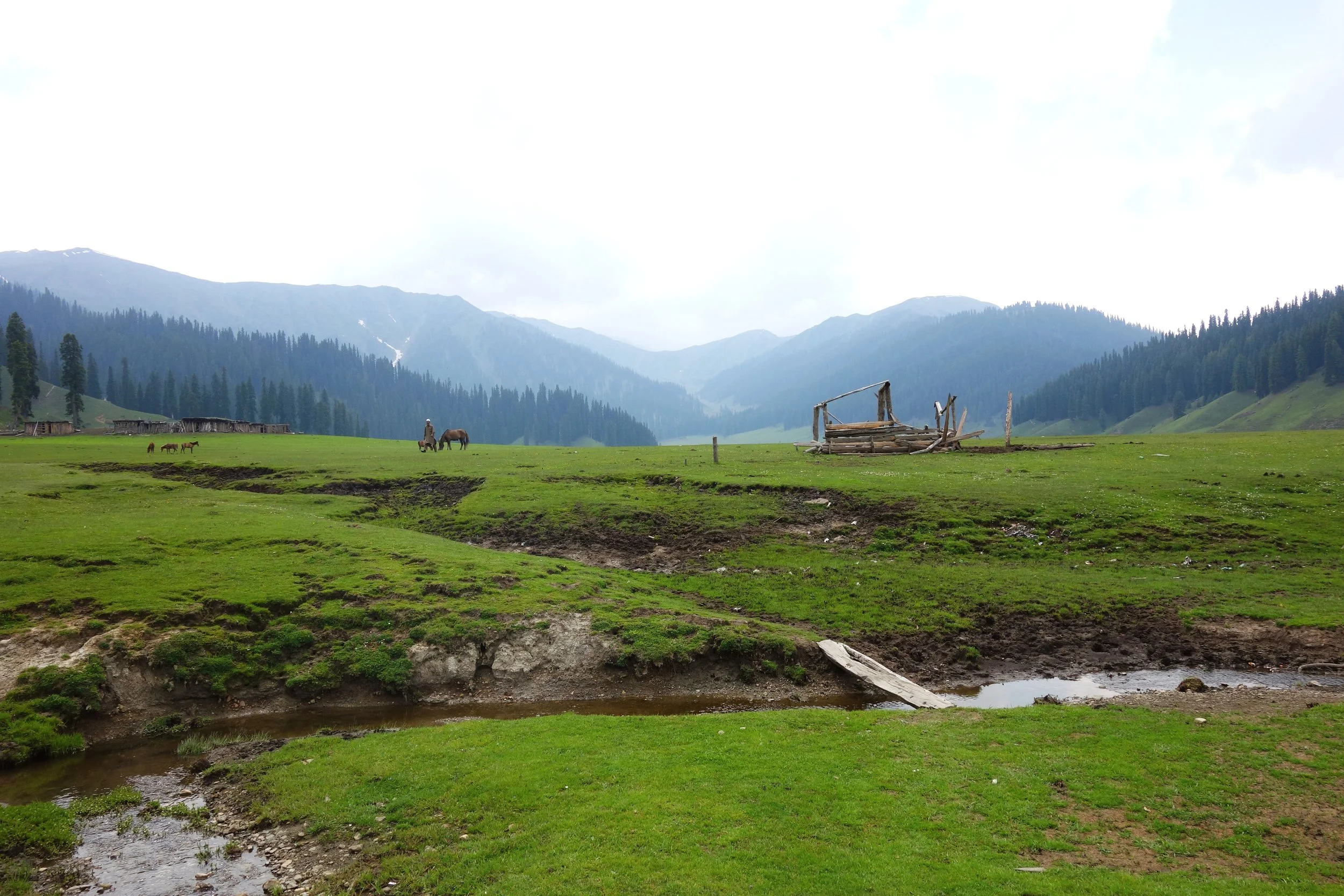
In the geological past the Valley was once a lake called the Satsar Lake which drained eventually due to various factors. However there is still a large diversity of of Lakes from the largest Wular Lake to the most famous Dal Lake to thousands of high altitude lakes nestled within the mountains which are an attractive trekking destination. The Kashmir Valley is bound on the South and South West by the Pir Panjals. And on the North and North East by the Great Himalaya and the Zanskar Range. It is by far the largest Valley in the complex Greater Himalaya Mountain system and certainly the most celebrated one.
Kashmir Valley is actually the Jehlum Valley and the Jehlum is the main drainage system for the Valley. The traditional source of the the Jehlum is considered to be the springs at Verinag. However many attribute the source to the Konsarnag Lake and even the Sheshnag Lake. The Lidder and Sindh are two main well known tributaries of the Jehlum. The Lidder has two main sources the Kolahoi Glacier for the West Lidder and the Sheshnag Lake for the East Lidder. The Sindh River rises from the Machoi Glacier near the Amarnath Caves.

A Faith Map of Jammu and Kashmir by Drew in 1875
Srinagar is the capital city of J&K and lies on the banks of the Jehlum River and it also includes the famous Dal Lake and the Nigeen Lake. The city is well know for the various Gardens laid out by the Mughals as well as the new fangled Tulip Garden which is a hit with the tourists. The Srinagar city has its own range of mountains called the Zabarwan Mountains which is a sub range of the Zanskar Range. The home of the endangered Hangul, the Dachigam National Park also lies on the edge of the City.
There are various other places of tourist interest in the Valley including Gulmarg, Pahalgam, Sonamarg, Yusmarg, Kokernag, Verinag, Achabal, Daksum, Parang and lately places like Doodpathri etc. My personal favorite has always been Gulmarg probably because I have sent a lot time here while growing up. However recently it is is over crowded and over priced. Gulmarg is a great Winter destination due to the humongous amount of Snows it gets.

The lesser know place which has fascinated me the most has been the Warwan Valley which could only be reached by trekking in the good old days. I happened to spend 5 nights in this enchanting Lost World. Being born in Kashmir and having familial connections in Himachal I have seen a lot of mountains but Warwan was special. Nowadays there is a road which goes over the Margan Pass and takes you to Inshin, the main village in Warwan. As of now I am not aware of how further this road goes. Technically though Warwan is a part of Kishtwar and hence a part of the Jammu Region.
A special note on Warwan Valley : The people of this region are by some accounts the closest that come to the ancient Kashmiris. Their language is the purest form of Kashmiri. The Warwan River runs through this enchanting Valley. This Valley runs parallel to the Lidder Valley and is around 3 to 4 km wide and 30 km long at an average elevation of 8000 to 9000 ft. At a place called Sukhnis the Valley transforms into a Gorge and on reaching Rangmarg you have two options.Taking a left leads you to the Gulol Pass crossing which you can descend into Sheshnag. Going straight takes you to the Botkol Pass going over which you come down to Panikher in the Suru Valley (Zanskar). This is the same route taken by the indomitable General Zorawar Singh when he launched his expeditions into Ladakh. Interestingly there was a Government proposal to make a road from Pahalgam to Panikhar which would technically be 45 kms but would provide unparalleled beauty as for almost half that route would under be the shadow of the fabled Nun Kun Massif. A point of special note is that Warwan as such is not in proximity of the Line of Control as compared with Gurez or Lolab.
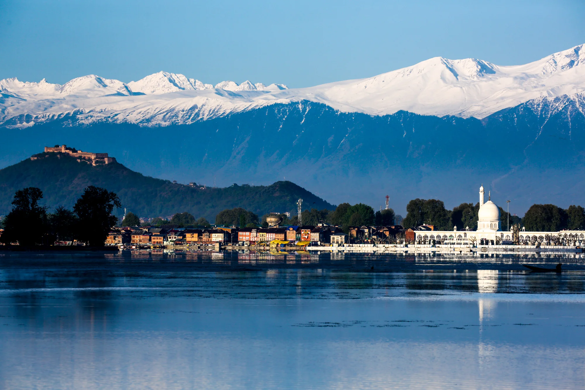
The Hazratbal Shrine by the Dal Lake and the Pir Panjals in the back ground
On the same axis lies the Sinthan Pass which connects Kashmir with Kishtwar proper. This scenic Pass is now becoming a destination as more and more Tourists go there to experience Snow which lasts well into June usually on the Sinthan Pass. One can also cross the Pass and go into Kishtwar and there are many interesting places there as well. Totally Offbeat.
Another region which sees a lot of tourist interest in the Gurez area. Gurez is actually a part of the Gilgit region but is counted in the Kashmir Valley. The people in Gurez speak Shina and were always more aligned with fellow Shina speakers in Gilgit rather than with Kashmir. The road to Gurez leads one over the Razdhan Pass and then you enter the enchanting land called Gurez. There is a road which goes from Gurez towards Kargil but as of now it is a military road but earlier that used to be one of the main Roads into Gurez. The fact that it is a part of Baltistan is borne out by the fact that the locals speak the Shina language, which is quite prevalent in Baltistan instead of Kashmiri.
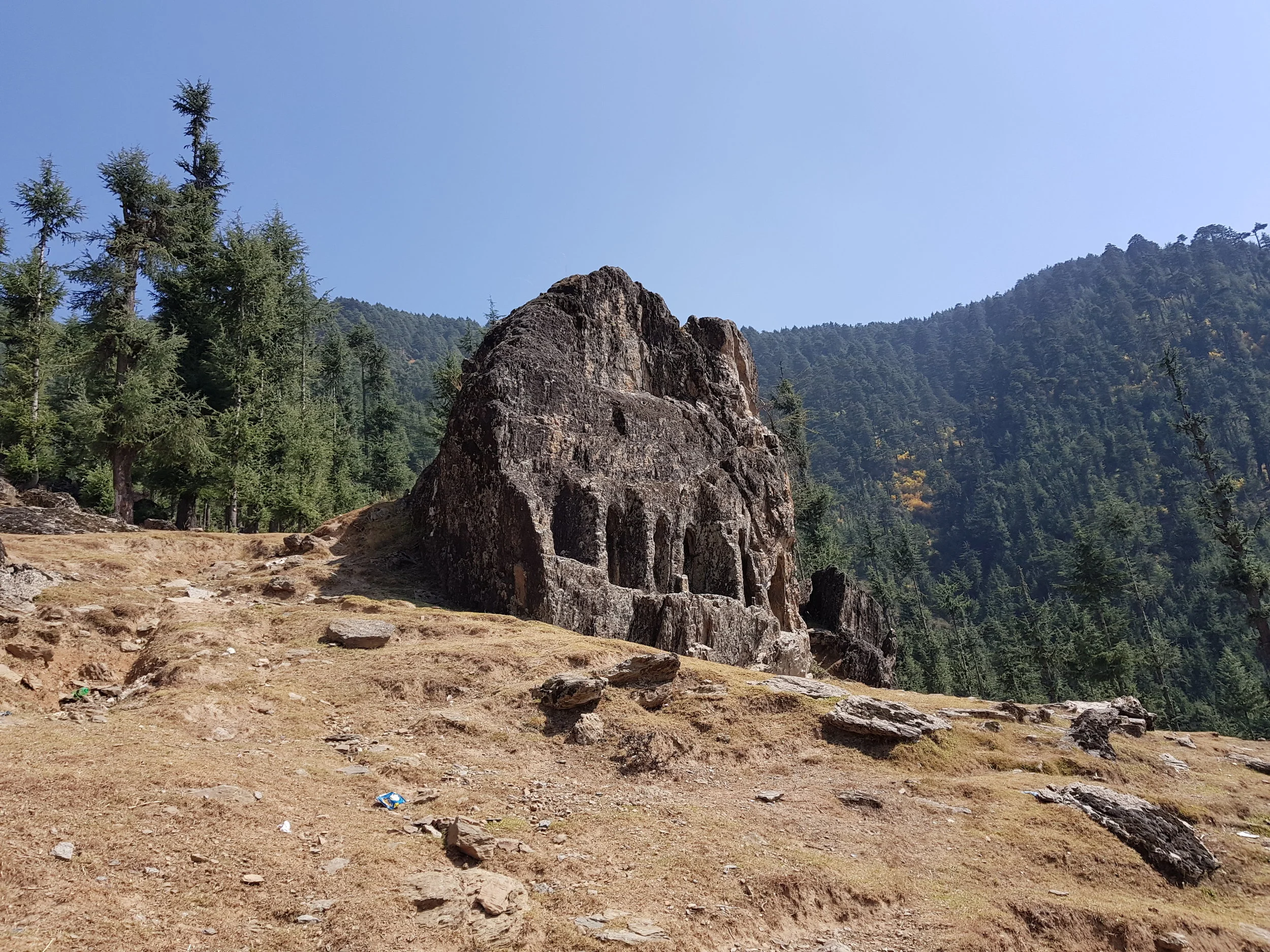
The Kalaroos Cave in Loalb Valley
And then there is the Lolab Valley and the Bangus Valley (both the Bod Bangus and the Lokut Bangus) in North Kashmir district of Kupwara. These are again very scenic areas but the movement of civilians especially tourists was severely restricted due to the proximity to the Line of Control. However now the restrictions have eased up and many Tourists now visit Bangus. Bangus is the largest Alpine meadow in Kashmir and covers a large area. The other famous Meadows in Kashmir like Gulmarg, Doodhpathri, Yusmarg and Tosa Maidan lie in the Pir Panjals and South and Western Kashmir but Bangus abuts the Great Himalayan Range itself. A Motorable Road has already been built to Bangus itself and Vehicles with 4x4 and Good Ground Clearance can already get t Bangus and even normal Passenger Cars would be able to get there once the Road is black topped.
Border Tourism in Kashmir
And now for the first time the Government is trying to promote Tourism to the areas which lie right on the LOC along the Kishenganga. This includes places such as Machil, Keran, Tangdhar and Titwal. Ours is the first Travel Company which has started limited Tours to these places for Adventurous clients.
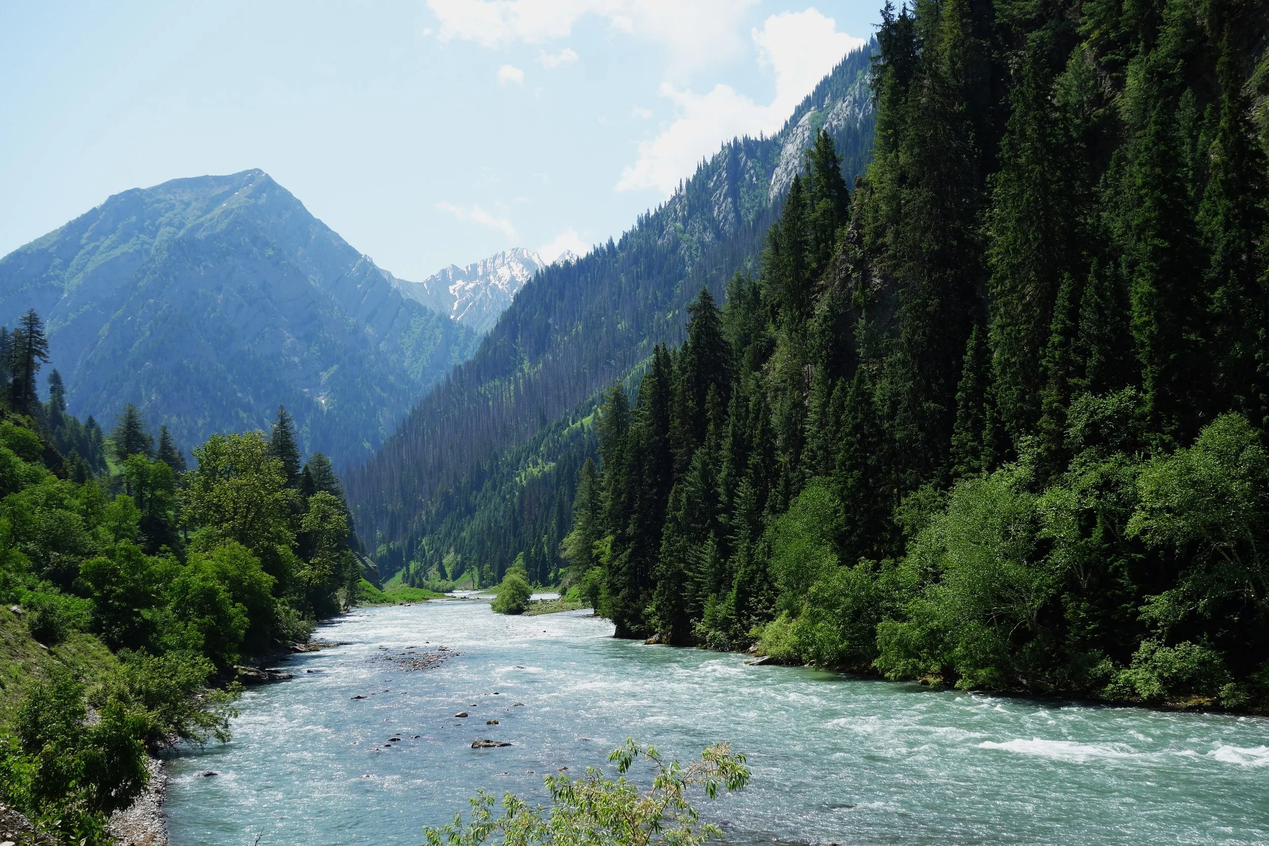
Weather
Kashmir has a Continental Weather with a proper 4 Seasons. In the Winters it can get quite Cold and all areas of the Valley get Snow in the Winters. Places like Gulmarg get a huge amount of Snow and that's why it's everyone’s favourite Winter Destination. Spring is probably the best Season in Kashmir with pleasant Days and Chilly Evenings. The Summer starts around mid June and July and in recent years it has started to get really Hot in Summers. Autumn again the Days become pleasant and the Nights Chilly.
Transport
The biggest advantage in Kashmir is the International Airport in Srinagar and its connected directly / indirectly with all Major cities. The Flight from Delhi to Srinagar is just One and Half Hours. Of course there is the Highway as well its on the verge of being connected by Rail in a couple of years.
PS : We Organise Trips to all these Places. Connect with us on Whats App Messenger on 98712 92288 for a Great Kashmir Experience.
Ghosts and Pahadi Dogs
A Himalayan Tale of some strange encounters around an Apple Orchard in the Shimla Hills in Himachal Pradesh more than 25 years back. And then we were in for surprise. There were Dogs, Ghosts and much more.

Ghosts and Pahadi Dogs
The house at the Orchard after a light snowfall. Pic courtesy a cousin. In BW for Vintage effect.
Hurry Up, I told my friend as we ran towards the Lakkar Bazaar bus stop in Shimla. It was already dark and the last bus to Kotkhai was leaving in another 10 minutes. We were still at the Mall and started running down the hill towards the Skating Rink which stood next to the Lakkar Bazaar bus-stand. We managed to reach the bus stand just in time to get into the bus which was headed towards our destination.
It was April but the evening were still crisp as the summer had not set in yet. Evening times rides in Himachal Roadways buses in those time in the early 90s were always special as there would be number of characters who would be nicely high on whatever their choice of poison was. The atmosphere in the bus was a distinct Himachali one as Kotkhai is not really on the Tourist map even today there were only locals in the bus except me and my friend who were just given our 12th exam and were visting our Family Orchards just before Kotkhai. Being from Kashmir I probably passed off as semi locals anyway.
We had come with a group of friends to spend a few days at the Family orchards near Kotkhai and all the other guys had left in the morning but me and my friend had stayed put due to a romantic entanglement that I found myself in with a very pretty lass from Sanjauli. Nothing much came out of it as she didn’t turn up at the rendezvous point at the fixed time and after much heart ache and facing a barrage of jokes from my friend we decided to go to the orchard that evening itself. I was down and nothing lifted the spirit like a couples of pegs. So after getting nicely happy with my friend I realized that we had little time to catch the bus and hence our rush to the bus stand.
All said and done me and my friend were now in the bus as it slowly snaked through Shimla town. It was a slow a tedious crawl to get out of the town and soon we were on our way to Kufri which was on the way. Kufri went by and so did Fagu until we reached Theog and here as the bus stopped briefly we had some tea and we realized that it was already 9 pm and it would take us atleast 1 hour more to be dropped at Koku Nalla which was the place where we were to get off the bus just before the bridge. The Orchard itself was around a 3 km walk from there on a kacha road.
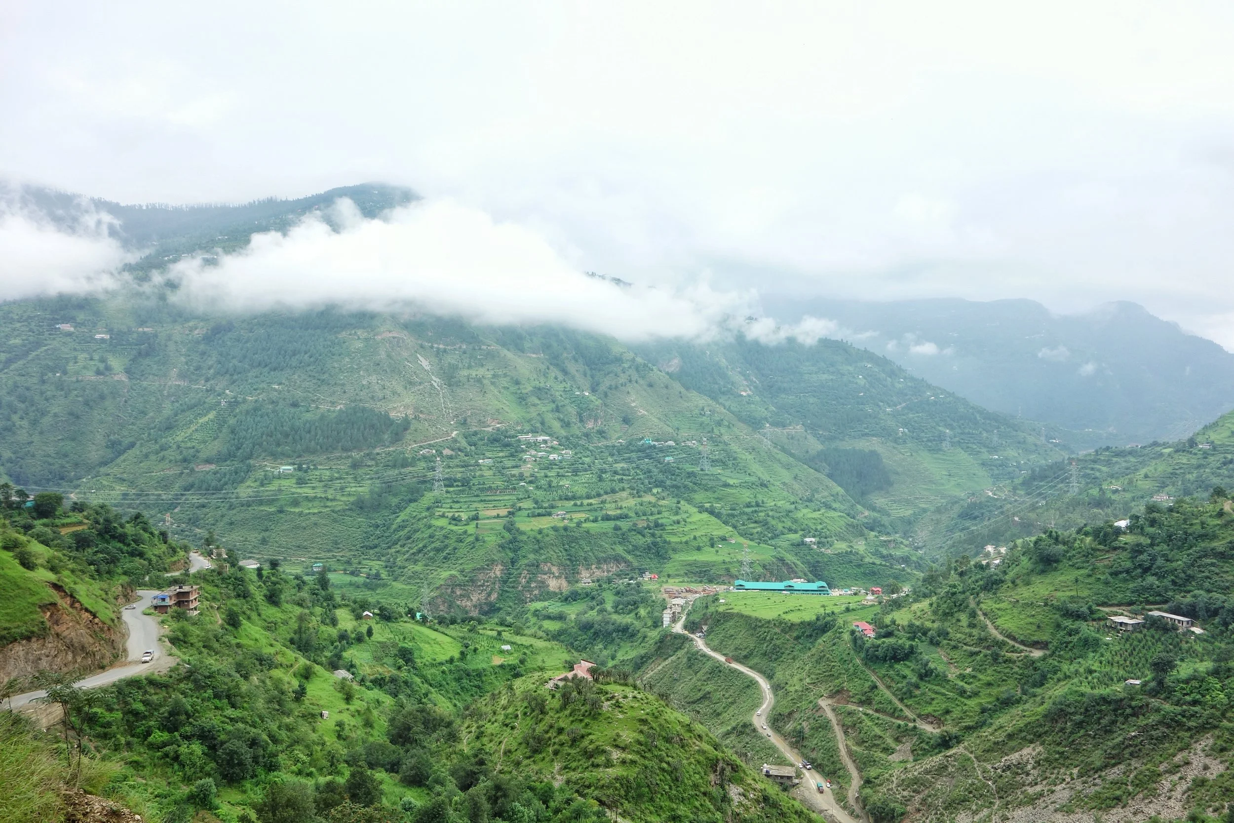
The Road snakes down the Hills in Theog
Again the bus started and it started to descend on the curvy mountain road towards Gumma. After what seemed an eternity we reached Gumma and Gumma always had the close to the Orchard feeling for me. Whenever I used to go to the Orchard, Gumma was the place reaching which I would tell my self that the Orchard is not far now. Had the same feeling again thsi time. So again after travelling for a while the conductor shouted Koku Nallah, anyone for Koku Nallah and I immediately shout yes and I realize that my friend had dozed off. I nudged him and we picked up our bags and got off the bus.
We just watched the bus leaving and it was then that I realised (now that the pegs were wearing off) that it was already 10:30 in the night. There was not a soul around and the only noise one can hear is the of the Pahadi dogs warning each others and idiots like us to stay off their turf. The Lalaji’s shop right at the road head was also shut and there was no light whatsoever.
It was then that I realized that all the years travelling to the Orchard we had never walked up in that late in the night and it was always in the day time or we always had a vehicle to take us up the kacha rasta upto the orchard. It was eerie at night and all the ghost stories that I had heard about these mountains and hill started coming to my mind. The house close to our house where three people were apparently murdered or the lady in a white gown which was seen in the Orchard at times in the night looking for her beloved or how one of my cousins had been possessed by the Demon himself one night at the orchard.
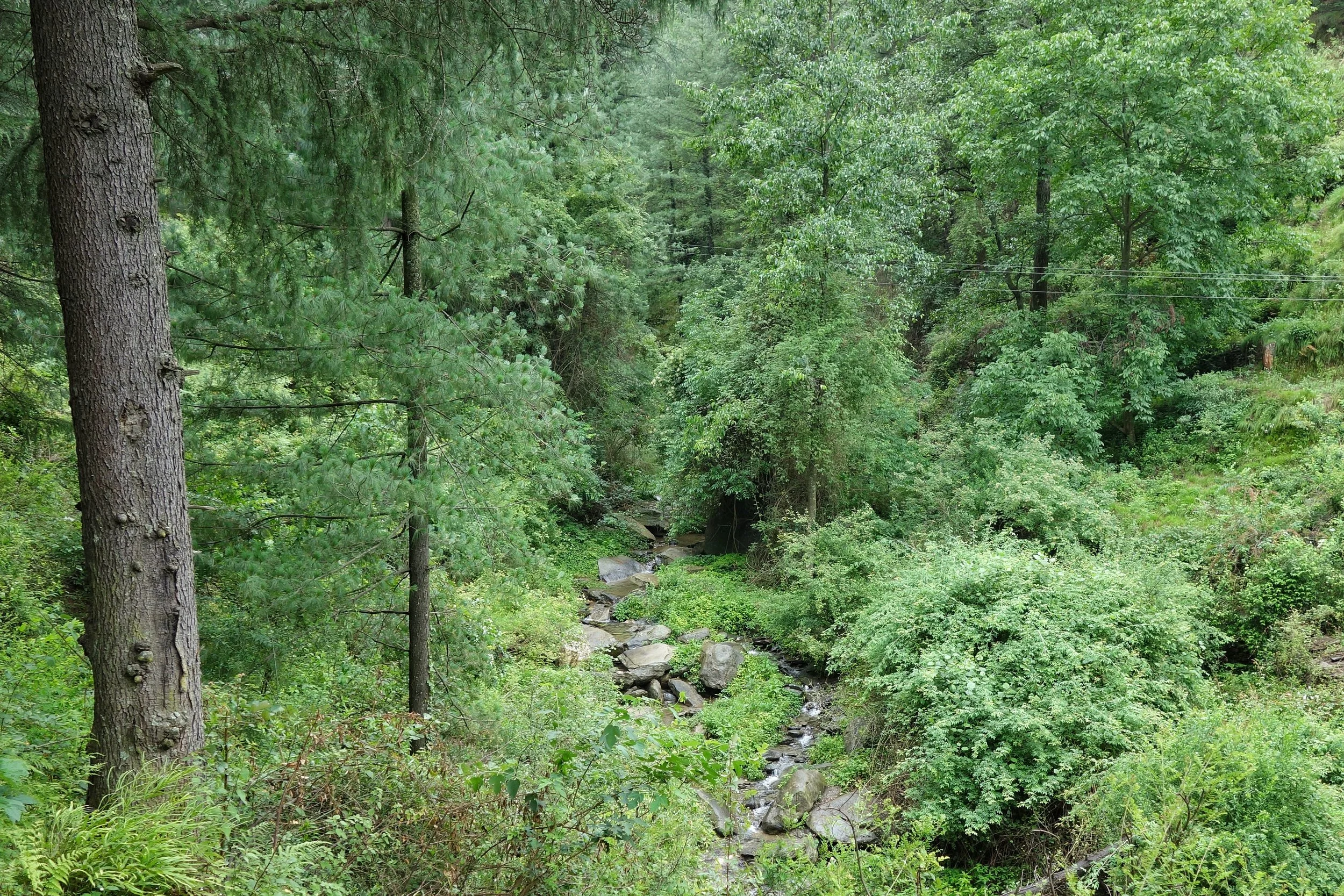
The Koku Nallah running through the thick forests
But I was always a rational man and I didnt believe in one bit of this bhoot wala mumbo jumbo. But my friend did as it was routine practice for me and my cousins to scare the hell of our friends who came to stay at the orchard by telling them mostly made up ghost stories around the bon-fire. Seeing all the almost grown men almost frozen in their chairs with fright was something we all cousins enjoyed but especially me as I didnt believe in all this bhoot stuff.
Ghosts aside there was one thing that I was really scared of at this time of the night. It was a present and clear danger and I could hear it as we started our walk up the rasta towards the Orchard. It was a completely still dark night and not even a leaf was shaking. There was just the sound of the Nallah that ran along the road. And it was then that we heard a bark. It was a bark with a deep bass accompanied by other barks. These were the Pahari Dogs which protected the Orchards and they were quiet languid lazy creatures in the day time but come night they were transformed into the hounds from hell. Among other duties they had to keep marauding monkeys out and also as a warning when the occasional leopard or a bear decided to visit the Orchard. These Dogs also didn’t fancy unknown humans coming anywhere near the Orchards as well in the night time.
Being a dog lover I understood that they were doing their job and doing it well but that did not lessen in anyway the fear I had of a chunk of my calf being taken by Moti the alpha dog at the Orchard. He even let me pat him in that day time but come night time and he was nobody’s friend.
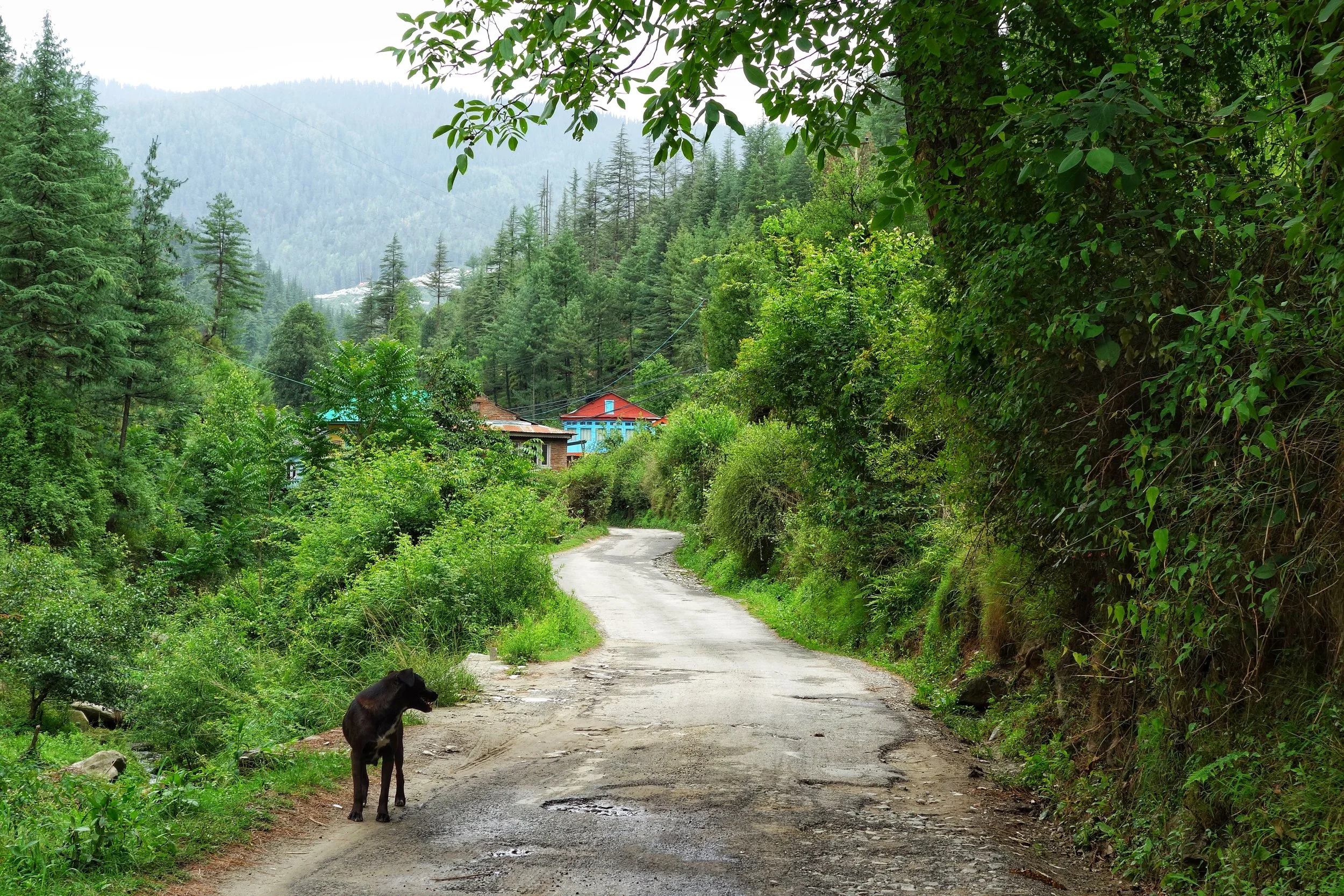
The Road to the Orchards
But we didn’t have any choice and I told my friend who was more scared of the Ghosts, ok lets do one thing I will fight the Ghosts if they come but you should fight the Dogs if they come. Seemed a reasonable trade off. So if a Ghost came I will go in front and face him and if it was the Dogs then my friend would face them. And it was then that the small flashlight went off. We had just walked a few steps and it went off. Just like that. Kaput. Murphy’s Law. So we had no choice but to slowly walk upwards with sticks in our hands and the barking constantly growing louder and coming closer.
We couldn’t see anything so we just lit of our lighter to give us whatever light it could. We walked closer to the gate of the Orchard till where cars could go. Finally after around 15 minutes we reached the gate of the Orchard. The thing was as long as you are not inside the Orchard gate the Dogs would just bark. But once you stepped past the Gate you were trespassing the territory of Moti and his band of brothers who knew how to rise up to the occasion and protect their turf. My friend was a little relieved that we reached the gate but I just grew more tense. The house was still a kilometer up the mountain and we had to walk through narrow pakhdandis through the Apple trees to get to the house. Anyways I opened the gate and stepped in.
The moment I stepped in I saw a moment in front of me. An animal just walked past the pakdandi around 10 meters in front of us. As we froze we saw the shining eyes just look at us for a moment and then it just slipped away and vanished. We just froze in our tracks. I asked my friend whether he had seen it. And he said yes I saw those eyes. Standing there we could hear the dogs barking very viciously but I realized they were not barking at us and something else had caught their fancy. The possibilities ran through my head as to what it was that we just saw ?
Taking no chances we went through our bags and we took out some newspapers. Bundled a few together and made a torch type thing and lit it. There was no way we were going to walk anymore in the dark without any light source. And soon we had some light and warily we started walking again. Up through the trees and we could hear the Dogs coming closer but by now we were pretty sure that they were not after us but probably after whatever creature that we saw. We just kept walking and walking hurriedly cause now we were close to the house and approaching the big tap right outside the small fence of the house boundary.
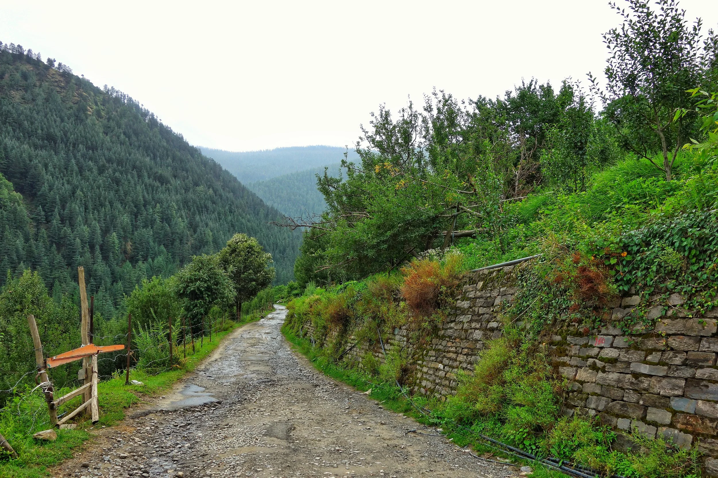
The Road cutting through the Orchards on either side. Nowadays its Motorable.
And then it happened again and we could feel those eyes looking at us again. And this time instead of just walking it just stood and we could feel the stare of those eyes if only for a few seconds. But as we froze the creature suddenly jumped the tap and disappeared into the night. As soon as he did that we saw Moti and two of his accomplices come running in and going in the direction of where the creature went. They didn’t even look at us, probably much more excited in getting their paws and teeth on whatever they were chasing. We stood for a moment and then just ran towards the house. We knocked the Door and the chowkidaar opened and he was surprised to see us there at that time. Why did you come so late ? he asked. Should have stayed in Shimla. It is not safe at night here he said again. I just ignored and walked up to where my cousins and friends were. Some sleeping some drunk.
We were also very tired and just hunkered down without telling anyone our story as the ones who were awake were just too sozzled to be interested in our story. So we just dropped into bed and slept. Early morning we woke up to a commotion and the chowkidaar was there and asking everyone especially me to come down and have a look at what had transpired in the night. There was a half eaten goat lying just outside the house boundary near the tap. Yes the same tap where we had seen the creature in the night. The goat was taken from a neighbors shed around 300 metres from there. Looking at the half eaten body I asked the chowkidaar, who did this ?
It was a Leopard he said as he showed me the teeth marks on the throat. The whole of last night suddenly flashed before me and in hind sight I realized what it was we saw, a Leopard. Yes a Leopard and that also at close quarters. I just looked at my friend and smiled. Not the Ghosts, not the Dogs, it was the Leopard !
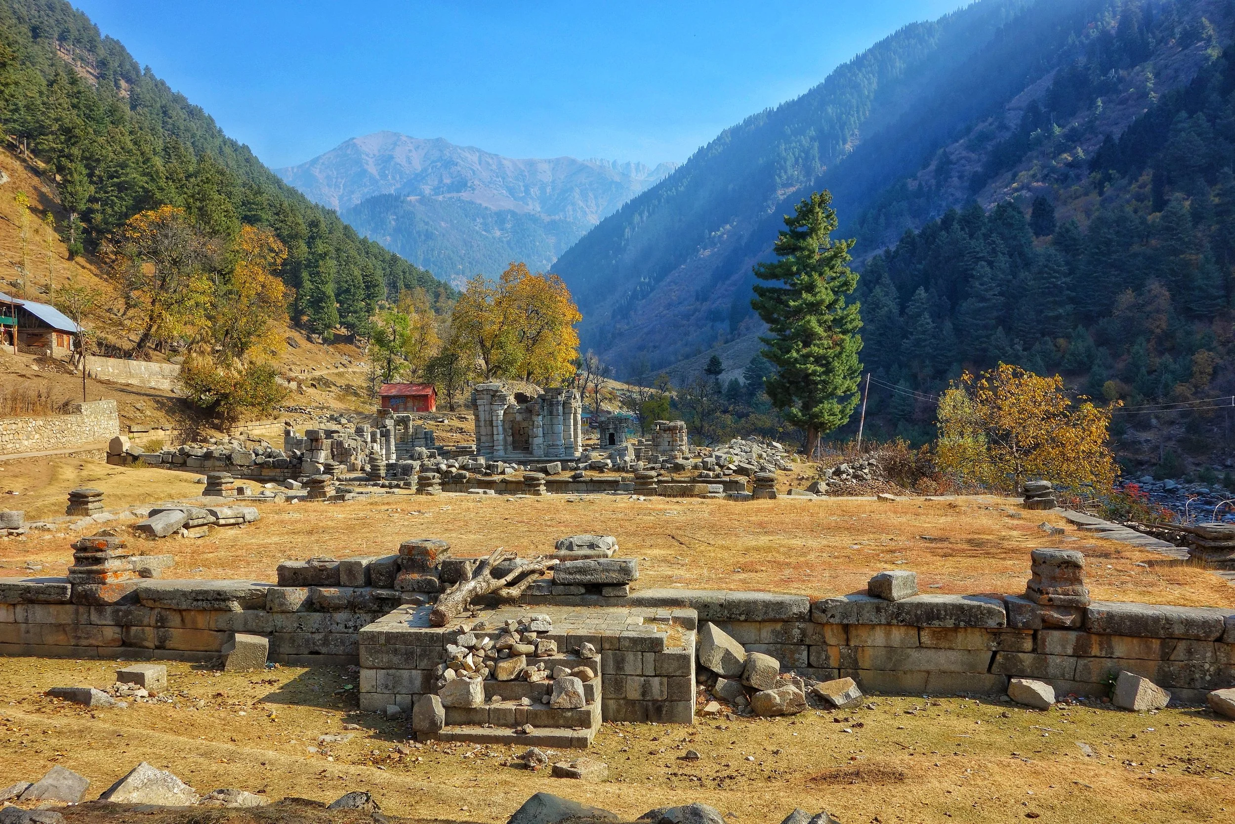
The Great Temple Complex at Naranag
The Great Temple complex ruins at Naranag in Kashmir. Probably one of the finest set of Temples built in Kashmir. Mostly lost and forgotten.

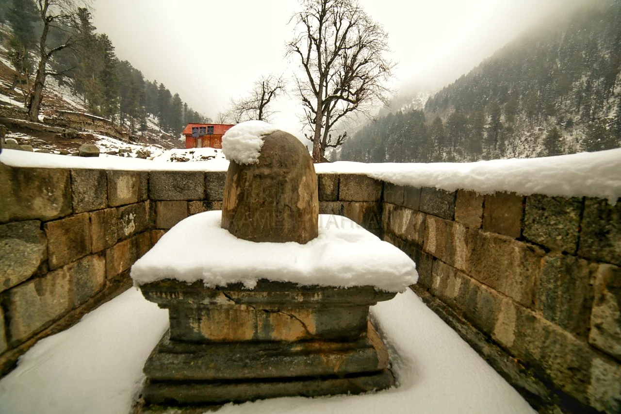
The Main temple Complex which still Houses the Idol.
The Great Temple Complex at Naranag
The Wangath Temple ruins located near Naranag near Kangan above the Sindh Valley. This Temple Complex was built Lalitaaditya Muktipada one of the most celebrated Kings of Kashmir of the Karkota Dynasty. The current structure was built around the 8th Century.
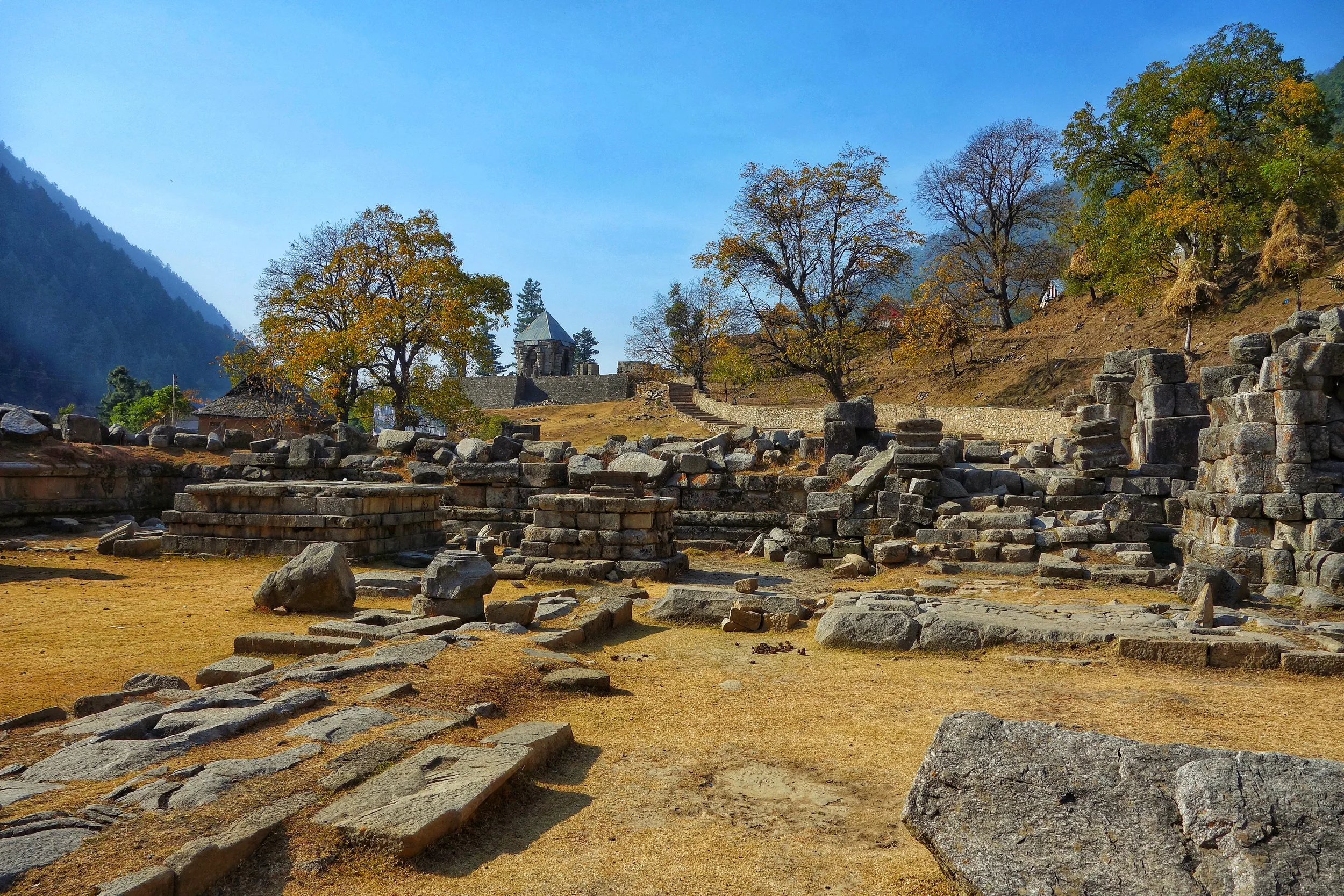
The Secondary Temple Remains
Kalhana notes in Rajatarangini that Ashoka built the city of Srinagari in the 3rd century BC. His son Jaluka, 220 BC, built the Shaivite temples Bhuteshvara, Jyestarudra, and Muthas in the Wangath valley around the holy spring of Naranag.
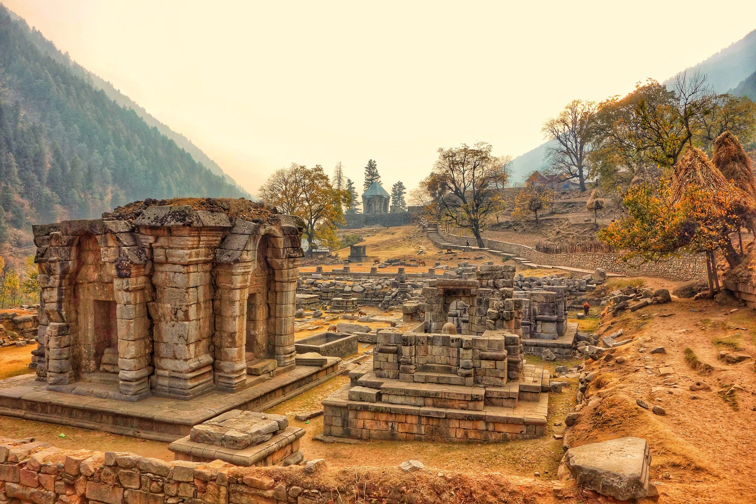
A view of the Main Temple from a distance
The Wangath temples were built in three groups, around the same time as the Shankaracharya Temple in Srinagar and the Bumazuv temple near Mattan. King Jaluka built a stone temple at the site of the spring Naranag around 137BC. King Jayendra (61 BC) used to worship Shiva Bhutesha at the shrine. Lalitaditya Muktapida (713-735 AD) donated a good sum of money to the shrine after his victorious expedition. King Avantivarman (855-883 AD) built a stone pedestal with a silver conduit at this shrine for the bathing of sacred images. Kalhana’s father Canpaka and uncle Kanka also frequented the site.
Another view of the Naranag Temple Ruins
As per Kalhana, the treasury of this shrine was plundered by King Sangramraja of Kashmir (1003-28 AD), during King Uccala’s time (1101 – 1111 AD) and later by the rebel baron Hayavadana. (Wiki)
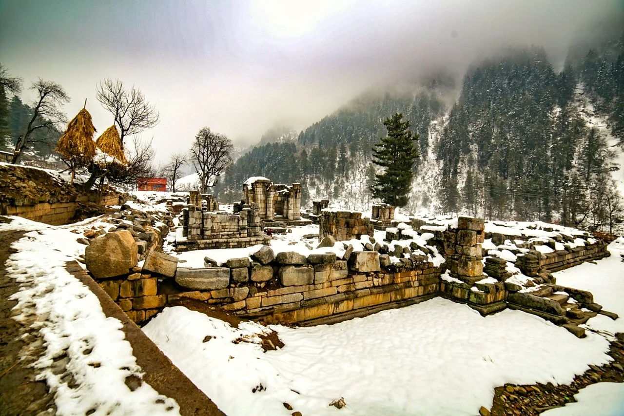
The Naranag Temple Ruins in the Winters
Auriel Stein did a lot of work on these Temples and identified a number of them along with other Western Archeologists.
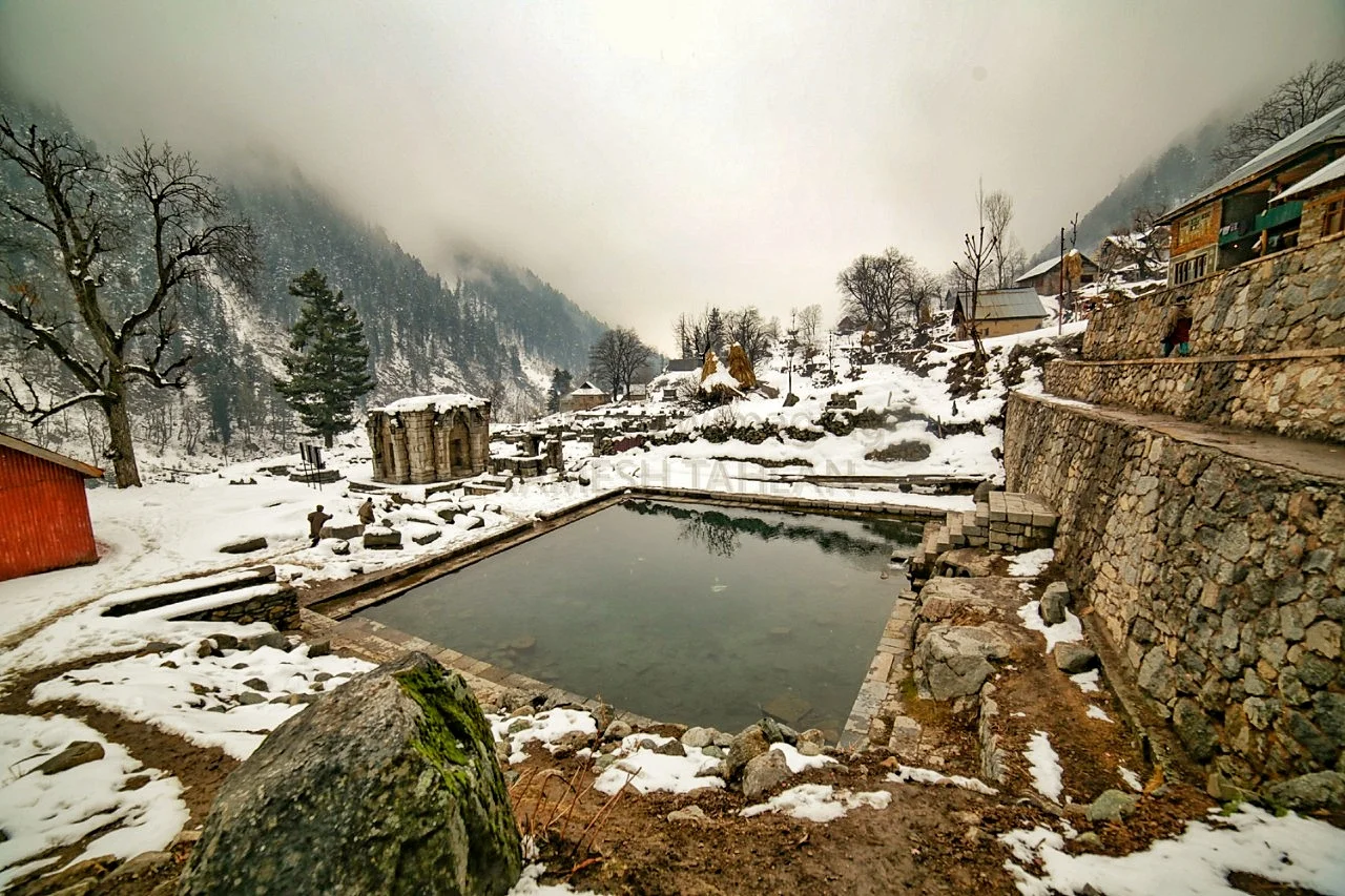
The Naranag Temple Sarovar in the Winters
It was in the Meadow of Mohanmarg that Auriel Stein stayed and translated the Rajtarangani from Sanskrit to English.
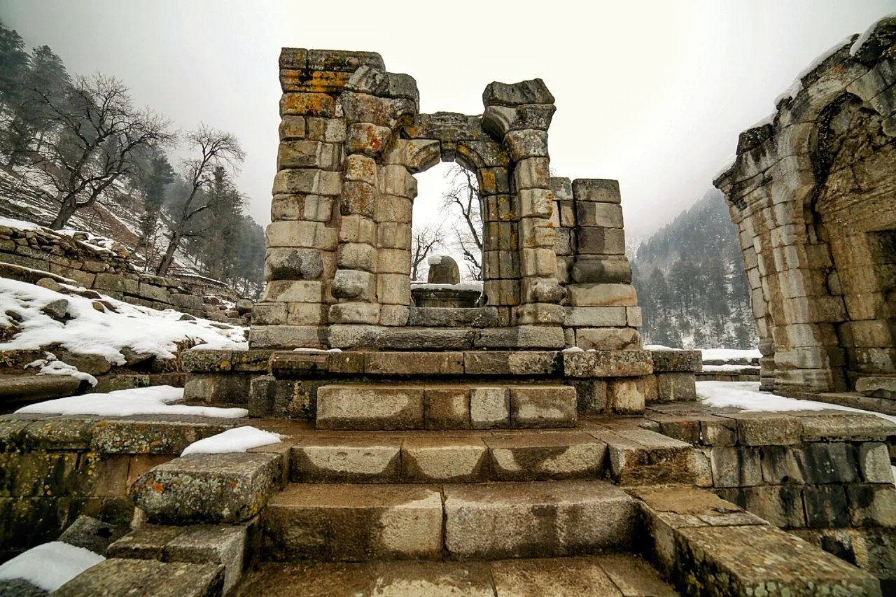
The Naranag Temple with a Shiva Ling
One thing surprising about this Temple is that all the main Temple Complexes in Kashmir were usually on the Valley floor itself or in case of the Shankaracharya Temple on top of a very prominent Hill. But this complex lies high above the Sind Valley by the Naranag Nallah. And it surely is a large Complex. Not to be missed and there are a lot of trekking / hiking opportunities around.
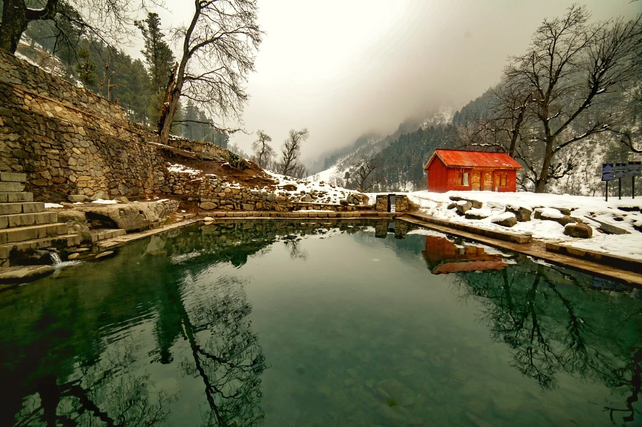
The Naranag Temple sarovar again
A very interesting place to say the least.
Himachal Day : A Brief History of the Modern Times
A brief history of the Himalayan state of Himachal Pradesh. A look into how different Hill states were combined to create one of the most beautiful and now amongst the most progressive states of the country.

Himachal Day : A Brief History of the Modern Times
The state of Himachal Pradesh officially came into existence on 25th January 1971 and till then it used to be a part of Punjab Hill States. Today we celebrate the completion of 47 years of its existence as a state.
The Punjab Hill States were themselves an amalgamation of the Punjab Hill States and the Shimla Hill States as they were also referred to. During the reign of the Mughals most of the Hill Kingdoms here were nominally aligned to them but were pretty free to act as they wished as long as the tribute was sent to the Mughals. However with the decline of the Mughal power the situation developed more fluidly and there were many actors who played a part in the formation of Himachal Pradesh. And whenever there is a power vacuum in history other forces are attracted to fill in the same.
In the beginning of the 19th century one of the most powerful Hill Raja was Raja Sansar Chand Katoch of Kangra who organised his Army and went on a conquering spree not only in the Hill Kingdoms but also invaded the plains of Punjab in order to gain territory. With an ambition to carve out a Katoch Kingdom he conquered various Hill Kingdoms in his neighbourhood including Chamba, Mandi, Kullu, Guler, Nurpur and Kutlehar. He even tried to capture territory around Hoshiarpur in Punjab but was repulsed by Maharaja Ranjit Singh in 1803 – 1804.
Having received a setback in Punjab he set his eyes on other Hill Kingdoms including Bilaspur (Kahlur) and Bara Thakurais (12 Thakurais) across the Satluj River. These Bara Thakurais till some years back had been a part of another powerful Hill Kingdom, Sirmour. And they had been the bone of contention between the Kingdoms of Kangra, Bilaspur and Sirmour. The Kingdom of Sirmour had also opposed the aggressive actions by Raja Sansar Chand in Mandi and Bilaspur.Raja Sansar Chand formed an alliance with the Raja of Nalagarh and together they captured large parts of Bilaspur territory and established control over the Bara Thakurais in the CIS Satluj area.
In the meanwhile the Gurkhas under General Amar Singh Thapa who had already captured Garhwal and Kumaon were now in occupation of the Sirmour Kingdom where they had been invited by one of the warring factions in the war of succession and once that was settled they decided not to leave and were in control of the Kingdom from their main base in Dehradun. After losing much of his territory to Raja Snasar Chand, the Raja of Bilaspur called on the Gurkha General again for help and to help thwart the plans of Raja Sansar Chand and his allies.
The Gurkhas due to ambitions of their own readily agreed to the same and stepped into the conflict on the part of the Bilaspur Raja. Raja Sansar Chand had already a lot on his hands and taking on the Gurkhas was just too much. The Gurkhas defeated Raja Sansar Chand and occupied the most strategic fort of the Himalayan foothills, the Kangra Fort. In addition to that they held all the Hill Kingdoms in the CIS Satluj areas and were also in control of another powerful Hill Kingdom, the Kingdom of Bushahr.
Raja Sansar Chand had no option but to approach his former bete-noire Maharaja Ranjit Singh and asked for his help and promised in return the Fort of Kangra and various other consolations. As a result after some machinations finally Ranjit Singh stepped in and the Gurkhas were evicted from the Fort of Kangra but they crossed over the Satluj and stood strong in their Forts around Solan and hence they carried on to occupy all the smaller Kingdoms and Thakurais.
On the other side of the Satluj after occupying the Kangra Fort, Maharaja Ranjit Singh spread his influence on all the Hill Kingdoms on which Raja Sansar Chand earlier held sway. All of Himachal on the Trans Satluj side was now held by Maharaja Ranjit and most of the territory on the other side of the Satluj was held by the Gurkhas. Due to the Treaty of Amritsar that Maharaja Ranjit Singh had with the British he was not entitled to make make any conquests in the CIS Satluj area and as the Gurkhas were in the CIS Satluj area, Ranjit Singh could not make any advance on them.
By this time the Gurkhas were on a collision course with the British. All the Hill Rajas and Thakurais asked the British for help in getting the Gurkhas out of their territories. They promised the British all the help in their war against the Gurkhas provided that their Kingdoms and Thakurais are returned to them after the Gurkhas leave.
In 1814 the Anglo Gurkha war took place at multiple fronts and the British defeated the Gurkhas and the Treaty of Sagauli was signed between the two. As a result of the Treaty the Gurkhas had to give up all their territory West of the Kali River to the British. This included Garhwal, Kumaon and parts of the present day Himachal Pradesh upto the Satluj River. The British now held sovereignty over these Hill States in Himachal and controlled the whole territory. It was at this time that at a certain location which was in their control they established the town of Shimla. And the Hill Rajas and Thakurs were given back their Kingdoms and Thakurais though they were under British suzerainty from then on. As they had to report to the British Resident at Shimla these were collectively known as the Shimla Hill States. These were as under
Bilaspur (Kahlur);
Bushahr with feudatories Delath and Khaneti; Nalagarh (Hindur);
Keonthal with five zaildaris Koti, Theog, Madhan, Ghund and Ratesh;
Baghal, Bhagat, Jubbal, Kumarsain, Bhajhi, Mahlog, Balsan, Dhami, Kuthar, Kunihar, Mangal, Beja, Darkoti, Tharoch, Sangri, Rawin and Dhadi.
The Kingdom of Sirmour was also returned to the Raja again under British suzerainty.
On the other side of the Satluj the areas were still under the control of Maharaja Ranjit Singh. In 1836 the Sikhs went further and occupied the Kullu Valley as well and bought Lahaul and Spiti also under their control. At this point of time the Sikhs controlled pretty much all the territory between the Satluj and the Indus. And so it remained for many years even after the death of Maharaja Ranjit Singh in 1839.
However in the aftermath of the Anglo Sikh Wars in 1846, which the Sikhs lost the British acquired control of this whole territory. The newly acquired Trans Satluj states that the British acquired and which were designated as the Punjab Hill States (as they previously belonged to the Punjab Kingdom) were as under
Punjab Hill States
Kangra, Guler, Jaswan, Datarpur, Nurpur, Chaitiba, Suket, Mandi and Kullu and Lahaul-Spiti
In addition the British also got suzerainty over the powerful Chamba Kingdom.
This was the makeup of the region till 1947 when India got independence the Simla Hill States and the Punjab Hill States as well as Chamba and Sirmour state were put together to form Himachal Pradesh. In 1956 after further re-organisation is was made a Union Territory. Finally it was made a formal state on the Indian Union in 1971 on January 25th. Shri Yashwant Singh Parmar is credited as being the Father of Himachal Pradesh and he was the Chief Minister of the state on a number of occasions. He hailed from a Rajput family in the erstwhile Kingdom of Sirmour. The longest serving Chief Minister of Himachal Pradesh who recently lost the elections, Shri Virbhadra Singh is the head of the Royal Family of Bushahr. The present Chief Minister Shri Jairam Thakur also belongs to a Rajput family from Mandi. A reminder that much of the present stems from the past.
Jai Himachal.
The Treasures of the Shri Pratap Singh Museum
The SPS Museum Srinagar was established in 1898 AD in the Maharaja’s Summer guest house largely based on collections transferred from State Toshkhana. Approximately 79,595 artifacts and objects covering various subjects like Archaeology, Numismatics, Decorative Art, Arms and Armory, Paintings, Textiles etc are housed in the Museum. A must visit for anyone in Kashmir.

The Treasures of the Shri Pratap Singh Museum
The SPS Museum Srinagar was established in 1898 AD in the Maharaja’s Summer guest house largely based on collections transferred from State Toshkhana. Approximately 79,595 artifacts and objects covering various subjects like Archaeology, Numismatics, Decorative Art, Arms and Armory, Paintings, Textiles etc are housed in the Museum. The proposal for the Museum was made around 1889 when a memorandum was submitted to the then Maharaja of Jammu and Kashmir, Maharaja Pratap Singh by his younger brother General Amar Singh and a European scholar, Captain S H Godferry proposing to build a museum in Srinagar for exhibiting artifacts covering the regions of Jammu, Kashmir, Ladakh, Baltistan and Gilgit. However the Museum was finally opened to public in March 1898.
The Museum was set up in a smaller Palace of the Maharaja by the banks of the Jehlum where the Guests of the Maharaja used to put up. The Old Museum Building in itself is a work of art with great frescoes and art adorning the walls and the ceilings. This Building faced the brunt of the floods in 2014 and is now closed for Public viewing. The Museum exhibits however have been moved to a new Museum building which has come up.
Some of the treasures that are on display (or will be on display are as follows) :
1. Harwan Terracotta Tiles
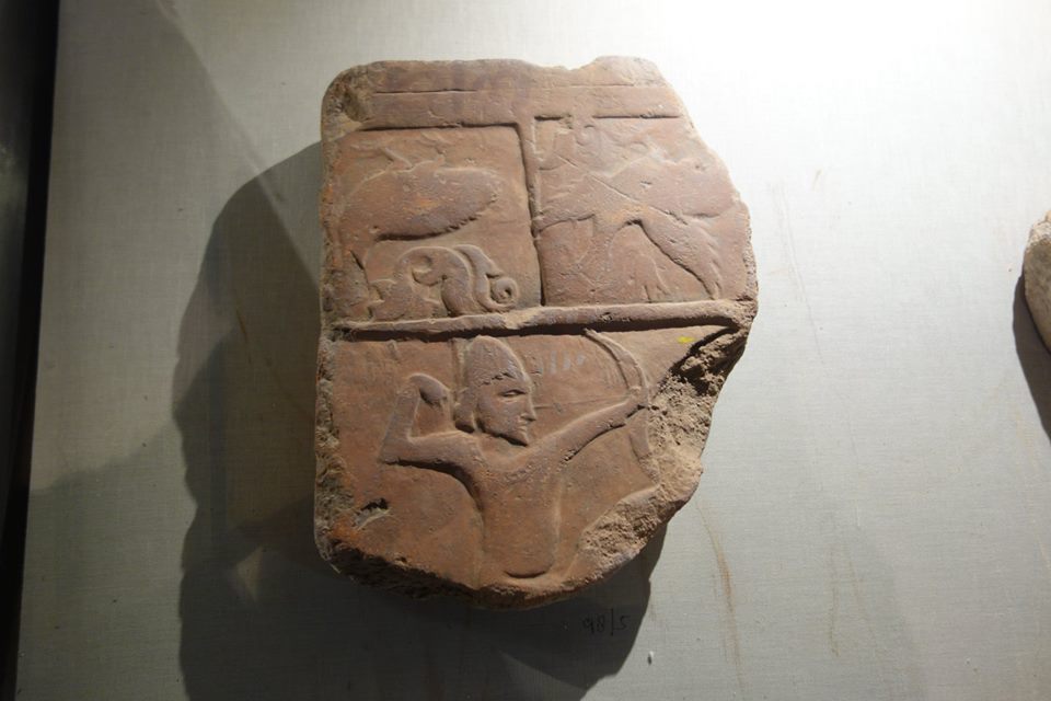
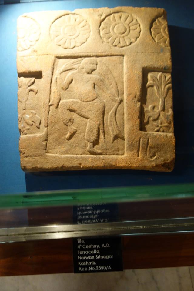
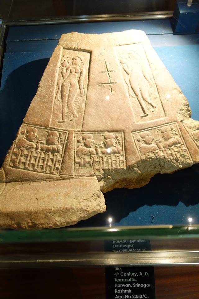
The Museum has on display a number of Terracotta Tiles which were discovered at the remains of an almost 2000 year old Buddhist Monastery in Harwan. This important Buddhist site is said to be the venue of the Fourth Buddhist Council convened by the Kushan Emperor Kanishka in the first century AD. It was from this Council that an estimated 500 monks left for Central Asia, Tibet and China to propagate the message of Lord Buddha.
The Tiles show a distinct Parthian/ late Sasanian influence underlying the close connections that Kashmir had with the Gandhara region at the time when Buddhism was the prevalent system of belief in both the regions. The Museum has a number of these Tiles showing daily activities of life in those times.
2. The Gilgit Manuscripts
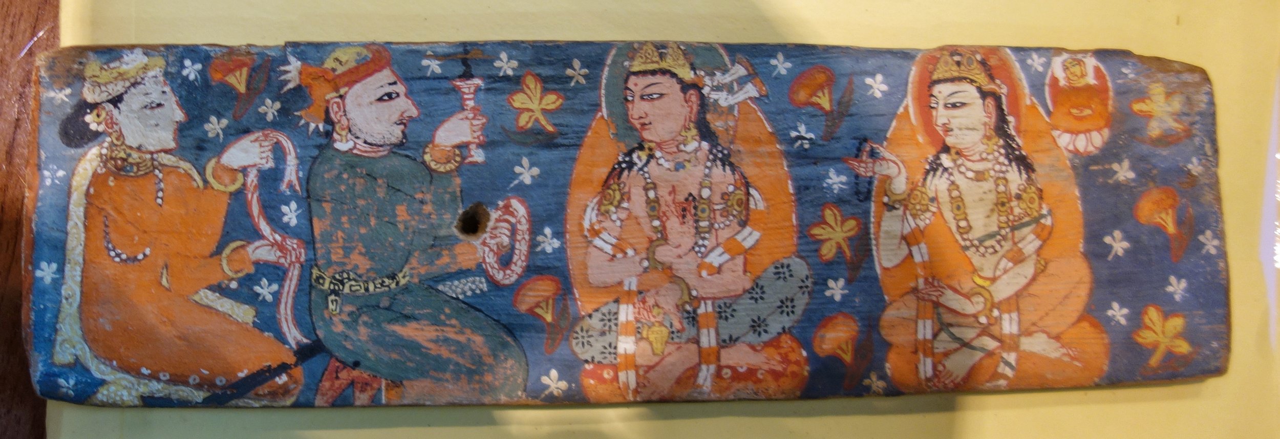
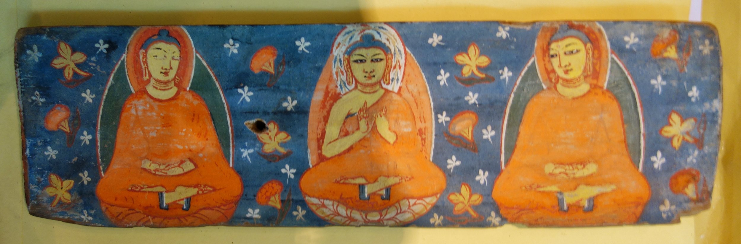
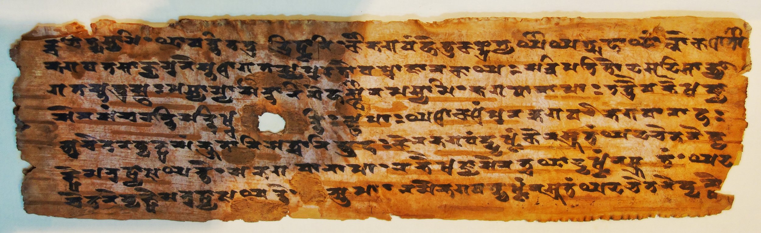
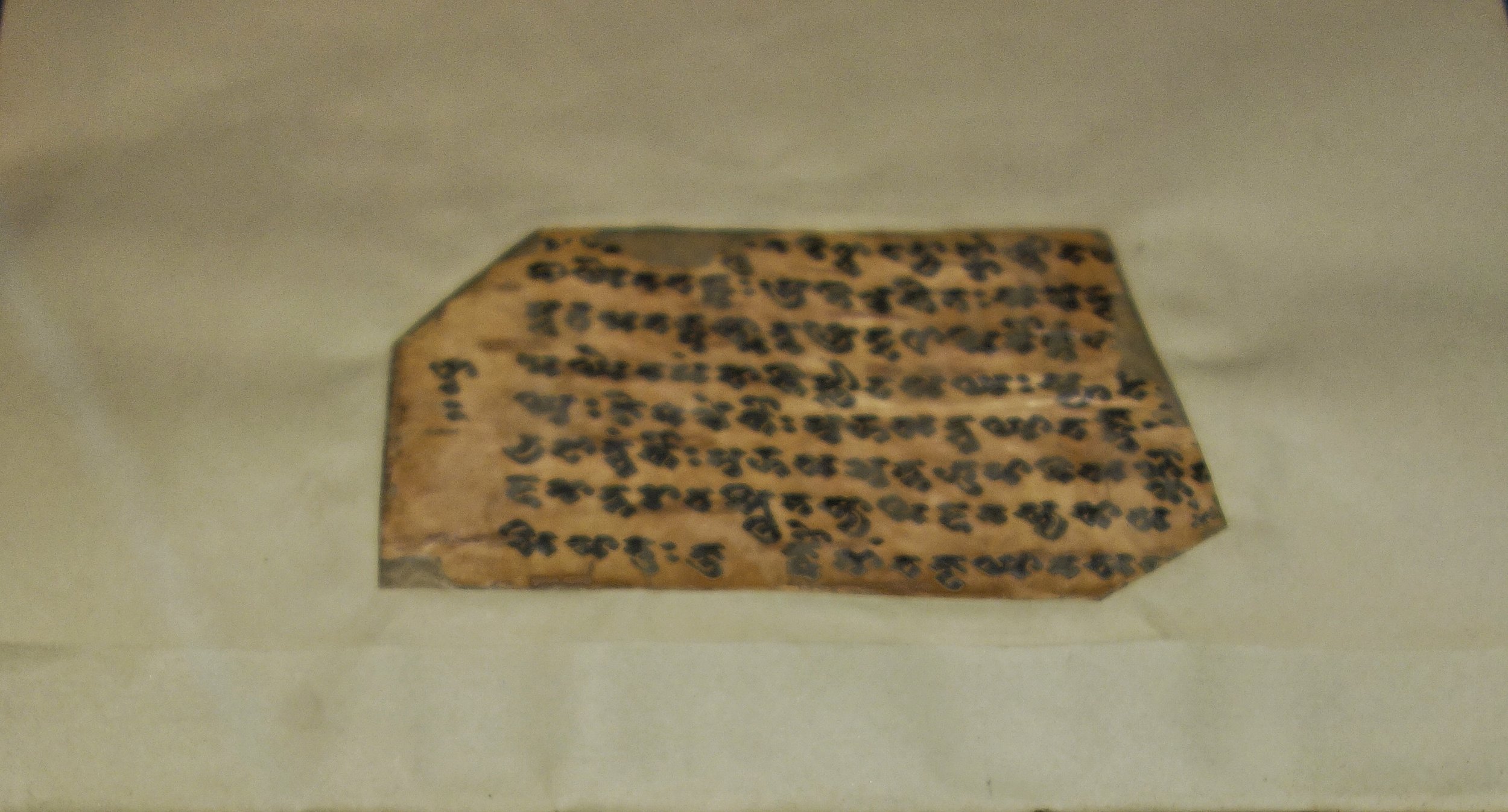
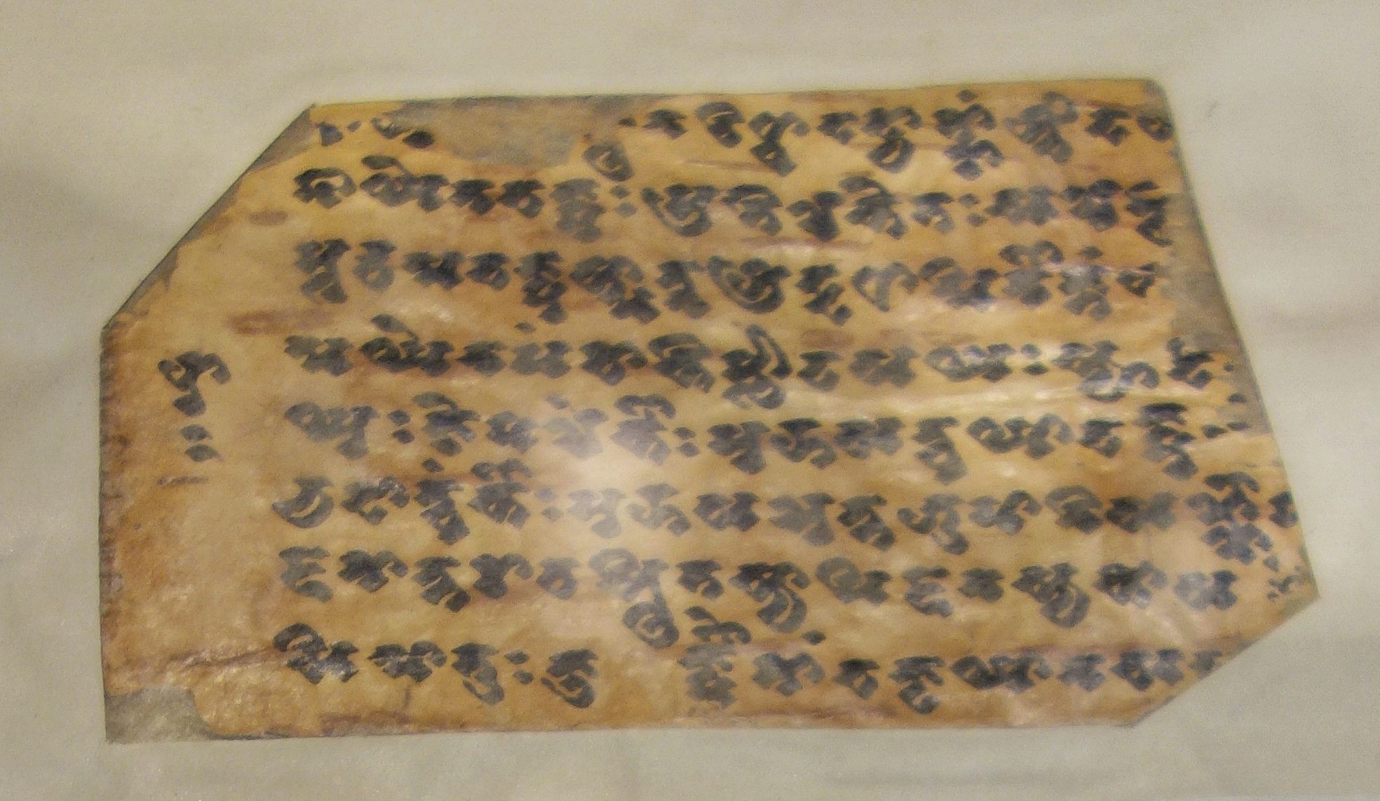
One of the oldest Manuscripts ever found in India, this Manuscript was found is a Village in Gilgit and was then passed onto the Maharaja of Jammu and Kashmir. As for the significance of the Gilgit manuscripts, especially of the Lotus Sutra which was found among the Manuscripts, I quote from a BBC article on the same “The Lotus Sutra was found in Gilgit region, now in Pakistan.The document, which dates back to 5th century, is perhaps the only Buddhist manuscript discovered in India.
Believed to be one of the most revered Buddhist scriptures, it represents the discourse delivered by Buddha towards the end of his life.
The Lotus Sutra is one of the most sacred scriptures of Mahayana Buddhism , which is strongest in Tibet, China, Taiwan, Japan, Korea, and Mongolia.”
A part of the collection is also housed in the National Archives in Delhi as well as some part exists in the Karachi Museum.
3. The 9th Century Vaishnava Avatar Bronze Frame
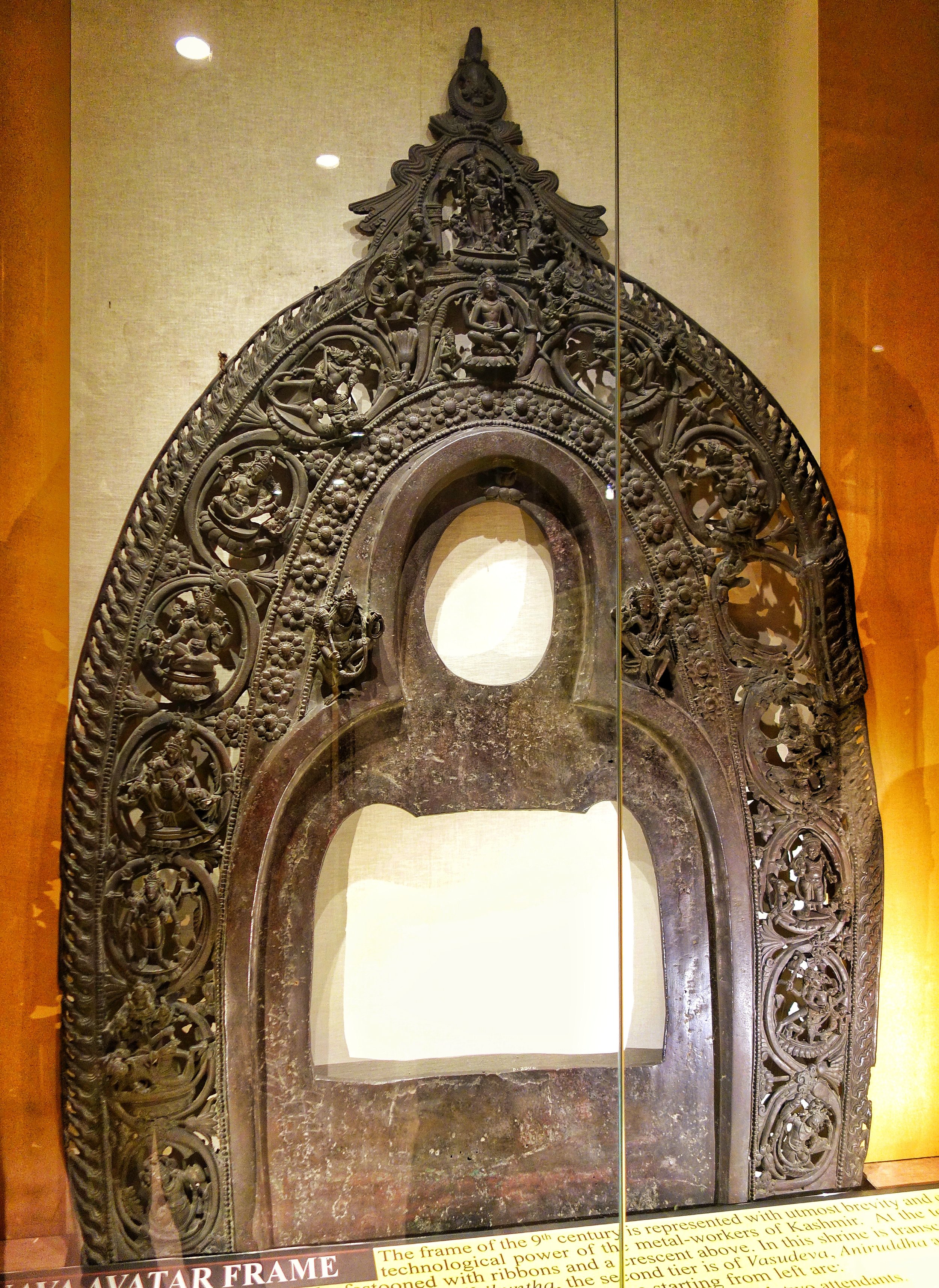
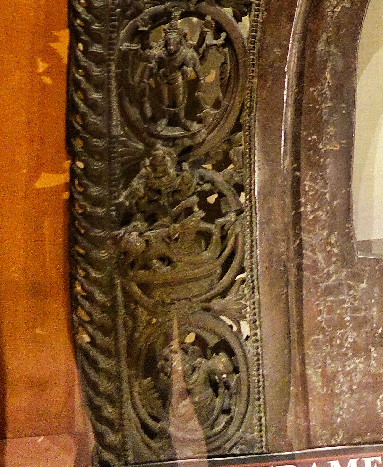
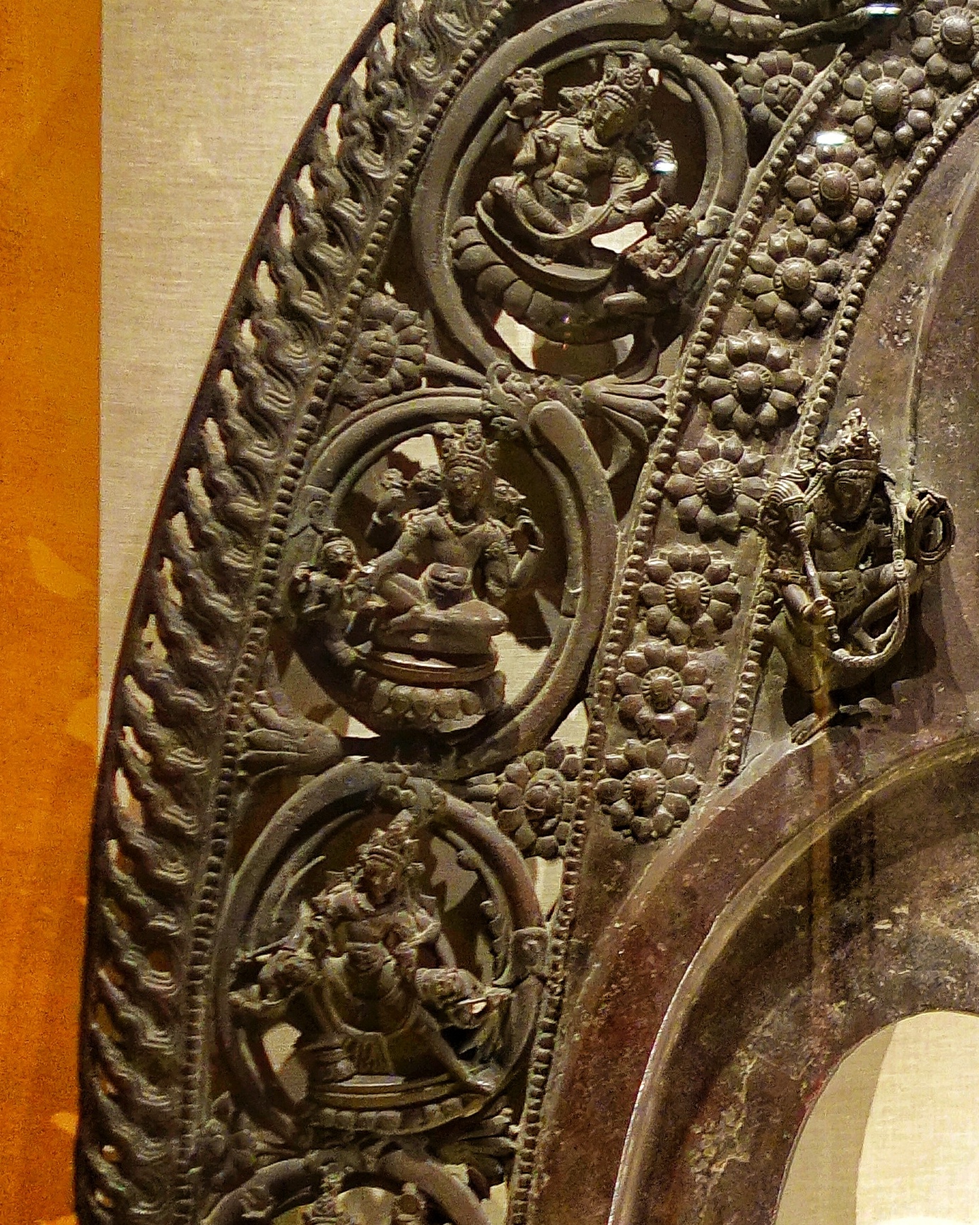
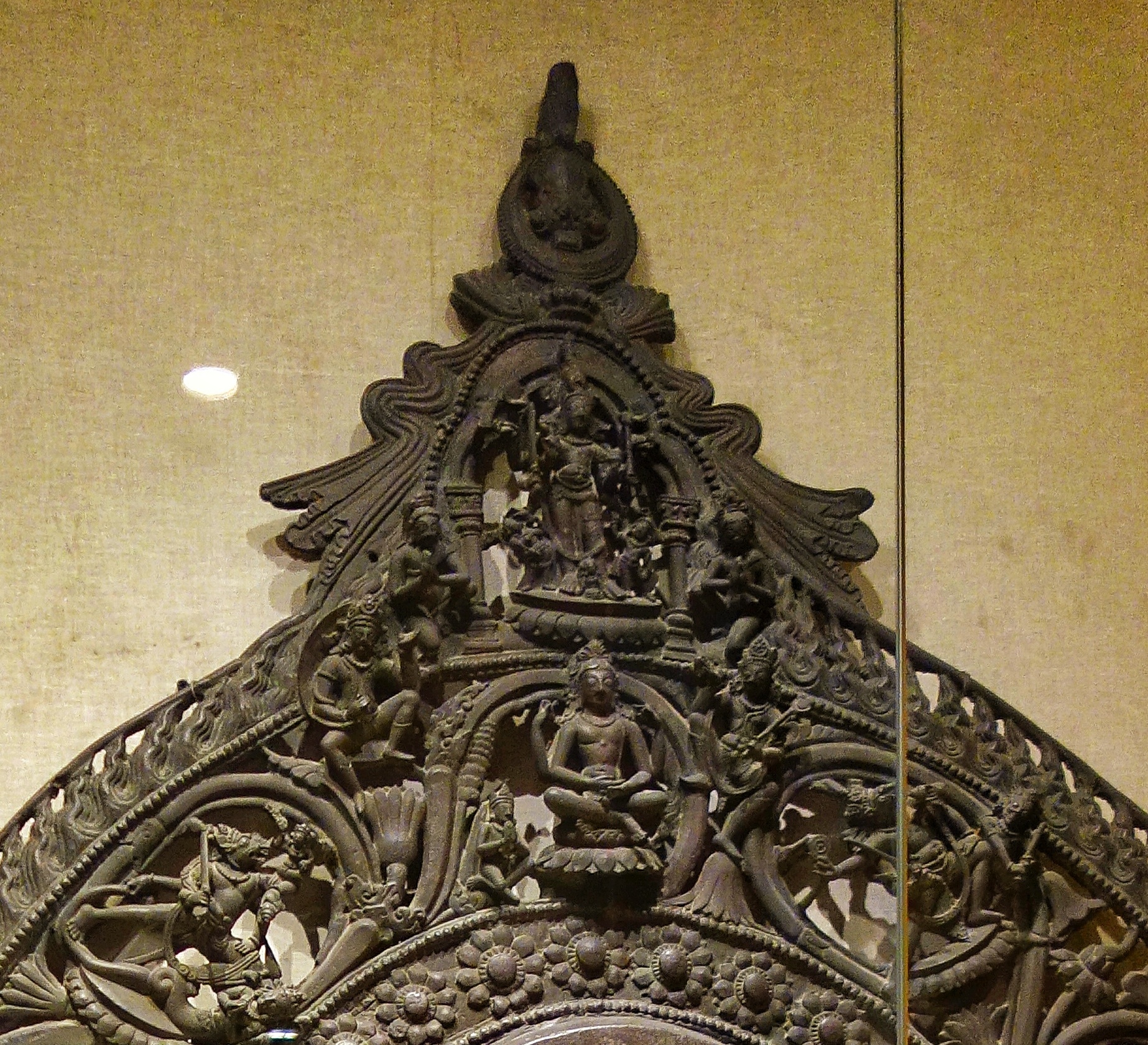
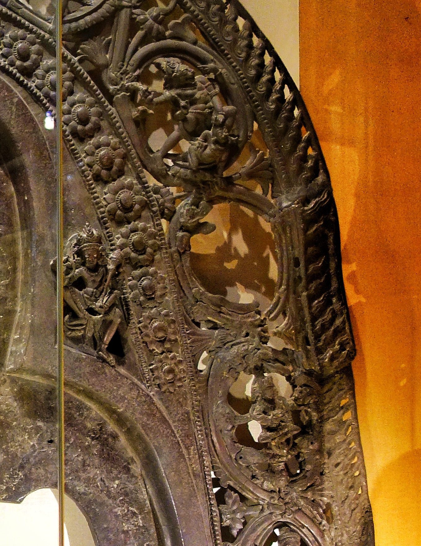
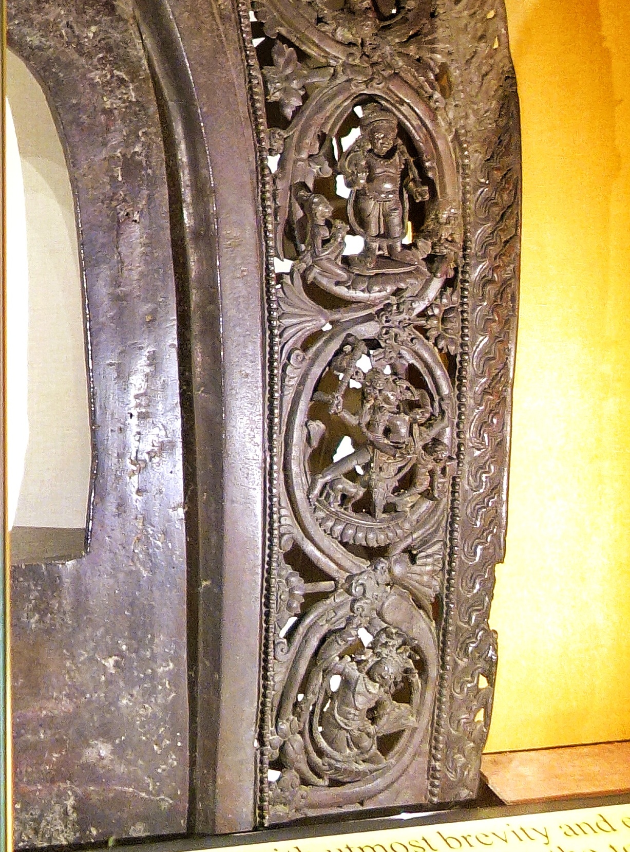
One of the most priceless treasures on display at the SPS Museum at Srinagar is a 9th Century metal “Vaishnava Avatar” frame which is a Prabhavali of bronze metal alloy measuring 6’4″ in height and 4′ wide and 1’2″ thick weighing almost 100 kgs excavated from Devsara. As the name suggests it shows various Avatars of Vishnu. Devsara, which is in Kulgam district had been in the past a great center for the casting of Bronze images and other metal works. Many of the bronze/ metal sculptures found here have unfortunately gone missing as they were simply taken away in the olden times as metal was always in high demand.
This masterpiece was discovered in 1931 and it is dated to the period of Shankar Varman. Each of the deity cast on it has great detailing and as such is a brilliant example of Kashmiri metal craftsmanship of that period. Fortunately this great piece of art along with another bronze sculpture of Lord Buddha along with a few coins made it to the Museum from the Devsara site. This sculpture is one of its kind in Kashmir and maybe India as well and is rated one of the most significant archaeological find in the Indian subcontinent.
4.Ghodas of the Ghoda Gali
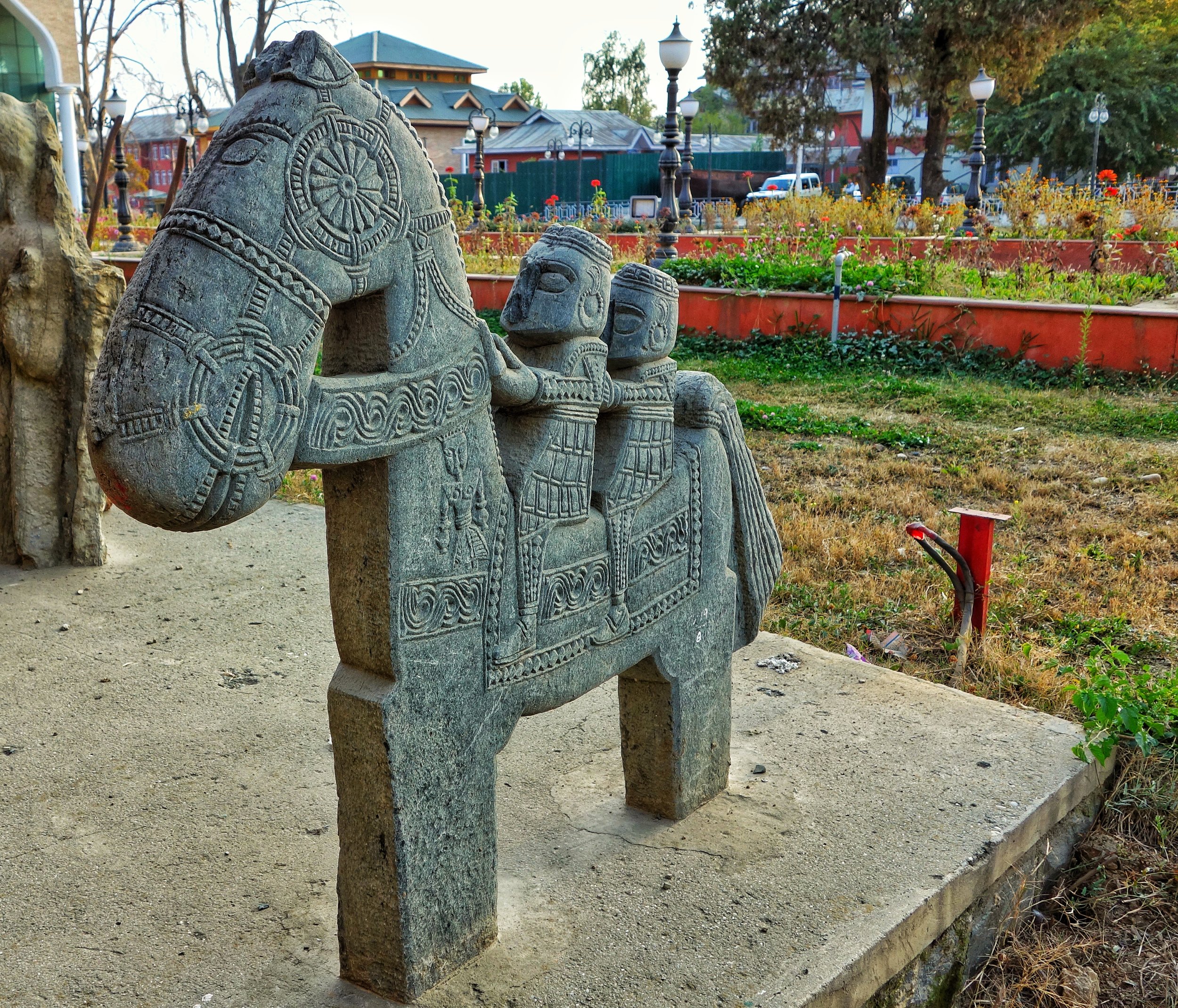
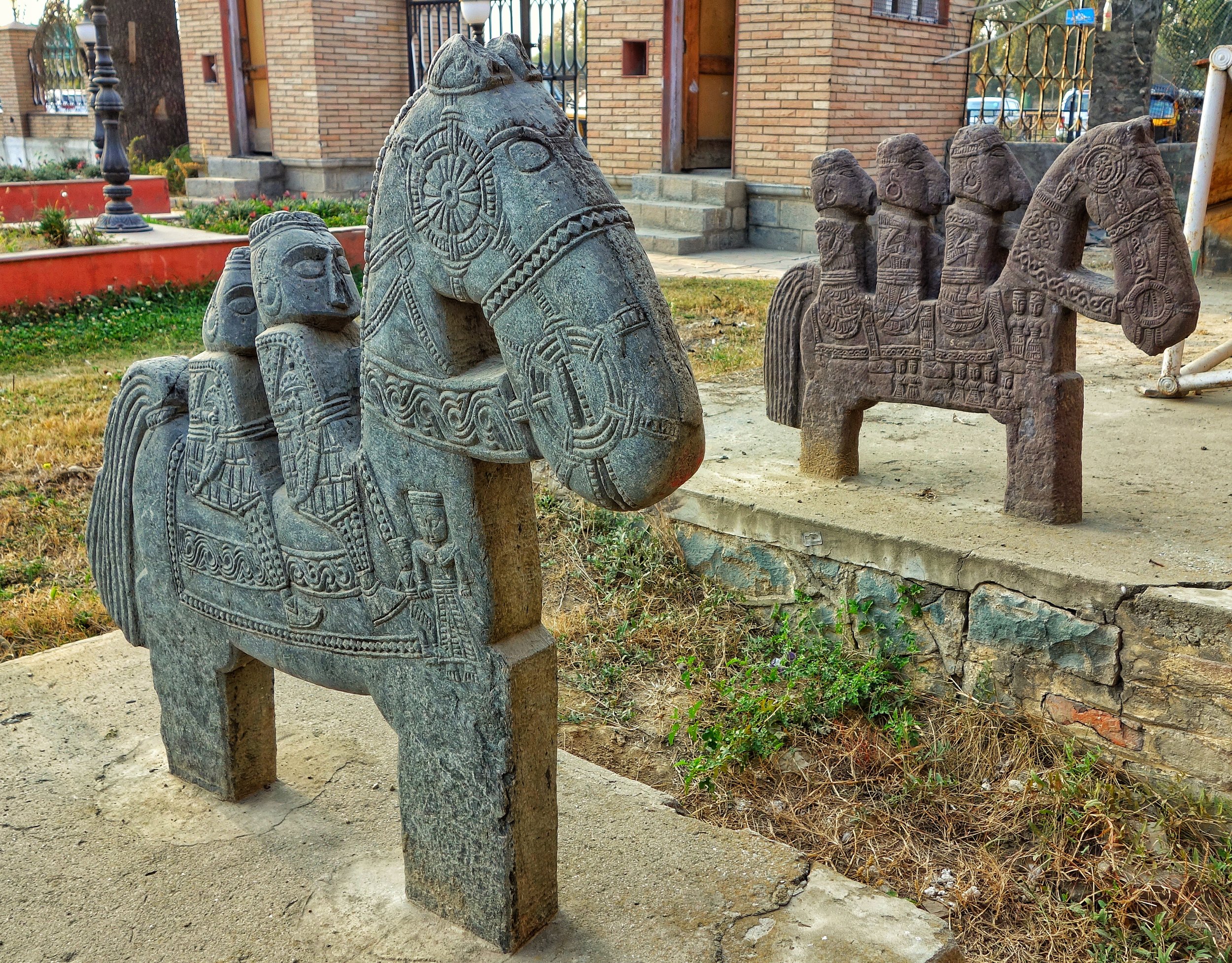
Another fascinating item on display are the Stone sculptures of the Ghoda Galli. Dotted along the Pir Panjals at certain Passes are these stone sculptures of Man Riding a Horse. These are usually found at the top of some Passes and they are found at numerous locations all over the Pir Panjals in the Jammu region. No one seems to be sure of how many of these are spread all over the Region, Even the origin is not very clear. As I spoke to one of the officials in the Museum the sculptures show a distinct Hellenic influence. A significant site for these is a place called the Ghoda Galli situated near Ramban where a great collection of these sculptures exist. A few of these pieces were sent over to the Sri Pratap Museum as well.
5.The Map Shawl
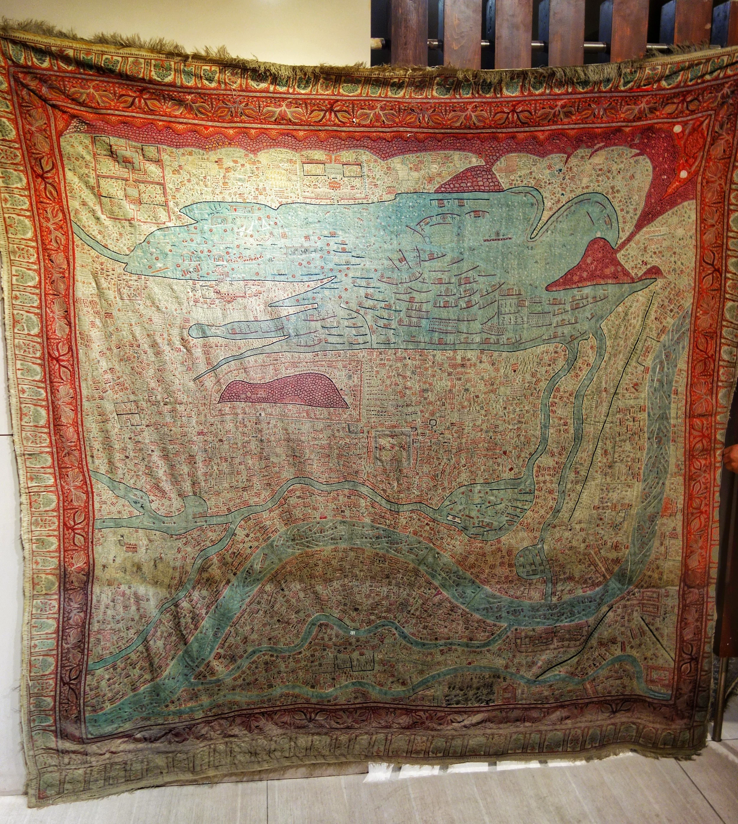
The amazing and exquisite Map Shawl of Srinagar. This Shawl took 30 years in the making. There are 3 or 4 such specimens in the world. And these were made in the late 1800’s.
One was presented to Queen Victoria by Maharaja Ranbir Singh and is presently at the Victoria and Albert Museum in London. One more is with a Museum in Australia. One is with a private collector and this piece is at the Shri Pratap Singh Museum in Srinagar though it’s not on display as it needs some refurbishing after the Floods.
It would be one of the most expensive pieces of textile ever made if it would be put on an auction.
6. Boat Gifted by Queen Victoria to Maharaja Ranbir Singh
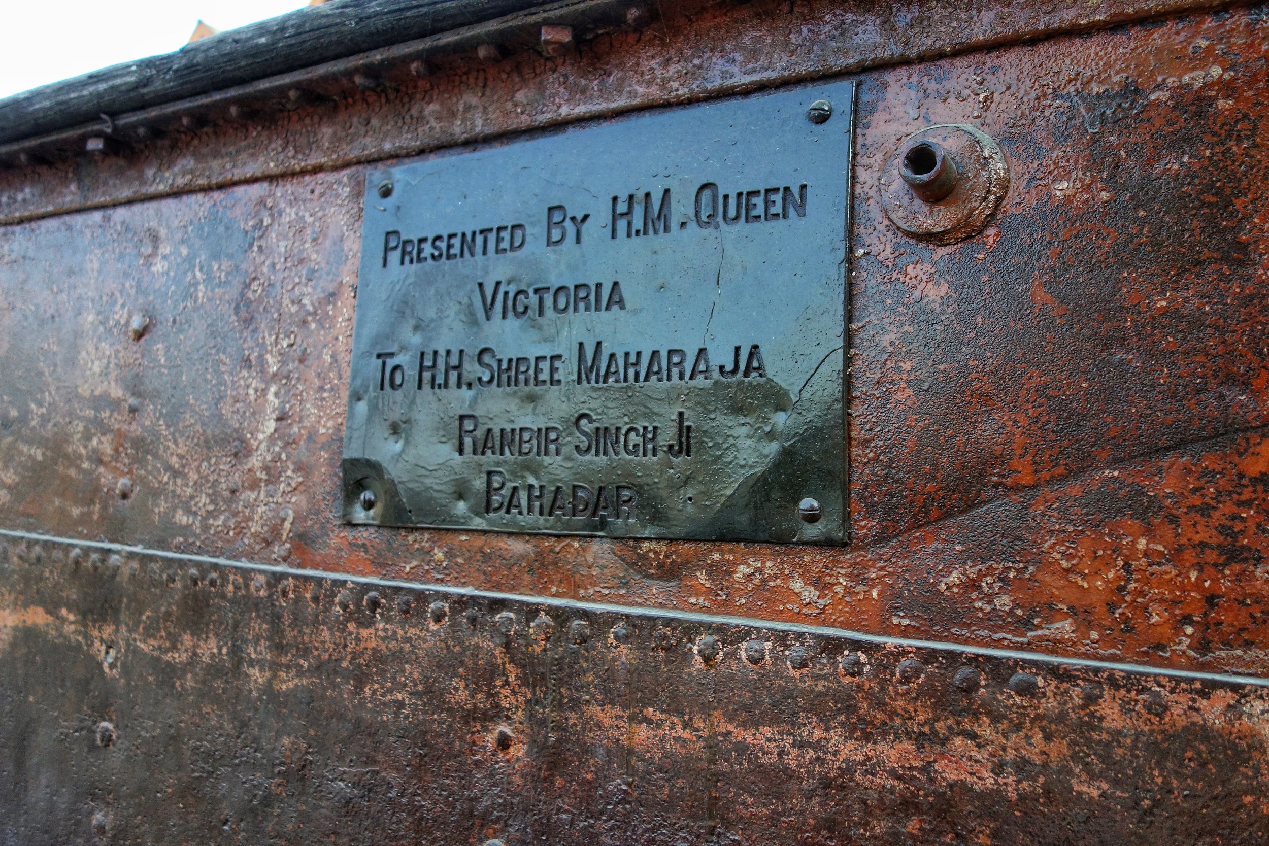
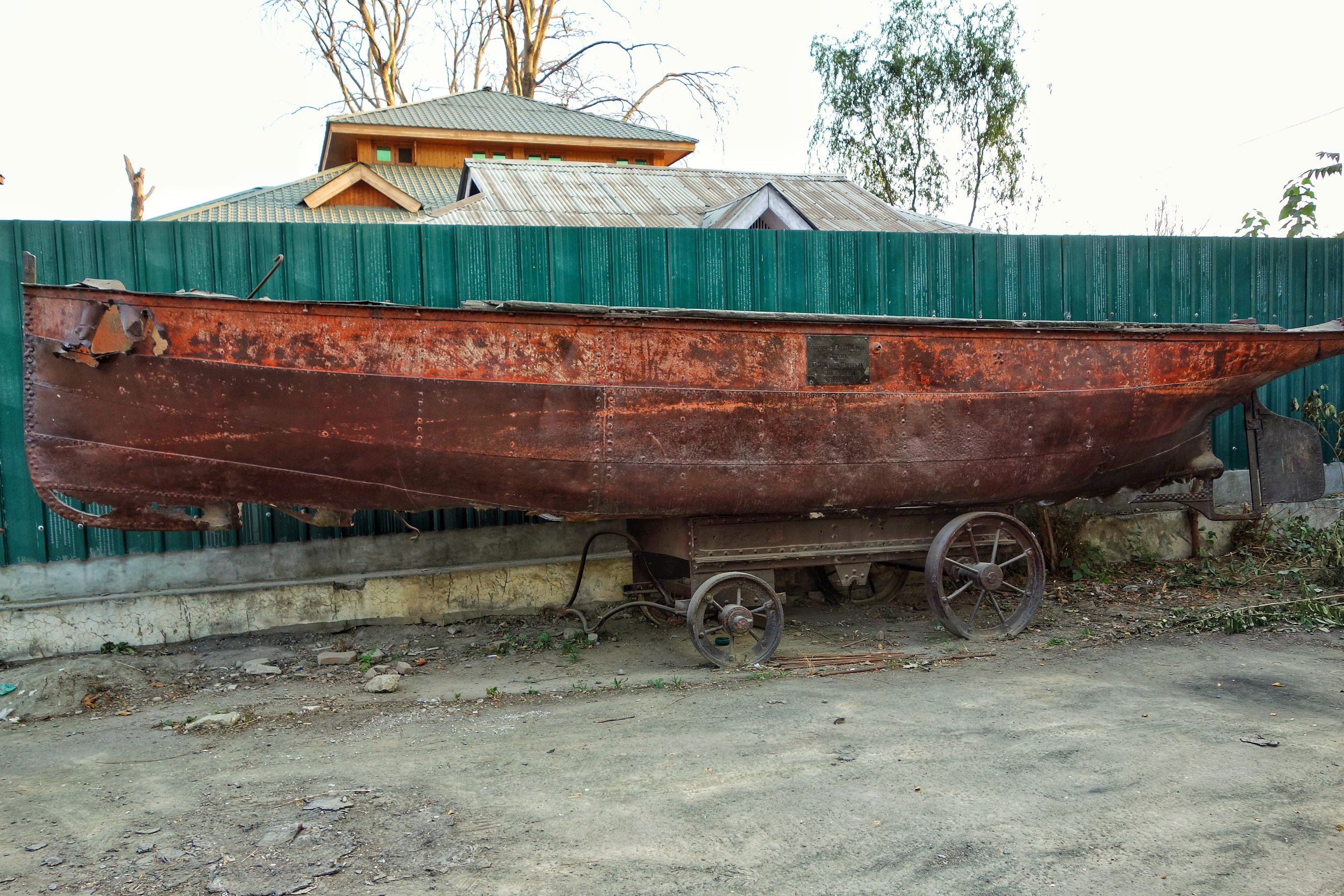
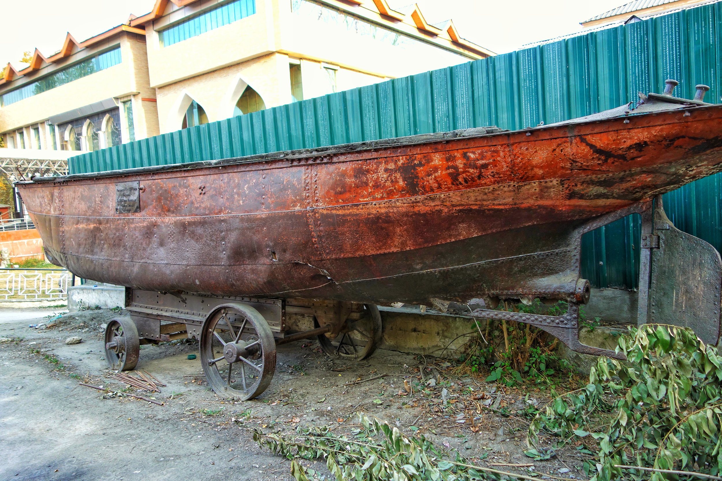
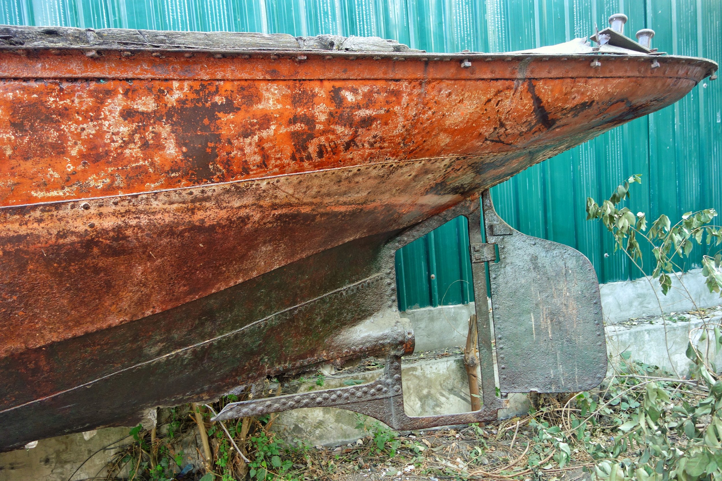
In the Museum Parking lies an interesting exhibit probably the largest one in whole Museum. A boat that was gifted by Queen Victoria to the then Maharaja of Kashmir, Maharaja Ranbir Singh. As of today it lies in a bad shape as it lies out in the open. Hopefully more would be done to preserve this important piece of History.
Kashmir : Between The Mughals and the Dogras
The history of Kashmir from the time of the rule of the Mughals till the time of the rule of the Dogras. And the Afghans and the Sikhs in between. A straight narrative of the complex history of the Kashmir Valley.

Kashmir ; Between the Mughals and the Dogras
The exalted Vale of Kashmir. The powder keg Kashmir. The enigma Kashmir. The mere mention of this name triggers a huge range of human emotions and reactions that few other words do.
Most people are well aware of what happened after Independence in 1947 but few are aware of the twists and turns of history that the Valley went through to land at that particular juncture in 1947. I try and explain the passage of History right through the Mughals to the Afghans to the Sikhs and to the Dogras. This has been compiled through various sources both offline and online. This is just an attempt at re-creating history without any prejudice to any race or religion or ethnicity. I will try my best and remain neutral to any bias and put things as they happened. My only bias would be towards a character that I have come to admire more than probably anyone in History. You will know when you read the complete story.
As most are aware Kashmir was a great favorite with the Mughals and it was a Mughal province for many centuries till finally the power of the Mughals began to decline and the Governors of the Provinces became semi-independent and began to assert their own whims and fancies.
Kashmir was no different but it had not missed the notice of the Afghans who used carry out their invasions of North India time and again in this period taking advantage of a weak Center.

The Hari Parbat Fort as seen from the Dal Lake
Cutting a long story short the Afghan Ahmad Shah Abdali finally conquered the Valley of Kashmir after the Afghan forces under Abdullah Khan Ashaq Akasi defeated the forces of the local commander and the guy in control of Kashmir, Abdul Qasim. This was in 1753.
Abdullah Khan Ashaq Akasi became the first Afghan Governor of Kashmir but within 6 months he had to go back to Kabul for some pressing business and Abdullah Khan Kabuli was put in charge.But the Afghans had become pretty unpopular because of the aggressive tax collections and eventually he was murdered by Sukhjiwan and Abdul Banday. And Sukhjiwan Mal assumed the Governorship of Kashmir for the next almost 9 years. But he declared his allegiance to the Mughal Emperor, Alamgir and for the same he was given the title of Raja. Another Governor who succeeded him Azad Khan declared his allegiance to the Ottoman Emperor.
Point being the Governor’s of Kashmir though nominally under Afghan rule continued to do mostly as they pleased and the state of affairs in Kabul at that time were such that the Afghan Kings had neither the time or inclination to intervene as they were busy in familial infighting for the right to Rule.

Shah Shuja Durrani
Once such Governor was Atta Muhammed Khan (1803 to 1813) who declared himself pretty much independent after his father was murdered in Kabul by supporters of a certain claimant to the Throne. As it so happened in 1808, the Afghan King Shah Shuja was ousted by the same individual, Muhammed Shah and his minister Fateh Khan. Atta Muhammed Khan invited Shah Shuja to come to Kashmir from where he could still go on ruling as the King of Afghanistan. Shah Shuja took the offer and landed up in Srinagar only to find himself Atta Muhammed Khan’s prisoner at the Hari Parbat Fort.
The new King Mahmud Shah and Fateh Khan realized that the loss of Kashmir would be a great one and they had to settle the score with Atta Muhammed Khan for declaring independence and also they wanted Shah Shuja in their custody. So in 1812 an Army was prepared under the command of Fateh Khan and his brother Azim Khan for a punitive and decisive strike against Atta Muhammed Khan and re-take Kashmir.
There was a problem though. A lot of water had flowed down the Jehlum since 1753 and there was a new power to be reckoned with. And yes you guessed it right, it was my favorite historical character, the Sher-e-Punjab, Maharaja Ranjit Singh (I will refer to him as the Sher in short).

The Sher E Punjab : Maharaja Ranjit Singh
The newly conquered/ aligned territories of the Sher lay in between Kabul and a smooth passage to Kashmir and the Afghans had no option but to ask the Sher for his assistance in return for which they offered suitable rewards. Not that the Sher didn’t have designs of his own on Kashmir. The rewards included the Eleven lakh Rupees and “half” of Kashmir if this amount wouldn’t be paid.
The newly formed Punjab Kingdom of the Sher was sandwiched between the Britishers on the East and the Afghans on the West. Both were formidable adversaries and having done his conquests to the South and the only avenue left for expansion was up North and hence to Kashmir. Kashmir as a territory offered great revenue and was also the center of the Shawl trade. It was also an important trading point for trade into Turkestan, Baltistan, Ladakh and Tibet. But besides all these there was a certain aura attached to this place. The Sher wanted Kashmir.
Till now the Sher had never been in direct conflict with the King of Afghanistan though he had fought Afghans on numerous occasions and was well aware of their military prowess. Nor did he want any confrontation with them till he chose the place and time.
So all things said and done an alliance was agreed upon and a small Sikh force was dispatched under Diwan Mokham Chand to go along with the Afghan forces to teach a lesson to the rebel Afghan Governor of Kashmir (History is never as simple as we are taught or what we assume it to be) and “secure” Shah Shuja from his captivity.
Oh another small thing. The wife of Shah Shuja had offered the Koh-i-Noor diamond to the Sher if he could secure the safe release of Shah Shuja. The Sher was a connoisseur of all good things in life and the Kohinoor would be crowning jewel in his great collection.

The Shergarhi Palace
So soon a combined Afghan-Sikh force marched into Srinagar and took over the main Shergarhi and the Hari Parbat Fort. Both Atta Muhammed Khan (the Sher had taken an undertaking from the Afghan King that he wouldn’t be harmed) and Shah Shuja on being released made haste for the Sikh camp understandably. Point to be noted that both forces reached Srinagar through different Routes
Diwan Mokham Chand now demanded his due as promised but Fateh Khan refused as he said that it all belonged to the Afghans and the Sikhs didnt play any part in it. After due deliberations with the Sher, the Diwan with his forces withdrew but they took along with them Shah Shuja and Atta Muhammed Khan. The Kohinoor was worth much more than Eleven Lakh Rupees. Not that Fateh Khan knew.
After they withdrew from Kashmir, the Sikh forces consolidated and induced Jahandad Khan (who was a brother of Atta Muhammed Khan, the deposed Governor of Kashmir, now in Sikh protection) the commander of Fort of Attock to let them into the Fort and take control.

The Attock Fort
The Sher was ready. This brought him into direct confrontation with the King of Afghanistan. Fateh Khan left Kashmir and a combined Afghan force now attacked the Sikhs at Attock. Joining the Sikh force were the formidable General Hari Singh Nalwa, General Gurmukh Singh, Karam Chand Chahal, the commander of the Sikh Artillery Ghouse Khan besides Dewan Mokham Chand who led the Sikh forces. Without getting into the details let me just say that the Sikhs won this first big engagement between the Sikh and the Durrani Empire.
Coming back to Kashmir. The Sher after his victory despatched a force under General Ram Dayal to fulfil his ambitions on Kashmir in 1814. The Afghans were ready for battle and they met at Hirpura. Fighting in the Pir Panjals in inclement weather was something the Sikhs were not prepared for. They lost heavily in this engagement and then in further engagements. Kashmir still lay with the Afghans. The Sikhs realized they needed expertise in mountain warfare which the Afghans were good at and the Sikhs were defeated in their first expedition into the Himalayas.
Just as it happened a war far away provided a new set of weapons to the Sher. The British had clashed with the Gurkhas around the same time. The Gurkhas were finally defeated in 1816 and what it did was that the fighting quality of the Gurkha soldier was greatly appreciated and many Gurkhas went on to join the forces of the Sher.

Maharaja Gulab Singh
Meanwhile Azim Khan was the new Governor of Kashmir and he tried his best to bring around some stability. His main revenue collector was Birbal Dhar. It so happened that some revenue targets were not met and Azim Khan was unhappy. Anticipating his wrath Birbal Dhar fled to Raja Gulab Singh of Jammu who sent him to the Sher. Birbal Dhar offered inside information on Kashmir and egged on the Sher to launch another attempt on Kashmir.
Soon the oppurtune time came in 1819 and Azim Khan had to leave for an engagement in Kabul leaving Jabar Khan in charge. A new force was prepared comprising of the Sikh Army with its newest element the Gurkhas. A galaxy of the Sher’s Generals were put in charge. These included Misr Diwan Chand, General Hari Singh Nalwa, Raja Gulab, Sardar Jawala Singh and General Akali Phulla Singh and they were assisted by the local Muslim rulers of Poonch, Rajauri and Bhimber. They marched onto Kashmir over the Pir Panjals.
The decisive battle was fought at Shopian. The Afghans fought hard and they fought well. But the cream of the Punjabi’s Emperors formidable and trained on European lines forces finally prevailed in the Battle. On July 15, the victorious Sikh forces marched into Srinagar and finally the Sher had his biggest prize Kashmir. The first son born to the Sher after the conquest of Kashmir was named Kashmira Singh.
Finally the Sher had Kashmir but he would never get to visit it in the next 20 years. The first Sikh Governor of Kashmir was General Hari Singh Nalwa. And then started the period of Sikh rule in Kashmir. In the meantime the ruler of Jammu, Raja Gulab Singh, a vassal of the Sher, started on a campaign in the surrounding areas with a view to consolidate his power in the Jammu Hills and beyond. He pretty soon ran over all the small Hill Rajas around and at the same time he came to assume the powerful position of the Commander in Chief of the Sarkar Khalsa Army (as the Sikh Army was called).
Raja Gulab Singh, a Dogra, had ambitions of his own and his brothers held powerful positions in the Court of the Sher. Raja Dhian Singh was one of the main Wazirs and Suchet Singh was the treasurer. Soon the Court of Punjab was divided into two factions. The Punjabi Sikhs on one side and the Dogras
on the other. Of course none of these factions could gio against the wishes of the Sher. Nobody could so much as whimper in front of him.
In 1839, the Sher passed away. The passing away of such a dominant personality and the factionalism soon led to the weakening of the Empire. The British had been lying in wait and having defeated all the major powers in the sub-continent the only obstacle to their complete domination was the Sher. He was no more. The time had come.

Political Divisions of Punjab after the First Anglo Sikh War in 1846
Finally in 1846 the British met the Sikhs in battle. After several hard fought Battles the British finally emerged victorious. Raja Gulab Singh, conveniently had kept out of all these Battles. A huge war indemnity was levied on the Sikhs and on being unable to pay so they offered in return all the territory between the Beas and the Indus to the British.
Raja Gulab Singh offered to pay the war indemnity of 75 lakhs Rupees in return for all the country between Ravi and Indus to be given to him. Kashmir which was a part of this to be turned onto him. He already controlled Jammu, Ladakh, Baltistan and Gilgit thanks to the expeditions of General Zorawar Singh. The only missing piece was Kashmir. The crown jewel. The British agreed. And hence was formed the state of Jammu and Kashmir.
Hence the Dogras under the newly crowned Maharaja Gulab Singh became the new Rulers of Kashmir. But this was not without drama. The last Sikh Governor of Kashmir, Sheikh Imam-ud-Din offered some resistance but owing to the pressure exerted by the British he soon gave up and the Dogras took actual possession of Kashmir.

Maharaja Ranbir Singh
Maharaja Gulab Singh was succeeded by his son, Maharaja Ranbir Singh and so the Dogras ruled till 1947 and after that we are mostly aware of what happened.
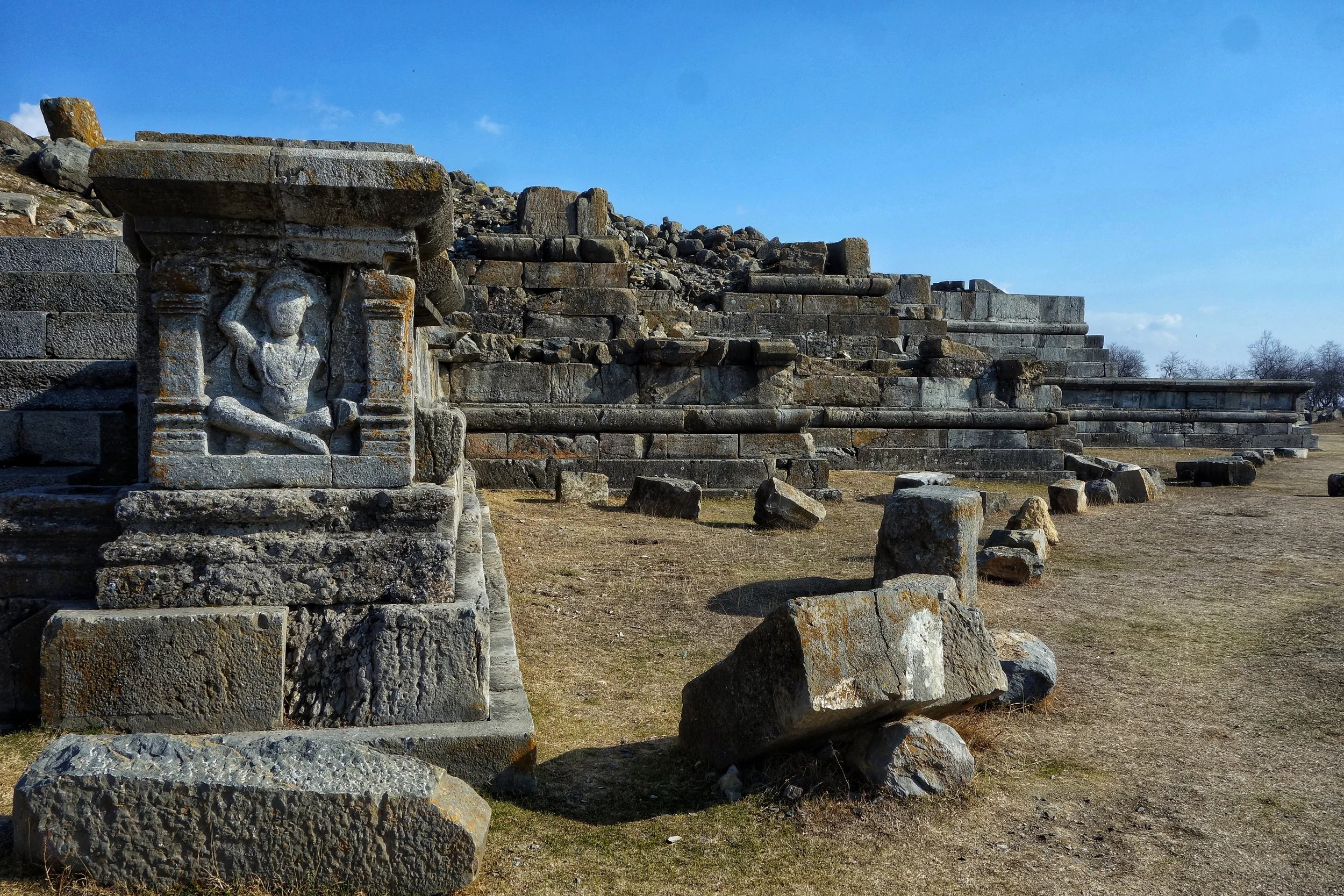
Parihaspora – The Ancient Capital of Kashmir
Just around 20kms from Srinagar lies the plateau of Parihaspora which was chosen as the site for a new Capital by one of the greatest Kings of Kashmir, Lalitaditya in the 8th century AD. The site situated on a Plateau is today in ruins but still a glorious memory of the time Kashmir was a powerful Kingdom.
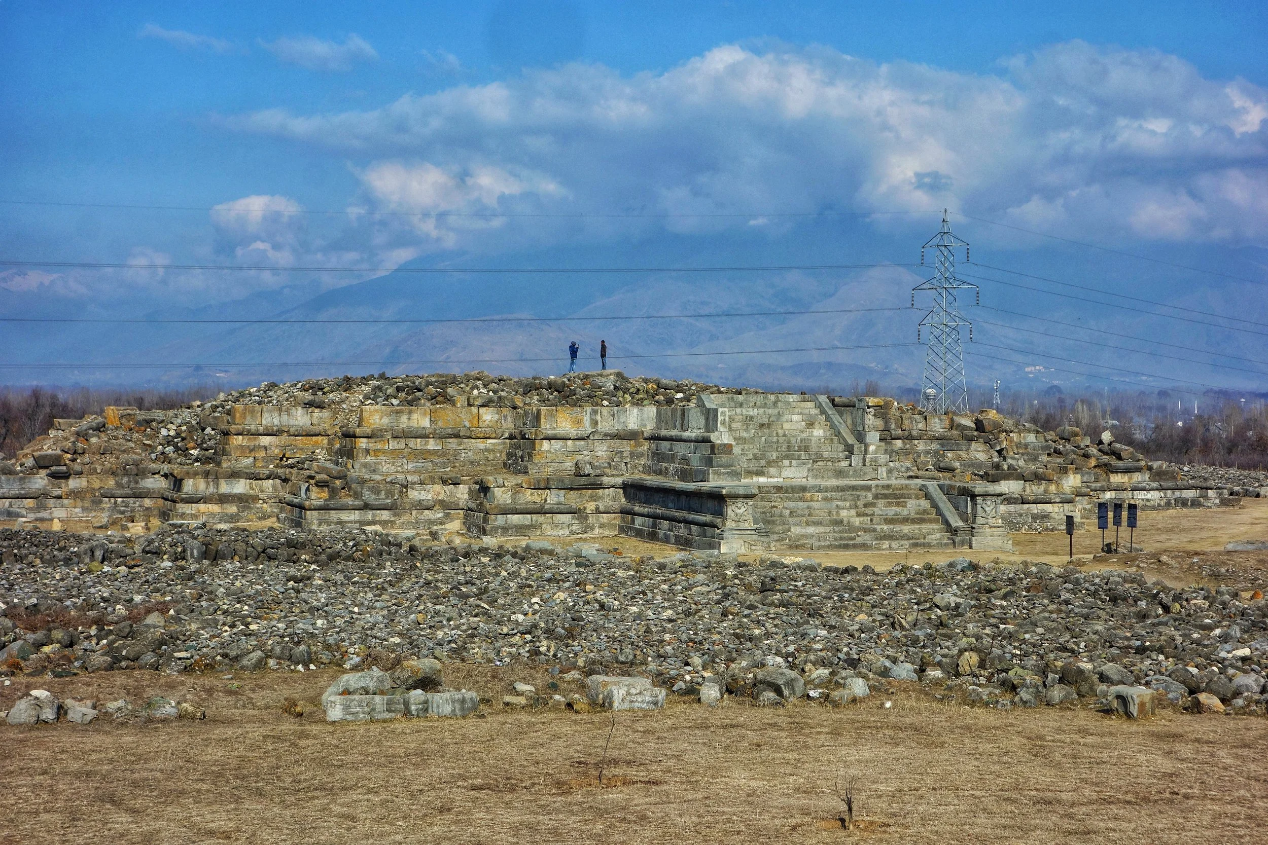
Parihaspora – The Ancient Capital of Kashmir
Just around 20kms from Srinagar lies the plateau of Parihaspora which was chosen as the site for a new Capital by one of the greatest Kings of Kashmir, Lalitaditya in the 8th century AD.
I decided to pay a visit the ruins which lay a few kms off the Srinagar Baramulla while I was going to Pattan and onwards later on to Uri.

Another Platform, Parihaspora
Lying next to a local Engineering College this mostly abandoned site is a sad reminder today of the glorious age of Lalitaditya. He moved the Capital here and built a Palace, Temples and a Buddhist Monastery over here. This was also the Golden Age of Buddhism in Kashmir but it existed in a syncretic alliance along with the Vedic beliefs. There was apparently a great statue of Vishnu made of Gold and an equally tall statue of the Buddha made in Copper. There are conflicting accounts as to what was the real purpose of these buildings but everyone agrees that Lalitaditya built them and they were simply magnificent.

Carvings on the stairs going up the Temple, Parihaspora
The ruins are spread over a large area and as of now only the bases of the great structures remain and these suggest that these must have been magnificent architectural specimens in their time. In fact the main structure here is quite bigger than the remains of the Great Sun Temple at Martand which is also attributed to Lalitaditya. The landscape is littered with stone blocks/ rocks of various sizes which at one time must have been a part of the great structures. Infact the locals nowadays refer to the place as “Kani Shahar” or the City of stones.
The place lost its glory when Lalitaditya’s son decided to move the Capital again and apparently the Jehlum changed its course due to some human intervention and with no direct access to water the decline began. And then Avantivarman, who built the Temples at Avantipora moved the Capital again and his son Shankarvarman decided to move it again to Shankarpura (Pattan) and decided to cannibalize the stones from the Temples and Palaces here.

The Stairs to the Temple, Parihaspora
On top of that another King Harsha decided to burn down the Temple and the Monastery after he suspected one of his rivals to be hiding there. Thus ended the glory of Parihaspora and what ever remained was destroyed by Sultan Sikandar in the 14 th century.

The Grand Platform, Parihaspora
But the plunder just didnt end there. Auriel Stein, the great British Indologist, who translated Kalhana’s Rajtarangani also visted the site twice in 1892. In between his two visits he noticed that a lot of sculptures and stones were missing. It turned out that the Maharaja of Jammu and Kashmir was building the Jehlum Cart road and stones from Parihaspora were being used for the construction. Auriel Stein then approached the British resident at the Court of the Maharaja and he was able to convince the Maharaja to put an end to the mindless destruction of whatever remained.

Another view, Prihaspora
And so to this day Parihaspora has a haunting presence. The ruins are said to be home to hundreds of snakes though I didnt see any. On a clear day one gets great views of the Haramukh and Mahadev Peaks from here. But it was a hazy day when I went. Hardly any tourists ever turn up here and except for a few College students loitering around the place is deserted.

A view of the "Kani Shehar"as the remains of Parihaspora are now called by the localls
Another lost glory from the rich architectural heritage of Kashmir.
Pics from December 2017. Parihaspora, Kashmir
Kiki’s Blog
Stories from the Himalayas








Five years ago the Galwan Valley was in the News for the wrong reasons after a deadly clash between the Indian and Chinese Armies in the Valley located in Ladakh lead to many deaths on the contentious Border between the two countries in wake of continued Chinese intrusions into Indian territory.
This area along the Shyok River, of which the Galwan Nallah or the Galwan River which forms the Galwan Valley has been off limits to Civilians since long but now the Indian Government has decided to open up the area for Civilians and we were amongst the First Civilians to venture into this beautifully desolate part of the Eastern Karakorams in Ladakh. Earlier Civilians could only venture upto the Village of Shyok from where the Shyok River takes a U turn and flows in a Northerly direction.