

Karakorams in Ladakh
The Himalayas might be the highest Range in the World but when it comes to sheer perpendicularity nothing compares to the mighty Karakorams. Many people consider the Karakoram to be a part of the Himalayas but its not. Its a separate Range in its own right. It might be considered at a part of the Great Himalayan Complex of Mountains that radiate out of the Pamir Knot. In common parlance the term Karakoram is synonymous with its most famous Peak, the K2 or the Godwin Austen as it was once called. But other Peaks and parts of it are relatively unknown.
The Himalayas might be the highest Range in the World but when it comes to sheer perpendicularity nothing compares to the mighty Karakorams. Many people consider the Karakoram to be a part of the Himalayas but its not. Its a separate Range in its own right. It might be considered at a part of the Great Himalayan Complex of Mountains that radiate out of the Pamir Knot. In common parlance the term Karakoram is synonymous with its most famous Peak, the K2 or the Godwin Austen as it was once called. But other Peaks and parts of it are relatively unknown.
And surprisingly most people in India are unaware of the large slice of Karakorams which lies on the Indian side of the LoC as well on the Indian side with Tibet. Of course the fact that all of our Borders on the Karakoram are disputed and as such getting Permissions for exploring these Regions are far and in between though in recent years there have been some Expeditions in the Eastern Karakorams led by Divyesh Muni Sir and his Team.

And the Karakoram is not a Monolithic Range and its has a number of quite distinct Sub Ranges which could be Mountain Ranges in their own right. It should be remembered that the name “Karakoram” was first used by Europeans for the Baltoro Range of the Karakorams which stretches from the point where the Nubra meets the Shyok and Northwards all the way to the Siachen Glacier. Now typically the Karakorams stretch from the Aksai Chin in the North East to the Tibetan Plateau and then it is bounded by the Shyok, the Indus and the Gilgit River towards the West.
Then there is the interesting Ladakh Range which runs between the Shyok and the Indus which run roughly parallel to each other for quite a length. As per some the Ladakh Range is a southern extension of the Karakoram while others consider the Shyok as the parting between the Great Himalayan Range and the Karakorams. So if we consider the first instance then even Leh lies in a part of the Karakoram Range. While as per others it lies in the Great Himalayan Range. The Britannica considers even the Pangong Range and the Chang Chenmo Ranges as parts of the Karakorams. Also the Kailash Range is considered a Southern extension of the Ladakh Range and so is the Deosai Range. The Mountains are complicated and especially the Karakorams.
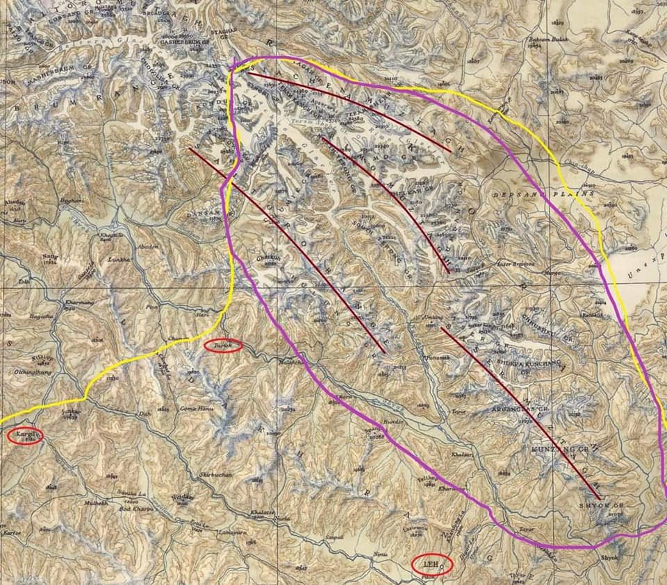
Now as for the main Karakorams it has a number of sub Ranges and out of these 3 lie fully on the Indian side and a 4th lies partly on the Indian side. The Sasser Muztagh is the southernmost sub Range of the main Range and lies between the bend of the Shyok when it changes direction and heads in a Northern direction. The Shyok rises in the Rimo Muztagh which lies above the Sasser Muztagh. The same trend is shown by the Nubra which also joins the Shyok and its at this point the Baltoro Sub Range starts which is partly on the Indian side. So the Sasser and the Baltoro Ranges are divided by the Nubra which rises in the Siachen Glacier. The Sasser La runs roughly between the Sasser Muztagh and the Rimo Muztagh. And in the extreme North along the Siachen Glacier runs the Siachen Muztagh.

And all these Sub Ranges further have different Groups of Peaks within them which Ill try and list below as given in the Royal Geographic Society Map of the Karakoram from 1939 as below :
Sasser Muztagh : Main Peak Groups
Shyok Group
Kunzang Group
Arganglas Group
Shukpa Kunchang Group
Chhusku Group
Sasser Group
Rimo Muztagh : Main Peak Groups
Rimo Group
North Terong Group
South Terong Group
Kumdan Group
Shelkar Group
Siachen Muztagh : Main Peak Groups
Teram Kangri Group
Teram Shahr Group
Singhi Group
Kyagar Group
Main Peaks (Out of the 20 Highest Peaks in India 12 Lie in the Karakorams)
Saltoro Kangri 7742
Sasser Kangri I 7672
Mamostong Kangri 7516
Sasser Kangri II 7513
Sasser Kangri III 7495
Teram Kangri I 7462
K12 7428
Ghent Kangri 7401
Rimo I 7385
Apsarasas Kangri I 7243
Rimo III 7233

Leaving you with a Classic Royal Geographic Map of the Karakorams in 1939 and a Map with some marked lines and places circled for reference. The Yellow Line is the LOC / Border while the Purple line is the extent of the Karakorams in India. (As in De Facto)

Amarnath Yatra 1898 Diwan Alim Chand
Diwan Alim Chand was a Pioneering Photographer attached to the Court of the Dogra Maharajas of Jammu and Kashmir. Diwan Alim Chand also had the privilege of having taken the first Photographs of the Amarnath Yatra back in 1898 when Maharaja Partap Singh, the Maharaja at that time had gone on a Pilgrimage to the Holy Cave.
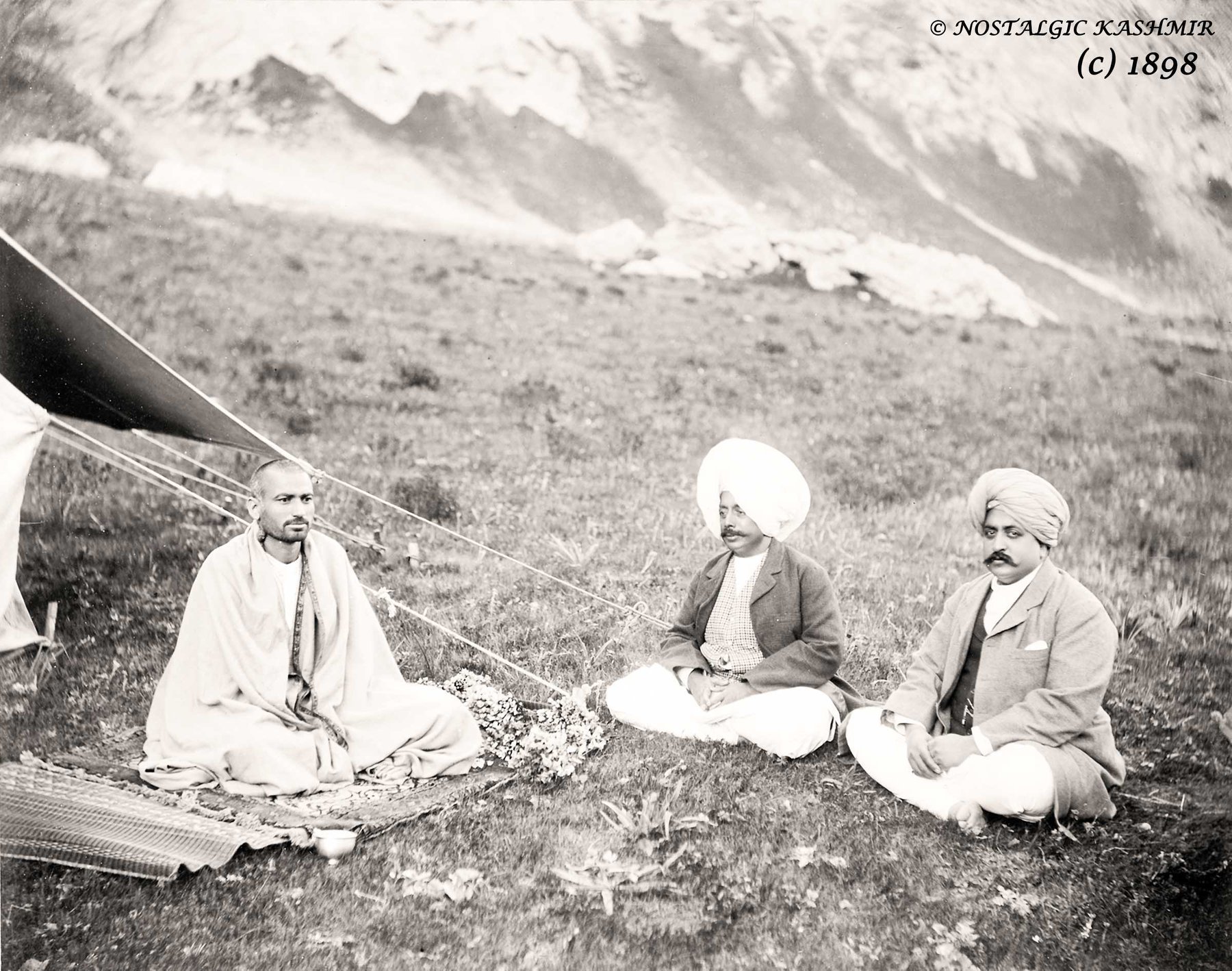
Maharaja Partap Singh (middle) flanked by Raja Amar Singh (right) and the Mahant of the Yatra at Chandanwari Camp.
Diwan Alim Chand was a Pioneering Photographer attached to the Court of the Dogra Maharajas of Jammu and Kashmir. Diwan Alim Chand also had the privilege of having taken the first Photographs of the Amarnath Yatra back in 1898 when Maharaja Partap Singh, the Maharaja at that time had gone on a Pilgrimage to the Holy Cave.
The Photographs offer a unique glimpse into History of how the Yatra was conducted almost 120 years back. It also offers a window of how the Geography of the area looked at that point of time and how it compares to more contemporary times.
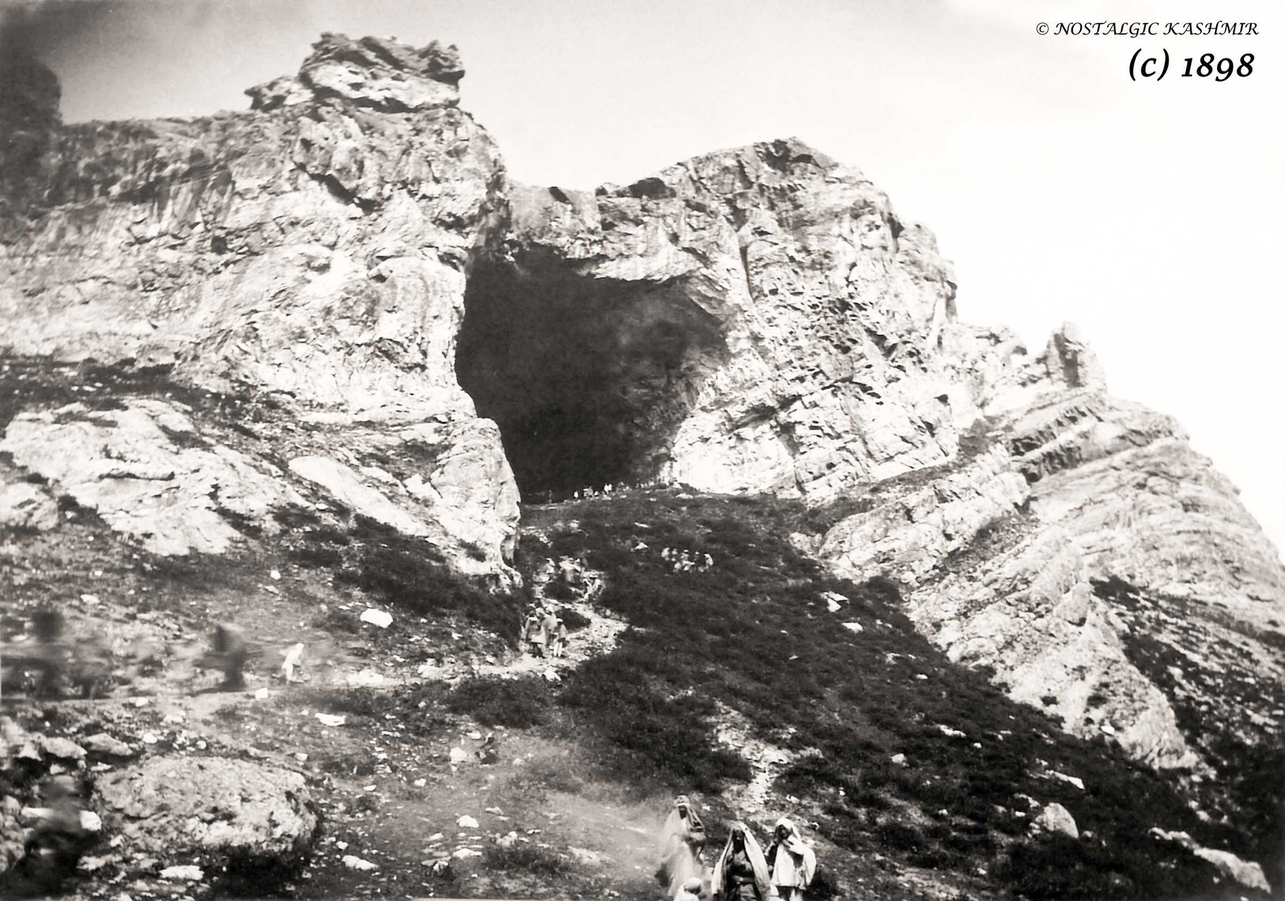
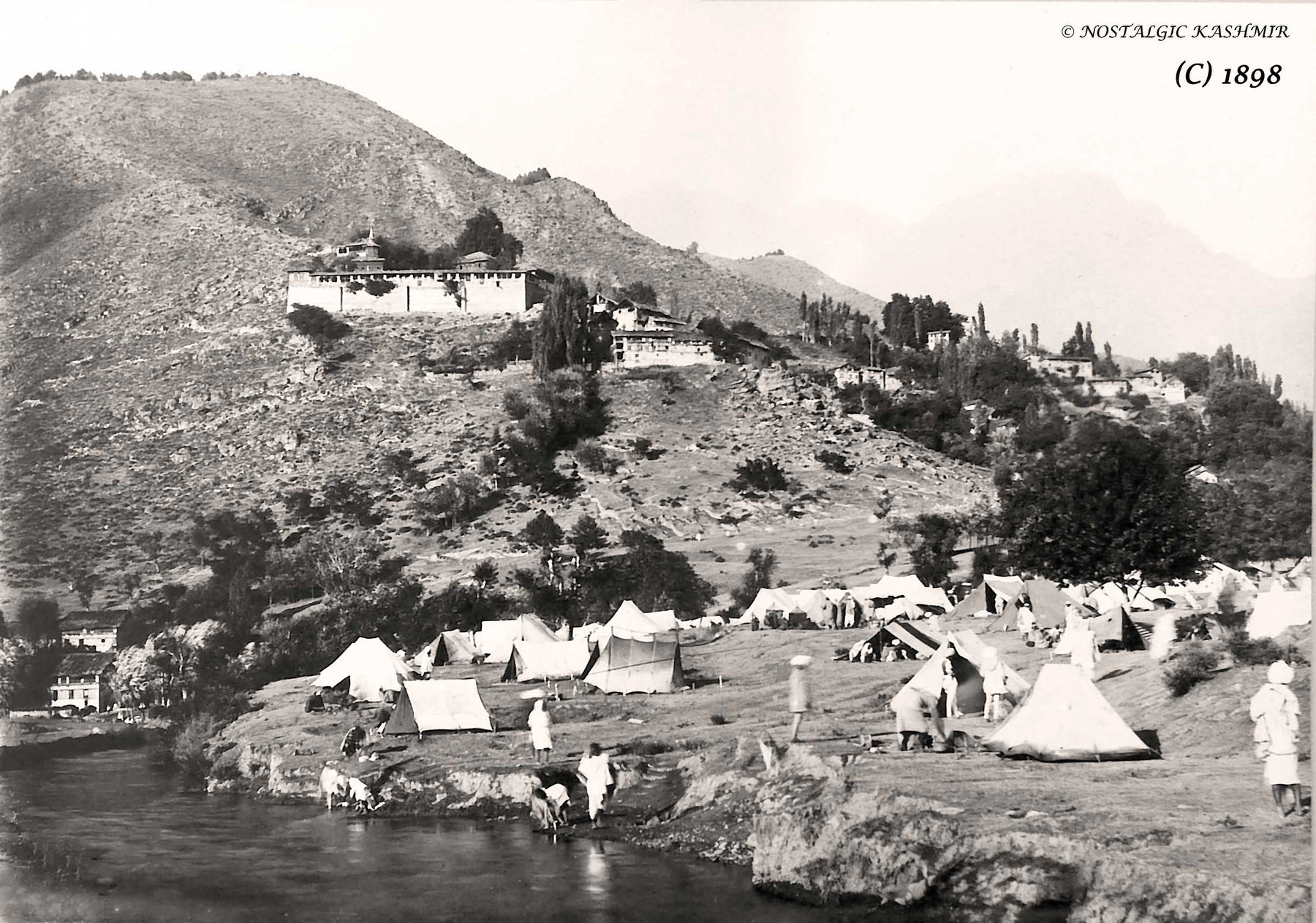
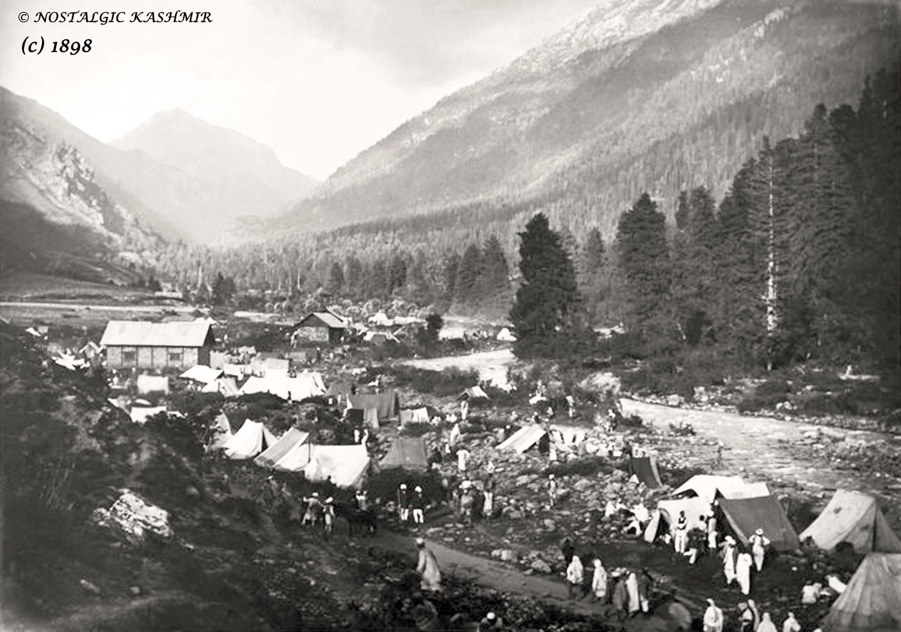
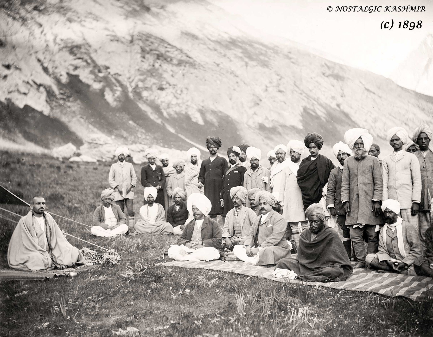
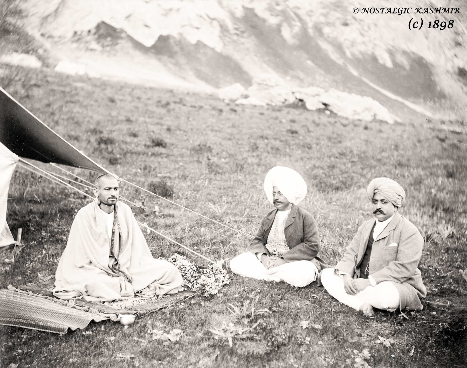
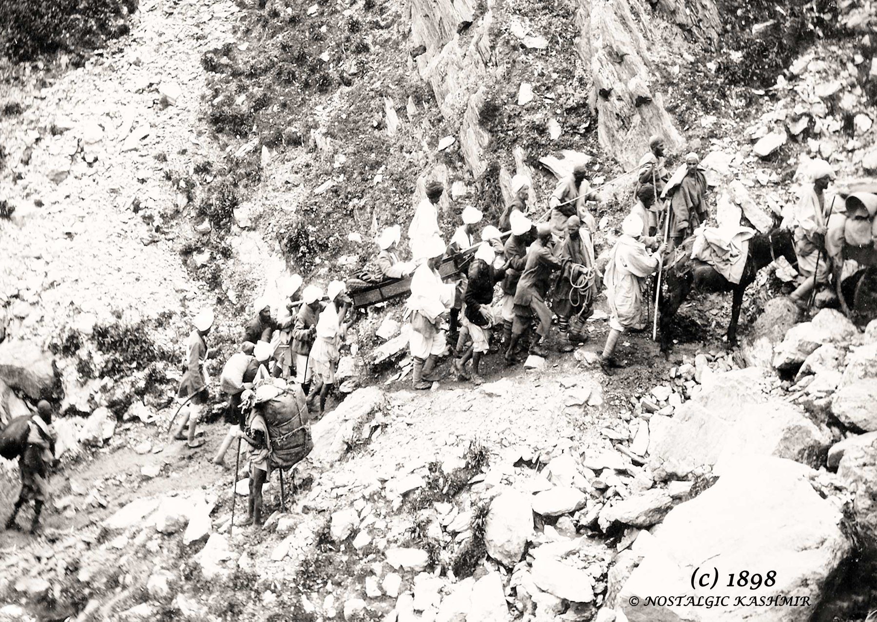
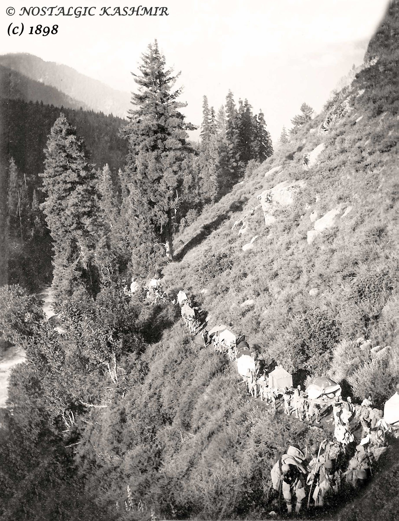
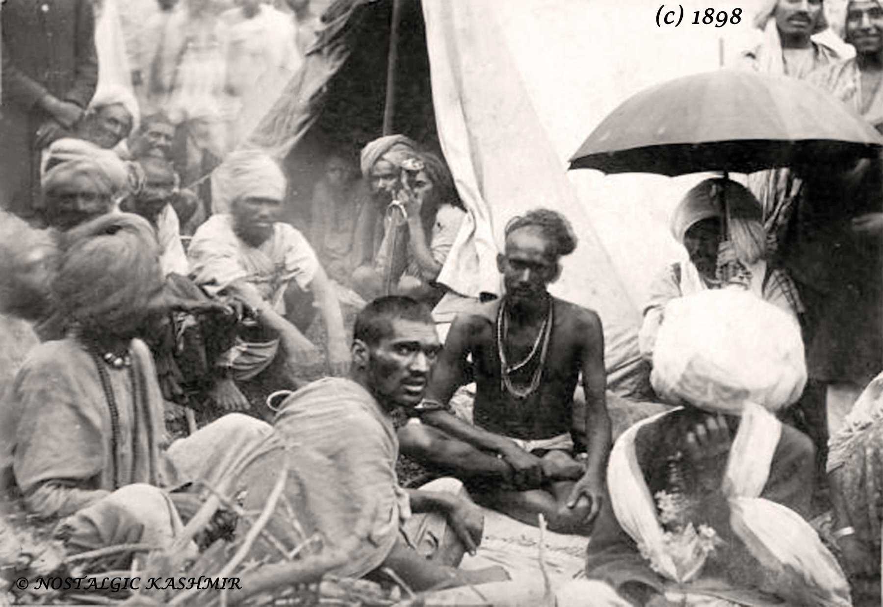
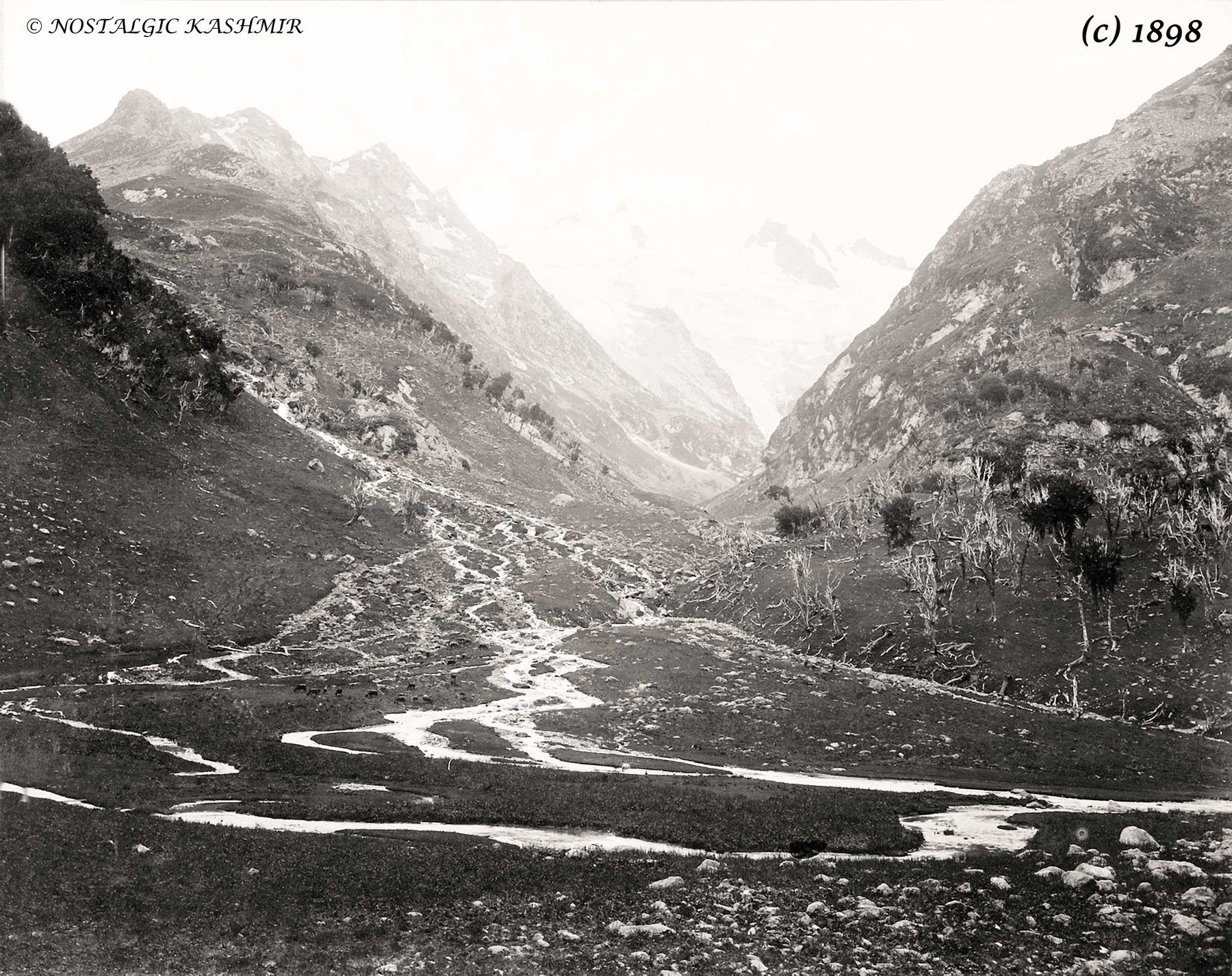
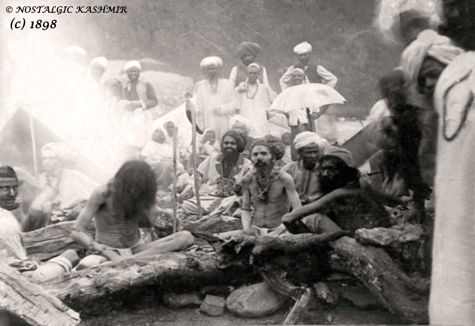
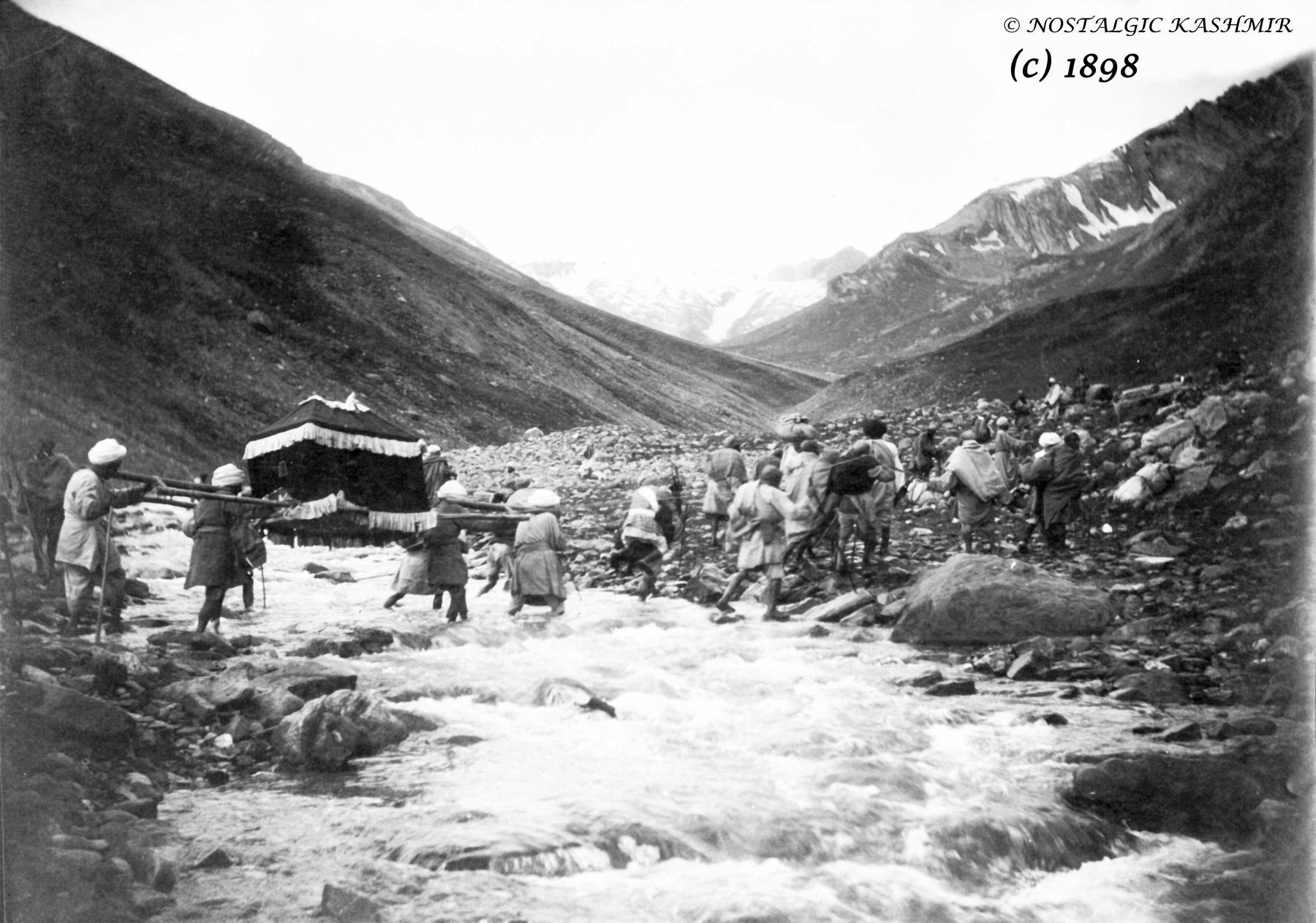
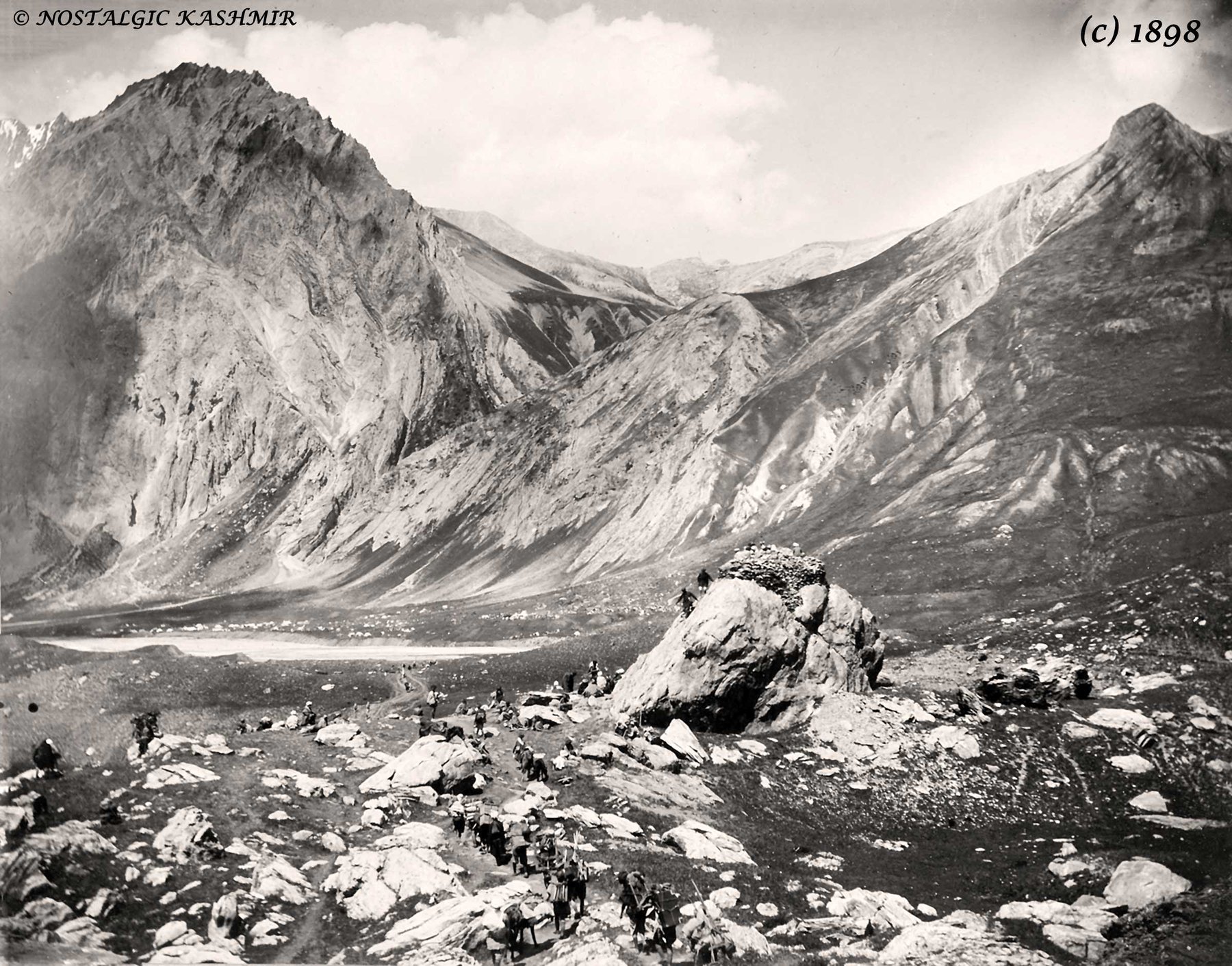
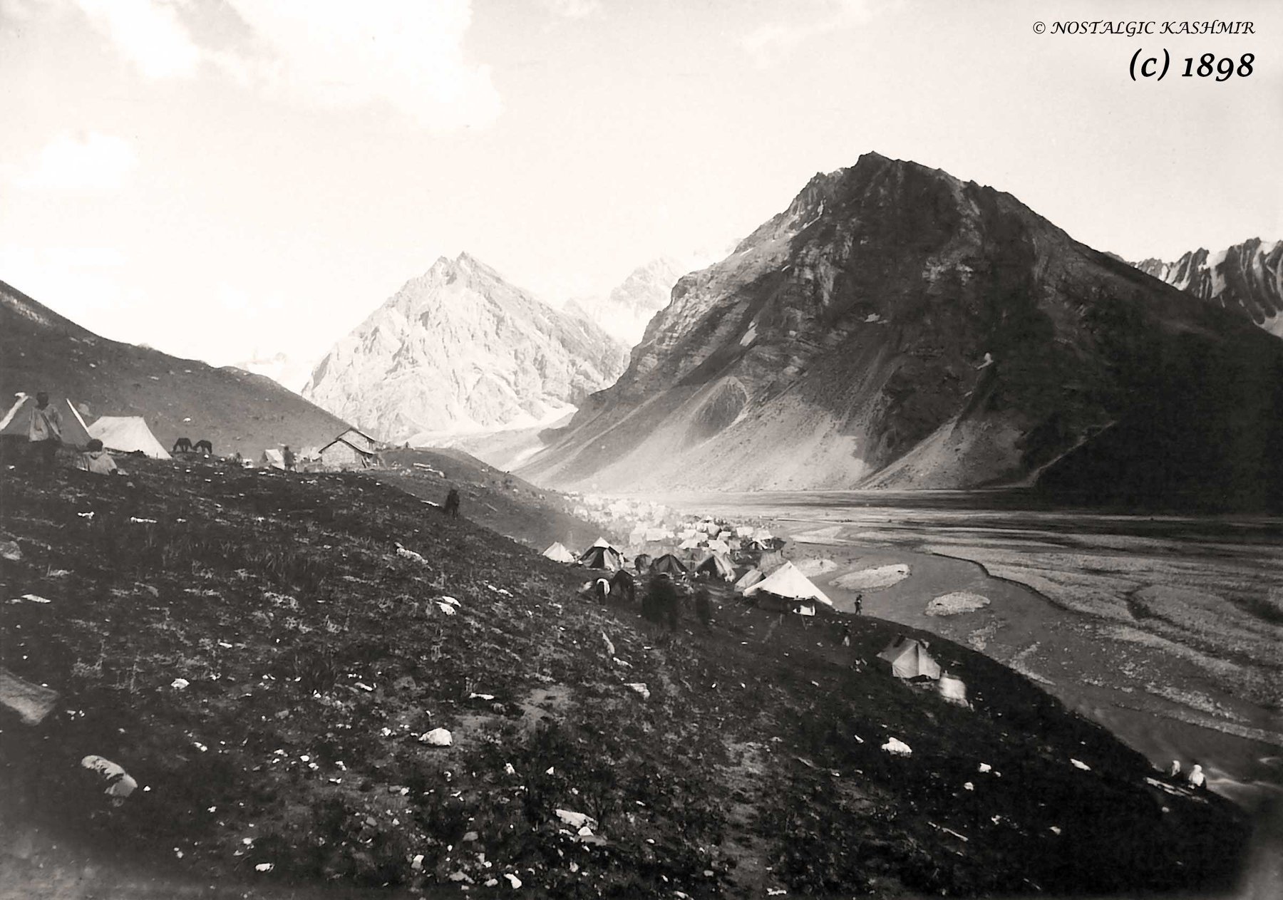
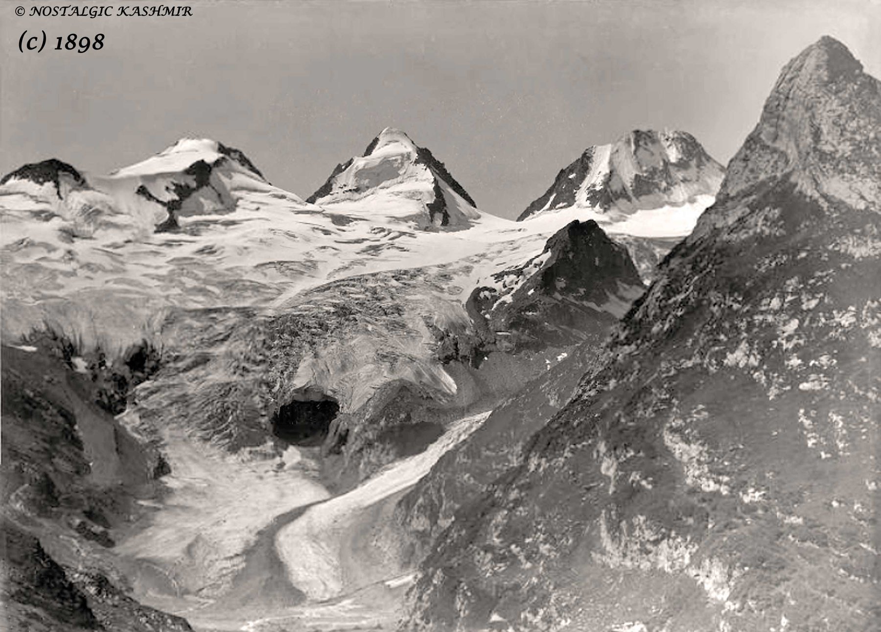
Pics Courtesy Nostalgic Kashmir and Showkat Rashid Wani Jinaab.

The Road to Uri
For the ones unaware of Uri it lies along the Jhelum Gorge as it swirls out of the Kashmir Valley and enters PoK and Uri is the last major Town before the LoC which lies around a dozen kms ahead of Uri. Ahead of Uri lies the Village of Salamabad which was the point for the Cross Border trade and Trucks from the other side of the LoC used to visit in better times. And then of course there is the Kaman Seu which is the LoC between the 2 Countries.

The Kazinag Mountains as seen from the Road to Uri
The Road to Uri and Beyond
Many of you must have heard of this place called Uri and many must have seen the famous Movie which had the same name (Though it was Shot in Serbia, that wasnt Uri) but how many have you been to Uri. Except for people from the Armed Forces and their known ones I hardly know anyone who has gone or made an effort to go to Uri.

On the Road. Uri 37 kms away
Uri lies at one end of the Kashmir Valley as the Mountains close in and the Jehlum now flows thorugh a Gorge instead of the wide expanse of the Kashmir Valley. The Valley keeps getting narrower as one moves towards Uri from Baramullah.

One of the idyllic Villages on the Jehlum
For the ones unaware of Uri it lies along the Jhelum Gorge as it swirls out of the Kashmir Valley and enters PoK and Uri is the last major Town before the LoC which lies around a dozen kms ahead of Uri. Ahead of Uri lies the Village of Salamabad which was the point for the Cross Border trade and Trucks from the other side of the LoC used to visit in better times. And then of course there is the Kaman Seu which is the LoC between the 2 Countries.

Approaching Uri which lies on the Mountain we are facing
Uri itself is beautifully set, surrounded by Mountains and overlooking the Jhelum as it moves across Kashmir. And its in Uri that things begin to change and Pahadi culture starts to show its influence. Uri is like a gateway to and out of Kashmir. And any Indian citizen can visit Uri Town without any Permits. You are allowed all the way to the Uri Bazaar and incase you want to go beyond Uri you need Permits.

Uri and Around
Moving beyond the drive to Uri from Srinagar (its around 100 kms) is also a scenic one and Ive tried to catch some of the views though it was a dreary December so the Mountains were as Brown as ever though there was some Snow on the Mountains.
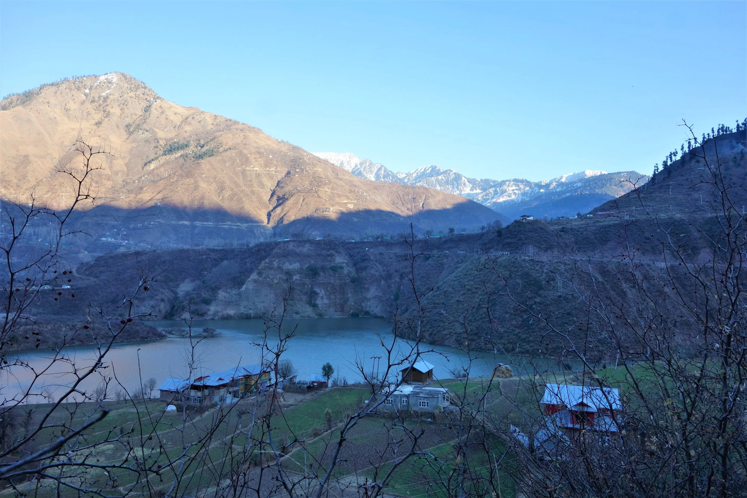
Moving beyond Uri and looking back just as we are reaching Salamabad
Sharing some pics of around Uri and I can assure you its much prettier in the Spring and the Summers. We at Travel The Himalayas arrange visits to such Offbeat destinations moving beyond the usual Touristy destinations.

The Road towards the LoC beyond Salamabad
Dulanja is one of the last Villages on the LoC on the Indian side and just beyond the Ridges is the Pakistani side across the LoC.

One of the last Villages on the Indian side of the LoC, Dulanja
Next time on your visit to Kashmir do try and fit in Uri as an Offbeat destination.

A beautiful Sunset in the area
Pics from 2017, December.

Chorbat Valley : Where Ladakh Gives Way to Baltistan
So where exactly does Baltistan begin and Ladakh end ? Well to be honest there is no such defined physical feature but most consider the Chorbat Valley as a part of Baltistan rather than Ladakh. In the pre-partition days Chorbat was an “Ilakka” in the Baltistan Wazarat. Geographically the Chorbat Valley starts at the point where the Shyok Valley narrows and becomes a Gorge before the Village of Bogdang. Bogdang is considered the first Village of the Chorbat Valley and hence the first Village of Baltistan. Technically it lies sandwiched between the Ladakh Range and the Karakorams.
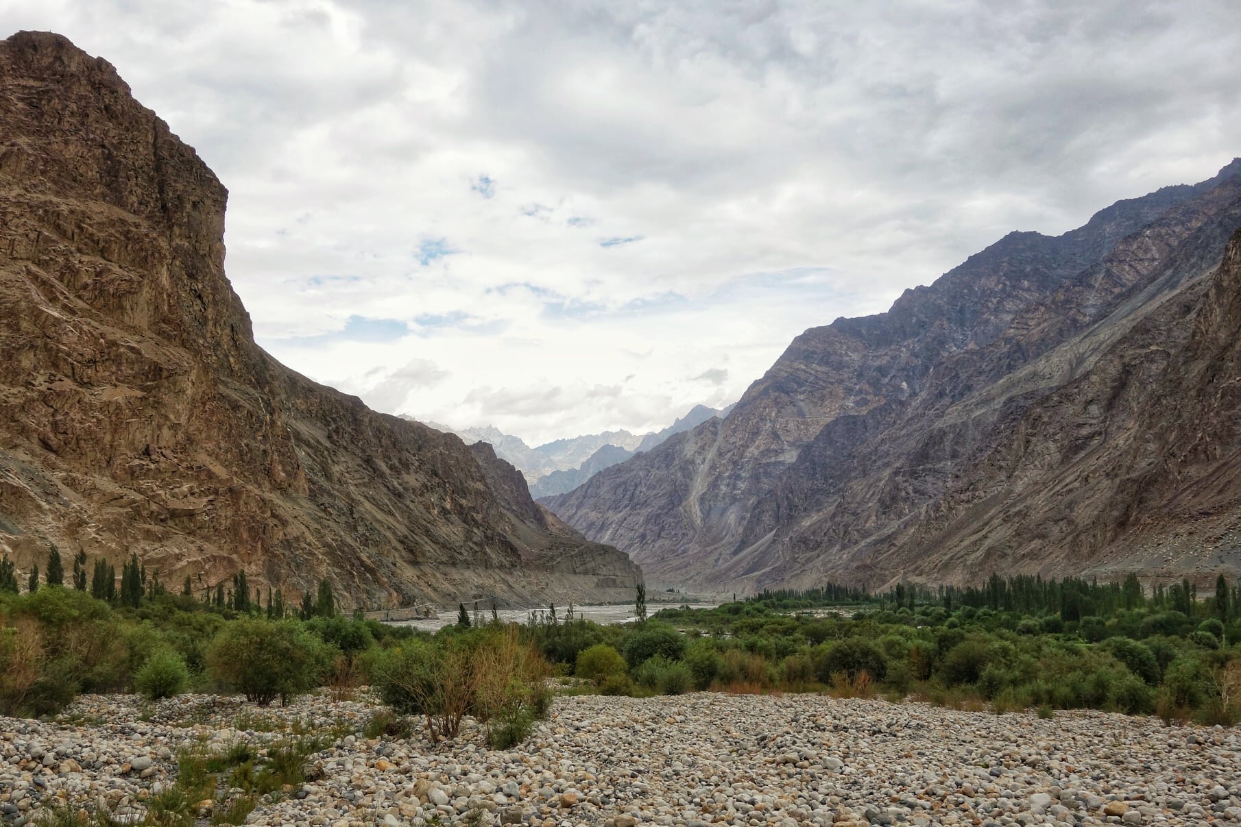
The Chorbat Valley at Turtuk
Many of us have traveled to Ladakh and many have visited the Nubra Valley and of course Turtuk is now a famous destination because of its Balti culture. Infact technically Turtuk lies in what was traditionally Baltistan though now divided by the Line of Control with most of Baltistan being on the other side though a small sliver of Baltistan lies on the Indian side. And most people are also aware of the fact that Turtuk came under Indian control in 1971.
So where exactly does Baltistan begin and Ladakh end ? Well to be honest there is no such defined physical feature but most consider the Chorbat Valley as a part of Baltistan rather than Ladakh. In the pre-partition days Chorbat was an “Ilakka” in the Baltistan Wazarat. Geographically the Chorbat Valley starts at the point where the Shyok Valley narrows and becomes a Gorge before the Village of Bogdang. Bogdang is considered the first Village of the Chorbat Valley and hence the first Village of Baltistan. Technically it lies sandwiched between the Ladakh Range and the Karakorams.

Chorbat as shown in the Classical Starchey’s Map of 1858

Chorbat as seen on Google Satellite View
The first Village being Bogdang, the next one is Chalunka and then its the biggest Balti Village, the famous Turtuk. Most people assume that Turtuk is the last Village before the LoC but its not. There is Tyakshi beyond Turtuk where one can go with permission and beyond Tyakshi lies the last Village on the Indian side of the LoC called Thang. One is allowed to go beyond Tyakshi but not all the way to Thang. One can see the Village of Thang from a distance though one is allowed to go to Thang only if one is a local or has relatives in the Village.

The first view o Thang
Though I was lucky enough to manage to go all the way to the Village and have a walk around and also got to Pluck Apricots for which the Region is famous. The Apricots of this area are jus something else. And from Thang in the distance one can see the Greenery of the first Village on the other side called Franu. Of course many people from the Villages who have relatives on the other side and have long demanded ease of Travel.

A sign welcoming you to the Northernmost Village of India

The first House in Thang
Infact in 1947 only Bogdang and Chalunka were on the Indian side but in 1971 Indian Forces took Turtuk, Tyakshi and Thang and overnight these Baltistani Villages became a part of India instead of Pakistan. Historically the Chorbat Valley which stretches from Bogdang all the way to Khaplu where the Shyok Valley opens up again. There are 13 Villages traditionally in the Chorbat Valley with 5 of them on the Indian side now. Also the Chorbat La was a traditional Pass which connected Ladakh with Baltistan from the Dah side along the Indus side.

The Starting point of the Chorbat Valley

The start of the Chrobat Valley where it widens up.
Chorbat was also a small Kingdom with the Capital at Siska which was also called Chorbat though later the Capital was moved to Turtuk and many Members of the Royal Family still live in Turtuk including the “King” who many people have had the pleasure of meeting in Turtuk. The Gentleman also has a very interesting Museum which has a Collection of old Personal and Royalty related items.

The Apricot Fields of Franu
And Chorbat was always heavily influenced by Ladakhi culture as well which is only expected as both Ladakhis and Baltis are of Tibetan stock and have various similarities especially in Language. Infact the Balti script and language is considered the closest one to Old Tibetan. This just adds another colorful dimension to the area known as Chorbat which is not really well known on the Tourist circuit.

One of those Natural Cold Storages common in the Region

The Green Fields of the Village of Franu across the Line of Control

Pestonjee Ka Ghoda and Parsis in Kashmir
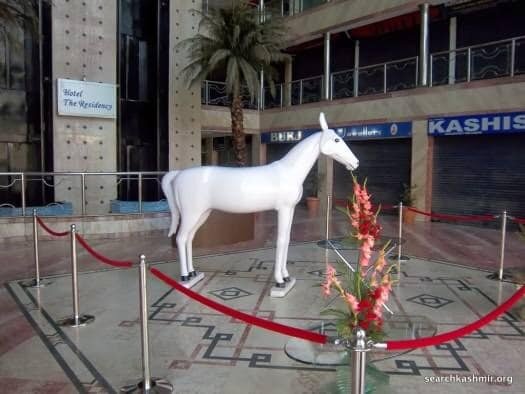
Anybody who grew up in Srinagar in the good old 1970s and 80s must be familiar with the famous Pestonjee Ka Ghoda on the Residency Road. The Pestonjee Ka Ghoda or the White Horse was installed outside the Pestonjee Building which was next to the Building which housed the famous Mahattas Photographers as well as the Grindlays Bank. As a kid I was always fascinated by this White Horse and used to see it quite often whenever we went to that side of Town.
Anybody who grew up in Srinagar in the good old 1970s and 80s must be familiar with the famous Pestonjee Ka Ghoda on the Residency Road. The Pestonjee Ka Ghoda or the White Horse was installed outside the Building which housed the famous Mahattas Photographers as well as the Grindlays Bank. As a kid I was always fascinated by this White Horse and used to see it quite often whenever we went to that side of Town. We didnt really care who Pestonjee was or what was the exact purpose or significance of this White Horse but we just liked it. It was like a Monument of a different kind in a City which didnt have many Statues in Public Places. Come Rain or Sun or Snowfall Pestonjee Ka Ghoda was always there.
That was the only connection that we had with the Parsi Community in Srinagar as there were hardly any left. Not much to the Parsi connection in Kashmir except our beloved Pestonjee Ka Ghoda. Or so I thought.
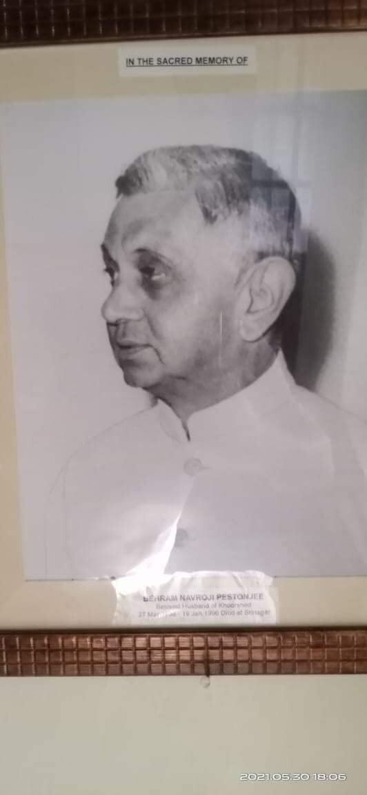
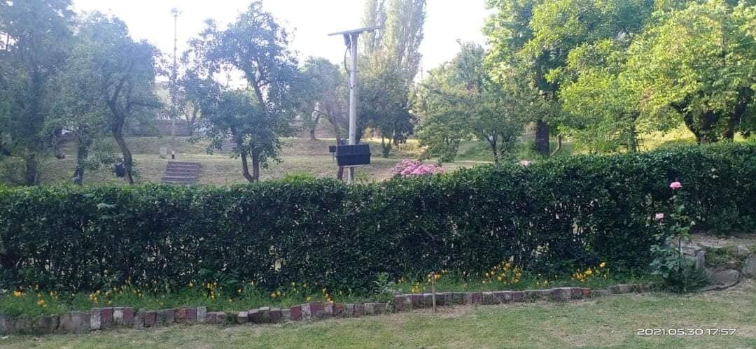
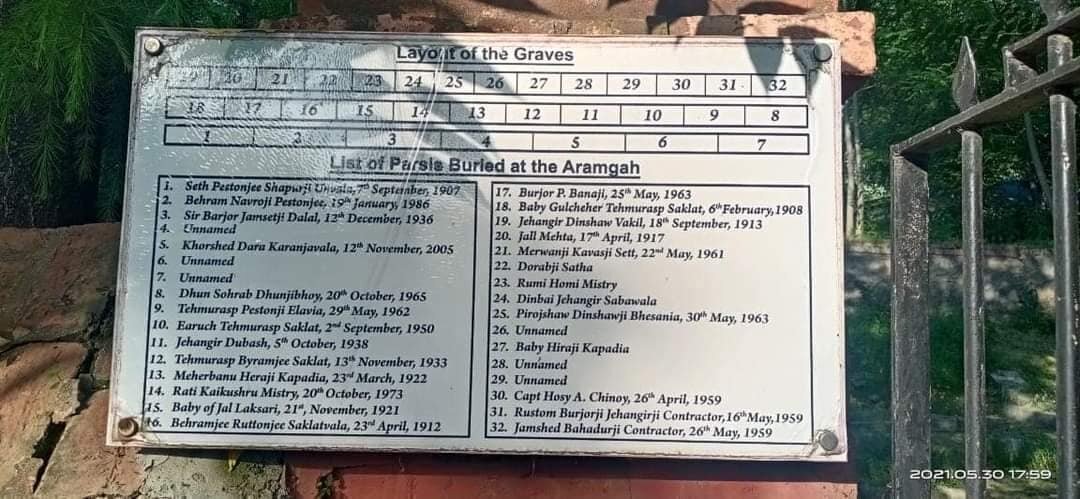
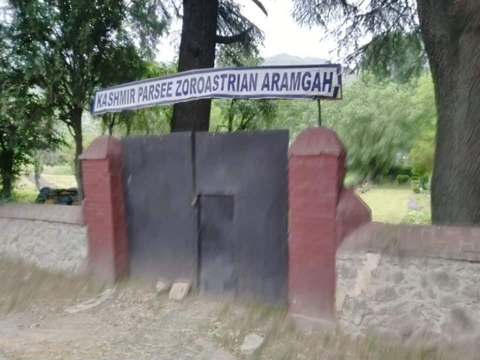
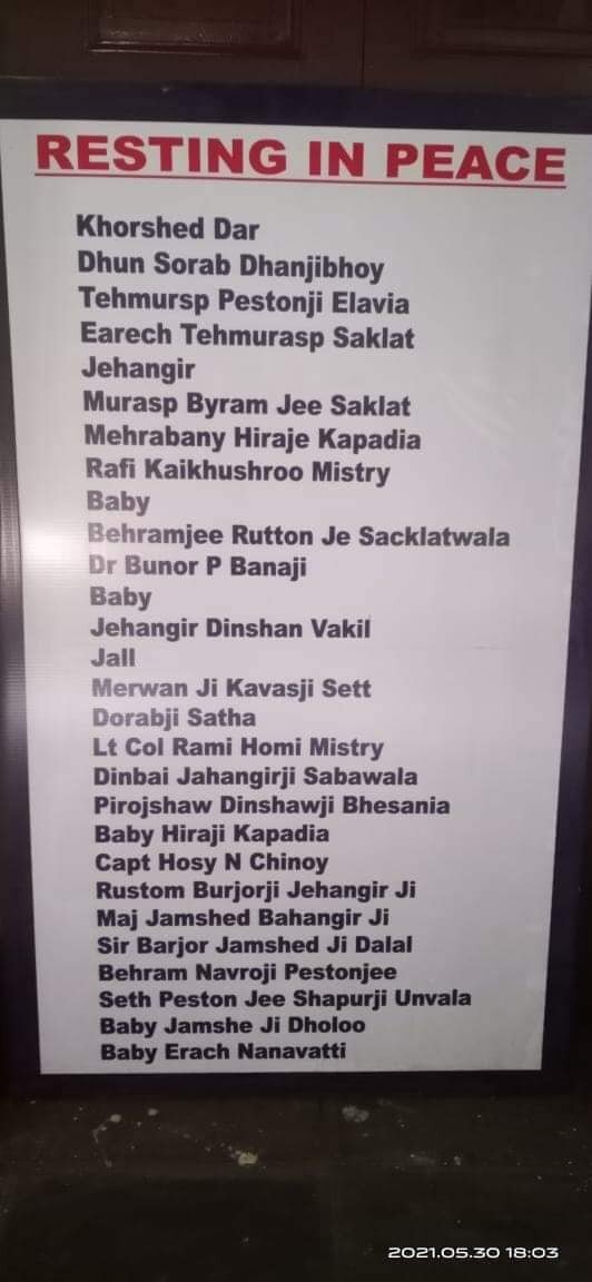
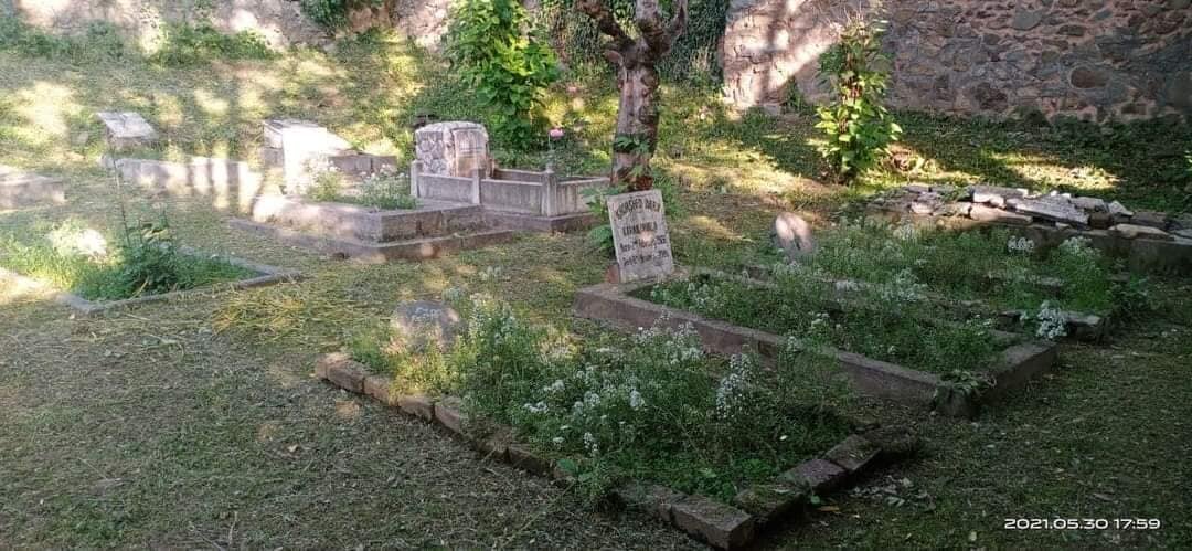
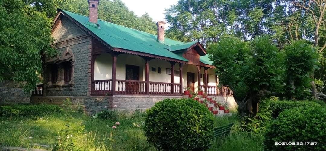
And last night I came across the pics of a Parsi Cemetry or an Aramgah in Kashmir. I was amazed to see that and till now I didnt know of its existence. And on top of that what surprised me even more was the excellent condition the place was in. There was even a list with Names of all the Parsis who had been laid to Rest in the Aramgah. The Graves were clean. The Garden looks well maintained. The Hedges were trimmed properly and since there was no mention of the location in Kashmir i started to search around and realised that this was somewhere around Badami Bagh. Now Badami Bagh as some of you must be aware is the Main Cantonment of Srinagar. And as such is a high security area so one cant just go looking for this place inside.
The fact that the place was so well maintained was a pointer to the fact that it was under the Army’s maintenance. So in order to get more information with Saleem Baig saab who is an authority on the Historical Stuff in Kashmir and shared the pics with him and even he was pleasantly surprised to see the pics. Baig Saab has already written on the subject of Parsis in Kashmir hence he bought some facts to my Notice. As it so happened the Parsi Aramgah mentioned in Historical contexts was somewhere near Pantha Chowk and beyond Pantha CHowk there were large Parsi land holdings in the area which houses the Khunmoh Industrial Estate now. And most of the Parsis lived in this area.
The Pantha Chowk area lies near the Badami Bagh Cantonment and this explains how the Aramgah came under Army’s maintenance. And the fact that its existence isnt so well known is due to the fact that its a High Security Zone and Civilian access is strictly controlled. And Baig Saab mentioned how Parsi Lands were acquired by the State as younger Parsis decided to move away especially after Independence. And as of today there are no Parsis in Kashmir and their only lasting legacy is this Aramgah and of course Pestonjee Ka Ghoda.
So what exactly was the Pestonjee Ka Ghoda story ? Well the thing was Pestonjee was a Trader and one of the things he dealt in was Imported Liquor. And of course one of the main selling Liquors was of course Scotch Whisky. And one of the main brand that Pestonjee dealt in was White Horse Scotch Whisky. What better advertisement for his Whiskey brand than putting a White Horse outside his Shop. The legend goes that the White Horse was imported all the way from England and installed outside the Shop where it became the legendary Pestonjee Ka Ghoda.
So what happened to the Pestonjee Ka Ghoda you may ask ?
Well the legendary Pestonjee Ka Ghoda is still there though now it has moved to an ugly Mall on the Residency Road and it stands in the Foyer in the Mall. The surroundings have changed but even today when I see it, it brings a flood of memories of the good old days. I am sure if Pestonjee Ka Ghoda could speak he would agree with me.
Credit To The Photographer Who Took These Pics. And SearchKashmir for the Pestonjee Ka Ghoda pic.

The Pir Panjal Pass
And one of the most famous Pass over the Range was called the Pir Panjal Pass and as per some versions of History the entire Range got its name from the name of the said Pass. The word Panjal probably came from the word Panchal. This Pass connects the Kashmir Valley with the Poonch Region of Jammu and thereon to the Northern Plains of India. This was the Pass used by the Mughals on what is now called the Mughal Road on their forays into Kashmir. Nowadays mostly the Pass is called the Pir ki Gali which is a reference to a Pir or Holy Man buried somewhere near the Pass.

The Pir Panjal Range a sub Range of the Himalayan Range stretches from the Kishenganga in the West to the Beas River in the East. It is mostly an under rated Mountain Range as it barely touches 20,000 ft and is dwarfed by its adjacent Himalayan Ranges. The Pir Panjal cradles one side of the Kashmir Valley and separates it from the North Indian Plains and it forms one side of the Kulu Valley as well. Two of the largest and most fabled Valleys of the Western Himalayas are bound by the Pir Panjals.
But as John Keay mentions in the epic When Men and Mountains Meet : Explorers of the Western Himalayas the Pir Panjal is as Noble a Mountain Range as any in the World. Its spires are the first White wall of Mountains that explorers faced on their way into the Northern Mountain vastness. The Pir Panjal gets more Snow than any other Range of the Himalayas, thanks to the Western disturbances, and holds one of the finest Ski Resorts in the World, Gulmarg.
And one of the most famous Pass over the Range was called the Pir Panjal Pass and as per some versions of History the entire Range got its name from the name of the said Pass. The word Panjal probably came from the word Panchal. This Pass connects the Kashmir Valley with the Poonch Region of Jammu and thereon to the Northern Plains of India. This was the Pass used by the Mughals on what is now called the Mughal Road on their forays into Kashmir. Nowadays mostly the Pass is called the Pir ki Gali which is a reference to a Pir or Holy Man buried somewhere near the Pass.
The Pir Panjal Pass has seen its share of History and as the Guardian Wall of Kashmir its history is firmly entwined with that of the Valley. It was via this Pass that many invaders came to the exalted Vale though later travel along the Jehlum Gorge was more popular as it was a much safer option than the moody Pir Panjal Pass and its freak lightning Storms and crazy Weather. There were other Passes to the right and left of the Pass as well but when a Motorable Road was constructed it chose to go through the main Pass.
And then there is this great Drone Shot by my friend Tufail Shah. Moving beyond just the aesthetics of this shot the Mountain Geography it encompasses is like a Poem in Geography. It captures the grace of the Pir Panjal Pass and other neighbouring Passes of and accompanying Meadows of the Pir Panjals. And this is what you see while approaching from the Kashmir side.
The River you see in the pic is the Rambi Ara and it itself is formed by the meeting of the Rupri Nar and the Yanga Nar which arise from the Galciers and Glacial Lakes surrounding this Pass. The Rambi Ara is a major Tributary of the Veshaw which is the largest left Bank tributary of the Jehlum. True to its point of origin the Rambi Ara is known for its turbulent nature and flash floods. In the pic you can see different streams joining up the Rambi Ara adding to its flow.
And then you can see the signs of modernity. The Road snaking its way upto the Pass and its known as the Mughal Road. The Road remains open for a good 8 to 9 months of the Year and provides an alternative to the Main Srinagar Jammu Highway. Then there are the Power transmission lines going over the Pass connecting the Kashmir Valley with the Northern Grid.
And of course last but not the least are the footprints of History left on the Pass. Almost bang in the middle of the pic you can see the remains of the Alia Bad Sarai, a Sarai built by the Mughals which offered shelter from the angry weather Gods of the Panjals. The Alia Bad Sarai stood right on the approach to the Pass but the motorable Road has been built above it. The Sarai was probably constructed under instructions from Ali Mardan Khan, a Persian General who served under Emperor Jahangir and under who’s supervision the Road was built. Ironically Jahangir died while on this Road and his Intestines are buried at the Chingus Sarai on the other side of the Pir Panjals.
It is said that he fell ill while going down this Road on his way to Lahore from Kashmir. Maybe he fell ill on the Pass itself due to inclement Weather. Maybe he paid a price for trying to tame the Gods of the Panjals. Maybe a lesson to us Mortals that the Mountains can never be tamed. The Mountains will prevail. Everytime.
Anyways enjoy the Poetry of the Pic which encompasses all the elements of the enigmatic Pir Panjals.
Pic by Tufail Shah. From Late Summer 2020

One of the Most Dangerous Mountain Roads in the World
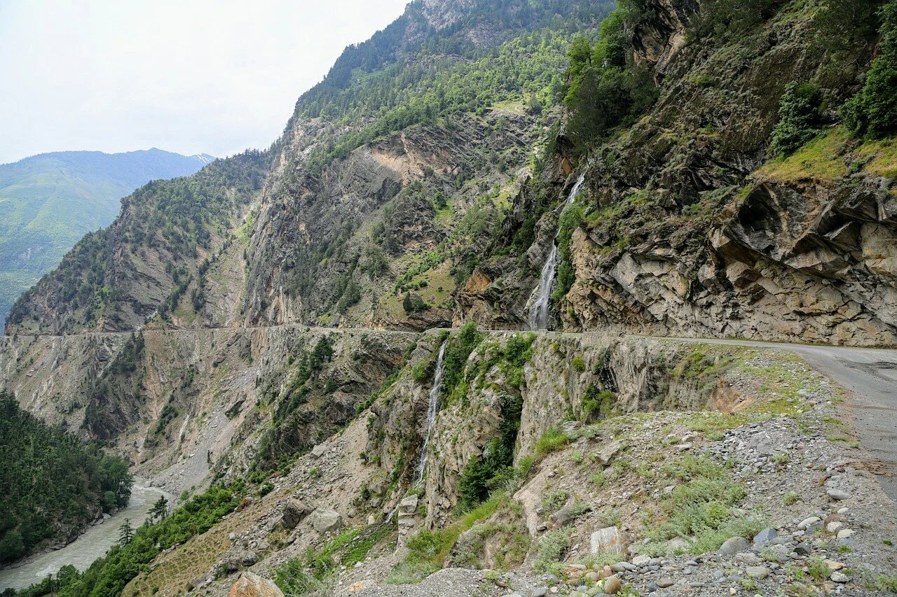
The Road which connects Killar in Pangi Valley in the Chamba District of Himachal Pradesh to Gulabgarh in the Padar Valley of Kistwar District is often reffered to as the Most Dangerous Road in the World. The Road runs along the Chenab / Chandrabhaga River’s Gorge.
The most dangerous section of the Road is between Tyari and Ishtyari in the Padar Tehsil of the Kishtwar District of the Jammu Division of the Union Territory of Jammu and Kashmir. The Cliffhanger section is cut through a solid Rock face and the River runs thousands of feet below the Road with a sheer fall. An alternative to this Cliffhanger is being built and once that is complete the Cliffhanger will be closed.

The Road which connects Killar in Pangi Valley in the Chamba District of Himachal Pradesh to Gulabgarh in the Padar Valley of Kistwar District is often reffered to as the Most Dangerous Road in the World. The Road runs along the Chenab / Chandrabhaga River’s Gorge.
The most dangerous section of the Road is between Tyari and Ishtyari in the Padar Tehsil of the Kishtwar District of the Jammu Division of the Union Territory of Jammu and Kashmir. The Cliffhanger section is cut through a solid Rock face and the River runs thousands of feet below the Road with a sheer fall. An alternative to this Cliffhanger is being built and once that is complete the Cliffhanger will be closed.
The Photos below are a Visual Essay on the said Journey and we aslo have a Video shot on the Cliffhanger section to give you the feeling of Driving on the most Dangerous Road in the World.

The picturesque Kishtwar Town which is the District Headquarter of the Kishtwar District.
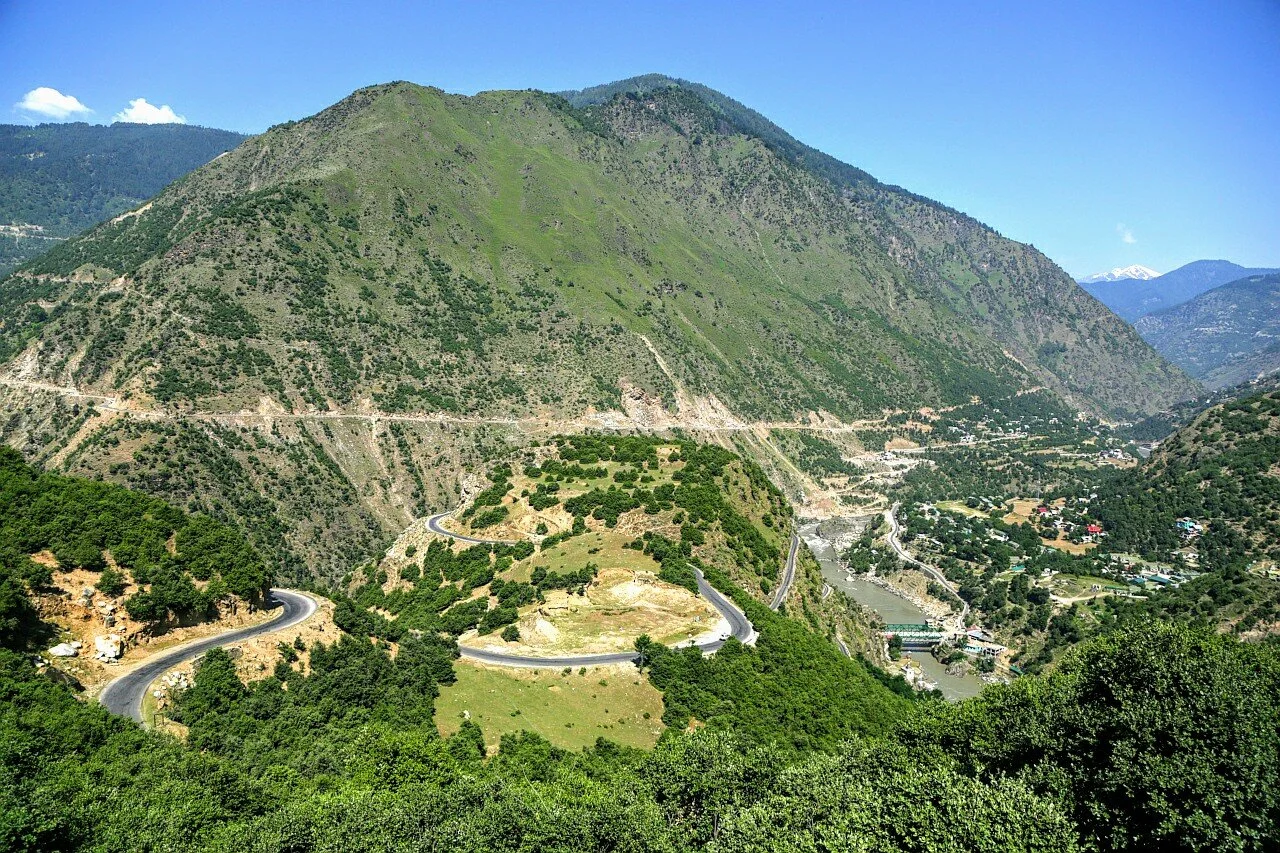
A place called Banderkoot near Kishtwar where the Marsudhar coming from the Warwan Valley meets the Chenab
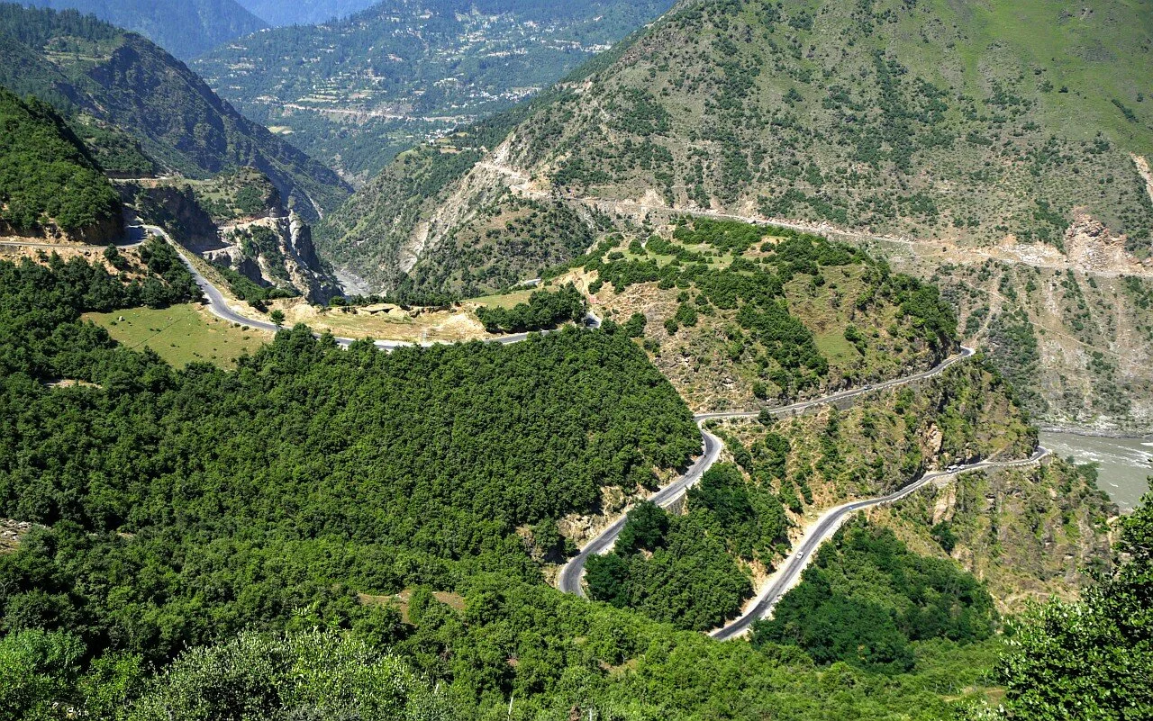
The winding Road down to Bandarkoot from Kishtwar Town
Moving from Kishtwar towards Gulabgarh in Padar
Atholi Village in Padar Valley with the Chenab in the foreground
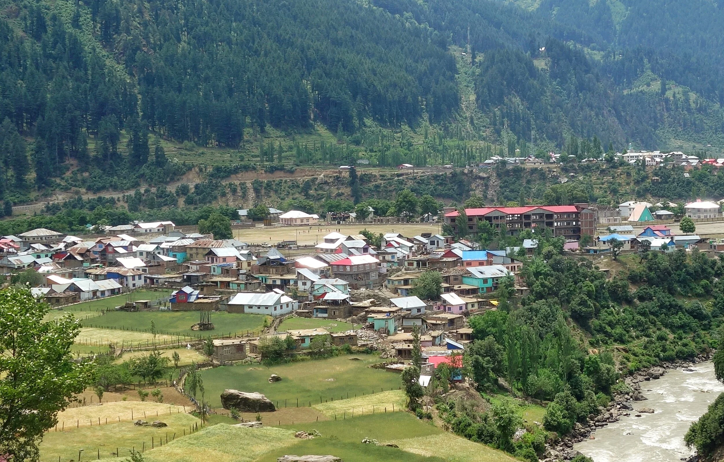
The small Town of Gulabgarh which is the main population center of Padar
Looking back towards the Road we came from in Gulabgarh
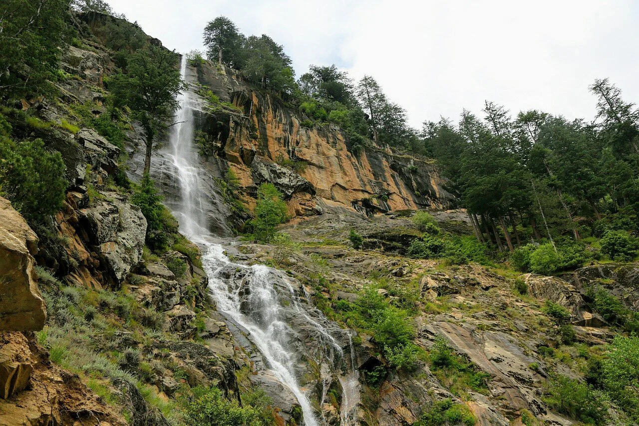
A beautiful Waterfall on the way. There are numerous such small and big Waterfalls all along this Route
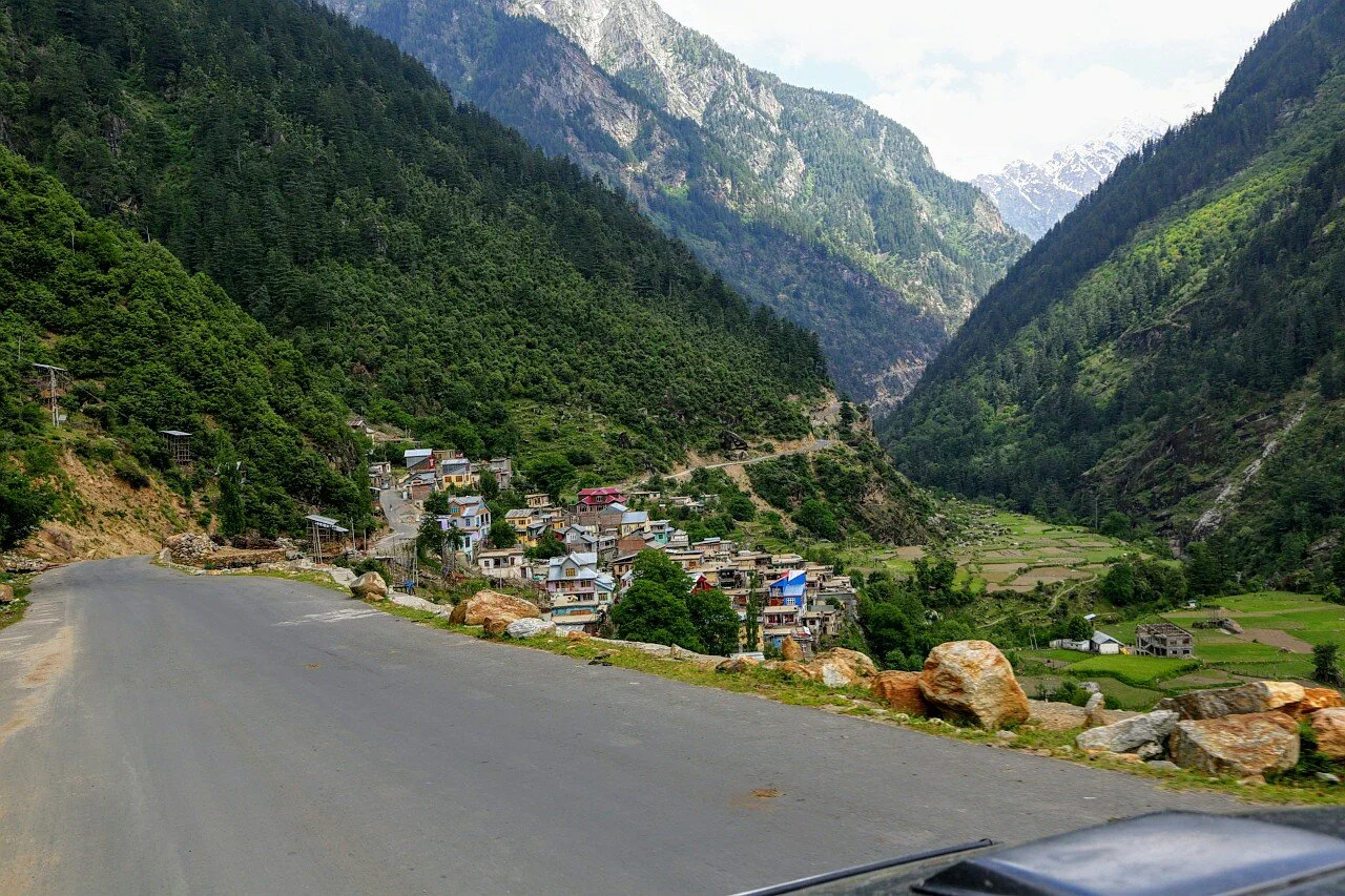
Driving towards the Village of Sohal where we stopped for a sumptuous Lunch of Rajma and Chawal. And as you can see the Road has been newly Black-topped all the way almost to the Cliffhanger section which isnt far from here.

Exiting from Sohal after Lunch and heading towards the Cliffhanger.
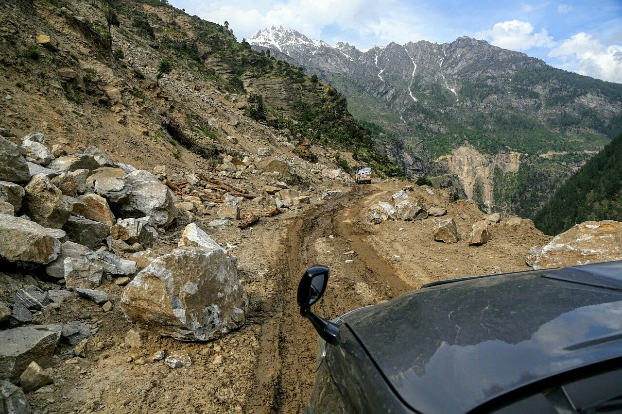
Landslides and Road widening are a constant feature on this Road. Crossing a section just before we hit the Cliffhanger Section.
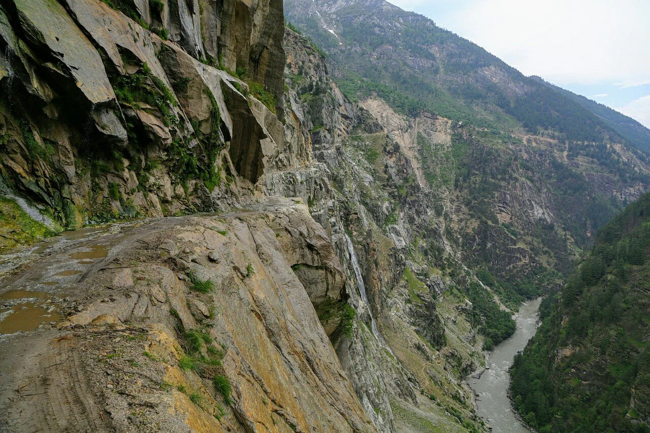
And this is the legendary Cliffhanger section of the Killar Kishtwar Road. Blasted out of a sheer Rock face this Road runs thousands of feet above the Chandrabhaga / Chenab River which flows at the bottom of the Gorge.

Another view of the Road through the rocky Cliff. There is no protection at all on the sides and this is actually a wide section of the Killar Kishtwar Road
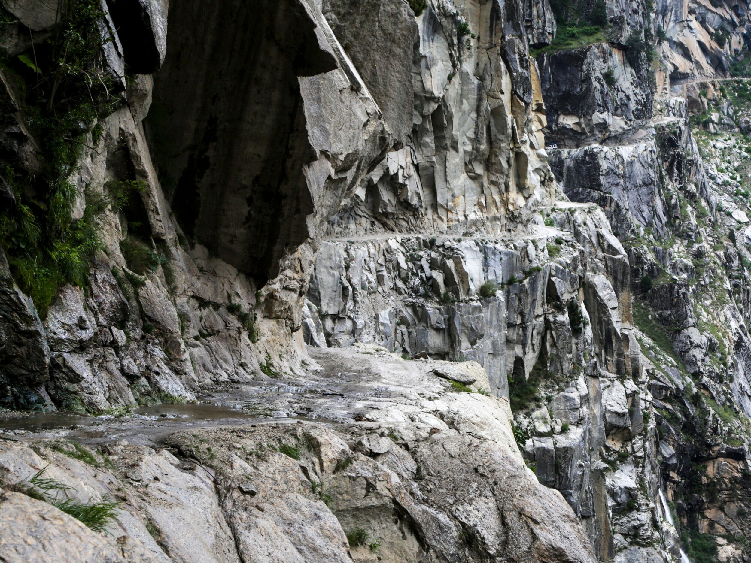
A Close up of the most Rocky and Dangerous section of the Cliffhanger section of the Killar Kishtwar Road.
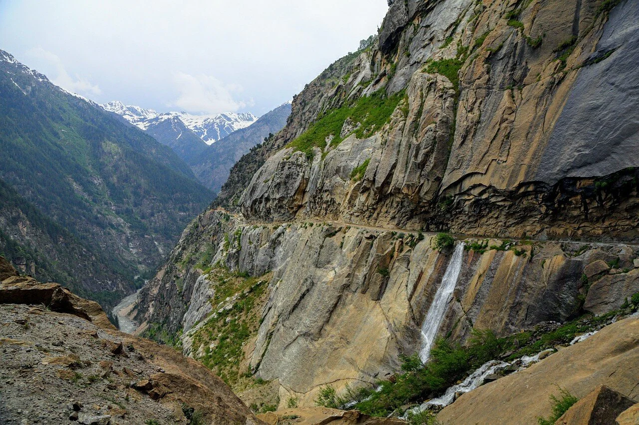
And finally after crossing the most Dangerous section we turn back and take a Photograph of the Cliffhanger section of the Killar Kishtwar Road.
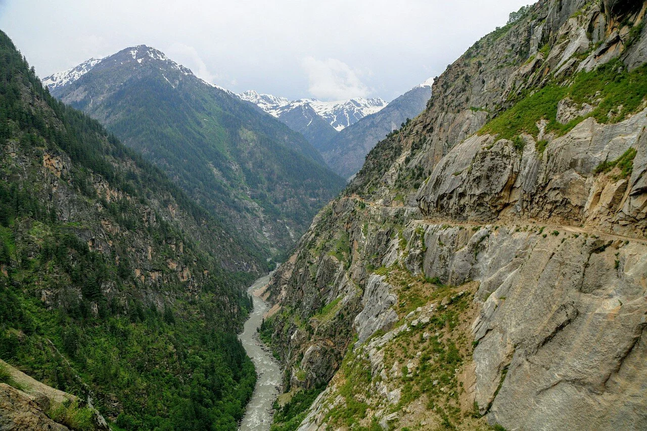
Another view of the Chenab and the Cliffhanger section of the Killar Kishtwar Road.
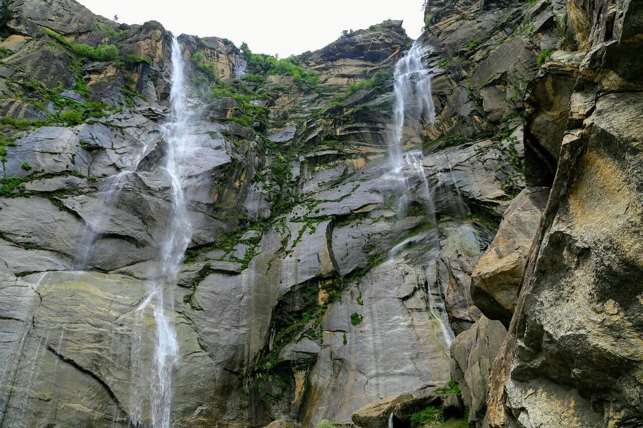
A beautiful Waterfall that signals the end of the Cliffhanger section of the Killar Kishtwar Road if you are coming from the Gulabgarh side.
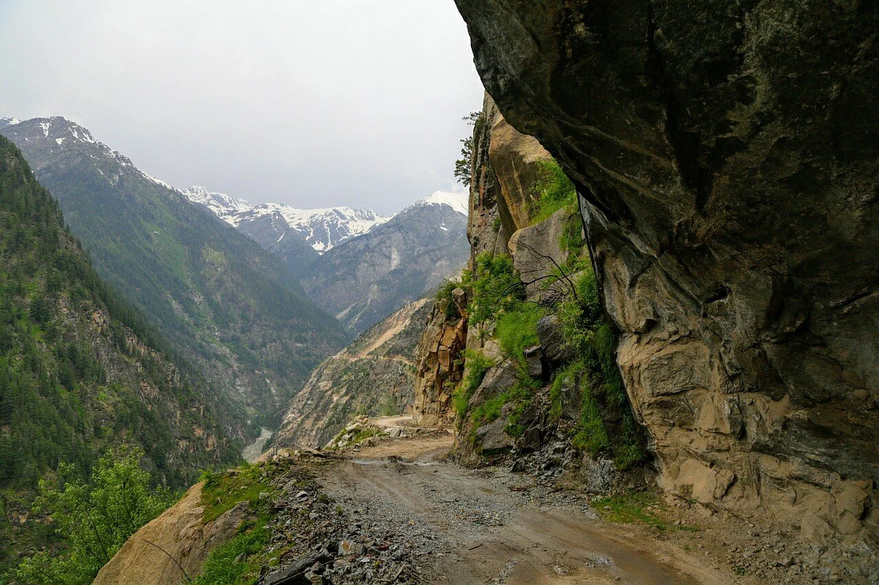
Moving further we get done with the Cliffhanger section of the Killar Kishtwar Road.
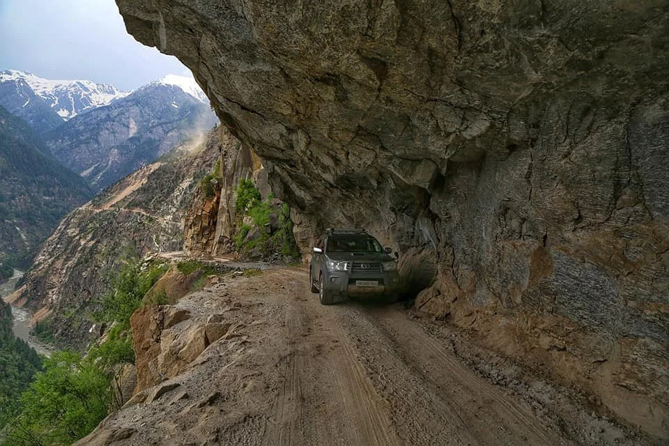
There are places on the Road where two Vehicles can pass each other on the Cliffhanger section of the Killar Kishtwar Road.
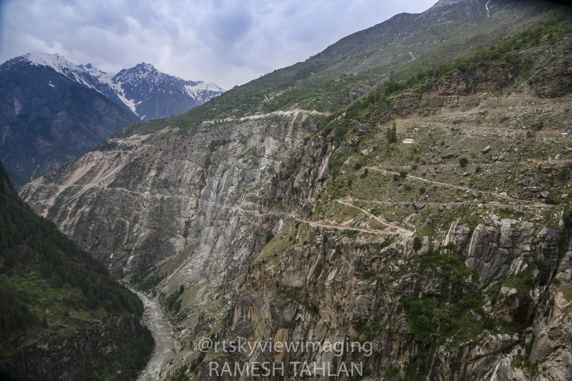
The Cliffhanger Section of the Killar Kishtwar Road as seen from a distance. an alternate Road is being built over the Rock face and the Cliffhanger section will be closed once that is done.
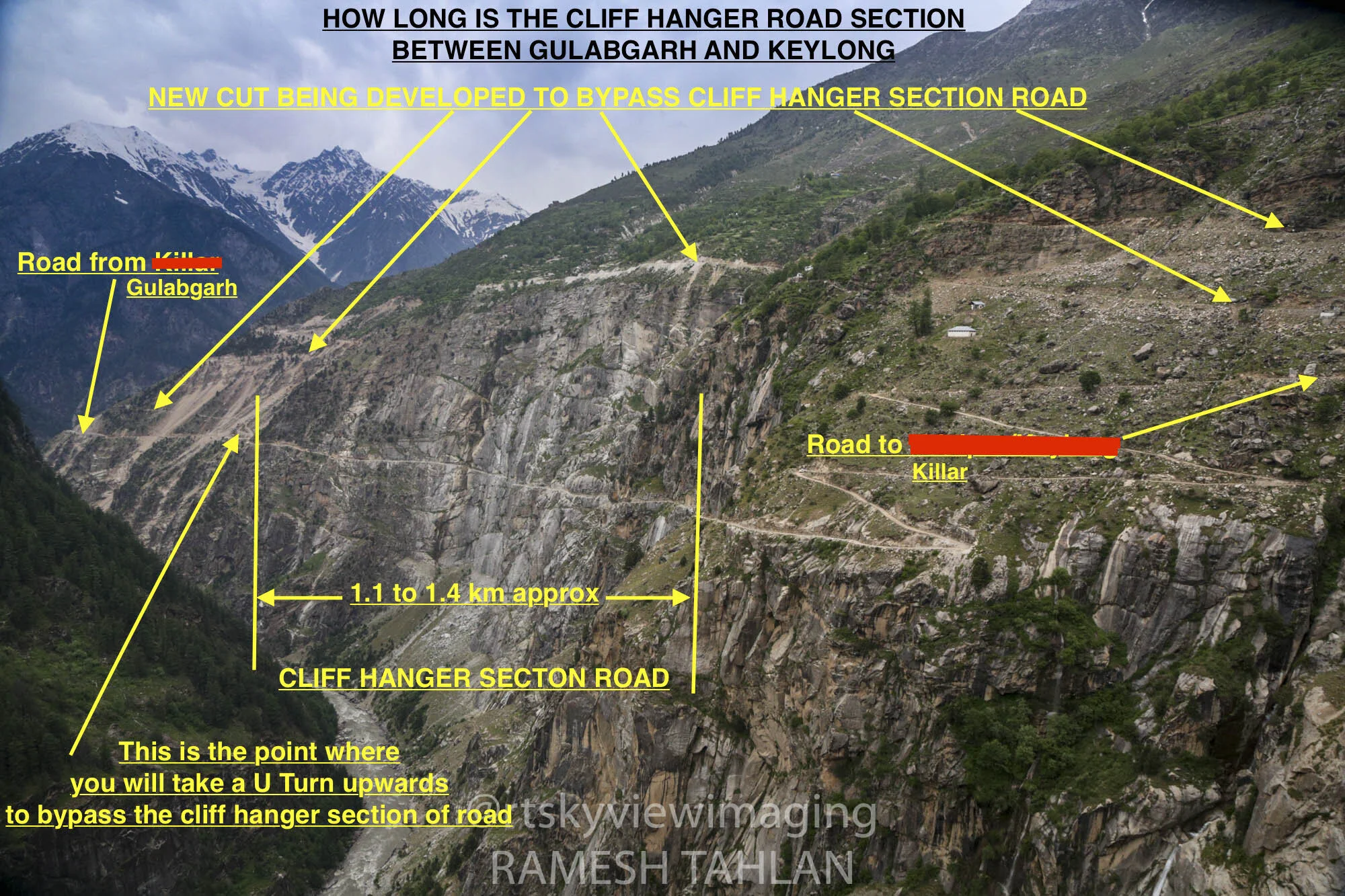
A Diagram over the Road explaining the technicality of the Cliffhanger section of the Killar Kishtwar Road
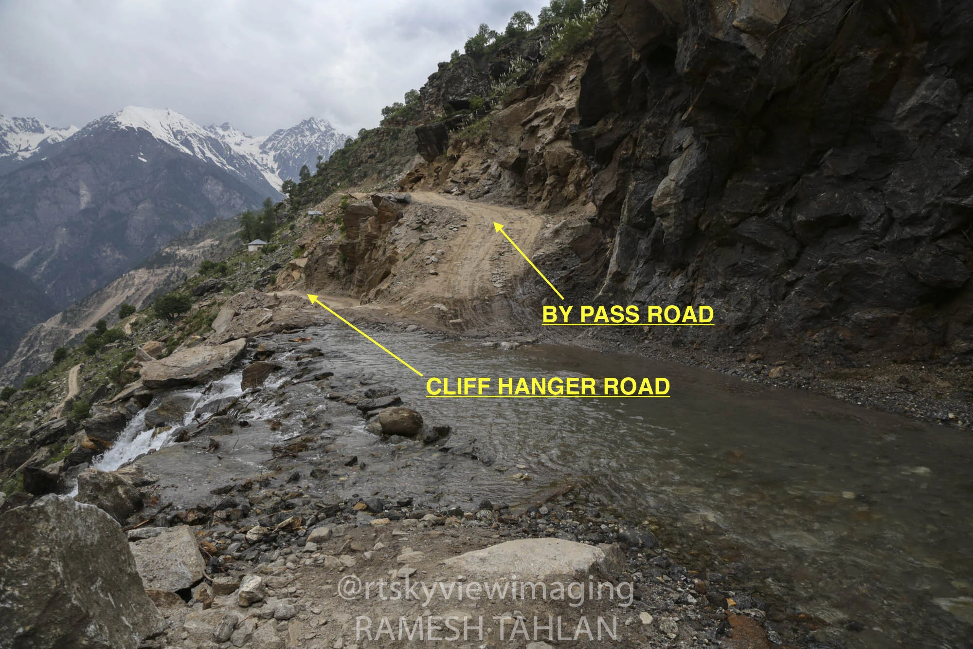
The diversion for the new Road to bypass the Cliffhanger section.
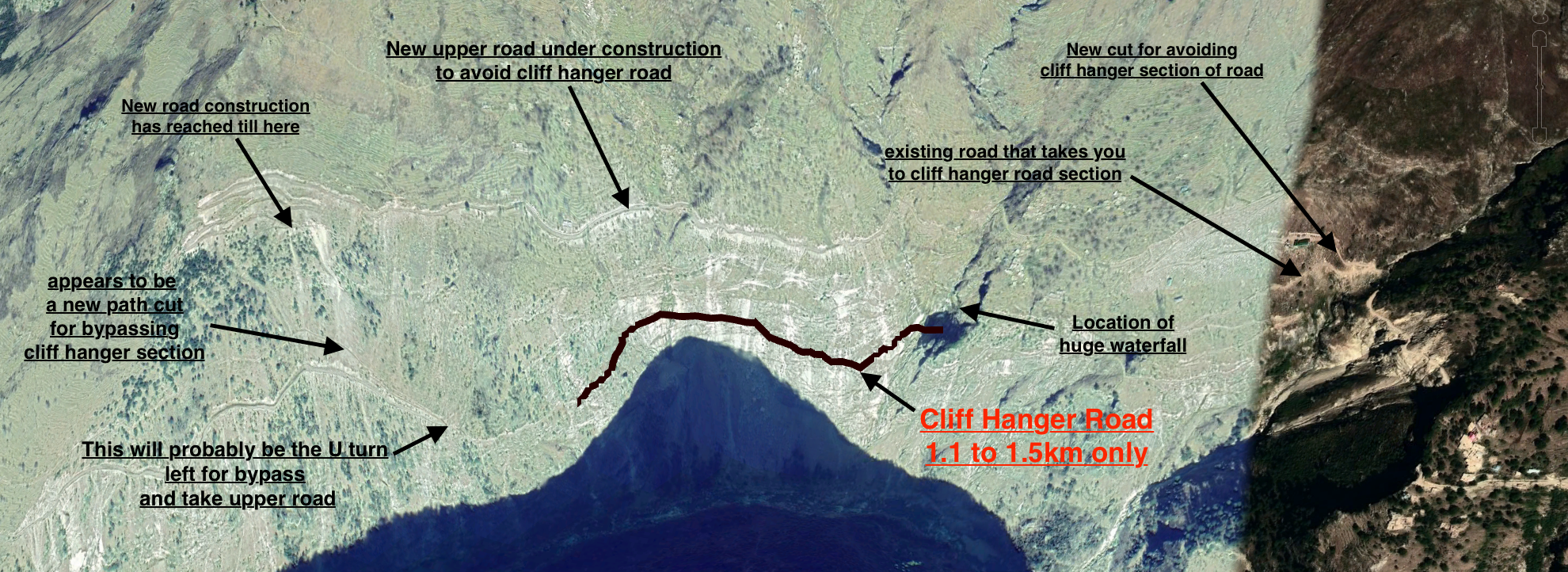
A Google Sky view of the Cliffhanger Section of the Killar Kishtwar Road

Another Google view of the most dangerous Cliffhanger section of the Killar Kishtwar Road
And here are a few Videos from this Road

Our Journey through some of the Most Dangerous Roads in the Himalayas. This one is supposed to be one of the most dangerous Road. It connects Kishtwar in Jammu Division of the UT of Jammu and Kashmir with Killar in the Pangi Valley of Chamba District of Himachal Pradesh

Wazir Lakhpat Rai Padari of Padar, Kishtwar
Well it starts with the Raja of Kishtwar called, very interestingly, Raja Mohammed Teg Singh also known as Saifullah Khan. Though the Rajas of Kishtwar had converted to Islam they kept a mix of Muslim Hindu names and followed many Hindu costums and this Raja was no different. He was a vassal of the Afhna Governor of Kashmir who fell out with the Rulers in Kabul. A force was sent to Kashmir from Kabul but the Governor stood up to it and was assisted in the same by forces from Kishtwar. And by this time Raja Mohammed Tegh Singh had got into a service a new Minister called Wazir Lakhpat Rai Padari, who as the name suggests was from Padar.

People familiar with Kashmir and Srinagar with particular must have seen it one time or the other though most of the time one misses it. Situated right on the Maulana Azad Road is the Smamadhi and accompanying it a small Temple which says Wazir Lakhpat Rai Trust from what I re-collect. It is the Samadhi of Wazir Lakhpat Rai Padiar, a Wazir and a Warrior who took part in many Battles and Intrigues in the first half of the 19th Century in the Western Himalayas. He is not to be confused with his namesake Lakhpat Rai, the Wazir under the Durranis in the 18th Century.
Well it starts with the Raja of Kishtwar called, very interestingly, Raja Mohammed Teg Singh also known as Saifullah Khan. Though the Rajas of Kishtwar had converted to Islam they kept a mix of Muslim Hindu names and followed many Hindu costums and this Raja was no different. He was a vassal of the Afhna Governor of Kashmir who fell out with the Rulers in Kabul. A force was sent to Kashmir from Kabul but the Governor stood up to it and was assisted in the same by forces from Kishtwar. And by this time Raja Mohammed Tegh Singh had got into a service a new Minister called Wazir Lakhpat Rai Padari, who as the name suggests was from Padar.
This done Raja Tegh Mohammed Singh set his sights on Bhaderwah which was under the suzerainty of Chamba, though it had its own Raja, and for the same he asked the Afghan Governor of Kashmir for assistance and soon his forces arrived in Kishtwar led by General Khuda Dost. Wazir Lakhpat led the Kishtwari forces and they advanced on Bhaderwah. A force was dispatched from Chamba under Wazir Nathu but they were defeated at Basnota and Gallugarh and the town of Bhaderwah was burnt. The Raja of Kishtwar was all praises for Wazir Lakhpat and a Jgir was bestowed upon him in Bonjwah, where his descendants still live. Later the Raja under the influence of his Hindu Purohit decided to revoke his alliance with Kashmir and decided to ally with Chamba and as a consequence an Army of from Kashmir landed in Kishtwar defeated the local forces and took away what it could and returned to Kashmir. But the Raja was still left in Power.
After that the Afghans in Kashmir were focused on the Sikhs and because of its location Kishtwar was pretty independent and not bothered by the intrigues going on in the Punjab Plains between the British, Sikhs and the Afghans. As it so happened the on the run Afghan King Shah Shuja landed in the custody of Maharaja Ranjit Singh (thats a separate story which includes the Koh I Noor). After enjoying his “hospitality” for sometime in 1815 Shah Shuja escaped from his custody and after swimming the Ravi and passing through Sialkot and Jammu landed up in Kishtwar. The reason he came to Kishtwar was obvious, as he assumed that the King being a Muslim would receive him well. And he was correct. Not only was he welcomed but also allowed to raise an Army to invade Kashmir. Shah Shuja went ahead with the invasion through the Marbal Pass but his Army was defeated and he had to return to Kishtwar defeated and his Army in tatters.

In the meanwhile the news of Shah Shuja being in Kishtwar reached Maharaja Ranjit Singh and at once a demand was raised upon Raja Mohammed Tegh Singh to hand over Shah Shuja. But Raja Mohammed Tegh Singh refused and this would have very grave consequences for him. Shah Shuja in the meanwhile escaped to Warwan Valley and from there on to Suru Valley. From there he went to Zanskar and then Lahaul and the Kulu Valley to finally land up in Ludhiana where he went to the British. Of course this greatly annoyed the Sher- E - Punjab and he deputed Gulab Singh of Jammu to take care of Kishtwar. And so Gulab Singh went about with a plan which would finally throw Kishtwar into his lap without any Military campaign.
Gulab Singh got in touch with Raja Mohammed Tegh Singh and told him that some of his own men were conspiring against him, their leader being none other than his faithful Wazir Lakhpat. He forged letters that were said to have been sent by the Wazir to Ranjit Singh inviting him to invade and take Kishtwar. The Kishtwar Raja was convinced and he planned to have the Wazir murdered in open Court. The eventful day two of his men fell over the Wazir who was grievously injured but survived. The Wazir also came to know that the plan was sanctioned by the Raja so on the purpose of getting back to health he asked the Kings leave to go back to his native Village. The King agreed but instead of going to his native Village he landed up with Gulab Singh and took up service with him and also pointed out how Kishtwar could be taken.
So Gulab Singh messaged the Kishtwar Raja to come and make a personal appearance in the Court of Ranjit Singh to mend fences with him. The reluctant Raja agreed but as soon as he reached Doda he was arrested and put into prison. Gulab Singh and Wazir Lakhpat Rai now took possession of Kishtwar without any resistance. And the person put in charge of Kishtwar was a gentleman Zorawar Singh. Of course assisted by the very able Wazir Lakhpat Rai.
Wazir Lakhpat Rai was also a part of Zorarwar’s Expeditions into Ladakh. During the the first Expedition he was instructed to take Zanskar while the main body of Zorarwar’s troops were engaged in Purik and further towards Leh. Wazir Lakhpat Rai marched to Zanksar and having subjugated it decided to return back via the Umasi La Pass which connected Zanskar directly with Padar and the Wazir being a Padari knew of it. Just the small thing that Padar at that time was under the Rule of Chamba. So whence the Wazir marched in there was some resistance which was taken care of by the Wazir’s troops. Also a small Group of Dogra soldiers were stationed in Padar as well which was again not taken kindly by Chamba. Wazir Lakhpat had an old History with Chamba and Wazir Ratanu, the Chamba Officer in charge of the Region was well too aware of it.

In the subsequent year there was again news of an uprising in Ladakh and in particular in Zanskar and the Dogra Garrison there was put to the sword. The news of the same drifted across the Great Himalayan Range and reached Padar and Wazir Ratanu. Emboldened, he decided to get rid of the Dogra soldiers stationed there and attacked them. A few were killed and many were taken as prisoners to Chamba. Of course this had extremely grave consequences as Zorawar Singh returned and had his vengeance. The whole Town of Chattargarh was burnt down and renamed Gulbagarh. To absolve himself of the blame the Raja of Chamba handed over Wazir Ratanu to Raja Gulab Singh.
In the aftermath of the death of Zorawar Singh there was again an uprising in Ladakh and Baltistan and the Dogra Garrison was under siege in Leh. Raja Gulab Singh who was engaged on the Afghan Frontier at that despatched Troops to quell the uprisings as well as to carry punitive actions against the Tibetans who had now occupied Ladakh. One body of Troops under Wazir Lakhpat Rai was assigned to go to Baltistan to take the situation in control over there. And thence he marched to Baltistan to do the needful and he relieved the Garrison in Skardu and got things under control. After that he teamed up with the other force which was assigned to Leh and they started fighting the Tibetans and driving them back. One of the Commanders of the Force sent to Leh was none other than the Wazir’s old friend, Wazi Ratanu of Chamba who had been handed over to Jammu. The Tibetans held up the the fortifications in Drangtse which were flooded by the Dogras. And finally they gave in and fled back beyond Chushul when finally Peace was made and the Treaty of Chushul which demarcated the boundary between Ladakh and Tibet which even stands today.
Even after that the Wazir wasnt quite done yet. In 1846 in the aftermath of the signing of Treaty of Amritsar, Kashmir was passed onto Raja Gulab Singh who paid the War indemnity on behalf of the Sikhs. It is pertinent to note that Jammu and neighbouring Regions, Ladakh and Baltistan were firmly in the possession of Raja Gulab Singh at that time due to actions carried by men like Wazir Lakhpat Rai who had seen action on all the fronts. A small Dogra Force led by none other than Wazir Lakhpat Rai, who was now the designated Governor of Kashmir, went to Kashmir in order to take possession of the territory from the Sikh Governor Shiekh Imam Ud Din. Its said that he was under instructions from General Lal Singh not to hand over possession without a fight and that's what he did. Unknowingly Wazir Lakhpat Rai turned up with his small Force asking for possession which was denied and a confrontation started. And it was in this confrontation that Wazir Lakhpat Rai lost his life. He was destined to be the first Governor of Kashmir but fate had other plans for him. Of course a Memorial was built for him on the M A Road in Srinagar probably close to the place he fell. The man though little known in contemporary History still left his mark in the different Regions of what came to be the Riyasat E Jammu Kashmir.
Old Soldiers Never Die, They Just Fade Away as they Say.
His descendants still continue to live in a place called Sarol Bagh near Bhaderwah and I am attaching some pics of the Heritage buildings over there some of them being built during the Wazir’s time. Photos by Shri D K Dogra.

The Bridges of Srinagar by Francis Firth
Srinagar City as most must be aware is settled on both Banks of the Jehlum and as such there were a number of Bridges which were put across the Jehlum originally starting with the First Bridge or Amira Kadal which was my favourite as it was closes to Home and we had a Shop there where I used to walk to often as a kid. Of course then the Zero Bridge was built which was without doubt everyone's favorite because of Little Hut. The Sardarji's shop which sold the best Softy in Kashmir.

This is view of Zaina Kadal taken from upstream side.
Francis Firth took a series of pics in Kashmir in 1875 and he did a few on the Bridges or Kadals as they are called in Kashmir.
Srinagar City as most must be aware is settled on both Banks of the Jehlum and as such there were a number of Bridges which were put across the Jehlum originally starting with the First Bridge or Amira Kadal which was my favourite as it was closes to Home and we had a Shop there where I used to walk to often as a kid. Of course then the Zero Bridge was built which was without doubt everyone's favorite because of Little Hut. The Sardarji's shop which sold the best Softy in Kashmir.

Photograph showing Aali Kadal AKA 5th Bridge on the veth( Jehlum) This bridge was originally built between 1414--1420 AD by Sultan Ali Shah brother of Budshah. This was the first Bridge built across Jehlum in Srinagar.In the floods of 1903 this bridge got washed away. Then Maharaja Partap Singh got it reconstructed at the same spot in 1904--05. (Credit Showkat Rasheid Wani)
And the construction technique of these Bridges is described in the Gazetteer of 1890 as under
The Kadal Bridge
These bridges are all made of deodar wood, upon the same plan. and are constructed in the following manner :
A triangular space, with its apex streamwards is formed in the bed of the river by strong stakes which are well driven down and covered with planks on the outside to a height of about 8’. This space is filled with heavy stones and forms the foundation of the pier. Each Pier consists of alternate layers of Deodar trunks. The Trunks are placed about a foot apart each succeeding layer is broader than the previous one and laid at right angles to it. The Trunks are fastened together at their ends by strong wooden pegs. The Piers are united by long and very stout Deodar trunks which stretch across from one to another and which are laid about two feet apart. The platform consists of rough Planks or Slender Poles which are closely laid across the trunks which connect the Piers and fastened at each end by wooden pegs. In some cases over the platform there is a coating of grass and Earth and the railing on each side but often there is neither.

This famous 92 yard Bridge was originally constructed by Sultan Zain- ul- Abidin Budshah in 1427 AD. It was a typical wooden bridge of cantilever design. In those days it was utilized as a Market as well. The bridge was dismantled completely as it was damaged beyond repairs in 1893 floods. The Bridge was reconstructed by Maharaja Partap Singh in 1897 & again a new bridge was constructed by Maharaja Hari Singh in 1926 which was repaired in 1953--54. The photograph has been taken looking upstream , Shah Hamadan Khanqah/Mosque can be seen on the left of the photograph. (Credit Showkat Rasheid Wani)
This kind of Bridge is very strong and durable, despite its rickety construction.
The Timber being Cedar is very durable and accidents rarely occur owing to the elasticity of the Construction and the outlet afforded to sudden floods through the many Passages in the substance of the Piers. Dr.Bellow witnesses the behaviour of these Bridges in the inundation of 1869, and though they were nearly swamped by the Flood none of them gave away.
The existing Kadal Bridges in the Valley in 1890 were as follows
Khanabal ; Bij behara ; Pampur
Amira ; Hubba ; Fateh ; Zaina ; Haili ; Naya ; Suffa
Sumbal ; Sopur ; Baramulla

The Bijbehara Bridge on the Jehlum

Gold Prospecting in the Riyasat e Jammu and Kashmir 1890
The Gazetteer of Kashmir and Ladakh of 1890 is a treasure trove of information regarding various aspects in the state. This is the small little Chapter in the Gazetteer which talks of Gold prospecting in the Riyasat. And of course it talks of some Gold mining in Baltistan.

A Man Sand Washing for Gold somewhere in Baltistan
The Gazetteer of Kashmir and Ladakh of 1890 is a treasure trove of information regarding various aspects in the state. This is the small little Chapter in the Gazetteer which talks of Gold prospecting in the Riyasat. And of course it talks of some Gold mining in Baltistan. But it mentions that Gold was still pretty tough to find and hardly an economically viable activity for the labour it involved. I wonder where did Herodotus get the reference for the Gold Digging Ants of Byltae ?
Gold.-Hugel is probably correct in his statement that neither gold nor silver has been found ; but he adds, "neither do the streams hear down gold dust, as in the neighboring countries."
This latter statement is disproved, as far as concerns the Shingo river, by Captain Montgomerie, R.E., who, in his account of the progress of the Kashmir survey, gives the following particulars regarding gold-washing in that stream "The drainage, escaping from the plains of Deosai, through a not easily distinguished gorge near the Katasiri station, falls into the Dras River above Kirkikhu. This tributary of the Dras River is called the Shigar and sometimes the Shingo river; it brings down gold with its waters, and gold-washing is carried on just below the junction. The Indus itself and several of its tributaries are known to produce gold.

The point at which the Shingo River meets the Drass River
The gold-washing in said not to be valuable, but it does sometimes give as much as one or two small rupees a day to a man, though a most barbarous method is employed in washing the earth. Thin earth is taken from the detritus which, I think, now generally lies above the highest flood line. After two or three washings, a black, heavyish sort of sand is left,, with the pieces of gold scattered here and there. As far as my own experience goes, I should say it was not a very profitable business, for after half an hour's washing I only got five very tiny nuggets hardly worth an anna, and I had, at the time, the benefit of the assistance of an Australian gentleman. This gentleman thought that something might be done by investing in a cradle aod apparatus. He said that a substance like the black send mentioned above had proved valuable in Australia."
Gold-washing is also carried on on the banks of the Jhelum, in the neighborhood of Tangrot, north of Jhelum, but to a very trifling extent. In the trans-Himalayan province gold is found in the bede of the Zanskar,Indus, and Basha rivers.

The Confluence of the Indus and the Zanskar
The people of Skardu are in the habit of coming every spring to the junction of the Zanskar river with the Indus, to search for Gold brought down by the melting of the winter Snow. Vigne says that on the banks of the Basha stream more gold is produced than in any other- part of Baltistan, and this was the only place which the former Raja reserved for himself. Any other person might wash the sand for gold elsewhere, but the value of the quantity collected at the end of the time expended is so nearly balanced that Vigne never saw any gold diggers but on one occasion (at Kiris). Here four or five men were employed, and must have washed and sifted a great many bushels of earth, but the quantity of gold dust obtained was not more than would cover a shilling.

Ladies learning Gold prospecting on the Shimsal River in Hunza
Apparently there still is a Tribe called Sonewal in the Shina language that pan the Rivers for Gold in Gilgit Baltistan and they sell their Gold to the jewellers in Gilgit apparently. But Gold prospecting still gives hope and some employment to people in these harsh Mountains.

The Indus Ganges Divide
The Indus and the Ganges are the two great Rivers which originate in the Himalayas/ Trans-Himalayas and all the Rivers of the Western and Central Himalayas drain into either of these two Rivers. The Indo - Gangetic Plain as the combined basin of these two Rivers is called sustains well over a Billion people and is one of the most thickly populated Regions on the Planet. The story of the Indus and the Ganga is the story of India in historical, social and religious contexts.
The Indus Ganges Divide
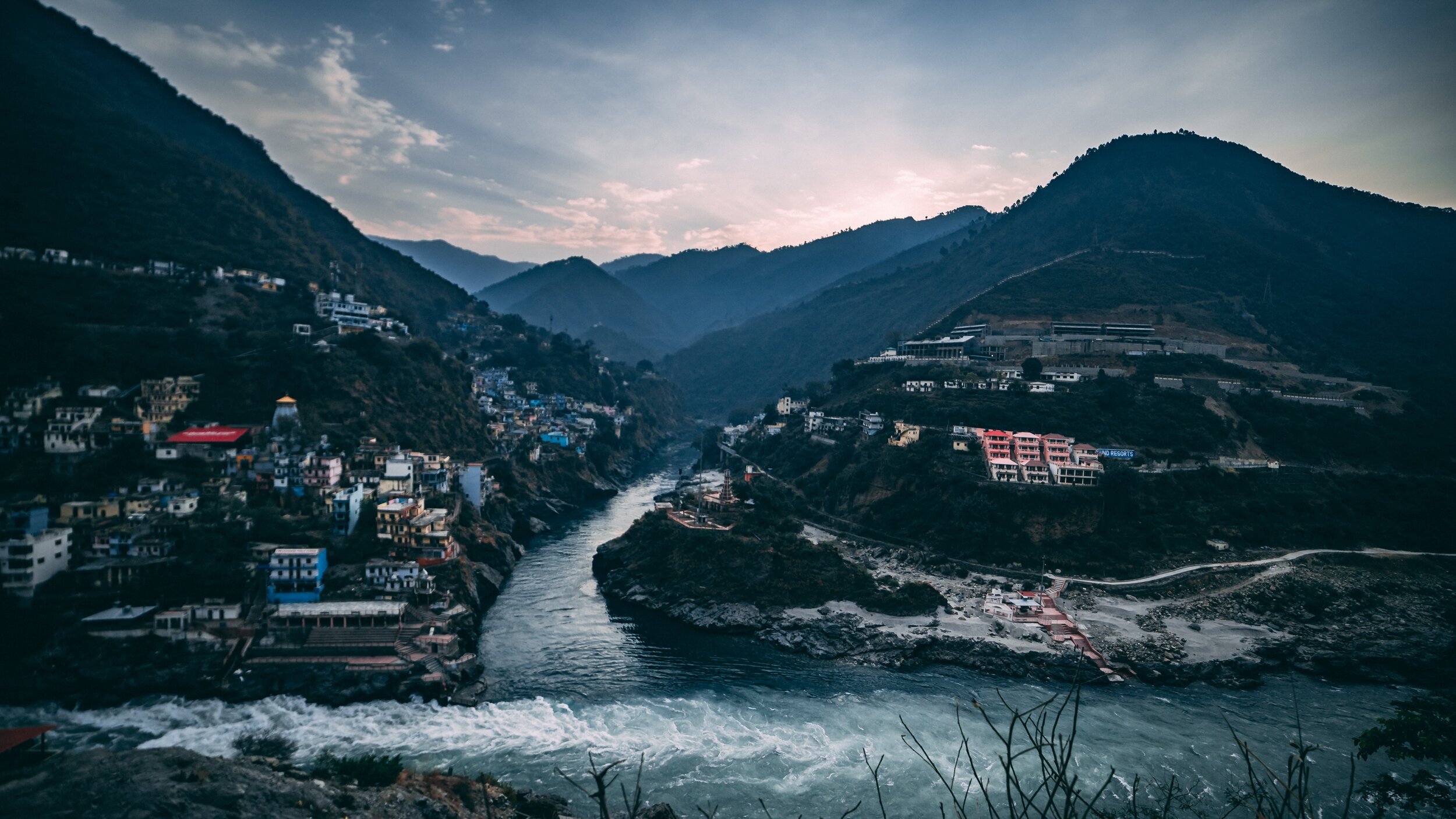
The Indus and the Ganges are the two great Rivers which originate in the Himalayas/ Trans-Himalayas and all the Rivers of the Western and Central Himalayas drain into either of these two Rivers. The Indo - Gangetic Plain as the combined basin of these two Rivers is called sustains well over a Billion people and is one of the most thickly populated Regions on the Planet. The story of the Indus and the Ganga is the story of India in historical, social and religious contexts.
Most of the Indus basin was turned over to Pakistan as a result of the partition though still a substantial part of Punjab, one of the most fertile of lands thanks to the Rivers coming down from the Himalayas still lies with us. The legendary land of the five Rivers traditionally stretched from Delhi to Peshawar though things have changed now. At the time of the Punjabi resurrection in early 1800’s under the indomitable Sher-E-Punjab, Maharaja Ranjit Singh it was the River Sutlej which served as the border between the powerful Sikh Kingdom of Punjab which stretched all the way to Tibet in the North and Balochistan in the South and the British Indian holdings.
The Sutlej also happens to be the longest of the five Rivers that give the Punjab its name and its also the Easternmost tributary of the mighty Indus. And its some where in Eastern Himachal that the actual ridgelines exist which separate the Indus Basin from the ganges Basin. Its actually a series of Ridges which run from Shimla itself towards Narkand and towards Rampur which lies on the Satluj River.
On the other side of the Ridge lie the tributaries and Nallahs which join either the Giri River or the Pabbar River. I assume that the Pabbar which drains into the Tons and then into the Yamuna and finally into the Ganges would be the Westernmost tributary (indirect albeit) of the Ganges. And interestingly some of these Nallahs are just a few hundred meters apart but the waters of one would end up in the Arabian Sea while the waters of the other would end up in the Bay of Bengal.
As per what you can see on the Google Maps Nallahs or Streams of the area join either the Satluj or the Giri River or the Pabbar. The Giri River is yet another tributary of the Yamuna which rises at a place called the Giri Ganga in the Mountains above Kharapathar near Kotkhai. Some of the Nallahs in the area are as follows
The Brandii Khad eventually joins the Satluj : https://goo.gl/maps/rsCFNgMFhCo
Ashwani Khad eventually joins the Giri River: https://goo.gl/maps/N4g4iY2iGGm
Nauty Khad (Eventually joins the Satluj) : https://goo.gl/maps/8JVFsbrETa42
Teer Nallah / Thaila Khad / Bhaira Khad are other Nallahs which run either side of the divide.
Can someone familiar with the Hydrography of the area let me know where actually are the points of origins of two seperate Streams which go to either sides are closest to each other ? Or is there a point somewhere where the same source of water gets divided to go either way. I would really like to visit such a place if it exists. This little piece of exploration might sound strange to people but different people have different obsessions. Mine is mainly the Himalayas and the Rivers which rise from it.
Thanks for taking time out to read this.
Presenting a pic of the Pabbar River cutting through the Pabbar Valley coming down from its point of origin at the Chandranahan Lake.
Kashmir : Do’s and Donts from 1902
In 1902, the Foreign Department of the British Government in India issued a Guide for foreign visitors to the territories of the Maharajah of Jammu and Kashmir and especially to the Kashmir Valley. It was called Kashmir Visitor Rules : Rules and Regulations for Observance by Visitors and Residents in the Territories of H H The Maharaja of Jammu and Kashmir
Kashmir : Do’s and Donts from 1902
In 1902, the Foreign Department of the British Government in India issued a Guide for foreign visitors to the territories of the Maharajah of Jammu and Kashmir and especially to the Kashmir Valley. It was called Kashmir Visitor Rules : Rules and Regulations for Observance by Visitors and Residents in the Territories of H H The Maharaja of Jammu and Kashmir “ Listing some of the Rules and Regulations that were stipulated in the same. It is interesting to note that some of these are still in force in some way or the other. Please note that I have copied them verbatim as given in the Handbook of which I have a soft copy. (For some of the Rules I give an explanation in the brackets for more clarity)
Section 1 Travel Rules
Information as to the usual routes for entering and leaving Kashmir may be obtained from the Assistant Resident. The route via Jammu and Banihal is private, and may not be used except with the special permission of His Highness the Maharaja obtained through the Resident. (The present Highway Route was an exclusive preserve of the Maharaja as the normal Route which went from Rawalpindi would entail the Maharaja having to go through British territory to get to Kashmir )
Persons subject to these rules are not allowed to travel from Kashmir to Simla (or vice versa) across the hills, or the plains (or vice versa) vid Kishtwar, Bhadarwah and Chamba, except with special permission of His Highness the Maharaja obtained through the Resident. (So no Trekking into Kashmir :)) (Even to this day there are Roads and Passes which connect Kashmir with these places but except locals few people ever use them)
Section 2 General Rules Applicable to Jammu and Kashmir
Cows and bullocks are, under no circumstances, to be killed in Jammu and Kashmir, and visitors are requested to see that their dogs do not worry these animals.
Visitors are required to settle all accounts before leaving Kashmir ; and should see that their servants do likewise, otherwise their servants may be detained at the last moment by order of the Court on the plea of a Creditor.
Section 3 : Rules applicable for Srinagar
Servants of visitors found resorting to places other than the fixed latrines are liable to
Punishment.Grass-cutters are prohibited from cutting grass in, or in the neighbourhood of, the station occupied by Europeans.
Riding and cycling on the buud are strictly prohibited. The Police have had orders to see that this rule is rigorously enforced.
Section 4 : Camping Sites
Visitors to Srinagar are !lot ptt-mitted to encamp in the Dilawar Khan Bagh situated
within the city, nor in the Nishat, Shalimar, or Chashmah Shahi gardens in the Dal Lake. The fixed camping places are the Wunslli, Hari Singh, Ram Munshi, and Chenar Baghs at Srinagar and the Nasim Bagh on the Dal Lake. Visitors are also informed that the plot of ground at Sumbal, known as the " Nandi ICeshwar Bhairalva," should not be used for camping purposes.The Chenar Bagh is specially reserved for bachelors. No parties of which ladies are
members are permitted to encamp within it.
Section 5 : House Boat Rules (Since Europeans couldn't buy / lease Land in Kashmir most of them lived in House Boats)
No boats of any kind, including dungas, house boats, &c., shall have water-closets
leading into the river. The water-closets of all existing house boats shall be closed, and in future no house boats shall be built with such open closets.No sweeper or servant shall throw into the river any kind of offensive matter or
sewage ; sweepers of house boats must carry away all refuse and solid and liquid excreta. When in Srinagar, such offensive matter shall be deposited in places assigned by the Municipal Committee, aid while outside Srinagar, shall be deposited in some dry land away from the banks of river.
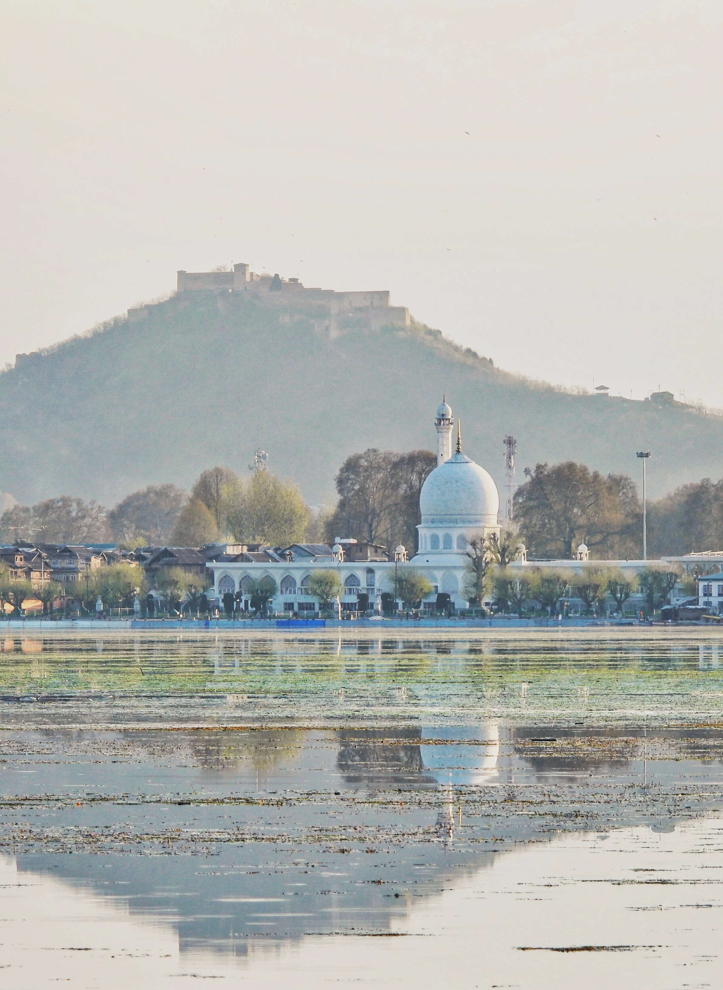
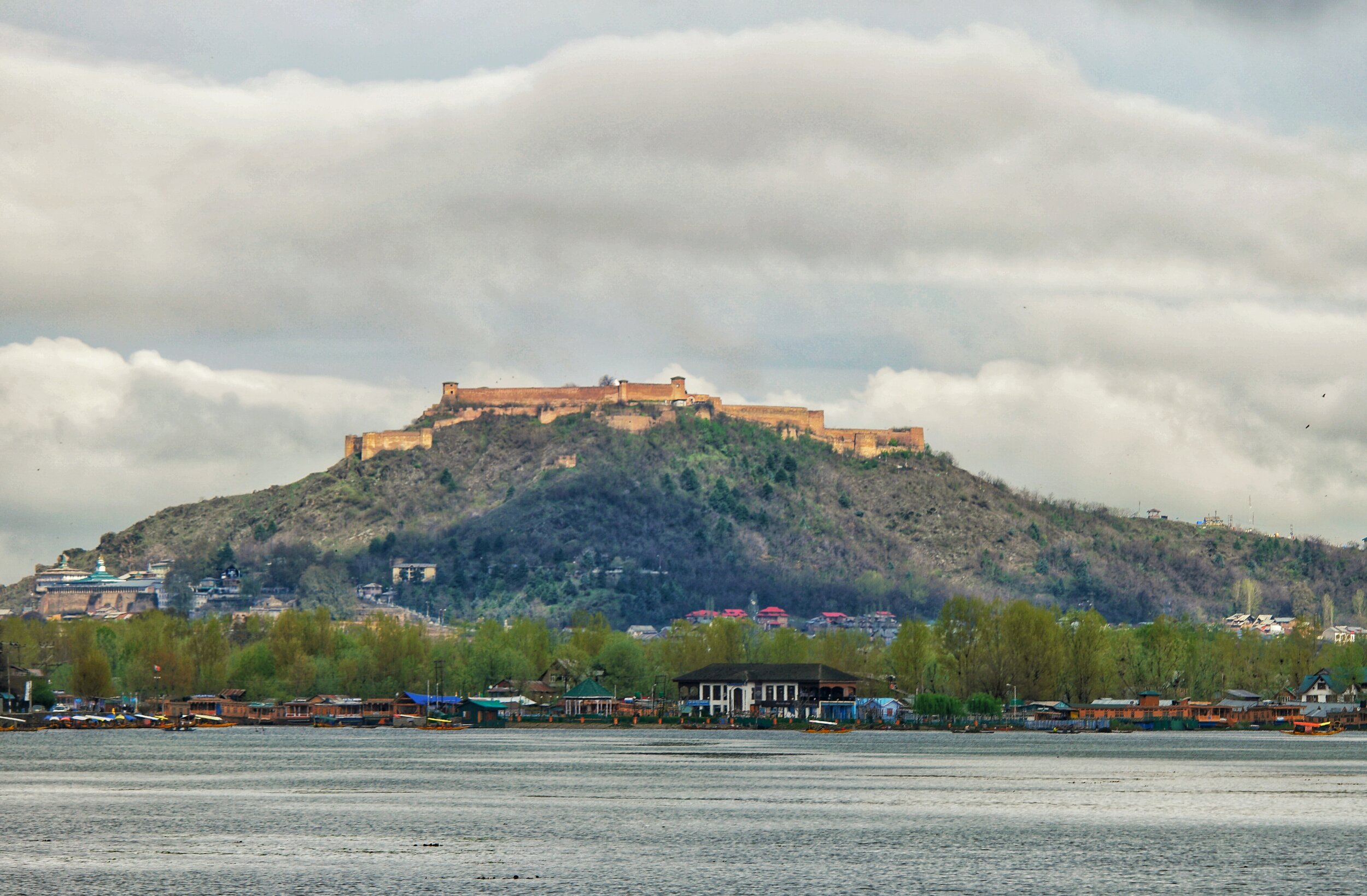
The Hari Parbat Fort over the Dal Lake. Pic from April 2017. Srinagar, Kashmir.
The Great Game on the Roof of the World
There have been many Western Explorers who went on different assignments in these Mountains but one of the key reasons was always to find out more about the Politics and the Geography of the regions which were not under the Control of the Empire. The frontiers of the Punjab Empire of Maharaja Ranjit Singh were a key target as they bordered the wilds of Afghanistan as it slowly gave way to Central Asia. Also of great interest to them were the Routes that were traditionally taken from Kashmir via Ladakh into Central Asia.

A Popular cartoom based on the Great Game published in 1878
The Great Game was a Political and Military game of intrigue and one upmanship played between the two Greatest Empires of that time, the British Empire and the Tsarist Russian Empire that was played in the most of the Nineteenth Century. At stake for the British was the Jewel in the Crown, the Indian sub-continent while for the Tsarist Russia it was their Empire in Central Asia. Both these Empires met somewhere in high Asia in the midst of the Mountains of the Great Himalayan System. Today we are gonna look at exactly where they met in High Asia.
The British had constant nightmares of Cossacks riding over the great Mountains and making a dent in their Indian holdings. The fact that Tsarist Russia overran most of Central Asia during this time and that a body of Cossacks now sat on top of the Wakhan not very far from the Kashmir territories did not make things comfortable for them either. The Great Game was played in a region stretching from Persia to Afghanistan over to India and Tibet and the whole of Central Asia.

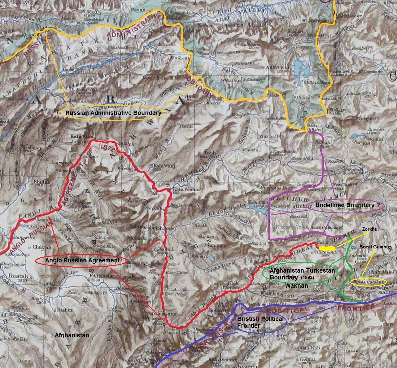
A Map on where the Boundaries met in High Asia
There have been many Western Explorers who went on different assignments in these Mountains but one of the key reasons was always to find out more about the Politics and the Geography of the regions which were not under the Control of the Empire. The frontiers of the Punjab Empire of Maharaja Ranjit Singh were a key target as they bordered the wilds of Afghanistan as it slowly gave way to Central Asia. Also of great interest to them were the Routes that were traditionally taken from Kashmir via Ladakh into Central Asia. The Cossacks had a reputation and the British wanted to have the information on all the possible Routes that the Cossacks would take in case they decided to lay their claim on the Jewel in the Crown.
This Map from 1885 really shows how close they were to each other and though most of the issues had been resolved between the British and the Russians, but like all Great Agreements and Pacts between Empires there was some Room left for further conflagurations on the same Boundary issues. The point was that the terrain was itself so inhospitable and few Russians and British had ever been to Ground Zero and all the final decisions were made far away in London and in Moscow. There was just this small matter of the area East of the Lake Victoria (yes there was a Lake Victoria in the Pamirs once upon a time) or as the Zorkhul as its called now.

A Painting of the Lake Zorkhul, 1870
As per the British and Russian agreement of 1885 the boundary matter was settled (almost) from the presumed source of the Oxus or the Amu Darya which was the the Zorkhul or Lake Victoria to the Harirud along the Afghanistan Russia border. For those who have read the works of Early Explorers the source of the Oxus was the greatest mystery of High Asia. And many Westerners disappeared forever looking for the legendary source of the Oxus. And even as of today (2020) the exact source of the Oxus hasnt been defined. Even last year a team from Oxford went looking and defining the Source out of 4 or 5 possible candidates. The question of the source of the Oxus still eludes us to this day and age. Anyways back then the Boundary was defined but the area to the East of the Lake where Russia, Afghanistan, Chinese Turkestan and British Empire actually met were left undefined. Both the Russian and the British were eager not to have a Border in high Asia so the Wakhan was deemed Afghan territory to serve as a no man’s land.
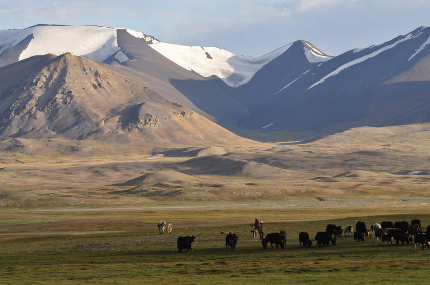
Kirghiz Nomads somewhere in the vicinity of the Lake
However later this area in itself became a matter of dispute and the Russians wanted to be the first in control just like they had done in Panjdeh. And as it would happen just around the same time Sir Francis Younghusband was in high Asia with his party not very far from the Lake. They were at the Bozai Gombaz in the Little Pamir (marked in the Map with a circle) and they were confronted by the Russian party and told they were in Russian territory and told to leave. As it had happened that Younghusband had trespassed into Russian territory before mistakenly (of course) and it turned out that the status of Bozai Gombaz was not defined in the earlier agreements with the Russians. So in order to avoid all further complications another boundary Commission was established and officials from both the British side and the Russian side met and as a consequence of it the border between Afghanistan and Turkestan was settled taking care that the Russian and the British Empire still didnt have a Land Border in High Asia.
Leaving you with a Map which makes the whole Geography more interesting. And some pics from here and there.
Of Mountains and Rivers
One of the most interesting thing about the Himalayas is how the Rivers interact with the Range and how the River Basins work. Since none of us is taught this in school in the Geography class the way one can study this fascinating aspect is to study Maps. Not the Maps of the new but the old Maps made by the Geological Surveys and the Royal Geographic Society Maps. The kind of detailing in these Maps is amazing when we keep in mind the fact that it was all done by boots on the Ground. No Aerial or Satellite Cartography.

Of the Himalayan Mountains and the Rivers
One of the most interesting thing about the Himalayas is how the Rivers interact with the Range and how the River Basins work. Since none of us is taught this in school in the Geography class the way one can study this fascinating aspect is to study Maps. Not the Maps of the new but the old Maps made by the Geological Surveys and the Royal Geographic Society Maps. The kind of detailing in these Maps is amazing when we keep in mind the fact that it was all done by boots on the Ground. No Aerial or Satellite Cartography.
And I finally found a Map which shows the River Basins / the Mountains / the Ridgelines / the Water Partings in a very simple and lucid fashion. Of course there are some explanations required for the un-initiated in the fine art of reading Maps. Not only does it show the Water Basins in the Himalayan context but it also shows the neighbouring River basins and how the Mountains affect the Course of the Rivers. You also need to understand that its this conflict between the Rivers and Mountains which has created the Valleys which has enabled Human communities to inhabit the Mountains.
In the Himalayan context the Three main Rivers which drain the Himalayas are the Indus in the West, the Ganges in the Middle and the Brahmaputra in the East. It is common knowledge that the Indus and the Brahmaputra which rise from almost the same vicinity of each other near the Mansarovar Lake in the Tibetan Plateau hem in the Great Himalayan Range from the opposite sides. The Indus forms the boundary on the West as it passes by the Nanga Parbat and the Brahmaputra forms the boundary on the East and it rounds off the Namcha Barwa in the East. The Indus and the Brahmaputra both never breach the Main Himalayan Ridgeline and run alongside but behind the Main Himalayan Ridgeline on the Tibetan Plateau. Both flow along what Geologists call the Indus Tsangpo Suture or divide in simpler terms. I would also like to mention one major River which actually cuts through the main Himalayan Ridge line and forms the Eastern boundary of the Western Himalayas. This would be the Satluj which coincidentally also originates around the same area as the Indus and the Brahmaputra (which is called Tsangpo in Tibet) and follows an independent course cutting through the Himalayas though it finally ends up in the Indus once it reaches the Great Plains of the Punjab.
Beyond the Basins of the Himalayan Rivers we have in the neighbourhood the Tibetan Basin though a part of the Tibetan Plateau is drained by these Himalayan Rivers themselves. Further North the main Ridge line of the Karakorams forms the Water Parting between the Himalayan Rivers (the Indus system) and the Tarim Basin. The Tarim Basin is itself separated from the Tibetan Basin by the Kunlun Mountains. To the West of the Tarim Basin separated by the Pamirs in the South and the Tian Shan in the North is the Central Asian basin of the Oxus and Jaxartes of the old. The names Oxus and Jaxartes were enough in the old times to induce Explorers to go into a frenzy so inaccessible these areas were. However nowadays the Oxus and Jaxartes are better known by their present names, the Amur Darya and the Syr Darya. On the southern Edge the Oxus and Jaxartes Basin is separated from the Himalayan River Basin by the Hindu Kush. Further down the sub Ranges of the Hindu Kush like the Sulaiman Mountains divides the Himalayan River Basin from the Helmand River Basin. This rounds off the Water Partings of the Indus in the Western Himalayas.
If you follow the Indus River in the Map you would see that after the point of origin the Main Waterparting of the Rivers runs behind the Main Himalayan Range rather than along the Main Ridge as classically should be the case. However at the point roughly at where it enters Ladakh from the Tibetan Plateau the River aligns itself with the Main Himalayan Range and continues the same course all the way to the Nanga Parbat where the Great Himalayan Range ends. The Water Parting however moves North towards the Karakorams and even across the Karakorams as seen in zone H. Close to the K2 however the Water Parting again moves along the main Himalayan Ridge line. But then after following the Main Ridge line of the Karakoram to West it again goes beyond the Karakorams as seen in zone C. It continues this trend until its behind the main Ridgeline of the Hindu Kush till at a point beyond the Tirich Mir it again aligns with the Main Ridge line to deviate again to form Zone B all the way to the Helmand Basin.
In pretty much the same way the Water Parting of the Tarim Basin also jumps beyond the Kun Lun, the Pamirs and the Tian Shans at places but it doesn't jump the main Ridge Line of the Karakorams as the reigning Peak of the K2 brings in a semblance of order and the Water Partings follow the K2 in the classical mode (I know this is complicated but once you co-relate with the Map and do some readings it will become more fascinating). Interestingly in the Hindu Kush its the highest Peak of the Hindu Kush the Tirich Mir which forces the Water Parting to run along the main Ridge line just like its supposed to be classically. However a point to be noted is that the Indus never concedes any of its “Mountains” the Western Himalayas or the Karakorams or the Hindu Kush to any River though itself it pushes its Basinal boundaries to well into the Kun Luns, the Pamirs and the Tian Shans though not quite making it to the main Ridge line.
And of course as we all the Mountains are rising and the Rivers are just cutting the Gorges and the Valleys and this state of flux will continue over a period of time till the end of time. And because of this constant change the Water Partings are not as fixed or permanent as we would like to believe. They are also constantly changing and evolving in a Geological time frame. This also shows how the Rivers and the Basind connect these highest Mountains in the World in a closer relationship than we actually believe. The River and the Basins provide the linkages which connect the Himalayas with the Karakorams, the Hindu Kush, the Kun Lun, the Pamirs and the Tian Shans. I collectively like to use the term “Himalayas” when talking about all these Ranges and the Great Himalayan Range when I am referring to the Main Himalaya Range. The highest Range on the Planet.
May we one day get to behold the magnificent sights that these Mountains hold and their mighty Peaks. And may we one day get to drink water from all these Rivers. The transition zones between these Himalayas is probably even today one of the least explored in the World and they continue to hold their Mysteries, occasionally revealing them to us mere Mortals.
The Last Anglo Abor War 1911
The Anglo Abor War was a series of events which took place in 1911 between the British and the Abor Tribesmen in what is today Arunachal Pradesh. The British were keen to explore and Map out the almost impenetrable Jungles that the Siang River cut through in the Eastern Himalayas. And of course this put them on a collision course with the local Tribal communities who saw them as invaders and outsiders.

The Last Anglo Abor War 1911
By the beginning of the 19th Century the British were well in control of most of the parts of the subcontinent of India with the only exception being the areas in North and North West India which were firmly in the control of the Sikhs under the Sher-E-Punjab Maharaja Runjeet Singh. But after his death and the arrival of the mid part of the 19th Century the Sikh Empire was also shattered and gradually taken over by the British.
However in the Eastern part of India which was broadly described as Assam there were still areas and Tribes which held out. The British could penetrate into the the Brahmaputra Valley as far up as Pasighat but beyond that started the foothills of the Eastern Himalayas which unlike their counterpart in the West was virtually impenetrable due to the dense Jungle and the indegenous Tribes which inhabited these parts. Foreigners were extremely unwelcome and the Tribes of the Hills took no prisoners. As per their long laid down Tribal traditions they just couldn't let foreigners in their sacred Lands and Jungles where their deities presided and allowed them to make a living out of hunting gathering.
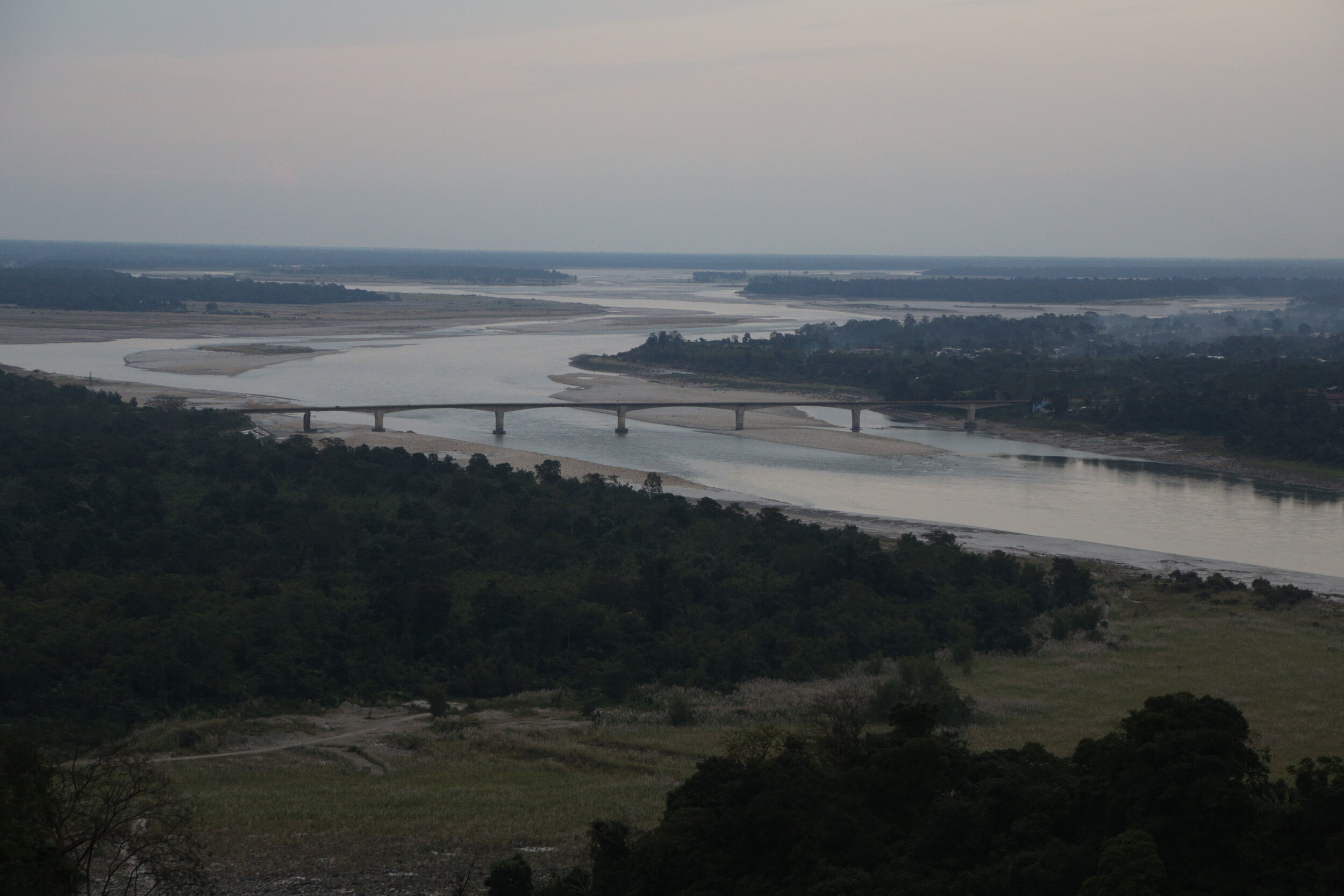
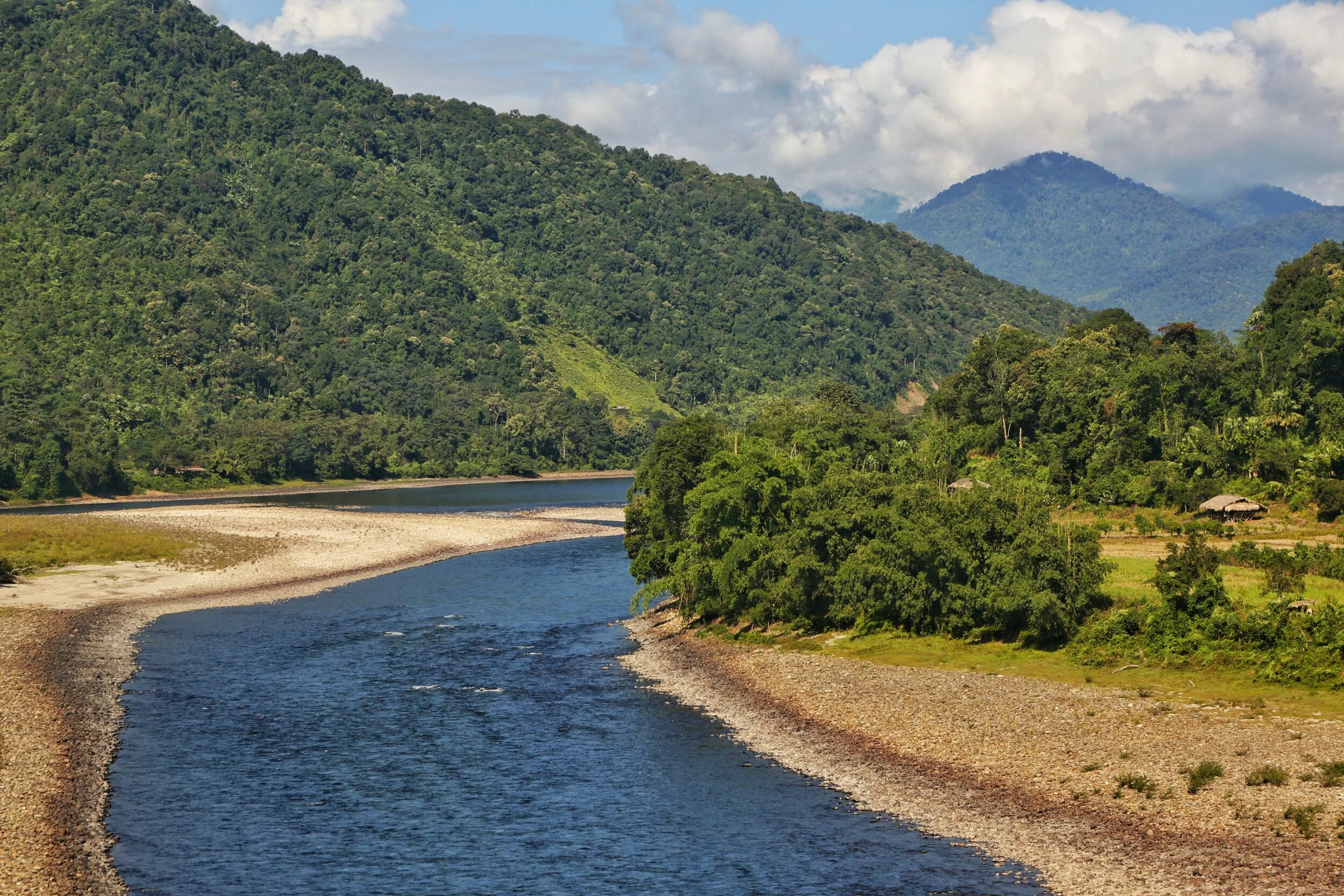
The Siang or the Brahmaputra before Pasighat
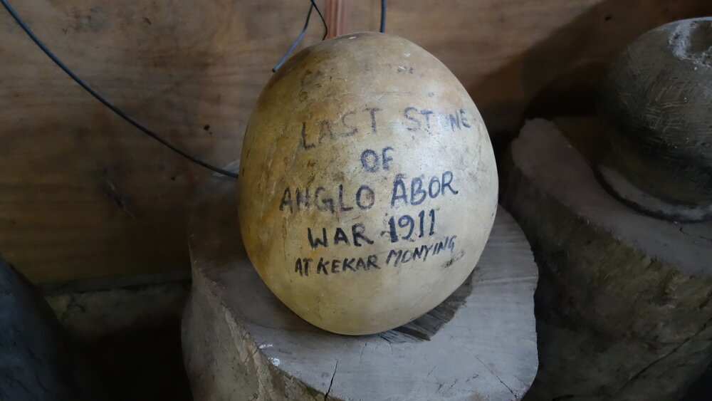
Let me first explain how I got to this point. We were driving around the North East in last November / December and while on the way from Pasighat to Aalo we stopped at one of the few local “Dhaba” if you could call it. These Dhabas serve quick Lunch / Dinner in the form of Dal Rice or Chicken Rice or Pork Rice or you could opt for Maggi instead. Or the regular Tea. Anyways since we were in a Group we ordered and some of the more curious ones started roaming around. And then I caught sight of what I though looked like an Ostrich’s egg and hence I decided to take a closer look. And then I realised that there was something written on it. It wasn't an Egg at all but a Stone which resembled an Egg. And the words written on it were “The Last Stone of the Anglo Abor War 1911 at Kekar Monying”
Well Kekar Monying is the name of certain cliffs in this area along the Siang River which goes onto to become the Brahmaputra as it hits the Assam Plains. And it was along these cliffs that an engagement in the cold December of 1911 was fought between the British and the Tribesmen who the British referred to as “Abor” at that time. The British carried all kind of modern weaponry whereas the Tribesmen were armed with their Bamboo Arrows and Stone Catapaults as their only “long range” weapons. Stone Catapaults which were used to launch big round stones like the one I saw there and you see in the pic at their adversary. And this particular Stone had the dubious distinction of being the last one used by the Tribesmen against the British. And how exactly it landed in that Roadside Dhaba is anybody’s guess. And of course I forgot to ask.
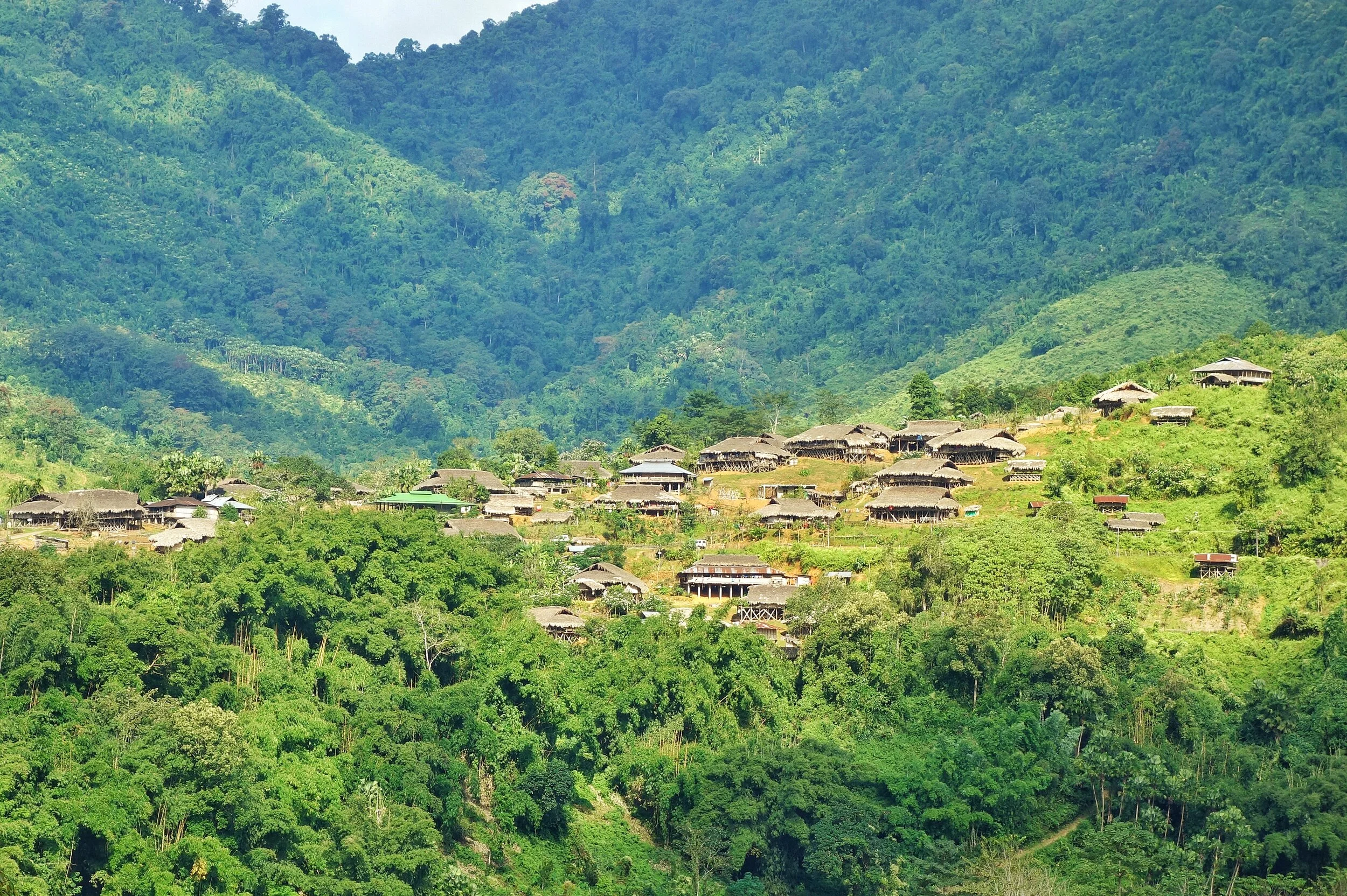
Typical Abor Country
This War which was fought in various segments started in the 1850s when the British began probing into these areas. There is a certain Village called Kebang spearheaded the campaign against the British. These were Adi Tribesmen (they were called Abor collectively by the British) and they fought no less than 4 Wars against the British and they had a name for each ie Bitbor Mimak (1858), Bongal Mimak (1859), Nijom Mimak (1894) and Poju Mimak(1911). The Adi were fierce warriors and towards the beginning of the 20th Century the British started to take them very seriously. They formed an Abor Expeditionary Force in order to penetrate the Region and establish firm control over it. The British were aware of the strategic importance of the area as they knew Tibet and China were not very far away but the territory between was largely unknown and they wanted to be in control of this unknown. But of course the Adis wouldnt have it that way. It was their Land. And they would fight tooth and nail to keep it.
Apparently the last War in 1911 was sparked off by a rather peculiar incident. A British Officer Williamson accompanied by another British Officer Dr.Greigerson, an interpreter, a couple of Coolies and a few Soldiers of the Assam Rifles were surveying the country and came to a Village. The Villagers offered them some gifts as offerings and there was a certain Villager who offered a Chicken as a gift but apparently this Villager had some skin disease and Williamson refused to accept his gift. This was of course a huge dishonour for the Villager who decided from thereon to follow Williamson till he accepted his gift.
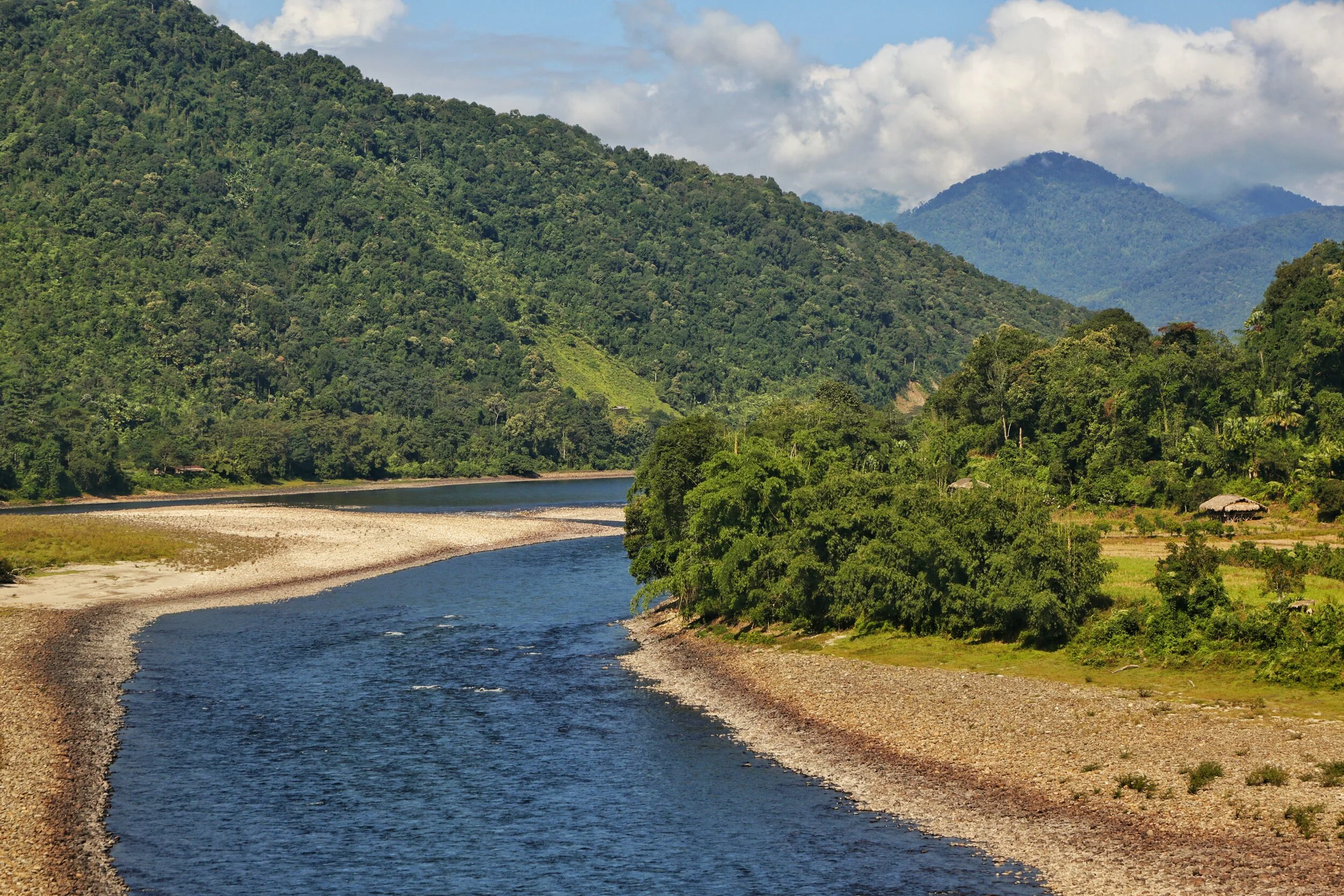
The Siang River
So when he moved to the next Village this Villager again came to him and offered the Chicken. Williamson was aware that this guy was following them and now he lost his temper and he used rough language and bad words in dealing with the Villager and to add insult to injury he struck him a couple of times with his stick. And this was now taken as a great dishonour by the whole Village. And they decided this would be avenged. But they would do this when they would be on their way down to the Plains.
But unknown to the Tribesmen Williamson and Dr.Grierson had a change of plan and decided to split into two different parties on their way back. On the night of March 31 while on his way to Dinner, Williamson was waylaid by the same Villager who had once offered him a Chicken. And killed. And they also killed his whole entourage. Dr.Grierson and his party were waylaid in Kadeng Village and put to death except one of the Coolies who was a Nepali and managed to somehow convince the Adi Tribesmen to spare his life. He of course went down and reported the whole incident to the authorities.
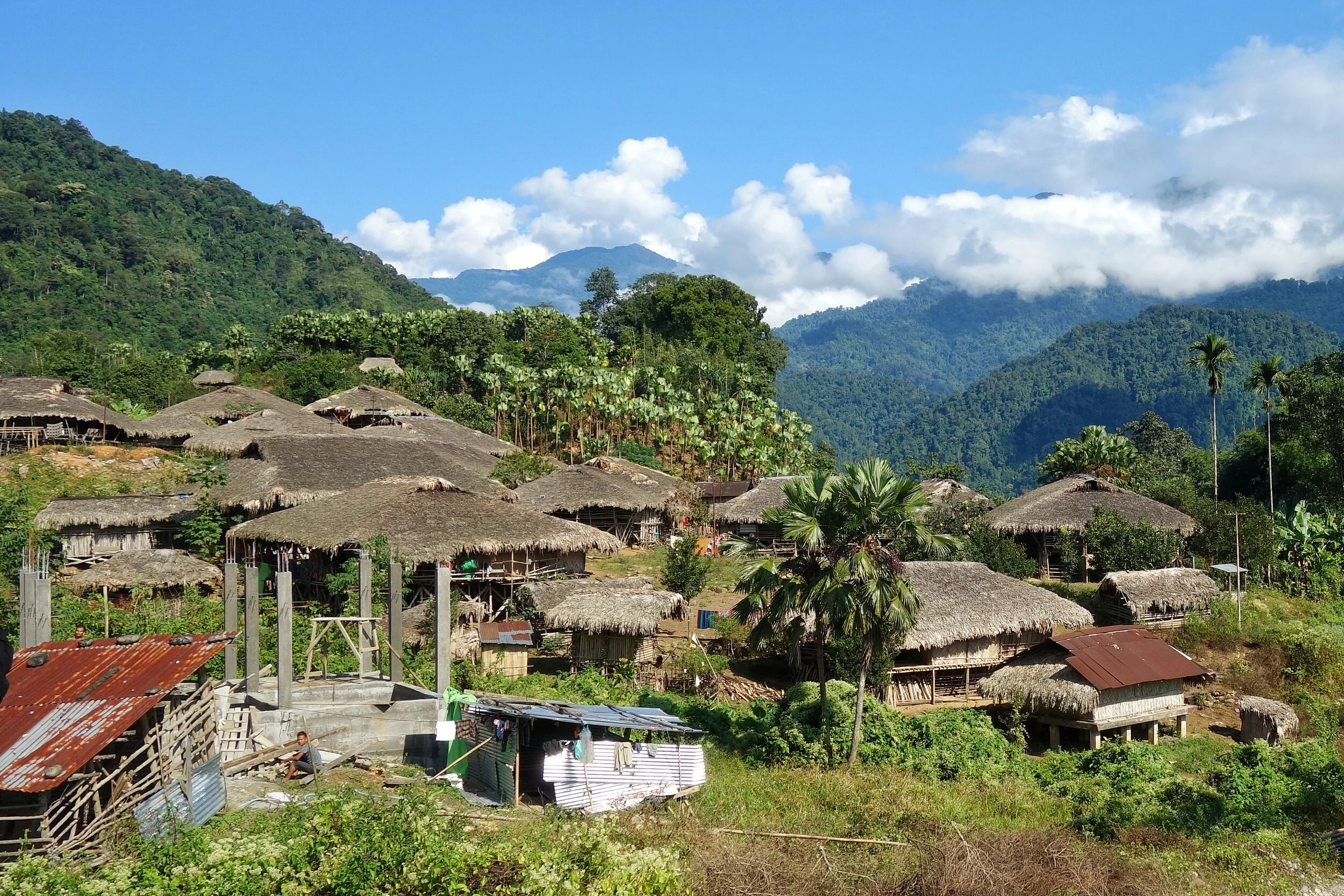
A typical Village in the area
And the Adi knew that now the British will come with full force and in December, the time most suitable to the British, the Abor Expeditionary Force showed up. The Adi fought bravely but of course were no match for the British with their modern Arms. The British marched up the Kadeng Village and the whole Village was then burned down. And there would not be another Abor War for the British to fight.
These Adi Tribesmen are the unrecognised Freedom Fighters of the country who have never got any recognition from the Government. Though I am aware of the name of some of the Adi Tribesmen who were a part of this, including the Villager who wanted to gift a Chicken, but that in my view would be an injustice to the thousands unnamed Adi and other Tribesmen who also fought for the country’s Independence like in other parts of the Country. Respect.
Pic from November 2019. On the Pasighat Aalo Road, Arunachal Pradesh
Inputs from various Online sources.
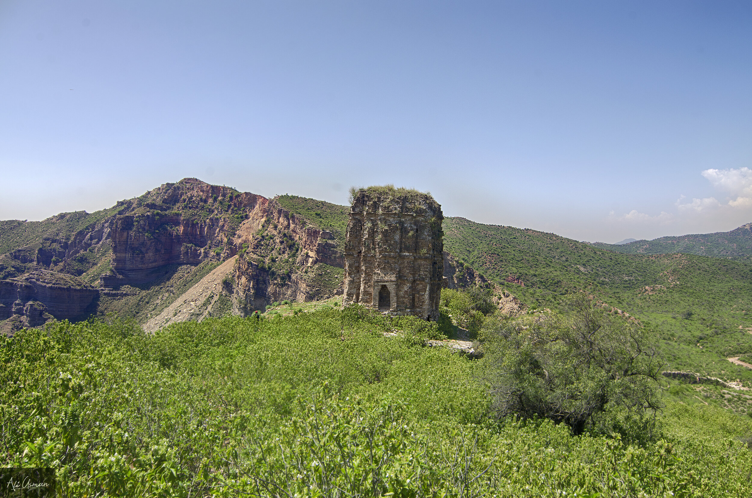
The Nandana Fortress of the Salt Range
The Arab Traveler Al-Beruni in his writings on India, mentions a place where he stayed and it was a great center of learning. It was called Nandana and it was a Hill Fortress on the eastern most escrapement of the Salt Range. The Salt Range is some senses is the youngest Range of the Himalayan Complex and lies between the Jhelum and the Indus in Northern Punjab and includes the Potohar Plateau. This low Mountain Range is called so because of the great Salt deposits that are found in this Range and it is famous for. As such the Fortress was located on a strategic location overlooking what was called the Nandana Pass.

The Nandana Fortress of the Salt Range
Al-Beruni was a very well noted Persian Scholar from Khwarazm and known for his Travels and Writings on India as he came to India with Mahmud of Ghazni when he invaded the subcontinent. Al-Beruni stayed in India for many years and studied all facets of Indian science, philosophy and culture. Of course the fact that he knew Sanskrit among many other languages immensely helped.
During the course of his stay in India, he mentions a place where he stayed and it was a great center of learning. It was called Nandana and it was a Hill Fortress on the eastern most escrapement of the Salt Range. The Salt Range is some senses is the youngest Range of the Himalayan Complex and lies between the Jhelum and the Indus in Northern Punjab and includes the Potohar Plateau. This low Mountain Range is called so because of the great Salt deposits that are found in this Range and it is famous for. As such the Fortress was located on a strategic location overlooking what was called the Nandana Pass.

During the time of his stay here during 1017 onwards Al Beruni noted that Nandana was a great center of learning once upon a time. And it was from here that Al Beruni first used the knowledge of Maths, Geometry, Trigonometry and Algebra to figure out the circumference of the Earth and he calculated it to within 99% of the actual Circumference as we know today. This was indeed a remarkable achievement a thousand years back and the “Mountain” he used for his experiment was Nandana. Nandana was not only a protected Hill Fortress, it also had a Temple built by the Hindu Shahi King Jayapal. There were also other structures which probably served as study center. But of course they had been destroyed in the conquest of the Nandana Fort by Mahmud Ghazni.
The Salt range itself had a number of Temple Fortresses built by the last Hindu Kings to rule this area, the powerful Hindu Shahis. And among them were the sites at Malot, Kafirkot, Amb and other including Nandana. Nandana was named after the mythological Garden of Lord Indra. These Temples served as important places of Worship for many years till invaders from the West came in and overwhelmed the local Dynasties. Nandana gained importance when it became the Capital of the Shahis after they lost Waihind to Mahmud of Ghazni. Nandana was thus the last Capital of the Hindu Shahis. Now Ghazni turned his eyes on Nandana and marched on it and the Hindu Shahi ruler Trilochan Pal deputed his son Bhimpala to defend Nandana. A great Battle was fought and the Turks under Mahmud mined the walls of the Fort and blew them up. Bhimpala was defeated but he fled and joined his Father in Kashmir where they had taken refuge with their cousin, Singharaja of Kashmir.

After much deliberation a Kashmir Force led by the General Tunga and whatever remained of the Hindu Shahi forces decided to take on the forces of Mahmud. And it was again around Nandana that this great Battle was fought. This Battle has been described in great detail in Kalahana’s Rajatarangani, The History of Kashmir. The joint Kashmir and Hindu Shahi forces were annihilated by Mauhmud’s forces and this was the end of the Hindu Shahi dynasty. And all that is left behind this Dynasty is a legacy of crumbling Temples spread across the Salt Range. And so was the case with Nandana.
But Nandana was also witness to another epic struggle when the Mongol hordes led by Genghis Khan decided to go to war with the mighty Khwarezem Sultan (who was a Mamluk) when his Ambassadors were killed by the Sultan. The wrath of the Mongols fell on the large Khwarezem and they systematically conquered and annihilated. The Sultan’s son and main heir took on the Mongols and defeated them at the Battle of Parwan and subsequently decide to go towards India and sought help from his Mamluk cousins of the Delhi Sultanate.

The Mongols re-grouped and led by Genghis Khan himself decided to pursue him. And it was on the banks of the Indus that a great engagement was fought between the Mongols and the Sultan’s sons Army after the Mongols caught up with them. The Mongols dominated the proceedings but getting an opportune moment the Sultan’s son fled across the Indus. The Mongols are said to have pursued him and his men till the Fortress of Nandana and they now captured and held the Nandana Fortress.. The Sultan’s son made it to Delhi but the Mamluk Sultan Iltumish declined to help him due to his relationship with the Abbasid Caliphs. The Mongols also returned only to come back later but that's a different story.
Ironically the same Mongols would then turn on the Abbasid Caliphs and bring to an end the Islamic Golden Age.
Coming back to Nandana which saw it all in its present condition is in a pitiful state. Most structures have totally collapsed and its not even a pale shadow of its past. No one even remembers the significance of this desolate Temple on the top of a Hill. It is located Near Pindi Dadan Khan in Punjab, Pakistan.
All pics from the Internet. Mostly by Ali Usman Baig
The Making of the Brahmaputra
The Brahmaputra is one of the great Rivers of the World and its named after the Hindu God Brahma. The Son of Brahma actually. The River originates close to the Mansrover Lake and makes it’s journey across the Tibetan Plateau and then it turns around the Himalayas and finally arrives on the plains of Assam. Its course from the Tibetan Plateau to the plains of Assam was for years an endearing mystery.

The Siang at Ranighat where it becomes the Brahmaputra
The Making of the Brahmaputra
So this year I finally saw for myself the only “Male” River of the Indian sub-continent the mighty Brahmaputra named after the God Brahma and it name means the Son of Brahma. In November though it presented its most benign form to me but it still was an awesome sight. For people used to Rivers in Northern India the Brahmaputra is almost a revelation because of its sheer size. Irs almost like an Ocean and you cant see the other end. I can only start to imagine how it looks after the Snow melt in the Summers and more so when the Monsoon hits and the River floods large areas of the surrounding country.
So we started off from Dibrugarh and made our way to the year old Bogibeel Bridge, which is a double decker Bridge for both Road and Rail and which has been in the making for over 200 months now. The work has been slow on the Bridge as it could only be done between the months of November to March when the rains are away and the water level was low. And it was from this Bridge that I had my first sighting of the mighty Brahmaputra and it looked awesome. In the far background I could see the silhouettes of the Himalayan foothills. And we couldn't help but stop our Cars in the middle of the Bridge and have a look at the magnificent Brahmaputra and its vast Flood plains. The River looked as serene as any body of water could and it was easy to forget that its the same River which wrecks destruction on a massive scale every year.

The Siang
Now understanding the origin of the Brahmaputra was always a complex task for the explorers of these parts which were few and far between. Unlike the Western Himalayas which had a whole lot of Explorers and Spies prying around, this was literally impossible in the Eastern Himalayas due to the dense Jungles which were a result of a lower Latitude (read this as warmer) and three times the amount of Rainfall that falls in the Western Himalayas. And then the thing was that there were three contenders who met at almost at the same location in the Assam plains near Sadiya where the Siang (also called the Dihang), the Dihang or Sikang which came from a more Northwesterly direction and then there was the mighty Lohit which came from an Easterly direction. All these carried enough water to be the Tsangpo. Finally the mystery was solved around 1885 and the Siang or the Dihang was finally established as the Tsang Po from the Tibetan Plateau.

The Tsang Po on the Tibetan Plateau
Starting from the beginning or the Yarlung Tsangpo as its known in Tibet originates from the vicinity of the Mansrover in Western Tibet and flows in an Easterly direction. It has thousands of small tributaries in Tibet with the first main one being the Raga Tsangpo. And then its the Nang Chu, Shang Chu and Rang Chu. Further ahead its joined by the Lhasa River or the Kyi Chu as its also called. And then a couple of other Rivers till the point its reaches the Eastern anchor of the Great Himalayan Range, the Namcha Barwa, at 7782 m, does justice to the Himalayan Range. At this point Yarlun pivots and runs through one of the deepest River Gorges in the World, the Yarlung Tsangpo Gorge and emerges as the Dihang or the Siang in Arunachal Pradesh.
Out of the other two, which along with the Siang form what is called the Brahmaputra once it reaches Assam, the Dibang River rises in the Mishmi Hills which are located where the Himalayan Ranges meets the Indo Burma Hill Ranges. The source of the River is near the Keya Pass somewhere close to the border with China. The third River, the mighty Lohit rises in the Tibetan Plateau and is known there as the Zayu. Its origin lies in the Kangri Garpo Range and it enters Arunachal Pradesh from Tibet and finally emerges into the plains at what is known as the Parshuram Kund. Many people in Assam used to consider the Lohit as the main Brahmaputra and many still do.

The Siyom River meets the Siang
And of course as it moves on through the Plains of Assam its joined by a number of Himalayan Rivers such as the Subansiri, Kameng, Bhareli, Dhansiri, Manas, Champamati, Saralbhanga, and Sankosh rivers. As well as Rivers rising in the Hills on the like the Burhi Dihing, the Disang, the Dikhu, and the Kopili. And then it enters Bangladesh and out of our realm.
Having experienced it now I know why its the only “Male” River in India. I wish to witness its angry avatar. I will return someday.
And below is a picture of the place where the Dihang or the Siang becomes the mighty Brahmaputra and the Eastern Himalayas give in to Plains of Assam and vice versa. In Geographical context this is a place where all your dreams come true. You understand how infinite Nature is and how insignificant we humans are. Yes we did build a Bridge there though.
Pic from November 2019. Above Pasighat, Arunachal Pradesh
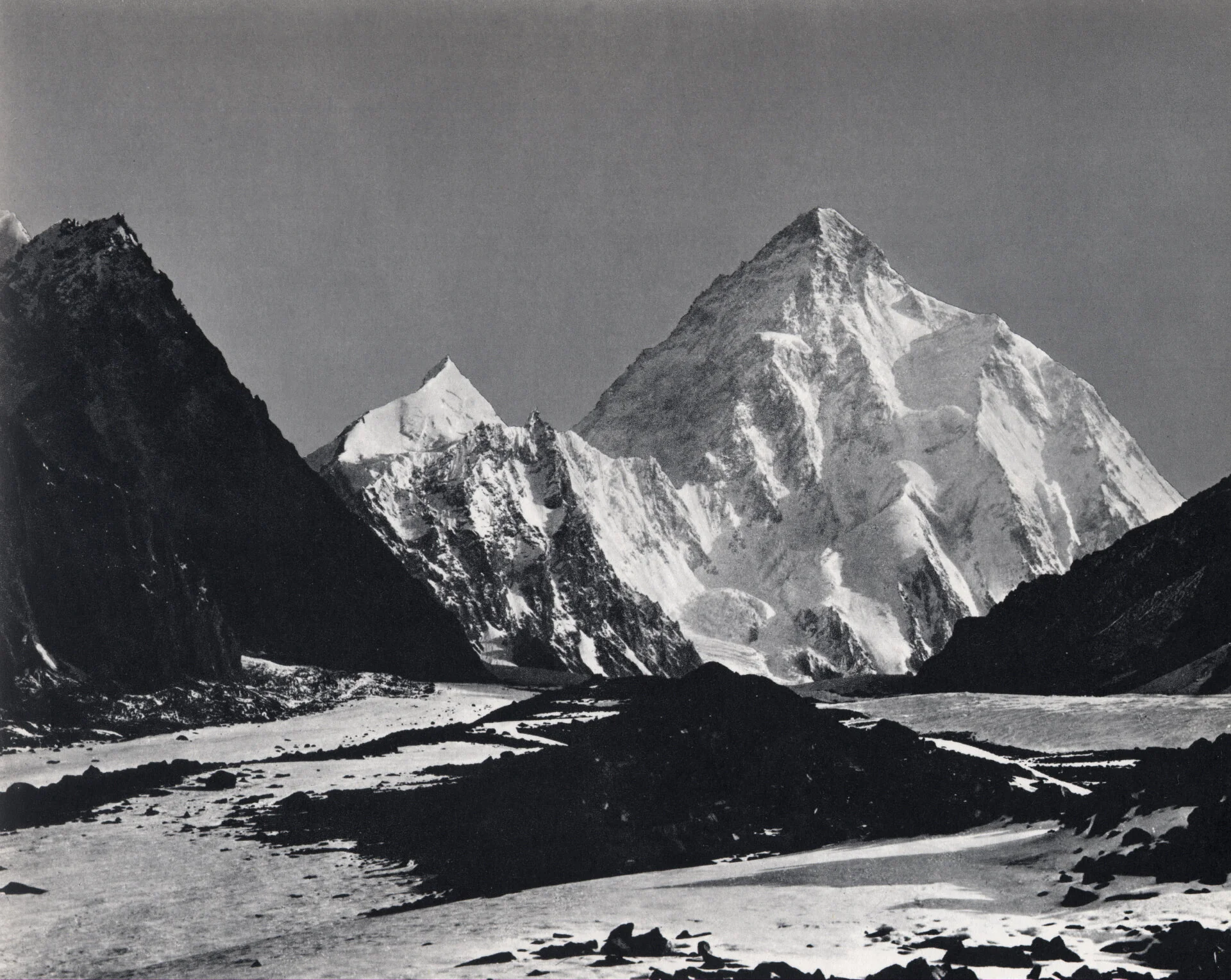
Video of Duke of Abruzzi’s Karakoram Expedition of 1909
An extremely rare Video of the Duke of Abruzzi’s Karakoram Expedition of 1909.
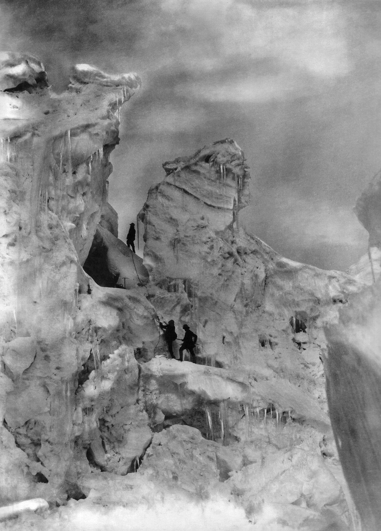
Duke of Abruzzi’s Karakoram Expedition of 1909
Prince Luigi Amedeo, Duke of the Abruzzi was an Italian Explorer and Mountaineer. He was from the Roual families of Italy and Spain and was a cousin of the Italian King.
The son of King Amadeus of Spain (who was also the Duke d’Aosta in Italy), Abruzzi was the first to ascend Mount St. Elias in Alaska (1897). His 1899 Arctic expedition reached latitude 86°34′ N—a record for the time. In 1906 he was the first to scale the highest summits of the Ruwenzori Range in east-central Africa. His expedition investigated the geology, topography, and glaciology of the range; it mapped the range and named its major peaks, passes, and glaciers. In 1909 Abruzzi climbed the world’s second highest mountain, K2, in the Himalayas, to a height of more than 20,000 feet (6,000 m).
In 1909 the Duke of Abruzzi as he was mostly known as set out on an Expedition to climb K2 and accompanying him was the ace photographer Vittorio Sella. Both these Men were pioneers in their fields.
In the said Expedition they reached a maximum height of 6250 m. The standard Route up the Peak goes over a feature now named in his memory as Abruzzi's spur. They tried to go for the Chogolisa as well but couldnt reach the summit but anyways set the World Record for the Highest Altitude achieved in a Mountaineering Expedition.
And now we have come across this Video of that Expedition from an unknown source. Though it says going up the Sind Valley but thats wrong. The Video starts with the Expedition reaching Srinagar via the Cart Road. Next we see vistas of Srinagar on the banks of the Dal Lake and the Jehlum I assume. We can see what appears to be a busy Market and a hustle bustle of Shikaras.
Next it shows the Expedition crossing the Indus River somewhere around Skardu I guess. They then go upto Shigar and then the Braldu Valley. They cross the Braldu River and go across the Burji La. And after that up the Skoro La and down.
They cross the Morraines of the Baltoro Glacier and finally arrive on the Glacier. Then we can see the Chogolisa (It was called the Bride’s Peak at that time by the Europeans). And finally we see the ethereal K2 in all its Glory.
This Video is worth its weight in Gold.
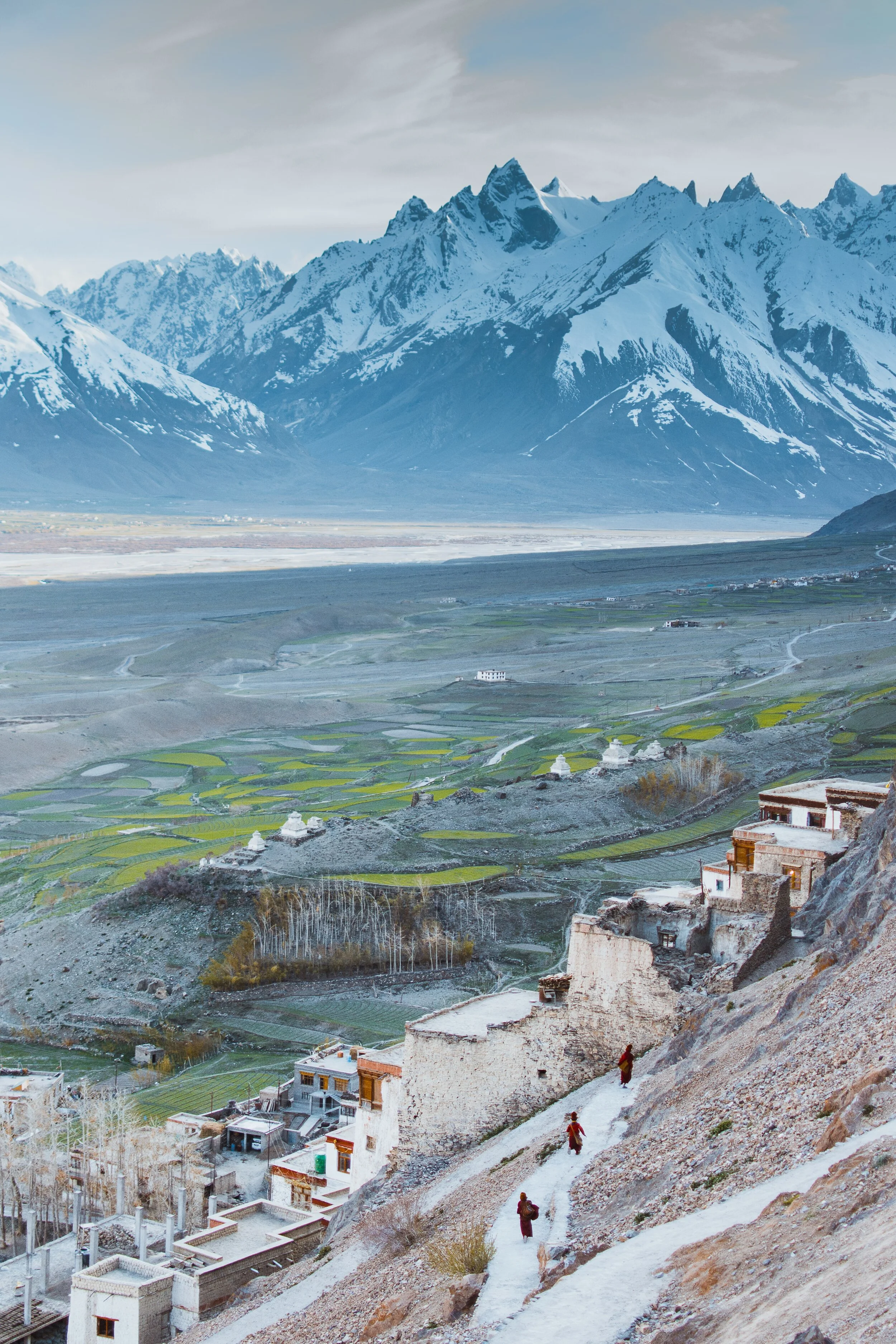
Pangi to Zanskar
The Ancient Routes which connected Pangi Valley in Chamba with Zanskar in Ladakh : Excerpts from Guide to Dalhousie Chamba and the Inner Mountains Between Shimla and Kashmir (1923)

The Village of Palamo on the Route connecting Lahaul with Zanskar via the Shinku La
Pangi to Zanskar
Excerpts from Guide to Dalhousie Chamba and the Inner Mountains Between Shimla and Kashmir (1923)
One of the most interesting readings of the recent times for me is this little Book. It was written by J Hucthison LRCP & SE, Chamba. It was printed at the Civil and Military Gazette Press in 1923 in Lahore and it was on sale for Rs.2.
Since at those times Motorable Roads / Motors were rare they hardly existed in the Himalayas. So a lot of stuff was written about different Routes which connected one Valley to another. And in today’s context we are sometimes surprised as the Routes were described between two areas which we don't really realise are close enough to be connected directly.
One such series is the section on the Routes which connected Pangi Valley to Zanskar. Yes you heard it right. These two were actually connected and still are though I doubt anyone uses these Routes anymore. We also need to remember that Pangi Valley in its higher reaches has Villages called Bhatoris which are Villages inhabited by “Bhots” as people of Tibetan/ Ladakhi origin were referred to. Just like in the neighbouring Paddar Valley of Kishtwar these “Bhots” are believed to have originally come over from Zanskar. Also worth remembering is the fact that Zanskar was at a point of time under Chamba Rule.

The Pangi Valley near the Killar Town
As per the Book, its says that in the earlier times a certain part of Trade to Central Asia was conducted from this Route while it was conducted from the Paddar and Umasi La Route as well. The Goods came to Pangi from Pathankot and Nurpur over the Sach and the Cheni Passes to Pangi. So what exactly does it say about the connecting Routes between Pangi and Zanskar. It mentions Six Routes which can be taken from Pangi to Zanskar and all these involve crossing the Great Himalaya itself. These are taken as stated in the Book.
1. From Darwas a branch ascends the Sural Nala and crosses the Sarsank Pass (16,200 feet), into the Danlong Nallah.
2. A similar branch from Kilar runs up the Hunan Nala and crosses the Shinkil Pass (16,300 feet).
3. From Sach a branch ascends the Saichu Nala to Saichu (10 miles), and Tuan (8 miles) and crosses the Mun La (16,500 feet), and unites with the two roads from Darwas and Kilar; the combined road then crosses the Poat La (17,500 feet) to Burdan Gompa in Zanskar. The roads from .Kilar and Tuan are seldom used. That from Darwas takes five days to Burda8n Gompa,. The stages are : Kansar, 8 miles ; Atyud, 1.0 miles ; Gokhun (over Sarsank Pass) 16 miles ; Sangati (Danlong N46), 6 miles ; Punchi (over Poat La) 12 miles ; Burdan Gompa, 6 miles. Large glaciers on both passes.

On the Road from Pangi to Lahaul along the Chandrabhaga
4. In the Saichu Nala an upper road runs from Kutal near Sach to Shun and rejoins the other road at Hillu, but it is rough and in places dangerous. From Saichu a Branch runs up the Chasag Nala to Bhotaur (10 miles) and crosses the Gurdhar Pass (16,791 feet), to Miyar (20 miles) in the Miyar Nala. This pass is so called owing to its being passable for ponies, which are brought from Lahul by this route to Pangi and over the Sach Pass to Chamba. Two men are needed to render help at difficult parts of the road.
5. At Udaipur a branch runs up the Miyar Nila and is narrow and difficult for four miles. From Chimrat (12 miles) the valley is open and the road good, up to the head of the Valley where it crosses the Kang La, 17,500 feet, in the Western Himalaya to Burdan Gompa. The journey from Kanjer, the last village, occupies five days. The stages are : Gompa, 8 miles ; Kesaryuncha, 7 miles ; Dutombn, 8 miles : Chural-pachan, (over Kang La), 12 miles : Bardan Gompa, 6 miles.

The Karsha Monastery in Zanskar. Pic by Klara Avsenik
6. Beyond Kanjer a branch ascends a side nala to croes the Tharang La, 17,133 feet, to the head of the Kado Tokpo stream in British Lahul. The journey from Kanjer to Darcha takes four days ; large glacier, but road fairly good ; no village till near Darcha.
Its amazing that most of these Passes and Routes are not in use and only the most hardened Trekkers venture into these most Inner parts of the Himalayas. This is where the opportunity lies for “Explorers” in the actual sense of the word to venture into see the beauty of the Inner Himalayas. As in the “wild” country which lies between “Shimla and Kashmir” as this hand Book called them.
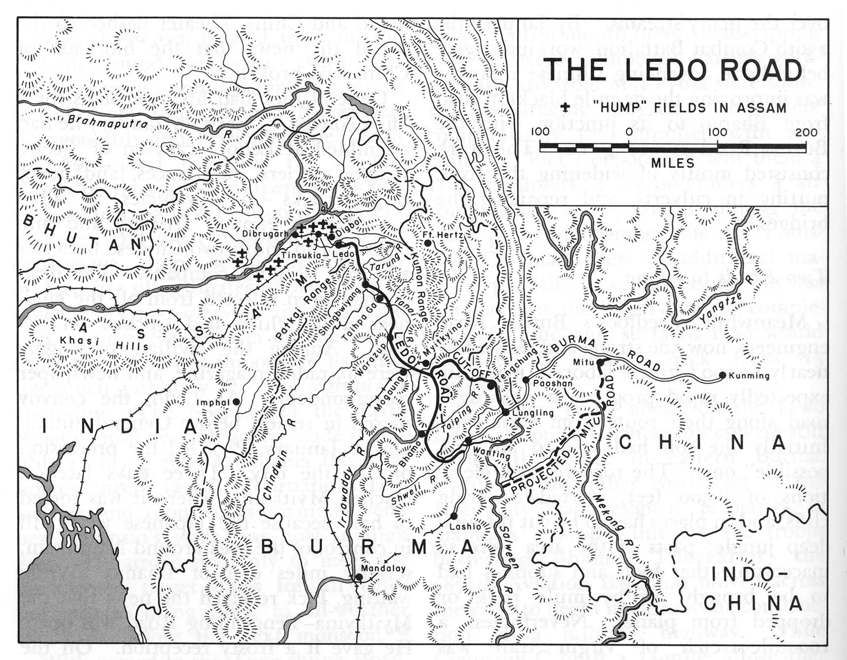
The Stilwell Road
The Stilwell Road Project once termed as an “impossible Engineering pipe dream” was not merely an Engineering feat accomplished but a saga of Valour, Grit and Determination. It stands as a testament to the Men responsible and the indomitable human spirit that made it possible.” This is the inscription at the Jairampura Cemetery, the largest Cemetery dating back to the Second World War and at the cemetery lie the remains of hundreds of Men who gave up their lives during the building of this Road. Amongst the dead were Indians including many local Tribals, Chinese, Americans and Burmese.

The Stilwell Road
“The Stilwell Road Project once termed as an “impossible Engineering pipe dream” was not merely an Engineering feat accomplished but a saga of Valour, Grit and Determination. It stands as a testament to the Men responsible and the indomitable human spirit that made it possible.” This is the inscription at the Jairampura Cemetery, the largest Cemetery dating back to the Second World War and at the cemetery lie the remains of hundreds of Men who gave up their lives during the building of this Road. Amongst the dead were Indians including many local Tribals, Chinese, Americans and Burmese.
This Project was undertaken at a time when the Japanese were in possession of most of Burma and were inching forward towards India and Southern China. This Road was supposed to provide supplies to the beleaguered Chinese fighting the Chinese. There were already Plane lifts from the North East India to China over what was then called the Hump, the impenetrable Hills and Jungles of the Patkai Range and it was through this Patkai Range that the Road was to be built. Ledo was the last Railhead of the Indian Railways and the Road was proposed to be started from there for the same reason.

The Patkai Range which was the first main barrier on the Stilwell Road.
In the Himalayan context the altitude would not sound much but the fact remains that building a Road over this Pass was much more complex and dangerous than probably the one built over the Karakoram Pass. The road only became a possibility as it was a desperate situation and the desperate situation needed a desperate solution. The solution was called the Ledo Road only to be renamed later as the Stillwell Road. Though there was already an Air connect over the Hump, it had to be supplemented with a Road link as well to push the supplies of men and material into China to supplement the Chinese in their War effort against the Imperial Japanese Army.
The Project was the brainchild of the American General Joseph Stilwell who was deputed to the China India Burma theater in the Second World War as the Commander of the American Forces, Deputy Commander of the Allied Forces (second in Command to the famous Admiral Louis Mountabatten) and as an Adviser to Chiang Kai Shek, who was the Commander of the Chinese Forces. He was also nicknamed Vinegar Joe for his caustic personality. And he had a personal disdain for Military pomp and show. All these qualities put him forever at loggerheads with his British and Chinese Allies.
His main objective was to connect India with China with a Road starting from Ledo in Assam to Kunming, Yunnan, China. And he always advocated the fact that the supplies currently being sent by Air had to be supplemented by Road supply Route in order to withstand the Japanese. Of course there were many who disagreed with Stilwell who was still adamant. The British Field Marshal William Slim who commanded the British Fourteenth Army in India/Burma wrote of the Ledo Road:

American Army Trucks on the Stilwell Road
I agreed with Stilwell that the road could be built. I believed that, properly equipped and efficiently led, Chinese troops could defeat Japanese if, as would be the case with his Ledo force, they had a considerable numerical superiority. On the engineering side I had no doubts. We had built roads over country as difficult, with much less technical equipment than the Americans would have. My British engineers, who had surveyed the trace for the road for the first eighty miles [130 km], were quite confident about that. We were already, on the Central front, maintaining great labour forces over equally gimcrack lines of communication. Thus far Stilwell and I were in complete agreement, but I did not hold two articles of his faith. I doubted the overwhelming war-winning value of this road, and, in any case, I believed it was starting from the wrong place. The American amphibious strategy in the Pacific, of hopping from island to island would, I was sure, bring much quicker results than an overland advance across Asia with a Chinese army yet to be formed. In any case, if the road was to be really effective, its feeder railway should start from Rangoon, not Calcutta.

The Memorial to the people who laid down their lives while making the Stilwell Road
The construction of the Road began in 1942 and it is estimated that 15,000 American Troops were involved in the building of the Road, along with thousands of Indian, Allied, Burmese and Chinese soldiers and workers. It is said that over 1000 American lives were lost during the construction of the Road and there were casualties amongst the others in the same effort. It was called Man a Mile Road as more than one life was lost per 1079 Mile length of this Road. The first Convoy which successfully got to Kunming from the Ledo Road was in the beginning of 1945 and by that time the tide of War had changed and the Japanese were no longer as dominating as they were in 1942. But still supplies were sent over this Route though much more were going by Air over the Hump.

Chinese line-up the streets of Kunming as the first Supply Convoy comes down the Ledo Road from India
The Road was re-named at the Stilwell Road from Ledo Road by none other than Chang Kai Shek, a tribute to the spirit of General Joseph Stilwell and his complete faith in this endeavour. As of today most of the Road lies in unusable condition on the Burmese side from the India side as its a hot zone with many Insurgent hideouts. But all the way from Ledo to Nampong, the last Indian town and upto the Pangsau Pass the Road is in excellent condition and its a great Drive.
Here is a Tribute Video to the Stilwell Road and how it looks and feels today. Hoping that one day in better times we could drive all the way to Kunming through some of the most spectacular Forests in the Region.
Video from Novemeber 2019. Road from Ledo to Nampong, Arunachal Pradesh
Kiki’s Blog
Stories from the Himalayas








Five years ago the Galwan Valley was in the News for the wrong reasons after a deadly clash between the Indian and Chinese Armies in the Valley located in Ladakh lead to many deaths on the contentious Border between the two countries in wake of continued Chinese intrusions into Indian territory.
This area along the Shyok River, of which the Galwan Nallah or the Galwan River which forms the Galwan Valley has been off limits to Civilians since long but now the Indian Government has decided to open up the area for Civilians and we were amongst the First Civilians to venture into this beautifully desolate part of the Eastern Karakorams in Ladakh. Earlier Civilians could only venture upto the Village of Shyok from where the Shyok River takes a U turn and flows in a Northerly direction.