
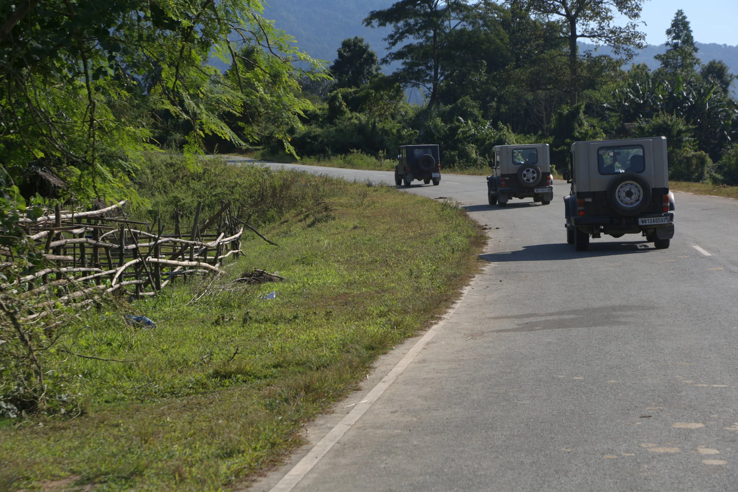
Nampong - Hell’s Gate on the Stillwell Road
Nampong was the last town on the Indian side on the Stilwell or the Ledo Road as it was called. It was around 13 kms before the infamous Pangsau Pass which was also called the Hell’s Pass and Nampong was considered the gateway to Hell's Pass and hence the name Hell’s Gate. This was when the Road started a climb to get over the Pansau Pas which was at almost 1200 m and Nampong was at about 300 m.

The Church in Nampong
Nampong - Hell’s Gate on the Stillwell Road
Nampong was the last town on the Indian side on the Stilwell or the Ledo Road as it was called. It was around 13 kms before the infamous Pangsau Pass which was also called the Hell’s Pass and Nampong was considered the gateway to Hell's Pass and hence the name Hell’s Gate. This was when the Road started a climb to get over the Pansau Pas which was at almost 1200 m and Nampong was at about 300 m.
In the Himalayan context the altitude would not sound much but the fact remains that building a Road over this Pass was much more complex and dangerous than probably the one built over the Karakoram Pass. The road only became a possibility as it was a desperate situation and the desperate situation needed a desperate solution. The solution was called the Ledo Road only to be renamed later as the Stillwell Road. Though there was already an Air connect over the Hump, it had to be supplemented with a Road link as well to push the supplies of men and material into China to supplement the Chinese in their War effort against the Imperial Japanese Army.
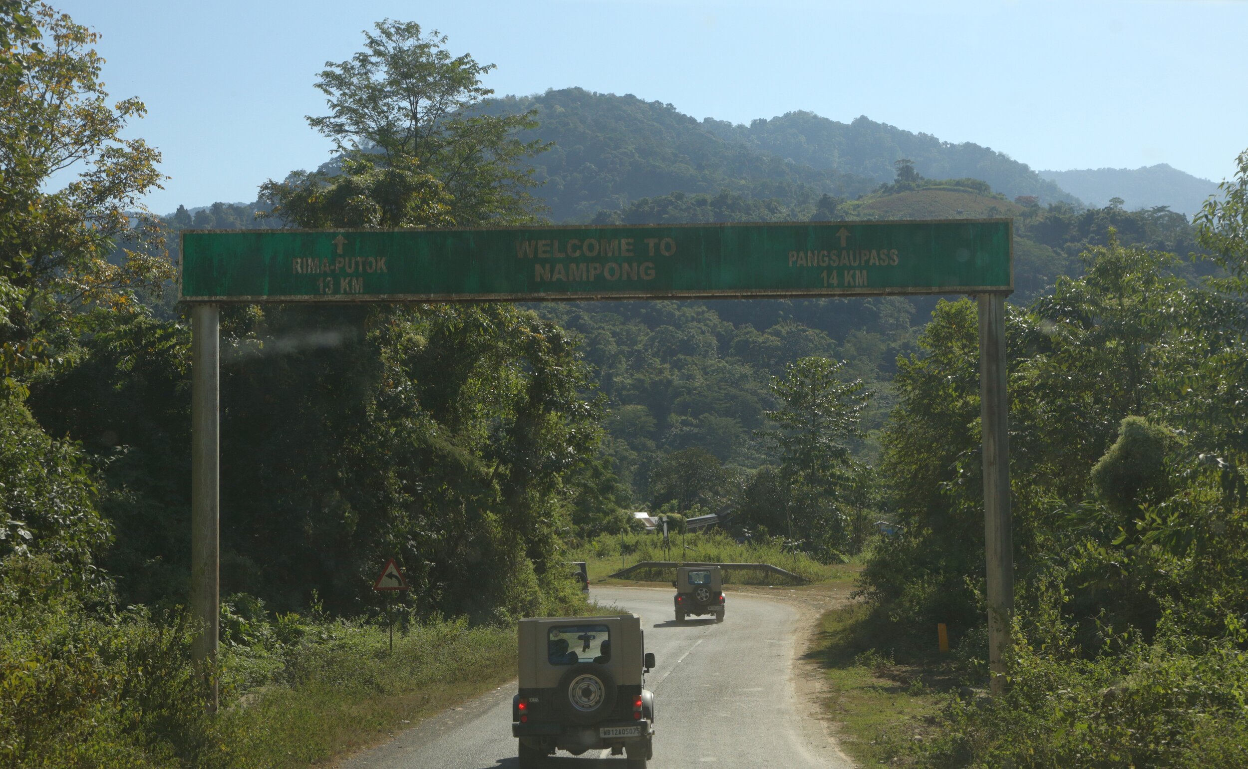
The Entrance to Nampong Town
Interestingly there is a Lake near the Pangsau Pass called the Pangsau Lake but the Amercians gave it another name. The Lake of no Return. It is said that many Planes crashed into this Lake but no traces of either the Planes or the Men or Supplies in it ever found. Hence the name the Lake of no Return. It was almost like the Bermuda Triangle in the Patkai Hills between Indian and Burma. The Lake even today is clearly visible on Google Earth but it lies on the Burmese side beyond the Pass so the possibility of going there is remote.
The town of Nampong (it used to be a Village but thanks to the Road its now a not so bustling Town of 4000+ people) was on our wishlist as I wanted to have a look at Hells Gate if not the Hell’s Pass itself. And a few years back the Indian authorities used to allow Indians all the way to Pangsau Pass but in recent years the access has been restricted. However there is a small window and the Army (the Assam Rifles actually) allow the locals across the Border on the 10th, 20th and 30th. And as luck would have it, it was the 30th of November so here was a chance which we could not miss. So with very high hopes we started from Miao in the morning with all hopes of getting to the Hells Pass.

The Patkai Hills beyond which lay Burma
The Stillwell Road (its the National Highway now) is now a smooth two-lane excellent piece of tarmac winding through some of the greenest scenery you can see. Low undulating Hills, thick forests, Tea Garden and small streams and best of all hardly any people or traffic. Quite a contrast from the Stillwell Road of the old which induced nightmares. So we drove and I made Videos on the way and luckily it was a clear sunny day and it wasnt too hot also. And onwards we drove through the breathtaking scenery all the way to Nampong town.
I for one always insist on travelers to read about the places they plan to visit. Read about the history especially and any historical significance attached to the Town. It will just make the place much more attractive to you. What would otherwise have been a quite little border town not gets linked to the Stillwell Road, the Second World War and even the Bermuda Triangle. Who would even think of such stuff ?

On the Stillwell Road
Anyways we reached nampong after a quick drive sooner than we expected due to the super excellent Roads. And drove through Town which looked as sleepy as they come. And we passed the Town and started climbing. And it was hardly a km out of Town that we came across the Army check Post. We went and spoke to them and they told us that this is as far as you can go back. Not allowed beyond this point. But its the 30th and arent people allowed till the actual Border we asked them. That's only for the local people of Nampong and not outsiders. Where can we get permission from we asked ? The SDO (Sub-Divisonal Officer they said) they told us and also gave us the directions to the SDO’s office. So a couple of us went down to the SDO’s Office while I stood up taking a Video of the pretty little town. And as expected the SDO didn't give permission. Strict orders from the Home Ministry was cited as the reason. I had a fair idea why the permission was now diificult but thats another story for another day.
Well anyways we are happy to have come so far. Next time for sure we will get to the Hell’s Pass from Hell’s Gate and maybe even to the Lake of No Return :)
Video from November 30, 2019
Stillwell Road to Nampong Town and beyond.
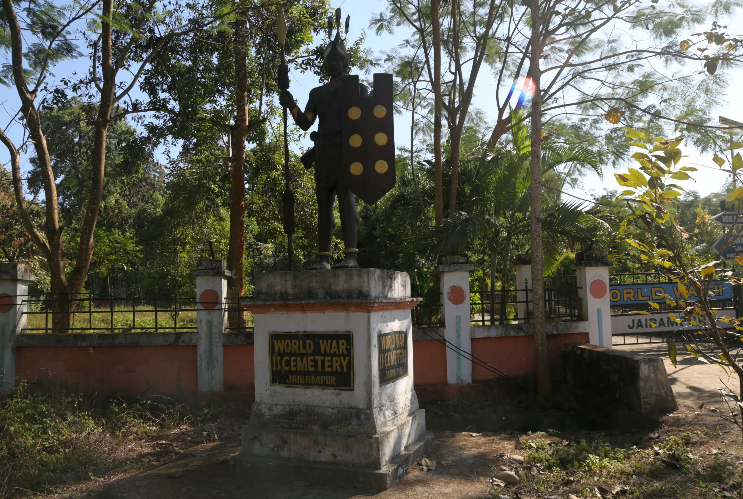
The Forgotten Jairampur Cemetery
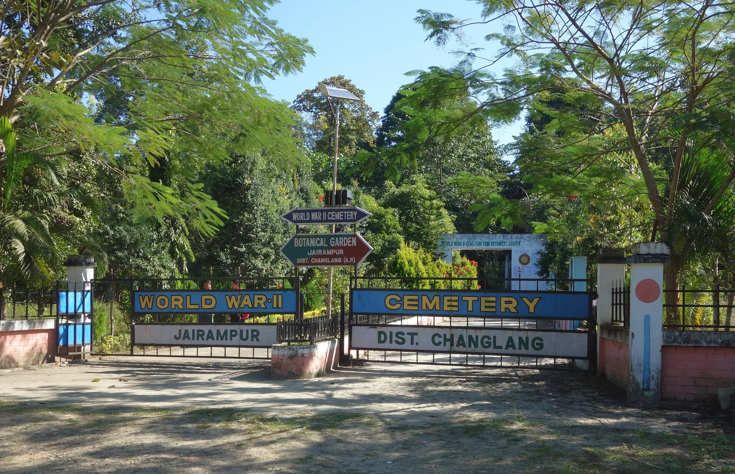
The Forgotten Jairampur Cemetery on the Stillwell Road near the border of Arunachal with Burma. The largest WWII Cemetery in India which was lost to the jungle but re-discovered in 1997.

The Forgotten Jairampur Cemetery
In the Changlang District of Arunachal Pradesh close to the border of Arunachal Pradesh with Myanmar on the spurs of the Patkai Mountains lay a Cemetery where were buried a number of Soldiers from the Second World War. This Cemetery lies around 30 kms before the Hell Pass or the Pangsau Pass as its called now and all the people buried here were soldiers engaged in the building of the marvel of engineering that came to be known as the Ledo Road or by its more famous name the Stillwell Road as it was named after an Amercian General. Making a Road across the Patkai would never be easy every Mile came at the cost of a Man.
The graves are said to belong to Taiwanese, Chinese, Amercan, Kachin and Indian soldiers who worked as labourers and workers on the Ledo Road which intended to connect Ledo in Assam with Kunming in China. Some of the graveyards are of Adi (Abor), Mishmi and Jaintia soldiers who fought for the Allied Forces and worked on the Road as well, but there is very little evidence left of their antecedents. Most of these people have said to expired out of disease, fatigue, malnutrition and a combination of all these factors.
This Project was undertaken at a time when the Japanese were in possession of most of Burma and were inching forward towards India and Southern China. This Road was supposed to provide supplies to the beleaguered Chinese fighting the Chinese. There were already Plane lifts from the North East India to China over what was then called the Hump, the impenetrable Hills and Jungles of the Patkai Range and it was through this Patkai Range that the Road was to be built. And as the Cemetery stands as a solemn reminder of the number of lives this endeavour would entail.
The Cemetery which contains over 1000 Graves is by far the largest Second World War Cemetery in India but surprisingly it was taken over by the Jungle and was only re-discovered in 1997. It had not only been taken over by the Jungle but extensive damage caused to the Graves by apparently wild Elephants but I assume by Grave robbers as well. During the time I visited I could see that except a few Graves all had been damaged. One of the epitaphs still readable in the Cemetery is that of a 30 year old Chinese Major who was a Company Commander and it reads as such
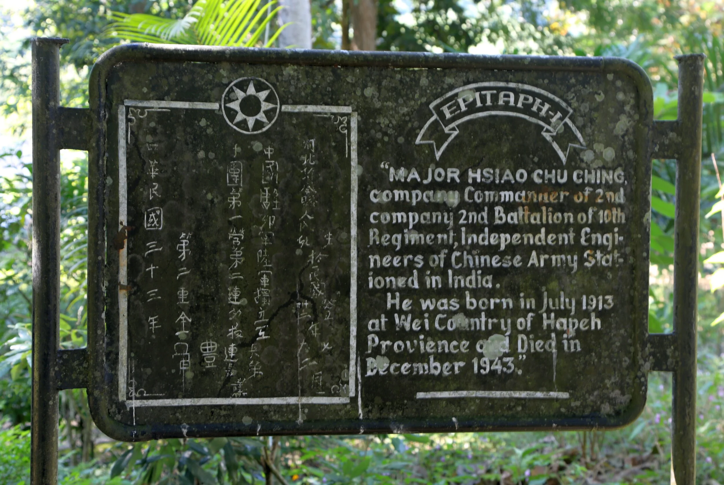
“Major Hsiao Chu Chung, Company Commander of the 2 nd Company, 2 nd Battalion of the 10th Regiment, Independent Engineers of Chinese Army stationed in India.
He was born in July 1913 at Wei Country of Hapeh Province and died in December 1943”
Almost all the Graves are now without an Epitaph and as I mentioned in a very bad state but the Botanical Garden built around the Cemetery does add grace to the place. And I noticed that a Tree was planted alongside each of the Graves, each Tree standing for someone who laid down their life in the War effort.
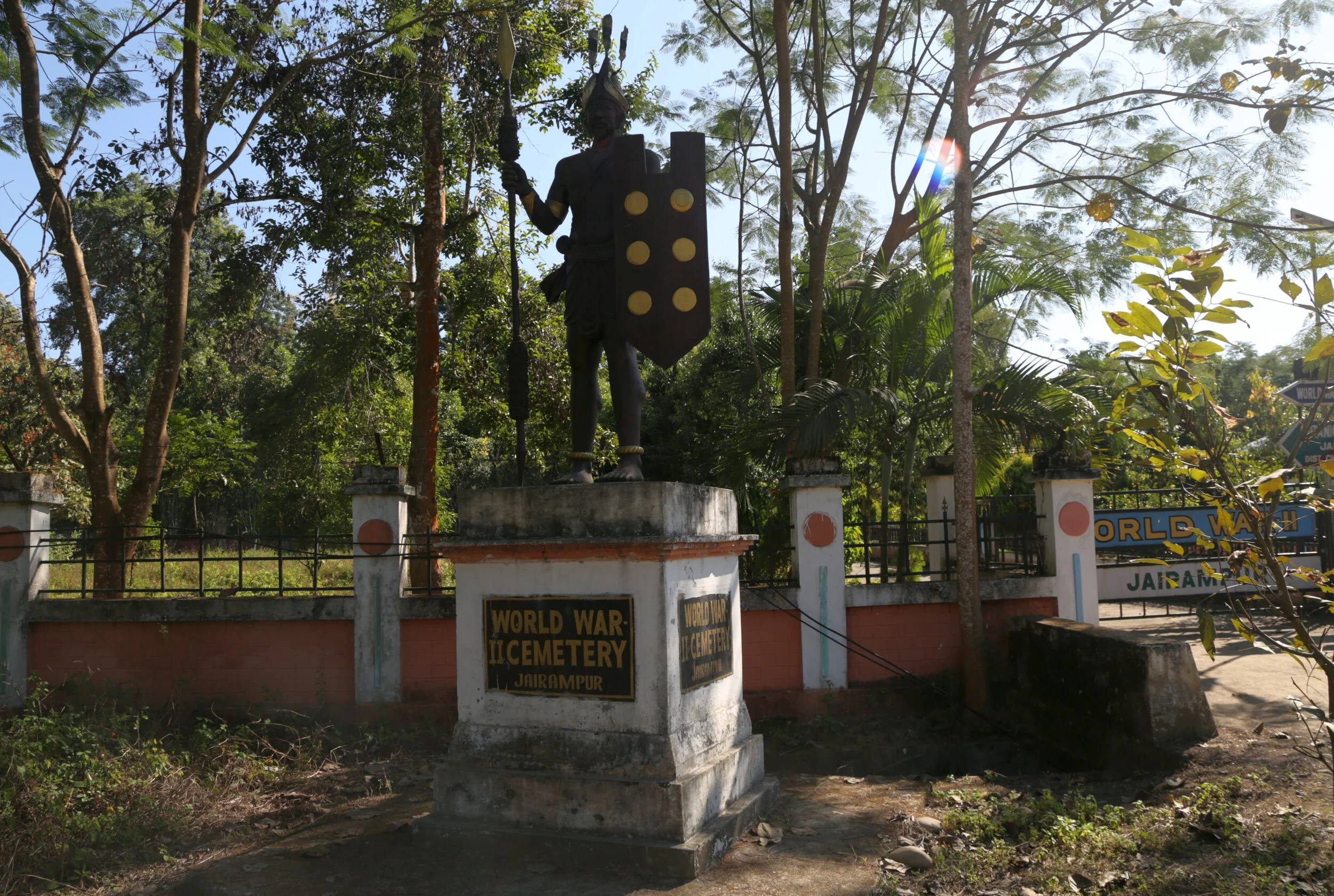
And Another board at the Cemetery, probably as a commemoration for all the unnamed Soldiers and Workers who now sleep in these decrepit Graves which reads as such
“World War Two Cemetery : These Graves bear silent testimony to those Soldiers, unlisted Workers and Labourers who ventured into the virgin Jungle amid blistering heat and laid down their lives in the line of duty during the Second World War, whilst a part of all the forces against the Imperial Japanese Army.
Their names liveth forever more”

Though the Government has now started some work on the Cemetery it is still a far cry from the very well preserved Cemeteries at Kohima and Imphal related to the same War. They are also building a Museum. But the cause of the most concern is the present status of the Graves. I can understand the neglect from the Indian side but i'm surprised that the Americans (the Road endeavour was led by the Amercians) haven't taken note and taken up the upkeep of the same. Maybe thats because no one is actually sure about the “Nationality” of these brave men.
I walked through the Cemetery and made a Video for you yourself to see the largest World War Two Cemetery in India. World War Two, the most brutal War in the History of Mankind.
The Nun Barashigri Glacial Region
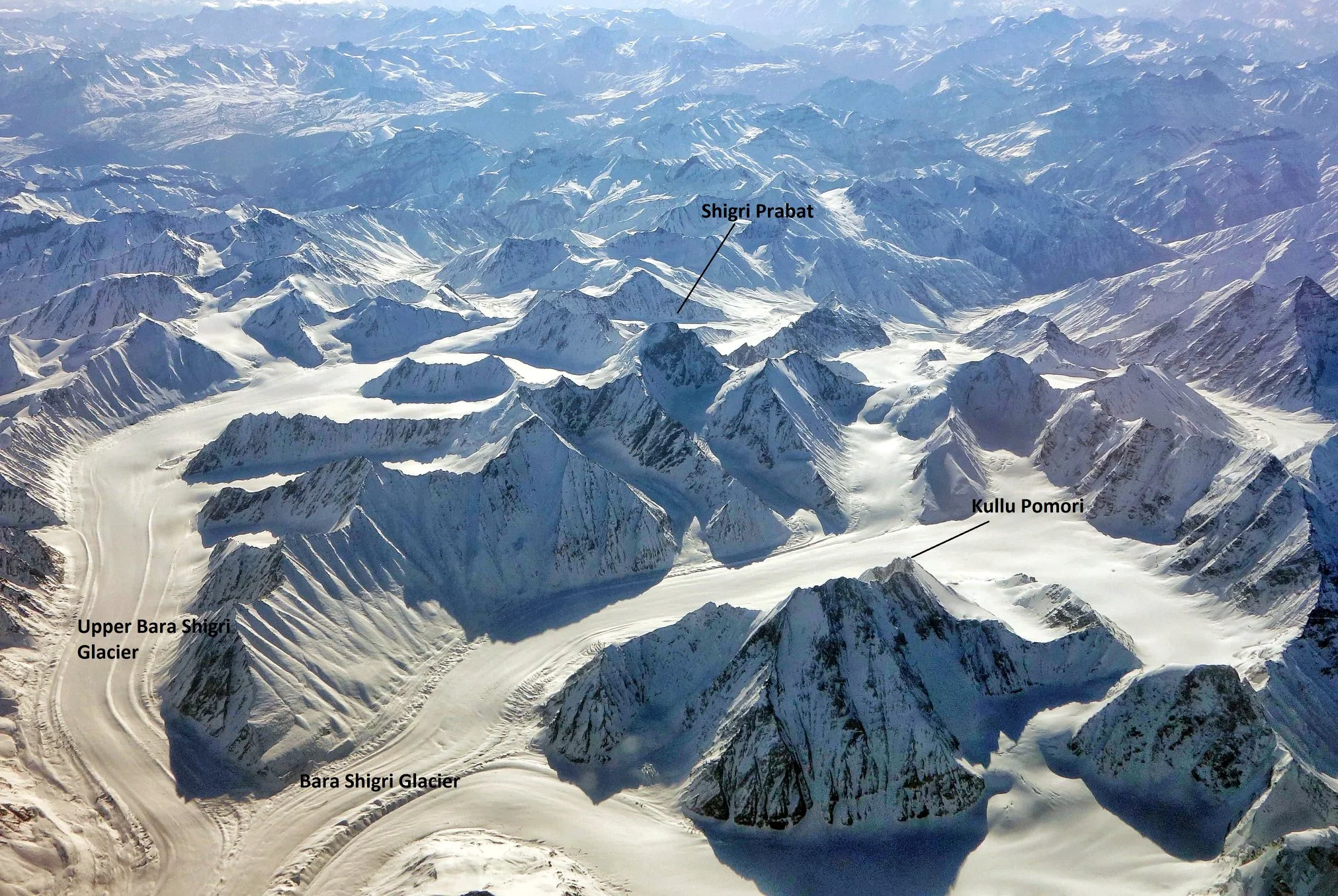
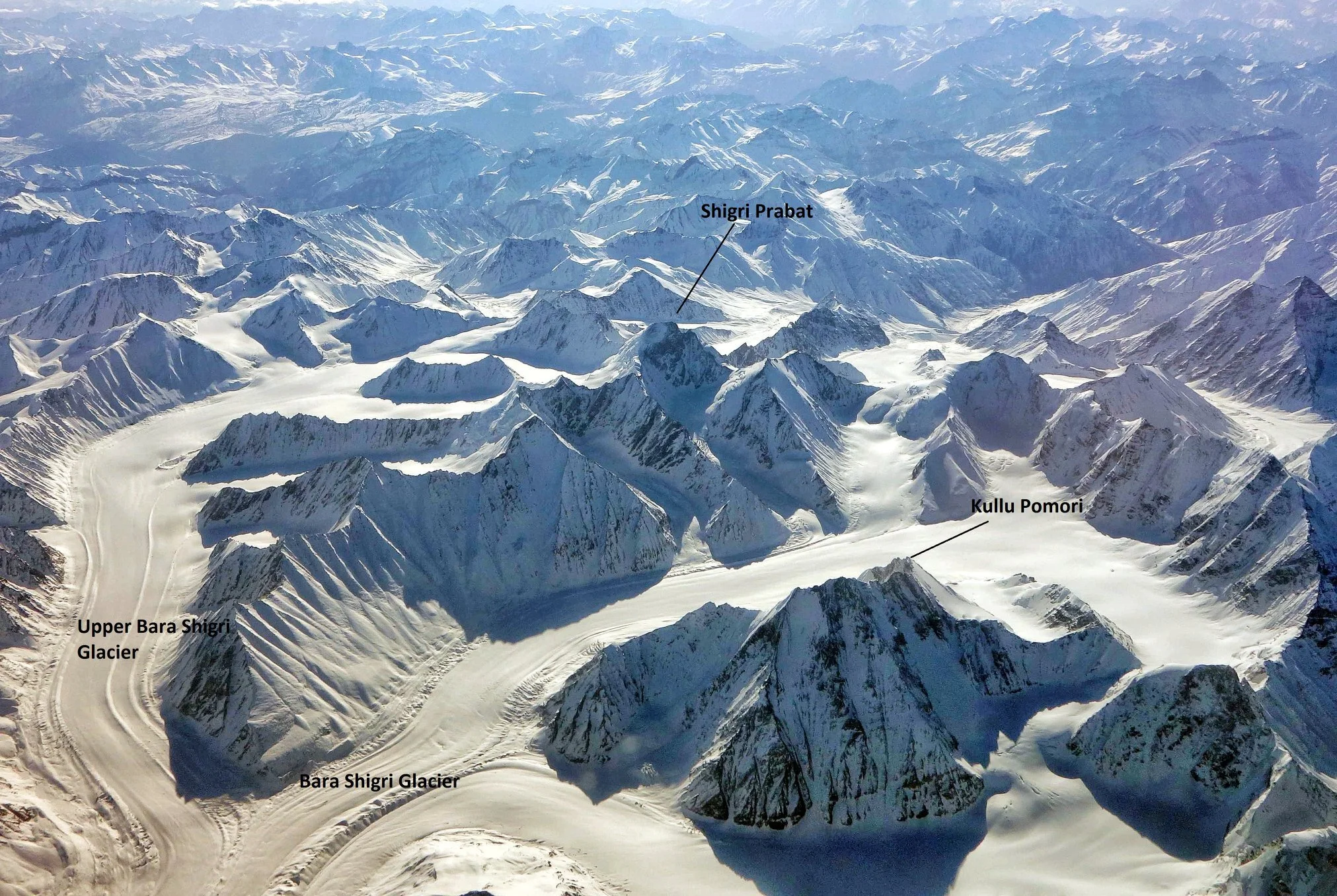
The Nun Barashigri Glacial Region is one of the largest Glacial Zones in the Himalayas and it lies in the Western part of the Himalayas. IT largely falls into the Chenab Basin but some flow from the Glacial Region goes to the Indus as well as the Ravi as well.

The Nun Barashigri Glacial Region
Glaciers and the current rate of degradation of Glaciers is a great Topic of Debate in the World. And of course here in the Himalayas we have a great concentration of Glaciers (do not confuse them with the Giant Glaciers of the Karakorams). We have Glaciers in the Western Himalayas as well as the Kumaon Himalayas with the Gangotri, Milam, Pindari etc being the well known ones. But unknown to most the largest concentration of Glaciers in the Indian Himalayas exists in a region known as the Nun Barashigri Glacier Zone. This is the inner sanctum of the Westen Himalayas with few people ever going anywhere near this Region.
As per the Glaciers of India by Vohra : “ Glaciers are found in all geographic areas of the Himalaya which lie above the elevation required to maintain ice. In some areas, they occur in large numbers and attain great lengths — measurable in tens of kilometers. Such mountain areas in India are the Nun-Barashigri, Gangotri-Chaukhamba, Kāmet group, Nanda Devi group, and Kānchenjunga. The principal glaciers of the Indian Himalaya, including their lengths, are: Gangotri, 30 km; Zemu (Sikkim Himalaya), 28 km; Mīlam (Nanda Devi area), 19 km; and Kedārnāth (Gangotri-Chaukhamba area), 14.5 km.”

This Inner Sanctum of the Nun Barashigri Glacial Region starts from the Region around the Nun Kun Peaks and continues South wards along the main spine of the Great Himalayan Range. The Nun Kun Peak lies between the Suru Valley in Ladakh and the Warwan Valley of Kishtwar. The Chenab is the main River into which most of the Rivers of this inner sanctum drain into though some Rivers drain into the Indus as well. Also it is very interesting to note that the Indus and the Chandra Bhaga / Chenab follow a parallel course on either side of the Great Himalayan Range. The Indus between the Zanskar and the Ladakh Range and the Chenab between the Pir Panjals and the Great Himalayas. Though Himalayan Region gets a lot of visitors few ever venture anywhere near this inner sanctum which is probably due to the fact that few people know of the existence of this vast Glacial belt. Over a 1000 Glaciers which feed mostly into the Chenab. The wild Nallahs which join the Chenab / Chandrabhaga are just a reminder of the wilderness that they originate at.
So why exactly is this area so unvisited ? Well for one the southern approach to this area is from the Kishtwar Region of Jammu and Kashmir. These are also known as the Kishtwar Himalayas and a favourite among foreifgn climbers who cant have enough of the Kishtwar Himalayas and their similarity to the perpendicularity of the Karakorams which is due to the fact that both have had great Glacial movements. Getting a glimpse of the Kishtwar Peaks still requires a few days of walking except when you see them from a flight. And Kishtwar sits in the shadow of Kashmir gets an amount of blow back though for many years the Region is comparatively trouble free. And of course the Roads are few and far between and not many people Trek in this Region. So thats another reason. And the most basic reason is that people just dont have a clue about this Region.
The Bara Shigri Glacier
As per the Glaciers of India by Vohra : “ The southern flank of the Nun-Barashigri range forms the northern portion of the Chenab River basin, north and east of Kishtwār; it is one of the most highly glacierized areas of the Indian Himalaya. Nearly 1,000 large and small glaciers drain into the Chenab River. The northern flank of the Nun-Barashigri range also supports many glaciers, which drain north into tributaries of the Indus River. Several glaciers are greater than 10 km in length; two exceed 20 km, and a third is a little less than 20 km. Several ice fields, drained by outlet glaciers, occur in the general area around Nunkun peak and also on the mountain itself. Ice fields are formed on mountain summits, or slightly lower down, and the highest summits protrude through the ice. This geomorphic characteristic is unique to this area, and perhaps indicates an earlier erosional surface. The glaciers are fed by both summer (monsoon) and winter (westerly) precipitation.
Presently, many cirques and small glacier valleys, especially in the eastern part of the range, are ice free, indicating a post-glacierization phase. Landsat 1 MSS images of the area (Path 158–Rows 37 and 38), acquired on 4 September 1972, show the transient snow line at its highest elevation of the year. Landsat 2 MSS images were acquired on 10 and 11 September 1976 (Path 158, and 159–Rows 36 and 37), following a fresh snowfall. This late monsoon snow covered the highest points of the main Himalaya Range, and was not restricted to a particular elevation as is sometimes thought to occur. Figure 3 shows a map of that area, prepared for the preliminary Inventory of Himalayan Glaciers (Kaul, 1999). Based on the preliminary inventory, it is estimated that there are 989 glaciers covering 2,280 km2 in the Chenab basin.”
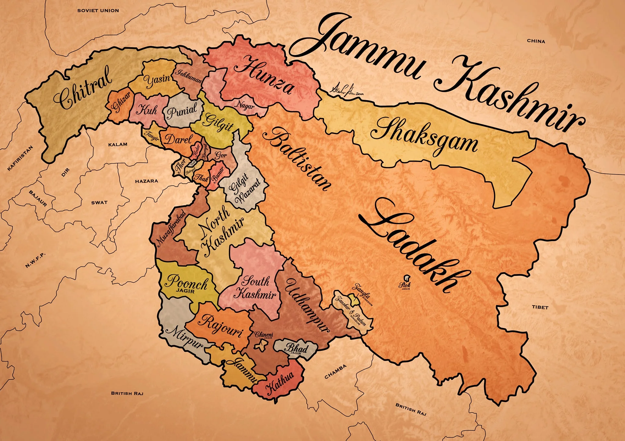
Historical Map of the Dogra Kingdom of Jammu and Kashmir
The State of Jammu and Kashmir as it was at its largest extent under the rule of the Dogras. This Map helps people understand the complicated Geography and Diversity of the erstwhile State of Jammu and Kashmir.

Historical Map of the Dogra Kingdom of Jammu and Kashmir
Another interesting Map of the previously E Jammu Kashmir by my talented friend Arsalan Khan who also belongs to the Riyasat. We had previously had an Article on the various Indigenous People of Jammu and Kashmir. Its not perfect, has its anomalies but it still an indicator of the diversity of the State from a Political angle. This Map shows the Dogra Kingdom at its most expansive. And i would like to point out that all these different areas were won over by the Dogras / Dogras under the Sikhs in War except Kashmir which was granted as a part of the Treaty between the British and Raja Gulab Singh on the payment of War Indemnity of 75 lakhs. It should be pertinent to mention that the Dogras also played a part in the Sikh conquest of Kashmir earlier from the Afghans. Also it suited the British in 1846, when the Sikh Kingdom still existed, to have a parallel power which they could use as counter against them and in this case it was Raja Gulab Singh and his hardy Hill Men. Here is an account of the transition of the Rulers in Kashmir From the Mughals to the Dogras giving a background of how Kashmir passed from the Mughals to the Afghans to the Sikhs and onto the Dogras.
Just an explanation on the parts :
Chitral : This is the most controversial inclusion as it always stirs up a Debate. Was Chitral at any point of time a part of the Dogra Kingdom ? Different historians had different versions on this but one thing was clear that the Chitral Kingdom did pay tribute to the Dogras. This has been verified by me personally with Members of the Chitral Royal Family. Of course later due to the Great Game Chitral was made a part of the Malakand Agency. Here is an account of the Chitral Expedition an important event in the History of Chitral
The Indigenous people of Jammu and Kashmir
Hunza / Gilgt and around : Besides Gilgit and Hunza there were other Hill States which used to be constantly at loggerheads with each other but used to occasionally unite against foreign aggression. These were Iskoman, Nagar, Yasin, Ghizer, Punial and Darel among the more notable ones. Gilgit was an important location and one of the most forward bases of the British in the Great Game which I have described in this article titled The Gilgit Game. In addition to these there were various other smaller “Shinaki Republics” which as the name suggests were Groups of Shina speaking people in communities in the area generally named as Chilas. The Imperial Gazzette of 1908 described them as such :
“A group of small republics in the valley of the Indus, lying west of Kashmir and south of Gilgit. The territory extends from the junction of the Astor river with the Indus to Seo on the right bank and Jalkot on the left bank of the latter river. Within this area the people are grouped in communities inhabiting one or more nullahs, each community forming a separate republic. Starting from the junction at Ramghat these are, in order : on the right bank, Gor, Kinergah, and Hodar ; and on the left bank, Bunar, Thak, Butogah, Giche, and Thor. They constitute the area known as the Chilas subdivision of the Gilgit Agency, while Chilas proper includes Kinergah, Butogah, and Giche. Lower down the river are Darel, Tangir, Khilli, and Seo on the right bank, and Harban, Sazln, and Jalkot on the left bank.
After the conquest of Chilas by Kashmir in 1851, the Maharaja imposed a tribute in gold-dust, and arranged for the administration of the country as part of the Gilgit district. A British Agency was re-established at Gilgit in 1889, which included, among other terri- tory, the Chilas subdivision described above except Thor. In 1892 a British mission to Gor was attacked by the Chilasis, which led to the occupation of their country and the appointment of a Political officer at Chilas. The right of the Kashmir Darbar to construct roads and station a limited number of troops in the territory was secured, but the autonomy of the Chilasis was guaranteed. Under the revised arrangements made in 1897 the republics pay small fixed sums to the Maharaja, and in 1899 Thor was incorporated in Chilas. Darel has rendered a tribute of gold-dust to Kashmir since 1866, when the Maharaja's troops raided the country. The tribute is now paid through the Punial governor. Tangir pays a small tribute to the governor of Yasin. The remaining communities have no political relations with either Kashmir or British India, except Jalkot, which from its position dominates Thor and the head of the Kagan valley in the North- West Frontier Province.”
Then on the other side we have Baltistan and Ladakh about who most people know a bit of the History and how these were conquered by General Zorawar Singh between 1834 and 1840. This is a brief account of the conquest of Ladakh and Baltistan by the Dogras. In Ladakh also once the Royal family was removed from Leh, the Ladakhi King was granted the Village of Stok and some surrounding area as a Jagir. Thats where the Stok Palace was built. Much the same way the Raja of Zanskar was granted the Jagirdari of Zangla. Or something to that effect. This is a general note on Zanskar to help in the understanding of this one of the most remote regions of the Himalayas. And ignore the Shaksgam part as its shown beyond its size. This article gives you an insight into the Shaksgam Valley. Another important part of the State which is missed out in this map is the region between the Karakorams and the Kun Lun Mountains called the Aksai Chin.
And then of course we have the Kashmir Valley itself. It was divided into North and South Kashmir for administrative purposes. To the West of Kashmir was Muzaffarabad which was the Pahari area along the Jhelum Valley starting from Uri. This is the part I belong to close to the town of Hatiann Bala. Muzzafarabad is also the Capital of the entity referred to as “Azad Jammu Kashmir”.
Then of course we have Poonch which was a Jagir granted to the family of Raja Suchet Singh, a brother of Raja Gulab Singh. It had a history of its own and struggled for a while to be independent of their Jamwal Cousins which only resulted in the Jagirdari being terminated for a bit. Here is an account of what transpired in the Kingdom of Poonch. There was also the very small Jagirdari of Chenani, which is a small Town on the Highway and I remember that there used to be a Palace of sorts over there. More than that I remember because the erstwhile Raja of Chenani was a friend of my Grandfather’s and i have seen him at my Grand Fathers’ place when I was very young.
And then there was Rajouri which is the stronghold of the Gujjars and most of them are based here during the Winters. Next to Rajouri was Mirpur which was really a part of Punjab and the people were called as Mirpuris. Due to the building of the Mangal Dam many Mirpuris went to the UK and thats the reason you have a strong Mirpuri community in the UK.
And then we had the Duggar heartland of Jammu and Kathua which bordered Chamba with which it shares a lot of Cultural similarities. The district of Udhampur at that time included the whole of Udhampur and Ramban as well as Doda and Kishtwar. The Jagirdari of Badh or Bhaderwah was granted to the Ruler of Bhaderwah who was installed by Gulab Singh after getting the Chambyalis to give up all their claims over Bhaderwah. It used to be an integral part of the Chamba Kingdom. This is an account of Bhaderwah. It connects with Chamba over the Padri Gali.
Of course this will get many people excited and there would be counter views but the views mentioned above are my own based on what I have read and experienced. Kindly feel free to disagree. But as a request just dont start a discussion 1947 onwards as it wont get us anywhere.
This Map is available in hi-res as well. Do let me know if you want.
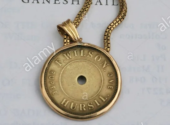
Pahadi Wilson : The English Raja of Harsil
Once upon a time there was an Englishman, called Pahadi Wilson who had crowned himself the Raja of Harsil so much so that he even issued his own currency, his own coin, for use in his own domain. Frederick E Wilson was his real name and his escapades could probably fill in a couple of Volumes. He was a Spy for the British Government and reportedly even had an affair with a Rani Sahib of Tehri it is said. And it is said that a curse was cast upon him and his coming generations by none other that Lord Shiva himself. Even the legendary Rudyard Kipling, who was a friend of his, described him as such, “lived a life that would have been the envy of kings”.

Pahadi Wilson : The English Raja of Harsil
Once upon a time there was an Englishman, called Pahadi Wilson who had crowned himself the Raja of Harsil so much so that he even issued his own currency, his own coin, for use in his own domain. Frederick E Wilson was his real name and his escapades could probably fill in a couple of Volumes. And his notoriety has lived up till the present day as a few years back, Sundar Lal Bahuguna, who started the Chipko Movement blamed Pahadi Wilson for the large scale damage caused to the Environment of Garhwal. He also supposedly was a Spy for the British Government and reportedly even had an affair with a Rani Sahib of Tehri it is said. And it is said that a curse was cast upon him and his coming generations by none other that Lord Shiva himself. Even the legendary Rudyard Kipling, who was a friend of his, described him as such, “lived a life that would have been the envy of kings”.
So who exactly was this Pahadi Wilson or Hyulsen Sahib as his neighbours called him and how exactly did he manage to land himself in the middle of all this action ?

Frederick E Wilson was a Soldier with the British Empire and was stationed in India. In around 1841 in circumstances that are still not very clear he deserted from the Army in Mussoorie. He was a young man of around 24 years age at that time. As per some sources he killed a fellow Soldier in a duel and that caused him to flee. He fled into the Mountains and entered the Kingdom of Tehri Garhwal where he asked the King to grant him some employment. But the King who was an ally of the British, would have nothing to do with him lest his British friends be unhappy to find out that the King was sheltering a fugitive from their Army. Left with no further recourse it is said that Pahadi Wilson went even deeper into the Mountains till he came to the Valley of the Bhagurathi at a place called Harsil and decided to set himself up over there far away from civilization in general and his fellow British in particular.
So there he settled and married a local lady as soon as the local Villagers accepted him into their Society. One would imagine that he acted like some important official and the local Villagers were scared of the Gora Babu and were generally very nice and accommodating with him. All except the Priests of the local Temples who probably thought of him as some kind of Missionary out to convert the people and hence render the powerful priests unemployed. But far from a Missionary Pahadi Wilson had Royal ambitions and wanted to make a lot of Money. Soon he got involved in the lucrative Timber trade in the Region. He also got involved in Trophy Hunting and he was a self taught Botanist and Ornithologist as well. He traded in all kinds of Exotci Wildlife products as well besides the Timber trade. He also introduced Rajma and Apples to the Region and put large tracts of land under cultivation of these Cash crops.

It is said and believed by many that he clandestinely spied on behalf of the British during the First War of Independence in 1857 and at many times supplied very vital information to the British. Through his informal network he not only kept an ear out in the plains but also in the Mountains and beyond and is also said to have played a part in the Great Game. Due to the invaluable service he rendered during the “Mutiny” he was pardoned for his offence of Deserting the Army and could now freely work with the British East India Company.
He convinced (some say coerced) the Raja of granting him the rights to fell Timber in the pristine Forests and it had just happened that the British were laying Railway Lines across the country and there was a great demand for Timber Sleepers of Sal for the Railway tracks. And this was where the Raja struck Gold and made a fortune beyond his wildest imagination. He set up sawmills along the Bhagirathi and vast amounts of Timber were floated down the River towards Haridwar.
Pahadi Wilson was truly a Raja now, and the first thing a Raja does is mint coin in his own name. And that's what Pahadi Wilson did and these are great Collector items today. He built a large Palace out of Deodar in Harsil. He married a couple of times and had numerous affairs. Everything seemed nice and dandy but his growing influence only made the Priests in Gangotri and Mukhba more sceptical of his real intentions.It is said that these than cast a curse on Pahadi Wilson and his coming generations. Of course the reason given for this was that Lord Someshwar had himself cursed him as he had almost completely hunted out all the Wildlife and destroyed all the Forests. As per the curse none of his progeny would live for long and one day his bloodline would disappear and everyone would forget about him.
Pahadi Wilson, in his wealthy prime decided to move out of Harsil to Mussoorie to live among his fellow British gentry as now he was a very well respected part of the Society. With all his wealth, he became one of the biggest landowners in the Mountains. He became friends with eminent people like A O Hume and Rudyard Kipling who’s Novel “The Man Who Would Be King” is said to have been inspired by Pahadi Wilson amongst others. And it was in Mussoorie that Pahadi Wilson passed away in 1883 but not before he witnessed the passing away of 2 of his 3 sons. His only surviving Son went into obscurity and his last known descendant was an Officer (probably a Grandson of his last surviving son) who served in the Indian Air Force but passed away in an Air Crash in 1953. Thus ended the line of Pahadi Wilson.
Maybe it was the curse of Lord Someshwar. The Gods, as it is said, neither forget nor forgive.
The Gilgit Game
Gilgit, strategically located is a vast valley around the point where the Gilgit and Hunza River meet beyond the Great Himalayan Range .. It was bound from the North on one side by the Karakoram Range and on the Western side by the Hindu Kush. Its location particularly later in history was one of immense importance once the Great Game started between Tsarist Russia and Imperial Britain.

Rakaposhi Peak as seen from the Gilgit Valley. Pic Courtesy Wikipedia
The Gilgit Game
Gilgit used to be a part of the Riyasat E Jammu Kashmir till it was occupied by Pakistan in 1947 and formed what was called the Northern Areas. A few years back it was made a “Province” along with Baltistan and re-named as Gilgit Batistan.
Gilgit lies in a Region which consisted Dardic populations and this was also called Dardistan. As per the Gazetteer of Jammu and Kashmir the district of Dardistan consisted of the following sub-divisions : Astore, Bunji, Chilas, Gilgit, Hunza, Nagar, Punial, Yasin and Chitral. On the whole the areas was called the Gilgit Wazarat and Gilgit was the main town.
Anyone familiar with the Geography of the Region would know the strategic location of Gilgit, which forms a vast valley around the point where the Gilgit and Hunza River meet beyond the Great Himalayan Range at an altitude of just 1500 m. It was bound from the North on one side by the Karakoram Range and on the Western side by the Hindu Kush. Its location particularly later in history was one of immense importance once the Great Game started between Tsarist Russia and Imperial Britain. Before the Great Game also its location with access to Central Asia, Afghanistan, Tibet and Kashmir and thereon to India made it an important center of Trade.

Somewhere in Hunza
The history of Gilgit is mostly obscure but at some point of time Buddhism held sway here and it was Ruled by the Patola Shahis. Gilgit was a great center of Buddhist learning and many pieces of Budhist religious iconry and Manuscripts like the Gilgit Manuscript have been found here. It was from Gilgit that many Buddhist Monks went further into Central Asia to spread the message of Buddha. However at some point of time Buddhism declined like in other places in North India and the Tra Dynasty came into power after a brief period of Tibetan and Chinese Rule in the region.
The names of the Ra Dynasty (The King was called Ra), who were Hindus (but some claim Hindu) is largely unknown except for the last one who was called Shri Badut. This Shri badut was apparently and cruel man and said to be a Cannibal as well. He was apparently killed by a Persian prince who married his Daughter and became the first Muslim ruler of Gilgit. The death of Shri Badut is still celebrated in Gilgit. The name of the Ruler hence was changed from Ra to Trakhan and its the Trakhan Dynasty which continued to Rule Gilgit for many centuries to come. And it continued to rule well into the starting of the 19th century.
As per the Kashmir Gazetteer of 1890 : “The history of Gilgit that is, its reliable history-does not go back further than the commencement of the present century, when it was conquered by the Yasinis under Suliman Shah, Khushwaktia. Azad Khan, of Payal or Punial, displaced the Yasinis, and Tahir Shah of the Nagar family overturned the Payali Raj. Tahir left Gilgit to his son Sikandar Khan, who was ousted by Gauhar Aman of Yasin about 1841. There upon Karim Khan, brother of Sikandar Khan, sought aid from the Governor of Kashmir,who, with the sanction of the Lahore darbar, sent a force of 1,000 men under Nathu Shah to assist him. In the meanwhile Sikandar Khan had been murdered; so Nathu Shah, feeling doubtful of success, sent for reinforcements. When these arrived, he assaulted the Fort and took it by storm. Gauhar Aman, ou hearing of this, fled precipitately to Mastuj. "
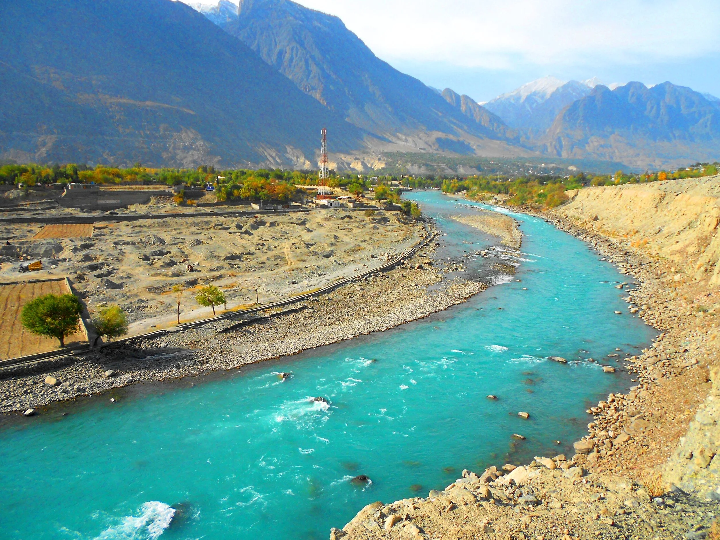
Gilgit River
From then on Gilgit became a part of the Sikh Kingdom and subsequently the Dogras. However it was not as easy as I am making it sound. There were multiple rebellions and it was during one such incident that Nathu Shah who was the Governor of Gilgit was killed. In 1856 again the Sikhs took Gilgit only to be relieved of it in the successive by Gauhar Khan. It was only after the 1857 and the First Mutiny that Maharaja Ranbir Singh sent a force to recover the country in 1860. In 1863 they rose again and another expedition was sent to Yasin. In 1866 Hunza was attacked by the Dogras along with their Nagar allies, but a trick was played on the Dogras and they were routed. A general alliance was formed against the Dogras by the Chitralis, Yasinis, Tangiris, Darelis and Hunzai and Punial was taken from them. However the Dogra garrison of 2500 at Gilgit held out and then reinforcements arrived and the Dogras re-claimed Gilgit and the surrounding country. Punitive missions were done and the status of Gilgit as an inevitable part of the Riyasat was finalised.
And by this time the Great Game had heated up and the Russians were right across the Hindu Kush and were almost at the Wakhan. This let the alarm bells ringing in the Empire Where the Sun Never Set. The British wanted to have greater influence on Gilgit and convinced the head strong Maharaja Ranbir Singh to let them station an Officer On Special duty to Gilgit in 1877. Gilgit was now the main listening Post in the Great Game and not far from there were the feared Cossacks of the Russian Army. After the death of the Maharaja the British appointed a Political Agent to Gilgit and effectively took over the administration of Gilgit. Gilgit Agency as it was called effectively became British and only in name was under the Maharaja’s rule. All the other neighbouring states were also slowly absorbed into the Gilgit Agency. Chitral was however made a part of Malakand Agency in NWFP. In 1935 the British leased out Gilgit from the Maharaja settling any doubts over Gilgit’s status.And so it stayed till Independence when the British on their return reverted Gilgit over to the Maharaja.

Gojal, Hunza - Nagar
It was now that the “Gilgit Rebellion” took place. The British left and the JK State took charge and Brig Ghansara Singh was appointed the Governor. The Gilgit Scouts, a regiment created by the British comprising of locals were incited by none other than their British officers to rebel and on 1st November after the Maharaja signed the Instrument of Accession they broke out in revolt. Both Brig. Ghansara Singh and his second in command Col.Majid were arrested by the Gilgit Scouts. And then the inevitable happened and the Non-Muslim population was put to the sword. The madness of the sub-continent spread to Gilgit as well. And of course the majority of the Population also wanted to be a part of the new nation on the West. The matter was thus settled for the time being. The same Gilgit Scouts moved further and sieged Skardu and captured kargil and even went as far as Zanskar.
The question remained as to why the British officers openly supported and even planned the whole operation. It was a Military Coup and no civilians took part. And even more strangely the British were eager that Gilgit be a part of Pakistan. The reason for the same was actually quite simple. The British as well as the Americans still wanted Gilgit as a base. The approach to Gilgit from Srinagar was mainly through the Burzil Pass which connected Guraiz with Gilgit. And then there was the Rajdhan Pass. Both these Passes were blocked for snow in the Winters and the Burzil would stay shut for atleast 6 months in a year. On the other hand the approach to Gilgit from NWFP was much easier and through an all Weather Road. Secondly the “Allies” were aware that they would be in a better position to influence Pakistan rather than India due to obvious reasons. And hence the whole operation planned and implemented. It was one of the smaller Games of the Great Game and is called by some as the Gilgit Game. There are many detailed writings on this so get a copy if you want more details.
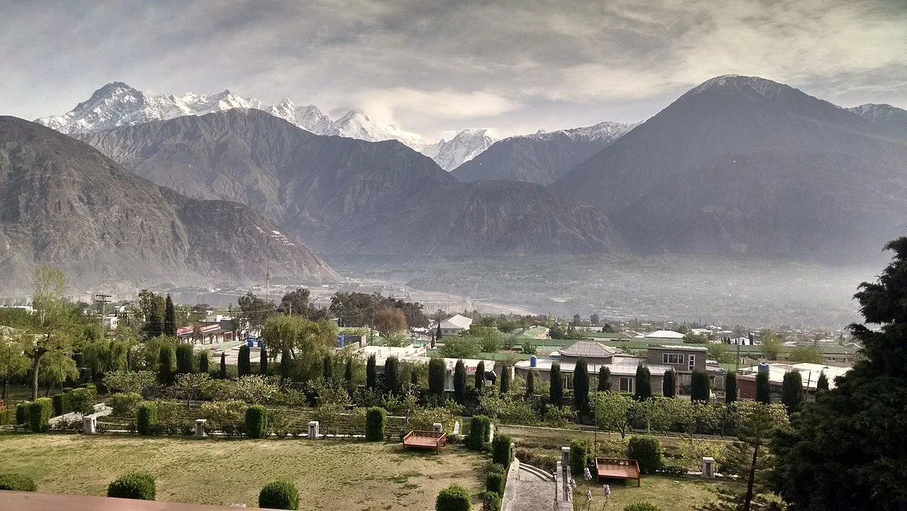
A view of the Gilgit Town and Valley. Image Courtesy Wikipedia
A pic of the Gilgit Town and the vast Valley surrounding it which made it perfect for an Airbase among other things. The Soviet union was just minutes away by flight. Pic courtesy Fehd Raza. Summer months.
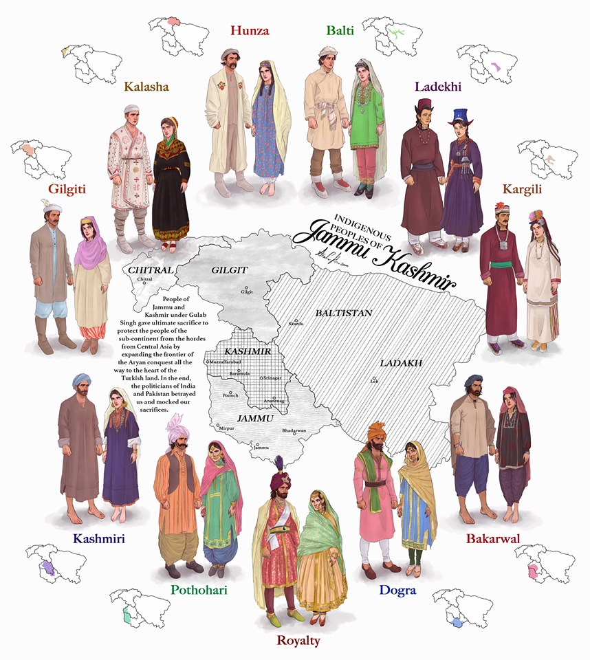
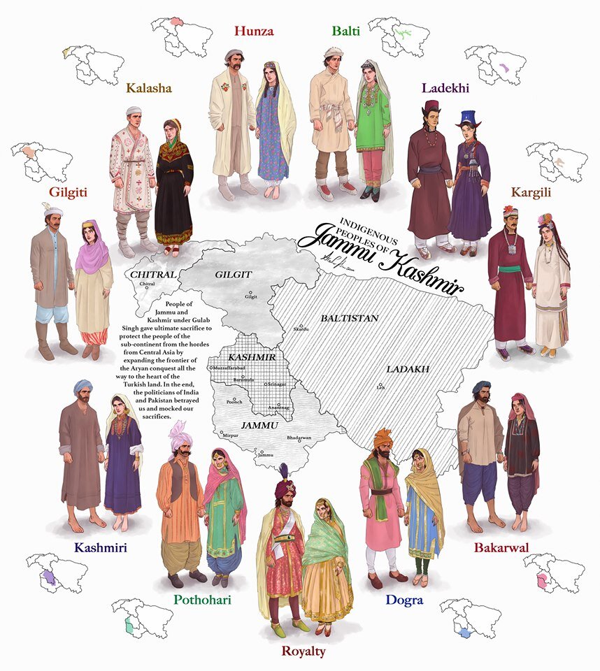
The Indigenous People of Jammu and Kashmir
The erstwhile State of Jammu and Kashmir was one of the most diverse State in the country in Ethnic, Religious and Lingual dimensions. The main "People" of Jammu and Kashmir and its different regions are briefly described in this Article.

The Indigenous People of Erstwhile State of Jammu and Kashmir.
This is a graphical representation of the people of Jammu and Kashmir made by Arsalan Khan and Rajja Sourav Singh Sarmal. A brief description of each by me to help in better understanding (Clockwise from top) :

Hunza (Burusho) Ladies. Pic credit Wikipedia
The Hunza : The Hunza or the Burusho people inhabit the Hunza Valley and neighboring Valleys in the extreme North of the state. They speak the Burushaski language which as a language has not been identified with any language Group. The Hunzai now mostly follow different schools of Islam.
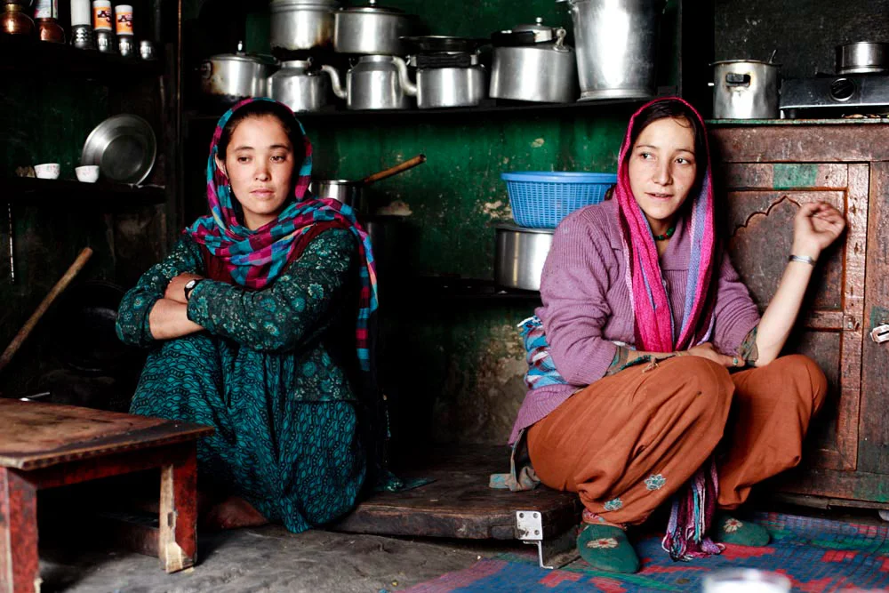
Balti Ladies. Pic Courtesy : https://www.behance.net/gallery/12289037/The-Balti-People-of-India
The Baltis : The Baltis are the inhabitants of the Baltistan and are of Tibetan origin with Dardic admix. Their language is Balti, which is a part of the Tibetan language Group. Infact it has the greatest similarity to old Tibetan. The Baltis follow Islam.

A :Ladakhi Lady in traditional Dress. Pic Courtesy Jimmy Nelson
The Ladakhis : The Ladakhis are the inhabitants of the Ladakh region and are of Tibetan descent. The Ladakhi language is from the Tibetan family. Ladakhis are Buddhists as well as Muslim.

Ladies in Kargil. Pic Courtesy Roots Ladakh
The Kargilis : The Kargilis or the Purigpas as they are called inhabit the Western part of Ladakh at the crossroads with Baltistan and Kashmir. Their language Purigi is a dialect of Balti and as such they are also a part of the Tibetan family. Purigis are mostly Muslim.

Bakarwal Men
The Bakarwals : The Bakarwals and their close cousins the Gujjars are traditionally nomadic pastoral people who inhabited the foothills of the Himalayas and moved to the Mountains in the Summers with their livestock. They (Gujjars/ Bakarwals) form the majority in the Poonch Rajouri region and spread among the Jammu Division and in Kashmir as well. They follow Islam.

Maharaja Ranbir Singh, the Dogra Ruler of Jammu and Kashmir state during who’s Rule the Dogra Kingdom reached it largest extent and also included Chitral
The Dogras : The traditional dwellers of the Jammu region or the “Duggar” as the region was known. They live in the foothills of Jammu and are spread into Himachal Pradesh as well. The Dogras speak the Dogri language which is from the Western Pahari Group of languages. The Dogras are mostly Hindu though a significant number converted to Islam and were referred to as Chibalis.
The Potohari : The Potohari/ Pahari are the most Punjabic people of Jammu and Kashmir and live across the Potohar Plateau which stretches well beyond Rawalpindi. They are in sizeable numbers in Poonch. Their language Pahari-Pothwari belongs to the Lhanda Family of Punjabi. They are majorly Muslim but there is a strong Hindu minority as well.
The Kashmiri : The people of the Kashmir area found mostly in the Kashmir Valley. They are the biggest Indegenous Group of people in the state. They speak Kashmiri language which belongs to the Dardic family of languages. Kashmiris are mostly Muslim though a small minority of Kashmiri Hindus also exists.

Dard - Shina People in Kargil
The Gilgiti : The Gilgiti or the Dards are the inhabitants of the vast Gilgit Valley in the North West of the state. They speak the Shina language. They (Dards) are also found in other areas of the state like Gurez and Drass where they have said to have migrated from Gilgit. They follow Islam though a few follow Buddhism as well in Ladakh.
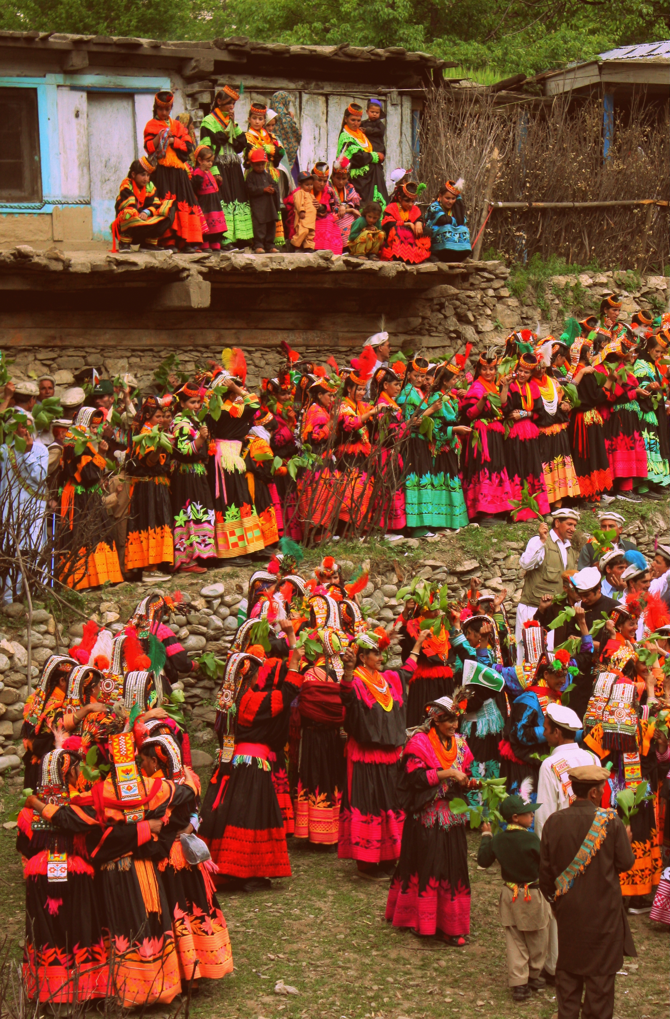
Kalash People during the Chillam Joshi Festiva. Pic Courtesy Wikipedia
The Kalash : The Kalash inhabit three Valleys in the Chitral Region now in KPK though at one time the Chitral Kingdom paid tribute to the Kingdom of Jammu and Kashmir. The Kalsha speak the Kalasha language which is a part of the Dardic family of languages. They have a distinct culture which has been under threat. Most Kalasha have converted to islam though a small number (3000 app) still follow traditional Animist beliefs.
Hi Res of Graphic can be downloaded from the link in the first comment.
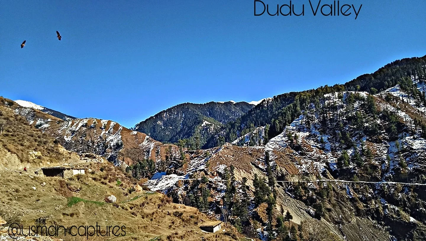
The Dudu Timber Saga
A tale from a time gone by when Forests were seen as great Resources of Timber and vast tract of these Himalayan Forests were given out on contract for Timber extraction. My Family was also involved in this Timber trade and were known as others in this business at Forest Leasees. This particular story is from the remote and unknown Dudu Latti Valley in Udhampur District in the Jammu Division of the Union Territory of J&K.
The Dudu Timber Saga
In today’s day and age the cutting of Forests is an abhorretion frowned upon by one and all. It was not always the same as once upon a time Timber was a great resource with multiple uses. Especially Himalayan Timber.
My family was involved in Timber business or “Jangalaat” as it was called back in the good old days when Timber and Forests were a resource to be exploited for Commercial gain. Cutting forests and selling them in the Market was an established big business in the Himalayan states especially in Jammu and Kashmir where Timber was one of the main resources of State Revenue.
Amongst the other hats he wore, my Grandfather was a Forest Leasee. A Forest Leasee was a person who took on contract a certain part of Mountain from the Government a part of Mountain. Under the terms of the Contract the Forest Leasee bid a certain amount for an area in Government floated Tenders. And once you got the Contract the whole Mountain was your and so were all the Trees. So once you landed up a Contract you sent your Men to the Jungle to cut down as many Trees as possible in the Contractual period.
It was a profitable Business I must say but not always as you would read as we go on. From the forests of Thandipora North of Kupwara, around Boniyar in Uri and even Pogal Paristan and Dudu Valley in Jammu. I grew up listening stories from my Father about those Forest Leasee days about how he would go to one of these remote Forestry Camps and spend the night there in Tents amidst the Bears and the Leopards. Of all the stories of those days my favourite one is about an incident which occured in a far away place in Jammu and Kashmir called the Dudu Valley in the Jammu Division somewhere in the wilderness between Udhampur and Kishtwar. Dudu Valley is now a part of the Latti Tehsil in Udhampur District.
Dudu Valley is today a secluded unknown beautiful part of Jammu so you can well imagine what it would have been back in those days over a 50 years back. But what Dudu had in those days were thick Forests which it still retains in parts till today as Iam made to believe. My Grandfather landed a Forest Contract in the Dudu Valley which was quite an isolated part of the state at that time. Also it was quite far from our base in Srinagar in Kashmir, in the back and beyond of Jammu Division. But my Grandfather thought he got a good deal and went ahead and took up the Contract along with a Partner who was based in Jammu and Pathankot.
Dudu Valley is drained by the Tawi River as it emerges out of its source near the Kailash Kund Lake from the Kailash Kund Glacier in the heights of the Pir Panjals. As it happened none of the younger men in the family were ready to go to this place in the back and beyond of nowhere. So it was upto my Grandfather to make the Journey all the way from Srinagar to Dudu Valley partly by Vehicle, partly by Horse and partly by foot. My Grandfather was a tough and sturdy Pahadi guy who was always up for the challenge. And he took it up.
So religiously he used to come to the place every other week to check on how stuff was going on at the isolated Camp.And of course things used to be fine when he was there but due to other business matters he could but spend just a few days in the wilderness of Dudu and had to return to Srinagar after a few days.
Now in those times half the challenge lay in getting the Contract for a lucrative Jungle and the other challenge was getting the cut Timber down to the Depots in Srinagar and Jammu from where it was sold in the Market. The way the Timber was transported in those days was kinda elementary. You just lobbed the cut Timber into the Mountain River and it would do the hard work and transport the Timber down River to more plainer areas where they were corralled and fished out of the River and sent to the Depot. This might sound very funny but this practice is still in use in parts of the World and even I have seen it being used in Kashmir long after we got out of the Forest Leasee business.
So one fine day when the Dudu harvest was done the logs were as usual tossed into the River. It was a good harvest and a large amount of high quality Dudu Forest Timber was now afloat the Tawi on its way downstream. And there were always teams of our guys downstream at the collection point to collect the Timber and get it out. But as it turned out that someone messed up and my Grandfather who was supposed to be on top of the operation was busy elsewhere, with full confidence in his Partner who was incharge of team for collection. The Timber arrived at the collection point but it seems no-one was there to corral it and the look out posted there had passed out after a bout of drinking. As a result all Timber just floated down. All the high quality Dudu Timber just floated downriver still and soon crossed over to Pakistan. It was a great loss.
Of course Daddy, as I used to call my Grandfather, let loose his wrath on all the incompetent people responsible for this debacle and decided that he would give up the Forest Business. And from the vast experience he had amassed working in areas in JK which even today most people have not heard of he decided to move to Government Contracts for construction in these areas. Besides the experience he had also at his behest a large Group of the hardiest men of these Mountains, the Gujjars in his employment as we shared Lingual similarity with them and our language dialects were quite similar. This of course helped him getting many Government and Military Contracts. The crowning glory of his career being bagging the prestigious Contract to build the High Altitude Warfare School at Gulmarg.
Sometimes I wonder what it would have been to have lived in those times. That Era. When Exploring Mountains could be made into a profitable business. Anyways.
Try visiting the Dudu Valley. Its still as pristine, almost, as it was during my Grandfather’s time. :)
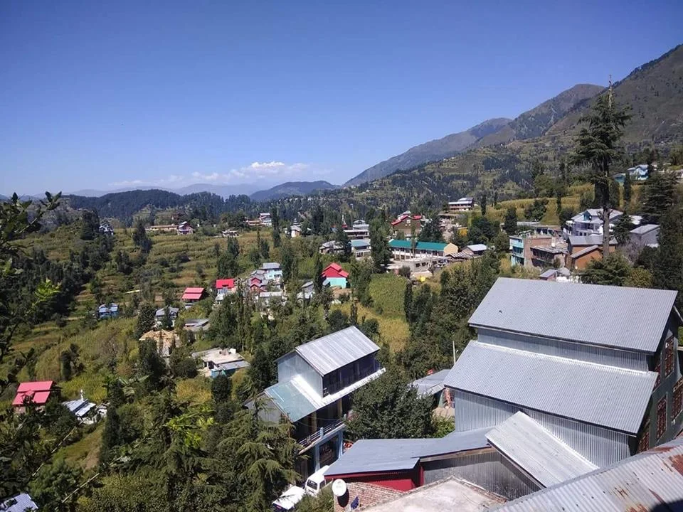
A pic of the Dudu Valley. Summer’s, this year. Pic credit the FB Page of Latti Dudu https://www.facebook.com/LATTItehsil/
The Dhankar Buddha of Spiti
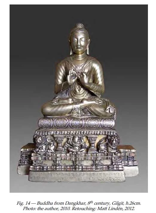
The Dhankar Gompa in Spiti as among st its posessions a metal Statue of the Buddha which was off limits to outsiders. A few people had ever seen and it was first photographed for open sources only in 2010. This is the story of the Buddha which came all the way from Gilgit

The Dhankar Buddha
Spiti or Piti as it was also called is probably as remote as any Trans Himalayan region and has for years lived in a time capsule but of course now things are changing. But like all the Lands Himalayan it holds its mysteries and secrets close to its chest. Just like neighbouring Lahaul and its ‘cultural / spiritual” big brother it was for most part of traceable history a part of the Guge Kingdom and subsequently the Central Tibetan Kingdom. Later on it became a part of Ladakh as the Kingdom grew powerful. It also became a bone of contention between Raja of Bushahr and the Ladakh Kingdom as the Bushahr Kingdom claimed Spiti as its own. Of course this led to the Raja of Bushahr to support the Central Tibetans and their Mongol allies when they decided to invade Ladakh over a religious dispute between the Dalai Lama and the King of Bhutan but that's a separate story.
Spiti because of its remoteness and isolation has preserved its culture and traditions, unlike many other such places. In the traditions of Tibetan Buddhism the Monastery is the center of life and the Monasteries are the keepers of ancient Manuscripts and Religious Iconry and these treasures have been very strictly guarded by generations of Monks who have lived in these Monasteries going back to thousands of years. The Monasteries of Spiti have survived plunder and ravage mostly through History except for a brief period when General Zorawar Singh took over Ladakh and Spiti was a part of Ladakh so he received Spiti as well.

The Dhankar Village and Gompa. Pic Courtesy : wikipedia Commons
Though Zorawar never came to Ladakh he appointed a certain zealous Officer in charge of Spiti. Now this Officer wasn't very fond of the local culture and tradition and went onto plunder many of the Monasteries and he was much despised for it. It should be pertinent to mention that the same Officer was a part of Zorawar’s Army which lost to the Tibetan / Chinese Army in the engagement in which the General was killed. But the said Officer was captured alive by the Tibetans and identified as the person responsible for the desecration of the Monasteries in Spiti and elsewhere. Suffice to say that he met a slow painful death as he was put in a cauldron of oil which was slowly heated.
Ok coming to the Topic of the Dhankar Monastery. It was one of the most important Monasteries in Spiti standing as it was above the confluence of the Spiti and the Pin Rivers. Dhankar had always been the traditional Capital of Spiti and the seat of the early “Local Rulers” of area called the Nonos. And of course the Dhankar Monastery had its own collection of Ancient Relics and Treasures though its is said that it was also plundered and ravaged during the Dogra Rule. And there was a certain Buddha statue highly revered and venerated but as closely guarded as well. It was called the Dhankar Buddha.
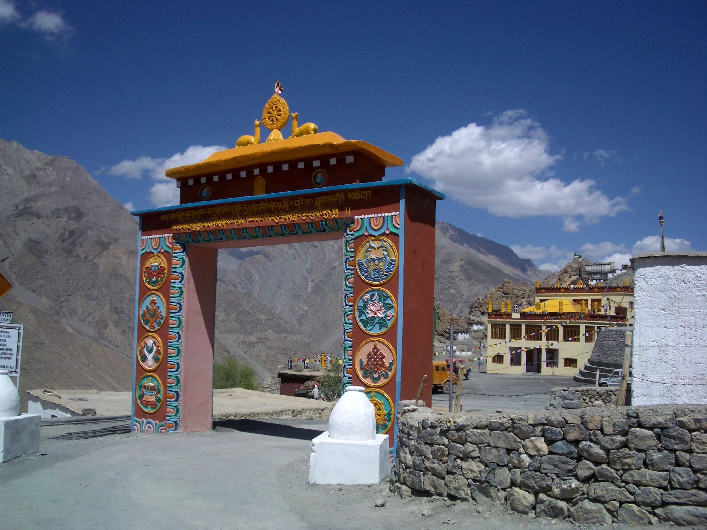
The Main Gate of the Dhankar Gompa. Pic Courtesy Wikipedia Commons.
Henry Lee Shutterworth was an Officer of the Raj who was posted in Kulu which was a British dominion. He also spent time in the most remote part of his jurisdiction in Lahaul and Spiti. With time he developed an interest in the local culture and tradition and began to record local Buddhist history and records. And this involved visiting various Monasteries in the area and trying to convince the Monks to show him some of the Treasures that the Monasteries so secretly guarded. And he had heard about the Dhankar Buddha and in time he was able to convince the Monks to show him the Dhankar Buddha. And he was totally taken aback when he saw the fine piece of Art and the quality of the Brass work. He wasnt allowed to take a Photo but was allowed to take a rub of the inscription at the bottom. Taking a Rub is akin to something we used to do as kids. Cover a coin with paper and then run a pencil over it so that the inscription on the coin is copied over the paper.
What he had stumbled upon was described by a Scholar of the subject as such “The Buddha from Dangkhar is in many ways one of the finest discoveries made in the field of Buddhist art and epigraphy for the cultural areas of Western Tibet and Greater Kashmir. We now know that the two inscriptions engraved on the lower part of the pedestal attest to the incredible journey of this image; produced in Gilgit in northern Pakistan in the eighth century, the statue was bestowed upon the royal monk from Guge, Lha lama Zhiwa Ö (lha bla ma zhi ba ’od) (1016–1111), about three hundred and fifty years later. Things were quite different then when Shuttleworth worked on the manuscript of his History of Spiti in the early 1930s. If the name of the Tibetan translator of royal descent had been easily identified, the main dedicatory inscription resisted easy decipherment.”

Another view of the Dhankar Gompa
That itself establishes the fact that Buddhism came to Tibet via what is now the Gilgit but via Central Asia. The fact that this sculpture made probably during the Rule of the Patola Shahis in Gilgit is an indicator enough. And from there it traveled all the way to the Kingdom of Guge in Western Tibet. And it was after 300 years of getting there that it was gifted to the Monastery in Spiti. And there it stayed, a mystery which was only solved by Shutterworth’s rubbing but Scholars yearned to have a look at it. The first time the Dhakar Buddha was photographed was in 1993 by a Government agency documenting India’s Arts under a Government legislation. It took a law for the Monks to reveal this Treasure and allow its Photography.
“In 2006, art historian Robert Linrothe took a glimpse at the metal sculpture but was not authorized to reproduce it. It is only in 2010 that the present author was entrusted by the monks from Dangkhar with the study of their sacred image, a request completed two years later.” These are the words of Yannick Laurent, a scholar at Oxford who was finally able to Photograph this much revered treasure. And for now the whole world can see it. It has a striking similarity to other Buddhas made during the Patola Shahi rule in Gilgit. That truly was a Golden Age of Buddhism in Gilgit and even the Gilgit Manuscripts, the most ancient and sacred of all Buddhist manuscripts are a testament to that.
So try your luck at the Dhankar Monastery next time. Maybe the Dhankar Buddha would give you an audience.
The Chamba Lahaul and the British Lahaul Story
Lahaul and Spiti have had a checkered fascinating history and lying on the Himalayan borderlines they have always been the bone of contention for various powers in the Region from the states of Kashmir, Chamba, Kullu, Bushahr, Ladakh, Guge, Tibet, the Chinese and even the Mongols, Baltis and Yarkandis. However little is known of the exact circumstances and the chain of events of History that followed as there are no written records. All the above powerful states / people left some mark or influence on these two adjoining Regions. This is an attempt to piece together their History though for most of the time the History followed its separate course in Lahaul and its own course in Spiti.
The Chamba Lahaul and the British Lahaul Story
The Himalayan / Trans Himalayan Region of Lahaul Spiti today stands as a district in the state of Himachal Pradesh. Both these Regions which were once and still are mostly Himalayan backwaters are now seeing rapid changes coming. The opening of the Rohtang Tunnel for public will open Lahaul at least to outside world like never before. And from a Tourist point of view it will grow more than a one night stop over on the way to Ladakh. Spiti will also be affected though it manages all year round connectivity from the other side. And Spiti has recently seen the influx of Tourists especially the younger generation like never before. Its like Spiti is like the new Ladakh and we see stuff on Spiti all the time.

Wife of Thakur Amar Chand of Lahaul as taken by Ralph Stewart 1913
Lahaul and Spiti have had a checkered fascinating history and lying on the Himalayan borderlines they have always been the bone of contention for various powers in the Region from the states of Kashmir, Chamba, Kullu, Bushahr, Ladakh, Guge, Tibet, the Chinese and even the Mongols, Baltis and Yarkandis. However little is known of the exact circumstances and the chain of events of History that followed as there are no written records. All the above powerful states / people left some mark or influence on these two adjoining Regions. This is an attempt to piece together their History though for most of the time the History followed its separate course in Lahaul and its own course in Spiti. Thats only fair as physically there is a contrast between the verticality of the Cis-Himalayan Lahaul Valley and the seeming Horizontality of the Trans-Himalayan Spiti Valley.

Lahual from somewhere near Keylong
The culture of Lahaul is also a curious mix of many influences mostly Hindu and Buddhist but also of the aboriginal Religion which was referred to as Loong Pai Chos which shared some similarity with the old Tibetan Bon traditions. This has resulted in a syncretic Religion in most of Lahaul and the Lahaulis like to mostly refer to themselves as Hindu-Bodh, which to me is a perfect example of peaceful co-existence of two major Religions. Spiti on the other hand has always been under great influence of Tibet and Ladakh and hence it has developed a strong tradition of Tibetan Buddhism as practiced in Tibet and Ladakh. And of course there are many Cultural similarities with the same Regions as well.

Somewhere in Lahaul by Ralph Stewart 1913
The origin of the name “Lahaul” is kinda not clear. The Ladakhis / Tibetans referred to Lahaul as Garzha or Garsa or vDvarska though some say the present name is derived from the Tibetan word Loh-Yul or the Land of the South. From the earliest records it is said that Lahaul was a part of the Kingdom of Chamba under Ajy Verman who became a Vassal of Kashmir sometime around the 8th Century. Thus Lahaul became a part of the Kashmir Kingdom and the influence of the most powerful King of Kashmir, Lalitaditya can be seen in Maylang and even in some early Temples in Kullu. But with time Kashmir lost its influence and it was Chamba Kingdom which prevailed over Lahaul it seems.

A Village near Darcha towards Zanskar.
Later it seems Lahaul became a part of the vast Kingdom of Guge in Western Tibet which included besides Lahaul, Spiti, Zanskar, Ladakh and even parts of Kashtwar and Paldar (as Kishtwar and Paddar were referred to by the Tibetans). At that time it is said that Lahaul was much bigger and included parts of Pangi and Paddar as they exist today. Since these Valleys are contiguous along the Chandrabhaga/ Chenab it is quite possible that the Guge influence was there as well. But after the fall of the Guge Kingdom, Lahaul was eyed upon by the neighbouring Kingdoms and it became somewhat of a bone of contention between the Chamba, the Kullu and the Bushahr Kingdoms. And it was during the Guge rule that Buddhism spread rapidly all over Lahaul and became the dominant Religious order. It was in the 16th Century that Raja Bahadur Singh of Kullu made certain incursions into Lahaul and loosened the grip of the Guge rule in the areas of Lahaul adjoining Kullu. The Kullu Rajas appointed local Chieftains who were mostly Buddhists. Their allegiance also varied between Kullu, Guge and even Ladakh depending on where the wind blew. This helped keep things mostly peaceful in Lahaul during these periods.
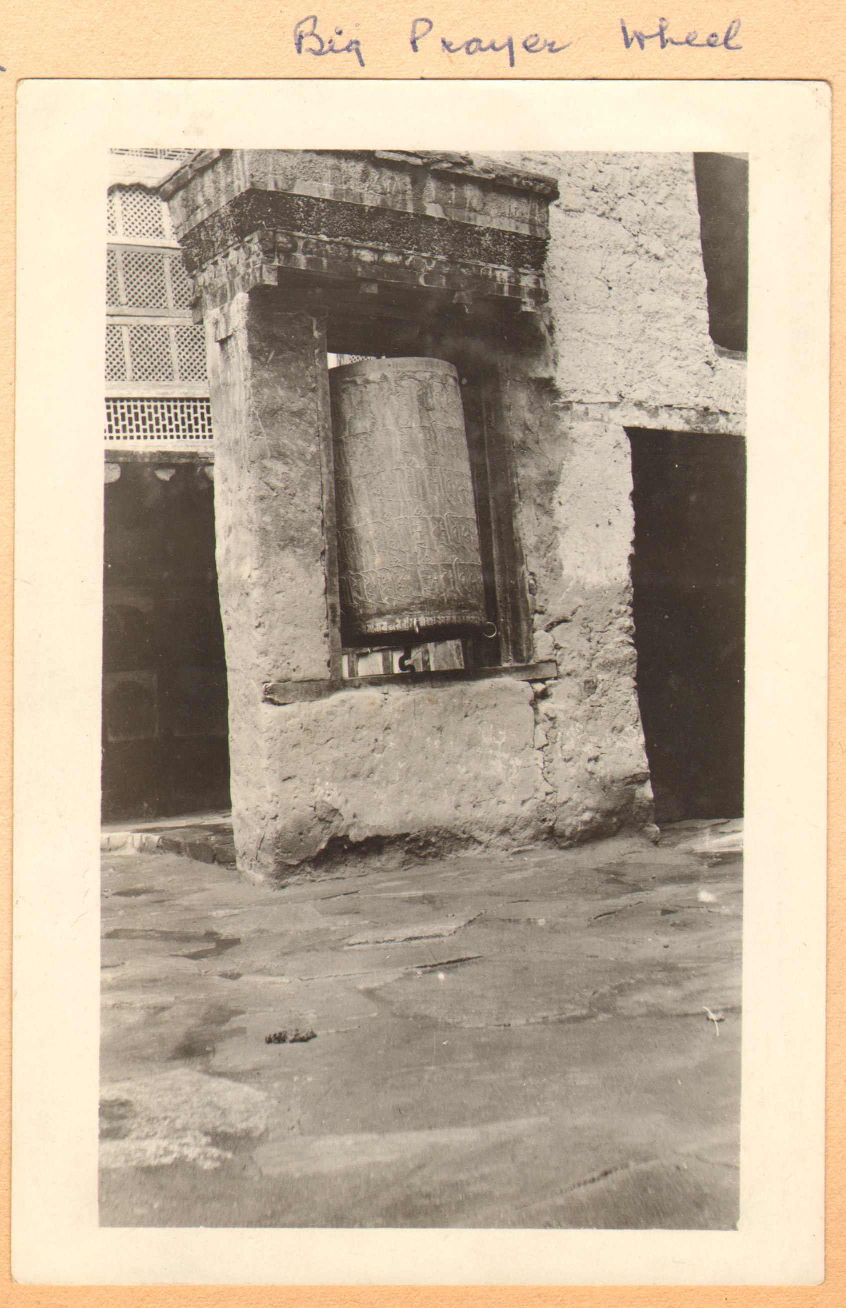
A Prayer Wheel in Lahaul by Ralph Stewart 1913
And Chamba Kingdom also started to take the lead and as the hold of the Guge weakened the Chamba Rajas began to assert their authority and advanced into areas which were associated with Western Lahaul rather than Chamba. They had advanced well into Pangi and Trilokinath which was the most important religious Center in Lahaul. The Chamba Rajas drew a nominal tribute from Lahaul, which the Lahaulis though still under the Gue Kingdom had no choice but to pay and one of the main items of tribute were 12 large dogs. I assume Lahauli Dogs for some reason held great value for the Chambyalis as I imagine these were Tibetan Mastiffs and they were good Dogs. Of course all these activities did not go unnoticed by the Rajas of Kullu and Bushahr. And the Kullu Raja decided to do something about it.Of course before also Kullu Rajas had made advances on the other side of the Rohtang. And there was a continuous power struggle between the Kullu Rajas with the Chambyalis on one side for Lahaul and with the Bushahris for Spiti on the other side. But nominally both Lahaul and Spiti were under Tibetan / Ladakhi Rule who were facing their own sets of problems with other neighbours mostly of Mongol origins.
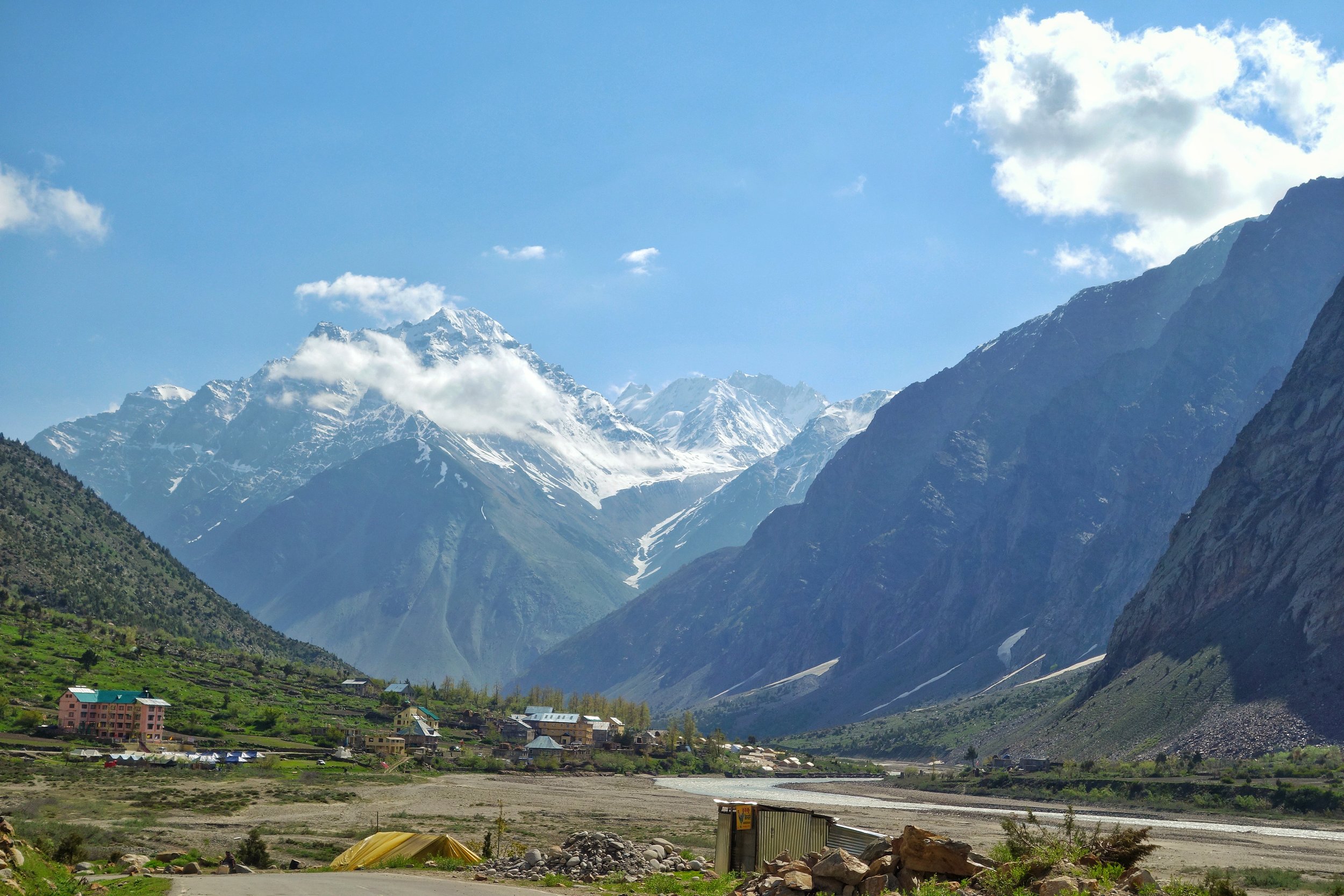
Jispa, Lahaul
And then in 1671 a Mongol Army attacked Lahaul and as usual they were in control for a few years. The Mongols probably wanted to assert the authority of the Central Tibetan Kingdom headed by the Dalai Lama and a claimant to all the territories of the Guge Kingdom. Interestingly there have been found graves and tombs in Lahaul of unknown people as both the Hindus and the Budhhists have never ritually buried the dead. They are supposed to be the remnants of people or perhaps a small force which came from Yarkand. But as usual the Mongols didnt stay put for long and left leaving Lahaul mostly to itself though still under Tibetan Rule.
Once they had left the Raja of Kullu decided to assert himself in a special way. The Kullu Raja married a Princess of Kishtwar for the same purpose.. And decided to go himself to Kishtwar to get his Bride. Of course the way he decided to assert to the Lahauli’s s that they should get rid of the Guge Rulers and be a part of Kullu. Thus his whole entourage was a show of strength of the Kullu Kingdom not only put on show for the Lahauli’s but for their friendly neighbourhood Chambyalis as well. And it seems the ploy worked but by then the Guge Kingdom was as good as collapsed. Lahaul was now firmly in Kullu’s grip except that the powerful Raja Chattar Singh of Chamba decided to re-assert his authority and again took Pangi and Trilokinath under strong Chamba control. And further Raja Chattar Singh’s son Raja Udai Singh further continued this Policy and even named the main Village where the Trilokinath Temple was situated as Udaipur, a name which still stands today. And the Kullu Rajas were firmly in the seat in other parts of Lahaul.

Above Keylong by Ralph Stewart 1913
But in the meantime things dramatically changed in Northern India and the British and the Sikhs under the Sher e Punjab Ranjit Singh were vying for power and the Western Himalayas came under the control of the Sikhs. Kullu and Chamba both became a part of the Sikh Kingdom and so did Lahaul. And it remained hence and this was enhanced when in 1840 the Sikh forces moved into Kullu and came down to Lahaul as well. And finally when the British defeated the Sikhs it passed onto the Brirtish. And as a result of the machinations which followed the formation of the state of Jammu and Kashmir, Chamba got to keep its part of Lahaul which was henceforth called as the Chamba Lahaul while Kullu was taken over by the British and the Kullu part of Lahaul was now called British Lahaul. Interestingly even Spiti had gone over to Raja Gulab Singh as it was a part of Ladakh but the British thought it prudent to have direct access to the Pashmina rich Region of Changthang and this could do this only if they kept Spiti.

Looking towards “British Lahaul” from outside Udaipur
And so it was till the British left and both Chamba and Kullu became a part of Himachal Pradesh and once again Chamba Lahaul and British Lahaul were merged to form Lahaul as we know it today.
Source : Various sources including Harcourt’s Himalayan Districts of Koloo, Lahoul and Spiti, 1874. Also History of Lahaul and Spiti by Sanjay Kumar. And of course a number of conjectures of my own. Please feel free to point out if you notice any discrepancy.
Pic: The Sun sets over what used to be Chamba Lahaul just outside the Village of Udaipur as the Chandrabhaga flows by. The Chorten was amongst the first reminder of the Cultural change in the Region as one comes in from the Pangi Valley side in Chamba.
Pic from June 2019. Near Udaipur, Lahaul, Himachal Pradesh.
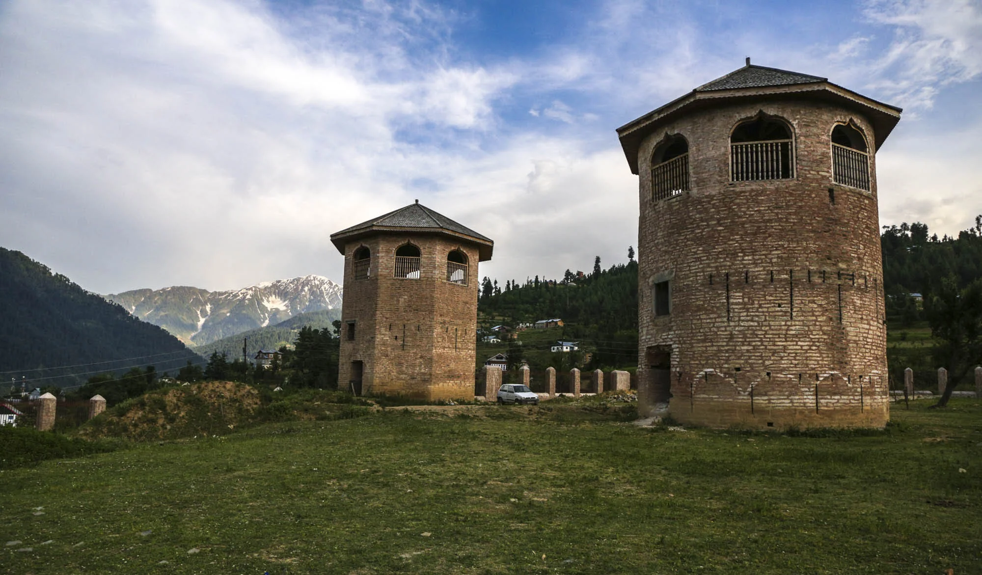
And then there is Bhaderwah !
The beautiful Region of Bhaderwah in the Doda District of the Jammu and Kashmir really stands up as a rival to the beauty of the celebrated Kashmir Valley. nterestingly the Gazzetter of Kashmir and Ladakh of 1890 talks of this beautiful area as well. It specifically mentions that the fruits grown in Bhaderwah can rival the best grown in the Kashmir Valley. Tobacco grown in Bhaderwah at that time was said to be of a very superior quality. And Bhaderwah Homey was also said to be very good. In today’s age we know that the Bhaderwahi Rajmah is supposed to be one of the best Rajmah carrying on the old Bhaderwah tradition of being one of the finest agricultural areas in the State.

And then there is Bhaderwah !
I have been to many places in the Mountains, personally and through Books and other Media. Read extensively. And I consider myself pretty well versed with the Western Himalayas, at least as its my home turf.
The problem is that when you are born and brought up in Kashmir, which was an act of providence, and I am sure I didnt do anything in my past, you get a certain Complex. Of course I am talking about the time when it was a calm and peaceful place back in the 80s. I call it the "Jannat E Kashmir" Complex and it develops when you constantly hear outsiders say how lucky you are to be born and to be living in Kashmir. Of course hearing it repeatedly it gets to your head. And of course this gets re-enforced when you read the works of various Westerners who happened to be so enamored with Kashmir mostly because it was off limits to most outsiders.
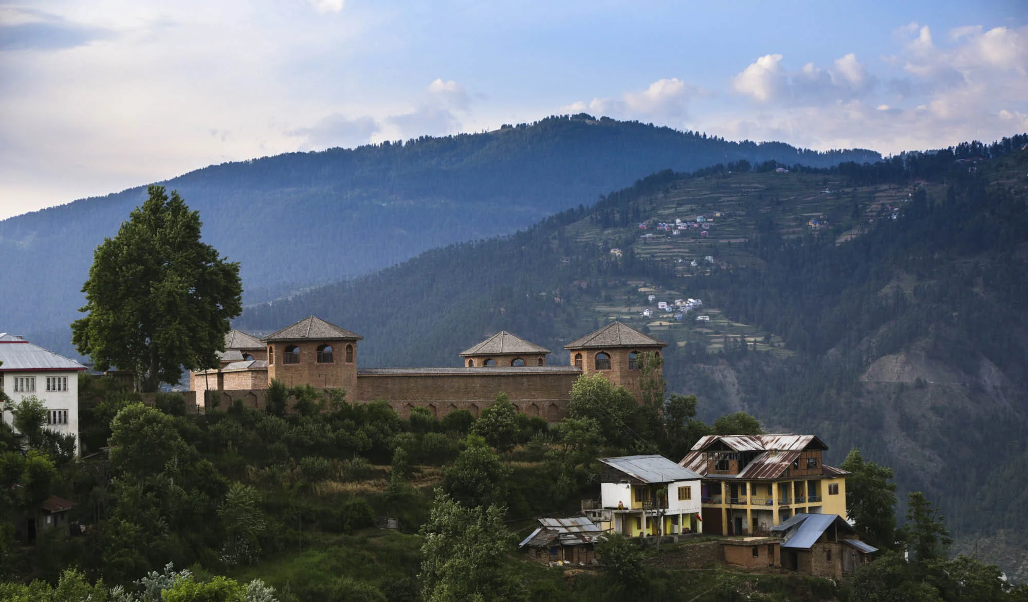
Anyways what this complex does is that you start to think of other places in the Mountains as being somehow lesser than "Glorious Kashmir". I still suffer from this Complex though in the years it has become less acute as I see more of the Mountains. A part of this Complex is that you consider Srinagar the most beautiful City in the Universe. And I never really found a place quite like it. Till I came to Bhaderwah. The only connection I have had with Bhaderwah was that Jagga, my Bakarwali had been brought to me by my friend from his ancestral home in Bhaderwah.
Interestingly the Gazzetter of Kashmir and Ladakh of 1890 talks of this beautiful area as well. It specifically mentions that the fruits grown in Bhaderwah can rival the best grown in the Kashmir Valley. Tobacco grown in Bhaderwah at that time was said to be of a very superior quality. And Bhaderwah Homey was also said to be very good. In today’s age we know that the Bhaderwahi Rajmah is supposed to be one of the best Rajmah carrying on the old Bhaderwah tradition of being one of the finest agricultural areas in the State.
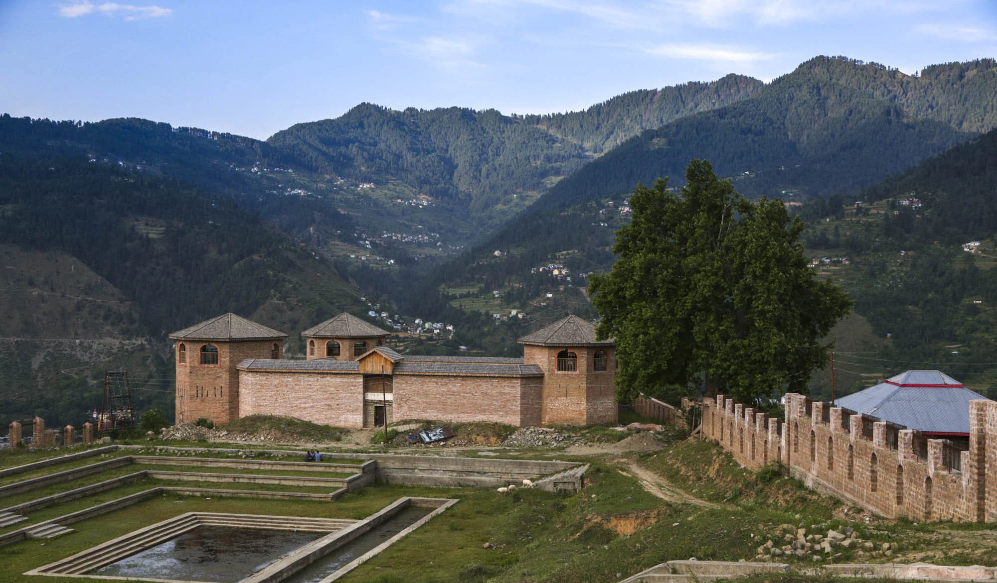
The coincidence is both Srinagar and Bhaderwah are at almost the same altitude of around 1600 m which is puny by Himalayan standards. But i guess its a good altitude at the latitudes they are located at of course with Srinagar being North of Bhaderwah. But Bhadewah gives Srinagar a run for its money when it comes to beauty. The Houses are quite similar though the Bhaderwah Valley is much narrower than the expansive Kashmir Valley. The population also has a large Kashmiri component and the population consists of a Muslim majority with a large Hindu minority.
And the Bhaderwah area which is connected to Jammu via the Chenab Valley and connected to Chamba via the Padri Pass was always quite a bone of contention between the two powerful Dogra Rajput Kingdoms. The Chambyalis usually dominated and held Bhaderwah many times until the power of Jammu grew under Raja Gulab Singh. There is said to be a great engagement fought between the Bhaderwahis lead by General Shagtu Kotwal gave a strong fight to the Chambyalis led by General Nathu Ram were defeated. These Chambayali raids on Bhaderwah was a regular feature and after repulsing the Chambyalis the General went to Raja Gulab Singh who was very pleased with him and gave him a Jagir in Bhaderwah. A sort of truce was arranged between Jammu and Chamba and the deal was that the revenue for the Rabi crop went to Jammu while the revenue from the Kharif crop went to Chamba.
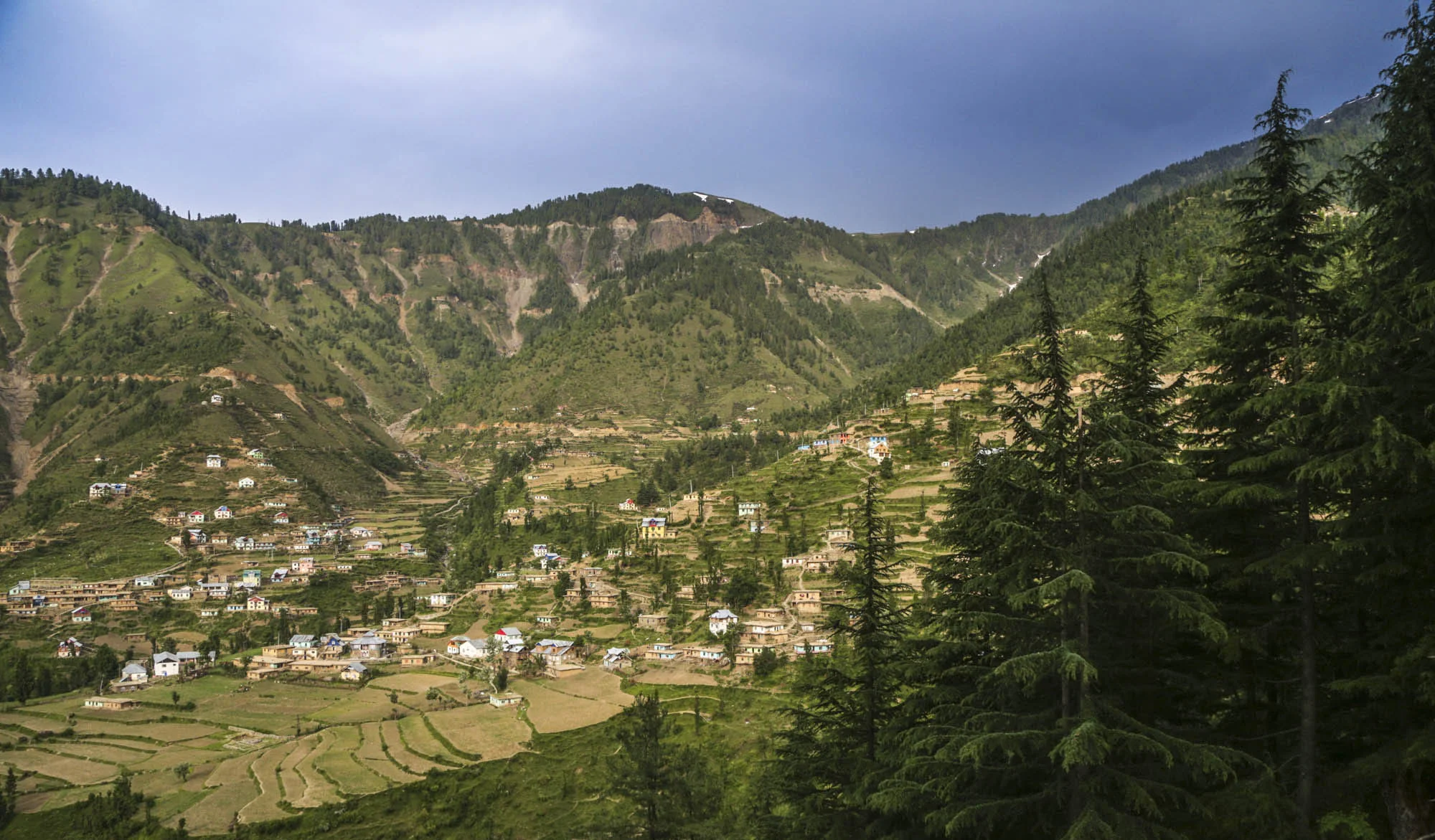
But after some kind of settlement between Jammu and Chamba, Bhaderwah as well as Doda and Kishtwar both areas also claimed by Chamba as its own, were settled and I guess the British had a role to play in that. The British I reckon got Dalhosuie of out this whole deal is the assumption I like to believe. Interestingly it is said that Gurkha soldiers posted in Bakloh used to come over to Bhaderwah to enjoy the salubrious air and the sublime Climate of this area as Bakloh also tends to get very hot in Summers with the temperature soaring to high 30s.
Anyways if you ever get a chance do visit this very pretty area. Words are not enough to do justice to the beauty of Bhaderwah. Its just magical. The Bhaderwah Fort is also a beautiful building and Houses a Temple in the inner courtyard and a small Mosque as well in the outer courtyard. Leaving you with a pic of this dreamy little town. I wish I could Post more pics of this Town but I implore you to discover this little gem for yourself.
Bhaderwah Town as seen from a distance. June, 2019
The Story of the Poonch Kingdom
Poonch is nowadays one of the most backward Districts of Jammu and Kashmir but it was once an important Hill Kingdom ruled by Rajput Hill Rajas, as was the norm in the lower Himalayas but over a period of time they had converted to Islam just like the Rajas of Kishtwar. The majority population of Poonch consists of Gujars and Bakarwals, along with Pahadis, Kashmiris, Punjabis, Rajputs and some Dogras.One feature which kinda unites the populace is that almost everyone speaks a version of Pahadi which is understood and spoken across the board. Traditionally Poonch has always been more of Punjabic / Potoharic (As in belonging to the Potohar Plateau) than Jammuic or Kashmiric.

The Story of the Poonch Kingdom
One of the most backward and in a certain way remote Districts of the state of Jammu and Kashmir is the district of Poonch which falls in the Jammu Division. Along with the neighbouring District of Rajouri its referred to as the Rajouri Poonch area or the Pir Panjal belt in the local political parlance just as the Doda/ Kishtwar area is called the Chenab Valley belt. This had further ramifications as both these belts have a Muslim majority in an otherwise Hindu majority Jammu Division. As I always say the most complicated part of India is the state of Jammu and Kashmir and it takes like forever to even begin to understand the complex make up of the state.
Coming back to Poonch, it was once an important Hill Kingdom ruled by Rajput Hill Rajas, as was the norm in the lower Himalayas but over a period of time they had converted to Islam just like the Rajas of Kishtwar. The majority population of Poonch consists of Gujars and Bakarwals, along with Pahadis, Kashmiris, Punjabis, Rajputs and some Dogras.One feature which kinda unites the populace is that almost everyone speaks a version of Pahadi which is understood and spoken across the board. Traditionally Poonch has always been more of Punjabic / Potoharic (As in belonging to the Potohar Plateau) than Jammuic or Kashmiric. I guess you get my drift.

Now the story of how Poonch came to be a part of the Riyasat (By Riyasat I mean the state of Jammu and Kashmir as it existed in 1947 before India got independence) is a rather interesting one, as Poonch and its Rulers always stressed on a separate identity for Poonch from Jammu or from Kashmir. As with all the regions in this Region Poonch came under the Rule of the Sikhs in 1819 when the Sikhs used the Region as a Platform for the acquisition of Kashmir after expelling the Afghans. The local Muslim Rulers were sidelined and the Hill Kingdoms in the area like Rajouri, Poonch, Bhimber etc were put under direct Sikh Rule.
And then in 1821 the Sher-E-Punjab appointed Gulab Singh as the Raja of Jammu even though he belonged to a minor faction of the Jammu Royal family. Raja Gulab Singh as he now came to be called had two other brothers as well Dhyan Singh and Suchet Singh, both of whom, just like Gulab Singh were in the service of the Sher-E-Punjab and together the Dogra brothers held immense power in the Sikh Court. In continuation to the favours shown to the Dogra brother in 1827 appointed Dhyan Singh as the Raja of Bhimber, Chibbal and Poonch. Just like his brother Dhyan Singh now became Raja Dhyan Singh and had a Kingdom of his own. As Raja Dhyan Singh was one of the most important Minister at the Court most of his time was spent in Lahore and on his behalf Raja Gulab Singh took care of Poonch and even crushed a rebellion there by the Hill tribes consisting of the Muslim Rajputs, the chibbalis and the Sudans.
In the vicissitudes that followed the death of the Sher-E-Punjab, saw the killing of Raja Dhyan Singh, Raja Suchet Singh (the 3rd Dogra Brother) and Raja Hira Singh (the son and Heir of Raja Dhyan Singh) and as a part of the whole mayhem when Raja Gulab Singh fell on the less favoured side and appeared weak the Poonch Kingdom was taken away by the Sarkar Khalsa and handed over to Faiz Talib Khan of Rajouri and so it stayed until a few years.
And the the first Anglo Sikh War took place and as a result Raja Gulab Singh became the Maharaja of Jammu and Kashmir and all the territory to the North of the Ravi River which included Poonch. The Maharaja handed over Poonch as a Jagir to Jawahir Singh and Moti Singh the surviving sons of his murdered Brother Raja Dhyan Singh.
But the brothers were not satisfied and took their case to the British arguing that Poonch was an independent Kingdom which was granted to them and they were not a part of the Maharaja’s Riyasat. But the British ruled otherwise and said that the Maharaja was still their suzerain. At the same time both Brothers starting quarreling with each other and their matter had to be settled. And by this time the Maharajaship had passed onto Maharaja Ranbir Singh, the son of Gulab Singh, who was a powerful Ruler as well as personality. He wasnt very fond of his cousin Jawahir and had him exiled to Amabala on an annual stipend for “treacherous conspiracy” and conveniently Jawahir Singh had no sons. Moti Singh’s son Baldev Singh contested this and said that Poonch belonged to the descendants of Raja Dhyan Singh. But the British were not amused and said Poonch was a Jagir (which Raja Dhyan Singh’s descendants vehemently opposed as they said it was a State) and an internal matter of the Maharaja of Jammu and Kashmir.

How ever Baldev Singh’s descendants though in nominal control of Poonch always contested this and send various emissaries and delegations to the British asking for a separate Poonch but the British disagreed. At the same time the Poonch “Rajas” maintained a good relation with their Cousins who Ruled the Riyasat and held high positions within the administration of the Maharaja’s Government, including Raja Jagatdev Singh who was at one time the Diwan of Kashmir. Raja Jagatdev Singh was also issued a Sanad by the Maharaja but they continued to question the status of Poonch vis a vis Jammu and Kashmir. The Poonch Rajas maintained “Poonch Houses” in Rawalpindi as well as later in Dehradun. There was also a Poonch House in Kud which was built as a present by Raja Jagatdev Singh for his favourite Queen. The Raja of Poonch as per the terms was the owner of all the land in Poonch and though there were reforms in Jammu and kashmir there were none in Poonch and this led to widespread discontent as the populace were heavily taxed by both the Raja and the Maharaja.
Finally this discontent boiled over after the Second World War and the almost 60000 Ponchis who had fought in the Second World War became a powerful force in the war over the Riyasat. They were Muslim Rajputs and most of the leaders pledged allegiance to Pakistan which was natural at that time. Without going into the details of the “Poonch Rebellion” which deserves a separate Story, let me just mention that the original Poonch is now split into two parts under India and Pakistan.
A pic of the dilapidated Poonch Fort by Safed Haathi. From 2017. This beautiful building is now sadly a Government Office and slowly falling into decay.

Pogal Paristan : The Land of Fairies
There is a place called Pogal and Paristan/ sometimes written as Peristan as well. Pogal and Peristan are both Rivers and they together give their name to this area. As per some Paristan name is derived from the word “Pari” for fairy and hence it meant the Land of Fairies and it is really that beautiful from what I have read and seen. Sargali, Sunseri, GaganTop, Nandigarh, Hans Raj Peak, Sharvadhar and the beautiful Gugli Meadows are said to be some of the places worth visiting here. And the language spoken here is a seperate one called the Pogali which is considered close to Kishtwari and Kashmiri. But the fact that they have developed a dialect of their own speaks about the separate character of this Region.

Pogal Paristan : The Land of Fairies
Ever heard of it. I am sure not. This is a small Region located in Ramban district and above Banihal in an area which is as unknown as well I dont even have an equivalent. Very few people I know have even heard of this beautiful Region. Of course lying on the borderlands between Jammu and Kashmir divisions hasn't done any favours to this place. I have never been to this place but would probably go next time around. I was planning to go to Spiti as I have never been there but Pogal Parsitan sure sounds better. So when people ask me “Oh you've never been Spiti ? Ill just nod my head and say Oh you've never been to Pogal Paristan ? I would rather go to a place few people go then go to a place where everyone is going.
But the topic today is the place called Pogal and Paristan/ sometimes written as Peristan as well. Pogal and Peristan are both Rivers and they together give their name to this area. As per some Paristan name is derived from the word “Pari” for fairy and hence it meant the Land of Fairies and it is really that beautiful from what I have read and seen. Sargali, Sunseri, GaganTop, Nandigarh, Hans Raj Peak, Sharvadhar and the beautiful Gugli Meadows are said to be some of the places worth visiting here. And the language spoken here is a seperate one called the Pogali which is considered close to Kishtwari and Kashmiri. But the fact that they have developed a dialect of their own speaks about the separate character of this Region.
And going back to the Gazetteer and what it said about these places :
Pogal : The name of a Valley lying towards the South-East end of the Banihal district; its drained by the Sundari or the Pogal stream , which takes its rise on the Southern slopes of the Nandmarg mountain, and flows in a south-westerly direction to a junction with the Peristan stream a tributary of the Bichlari River.
Peristan : The name of a narrow valley lying at the south-east end of the Banihal district. Its general direction is east and west ; the range of mountains on the south side is of considerable elevation, and the slopes are covered with forest; on the north the hills are not so high, and are bare and stony, This valley contains no large villages, but there are numerous hamlets and a considerable amount of cultivation.
.The Peritsan stream, which drains it, takes its rise on the slope of the lofty mountain at the north-east end of the valley, and flowing in a westerly direction, unites with the Sunderi or Pogal stream, above its junction with the Bichlari. The banks are for the most part precipitous, especially on the north side.
It is bridged just west of the Village of Chiuli, and is fordable a little distance above it, and also, it is believed, in other places. The path from Kishtwir to Kashmir, by the Nandmarg pass, crosses the Peristan Valley. It ia used early in the season before the Brari Bal route becomes practicable.
It further mentions the following Peristan which is the name of a Village in the same Valley. A small Village in the Valley of the same name forming part of the Banihal district ; it is situated on the top of a spur above the west side of the Village of Halan.
The inhabitants number two families of Hindu zamindars and a Muslim Blacksmith.
Peristan lies on the Road from Kishtwar to Kashmir by the Nandmarg Pass.
I tried to find a pic of the Region and though I found a few Videos I couldnt find any pic to do justice to the beauty of the Region. So i just post the best pic I could find which is from July 2018. Its from a high Meadow and has Gujjar Dhoks.
Pic from July 2018 (assumed). Pogal Paristan, Ramban District, Jammu Division, Jammu and Kashmir. Photographer unknown.
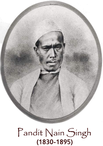
Pandit Nain Singh Obituary by a British Officer
An Obituary of one of the Greatest “Pandits” of the Himalayan Exploration Saga, Pandit Nain Singh. The Pandits were a Group of local Pahadi people who were trained by the British to go and Explore neighbouring Mountain Regions which were off limits to the British.

The Pundit Nain Singh. We have received from Colonel Edmund Smyth the following interesting details regarding our recently deceased gold medallist Nain Singh:
The Grange, Welwyn, Herts, 8th April,882.
Dear Sir, I saw in the obituary of the Times of the 15th March, a notice of the death of the famous Pundit, Nain Singh, and as I happen to have known him, in years gone by, perhaps better than anyone else, I send you this short account of him for publication in this month's * Proceedings.'
First I will explain how I think he and the others who were trained as explorers by Colonel Montgomerie came to be called Pundits. Nain Singh was a Government schoolmaster in the village of Milum, District of Johar, Province of Kumaon, in the Himalaya, and was, I think, the first man sent to Colonel Montgomerie to be instructed in the use of surveying instruments, and his title of Pundit (which means schoolmaster) seems to have stuck to him during the remainder of his life. The same name was also given to the other explorers who followed him, who were not Pundits at all. Pundit is a title generally given to learned Hindus, but schoolmasters are always called Pundit whether earned or not.
Nain Singh belonged to a peculiar set of people,generally called Bhootiahs (quite different from the Bhootiahs^ or Bhootanese, of Bhootan), who inhabit the highest accessible parts of the different Valleys in Kumaon and Gurhwal,which form the head-waters of the rivers Ganges and Kali (called Sardha or Surju lower down). Their villages are situated at an elevation of 1 0,000 to 13,000 feet,a t the foot (on the south side) of the various passes leading into Tibet; they are well and substantially built, though only occupied from June to November each year. The Bhootiahs pass their lives in trade with Tibet, and they are the only people allowed by the Tibetan authorities of Nari-Khorsum (that part of Tibet which is the basin of the Upper Sutlej river, and north of Kumaon and Gurhwal) to enter their country for purposes of trade. From June to November they are constantly going backwards and forwards over the passes, bringing the produce of Tibet (borax, salt, wool, gold-dust,also ponies) and taking back grain of all kinds (as no grain is grown in that part of Tibet on account of its altitude and want of water), English goods, chiefly woollens, and other things. The goods are carried on the backs of sheep, goats, ponies, yaks, and jhoopoos (a cross between the Tibetan yak and the hill cow). During the remainder of the year they move down to the foot of the hills and sell their produce to the Buniahs or traders,who meet them for that purpose at the different fairs held at Bagesar, Ramnugur,Kashipur, Burmdeo, Kotdwara, and other places. Most of them have another set of villages in the lower hills besides those I have mentioned close to the passes, which their families occupy during the cold weather. They are a hardy and enterprising race, and many of them find their way during the cold weather to Delhi and Meerut, and some as far as Bombay and Calcutta, where they can purchase English goods at a cheaper rate.
The origin of these people is uncertain; they have Hindu names, and call themselves Hindus, but they are not recognised as such by the orthodox Hindus of the plains or hills. "While in Tibet they seem glad enough to shake off their Hinduism and become Buddhists, or anything you like. I was employed for many years in Kumaon and Gurhwal and knew these Bhootiahs perhaps better than anyone else. In 1862-3 I was in correspondence with Colonel (then Captain) Montgomerie. I think it was about an expedition I was going to make into Tibet and hearing he wanted some trustworthy men to train as explorers in that region,I strongly recommended him to engage some of these Bhootiahs, both on account of their thorough knowledge of the Tibetan language, and also because they had the entree into the country. He asked me to select two, and send them to him to be trained. I accordingly chose our friend Nain Singh, who was then employed as Pundit (or schoolmaster) of the Government's school of Milum, in Johar, and the second man I chose was his cousin( not brother as stated in the English translation of Nain Singh's journal) Manee or Maun Singh, who was Putwarie or chief native official of Johar. Manee was far superior to Nain Singh in position,wealth, and intellect,and might have done well, but unfortunately he was too well off in his own country to take to the rough life of exploration.
After being trained they were both sent off together, in January 1865, with directions to trace the great river Brahmaputra from its source in the mountains, East of the Mansarovar Lake, to Lhasa, a supposed distance of 800 miles, and in returning to take, if possible,a more northerly route. They crossed the Johar Pass from Milum, and met with great difficulties in Nari-Khorsum; it had probably become known they were exploring party; they had returned twice, and it was then resolved to try and make a start from Nepal; there they also met with difficulties, and Manee seems to have been discouraged and left Nain Singh, and after
making a rather long tour in the north of Nepal, he returned home and is, I believe, still Putwarie of Johar. Nain Singh, however, stuck to his work, and after some Further delay managed to join a party who were going from Nepal to Lhassa. He entered Tibet from Nepal by the Kirong Pass, and after travelling due north for about 130 miles, struck the great river at the monastery of Tadum, and then, turning to the east, followed the course of the stream for 600 miles till he reached Lhassa. He stayed there for some months, recruiting his finances by turning his old profession of schoolmaster to account, and teaching the Tibetans arithmetic. He returned the same way as far as Tadum, and then explored new ground for 200 miles until he reached the sources of the Brahmaputra In the mountains,not very far from the Mansarovar Lake. This was in 1866.
In the following year, 1867, Nain Singh tells me in one of his letters which I still have, he was sent by Colonel Montgomerie over the Mana Pass (near the temple of Badrinath) to Gartok (the capital of the Tibet district of Nari-Khorsum),to Chujothol, and the gold mines of Thok-jalung, the climate of which place he compares with that of the Mansarowar Lake, to give me an idea of it, as he knew I had been there. Thok-jalung he describes as much colder. He gives the elevation as 15,000 feet. This is evidently a mistake, as in his journal it is, I think, said to be 16,300 feet. That of the Mansarowar Lake is 15,200 feet, and this would account for the difference of temperature. He found about 500 tents of miners there, and says that to avoid the cold (cold wind I suppose) these tents were pitched in great holes. Captain Montgomerie's account of this important journey, with the tables of Observations taken by " the Pundit," are published in the Society's *Journal,v' ol. 39.
I used to hear very frequently from both Nain Singh and Manee, but can only find four of their letters now, which I shall be glad to lend to anyone wishing to see them. They are written in Hindee. One is from Manee, the other three from Nain Singh. In two of these letters he informs me of the great loss he had sustained, in being robbed of the gold chronometer given him by the Royal Geographical Society in 1868. It was stolen from him six months after he received it, and while, he says, he was in the performance of his public duties. The fact is, he entrusted it to someone to take to his home, and the man stole it. He was much distressed, and expressed a hope that another chronometer exactly like it, with the same inscription engraved on it, might be sent to him, and he would gladly pay the cost of it; and then he went on to write in Hindee character the English words of the inscription which were these :?" De President and Council of de Raeel Jographical Society of London to Pundit Nain Singh for his great Jographical exploration. 25th May, 1868."
The Council was not able to comply with Nain Singh's request, but in May, 1877, the much higher honour of a Royal medal was awarded him in these terms: "The Victoria or Patron's medal is awarded to the Pundit Nain Singh, for his great Journeys and surveys in Tibet, and along the Upper Brahmaputra, during which he has determined the position of Lhassa, and added largely to our positive knowledge of the map of Asia.'*' Colonel H. Yule, who had taken all along the greatest interest in the man and his work, received the medal at the anniversary meeting on behalf of Nain Singh, and in his reply to the eloquent words in praise of this native explorer addressed to him by the President, said : " He is not a topographical automaton, or merely one of a great multitude of native employees with an average qualification. His observations have added a larger amount of important knowledge to the map of Asia than those of any other living man, and his journals form an Exceedingly interesting book of travels."
For the last few years of his life Nain Singh had retired into private life, and lived in comfortable circumstances during the hot weather in his native village of Milum, where his cousin and former companion Manee was Putwarie; and during the cold weather on a small jaghire or estate in the plains given to him by the Government for his services. He died at Moradabad (I believe on the lst of February last), of cholera, contracted at the great January fair of Allahabad. He must have been about fifty-seven years old. Nain Singh was employed for many Years under me, and I always had a very high opinion of him; a more truthful or reliable man could, in my opinion, not be found for the work he was called upon to do. There may be mistakes in his journals, but no wilful ones. I don't know what family he leaves behind, but there were two boys, nephews of his, educated at the Mission School at Almorah, who became Christians some years ago, and are now studying medicine at Agra, under Dr. Yalentine. The great exploit of Nain Singh, his journey from Nepal to Lhassa and back to the Mansarovar Lake, in 1865-6, need not be further described here. A translation of his journal, with introductory remarks by Colonel (then Captain) Montgomerie, was read before this Society on the 23rd March,1 868, and published in the 38th volume of the Society's * Journal.' Edmund Smyth, Colonel.
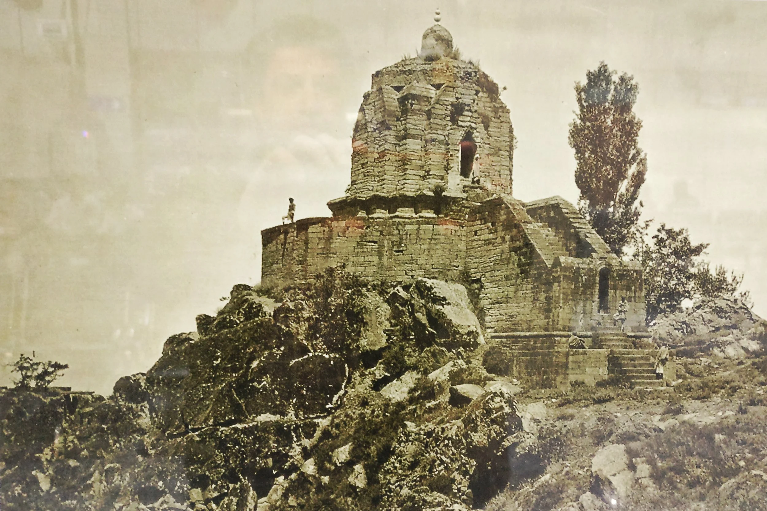
The Lingual Diversity of the state of Jammu and Kashmir
The state of Jammu and Kashmir is made up of a number of geographically separate Regions divided by Ranges of the Himalaya. Its home to a diverse variety of Ethnicity, Cultures, Religions and of course Languages and Dialects. This article looks at the language diversity in the state of Jammu and Kashmir.

The Lingual Diversity of the state of Jammu and Kashmir
The State of Jammu and Kashmir is not only Geographically and Ethnically diverse with the two Highest Ranges in the World, the Himalayas and the Karakorams and also hosting Peaks of over 8000m from both these Ranges. Ethically it has a diverse mixture of people and distinct Regions dominated by different Religions such as Islam, Buddhism and Hinduism. But one of the little understood and little know fact in the Lingual diversity that exists in this state which we study as it existed in 1947 before the Partition.
The state was basically made of of 5 different Regions which were all Mountainous and it was the Mountains and the Rivers which divided the Populations. The main Regions as we can name in today’s context were (in Alphabetical order) were Baltistan, Gilgit, Jammu, Kashmir and Ladakh. And of course we have a major language language associated with the Region. Balti with Baltistan, Shina with Gilgit, Dogri with Jammu, Kashmiri with Kashmir and Ladakhi with Ladakh. But these classifications only sum up the language of the perceived majority in that Region but doesn't really give a true picture of the lingual diversity and how the languages sometime merge to create hybrid languages.
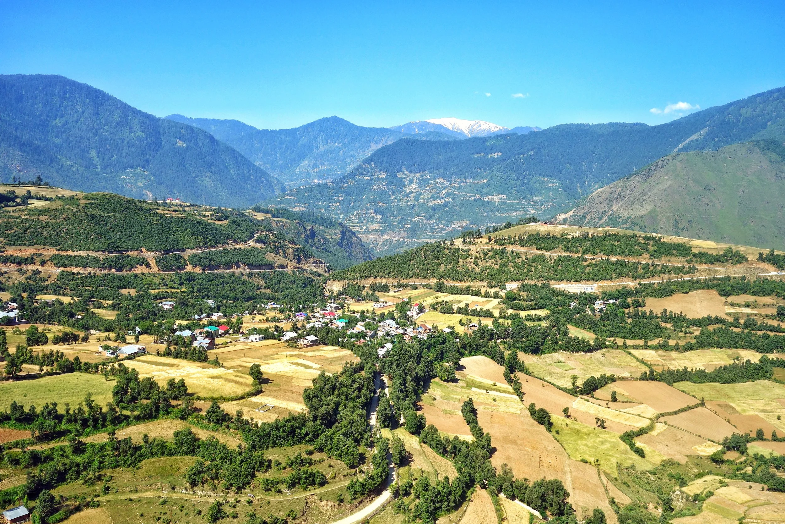
Starting from the Jammu Region which has a diverse language influences. Starting from the bottom at Poonch and Rajouri where the spoken language is Poonchi or Pahari or Potohari. This language belongs to the Lahnda/ Punjabi family of the Indo Aryan languages. Moving Eastward we have the Dogri language, which was considered as a Punjabic language and still has a lot of commonality with Punjabi. But now Dogri is considered an independent language and one of the main languages of the Western Himalayan Pahari language Group.
And then we have the Gurjuri spoken by the Gujjars. Gurjuri is closely allied to the Marwari dialect of Rajasthani and also has a fair mix of Punjabi in it. In fact the Gujars living in Punjab speak Punjabi and the languages are intermixed. Gurjuri is also spoken in the Kashmir Valley where also there are communities of Gujjars. However a number of Kashmiri words have overtime have become common usage by the Kashmiri Gujjars influenced by their Kashmiri neighbours.
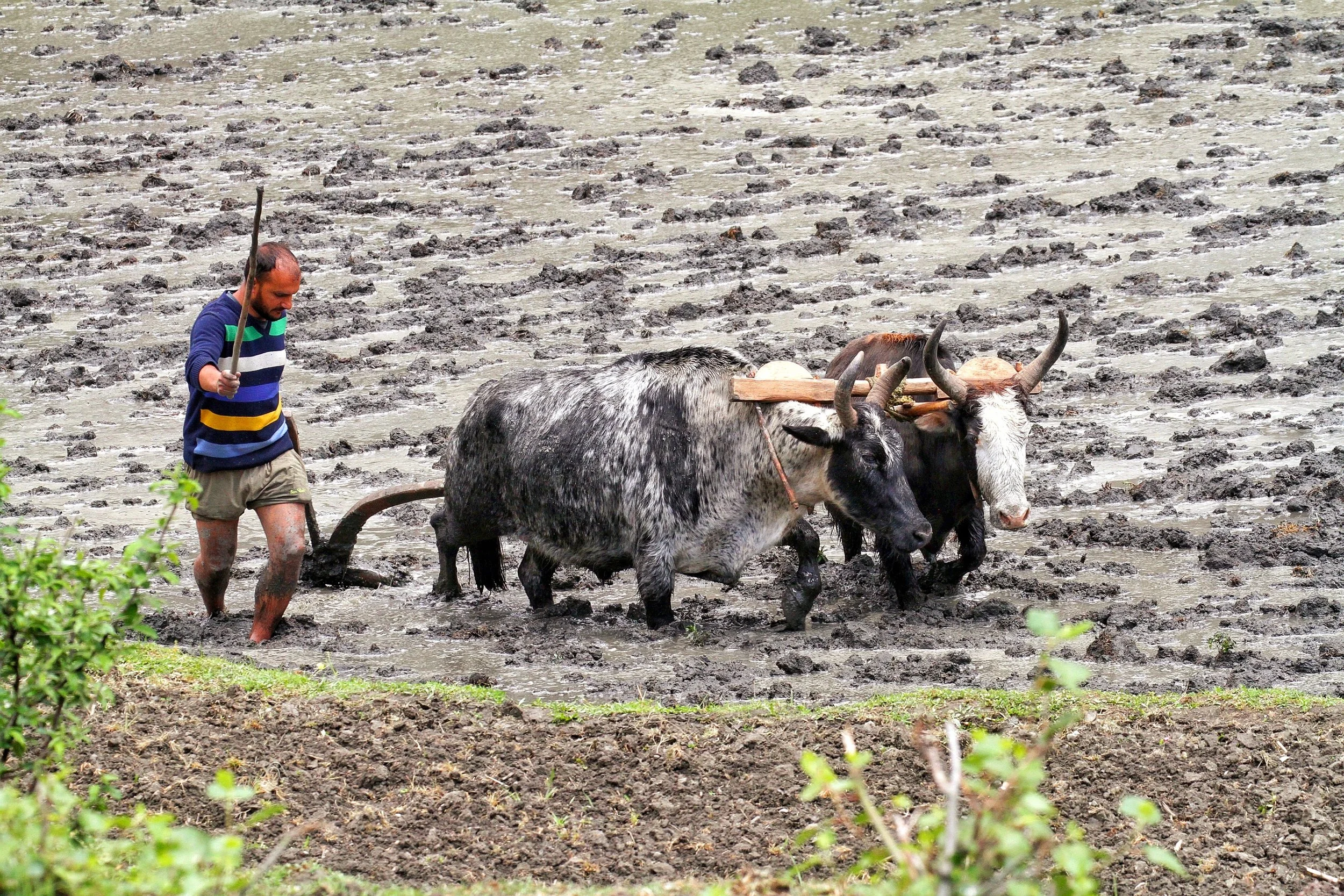
Moving upwards into other parts of the Jammu Division we see increasing influence of Kashmiri language which is a part of the Dardic Language family of the Indo Aryan language Group. Bhadarwahi, Bhalesi and Curahi from an intermediate forms of speech bridging the gap between the Punjabi or Dogri and the Kashmiri System. Padari is an extremely interesting dialect, spoken in Padar region of Kistwar on the banks of the Chinab. It has a striking similarity to Pangwali, spoken in the Pangi Valley in Chamba.
Siraji is the language spoken in country north of Chinab between Ramban and Bhart on the way to Kishtwar. It is central to Doda and is also called Doda Siraji at times. Due to its location, to the North it gives was to Kashmiri, on West to Rambani, on the North East to Kishtwari, and on the South and South West to Bhadarwahi and Chamba dialect. Its generally frameworked like Punjabi but has many points in agreement with Kashmiri.
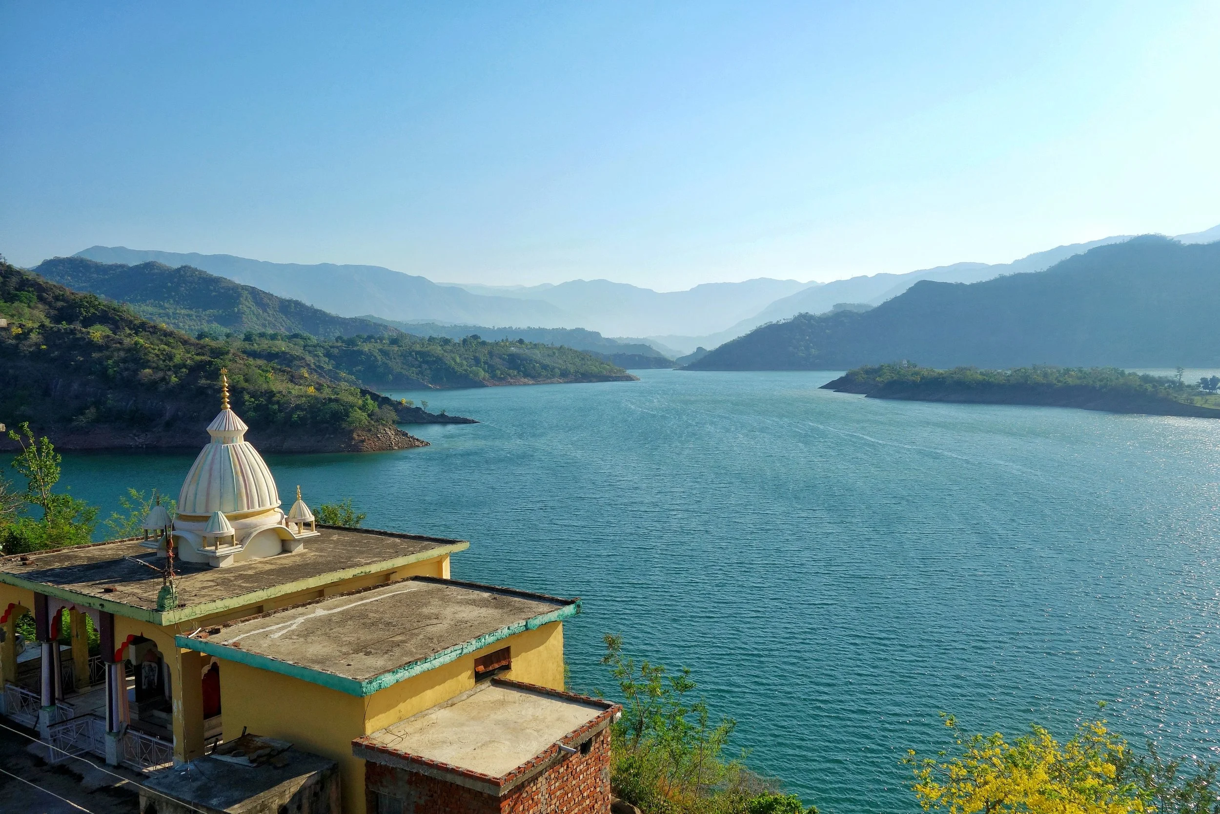
Rambani as the name suggests is the language spoken around Ramban and like the Poguli which it closely resembles it is connected with Kashmiri though further away than it than Poguli. Rambani has a very largely Punjabi pronunciation whereas Poguli pronunciation is more like Kashmiri.
Poguli is a language spoken in a small area to the East of Ramsu. It resembles Kashmiri though it is unintelligible to speakers of the Kashmiri language. However it seems that all speakers of Poguli have some basic understanding of Kashmiri. Nearly all peculiarities of Kashmiri are found in Poguli which however contains a number of points in common with dialects which look to Punjabi as a fountainhead. Kishtwari is spoken around the Kishtwar area of the Kishtwar region. It is considered a sub-dialect of Kashmir which it resembles very much. Kashmiri is well understood in Kishtwar.
And of course then we come to the Valley itself where the main spoken language is Kashmiri. The second most spoken language in Kashmir is Gurjuri probably followed by Punjabi / Pahari spoken in the Border areas adjoining the LOC in the West. However there are still speakers of Shina in the Gurez Valley, a couple of Villages in Tral and the Sarbal Village in Sonamarg. There is also a small community of Shina people who live in Srinagar city and they also speak Shina. Shina BTW is the main language of people in Gilgit.

Shina itself is a part of the Dardic family, same as the Kashmiri language. Its the most spoken language of the Gilgit region and it has a number of dialects such as Gilgiti (the prestige dialect), Astori, Chilasi Kohistani, Drasi, Gurezi, Jalkoti, Kolai, and Palasi. Related languages spoken by ethnic Shina are Brokskat (the Shina of Baltistan and Dras), Domaa, Kohistani Shina, Palula, Savi, and Ushojo. Shina is also spoken in the Drass area, Dah and Hanu and other “Aryan” Villages of Ladakh. Shina is also spoken in areas adjoining Gilgit like Kohistan in Khyber Pakhtunkhwa.
And then we come to Baltistan, where the main language is Balti. Balti is a part of the Tibetan family and belongs to the Ladakhi Balti Group. Infact many words that were used in old Tibetan are still found to be in use in modern Balti whereas they are not used in modern Tibetan anymore. Balti is widely spoken in Baltistan and a dialect, the Puriki is spoken in the Kargil area and the Suru Valley. Proper Balti is spoken in the Turtuk area of Ladakh as well. The language is also used by Balti communities settled elsewhere including the small Group of Balti people settled around Dehradun in Uttarakhand.
And finally Ladakhi which like Balti belongs to the Tibetan language family and is related to Balti as well. Besides proper Ladakhi it has a dialect called the Zanskari which is spoken in the Zanskar region. Interestingly both Ladakhi and Balti belong to the Ladakhi Balti family of Tibetan language. These are also called Western Archaic Tibetan languages as they have a lot in common with Old Tibetan unlike the more modern Western Tibetan language of the Lahaul Spitian language. Ladakhi has other sub-dialects if you may like Lehskat after Leh, where it is spoken; Shamskat, spoken in the northwest of Leh; Stotskat, spoken in the Indus valley and which is tonal unlike the others; Nubra, spoken in the north of Leh. In my personal experience I think all these Tibetan languages are mutually intelligible to some extent as I see people speaking Puriki and Ladakhi being able to have a conversation.
This should give you an idea of the languages spoken in the state of Jammu and Kashmir and we know that in the Mountains in the older times populations evolved in isolation and hence the vast array of languages and dialects and sub dialects. Infact in some cases the language changes from Valley to Valley so the actual number of dialects are well impossible to even comprehend but this gives you an idea of the diversity.
Source : Language of Northern Himalayas by Bailey 1908 and other Internet sources including Wikipedia.
And adding a language Map of Jammu and Kashmir by Drew from the late 1800's.
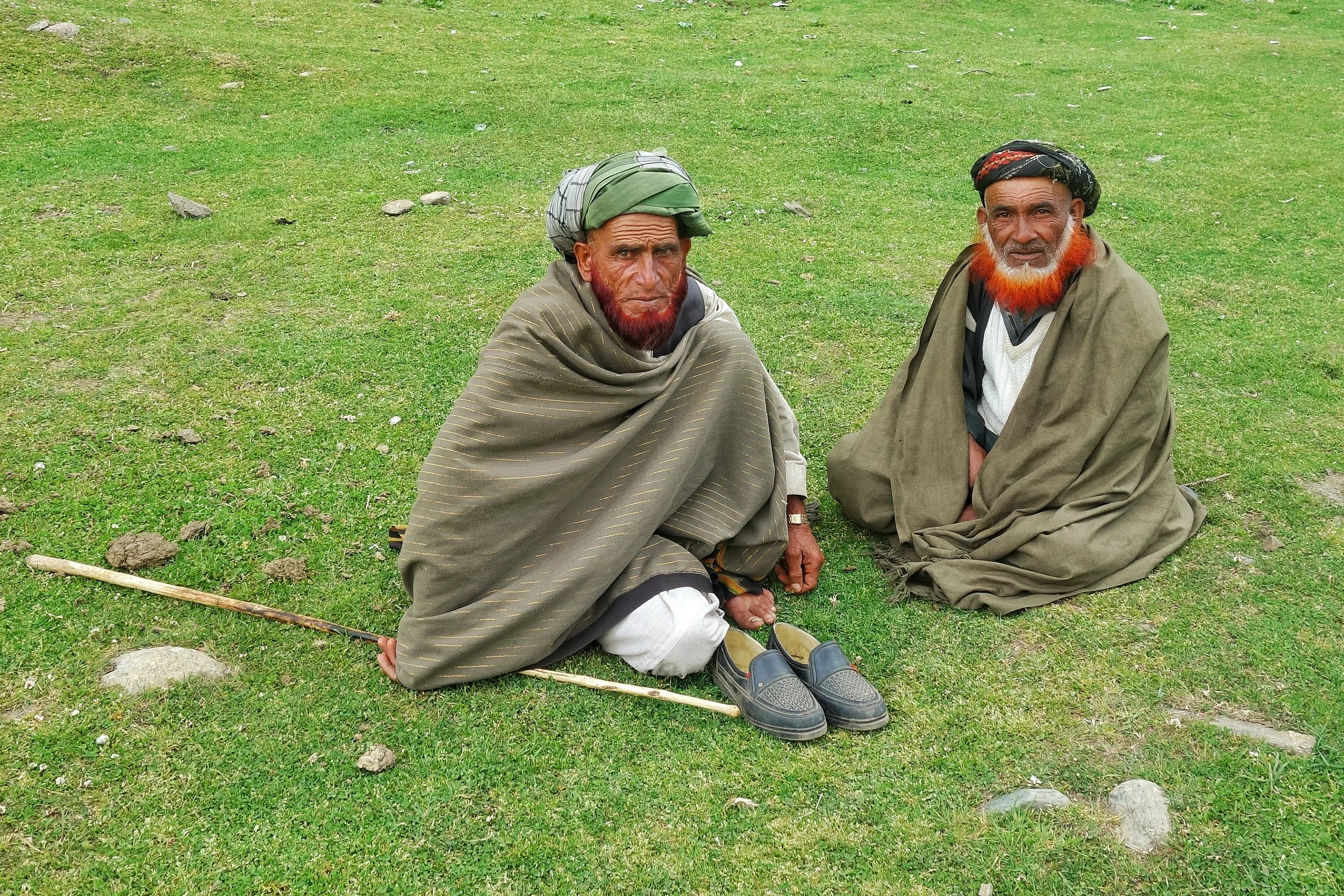
The Original Mountain Men and Women of the Western Himalayas
Ive had a childhood fascination for the Gujjars and especially the Bakarwals while growing up in Kashmir. Well they are almost the same thing except that nowadays the ones who live in fixed locations are called Gujjars while the ones which move up and down with their herds are referred to as the Bakarwals. Also as the name suggests it comes from the word Bakri, so a Bakarwal is also a keeper of the Sheep. Especially in the State of Jammu and Kashmir. There isnt a single Region in this vast State which is not familiar with the congenial Bakarwals who flocked to the highlands with their Goat/ Sheep / Buffaloes / Horses/ Mules which they term as “Maal” as in “Goods”. That is the commodity that they deal in and a Bakarwal is judged by the size of his Herd. And then there were my favourite part of a Bakarwal entourage, the Shepherd Dogs also called by the same name Bakarwal or Bakarwali.
The Original Mountain Men and Women of the Western Himalayas
Ive had a childhood fascination for the Gujjars and especially the Bakarwals while growing up in Kashmir. Well they are almost the same thing except that nowadays the ones who live in fixed locations are called Gujjars while the ones which move up and down with their herds are referred to as the Bakarwals. Also as the name suggests it comes from the word Bakri, so a Bakarwal is also a keeper of the Sheep. These Bakarwals are the original Mountain men of our parts. . Especially in the State of Jammu and Kashmir. There isnt a single Region in this vast State which is not familiar with the congenial Bakarwals who flocked to the highlands with their Goat/ Sheep / Buffaloes / Horses/ Mules which they term as “Maal” as in “Goods”. That is the commodity that they deal in and a Bakarwal is judged by the size of his Herd. And then there were my favourite part of a Bakarwal entourage, the Shepherd Dogs also called by the same name Bakarwal or Bakarwali.
Most of these Bakarwals are now based in the Winter time mainly in the Poonch Rajouri areas of J&K where they form a majority of the Population. However they are distributed all over the Jammu Division as well as neighbouring Regions of HP like Chamba and places like Nalagarh in Punjab and moving further East even as far as Dehradun in Uttarakhand. Infact in parts of Jammu and Himachal Pradesh they share the pastures with the other Mountain Men, the Gaddis. The main difference being that the Gujjars / Bakarwals of J&k are Muslim while the Gaddis are Hindu.
From the Jammu side they usually move towards the higher Regions in the state in all the 3 Divisions of the state. They cross the Pir Panjals to get into the Kashmir Valley and head onto the higher Alpine meadows dotted around the Valley. In the Jammu division they move towards the Kishtwar side and spread over the different Valleys like the Padar Valley from where some even go towards Zanskar. There are others who go towards Marwah and Wadwan and some even cross over to the Suru Valley in Ladakh. Some go to the higher reaches in Kathua District like Sarthal where I happened to meet both Bakarwal and Gaddi shepherds.
While on the Machail Road on the way back we gave a lift to a Bakarwal who had just left his herd at somewhere beyond Machail, areas which are inhabited by Buddhists who came to the Region from adjoining Zanskar. And we gave him a ride till Gulabgarh and on the way he asked us how hot it is in Jammu and we said that down in the foothills the temperatures were over 40 C. Ah he said then Ill go to Srinagar. I asked him why ? Well its cooler there he said and told me he had another Dera somewhere near Shopian in the higher reaches on the way to the Pir Ki Gali.
Kashmir Valley itself has quite a strong Gujjar population and they largely inhabit the areas in the higher reaches above Ganderbal all the way to Zoji La. They are also spread in the more sensitive Border Villages along the LOC. They actually live on both sides of the Border and the area that we belong to, ancestrally was also a Gujjar majority area. So we have a kind of language affinity with them as well and we can almost understand each other when they speak Gojri and I speak our Punjabi. Thats another reason why I get along with them famously. Infact in the time of Grandfather all the main guys handling the tougher side of business like the Forest Leasee and other Construction work was handled by the hardy and reliable Gujjars. And I remember my favourite one was a guy called Sitara, who drove one of our Trucks. Typical handsome Gujjar with a flowing orange (henna dyed) beard. And of course we use love going for a drive in the Truck.
Anyways with modern times creeping into their lifestyles as well many of the younger generation are now looking for alternative, more settled ways of life. Taking the heards over the high Passes into secret Valleys and Dhars best known to their forefathers and all the associated Risks are just not worth it for the newer generation. And of course every Bakarwal father wants to give education to their children and of course this is good. And education leads to aspirations and being a Shepherd doesnt rate high on any work list. I am afraid the Bakarwals we see now are the last of the Generation and the time is not far when coming across a Bakarwal entourage would be a rare thing. Its getting rarer but you can still manage if you know where to go.
And here is an entourage that we met on the way from Kishtwar to Gulabgarh. The younger and fitter men had already gone ahead with the “Maal” and this was the follow up party of the older men, women, kids and their well dressed Horses and Mules. They were a riot of Colour. And of course the younger Bakarwalis (I mean the Dog breed) as the strong amongst them were on duty with the Maal. And it was quite a sight.
Background Music is a Bakarwali song that I got from Youtube and not sure of the origin. The beautiful Song talks about a Lady (Young) talking about its only companion a Crow that used to sit on a Mountain Top. And the lady yearns for her loved ones and keeps sending many letters to her Baba, Chacha, Mama and Lala. Well thats what I understood .Enjoy the Video and the song.
PS: We took permission from the main Elder before shooting the Video and the ever genial Bakarwal gave it when I broke into my Mother tongue.
Video from June 2019. On way from Kishtwar to Gulabgarh. Jammu Division. J&K
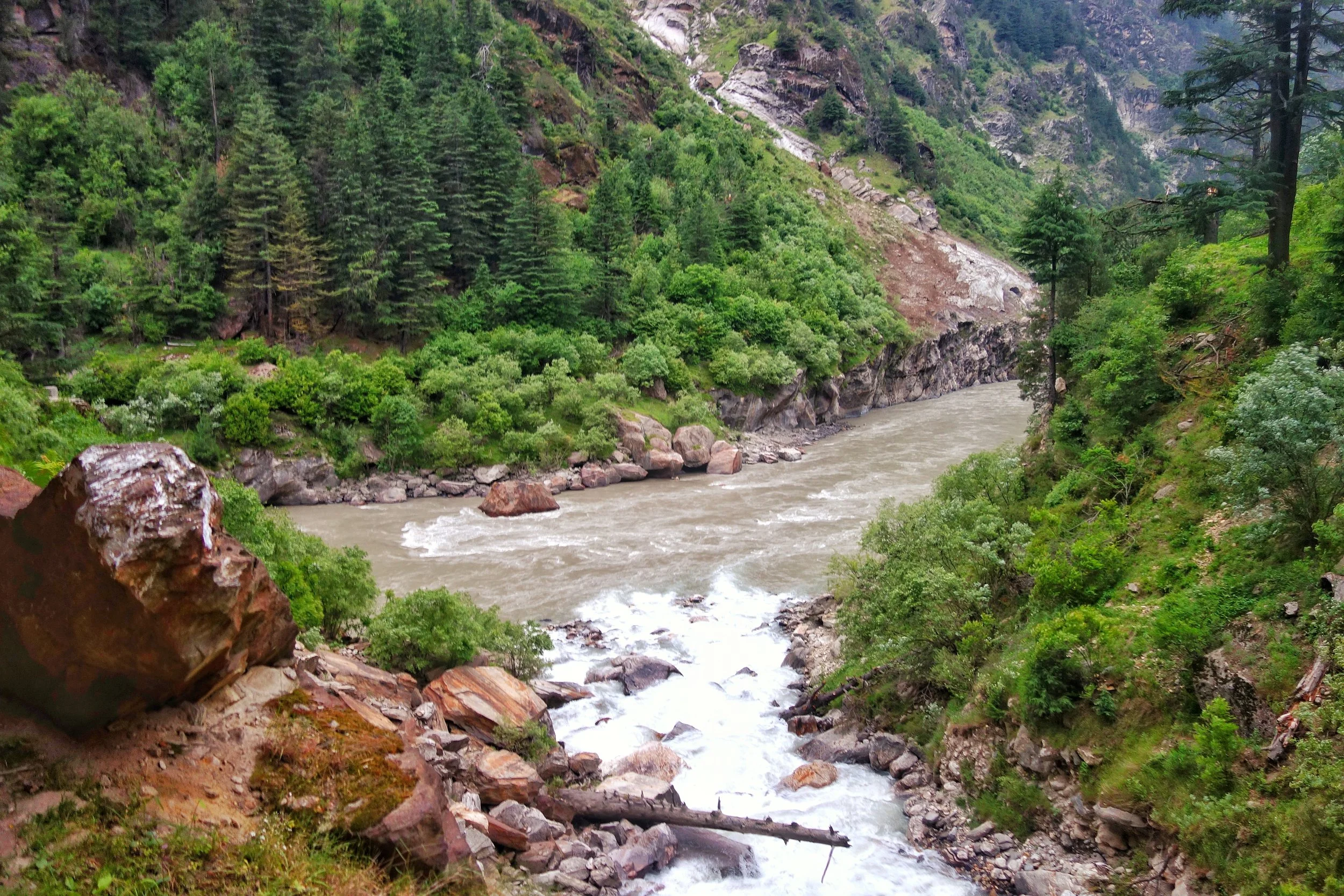
The Dichotomy of the Moon River
The Moon River or the Chandrabhaga or the Chenab is a River that flows through some of the most rugged parts of the Himalayas starting its journey in the Lahaul Valley and making its way through Pangi Valley and into Padar Valley and Kishtwar in Jammu and Kashmir. It is a River of many legends and we try and Map its jurney from the Chandrabhaga to the Chenab.
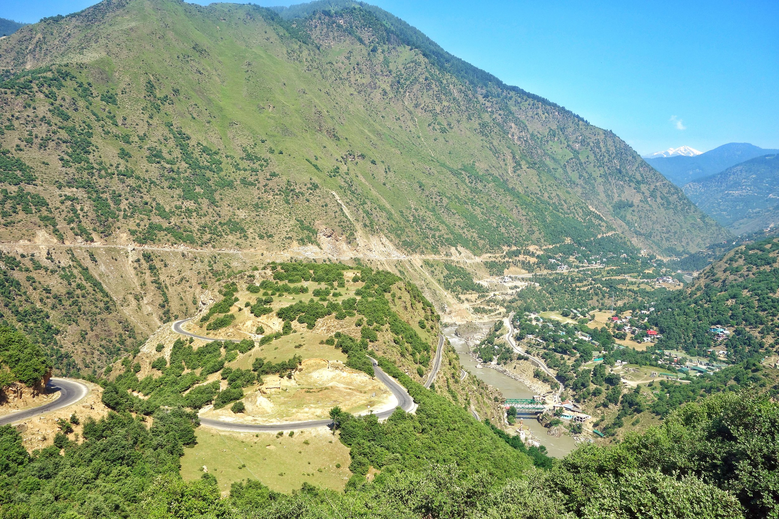
Bandarkoot near Kishtwar where the Marsudar meets the Chenab / Chandrabhaga
The Dichotomy of the Moon River
The Moon River as I like to call it or the Chandrabhaga or the Chenab, as its commonly known as, is truly a Himalayan River in all senses. This River and its tributaries run through some of the wildest and the ruggedest country in the Himalayas.Lahaul, Pangi and Kishtwar Valleys and their sub-Valleys are homes to this River. All these three Valleys have some of the craggiest Peaks in the Himalayas and the beauty is just mind blowing. Its the River of folktales and in the Punjab many love stories were written about Lovers being seperated by the Chenab. Who can forget the immortal lines from the classical Punjabi romance Sohni Mahiwal :
Sohni Chenab de kinare, Te Pukarey, Tere naam ve, aaja aaja aaja
Of course it ended in tragedy when both Sohni and Mahiwal were taken by the Chenab and the romance turned into a Tragedy for people to talk about.
Most are well aware that the Chandra and Bhaga River which rise around the Baralacha La Pass and then flow down into Lahaul and they finally merge. But the Chandrabhaga or the Chenab is the only major Himalayan River who’s name changes for apparently no reason. And also it has two starting points as well and there is debate whether the Chandra is a tributary of the Bhaga or the other way round. Its mostly an academic debate as they both rise close to each other and as by scientific definition the main River is the one which rises the farthest from the point it hits the Sea or another River that it merges into. And the Moon River finally becomes a part of the mighty Indus, after combining with the Sutlej as the Panjnad, as it makes its way to the Ocean.
Video of Driving along the Chandrabhaga Gorge between Killar in Pangi Valley, Chamba to Udaipur in the Lahaul Valley.
So why the 2 names ? The Moon River was referred to as the Askini in the Rig Veda. It meant the River with dark waters which holds true till today. The Waters of the River are rather murky as I couldnt help but notice as I travelled along the River from Kishtwar all the way till Tandi. The Gorge of the Moon River is amazingly spectacular. Its sparsely populated because of the verticality and its only now with the building of Roads can we humans even venture into this forbidden land of the Moon River. It was refferd to as the Chandrabhaga in the Mahabharata as well and the Greeks also called it Sandraphogus / Sandabaga / Cantabaga. Infact Alexander the Great established an Alexandria on the Indus at the point where the Panjnad (combination of the Chandarbhaga/ Chenab and Sutlej) met the Indus. The name Chenab is also a further development of the name with Persian cognates. Chen meaning Moon and Ab meaning water. The Moon River.
So where exactly does the River change its name ? On the maps, the regular ones officially once the River crosses into J&K from Himachal Pradesh which is at the point where the Sansari Nallah meets the River. The Sansari Nallah is considered the Border between the two states though some Maps of JK claim areas beyond the Sansari Nallah like Dharwas before Killar to be a part of J&K. The Sansari Nallah is a typical wild Himalayan River of the Region and this The photo below is taken exactly at the point where this Nallah meets the Moon River.
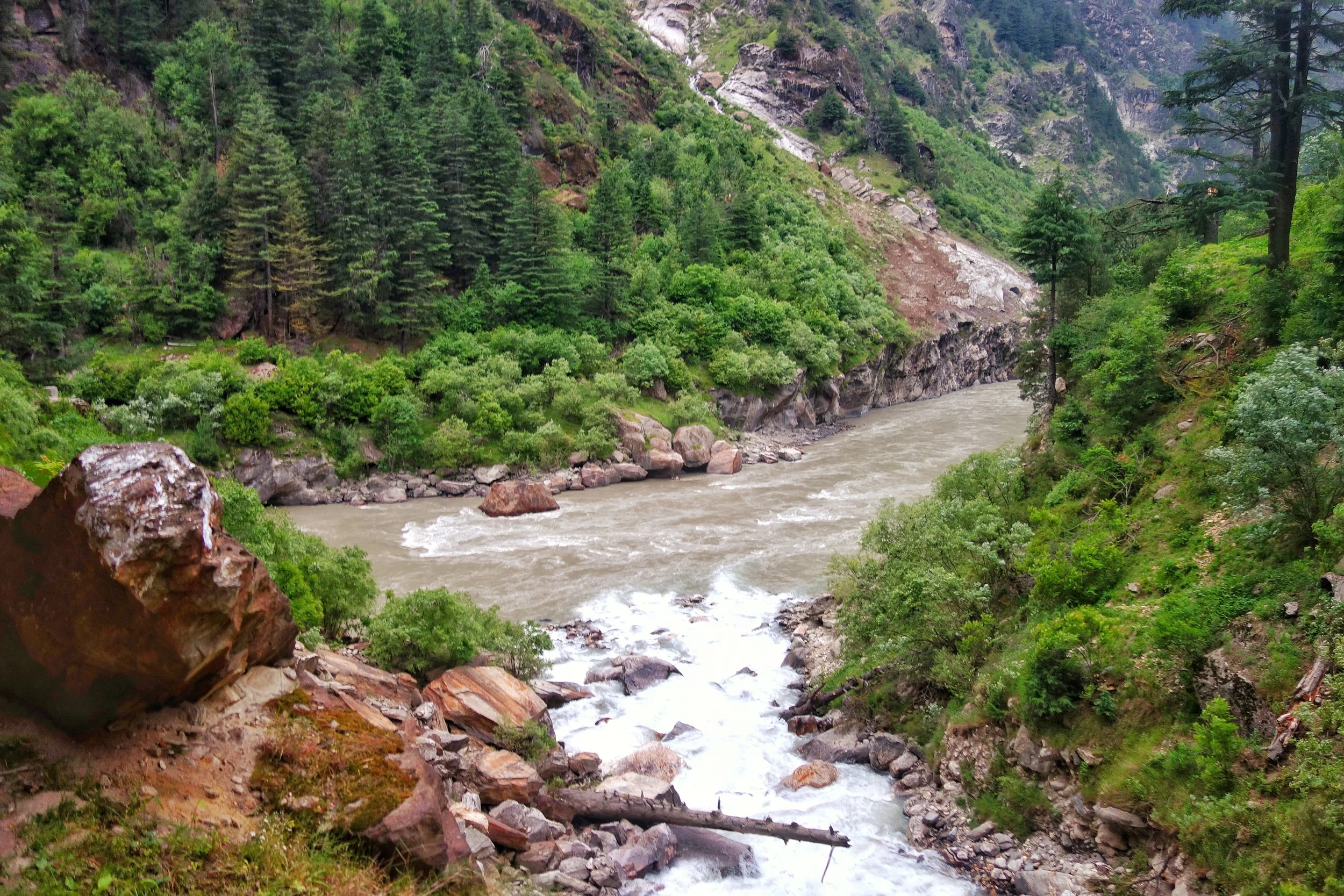
The Sansari Nallah as it meets the Chandrabhaga at the border between Himachal Pradesh and Jammu and Kashmir. This is where the Chandrabhaga becomes the Chenab.
The Sansari Nallah as it meets the Chandrabhaga at the border between Himachal Pradesh and Jammu and Kashmir. This is where the Chandrabhaga becomes the Chenab as per one account.
But there is more to it. Many purists consider the River to be still the Chandrabhaga as it enters the state of J&K. One of the main proponent of this theory is a Slovakian gentleman by the name of Altos Mlonk. He is an absolute Guru. He is the absolute master of Kishtwar and knows stuff beyond our imagination. As per Altos the point where the Chandrabhaga becomes the Chenab is at Bandarkoot near Kishtwar town where the turbulent Marsudar meets the Chandarbhaga. Infact the Marsudar carries more water than the main River itself when it merges into it.
The Marsudar rises at around 5175 mts and its begins life as the Gumbar and the Batkot Nallah which merge and form the Warwan River. This River has carved out the Warwan Valley which in my opinion is one of the most beautiful Valleys of the Himalayas. And the Warwan flows down and is joined by many other Rivulets in the Marwah and Dachan areas. The Marsudar flows throw some of the most unknown areas of the Himalayas which most wouldnt even know of. I trekked the Warwan in in 1989 and still remember the quaint River unlike the wild Marsudar that it becomes.
So I take it as such. And believe that the Chandrabhaga becomes the Chenab when the Marsudar joins it at Kishtwar. The place where these wild Rivers meet is like a pilgrimage spot for someone like me. Its just magical when you think about the places these Waters come from. The Moon River enchants forever.
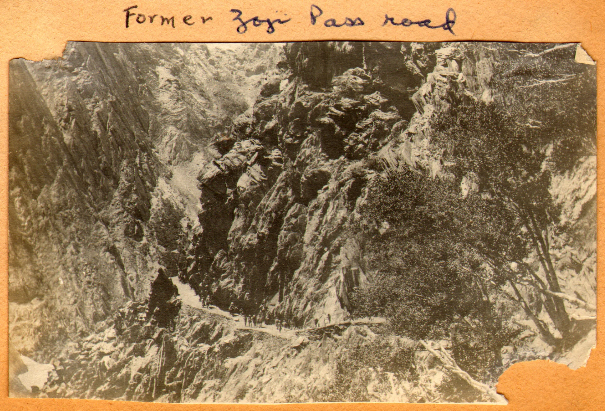
The Pass of Shiva
The Pass of Shiva as it was originally called is one of the main Passes used since historical times and it connected Kashmir with Ladakh. A fascinating insight into the Pass of Shiva or the Sheoji Pass. Today this name has transformed into what we call the Zoji La.

The Pass of Shiva
Sometimes while going through historical documents you stumble upon information thats nothing short of fascinating. As I spend some time everyday browsing through historical Documents / Journals related to the Himalayas in general and the Western Himalayas I came upon a piece of information that I was also unaware of.
The mighty Zoji La which connects Kashmir with Ladakh above the Sind Valley was actually named after Lord Shiva. The name of the Pass used to be Shivji Pass or Sheoji Pass which was corrupted with the Passage of time and eventually Sheoji turned into Zoji. Now the thing that is fascinating about this is that this is the first time I am hearing of a Mountain Pass named after the most powerful God of the Hindu trinity.

The Zoji La track as it was in 1913. Photography by Ralph Stewart.
This is what the 1890 Gazzetteer of Kashmir and Ladakh mentions about the Zoji Pass : Called Zoji La by the Ladakhis and Zoji Bal by the Kashmiris. The proper name is a corruption of Shivji or Sheoji, one of the three great Hindu deities. It leads over the Western Himalayas from the head of the Dras Valley to the Sind Valley in Kashmir. And is crossed on the Route from Srinagar to Leh between Baltal and Matayan.
It further mentions : The Pass has many names ; in the old Maps it is called Kantal, signifying the lofty hill, and under this name Jesuit missionary Desideri refers to it. Vigne calls it Palen-i-Kotal or Bal-tal (above-below) otherwise Shurji La, the hill of Shiva; the terminals “La” and “Bal” in the language of the Tibetans and Kashmiris, respectively, signify “Hill Pass”.
And interestingly it throws up some more interesting stuff from that day and age and mentions two approaches to the Pass from Kashmir : It is closed by Snow during nearly half the year, and is entirely impassable, except to Post couriers during two months. Two Routes lead up to it from the Kashmir side
1- Follows up the bed of the Sind River and passes over the blocks of Ice and Snowdrift which block the narrow Gorge through which it flows. This is the Winter Road and is only practicable for footmen.
2-Winds up the steep slope of the Hill rising above the Gorge of the Sind River to the North. It is a fair Road but is only used from July to December.
The top of the Pass is 2118 feet above Baltal. The descent on the Ladakh side is easy leading down to the Dras River and along its banks to Matayan crossing several tributary streams.
The Pass itself is the only section of the Road that closes to Dak services for more than a day or two at a time, in worst of Seasons. The Dak runners are sometimes unable to cross for two or three weeks the length of the impracticable section at such times is about 7 miles or so from Baltal to Gremen.
It should be noted that the British gave great importance to the Pass as they saw it as the first step on the way of setting up an all weather Trade Route between India and Turkestan and apparently the Pass of Shiva was the first of the mighty Passes that the Himalayas would throw at the Travelers. Maybe it because of the same reason that the Pass was held in reverence, I assume once upon a time and named after Shiva.

The Road climbing up from the Sind Valley as in the present day
In today’s day and time with all the Modern technology Engineers still struggle with the Pass though crossing it is no longer the ordeal it used to be once upon a time. But the approach is located in a fragile Mountain and shooting stones are still a clear and present danger. And landslides and avalanches still haunt the Pass. A lot of work keeps getting done but the Pass of Shiva doesn't stay quiet for long. Well, its Shiva’s Pass. What else would you expect !
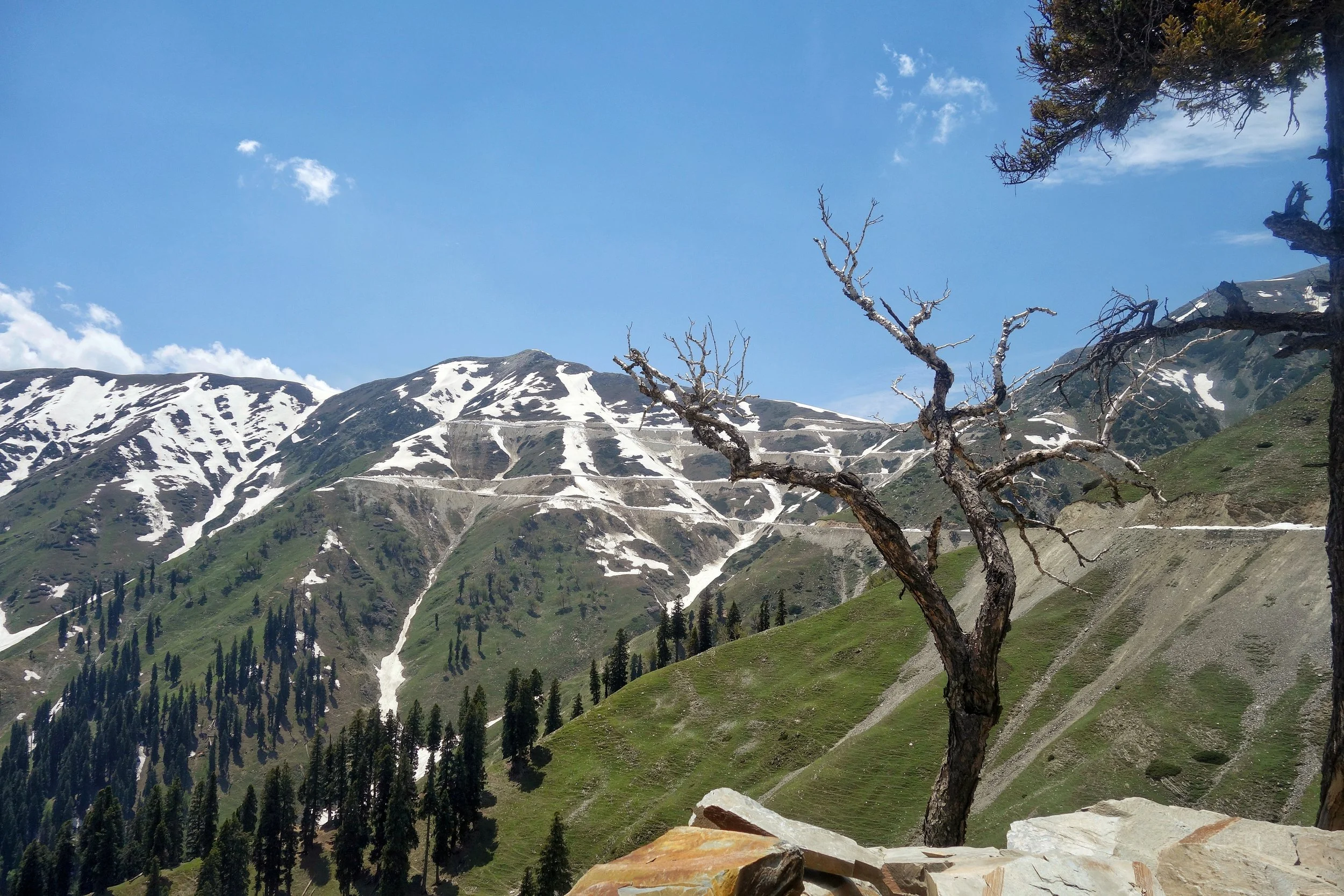
The Sheep of Sinthan
The gentle Sheep of the Sinthan Pass which connects Kashmir with Kishtwar. An absolutely beautiful Pass with mind blowing scenery on either side.
The Sheep of Sinthan
On our recent long foray into the Mountains me and Tahlan Sir decided to go to the Sinthan Pass as it had opened just a day earlier. In the evening we were warned by some people that there was some Militant activity around the Pass and we should avoid.
Of course we had our own sources and being from Kashmir these thing hardly perturb me. Anyways we got our all clear and started our Journey towards Sinthan. Because of the incident which took place one day before the security personnel were on alert and the check points to the Pass were manned by the Army. The Army men were rather amused when they saw a HR registered Fortuner with two not so young men wanting to go to Sinthan Pass. We were asked why we were going there ? I told them well I am missing home and if I feel like I might go to Srinagar from there and if I m not in the mood I will come back. They obviously laughed. :)
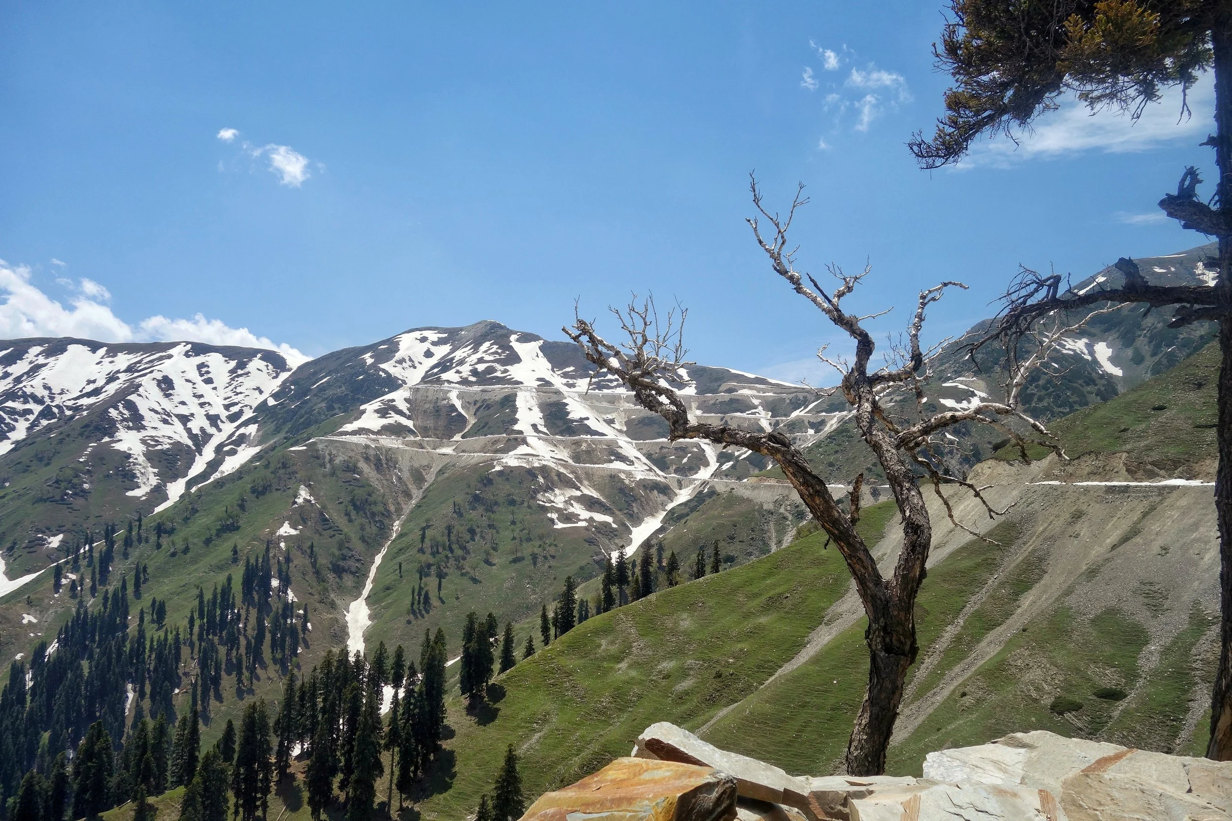
And soon we were on our way through this beautiful pristine area which still lives in an era gone by. The Gujjars were also on the move with their livestock, Horses, Families and Dogs. The population in the area is a mixed bag, there are Hindu Kishtawaris who live in the higher Villages, Muslim Kishtawaris (some of Kashmiri) descent in the Villages along the Road and Gujjars on the move and also living in some of the Villages. This mixing gives this area a unique cultural identity and adds to the charm of the place. Mosques and Temples around each other. It almost gave a notion of Paradise but of course this area has had its share of troubles.
Anyways the drive upto the top was just amazing with a lot of Snow walls right till the top of the Pass and some more on the other side. Anyways once on top I told Ramesh Sir that lets go down to Kashmir and have a cup of tea at the first place we find in Kashmir. And it was while going down that we met these guys. And surely they looked dangerous, but they didnt bother us and to me they looked like Tourists going upto their favourite holiday destination. Have a look ;)
And of course we had Tea at a shack set up by a Gujjar boy and served Girdas with Butter and Tea. And then we met a Gentleman there. Well thats a story for another day.
Video from the Kashmir Side of the Sinthan Pass. June 2019.
Gurez to Drass
A Road which connects Gurez to Drass via the Kaobal Gali. This provides an alternate Route from Kashmir into Ladakh via Gurez instead of the Zoji La but as of now the Road remains Off limits for Civilians and only Military Vehicles are allowed. Presenting some exclusive pics of this beautiful Road and hoping one day its opened for normal Civilian traffic.

Gurez to Drass Road
The Road from Gurez to Drass
There happens to be Road which connects Gurez with Drass over the Kaobal Gali, offering an alternative to the Zoji La but this Road as of now is strictly Off limits for civilians and serves the Military. Here are some exclusive pics of this Road by Hashim Zargar.


Well there are Two Passes, either of which has to be crossed in order to drive down to Leh. The Zoji La from the Kashmir side or the Baralacha La from the Lahoul side to get into Ladakh.

Actually there is a third one as well. Its called the Kaobal Gali, and it connects Gurez in Kashmir to Drass in via Mushkoh Valley Kargil, Ladakh and hence you bypass the Zoji La.


Gurez and Drass are actually close to each other if you look at them in a Map and the people also share cultural similarities in the fact that they are both Shina speaking people who came down from Gilgit centuries ago. (Thats another Tale for another time).

But as of now the Road is off limits to Civilians but hopefully it will open one day for General use.

From those who have taken this Road I hear stories of unparalleled unmatched beauty as some of you must have visited both these places and know how they are.

A glimpse of somewhere on the Gurez to Drass Road.


Kiki’s Blog
Stories from the Himalayas








Five years ago the Galwan Valley was in the News for the wrong reasons after a deadly clash between the Indian and Chinese Armies in the Valley located in Ladakh lead to many deaths on the contentious Border between the two countries in wake of continued Chinese intrusions into Indian territory.
This area along the Shyok River, of which the Galwan Nallah or the Galwan River which forms the Galwan Valley has been off limits to Civilians since long but now the Indian Government has decided to open up the area for Civilians and we were amongst the First Civilians to venture into this beautifully desolate part of the Eastern Karakorams in Ladakh. Earlier Civilians could only venture upto the Village of Shyok from where the Shyok River takes a U turn and flows in a Northerly direction.