The Indus Ganges Divide
The Indus Ganges Divide
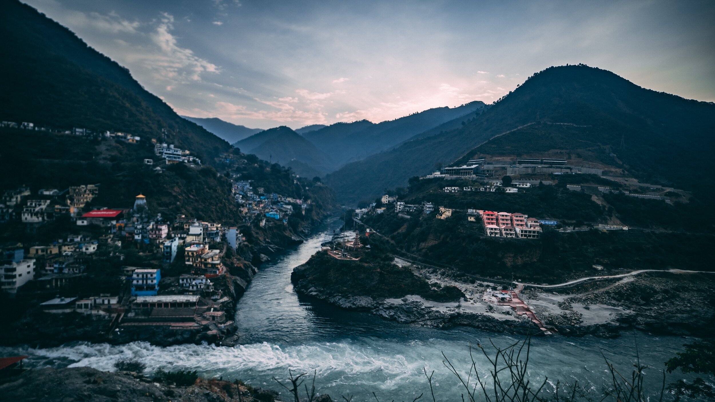
The Indus and the Ganges are the two great Rivers which originate in the Himalayas/ Trans-Himalayas and all the Rivers of the Western and Central Himalayas drain into either of these two Rivers. The Indo - Gangetic Plain as the combined basin of these two Rivers is called sustains well over a Billion people and is one of the most thickly populated Regions on the Planet. The story of the Indus and the Ganga is the story of India in historical, social and religious contexts.
Most of the Indus basin was turned over to Pakistan as a result of the partition though still a substantial part of Punjab, one of the most fertile of lands thanks to the Rivers coming down from the Himalayas still lies with us. The legendary land of the five Rivers traditionally stretched from Delhi to Peshawar though things have changed now. At the time of the Punjabi resurrection in early 1800’s under the indomitable Sher-E-Punjab, Maharaja Ranjit Singh it was the River Sutlej which served as the border between the powerful Sikh Kingdom of Punjab which stretched all the way to Tibet in the North and Balochistan in the South and the British Indian holdings.
The Sutlej also happens to be the longest of the five Rivers that give the Punjab its name and its also the Easternmost tributary of the mighty Indus. And its some where in Eastern Himachal that the actual ridgelines exist which separate the Indus Basin from the ganges Basin. Its actually a series of Ridges which run from Shimla itself towards Narkand and towards Rampur which lies on the Satluj River.
On the other side of the Ridge lie the tributaries and Nallahs which join either the Giri River or the Pabbar River. I assume that the Pabbar which drains into the Tons and then into the Yamuna and finally into the Ganges would be the Westernmost tributary (indirect albeit) of the Ganges. And interestingly some of these Nallahs are just a few hundred meters apart but the waters of one would end up in the Arabian Sea while the waters of the other would end up in the Bay of Bengal.
As per what you can see on the Google Maps Nallahs or Streams of the area join either the Satluj or the Giri River or the Pabbar. The Giri River is yet another tributary of the Yamuna which rises at a place called the Giri Ganga in the Mountains above Kharapathar near Kotkhai. Some of the Nallahs in the area are as follows
The Brandii Khad eventually joins the Satluj : https://goo.gl/maps/rsCFNgMFhCo
Ashwani Khad eventually joins the Giri River: https://goo.gl/maps/N4g4iY2iGGm
Nauty Khad (Eventually joins the Satluj) : https://goo.gl/maps/8JVFsbrETa42
Teer Nallah / Thaila Khad / Bhaira Khad are other Nallahs which run either side of the divide.
Can someone familiar with the Hydrography of the area let me know where actually are the points of origins of two seperate Streams which go to either sides are closest to each other ? Or is there a point somewhere where the same source of water gets divided to go either way. I would really like to visit such a place if it exists. This little piece of exploration might sound strange to people but different people have different obsessions. Mine is mainly the Himalayas and the Rivers which rise from it.
Thanks for taking time out to read this.
Presenting a pic of the Pabbar River cutting through the Pabbar Valley coming down from its point of origin at the Chandranahan Lake.